Cobar Mining Seminar 2010 - The AusIMM · Cobar Mining Seminar 2010 ... Manfred Wimberger –...
27
Rejuvenating Historical and Producing Operations Cobar Mining Seminar 2010
Transcript of Cobar Mining Seminar 2010 - The AusIMM · Cobar Mining Seminar 2010 ... Manfred Wimberger –...
Rejuvenating Historical and Producing Operations
Cobar Mining Seminar 2010

Organised by the Cobar Branch of
The Australasian Institute of Mining & Metallurgy
Cobar Mining Seminar 2010
Rejuvenating Historical and
Producing Operations
Friday 6th August 2010
Cobar Golf & Bowling Club, Cobar,
New South Wales, Australia
Compliers: Berthelsen R.R, Wimberger M.G.
Published by AusIMM, Cobar Branch, August, 2010

Cobar Mining Seminar 2010 – Rejuvenating Historical and Producing Operations
AusIMM Cobar Branch
With thanks to all our sponsors:

Cobar Mining Seminar 2010 – Rejuvenating Historical and Producing Operations
AusIMM Cobar Branch
Welcome
On behalf of the Cobar Branch of the AusIMM, we welcome you to the Outback New South Wales
town of Cobar for the Cobar Mining Seminar 2010 which includes activities held from Thursday 5th
August to Friday 6th August, 2010.
Pre‐seminar tours at three of Cobar’s mines will help to orient and prepare you for some of the
following days discussions. The seminar will feature speakers from various backgrounds, disciplines
and areas from around Australia. Some will focus on the deposits in the Cobar and Western Region
of New South Wales, while other will review mining and processing applications which help
rejuvenate historical and producing operations.
Whatever your discipline or project we hope there is something in this seminar useful to you and
invite you to enjoy the facilities and hospitality of our friendly town.
The committee appreciates the support from speakers, sponsors and delegates in make this event a
success. The committee also wishes to thank management of Endeavor Mine, CSA Mine and Peak
Mine for allowing mine and mill tours to be offered.
Organising Committee
Rex Berthelsen – Chairman and Convenor | Principal Geologist, New Gold Inc, Cobar
Neil Schunke – Treasurer | Mine and Tech Services Superintendent, AGD Operations, Heathcote
Tom Simpson – Secretary | Senior Mining Consultant, Black Star Mining, Cobar
Peter Lloyd – General Manager, Peak Gold Mines, Cobar
Manfred Wimberger – Geology Superintendant, Peak Gold Mines, Cobar
Leonie Burford – Mine Geologist, Endeavor Mine, Cobar
Roger Jackson – Non Executive Director, EDMSL, Brisbane
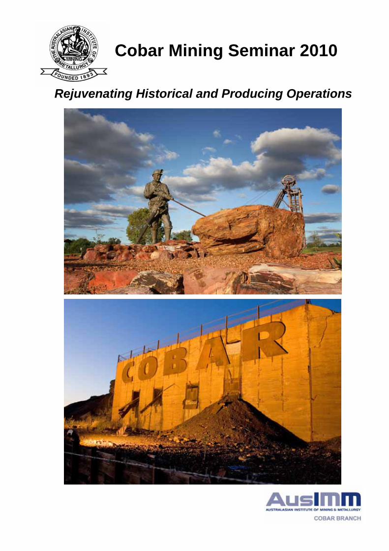
Cover photos : Top – Great Cobar Heritage Park with old Chesney Headframe Bottom – Great Cobar Mine: Entrance to Cobar Photos courtesy of Peak Gold Mines & taken by Mark Ingram Photography
Cobar Mining Seminar 2010 – Rejuvenating Historical and Producing Operations
AusIMM Cobar Branch
Thursday 5th August 2010
8:00am to 4:00pm – Mine and Mill tours CSA, Endeavor and Peak Mines
4:30pm – Seminar Registrations
5:00pm to 7:00pm – Ice Breaker, Cobar Bowling and Golf Club Auditorium
Friday 6th August 2010
8:30am Rex Berthelsen Opening and Welcome
8:40am Keynote Address Craig Stegman
Revitalising Mining Operations: Making the Most of What You Have
9:10am Jason Hosken Operations Exploration Using Mine Scale Structural Definition, Cobar NSW including a CSA Mine Case Study
9:35am Barry Taylor The Perseverance Gold Copper deposit – A New Peak Gold Mines Challenge
10:00am Ken McQueen Geochemical Vectoring to Ore in the Cobar Bedrock and Regolith ‐ Detecting Extensions
10:25am Morning Tea Session 2 Chaired by Peter Lloyd
10:55am Phil Shields Brownfields Exploration at Girilambone ‐ Understanding the mineralised systems
11:20am Phil Carrello CSA Mine Observations Applied to the Development of Regional Exploration Models
11:45am Peter Ganza Redevelopment of Hillgrove
12:10pm Gernot Loidl The Elura Pb – Zn – Ag Deposit, Central NSW ‐ Ore characterisation and geo‐metallurgy, preliminary results
12:35pm Lunch Session 3 Chaired by Rubens de Figueiredo
1:35pm Ian Cooper Reviving Nymagee
2:00pm Mehmet Yumlu Pastefill ‐ becoming a feasible and popular option for ensuring recovery of high grade deposits.
2:25pm Peter Lean Underground Mobile Information System (UMIS)
2:50pm Leo Dawson Benchmarking for Operational Improvement
3:15pm Afternoon tea Session 4 Chaired by Tony Davis
3:40pm Ross Garling Hydraulic Mining – a proven and cost effective way to Re‐Mine Tailings for Plant Feed, and Sustainable Relocation
4:05pm Ben Murphy Mine Based Pre‐concentration to reduce transportation costs for small deposits
4:30pm Peter Lines Upgrading Older Equipment ‐ Upgrades designed to take advantage of modern processes in mineral processing
4:55pm Closing Remarks
6:30pm Annual Dinner Cobar Golf Club Auditorium – Dress: Neat Casual
Cobar Mining Seminar 2010 – Rejuvenating Historical and Producing Operations
AusIMM Cobar Branch
ABSTRACTS INDEX
OPERATIONS EXPLORATION USING MINE SCALE STRUCTURAL DEFINITION, COBAR NSW
INCLUDING A CSA MINE CASE STUDY. ....................................................................................... 1
THE PERSEVERANCE GOLD COPPER DEPOSIT – A NEW PEAK GOLD MINES CHALLENGE. ........ 3
GEOCHEMICAL VECTORING TO ORE IN THE COBAR BEDROCK AND REGOLITH: DETECTING
EXTENSIONS ............................................................................................................................... 5
BROWNFIELDS EXPLORATION AT GIRILAMBONE: UNDERSTANDING THE MINERALISED
SYSTEMS ..................................................................................................................................... 7
CSA MINE OBSERVATIONS APPLIED TO THE DEVELOPMENT OF REGIONAL EXPLORATION
MODELS...................................................................................................................................... 9
REDEVELOPMENT OF HILLGROVE ............................................................................................ 12
THE ELURA PB – ZN – AG DEPOSIT, CENTRAL NSW, AUSTRALIA: ORE CHARACTERISATION
AND GEO‐METALLURGY, PRELIMINARY RESULTS .................................................................... 13
REVIVING NYMAGEE ................................................................................................................ 15
PASTEFILL ‐ BECOMING A FEASIBLE AND POPULAR OPTION FOR ENSURING RECOVERY OF
HIGH GRADE DEPOSITS. ........................................................................................................... 16
UNDERGROUND MOBILE INFORMATION SYSTEM (UMIS) ...................................................... 17
BENCHMARKING FOR OPERATIONAL IMPROVEMENT ............................................................ 18
HYDRAULIC MINING – A PROVEN AND COST EFFECTIVE WAY TO RE‐MINE TAILINGS FOR
PLANT FEED, AND SUSTAINABLE RELOCATION ....................................................................... 19
MINE BASED PRE‐CONCENTRATION PRESENTATION .............................................................. 20
UPGRADING OLDER EQUIPMENT UPGRADES DESIGNED TO TAKE ADVANTAGE OF MODERN
PROCESSES ............................................................................................................................... 21
Cobar Mining Seminar 2010 – Rejuvenating Historical and Producing Operations
Page | 1
AusIMM Cobar Branch
OPERATIONS EXPLORATION USING MINE SCALE STRUCTURAL DEFINITION,
COBAR NSW INCLUDING A CSA MINE CASE STUDY.
Jason Hosken, XSTRACT
Abstract
The regional geology of the Cobar mineral field has been extensively researched and documented
compared to localised deposit geology descriptions. The application of regional scale geological
findings for mine scale exploration purposes is often difficult given mine workings typically occur
inside the regional mineralisation ‘footprint’. In the operating mine environment, structural
definition of the mineralised and un‐mineralised framework is important for exploration success.
Limited structural definition and geological understanding on the mine scale can adversely impact
upon discovery potential.
Economic mineralisation from the Peak Mine in the south to the Endeavor Mine in the north is
typically characterised by narrow and vertically continuous pipe like lenses with short strike lengths.
Deposits are typically shear hosted within north‐south trending sub‐vertical fault complexes. The
amount and size of shears hosting mineralisation varies between deposits, however structural
features defining individual lenses are similar for the majority of deposits. Mine scale structural
definition of host shears and faults in addition to lens dilation characteristics is crucial for developing
in mine exploration models.
Historical and recent workings at the CSA Mine expose structures defining a mineralisation
‘footprint’ containing four major mineralisation systems over a strike length of 1.2 km and to a depth
of >2.0 km with over 30 mineralised lenses. The evolution of geological mapping at CSA from the
1960’s to the present highlights improvements in geological understanding throughout the period.
Structures defining shear hosted mineralisation at CSA are similar for all four systems. Mine
workings between the four systems exposes structures defining the mineralised ‘footprint’ for each
system.
The strike length of north‐south trending mine scale corridors hosting mineralisation at CSA are
clearly defined within the bounding structures outlining the mineralisation ‘footprint’. Mineralised
dilation zones share similar characteristics on all scales. Definition of the structural ‘footprint’ and
style of mineralisation is required for exploration targeting and also assists with effective mine
design.
This presentation defines typical structural relationships defining mineralisation in the Cobar area.
In addition, recent exploration success at the CSA Mine is explained through the definition and
interpretation of key geological structures recorded by both historical and recent underground
mapping.

Cobar Mining Seminar 2010 – Rejuvenating Historical and Producing Operations
Page | 2
AusIMM Cobar Branch
References
CSA Mine geology mapping ‐ Unpublished
Elliot, S M, Snowden, D V, Bywater, A, Standing, C A and Ryba, A, 2001. Reconciliation of the
McKinnons Gold Deposit, Cobar, New South Wales, in Mineral Resource and Ore Reserve Estimation
– The AusIMM Guide to Good Practice (Ed: A C Edwards), pp257‐268 (The Australasian Institute of
Mining and Metallurgy: Melbourne).
Glen, R A, 1987. Copper and gold deposits in deformed turbidites at Cobar, Australia: Their structural
control and hydrothermal origin, Economic Geology, 82: 124‐140
Hosken J, Haren E, Winchester A, 2006. Resource Modelling in an Evolving Mine – CSA Mine, Cobar,
New South Wales ‐ 6th International Mining Geology Conference Darwin, NT, August 2006), pp153‐
166 (The Australasian Institute of Mining and Metallurgy: Melbourne).
Jeffrey, S I, 1994. A structural, geophysical, isotopic and geochemical appraisal of the CSA Deposit,
Cobar, Australia. Implications for the Deformation of the Cobar Basin and Mineral Potential.
(Masters Thesis, University of Tasmania)
Lawrie, K C, Hinman, M C, 1998. Cobar‐style polymetallic Au‐Cu‐Ag‐Pb‐Zn deposits, AGSO Journal of
Australian Geology and Geophysics, 17(4): 169‐187
Mc Dermott, J J, Smith, C K, Jeffrey S I, 1996. Geology of the CSA deposit, in The Cobar Mineral Field
– A 1996 Perspective. (Eds: Cook et al.) pp 197‐213 (The Australian Institute of Mining and
Metallurgy, Melbourne)
Stegman, C.L, Pocock, J.A, 1996. The Cobar Gold Field – A Geological Perspective, in The Cobar
Mineral Field – A 1996 Perspective. (Eds: Cook et al.) pp 229‐264 (The Australian Institute of Mining
and Metallurgy, Melbourne)
Cobar Mining Seminar 2010 – Rejuvenating Historical and Producing Operations
Page | 3
AusIMM Cobar Branch
THE PERSEVERANCE GOLD COPPER DEPOSIT – A NEW PEAK GOLD MINES
CHALLENGE.
Barry Taylor, Peak Gold Mines, Newgold
Abstract
The Perseverance deposit is the most southerly known economic copper/gold deposit within the
Cobar Gold Field. The deposit is situated approximately 12km to the south‐southeast of Cobar at
MGA 393725E: 6506540N. The deposit is essentially blind to surface with the top of economic
mineralisation occurring 750m below ground level.
Based on the December 2009 JORC compliant resource estimate (inclusive of reserves and nett of
depletion) the deposit contains 2,760,000 tonnes @ 5.97g/t Au and 0.90% Cu (530,000oz of gold and
24,700 tonnes of copper). 190,000oz of gold and 15,000 tonnes of copper have been produced to
date, principally from the Zone A section of the Perseverance lens. The deposit comprises 4 principal
lenses, the Perseverance, Hulk, Zone B, and Hercules lenses. In excess of 90% of the known resource
tonnes are contained within the Perseverance and Hulk lenses. The Perseverance lens remains open
at depth and to the south.
The deposit is shear related and hosted within mid to upper Devonian rocks of the Cobar Basin. The
competency contrast of rhyolites juxtaposed against sediments by the Peak‐Perseverance Shear
appears to be the principal control on mineralisation. Both the Perseverance and Hulk lenses are
primarily hosted by brecciated rhyolite peripheral to the Peak‐Perseverance Shear which juxtapose
rhyolites against Chesney Formation sediments across the shear. This faulted rhyolite sediment
contact roughly defines the global orientation of the deposit. The Zone B and Hercules lenses, which
are significantly less important in tonnage terms, are hosted by rhyolite breccias within the main
body of the rhyolite and appear to be unrelated to the Peak‐Perseverance Shear. The Perseverance
lens continues within the shear for up to several hundred metres beyond the extent of the faulted
rhyolite sediment contact. Mineralisation within the shear beyond the faulted rhyolite contact zone
is hosted by sheared silicified sediments.
Brecciated rhyolite hosted chalcopyrite and pyrrhotite with accessory gold occur predominantly as
crosscutting vein breccias and are the dominant and economically most significant mineralisation
style within the deposit. Additional mineralisation styles include clast specific disseminated
chalcopyrite and pyrrhotite and overprinting galena‐sphalerite veins and breccia fill mineralisation.
Within the Perseverance lens the presence of northeast trending high grade breccia veins developed
oblique to a north‐south trending shear system has led to the development of steeply north
plunging high grade ore shoots within a globally north‐south trending mineralised domain. These
high grade shoots have limited horizontal continuity but significant down plunge extent.
The presence of coarse gold and the resulting strongly skewed nature of the gold grades, in
conjunction with controls on mineralisation which are not parallel to the mineralised domain lead to
predictive difficulties regarding stope performance.
Zone D (the southern section of the Perseverance Lens) produced its first stope ore in August 2009
and is currently Peak’s principal focus for development. Zone D will be Peak’s main gold ore source

Cobar Mining Seminar 2010 – Rejuvenating Historical and Producing Operations
Page | 4
AusIMM Cobar Branch
in the short to medium term (1 to 5 years). Maximising the returns from the deposit will continue to
require diligent underground mapping and sampling and close‐spaced delineation drilling.
Ongoing challenges include optimising sampling to assist in grade control. Strong heterogeneity of
the gold content of the ore and geological controls on mineralisation which are not parallel to the
global trend of the mineralisation impose a set of difficulties which meaningful sampling and sound
geological control should help overcome.
Cobar Mining Seminar 2010 – Rejuvenating Historical and Producing Operations
Page | 5
AusIMM Cobar Branch
GEOCHEMICAL VECTORING TO ORE IN THE COBAR BEDROCK AND REGOLITH:
DETECTING EXTENSIONS
K.G. McQueen, University of Canberra
Abstract
Ore systems in the Cobar Basin show a range of styles and geometries, but are commonly
structurally controlled/modified lenses of sulphides, concentrated in steeply plunging pipe‐like
clusters. Many have great depth extension, but a small horizontal footprint and they represent
difficult exploration targets. Around known deposits, extensions or nearby lenses might easily be
missed, particularly if they lack a strong geophysical signature.
Geochemical dispersion halos around these deposits, and the vectoring potential they provide,
reflect a combination of element patterns related to primary hydrothermal wallrock alteration
(mostly of major elements) and the variable weathering overprint on the primary pattern and
dispersion of ore elements following sulphide destruction.
Observations and geochemical studies at Elura, CSA and New Cobar show that below the weathering
front major element patterns related to visible and cryptic mineral alteration provide the largest
target halo for exploration. Primary dispersion of the ore elements is more restricted. For example,
at Elura (Endeavor Mine) cryptic wallrock alteration can be identified up to 300 m around the
deposit below the weathering front using Pearce Element Ratio (PER) analysis and mineralogical
modelling (GER). Visible alteration extends to between 5 and 70 m. Detectable primary dispersion of
ore and pathfinder elements (Zn, Pb, Cu, As, Sb, Tl) is generally restricted to less than 70 m. At the
CSA deposits alteration accompanying ore formation has produced cryptic depletion of Li up to 500
m around the Eastern System and less extensive depletion of Na, K, Sr and Ba. This geochemical
pattern reflects pervasive Fe‐rich chlorite development, destruction of feldspar and replacement of
muscovite. Visible alteration in the form of strong silicification and quartz‐carbonate veining is
typically restricted to 20 m. Detectable enrichment in ore and pathfinder elements (e.g. Cu, Pb, Zn,
Ag and As) is limited to less than 20 m from the ore lenses.
Above the weathering front wall rock alteration patterns have been largely destroyed or
dramatically reduced by intense chemical alteration related to the long and multi‐stage weathering
history of the Cobar terrain. Primary alteration involving enrichments in Si, Fe, Mn, and to some
extent K are better preserved due to the weathering stability of some primary minerals, such as
quartz and muscovite or the relative stability of secondary Fe and Mn oxides. Less stable alteration
minerals such as carbonates and chlorites are lost, although some of their constituents (e.g. Fe and
Mn) may be retained in the regolith. Within the regolith, ore and associated pathfinder elements
provide the best dispersion halo or geochemical target. The geometries of these patterns are
controlled by hydrologic factors and, in the case of outcropping deposits, by the degree of
mechanical dispersion of lag derived from gossan or ferruginised saprolite. For example, at Elura
subtle Zn and Cd anomalies are detectable up to 150 m from ore in ferruginous mottled saprolite.
The dispersion of Pb and Ag is more limited and irregular. Mechanical dispersion of the exposed
gossan has produced an elongate Pb anomaly (>50 ppm) extending more than 1,200 m along a

Cobar Mining Seminar 2010 – Rejuvenating Historical and Producing Operations
Page | 6
AusIMM Cobar Branch
shallow drainage feature with an associated Zn soil anomaly. At the CSA site, detectable Cu, Zn and
As anomalies extend up to 100 m in saprolite around known lenses. Anomalous values of Ba and Sb
extend up to 50 m, but elevated levels of Pb and Bi are typically restricted to less than 20 m. The
near surface zone of the smaller New Cobar Cu‐Au deposit shows an interesting pattern of ore and
pathfinder element dispersion that is related partly to weathering of a primary dispersion pattern,
with further but limited secondary hydromorphic dispersion. There is a distinctive Pb, Ag and Cu halo
up to 25 m wide, related to the weathering of disseminated primary mineralisation around the main
lode (i.e. in situ preservation of ore elements within a weathered primary halo). In addition, sub‐
horizontal ferruginous veins with Pb values up to 700 ppm extend for 70 m away from the main lode.
This represents the remnants of a primary leakage halo surrounding the deposit, in which the ore
and surrounding alteration features are no longer evident but where the ore elements have been
preserved in stable iron and manganese oxides. Secondary dispersion of these elements extends for
a further 10 m. Within this broad multi‐origin halo there is an inner halo of anomalous As, Bi, Se, W
and Sn, closely surrounding the lode and reflecting varying levels of secondary dispersion. Gold has
been strongly leached from the very upper part of the weathering profile but concentrated deeper
in the gossan.
While secondary dispersion of ore and pathfinder elements and related spatial zoning for elements
with differing mobility provide the best geochemical vectors to ore in the regolith it is important
recognise that patterns are also dependant on the level of deposit exposure and the extent and
history of physical and chemical weathering.
During geochemical exploration for Cobar‐type deposits the weathering front represents an
important switch over point from using the dispersion pattern of ore and pathfinder elements in the
regolith to using major element patterns related to wall rock alteration in the bedrock. Depending
on the search depth and extent of weathering, different approaches are needed to detect the overall
ore‐fluid system and the position of contained ore lenses. This presentation will document the
characteristic dispersion features of these two environments and also highlight two techniques for
detecting cryptic alteration and using zoning within the alteration halo to vector to ore.
Cobar Mining Seminar 2010 – Rejuvenating Historical and Producing Operations
Page | 7
AusIMM Cobar Branch
BROWNFIELDS EXPLORATION AT GIRILAMBONE: UNDERSTANDING THE
MINERALISED SYSTEMS
Phil Shields and Phil Jones, Straits Resources Ltd
Abstract
Exploration drilling, targeting sulphide deposits beneath the Murrawombie open cut, Tritton Deeps
and Budgery copper oxide workings in central New South Wales, has successfully delineated new
and additional copper resources occurring within large tabular pyritic sulphide sheets. At Tritton
Deeps mineralisation has been intersected and remains open to a vertical depth of 1200 metres,
Murrawombie Deeps to 700 metres and at Budgery to 350 metres.
Reinterpretation of historical and more recent geological data, including relogging of drill core, allied
with a focus on geochemical haloes has redefined the tabular mineralising systems. Mineralisation is
hosted within highly siliceous and ankeritic hydrothermally altered metasediments which are
underlain by magnesium chlorite rich and variable stringer sulphide veined alteration zones.
Hanging wall ankerite alteration is strongly evident at Tritton but less so at Murrawombie. At
Budgery there is a variable but strong magnetite chlorite carbonate alteration package within the
hanging wall sequence.
Doleritic intrusives within the hanging wall and footwall portions of the Tritton host sequence occur
as bedding parallel dyke? swarms interdigitating with the metasediments whereas basaltic volcanics
and volcaniclastics at Budgery and at Great Hermidale occur as synsedimentary lavas and reworked
sequences. Other doleritic intrusives and volcanics? occur within the Murrawombie mine sequence
as well as serpentinised ultramafic intrusives structurally emplaced into graphitic shear zones.
Recently defined narrow polymict soft sediment breccias within the overlying host metasediment
sequence contain abundant fine grained lithic debris as well as minor mafic, rare massive sulphide
and trace ultra‐mafic clasts within a coarse grained quartz rich psammitic matrix. Some psammites
and a black psammopelite unit appear to be good local mappable stratigraphic horizons.
The three deposits appear to have been formed synchronous with sedimentation in the form of
tabular and steeply south east plunging bodies that have been subjected to considerable
deformation and consequent remobilisation of sulphides. The mineralisation is both massive or
banded pyrite and chalcopyrite with minor sphalerite, bornite, tetrahedrite and galena. The
sulphidic mineralisation defined to date is compatible with that currently being processed at Straits
Resources Limited (“SRL”) owned Tritton Copper Mine process plant located 26 kilometres south
west of Girilambone.
The Tritton Copper Mine, which was commissioned in late 2004, currently produces approximately
96,000 tonnes of copper concentrate per year containing 24,000 tonnes of copper. The majority of
the ore being processed comes from Tritton with an increasing proportion coming from the recently
reopened North East orebody. A recent review of the Murrawombie interpretation has culminated
in a significant increase in contained copper and resulted in a new resource of 5.89Mt tonnes @
1.6% Cu and 0.3g/t Au (0.8% Cu cutoff) being defined. A small open pittable resource of 2.02Mt @
1.1%Cu (0.3% Cu cutoff) has been defined at Budgery to a depth of 200 metres with transition and
primary sulphides defined within a larger pyritic tabular sheet. Exploration is continuing to assess
Cobar Mining Seminar 2010 – Rejuvenating Historical and Producing Operations
Page | 8
AusIMM Cobar Branch
the down dip and possible underground sulphide potential. Permitting for this deposit is
progressing.
Resource definition drilling is continuing on the Murrawombie Deeps, Tritton Deeps and Budgery
deposits located from Hermidale in the south to Girilambone in the north. The similarities in
geology, alteration, deformation and metallurgy (compatibility with the Tritton Mill) between the
deposits bodes well for the addition of deeper resources at North East and Larsens and possibly at
other under explored prospects such as Double Tanks and Avoca Tank.

Cobar Mining Seminar 2010 – Rejuvenating Historical and Producing Operations
Page | 9
AusIMM Cobar Branch
CSA MINE OBSERVATIONS APPLIED TO THE DEVELOPMENT OF REGIONAL
EXPLORATION MODELS
Phil Carrello, CSA
Abstract
CSA Mine is situated 10 kilometres north of Cobar in central New South Wales. It is operated by
Cobar Management Pty Ltd (CMPL), a wholly owned Australian subsidiary of Glencore International
AG (Switzerland). Since being discovered in 1871, CSA mine has produced in excess of 800,000
tonnes of copper metal. The mine started in 1871 and operated with an erratic production history
until 1964 when Broken Hill South Ltd began large scale production. The mine passed to CRA in 1980
and then to Golden Shamrock Mines in 1992. The mine was closed in 1997/8 following its acquisition
by Ashanti Goldfields and was reopened in 1999 by Glencore. The current mining rate at CSA is
950,000 tonnes per annum at an average grade greater than 5% copper and 30ppm silver.
Exploration from 1999 to the present has mostly focused on exploring for additional underground
resources at the CSA Mine with various periods of detailed surface exploration on CMPL regional
leases. Recent exploration efforts have concentrated on using observations from CSA to develop
regional exploration models. Observations relating to the geometry, structure, geology,
geochemistry, alteration and geophysics at CSA have been used to develop some of the regional
exploration targets.
Geometrical features of the CSA deposits which can be applied to exploration include the short
strike length but large plunge extent of ore bodies which vary in width from about 3 to 30 metres. In
terms of vertical extent, some lenses can be traced for over 1 kilometre. For instance, the Western
system of ore lenses extends from the surface to about 1 kilometre below the surface and the K lens
situated within the QTS North lens system extends from approximately 600 metres to 2 kilometres
below surface.
Structural features on a mine scale will not be dealt with in great detail however on a semiregional
scale several observations pertaining to regional exploration models may be significant. Such
features include the relationship between regional north striking stratigraphy and the apparent
although to some extent poorly defined northerly striking regional structures, areas of ductile
deformation interspersed with local zones of brittle failure and stratigraphic thickening. These
features are interpreted to be major indicators of strong mineralisation at the CSA Mine scale. The
exact location of the regional northerly trending structures is to some extent uncertain and is reliant
on interpretation of aeromagnetics, previous geological mapping and surface geochemistry.
Underground geological mapping and local surface mapping within the CSA Mine environs has also
identified the importance of local intersection of structures as a major control of mineralisation.
Underground mapping has also identified a distinctive morphology for ore lenses. Mineralisation
zones grade from barren material to zones of chalcopyrite and quartz sulphide veins and/or
disseminated chalcopyrite to massive to semi‐massive sulphide to chalcopyrite and quartz sulphide
veins and/or disseminated chalcopyrite to barren material. Some of the lens systems exhibit this
complete ore type morphology such as the QTS North series of lenses while others such as the
Western and Eastern system of lenses may contain only part of this morphology gradation.

Cobar Mining Seminar 2010 – Rejuvenating Historical and Producing Operations
Page | 10
AusIMM Cobar Branch
Another important geological feature is the appearance and differences in the surface expression of
CSA ore bodies within CML5. For the Western system of lenses, the lenses are expressed at the
surface as gossanous materials whereas at the surface of the QTS North lens system, the ore lenses
are expressed as buck and barren quartz veins with some local shearing and fracturing with some
associated ferruginous staining of country rock. Understanding of the regolith and the weathering
profile is perhaps an area where considerably more work could be undertaken in order to assist in
the development of regional exploration models and although there is some information available
above the Western System little is known above the QTS North and QTS South ore lenses.
Surface sampling media such as soils has primarily been used to identify prospective trends. Bedrock
geochemical sampling using auger and percussion drilling has also been extensively practiced. Other
selective bedrock programs have also been used historically to identify the characteristics of the CSA
primary mineralisation. These selective programs can be summarised as a means to analyse
depletion haloes of for instance alkali and alkali‐earth elements and also to define the narrow
enhancement haloes in the vicinity of the underground ore bodies.
Use of pathfinder element geochemistry is perhaps one of the major regional geochemical
techniques that CMPL has used recently in regional exploration programs with some success. Surface
and bedrock geochemical techniques have been particularly successful in identifying prospective
trends and in identifying CSA style pathfinder geochemical trends in primary mineralisation. Analysis
of surface geochemical trends has identified that mineralisation appears to be related to elevated
Cu, Pb, Zn and Ag and also anomalous levels of Sb, W, As, Au, Se, Cd, Hg and Bi. Elemental
distribution within and surrounding primary copper mineralisation both within the CSA underground
mined ore lenses is characterised by enhanced Ag, Au, As, Sb, Hg, Se, Cd, Hg and Bi within
mineralisation but becomes less abundant in these elements in the barren country rock.
Other important geochemical features which are used as regional exploration tools include the
metal zonation which is observed in the Western system of lenses within CSA Mine where lenses
range from lead and zinc rich near surface and grade to copper rich ore bodies at depth. In contrast,
above the QTS North and QTS South ore bodies, lead and zinc rich mineralisation is absent and
copper ore bodies begin approximately 600 metres below the surface. This observation indicates
that surface copper anomalism can not be used necessarily as a “footprint” for subsurface
mineralisation which increases the difficulty in developing regional exploration models. Because of
the different surface geochemical expression of ore lenses above the CSA mine ore bodies, it is
critical that multielement geochemical trends with or without copper anomalism be evaluated with
drilling.
Alteration is also an important feature in the CSA mine where two main observations have been
noted. Firstly, strong mineralisation is associated with black, magnesium rich chlorite alteration with
green, iron rich chloritisation also prominent but situated in more distal positions with respect to
mineralisation Secondly, silica is an important but not consistently present alteration component of
the ore lenses. Magnetite alteration also appears to be an important alteration component in places
but is at this stage not understood.
There appears to be prominent alteration haloes in and around the CSA Mine lenses signified by
trends in trace element geochemistry and/or major element geochemistry. Regional surface trace
and major element geochemistry trends have been used to define broad alteration trends and to
define major structures. This technique has been used north of the CSA Mine to define the Myrt
Cobar Mining Seminar 2010 – Rejuvenating Historical and Producing Operations
Page | 11
AusIMM Cobar Branch
Fault using, for instance, antimony anomalism. Threshold data for the trace element geochemistry
must be evaluated before using regional trace element geochemistry trends to define alteration
haloes,. A technique not used as yet on CMPL tenure but used elsewhere in the Cobar district with
some apparent success is PIMA technology to define regional alteration trends.
Geophysics is an important exploration tool that has been used in the CSA Mine environs where
coincident conductive and magnetic ore bodies have been defined. The ore bodies also have a high
specific gravity and hence gravity surveying could also be useful in developing regional exploration
models. Gravity surveying was critical in the discovery of QTS North and QTS South mineralisation.
This has been shown at Shuttleton project where gravity surveying has defined a prominent anomaly
within the project area. Surface electromagnetic surveying, although not used recently in the CSA
Mine area, has defined several anomalies both within the CSA Mine tenement and elsewhere such
as at the Shuttleton project. Down hole EM surveying is routinely employed on CMPL surface
exploration diamond drill holes, detecting several anomalies relating to in hole and off hole
conductors. Of considerable interest in the CSA Mine area has been the use of MIMDAS surveys
which support the interpreted extension of mineralisation directly north of the QTS North ore
lenses. This technique was employed in an attempt to detect relatively deep mineralisation.
The Shuttleton Project is the best understood of the CMPL regional projects. ‘CSA like’ features at
Shuttleton include the lenticular nature and extent of mineralisation as evidenced in CMPL drilling
programs and historic mining records and the geochemical signature both within and surrounding
primary mineralisation.
The host rock sequence at Shuttleton is similar to that encountered at CSA Mine. Interbedded
siltstone and sandstone is prevalent with stratigraphy striking broadly northsouth. Sandstone beds
are generally thicker at Shuttleton and act as a focus for brittle failure with the chloritic siltstone
locally having undergone ductile deformation. Mineralisation at Shuttleton is similar to
mineralisation in the Western and Eastern systems at CSA. Surface disturbance due to historic
mining activities has precluded the observation of surface gossanous material at Shuttleton,
however significant goethitic and haematitic material was noted near surface within drilling
completed in 2007.
Geophysics has been used less recently at Shuttleton but historic gravity surveying defined a large
gravity “high” that coincides with a significant aeromagnetic “high”. Downhole EM surveying of holes
drilled in 2007 identified an off‐hole conductor which appears equivalent to copper mineralisation.
A combination of geological, geophysical and geochemical observations made in the CSA Mine ore
lenses and in the environs of the CSA Mine have been used to develop regional exploration models
north of the CSA Mine and within the Restdown, Mt Hope and Shuttleton projects.
Cobar Mining Seminar 2010 – Rejuvenating Historical and Producing Operations
Page | 12
AusIMM Cobar Branch
REDEVELOPMENT OF HILLGROVE
Peter Ganza, Hillgrove Mine, Straits Resources
Abstract
The Hillgrove Mine was redeveloped in late 2006 with the objective of delivering antimony, gold and
scheelite ore from a modern, productive underground mine to a newly constructed mill. The mine,
located on the New England plateau of New South Wales, is rich in narrow vein underground mining
history and is contained in an environmentally sensitive and topographically challenging area.
The Hillgrove area boasts approximately 200 lodes that have been mined at some time by numerous
operators during the areas’ one hundred and thirty year history. Each of these mines was
predominantly worked by hand held methods, relying on rail haulage within the mine and ultimately
a hoisting system to the operator’s mill. Tonnages from these mines were small but high grade and
when combined with fluctuating antimony prices and rising costs, it resulted in a chequered start‐
stop history for the field.
The goal was to redevelop the mine into a modern diesel trackless mining operation capable of
delivering a target 250kt pa of ore from the underground mine to the mill. To achieve this,
numerous aspects had to be considered, including the mining method to sustain production,
equipment selection, recruitment and the establishment of infrastructure that could support the
future plans for the mine.
Cobar Mining Seminar 2010 – Rejuvenating Historical and Producing Operations
Page | 13
AusIMM Cobar Branch
THE ELURA PB – ZN – AG DEPOSIT, CENTRAL NSW, AUSTRALIA:
ORE CHARACTERISATION AND GEO‐METALLURGY, PRELIMINARY RESULTS
Gernot C. Loidl1, Ian R. Plimer1, Oskar A.R. Thalhammer1,2
1School of Earth and Environmental Sciences, Department of Geology and Geophysics, University of Adelaide,
Australia 2Department of Applied Geosciences and Geophysics, University of Leoben, Austria
Abstract
The Ellura lead‐zinc‐silver deposit, with an estimated total pre‐mined resource of 45Mt at 8.5% Zn,
5.3% Pb and 69g/t Ag, is located in central NSW, approximately 800km west of Sydney, Australia.
The orebody is of epigenetic nature, sediment‐hosted and strongly structural controlled. The host
rock is a turbiditic sequence, characterised by interbedded sand‐, mud‐ and siltstone layers,
characterised by variance of frequency and thickness of the sandstone layers. The changing
quantities of sandstone affected brittle – ductile fracture behaviour, and subsequently the
permeability. Approx. 70% of the entire orebody is located within a sandstone‐enriched CSA
Siltstone sequence. Therefore, the mineralisation is at least to some extent lithologically controlled.
The mineralisation is of an overall sheet‐like geometry, with several sub‐vertical massive sulphide
pipes which are surrounded by a halo of breccia – stringer type mineralisation. Those massive
sulphide pipes show a concentric framework with predominant pyrrhotite in the core and almost
exclusively pyrite in the rim areas. It formed in zones of increased dilation within a NNW‐trending,
transpressional fault corridor. Sulphides comprise sphalerite, galena, pyrrhotite, pyrite, chalcopyrite,
arsenopyrite and argentian tetrahedrite, quartz, siderite, subordinate calcite and ankerite, with
varying quantities of sericite and chlorite as the major gangue minerals. The first mining activities
commenced in 1983. The deposit, now known as Endeavor, is currently exploited by CBH Resources
Ltd. Despite (a) the long and continues mining history, (b) the frequent and significant fluctuations of
Zn and Pb ore to concentrate metal recovery rates, and (c) elevated Bi concentration in the lead
concentrate, only few studies on ore characteristics have been undertaken since the existence of the
Elura Mine. In order to increase the knowledge and the understanding about geo‐metallurgical
characteristics, a detailed multi‐disciplinary study covering mineralogy, mineral chemistry, ore
textures and trace element distributions, in particular those of smelter penalty elements e.g. Bi, has
been undertaken as part of a PhD project.
Trace elements were analysed by ALS (Australia), electron microprobe analyses (EMP) were
conducted on a JEOL Superprobe JXA 8200 at the University of Leoben (Austria), particle mineral
analyses and field scans were conducted on a QEMSCAN® E430 by AMDEL Laboratories (Adelaide).
Trace elements on whole rock samples revealed several significant concentration trends as a
function of depth within the orebody. Bi, Co, Se, Te and In show a pronounced concentration
increase within the deeper parts of the orebody with values up to 714ppm, 288ppm, 45ppm,
1.88ppm and 3.21ppm, respectively. The analyses for Cd resulted in a maximum value of 444ppm,
and is supporting the downwards trend. The elements Bi, Co and Ga occur at rather constant and
low values in the lower uppermost part to the mineralisation, however, show enrichment at depth.
The observed increases in their median values are by over 130 times for Bi, 6 times for Co and by 1.4
times for Ga. A converse trend has been observed for Sb, Hg and Tl, which reach maxima in the
uppermost regions of the orebody. The observed maximum values are over 2000ppm for Sb and
66ppm for Hg. Arsenic concentration is quite variable throughout the entire mineralisation;
Cobar Mining Seminar 2010 – Rejuvenating Historical and Producing Operations
Page | 14
AusIMM Cobar Branch
nevertheless, an overall weak enrichment trend towards the upper parts of the orebody is
noticeable. Concentrations between 10ppm and 1.5wt% have been observed. Elements such as Se,
In, Cd, Co and Cu feature a weak but nevertheless verifiable affinity to pyrrhotitic ore types in the
core zones of the massive sulphide pipes. Thallium is characterised by a clear preference towards
the pyritic ore type.
EMP analyses of galena showed elevated Bi concentrations with maximum values between 0.1 and
0.7wt%. Element mapping suggests that Bi is occurring in solid‐solution rather than as discrete Bi
mineral phases intergrown with galena. Elevated Hg concentrations are observed in pyrite,
pyrrhotite, sphalerite and chalcopyrite. The increase of Sb corresponds with the occurrence of
argentian tetrahedrite in the uppermost zones of the orebody. The investigation of sphalerite
composition revealed a pronounced enrichment trend of Cd with increasing depth which is in
accordance with the whole rock geochemistry. The compositional variation of Fe in sphalerite
showed: (a) a strong correlation of Fe‐rich Sph to pyrrhotitic and Fe‐poor Sph to pyritic ore in the
upper areas of the orebody with mean values of 7.4 and 3.2wt%, respectively; (b) a preferred
occurrence of Fe‐rich Sph within the lower parts, accompanied by an absent correlation to neither of
the ore types.
QEMSCANTM analyses are being processed by the author; preliminary results will be presented at
the conference. Particle mineral analysis on particle separates mounted on polished blocks were
undertaken in order to investigate mineral liberation, mineral associations and mineral specific
surface exposure for all major sulphide phases. Field scans on polished thin‐sections were used to
study textural ore characteristics such as grain size distributions, intergrowths, inclusions and
exsolutions. Both data sets will also help to identify host mineral phases for smelter penalty
elements not identified in the course of microscopic and EMP investigations.
The authors acknowledge the support of AMDEL laboratories, FEI Company and CBH Resources Ltd.
Cobar Mining Seminar 2010 – Rejuvenating Historical and Producing Operations
Page | 15
AusIMM Cobar Branch
REVIVING NYMAGEE
Ian Cooper, YTC Resources Ltd
Abstract
The Nymagee mineral field is located 80km to the south east of Cobar. Historic production is
dominated by the Nymagee Copper Mine which mined 422000t @ 5.8% Cu. Exploration by
numerous companies during the 1970’s to 1990’s outlined multiple anomalous areas with some ore
grade intersections. A detailed review of previous work accompanied by soil geochemistry, IP and
down hole EM led to discovery of the Hera Deposit in 2001 by Pasminco.
Triako Resources acquired the Hera Deposit from Pasminco in late 2003 and started a major
evaluation programme and feasibility studies with a focus on the gold potential of the project. This
resulted in a resource of 1.79Mt @ 6.7g/t Au, 14g/t Ag, 0.2% Cu, 2.5% Pb, 2.8% Zn. In late 2006
Triako Resources was acquired by CBH Resources who focused on the Hera Deposit as a base metal
resource to match their existing operations resulting in a resource of 3.30Mt @ 2.67g/t Au, 15g/t Ag,
2.7% Pb, 3.4% Zn. In late 2009 YTC Resources purchased the Hera Deposit and surrounding
tenements from CBH Resources and has commenced a definitive feasibility study with gold being the
main commodity being sought.
The Nymagee area is in a similar setting to the Cobar Gold Field. The area lies to the immediate west
of the regional Rookery Fault. Mineralisation in the broader Cobar Basin is hosted in Devonian
siltstones and sandstones with little or no volcanic present. Mineralisation tends to be short strike
length with great vertical extent. There are distinct Pb+Zn±Au and Cu lenses. Alteration is
dominated by silicification and chloritisation. Mineralisation is structurally controlled, epigenetic
and is syn to post ‐ deformation and regional metamorphism.
Whilst matching the general features above the Hera Deposit and nearby Hebe Prospect have some
additional features such as longer strike extents contained in brittle fault zones; non‐magnetic
pyrrhotite and cubanite indicating formation temperatures over 350°C; skarn mineralogy such as
scheelite, apatite, garnet, zoisite, and tremolite and mineralogy suggesting a possible magmatic
input such as fluorite and K‐feldspar.
Exploration for further deposits in the area has been greatly assisted by thorough review of previous
work over the past 45 years. Key features of the exploration noted to date include:
A strong positive gravity response related to the significant volume of disseminated pyrrhotite
surrounding mineralisation as part of the alteration system.
The equivocal nature of magnetic data with both magnetic and non magnetic mineralisation present.
The use of down hole EM with mixed results.
Pb, As and Sb found to be good pathfinder elements in surficial geochemistry.

Cobar Mining Seminar 2010 – Rejuvenating Historical and Producing Operations
Page | 16
AusIMM Cobar Branch
PASTEFILL ‐ BECOMING A FEASIBLE AND POPULAR OPTION FOR ENSURING
RECOVERY OF HIGH GRADE DEPOSITS.
Mehmet Yumlu, AMC Consultants
Abstract
The upward demand cycle for minerals and metals seems to have returned. Difficult projects are
being reconsidered and existing operations are reviewing their mining methods. Typically the
projects involve the potential recovery of selective ore blocks with high contained metal values and
often in problematic ground conditions. The existing operations are getting deeper and often have
pillars to recover.
Mining methods that rely on cemented paste fill have been traditionally viewed as “high cost” and
“methods of last resort”. However, as the true value of the mineral assets are recognised, paste fill
plants are rapidly becoming the preferred system for mine backfill applications where high ore
recovery is fundamental to project success.
This presentation will provide a review of some recent trends in the implementation of paste backfill
in a variety of underground mining situations.

Cobar Mining Seminar 2010 – Rejuvenating Historical and Producing Operations
Page | 17
AusIMM Cobar Branch
UNDERGROUND MOBILE INFORMATION SYSTEM (UMIS)
Peter Lean, Perilya Broken Hill Ltd
Abstract
An investigation into real time information delivery underground highlighted the requirement for a
more efficient way to communicate between surface departments and the underground shift
supervisors. Critical information relevant to operations on that particular shift needed to be passed
on to allow shift supervisors to make quality decisions about resources, priority tasks and safety
related issues.
For this information to be made available, a customised computer application has been developed
for use on Tablet PC’s, with information being updated using a network of wireless “hot‐spots”
throughout the mine. The application allowed information such as mine plans, survey memo’s, risk
assessments, void assessments, ventilation plans and personnel training records to be made
available to shift supervisors on the job, with the confidence that they had access to the most up‐to‐
date information.
The project successfully identified and addressed the critical issues with information currency and
accuracy, and provided a robust solution that effectively manages the problem. The solution
minimised the time taken to locate critical information and maximised the productivity and
efficiency of the shift supervisors.

Cobar Mining Seminar 2010 – Rejuvenating Historical and Producing Operations
Page | 18
AusIMM Cobar Branch
BENCHMARKING FOR OPERATIONAL IMPROVEMENT
Leo Dawson, AMC Consultants
Abstract
The operation of mature mines often involves a continued focus on the reduction of controllable
costs and striving for improvements to production performance. Benchmarking is one technique
available to assist miners to achieve these goals.
Benchmarking can be defined as the practice of measuring an operation’s performance and practices
in key areas and comparing them with other operations to find ways of achieving better results.
Benchmarking leads to operational improvement through a process of measurement, comparative
analysis, identification of performance gaps, and the development and implementation of solutions.
However, when comparing performance it is vital to remember that the mining operations are not in
the business of simply moving rock more cheaply than their peers, they are there to generate the
best possible return from their operation that meets with their overall business objectives.
This presentation reviews the application of benchmarking and the results of selected case studies
that have been used effectively to identify performance gaps and target and prioritise improvement
opportunities at a number of Australian operations.
Cobar Mining Seminar 2010 – Rejuvenating Historical and Producing Operations
Page | 19
AusIMM Cobar Branch
HYDRAULIC MINING – A PROVEN AND COST EFFECTIVE WAY TO RE‐MINE
TAILINGS FOR PLANT FEED, AND SUSTAINABLE RELOCATION
RW Garling and D Prentice, Hydraulic Mining Solutions
Abstract
Hydraulic Mining has been a recognised method for mining alluvial and tailings deposits for well over
a hundred years. Indeed there are many relics around the old tin and gold mining areas in say
Tasmania, and the Palmer River in Queensland, and many other locations in Australia and overseas.
However over the last 50 years Fraser Alexander have been refining their hydraulic mining
techniques on the gold tailings dumps around Johannesburg, and elsewhere around the world,
drawing on some of the latest technology from the china clay mining in the United Kingdom.
The hydraulic mining of old was low pressure (approx 10bar), relatively fixed in location, and
requiring large infrastructure to supply the large volumes of water necessary.
Today’s hydraulic mining differs markedly in that it utilises:‐
Much higher pressures, typically in the order of 30 bar, but variable to suit the conditions
Concentrates the pressure into a high impact area to create a dense slurry
Creates consistently high densities – 50‐60% solids in gold & copper tailings
Is mounted on remote controlled track mounted units
Utilise flexible supply hoses and are thus quite manoeuvrable
Due to the high densities the water requirement is lower and generally recyclable
Allow good visual control to mine cleanly and protect infrastructure
Being a wet process dust is not generated
As the only water is between the monitor and slurry pump the evaporation losses are minimised.
Can be very low cost depending on the volumes moved – each unit can produce up to 500 tph
The high intensity jetting provides a consistent fine slurry to the mill for reprocessing with no clay balls.
The paper will describe the above factors and draw on the many examples of projects undertaken in
Australia, South Africa and elsewhere around the world.

Cobar Mining Seminar 2010 – Rejuvenating Historical and Producing Operations
Page | 20
AusIMM Cobar Branch
MINE BASED PRE‐CONCENTRATION PRESENTATION
Ben Murphy, Gekko Systems
Abstract
Despite advances in mobile fleet efficiency and materials handling technology in recent years, the
cost of transporting ore from the mine to the processing plant is still a significant operating cost in
most mining operations. If the volume of the ore needing to be transported can be reduced this
could lead to a smaller mobile fleet, reduced materials handling and less stockpiling adding up to
significant capital and operating cost savings. Along with these potential cost savings, employing
mine based pre‐concentration using fine crushing and gravity separation also has a number of
environmental and permitting advantages that may make mining smaller deposits viable.
Mine based pre‐concentration can break a number of mining industry paradigms and deliver step
change improvements.

Cobar Mining Seminar 2010 – Rejuvenating Historical and Producing Operations
Page | 21
AusIMM Cobar Branch
UPGRADING OLDER EQUIPMENT UPGRADES DESIGNED TO TAKE ADVANTAGE
OF MODERN PROCESSES
Peter Lines, FLSmidth Minerals
Abstract
There is a significant equipment data base globally still in operation, that was supplied before 1970.
A lot of that equipment was designed to operate under totally different economic assumptions
compared to those that are in place today as well as the design being tailored to suit the operating
philosophies prevailing at the time of purchase. The advances in Processing technologies,
availability, cost and performance of ancillary additives, and advances in Mechanical Engineering
device designs, have resulted in a number of component retrofits which are available for installation
onto the old equipment significantly improving that equipment capacity, performance, efficiency
and reliability.
A selection of examples in Sedimentation, Flotation and Filtration applications are provided in the
body of the paper to illustrate the technologies available today to upgrade older equipment to
provide 20th Century performance.