CITY PARK 211-215 SOUTH TERRACE, ADELAIDE...02.03.2016 CITY PARK 211-215 SOUTH TERRACE, ADELAIDE...
49
Prepared for: Greenbelt Developments Pty Ltd Date: 02.03.2016 CITY PARK 211-215 SOUTH TERRACE, ADELAIDE Planning Report
Transcript of CITY PARK 211-215 SOUTH TERRACE, ADELAIDE...02.03.2016 CITY PARK 211-215 SOUTH TERRACE, ADELAIDE...
Prepared for:
Greenbelt Developments Pty Ltd
Date:
02.03.2016
CITY PARK211-215 SOUTH TERRACE,
ADELAIDEPlanning Report

REF 00131‐001 | 2 March 2016 1
Proprietary Information Statement
The information contained in this document produced by Ekistics Planning and Design is solely for the use of the
Client as identified on the cover sheet for the purpose for which it has been prepared and Ekistics Planning and
Design undertakes no duty to or accepts any responsibility to any third party who may rely upon this document.
All rights reserved. No section or element of this document may be removed from this document, reproduced,
electronically stored or transmitted in any form without the written permission of Ekistics Planning and Design.
Document Control
Revision Description Author Date
V1 Draft Planning Statement RT 28/02/16
V2 Final Planning Statement RT 02/03/16
Approved by: Rebecca Thomas, Associate Date: 02/03/16

REF 00131‐001 | 2 March 2016 2
Contents
1. EXECUTIVE SUMMARY 4
2. INTRODUCTION 5
2.1 BACKGROUND 5
2.2 PRE‐LODGEMENT PROCESS 5
2.3 PUBLIC CONSULTATION 7
2.4 STRATEGIC BENEFITS 9
3. PROCEDURAL MATTERS 9
3.1 NATURE OF DEVELOPMENT 9
3.2 PLANNING AUTHORITY 10
3.3 ASSESSMENT PROCESS 10
3.4 REFERRALS 10
4. SUBJECT SITE AND LOCALITY 11
4.1 SUBJECT SITE 11
4.2 LOCALITY 12
5. DESCRIPTION OF THE PROPOSAL 14
5.1 KEY FEATURES 14
5.2 STAGED CONSENT 16
5.3 SPECIALIST CONSULTANT DOCUMENTATION 16
6. DEVELOPMENT PLAN ASSESSMENT 16
6.1 OVERVIEW 16
6.2 LAND USE 17
6.3 BUILT FORM DESIGN, SITING, MASSING AND INTERFACE 19
6.4 STREET ACTIVATION 28
6.5 HERITAGE AND CONSERVATION 29
6.6 APARTMENT AMENITY 29
6.7 OPEN SPACE AND PUBLIC REALM 31
6.8 LANDSCAPING 33
6.9 PRIVACY 34
6.10 ACOUSTIC CONSIDERATIONS 36

REF 00131‐001 | 2 March 2016 3
6.11 CAR PARKING, VEHICLE MOVEMENT AND BICYCLE PARKING 37
6.12 ENERGY EFFICIENCY AND SUSTAINABILITY 41
6.13 WASTE MANAGEMENT 42
6.14 STORAGE 43
6.15 CRIME PREVENTION 44
7. CONCLUSION 47
Appendices Appendix 1. Certificates of Title and Survey Plan
Appendix 2. Site and Surrounds Map
Appendix 3. Wood Bagot Architectural documentation and Plans
Appendix 4. Vipac Wind Impact Assessment Report
Appendix 5. Arup Energy Efficiency Statement
Appendix 6. Sonus Noise Assessment Report
Appendix 7. Dash Architects Heritage Impact Assessment Report
Appendix 8. Cardno Traffic and Transport Assessment Report
Appendix 9. Leigh Design Waste Management Plan
Appendix 10. TCL Landscape Design Documentation
Figures Figure 4.1 Subject Site .......................................................................................................................................... 12 Figure 4.2 South-central city development ........................................................................................................... 13 Figure 6.1 Development Plan Zoning .................................................................................................................... 17 Figure 6.2 Building height transition along South Terrace .................................................................................... 24 Figure 6.3 Interface Treatment Approach ............................................................................................................. 25 Figure 6.4 Delhi Street – existing and proposed setbacks ..................................................................................... 26 Figure 6.5 View of Delhi Street – roof top of the Sage Hotel (looking north-east) ................................................ 35
Tables Table 2.1 Community Feedback from informal Open Day ...................................................................................... 7 Table 4.1 Site Features .......................................................................................................................................... 11 Table 5.1 Specialist consultant documentation ..................................................................................................... 16
REF 00131‐001 | 2 March 2016 4
1. Executive Summary
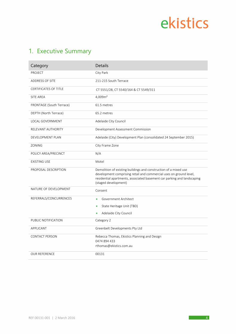
Category Details PROJECT City Park
ADDRESS OF SITE 211‐215 South Terrace
CERTIFICATES OF TITLE CT 5551/28, CT 5540/164 & CT 5549/311
SITE AREA 4,009m²
FRONTAGE (South Terrace) 61.5 metres
DEPTH (North Terrace) 65.2 metres
LOCAL GOVERNMENT Adelaide City Council
RELEVANT AUTHORITY Development Assessment Commission
DEVELOPMENT PLAN Adelaide (City) Development Plan (consolidated 24 September 2015)
ZONING City Frame Zone
POLICY AREA/PRECINCT N/A
EXISTING USE Motel
PROPOSAL DESCRIPTION Demolition of existing buildings and construction of a mixed use development comprising retail and commercial uses on ground level, residential apartments, associated basement car parking and landscaping (staged development)
NATURE OF DEVELOPMENT Consent
REFERRALS/CONCURRENCES Government Architect
State Heritage Unit (TBD)
Adelaide City Council
PUBLIC NOTIFICATION Category 2
APPLICANT Greenbelt Developments Pty Ltd
CONTACT PERSON Rebecca Thomas, Ekistics Planning and Design
0474 894 433
OUR REFERENCE 00131

REF 00131‐001 | 2 March 2016 5
2. Introduction
2.1 Background This report has been prepared on behalf of Greenbelt Developments Pty Ltd in support of an application to
demolish the existing buildings located at 211‐215 South Terrace, Adelaide and construct a mixed use
development comprising retail and commercial uses at ground level, residential apartments, three levels of
basement car parking and landscaping associated with private courtyards and a new walkway through the site
between South Terrace and Delhi Street.
‘City Park’ as the project is known, is intended to integrate and enhance the connection with the adjoining
parklands while presenting a high quality, built form edge to South Terrace. Active ground level frontages
incorporating suitable commercial and retail operations will provide ‘destination’ attributes and offer amenities
to visitors, as well as ensuring a diverse, quality mix of facilities for ‘City Park’ residents. The proposed varied
building heights and off‐set tower elements will offer a unique element to the city fringe while taking full
advantage of attractive City, Parkland and Adelaide Hills views.
Site access and egress points have been carefully located, utilising existing public road frontage for vehicles,
with car parking efficiently provided at basement levels. Enhancements to Downer Place together with a new
north‐south pedestrian and cycle access link through the site will significantly improve pedestrian safety and
connectivity within the area.
This development presents a unique opportunity to deliver a high quality, multi‐level, mixed use development
on a currently underutilised city site, assisting to transform the central area of South Terrace into a dynamic,
pedestrian orientated environment.
2.2 Pre-lodgement Process The Applicant elected to participate in the ‘Pre‐lodgement’ process offered by the Department of Planning
Transport and Infrastructure (DPTI). This involved:
A DPTI project initiation meeting;
Three (3) pre‐lodgement planning (PLP) meetings with DPTI in September 2015, November 2015 and
January 2016; and
Two (2) Design Review sessions, hosted by the Office for Architecture and Design SA (ODASA) held in
December 2015 and February 2016.
The feedback provided via these sessions, particularly in relation to the proposed architectural expression, form,
massing/building height and materials informed the design development of the project with the final Design
Review session delivering highly complimentary feedback including:
Support for the design direction;
Support for the urban strategy and response to the emerging character of South Terrace;
Praise for the thorough and detailed site and context analysis;

REF 00131‐001 | 2 March 2016 6
Support for the 15 storey and 18 storey built form massing and the proportions of the two buildings
relative to the context;
Support for the street wall and ‘city edge’ to South Terrace;
Support for the expression and articulation of the residential levels;
High regard for the composition of the facade system and materials in the building’s environmental
performance;
In principle support for apartment and floor layout planning, access to natural ventilation and light along
most corridors; and
Support for basement parking.
The following items were identified by ODASA for further investigation:
1. Opportunity to offer a more direct public path to the existing pedestrian crossing to the south
Parklands;
2. Consideration of providing public access to the diagonal thoroughfare to maximise exposure to
commercial tenancies and provide a more activated public interface;
3. Further considerations of strategies to achieve passive surveillance and activation of the central
courtyard and street frontage at lower levels; and
4. Further consideration of where long narrow corridors have apartment doors facing directly opposite
each other.
The Design Team has noted the feedback and offers the following response to the four issues listed above.
The existing Pedestrian Activated Crossing (PAC) across South Terrace is situated slightly west of the centre site
frontage and offers a valuable pedestrian connection between the Parklands and City Park. While the alignment
of a new north‐south link directly opposite this PAC would be preferable, to do so would compromise the
proposed development layout and functionality by transecting through the centre of the subject site. For
security, marketing and amenity reason, it is not appropriate to provide public access through the proposed
diagonal thoroughfare which links the north and south building. It is reasonable to afford future residents a
reasonable level of privacy and security in the central courtyard as the use of this space will contribute
significantly to the amenity and enjoyment of living at City Park.
The proposed pedestrian walkway along the eastern boundary of the subject site aligns directly with the north‐
south section of Delhi Street which is clearly desirable. This alignment also retains and reinforces the traditional
grid pattern of public roads/laneways for which Adelaide is known.
The retail/commercial tenancy exposure to South Terrace is substantial and it is not considered that allowing
public access into the apartment building foyer and residential walkway link would add to the level of vibrancy
and activity generated by the development. Notwithstanding this, it is highly likely that the central retail tenancy
which abuts the foyer, will incorporate a shop opening into the apartment lobby area for access by residents.

REF 00131‐001 | 2 March 2016 7
With regard to the last comment, it is acknowledged that at the lower podium levels, a number of the
apartment entry doors face one another. The ODASA comment implies that this configuration is undesirable
however we do not hold this view. The rare occasions at which neighbouring occupiers would be entering or
exiting their apartments at the same time and perhaps gain a quick, limited view into another resident’s
apartment is not, in our view, a shortcoming but an opportunity to spontaneously engage with a neighbour.
While the reorientation of apartment front doors could be accommodated this, in our opinion, would add little
benefit and would compromise the internal layout of apartments.
2.3 Public Consultation The Applicant also chose to undertake an informal public ‘Open Day’ to present and seek comment from local
residents and business owners of the intended development application. The Open Day was held on the
7th February 2016 at the Sage Hotel, immediately adjacent the site, between 11.00am and 3.00pm. Other key
stakeholders were also invited including the City South Association, the South West City Community Association,
the Adelaide City Council Lord Mayor, Deputy Mayor and two local Ward Councillors. In addition separate
individual meetings were held with the Principals of the two adjoining schools, Gilles Street Primary and
Pulteney Grammar. The schools were also invited to attend the open day and ongoing dialogue, particularly
with Gilles Street Primary, has continued to inform the project.
One local resident of Delhi Street, who was unable to attend the Open Day, met separately with the Planning
Consultant to discuss the project.
In addition to the School representatives, a total of 9 people attended the Open Day and a further 2 residents
offered views after the Open Day. The key issues raised by those attending the Open Day, together with the
comments provide by the school are summarised below.
Table 2.1 Community Feedback from informal Open Day
Comments Applicant’s Response
Good to hear site will be redeveloped as
currently presents poorly to the street
Agreed. Surrounding site amenity and streetscape will be greatly
improved by the proposed development.
Concerns with the proposed public access
walkway which might result in undesirable people
accessing Delhi Street
While these concerns are acknowledged, the benefits of
improved accessibility for local residents and the broader city are
considered to outweigh the potential minor intrusion from
greater volumes of pedestrian movement. The walkway will be
well lit with CCTV and site security will ensure undesirable
behavior is managed within the vicinity of the site.
Greater volume of people in Delhi Street will
result in more noise and nuisance to existing
residents
Supportive of high quality development &
activation of the precinct
Agreed. The development will ‘lift’ the area considerably, add
value to existing properties in the locality, offer significantly
greater passive surveillance and bring a vibrancy to the
community.

REF 00131‐001 | 2 March 2016 8
Comments Applicant’s Response
Concerns regarding potential conflict between
vehicles and school students in Downer Place (up
to 150 students at one time)
This issue is covered in detail in Section 6.7 of this report. A new
footpath (there is currently none) is to be installed along Downer
Place and various measures will be implemented to enhance
safety including:
Angled sight splays in the building form;
Warning system and mirrors; and
Loading Management Plan
The proposal also provides for a new, vehicle free access link
along the proposed north‐south walkway. The School currently
has double access gates at the western end of Delhi Street and
therefore could chose to utilise a new route along Delhi Street,
the new pedestrian walkway and then across the Pedestrian
Activated Crossing over South Terrace. This alternative route,
which avoids almost all vehicle traffic is approximately 136m long
compared to the existing route along Downer Place which is
approximately 90m long. This small extra distance is considered
negligible given the safety and amenity benefits of the alternative
route.
Concern re management of construction
externalities to minimise impacts on adjacent
schools, properties & local community
It is recognised that there will be some disruption to local
businesses, the schools and residents during construction. A
Construction Management Plan will document the arrangements
to be put in place to manage construction impacts, including
minimising noise impacts during ‘sensitive’ hours, traffic
management, site hoardings, construction waste and ensuring
adjoining building protection and stability. An alternative access
route for Gilles Street Primary will also be negotiated with
temporary access likely to be provided through the Sage Hotel
site.
Concern that some future residents will have
view into the school grounds and may also
complain about the noise generated by students
playing
These issues are covered within Sections 6.8, 6.9 and 6.10 within
this report. The subject site has a shared boundary edge with
Gilles Street Primary of some 30m and this portion of the
development is proposed to be 3 storeys. Measures to manage
privacy, visibility and noise have been incorporated into the
development and include:
Built form boundary setback;
New 3m high boundary fencing;
Existing and proposed landscaping; and
1.7m balcony screening.

REF 00131‐001 | 2 March 2016 9
2.4 Strategic Benefits The site presents an outstanding opportunity to demonstrate the principles and directions underpinning the 30
Year Plan for Greater Adelaide, with the potential to deliver various strategic benefits including:
Innovative mixed‐use, medium‐to‐high rise development of outstanding design quality, incorporating a
range of adaptable apartments;
Activation of street‐level frontages by increasing pedestrian use and introduction of retail/commercial
uses;
New and improved pedestrian linkages and high quality urban design features; and
Significant construction, employment and flow‐on benefits for the City and State economies.
The project directly supports the States Planning Strategy which aims to achieve 15,040 net additional dwellings
and 27,300 net additional population for Adelaide City by contributing 256 apartments that will translate to
approximately 350‐400 permanent city residents.
During construction and thereafter, the City Park project will generate substantial economic and employment
benefits to the City. The proposed development represents substantial private sector investment within the
Adelaide Central Business District of approximately $50 million. Fit‐out and landscaping costs will increase this
investment by approximately $90 Million, resulting in a total investment of over $90 Million.
3. Procedural Matters
3.1 Nature of Development The proposed development involves the demolition of existing buildings and the construction of multi‐level
apartment building with ground level retail/commercial activities, together with basement car parking.
Pursuant to the definitions in Schedule 1 of the Adelaide City Development Plan (Consolidated 24 September
2015), a ‘medium to high scale residential or serviced apartment development’ is defined as a ‘residential or
serviced apartment development of 4 or more building levels’.
While the precise nature of the southern ground floor tenancies are not yet know, it is anticipated that they will
comprise ‘shops’.
A ‘shop’ is defined in the Development Regulations, 2008 as:
‘shop means—
(a) premises used primarily for the sale by retail, rental or display of goods, foodstuffs, merchandise or
materials; or
(b) a restaurant; or
(c) a bulky goods outlet or a retail showroom; or
(d) a personal service establishment,

REF 00131‐001 | 2 March 2016 10
but does not include—
(e) a hotel; or
(f) a motor repair station; or
(g) a petrol filling station; or
(h) a plant nursery where there is no sale by retail; or
(i) a timber yard; or
(j) service trade premises; or
(k) service industry.
3.2 Planning Authority Pursuant to Schedule 10(4B) of the Development Regulations, 2008, the Development Assessment Commission
(DAC) is the relevant planning authority for this variation application, as the variation components, as well as
total development cost, is well in excess of $10 million.
3.3 Assessment Process The application constitutes a ‘Consent on‐merit’ proposal, being neither a complying or non‐complying form of
development.
In accordance with Principle of Development Control 27(b) within the City Frame Zone, the application
constitutes a Category 2 form of development for the purposes of Public Notification, as the proposal comprises
development on:
land adjacent the City Living Zone which exceeds 22 metres in building height; and
a catalyst site that exceeds 36 metres in building height.
3.4 Referrals Pursuant to Schedule 8 of the Development Regulations, 2008, the application is required to be referred to the
Government Architect.
Due to the proximity of State Heritage listed buildings (most notably Gilles Street Primary School), the
application may be referred to the State Heritage Unit if the DAC are of the opinion that the proposed
development may materially affect the context within which the State Heritage Place is situated.
An informal referral to Adelaide City Council is also likely in order to confirm any local heritage comment,
infrastructure and service provision issues including traffic, waste, public realm etc.

REF 00131‐001 | 2 March 2016 11
4. Subject Site and Locality
4.1 Subject Site The subject site comprises a land parcel of approximately 4,000m², currently occupied by the two‐storey
Country Comfort Motel which is built (primarily) to the boundary perimeter of the site with a large paved,
central car parking area. The site has a southern frontage of approximately 61.5 metres to South Terrace and a
western side boundary of approximately 65.2 metres to Downer Place, a public no‐through road accessed only
from South Terrace. Key site features and legal identifiers are outlined in the table below and a copy of the
Certificates of Title and Survey Plan are located at Appendix 1.
Table 4.1 Site Features
Address Allotment Certificates of Title Combined Total Area
Combined Frontage
Combined Depth
211‐215 South Terrace 249 248 285
CT 5551/28
CT 5540/164
CT 5549/311
4,009.8m² 61.5 metres 65.2 metres
The land also has a northern frontage of approximately 31 metres to Delhi Street (accessed via Gilles Street or
Pulteney Street) and a 30 metre (approximately) boundary to Gilles Street Primary School. The original 1899
school building (111 Gilles Street, Adelaide) is a State Heritage listed building. The shared site boundary is
located approximately 16 metres from the rear of the existing heritage listed school building. A number of the
single storey row cottages on Delhi Street adjacent the site are listed on Council’s Local Heritage Register.
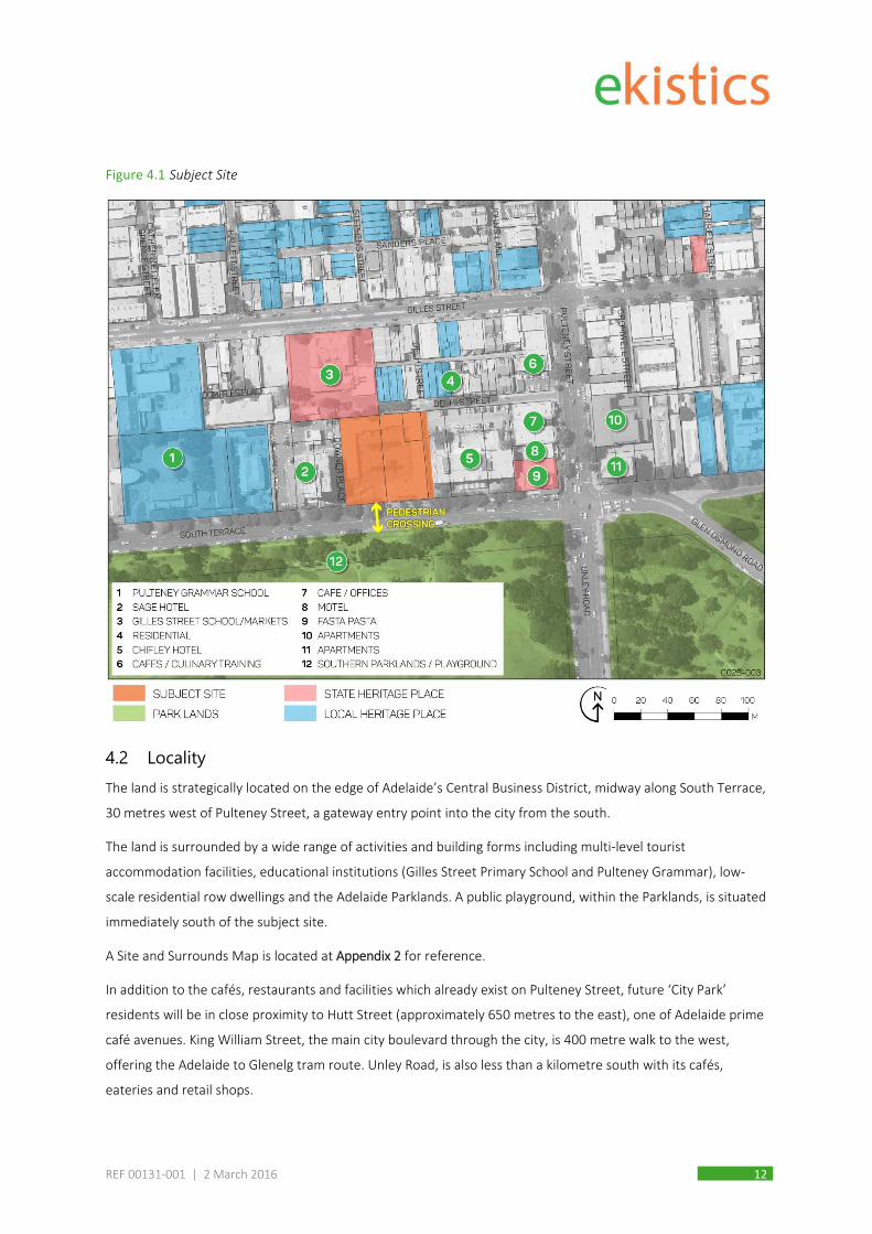
To the west of Downer Place is the 12 storey (approx. 35 metre high) Sage Hotel. To the immediate east is the 5
storey (approx. 18 metre) Chifley Hotel. Other sites and key features within the locality are illustrated in the
following site plan.
REF 00131‐001 | 2 March 2016 12
Figure 4.1 Subject Site
4.2 Locality The land is strategically located on the edge of Adelaide’s Central Business District, midway along South Terrace,
30 metres west of Pulteney Street, a gateway entry point into the city from the south.
The land is surrounded by a wide range of activities and building forms including multi‐level tourist
accommodation facilities, educational institutions (Gilles Street Primary School and Pulteney Grammar), low‐
scale residential row dwellings and the Adelaide Parklands. A public playground, within the Parklands, is situated
immediately south of the subject site.
A Site and Surrounds Map is located at Appendix 2 for reference.
In addition to the cafés, restaurants and facilities which already exist on Pulteney Street, future ‘City Park’
residents will be in close proximity to Hutt Street (approximately 650 metres to the east), one of Adelaide prime
café avenues. King William Street, the main city boulevard through the city, is 400 metre walk to the west,
offering the Adelaide to Glenelg tram route. Unley Road, is also less than a kilometre south with its cafés,
eateries and retail shops.

REF 00131‐001 | 2 March 2016 13
Following changes to Adelaide City Council’s Development Plan via the Capital City Development Plan
Amendment authorised in March 2012, the broader locality has undergone significant regeneration, with a
number of multi‐level development projects currently under construction, completed or having been recently
granted approval.
The following figure identifies some of the development activity in the south‐central area of the city, together
with a number of the other existing multi‐level buildings.
Figure 4.2 South-central city development
REF 00131‐001 | 2 March 2016 14
5. Description of the Proposal
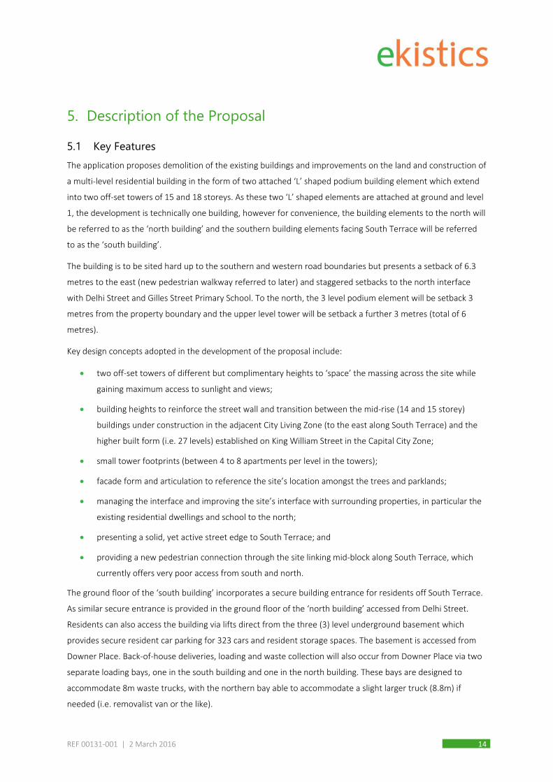
5.1 Key Features The application proposes demolition of the existing buildings and improvements on the land and construction of
a multi‐level residential building in the form of two attached ‘L’ shaped podium building element which extend
into two off‐set towers of 15 and 18 storeys. As these two ‘L’ shaped elements are attached at ground and level
1, the development is technically one building, however for convenience, the building elements to the north will
be referred to as the ‘north building’ and the southern building elements facing South Terrace will be referred
to as the ‘south building’.
The building is to be sited hard up to the southern and western road boundaries but presents a setback of 6.3
metres to the east (new pedestrian walkway referred to later) and staggered setbacks to the north interface
with Delhi Street and Gilles Street Primary School. To the north, the 3 level podium element will be setback 3
metres from the property boundary and the upper level tower will be setback a further 3 metres (total of 6
metres).
Key design concepts adopted in the development of the proposal include:
two off‐set towers of different but complimentary heights to ‘space’ the massing across the site while
gaining maximum access to sunlight and views;
building heights to reinforce the street wall and transition between the mid‐rise (14 and 15 storey)
buildings under construction in the adjacent City Living Zone (to the east along South Terrace) and the
higher built form (i.e. 27 levels) established on King William Street in the Capital City Zone;
small tower footprints (between 4 to 8 apartments per level in the towers);
facade form and articulation to reference the site’s location amongst the trees and parklands;
managing the interface and improving the site’s interface with surrounding properties, in particular the
existing residential dwellings and school to the north;
presenting a solid, yet active street edge to South Terrace; and
providing a new pedestrian connection through the site linking mid‐block along South Terrace, which
currently offers very poor access from south and north.
The ground floor of the ‘south building’ incorporates a secure building entrance for residents off South Terrace.
As similar secure entrance is provided in the ground floor of the ‘north building’ accessed from Delhi Street.
Residents can also access the building via lifts direct from the three (3) level underground basement which
provides secure resident car parking for 323 cars and resident storage spaces. The basement is accessed from
Downer Place. Back‐of‐house deliveries, loading and waste collection will also occur from Downer Place via two
separate loading bays, one in the south building and one in the north building. These bays are designed to
accommodate 8m waste trucks, with the northern bay able to accommodate a slight larger truck (8.8m) if
needed (i.e. removalist van or the like).

REF 00131‐001 | 2 March 2016 15
A large, secure bicycle storage facility for 256 bike spaces is proposed at ground floor between the two buildings
with access from both Downer Place and from within the development (central courtyard). Additional bike
parking will be provided within the pedestrian walkway and, subject to Council agreement, within other public
realm locations around the site.
Ground floor retail and commercial tenancies are proposed along the South Terrace frontage, currently divided
into three potential tenancy spaces comprising a total of 432m2 of leasable floor area. It is envisaged that at
least one of these spaces will be occupied by a café/restaurant and that outdoor dining will occur around a
portion of the ground floor.
A large central courtyard is situated in the middle of the site surrounded on three sides by the proposed
building. Three quarters of this courtyard is intended for private use by ‘City Park’ residents and guests and is
accessible through either the south or north building entrances which are linked by a covered walkway. A large
multi‐purposes dining/entertaining space is accessible for residents in the ground floor of the ‘north building’
and opens out into the courtyard for use during functions and the like.
The balance of the ground level forms an open courtyard recessed off a new pedestrian walkway linking the
southern end of the site (South Terrace) with the north (Delhi Street). The alignment of this new access link,
which is intended to be accessible to the public, provides a highly valuable north‐south city connection between
the Parklands and Gilles Street, along the north‐south section of Delhi Street. The central recess along with the
walkway offers space for substantial landscaping and outdoor dining set against an attractive visually permeable
screening element which defines the ‘public’ verses ‘private’ space.
The new pedestrian walkway link is intended to remain open to the public other than during maintenance,
cleaning or when partial or full closure may be required for safety reasons. New footpaths are proposed to be
constructed along the eastern side of Downer Place and at the western end of Delhi Street. There are currently
no footpaths along these roads. While the new footpaths will be public road reserve constructed to Council
standards, the proposed new north‐south pedestrian link will remain in private ownership with maintenance,
cleaning and landscaping the responsibility of City Park.
The building contains 256 apartment in a variety of 1, 2 and 3 bedroom forms as follows:
101 one bedroom apartments ranging in size between 50m2 to 55m²;
123 two bedroom apartments ranging in size between 68m2 and 80m²;
32 three bedroom apartments ranging in size between 95m2 and 130m²;
Each apartment has a private balcony/terrace which range in size between 7m2 to 28m2. The majority of the
balconies are inset to the building facade meaning the space can function as an extension to the internal living
area improving amenity and space efficiency.
In addition these private spaces, communal recreation, open space and entertainment space for the use of
residents and their guests is provided as follows:
A 500m2 ground level courtyard (as previously mentioned);
REF 00131‐001 | 2 March 2016 16
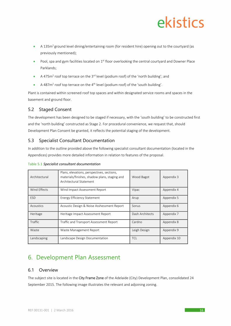
A 135m2 ground level dining/entertaining room (for resident hire) opening out to the courtyard (as
previously mentioned);
Pool, spa and gym facilities located on 1st floor overlooking the central courtyard and Downer Place
Parklands;
A 475m2 roof top terrace on the 3rd level (podium roof) of the ‘north building’; and
A 487m2 roof top terrace on the 4th level (podium roof) of the ‘south building’.
Plant is contained within screened roof top spaces and within designated service rooms and spaces in the
basement and ground floor.
5.2 Staged Consent The development has been designed to be staged if necessary, with the ‘south building’ to be constructed first
and the ‘north building’ constructed as Stage 2. For procedural convenience, we request that, should
Development Plan Consent be granted, it reflects the potential staging of the development.
5.3 Specialist Consultant Documentation In addition to the outline provided above the following specialist consultant documentation (located in the
Appendices) provides more detailed information in relation to features of the proposal.
Table 5.1 Specialist consultant documentation
Architectural
Plans, elevations, perspectives, sections,
materials/finishes, shadow plans, staging and
Architectural Statement
Wood Bagot Appendix 3
Wind Effects Wind Impact Assessment Report Vipac Appendix 4
ESD Energy Efficiency Statement Arup Appendix 5
Acoustics Acoustic Design & Noise Asshessment Report Sonus Appendix 6
Heritage Heritage Impact Assessment Report Dash Architects Appendix 7
Traffic Traffic and Transport Assessment Report Cardno Appendix 8
Waste Waste Management Report Leigh Design Appendix 9
Landscaping Landscape Design Documentation TCL Appendix 10
6. Development Plan Assessment
6.1 Overview The subject site is located in the City Frame Zone of the Adelaide (City) Development Plan, consolidated 24
September 2015. The following image illustrates the relevant and adjoining zoning.

REF 00131‐001 | 2 March 2016 17
The primary objective of the of City Frame Zone is to promote development that contains a mix of uses,
including shops, offices and commercial development at lower floors, with residential land uses above with
views to the Park Lands. Development is expected to create a strong edge to the Park Lands and present a
uniform streetscape established through a largely consistent front setback and tall, articulated building facades.
Figure 6.1 Development Plan Zoning
An assessment against the key provisions of the Zone as well as Council Wide policies follows.
6.2 Land Use Frame Zone provisions
Desired Character extract
This Zone will primarily contain medium to high scale residential development supported by a mix of shops,
personal services, restaurants, cafés, and community and hospitality uses.
The mix of complementary land uses will extend activity into the evening to enhance the vibrancy and safety of
the area.

REF 00131‐001 | 2 March 2016 18
Small-scale licensed entertainment premises, nightclubs or bars may occur in limited numbers where they are
designed and sited to maintain day and evening activation at street level. Development will include residential
and mixed use residential buildings that are well connected to nearby public transport networks, including the
tramline.
Catalyst sites provide opportunities for integrated developments on large sites to assist in the transformation of
a locality. Such developments will facilitate growth in the residential population of the City, while also activating
the public realm and creating a vibrant main street feel. A range of land uses will be provided that add to the
range of local employment opportunities and the availability of services and shopping facilities within the main
street.
OBJ 1 Development that contains a mix of uses including shops, offices and commercial development
at lower floors with residential land uses above with views to the Park Lands and Squares.
OBJ 5 An area that allows people to work, shop and access a range of services close to home.
PDC 1 The following types of development, or combinations thereof, are envisaged in the Zone:
Affordable housing
Aged persons accommodation
Community centre
Consulting room
Dwelling
Educational establishment
Hotel
Indoor recreation centre
Licensed entertainment premises
Office
Pre-school
Primary school
Residential flat building
Restaurant
Retirement village
Shop or group of shops
Supported accommodation
Tourist accommodation
PDC 2 Development should comprise wholly residential buildings or mixed use buildings with non-
residential development at the ground/first floor level and residences above.
PDC 3 Development should reinforce the area as predominantly residential, with non-residential land
uses comprising no more than 40 percent of any new building.
PDC 4 Non-residential development should occur as part of a mixed use building and comprise uses that:
(a) are of a role and function appropriate for the Zone;
(b) encourage walking and cycling to local shopping, community services and other activities;
and
(c) do not detrimentally impact on the amenity of nearby residents.
PDC 5 Licensed entertainment premises, nightclubs or bars should be small in scale, secondary to the
primary land use mix in each street and not detract from the street’s daytime activation.
PDC 18 Development on catalyst sites (sites greater than 1500 square metres, which may include one or
more allotment) should be comprised of medium to high scale residential development that is
carefully integrated with non-residential development.

REF 00131‐001 | 2 March 2016 19
Council Wide Provisions
PDC 5 Development should comprise of a range of housing types, tenures and cost, to meet the widely
differing social and economic needs of residents.
Land Use Assessment
As sought by the City Frame Zone, the proposal incorporates:
Medium to high scale residential development; and
Retail/commercial/restaurant uses which will activate the street and to a degree, extend activity into
the evening (together with the comings and going of City Park residents and visitors).
From a land use perspective, this is directly aligned with what the City Frame Zone envisages.
The City Frame Zone will accommodate more residents and foster greater use of the Park Lands
and Squares. The Zone will encourage medium to high scale residential development facing the
Park Lands and Squares with cafes, restaurants and shops at the ground floor.
(Adelaide City Development Plan quote, Preface, City Form)
A variety of apartment configurations will be offered in 1, 2 and 3 bedrooms forms and of differing floor plate
sizes. There is potential to combine apartments to create a custom apartment layout should future purchasers
request.
While the project does not propose to deliver affordable housing through a formal housing agreement, the
project aims to pitch its product to a wide range of purchasers, and will be offering a number of apartments
(estimated at 15‐20%) at or below $400,000. While this is marginally above the current ‘affordable housing’
price limit of $350,000, the lower end apartment range offered within the City Park development is,
comparatively, very affordable for city apartment living.
In this way, the intent of affordable housing is integrated into the project in a realistic and viable way and the
apartment product split ensures the development caters for a variety of household structures.
The proposal is considered to achieve the desired land use mix sought by the Adelaide City Development Plan.
6.3 Built Form Design, Siting, Massing and Interface Frame Zone provisions
Desired Character extract
The location and scale of buildings will achieve high quality urban design outcomes, with the highest built form
located along South Terrace facing the Park Lands with a slightly lower built form framing the Squares.
Buildings will have minimal or no setback and provide tall walls when viewed from the main road frontage to
achieve a consistent built form facade. Landscaping and small variations in front setback will assist in softening
the continuous edge of new built form and provide a higher amenity streetscape and pedestrian environment
which is shaded by street trees and other mature vegetation.

REF 00131‐001 | 2 March 2016 20
Buildings will have a strong horizontal emphasis with clearly defined and segmented vertical elements. At street
level, the use of solid materials will be appropriately balanced with glazed areas to provide visual interest and
activity. Tall facades will be well articulated with finer details that contribute positively to the public realm,
including modelled facades, canopies, fenestration and balconies that make use of light and shade.
Development on catalyst sites will exemplify quality and contemporary design that is generally greater in height,
or intensity, than its surroundings. However, development will be designed to carefully manage the interface
with sensitive uses in the City Living Zone, particularly with regard to massing; proportions; overshadowing;
traffic and noise related impacts.
OBJ 2 Development that creates a strong edge to the Park Lands and Squares.
OBJ 3 A uniform streetscape established through a largely consistent front setback and tall, articulated
building facades.
OBJ 7 A built form that provides a transition down in scale and intensity at the Zone’s boundaries to
maintain the amenity of properties located within the adjoining City Living Zone.
PDC 10 The ground floors of buildings should have a minimum floor to ceiling height of 3.5 metres to
allow for adaptation to a range of land uses including shops, cafés, restaurants or offices without
the need for significant alterations to the building.
PDC 11 A minimum of 70 percent of the ground floor primary frontage of buildings should be visually
permeable, transparent or clear glazed to help create active street frontages and maximise
passive surveillance.
PDC 12 Buildings on sites with a frontage greater than 10 metres should be articulated through variations
in forms, materials, openings and colours.
PDC 13 Buildings should be designed to overlook or be orientated towards the Park Lands and Squares
and pedestrian and cycle routes.
PDC 14 Except where the airport’s operations require a lesser height or the development is located on a
site greater than 1500 square metres (which may include one or more allotment), building height
should not exceed:
(a) 36 metres south of Gilles and Gilbert streets; and
(b) 29 metres north of Gilles and Gilbert streets.
PDC 16 Buildings (excluding verandahs, porticos and the like) should generally be built to the primary
road frontage.
PDC 17 Development on land directly abutting the City Living Zone should avoid tall, sheer walls at the
interface by ensuring walls greater than 3 metres in height are set back at least 2 metres from
the rear allotment boundary with further articulation at the upper levels.
REF 00131‐001 | 2 March 2016 21
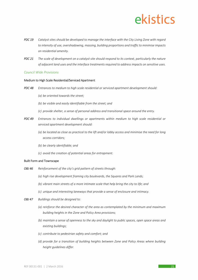
PDC 19 Catalyst sites should be developed to manage the interface with the City Living Zone with regard
to intensity of use, overshadowing, massing, building proportions and traffic to minimise impacts
on residential amenity.
PDC 21 The scale of development on a catalyst site should respond to its context, particularly the nature
of adjacent land uses and the interface treatments required to address impacts on sensitive uses.
Council Wide Provisions
Medium to High Scale Residential/Serviced Apartment
PDC 48 Entrances to medium to high scale residential or serviced apartment development should:
(a) be oriented towards the street;
(b) be visible and easily identifiable from the street; and
(c) provide shelter, a sense of personal address and transitional space around the entry.
PDC 49 Entrances to individual dwellings or apartments within medium to high scale residential or
serviced apartment development should:
(a) be located as close as practical to the lift and/or lobby access and minimise the need for long
access corridors;
(b) be clearly identifiable; and
(c) avoid the creation of potential areas for entrapment.
Built Form and Townscape
OBJ 46 Reinforcement of the city’s grid pattern of streets through:
(a) high rise development framing city boulevards, the Squares and Park Lands;
(b) vibrant main streets of a more intimate scale that help bring the city to life; and
(c) unique and interesting laneways that provide a sense of enclosure and intimacy.
OBJ 47 Buildings should be designed to:
(a) reinforce the desired character of the area as contemplated by the minimum and maximum
building heights in the Zone and Policy Area provisions;
(b) maintain a sense of openness to the sky and daylight to public spaces, open space areas and
existing buildings;
(c) contribute to pedestrian safety and comfort; and
(d) provide for a transition of building heights between Zone and Policy Areas where building
height guidelines differ.

REF 00131‐001 | 2 March 2016 22
OBJ 48 Development which incorporates a high level of design excellence in terms of scale, bulk, massing,
materials, finishes, colours and architectural treatment.
Height, Bulk and Scale
PDC 167 Development should be of a high standard of design and should reinforce the grid layout and
distinctive urban character of the City by maintaining a clear distinction between the following:
(a) the intense urban development and built-form of the town acres in the Capital City, Main
Street, Mixed Use, City Frame and City Living Zones;…
PDC 168 The height and scale of development and the type of land use should reflect and respond to the
role of the street it fronts as illustrated on Map Adel/1 (Overlay 1).
PDC 169 The height, scale and massing of buildings should reinforce:
(a) the desired character, built form, public environment and scale of the streetscape as
contemplated within the Zone and Policy Area, and have regard to:
(i) maintaining consistent parapet lines, floor levels, height and massing with existing
buildings consistent with the areas desired character;
(ii) reflecting the prevailing pattern of visual sub-division of neighbouring building frontages
where frontages display a character pattern of vertical and horizontal sub-divisions; and
(iii) avoiding massive unbroken facades.
(b) a comfortable proportion of human scale at street level by:
(i) building ground level to the street frontage where zero set-backs prevail;
(ii) breaking up the building facade into distinct elements;
(iii) incorporating art work and wall and window detailing; and
(iv) including attractive planting, seating and pedestrian shelter.
PDC 172 Development in a non-residential Zone that abuts land in a City Living Zone, the Adelaide Historic
(Conservation) Zone or the North Adelaide Historic (Conservation) Zone, should provide a
transition between high intensity development and the lower intensity development in the
adjacent Zone by focussing taller elements away from the common Zone boundary.
Composition and Proportion
PDC 179 Development should respect the composition and proportion of architectural elements of building
facades that form an important pattern which contributes to the streetscape’s distinctive
character in a manner consistent with the desired character of a locality by:
(a) establishing visual links with neighbouring buildings by reflecting and reinforcing the
prevailing pattern of visual sub-division in building facades where a pattern of vertical and/or

REF 00131‐001 | 2 March 2016 23
horizontal sub-divisions is evident and desirable, for example, there may be strong horizontal
lines of verandahs, masonry courses, podia or openings, or there may be vertical proportions
in the divisions of facades or windows; and
(b) clearly defining ground, middle and roof top levels.
PDC 180 Where there is little or no established building pattern, new buildings should create new features
which contribute to an areas desired character and the way the urban environment is understood
by:
(a) frontages creating clearly defined edges;
(b) generating new compositions and points of interest;
(c) introducing elements for future neighbouring buildings; and
(d) emphasising the importance of the building according to the street hierarchy.
Articulation and Modelling
PDC 181 Building facades fronting street frontages, access ways, driveways or public spaces should be
composed with an appropriate scale, rhythm and proportion which responds to the use of the
building, the desired character of the locality and the modelling and proportions of adjacent
buildings.
Materials, Colours and Finishes
PDC 186 The design, external materials, colours and finishes of buildings should have regard to their
surrounding townscape context, built form and public environment, consistent with the desired
character of the relevant Zone and Policy Area.
PDC 187 Development should be finished with materials that are sympathetic to the design and setting of
the new building and which incorporate recycled or low embodied energy materials. The form,
colour, texture and quality of materials should be of high quality, durable and contribute to the
desired character of the locality. Materials, colours and finishes should not necessarily imitate
materials and colours of an existing streetscape
PDC 188 Materials and finishes that are easily maintained and do not readily stain, discolour or deteriorate
should be utilised.
PDC 189 Development should avoid the use of large expanses of highly reflective materials and large areas
of monotonous, sheer materials (such as polished granite and curtained wall glazing).

REF 00131‐001 | 2 March 2016 24
Built Form Design, Siting, Massing and Interface Assessment
Building Height
As a catalyst site, the City Park development is not constrained by quantitative building heights (whereby a 36
metre building height would typically apply for non‐catalyst sites). Nevertheless, the scale of proposed
developments should respond to the context of the site and the nature of adjoining land uses.
What building heights are potentially contemplated on catalyst site in the City Frame Zone is therefore the
question. Through the early design development of City Park, building height, scale and massing were a central
focus. The following factors were identified as most important when determining suitable built form scale:
1. Key statements within the Development Plan which signalled the desired form of development and
preferred character. This included guidance from the Development Plan which calls for:
highest built forms along South Terrace
high rise fronting the Parklands
tall facades
catalyst sites greater in height or intensity than the surroundings
building heights that reflect and respond to the role of the street hierarchy (noting that South
Terrace is a Primary City Access Route)
2. The direction provided by recently approved buildings within the South Terrace context, in particular
two buildings within the City Living Zone further east of the subject site (refer to Wood Bagot extract
below).
Figure 6.2 Building height transition along South Terrace
As demonstrated in the image above, there appears a coherent transition of building heights
developing along South Terrace from the 14 and 15 storey buildings approved and under construction
in the City Living Zone to the east (non‐catalyst site height requirement of 22m/7‐8 storeys) to the 27
storey building in the Capital City Zone to the west (building height maximum of 56m/18‐19 storeys).
The subject site, located between these buildings lends itself to a mid‐rise scale (such as the 15 and 18
storey’s proposed) which contributes to a transition along the Terrace from the residential areas to the
east through to the mixed use location in the Frame, gradually rising to the most intense development
along King William Road, the ‘city spine’.

REF 00131‐001 | 2 March 2016 25
3. Ability to manage interface impacts, particularly with the City Living Zone to the north, including
intensity of use, overshadowing, massing, building proportions and traffic to minimise impacts on
residential amenity. Each site boundary has been uniquely treated to respond to the interface
environment to which it presents. The image below identifies the five main ‘interface’ locations and
the design response adopted.
Figure 6.3 Interface Treatment Approach
The size of the subject site enables a development where the taller elements can be staggered and presented as
two distinctive, slender towers (small floor plate size) which are well spaced. This siting arrangement assist to
visually minimize the building mass and scale. The proposal also offers varying setbacks and architectural design
to respond to the particular interface environment at each site boundary. The careful siting of the building
towers, the central courtyard and walkway, building recesses and a high degree of facade articulation will create
an intimate character, openness to the sky and sunlight access.

REF 00131‐001 | 2 March 2016 26
Feedback from the Design Review process in relation to built form height and massing has been very positive,
acknowledging however that a design of exceptional quality is essential together with careful management of
potential interface issues (discussed further in the report).
Given these factors and the achievement of the other Development Plan provisions coupled with the tendency
towards taller buildings in the locality (most notably within the City Living Zone) and the desired character of the
City Frame Zone and catalyst site objectives in particular, the proposed building height is not considered
unreasonable or in conflict with the intended transformation of the area, which seeks high‐scale development
with prominent street walls that frame the street and Parklands, and for large strategic sites to be developed to
their full potential.
Setbacks
Variable setbacks have been adopted to respond to site context and streetscape character.
As sought in the Development Plan, a zero setback is presented to South Terrace to emphasise a strong edge to
the Parklands. The potential to setback the building to South Terrace was initially explored given the existing
deep setbacks of adjacent buildings however feedback from PLP and Design Review meetings expressed the
view that the built form should be hard to the street edge. The recessed ground level shop windows do offer
some relief to this strong facade, with glazing setback a minimum of 1m behind the rear face of the columns to
allow for unimpeded access (including sufficient disability access) and for adequate shelter from wind and rain.
Currently the back of the Country Comfort Motel is sited hard up against Delhi Street with no footpath as
illustrated in the image below.
Figure 6.4 Delhi Street – existing and proposed setbacks
The proposal will substantially alter this streetscape installing a public footpath, setting the 3 level podium back
3m and the taller tower element back 6m from the northern property boundary with the City Living Zone. This
meets, and in fact exceeds the requirements of City Frame Zone Principle of Development Control 17 which is
re‐quoted below (our emphasis).
PDC 16 Development on land directly abutting the City Living Zone should avoid tall, sheer walls at the
interface by ensuring walls greater than 3 metres in height are set back at least 2 metres from
the rear allotment boundary with further articulation at the upper levels.

REF 00131‐001 | 2 March 2016 27
Facade Design
High quality, contemporary design is sought, particularly where new infill development seeks to introduce new,
transformational development on catalysts sites. The proposed architectural expression is most succinctly
expressed in the Wood Bagot Architectural submission (Appendix 3).
A consistent built form facade across the development is presented which adopts strong vertical columns,
modelled with articulated pre‐cast panels in an organic ‘tree branch’ form. The design has deliberately
embraced a more solid appearance by pronouncing the columns and masonry elements in order to represent a
‘residential’ character rather than a heavily glazed building which tends to have a more commercial feel. The
rhythm of inset windows and deep balconies provides depth to the facade and will create visible light and shade
variations across the facade for interest.
The combination of materials, colours and finishes offers an elegant, contemporary presentation which appears
robust but also sympathetic to the existing character built form in the locality.
While no canopies project from the building, the recessed ground level shop front provides pedestrian shelter
and is the preferred option to ensure the facade design is not compromised.
The potential wind impact created by the development has been assessed by Vipac (Appendix 4) who confirm
that the conditions experienced on the ground, at entrances and on the podium terraces will be acceptable
subject to the use of café screens around certain outdoor dining locations and the installation of a canopy on
the north building roof terrace.
Building entrances will be clearly identified and provide a personal address for both the south and north
building. Way finding signage will assist to direct visitors to the key entry points.
Interface Considerations
In relation to interface considerations the following additional observations are made:
Intensity of use and Traffic– the development will result in more pedestrian movement within Delhi
Street and the surrounds given the presentation of dwellings to Delhi Street and the location of the
South Building entrance lobby. No vehicle access to the site is possible from Delhi Street so traffic
movements are unlikely to change substantially although some additional on‐street parking is probable
(noting however that existing Residential permit parking and 2 hour limits are imposed). The 3‐storey
townhouse forms presenting to Delhi Street are consistent with the existing domestic scale of the street
and offer a suitable transition in terms of intensity of use, streetscape presentation and built‐form
massing to the balance of the apartment development.
Overshadowing ‐ the orientation of the site results in no overshadowing of the residential properties to
the north or to Gilles Street Primary School. Some additional shadow is cast on the adjacent Parklands
Playground however the narrow width of the south building means that a portion of the park has access
to sunlight at all times. Shadow diagrams are included in the Wood Bagot documentation at Appendix 3.
REF 00131‐001 | 2 March 2016 28
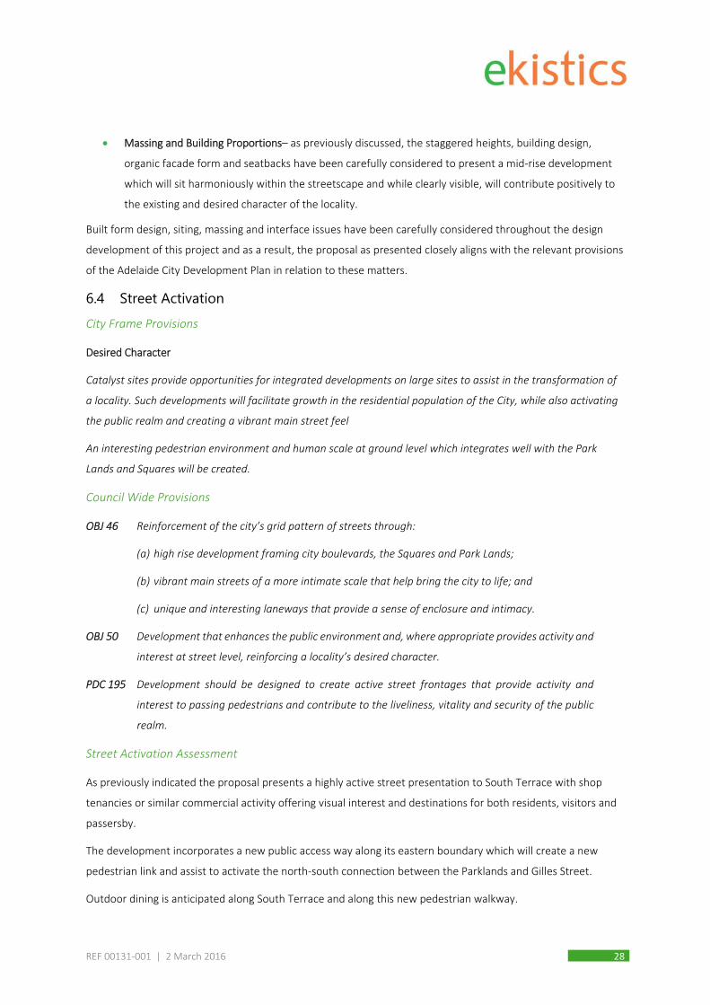
Massing and Building Proportions– as previously discussed, the staggered heights, building design,
organic facade form and seatbacks have been carefully considered to present a mid‐rise development
which will sit harmoniously within the streetscape and while clearly visible, will contribute positively to
the existing and desired character of the locality.
Built form design, siting, massing and interface issues have been carefully considered throughout the design
development of this project and as a result, the proposal as presented closely aligns with the relevant provisions
of the Adelaide City Development Plan in relation to these matters.
6.4 Street Activation City Frame Provisions
Desired Character
Catalyst sites provide opportunities for integrated developments on large sites to assist in the transformation of
a locality. Such developments will facilitate growth in the residential population of the City, while also activating
the public realm and creating a vibrant main street feel
An interesting pedestrian environment and human scale at ground level which integrates well with the Park
Lands and Squares will be created.
Council Wide Provisions
OBJ 46 Reinforcement of the city’s grid pattern of streets through:
(a) high rise development framing city boulevards, the Squares and Park Lands;
(b) vibrant main streets of a more intimate scale that help bring the city to life; and
(c) unique and interesting laneways that provide a sense of enclosure and intimacy.
OBJ 50 Development that enhances the public environment and, where appropriate provides activity and
interest at street level, reinforcing a locality’s desired character.
PDC 195 Development should be designed to create active street frontages that provide activity and
interest to passing pedestrians and contribute to the liveliness, vitality and security of the public
realm.
Street Activation Assessment
As previously indicated the proposal presents a highly active street presentation to South Terrace with shop
tenancies or similar commercial activity offering visual interest and destinations for both residents, visitors and
passersby.
The development incorporates a new public access way along its eastern boundary which will create a new
pedestrian link and assist to activate the north‐south connection between the Parklands and Gilles Street.
Outdoor dining is anticipated along South Terrace and along this new pedestrian walkway.

REF 00131‐001 | 2 March 2016 29
Street activation is significantly enhanced by the proposal with the intent of the relevant Development Plan
provisions met.
6.5 Heritage and Conservation Council Wide Provisions
OBJ 43 Development that retains the heritage value and setting of a heritage place and its built form
contribution to the locality.
PDC 140 Development on land adjacent to a heritage place in non-residential Zones or Policy Areas should
incorporate design elements, including where it comprises an innovative contemporary design,
that:
(a) utilise materials, finishes, and other built form qualities that complement the adjacent
heritage place; and
(b) is located no closer to the primary street frontage than the adjacent heritage place.
Heritage and Conservation Assessment
Dash Architects provided early feedback on the project and have reviewed the current plans in relation to the
siting of the development in the context of both State and Local heritage listed properties.
Their Heritage Impact Assessment (Appendix 7) concludes that the design approach addresses the relevant
heritage provisions of the Development Plan and is in fact a “notable improvement to the setting of the
identified heritage places, and residential amenity of the locality”.
The DASH assessment goes on to state that “While the development may be visible within the boarder context of
the identified State Heritage places, this context is that of the City Frame Zone along one of the City’s bounding
boulevards, where substantial development of this nature is envisaged”. DASH conclude that the proposed
development does not materially affect the context or setting of any State Heritage places.
The application is considered to achieve the relevant Development Plan provisions relating to heritage.
6.6 Apartment Amenity City Frame Zone
OBJ 6 Adaptable and flexible building designs that can accommodate changes in use and respond to
changing economic and social conditions.
Council Wide Provisions
PDC 7 Residential development should be designed to be adaptable to meet people’s needs throughout
their lifespan to ensure that changes associated with old age, special access and mobility can be
accommodated.

REF 00131‐001 | 2 March 2016 30
OBJ 22 Medium to high scale residential (including student accommodation) or serviced apartment
development that:
(a) has a high standard of amenity and environmental performance;
(b) comprises functional internal layouts;
(c) is adaptable to meet a variety of accommodation and living needs; and
(d) includes well-designed and functional recreation and storage areas.
PDC 50 Medium to high scale residential or serviced apartment development should be designed to
maximise opportunities to facilitate natural ventilation and capitalise on natural daylight and
minimise the need for artificial lighting during daylight hours.
PDC 51 Medium to high scale residential or serviced apartment development should be designed and
located to maximise solar access to dwellings and communal open space on the norther facade.
PDC 54 The maximum distance of a habitable room such as a living, dining, bedroom or kitchen from a
window providing natural light and ventilation to that room is 8 metres.
PDC 70 Medium to high scale residential or serviced apartment development should provide a high
quality living environment by ensuring the following minimum internal floor areas:
(a) studio (where there is no separate bedroom): 35 square metres
(b) 1 bedroom dwelling/apartment: 50 square metres
(c) 2 bedroom dwelling/apartment: 65 square metres
(d) 3+ bedroom dwelling/apartment: 80 square metres plus an additional 15 square metres for
every additional bedroom over 3 bedrooms.
Apartment Amenity Assessment
The mix of apartments (1, 2 and 3 bedrooms) offers diversity for occupants but also an adaptable, functional
building design where apartment could be combined/modified to provide custom layouts as desired. Current
apartment sizes achieve the minimum floor areas referenced in PDC 70 above.
Cross ventilation is enhanced through window placement and large balconies, with the inclusion of a large
proportion of corner apartment providing dual orientation. While the site alignment does result in some
southern facing apartment, these are kept to a minimum with a maximum 1 south facing apartment on each
level in the towers (with many of the upper levels containing no south only facing apartments).
Levels and access points are compliant with disability access requirements and main entrance points will be
clearly identifiable for residents and visitors to City Park.
A combination of private and communal open space and recreational facilities will be offered together with a
range of other resident amenities which will contribute to a high quality of living.
REF 00131‐001 | 2 March 2016 31
6.7 Open Space and Public Realm City Frame Zone
OBJ 4 Development that creates a high quality public realm that promotes walking, cycling, public
transport patronage and social interaction.
PDC 9 Pedestrian shelter and shade should be provided over footpaths through the use of continuous
structures such as awnings, canopies and verandahs.
Council Wide Provisions
PDC 56 Medium to high scale residential or serviced apartment development should be designed to
ensure living areas, private open space or communal open space, where such communal open
space provides the primary area of private open space, are the main recipients of sunlight.
PDC 57 Medium to high scale residential or serviced apartment development should locate living areas,
private open space and communal open space, where such communal open space provides the
primary area of private open space, where they will receive sunlight and, where possible, should
maintain at least two hours of direct sunlight solar time on 22 June to:
(a) at least one habitable room window (excluding bathroom, toilet, laundry or storage room
windows);
(b) to at least 20 percent of the private open space; and
(c) communal open space, where such communal open space provides the primary private open
space for any adjacent residential development.
PDC 59 Medium to high scale residential development and serviced apartments should provide the
following private open space:
(a) studio (where there is no separate bedroom): no minimum requirement but some provision is
desirable.
(b) 1 bedroom dwelling/apartment: 8 square metres.
(c) 2 bedroom dwelling/apartment: 11 square metres.
(d) 3+ bedroom dwelling/apartment: 15 square metres.
A lesser amount of private open space may be considered appropriate in circumstances where
the equivalent amount of open space is provided in a communal open space accessible to all
occupants of the development.
PDC 60 Medium to high scale residential (other than student accommodation) or serviced apartment
development should ensure direct access from living areas to private open space areas, which
may take the form of balconies, terraces, decks or other elevated outdoor areas provided the
amenity and visual privacy of adjacent properties is protected.

REF 00131‐001 | 2 March 2016 32
PDC 61 Other than for student accommodation, private open space should have a minimum dimension
of 2 metres and should be well proportioned to be functional and promote indoor/outdoor living.
PDC 62 Balconies should be integrated into the overall architectural form and detail of the development
and should:
(a) utilise sun screens, pergolas, shutters and openable walls to control sunlight and wind;
(b) be cantilevered, partially cantilevered and/or recessed in response to daylight, wind, acoustic
and visual privacy;
(c) be of a depth that ensures sunlight can enter the dwelling below; and
(d) allow views and casual surveillance of the street while providing for safety and visual privacy.
PDC 65 The incorporation of roof top gardens is encouraged providing it does not result in unreasonable
overlooking or loss of privacy.
PDC 170 Where possible, large sites should incorporate pedestrian links and combine them with publicly
accessible open space.
Open Space and Public Realm Assessment
The proposal offers a variety of open space, both private and communal, for residents. Each apartment has
a private balcony/terrace which range in size between 7m² to 28m². The majority of the balconies are
recessed to the building facade meaning the space can function as an extension to the internal living area
improving amenity and space efficiency.
In addition communal recreation, open space and entertainment space for the use of residents and their
guests is provided as follows:
A 500m² ground level courtyard;
A 135m² dining/entertaining room (for resident hire) opening out to the ground level courtyard;
Pool, spa and gym facilities;
A 475m² roof top terrace on the 3rd level (podium roof) of the ‘north building’; and
A 487m² roof top terrace on the 4th level (podium roof) of the ‘south building’.
In addition, the new pedestrian walkway, which accounts for 620m² of space (or 15% of the development)
will be available for residents and the public also.
It is acknowledged the some of the balconies are marginally smaller than the sizes suggested in PDC59
however the proposal is still considered to achieve the intent of this Principle which also states that “a
lesser amount of private open space may be considered appropriate in circumstances where the equivalent
amount of open space is provided in a communal open space accessible to all occupants of the
development.”

REF 00131‐001 | 2 March 2016 33
This range of space is considered more than adequate for the development and meets the relevant
Development Plan provisions.
Pedestrian Use of Downer Place
Students from Gilles Street School currently access Downer Place via an existing gate at the northern end of the
street and walk along Downer Place to access the Southern Parklands. It is understood that this movement
occurs on virtually all schools days and sometimes occurs multiple times in one day. As there is no footpath on
Downer Place, people are currently required to walk on the road carriage along the existing spoon drain.
The development proposal provides an opportunity to improve the current pedestrian experience and safety of
users in Downer Place. It is proposed that a footpath be installed along the eastern building edge for pedestrian
use. To manage the combination of pedestrian movements and increased traffic on Downer Place, the following
measures will be adopted:
Incorporation of building sight splays provided at the basement access and two service areas along
Downer Place to enhance sightlines of drivers exiting the building;
Installation of a warning system and mirrors for reversing delivery/waste vehicles into the two loading
bays to reduce the risk of conflict with pedestrians;
Changes in the pavement material to differentiate between crossover points and footpath space; and
Preparation of a Loading Management Plan for all site deliveries or loading procedures.
These measures have been suggested and assessed by Cardno Traffic Consultants who are satisfied that the
arrangements will offer appropriate levels of safety for users of Downer Place.
6.8 Landscaping Council Wide Provisions
PDC 206 Landscaping should:
(a) be selected and designed for water conservation;
(b) form an integral part of the design of development; and
(c) be used to foster human scale, define spaces, reinforce paths and edges, screen utility areas
and enhance the visual amenity of the area.
PDC 207 Landscaping should incorporate local indigenous species suited to the site and development,
provided such landscaping is consistent with the desired character of the locality and any heritage
place.
PDC 208 Landscaping should be provided to all areas of communal space, driveways and shared car
parking areas.
REF 00131‐001 | 2 March 2016 34
Landscaping Assessment
TCL were engaged to provide advice on the site landscaping design, plant species selection and public
realm/walkway materials. Their submission (Appendix 10) outlines the landscaping strategy for the development
which aims to incorporate mature trees in key locations offering shade, colour and texture in the urban
environment, complimented by low level shrubs and grasses (with consideration of CPTED principles).
Tree selection carefully considers the harsh urban environment in which they must grow to ensure those
selected can realistically survive and thrive in the plaza setting. Raised planter boxes will be used to manage root
depth requirements above the basement and on roof top terraces. These have the added benefit of providing
an interesting change in the levels and being adaptable for seating.
Plantings providing a visual screen (once mature) will be established along the northern boundary (to the
school) and along the full length of the proposed pedestrian walkway. This eastern row of trees will assist to
define the walkway and the site boundary. The roof top planting will incorporate perimeter planter boxes
around the terraces to keep users away from the building edge, for both privacy and amenity.
Planting of both native and exotic species is proposed, providing a unified ornamental appearance that reflects
a high quality contemporary environment. The species selected are appropriate to the site conditions, suitability
of form and offer limited ongoing maintenance and watering requirements.
The intended landscaping scheme for the development is considered to achieve the relevant Development Plan
provisions.
6.9 Privacy Council Wide Provisions
PDC 66 Medium to high scale residential or serviced apartment development should be designed and
sited to minimise the potential overlooking of habitable rooms such as bedrooms and living areas
of adjacent development.
PDC 67 A habitable room window, balcony, roof garden, terrace or deck should be set-back from
boundaries with adjacent sites at least three metres to provide an adequate level of amenity and
privacy and to not restrict the reasonable development of adjacent sites.
Privacy Assessment
With the exception of the properties to the north‐east, the proposed development abuts public roads and/or
commercial/intuitional land uses where the opportunity to gain views is encouraged for passive surveillance
reasons.
In relation to the existing residential dwellings in nearby streets, the image over page, taken from the roof top
of the 12 storey Sage Hotel, gives some indication of the ability to gain views into adjoining properties. Visibility
is very limited due to the densely developed urban environment, the closeness in which buildings are situated
and the nature of the private open space, which is typically small rear, often covered, courtyards. At the closest

REF 00131‐001 | 2 March 2016 35
point the north building will be approximately 30 metres away from the rear courtyard of properties in Delhi
Street. At this distance and sightline angle the ability to gain views into these spaces is extremely limited.
Figure 6.5 View of Delhi Street – roof top of the Sage Hotel (looking north-east)
The proximity of Gilles Street Primary School has also been considered in the context of views and while passive
surveillance may be considered a positive for the school (particularly out of school hours whereby passive
surveillance may deter vandalism and the like), the school has raised the issue of views into the school grounds.
In response to this a 3m boundary wall along this section of the northern boundary is proposed, together with
1.7m privacy screening on the 1st floor balconies. The Wood Bagot Northern Elevation drawing A‐3200 best
illustrates the proposed balcony screening arrangements. Existing and proposed trees along the school
boundary will also provide a degree of visual protection.
On the upper levels, the majority of the balconies are fully recessed for added privacy and protection from the
elements.
In the context of a city central location whereby multi‐storey buildings are envisaged, the issues of privacy have
been satisfactorily considered and reasonable measures adopted to manage the amenity of adjoining properties
and the future residents of City Park.
SUBJECT SITE
GILLES STREET PRIMARY
DELHI ST
PROPERTIES

REF 00131‐001 | 2 March 2016 36
6.10 Acoustic Considerations Council Wide provisions
PDC 68 Medium to high scale residential or serviced apartment development close to high noise sources
(e.g. major roads, established places of entertainment and centres of activity) should be designed
to locate noise sensitive rooms and private open space away from noise sources, or be protected
by appropriate shielding techniques.
PDC 69 Attached or abutting dwellings/apartments should be designed to minimise the transmission of
sound between dwellings and, in particular, to protect bedrooms from possible noise intrusions.
OBJ 27 Noise sensitive development designed to protect its occupants from existing noise sources and
from noise sources contemplated within the relevant Zone or Policy Area and that does not
unreasonably interfere with the operation of non-residential uses contemplated within the
relevant Zone or Policy Area.
PDC 95 Noise sensitive development should incorporate adequate noise attenuation measures into their
design and construction to provide occupants with reasonable amenity when exposed to noise
sources such as major transport corridors (road, rail, tram and aircraft), commercial centres,
entertainment premises and the like, and from activities and land uses contemplated in the
relevant Zone and Policy Area provisions.
PDC 96 Noise sensitive development in mixed use areas should not unreasonably interfere with the
operation of surrounding non-residential uses that generate noise levels that are commensurate
with the envisaged amenity of the locality.
Acoustic Assessment
An Environmental Noise Assessment report prepared by Sonus (Appendix 6) provides a detailed analysis of the
noise implications for the development proposal.
Sonus has recommended the following treatments and arrangements be adopted in the development:
Masonry wall construction;
Glazing to living areas (other than bedrooms) in the south wing on level 1 to be constructed from
10.38mm thick laminated glass;
6.38mm thick laminated glazing of apartments in all other areas;
All facade glazing and any sliding door elements should be fitted with seals that seal the window or
sliding door airtight when closed; and
That deliveries and waste collection ne managed so as to not occur during the following times:
» after 10.00pm; and
» before 7.00am Monday to Saturday or before 9.00am on a Sunday or Public Holiday.
REF 00131‐001 | 2 March 2016 37
The location of the Gilles Street Primary School to the immediate north and the potential for noise transfer from
this property, partcuraly during school recess and lunch, was considered. The school raised a concern during the
informal consultation that future occupants of the lower level apartment in the north‐west corner of the
development may raise concern with ‘school noise’. The school did not wish to have its activities or use of its
yard restricted due to neighbour complaints after completion of the development.
This matter was discussed with Sonus who confirmed that the noise generated by schools is excluded from
Environment Protection (Noise) Policy, 2007. This in effect, gives schools ‘protection’ from noise complaints. The
approach generally taken is that the sound of children playing is, for the majority of people, not obtrusive or
annoying and that notwithstanding this noise may be apparent to people living in proximity to a school, this type
of noise does not unreasonably impact on the amenity of residents. There is obviously an expectation that any
future residents/purchasers inform themselves as to the nature of nearby uses thereby making a conscious
choice whether to live adjacent a school (or not).
Notwithstanding this, some boundary treatment is proposed along portion of the northern boundary adjacent
the school (previously discussed under Privacy) and the laminated glazing recommended together with
door/windows seals will provide a level of acoustic protection for apartment directly adjacent the school
boundary.
With respect to the mechanical plant, the enclosed roof form will conceal plant and equipment and greatly
assist in minimising noise transfer. The screening enclosing plant areas will be designed to ensure compliance so
that noise generated does not exceed 55 dB(A) during the daytime and 45 dB(A) during night time.
Final acoustic design requirements will be established during the engineering development phase and when
operational details are determined, however the Applicant has no objection to the recommendations suggested
by Sonus. Importantly, the assessment undertaken to date identifies that the proposal will not unreasonably
interfere on residential amenity or the operations of the surrounding area by way of noise emissions, and as
such, will achieve the intent of the relevant Development Plan provisions.
6.11 Car Parking, Vehicle Movement and Bicycle Parking Council Wide Provisions
PDC 75 To ensure an adequate provision of on-site parking, car parking should be provided for medium
to high scale residential (other than student accommodation) or serviced apartment
development in accordance with Table Adel/7.
PDC 77 Car parking areas should be designed and located to:
(a) be close and convenient to dwellings/apartments;
(b) be lit at night;
(c) be well ventilated if enclosed;
(d) avoid headlight glare into windows; and

REF 00131‐001 | 2 March 2016 38
(e) clearly define visitor parking.
PDC 78 Where garages are located within a basement or undercroft:
(a) the width of access driveways should be kept to a minimum and should not detract from the
streetscape;
(b) driveways should be designed to ensure safe and convenient access and egress;
(c) access should be restricted to one driveway or one point of access and egress;
(d) vehicles should be able to safely exit in a forward direction and should not compromise pedestrian
safety or cause conflict with other vehicles; and
(e) the height of the car park ceiling should not exceed one metre above the finished ground floor level
to ensure minimal impact on the streetscape.
PDC 233 An adequate supply of on-site secure bicycle parking should be provided to meet the demand
generated by the development within the site area of the development. Bicycle parking should be
provided in accordance with the requirements set out in Table Adel/6.
PDC 234 Onsite secure bicycle parking facilities for residents and employees (long stay) should be:
(a) located in a prominent place;
(b) located at ground floor level;
(c) located undercover;
(d) located where passive surveillance is possible, or covered by CCTV;
(e) well lit and well signed;
(f) close to well used entrances;
(g) accessible by cycling along a safe, well lit route;
(h) take the form of a secure cage with locking rails inside or individual bicycle lockers; and
(i) in the case of a cage have an access key/pass common to the building access key/pass.
PDC 240 Development should be designed so that vehicle access points for parking, servicing or deliveries,
and pedestrian access to a site, are located to minimise traffic hazards and vehicle queuing on
public roads. Access should be safe, convenient and suitable for the development on the site, and
should be obtained from minor streets and lanes unless otherwise stated in the provisions for the
relevant Zone or Policy Area and provided residential amenity is not unreasonably affected.
PDC 241 Facilities for the loading and unloading of courier, delivery and service vehicles and access for
emergency vehicles should be provided on-site as appropriate to the size and nature of the
development. Such facilities should be screened from public view and designed, where possible,
so that vehicles may enter and leave in a forward direction.

REF 00131‐001 | 2 March 2016 39
PDC 250 Car parking areas should be located and designed to:
(a) ensure safe and convenient pedestrian movement and traffic circulation through and within the
car parking area;
(b) include adequate provision for manoeuvring and individually accessible car standing areas;
(c) enable, where practical, vehicles to enter and leave the site in a forward direction;
(d) minimise interruption to the pattern of built form along street frontages;
(e) provide for access off minor streets and for the screening from public view of such car parking
areas by buildings on the site wherever possible;
(f) minimise adverse impacts on adjoining residential properties in relation to noise and access and
egress;
(g) minimise loss of existing on-street parking spaces arising through crossovers and access;
(h) incorporate secure bicycle parking spaces and facilitate convenient, safe and comfortable access
to these spaces by cyclists; and
(i) provide landscaping, such as semi-mature trees, to shade parked vehicles and reduce the visual
impact of the car parking area while maintaining direct sight lines and informal visual surveillance.
PDC 253 Off-street parking should:
(a) be controlled in accordance with the provisions for the relevant Policy Area;
(b) be located away from street frontages or designed as an integral part of buildings on the site.
Provision of parking at basement level is encouraged; and
(c) not include separate garages or carports in front of buildings within front set-backs.
Car Parking, Vehicle Movement and Bicycle Parking Assessment
Cardno Traffic Engineers have prepared a Traffic and Transport Assessment in association with the proposal
(Appendix 8).
All vehicle movement associated with the proposal is to occur via Downer Place, as is currently the arrangement
for the Country Comfort Motel. This ‘no‐through’ road only services vehicles associated with the subject site and
the Sage Hotel, so is ideally suited as a safe and convenient vehicles access point, reducing traffic impacts on
South Terrace and Delhi Street. The use of Downer Place by Gilles Street Primary School students has been
previously discussed (Section 6.7) and the public realm improvement to the street will ensure maintenance of
the access the school currently enjoys and improve the safety of pedestrians through the inclusion of a
dedicated footpath and other measures to enhance sightlines to reduce vehicle and pedestrian conflict.
Traffic generation resulting from the development and the impact on the existing road network has been
assessed by Cardno and determined to be low and well within the capacity of existing roads and intersections.

REF 00131‐001 | 2 March 2016 40
There are no quantitative car parking rates within the Adelaide City Development Plan applicable to the
proposed development. Notwithstanding this, there is a marketing necessity which requires the allocation of car
parks for future occupant. Accordingly 323 car parking spaces over three basement levels are proposed. A small
number of these are tandem (32) and future purchasers will be able to determine, to a degree, the car parking
space allocation which suits their needs. It is envisaged that:
1 bedrooms apartments will be allocated 1 space;
2 bedrooms apartment will have the choice of 1 or 2 spaces; and
3 bedroom apartments will be allocated 2 spaces.
In the event that there is a lower take up of car parking spaces by future purchasers, the expanse of basement
may be reduced (subject to a separate variation application).
Four (4) of the spaces within the basement will be assigned to the commercial/retail tenancies for
staff/management parking. Similarly, this allocation may prove flexible if required.
General public access into the basement is not intended so access will be via a secure swipe card or pin
arrangement.
The car park design will meet the requirements of Australian/New Zealand Standard 2890.1:2004 (Parking
Facilities Part 1: Off Street car parking).
The location of car parking below ground is considered to be superior aesthetically and functionally to any
provision above ground and offers a good use space. The separation of the loading/waste collection bays from
the basement is desirable as it provides for safer separation of domestic and commercial vehicles and ensures
that trucks do not obstruct cars from entering or existing the basement car park.
The improved pedestrian linkage through the site to the north and south will encourage trips on foot and by
bike.
Secure bicycle parking is provided for residents within a large, centrally located ground floor storage room
providing 1 bike parking space per apartment (256). In addition, it is intended to provide 15 at‐grade bike
parking spaces for retail customers/visitors within the proposed pedestrian walkway and subject to Council’s
approval, additional public racks on the footpath opposite the site. The allocation of bike parking across the site
will meet the anticipated demand generated by the development.
The proposed vehicle access and parking arrangements offer a safe, convenient and design compliant solution
with all access off a suitable side street to minimise traffic hazards to South Terrace and ensure minimal impact
to Delhi Street. Vehicle and bike parking spaces have been incorporated based on projected demand and will
service the development adequately.
The proposed vehicle movement and car/bicycle parking arrangements achieve the relevant provision of the
Adelaide City Development Plan.

REF 00131‐001 | 2 March 2016 41
6.12 Energy Efficiency and Sustainability Council Wide Provisions
PDC 108 Energy reductions should, where possible, be achieved by the following:
(a) appropriate orientation of the building by:
(i) maximising north/south facing facades;
(ii) designing and locating the building so the north facade receives good direct solar radiation;
(iii) minimising east/west facades to protect the building from summer sun and winter winds;
(iv) narrow floor plates to maximise the amount of floor area receiving good daylight; and/or
(v) minimising the ratio of wall surface to floor area.
(b) window orientation and shading;
(c) adequate thermal mass including night time purging to cool thermal mass;
(d) appropriate insulation by:
(i) insulating windows, walls, floors and roofs; and
(ii) sealing of external openings to minimise infiltration.
(e) maximising natural ventilation including the provision of openable windows;
(f) appropriate selection of materials, colours and finishes; and
(g) introduction of efficient energy use technologies such as geo-exchange and embedded, distributed
energy generation systems such as cogeneration*, wind power, fuel cells and solar photovoltaic
panels that supplement the energy needs of the building and in some cases, export surplus energy
to the electricity grid.
PDC 113 New residential development and residential extensions should be designed to minimise energy
consumption and limit greenhouse gas emissions.
PDC 114 Development is encouraged to avoid heat loss by incorporating treatments, such as double
glazing of windows along the southern elevation, or by minimizing the extent of windows facing
south.
Energy Efficiency and Sustainability Assessment
Arup have provided advice and assessment on ESD matters in association with the proposal (Appendix 5).
Based on the initial NatHERS assessment carried out by Arup, indications are this development has the potential
to exceed the requirements of Class 2 sole occupancy units, being an average of not less than 6 stars with no
individual units achieving less than 5 stars.
Other ESD features include:
REF 00131‐001 | 2 March 2016 42
A design which maximises access to northern light and minimises the number of west and south facing
apartments;
Small tower floor plates to enable a high number of dual facing apartments;
Recessed balconies offering shelter and weather protection;
Ensuring all living areas and bedrooms have direct access to natural ventilation and daylight (no
borrowed light);
Apartments offering efficient, adaptable layouts allowing for separate cooling and heating of living
spaces and bedrooms;
Glazed door and windows utilised at the ends of podium corridors for improved natural light; and
Roof drainage to be captured and stored in water tank/s for irrigation use across the site.
The following initiatives are also currently being investigated:
The reduction of potable water consumption through the provision of low flow fittings and fixtures
including taps, water closets, showers and dishwashing machines with high WELS ratings; and
Use of low volatile organic compound (VOC) paints, sealants, adhesives, carpets and finishes; and low
chemical, composite and/or sustainable plantation timber wood products throughout buildings.
The development incorporates both passive design features and low energy products, systems and services and
will sufficiently achieve the energy efficiency provisions within the Development Plan.
6.13 Waste Management Council Wide Provisions
OBJ 28 Development which supports high local environmental quality, promotes waste minimisation, re-
use and recycling, encourages waste water, grey water and stormwater re-use and does not
generate unacceptable levels of air, liquid or solid pollution.
PDC 101 A dedicated area for on-site collection and sorting of recyclable materials and refuse should be
provided within all new development.
PDC 102 A dedicated area for the collection and sorting of construction waste and the recycling of building
materials during construction as appropriate to the size and nature of the development should
be provided and screened from public view.
PDC 103 Development greater than 2000 square metres of total floor area should manage waste by:
(a) containing a dedicated area for the collection and sorting of construction waste and
recyclable building materials;
(b) on-site storage and management of waste;
(c) disposal of non-recyclable waste; and

REF 00131‐001 | 2 March 2016 43
(d) incorporating waste water and stormwater re-use including the treatment and re-use of
grey water.
Waste Management Assessment
Leigh Design has been engaged to advise of a suitable waste management plan for the proposed development
(Appendix 9). In summary, each apartment level will have access to separate waste and recycling chutes on each
building floor which will discharge separated waste into allocated bin rooms on the ground floor. Leigh Design
has confirmed that sufficient space has been allocated for waste storage on the site. Ground level dwellings and
retail tenancies will manually take refuse into these rooms for disposal. A private contractor will undertake
collection throughout the week (at staggered times outside of peak and noise sensitive hours) and will be
required to operate in accordance with a Waste Management Operational Plan to be prepared for the
development. Waste collection vehicles up to 8.0m long will access the site via Downer Place and reverse in to
the two allocated loading docks following which drivers will load the waste for removal. Day to day site
operations and maintenance will be administered by an on‐site City Park manager.
Separate waste storage space is allocated for the disposal of organic matter and for larger bulky items/hard
waste. Green landscaping waste will be managed by a separately engaged landscaping maintenance contractor.
The convenience and ease at which the system can be used by apartment residents is anticipated to encourage
recycling, reducing material sent to landfill. Amenity benefits are also achieved by removing the need for open
lid bin rooms, common in older style apartment complexes. Further, waste trucks do not need to enter the
basement area which improves safety and minimises nuisance to residents.
It is considered that the proposal accords with the policies relating to Waste Management.
6.14 Storage Council Wide Provisions
PDC 80 Site facilities should be readily accessible to each dwelling/serviced apartment, complement the
development and relevant desired character and should include:
(a) a common mail box structure located close to the main pedestrian entrance;
(b) areas for the storage and collection of goods, materials, refuse and waste including facilities
to enable the separation of recyclable materials as appropriate to the size and nature of the
development and screened from public view; and
(c) external clothes drying areas for residential dwellings that do not incorporate ground level
open space.
PDC 81 Medium to high scale residential (other than student accommodation) or serviced apartment
development should provide adequate and accessible storage facilities for the occupants at the
following minimum rates:
(a) studio: 6 cubic metres

REF 00131‐001 | 2 March 2016 44
(b) 1 bedroom dwelling/apartment: 8 cubic metres
(c) 2 bedroom dwelling/apartment: 10 cubic metres
(d) 3+ bedroom dwelling/apartment: 12 cubic metres
50 percent of the storage space should be provided within the dwelling/apartment with the
remainder provided in the basement or other communal areas.
Storage Assessment
The proposed residential storage solutions include a range of storage options including:
835m2 of residential storage space across the three basement levels;
111m2 of residential storage space within secure ground floor rooms;
Internal apartment storage including cupboard space and built‐in wardrobes;
A secure bicycle storage room for 256 bikes;
Inclusion of optional ‘over bonnet’ storage spaces within the basement for resident use;
Potential for other ‘between’ carpark storage space within the basement;
Separate, screened bin storage/waste rooms for each building; and
Separate mail room allocated to each building entrance.
The site will be overseen by an on‐site manager/concierge, employed to serve the day to day needs of residents
and manage the site operations and maintenance.
While the allocation and division of storage space per apartment is yet to be finalised, it is considered that
sufficient space for storage needs will be available to City Park residents.
6.15 Crime Prevention Council Wide Provisions
OBJ 24 A safe and secure, crime resistant environment that:
(a) ensures that land uses are integrated and designed to facilitate natural surveillance;
(b) promotes building and site security; and
(c) promotes visibility through the incorporation of clear lines of sight and appropriate lighting.
PDC 82 Development should promote the safety and security of the community in the public realm and
within development. Development should:
(a) promote natural surveillance of the public realm, including open space, car parks, pedestrian
routes, service lanes, public transport stops and residential areas, through the design and location
of physical features, electrical and mechanical devices, activities and people to maximise visibility
by:

REF 00131‐001 | 2 March 2016 45
(i) orientating windows, doors and building entrances towards the street, open spaces, car
parks, pedestrian routes and public transport stops;
(ii) avoiding high walls, blank facades, carports and landscaping that obscures direct views to
public areas;
(iii) arranging living areas, windows, pedestrian paths and balconies to overlook recreation areas,
entrances and car parks;
(iv) positioning recreational and public space areas so they are bound by roads on at least two
road frontages or overlooked by development;
(v) creating a complementary mix of day and night-time activities, such as residential,
commercial, recreational and community uses, that extend the duration and level of intensity
of public activity;
(vi) locating public toilets, telephones and other public facilities with direct access and good
visibility from well-trafficked public spaces;
(vii) ensuring that rear service areas and access lanes are either secured or exposed to
surveillance; and
(viii) ensuring the surveillance of isolated locations through the use of audio monitors, emergency
telephones or alarms, video cameras or staff eg by surveillance of lift and toilet areas within
car parks.
(b) provide access control by facilitating communication, escape and path finding within development
through legible design by:
(i) incorporating clear directional devices;
(ii) avoiding opportunities for concealment near well travelled routes;
(iii) closing off or locking areas during off-peak hours, such as stairwells, to concentrate
access/exit points to a particular route;
(iv) use of devices such as stainless steel mirrors where a passage has a bend;
(v) locating main entrances and exits at the front of a site and in view of a street;
(vi) providing open space and pedestrian routes which are clearly defined and have clear and
direct sightlines for the users; and
(vii) locating elevators and stairwells where they can be viewed by a maximum number of people,
near the edge of buildings where there is a glass wall at the entrance.
(c) promote territoriality or sense of ownership through physical features that express ownership and
control over the environment and provide a clear delineation of public and private space by:
REF 00131‐001 | 2 March 2016 46
(i) clear delineation of boundaries marking public, private and semi-private space, such as by
paving, lighting, walls and planting;
(ii) dividing large development sites into territorial zones to create a sense of ownership of
common space by smaller groups of dwellings; and
(iii) locating main entrances and exits at the front of a site and in view of a street.
(d) provide awareness through design of what is around and what is ahead so that legitimate users
and observers can make an accurate assessment of the safety of a locality and site and plan their
behaviour accordingly by:
(i) avoiding blind sharp corners, pillars, tall solid fences and a sudden change in grade of
pathways, stairs or corridors so that movement can be predicted;
(ii) using devices such as convex security mirrors or reflective surfaces where lines of sight are
impeded;
(iii) ensuring barriers along pathways such as landscaping, fencing and walls are permeable;
(iv) planting shrubs that have a mature height less than one metre and trees with a canopy that
begins at two metres;
(v) adequate and consistent lighting of open spaces, building entrances, parking and pedestrian
areas to avoid the creation of shadowed areas; and
(vi) use of robust and durable design features to discourage vandalism.
PDC 83 Residential development should be designed to overlook streets, public and communal open
space to allow casual surveillance.
Crime Prevention Assessment
The consideration of safety (actual and perceived) and measures to prevent the likely hood of crime and
vandalism have informed the design development of City Park. Key features include:
The use of robust and durable materials and finishes, particularly at ground level and within the public
walkway;
Offering clear sightlines as far as achievable through and around the development including visibility
between the public and private courtyard;
Use of appropriate lighting in accordance with Australian and New Zealand lighting standards
throughout the development with suitable illumination levels and lighting spill that reduces black spots,
while also not creating glare;
Installation of CCTV in key locations including the public walkway and basement carpark;
Inclusion of a wide public walkway with excellent visibility and escape route options at either end;
A secure basement carpark which will not typically be accessed by the public;

REF 00131‐001 | 2 March 2016 47
Secure building entrances for residents accessed from either end of the development encouraging
activity at both the south and northern end of the site;
More activation of South Terrace and Delhi Street due to the movement of people and inclusion of retail
/commercial tenancies which will offer day and night activity;
Enhanced passive surveillance around the site, along roads and into the Parklands through the
orientation of doors, windows, balconies, access points and the public walkway;
Use of suitable landscaping which includes a combination of lower ground level plantings and higher
tree canopies minimising the opportunity for people to be obscured by plantings;
On‐site caretaker for City Park who will monitor security and safety issues that arise; and
Use of way finding signage as appropriate to confirm building entrances for visitors/deliveries etc.
The design development of the project has sought to ‘design out crime’ by creating a physical environment that
discourages illegitimate behaviour and fosters feelings of safety and security. The proposal meets the intent of
the relevant crime prevention principles in the Development Plan and will significantly enhance the vibrancy and
activity in this part of the city.
7. Conclusion The subject land is a catalyst site within the Adelaide City square mile and as a large consolidated site presents
an enormous opportunity to deliver a highly integrated, transformational development which, together with
other notable development in the locality, will significantly regenerate south‐central area of the city.
The proposal presents:
A high quality, attractive building on a highly underutilised site which is sensitively sited and arranged on
the site to manage massing, scale, shadow, apartment amenity and provide for open space;
An appropriate mix of land uses including a variety of apartment options and ground level
retail/commercial space to encourage street activation and provide services for the local community;
A range of functional open space and recreational facilities for residents;
A new pedestrian walkway and courtyard link between South Terrace through to Gilles Street via Delhi
Street significantly improving public accessibility through the area;
Appropriate consideration of heritage adjacency and City Living Zone interface issues;
Considerable landscaping and public realm features, including safety improvements to Downer Place;
Integrated and visually hidden basement car parking with separated loading bays;
Inclusion of energy efficiency features, practical waste management system and generous on‐site
storage spaces; and

REF 00131‐001 | 2 March 2016 48
Careful consideration of crime prevention matters including significant improvement to accessibility and
passive surveillance.
The development is an exemplar for design excellence in respect to massing, materials, finishes, colours and
architectural treatment, and as such achieves the intent of the relevant Development Plan provisions and
warrants the granting of Development Plan Consent.