CITY OF WALTHAM FORM FOR QUOTES
18
CITY OF WALTHAM FORM FOR QUOTES NAME OF PROJECT: Comprehensive Traffic Study for all 5 Potential Marijuana Dispensaries Locations Date: November 4th, 2021 Department making request: TRAFFIC DEPARTMENT Traffic Engineer: Michael Garvin Phone Number: 781-314-3404 Purchasing Agent: Crystal Philpott Phone Number: 781-314-3244 EMAIL QUOTES TO: [email protected] QUOTES DUE BACK: Wednesday November 17 th , 2021 Scope of Services to Quote: The City of Waltham is seeking a consultant to perform a Comprehensive Traffic Report for the 5 Potential Marijuana Dispensaries in the Bear Hill Road, Main Street Area. The completed Report shall be due 30 days from date of Award to the Traffic Department. The City will Award the most responsible Vendor offering the service requested at the lowest price. The Consultant must perform the following activities, as well as all other requirements in the Guidelines for Preparation of a Traffic Impact Assessment: 1. Collect current (2021) traffic volumes, in accordance with the requirements in the City of Waltham Guidelines for Preparation of a Traffic Impact Assessment (including Average Annual Weekday volumes, AM Peak Hour, PM Peak Hour, and Saturday Peak Hour). 2. The study area shall include the following intersections at a minimum: a. Each site driveway with the major street for each of the proposed dispensaries b. Bear Hill Road/Second Avenue c. Main Street/Bear Hill Road/Green Street d. Main Street/Stow Street/Tower Road e. Main Street/Cutting Lane f. Main Street/Border Road g. Winter Street/Second Avenue 3. The Existing Conditions section of the comprehensive traffic study shall present a capacity analysis of each study intersection during each peak hour using seasonally adjusted 2021 traffic volumes. The existing roadway network and traffic signal timings shall be used, and an accident history analysis shall be presented.
Transcript of CITY OF WALTHAM FORM FOR QUOTES

CITY OF WALTHAM FORM FOR QUOTES
NAME OF PROJECT: Comprehensive Traffic Study for all 5 Potential Marijuana Dispensaries Locations
Date: November 4th, 2021
Department making request: TRAFFIC DEPARTMENT
Traffic Engineer: Michael Garvin Phone Number: 781-314-3404
Purchasing Agent: Crystal Philpott Phone Number: 781-314-3244
EMAIL QUOTES TO: [email protected] QUOTES DUE BACK: Wednesday November 17th, 2021
Scope of Services to Quote: The City of Waltham is seeking a consultant to perform a Comprehensive Traffic Report for the 5 Potential Marijuana Dispensaries in the Bear Hill Road, Main Street Area.
The completed Report shall be due 30 days from date of Award to the Traffic Department. The City will Award the most responsible Vendor offering the service requested at the lowest price.
The Consultant must perform the following activities, as well as all other requirements in the Guidelines for Preparation of a Traffic Impact Assessment:
1. Collect current (2021) traffic volumes, in accordance with the requirements in the City of WalthamGuidelines for Preparation of a Traffic Impact Assessment (including Average Annual Weekdayvolumes, AM Peak Hour, PM Peak Hour, and Saturday Peak Hour).
2. The study area shall include the following intersections at a minimum:a. Each site driveway with the major street for each of the proposed dispensariesb. Bear Hill Road/Second Avenuec. Main Street/Bear Hill Road/Green Streetd. Main Street/Stow Street/Tower Roade. Main Street/Cutting Lanef. Main Street/Border Roadg. Winter Street/Second Avenue
3. The Existing Conditions section of the comprehensive traffic study shall present a capacityanalysis of each study intersection during each peak hour using seasonally adjusted 2021 trafficvolumes. The existing roadway network and traffic signal timings shall be used, and an accidenthistory analysis shall be presented.

4. For the “No Build” analysis, the following assumptions shall be incorporated:a. A Five Year (2026) scenario shall be presented for the “No Build” scenario. A background
growth rate of 0.5 percent per year shall be assumed.b. At each of the five dispensary locations, if the location is currently occupied by a business,
then the trips generated by that current use shall continue to be included in the trafficnumbers. If the location is currently vacant, then trips calculated (assuming ITE TripGeneration rates) to have been generated by the prior use at that location shall be addedto the baseline traffic volumes.
c. Traffic volumes for all known developments along Bear Hill Road, Second Avenue, andMain Street in the vicinity of the dispensaries shall be added to the baseline trafficvolumes. This shall include, but is not necessarily limited to:
i. Phase II of the 1265 Main Street project (use traffic study in FEIR for this project)ii. 40B project being constructed on Second Avenue in Waltham
iii. 40B project to be constructed in this vicinity in Westond. As part of the 1265 Main Street Phase II FEIR, significant roadway network reconstruction
is proposed, including a new Main Street Bridge over I-95, a realignment of Green Street tobe directly opposite Bear Hill Road, the extension of Green Street to connect with Route20, converting Stow Street to a cul-de-sac to no longer connect with Main Street, as well asother modifications. This comprehensive traffic study shall assume all of these projectsare complete by the “No Build” scenario, and all changes to traffic patterns assumed in theFEIR shall be incorporated into this “No Build” analysis.
5. For the “Build” analysis, the following assumptions shall be incorporated:a. Traffic studies for each of the five individual dispensaries have been prepared. These five
traffic studies shall be reviewed, and the Consultant shall assume that the four largesttraffic impact dispensaries will be built at the same time, and the dispensary with thesmallest traffic impact does not get built.
b. The trip generation and trip generation assumptions in those four largest dispensariesshall be reviewed by the Consultant. If there are any inconsistencies among theassumptions, the Consultant shall revise trip generation and distribution assumptions toensure they are consistent, in accordance with the Waltham Guidelines for Preparation ofa Traffic Impact Assessment.
c. The 2026 “Build” scenario shall assume that traffic trips generated by the prior use of thefour dispensaries are subtracted out of the roadway network and the traffic tripsgenerated by the four largest dispensaries are subsequently added in to the roadwaynetwork.
d. Capacity analyses shall be presented for all future (2026) conditions: No Build, Build, AMPeak Hour, PM Peak Hour, and Saturday Peak Hour.
6. If any of the four traffic studies for the marijuana dispensaries have included proposals formitigative measures, then the comprehensive traffic study shall include an additional capacityanalysis that incorporates this mitigation.
(See attached Map of locations in question as well as the City of Waltham’s Traffic Impact Guidelines)
Lump Sum Cost for all Items:
Cost in words:
Name of Vendor:
Address: Phone Number:
Contact Name:
Evidence of Liability Insurance may be required. Yes X No ___
Please return quotes to the email listed above by Wednesday November 17th, 2021
This information is shared with at least 3 vendors for price comparison.

GUIDELINES FOR PREPARATION OF A
TRAFFIC IMPACT ASSESSMENT November 14, 2013
Subject: Revision to Regulations Drafted by the City Traffic Engineer dated April 10, 1998, October 14, 1992 and November 14, 2013.
The enclosed is an amended version of the guidelines relating to the scope of traffic studies prepared for the city, and the required standards of experience for firms conducting such studies. The revisions appear on page B-1 of appendix B.
The complete document is enclosed, being 8 pages of guidelines, 2 pages of appendix A and 2 pages of appendix B.
The effective date of this revision is November 14, 2013.
J. Michael Garvin, P.E.Traffic Engineer
1
CITY OF WALTHAM TRAFFIC COMMISSION
GUIDELINES FOR PREPARATION OF A
TRAFFIC IMPACT ASSESSMENT
The following guidelines are intended to indicate the basic information to be included in traffic analysis reports submitted to the City of Waltham as part of a developer’s prospectus or for other purposes. Specific projects may warrant that additional information also be included. Much of the following is taken from MEPA guidelines with their permission. Please see Appendix A for a checklist of deliverable materials and Appendix B for the standards of experience required to be met by firms and individuals preparing traffic impact assessments for the City of Waltham. The legal authority for this document is found in the Acts of 1976 of the Great and General Court of the Commonwealth of Massachusetts, Chapter 143, Section 2; and the City of Waltham General Ordinances Chapter 21, Section 3.5 as amended by Council Order 27225 by Council Order 27225 on September 25, 1991.
A. Project Introduction
1. Proposal Description – A brief description of the proposed development and study area. The boundaries of this study area should be well defined and must include the area mandated by the Zoning Ordinance. If not so mandated, the study area must be negotiated with the City’s Traffic Engineer. His/Her written approval of the proposed study area must be obtained before the study begins.
2. Locus Map – To set the context regionally and within the City, provide a
map showing proposed site in relation to existing highway and mass transit routes and facilities and private alternative transportation routes.
3. Site Plan – indicating proposed “footprint” of the project relative to other
buildings on the site and showing all land owned by the proponent, all access to/from the site and all on-site parking and circulation. A standard engineering scale should be used.
4. Zoning Map – indicating current zoning of the site and adjacent parcels.
Proposed changes in zoning should be discussed relative to the potential “full” development of the site. A brief summary of the applicable zoning regulations and requirements should be included.
2
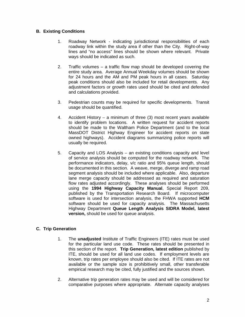
B. Existing Conditions
1. Roadway Network - indicating jurisdictional responsibilities of each roadway link within the study area if other than the City. Right-of-way lines and “no access” lines should be shown where relevant. Private ways should be indicated as such.
2. Traffic volumes – a traffic flow map should be developed covering the
entire study area. Average Annual Weekday volumes should be shown for 24 hours and the AM and PM peak hours in all cases. Saturday peak conditions should also be included for retail developments. Any adjustment factors or growth rates used should be cited and defended and calculations provided.
3. Pedestrian counts may be required for specific developments. Transit
usage should be quantified.
4. Accident History – a minimum of three (3) most recent years available to identify problem locations. A written request for accident reports should be made to the Waltham Police Department (and to the local MassDOT District Highway Engineer for accident reports on state owned highways). Accident diagrams summarizing police reports will usually be required.
5. Capacity and LOS Analysis – an existing conditions capacity and level
of service analysis should be computed for the roadway network. The performance indicators, delay, v/c ratio and 95% queue length, should be documented in this section. A weave, merge, diverge and ramp road segment analysis should be included where applicable. Also, departure lane merge capacity should be addressed as required and saturation flow rates adjusted accordingly. These analyses should be performed using the 1994 Highway Capacity Manual, Special Report 209, published by the Transportation Research Board. If microcomputer software is used for intersection analysis, the FHWA supported HCM software should be used for capacity analysis. The Massachusetts Highway Department Queue Length Analysis SIDRA Model, latest version, should be used for queue analysis.
C. Trip Generation
1. The unadjusted Institute of Traffic Engineers (ITE) rates must be used for the particular land use code. These rates should be presented in this section of the report. Trip Generation, latest edition published by ITE, should be used for all land use codes. If employment levels are known, trip rates per employee should also be cited. If ITE rates are not available or the sample size is prohibitively small, other transferable empirical research may be cited, fully justified and the sources shown.
2. Alternative trip generation rates may be used and will be considered for
comparative purposes where appropriate. Alternate capacity analyses

3
of baseline and future conditions will also be required for those alternative rates presented.
D. Trip Distribution
1. Distribution – all generated vehicle trips to/from the site through allaccess points are to be documented. Several categories of trips shouldbe considered for applicable land uses as outlined in the ITE TripGeneration manual, latest edition. Analytic bases for reducing themain street volumes due to pass-by trips, impulse trips, etc., are to bedocumented in detail. The following trips should be considered for allretail developments:
• Primary/Site – one which the purpose of the trip is shopping and thetrip pattern is generally home-to-shopping-to-home.
• Pass-By/Site – directly from the traffic stream passing the facility onthe adjacent street system and does not require a diversion fromanother roadway.
• Basis for Trip Distribution percentages and assignment should be welldocumented.
2. All developments should also consider other study area sites – tripsgenerated from nearby approved or committed projects including stateand/or local approvals. Such nearby projects may be across the cityline.
E. Future Conditions
1. Traffic Volumes for the “no-build” and “build” scenarios should begraphically shown. Future conditions should cover a five year timehorizon normally, with a two year horizon as a minimum for low impactdevelopments.
• Trip tables for all development within the study area should begenerated from available data or reasonable assumptions.Assumptions should be stated explicitly. These tables should becombined with future year background volumes to develop the “no-build” traffic volumes.
• The trip table for the proposed development should then be added togenerate “build” volumes.
• Transit tables should also be included in this section when applicable.
2. Current Projects – table of all projects within the study radius covering asa minimum a five year time horizon from the petition date. Proponentsshould contact state agencies and other cities and towns regarding the

4
impact of other known projects in the affected study area to determine how to incorporate those impacts.
3. Capacity Analysis – future conditions capacity (V/C, LOS, delay and 95%queue) should be computed for no-build and build, without and withmitigation measures in place. The performance indicators asdocumented above in the Existing Conditions section of the report shouldagain be depicted in tabular form, arranged for easy side-by-sidecomparison.
4. Signal Warrant Analysis – using the Manual on Uniform Traffic ControlDevices, latest edition.
5. Summary – tabular summary comparing base-case to five year “no-build”and “build” scenarios.
F. Mitigative Measures – All assessments should include but not be limited to thefollowing:
1. Mitigative Actions – Future year performance degradation must be fullymitigated to equivalent “no-build” delay and v/c ratios. The effects ofmitigative measures should be quantified in this section.
2. Additional Analysis – capacity analyses of all mitigative measures shouldbe computed as outlined above.
Where use of existing transit systems is proposed as mitigation, analysisof the impacts on capacity and performance of those services should bequantified and documented in this section.
3. Commitment – the report should clearly identify the individual costs of theproposed improvements. The responsible party for the implementation ofthe proposed improvements should also be clearly identified. Amechanism by which these commitments will be executed and theirintended duration should be indicated. A schedule of when, in relation toany project phasing, particular improvements need to be implementedshould be outlined.
4. Construction Schedule – with proposed mitigative measures for thefollowing:
• Noise and dust pollution from construction equipment.• Any capacity restraints on the existing network.• Area parking supply during construction including construction
workers.• Loading and unloading of trucks and heavy vehicles.

5
5. Development Options – alternative densities and land uses along with smaller size developments in some instances should be analyzed as a means of traffic mitigation.
G. Required data: Report Appendix
The following list identifies data which should be included in each report. This list is to be consistently followed when displaying data and analyses: 1. Recorded traffic counts – tabular summaries
• Turning movement counts. • Directional volume counts. • Existing AM/PM peak period and 24 hour traffic volumes. • Calculated Peak Hour Factors by individual approach. • Future year peak hour traffic volumes. • Adjustment factors and sources.
2. Permit sketches and layout plans 3. Capacity and LOS analysis data
• Lane geometry • Assumed signal phasing • Critical volumes • Assumed saturation flow rates • All work sheets or computer outputs
4. Queue Analysis on a approach basis for future no-build, full-build and
future build with mitigation scenarios in a tabular format. 5. ITE land use code sheets 6. Plotted stopping sight distance analyses 7. Signal warrant analysis sheets 8. Weaving analyses, where applicable
H. Design Standards - The latest edition of the following publications are required to be used. In case of conflicts between these documents, the Zoning Ordinance shall govern, then these guidelines, then the other standards listed.
1. City of Waltham Zoning Ordinance, with the latest legally applicable
amendments. 2. ITE Traffic Access and Impact Studies for Site Development, a proposed
recommended practice.
6
3. Highway Capacity Manual. 4. ITE Trip Generation. 5. Manual on Uniform Traffic Control Devices Handbook and Massachusetts
Amendments. 6. Massachusetts Department of Public Works Highway Design Manual. 7. American Association of State Highway and Transportation Officials
(AASHTO) Handbook. 8. Access Management for Streets and Highways, FHWA Implementation
Package FHWA-IP-82-3, June 1982. I. Standards for Presentation of Report.
1. Paper copies of the report shall be letter size 8 ½” x 11”. Report pages shall be numbered. Every page of each appendix shall be numbered. A table of contents shall be provided which includes major headings and contents of each appendix. Labeled separators shall be used for each appendix.
2. Submit one copy of an Executive Summary, the full Traffic Impact Report
and all data files on disk directly to the Traffic Engineer and obtain a receipt. The Executive Summary and Traffic Impact Report shall be a Microsoft Word file or an ASCII text file importable into Microsoft Word. Provide a directory of filenames with an explanation of the purposes of each file. Data files shall be as created by the application programs. Hand calculations of capacity are not permitted. If these requirements cause a hardship, the proponent may ask for relief.
J. Modeling Standards.
1. Include an explanation of all modeling assumptions used. Identify whether each impute value is default, measured or projected. Saturation flow must be measured for a given movements or use the default value of 1800 Vph. Waltham is part of a metro area over 250,000 population. For signal timing in the case of an isolated intersection, use optimum timing to minimize intersection delay. In the case of an intersection within an existing or proposed interconnected system, use existing cycle length and split or use PASSER, latest edition or TRANSYT-7F, latest edition, or any other optimization software as requested by the Traffic Engineer, to optimize the entire interconnected system for cycle length and split to produce minimum system delay. Provide time/space diagrams in the latter case. Exclusive pedestrian phases, whether concurrent or exclusive, shall be modeled as if occurring 100% of the cycles. Do not model pedestrian phases as concurrent without the advance permission of the City Traffic Engineer.
7
K. Traffic Counting Standards.
1. ATR counts must be 48 hours minimum, not including Saturdays,Sundays, holidays, any day within a holiday week, or any day with anysnow fall in the Boston basin geographical area. Provide a plot ofaverage directional count by hours for a 24 hours average weekday, foreach location counted.
2. Turning movement counts must be sufficient to show that they include the2 highest peak hours among these possibilities at least: AM highwaypeak, mid day highway peak, mid afternoon highway peak, PM highwaypeak. If the 2 highest generator peak hours do not overlap any part of thehighway peak, show substantiating data.
L. Site Plan Standards.
1. The proposed site layout in relation to the existing right-of-way shall beclearly shown. The following shall be included:
• Scaled plan showing existing and proposed layout lines, building andparking lot areas, driveways (with direction of travel) and land usage.
• Proposed geometric changes and widenings. (Driveways, storagelanes, acceleration/deceleration lanes)
• Location of traffic channelizing items such as islands, curbing andpavement markings.
• Relevant radii.
• The location of physical barriers to traffic such as guard stations,garage doors, and vehicle control devices such as signals, detectors,card readers, payment booth, etc. as applicable.
2. Submit two sets of site plans directly to the Traffic Engineer and obtain areceipt.
M. Delivery of Report Materials.
1. Submit two (2) full copies of the report and ten (10) copies of theExecutive Summary to Traffic Engineering. And one (1) copy of the fullreport on PDF emailed to the Traffic Engineer.
2. Submit one (1) set of plans to the Clerk of the Traffic Commission forPolice Department review.
3. Submit one (1) set of plans to the Fire Chief for review.
8
4. Submit two (2) sets of full size plans and eight (8) sets of half size plansto Traffic Engineering.
5. Submit one (1) set of the disk data as described in these guidelines toTraffic Engineering.
6. Obtain signatures on a receipt attesting to the delivery of all the above.
7. In order to have consideration of the traffic impact report placed onthe agenda of the Traffic Commission’s regular meeting usuallyscheduled for the third Thursday of a month, (except July andAugust) the above materials shall be delivered to all the listedparties on or before 4:00 pm of the last business day of thepreceding month. Before requesting a special meeting of the TrafficCommission to consider the traffic impact report, the petitioner shalldeliver the above materials at least three weeks before the date ofthe requested special meeting.
SEASONAL VARIATONS OF TRAFFIC VOLUMES WITHIN WALTHAM
LOCATION: RT. 128 / I -95, SOUTH OF RT. 20
COUNT STATION: 32
MONTH 1991 1992 AVERAGE VOLUME DEVIATION FROM AVERAGE DEVIATION FROM MAXIMUM
JAN 134,600 138,100 136,350 11.02% 18.57%
FEB 128,800 145,100 136,950 10.63% 18.21%
MAR 147,500 149,200 148,350 3.19% 11.41%
APR 152,200 155,500 153,850 -0.40% 8.12%
MAY 157,100 160,500 158,800 -3.63% 5.17%
JUN 169,100 165,800 167,450 -9.28% 0.00%
JUL 152,900 163,700 158,300 -3.31% 5.46%
AUG 158,000 164,400 161,200 -5.20% 3.73%
SEP 157,800 162,200 160,000 -4.42% 4.45%
OCT 159,600 164,200 161,900 -5.66% 3.31%
NOV 150,400 152,700 151,550 1.10% 9.50%
DEC 142,900 145,300 144,100 5.96% 13.94%
TOTAL 150,908 155,558 153,233

9
10
CITY OF WALTHAM TRAFFIC COMMISSION
APPENDIX A CHECKLIST FOR DELIVERY OF MATERIALS TO
BE INCLUDED IN A TRAFFIC IMPACT ASSESSMENT
Note: Section letters and numbers below refer to corresponding sections of the document titled “GUIDELINES FOR PREPARATION OF A TRAFFIC IMPACT ASSESSMENT”.
G - DATA REQUIRED TO BE SUBMITTED.
G 1. Recorded traffic counts – tabular summaries. • Turning movement counts.• Directional volume counts.• Existing AM/PM peak period and 24 hour traffic volumes.• Calculated Peak Hour Factors by individual approach.• Future year peak hour traffic volumes.• Adjustment factors and sources.
G 2. Permit sketches and layout plans.
G 3. Capacity and LOS analysis data. • Lane geometry• Assumed signal phasing• Critical volumes• Assumed saturation flow rates• All work sheets or computer outputs
G 4. ITE Trip Generation land use code sheets.
G 5. Plotted stopping sight distance analyses.
G 6. Signal warrant analysis sheets.
G 7. Weaving analyses, where applicable.
I - STANDARDS FOR PRESENTATION OF REPORT.
I 1. Paper copies of the report shall be letter size 8 ½” x 11”. Report pages shall be numbered. Every page of each appendix shall be numbered. A table of contents
11
shall be provided which includes major headings and contents of each appendix. Labeled separators shall be used for each appendix.
I 2. Submit the report and all data files on disk directly to the Traffic Engineer. See
section M.4.
The report shall be a Microsoft Word file or an ASCII text file importable into Microsoft Word running under Microsoft Windows/Windows 95. Provide a directory of filenames with an explanation of the purposes of each file. Data files shall be as created by the application programs.
K - TRAFFIC COUNTS. K 1. ATR counts: Provide a plot of average directional count by hours for a 24-hour
average weekday, for each location counted. K 2. Turning movement counts: Provide a graphic presentation. L - SITE PLAN STANDARDS. L 1. The proposed site layout in relation to the existing right-of-way shall be clearly
shown, including the following details: • Scaled plan showing existing and proposed layout lines, building and parking
lot areas, driveways (with direction of travel) and land usage. • Proposed geometric changes and widenings. (Driveways, storage lanes,
acceleration/deceleration lanes) • Location of traffic channelizing items such as islands curbing and pavement
markings. • Relevant radii. • The location of physical barriers to traffic such as guard stations, garage
doors, and vehicles control devices such as signals, detectors, card readers, payment booth, etc. as applicable.
M - DELIVERY OF REPORT MATERIALS. M 1. Submit two (2) full copies of the report and ten (10) copies of the Executive
Summary to Traffic Engineering. And one (1) copy of the full report on PDF emailed to the Traffic Engineer.
M 2. Submit one (1) set of full size plans to the Clerk of the Traffic Commission for
Police Department review. M 3. Submit one (1) set of full size plans to the Fire Chief for review. M 4. Submit two (2) sets of full size plans and eight (8) sets of half size plans to Traffic
Engineering. M 5. Submit one (1) set of the disk data as described in these guidelines to Traffic
Engineering.
12
Summary of quantities of deliverables: Two full copies of report, Ten copies of Executive Summary and one copy of full report on PDF. Four sets of full size plans, Eight sets of half size plans and one set of disk data.
CITY OF WALTHAM TRAFFIC COMMISSION
APPENDIX B. STANDARDS OF EXPERIENCE FOR FIRMS AND INDIVIDUALS PREPARING TRAFFIC IMPACT ASSESSMENTS FOR
SUBMITTAL TO THE CITY OF WALTHAM.
The legal authority for these standards is found in the Acts of 1976 of the Great and General Court of the Commonwealth of Massachusetts, Chapter 143, Section 2: and the City of Waltham General Ordinances Chapter 21, Section 3.5 as amended by Council Order 27225 on September 25, 1991.
Any firm or individual proprietorship which prepares a traffic impact assessment or traffic study for the City of Waltham, or presents such an assessment or study to the city of Waltham, or which defends or challenges such an assessment or study before an agency of the City of Waltham, shall cause all such work to be closely supervised by, reviewed by and authorized by or attributed to one or more persons employed by said firm or proprietorship. Each such supervisor, reviewer and author shall meet all of the following three experience qualifications or the respective substitution(s) given below:
1) REGISTRATION. Each such person shall be a Professional Engineer registeredby the Commonwealth of Massachusetts as a Civil Engineer or a Traffic OperationsEngineer at the time such report is prepared and for at least three full years out ofthe previous four years before such preparation; and
2) AUTHORSHIP. Each such person shall have previously had the primary or soleresponsibility for the preparation for a government subdivision or agency of at leastten (10) traffic impact assessments or traffic operations studies, at least one of whichshall be of a nature similar to the report to be prepared for, or presented to, ordiscussed before an agency of the City of Waltham; and
3) EXPERIENCE. Each such person shall have had the equivalent of full-time paidwork experience in the field of traffic engineering on public streets or highways for atleast three (3) full years out of the previous six (6) years before undertaking trafficassessment work for the purposes described above for or before an agency of theCity of Waltham.
Substitutions for each requirement above, respectively:
1) Registration as a Professional Traffic Operations Engineer (PTOE) in anotherjurisdiction having specialized registration for traffic engineers may be substituted ona “one year for one year” basis for years of registration as a civil or traffic engineer inthe Commonwealth (requirement 1)
2) Post graduate level continuing education credits (CEU) in the field of trafficengineering or transportation engineering may be substituted for the authorship of

13
traffic impact assessments on the basis of 3.0 CEU’s equal one impact assessment (requirement 2).
3) Each twenty-four (24) months of full-time paid work experience in transportationengineering or transportation planning for public streets or highways may besubstituted for one (1) year of full-time paid work experience in traffic engineering bythose persons who are current members of Associate or higher grade in goodstanding of the Institute of Transportation Engineers. Also, each twenty-four (24)months of full-time paid work experience in transportation planning for public streetsand highways may be substituted for one year of full-time paid work experience intraffic engineering by persons who are current regular members in good standing ofthe American Planning Association (requirement 3).
Filename: 2013 Traffic Impact Guidelines

k
ji
h
g
f
edcb
a
MAIN ST
INTE
RST
ATE
95
WESTON ST
WES
T ST
BOR
DER
RD
SEC
ON
D A
VE
BEAR
HIL
L RD
THIR
D A
VE
FIFT
H AV
E
TOW
ER R
D
STOW ST
WINTER ST
TOTTEN POND RD
PREN
TICE
ST
FIRS
T AV
E
VERNON ST
SUMMIT ST
FOURTH AVE
WYM
AN S
T
DALE ST
PRO
SPEC
T HI
LL R
D
JONES RD
JEN
NIN
GS
RD
HAW
THO
RNE
RD
LUND
A ST
EDD
Y ST
ELSON RD
TOM
LIN
ST
OVERLAND RD
BLAC
KBEA
R D
R
FOX RD
COLBURN S
T
SART
ELL
RDCOLUMBUS AVE
EVERETT ST
LUR
A LN
PROSPECT HILL LN
BAN
KS S
T
GREGORY ST
UPLAND RD
SMAR
T ST
KODIAK WAY
NAT
HAN
RD
CARL
ETO
N RD
RAVENSWOOD RD
MILTON S
T
GR
EEN
ST
EDGE HILL RD
SYLV
AN R
D
GEO
RG
IAN
RD
CAL
DW
ELL
RD
MAR
KET
PLAC
E DR
HIC
KOR
Y D
R
HANSEN RD
PHIL
IPS
TER
R
DERM
ODY
RD
GATE
HOUS
E DR
ATWATER LN
INTE
RSTA
TE 9
5
PRO
SPEC
T HI
LL R
D
INTE
RSTA
TE 9
5WINTER ST
Source:Office of Geographic and Environmental Information (MassGIS), Commonwealth of Massachusetts Executive Office ofEnvironmental Affairs. Map created byCity of Waltham GIS.
Comprehensive Traffic Studyfor Waltham Marijuana Dispensaries
Waltham, Massachusetts
0 1,200 2,400600Feet November 4, 2021
Study Intersection
Legend
Doc
umen
t Pat
h: G
:\Map
s\D
ispe
nsar
y Tr
affic
Stu
dy L
ocat
ions
.mxd
a. Bear Hill Road/Second Avenueb. Main Street/Bear Hill Road/Green Streetc. Main Street/Stow Street/Tower Roadd. Main Street/Cutting Lanee. Main Street/Border Roadf. Winter Street/Second Avenueg. Driveway at 305 Second Avenueh. Driveway at 196 Bear Hill Roadi. Driveway at 221 Bear Hill Roadj. Driveway at 235 Bear Hill Roadk. Driveway at 1256 Main Street
Study Intersections
Potential DispensaryLocation
TOW
N O
F W
ESTO
N
ProspectHill
Park