City of Joondalup/City of Wanneroo 100 years ago,...
23
City of Joondalup/City of Wanneroo By Sarah Pratt Reference and Local History Librarian City of Joondalup 100 years ago, Now The original inhabitants of this area were Whadjuk and Yued Nyoongar. The Oor-dal-kalla people were the family group of Yellagonga, a prominent Aboriginal elder highly regarded in Nyoongar culture. It is from the Oor-dal- kalla people that Joondalup derives its name. The Nyoongar word is Doondalup and it means ‘the lake that glistens’. The name Wanneroo comes from two aboriginal words ‘wonna’ or ‘wanna’; a stick used by Aboriginal women for digging roots and ‘roo’ that means ‘the place of’. Wanneroo was still mainly bush in 1914 and the local Nyoongar people were still to be seen living their traditional life, especially around Lake Joondalup. The population is diverse with migrants from over 100 nations. Less than one percent are Aboriginal. Around half of residents were born in Australia. The largest migrant groups historically have been from Britain and Ireland as well as Italy and Southern/Eastern Europe, Vietnam and India. Today, significant migration to the area comes from many African nations including South Africa, as well as Burma and the Philippines. The present-day population is diverse with migrants from over 100 nations. Around half of residents were born in Australia, but less than one percent are Aboriginal. The largest migrant groups historically have been from Britain and Ireland as well as Italy and Southern/Eastern Europe, Vietnam and India. Today, significant migration to the area comes from many African nations including South Africa, as well as from Burma and the Philippines. In 1834 explorer John Butler led an excursion into the area known as Wanneroo. The party of four travelled about 48 kilometres north of Perth in search of lost cattle. They travelled along the eastern shore of Lake Joondalup. Butler recorded seeing other large lakes in the area. He also noticed the high quality of the soil. As a result, the Wanneroo area was first used by pastoralists. In 1837 and 1838 John Septimus Roe and George Grey explored the Wanneroo district and gave a positive assessment of the suitability of the land around the lakes for farming. This led to
Transcript of City of Joondalup/City of Wanneroo 100 years ago,...
City of Joondalup/City of Wanneroo By Sarah Pratt Reference and Local History Librarian
City of Joondalup
100 years ago, Now
The original inhabitants of this area were Whadjuk and Yued Nyoongar. The Oor-dal-kalla people were the family group of Yellagonga, a prominent Aboriginal elder highly regarded in Nyoongar culture. It is from the Oor-dal-kalla people that Joondalup derives its name. The Nyoongar word is Doondalup and it means ‘the lake that glistens’. The name Wanneroo comes from two aboriginal words ‘wonna’ or ‘wanna’; a stick used by Aboriginal women for digging roots and ‘roo’ that means ‘the place of’. Wanneroo was still mainly bush in 1914 and the local Nyoongar people were still to be seen living their traditional life, especially around Lake Joondalup.
The population is diverse with migrants from over 100 nations. Less than one percent are Aboriginal. Around half of residents were born in Australia. The largest migrant groups historically have been from Britain and Ireland as well as Italy and Southern/Eastern Europe, Vietnam and India. Today, significant migration to the area comes from many African nations including South Africa, as well as Burma and the Philippines. The present-day population is diverse with migrants from over 100 nations. Around half of residents were born in Australia, but less than one percent are Aboriginal. The largest migrant groups historically have been from Britain and Ireland as well as Italy and Southern/Eastern Europe, Vietnam and India. Today, significant migration to the area comes from many African nations including South Africa, as well as from Burma and the Philippines.
In 1834 explorer John Butler led an excursion into the area known as Wanneroo. The party of four travelled about 48 kilometres north of Perth in search of lost cattle. They travelled along the eastern shore of Lake Joondalup. Butler recorded seeing other large lakes in the area. He also noticed the high quality of the soil. As a result, the Wanneroo area was first used by pastoralists.
In 1837 and 1838 John Septimus Roe and George Grey explored the Wanneroo district and gave a positive assessment of the suitability of the land around the lakes for farming. This led to

some of the colony’s land speculators taking up land grants around Lakes Joondalup, Nowergup, Mariginiup and Neerbup. Although none of the land speculators took up permanent residence they did, however, lease the land to pastoralists. Later, colonisation spread to the northern area known as The Lakes, about 15 miles (22 kilometres) north of the Perth settlement, attracting pioneers and settlers to Wanneroo.
European settlement saw the establishment of market gardens, piggeries, poultry farms and vineyards near and around Lake Joondalup. In 1918 Wanneroo was still a rural area. Without irrigation or artificial fertilizers, market gardens were being established close to Lake Joondalup and the other lakes in the district - many by migrants from southern Europe. The first tomato seeds ever planted in WA were brought to Wanneroo from California by an Italian migrant in 1920. The first large scale vineyards were planted in the 1920s. Piggeries, poultry farms and dairies were also established. Cattle and some sheep were grazed further from the lakes, with wells dug where water was required. In 1921 a saw mill was established, with wooden blocks and planks for road building being an important output.
Market gardens and a vineyard still exist in the City of Wanneroo area. In the City of Joondalup and in much of Wanneroo, housing estates, commercial properties, light industrial estates and roads have replaced the market gardens, poultry farms, dairies and piggeries. The largest areas of employment (COW) are construction, retail education/training and manufacturing. The suburbs of Ashby, Clarkson, Darch, Hillarys, Hocking, Madeley, Marmion, Padbury, Pearsall, Sinagra, Tapping and Whitfords are all named for early settlers to the area.
In 1849, Patrick Marmion established a shore whaling station on ten acres (4 hectares) of leased crown land. The whaling station operated for three years before it closed due to a lack of trained staff. The large brick chimney which formed part of the processing works was used as a navigation aid for boats and planes. The chimney was demolished in 1953.
A 2.5 metre sculpture at the entry to Sorrento Beach, south of the Sorrento Surf Life Saving Club, was commissioned by the City of Joondalup. It commemorates Patrick Marmion and his whaling station. Sculptor Albie Herbert and artist Eric Schneider worked with 37 Year 7 students from Marmion Primary School to create the work. The four-sided totem entitled Odyssey is based in a boat (a model of
Patrick Marmion died in 1856 – just four years after the Sorrento whaling station closed.
Patrick Marmion’s schooner, the Pelsaert), and tells the changing story of whales’ relationship with people. The bottom layers illustrate whale hunting and the top layers show people whale watching for pleasure. The suburb of Marmion is named in honour of Patrick Marmion.
The district was gazetted as Wanneru in 1907 and the name was not officially changed to Wanneroo until 1953, even though locally the ‘Wanneroo’ spelling had always been more commonly used. The district was locally governed by the Wanneroo Road Board which was formed in 1902, taking over responsibility for the area from the Perth Road Board.
In 1998 the City of Wanneroo was divided into two local government areas - Wanneroo and Joondalup.
In 1918, the main road from Perth to and through Wanneroo was partly made from wood blocks or planks. The rest was limestone or dirt track. Wells were located along the road. They were maintained by the local Road Board who provided buckets and rope so travellers and their horses could access water on their journey. The road was originally gazetted in 1864 and was fully bituminized in the 1930s.
The area is serviced by the freeway and many quality bitumen roads, as well as the train line. Wanneroo Road is now a four-lane road and is one of the main thoroughfares to Perth.
There was only one registered vehicle in Wanneroo in 1917/18, a Ford truck. Ten years later the list had grown to 15 - mostly trucks that would have been used for taking produce to market in Perth and other farm work. Most transport was horse-powered. It was a six-hour journey form Perth to Wanneroo.
In the 1920s there was a greater number of motor cars in Perth. It was during this time that tourists started visiting the City of Wanneroo area. Popular destinations included the Yanchep caves and the beaches.

The first service station in the district opened on Wanneroo Road in 1929. William Charles Pearsall applied for permission to open Wanneroo’s first petrol station in 1929. The garage was erected at the 13-mile peg on Wanneroo Road (the present junction of Ocean Reef Road and Wanneroo Road) and run largely by his son Charles. They were in competition with another prominent Wanneroo family, the Dennis’s, who had opened service station two miles (3.2 kilometres) further north, in the Wanneroo township. The suburb of Pearsall was named after William Pearsall, in honour of his long contribution to the community including as a member of the Wanneroo Road Board.
In 1909 the first major Wanneroo Agricultural Show was held. In the 1920s, horse and foot races were held at the location known as Perry’s Paddock.
The Wanneroo Show remains a popular annual event, along with many other community events run by the Cities of Wanneroo and Joondalup.
In 1916 Wanneroo was still a place for hunting – the local government (Road Board) resolved to complain to the police about the “wholesale destruction of kangaroos in the district by ‘weekenders from the city’.”
Kangaroos can still be found in the bush areas, as well as grazing on the grass at the Marangaroo golf course and Pinnaroo cemetery. Today, kangaroos - like all native species - are protected under the Wildlife Conservation Act. Shooting kangaroos is legal under the Act only under very specific circumstances either by license or as a holder of land on which kangaroos cause damage.
Lime burning was an important activity with the number of kilns peaking in the 1920s and 30s at about 47, employing over 200 people. Limestone is heated in kilns to create lime which is used in many industries including construction, metal refinery and food production.
Only one lime kiln business still operates in the area – Susac Lime Supply in northern Wanneroo. http://www.susaclime.com.au/ Quarries in the City of Joondalup have been redeveloped into housing estates and the Joondalup Resort Golf Course.
Several community institutions were already in operation one hundred years

ago. A community hall had been built in the very early 1900s. The first school had been established in 1874, postal service and newspaper service in 1883, local government (Road Board) in 1902. The first telephone in the district was installed in 1895. At the start of World War I the town of Wanneroo consisted of a school house, teacher’s residence, a showground and agricultural hall where the local Road Board met and where dances were held on a regular basis. There were no shops, no electricity, no motorized vehicles and no medical services.
Other amenities were slower to arrive. Prior to the 1930s, church services were held in the school house. In the 1930 the police station, church and cinema were built. It was also during this time that Yanchep National Park was created and the Yanchep bus service began operation. During the late 1940s/1950s, the Wanneroo bus service, shopping centre, rubbish collection and Volunteer Fire Brigade were established. Electric power reached the Wanneroo town site in 1954. Outer areas had to wait longer. It was not until the 1960s that Yanchep was connected to the electric power grid. The 1960s also saw the establishment of the sewerage and water supply. Wanneroo Library opened on 3 May 1961. Wanneroo Hospital (now Joondalup Health Campus) was officially opened in 1980. Its construction was part of the Shire of Wanneroo's rapid development from the 1970s to the 1980s.
A century ago, the population of the district would be numbered in the 100s (Reported as 300 in 1909) and
The population of the City of Wanneroo at the 2016 census was 195,253 and is still growing at a rapid pace.

comprising around 60 families.
Joondalup’s population is more stable at around160,995.
In 1925 the Northern Beaches were first explored. The first shacks were built in ca. 1925 of beach timber and kerosene tins. They were located on Whitfords Beach from Pinnaroo Point running northwards. The land was owned by Tom Simpson who bought it from the Midland Railway Company. Frank Whitford was unsuccessful in developing the land, but the name stuck when the land reverted back to Simpson in 1939. The area was known as Whitfords Beach thereafter. A syndicate of shack owners (Whitfords Beach Pty Ltd) bought the property in 1967 then another syndicate bought the area for subdivision and development in 1971. Attempts to clear the shacks were made by the Wanneroo Road Board from as early as 1940. Final clearing of the shacks started in 1972 when they were demolished by the council to allow for residential development.
In the 1930's the O'Brien family transported multiple caravans up to Mullaloo to start a caravan park. Later sold to Jack Williams, it was bought by the Merifield family in 1956 and was renamed the Seaside Gardens Caravan Park. In addition to caravans, it also had chalets and a small shop. Seaside Gardens was built on the site of what is now Merrifield Place, Mullaloo which was named after the Merifield family but was incorrectly spelled.
The land where Seaside Gardens Caravan Park once stood, is now the residential suburb of Kallaroo. Merrifield Park in Kallaroo was named in honour of the Merifield family.
The coastal suburbs were small holiday spots where families would go to fish and swim during the summer. Infrastructure and roads within the region were limited.
The coast is still a popular place for families to relax and enjoy themselves. They have the option of visiting AQWA, Sorrento Quay, Hillarys Marina and Ocean Reef Marina.
The Australian Imperial Force (A.I.F.) was established in 1914, and the 10th Light Horse Regiment was formed soon afterwards. In 1943 the regiment gained
In April 2004, the City of Wanneroo held a commemoration ceremony at the 10th Light Horse Heritage Trail in Neerabup National Park to mark the 60th

A.I.F. status, although it did not serve overseas. On 9 December 1941, the 10th Light Horse Regiment left its Bunbury base for Wanneroo. The regiment patrolled the coastal bushland as far as Yanchep. The troopers were divided into squadrons, each doing a monthly rotation of coastal patrols before coming back to the base camp at Wanneroo. While on patrol the troopers camped close to the beach at 20 kilometre intervals and patrols of three or four men rode in each direction meeting with the patrol from the next camp, then riding back to their own camp. In wet weather when visibility was poor the wind was used for direction. The 10th Light Horse was the last active mounted regiment in Australia. It was disbanded on 14 April 1944.
anniversary of the regiment’s disbandment.
The northern beaches have always been popular with swimmers and surfers. Formed in the 1960s, the Mullaloo Surf Life Saving Club was incorporated with the West Australian Life Saving Association in 1965. The Surf Life Saving Club had its official opening on 23 January 1966. The Mullaloo Surf Lifesaving Club patrols over 4.5 kilometres of beach from Pinnaroo Point to Mullaloo North. The City of Wanneroo built a new facility for the club in 1991.
In 2016, the City of Joondalup contributed $675,000 towards the $1.7 million cost of refurbishing the Mulllaloo Surf Life Saving Club. The training room, administration centre, entrance, balcony and storage areas were redesigned to better enable the club to meet the increased demand for its services. A new roof, exterior painting and enclosing the balcony were also completed.
In the 1970s, the State Government developed a vision for a commercial, civic and cultural hub in Perth’s northern corridor. The plan for a self-sustainable community, that was supported by public transport and reduced its effect on the delicate environment, was well ahead of its time.
With populations of 160,995 and 195,253 and land areas of approximately 99 and 686 square kilometres respectively, the Cities of Joondalup and Wanneroo are among the largest local governments in Western Australia by population. They cover a significant proportion of the Perth metropolitan area.

Joondalup was the first new town in Australia to be designed along the three-line principle, which planned for economic, social and environment sustainability.
In 1971, West Coast Highway between Mullaloo and Sorrento was completed. This promoted further development in the area. Sorrento was then in the early stages of residential development, and Hillarys was soon to follow. This coastal area was soon going to attract expansion on a much larger scale than early residents could ever have imagined!
West Coast Highway now extends up to Hepburn Avenue. A coastal road now extends to Burns Beach. In 2008, Marmion Avenue was extended through to Yanchep.The coastal strip is now an almost exclusively residential area, with final sections in Alkimos and Eglinton partially developed.
The Joondalup Development Corporation was created in the 1980s stating its mission: “to create a community of which Western Australians can be proud – a community integrated with the natural resources of Joondalup, while providing the amenities required of modern living with land prices within reach of the average buyer.”
In the 1980s and 1990s, residential suburbs were developed around the City. A lot of the area was held under mineral leases for limestone quarries and the suburbs were designed to fit in the old quarries. Connolly and the Joondalup Golf Course was one of the major developments on the old quarry sites.
The City of Joondalup continues to develop at a rapid rate. In 1993 the North Metropolitan College of TAFE (Joondalup Campus) accepted its first intake of students. In July 1984 Edith Cowan University (Joondalup Campus) opened. Originally housed in the (now) City of Joondalup Council Offices, the university moved to its present campus in 1987. The Joondalup Police Academy was opened by Premier Geoff Gallop on 15 February 2002. The $47 million police academy features a 10-bay firing range, skills training area, mock courtroom, an operational scenario village, and a parade ground, all with state-of the-art technology, as well as a chapel and residential accommodation for country students. Adjacent to the Edith Cowan University and the West Coast Institute (formerly West Coast College of TAFE) the academy forms part of the Joondalup Learning Precinct. Lakeside Joondalup Shopping Centre opened in 1994. After extensive redevelopment was completed in

November 2014, Lakeside Joondalup has now become one of the largest shopping centres in Western Australia. Arena Joondalup opened in 1994 and is the home of the West Perth Football Club. An aquatic centre was added in 2000. The City of Joondalup has one of the region’s largest cultural programs with festivals, exhibitions, concerts, children’s events, markets and cultural celebrations just some of the events organised by the City each year. This includes the very popular Valentine’s Day Concert. The Kaleidoscope Festival of Lights attracts many residents and visitors to the area.
The Mitchell Freeway is named after former state Premier and Governor Sir James Mitchell and connects the Perth Central Business district with the northern suburbs. Construction of the freeway commenced in stages from the late 1960s onwards. The median strip of the freeway houses the Joondalup railway line and a shared pedestrian and bike path is built alongside much of the freeway. The Mitchell Freeway began as part of the Metropolitan Region Scheme in the mid-1950s. In 1986 the freeway was extended to Hepburn Avenue and in 1988 to Ocean Reef Road. In 1991-1992 the median strip of the entire freeway was widened to accommodate the Joondalup railway line, built under the Northern Suburbs Transit System project. A 3km extension to Hodges Drive was opened in 2001. One of the latest extensions, a 4 km stretch with exits at
Both the Mitchell Freeway and the Perth – Joondalup railway line continue to expand further northwards to cater for the ever-increasing number of people living and working in the Northern Suburbs.

Shenton Avenue met with opposition as the original design involved building a wall several metres high. Opponents claimed the wall would be an eyesore and would physically divide the area. Plans were redrawn, and the stage opened in November 2008.
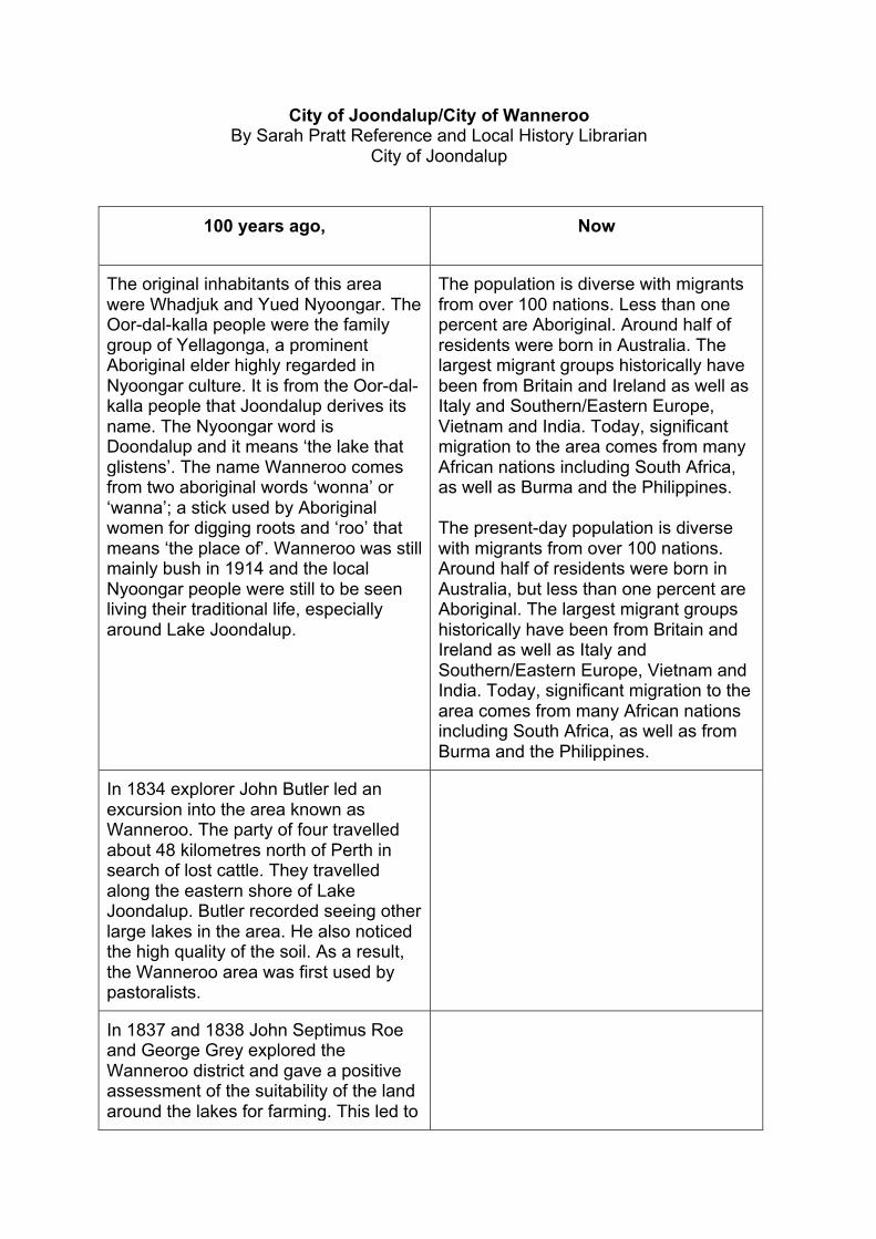
Fred White on the verandah of the Wanneroo schoolhouse - Fred White was the head teacher at the Wanneroo State School from 1916 to 1921. Reproduced with permission of Wanneroo Museum and Community History Centre.
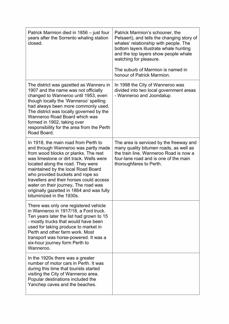
Wanneroo Rd ca 1902 Reproduced with permission from the City of Joondalup
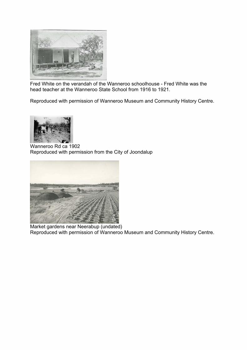
Market gardens near Neerabup (undated) Reproduced with permission of Wanneroo Museum and Community History Centre.

The war and its impact Twenty-three men from the Wanneroo area enlisted in the First World War including four brothers from the Cockman family, early settlers in the Wanneroo area. Nine men** from the Wanneroo area were killed in action, all on the Western front in France. (No Wanneroo servicemen died in Gallipoli.) Two soldiers – best friends William Cockman and Richard Smales, enlisted together and died on the same day. On such a tiny community, these deaths had a large impact.
• Percy Ainger ** • Albert Bennett ** • Herbert George Bennett ** • James Dunn Bennett ** • Vincent Berriman • Richard Willian Bettles • John Black • Donald Drummond Clarkson • Ernest John Cockman • Ross Roy Cockman • Wesley James Cockman • Willian Edgar Cockman ** • Harold Edward Karl Davies • Edgar Joseph Dorizzi • Philip Hexamer • Frank Isele • William MacKinley • Stephen Michael Redmond • Francis Granville Sims • Richard Francis Smales ** • Richard Waltham **
The Cockman boys, William (Bill) (1892 – 1916), Wesley (1890 – 1954), Ross (1896 – 1972) and Ernest (Jack) (1879 – 1969) all served in the army. Wesley and Ernest served in the 44th Battalion, Ross in the 4th Machine Gun Battalion and William in the 51st Battalion. Bill, Wes, Ross and Jack Cockman each gave their mother a brooch before they left for war. Mrs Cockman wore all four brooches at once. Three were pinned in a row to the front her dress and one was pinned at the waist. Before leaving for overseas the Cockman brothers attended an army training camp at Blackboy Hill in Helena Valley.
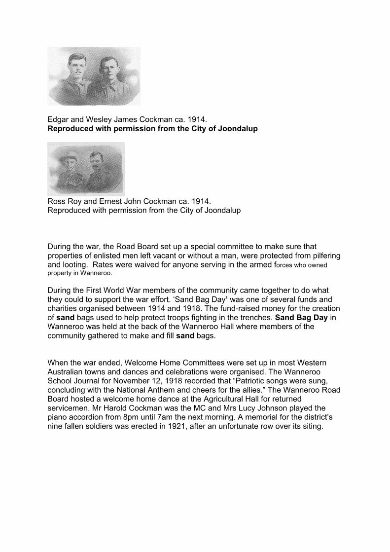
Edgar and Wesley James Cockman ca. 1914. Reproduced with permission from the City of Joondalup
Ross Roy and Ernest John Cockman ca. 1914. Reproduced with permission from the City of Joondalup During the war, the Road Board set up a special committee to make sure that properties of enlisted men left vacant or without a man, were protected from pilfering and looting. Rates were waived for anyone serving in the armed forces who owned property in Wanneroo. During the First World War members of the community came together to do what they could to support the war effort. ‘Sand Bag Day’ was one of several funds and charities organised between 1914 and 1918. The fund-raised money for the creation of sand bags used to help protect troops fighting in the trenches. Sand Bag Day in Wanneroo was held at the back of the Wanneroo Hall where members of the community gathered to make and fill sand bags. When the war ended, Welcome Home Committees were set up in most Western Australian towns and dances and celebrations were organised. The Wanneroo School Journal for November 12, 1918 recorded that “Patriotic songs were sung, concluding with the National Anthem and cheers for the allies.” The Wanneroo Road Board hosted a welcome home dance at the Agricultural Hall for returned servicemen. Mr Harold Cockman was the MC and Mrs Lucy Johnson played the piano accordion from 8pm until 7am the next morning. A memorial for the district’s nine fallen soldiers was erected in 1921, after an unfortunate row over its siting.

Sarah Frances and Richard Francis Smales. Richard Francis was working on his parents' market garden at lake Pinjar before he enlisted in 1915. He was killed at the Battle of Mouquet Farm on the Somme on 3 September 1916. Reproduced with permission of Wanneroo Museum and Community History Centre. Commonwealth grants were made available to road board authorities for the purpose of employing returning soldiers. ‘Peace loans’, where people loaned money to the government to fund soldier pensions, were sought. Wanneroo was advised that the district’s residents should provide £1,000 in Peace Loans. This target was exceeded, and the Wanneroo Road Board was rewarded with a photograph of the Prince of Wales. Meanwhile in war-ravaged Europe, millions of displaced people were looking for opportunities for a new life. Some of these found their way to the Wanneroo district, where land was easier to come by than in Perth. In particular, a number of Italians were successful in converting swamp land around the lakes into successful market gardens. Family names such as Ariti, Conti, Luisini, Sinagra and Villanova all became intertwined with the history of Wanneroo at this time. In 1948 Carmelo Conti planted the first vines which would form the basis of Conti’s Winery and Restaurant which operated to this day. Resources: City of Joondalup/City of Wanneroo Picture Joondalup Picture Joondalup (accessed via the City of Joondalup website joondalup.wa.gov.au) is an online collection of historical photographs covering the early settlement of our area to the present day.
Investigating Joondalup's Past
The Joondalup Local History Library has an extensive collection of photographs, oral histories, maps, newspapers and ephemera which document the changes that have occurred in the local community over time.

Using these primary sources an electronic Guide and Student Learning Journal has been developed to assist teachers with meeting outcomes in the lower primary History Curriculum. Topics covered include:
• Who lived here first and how do we know? • How has our community changed? • Which environmental features have been lost and which have been retained? • What contribution has been made by different groups and individuals in the
community? • How and why do people choose to remember significant events of the past?
The Investigating Joondalup’s Past kits and Teaching Guide are available for schools to borrow from the Joondalup Local History Library. A school membership will need to be completed before the resources can be borrowed.
For further information on the resources and borrowing conditions please contact the library on 9400 4746 or the School Liaison Officer on 9400 4207.
Picture Wanneroo Picture Wanneroo (accessed via wanneroo.wa.gov.au) is online collection of historical photographs covering the early settlement of our area to the present day.
Recommended Reading All schools located in the City of Joondalup area received a complimentary copy of Picture our past: celebrating Joondalup's past together / project researchers and writers, Daniel Rozas Núñez, Karen Newman, Angela Calitz and Greg Burford. The book contains a wealth of information. It covers the history of the Joondalup and Wanneroo regions, through photographs and family biographies of the early European settlers. It’s available for purchase or loan from the City of Joondalup Libraries. Live, work, play; Wanneroo recollections / written and compiled by Carol Leigh uses oral history recollections, pictorial material and concise historical text to create a lively and engaging portrayal of the rich and varied history of Wanneroo. The Times of Wanneroo as told to Bill Marwick and The Pioneers: a story of Wanneroo provides interesting accounts of earlier days. The Wanneroo histories can be purchased at the Wanneroo Museum or borrowed from the Wanneroo Public Library. Excursions

Joondalup Library Local History School Tours
We welcome visits by school children. Many schools combine their visit to the Local History Library with a civic tour of the City's Council Chambers. A self-guided tour of the library is available, or our staff can introduce the collection to your students.
Tours of Local History can be tailored to meet your needs. If you have an area of interest, please give our staff sufficient notice so we can plan a tour to meet your needs. You can also use one of our Investigating Joondalup’s Past school resources kits during your visit. http://www.joondalup.wa.gov.au/Explore/Libraries/LocalHistory/InvestigatingJoondalupsPast.aspx
For further information or to book a tour please contact the library on 9400 4746 or the School Liaison Officer on 9400 4207.
Wanneroo Regional Museum and Community History Centre The Wanneroo Regional Museum gives a voice to communities that make up Wanneroo's history. Travel through time and explore a range of exhibits, audio-visuals and interactive displays. School visits can be arranged. Wanneroo's Community History Centre is located in the Wanneroo Regional Museum, with an extensive collection about the history and heritage of Wanneroo including books, pamphlets, photographs, maps, oral history interviews, archive material and newspapers. Historic houses Cockman House and Buckingham House are historic buildings of local significance that can be visited. School bookings can fill up well in advance. Museum in a box This exciting outreach program has been designed for use by educational institutions throughout Perth. We have designed and curated four different boxes, each addressing a different person or subject connected to World War I and the Wanneroo area. Students will learn about Richard Smales who died on the Somme and Vincent Berriman who was fortunate enough to return home. We also cover the important role of the Red Cross on the home front and examine the interesting life of AANS Nurse, Sr. Anne Donnell. Each box contains real museum specimens and artefacts, images, DVDs, CDs, books and educational resources Educational resources including information about excursions can be found at http://www.wanneroo.wa.gov.au/educationalresources Yanchep National Park The Mooro Boodjar (Nyoongar) people have been visiting Yanchep for thousands of years. They came to Loch McNess not only for food, but more importantly to hold tribal meetings, discuss tribal law matters, stage corroborrees and, in some cases,

initiate young men into adulthood and associated religious life. Loch McNess is extremely significant to the aborigines of the area because it’s a mythological site. Yanchep National Park has a variety of activities for schools. For more information please go to https://parks.dpaw.wa.gov.au/sites/default/files/downloads/parks/yanchep_np_school_activities.pdf

Transport
Transport in the early 1900s in Wanneroo Reproduced with permission of Wanneroo Museum and Community History Centre.
George Leach at the wheel of his truck ca. 1921. George Leach, farmer and market gardener, owned the 1st motor vehicle in Wanneroo. He bought a Model T Ford in 1916 and later replaced it with the truck in this photograph. The car and the truck bore the WN 1 number plate. Reproduced with permission of Wanneroo Museum and Community History Centre.
Pearsall’s garage, Wanneroo ca. 1930 Reproduced with permission from the City of Joondalup
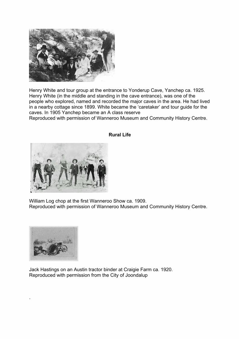
Henry White and tour group at the entrance to Yonderup Cave, Yanchep ca. 1925. Henry White (in the middle and standing in the cave entrance), was one of the people who explored, named and recorded the major caves in the area. He had lived in a nearby cottage since 1899. White became the ‘caretaker’ and tour guide for the caves. In 1905 Yanchep became an A class reserve Reproduced with permission of Wanneroo Museum and Community History Centre.
Rural Life
William Log chop at the first Wanneroo Show ca. 1909. Reproduced with permission of Wanneroo Museum and Community History Centre.
Jack Hastings on an Austin tractor binder at Craigie Farm ca. 1920. Reproduced with permission from the City of Joondalup .

. Chicken shed and hens at Ben Ceres poultry farm, Greenwood Reproduced with permission from the City of Joondalup
Rista (Chris) Spasich bagging cabbages for market ca. 1943. Reproduced with permission from the City of Joondalup
World War 2
Trooper R. Bardon of the 10th Australian Light Horse Regiment showing a mortar loaded on a pack horse, Wanneroo ca. 1940s. Reproduced with permission from the City of Joondalup
Saddlers of the 10th Australian Light Horse Regiment ca. 1940s. Reproduced with permission from the City of Joondalup


.
Car park at Mullaloo Beach full during the carnival held for the opening of the Mullaloo Surf Lifesaving Club ca. 23 January 1966. Reproduced with permission from the City of Joondalup
Mullaloo Surf Life Saving Club ca. 1972. Reproduced with permission from the City of Joondalup
Aerial view of Mullaloo Surf Life Saving Club and Tom Simpson park ca. 15 February 2017. Reproduced with permission from the City of Joondalup
Developments
Aerial view of the suburb of Joondalup looking north from the Wanneroo (now City of Joondalup) Council building towards Wanneroo Hospital, with Lake Joondalup in the background ca. 1984. Reproduced with permission from the City of Joondalup

Joondalup Central Business District ca. 2016. Reproduced with permission from the City of Joondalup
Hillarys Boat Harbour under construction ca. 1986 Reproduced with permission from the City of Joondalup
. Hillarys Boat Harbour ca. 3 June 2008. Reproduced with permission from the City of Joondalup Aerial view of Wanneroo, Wanneroo Town Centre, Hocking, Pearsall, Gnangara and Madeley ca. 2015. Reproduced with permission of Wanneroo Museum and Community History Centre.