City of BIM and GIM @ Public Spaces
32
BIM and GIM @ Public Spaces City of Rotterdam Joris Goos (Manager GIS) & Henny Stolwijk (BIM Implementation) Geo-data GIM GIS 3D City models BIM@Public Spaces
Transcript of City of BIM and GIM @ Public Spaces

BIM and GIM@ Public Spaces
City ofRotterdam
Joris Goos (Manager GIS) & Henny Stolwijk (BIM Implementation)
Geo-dataGIMGIS
3D City modelsBIM@Public Spaces
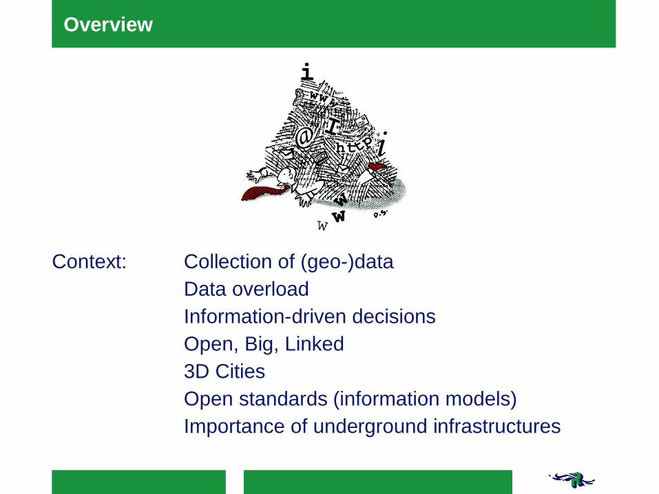
Overview
Context: Collection of (geo-)dataData overloadInformation-driven decisionsOpen, Big, Linked3D CitiesOpen standards (information models)Importance of underground infrastructures

Overview
Goal: Integration of information via- As-designed and As-built- 2D (GIS) turns 3D (or 4- or 5D)- Underground- Rich semantics- Asset management
Examples: BIM @ RotterdamPort of RotterdamRotterdam 3D

Background: goals of GIM
§ Information is consistent and managable
§Good quality of information
§Object-oriented information & semantics
§Collected once, used many times
§Open data standards for information models, national and
international
§Any number of representations (GIS, maps and models) and
formats (shape, XML, etc..)

Aspects of BIM in projects
§Systems engineering for specification of requirements
(including stakeholder-analysis)
§Modelling surroundings (included in BIM) from geo
§3D design and engineering
§Tender
§Build
§Delivery of information to Asset Management Systems

Aspects of BIM in projects – relation to GIM
§Systems engineering for specification of requirements
(including stakeholder-analysis)
§Modelling surroundings (included in BIM) from geo
§3D design and engineering
§Tender
§Build
§Delivery of information to Asset Management Systems
challenge
challenge

Collecting data of surroundings and environment

3D underground infrastructures from geo-information

3D underground infrastructures from geo-information

Projects

Assessment of risks
'clash'


Bridge renovation
https://www.youtube.com/watch?v=oI3PPfxJcc0

Next Generations Infrastructures powered byMaasvlakte 2 : 3D Spatial Data Infrastructures
Features?Semantics?Geometry?Topology?Data structure?Mapping technology?Standard(s) for information exchange?System architecture?Visualisation approaches?
Sisi ZlatanovaJakob Beetz
Anne-Jan BoersmaAlbert Mulder

Use case: quays

IfcQuay - BIM model kademuur
Use case: quays
Source: Jakob Beetz

Existing Geonovum/INSPIRE/OGCInformation models andconcepts
Port of Rotterdam as a case study for theharmonisation of domain information models in TheNetherlands
New IFC (BIM)models voor quays
494 existing geo-concept in 16 domainmodels170 selected, 20 of those are pretty much the same
One object (quay) gets 7different representations indifferent systems
Innovative approach

Asset management @ Public Spaces
Asset management systems27 inspections600.000 trees
2.200 hectares green
2.500 hectare grey
1.150 civil structures

Asset management @ Public Spaces
Traditional outcome:§Management, Facility, Maintenance§Tenders§Operational programs
But now:§ Domain specific becomes generic§ Geo-information and asset information together are a
source for BIM

New ideas on collection and sharing (data to information)

Pilots on underground infrastructures and objects
11-12-201522
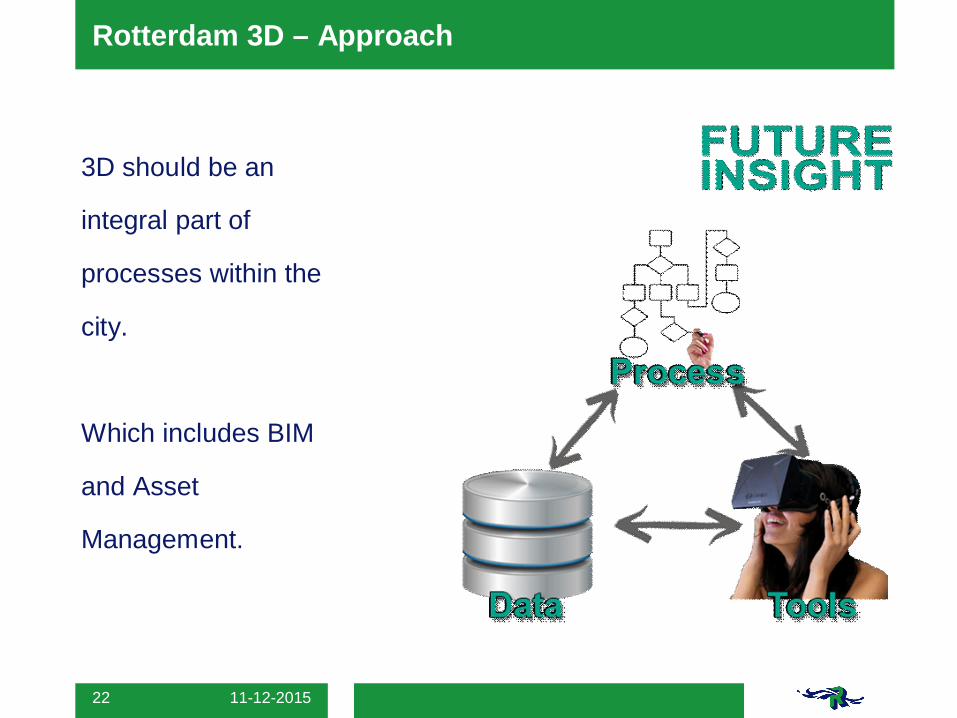
Rotterdam 3D – Approach
3D should be an
integral part of
processes within the
city.
Which includes BIM
and Asset
Management.
Rotterdam 3D
White canvas
All of our semantics
Consistent
Managable
https://www.youtube.com/watch?v=1MNbwvWuHMo
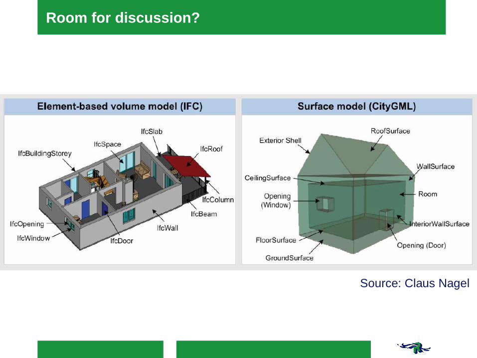
Room for discussion?
Source: Claus Nagel


CAD en BIM GEO en GIS
uitwisseleneenduidigbetekenisvol
uitwisselenbegrijpenbesparen
Geonovum
CROWeisenbibliotheek
IMXXX+ metadata+ WFS/WMS
building smartInternational
RDF/OWL
IFC4
open standards and models

Representations (7) of quays

3D selectie
Inheritance of semantics and topology

What?

11-12-201531
Rotterdam 3D versie 2.0 – Proof of concept

11-12-201532
Rotterdam 3D versie 2.0 – Proof of concept