Chapter 5 Environmental and Recreational · PDF file• Matt Rice, American Rivers ......
50
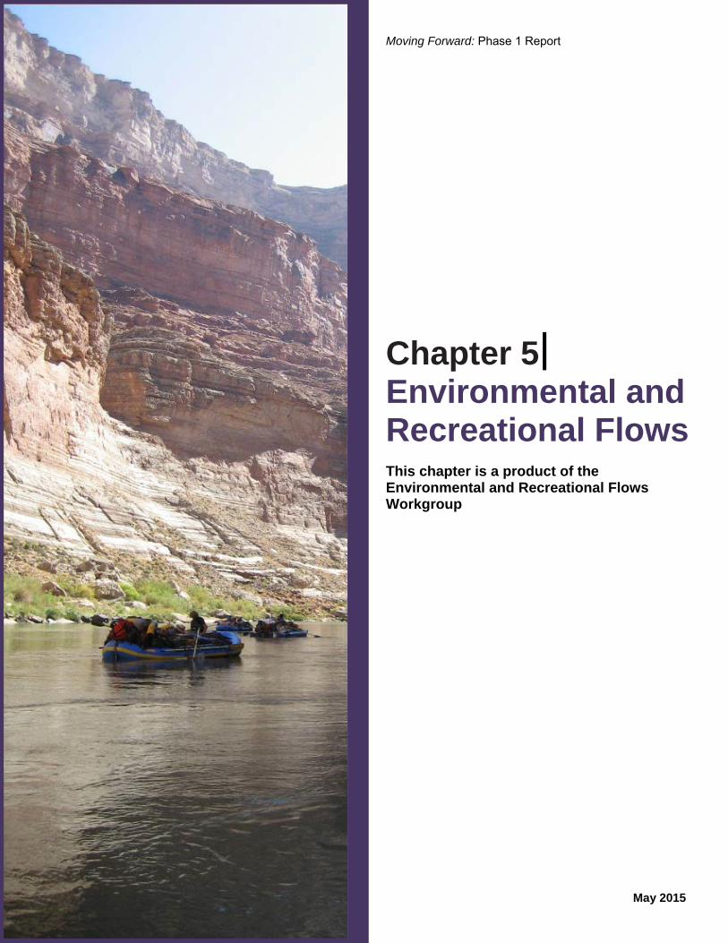
Moving Forward: Phase 1 Report May 2015 Chapter 5 Environmental and Recreational Flows This chapter is a product of the Environmental and Recreational Flows Workgroup
Transcript of Chapter 5 Environmental and Recreational · PDF file• Matt Rice, American Rivers ......
Moving Forward: Phase 1 Report
May 2015
Chapter 5 Environmental and Recreational Flows This chapter is a product of the Environmental and Recreational Flows Workgroup

Cover photo source: Taylor Hawes

Disclaimer The Basin Study Disclaimer, published December 2012, is incorporated by reference herein. Nothing in this disclaimer alters the Basin Study Disclaimer, which remains in full force and effect. All work products (draft and final) of the Environmental and Recreational Flows Workgroup (Workgroup) are therefore subject to the Basin Study Disclaimer and the following:
(1) With respect to the Basin Study, the Basin Study Coordination Team, which directs and reviews the efforts of the workgroups relating to Phase 1, including the Workgroup, shall have sole and exclusive discretion regarding how and whether to use any and all work products submitted by the Workgroup.
(2) The Workgroup has no force of law and no legal authority to establish statutory, regulatory, and/or administrative requirements regarding environmental, recreational, and/or hydropower flows.
(3) Workgroup work products are not intended to reflect, nor shall be evidence of, any of the Workgroup participants’ interpretation of legal and/or administrative requirements on the use of Colorado River Basin water.


May 2015 i
Environmental and Recreational Flows
Contents Page
Acronyms and Abbreviations ........................................................................ iii
Workgroup Members ..................................................................................... iv
5.1 Introduction ..................................................................................... 5-1 5.2 Background on Environmental and Recreational Flows Considered in the Basin Study ........................................................ 5-1 5.3 Workgroup Objective and Approach .............................................. 5-3 5.3.1 Workgroup Process ............................................................ 5-3 5.3.2 Workgroup Approach ........................................................ 5-3 5.4 Ecological, Recreational, and Hydropower Resources
in the Colorado River Basin ............................................................ 5-6 5.4.1 Ecological Resources ......................................................... 5-8 5.4.2 Recreational Resources .................................................... 5-10 5.4.3 Hydropower Resources .................................................... 5-11 5.4.4 Summary of Resources .................................................... 5-12 5.5 Focus Reach Selection Process ..................................................... 5-12 5.5.1 River Reach Identification ............................................... 5-12 5.5.2 River Reach Selection Criteria ......................................... 5-12 5.5.3 River Reach Characterization .......................................... 5-13 5.5.4 River Reach Selection ...................................................... 5-13 5.6 Focus Reach Assessment .............................................................. 5-14 5.6.1 Upper Colorado River Focus Reach ................................ 5-14 5.6.2 White River Focus Reach ................................................ 5-17 5.6.3 Bill Williams River Focus Reach .................................... 5-19 5.6.4 Henry’s Fork Headwaters Focus Reach ........................... 5-21 5.7 Existing Ecological, Recreational, and Hydropower Programs .... 5-23 5.7.1 Programs and Mechanisms .............................................. 5-24 5.7.2 Description of Program Types ......................................... 5-24 5.8 Opportunities and Challenges for Expanding Environmental and Recreational Flows Programs ................................................ 5-28 5.8.1 Opportunity: Develop sources of sustainable funding for environmental and recreational fow projects ............. 5-30
5.8.2 Opportunity 1: Use structured and cooperative market-based mechanisms to provide benefits to multiple sectors including ecological and recreational
resources .......................................................................... 5-30 5.8.3 Opportunity 2: Develop projects that incorporate watershed management .................................................... 5-32 5.8.4 Opportunity 3: Develop partnerships that achieve the
protection or improvement of ecological and recreational resources through payment for protection of environmental attributes .............................................. 5-33
5

ii May 2015
5.8.5 Opportunity 4: Investigate opportunities to use voluntary water management optimization for the protection or restoration of environmental and recreational flows ........................................................................................................... 5-35
5.8.6 Opportunity 5: Facilitate enhanced coordination among existing programs ................. 5-35 5.8.7 Opportunity 6: Support additional capacity-building for existing
and new stakeholder coalitions ...................................................................................... 5-37 5.9 Summary ..................................................................................................................................... 5-38 5.10 References ................................................................................................................................... 5-39
Tables 5-1 Workgroup Task Summary ........................................................................................................... 5-4 5-2 Summary of Program Types and Mechanisms ........................................................................... 5-28
Figures 5-1 River Reach Delineations ............................................................................................................. 5-7 5-2 River Reach Selection Goals and Criteria ................................................................................... 5-13 5-3 Extent of the Upper Colorado River Focus Reach ...................................................................... 5-15 5-4 Extent of the White River Focus Reach ...................................................................................... 5-18 5-5 Extent of the Bill Williams River Focus Reach .......................................................................... 5-20 5-6 Extent of the Henry’s Fork Headwaters Focus Reach ................................................................ 5-22
Appendices 5A Focus Reach Selection Process 5B Existing Ecological, Recreational, and Hydropower Programs

May 2015 iii
Acronyms and Abbreviations
Basin States Colorado River Basin States
Basin Study Colorado River Basin Water Supply and Demand Study
BLM Bureau of Land Management
BWRCSC Bill Williams River Corridor Steering Committee
cfs cubic feet per second
CRSP Colorado River Storage Project
CRSS Colorado River Simulation System
EQIP Environmental Quality Incentives Program
EPA U.S. Environmental Protection Agency
ESA Endangered Species Act
GCDAMP Glen Canyon Dam Adaptive Management Program
ICS Intentionally Created Surplus
kWh kilowatt-hour
M&I municipal and industrial
LCR MSCP Lower Colorado River Multi-Species Conservation Program
MW megawatt
NFRIA North Fork River Improvement Association
NGO non-governmental organization
NPS National Park Service
NRCS Natural Resources Conservation Service
Reclamation Bureau of Reclamation
Recovery Program Upper Colorado River Endangered Fish Recovery Program
SJRRIP San Juan River Basin Recovery Implementation Program
TNC The Nature Conservancy
U.S. United States
USFWS U.S. Fish and Wildlife Service
USGS U.S. Geological Survey
Workgroup Environmental and Recreational Flows Workgroup
WRCC Western Regional Climate Center
iv May 2015
Workgroup Members:
• Matt Rice, American Rivers
• Nathan Fey, American Whitewater
• Don Gross, Arizona Department of Water Resources
• Pam Adams, Bureau of Reclamation
• Chuck Cullom, Central Arizona Project
• Mohammed Mahmoud, Central Arizona Project
• Sharook Madon, CH2M HILL (contractor team)
• Kyle Hamilton, CH2M HILL (contractor team)
• Kirstin Skadberg, CH2M HILL (contractor team)
• Angela Rashid, Colorado River Board of California
• Lindia Liu, Colorado River Board of California
• Cliff Barrett, Colorado River Energy Distributors Association
• Leslie James, Colorado River Energy Distributors Association
• Peter Fleming, Colorado River Water Conservation District
• Leon Basdekas, Colorado Springs Utilities
• Linda Bassi, Colorado Water Conservation Board
• Jennifer Pitt, Environmental Defense Fund
• Kerry Sundeen, Front Range Water Council
• Meena Westford, The Metropolitan Water District of Southern California
• Kate Cannon, National Park Service
• Bill Hansen, National Park Service
• Mark Wondzell, National Park Service
• Vanessa Mazal, National Parks Conservation Association
• Dave Nimkin, National Parks Conservation Association
• Kristin Green, New Mexico Interstate Stream Commission
• Steve Harris, Rio Grande Restoration
• Seth Shanahan, Southern Nevada Water Authority
• Peter Culp, Squire, Sanders & Dempsey LLP
• Cheryl Lombard, The Nature Conservancy
• John Sanderson, The Nature Conservancy
• Meg White, The Nature Conservancy
• Robert Wigington, The Nature Conservancy
• Melinda Kassen, Theodore Roosevelt Conservation Partnership
• Jana Mohrman, U.S. Fish and Wildlife Service
• Polly Hays, U.S. Forest Service
• Ted Rampton, Utah Associated Municipal Power Systems
• Henry Maddux, Utah Department of Natural Resources
• Sam Loftin, Western Area Power Administration
• John Zebre, Zebre Law Office
This chapter is product of the Environmental and Recreational Flows Workgroup.
Workgroup Co-Chairs: • Alan Butler, Bureau of Reclamation • Taylor Hawes, The Nature Conservancy • Ted Kowalski, Colorado Water Conservation Board

May 2015 5-1
Environmental and Recreational Flows
5.1 Introduction The Colorado River Basin Water Supply and Demand Study (Basin Study) confirmed that, in the absence of timely action, there are likely to be significant shortfalls between projected water supplies and demands in the Basin in coming decades (Bureau of Reclamation [Reclamation], 2012a). Such future action will require diligent planning, collaboration, and the need to apply a variety of ideas at local, state, regional, and Basin-wide levels. In May 2013, Phase 1 of the Moving Forward effort was initiated to build on findings for critical next investigations described in the Basin Study and to do so in a manner that continues to facilitate and build upon the broad, inclusive stakeholder process demonstrated in the Basin Study.
The Environmental and Recreational Flows Workgroup (Workgroup) was convened as part of the Moving Forward effort initiated by Reclamation and the seven Colorado River Basin States1 (Basin States) in collaboration with the Ten Tribes Partnership and conservation organizations. The Workgroup was formed to promote stakeholder dialogue to identify and assess options that provide multiple ecological, recreational, and hydropower generation benefits.
The Workgroup is composed of leaders and experts in the area of environmental and recreational flows who represent a broad range of perspectives. The primary objective of the Environmental and Recreational Flows Workgroup was to build upon the Basin Study’s assessment of environmental and recreational flows to identify ideas for potential future voluntary, non-regulatory solutions that protect or improve ecological and recreational resources2 while supporting other management goals to achieve integrated solutions that benefit multiple uses, both consumptive and non-consumptive, including hydropower.
1 Arizona, California, Colorado, Nevada, New Mexico, Utah, and Wyoming 2 Ecological and recreational resources include flows, water quality, temperature, etc. (see Guiding Principles). Flows are but one tool available that can be used to protect or improve ecological and recreational resources.
This chapter is a product of the Workgroup and documents its activities and findings during the approximately 18-month Phase 1 of the Moving Forward effort. The chapter provides information on the Workgroup’s structure, objective, and approach to achieving the objective, which includes the following tasks: the selection of focus reaches and an assessment of current conditions on those reaches, opportunities and challenges for implementing successful environmental and recreational flow programs, and a suite of ideas that may be considered for potential future action.
5.2 Background on Environmental and Recreational Flows Considered in the Basin Study
The Basin Study incorporated flow and water-dependent ecological systems, recreation, and hydropower generation through the inclusion of the Enhanced Environment water demand scenario, the adoption of system reliability metrics resources across scenarios, and the modeling of a conceptual Upper Basin water bank. Each of these approaches is described below.
A scenario planning approach was used in the Basin Study to examine uncertainties surrounding future water demand in the Colorado River Basin (Basin). The six water demand scenarios selected for evaluation in the Basin Study represented alternative views of how the future might unfold. The scenarios were used to quantify the potential effects of driving forces, for example, changes in population, social values, land use, and agricultural and municipal efficiencies, on consumptive demands. Non-consumptive demands, such as environmental and recreational flows, did not affect the total consumptive demand in any scenario; however, these demands were assessed across all scenarios through the evaluation of flow targets, characterized through ecological and recreational system reliability metrics.
5

Moving Forward: Phase 1 Report
5-2 May 2015
The demand scenarios evaluated in the Basin Study ranged from a Slow Growth scenario with the lowest population growth and highest agricultural demand to a Rapid Growth scenario with the highest population growth and lowest agricultural demand. The Enhanced Environment scenario assumed, in part, that changing social values would affect future water demand. This demand scenario had a lower consumptive demand than most other demand scenarios due to the assumption that changing social values led to faster adoption of municipal and industrial (M&I) conservation measures under the baseline, that is, without any options and strategies in place. Further details regarding the demand scenarios are available in the Basin Study, Technical Report C (Reclamation, 2012b).
In the Basin Study, system reliability metrics were defined as measures that indicated the ability of the Colorado River system to meet Basin resource needs under future conditions. System reliability metrics were developed for the Basin Study to measure, both quantitatively and qualitatively, the potential effects of current and future water supply and demand imbalances on Basin resources and to evaluate the effectiveness of options and strategies to resolve those imbalances. The metrics that approximated the flow-based conditions necessary to support ecological and recreational resources were developed for the Basin Study to facilitate an understanding of how varying hydrologic conditions may affect ecological and recreational resources under a range of future conditions. The ability to assess impacts to Basin resources was limited by the spatial and temporal details of Reclamation’s Colorado River Simulation System (CRSS)3. For example, the geographic locations at which these metrics were applied did not represent all of the important locations for these resources in the Basin; rather, they represented locations that are explicitly represented in CRSS and have resource relevance. Additional system reliability metrics reported the potential effects of supply and demand imbalances to future hydropower generation. The Basin Study metrics are discussed in the Basin Study, Technical Report D (Reclamation, 2012c). The results of evaluating these metrics are discussed in the
3 CRSS is the Bureau of Reclamation’s long-term planning model used in the Basin Study. See the Basin Study, Technical Report G for more information (Reclamation, 2012e).
Basin Study, Technical Report G (Reclamation, 2012d).
Through a process described in the Basin Study, Technical Report G (Reclamation, 2012d), thresholds for which a resource was deemed vulnerable were established for some of the metrics. These metrics indicate all Basin resources are increasingly vulnerable, through time, due to increasing supply and demand imbalances. Options and strategies were shown to decrease the resource vulnerabilities, and certain options were more effective in reducing the ecological and recreational vulnerabilities, while also reducing other vulnerabilities such as hydropower and water delivery.
Basin Study modeling indicates Basin resources, including environmental, recreational, and hydropower resources, are increasingly vulnerable through time.
During the Basin Study, input was solicited from Basin Study participants, interested stakeholders, and the general public on options and strategies for helping to resolve future water supply and demand imbalances in the Basin. More than 150 options were submitted to the Basin Study, several of which had the explicit purpose of benefiting ecological and recreational resources that are dependent upon instream flows. For example, one of the strategies evaluated in the Basin Study was a conceptual Upper Basin water bank with objectives to (1) increase water delivery reliability and (2) use increased flow to improve the performance of ecological and recreational resource system reliability metrics. In this particular concept modeled in the Basin Study, it was assumed that various conservation (M&I, agricultural, and energy) efforts across the Upper Basin would be coordinated for the purpose of yielding water to store in the bank. An additional assumption was that the conserved water was routed to the bank; that is, protected from downstream diversion until it reached the bank. The routing of conserved water ensured that water reached the bank and increased flows for environmental and/or recreational purposes. Several related options that were submitted to the Basin Study, but not quantitatively assessed due to the legal, regulatory, or technical complexity, include an option to financially incentivize water conservation to supply a

Chapter 5 − Environmental and Recreational Flows
May 2015 5-3
water bank and several options to modify reservoir operations to restore downstream flows or maximize hydropower generation. Additional information about the options and strategies evaluated in the Basin Study are discussed in the Basin Study, Technical Report F (Reclamation, 2012e).
5.3 Workgroup Objective and Approach
Although the Basin Study resulted in a good additional step toward incorporating the needs of flow-dependent resources and evaluating concepts to better meet those needs under a range of future conditions, it was recognized that exploring ways to meet ecological and recreational needs should continue beyond the completion of the Basin Study. This Workgroup was convened to address the Basin Study recommendation that future efforts should strive to better understand the needs of these systems, better reflect those needs in a modeling framework, and further explore solutions considered in the Basin Study as well as other studies that promote the protection or improvement of environmental and recreational flows (Reclamation, 2012).
The primary objective of the Workgroup was to build upon the Basin Study’s assessment of environmental and recreational flows to identify ideas for potential future voluntary, non-regulatory solutions that protect or improve ecological and recreational resources while supporting other management goals to achieve integrated solutions that benefit multiple uses, both consumptive and non-consumptive, including hydropower. Explicitly exploring potential opportunities to protect or improve hydropower resources was beyond the scope of the Workgroup and beyond the expertise of many Workgroup members. The Workgroup did strive to recognize the importance of hydropower resources within the Basin and the potential interrelationships between hydropower resources and river-based ecological and recreational resources.
5.3.1 Workgroup Process
The Workgroup is composed of approximately 40 members representing a broad range of perspectives
related to environmental and recreational concerns from throughout the Basin. The Workgroup includes representatives of conservation, recreation, and federal power customer organizations; water purveyors; state agencies; and federal agencies. Three Co-Chairs, representing Reclamation, The Nature Conservancy (TNC), and the Colorado Water Conservation Board were selected to lead the Workgroup. The Co-Chairs facilitated discussion and helped to define the Phase 1 tasks. The Workgroup was supported by resource personnel from Reclamation and the Moving Forward consulting team led by CH2M HILL. The Workgroup met periodically, either in person or via conference calls, between June 2013 and October 2014.
5.3.2 Workgroup Approach
The Workgroup began by developing Guiding Principles to provide a common platform and ongoing guidance about how the Workgroup would approach the tasks and any issues encountered. Because issues pertaining to ecological and recreational resources are inherently site-specific (for example, necessary minimum flows to safely raft a river reach) but also broader in scale (for example, the recovery of endangered species), the Workgroup approach investigated both specific sites and the Basin more holistically. Because detailed assessments of all river reaches in the Basin were not feasible, the Workgroup selected several focus reaches to understand specific ecological and recreational issues and the programs already in place to help address these issues. This assessment examined the current conditions in the focus reaches and identified scientific uncertainties associated with understanding environmental, recreational, and hydropower resources in the focus reaches. A review of existing programs in the entire Basin and in other regions with similar issues was then conducted to help provide ideas for how future programs could be expanded to protect or improve ecological and recreational resources, both at specific sites and across the entire Basin. Consistent with the objective of the Workgroup and the Guiding Principles, the ideas for potential solutions include both flow- and non-flow-related solutions. Phase 1 tasks performed by the Workgroup are shown in Table 5-1 and are described in the following sections.

Moving Forward: Phase 1 Report
5-4 May 2015
TABLE 5-1 Workgroup Task Summary
Task Number Task
1 Identify Guiding Principles for the Workgroup
2 Develop selection criteria to identify focus reaches
3 Apply criteria to select focus reaches
4 Conduct assessment of current conditions in focus reaches
5 Identify scientific uncertainties and opportunities to address those uncertainties
6 Document mechanisms or programs that have been successful in protecting environmental and river-based recreational resources
7 Explore and document opportunities and potential solutions that might be applied on a scale larger than focus reaches
8 Prepare Phase 1 Workgroup Report

Chapter 5 − Environmental and Recreational Flows
May 2015 5-5
Environmental and Recreational Flows Workgroup Guiding Principles
1. Seek solutions and opportunities that promote environmental resiliency.1
2. Recognize the importance of biodiversity and ecosystem health:
Support actions that help recover flow-dependent endangered species and avoid future listings.
Strive to achieve diverse and healthy ecosystems that provide benefit in addition to recovering endangered species.
Recognize how forest and watershed health contributes to the sustainability of values associated with water supply and quality, including environmental and recreational flows.
3. Recognize the importance of river-based recreational benefits to local economies:
Support actions that help preserve and improve river boating opportunities, angling, and other river-based recreational activities.
Seek potential solutions that provide reliable and predictable recreational flows.
4. Recognize and support the environmental and recreational values of Colorado River Basin national park units.
5. Recognize the importance of hydropower resources within the Basin and how hydropower resources and river-based environmental and recreational resources affect one another.
6. Acknowledge tradeoffs among resource management actions:
Understand how flow-related and non-flow-related variables (such as temperature, water quality, riparian habitat, poor physical habitat in the river, impediments to fish passage, and invasive species) influence ecosystem resources.
Consider and recognize the inter-relationships, both positive and negative, among desired environmental flows and recreational flows, hydropower resources, and other uses of water.
Strive to develop potential solutions to protect ecological and recreational values that do not negatively affect other water uses. Seek potential solutions that are proactive and collaborative and that reduce vulnerabilities across the resource categories identified in the Basin Study with the objective of avoiding regulatory oversight and zero-sum outcomes.
Recognize that local solutions can impact other regional issues and that regional solutions might have local impacts.
Focus first on high-priority locations based on consideration of current river health and future vulnerability.
7. Observe and use the best available science appropriately:
Advance science to develop and improve knowledge base related to achieving the goals of species recovery and related to other ecological and recreational resources.
Recognize and seek to eliminate current limitations in data/models as they relate to environmental and recreational flows and other water uses.
8. Comport with current laws and governance:
Potential solutions will be consistent with the Law of the River.
9. Improve efficiencies through collaboration and cooperation:
In developing possible solutions, consider and promote solutions that complement the work being done in other workgroups.
1 Environmental resiliency is defined as the capacity of a system to absorb disturbance and reorganize while undergoing change so as to still retain essentially the same function, structure, identity, and feedbacks. (Walker et al., 2004).

Moving Forward: Phase 1 Report
5-6 May 2015
5.3.2.1 Focus Reaches
The Workgroup selected reaches of the Colorado River and its tributaries to explore and help complete the Phase 1 tasks. The goal of the focus reach assessment was to understand current conditions, ecological and recreational issues, and scientific uncertainties at a site-specific scale.
A process, which is further described in Section 5.5, was developed to narrow an initial list of possible reaches (29 in the Upper Basin, 8 in the Lower Basin, and 5 headwater reaches) (Figure 5-1) to 4 Phase 1 focus reaches. The reaches selected through this process were:
Mainstem of the Colorado River between the confluence with the Gunnison River and the confluence with the Green River
White River between Taylor Draw Dam and the confluence with the Green River
Bill Williams River from Alamo Dam to the confluence with the Colorado River at Lake Havasu
Henry’s Fork headwaters area within parts of Utah and Wyoming.
5.3.2.2 Wider Geographic-Scale Opportunities and Potential Solutions
The Workgroup also reviewed existing programs operating both within the Basin and in other river basins worldwide to gain an understanding of current activities being undertaken to protect or improve ecological and recreational resources in a variety of contexts. The Workgroup then explored concepts that could benefit ecological and river-related recreational resources across a broader geography in the Basin (that is, not solely in the focus reaches). This review of current programs provided useful examples of approaches and practices that could potentially be applied to the focus reaches or provide opportunities in other parts of the Basin. Examples include sustainable funding mechanisms, agricultural programs that could benefit farmers and rivers, and a discussion of how cooperative, structured water markets could benefit rivers while fostering water security and flexibility for other users. This review generated ideas for actions that
could potentially be taken in later phases of the Moving Forward effort or that could be undertaken by others in the Basin through different processes or on an ad hoc basis with willing funding partners and interested stake-holders. As subsequent phases of the Moving Forward effort (or other efforts) continue to identify and evaluate options to protect or improve ecological and recreational resources, the positive and negative effects to all resources, including hydropower, should be considered.
5.4 Ecological, Recreational, and Hydropower Resources in the Colorado River Basin
From its headwaters on the Continental Divide in Wyoming and Colorado to the deserts of the Southwest, the Colorado River and its tributaries flow through many regions with distinct geographic and ecological characteristics that have created a unique and varied river system. The Colorado River system supports important ecosystems, provides myriad recreation activities, and supplies electric power to many western states.
Although the Workgroup did not directly address hydropower resources, it did recognize the importance of hydropower resources within the Basin and the potential interrelationships between hydropower resources and river-based ecological and recreational resources. For this reason, a description of Basin hydropower resources is included in this section. While recreational opportunities provided by reservoirs—a valuable Basin resource—were considered in the Basin Study, the Workgroup did not consider flat-water recreation as part of its effort.
Potential interrelationships exist between environmental and recreational flows and hydropower resources; as options to protect or improve ecological and recreational resources are evaluated in any future efforts, the effects on all resources, including hydropower, should be considered.

Chapter 5 − Environmental and Recreational Flows
May 2015 5-7
FIGURE 5-1 River Reach Delineations
Notes: 1. Reaches do not include the impounded waters located upstream of dams. 2. Similar to the Basin Study, the scope of the Moving Forward effort is limited to the portion of the Basin within the United States
(U.S.).

Moving Forward: Phase 1 Report
5-8 May 2015
5.4.1 Ecological Resources
As the Colorado River flows from the Rocky Mountains, through the desert Southwest, and into Mexico, variations in climate, hydrology, and habitats create an impressive ecological diversity. Within the Basin, many distinct freshwater ecosystems have been identified from the headwaters to the Delta. In addition, the Colorado River flows through seven national wildlife refuges and nine national parks, lands that are prized and protected for their ecological complexity and natural beauty. Current conditions along the Colorado River and its tributaries differ significantly from historical conditions. Over the last century, riparian communities and instream habitats have been altered by water management, land development, and the introduction of nonnative species. In the future, ecosystems may be further challenged by higher temperatures and other projected effects of climate change, which are expected to affect both water demand and water supply.
In the Upper Basin, the Colorado River is joined by several tributaries flowing through five states and through varied geography and topography, resulting in a wide variety of ecosystems from mountain forests to desert canyons. The Upper Colorado River system supports significant biodiversity and is home to 14 native fish species, including 4 species listed as threatened or endangered under the Endangered Species Act (ESA): the Colorado pikeminnow, humpback chub, bonytail, and razorback sucker. The floodplains of the Colorado River and its tributaries harbor wetland riparian plant communities and associated wildlife such as birds and bats.
In many areas of the Upper Basin, human land and water uses have physically altered the river and caused changes in water flow patterns. These changes have affected plant and animal species that depend on rivers and the adjacent riparian habitat. These changes also pose key challenges to the ecological resources of the Basin, including altered flow regimes (temporal reductions and increases in flow), introduction of nonnative plant and fish species, and water quality degradation.
Reduced flows can affect aquatic habitat, for example, by reducing useable habitat for fish and isolating fish in small pools. Lack of flooding or flushing flows in the spring disrupts spawning cues of native fish (McAda, 2003) and affects germination of riparian plants
(Mahoney and Rood, 1998). Flooding flows are also necessary to move sediment down the river and to create, destroy, and re-arrange riffles, pools, point-bars, and other critical habitats (Wilcox et al., 2013).
Alteration of natural flow regimes has also contributed significantly to the success of invasive, nonnative fish and plant species throughout the Basin. While all species compete to survive, invasive species often have functional traits that allow them to out-compete native species under the altered river conditions now present. Nonnative predatory fish, such as smallmouth bass and walleye, pose a serious threat to the recovery of endangered fish in the Upper Basin. To address this threat, the Upper Colorado River Endangered Fish Recovery Program (Recovery Program), along with the states of Colorado, Wyoming, and Utah, is taking action to remove nonnative fish and prevent them from entering areas inhabited by endangered fish.
Additionally, in the Upper Basin tamarisk and Russian olive have continued to spread and form dense stands in some areas. Research indicates that within the same lowland riparian area, the range of the amount of water consumed by both these invasive and native trees (such as cottonwoods) is similar such that restoration efforts undertaken for purposes of flow augmentation generally depend on replacing nonnative vegetation in more upland riparian areas with less consumptive native vegetation such as sacaton and mesquite (Tamarisk Coalition, 2009; Nagler et al., 2010). However, there are other reasons for removing tamarisk and Russian olive trees aside from flow augmentation, such as restoring native vegetation and river access. To address this concern, many stakeholders and agencies are working to remove tamarisk; for example, the Tamarisk Coalition has undertaken many tamarisk control projects in an effort to restore native riparian vegetation in the southwest (Tamarisk Coalition, 2014). Additionally, the U.S. Department of Agriculture introduced a tamarisk beetle into portions of Colorado, Nevada, Texas, Utah, and Wyoming during 20012009 to biologically control tamarisk. The beetle was not approved for release within 200 miles of habitat for the endangered southwestern willow flycatcher, which nests in tamarisk. However, the tamarisk beetle has spread farther south, into southwestern willow flycatcher habitat, than previously anticipated (U.S. Fish and Wildlife Service [USFWS], 2012). This has led to the defoliation of tamarisk stands

Chapter 5 − Environmental and Recreational Flows
May 2015 5-9
along the river, but also may be negatively affecting habitat for an endangered species.
Maintaining water quality is another important challenge in the Upper Basin that affects aquatic and terrestrial species as well as people. A number of pollutants, including heavy metals, pesticides, fertilizers, selenium, and salt, are present in different areas of the Basin. Salinity is an important water quality concern in the Basin because of the potential impacts on U.S. and Mexican water users and the negative effects of salinity on aquatic and riparian plants and animals (Vandersande et al., 2001). The primary source of salinity loading to the river systems in the Upper Basin is water passing through underlying geologic formations that are high in salt content (Pillsbury, 1981). Drain water return flows from irrigation are another important contributing factor to salinity levels.
Stakeholders in the Upper Basin have implemented programs that are addressing several of these issues. For example, the Recovery Program and the San Juan River Basin Recovery Implementation Program (SJRRIP) were developed to coordinate the implementation of recovery plans for four endangered fish species in the Upper Basin. The programs are implemented collaboratively by federal, state, and local partner agencies and include activities such as native fish population augmentation, fish passage improvements, and eradication of nonnative species.
Downstream of Glen Canyon Dam and at the beginning of the Lower Basin lies the Grand Canyon, an iconic canyon that provides habitat for several threatened and endangered species. The Glen Canyon Dam Adaptive Management Program (GCDAMP) was established to provide for long-term research and monitoring of downstream resources with a goal of enhancing and improving downstream resources and dam operations (GCDAMP, 2014a). Through the adaptive management process, scientific experimentation provides information on the effects of the operations of Glen Canyon Dam on downstream resources in Glen and Grand Canyon. Based on information gathered through this process, adjustments to the operations of Glen Canyon Dam, consistent with existing laws, are recommended to the Department of the Interior (GCDAMP, 2014b).
In the Lower Basin, the Colorado River is highly regulated, and the riparian corridor bears little resemblance to the historical floodplain. The
construction of Glen Canyon, Hoover, Davis, Parker, Palo Verde, Imperial, Laguna, and Morelos Dams on the Colorado River has created a managed flow system within the U.S., resulted in intermittent flows in the Colorado River Delta within Mexico, and altered natural habitat along the rest of the river. Resulting changes include loss of native riparian vegetation and floodplains; altered aquatic habitat structure and function; declining groundwater elevations resulting from the lack of surface water recharge and groundwater pumping; regulated flows; altered water quality (temperature, salinity/conductivity, pollutants); discontinuity of sediment and nutrient transport; and introduction of numerous nonnative species (plants and animals) (Reclamation, 2004).
The current vegetation mix along the Lower Colorado River mainstem differs significantly from historical conditions. Although woody riparian vegetation is present, the area is predominately tamarisk or tamarisk mixed with mesquite, and limited acreage of native vegetation remains. On the Bill Williams River, however, significant native riparian forests persist. Riparian ecosystems provide important habitat for many species, and the corridor supports many wildlife species (birds, mammals, fish, reptiles, and amphibians), including both resident species and migratory visitors (Reclamation, 2004). Over the past 40 years, several species native to the Lower Colorado River have been listed as endangered, including the Yuma clapper rail, Colorado pikeminnow, humpback chub, bonytail, razorback sucker, yellow-billed cuckoo, and southwestern willow flycatcher.
In response to these endangered species listings, representatives of the states of Arizona, California, and Nevada, U.S. Department of the Interior agencies, and other stakeholders along the Lower Colorado River formed the Lower Colorado River Multi-Species Conservation Program (LCR MSCP), a regional partnership created to balance the delivery and use of the Colorado River water resources and hydropower production with the conservation of native species and their habitats. The program area extends over 400 miles of the Lower Colorado River and includes Lake Mead, Lake Mohave, and Lake Havasu; the historic 100-year floodplain along the mainstem of the Lower Colorado River; and portions of the Muddy, Virgin, Gila, and Bill Williams Rivers. The program includes activities such as habitat creation and native fish augmentation (Reclamation, 2004).

Moving Forward: Phase 1 Report
5-10 May 2015
Another major development related to the management of the Colorado River was the November 2012 signing of Minute 319 to the 1944 Treaty with Mexico, a historic binational agreement in effect through 2017. While assessing the ecological and recreational resources within Mexico is beyond the scope of the Moving Forward effort, Minute 319 provides a good example of multiple cooperative actions related to water conservation and system operations, which also provide water for environmental flows for the Colorado River Delta and funding for restoration activities. The pulse flow event, where water was released to flow downstream into the Colorado River Delta, was completed in the spring of 2014 with water that Mexico elected to use for the purpose of benefiting the Delta in coordination with the U.S. and Basin States. The pulse flow and a longer-lasting base flow are expected to provide for the restoration of approximately 2,300 acres of habitat by allowing native willow and cottonwood trees to germinate and water to sustain their growth. There is also an opportunity to gain important scientific information on the effectiveness of these flows (International Boundary and Water Commission, 2014).
The Colorado River and its tributaries provide important habitat for many native species, including several threatened or endangered species; some of these species are found nowhere else in the world. The Recovery Program, the SJRRIP, and the LCR MSCP are examples of existing critical and effective programs that focus on the recovery and protection of many species while allowing for continued water deliveries. This important work should continue.
5.4.2 Recreational Resources
The Colorado River and its tributaries are a world-renowned natural heritage where millions of visitors
enjoy boating, fishing, camping, hiking, and other recreational activities annually. Tourism income generated by these activities provides major support to local economies. Much of the river and tributary corridor most intensively used for recreation is managed as national parks, national recreation areas, national forests, Bureau of Land Management (BLM) lands, or state and local parks. The nine4 National Park Service (NPS) units along the Colorado River and its tributaries accounted for nearly 20 million visits in 2012, with a total visitor spending of more than $1.2 billion (NPS, 2014), and more than 20 million visits in 2013, with a total visitor spending of more than $1.5 billion (Cullinane et al., 2014). If areas in the Basin outside of NPS units are also considered, the contributions to local and regional economies would be even larger.
River boating opportunities in the Upper Basin range from stretches that provide a relaxing flat-water float to challenging whitewater runs in remote canyon settings. Cataract Canyon, Westwater Canyon, and many reaches in the Colorado headwaters are heavily used each year. The Upper Colorado River below Kremmling, Colorado, sees between 37,000 and 60,000 boaters each year (BLM, 2014), and boater numbers on the Colorado River through Glenwood Canyon are significantly higher. Many of the popular whitewater runs, including the coveted Grand Canyon section, are served by commercial outfitters. The Grand Canyon section is run by more than 22,000 people annually and is the only whitewater stretch on the mainstem in the Lower Basin. However, unique paddling trips through canyons and wildlife refuges exist below Hoover Dam. In fact, in June 2014, the Secretary of the Interior designated the 30-mile stretch of the Colorado River immediately downstream of Hoover Dam as the first National Water Trail in America’s Southwest and the first that traverses a desert.
4 Although there are 11 NPS units in the NPS’ Colorado River Program, nine are considered to be directly linked to the Colorado River and its major tributaries: Rocky Mountain National Park, Dinosaur National Monument, Black Canyon of the Gunnison National Park, Curecanti National Recreation Area (managed jointly with Black Canyon of the Gunnison), Arches National Park, Canyonlands National Park, Glen Canyon National Recreation Area (Rainbow Bridge National Monument is managed jointly with Glen Canyon National Recreation Area), Grand Canyon National Park, and Lake Mead National Recreation Area. The other two units are Rainbow Bridge National Monument and Grand Canyon-Parashant National Monument.

Chapter 5 − Environmental and Recreational Flows
May 2015 5-11
The nine National Park units in the Basin accounted for nearly 20 million visits in 2012 and 2013, with total visitor spending exceeding $1.2 billion and $1.5 billion, respectively. These and other recreational opportunities contribute to local and regional economies.
In addition, the many reservoirs in the Basin provide opportunities for fishing, motor boating, and general recreation. For example, the Lake Mead National Recreation Area had 6.3 million visitors in 2012 and was the sixth most-visited site in the NPS system. The Glen Canyon National Recreation Area with Lake Powell had more than 2 million visitors that same year (NPS, 2014).
Most recreational resources in the Basin are affected directly or indirectly by variations in instream flows. Directly, changes to the river’s flow can influence hydraulic conditions (for example, depth, velocity, and width) and determine the type and quantity of river-recreation opportunities. Over time, changes in stream flows can influence geomorphology and the density of riparian vegetation in the system—both of which may affect the condition of whitewater rapids and other features that are critical to various types of river recreation. For example, reservoir operations can decrease or increase instream flows downstream from storage facilities, influencing whether a river reach is boatable, fishable, or swimmable.
Abundant recreational opportunities are supported by the Colorado River and its tributaries, and variations in instream flows can directly affect recreational resources.
5.4.3 Hydropower Resources
Reclamation operates numerous facilities on the Colorado River and its tributaries that generate clean, renewable hydropower to meet a portion of the electrical energy needs in the Basin States and Nebraska. The hydropower plants in the Basin have a
total generating capacity of more than 4,200 megawatts (MW).
In the Upper Basin, the Colorado River Storage Project (CRSP) facilities produce hydropower at five dams: Glen Canyon on the Colorado River; Flaming Gorge on the Green River; and Blue Mesa, Morrow Point, and Crystal on the Gunnison River. CRSP facilities provide power to 150 wholesale customers in Arizona, Colorado, Nebraska, Nevada, New Mexico, Utah, and Wyoming. The dams of the CRSP main storage units have a combined live storage capacity of 30.6 million acre-feet and hydropower generation capabilities to provide more than 5 billion kilowatt-hours (kWh) of energy annually, enough electricity to serve approximately 500,000 households.
On the Lower Colorado River, Reclamation manages, operates, and maintains Hoover, Davis, and Parker Dams and their associated power plants and facilities. Hoover and the Parker-Davis project provide power to 15 and 36 contractors, respectively, in Arizona, California, and Nevada. These dams have a combined live storage capacity of 29.8 million acre-feet. The three dams generate, on average, about 5.3 billion kWh of hydropower, enough to serve approximately 500,000 households.
The power generated from the Upper and Lower Basin facilities that is surplus to Reclamation project needs is marketed by the Western Area Power Administration of the U.S. Department of Energy. The power is sold primarily to non-profit entities such as municipal utilities, rural electric cooperatives, state and federal agencies, and tribes. Although Reclamation operates the hydropower facilities, Western develops rates and markets the power. Power rates are designed to recover all the federal investment, with interest, and operation and maintenance expenses and are not subsidized by the federal government. In addition, power rates in the Upper Basin pay for irrigation projects and are a source of major funding for important environmental programs. For example, power revenue generated from the CRSP provides approximately $20 million annually to the Recovery Program, the SJRRIP, the Colorado River Basin Salinity Control Program, and the GCDAMP.

Moving Forward: Phase 1 Report
5-12 May 2015
Hydropower facilities in the Basin provide power to over 200 contractors and millions of people throughout eight western states (Arizona, California, Colorado, Nebraska, Nevada, New Mexico, Wyoming, and Utah), while helping support important environmental programs in the Basin in addition to repaying the federal investment in the facilities.
5.4.4 Summary of Resources
The Colorado River provides habitat to a wide range of species, including several federally endangered species. As the river flows through seven states, it provides recreational opportunities in the forms of boating, fishing, and hiking, all of which provide significant benefits to the regional economy. The hydropower generated throughout the Basin is a source of clean, renewable energy for millions of households. Finally, the river provides drinking water to 40 million people and irrigation water for about 5.5 million acres of farmland. Balancing the benefits of the system across these resources is a complex challenge. Each reach of the Colorado River and its tributaries contains a unique mix of these resources and issues that need to be considered when planning management strategies. In recognition of this complexity, the Workgroup developed a process to identify specific focus reaches that could be used in Phase 1 to explore opportunities and challenges on a local scale.
5.5 Focus Reach Selection Process
To understand particular environmental and recreational issues at specific locations and at a reasonable scale, the Workgroup selected several reaches to explore further. A customized focus reach selection process was undertaken to help the Workgroup come to a consensus on several reaches to use as focus reaches.5 For the river reach selection process, the Workgroup completed four main steps:
5 The focus reach selection process was undertaken to assist with the specific goals of the Workgroup and may not be appropriate for use in other settings.
1. Developed a list of rivers in the Upper and Lower Basins that could be suitable for Phase 1 of the Moving Forward effort and divided them into reaches.
2. Identified five goals for reach selection and developed specific criteria supporting each goal.
3. Characterized each river reach on the initial list based on the selection criteria.
4. Used the reach characterizations to narrow the initial list of reaches to the final list of focus reaches.
The following sections provide further explanation of each step. Details of the steps are in Appendix 5A.
5.5.1 River Reach Identification
The process of selecting focus reaches for Phase 1 was initiated by developing a list of major rivers and tributaries in the Upper and Lower Basins (Appendix 5A). A few rivers (for example, the Colorado River through the Grand Canyon) were not included on this list because of existing ongoing planning or legal processes. Rivers on the list were divided into reaches based on key physical attributes such as major river confluences and dam locations. The delineation process resulted in an initial list of 37 river reaches to be considered in the reach selection process, including 29 reaches in the Upper Basin and eight reaches in the Lower Basin, as shown on Figure 5-1.
Headwater river reaches were defined as a separate category to represent river reaches that are in the uppermost part of a watershed and typically above any dams or other major water control facilities. Five headwater areas were considered with the goal of selecting one as an additional focus reach. The delineated river reaches and headwater reaches considered in this process are listed in Appendix 5A.
5.5.2 River Reach Selection Criteria
The Workgroup aimed to select focus river reaches that would represent a diverse range of river reaches in terms of current river health, recreational value, geographic location, regional significance, and potential tradeoffs with other water uses. To accomplish this, reach selection criteria (Appendix 5A) were developed based on five distinct goals to narrow the initial list to two to six focus reaches (Figure 5-2).

Chapter 5 − Environmental and Recreational Flows
May 2015 5-13
The following five goals were used to develop the selection criteria:
1. Protect or improve river ecological health.
2. Protect or improve river recreational experiences.
3. Limit or manage tradeoffs with other water uses.
4. Consider geographic location and regional importance.
5. Consider constraints limiting flexibility of solutions.
5.5.3 River Reach Characterization
River reach characterization for each criterion was based on a series of information-gathering efforts. First, quantitative data, when available, were compiled for the criterion by reach. Next, data gaps were filled by Workgroup members with expertise or professional knowledge in the area. Finally, characterization ratings of A, B, or C were assigned based on the available information and Workgroup consensus. Details about the initial data collection effort and quantitative characterization methodologies are in Appendix 5A.
5.5.4 River Reach Selection
After the river reach characterization was complete, focus reaches were selected using a two-step process. First, a filtering process was used to identify a “decision point” for each criterion above which a reach would be retained and below which it would be dropped. For example, a filter could be applied that retained all reaches with a rating of A or B in the “native fish species of conservation interest” criteria. This filtering process resulted in reducing the number of reaches under active consideration from 37 to 18. The filtering process is described in Appendix 5A.
The Workgroup then selected the focus reaches from the filtered list of 18 reaches. During this step, while adhering to the Guiding Principles, Workgroup members discussed qualitative factors, such as political feasibility of working on a particular reach and diversity of reaches, based on their collective knowledge and best professional judgment to arrive at the list of focus reaches on a consensus basis. A similar qualitative process was used to select one headwater focus reach to represent headwater cold-water streams that are above dams and have primarily natural hydrology and runoff patterns.
FIGURE 5-2 River Reach Selection Goals and Criteria
* The phrase “of conservation interest” was developed by the Workgroup to be a general term and is not intended to correspond to specific regulatory or conservation definitions.

Moving Forward: Phase 1 Report
5-14 May 2015
Using this process, the following reaches, including two Upper Basin reaches, one Lower Basin reach, and one headwater reach, were selected as focus reaches:
Upper Colorado River Focus Reach (Upper Basin) mainstem of the Colorado River between the confluence with the Gunnison River and the confluence with the Green River (Reach UCO-2)
White River Focus Reach (Upper Basin) White River between Taylor Draw Dam and the confluence with the Green River (Reach WHR-1)
Bill Williams River Focus Reach (Lower Basin) Bill Williams River from Alamo Dam to the confluence with the Colorado River at Lake Havasu (Reach BWR-1)
Henry’s Fork Headwaters Focus Reach
5.6 Focus Reach Assessment This section assesses the current conditions of each of the four focus reaches selected for Phase 1. The assessment is not intended to be a comprehensive overview of the reach, but rather a general description identifying attributes and issues as they relate to the selection criteria that could present opportunities to protect or improve ecological and recreational resources in accordance with the Workgroup objective. The assessment also summarizes key programs currently in place on each focus reach to help understand existing efforts to protect or improve ecological and recreational resources. Finally, to identify potential needs, scientific uncertainties and data gaps are discussed.
Many environmental and recreational issues are site-specific, and addressing these issues would require site-specific measures. For this reason, the Workgroup selected four focus reaches to help understand site-specific issues.
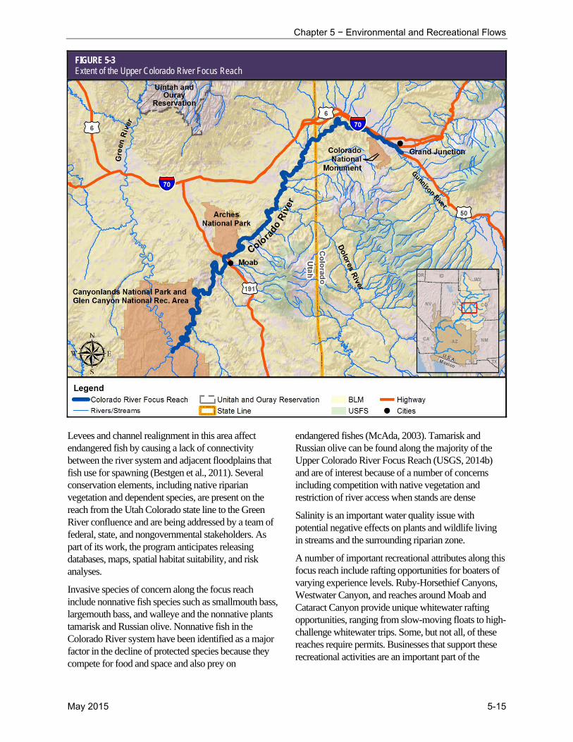
5.6.1 Upper Colorado River Focus Reach
The Upper Colorado River Focus Reach begins at the confluence with the Gunnison River and flows downstream to the Green River confluence. This 132-mile reach of the Colorado River (Figure 5-3) receives water from the upstream watershed, including snowmelt runoff from higher elevation areas such as the tributaries of the Gunnison, Dolores, Roaring Fork, Eagle, and Blue Rivers. The many tributaries that flow into and above the focus reach range from small, unregulated tributaries to larger tributaries with substantial reservoir storage and water regulation. This reach is also below several exports to Colorado’s Front Range, large irrigation areas on Colorado’s West Slope, and several salinity control projects. Additionally, the Aspinall Unit reservoir complex on the Gunnison River upstream includes the Blue Mesa, Morrow Point, and Crystal Dams, which together are capable of generating up to 283 MW of hydropower.
Along its course, the Upper Colorado River Focus Reach flows through Grand Junction, Colorado; private and BLM land; and two national parks (Arches and Canyonlands). The average of all annual flows near Cisco, Utah, below the Dolores River, is 7,168 cubic feet per second (cfs); the average of the 10 percent lowest annual flows is 3,251 cfs; and the average of the 10 percent highest annual flows is 11,950 cfs (U.S. Geological Survey [USGS], 2014a). Annual precipitation in this region is about 9 inches (Western Regional Climate Center [WRCC], 2014).
5.6.1.1 Environmental and Recreational Attributes
The Upper Colorado River Focus Reach and its surrounding riparian corridor provides habitat for many plant and wildlife species. The focus reach contains critical habitat for humpback chub, Colorado pikeminnow, razorback sucker, and bonytail, all of which are federally endangered fish included in the Recovery Program. As part of the recovery effort for these fish, the USFWS has developed a biological basis for flow recommendations at the Colorado-Utah state line (above the confluence with the Dolores River) (McAda, 2003). Habitat restoration is another important issue for recovery of these species.
Chapter 5 − Environmental and Recreational Flows
May 2015 5-15
FIGURE 5-3 Extent of the Upper Colorado River Focus Reach
Levees and channel realignment in this area affect endangered fish by causing a lack of connectivity between the river system and adjacent floodplains that fish use for spawning (Bestgen et al., 2011). Several conservation elements, including native riparian vegetation and dependent species, are present on the reach from the Utah Colorado state line to the Green River confluence and are being addressed by a team of federal, state, and nongovernmental stakeholders. As part of its work, the program anticipates releasing databases, maps, spatial habitat suitability, and risk analyses.
Invasive species of concern along the focus reach include nonnative fish species such as smallmouth bass, largemouth bass, and walleye and the nonnative plants tamarisk and Russian olive. Nonnative fish in the Colorado River system have been identified as a major factor in the decline of protected species because they compete for food and space and also prey on
endangered fishes (McAda, 2003). Tamarisk and Russian olive can be found along the majority of the Upper Colorado River Focus Reach (USGS, 2014b) and are of interest because of a number of concerns including competition with native vegetation and restriction of river access when stands are dense
Salinity is an important water quality issue with potential negative effects on plants and wildlife living in streams and the surrounding riparian zone.
A number of important recreational attributes along this focus reach include rafting opportunities for boaters of varying experience levels. Ruby-Horsethief Canyons, Westwater Canyon, and reaches around Moab and Cataract Canyon provide unique whitewater rafting opportunities, ranging from slow-moving floats to high-challenge whitewater trips. Some, but not all, of these reaches require permits. Businesses that support these recreational activities are an important part of the
Moving Forward: Phase 1 Report
5-16 May 2015
economy in Grand Junction, Colorado; Moab, Utah; and beyond.
5.6.1.2 Programs and Management
A number of existing programs are in place for the Colorado River that address ecological and recreational attributes on the Upper Colorado River Focus Reach. The Recovery Program is working to recover the endangered humpback chub, bonytail, Colorado pikeminnow, and razorback sucker, all of which inhabit the focus reach.
To remove nonnative invasive plant species in the focus reach, the Southeast Utah Riparian Partnership works with community partners to complete voluntary tamarisk removal and restoration projects in the Professor Valley and Moab areas. Salinity issues above the focus reach are being addressed by the Natural Resources Conservation Service (NRCS), Reclamation, and state agencies, which have implemented irrigation improvements upstream of the focus reach aimed at reducing salt load by reducing high salinity agricultural drain water return flows. In the focus reach, salinity is monitored below the confluence with the Dolores River as part of the Colorado River Basin Salinity Control Program to monitor the effectiveness of salinity control projects above this focus reach. Studies estimate that salinity control measures related to the Grand Valley, Lower Gunnison Basin, Silt, and Paradox Valley Salinity Control projects have helped to reduce salt load in the focus reach by more than 140,000 tons per year (NRCS, 2011; Colorado River Basin Salinity Control Forum, 2014).
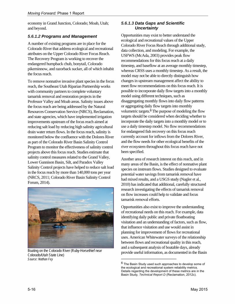
Boating on the Colorado River (Ruby-Horsethief near Colorado/Utah State Line) Source: Nathan Fey
5.6.1.3 Data Gaps and Scientific Uncertainty
Opportunities may exist to better understand the ecological and recreational values of the Upper Colorado River Focus Reach through additional study, data collection, and modeling. For example, the USFWS (McAda, 2003) provides peak flow recommendations for this focus reach at a daily timestep, and baseflow at an average monthly timestep, whereas CRSS uses a monthly timestep. As a result, the model may not be able to directly distinguish how changes in upstream management affect the ability to meet flow recommendations on this focus reach. It is possible to incorporate daily flow targets into a monthly model using different techniques, such as disaggregating monthly flows into daily flow patterns or aggregating daily flow targets into monthly volumetric targets.6 The purpose of modeling the flow targets should be considered when deciding whether to incorporate the daily targets into a monthly model or to use a daily timestep model. No flow recommendations for endangered fish recovery on this focus reach currently account for inflows from the Dolores River, and the flow needs for other ecological benefits of the river ecosystem throughout this focus reach have not been specified.
Another area of research interest on this reach, and in many areas of the Basin, is the effect of nonnative plant species on instream flows. Studies designed to evaluate potential water savings from tamarisk removal have had mixed results, and a USGS study (Nagler et al., 2010) has indicated that additional, carefully structured research investigating the effects of tamarisk removal on flow increases could help to validate and focus tamarisk removal efforts.
Opportunities also exist to improve the understanding of recreational needs on this reach. For example, data identifying daily public and private floatboating visitation and an understanding of factors, such as flow, that influence visitation and use would assist in planning for improvement of flows for recreational uses. American Whitewater surveys of the relationship between flows and recreational quality in this reach, and a subsequent analysis of boatable days, already provide useful information, as documented in the Basin
6 The Basin Study used such approaches to develop some of the ecological and recreational system reliability metrics. Details regarding the development of these metrics are in the Basin Study, Technical Report D (Reclamation, 2012c).

Chapter 5 − Environmental and Recreational Flows
May 2015 5-17
Study7. Additional research in this reach, by American Whitewater in 2014, compliments the information contained in the Basin Study and is available to help inform efforts to reduce recreation vulnerabilities. These data could also assist in quantifying the economic benefits of recreation in the area.
5.6.1.4 Summary
All of the factors upstream of the Upper Colorado River Focus Reach will have effects on its important ecological, recreational, and hydropower values. Concerns in the focus reach include endangered fish recovery, improved recreational boating, invasive fish species, tamarisk stands, and salinity levels. Additional data and analysis could improve the understanding of these issues, including the effect of tamarisk removal on flows, the relationship between flow and other factors on boating visitation and use, and the flow needs for endangered fish and other flow-dependent species below the Colorado-Utah state line.
5.6.2 White River Focus Reach
The White River Focus Reach flows from Taylor Draw Dam near Rangely, Colorado, downstream to the Green River confluence. This 105-mile focus reach of the White River (Figure 5-4) receives water primarily from the upstream watershed from snowmelt in higher elevation areas. Due to its relatively low water storage capacity, Taylor Draw Dam has a minimal influence on river flow downstream from the reservoir (Martinez et al., 1986). However, the reservoir, operated by the Rio Blanco Water Conservancy District, serves many purposes, including the generation of about 1.6 MW of hydroelectric power, recreation, fish and wildlife protection, and limited drinking and irrigation water. Along its course, this focus reach flows through private and BLM lands as well as the Ute Tribe’s Uintah and Ouray Reservation. The average of all annual flows near Watson, Utah, is 686 cfs; the average of the 10 percent lowest annual flows is 381 cfs; and the average of the 10 percent highest annual flows is 1,128 cfs USGS, 2014a). Annual precipitation in this area ranges from 7 to 10 inches (WRCC, 2014).
7 See the Basin Study, Technical Report D, Appendix D2 for more information on this analysis (Reclamation, 2012c).
5.6.2.1 Environmental and Recreational Attributes
The White River Focus Reach includes critical habitat for two species included in the Recovery Program: the Colorado pikeminnow and the razorback sucker. Webber et al. (2013a) identified spawning of these fish in the river, indicating that the focus reach is important for spawning and rearing habitat for these two species. Nonnative invasive species are an issue in this focus reach. Nonnative smallmouth bass were introduced from the Green River and are a special concern due to steadily increasing populations of this predator of native fish (Webber et al., 2013b). The states of Utah, Wyoming, and Colorado are taking aggressive actions to curb this threat to recovery efforts in the Upper Basin.
Flows are generally too erratic in this focus reach for consistent whitewater boating use, although high-quality Class I and Class II multi-day whitewater boating trips are supported by local outfitters, equipment rental, and shuttle services. Most river trips occur during spring runoff from mid-April to mid-June when flows range between 1,000 and 2,400 cfs. Taylor Draw Dam does not provide a large amount of water storage; therefore, flow below the dam is subject to seasonal river variations, and erratic flows downstream are mainly due to natural variability. Other recreational activities in the reach include angling for channel catfish in the Rangely, Colorado area.
White River above Mt. Fuel Source: Tim Palmer

Moving Forward: Phase 1 Report
5-18 May 2015
FIGURE 5-4 Extent of the White River Focus Reach
5.6.2.2 Programs and Management
Existing programs on the White River Focus Reach are working to protect endangered fish species. The 1982 Biological Opinion for Taylor Draw Dam (U.S. Army Corps of Engineers, 1982) concludes that flow releases planned for the project will meet the requirements of the various life stages of the Colorado pikeminnow. Conservation measures for Colorado pikeminnow included in the Biological Opinion are monitoring spawning locations, determining the feasibility of passage around or through the dam, and habitat enhancement projects.
Like the Upper Colorado River Focus Reach, the White River Focus Reach is included in the Recovery Program. As part of this program, research and planning activities, such as the development of interim flow recommendations (Haines et al., 2004) and removal of smallmouth bass, have been undertaken for the White River.
5.6.2.3 Data Gaps and Scientific Uncertainty
As part of the Recovery Program, a White River Management Plan is being developed that will include draft flow recommendations and a programmatic biological opinion. The plan, currently under development by the USFWS, will build on preliminary seasonal flow recommendations for endangered fish species by using new biological information to develop the Recovery Program’s year-round flow recommendation.
To obtain information about recreational flow needs on the White River, American Whitewater has conducted a study of stream flows and recreational quality. This research, completed in December 2014,8 identifies the range of flows that support the full array of boating
8 The final report from the flow survey will be available at: http://www.americanwhitewater.org/.

Chapter 5 − Environmental and Recreational Flows
May 2015 5-19
opportunities for the mainstem and tributaries of the White River and how changes in streamflows affect recreation quality. Other opportunities may also exist for improving an understanding of recreational needs on this reach. For example, data describing commercial and private floatboating visitation and an understanding of the factors, including flow, that influence visitation and use would assist in planning for improving flows for recreational uses. These data could also assist in quantifying the economic benefits of recreation in the area.
5.6.2.4 Summary
The White River Focus Reach includes important ecological and recreational attributes, including critical habitat for the Colorado pikeminnow and the razorback sucker, and boating and fishing opportunities. Concerns in the focus reach include invasive fish species, especially the smallmouth bass, and erratic flows that make whitewater rafting conditions unpredictable. Additional data collection to improve understanding of these issues is underway through the White River Management Plan and the recreational flow study by American Whitewater.
Colorado Pikeminnow Source: Bureau of Reclamation
5.6.3 Bill Williams River Focus Reach
The Bill Williams River Focus Reach begins downstream from Alamo Dam in west-central Arizona and flows to the Colorado River confluence at Lake Havasu, a distance of about 45 miles. Along its course, this focus reach flows through BLM land as well as the 6,100-acre Bill Williams River National Wildlife Refuge (Refuge), the 8,400-acre Planet Ranch, and the 1,000-acre Lincoln Ranch (Figure 5-5). Streamflow in the focus reach is primarily controlled by operations at Alamo Dam, with the average of all annual flows below the dam at around 114 cfs; the average of the 10 percent lowest annual flows at 5 cfs; and the average of
the 10 percent highest annual flows at 731 cfs (USGS, 2014a). Weather conditions along the focus reach are dry, with an average precipitation of 9 inches annually near Alamo Dam and less downstream (WRCC, 2014).
Bill Williams River near Planet Ranch, AZ Source: Andrew Hautzinger
5.6.3.1 Environmental and Recreational Attributes
The Bill Williams River Focus Reach contains significant native woodland forests that provide habitat for many animal species. The Refuge, extending about 9 miles upstream from Lake Havasu, contains one of these important forests, which provides habitat for numerous plant and animal species. Because more than 348 bird species have been sighted in the Refuge, the Audubon Society has named the Bill Williams River an Important Bird Area. The ESA-listed southwestern willow flycatcher, Yuma clapper rail, and yellow-billed cuckoo are found along the focus reach.
The fish populations in this focus reach are dominated by nonnative and sport fish species, but bonytail populations (an ESA-listed species) are augmented by the USFWS and the LCR MSCP in the delta region of the Bill Williams River. Historically, the native longfin dace occurred throughout the river, and the endangered razorback sucker may also have inhabited the lower Bill Williams River (Lytle, 2006).
Sport fishing, hunting, wildlife watching, and camping are popular recreational activities along the focus reach and in the Refuge. Canoeing and kayaking are also present in the lower portions of the focus reach within some areas of the Refuge.

Moving Forward: Phase 1 Report
5-20 May 2015
FIGURE 5-5 Extent of the Bill Williams River Focus Reach
5.6.3.2 Programs and Management
Overseen by the Bill Williams River Corridor Steering Committee (BWRCSC), the Bill Williams River is the focus of a concerted research and management effort that benefits many ecological and recreational values. The BWRCSC is a stakeholder group that includes regulatory agencies, non-governmental organizations (NGO), local jurisdictions, and scientists with management concerns and responsibilities related to the Bill Williams River (BWRCSC, 2014). This group works cooperatively to help fund and coordinate research and adaptive management of the river’s resources.
The Sustainable Rivers Project, a national collaboration between TNC and the U.S. Army Corps of Engineers, is part of this cooperative effort. Through this project, flow releases from Alamo Dam are adjusted to meet natural resource objectives, including the enhancement of cottonwood-willow riparian areas and flood control.
The project incorporates adaptive management to facilitate the evaluation of management efforts and encourages making necessary adjustments to better achieve a balance between management objectives. As part of this effort, studies have been conducted to evaluate the relationship between flows below Alamo Dam and ecological and hydrological processes (for example, Shafroth et al., 2010; Simpson et al., 2013).
In addition to river-wide programs, other programs are in place on the focus reach to manage specific lands. Activities within the Refuge are governed by a Comprehensive Management Plan. The Refuge works with partners, including the BWRCSC, to help accomplish its wildlife management and conservation mission. The BLM also maintains a Resource Management Plan for its lands along the focus reach. Two segments of the Bill Williams River have been determined by BLM to be suitable for inclusion in the

Chapter 5 − Environmental and Recreational Flows
May 2015 5-21
National Wild and Scenic Rivers System due to their scenic, recreational, fish, and wildlife values.
5.6.3.3 Data Gaps and Scientific Uncertainty
Ongoing research is underway on the Bill Williams River Focus Reach to address flow-related ecological processes in an effort to improve flow management in the Bill Williams River. Numerous research activities sponsored by federal and state agencies, universities, and NGOs have been undertaken along this focus reach, such as impacts of managed floods on wildlife and habitat (Shafroth et al., 2010), hydrographic/geomorphic surveys (Wilcox et al., 2013), and research on fish, birds, and other wildlife habitats (Andersen and Shafroth, 2010). There is also interest in how pulse flow releases and turbidity could impact the Central Arizona Project water supply, which has intakes in the Bill Williams River arm of Lake Havasu (USGS, 2009).
To obtain information about recreational flow needs on the Bill Williams River Focus Reach, American Whitewater has conducted a study, completed in December 2014,9 of streamflows and recreational quality. This research will help identify the range of flows that supports the full array of boating opportunities for the mainstem of the Bill Williams River, and identify opportunities to enhance recreational values in this focus reach.
Southwestern Willow Flycatcher Source: Bureau of Reclamation
9 The final report from the flow survey will be available at: http://www.americanwhitewater.org/.
5.6.3.4 Summary
The Bill Williams River Focus Reach contains important ecological and recreational values including significant native cottonwood-willow riparian forests that support many wildlife species. Recreational activities on the focus reach are largely related to enjoying these ecological assets. A flow-related research and management program is underway on this focus reach to protect and improve these ecological and recreational resources as is a recreational flow study by American Whitewater.
5.6.4 Henry’s Fork Headwaters Focus Reach
The Henry’s Fork Headwaters Focus Reach flows from Henry’s Lake and headwater tributaries downstream into Flaming Gorge Reservoir. This focus reach includes about 400 perennial stream miles and drains a watershed that includes 520 square miles (Figure 5-6). Headwaters of the Henry’s Fork Basin primarily originate in Utah on the north slopes of the Uinta Mountains at Henry’s Fork Lake below King’s Peak. It flows northeasterly through Utah, and then east across Wyoming before it dips down to reach Flaming Gorge Reservoir near Manila, Utah.
The water flowing through this focus reach is derived from runoff within the watershed. Hoop Lake and Beaver Meadows reservoirs provide water storage in the area, primarily for agriculture, and several perennial tributaries, including Poison Creek, Beaver Creek, and the Burnt Fork drain into Henry’s Fork. The focus reach and its tributaries flow through BLM and U.S. Department of Agriculture land, Wyoming state land, and in Utah, through U.S. Forest Service land. In addition, some land is privately owned, including land used for ranching and agriculture. The average of all annual flows near Manila, Utah, is 80 cfs; the average of the 10 percent lowest annual flows is 24 cfs; and the average of the 10 percent highest annual flows is 186 cfs (USGS, 2014a). Annual precipitation in this area ranges from 7 to 14 inches (WRCC, 2014).
5.6.4.1 Environmental and Recreational Attributes
The Henry’s Fork Headwaters Focus Reach provides habitat for many native fish species, including an important population of Colorado River cutthroat trout. This population is important because tributaries in the Henry’s Fork watershed still contain 100 percent pure

Moving Forward: Phase 1 Report
5-22 May 2015
Colorado River cutthroats. Studies have suggested that efforts should continue to restore and maintain populations of flannelmouth sucker and bluehead sucker in Henry’s Fork, including sampling, monitoring, and removal of nonnatives (Gelwicks et al., 2009).
The Henry’s Fork area also provides habitat for other wildlife species, including the yellow-billed cuckoo, greater sage grouse, whooping crane, and other bat, amphibian, and reptile species. This area also contains yearlong and winter range for moose, elk, pronghorn, and mule deer, and has been designated a Crucial Habitat Priority Area for the Wyoming Game and Fish Department. Cottonwood-willow riparian zones are found in tributary floodplains in this focus reach, as well as nonnative species including leafy spurge, tamarisk, and Russian olive.
Salinity is an important issue on this focus reach. On average, the Henry’s Fork accumulates 37,200 tons of
salt per year, of which 20,800 tons are associated with irrigation activities in the area. As a result, the lower portion of Henry’s Fork was designated an NRCS Salinity Control Area in 2013 (NRCS, 2013). Recreational attributes along this focus reach include hiking trails and campsites maintained along the Henry’s Fork and its tributaries. Many fishing opportunities exist in this focus reach and nearby high mountain lakes.
5.6.4.2 Programs and Management
The Henry’s Fork drainage is managed for the benefit of Colorado River cutthroat trout through a conservation strategy developed by the wildlife agencies in Colorado, Utah, and Wyoming (Colorado River Cutthroat Trout Coordination Team, 2006). Issues addressed by the conservation strategy include isolation of upstream populations caused by land management practices.
FIGURE 5-6 Extent of the Henry’s Fork Headwaters Focus Reach

Chapter 5 − Environmental and Recreational Flows
May 2015 5-23
Because of the combination of high fisheries values and salinity contributions within the Henry’s Fork, the NRCS has created a partnership with Trout Unlimited to establish a watershed coordinator who will work with private landowners to improve irrigation efficiencies and increase crop yields, reduce labor and water requirements, and reduce salt loading in the drainage. The partnership will seek projects that improve water quality or enhance aquatic habitat for native fish species. For example, projects could work to reduce fish entrainment, promote fish passage, improve water availability, or augment riparian habitat for waterfowl and other associated species.
Beaver Creek, Wyoming Source: Hillary Walrath
5.6.4.3 Data Gaps and Scientific Uncertainty
Opportunities to better understand ecological and recreational values in the Henry’s Fork Headwaters Focus Reach include additional studies of the magnitude and duration of flows required to achieve ecological requirements and the connections between surface water, groundwater, and related biotic communities.
Other areas needing additional study are sediment budget and transport dynamics, nutrient cycling and decomposition, and the role of fire in the drainage. Physical inspections of areas where roads cross the headwater creeks would allow a better understanding of barriers to fish passage.
As part of Wyoming’s consumptive use program, the State has been collecting continuous diversion and streamflow data in the drainage. The State also has remote sensing evapotranspiration data from 2011. The next step will be to install a weather station, which the
State plans to do by 2015. A detailed understanding of the use within the focus reach is important when attempting to develop water resource management strategies and these data can be used for water management decisions by the watershed coordinator.
5.6.4.4 Summary
The Henry’s Fork Headwaters Focus Reach has ecological attributes, such as important habitat for the Colorado River cutthroat trout and other wildlife species. Recreational opportunities in this focus reach are hiking, camping, and fishing. Concerns in the focus reach include invasive fish species, tamarisk stands, and high salinity levels. Additional data on ecological flow requirements, sediment transport, and the role of fire in drainage, as well as an inventory of fish barriers in the headwaters area, could improve the understanding of these issues.
River reaches face unique challenges associated with threatened and endangered species, threats from nonnative fish species, water quality concerns, understanding the relationship and effect of flows on ecological and recreational values, and the effect of invasive species removal and native vegetation restoration on flows.
5.7 Existing Ecological, Recreational, and Hydropower Programs
Recognizing that the existing programs in the focus reaches provide valuable resources for protecting or improving ecological and recreational resources and that other existing programs are in place across the Basin, the Workgroup reviewed existing programs in place beyond the focus reaches. To do this, the Workgroup first developed a list of 78 programs10 operating in the Basin, in other parts of the U.S., and in international regions of interest that include mechanisms to benefit environmental and recreational
10 The term “programs” refers to a variety of programs, laws, and stakeholder groups related to ecological, recreational, and hydropower resources. The list of 78 programs does not represent an exhaustive list, but rather a reasonable list appropriate for evaluating best practices and mechanisms based on the knowledge and experience of the Workgroup.

Moving Forward: Phase 1 Report
5-24 May 2015
flows. Each program was then reviewed and analyzed to identify promising approaches and practices that could potentially be applied to the focus reaches or provide opportunities in other parts of the Basin. Finally, common approaches and practices were grouped and discussed by program type, including the mechanisms typically used by each program type.
Many programs and processes that use a range of effective mechanisms currently operate within the Basin to address ecological and recreational resources.
5.7.1 Programs and Mechanisms
The list of programs reviewed by the Workgroup is diverse in terms of both geographic location and approach to reaching program goals. Starting with the existing programs on the focus reaches, the list was developed by surveying existing programs in the remainder of the Basin, other parts of the U.S., and international regions of interest. Programs on the list involve a variety of organizations, including government agencies, environmental groups, power customer organizations, and local stakeholders. The survey of programs is neither exhaustive nor an endorsement of particular programs; rather, it illustrates the types of programs and mechanisms that have been implemented.
The Workgroup looked at many goals and approaches used by different programs. For example, the Workgroup reviewed several programs that do not have the specific goal of benefitting ecological and recreational flows but that do include activities that improve these flows as an ancillary benefit. These types of programs may provide an indirect benefit to ecological and recreational resources, while other programs directly benefit ecological and recreational resources consistent with the programs’ specific goals.
As part of the review of this diverse group of programs, key mechanisms characterizing each program were identified. For the purpose of the review, mechanisms were defined as the activities and approaches used by a program to reach its goals. Although many types of programs were included in the review, a number of common mechanisms, goals, and resulting benefits were identified among them. Recognizing that many programs share common features, programs using
similar mechanisms were grouped into five program types. The complete list of programs reviewed as part of this task is included in Appendix 5B, which also summarizes the goals and mechanisms of each program.
5.7.2 Description of Program Types
Project funding, water management enhancements, conservation and species recovery plans, water rights acquisitions, and stakeholder groups are the five program types identified by the Workgroup and are described below. The common mechanisms used by each are summarized, and an example of each program type is discussed.
5.7.2.1 Project Funding
Identifying a funding source is a key component of any management program. Several programs make funding available for projects that directly or indirectly provide environmental and recreational flow benefits. Some of these programs award competitive one-time grants, such as the conservation grants offered by the National Fish and Wildlife Foundation. WaterSMART Water and Energy Efficiency grants focus on water use efficiency, but they can also provide an indirect benefit to ecological and recreational resources by reducing the amount of water diverted for human use, thus potentially increasing instream flows. Other examples of funding programs are the Environmental Quality Incentives Program (EQIP), and the Regional Conservation Partnership Program implemented by the NRCS. These voluntary programs provide financial and technical assistance to agricultural producers to help plan and implement conservation practices that address natural resource concerns (NRCS, 2014). EQIP provides opportunities to improve soil, water, plant, animal, air, and related resources on agricultural land and non-industrial private forestland. EQIP practices indirectly benefit environmental and recreational flows by maintaining water in streams and rivers and also include improvements to irrigation efficiency such as installation of a sprinkler irrigation system or lining of irrigation ditches. EQIP is coordinated with funding from Reclamation and the states for the Colorado River Basin Salinity Control Program above Imperial Dam.
5.7.2.2 Water Management Enhancements
Many of the programs reviewed in Phase 1 can be considered water management enhancement programs. These programs provide direct or indirect

Chapter 5 − Environmental and Recreational Flows
May 2015 5-25
environmental and recreational benefits through such mechanisms as flow routing (that is, ensuring water conserved or released from an upstream location is protected until it reaches a targeted downstream location), coordinated reservoir operations, or water banking. Coordinated reservoir operations, as part of a voluntary water management strategy, can orchestrate water release from different reservoirs to provide ecological and recreational benefits while simultaneously meeting other demands. The coordinated release from Alamo Dam on the Bill Williams River provides an example of such actions. Water banking provides an opportunity to meet water supply needs by allowing for the temporary storage of, and potential transfer of, water from one use to another, while possibly generating instream benefits along the way.
These programs require that both resource needs (including water delivery and hydropower needs) and environmental and recreational flows are met. Through careful coordination among stakeholders and perhaps incentivizing participation in the program, opportunities may exist to enhance environmental and recreational flows through water management alternatives.
For example, the Upper Colorado River Wild and Scenic Stakeholder Group is an independent, collaborative partnership that incorporates water management in their efforts to develop and implement a local alternative to Wild and Scenic River designation on the Upper Colorado River. The intent of the group is to balance permanent protection of the river’s “outstandingly remarkable values,” certainty for stakeholders, water project yield, and water use flexibility (Upper Colorado River Wild and Scenic Stakeholder Group, 2014). The group has developed a management plan that will protect river segments by relying on existing water management mechanisms. These mechanisms include instream flow water rights appropriated by the Colorado Water Conservation Board and the delivery of water through the protected river segments to senior downstream water users. They also include new cooperative efforts that can benefit the river without adversely impacting existing water users.
With careful consideration of the diverse water needs in the Basin, and recognizing that participation would be voluntary, the Workgroup identified water management enhancement as a potential opportunity to advance environmental and recreational benefits in the Basin.
5.7.2.3 Conservation and Species Recovery Plans
Conservation of plant and animal species and recovery of threatened and endangered species have resulted in programs that directly benefit the environment and indirectly benefit recreational values. These programs often include flow recommendations for the benefit of different species, most commonly fish. For example, the Upper Colorado Coordinated Reservoir Operations project works on a voluntary basis to provide suitable flows in the 15-mile reach of the Colorado River that includes important endangered native fish habitat (Recovery Program, 2006). Other mechanisms used by this type of program can include native fish population augmentation, fish passage improvements, eradication of nonnative species, and habitat preservation and restoration. These are all actions taken by the Recovery Program on the White River and Upper Colorado River focus reaches. Research and monitoring needed to establish fact-based recommendations are also often a feature of these programs.
Another example of this type of program in the Lower Basin is the LCR MSCP, which was created to balance the use of Colorado River water resources and hydropower production with conservation of native species and their habitats. The program contributes to the recovery of species currently listed under the ESA and focuses on habitat protection and creation to reduce the likelihood of additional species listings. Implemented over a 50-year period, the LCR MSCP accommodates current water diversions and power production and optimizes opportunities for future water and power development by providing ESA compliance through the implementation of the LCR MSCP Habitat Conservation Plan (Reclamation, 2013). The Habitat Conservation Plan calls for the creation of more than 8,100 acres of habitat for fish and wildlife species and the production of more than 1.2 million native fish to augment existing populations (Reclamation, 2004); more than 2,900 acres of native riparian habitat have been created to date (Reclamation, 2014). The plan will benefit at least 26 species, most of which are state or federally listed endangered, threatened, or sensitive species (Reclamation, 2004).
Species recovery plans typically focus on improvements to riparian and instream habitat for species of conservation interest. One common mechanism related to this type of program is a USFWS programmatic biological opinion. Activities associated

Moving Forward: Phase 1 Report
5-26 May 2015
with this program type can include flow recommendations, native fish augmentation, and habitat preservation or restoration.
The Recovery Program and its partners are recovering four species of endangered fish in the Upper Colorado River and its tributaries, while water use and development continues to meet human needs in compliance with interstate compacts and applicable federal and state laws. All water resources are managed in accordance with state water law, individual water rights, and interstate compacts to provide adequate instream flows for the endangered fish while meeting water needs of growing western communities. The Recovery Program provides ESA compliance for continued operation of federal water and power projects in accordance with project purposes through water leases and contracts, coordinated water releases from upstream reservoirs, efficiency improvements to irrigation systems, and re-operation of federal dams and reservoirs (Recovery Program, 2014a, 2014b).
While formal species conservation and recovery plans are typically within the purview of the USFWS, several mechanisms used by these programs, such as habitat conservation and eradication of nonnative species, do have promise as potential opportunities to advance environmental and recreational benefits in the Basin.
Sage Grouse with Chicks Source: Hillary Walrath
5.7.2.4 Water Rights Acquisitions
The acquisition of water rights is a direct approach to providing environmental and recreational benefits. Programs that involve water rights acquisition are subject to state and federal legislation related to water rights and political and community sensitivity to water rights issues. Related programs can operate by
purchasing or leasing water rights to establish instream flows for environmental and recreational benefits.
For example, the Utah Division of Water Resources now has authority to approve private water leases to benefit native trout. As part of this statute passed in 2010, private and non-profit groups can lease water for up to 10 years from willing landowners and irrigators if the water is dedicated for instream fishery benefits. By allowing these market-based transactions, this authority is expected to expand the scope of instream protection in Utah.
In another example, through its Instream Flow Program, the Colorado Water Conservation Board has the authority to appropriate instream flow water rights to preserve flows to a reasonable degree for the benefit of the natural environment (Colorado Water Conservation Board, 2014). Resources protected by this program include cold and warm water fisheries, riparian vegetation, unique hydrologic features, and critical habitat for threatened or endangered native fish. Through the Colorado Instream Flow Program, the State of Colorado has appropriated more than 1,800 water rights for instream flows, protecting more than 9,000 miles of streams. The State of Colorado also has entered into more than 25 transactions through its water acquisition program, under which it can purchase, lease, or accept donations of water rights for instream flow purposes, resulting in the protection of more than 900 cfs on various streams.
While the Colorado and Utah programs show that water acquisitions can provide ecological and recreational benefits, water rights legislation and political and community sensitivity pose significant challenges for implementation of water rights acquisition programs. Thus, while Phase 1 does not identify the acquisition of water rights as a specific opportunity, there may be future opportunities relating to water rights acquisitions that could improve ecological and recreational resources in the Basin.
5.7.2.5 Stakeholder Groups
Stakeholder groups throughout the Basin (such as the LCR MSCP, the Salinity Control Program, and GCDAMP) bring together representatives of groups that have an interest in the same river or watershed. These stakeholder groups employ a variety of mechanisms to pursue common goals. Often, process coordination and collaborative planning is a key aspect of stakeholder group activities that involve working

Chapter 5 − Environmental and Recreational Flows
May 2015 5-27
together to address complex water management and natural resource conservation issues. Stakeholder groups may also participate in activities such as public outreach and education or research projects. Stakeholder groups may also build organizational capacity by forming partnerships with governmental entities and NGOs.
For example, the BWRCSC is a partnership effort that includes regulatory agencies, NGOs, local jurisdictions, and scientists with management concerns and responsibilities related to the Bill Williams River. The purpose of the BWRCSC is to facilitate and foster open communication and to promote a commitment to good science (BWRCSC, 2014). The committee’s member agencies have funded and organized the majority of the research being conducted on this river system and have implemented an adaptive management approach based on the resulting data. Also, the Upper Colorado River Wild and Scenic Stakeholder Group represents a diverse range of interests in the Upper Basin such as recreation and conservation organizations, municipal water providers and county, state, and federal entities. The intent of the group is to balance permanent protection of the river’s “outstandingly remarkable values,” certainty for stakeholders, water project yield, and water use flexibility.
Coordination and collaboration among diverse stakeholders are key mechanisms that encourage the success of individual programs. Capacity-building can also help foster the establishment of new programs and ensure the continued success of well-established programs. Stakeholder coordination and capacity-building provide opportunities to advance environmental and recreational benefits in the Basin.
5.7.2.6 Summary
The Workgroup’s review of existing programs resulted in the identification of program mechanisms that could provide additional opportunities on the focus reaches included in Phase 1 and potentially on other reaches across the Basin (Table 5-2). Because funding is an important element of any project, sustainable funding was identified as a good potential opportunity for improving ecological and recreational flows on focus reaches. Water management enhancement-related mechanisms such as water banking and flow routing were also recognized as important potential opportunities because of their ability to contribute to improving the amount and timing of instream flows. Though species conservation and recovery plans are typically under the jurisdiction of the USFWS, and are subject to specific regulations and situations, some mechanisms used by these programs could be considered as opportunities as part of Phase 1. Finally, key elements of many successful programs are a strong stakeholder base and the ability to build organizational capacity.
Cooperative, multi-interest/multi-party voluntary mechanisms have proven to be successful in protecting or improving ecological and recreational resources, and such mechanisms/programs normally benefit more from broader support among competing interests than mandatory, regulatory mechanisms do.

Moving Forward: Phase 1 Report
5-28 May 2015
TABLE 5-2 Summary of Program Types and Mechanisms
Program Type Mechanisms
Project Funding Competitive grants
Program grants
Water Management Enhancements
Flow routing
Coordinated reservoir operations
Water banking
Conservation and Species Recovery Plans
Species flow recommendations
Native fish population augmentation
Fish passage improvements
Habitat preservation and restoration
Research and monitoring
USFWS Programmatic Biological Opinion
Water Rights Acquisition
Purchase of water rights
Lease of water rights
Establishment of instream flows
Stakeholder Groups
Process coordination
Collaborative planning
Public outreach and education
Research projects
Creating synergies between multiple stakeholders
5.8 Opportunities and Challenges for Expanding Environmental and Recreational Flows Programs
Colorado River interests have taken meaningful steps to protect or improve ecological and recreational resources; however, opportunities exist to expand or implement new environmental and recreational flows programs in the context of addressing long-term imbalances in the Colorado River system. While assessing the future vulnerabilities at any particular
reach, including the focus reaches, was beyond the scope of this effort, the Basin Study showed that all Basin resources are increasingly vulnerable, through time, due to increasing supply and demand imbalances.
Though meaningful and significant steps have been taken to protect or improve ecological and recreational resources, opportunities exist to expand or implement new environmental and recreational flow programs.

Chapter 5 − Environmental and Recreational Flows
May 2015 5-29
Options and strategies modeled as part of the Basin Study were shown to decrease resource vulnerabilities. The modeling demonstrated that options that were effective at reducing ecological and recreational vulnerabilities also reduced vulnerabilities of other resources. For this reason, the Workgroup explored opportunities that could provide ecological and recreational benefits in the Basin, while ideally benefitting other resources, or at the least, not harming other resources. The Workgroup was charged with describing the challenges associated with these opportunities based on their collective experience and identifying potential future actions that would advance the opportunities. Potential actions related to the identified opportunities were developed for further consideration by the Coordination Team or other parties interested in advancing environmental and recreational flow opportunities in the Basin. Potential actions may relate to a specific focus reach, but more often they are meant to apply more broadly to other reaches in the Basin if and when opportunities arise for implementation. The opportunities and the potential actions were developed to help meet the Workgroup’s primary objective and to be consistent with the Workgroup’s Guiding Principles. In many cases, the potential future actions suggest the modification of flows to help protect or improve ecological and recreational resources, but non-flow-related actions are also considered for several opportunities.
The Workgroup identified seven major opportunities to protect or improve ecological and recreational resources within the Basin. The Workgroup did not prioritize its opportunities or potential actions, therefore the ordering of the following list or lists in subsequent sections does not imply a prioritization.
1. Develop sources of sustainable funding for environmental and recreational flow projects.
2. Use structured and cooperative market-based mechanisms to provide benefits to multiple sectors including ecological and recreational resources.
3. Develop projects that incorporate watershed management.
4. Develop partnerships that achieve the protection or improvement of ecological and recreational resources through payment for protection of environmental attributes.
5. Investigate opportunities to use voluntary water management optimization for the protection or restoration of environmental and recreational flows.
6. Facilitate enhanced coordination among existing programs.
7. Support additional capacity-building for existing and new stakeholder coalitions.
The potential actions identified by the Workgroup include unique complexities and challenges that would necessitate further exploration and analysis to determine how each could be employed in the Basin.
In Phase 1 of the Moving Forward effort, the opportunities identified have been described in basic terms. Each of these options would include unique complexities and challenges, which would need further exploration and analysis to determine how each could be employed in the Basin. For example, additional scientific research may be necessary to understand effective and efficient mechanisms for implementation of possible options, quantify the benefits that may accrue, and reduce the likelihood of unintended harmful consequences. Models may need to be enhanced or developed to assist in analyzing the potential effects of any proposed actions, and data gaps may need to be filled before modeling activities can begin. Similarly, it will likely be necessary both to define metrics by which the success of any action can be evaluated and to implement monitoring programs necessary to collect the required information. The resources needed to fill these information gaps should be evaluated as potential actions are considered for implementation and the issues in the specific location will drive the selection of any of the potential actions. Additionally, it will be necessary to ensure that any potential action considered for implementation complies with existing laws and regulations. The following sections describe each opportunity in greater detail.

Moving Forward: Phase 1 Report
5-30 May 2015
Future activities aimed at protecting or improving ecological and recreational resources should consider potential impacts to hydropower generation, when appropriate.
5.8.1 Opportunity 1: Develop sources of sustainable funding for environmental and recreational flow projects
5.8.1.1 Description
Sustainable funding ensures that sufficient and stable revenue streams are available over the long-term to accomplish a program’s goals and to implement desired projects. Sustainable funding strategies consider all potential sources of available funding, including government sources, private donors, corporations, NGOs, and revenues generated by user fees and other funding arrangements. A mix of traditional sources of state, local, and federal funding, as well as innovative market-based approaches, such as payment for protection of environmental attributes (see Opportunity 4), are a key part of this financial strategy. Successful implementation of long-term solutions to meet competing water needs in the Basin could, in part, be dependent upon the ability of stakeholders to identify and use sustainable funding strategies.
5.8.1.2 Considerations
Procuring sustainable funding from traditional local, state, and federal sources is challenging because they are typically limited and competitive, and their availability is often contingent upon prevailing economic conditions, the political climate, and uncertainties associated with the appropriations process (Mathieu, 2011). Programs may need to procure funding from multiple and diverse sources because these inherently pose less risk from funding limitations (Mathieu, 2011; World Wildlife Fund, 2009). Cost-share programs that require matching funds provide one alternative to seeking a sole funding source. While user fees provide an attractive source of continuous, sustainable revenue, they can be challenging to assess due to public perception. Power revenues that support the Upper Basin Fund provide an invaluable funding source. Legal limitations are in place on the use of these
funds, and significant diversions of funds for new purposes could diminish the capacity for the funded programs to be successful. For example, the Upper Basin Fund provides power revenues for base funding for the Recovery Program and the SJRRIP under specific legislative authority. Relying on funding from a single source or stakeholder group may be insufficient and unsustainable to achieve program goals.
5.8.1.3 Potential Actions
Use cost share programs (for example, the U.S. Department of Agriculture’s Regional Conservation Partnership Program) to help fund projects.
Investigate the feasibility of constructing small hydropower facilities that do not unduly impact river connectivity or flows but that provide a variety of benefits and potentially generate funds to support environmental and recreational flow projects.
Educate the public about the benefits of user fees and build political support for user fees, where appropriate.
5.8.2 Opportunity 2: Use structured and cooperative market-based mechanisms to provide benefits to multiple sectors including ecological and recreational resources
5.8.2.1 Description
Structured water markets can create additional flexibility in the management of water in the West by allowing water to be voluntarily moved from one use to another on at least a temporary, compensated basis. Cooperative efforts to establish water markets and associated market-based mechanisms for water transfers can help meet and shore up water supply needs during drought conditions by allowing for the
The Deschutes River Basin in Central Oregon has implemented multiple innovative agricultural/ municipal conservation and efficiency programs to restore and protect instream flows for ESA-listed species and recreational purposes (Dickinson et al., 2011). The Deschutes River Conservancy has coordinated most of these efforts, provided funding for these projects, and has helped parties obtain funding from a variety of traditional and market-based sources.

Chapter 5 − Environmental and Recreational Flows
May 2015 5-31
temporary storage or transfer of water. Such market-based mechanisms also have the potential to produce concurrent environmental and recreational benefits, while meeting water supply needs, by increasing or maintaining flows when making voluntary, compensated water transfers and by timing releases to supplement flows when necessary. Market mechanisms can also be structured to incentivize water conservation activities in geographies where flow improvements are needed to provide environmental and recreational benefits.
5.8.2.2 Considerations
The approach for implementing cooperative, market-based mechanisms is dependent on many factors. These factors include geographic location; availability of facilities; availability of funding to structure a water market and to compensate water lessors and, possibly, impacted communities; the existence of mechanisms that enable the temporary or permanent transfer of entitlements; administrative and accounting obstacles; and the availability of willing water lessees. The overall goals of using water markets can vary widely. For example, market-based mechanisms could be established to protect critical reservoir elevations, mitigate shortages, or provide water to junior users who would be more vulnerable to shortages or ecological and recreational resources during times of need. The conserved water could become system water, could be tracked and stored (banked) for later use, or could be a combination of the two.
Several cooperative efforts across the Basin, such as the NRCS Regional Conservation Partnership Program, have the potential to implement mechanisms that could provide multiple benefits through reductions in consumptive use and could potentially utilize market-based mechanisms. Such reductions in consumptive use may have indirect benefits to ecological and recreational resources. Results of these efforts can be reviewed to help establish best practices for this approach.
Colorado River near Moab, Utah Source: Nathan Fey
A mechanism known as Intentionally Created Surplus (ICS) is already being used to enhance water management flexibility in the Lower Basin and is an example of tracking and storing conserved water for future use by municipal and agricultural water users. The ICS mechanism encourages and accounts for augmentation and conservation of water supplies (for example, fallowing of land, lining of canals, and other system efficiency improvements) by allowing this water to be stored in Lake Mead for later use. The use of ICS is limited to water entitlement holders in the Lower Basin. A similar concept was included in Minute 319 to the 1944 Treaty with Mexico, known as Intentionally Created Mexican Allocation, which will permit Mexico to store water that may be taken later, under conditions established in the Minute. In the Upper Basin, the Colorado Water Bank Working Group11 has been investigating the potential for
11 Participants in the Colorado Water Bank Working Group include the Colorado River District, Southwest River District, Front Range Water Council, Colorado Water Conservation Board, and TNC.
The Deschutes Water Alliance Water Bank was established to ensure adequate water supplies for agriculture while also making water available for Central Oregon cities and rivers. The water bank operates in a voluntary, market-based manner using existing Oregon water law statutes under a cooperative agreement. The Deschutes River Conservancy administers and staffs the water bank as well as a separate groundwater mitigation bank where temporary mitigation credits can be obtained through the Instream Leasing Program.

Moving Forward: Phase 1 Report
5-32 May 2015
cooperatively banking conserved water based on a voluntary and compensated approach to avoid or mitigate compact deficits. The Basin Study modeled a version of this concept that routed conserved water to a downstream storage facility. By assuming that mechanisms are in place to protect the water generated through upstream conservation, the routed water increased river flows in the Upper Basin. Additional information about the assumptions and construct of this concept are in the Basin Study, Technical Report G (Reclamation, 2012d).
Numerous challenges would need to be addressed before market-based mechanisms could successfully be implemented in many parts of the Basin. While any program must be in compliance with existing state and federal laws and regulations, including water rights, other challenges would be specific to the locations and objectives of particular programs and could include the potential need to negotiate interstate agreements, the availability of infrastructure, and the administration of a water bank. The effects to hydropower and the locally impacted community would also need to be considered. Finally, participation in any water market must be incentivized properly to encourage participation or to target the benefits, for example, to protect reservoir levels or improve river flows.
Carpenter Ranch on the Yampa River Source: Taylor Hawes
5.8.2.3 Potential Actions
Explore opportunities to increase water efficiencies that reduce consumptive use and identify where and how water savings could maintain or improve river flows.
Explore different incentive mechanisms to facilitate a reduction in consumptive use, including who can provide incentives.
Encourage federal support for federal agency flexibility that may be required for the operation of cooperative water markets and market-based approaches.
Identify storage projects where environmental and recreational water could be beneficially banked.
Identify and document flow routing concepts and tools that may be necessary to route water when transferring water using a water bank or other water market program and consider the potential flow benefits, especially in the Upper Basin.
Continue to explore opportunities for use of cooperative, market-based approaches and banking throughout the Basin at various geographic scales.
5.8.3 Opportunity 3: Develop projects that incorporate watershed management
5.8.3.1 Description
The health of a river system is often determined by the health of the contributing watershed. Management of ecological and water resources at the watershed level allows consideration of the interconnectivity between soil, surface water, groundwater, plants, animals, and other ecosystem functions and resources. Watershed management also incorporates consideration of human water use, including recreational river flows, coldwater sport fisheries, water supply, water rights, and other related factors and natural resources.
5.8.3.2 Considerations
A healthy Colorado River watershed may require multiple facets of watershed management. The environmental and recreational needs along the river
The U.S. Forest Service has a number of programs that focus on management and restoration of forested headwaters. These include the national Watershed Condition Framework, the Legacy Roads and Trails Program, the Aquatic Organism Passage Program, the national Best Management Practices Program, and the Collaborative Forest Landscape Restoration Program.
The Watershed Condition Framework has classified the condition of 15,034 watersheds on national forest systems lands using a consistent nationwide process. Work is currently proceeding to develop and implement restoration plans in selected priority watersheds (U.S. Forest Service, 2014).

Chapter 5 − Environmental and Recreational Flows
May 2015 5-33
are directly affected by how the resources and risks in the watershed are managed. For example, nonnative tamarisk trees may result in consumptive use of Colorado River water and overrun native riparian vegetation, but they also provide important habitat for the endangered southwestern willow flycatcher; therefore, any removal of tamarisk may need to be replaced by native vegetation. Another potential resource management strategy could be the use of weather modification to increase the overall water supply in the watershed, for example, through cloud seeding to increase snowfall in mountain regions (Ryan, 2005). Watershed management is most successful when stakeholders come together with common goals and interests. Often, small watershed groups partner with state and federal agencies to combine resources, expertise, and funding, such as the partnership on the Henry’s Fork with the NRCS to reduce salinity levels in the river through land management activities. Such partnerships are often needed both to promote watershed health and to comply with laws and regulations. For example, dust accumulation on snow changes its reflectivity and results in earlier snowmelt and more evaporative moisture losses (Painter et al., 2007, 2010, and 2012; Skiles et al., 2012). Watershed groups may benefit from partnering with landowners or land management agencies to investigate options to control land-based dust sources. Active forest management that replaces mature forests that have been cleared by harvesting, fires, or insect infestations with replacement growth, anticipated to generate favorable runoff, can provide temporary increases in runoff yield, however these gains are generally not sustainable and can result in other negative ecological impacts (National Research Council, 2008).
As populations grow and the demand for water increases, protection of the Colorado River watershed will become more important. Identifying the resources to protect, fostering awareness of potential threats and risks, and making progress toward opportunities for protection and restoration must be collectively managed. Successful watershed management will be built upon collaboration among municipal, industrial, agricultural, environmental, and recreational stakeholders and local, state, and federal government partners.
Colorado River in Ruby Canyon Source: Tim Palmer
5.8.3.3 Potential Actions
Investigate opportunities to expand Henry’s Fork salinity control program.
Support tamarisk removal pilot project (for example, in the Upper Colorado River Focus Reach) to evaluate removal benefits.
Investigate opportunities to decrease impacts of dust on snow.
Continue to investigate opportunities to use weather modification to increase water availability in the watershed along with the efficacy of this approach.
5.8.4 Opportunity 4: Develop partnerships that achieve the protection or improvement of ecological and recreational resources through payment for protection of environmental attributes
5.8.4.1 Description
The Basin’s ecosystems provide multiple societal benefits. These benefits include the purification of air and water, flood and climate regulation, maintenance of biodiversity, food production, regulation of groundwater and surface water flows, and scenic landscapes for passive and active recreation (Kaval, 2011). Payment for protecting environmental attributes makes use of financial and market-based mechanisms to engage landowners on a voluntary, compensated basis to protect valuable attributes that benefit society. This concept is sometimes referred to as payment for ecosystem services (Stanton et al., 2010). These types

Moving Forward: Phase 1 Report
5-34 May 2015
of programs may be voluntary in nature, and they may also be undertaken in response to an existing regulatory requirement, such as requirements to undertake mitigation activities under the Clean Water Act or ESA. Buyers under these types of programs are typically downstream users who gain value or benefits from protecting environmental attributes, or who choose to address a regulatory requirement by working with upstream water or land users. Sellers are typically upstream landowners or groups that receive some form of compensation to implement conservation or land management practices that protect the quality and continued availability of desired environmental attributes (Mathieu, 2011). An example of such a program in the Basin is the seven-state Colorado River Basin Salinity Control Forum, which coordinates and implements a program throughout the Basin that uses federal and non-federal funds to improve the efficiency of irrigation systems to reduce seepage and return flows that carry salinity back to the Colorado River system.
5.8.4.2 Considerations
Challenges can be anticipated when considering opportunities to pay for the protection of environmental attributes in the Basin. For example, sellers may not be motivated to participate unless they feel adequately compensated for implementing conservation measures on their land. Buyers may be unwilling to participate unless the benefits associated with the program can be adequately demonstrated and quantified or unless the program can guarantee that a payment will generate the desired regulatory “credit” toward mitigation requirements or other obligations. The financial needs of potential sellers and the efficacy of existing regulatory frameworks, if applicable, to motivate buyers must be assessed when considering these types of opportunities in the Basin. Due to the diversity of ecosystems and land use patterns within the Basin, the costs to implement conservation practices will likely be site-specific and differ between landowners. Thus, payment programs would need to consider the differing costs associated with implementing conservation practices across the Basin. These types of programs in the Basin would also need to implement adequate performance measures, monitoring, and enforcement to ensure that watershed improvements are occurring as a result of conservation or land management practices (Mathieu, 2011). Finally, flow-related programs will need to comply with state and federal laws related to the use and administration of water.
Angler on the Upper Colorado River near Kremmling, CO Source: Taylor Hawes
5.8.4.3 Potential Actions
Review existing conservation programs (both those with and without regulatory foundations) to identify opportunities to initiate new program elements that can create benefits for ecological and recreational resources, and, if applicable, create new opportunities for regulated entities to meet their existing regulatory obligations through these types of approaches. (This potential action does not propose seeking new regulation.)
Invest in efficiency projects that can enhance environmental attributes.
In the Tualatin River in Oregon, a wastewater utility has established a program to pay for the protection of environmental attributes to reduce the temperature of the river and help preserve and restore fish and aquatic wildlife habitat. The utility pays upstream landowners to implement land management practices that reduce thermal loading to the river. The utility has planted trees and shrubs along 35 miles of stream banks in the Basin and has secured conservation easements to maintain healthy stream corridors. The plantings and easements also provide other valuable ecosystem services such as habitat expansion, carbon sequestration, erosion control, and filtration of runoff. These efforts have proven to be less expensive for the utility than the proposed alternative, which involves building infrastructure to cool the effluent from its wastewater treatment facilities.

Chapter 5 − Environmental and Recreational Flows
May 2015 5-35
5.8.5 Opportunity 5: Investigate opportunities to use voluntary water management optimization for the protection or restoration of environmental and recreational flows
5.8.5.1 Description
Voluntary water management enhancements can be used to improve streamflows to maintain, protect, restore, or enhance ecological and recreational resources in river systems. These enhancements may include re-timing diversions and reservoir releases. Releases from reservoirs not only can meet a water supply or power generation need, but also can, for example, provide needed minimum flows for fish species or whitewater boating, be used to flush excess accumulated sediment and rebuild gravel bars and beaches, and help restore riparian vegetation.
5.8.5.2 Considerations
A voluntary water management enhancement has challenges, such as ensuring that the increased flows reach the intended downstream beneficiary. Any modifications to reservoir operations must be within existing operating criteria and legal requirements for that reservoir and should not interfere directly or indirectly with authorized project purposes. Further, opportunities for ecological and environmental benefits through voluntary flow releases or other measures will be constrained by existing water allocation entitlements, water rights, biological and physical conditions, socioeconomic limitations, political and legal requirements, and the physical features of existing dams, such as design of outlet structures, that can severely limit the rate at which controlled water releases from a dam can be managed (Richter and Thomas, 2007)
5.8.5.3 Potential Actions
Beginning with focus reaches, explore existing flexibility in timing of diversions or reservoir releases that could be used to voluntarily enhance environmental and recreational flows.
Identify and document flow routing concepts and tools currently available in the Basin.
5.8.6 Opportunity 6: Facilitate Enhanced Coordination among Existing Programs
5.8.6.1 Description
Water management in the Basin is complex, as are the challenges associated with balancing competing needs such as water delivery, hydropower generation, and environmental protection. To meet such challenges, various stakeholders have implemented programs and initiatives, each with their own set of goals, objectives, approaches, and processes, in various parts of the Basin. Facilitating additional cross-program coordination and information exchange are important strategies that can allow such programs to work together and focus resources to address Basin-wide challenges.
5.8.6.2 Considerations
Significant challenges faced by existing programs in the Basin often transcend program boundaries. For example, species recovery goals often require implementation of measures to improve ecological conditions at multiple locations in the Basin. The recent spread of invasive mussels poses significant risks to the Basin’s water quality and ecology. Climate change is projected to have Basin-wide impacts on water supply, water quality, and ecology. Such challenges highlight the need for increased coordination between these programs to exchange information, compare findings, and collaborate on data collection and other efforts to establish and address Basin-wide priorities (Melis et al., 2010).
Colorado Parks and Wildlife, Denver Water, and Aurora Water of Colorado are currently coordinating flow releases from 11 Mile Dam on the upper South Platte River to improve the coldwater sport fishery below the dam and for dozens of downstream river miles. Colorado Parks and Wildlife fisheries biologists have been conducting research on the wild rainbow trout’s natural reproduction processes. They realized that flow releases from the dam could be re-timed so that the trout eggs and emerging trout fry haved additional time to hatch and then find refuge before the releases occur. Initial findings show are that the re-timing of flows has a direct and significant correlation to the recent increase in fish populations.

Moving Forward: Phase 1 Report
5-36 May 2015
Bonytail Chub Source: Bureau of Reclamation
Conferences can provide a valuable venue to exchange information on scientific advances, best practices, and effective policies for protecting and restoring ecological and recreational resources. One example of the many conferences12 that occur each year was co-hosted by Reclamation and the Utton Center at the University of New Mexico School of Law on the social and institutional aspects of river restoration in 2011. This conference brought together policy makers, academics, and practitioners to discuss opportunities and challenges associated with institutional arrangements for large-scale river restoration.
12 Available at: http://uttoncenter.unm.edu/projects/river-restoration.php
The conference resulted in recommendations from the Utton Center and conference organizers to Reclamation on next steps to improve institutional arrangements for river restoration programs (Utton Center, 2011). Conferences that focus on a particular geographic region, such as the Colorado River Basin Science and Resource Management Symposium (USGS, 2008), can also be beneficial because experts and local practitioners can exchange information on regionally focused topics.
The efficient dissemination of relevant state-of-the-art ecological and recreational research and data can help promote coordination between researchers and practitioners and promote implementation of best practices. For example, the University of Arizona has established a database (University of Arizona, 2014) of studies on flow needs and flow responses of riparian and aquatic species in Arizona. The database provides a central location for researchers or practitioners to use when working on environmental flow-related projects.
The data.gov website provides another central location for the sharing of data, including flow and other hydrologic variables. The efficient dissemination of such data can aid in the coordination between activities by ensuring all efforts are using the best and most recent data. Additionally, the Department of the Interior Landscape Conservation Cooperatives bring together federal, state, and local governments, tribes, NGOs, and university researchers to better integrate science and management to address climate change and other landscape scale issues. The Landscape Conservation Cooperatives help disseminate information, connect researchers, identify science gaps, and avoid duplicate research.
Effective engagement of parties across programs is essential for successful cross-program coordination but can be quite challenging. Cross-program collaborative efforts also need to focus on implementation and ensure that any proposals or recommendations are feasible and, most importantly, fundable (Melis et al., 2010).
5.8.6.3 Potential Actions
Identify and promote additional cross-program collaboration for multi-benefit opportunities.
Sponsor a conference, session at an existing conference, or workshop where water managers/practitioners would focus on, for example, identifying data gaps and presenting
The Recovery Program and the SJRRIP have many common goals and objectives, including the conservation of native fish and wildlife as mandated by the ESA. These two programs provide an example of inter-program coordination, collaboration and information sharing in the Upper Basin. The SJRRIP was, in fact, modelled after the Recovery Program, and the two programs share many common monitoring, research, and restoration strategies. The two programs coordinate and collaborate in four main areas: (1) preparing and presenting annual briefings jointly to Congress (based on common authorizing legislation); (2) sharing funding for, and participating jointly in public outreach efforts; (3) jointly developing species recovery goals; and (4) sharing a hatchery facility. There is also considerable overlap of program participants, and informal information sharing that occurs between the two programs as a result. Exchange of information on research and management activities related to species conservation efforts also occurs in a more formal setting at the Annual Researchers’ Meeting held between these two programs (Kantola, 2014).

Chapter 5 − Environmental and Recreational Flows
May 2015 5-37
state-of-the-art best practices relating to environmental and recreational flows.
5.8.7 Opportunity 7: Support Additional Capacity-Building for Existing and New Stakeholder Coalitions
5.8.7.1 Description
Capacity-building is about providing the tools and resources needed by watershed and environmental conservation organizations so that they can effectively develop and fulfill their missions and achieve their goals. Newly formed and established conservation organizations and coalitions can procure funding specifically for capacity-building from both private and public sources.
Southwest Colorado Source: © Tracey Murray/The Nature Conservancy
5.8.7.2 Considerations
Watershed/conservation groups typically begin as volunteer-driven efforts that involve local citizens and landowners who have a vested interest in the water resources within their area. To build capacity, these groups need adequate tools, resources, and knowledge to build their organization, develop their leaders, and solicit volunteers. They also need to establish partnerships with governmental entities and NGOs, build capital resources, obtain funding, and make effective use of technical and specialized resources. The groups need support to procure office space and equipment, develop new projects, and remain current with new approaches and technologies. Such capacity-building activities are critical to an organization’s continued success. In fact, community-based
organizations have been most successful in protecting and/or improving watershed resources when they have sought and received strong support to build capacity (U.S. Environmental Protection Agency [EPA], 2003). Yet, procuring funding for capacity-building activities often remains a challenge for organizations; grant makers often prefer to fund more high-profile, on-the-ground restoration or conservation projects that yield more immediate and directly measurable results (Lutz, 2007).
5.8.7.3 Potential Actions
Support the building of technical and organizational capacity in newly established watershed/conservation programs within the Basin (for example, by using Reclamation’s program for Cooperative Watershed Management).
Support continuing education programs in technical, organizational, and leadership development for established watershed/ conservation organizations in the Basin.
Opportunities exist to protect and improve ecological and recreational resources through programs designed to benefit other Basin resources.
The North Fork River Improvement Association (NFRIA) is a coalition of landowners, environmental groups, farmers and ranchers, irrigation companies, outdoor groups, gravel mining companies, and concerned citizens that has benefited greatly from capacity-building support for its restoration and community education projects. NFRIA was originally formed in 1996 as a group of local landowners to investigate ways to reduce bank erosion on their properties along the North Fork of the Gunnison River in Colorado. By 2010, NFRIA had transformed into a vigorous watershed organization aimed at river restoration and water quality monitoring projects in the North Fork watershed. Funds for NFRIA’s projects have been provided by the EPA, National Fish and Wildlife Foundation, National Forest Foundation, Colorado Water Conservation Board, and other state and federal agencies (EPA, 2003).

Moving Forward: Phase 1 Report
5-38 May 2015
5.9 Summary The Basin Study, completed in 2012, considered flow- and water-dependent ecological systems, recreation, and hydropower generation through the inclusion of the Enhanced Environment water demand scenario, the adoption of metrics used to compare the performance of these resources across scenarios, and the modeling of a conceptual Upper Basin water bank. The metrics indicate all Basin resources are increasingly vulnerable, through time, due to increasing supply and demand imbalances, but options and strategies can reduce those vulnerabilities. Certain options and strategies that were effective at reducing ecological and recreational resource vulnerabilities also reduced other resource vulnerabilities.
The primary objective of the Workgroup was to build upon the Basin Study’s assessment of environmental and recreational flows to identify ideas for potential future voluntary, non-regulatory solutions that protect or improve ecological and recreational resources while supporting other management goals to achieve integrated solutions that benefit multiple uses, both consumptive and non-consumptive, including hydropower. As issues pertaining to ecological and recreational resources are inherently site-specific (for example, necessary minimum flows to safely raft a river reach) but also broader in scale (for example, recovery of endangered species), the Workgroup took an approach that investigated both specific sites and the Basin more holistically.
To understand site-specific issues, the Workgroup selected four focus reaches using an analytical and consensus-based process in the Basin and completed an assessment of each focus reach. These assessments helped the Workgroup understand current conditions, ecological and recreational issues, and scientific uncertainties at a site-specific scale. The reaches selected by the Workgroup were as follows:
Mainstem of the Colorado River between the confluence with the Gunnison River and the confluence with the Green River
White River between Taylor Draw Dam and the confluence with the Green River
Bill Williams River from Alamo Dam to the confluence with the Colorado River at Lake Havasu
Henry’s Fork headwaters from Henry’s Lake and headwater tributaries downstream into Flaming Gorge Reservoir.
Though each reach faces unique challenges, some commonalities exist among the reaches assessed by the Workgroup. The recovery of endangered species, the threat that nonnative fish pose to the recovery of endangered and other native species, and water quality concerns are common issues among the four focus reaches. In addition, common scientific uncertainties relate to understanding the relationship between flow and ecological and recreational resources, for example, refining an understanding of flow requirements for fish species. Other uncertainties relate to the effect of invasive species removal and native vegetation restoration on flows.
A survey of 78 existing programs helped provide useful examples of existing mechanisms for the protection or restoration of ecological and recreational resources. The Workgroup identified five program types to broadly categorize the existing programs: project funding, water management enhancements, conservation species recovery plans, water rights acquisition, and stakeholder groups. Programs of each type are currently operating in the Basin. Understanding the existing mechanisms used by each program type helped the Workgroup identify future opportunities.
The Workgroup identified seven major opportunities to advance environmental and recreational benefits within the Basin: 1. Develop sources of sustainable funding for
environmental and recreational flow projects. 2. Use structured and cooperative market-based
mechanisms to provide benefits to multiple sectors, including ecological and recreational resources.
3. Develop projects that incorporate watershed management.
4. Develop partnerships that achieve the protection or improvement of ecological and recreational resources through payment for protection of environmental attributes.
5. Investigate opportunities to use voluntary water management optimization for the protection or restoration of environmental and recreational flows.
6. Facilitate enhanced coordination among existing programs.
7. Support additional capacity-building for existing and new stakeholder coalitions.

Chapter 5 − Environmental and Recreational Flows
May 2015 5-39
Each opportunity includes several ideas for potential future actions that can be considered by the Coordination Team for potential later phases of the Moving Forward effort, undertaken by others in the Basin through different processes, or undertaken on an ad hoc basis with willing funding partners and interested stakeholders. The undertaking of any of these activities has the potential to help protect or improve ecological resources in the Basin to varying degrees.
However, these potential future actions may require additional information before they are implementable, including additional scientific research, tool and model development, feasibility level analyses, and the development of monitoring plans. Also, there should be recognition of the complexities associated with ensuring actions have the intended effects and of the tradeoffs that may exist between these actions and effects on other Basin resources.
5.10 References Andersen, D.C. and P.B. Shafroth, 2010. Beaver dams, hydrological thresholds, and controlled floods as a
management tool in a desert riverine ecosystem, Bill Williams River, Arizona. Ecohydrology. 3(3): 325-338.
Bestgen, K.R., G.B. Haines, and A.A. Hill, 2011. Synthesis of flood plain wetland information: Timing of razorback sucker reproduction in the Green River, Utah, related to stream flow, water temperature, and flood plain wetland availability. Colorado River Implementation Program Projects 22F and FR-FP Synthesis.
Bill Williams River Corridor Steering Committee (BWRCSC), 2014. Bill Williams River Corridor Steering Committee. Retrieved from: http://billwilliamsriver.org/Committee/.
Bureau of Land Management (BLM), 2014. Rafting and Float Boating on the Upper Colorado River. Retrieved from: http://www.blm.gov/co/st/en/fo/kfo/recreation_opportunities/rafting.html.
Bureau of Reclamation (Reclamation), 2004. Volume I: Lower Colorado River Multi-Species Conservation Program Programmatic Environmental Impact Statement/Environmental Impact Report. Final. December.
_____, 2012a. Colorado River Basin Water Supply and Demand Study, Study Report. December.
_____, 2012b. Colorado River Basin Water Supply and Demand Study, Technical Report C – Water Demand Assessment. December.
_____, 2012c. Colorado River Basin Water Supply and Demand Study, Technical Report D – System Reliability Metrics. December.
_____, 2012d. Colorado River Basin Water Supply and Demand Study, Technical Report G – System Reliability Analysis and Evaluation of Options and Strategies. December.
_____, 2012e. Colorado River Basin Water Supply and Demand Study, Technical Report F – Development of Options and Strategies. December.
_____, 2013. LCR Multi-Species Conservation Program, General Program. Retrieved from: http://www.lcrmscp.gov/general_program.html.
_____, 2014. Lower Colorado River Multi-Species Conservation Program, Final Implementation Report, Fiscal Year 2015 Work Plan and Budget, Fiscal Year 2013 Accomplishment Report. June.
Colorado River Basin Salinity Control Forum, 2014. Draft Water Quality Standards For Salinity, Colorado River System.
Colorado River Cutthroat Trout Coordination Team, 2006. Conservation strategy for Colorado River cutthroat trout (Oncorhynchus clarkii pleuriticus) in the States of Colorado, Utah, and Wyoming. Colorado Division of Wildlife, Fort Collins. 24p.
Colorado Water Conservation Board, 2014. Instream Flow Program. Retrieved from: http://cwcb.state.co.us/environment/instream-flow-program/Pages/main.aspx.

Moving Forward: Phase 1 Report
5-40 May 2015
Cullinane, Thomas C., C. Huber, and L. Koontz, 2014. 2013 National Park visitor spending effects: Economic contributions to local communities, states, and the nation. Natural Resource Report NPS/NRSS/EQD/NRR—2014/824. National Park Service, Fort Collins, Colorado.
Dickinson, M.A., C. Dyballa, M. Garrity, and A. Schempp, 2011. Water Efficiency for Instream Flow: Making the Link in Practice. A joint project of the Alliance for Water Efficiency, American Rivers, and the Environmental Law Institute. 61 pages.
Gelwicks, K., C. Gill, A. Kern, and R. Keith, 2009. Current Status of Roundtail Chub, Flannelmouth Sucker, and Bluehead Sucker in the Green River Drainage of Wyoming. Wyoming Game and Fish Department Fish Division Administrative Report.
Glen Canyon Dam Adaptive Management Program (GCDAMP), 2014a. Glen Canyon Dam Adaptive Management Program. Retrieved from http://www.gcdamp.gov/index.html
_____, 2014b. What is Adaptive Mangement. Retrieved from: http://www.gcdamp.gov/aboutamp/index.html
Haines B., D. Irving, and T. Modde, 2004. Base flow recommendations for endangered fishes in the White River, Colorado and Utah, 1995-1996. in T. Modde (editor). Flow recommendations for the White River, Utah-Colorado.
International Boundary and Water Commission, 2014. Fact sheet: Minute 319 Environmental Flow.
Kantola, A., 2014. Personal communication with Angela Kantola, U.S. Fish and Wildlife Service. June 24, 2014.
Kaval, P., 2011. Ecosystem Service Valuation of the Colorado River Basin: A Literature Review and Assessment of the Total Economic Value of the Colorado River Basin. A Report Prepared for The Nature Conservancy. 92 pages.
Lutz, L., 2007. Capacity building key to success for watershed groups. Retrieved from: http://www.bayjournal.com/blog/post/capacity_building_key_to_success_for_watershed_groups.
Lytle, D.A., 2006. Streamflow-biota relations: Fish and aquatic macroinvertebrates. in Shafroth, P.B., and V.B. Beauchamp eds., 2006, Defining ecosystem flow requirements for the Bill Williams River, Arizona: U.S. Geological Survey Open-File Report 2006-1314, 144 p.
Mahoney, J.M. and S.B. Rood, 1998. Streamflow requirements for cottonwood seedling recruitment – an integrative model. Wetlands 18: 634-645.
Martinez, P.J. et al., 1986. White River Taylor Draw Project pre-and post-impoundment fish community investigations. Colorado Division of Wildlife, Fort Collins. 121 pp.
Mathieu, J., 2011. A Compendium of Financing Sources and Tools to Fund Freshwater Conservation. The Nature Conservancy. 81 pages.
McAda, C.W., 2003. Flow recommendations to benefit endangered fishes in the Colorado and Gunnison Rivers. U.S. Fish and Wildlife Service, Recovery Program Project Number 54.
Melis, T.S., J.F. Hamill, G.E. Bennett, L.G. Coggins, Jr., P.E. Grams, T.A. Kennedy, D.M. Kubly, and B.E. Ralston, eds, 2010. Proceedings of the Colorado River Basin Science and Resource Management Symposium. November 18–20, 2008. Scottsdale, Arizona: U.S. Geological Survey Scientific Investigations Report 2010–5135, 372 p.
Nagler, P.L., E.P. Glenn, C.S. Jarnevich, and P. B. Shafroth, 2010. The potential for water savings through the control of saltcedar and Russian olive. in Shafroth, P.B., Brown, C.A., and Merritt, D.M., eds., 2010, Saltcedar and Russian olive control demonstration act science assessment: U.S. Geological Survey Scientific Investigations Report 2009–5247, 143 p.

Chapter 5 − Environmental and Recreational Flows
May 2015 5-41
National Park Service (NPS), 2014. National Park visitor spending effects economic contributions to local communities, states, and the nation. Natural Resource Report NPS/NRSS/EQD/NRR—2014/765. 50 p.
National Research Council, 2008. Hydrologic Effects of a Changing Forest Landscape. Committee on Hydrologic Impacts of Forest Management.
Natural Resources Conservation Service (NRCS), 2011. Monitoring and evaluation report Grand Valley unit Colorado River salinity control project, 25 p. U.S. Department of Agriculture.
_____, 2013. Henry’s Fork Salinity Control Project Plan and Environmental Impact Statement for Irrigation Improvements. Sweetwater and Uinta Counties, Wyoming; Daggett and Summit Counties, Utah. U.S. Department of Agriculture.
_____, 2014. Environmental Quality Incentives Program (EQIP). U.S. Department of Agriculture. Retrieved from: http://www.nrcs.usda.gov/wps/portal/nrcs/main/national/programs/financial/eqip/.
Painter, T.H., A.P. Barrett, C.C. Landry, J.C. Neff, M.P. Cassidy, C.R. Lawrence, K.E. McBride, and G.L. Farmer. 2007. Impact of disturbed desert soils on duration of mountain snow cover. Geophysical Research Letters. 34: L12502, doi:10.1029/2007GL030284.
Painter T., J. Deems J. Belnap, A. Hamlet, C. Landry, and B. Udall, 2010. Response of Colorado River runoff to dust radiative forcing in snow. Proceedings of the National Academy of Sciences.
Painter, T.H., S.M. Skiles, J.S. Deems, A.C. Bryant, and C.C. Landry, 2012. Dust Radiative Forcing in Snow of the Upper Colorado River Basin: 1. A 6 Year Record of Energy Balance, Radiation, and Dust Concentrations. Water Resources Research, 48, W07521, doi:10.1029/2012WR011985.
Partners of the Upper Colorado River Endangered Fish Recovery Program (Recovery Program), 2006. Upper Colorado River Endangered Fish Recovery Program Coordinated Reservoir Operations Implementation Plan. 10 p.
_____, 2014. About the Upper Colorado River Endangered Fish Recovery Program. Retrieved from: http://www.coloradoriverrecovery.org/general-information/about.html.
Pillsbury, A.F., 1981. The salinity of rivers. Scientific American. 245(1):54-65.
Richter, B.D. and G.A. Thomas, 2007. Restoring environmental flows by modifying dam operations. Ecology and Society, 12(1): 12. [online] Retrieved from: http://www.ecologyandsociety.org/vol12/iss1/art12/.
Ryan, T. (The Metropolitan Water District of Southern California), 2005. Weather Modification for Precipitation Augmentation and Its Potential Usefulness to the Colorado River Basin States.
Shafroth, P.B., A.C. Wilcox, D.A. Lytle, J.T. Hickey, D.C. Andersen, V.B. Beauchamp, A. Hautzinger, L.E. McMullen, and A. Warner, 2010. Ecosystem effects of environmental flows: modelling and experimental floods in a dryland river. Freshwater Biology, 55, 68-85.
Simpson, S.C., T. Meixner, and J.F. Hogan, 2013. The role of flood size and duration on streamflow and riparian groundwater composition in a semi-arid basin. Journal of Hydrology. 488:126-135.
Skiles, S.M., T.H. Painter, J.S. Deems, A.C. Bryant, and C.C. Landry, 2012. Dust radiative forcing in snow of the Upper Colorado River Basin: 2. Interannual Variability in radiative forcing and snowmelt rates. Water Resources Research, 48, W07522, doi:10.1029/2012WR011986.
Stanton, T., M. Echavarria, K. Hamilton, and C. Ott, 2010. State of Watershed Payments: An Emerging Marketplace. June.
Tamarisk Coalition, 2009. Colorado River Basin tamarisk and Russian olive assessment. December.
_____, 2014. Tamarisk Beetle. Retrieved from: http://www.tamariskcoalition.org/programs/tamarisk-beetle.
University of Arizona, 2014. Retrieved from: https://wrrc.arizona.edu/EnWaP.

Moving Forward: Phase 1 Report
5-42 May 2015
Upper Colorado River Endangered Fish Recovery Program (Recovery Program), 2014a. About the Upper Colorado River Endangered Fish Recovery Program. Retrieved from: http://www.coloradoriverrecovery.org/general-information/about.html
_____, 2014b. Recovery program elements. Retrieved from: http://www.coloradoriverrecovery.org/general-information/recovery-program-elements.html
Upper Colorado River Wild and Scenic Stakeholder Group, 2014. Wild & Scenic-Related Resources, Upper Colorado River Wild and Scenic Alternative Management Plan. Retrieved from: http://www.upcowildandscenic.com/about-us.html.
U.S. Army Corps of Engineers, 1982. Taylor Draw dam and reservoir, White River, permit: environmental impact statement.
U.S. Environmental Protection Agency (EPA), 2003. Building Capacity for Nonpoint Source Management. Case Studies Report. Contract #68-C-00-169.
U.S. Fish and Wildlife Service (USFWS), 2012. Final Environmental Assessment for the Designation of Critical Habitat for the Southwestern Willow Flycatcher.
U.S. Forest Service, 2013. Retrieved from: Watershed Condition Framework. http://www.fs.fed.us/biology/watershed/condition_framework.html.
U. S. Geological Survey (USGS), 2008. Proceedings of the Colorado River Basin Science and Resource Management Symposium, November 18-20, 2008. Scottsdale, Arizona. Retrieved from: http://pubs.usgs.gov/sir/2010/5135/.
_____, 2009. Sediment Transport in the Bill Williams River and Turbidity in Lake Havasu During and Following Two High Releases from Alamo Dam, Arizona, in 2005 and 2006 – Scientific Investigations Report 2009-5159.
_____, 2014a. USGS Current Water Data for the Nation. Retrieved from: http://waterdata.usgs.gov/nwis/rt.
_____, 2014b. National Institute of Invasive Species Science mapping tool. Retrieved from: http://www.tamariskmap.org/cwis438/websites/t-map/home.php?WebSiteID=2.
Utton Center, 2011. Utton Transbounary Resources Center. Retrieved from: http://uttoncenter.unm.edu/projects/river-restoration.php.
Vandersande, M.W., E.P. Glenn, and J.L. Walworth, 2001. Tolerance of five riparian plants from the lower Colorado River to salinity drought and inundation. Journal of Arid Environments. 49: 147-159.
Walker, B., C.S. Hollin, S.R. Carpenter, and A. Kinzig, 2004. Resilience, adaptability, and transformability in social-ecological systems. Ecology and Society, 9 (2):5.
Webber, P.A., K.R. Bestgen, and G.B. Haines, 2013a. Tributary Spawning by Endangered Colorado River Basin Fishes in the White River. North American Journal of Fisheries Management. 33:1166-1171.
Webber, P.A., M.J. Breen, and J.A. Skorupski, 2013b. Annual Report #167: Smallmouth bass control in the White River. January.
Western Regional Climate Center (WRCC), 2014. Cooperative Climatological Data Summaries. Retrieved from: http://www.wrcc.dri.edu/climatedata/climsum/.
Wilcox, A.C., F. Dekker, P. Gremillion, D. Walker, P. Shafroth, C. Riebe, K. House, and J. Stella, 2013. Draft Final Report Analysis of sediment dynamics in the Bill Williams River, Arizona. U.S. Fish and Wildlife Service Report. February.
World Wildlife Fund, 2009. Guide to Conservation Finance: Sustainable Financing for the Planet.