Chapter 1
18
Chapter 1 The World of Geography
-
Upload
wang-jensen -
Category
Documents
-
view
32 -
download
0
description
Chapter 1. The World of Geography. Section 1. The Five Themes of Geography. Geography. Is the study of the Earth. Geographers are guided by two basic questions:. Where are things located??? Why are they there???. To find the answers, geographers use themes to organize information. - PowerPoint PPT Presentation
Transcript of Chapter 1

Chapter 1
The World of Geography

Section 1Section 1
The Five Themes of GeographyThe Five Themes of Geography
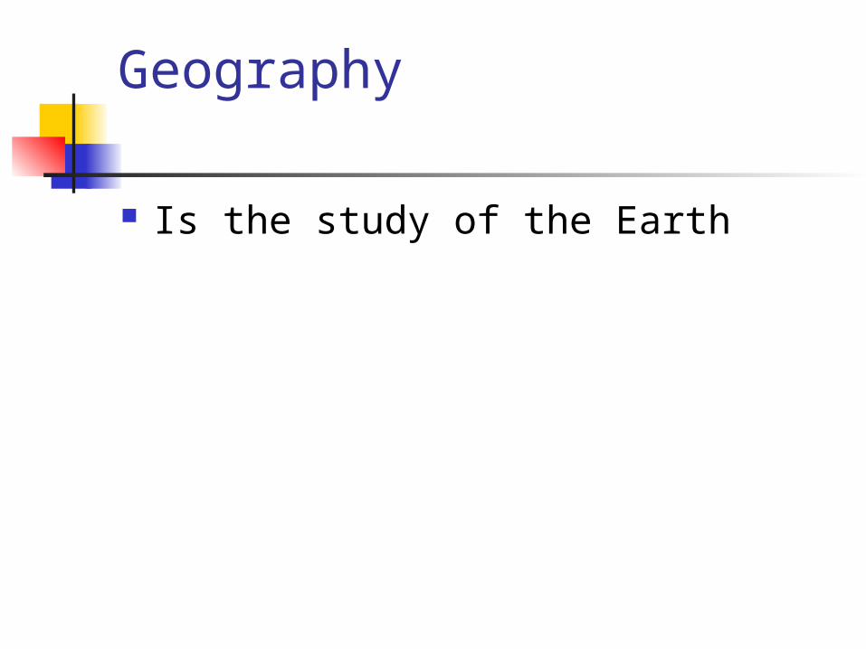
Geography
Is the study of the Earth

Geographers are guided by two basic questions: Where are things located??? Why are they there???

To find the answers, geographers use themes to organize information
Location: where a point exists Place: a location’s physical and human features Human Environment interaction: how people affect
their environment Movement: How goods, ideas, and people get
from one place to another Regions: Large areas that are linked by similar
characteristics

Location Absolute location
A places exact position on Earth (geographic address)
Uses latitude and longitude
Relative location Explains where a
place is by describing places near it.
“I live in Bismarck, 190 miles west of Fargo”

Location Lines of Latitude:
East-West circles around the globe Parallels:
Another name for lines of latitude, because they are parallel to one another
Degrees: Unit used to measure location on maps
Equator: A parallel in the middle of the globe

Location Lines of Longitude:
Lines that circle the globe from North-South
Meridians: Another name for lines of Longitude All run through the North and South Poles
Prime Meridian: Runs though Greenwich, England Is 0 degrees longitude

Latitude and Longitude Latitude
Measured North and South of Equator Longitude
Measured East and West of Prime Meridian (Greenwich, England)
Measured in degrees, minutes, seconds Degree - 69.1 miles Minute - 1.15 miles Second - 101 feet

Place Physical features
Climate - hot or cold Land is hilly
Human features How many people live there What these people do

Human - Environment Interaction How have people learned to survive in
the area? How do they deal with the environment? Are they helping or hurting the
environment?

Movement Helps people understand cultural
changes Goods and people move: bringing their
culture with them Immigrants to America

Regions Used to make comparisons Deserts, forests, plains, mountains Plain
A region of flat land

Section 2Section 2
The Geographer’s ToolsThe Geographer’s Tools
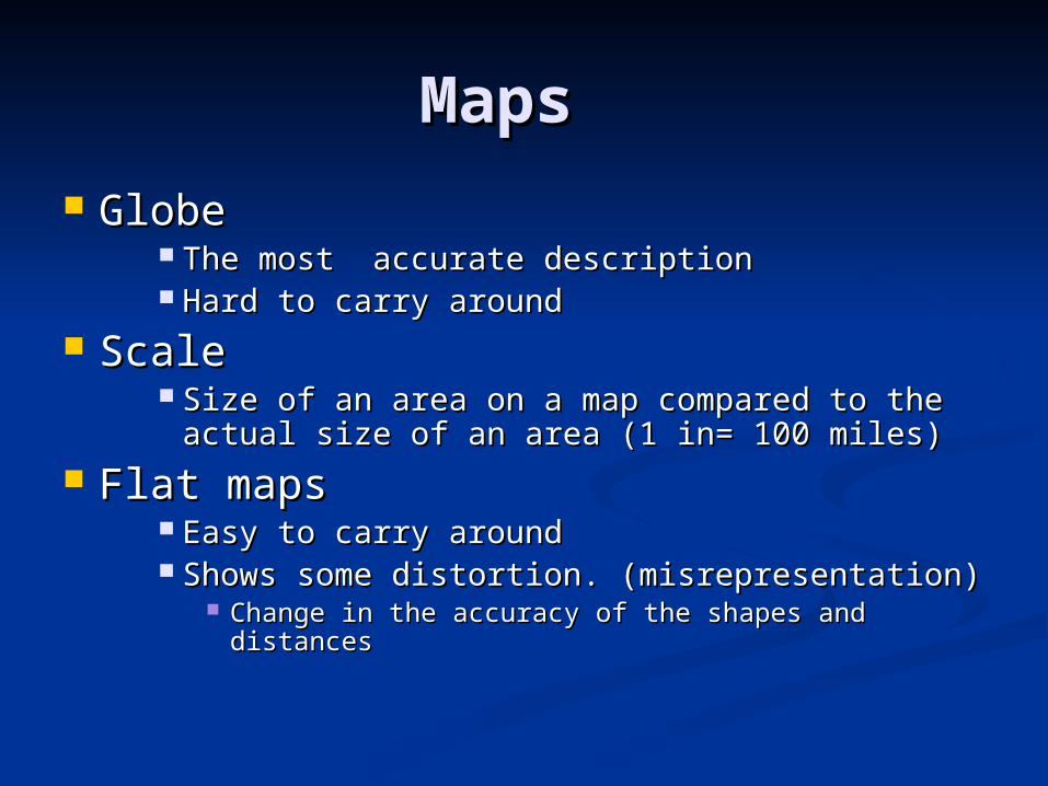
MapsMaps
GlobeGlobe The most accurate descriptionThe most accurate description Hard to carry aroundHard to carry around
ScaleScale Size of an area on a map compared to the Size of an area on a map compared to the
actual size of an area (1 in= 100 miles)actual size of an area (1 in= 100 miles) Flat mapsFlat maps
Easy to carry aroundEasy to carry around Shows some distortion. (misrepresentation)Shows some distortion. (misrepresentation)
Change in the accuracy of the shapes and Change in the accuracy of the shapes and distancesdistances

MapsMaps Projection - method of putting a map of the Projection - method of putting a map of the
Earth onto a flat piece of paperEarth onto a flat piece of paper Mercator ProjectionMercator Projection
Gerardus MercatorGerardus Mercator Flat map - used by sailorsFlat map - used by sailors Shows correct shapes of landmasses, but not true Shows correct shapes of landmasses, but not true
distances or sizesdistances or sizes
Robinson ProjectionRobinson Projection Arthur RobinsonArthur Robinson
Best world map availableBest world map available Distorted around the edgesDistorted around the edges WAS Official projection for National Geographic – WAS Official projection for National Geographic –
now Winkle Tripelnow Winkle Tripel

More MapsMore Maps
Interrupted projection mapInterrupted projection map ““Orange Peel”Orange Peel” Hard to figure distances correctlyHard to figure distances correctly
DistortionDistortion Flat maps distort land masses because Flat maps distort land masses because
the Earth is round.the Earth is round. Subject of a Map = TitleSubject of a Map = Title
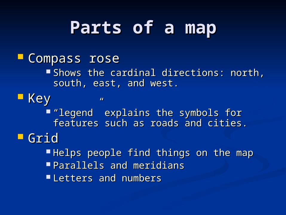
Parts of a mapParts of a map
Compass roseCompass rose Shows the cardinal directions: north, south, Shows the cardinal directions: north, south,
east, and west.east, and west. KeyKey
““legend” explains the symbols for features legend” explains the symbols for features such as roads and cities.such as roads and cities.
GridGrid Helps people find things on the mapHelps people find things on the map Parallels and meridiansParallels and meridians Letters and numbersLetters and numbers


![Chapter 1: Getting Started with Alteryx · Chapter 1 [ 42 ] Chapter 4: Writing Fast and Accurate. Chapter 1 [ 43 ] Chapter 1 [ 44 ]](https://static.fdocuments.in/doc/165x107/5e903c60f316447eb43c0e7a/chapter-1-getting-started-with-alteryx-chapter-1-42-chapter-4-writing-fast.jpg)