CARNARVON HARBOUR AND CHANNEL DREDGING …
52
DEPARTMENT OF MARINE AND HARBOURS CARNARVON HARBOUR AND CHANNEL DREDGING CONSULTATIVE ENVIRONMENTAL REVIEW 627.74(941) 111111111111 LEP I IIII VIIIII11111111111111 Copy A 910356/1 Department of Environmental Protection Library 0101 1 %6- LePro 'ost En viron mental Consultants
Transcript of CARNARVON HARBOUR AND CHANNEL DREDGING …
DEPARTMENT OF MARINE AND HARBOURS
CARNARVON HARBOUR AND CHANNEL DREDGING
CONSULTATIVE ENVIRONMENTAL REVIEW
627.74(941) 111111111111LEP I IIII VIIIII11111111111111
Copy A 910356/1
Department of Environmental Protection Library
01011%6-
LePro 'ost En viron mental Consultants
I
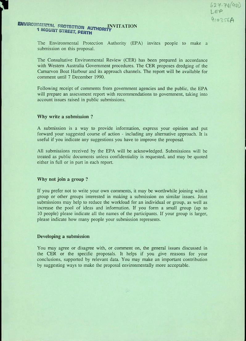
AUTH1 INVITATION 'I Ly STREET PERTH
The Environmental Protection Authority (EPA) invites people to make a submission on this proposal.
The Consultative Environmental Review (CER) has been prepai-ed in accordance with Western Australia Government procedures. The CER proposes dredging of the Carnarvon Boat Harbour and its approach channels. The report will be available for comment until 7 December 1990.
Following receipt of comments from government agencies and the public, the EPA will prepare an assessment report with recommendations to government, taking into account issues raised in public submissions.
Why write a submission ?
A submission is a way to provide information, express your opinion and put forward your suggested course of action - including any alternative approach. It is useful if you indicate any suggestions you have to improve the proposal.
All submissions received by the EPA will be acknowledged. Submissions will be treated as public documents unless confidentiality is requested, and may be quoted either in full or in part in each report.
Why not join a group?
If you prefer not to write your own comments, it may be worthwhile joining with a group or other groups interested in making a submission on similar issues. Joint submissions may help to reduce the workload for an individual or group, as well as increase the pool of ideas and information. If you form a small group (up to 10 people) please indicate all the names of the participants. If your group is larger, please indicate how many people your submission represents.
Developing a submission
You may agree or disagree with, or comment on, the general issues discussed in the CER or the specific proposals. It helps if you give reasons for your conclusions, supported by relevant data. You may make an important contribution by suggesting ways to make the proposal environmentally more acceptable.

When making comments on specific proposals in the CER:
clearly state your point of view;
indicate the source of your information or argument if this is applicable; and
suggest recommendations, safeguards or alternatives.
Points to keep in mind
By keeping the following points in mind, you will make it easier for your submission to be analysed:
attempt to list points so that the issues raised are clear. A summary of your submission is helpful;
refer each point to the appropriate section, or recommendation in the CER;
if you discuss different sections of the CER, keep them distinct and separate, so there is no confusion as to which section you are considering;
attach any factual information you wish to provide and give details of the source. Make sure your information is accurate.
Remember to include:
your name; address; and date.
The closing date for submissions is: 7 December 1990
Submissions should be addressed to:
The Chairman, Environmental Protection Authority, 1 Mount Street, PERTH WA 6000.
Attention: Mr. Ron Van Delft

CARNARVON BOAT HARBOUR AND CHANNEL DREDGING
CONSULTATIVE ENVIRONMENTAL REVIEW
Report to: Department of Marine and Harbours, Marine House, 1 Essex Street, FREMANTLE WA 6160.
by: LeProvost Environmental Consultants, Suite 2, 1st Floor, 175 Labouchere Road, COMO WA 6152.
5 November 1990
LEC Ref: J214
Report No. 324

LeProvost Environmental Consultants i
CARNARVON BOAT HARBOUR AND CHANNEL DREDGING
CONSULTATIVE ENVIRONMENTAL REVIEW
Table of Contents
SUMMARY iv
1 INTRODUCTION 1
1.1 This Document 1 1.2 The Proponent 2 1.3 Background 2 1.4 Proposed Development 2 1.5 Timing of Development 4 1.6 Responsible Authorities 4 1.7 Acknowledgments 4
2 NEED FOR DEVELOPMENT AND ALTERNATIVES CONSIDERED 5
2.1 Need for Development 5
2.2 Alternatives Considered 5
2.2.1 Introduction 5 2.2.2 Offshore Disposal of Dredge Spoil 5 2.2.3 Onshore Disposal of Dredge Spoil 6 2.2.4 'No Development' Option 6
3 DESCRIPTION OF THE ENVIRONMENT 7
3.1 Available Information 7
3.2 Physical Characteristics 7
3.2.1 Regional Setting 7 3.2.2 Climate 7 3.2.3 Oceanography 8 3.2.4 Geomorphology and Sediment Transport 8

LeP'-ovost Environmental Consultants ii
3.3 Biological Characteristics 9
3.3.1 Introduction 9 3.3.2 Marine Habitats 9
3.3.3 Avifauna 10 3.3.4 Ecosystem Condition 0 10
3.4 Social Characteristics 11
3.4.1 Brief Profile of Carnarvon 11 3.4.2 Fishing 11 3.4.3 Recreational Boating Use 12 3.4.4 Present Land Use and Zoning 12 3.4.5 Future Development 12 3.4.6 ConservationValue 13
4 ENVIRONMENTAL IMPACT ASSESSMENT AND MANAGEMENT 14
4.1 Introduction 14 4.2 Physical Environment 14
4.2.1 Water Quality 14 4.2.2 Sediment Movement and Stability 16 4.2.3 Hydrodynamics 16
4.3 Biological Environment 17
4.4 Social Environment 17
5 SUMMARY OF ENVIRONMENTAL MANAGEMENT COMMITMENTS9
6 CONCLUSION 20
7 REFERENCES 21

LeProvost Environmental Consultants iii
LIST OF FIGURES
1 Location Map 22
2 History of Dredging, Spoil Disposal and Land Clearing Activities 23
3 Proposed Dredging and Spoil Disposal Sites 24
4 Cross-sections of Dredge Spoil Area (Site 1) and Bund Wall 25
5 Carnarvon Proposed Fascine Development Concept A 26
6 Marine Habitat Assemblages 27
LIST OF PLATES
1 Aerial view of project site
LIST OF APPENDICES
1 Environmental Protection Authority Guidelines for the Consultative Environmental Review (CER)
2 Waterbird Usage of Tidal Mudflats on the Gascoyne Delta - Carnarvon
3 Glossary of Terms

LeProvost Environmental Consultants iv
SUMMARY
DESCRIPTION OF PROJECT
The Department of Marine and Harbours proposes to dredge the Carnarvon Boat Harbour and its approach channels.
The project will involve maintenance dredging of the outer approach channel to Teggs Channel and the Harbour entrance channel, and a small extension to the Harbour basin. Approximately 85,000 m3 of material will be dredged overall, comprised of some 40,000 m3 from Teggs Channel, 33,500 m3 from the Harbour entrance channel and 11,200 m3 from the proposed harbour extension area.
The approach channel to Teggs Channel will be realigned slightly to avoid a naturally prograding sandspit which currently causes sedimentation within the existing channel. This realignment is expected to decrease future requirements for maintenance dredging.
The existing Carnarvon Boat Harbour will be extended slightly by the excavation of a section of land in its north-east corner. The extension will be used to provide facilities for recreational boats which currently share the existing harbour area with fishing boats.
Dredge spoil will used to reclaim land at two locations (1.1 ha and 4.0 ha respectively) within the harbour lease boundary. Spoil material will be fully contained within bund walls that will be constructed to contain the fill, while directing the wash water away from mangrove and seagrass communities. The wash will discharge into the entrance waters of the Carnarvon Fascine and into the basin of the Carnarvon Boat Harbour.
DESCRIPTION OF ENVIRONMENT
The Carnarvon Boat Harbour is located on the southern boundary of the Gascoyne River delta. The hardstand areas surrounding the Harbour are built on reclaimed land that was constructed from dredge spoil when the Harbour was originally excavated.
The main marine habitats in the project area include high tidal mangrove and samphire salt flat; mid-tidal mangrove forest; low tidal sand and mud flat; subtidal seagrass meadows; and tidal sand bars and deep channels.
ENVIRONMENTAL IMPACTS AND MANAGEMENT PROGRAMME
The environmental impacts identified for the proposed dredging and spoil disposal operations, and the proposed mitigating measures to manage these impacts are summarised in Table 1.

LeProvost Environmental Consultants v
TABLE 1
POTENTIAL ADVERSE IMPACTS PREDICTED, PROBABILITY OF OCCURRENCE, PERCEIVED SIGNIFICANCE, AND PROPOSED MANAGEMENT PROGRAMME TO MITIGATE IMPACTS FOR
CARNAR VON BOAT HARBOUR AND CHANNEL DREDG1TG
POTENTIAL ADVERSE PROBABILITY PERCEIVED I
ENVIRONMENTAL IMPACTS OF IMPACT SIGNIFICANCE MANAGEMENT
OCCURRENCE OF IMPACT PROGRAMME AND COMMITMENTS
Some 4 ha of high intertidal sand Inevitable Low No action possible. fiat waterbird habitat will be lost.
Dredging will generate water Inevitable Low The effect will be transient. Local turbidity within the Harbour, waters are naturally turbid at entrance channel, Teggs Channel certain times of the year as a and adjacent waters, result of flood events, stormwater
runoff and wind mixing.
Wash water discharge from spoil High Low Wash water flow into the Fascine disposal may cause discolouration entrance will be directed away of Fascine waters, particularly from sensitive marine habitats. during incoming tides.
Dredge spoil disposal has the Low Low A supervisor will be on site potential to impact on nearby during construction to ensure that mangrove and seagrass communities the dredging works proceed as in the event of overtopping of, or a designed. The supervisor will breach in the bund wall. stop construction immediately if
this impact occurs.
Increased facilities and use of the Medium Medium A fuel and oil spill contingency Harbour as a resultof the proposed plan will be prepared for the expansion will increase the potential Carnarvon Boat Harbour. for oil and fuel spills to occur.
Noise emissions from construction Low Low Construction activity will be activity may affect nearby residents. confined to daylight hours, six
days per week. All dredging operations shall comply with the Noise Abatement (Neighbourhood Annoyance) Regulation 1979.

LeProvost Environmental Consultants 1
CARNARVON BOAT HARBOUR AND CHANNEL DREDGING
CONSULTATIVE ENVIkONMENTAL REVIEW
1 INTRODUCTION
1.1 THIS DOCUMENT
This document is a Consultative Environmental Review (CER) of a proposal to undertake maintenance dredging and limited expansion dredging of the Carnarvon Boat Harbour in Western Australia.
Guidelines for the CER have been provided by the Environmental Protection Authority (EPA) and are presented in Appendix 1. The structure of this CER broadly follows the structure outlined in those guidelines.
Section 1 of the CER introduces the proponent, outlines the background and history of the - project, describes the project in detail, the preferred timing of development and lists the
responsible authorities.
Section 2 discusses the need for the proposed works and evaluates possible alternatives.
Section 3 describes the existing physical, biological and social environment of the project area within a regional and local context.
Section 4 assesses the potential environmental effects of the proposed works on the environment and details the management programme proposed to mitigate and manage these impacts.
Section 5 lists the environmental management commitments made by the proponent to manage the impact, of the project.
Section 6 presents the major conclusions of the CER.
Appendix 1 presents the EPA guidelines for the preparation of this CER.
Appendix 2 presents the results of bird studies in the Carnarvon region undertaken by the Royal Australian Ornithologists Union.
Appendix 3 provides a glossary of scientific terms used.

LeProvost Environmental Consultants 2
1.2 THE PROPONENT
The proponent for the Carnarvon Boat Harbour and channel dredging works is the Department of Marine and Harbours (DMH). The dredging works will be undertaken by a contractor selected by DMH.
1.3 BACKGROUND
The town of. Carnarvon is situated within the southern part of the Gascoyne River Delta System (Fig. 1). The Carnarvon Boat Harbour is located adjacent to the ocean entrance of the South Arm (Carnarvon Fascine) of the Gascoyne River. The infrastructure supporting the Harbour is built on land reclaimed from the low-lying delta. A dredged channel connects the Harbour with the open waters of the ocean via Teggs Channel (Plate 1).
The Carnarvon Boat Harbour, harbour entrance channel and the outer approach channel to Teggs Channel were established in 1973. Spoil derived from excavation of the Harbour and harbour entrance channel excavation was used for land reclamation onshore to create hardstand areas for harbour facilities. Dredge spoil from the approach channel to Teggs Channel was dumped offshore.
During routine maintenance dredging, the outer approach channel is dredged across the northern end of a prograding subtidal sand spit. The natural tendency for this spit to reform, combined with the movement and re-deposition of the previously dredged material dumped adjacent to the channel, have resulted in siltation of this channel, and the requirement for maintenance dredging to be undertaken every 3-4 years. However, dredging at this frequency has been avoided by relocating channel markers and navigation aids. Maintenance dredging was carried out in the outer approach channel to Teggs Channel in 1979 and 1984, with the dredged spoil being disposed of into the adjacent waters to the north-west of Teggs Channel.
Figure 2 shows the location of areas modified as a result of previous harbour construction and maintenance activity.
Since the last period of maintenance dredging in 1984, sedimentation of both the approaches to Teggs Channel, and the harbour entrance has occurred to the extent that a navigation hazard now exists in both areas, particularly at low tides.
1.4 PROPOSED DEVELOPMENT
The project will involve the dredging of the outer approach channel to Teggs Channel, the harbour entrance channel, and the basin at Carnarvon Boat Harbour. The harbour lease area and the proposed dredging and spoil disposal areas are shown on Figure 3.
The approach channel to Teggs Channel will be realigned slightly from its existing position and dredged to a depth of -3.5 m below Chart Datum (CD) which is equivalent to

LeProvost Environmental Consultants 3
-2.7 m below Australian Height Datum (AHD). The realignment will significantly reduce the rate of sediment deposition that occurs in the existing channel, thus reducing the requirements for maintenance dredging. Navigation aids will be realigned to the new channel position.
The harbour entrance channel will be returned to its design depth of -3.0 m below CD (-2.2 m below AHD).
The existing Carnarvon Boat Harbour will be extended slightly by the excavation of a section of land in its north-east corner. The extension to the Harbour will be used to provide facilities for recreational boats which currently share the existing harbour area with the local fishing boats. This section will be dredged to a depth of -2.5 m below CD (-1.7 m below AHD).
Dredging will be undertaken by a small cutter-suction dredge. Approximately 85,000 m3 of material will be dredged overall, comprised of some 40,000 m3 from the approach to Teggs Channel, 33,500 m3 from the harbour entrance channel and 11,200 m3 from the proposed harbour extension area.
The material to be dredged consists of fine to medium sands from the approach to Teggs Channel and fine sands and silts from the harbour entrance channel and proposed extension area.
The dredge spoil will be pumped and spread on an area adjacent to Pickles Point, south-west of the Harbour and to an area north of the proposed extensions to the Harbour. These areas will total 4.0 ha (Site 1) and 1.1 ha (Site 2) respectively (Fig. 3). Bund walls will be constructed to contain the spoil material from the dredge discharge pipeline. Wash water from the spoil disposal areas will be directed away from mangrove and seagrass assemblages and will be discharged into the entrance waters of the Carnarvon Fascine and into the basin of the Carnarvon Boat Harbour.
The northern side of the Site 1 dredge spoil site will be shaped at the completion of spoil disposal to form a beach profile, thereby maintaining the character of the north shore of the harbour area. The southern side will be allowed to form at the natural angle of repose of the dredged spoil and thus naturally stabilise and blend into the existing shore.
A rise in sea level has been predicted as a result of global warming associated with the Greenhouse Effect. This would result in low-lying coastal terrain such as salt marshes, mud flats and lagoon margins being vulnerable to inundation, particularly in areas such as Carnarvon where flooding and Storm surge occur periodically. In consideration of existing storm surge levels and possible climatic changes associated with the Greenhouse Effect, Site 1 will be filled to a height of 3.0 m above CD (3.8 m above AHD) and Site 2 to a height of 2.5 m above 'CD (3.3 m above AHD). Cross-sectional views of the proposed dredge spoil area and bund walling at Site 1 are shown in Figure 4.
The dredge spoil areas will be used for future commercial purposes in aligning and integrating the Carnarvon Boat Harbour with the future development of Carnarvon. A

LeProvost Environmental Consultants 4
concept plan for the future development of the Carnarvon Fascine area including the Carnarvon Boat Harbour is shown in Figure 5. This plan has been prepared on behalf of the Shire of Carnarvon by DMH and is supported by the Shire, but as yet has no statutory authority.
The dredging and spoil disposal works proposed in this document will employ approximately six people for the duration of the works.
The proposed new channel alignment in Teggs channel will minimise future maintenance dredging requirements. There are several areas within the Harbour Reserve which will adequately cater for spoil disposal site requirements for the next few decades. In the longer term future alternatives will again be reviewed. If necessary dredge spoil will be stockpiled on a site within the Harbour Reserve for trucking elsewhere.
1.5 TIMING OF DEVELOPMENT
Dredging will be undertaken at a rate of approximately 240 m3/h. It is proposed that the dredge will operate six days per week for nine hours each day. At this rate, dredging of the estimated 85,000 m3 of material will take two to three months to complete.
Construction time is limited by the prevailing weather conditions. Dredging activity at Carnarvon should be undertaken between March and September to avoid long periods of down time caused by cyclonic weather conditions, typical of the summer season. Consequently it is proposed to commence construction activity in March 1991.
Construction of additional harbour facilities on the dredge spoil areas will proceed in the future as required, and will be the subject of a separate report.
1.6 RESPONSIBLE AUTHORITIES
The Department of Marine and Harbours will be responsible for all aspects of the management of the proposed dredging and spoil disposal works.
1.7 ACKNOWLEDGMENTS
This report was produced by LeProvost Environmental Consultants (LEC) in collaboration with officers of the Department of Marine and Harbours. The Royal Australian Ornithologists Union contributed a report of bird usage of the Carnarvon delta which is included as Appendix 2 to this report.

LeProvost Environmental Consultants 5
2 NEED FOR DEVELOPMENT AND ALTERNATIVES CONSIDERED
2.1 NEED FOR DEVELOPMENT
Sedimentation in the outer approach channel to Teggs Channel and in the entrance channel to the Carnarvon Boat Harbour is causing a navigation hazard to boats. Fishing boats have been damaged on occasions from running aground on the shallower sections. Some local professional fishing operators have threatened to relocate their businesses unless the channels are restored to a safe navigable condition.
Mooring space within the existing Carnarvon Boat Harbour is limited, causing congestion and conflict between recreational boat users and the local fishing fleet. The proposed extensions to the harbour will enable facilities for recreational boats to be separated from the commercial users of the Harbour.
2.2 ALTERNATIVES CONSIDERED
2.2.1 Introduction
There is no alternative to the proposed maintenance dredging other than the 'no development' option. However, two options are available for the selection of the spoil disposal areas. These are:
offshore; and
onshore.
2.2.2 Offshore disposal of dredge spoil
There are a number of disadvantages associated with offshore dredge spoil disposal. These are:
economical disposal adjacent to Teggs Channel as has occurred previously returns to the channel, thereby increasing the requirement for maintenance dredging;
it is not economically viable to pump the dredge spoil to offshore disposal sites located such that the material does not contribute to channel siltation; and
spoil provides a good economical source of fill material which is in short supply in Carnarvon. Offshore disposal would waste this valuable resource which is required for integrating the existing Carnarvon Boat Harbour with the future development of the Town of Carnarvon.
LeProvost Environmental Consultants 6
2.2.3 Onshore disposal of dredge spoil
Pumping constraints exist on the length of the pipeline for the envisaged dredge which can be used for dredge spoil disposal. Hence the location of spoil disposal sites is to a large extent governed by the location of dredging.
Pelican Point, which is on the southern end of Babbage Island, is within the boundary of the pipeline limit. Spoil disposal in the vicinity of Pelican Point does not meet the need to align and integrate the Carnarvon Boat Harbour with the. future development of Carnarvon. Further addition of material to the southern end of Babbage Island may add to the material that is already being deposited in the Fascine entrance channel.
The proposed Site 1 spoil disposal site (Fig. 3) is at the limit of the dredges pumping capacity when dredging the approaches to Teggs Channel. This site is ideally located for the harbour entrance channel dredging. Its use will minimise inconvenience to local users of the harbour in that no barrier to passage will be created by the disposal pipeline.
The proposed Site 2 spoil disposal site (Fig. 3) is located on previously cleared land adjacent to the harbour basin for the provision of future services for the recreational component of the harbour. As such. it cannot be located elsewhere.
The two proposed spoil disposal sites are located both within the harbour lease boundary and within boundaries of land proposed for eventual reclamation as part of the overall Proposed Fascine Development Concept for Carnarvon (Fig. 5).
2.2.4 'No Development' Option
Failure to undertake the proposed dredging works will result in the Harbour and connecting channels becoming completely inaccessible to boats. This will be detrimental to commercial fishing operators and recreational boat users in Carnarvon. It will also disadvantage Carnarvon if the commercial fishing fleet relocate their operations to Geraldton as threatened.

LeProvost Environmental Consultants 7
3 DESCRIPTION OF ENVIRONMENT
3.1 AVAILABLE INFORMATION
The Camarvon area, including the project site for th Camarvon'B oat Harbour and Channel Dredging works, has been examined in several detailed studies. These include a flora and vegetation survey by Keating and Trudgen (1987), a study of siltation in Teggs Channel by DMH (1987), a planning study for Babbage Island by the Department of Land Administration (DOLA) (1988) and a pre-development study for the Carnarvon Fascine Development by DMH (in prep). A study of waterbirds in the Camarvon region has been undertaken by the Royal Australian Ornithologists Union (RAOU) and is included in Appendix 2.
In addition, a number of field surveys and site visits have been undertaken by DMH, including a drogue tracking exercise and a study of sedimentation and coastal processes.
This description of the environment is based mainly on a desk review of available aerial photography and documented information by LEC. A brief site inspection has also been undertaken by LEC.
3.2 PHYSICAL CHARACTERISTICS
3.2.1 Regional Setting
The Gascoyne delta is situated on a semi-arid, wave-dominated coast at the northern end of Shark Bay. It has a lobate form approximately 9 km across and is flat, sparsely vegetated country interrupted only by the Brown Range, a north-trending series of red-brown dunes up to 10 m high. The seaward edge of the delta is a strand plain, up to 1 km wide, of elongate lagoons and mangrove tidal flats separated by beach spits and low beach ridges (Johnson, 1982).
3.2.2 Climate
Climatic data on the Shark Bay region have been summarised by Logan and Cebuiski (1970). The climate is semi-arid. Rainfall is variable and often occurs as sporadic heavy showers. The average annual minimum temperature is 17°C; the maximum is 27°C; the hottest month is February and the coolest is July. During summer the dominant winds are strong, persistent southerly breezes averaging 5-8 m/s. During winter the average wind speed drops to 3-4 m/s with extended calm periods. The area is subject to summer cyclones when winds of 20-30 m/s, gusting to 50 m/s may persist for 12 hours. If a cyclonic depression moves inland, heavy rain follows, often resulting in widespread flooding (Logan & Cebulski, 1970).

LeProvost Environmental Consultants 8
3.2.3 Oceanography
Tides at Carnarvon are mixed. Neap tides are diurnal with a range of 0.3 m, and spring tides are semi-diurnal with a recorded range of 0.9 m (Department of Defence, 1988). Available information regarding tides at Carnarvon is currently under review. The range of neap tides has been established to be 0.46 m and spring tides 0.95 m (Wallace, DMH, pers. comm. 1990). Tidal currents flood southwards and ebb northwards (Logan & Cebuiski, 1970).
At Carnarvon the dominant south-westerly wind-generated waves impinge on a north and north-north-west-trending coast. Hence the dominant longshore currents are northward and, reinforced by ebb tidal currents, cause strong northward littoral drift (Johnson, 1982). However southward littoral drift can be induced by cyclone-generated waves from the north, or long period swell refracted around the offshore islands.
Tropical cyclones have the greatest potential for causing serious storm surge at the mouth of the Gascoyne River. The water level, in Carnarvon, for a 1:100 year extreme storm event has been predicted to reach 0.9 m above CD (1.7 m above AHD) (Wallace & Boreham, 1988).
3.2.4 Geomorphology and sediment transport
The harbour has been constructed within a sand bank formed by gradual deposition of hinterland sediments as the delta has grown seaward over time. On the seaward side, the bank has been colonised by mangroves and finer sediments have been incorporated into the soil profile. The bank was originally low lying and would have flooded during high tides and periods of river flow. Construction of the harbour in 1973 raised land levels on the bank above the influence of tides and most floods.
Closure of the South Arm of the Gascoyne River Delta by an embankment in 1987 means that this bank no longer receives fluvial input of sediments, nor is it flooded during river flow. The main land shaping forces now acting on the bank are the marine derived forces of swell, tide and wind induced waves.
Recent studies of offshore sediment movement (DMH, 1987) indicate that the closure of the South Arm of the river, coupled with the predominant sea' and swell directions from the south-south-west, and westerly directions has resulted in a predominant nett northerly sediment movement pattern. Cyclones and storms from the north-west can cause short term reversal of sediment transport to the south.

LeProvost Environmental Consultants 9
3.3 BIOLOGICAL CHARACTERISTICS
3.3.1 Introduction
Little information is available on the biotic character of the proposed dredging and spoil disposal locations. The following description is based on analysis of recent colour aerial photography, and a brief site reconnaissance visit.
3.3.2 Marine Habitats
The main marine habitat types which occur within the project area are as follows:
high tidal mangrove and samphire salt flat;
mid-tidal mangrove forest;
low tidal sand flat
subtidal seagrass meadows;
subtidal sand bar and spit; and
deep subtidal channels.
The approximate distribution of the above habitat types is shown in Figure 6. The habitat assemblages which are directly affected by the proposed dredging and land eclamation project are:
high tidal mangal salt flat;
low tidal sand flat; and
subtidal sand bar.
The biotic characteristics of these habitats are described in the following sections.
3.3.2.1 High tidal mangrove and samphire salt flat
This habitat is only inundated during high spring tides. It supports sparse stunted Avicennia mangroves and salt marsh (Sarcocornia sp.). Fiddler and grapsid crabs (Uca and Sesarina sp., respectively) inhabit this assemblage. Grazing molluscs such as creepers (Cerithid sp. and Terebralia sp.) also occur around the base of mangroves.

LeProvost Environmental Consultants 10
3.3.2.2 Low tidal sand flat
This habitat is exposed only during low tides. It supports mainly a burrowing infauna of crabs (fiddler and sand bubbler), worms and molluscs such as moon snails (Polinices), volutes and dog whelks. These habitats are frequented by wading birds who forage and loaf on such areas.
3.3.2.3 Subtidal sand bar
These habitats are slowly mobile and tend to support little epibiôta. Burrowing molluscs and demersal fish such as flathead, mullet, flounder and whiting tend to form the main biotic component.
3.3.3 Avifauna
The tidal flats of the Gascoyne delta are frequented by wading birds which migrate along the coastline. However, limited information is available on the waterbird usage of these tidal flats. The results of bird counts in the Gascoyne delta area by RAOU are presented in Appendix 2.
During RAOU bird surveys, around 1,300 migratory shorebirds have been found to be using the low tidal sand flat adjacent to Pickles Point (Figure 5) which includes part of the proposed dredge spoil disposal area (Site 1). Anecdotal information suggests, however, that up to 4,000 migratory waders use the tidal flats in the area between Pickles Point and Mangrove Point (Appendix 2).
3.3.4 Ecosystem Condition
As indicated in Section 3.2.4, the project area is not in pristine unmodified, condition (Plate 1). Both previous harbour construction and land reclamation plus the closure of the South Arm of the Gascoyne River and land reclamation for the suburb of Brockman have modified local hydrodynamics and natural habitats.
Operation of the commercial harbour facilities has the potential to affect local water quality at times through accidental fuel spillages and perhaps through groundwater seepage of wastewater. The potential for such impacts is minimised by the harbour wastewater management policy.
Sewage disposal from buildings and public facilities within the Harbour is by means of individual septic tanks. When required, the contents of the septic tanks are mechanically pumped into road tankers and removed from the Harbour.
Rain and stormwater runoff into the basin of the Carnarvon Boat Harbour is minimal as a result of the high porosity of the natural ground materials. These sands readily soak up

LeProvost Environmental Consultants
most of the annual rainfall. Runoff from buildings is directed into soak wells or is allowed to disperse naturally. No stormwater pipes discharge directly into the basin of the Harbour. Drainage traps are inst?1led in the boat maintenance area and slipway to prevent oil or fuel spills from entering the Harbour.
No data exist to confirm the adequacy of the management policy.
The proposed harbour extension and 1.1 ha spoil disposal area (Site 2) adjacent are located on land previously cleared during the original harbour construction. The proposed 4 ha reclamation area (Site 1) on Pickles Point occurs on a previously undisturbed sand flat habitat. However, the extent to which this area has been indirectly modified as a result of changes to the local hydrodynamics from nearby dredging activities and the closure of the South Arm of the Gascoyne River is unknown.
3.4 SOCIAL CHARACTERISTICS
3.4.1 Brief Profile of Carnarvon
European settlement of the Gascoyne River delta began in the 1870s and the town of Carnarvon was gazetted in 1883. The town was originally developed as a port for shipping livestock and wool from pastoral stations in the region. Horticulture, fishing, mining and tourism have since developed to form a broad industry base for the town.
Approximately 7200 people live in the Carnarvon Shire, of which some 75% live in the town (Department of Regional Development & the North West (DRDNW), 1988). The population is multicultural. It is estimated that 20% of the town's population are Aboriginal people, and many immigrants have settled in Carnarvon from the United Kingdom, Yugoslavia, Italy and Portugal.
3.4.2 Fishing
The Gascoyne fishing industry was valued at $27 million in 1984 and contributed about 3.7% to direct employment (DOLA, 1988). The main professional fisheries operating in the Carnarvon area are for prawns, rock lobsters, scallops and snapper. Approximately 35 fishing boats use the Carnarvon Boat Harbour all year round. However, up to 70 fishing boats use the Harbour during the peak fishing season.
Fishing is a popular recreational pursuit for the people of Carnarvon. Fishing is conducted from boats in offshore areas, and by shore-based anglers primarily from the Carnarvon Jetty.
LeProvost Environmental Consultants 12
3.4.3 Recreational Boat Use
The Harbour is primarily for the use of commercial fishing vessels, with only limited and temporary use by recreational vessels. At present the Harbour provides mooring facilities for some 20 recreational vessels. A launching ramp is provided in the northern corner for the launching of small recreational vessels which is used by both the local population and visitors to Carnarvon. These vessels are used primarily for recreational fishing purposes. However, during the year up to 100 additional recreational vessels visit the Harbour mainly for refuelling and for rest and shelter.
All recreational boating facilities are shared with the commercial fishing vessels. The proposed extension of the basin of the Carnarvon Boat Harbour will provide additional recreational facilities and help alleviate some of the problems associated with sharing facilities.
The future demand for recreational boating facilities in the Camarvon Boat Harbour will be determined by the trends in demand for boating, both overall in Western Australia and specifically in Carnarvon. The proposed extension addresses only the immediate short-term demand and will provide moorings for approximately 20 vessels. The Fascine predevelopment study has identified a longer term requirement for 60 pens and recommends the existing basin be extended (see Fig. 5) (DMH, in prep.).
3.4.4 Present Land Use and Zoning
The harbour is currently zoned for "Public Purposes" and individual lots within the harbour complex are zoned for "General Industry". The Harbour Lease Site (Fig. 3) is reserved for "Harbour Purposes" and is managed by DMH.
3.4.5 Future Development
The town of Carnarvon is constrained in size by a lack of readily developable land. This constraint has long been recognised by the Shire of Carnarvon who have commissioned studies into future planning and land use directions for the town (DRDNW, 1988). These studies have focussed attention on the Fascine, and Babbage and WhitlOck Islands as being the resource around and on which future development should take place. To this end, DOLA (1988) undertook a study of the land capability and conservation values of Babbage and Whitlock Islands and identified areas suitable for various land uses. Subsequently the Council, through DMH have commissioned a development concept for the Fascine area which is aimed at improving the utility, aesthetics and recreational use of the Fascine. This development concept is the subject of a separate Public Environmental Review from which Fig. 4 of this report has been obtained. Improvement and extension of the harbour area and its northern foreshore are integral parts of the development concept.

LeProvost Environmental Consultants 13
3.4.6 Conservation Value
There are no designated conservation reserves within the immediate study area. Proposals to conserve mangrove and samphire areas of Babbage and Whitlock Islands are contained within both the DOLA (1988) and DMH (in prep.) reports. Furthermore, the proposed Shark Bay Marine Park boundary extends close to the southern boundary of the Carnarvon townsite. This Park, if proclaimed, will conserve large areas of subtidal seagrass banks, mangroves and high tidal mud flats and therefore, the types of shallow marine habitats which occur within the immediate project area are likely to be protected elsewhere in the region.
Nevertheless, these habitats are recognised as performing useful roles as sources of nutrients and shelter for nearshore marine ecosystems. Intertidal flats are also extensively used by migratory wading birds for feeding (Appendix 2).
As such, the marine habitats of the project area do have local value from an ecosystem maintenance perspective.
Australia is obliged to ensure measures for the preservation of migratory wading birds and their habitats as identified in the Agreement between the Government of Australia and the Government of Japan for the Protection of Migratory Birds in danger of extinction and their environment 1974 and the Agreement between the Government of Australia and the Government of the People's Republic of China for the Protection of Migratory Birds and their Environment 1986. Under these treaties the governments of each country are obliged to prohibit the taking of migratory birds and their eggs, encourage research and exchanges of data, establish sanctuaries and undertake measures to preserve and enhance the environment of migratory birds.

LeProvost Environmental Consultants 14
4 ENVIRONMENTAL IMPACT ASSESSMENT AND MANAGEMENT
4.1 INTRODUCTION
The environmental impact assessment is based on information gathered from:
a field survey of Whitlock and Babbage Islands, and the Camarvon Fascine undertaken by LEC (1990);
review of available literature and information; and
discussion with relevant local authorities (i.e. Carnarvon Town Council and the Department of Marine and Harbours).
The main environmental effects of the proposed development will be:
water turbidity during dredging; and
habitat loss and modification.
Further detail on these effects and proposed mitigating measures to manage these effects is provided in the following sections.
4.2 PHYSICAL ENVIRONMENT
4.2.1 Water Quality
4.2.1.1 Dredging
The dredging operations associated with. the construction phase of the development will generate water turbidity within the Carnarvon Boat Harbour, entrance channel and adjacent waters. This will be a temporary condition and waters should return to background turbidity concentrations soon after completion of the dredging. Turbidity arising from dredging in the Harbour entrance channel is unlikely to adversely affect seagrass populations in the adjacent waters.
Prior to the construction of the flood control levee across the South Arm of the Gascoyne River, this stretch of water would have been highly turbid during previous periods of river flooding. Hence, short-term periods of increased water turbidity were not an uncommon event in the water body and, as such, the associated marine assemblages are likely to be adapted to these events. The turbidity arising for the spoil disposal work may in fact generate less impacts than that associated with previous flooding since the salinity of the water body will not change. Previous flooding impacts would have resulted from

LeProvost Env iron mental Consultants 15
freshwater discharge, sediment abrasion and smothering as well as increased water turbidity. The impacts of the proposed dredging and spoil disposal are therefore likely to be relatively benign in comparison.
4.2.1.2 Spoil disposal
The dredge spoil for both disposal sites will be contained by bund walls.
For Site 1 (Fig. 3), a bund wall will initially be developed along the southern face of the reclamation site by progressive extension of the discharge pipe, with wash waters flowing across the Pickles Point intertidal zone towards the Fascine Entrance and away from existing mangrove and seagrass communities. During subsequent deposition to the north of the bund, wash waters will flow into the Fascine entrance waters. The bund will both contain the solids, and direct the wash water into the Fascine entrance. If required, stop boards and/or flow directors will be used initially to direct sands and silts away from mangrove and seagrass communities.
It is anticipated that the initial bund wall and most of the subsequent fill will come from the offshore approaches to Teggs Channel. The material will comprise mainly of fine to medium sands with minimal silt. Water turbidity is therefore unlikely to be intense during this dredging exercise. Fine sands and silts will be encountered mainly in the harbour entrance and proposed extension.
The effects of tidal movements and wind mixing will rapidly dilute and disperse the wash waters with the Fascine waters. However, wash water will cause short-term discolouration of the Fascine. This condition will be of about two months duration and will not have an adverse impact upon marine assemblages.
For Site 2 (Fig. 3), bunding will be constructed from on-site material prior to dredge discharge. The bunding will contain the solids and direct the wash water back into the Harbour. The combined effects of dredging and wash water discharge will result in discolouration of the harbour waters. This is not expected to cause any adverse impact on adjoining mangrove assemblages or harbour bottom assemblages.
4.2.1.3 Fuel and oil spills
Increased use of the Harbour associated with the expansion of the basin area and harbour facilities will increase the potential for oil and fuel spills and wastewater discharge to occur within the Harbour. Experience has shown that the types of oil products used in the Harbour, e.g. diesel fuel, have little or no impact on marine ecosystems except when released in large voltimes. However, a fuel and oil spill contingency plan for the Carnarvon Boat Harbour will be prepared by the proponent. This will incorporate a management strategy for pollutants such as sewage, fishing wastes and plastics, in addition to fuel and oil spills.
LeProvost Environmental Consultants 1 16
4.2.1.4 Drainage and wastewater disposal
Stormwater drainage from the land north-east of the Harbour (Site 2) currently flows eastward and filters through mangrove communities into the ocean. The reclaimed area will drain to the Harbour and adjoining natural surrounds.
The spoil disposal sites will be developed at a future date for extensions to the existing harbour facilities. Drainage and wastewater disposal will be in accordance with Water Authority and Shire of Carnarvon regulations.
4.2.2 Sediment Movement and Stability
The realignment to the outer approach channel will significantly redu' e sedimentation within the channel and hence reduce the requirement for frequent maintenance dredging. A study of siltation in Teggs Channel was undertaken by DMH (1987). The approximate annual rate of siltation within the area of Teggs Channel that was last dredged in 1984 was 27,000 m3/y. Results from drogue tracking indicate that the natural flow out from Teggs Channel is in a north-westerly direction. Maintenance dredging can be minimised by ensuring that the dredged approach channel is closely aligned with tidal flow paths. Charts prepared at the turn of the century indicate that a natural channel (Yule Creek) did exist in the area of concern. This supports the theory that the Teggs Channel alignment should continue further in a north-westerly direction before turning west. On this basis it is estimated that further maintenance dredging in Teggs Channel and the harbour entrance channel will not be required for at least 5-6 years.
The spoil disposal areas will be stable. Site 1 is protected from wave attack from the south by the sand bar immediately adjacent to Teggs Channel, and from the west by the southern end of Babbage Island. Previous land reclamation in this area has proved stable. Similarly Site 2 will remain stable.. Bund walls will be fully maintained during construction to ensure stability and will ultimately form part of the stable reclaimed area. The spoil sites will be stabilised with vegetatiOn to prevent wind erosion and any possible dust problems.
4.2.3 Hydrodynamics
Reclamation of the low tidal sand flat adjacent to Pickles Point will not impact upon the hydrodynamics of the Fascine. The vast majority of water entering or leaving the Fascine passes through the channel immediately adjacent to the southern end of Babbage Island. This channel has been maintained by natural processes despite changes to the size and location of the adjacent spit.

LeProvost Environmental Consultants 17
4.3 BIOLOGICAL ENVIRONMENT
The main impact of the proposed dredging and spoil disposal works will be the loss of 4 ha of intertidal sand flat and associated biota. The remaining marine habitats and assemblages in the vicinity of the harbour will not be adversely affected by the proposed dredging and spoil disposal works. The proposed bunding arrangements will ensure that spoil material is contained and that wash water disposal is controlled.
Loss of 4 ha of intertidal sand flat from the area between Pickles Point and Mangrove Point will reduce the local availability of this habitat for migratory wading birds (Plate 1). The regional significance of this particular area is unknown as bird counts for similar habitats elsewhere have not been undertaken.
The local significance of the proposed spoil site is unclear as bird counts in the area between Pickles Point and Mangrove Point have not determined the exact waterbird usage of the proposed spoil site. Planimetric analysis of aerial photographs indicate the intertidal sand flat area between Pickles Point and Mangrove Point to total some 30 ha. Thus the proposed dredge spoil site represents some 13 % of that intertidal area.
From analysis of aerial photographs it is apparent that there are considerable areas of intertidal sand flat within the Gascoyne delta and south of Carnarvon. Given the poor data record, the relatively low numbers (1,300) of birds recorded in the area between Pickles Point and Mangrove Point (Appendix 2) and the relatively small percentage of this area that would be modified by the proposed spoil disposal, it is most unlikely that the effect of spoil disposal can be accurately determined. Furthermore, the proposed marine park in Shark Bay should provide adequate conservation of this type of habitat in the region.
4.4 SOCIAL ENVIRONMENT
Dredging and spoil disposal operations will generate minor noise emissions. Due to the distances between the harbour and residential areas, it is unlikely that nearby residents will be adversely affected. However it is proposed that dredging be confined to daylight hours only to minimise any noise impacts generated by the works on nearby residents. All dredging operations shall comply with the Noise Abatement (Neighbourhood Annoyance) Regulations 1979.
Discharge of wash water into the entrance channel of the Carnarvon Fascine will result in discolouration of the Fascine waters, particularly on incoming tides during spoil disposal operations. This impact will be of short duration only and the extent of water discolouration will be considerably less than that experienced locally during flood events in the Gascoyne River. Residents are therefore unlikely to be concerned.
Dredging operations in the outer approach channel to Teggs Channel and in the harbour entrance channel have the potential to interfere with boat access between the Harbour and the ocean. Dredging operations will be planned to facilitate continuous boating access to the Harbour wherever possible. Small draft boats will circumnavigate the dredge. Larger
LeProvost Environmental Consultants 18
boats which have to use the channel, will have to wait for a time convenient to the dredge to enter or exit the Harbour.
Notices detailing. the dredging programme will be distributed around the Harbour, indicating periods when the channel may be temporarily inaccessible to boat users. The dredge will be equipped with VHF radio to allow communication between the dredge, Port Officer and boats entering or leaving the Harbour.
The realignment of Teggs Channel will require adjustment to the position of the existing navigation aids. During dredging works, navigation aids will be maintained to allow safe use of the channels.
The proposed dredging project will result in benefits to the local community. Maintenance dredging in the outer approach channel to Teggs Channel and the harbour entrance channel will improve boating access to the Camarvon Boat Harbour. The proposed extension to the existing harbour will improve recreational boating facilities for local residents and reduce congestion within the harbour.
The reclaimed land will be developed in the future to- provide additional facilities for users of the harbour.
Proposed conservation areas within the vicinity of the proposal will not be adversely affected. The mangrove communities adjacent to -the project area which provide an - aesthetically attractive approach to the harbour will also not be adversely affected by the proposal. •

LeProvost Environmental Consultants 19
5 ENVIRONMENTAL MANAGEMENT COMMITMENTS
The proponent makes the following commitments in order to manage the potential environmental impacts of the proposed Carnarvon Boat Harbour and Channel Dredging and spoil disposal works.
Construction activity will be confined to daylight hours, six days per week to minimise possible noise impacts on nearby residents.
Dredging operations will be planned so as to allow the various fishing boats using the harbour to enter and exit the Harbour.
Dredge spoil will be contained within bund walls to prevent smothering of mangroves and other marine assemblages outside the proposed dredge spoil areas.
Wash waters will be directed away from existing mangrove and seagrass communities. At Site 1, the wash water will flow into the Fascine entrance waters while at Site 2, the flow will be directed into the basin of the Harbour.
A supervisor will be on site during construction to ensure that the dredging works proceed as designed.
The final floor levels of the dredge spoil areas used for harbour infrastructure will be above the 1:100 year flood level, with an additional allowance for a possible sea level rise associated with the Greenhouse Effect.
The northern side of the Site 1 dredge spoil area will be shaped to form a beach profile to maintain the character of the north shore of Pickles Point. The southern side will be allowed to form at the natural angle of repose so as to naturally stabilise and blend into the existing shore.
The spoil sites will be stabilised by vegetation to prevent wind erosion and any dust problems.
A fuel and oil spill contingency plan for the Carnarvon Boat Harbour will be prepared within six months of the dredging works in consultation with the EPA.
Monitoring of sediments and navigable depth in the newly aligned channel will be carried out on an annual basis by DMH.

LeProvost Environmental Consultants 20
6 CONCLUSION
It is considered that the proposed development can be undertaken with minimal adverse environmental impacts.
The main impact of the proposal is the loss of 4 ha of intertidal sand flat and associated biota. However, given that this habitat is not in short supply in the region, and that proposals exist for the conservation of this habitat within the vicinity of the project area, its loss is unlikely to threaten the population of biota currently utilising the site. The proposal also increases the potential for reductions in local water quality as a result of increased usage of the harbour and associated facilities. The proponent will minimise this potential impact by preparing a harbour management and contingency plan to the satisfaction of appropriate authorities.
The proposal will benefit the Town of Carnarvon and the commercial fishing fleet who operate from the harbour. It will also improve the social amenity of the Harbour by the addition of recreational boating facilities, and by reducing congestion at existing facilities.
Therefore the proposal is considered to be environmentally responsible and approval to proceed according to the commitments contained within this document is requested.
LeProvost Environmental Consultants 21
7 REFERENCES
Department of Defence (Navy. Office), 1989. Australian National Tide Tables 1990. Australian Hydrographic Publication No.11. Australian Government Publishitig Service, Canberra, Australia.
Department of Land Administration (DOLA), 1988. Babbage Island Carnarvon Planning Study September 1988 Draft Report. Department of Land Administration, Perth, Western Australia, 73 pp.
Department of Marine & Harbours, 1987. Carnarvon Teggs Channel Siltation Investigation. Report No. DMH HO 3957, N. Siragusa, Department of Marine & Harbours, Fremantle, Western Australia.
Department of Marine & Harbours, in prep. Carnarvon Fascine P redevelopment Study. Report No. DMH D2/90, Department of Marine & Harbours, Fremantle, Western Australia.
Department of Regional Development & the North West in association with the Shire of Carnarvon, 1988. Carnarvon Future Directions, A Development Strategy for the Town of Carnarvon. Department of Regional Development & the North West, Perth, Western Australia, 40 pp.
Johnson D.P., 1982: Sedimentary facies of an and zone delta: Gascoyne Delta, Western Australia. Journal of Sedimentary Petrology 52(2): 547-563.
Keating C. & Trudgen M., 1987. A Flora and Vegetation Survey of Babbage Island and Whitlock Island (Carnarvon, WA.). Unpublished report prepared for the State Planning Commission, Western Australia, 41 pp.
LeProvost Environmental Consultants, 1990. Carnarvon Fascine Development Constraints Study. Unpublished report to the Department of Marine & Harbours. Report No. R283, LeProvost Environmental Consultants, Perth, Western Australia.
Logan B.W. & Cebulski D.E., 1970. Sedimentary environments of Shark Bay, Western Australia. In: Logan, B.W. (ed.), Carbonate Sedimentation and Environments, Shark Bay, Western Australia. American Association of Petroleum Geologists Memoir 13: 1-37.
Wallace D.F. & Boreham P. 1988. Prediction of Extreme Water Levels due to Storm Surge at Denham. In: Department of Marine & Harbours, 1990, Carnarvon Fascine Predevelopment Study. Report No. DMH D2/90, Department of Marine & Harbours, Fremantle, Western Australia.

LeProvost Environmental Consultants 22
I.................. 4 ..................................... ::::::113° 39E
NORTH ....._-!,_ ..... .... .... ..../ •'.l /
Whitmore isIand G a SC o
I .......................................... .1
Carnarvon Jetty
Jetty . . .
Island
:\
Pelican PointL :::: : : :: . ..
Indian 24 54S °—
LL
Mangrove Point A Jetty
0 c e a n CARNARVON BOAT HARBOUR
0 2km
CARNARVON BOAT HARBOUR AND CHANNEL DREDGING Figure
LOCATION MAP I
AMS IDate:9190
J214 R324

NORTH
500m
flqOA
24 55'S
- CARNAR VON BOAT HARBOUR AND CHANNEL DREDGING Figure
HISTORY OF DREDGING, SPOIL DISPOSAL 2 AND LAND CLEARING ACTIV'TIES
Auth AMS jOate 9/90
11 3 40'E
Carnavon
Fa8cjne
Point
Dredge spoil disposal are 1973, 1979 and 1984 I /
73
Outer approach channel dredged in 1973. 1979 and 1984
Mangrove Point
REFERENCE
ME Dredged area
8poli disposal site
12 Cleared land
Spoil diapoaai in 1973]

LeProvost Environmental Consultants
Babbage Island
N
000/,
rbourL:ea
Carnarvon
Pelican POintFascine
NORTH
: I Dredge apoll aret L(4.3ha) (Site 1)
I n d i a n
0 C e a n
E
\H :::: Harbour entrance
Mangrove Point :j channel dredging
0
I 24 558
CARNAR VON BOAT HARBOUR AND CHANNEL DREDGING Figure
PROPOSED DREDGING AND 3 SPOIL DISPOSAL AREAS
Auth :AMS bate :9/90

LeProvost Environmental Consultants 25
Bund wall constructed 2000 from existing material I Dredge spoil at the spoil area
NS ngle of Repose S
TYPICAL SECTION THROUGH BUND WALL
A A Width varies
RL4.00 -------------------
1•12t01•1>
0.50(approx)
Angle of Repose of the dredged spo
SECTION A - A
Source : Dept of Marine and Harbours 1990
CARNARVON BOAT HARBOUR AND CHANNEL DREDGING Figure
CROSS-SECTIONS OF DREDGE SPOIL AREA (SITE 1)
AND BUND WALL Auth AMS IDate 9/90
J214 R324

GJ2SCO YNE
P 1 L1-••- BABBAGF
E AP-9a( 90I.M. B1OKMAN
BBAG/ - -
/* bLAND FIS,
/ I—(
_7' • \,. '0
WI-IITLOCK . 1
fl.flk, 0 440.ng _4 40.340 - / ND/A N
,. ISLAN1I
C C E I N
-y
U-Is CU dg
Appr4xina-iCn Ponitior, 01 hit-hog Ui,hnn Foge
[_ I)niilopoinni / C am ninth St(nt 1) \l II'
11
Publiz So/knilaination
(./(nmmnniIv /
CAR\&R%O /
0
PROJOSLD ES(iNF: I)EVILLOP\1I-.\ I CONCEPT Orniiannd in ionjonetion iii h - ' --
./\. P. 1301. Iki.anln,cnl
of '1 tine and
indair K night and Farmers - C onsu':ing Ergingers t. - N 5 Conrail, atid tIer,, all
29 00l4ShJIOlhlllglOg4O,/ t\
'
tgure
— . S
- -. . 00004 £ MAClOOPS
k-ne Pnenem& Gin -i )87 Innan, Rn4 IG&'CC &)€ - 32 2011 I).M.Ii. 205-1
RIVER
El

LuProyot Environmental Consuilunis
113, Babbage Whitlock Island 113 39'E 113 40E
I n d i a n I8Iand CARNARVON TOWNSITE
0
Ocean
REFERENCE
MARINE HABITAT ASSEUBLAGES
Hta tidal manove and ''•..l samphire salt flat
Mid tidal mangrove forest
Low tidal sand / mud flat
Subtidal seagrasa meadows
Subtldai sand bar / spit
Deep subtldai channel
5?0m
'JJ Dredge •poii area (SIte 2)
— .. ........ X .:.'..::. ............
\-?c'
' ••:-.4-t•t Harbour basin dredging
PlckI.a / / / Uarnarvof) Fl Point / ( J Boil Harbour
Dredge apoil area (Site 1)
CARNARVON BOAT HARBOUR AND CHANNEL DREDGING ....................
Auth AMS kate /no
MARINE HABITAT ASSEMBLAGES
241 548
24 55S
FIgure
6


Department of Marine and Harbours
CARNARVON BOAT HARBOUR AND CHANNEL DREDGING
Consultative Environmental Review
APPENDIX 1
EPA GUIDELINES FOR THE CONSULTATIVE ENVIRONMENTAL REVIEW
LEC Ref: J214/R324
CARNARVON FISHING HARBOUR - MAINTENANCE DREDGING AND RECLAMATION
GUIDELINES FOR THE CONSULTATIVE ENVIRONMENTAL REVIEW
1. SUMMARY
The Consultative Environmental Review (CER) should contain a brief summary of:
salient features of the proposal:
alternatives considered;
description of receiving environment and analysis of potential impacts and their significance;
environmental monitoring, management and safeguards, and commitments thereto; and
conclusions.
2. INTROOICTION
The CER should include:
identification of proponent and responsible authorities;
background and objectives of the proposal including development concepts and details of previous dredging work associated with the harbour;
brief details, and timing of the proposal;
relevant statutory requirements and approvals including details and extent of existing zoning under the local Town Planning Scheme; and
purpose and structure of the CER.
3. NEED FOR THE DEVELOPMENT
The CER should provide a discussion of the justification for the project and project costs (in the broad sense) and benefits at local and regional levels. For example the following items should be covered:
the proposed development should be considered within the context of local and regional requirements;
benefits to the community of the project; and
how this proposal fits into any overview or regional plan for future development. Include discussion of proposed future expansion to fishing harbour area and associated facilities, an' proposed Fascine development.
EVALUATION OF ALTERNATIVES
The evaluation of alternatives is an important part of a CER. A discussion of alternative options should be given. A comparison of these in the context of the stated objectives should be included as well as costs and benefits at both construction and long term stages. In this way, the rationale for not choosing certain alternatives should be clear as well as the basis for choosing the preferred option.
DESCRIPTION OF PROPOSAL
This should include:
general concept;
extent of dredging, outside and within existing fishing boat harbour;
disposal of dredged material;
extent of reclamation;
bund wall designand construction, and protection of the adjacent environment;
proposed land uses on reclaimed area noting any potential pollution sources;
associated works;
turbidity created by dredging both during dredging and during discharge of material;
access; - - -. -
other works including infrastructure sources;
drainage of reclaimed area;
the construction period;
operations; and
employment.
6. EXISTING ENVIRONMENT
The CER should provide an overall description of the environment and an appraisal of physical and ecological systems likely to be affected by it.
It should then concentrate on the significant aspects of the environment likely to be impacted by the development (ie in particular the processes sustaining the system). Only the processes, habitats, resources and potential resources which could be influenced should be defined.
Wherever possible in the discussion of physical and biological processes that are essential determinants in the maintenance of habitats and resources, models or diagrams should illustrate and synthesize the interactions between the processes.
This discussion shoud relate to the dredge and reclamaticr areas and include:
physical;
soils;
geology;
hydrology including flood events/history, role of Babbage Island causeway in relation to this;
sediment movement (taking into account any recent modifications to the local hydrological characteristics, and landform); and
existing wastewater management and drainage of adjacent lease area associated with the fishing boat harbour;
- • biological;
flora (in particular mangrove and samphire communities); and
fauna.
human environment:
road systems and traffic;
land tenure of existing land and zoning of reclamation area;
existing adjacent land use;
existing boat use patterns;
regional landscape; and
other human uses.
7. ENVIRONMENTAL IMPACTS
This is the most important part of the CER and should identify the overall impact of the proposal on the total ecosystem within and adjacent to the site during and after construction.
The objective of this section is to synthesise all information and predict potential impacts upon the environment in the short and long term, including description of predicted environmental impacts on adjacent areas and associated land uses in relation to existing environmental processes, beneficial impacts and the impacts of alternatives. Thi' should include an assessment of the resilience of the systems identified in Part 6 to natural and man-induced pressures.
Impacts should be quantified where possible. Criteria for making assessments of their significance should be outline. In some areas there will be advantage in discussing construction and operation impacts separately.
It will be necessary to determine impacts on individual components of the environment before a final overall synthesis of potential impacts is made. -
2 -

Tssection should include but not be limited by consideration of impacts from the following;
Dredging and RecIamatlon
Water turbidity associated with dredging and spoil disposal.
Spoil Disposal:
rationale for site selection and impacts;
mode of transport to disposal site;
extent and containment of reclamation area;
spoil contaminants (if applicable); and
impact on adjacent mangrove communities and intertidal community.
Foreshore Areas:
boating/car parks.
Economic:
employment dunng construction; and
use of reclaimed area.
Other Impacts which should be addressed include:
Construction and long term impacts on existing adjacent community (le noise, increased traffic);
Access;
Impact on natural drainage of reclamation area, and proposed run off/wastewater management on reclamation area;
Landscape Aesthetics;
impact of dredging and reclamation on tidal flushng characteristics/dynamics;
Frequency and impact of maintenance dredging in the future. This should include discussion of how future dredge spoil would be disposed of in a way which would not require further environmental impact assessment;
impact of dredging of harbour assess channel on improved areas to harbour, and consequent increased fishing boat use, and adequacy of existing size of the harbour; and
Wastewater disposal.
The final synthesis should include an assessment of the significance and timing of the various potential impacts identified.
8. ENVIRONMENTAL MANAGEMENT
An environmental management programme should be described on the basis of (and cross-referenced to) the synthesis of potential environmental impacts described in 7.
The purpose of the management programme is to demonstrate the manner in which potential environmental impacts can be amefiorated.
Authonties responsible for a management should be clearly identified as should management administration, costs and funding including long term financial contingency. Reference should be made to environmental standards expected.
Elements of monitoring and the environmental management programme should include the impacts identified in 7. Emphasis should be placed on the manner in which monitoring results will lead, ahere appropriate, to amendments to the management programme.
Environmental safeguards should be described.
Procedures for reporting the results of monitoring and management to appropriate authorities should be given.
Sediment movement and water quality, including both within harbour and reclaimed area, including management of pollutants such as hydrocarbons, sewage, fishing wastes and plastics;
/ 3

management of reclaimed area inckjding drainage. bund wall stability; and
management and control of land uses-and harbour on reclaimed area.
9-. COMMITMENTS
Where:an environmental problem has the potential to occur, the proponent should cover this potential problem with a commitment to rectify it. Where appropriate, the commitment should include:
(a) who will do the work;
(6) what the work is;
(C) when the work will be carried out; and
(d) to whose satisfaction the work will be carried out.
A summary of all commitments in numbered form should be given.
CONCLUSION An assessment of the environmental acceptability of the project in terms of its overall environmental impact and in the context of the proposed management programme should be given.
REFERENCES
All references used in the CER should be listed.
APPENDICES
GLOSSARY - Definitions of technical terms, abbreviations should be included.
CER GUIDELINES . A copy of these Guidelines should be included in the document.
Ancillary or lengthy informatiOn related to discussion in the text of the Report.
-4

Department of Marine and Harbours
CARNARVON BOAT HARBOUR AND CHANNEL DREDGING
Consultative Environmental Review
APPENDIX 2
WATERBIRD USAGE OF TIDAL MUDFLATS
ON THE GASCOYNE DELTA - CARNARVON
LEC Ref: J214/R324

Royal Australasian Ornithologists Union
WATERBIRD USAGE OF TiDAL NUDFLATS ON THE GASCOYNE DELTA - CARNARVON
A Review of current knowledge b v
R.M. Vervest and D. Watkins
BACKGROUND
Limited information is available on the waterbird usage of tidal mudflats in the Carnarvon area. The Royal Australasian Ornithologists Union (RAOU) briefly visited the area in September/October 1987 as part of a wetland expedition to Lake NcLeod. Counts were conducted in the Gascoyne delta area including the Fascine and mouth of Oyster Creek
Occassional other surveys by RAOU members and other amateur ornithologists have recorded waterbirds in the delta region, some of which refer specifically to the proposed dredging and dredge spoil sites. Information is often restricted to species lists. Count data that is available is shown in Tables I & 2.
SHOREBIRD USAGE
it is common knowledge that migratory shorebirds make extensive use of tidal mudflat for feeding. These birds, as well as some species of tern and egret (that also use these areas), are protected by international treaties.
During RAOU surveys, around I , 300 migratory, shorebirds were found to he using the area which includes Dart of the proposed dredge spoil site. Anecdotal information suggests however, that up to 4,000 migratory waders use the tidal mudflats in the area between Pickles Point. and Mangrove Point (G. Shannon, R. Hill pers. comm.). Other PAOU data collected during September/October 1987 revealed some shorebird activity (450 birds) in the area near Nile .Jetty, Chi.namans Poo]. (Gascoyne River) and Miahoolia Beach (coast, north of Carnarvon)
The RAOU is of the opinion that the proposed dredge spoil. site is probably the most significant known feeding area in the Gascoyne delta for migratory shorebirds.
Al t.hough cxi. sting shorebird data do not reveal large numbers (compare

2
nearby Lake NcLeod, 111,600 shorebirds in October 1987),'mudflat in the Gascoyne delta does support a similar species richness to that of Lake Nokeod (27 sp. lake McLeod, 24 sp. Gascoyne delta). Information is not. avai ].able on the importance of tidal mudflat in the Gascoyne delta to mi-p- ratory waders, when Lake McLeod is dry.
Some species of migratory shorebird show preferences for mangroves as feeding and roosti.ng sites. We are aware of a significant number of Grey-tailed Tattler (250) using mangroves in the boat harbour channel. This species was recorded in several mangrove-lined creeks between Carnarvon and Shark Bay during September 1987 in numbers up to 300 (unpubi. RAOU data). The record at Carnarvon is interesting because of the concentrated number and further work should be carried out to determine the frequency of this event.
OTHER. WATERBIRDS
A further 1,300 waterbirds of other species were also counted thus real.isi.ng a total of some 2,600 waterbirds (see Table 2).
Colonies of egrets are known to exist south of Carnarvon near the boat. harbour. Up to 170 egrets in breeding plumage have been counted on occassi.ons suggesting that 50-60 pairs may breed in the area. These numbers are of regi ona]. significance and the extent to which these birds use mudflats and other areas on the Gascoyne delta is not known. Most. of t.hese egrets are either Little or Great Egrets though it is possible that. the Intermediate Egret breeds here as well
A colony of cormorant.s is known to the RAOU, but further work is required to determine the extent and number of t.hese birds and which species are breeding.
Figure 1 i].lustrates areas that are thought to he of importance for waterhirds.
THE PROPOSAL AND POSSIBLE INPACTS ON WATER.BIRDS
It is our understanding that a channel wi 11 he dredged along the entrance to the boat. harbour and out. into Teggs Channel . Dredge spo I amounting to four hectares in area will then he deposited on mudfiat adjacent. the Pickles Point area. This area is within the Carnarvon Boat. Harbour lease.
It appears that, little impact on waterbirds would occur from the proposed dredging outside the boat harbour entrance channel.
However, work should he conducted to determine the importance of fringing mangroves to shorebirds in the entrance channel itself. According to our information there is a strong possibility that the

3
depositing of dredge spoil on Pickles Point could impact on the feeding requirements of waterbirds using the Gascoyne delta. If local information is correct about numbers of waterbirds between Pickles and Mangrove Points, this impact could be significant. It does seem that the area designated for dredge spoil is one of the only areas of substantial mudflat in the delta capable of supporting lare numbers of waterbirds.
CHANGES TO PROPOSAL AND RECOMMENDATIO
It is our understanding that an alternative mainland site has been considered for dumping spoil.
In view of the probable importance of the Pickles Point mudflats as a waterbird feeding area, we would urge the use of the mainland fill site.
In our view, it appears necessary to conduct comprehensive surveys in the Gascoyne delta region in order to establish its true value for waterbirds. Short of a long term monitoring program to achieve this aim, surveys could be conducted over a short period (3-4 days) in spring/early summer with the aims of determining waterbi.rd abundance at the site, significance of other areas in the Gascoyne delta and movements of birds between these areas. Particular reference should be made to the suitability of other sites nearby for migratory shorebirds and the feeding requirements of egrets.
An assessment of shorebird usage should be attempted to determine the relative importance of the Gascoyne delta in late summer for harbouring shorebirds that disperse from drying mudflats at Lake NcLeod.
Finally, it should be noted that our comments are made without the firm basis of regular count data on the Gascoyne delta or extensive geographical knowledge of the area.

..... ...... ........ ..... ..... ........
.... .... ......... ... .... ..........
IMPORTANT ROOSTING AND FEEDING SITES FOR WATERBIRDS
Figure 1
TABLE I
SHOREBIRD COUNTS ON THE GASCOYNE DELTA AND NEARBY SITES
Site Ia lb 2a 2b 3 4 5 6
Species
Pied Oystercatcher 2 1 2 Bar-tailed Godwit 400. 82 4 20 80 Black-winged Stilt 3 3 Common Sandpiper 10 3 7
Curlew Sandpiper 50 2 50 Eastern Curlew 8 1 27 90 Great Knot 20 30 Greenshank 3 2
Grey Plover 5 3 15 3 5 1.
Grey-tailed Tattler 40 50 30 Large Sand Plover 20 1.5 12 30 Lesser Golden Plover 3 7
Little Curlew 42
Marsh Sandpiper 3 2 5
Red Knot 10 Red-capped Plover 3 7
Red-kneed Dotterel 3
Red-necked Avocet . .
Red-necked Stint 80 4 1 10.0
Ruddy Turnstone 2 20 2
Sanderling 3 1 Terek Sandpiper 3 2
Whimbrel 6 1 8
Wood Sandpiper 6
unidentified shorebirds 120 375
TOTAL 649 --------------------------------------------------------------------
----------------------------------------------------------------234 417 158 414 36 1 42
SITE INFORMATION
la Fascine (September 1987) lb = Fascine (October 1987) 2a = mouth of Oyster Creek (September 1987) 2b Oyster Creek (September 1987) 3 Mile Jetty (September 1987) 4 = Chinamans Pool, Gascoyne River (September 1987) 5 = Niaboolia Beach (September 1987) 6 = High School Oval/Airfield (October 1987)

TABLE 2
OTHER WATERBIRD COUNTS ON THE GASCOYNE DELTA
Site la I b 2a 2b 3 4 5 Species ---------------------------------------------------------------
Fairy Tern 10 2 10 Pacific Gull 3 4 Crested Tern 373 20 10 Lesser Crested Tern 80 Gull-billed Tern 1 10 Caspian Tern 3 Silver Gull 65 10 100 5 Great Egret 2 Intermediate Egret 3 2 Little Egret 1 1 unidentified egrets 110 120 Whiskered Tern 10 60 Great Cormorant 3 Little Black Cormorant 12 3 3 Little Pied Cormorant 3 Pied Cormorant 600 10 3 Buff-banded Rail Australian Pelican 20 3 White-faced Heron 2 1 Eastern Reef Egret I Hoary-headed Grebe 3 Pacific Black Duck 5 Grey Teal 10 Darter 1 Australasian Grebe 2 Maned Duck 7 Straw-necked This 1 Clamorous Reed-Warbler I Yellow-billed Spoonbill Black.Swan 1
TOTALS -------------------------------------------------------------
503 ----------------------------------------------------------------
4 821 10 299 65 7
SITE INFORMATION
la =Fascine (September 1987) lb = Fascine (October 1987) 2a = mouth of Oyster Creek (September 1987) 2b = Oyster Creek (September 1987) 3 = Mile Jetty (September 1987) 4 = Chinamans Pool, Gascoyne River (September 1987) 5 = Miaboolia Beach (September 1987)

Department of Marine and Harbours
CARNARVON BOAT HARBOUR AND CHANNEL DREDGING
Consultative Environmental Review
APPENDIX 3
GLOSSARY OF TERMS
LEC Ref: J214/R324

LeProvost Environmental Consultants 1
GLOSSARY
Abbreviations of Measures
% - percentage °C - degrees Celsius ha - hectares (square kilometres) M. - metre m/s - metres per second 1113 - cubic metres [equivalent to kilolitres (kL)] m3/s - cubic metres per second m3/y - cubic metres per year
Acronyms
AHD - Australian Height Datum CAMBA - China Australia Migratory Birds Agreement CD - chart datum CER - Consultative Environmental Review DMH - Department of Marine and Harbours DOLA - Department of Land Administration DRDNW - Department of Regional Development & the North West EPA - Environmental Protection Authority JAMBA - Japan Australia Migratory Birds Agreement LEC - LeProvost Environmental Consultants PHC - Port and Harbour Consultants RAOU - Royal Australian Ornithologists Union
Scientific Terms
biota - plants and animals of an area bund wall - earth embankment chart datum - chart datum is zero on the tide gauge and 0.841 m below
Australian Height Datum (at Carnarvun) cyclone - centre of low atmospheric sea pressure datum - fixed reference level delta - a plain formed at the margin of a water body by deposition
of stream-borne sediments at the mouths of streams demersal - living in lowest layer of a water body; benthic diurnal - occurring daily ecosystem - the dynamic whole formed by the habitat and the
association of living beings (biotic community) that reside there
epibiota - plants and animals that live or grow on the surface of other organisms, e.g seagrasses
fauna - animals

LeProvost Environmental Consultants 2
flora - plants fluvial - of or pertaining to a river; produced by the action of a
stream or river foreshore - beach zone adjoining the river or sea gastropods - class of molluscs often having a single shell (eg. snails) geology - study of the Earth geomorphology - the description and interpretation of landforms habitat - the environmental situation in which an organism or a
species is characteristically found hydrodynamics - forces acting on or exerted by liquids infauna - bottom-dwelling and burrowing animals intertidal - area periodically exposed between low and high tide marks lobate - tongue-like projection mangroves - type of tree that occurs along tidal estuaries, in salt
marshes and on muddy coasts prograding - outward building of shoreline or coastline by nearshore
deposition of river-borne sediments or beach material sandspit - sand embankment with one end attached to the mainland
and the other terminating in open water; formed from sediment deposited by longshore currents
sedimentation - process of deposition of mineral grains or precipitates in beds or other accumulations
species - a group of related individuals that are actually or potentially capable of interbreeding; a group of organisms constituting a single gene pool
spoil - soil material which has been excavated subtidal - below the level of low water mark swell - wave motion in ocean with long regular undulation caused
by a distant disturbance turbidity - cloudiness in a liquid caused by suspended material volutes and whelks - types of gastropods withpiral &11MEr' TTION AUTHOIT wind waves .,. - waves generated by wind action