CALIFORNIA REGIONAL WATER QUALITY CONTROL …€¦ · cyanide heap leach and Merrill-Crowe...
64
CALIFORNIA REGIONAL WATER QUALITY CONTROL BOARD LAHONTAN REGION BOARD ORDER NO. R6V-2010-(TENTATIVE) WDID NO. 6B159708001 NEW WASTE DISCHARGE REQUIREMENTS FOR GOLDEN QUEEN MINING COMPANY, INC. SOLEDAD MOUNTAIN PROJECT Kern County The California Regional Water Quality Control Board, Lahontan Region (Water Board) finds: 1. Discharger Golden Queen Mining Co., Inc. (Golden Queen) plans to construct and operate the Soledad Mountain Project located approximately two miles west of State Highway 14 on the south side of Silver Queen Road in Kern County. The project will be an open pit mining operation, which will utilize conventional open pit mining methods and the cyanide heap leach and Merrill-Crowe processes to recover gold and silver from crushed, agglomerated ore. The project facilities will be located on private land (fee land and patented lode mining claims and mill site claims) and federal land (unpatented lode mining claims and mill site claims) administered by the Bureau of Land Management (BLM), as shown on Attachment A of this Board Order (Order). For the purposes of this Order, Golden Queen (Owner, Landowner, and Operator), and the BLM (Landowner) are collectively referred to as the "Discharger." Naming the BLM as a Discharger in this Order is consistent with past determinations made by the Regional Water Boards and the State Water Resources Control Board (State Water Board). Hereinafter, the term "Discharger" will be used to assign primary responsibility to Golden Queen and secondary responsibility to the BLM. If Golden Queen fails to meet the requirements of this Order, the BLM will become the primary responsible party for complying with the requirements of this Order. The requirements may include cleanup and abatement of the effects of any pollution, threatened pollution, or nuisance associated with waste discharges at the Facility. 2. Order History On October 30, 1997, Golden Queen submitted a Report of Waste Discharge (ROWD) for construction and operation of the Soledad Mountain Project. On March
Transcript of CALIFORNIA REGIONAL WATER QUALITY CONTROL …€¦ · cyanide heap leach and Merrill-Crowe...
CALIFORNIA REGIONAL WATER QUALITY CONTROL BOARD LAHONTAN REGION
BOARD ORDER NO. R6V-2010-(TENTATIVE)
WDID NO. 6B159708001
NEW WASTE DISCHARGE REQUIREMENTS
FOR
GOLDEN QUEEN MINING COMPANY, INC. SOLEDAD MOUNTAIN PROJECT
Kern County The California Regional Water Quality Control Board, Lahontan Region (Water Board) finds: 1. Discharger
Golden Queen Mining Co., Inc. (Golden Queen) plans to construct and operate the Soledad Mountain Project located approximately two miles west of State Highway 14 on the south side of Silver Queen Road in Kern County. The project will be an open pit mining operation, which will utilize conventional open pit mining methods and the cyanide heap leach and Merrill-Crowe processes to recover gold and silver from crushed, agglomerated ore. The project facilities will be located on private land (fee land and patented lode mining claims and mill site claims) and federal land (unpatented lode mining claims and mill site claims) administered by the Bureau of Land Management (BLM), as shown on Attachment A of this Board Order (Order). For the purposes of this Order, Golden Queen (Owner, Landowner, and Operator), and the BLM (Landowner) are collectively referred to as the "Discharger." Naming the BLM as a Discharger in this Order is consistent with past determinations made by the Regional Water Boards and the State Water Resources Control Board (State Water Board). Hereinafter, the term "Discharger" will be used to assign primary responsibility to Golden Queen and secondary responsibility to the BLM. If Golden Queen fails to meet the requirements of this Order, the BLM will become the primary responsible party for complying with the requirements of this Order. The requirements may include cleanup and abatement of the effects of any pollution, threatened pollution, or nuisance associated with waste discharges at the Facility.
2. Order History On October 30, 1997, Golden Queen submitted a Report of Waste Discharge (ROWD) for construction and operation of the Soledad Mountain Project. On March

GOLDEN QUEEN MINING CO., INC. -2- BOARD ORDER NO. R6V-2010-(TENT) SOLEDAD MOUNTAIN PROJECT WDID NO. 6B159708001 Kern County
5, 1998, the Water Board adopted Board Order No. 6-98-009 WDID No. 6B159708001 setting the Waste Discharge Requirements (WDRs) for the construction and operation of the Soledad Mountain Project. The 1998 WDRs are specific to two heap leach pads with stockpiles of crushed and agglomerated ore (referred to as “Waste Piles”) and seven internal solution impoundments (referred to as “Impoundments”). Although the Water Board issued WDRs, Golden Queen did not construct or operate the mine. Because the Golden Queen has since updated the project design to incorporate technological and process enhancements and improve the heap leach facility layout, eliminating the need for in-heap solution impoundments, Board Order No. 6-98-009 no longer reflects the project and is rescinded. Additional project design revisions included modifying the mine plan to incorporate backfilling of waste rock in mined-out phases of the open pits to accommodate new reclamation requirements introduced in 2002 by the State for certain types of open pit, metal mines. On March 8, 2007, Golden Queen submitted a revised ROWD for construction and operation of the Soledad Mountain Project, incorporating the design changes. The Water Board determined the revised ROWD complete on April 11, 2007.
3. Reason for Action The Water Board is adopting new WDRs to impose requirements for the construction and operation of the Soledad Mountain Project. These requirements include monitoring and reporting.
4. Facility
The Soledad Mountain Project as proposed consists of open pits, waste rock disposal areas, ore stockpiles, a crushing and screening plant, heap leach facility, precious metals recovery plant, stormwater management facilities, ancillary facilities (e.g., shop, warehouse, offices, assay laboratory, fuel storage, utilities infrastructure) and growth media stockpiles. The heap leach facility consists of the facilities that receive ore for leaching with dilute sodium cyanide (NaCN) solution, which include two heap leach pads (Phase 1 pad and Phase 2 pad), and the facilities that receive NaCN solution, which include the surface impoundments. For the purposes of this Order, the Soledad Mountain Project will be referred to as the “Facility”. Attachment B of this Order presents the general site layout.
5. Facility Location The Facility is located approximately two miles west of State Highway 14 on the south side of Silver Queen Road in Kern County within: (1) Section 32, T11N, R12W, SBB&M; (2) Sections 5, 6, 7, 8, and 18, T10N, R12W, SBB&M; and, (3) Sections 1 and 12, T10N, R13W, SBB&M. Attachment C of this Order shows the Facility location.

GOLDEN QUEEN MINING CO., INC. -3- BOARD ORDER NO. R6V-2010-(TENT) SOLEDAD MOUNTAIN PROJECT WDID NO. 6B159708001 Kern County
6. Existing Site Conditions/ Land Use
Currently, land uses in the general project vicinity include sparsely scattered single-family residences, open space that is predominantly covered with native vegetation, and various industrial facilities including historical precious metals open pit mining activities.
7. Description of Proposed Facility Components
a. Open Pits
The mine plan includes five mining phases. Phases 1 through 5 will be mined during the first seven years of the mine life to produce approximately 43.9 million tons of ore and to dispose of 109.4 million tons of waste rock. Future potential exists (Phases 6 and 7), that could further extend the mine life by four years beyond the initial seven years and increase the ultimate quantities of ore and waste rock mined to approximately 69 million tons and 213 million tons, respectively. Attachment D of this Order shows the proposed ultimate open pit configuration for the first five mining phases and gives an indication of the ultimate open pit outline should the future potential be realized. The ultimate pit wall configuration will consist of 20-foot wide safety benches at 60-foot vertical intervals with a maximum overall slope angle of 55 degrees. The open pit bottom elevations for each mining phase are shown below.
OPEN PIT BOTTOM ELEVATIONS
Mining Phase1 Open Pit Bottom Elevation2 (feet)
1 2,740
2 2,920
3 2,960
4 2,840
5 3,180
6 2,900
7 2,660 1 Phases 6 and 7 are future potential. 2 Elevation above mean sea level.

GOLDEN QUEEN MINING CO., INC. -4- BOARD ORDER NO. R6V-2010-(TENT) SOLEDAD MOUNTAIN PROJECT WDID NO. 6B159708001 Kern County
b. Heap Leach Pads Two heap leach pads are proposed for the Facility, Phase 1 pad and Phase 2 pad, which are dedicated, single use, conventional pads with cells separated by internal divider berms for solution management. The Phase 1 pad will be constructed first, followed by the Phase 2 pad once the Phase 1 pad nears capacity.
The Phase 1 heap leach pad is designed to contain approximately 51.2 million tons of ore and covers an approximate area of 205 acres. The Phase 1 pad consists of four cells that will be constructed in stages. The Phase 2 pad covers an area of approximately 92 acres and is designed to contain the balance of the indicated mineral resources with a nominal capacity of 25 million tons. Crushed and agglomerated ore will be stacked on the Phase 1 heap leach pad to an ultimate height of 200 feet above the liner in 30-feet high controlled lifts. Detailed design of the Phase 2 heap leach pad will be completed only after consideration of the operational experience gained from the Phase 1 pad and pending further evaluation of the indicated mineral resources. The Phase 2 pad will be constructed once a decision is made to mine future phases (Phase 6 and Phase 7) of the open pit.
c. Surface Impoundments The surface impoundments consist of a pump box and overflow pond. Attachment E and Attachment F of this Order show the general arrangement of the pump box and the layout of the overflow pond, respectively. The pump box is a reinforced concrete box structure with three compartments for the management of pregnant, barren, and recycle process solutions. The pregnant and recycle solution compartments each have an approximate capacity of 16,100 gallons, and the barren solution compartment has an approximate capacity of 42,300 gallons. Each compartment will have dedicated pumps to allow for distribution of barren and recycle solutions to the heap and pregnant solution to the Merrill-Crowe plant. Solutions from the heap leach pad will flow by gravity to the pump box via one of two pipes that lie in a lined solution conveyance channel. Any overflow from the pump box will be routed to the downstream overflow pond via a lined channel.
The capacity of the overflow pond was determined using a probabilistic water balance simulation, to provide a total volume of 27.8 million gallons, allowing for operational upsets and extraordinary rainfall events. In the event of a pump or power failure, the overflow pond will store up to 8 hours of draindown volume at the design solution application rate. In addition, capacity exists

GOLDEN QUEEN MINING CO., INC. -5- BOARD ORDER NO. R6V-2010-(TENT) SOLEDAD MOUNTAIN PROJECT WDID NO. 6B159708001 Kern County
within the overflow pond to retain the runoff from a 100-year, 24-hour storm event.
d. Precious Metals Processing Plant and Chemical Storage Areas
All NaCN solution storage tanks, pumps, pipes, and process equipment are designed with secondary containment. Varied forms of secondary containment will be used, including synthetic liners, concrete slabs, curbed concrete containment areas and piping within piping systems. A liner system installed beneath the Merrill-Crowe plant and the immediate area surrounding it will seamlessly connect to the overflow pond to contain potential spills. Hoods will collect and direct all furnace exhaust fumes to a dry dust suppression system (i.e., baghouse). Chemicals and reagents will be stored in closed, appropriately designed, weatherproof containers in secure, open-air or well-ventilated storage areas where appropriate secondary containment will be provided. All containers will be properly labeled and stored in conformance with all applicable regulations.
e. Waste Rock Disposal Areas During the initial seven-year mine life, a total of 109 million tons of waste rock will be mined and disposed of at the nominal rate of 15 million tons per year. If future mine potential is realized, an additional 104 million tons would be mined, for a total estimated quantity of 213 million tons. The design and operational plans for the waste rock facilities are such that the bulk of the waste rock (57 percent) will be backfilled into mined-out phases of the open pit and another 17 percent will be stockpiled and sold as aggregate. The remaining waste rock will be used primarily to construct the base of the Phase 2 heap leach pad and a level area for the aggregate operation.
f. Fuel Storage
Fuel will be received in bulk and lubricants will be received in steel drums or plastic cubes. Diesel fuel and gasoline will be stored in 10,000-gallon and 1,000-gallon aboveground steel storage tanks, respectively. The tanks will be set in secondary containment designed according to applicable requirements. Other petroleum products will be stored in their shipping containers within secondary containment, such as lined bermed areas or concrete sumps within the workshop building or the warehouse yard.
g. Sanitary and Solid Waste Toilet facilities will be provided in the workshop and warehouse and in the crushing/screening plant control room. Effluent from the sanitary facilities will flow by gravity to two sets of septic tanks and then to an engineered leach

GOLDEN QUEEN MINING CO., INC. -6- BOARD ORDER NO. R6V-2010-(TENT) SOLEDAD MOUNTAIN PROJECT WDID NO. 6B159708001 Kern County
field designed according to applicable standards and located just north of the crushing/screening plant. Portable toilets will be placed in areas not directly served by the permanent facilities, and moved periodically as operations dictate. Wastes will be removed on an as-required basis and disposed of in an approved manner.
Handling and disposal of solid waste produced on site will be in accordance with all applicable regulations. Portions (small cells) of the waste rock dumps may function as a solid waste facility for disposal of certain general, non-hazardous wastes such as debris from the demolition of miscellaneous, old structures. During construction and once the mine is in production, recurring domestic waste will be collected and removed from the site for disposal in the Mojave landfill. Solvents, waste oil, contaminated fuel and other similar residues from the workshop will be collected in a waste oil tank located in the immediate vicinity of the workshop and will typically be recycled or disposed of in an approved manner. Used oil filters will be drained and recycled.
8. Description of Process Steps
a. Mining Conventional, open-pit mining methods will be used to mine ore and waste rock. Mining operations will include drilling, blasting, loading and hauling. At full production, ore and waste rock will be mined at the nominal rate of 6.3 million tons and 15 million tons per year, respectively. Standard industry practices and materials will be used in blasting operations, including use of conventional ammonium nitrate and fuel oil (ANFO) as the primary blasting agent. Front-end loaders will load trucks with the blasted, run-of-mine ore and waste rock. Ore will be crushed in the primary crusher and either hauled by truck or conveyed by pipe conveyor to a coarse ore stockpile. Waste rock will be hauled by truck to the designated waste rock disposal area. The bulk of the waste rock will be backfilled in mined-out phases of the open pits. The remainder of the waste rock will be dumped on surface outside the ultimate open pit boundary.
b. Processing Crushing and screening will reduce run-of-mine ore to 100 percent minus 1� inch. Temporary coarse ore and fine ore stockpiles with live capacities of 8,250 tons and 3,300 tons, respectively, will provide flexibility in the

GOLDEN QUEEN MINING CO., INC. -7- BOARD ORDER NO. R6V-2010-(TENT) SOLEDAD MOUNTAIN PROJECT WDID NO. 6B159708001 Kern County
crushing/screening plant. Cement will be added to the crushed ore as an agglomerating agent or binder for good permeability and pH control. The crushed ore will be conveyed by overland conveyor to the agglomeration drum located on the heap leach pad, where it will be wetted with barren process solution. A series of moveable conveyors and radial stacker system will then stockpile the agglomerated ore on the pads.
Dilute NaCN solution will be applied to the ore via drip emitters at the design flow rate of approximately 4,400 gallons per minute (gpm) and application rate of 0.004 gpm per square foot, with cyanide concentrations ranging from 150 milligrams per liter (mg/L) to 300 mg/L and pH values between 10 and 11. Process solution will percolate through the ore on the heap to dissolve the precious metals. The pregnant solution will be collected at the base of the heap in the solution collection pipes and drain to the toe of the heap. Pregnant solution will then flow to the pump box in one of two pipes contained within the double-lined solution conveyance channel.
c. Gold and Silver Recovery During active leaching operations, the zinc precipitation process (referred to as the Merrill-Crowe process) will be used to recover precious metals from the pregnant solution. Zinc dust will be metered into the deaerated solution via a zinc slurry cone where it will combine with the cyanide in a rapid, cementation-type reaction. Gold and silver will be precipitated as micron-sized particles of metallic gold and silver. Following the precipitation process, all subsequent processing will take place in the refinery. In the refinery, the solution will be pumped through plate and frame filters to remove the gold and silver particles as a precipitate, at which point the solution is termed barren. The barren solution will flow to the pump box and then pumped to the heaps. A retort will be used to remove mercury from the precipitate by heating to volatilize the mercury, which is then condensed and collected in a mercury trap for sale to the commercial market. Following this process, the dry precipitate will be mixed with selected fluxes in an induction furnace where impurities in the melt combine with the slag, which will be tapped as required and poured into slag pots. Slag will then be cooled and crushed, and occluded particles of gold and silver recovered by gravity for further processing. The molten mix of gold and silver (i.e., the dorè) will be poured into molds, cooled, cleaned and shipped to a commercial refinery where gold and silver bullion are produced for final sale.
Once rinsing of the leached residues on the heap leach pads starts, the carbon adsorption process will be used to recover residual gold and silver, as carbon is not affected by low cyanide concentrations. In the carbon process, the pregnant solution is pumped to a series of tanks (carbon columns) holding

GOLDEN QUEEN MINING CO., INC. -8- BOARD ORDER NO. R6V-2010-(TENT) SOLEDAD MOUNTAIN PROJECT WDID NO. 6B159708001 Kern County
activated carbon. As the pregnant solution flows through the carbon, precious and other metals, such as copper and zinc, are adsorbed from solution onto the carbon. When the carbon reaches its metal loading capacity, it is transferred from its column to a stripping vessel. In the stripping cycle, a hot caustic soda and NaCN solution is circulated at a low flow rate through the carbon, releasing the precious metals from the carbon to the caustic solution. This solution flows through an electrowinning cell where the precious metals are deposited onto cathodes. The cathodes are cleaned to yield a gold-silver sludge, which is further processed in the refinery to produce a dorè as before.
d. Process Solution Flows
Barren solutions from the Merrill-Crowe plant will flow to the pump box and then pumped to the heaps. Make-up water will also be pumped to the pump box and then to the heaps.
9. Description of Wastes
a. Ore on the Heap Leach Pads Crushed and agglomerated ore will be stockpiled on the heap leach pads and will contain varying levels of NaCN solution. Cement will be added to the crushed ore as a binder and to control the pH of the process solutions. The lithologies that will be mined are rhyolite porphyry and flow-banded rhyolite (68.1 percent), pyroclastics (10.5 percent) and quartz latite porphyry (21.3 percent). Minor quantities of siliceous vein ore (0.1 percent) will also be mined. The various rock types are quite similar in chemical composition, and are high in silica with little or no clay. Gold occurs as native gold and electrum (gold with greater than approximately 20 percent silver). Silver occurs principally as the mineral acanthite, with some electrum, native silver, pyrargyrite and polybasite. Pyrite, galena and chalcopyrite are present in minor amounts.
b. Waste Rock The waste rock is the barren rock and/or rock with non-economic gold and silver grades, which must be mined to expose the ore. The waste rock occurs in the same lithologies as the ore described above.

GOLDEN QUEEN MINING CO., INC. -9- BOARD ORDER NO. R6V-2010-(TENT) SOLEDAD MOUNTAIN PROJECT WDID NO. 6B159708001 Kern County
c. Process Solution
The process solution is a dilute NaCN solution. During operations, the process solution will typically contain concentrations of approximately 150 mg/L NaCN, and will be high in total dissolved solids with a high pH.
d. Sanitary Waste
Effluent from the sanitary facilities will flow by gravity to septic tanks and an engineered leach field.
e. Solid Waste Solid waste is comprised of office waste and certain general, non-hazardous wastes such as scrap metal and debris from the demolition of miscellaneous, old structures.
f. Petroleum-based Waste Petroleum-based waste is comprised of solvents, waste oil, contaminated fuel and other similar residues from the workshop.
10. Description of Waste Management Units (WMUs)
a. Heap Leach Pads The crushed and agglomerated ore stockpiled on the heap leach pads is classified as a Group B mining waste pursuant to section 22480, Title 27, California Code of Regulations. The ore heaps and pads are designed and will be constructed as Group B waste piles with engineered liner systems to prevent the waste from contacting the underlying land surface.
b. Surface Impoundments The surface impoundments, which consist of a pump box and overflow pond, are a connected system. The pump box and overflow pond are designed and will be constructed as Group B surface impoundments. Their designs include engineered liner systems and provide capacity for containment of process solutions with zero discharge. The process solution is classified as a Group B mining waste pursuant to section 22480, Title 27, California Code of Regulations.

GOLDEN QUEEN MINING CO., INC. -10- BOARD ORDER NO. R6V-2010-(TENT) SOLEDAD MOUNTAIN PROJECT WDID NO. 6B159708001 Kern County
c. Waste Rock Facilities The waste rock mined to expose ore will be dumped at its angle of repose primarily in mined-out phases of the open pit and on surface outside the ultimate pit boundary. The waste rock is classified as Group C mining waste pursuant to section 22480, Title 27, California Code of Regulations. The waste rock facilities are designed and will be constructed as Group C waste piles.
11. Description of WMU Liner Systems
a. Heap Leach Pads The liner system for the heap leach pads consists of a single composite liner (i.e., a geomembrane in direct contact with a soil liner) to provide containment of the process solutions. From the top down, the liner system consists of the following components: 1) Leachate collection and recovery system (LCRS) comprised of a 2-feet
thick protective drainage layer of crushed rock or ore with a network of solution collection pipes;
2) 80-mil (where 1 mil equals 0.025 millimeters) thick linear, low-density polyethylene (LLDPE) geomembrane; and
3) 1-foot thick soil liner. The soil liner will be constructed of either onsite historical tailings and native soils amended with bentonite, or historical tailings amended with native clayey soils. The amended tailings when compacted yield a permeability of less than 1x10⁻⁶ centimeters per second (cm/sec). The 80-mil LLDPE combined with compacted, amended tailings provides a resilient, composite liner system for containment of process solutions. A drainage layer, consisting of competent ore or waste rock crushed to minus 1½-inch, will be provided as a cushion to protect the geomembrane from damage when crushed and agglomerated ore is stockpiled on the pads and to augment solution collection. The hydraulic head above the liner will be minimized via internal solution collection pipes placed on the geomembrane and within the drainage layer, and by site grading; both designed to encourage positive drainage. Additionally, the liner design incorporates a leak detection and collection system (LDCS) and vadose zone monitoring system along the downgradient toe of the pad. Attachment G and Attachment H of this Order show the layout of the solution collection pipes for the Phase 1 pad and the typical details of the liner system, respectively.

GOLDEN QUEEN MINING CO., INC. -11- BOARD ORDER NO. R6V-2010-(TENT) SOLEDAD MOUNTAIN PROJECT WDID NO. 6B159708001 Kern County
A lined solution conveyance channel runs along the northern edge of the Phase 1 heap leach pad (Attachment H). Process solutions collected in the leach pad pipe network will be conveyed to the pump box by gravity flow in 15-inch diameter high-density polyethylene (HDPE) pipes that lie in the lined channel. The lined channel therefore provides a second level of containment. Specifically, the solution conveyance channel liner system consists of the following components, from the top down: 1) 80-mil HDPE upper primary geomembrane; 2) Highly transmissive HDPE geonet LDCS drainage layer; 3) 60-mil HDPE lower secondary geomembrane; and 4) 1-foot thick soil liner.
b. Surface Impoundments The concrete pump box is single-lined with an HDPE geomembrane welded to the liner in the solution conveyance channel, and will be set in a lined sump to provide a second level of containment. The liner system for the pump box area consists of the following components, from the top down: 1) 1-foot thick cushion layer of fine sand or gravel; 2) 80-mil HDPE geomembrane; and 3) 1-foot thick soil liner. The 1-foot cushion layer of sand or gravel will protect the HDPE geomembrane liner system from the weight of the concrete box. The geomembrane liner will be founded on a 1-foot thick, amended soil liner compacted to attain a permeability of 1x10⁻⁶ cm/sec or less. The composite liner design for the overflow pond consists of a double synthetic liner with an integrated LDCS and considers harsh UV radiation conditions. Specifically, the pond liner system consists of the following components, from the top down: 1) 60-mil HDPE upper primary geomembrane;
2) Highly transmissive HDPE geonet LDCS drainage layer;
3) 60-mil HDPE lower secondary geomembrane; and

GOLDEN QUEEN MINING CO., INC. -12- BOARD ORDER NO. R6V-2010-(TENT) SOLEDAD MOUNTAIN PROJECT WDID NO. 6B159708001 Kern County
4) 1-foot thick soil liner.
The 60-mil HDPE upper geomembrane was selected as the primary containment liner due to its superior UV resistance. Attachment F of this Order shows the liner detail for the overflow pond.
12. Description of Leak Detection and Collection System (LDCS)
a. Heap Leach Pads The primary leak detection system is a doubled-lined system with an LDCS included between the liners with sufficient capacity to allow for monitoring of leakage through the primary liner. The lower liner consisting of 60-mil HDPE will be placed over the soil liner and then overlain with a high-flow capacity geonet to serve as the collection medium. The upper liner will be 80-mil HDPE constructed in a continuous manner with the heap leach pad synthetic liner. An LDCS sump will be included at the downgradient boundary of each cell of the pad where collection pipes tie into the main pipelines, which lie in the lined solution conveyance channel. Attachment I of this Order shows details for the leak detection system.
b. Surface Impoundments The overflow pond liner system incorporates an integrated LDCS, which will prevent excessive hydraulic heads on the lower liner should a leak occur in the upper liner. Should leakage occur through the upper liner, it will be collected in the highly transmissive LDCS layer and routed (via gravity flow) to an LDCS sump. Riser pipes will withdraw any solution collected in the LDCS sump. The risers consist of 12-inch diameter, HDPE pipes, with slotted sections in the sump area. Solution is recovered via an automated submersible pump installed in the riser. Solutions will be discharged back into the overflow pond.
13. Description of the Vadose Zone Monitoring System
a. Heap Leach Pads In addition to the leak detection system, a vadose zone monitoring system has been designed for the shallow alluvial formation materials at ‘critical’ sections of the heap leach pads. The vadose zone monitoring system consists of a series of lysimeters installed approximately 5 feet inside the pads and 25 feet below grade along the toe of the pads. Each individual system consists of a protective casing, collection tubing, and lysimeter. A lysimeter will be located at the end of the primary solution pipe from each cell,

GOLDEN QUEEN MINING CO., INC. -13- BOARD ORDER NO. R6V-2010-(TENT) SOLEDAD MOUNTAIN PROJECT WDID NO. 6B159708001 Kern County
and at the midpoint of each cell toe berm. Attachment J and Attachment K of this Order show the proposed lysimeter locations for the Phase 1 leach pad and the lysimeter installation details, respectively.
b. Surface Impoundments
Vadose zone monitoring for the surface impoundments consists of lysimeters placed directly below the LDCS sumps at the pump box and overflow pond at an approximate depth of 25 feet.
14. Description of the Groundwater Monitoring System
Background groundwater quality is being measured in monitoring wells MW-1, MW-2, and MW-3 (Attachment MRP-2). MW-1 will be properly abandoned prior to the construction of Cell 3 of the Phase 1 heap leach pad. Two wells (MW-4 and MW-5; Attachment MRP-2) will be installed prior to construction of Cell 1 of the Phase 1 pad. Attachment MRP-2 shows the existing wells MW-1, MW-2, and MW-3 as well as the proposed locations of wells MW-4 and MW-5. The groundwater monitoring program is further described in Monitoring and Reporting Program R6V-2010-Tentative, which is made part of this Order.
15. Stormwater Discharges
Construction Activities. Before the construction phase, you are required to submit a Notices of Intent (NOI) with the State Water Board to obtain coverage under the General Permit for Discharges of Stormwater Associated with Construction Activity (Construction General Permit, 99-08-DWQ) or the revised Construction General Permit 2009-0009-DWQ, effective July 1, 2010. Industrial Activities. You are required to file an NOI regarding stormwater discharges at the Facility. Such discharges will be regulated under the State’s National Pollution Discharge Elimination System (NPDES), Industrial Stormwater General Permit Order 97-03-DWQ.
16. Waste Classification
The crushed and agglomerated ore stockpiled on the heap leach pads and the NaCN process solutions are classified as Group B mining wastes. The waste rock is classified as Group C mining waste. These classifications are in accordance with the definitions of mining waste contained in section 22480, Title 27, California Code of Regulations.

GOLDEN QUEEN MINING CO., INC. -14- BOARD ORDER NO. R6V-2010-(TENT) SOLEDAD MOUNTAIN PROJECT WDID NO. 6B159708001 Kern County
17. Authorized Disposal Sites
The only authorized disposal sites for crushed and agglomerated ore are the Phase 1 and Phase 2 heap leach pads. The only authorized disposal sites for the NaCN process solutions are the two heap leach pads and the surface impoundments. Construction debris, including building foundation material and water pipe, is allowed on the heap leach pads and surface impoundments for disposal only after appropriate material is placed on the liners to prevent liner punctures.
18. Water Quality Protection Standards
A Water Quality Protection Standard (WQPS) is required for the Facility by this Order, and consists of constituents of concern, concentration limits, monitoring parameters, monitoring points, and points of compliance. The WQPS applies over the active life of the Facility, the closure and post-closure maintenance period, and the compliance period. The constituents of concern, monitoring points, and points of compliance is described in the Monitoring and Reporting Program, which is made part of this Order.
19. Closure and Post-Closure Maintenance
The Discharger has submitted a Preliminary Closure and Post-Closure Maintenance Plan in accordance with Division 2, subdivision 1, chapter 4, subchapter 4, section 21769, Title 27, California Code of Regulations. The discharger will submit a Final Closure and Post-Closure Maintenance Plan upon notification of closure, no later than 180 days before beginning any final closure activities. Key aspects of the preliminary plan is outlined below.
a. Heap Leach Pads
1) Neutralization
The basic approach to reducing the cyanide concentrations is to allow natural processes to occur and to perform a staged rinse with fresh water. The rinsing and neutralization process will involve application of fresh water for short periods and then allowing the rinsed areas to drain and “rest.” Periods of “rest” will assist in the natural degradation of cyanide. Hydrogen peroxide or an equivalent oxidizing agent may be used to accelerate the neutralization process, if necessary.
The recirculation system (pump box and pumps, distribution pipes, drip emitters and network of solution collection pipes) used during operations will be used to apply the rinse solutions to the leached residues. The heap leach pad design provides internal berms to separate individual

GOLDEN QUEEN MINING CO., INC. -15- BOARD ORDER NO. R6V-2010-(TENT) SOLEDAD MOUNTAIN PROJECT WDID NO. 6B159708001 Kern County
cells, allowing active leaching of crushed and agglomerated ore in some cells to continue after rinsing of leached residues in other cells has started. The proposed method of neutralization is commonly used in the industry. Should new methods be proven prior to development of the Final Closure and Post-Closure Maintenance Plan, the Discharger may revise the current proposal to incorporate such technologies.
2) Evaporation
The addition of fresh water to rinse the leached residues must be balanced by losses due to evaporation. Mean annual evaporation in the project vicinity is approximately 80 inches versus a mean annual rainfall of 5.74 inches; therefore, rapid solution losses due to evaporation are expected. Once neutralization is complete, all solutions draining from the heap or remaining in the overflow pond will be disposed of through evaporation.
3) Sampling and Analysis
Solutions from each cell of the heap will be sampled regularly and taken to the onsite assay laboratory for analysis. The samples will be analyzed for gold, silver, pH and free cyanide. The analyses will be used to control and direct the rinse solutions to various parts of the heap. The Final Closure and Post-Closure Maintenance Plan will include a sampling and analysis protocol, which will include a program to recover representative samples of the leached and rinsed residues from the heap. The protocol will provide a list of elements for which the samples are to be analyzed, the analytical procedures to be used and an agreed basis for recording and analyzing data and drawing conclusions. The concentration limits for cyanide in the leached residues and rinse solutions set by the Water Board are listed in III.D.3 of this Order. Rinsing and neutralization of the leached residues will continue until these targets are met. The Water Board will reclassify the rinsed residues from a Group B mine waste to a Group C mine waste once the residues have been effectively neutralized and the concentration limits for the residual cyanide concentration have been met.
4) Regrading, Soil Placement and Revegetation Reclamation of the heaps will be completed once the leached residues have been reclassified as a Group C mine waste. A dozer will be used to

GOLDEN QUEEN MINING CO., INC. -16- BOARD ORDER NO. R6V-2010-(TENT) SOLEDAD MOUNTAIN PROJECT WDID NO. 6B159708001 Kern County
reslope the sides of the heaps to approximately 2.5H:1V and rework the crests so that these blend with the natural topography. The initial contouring is designed to control drainage and minimize erosion. Revegetation will provide long-term stability, reduce visual contrasts and provide wildlife habitat.
The lined solution conveyance channel running along the northern edge of the Phase 1 heap leach pad will be filled with waste rock, covered with growth media and seeded. Prior to these reclamation activities, the channel will be checked to ensure that there are no residual solids on the liner. Any residues will be disposed of as described below for the overflow pond, and the liner will be cut and/or perforated and folded back upon itself.
b. Surface Impoundments
After rinsing of the heap is complete and all solution has evaporated from the overflow pond, any residual solids that may have accumulated in the pump box and pond will be sampled and analyzed. Any hazardous materials will be disposed of off-site at an appropriate disposal facility in accordance with applicable regulations. Non-hazardous materials will be returned to the heap or will remain in the impoundments for burial. The liner in the overflow pond will be cut and/or perforated and folded back upon itself. The solution pumps and the supporting steel in the pump box will be dismantled and removed offsite. The upper three feet of concrete will be broken up and placed in the bottom of the pump box. Both surface impoundments will be filled with waste rock, covered with growth media and seeded.
c. Waste Rock Facilities The crests of the waste rock dumps will be reworked with a dozer to eliminate straight lines so they blend with the natural topography. The waste rock dump slopes will be recontoured to 2H:1V or approximately 27°. The contouring is designed to provide stable surfaces and to control and minimize erosion. Revegetation will then proceed, which will include seeding with seed that has been collected and stored on site. Revegetation will provide longer-term stability, reduce visual contrasts and provide wildlife habitat.
d. Miscellaneous Disturbed Areas
All process equipment will be removed. Permanent structures will be dismantled and removed or converted to another continuing, beneficial use. Foundations will be broken up and covered with clean fill to a minimum depth of one foot. All surplus materials and storage containers will be recycled or disposed of offsite. Any remaining reagents will be returned to vendors.

GOLDEN QUEEN MINING CO., INC. -17- BOARD ORDER NO. R6V-2010-(TENT) SOLEDAD MOUNTAIN PROJECT WDID NO. 6B159708001 Kern County
Disturbed areas will be ripped with a dozer or scarified with a grader and seeded.
The two (or three) production wells will remain for future industrial activities in the area. Once monitoring is no longer required, the monitoring wells will be abandoned according to applicable regulations. Septic tanks and piping will be removed with no further reclamation of the leach field required.
20. Reasonably Foreseeable Release
The Discharger is required to provide financial assurance for remediation of a reasonably foreseeable release. This Order acknowledges the Discharger prepared: (a) a plan for initiating and completing corrective action for a known or reasonably foreseeable release from the Facility; and (b) a lump sum estimate of the costs to carry out the actions necessary to perform the corrective action.
21. Financial Assurance
Section 22510, Title 27, California Code of Regulations requires the Discharger to provide funds to cover the costs of closure, post-closure maintenance, and remediation of a reasonably foreseeable release before commencing operations at the Facility. "Commencing operations" is considered the discharge of ore to the Facility. This Order requires that proof of financial assurances in a form acceptable to the Water Board and an updated cost estimates be submitted to the Water Board annually.
22. Topography
Soledad Mountain, a volcanic peak approximately three miles in diameter, is a major topographic landmark in the area with steep slopes and minimal soil cover at the middle and upper elevations. Alluvium and colluvium cover the lower slopes, which grade down towards the valley floor. Elevations range from 4,190 feet above mean sea level (MSL) at the summit of Soledad Mountain to approximately 2,700 feet along Silver Queen Road.
23. Climate
The project is located in one of the hottest and driest areas in the United States, the western Mojave Desert, with annual precipitation and evaporation rates of approximately 5.74 inches and 80 inches respectively. The maximum expected 100-year, 24-hour storm precipitation is 3.6 inches.

GOLDEN QUEEN MINING CO., INC. -18- BOARD ORDER NO. R6V-2010-(TENT) SOLEDAD MOUNTAIN PROJECT WDID NO. 6B159708001 Kern County
24. Site Geology
a. Setting Soledad Mountain is located in the Western Mojave Geomorphic Province of Southern California and is of Middle to Late Miocene age. The Soledad Mountain mineral deposit is hosted in a volcanic sequence of rhyolite porphyry and flow-banded rhyolite, pyroclastics and quartz latite porphyry that form a large, partially eroded, dome-shaped feature along the margins of a collapsed caldera. High-grade precious metals mineralization is associated with steeply dipping, epithermal veins occupying faults and fracture zones that crosscut rock units and generally trend towards the northwest. Surrounding these zones are siliceous envelopes that contain lower grade material that forms the bulk of the mineral resource. Vein systems vary in true width from five to over 100 feet.
b. Soils Generally, interbedded alluvial fan deposits of sand, sandy gravel, silty sand, and clayey sand underlie the processing and ancillary facilities. The Phase 1 heap leach pad will be constructed on the north flank of Soledad Mountain. The uppermost geologic unit at this location is a Quaternary colluvium with an upper layer of Arizo soil. The Arizo soil is a sandy loam with 40 percent gravel and small stones to 50 percent stones and cobbles with depth. It varies in thickness from less than one inch to 24 inches in the area of the toe of the pad. The depth to bedrock ranges from 100 feet in the upslope area of the pad to approximately 260 feet in the toe area of the pad. The future Phase 2 heap leach pad will be located on the west flank of Soledad Mountain in an area of Quaternary alluvium overlain by Cajon soil and Arizo soil. The Cajon soil is a light brown to brown, gravelly loam to loamy sand with 15 percent gravel. Cajon soil is located on alluvial fans and plains with zero to four percent slopes to the west and south of Soledad Mountain. The depth to bedrock in the vicinity of the future Phase 2 pad is unknown.
The waste rock will either be backfilled in mined-out phases of the open pit or placed slightly higher on the flanks of Soledad Mountain than the heap leach pads. The volcanic bedrock in these areas has weathered to a soil referred to as torriorthents. The torriorthents consist of clay loam to cobbly, loamy sand with up to 60 to 70 percent rocks and cobbles. In many places, the torriorthents form steep scree and talus slopes.

GOLDEN QUEEN MINING CO., INC. -19- BOARD ORDER NO. R6V-2010-(TENT) SOLEDAD MOUNTAIN PROJECT WDID NO. 6B159708001 Kern County
c. Seismicity The Facility is located in the seismically active Southern California region. Records from the late 19th Century to November 2006 show that at least 580 earthquakes of magnitude greater than or equal to 4.0 have been recorded within 62 miles of the Facility. The number of recorded earthquakes and their magnitudes indicates that the Facility is located in an area where future earthquakes can be expected. However, there are no known landslides or fault scarps on Soledad Mountain that could have been triggered or caused by earthquakes. Furthermore, stability analyses have been performed on the open pit slopes, the ore stockpiled on the heap leach pad to an ultimate height of 200 feet and on the waste rock dumps to ensure stability under both static and seismic loading conditions.
25. Ore and Waste Rock Geochemistry
a. Acid Base Accounting
Acid generating and neutralization potential was evaluated using static testing procedures on ore, waste rock, historical tailings and leached and rinsed residues from column leach tests. The acid base accounting analyses demonstrate that the Acid Rock Drainage (ARD) potential of most waste materials is low to non-existent. The leached and rinsed residues, historical tailings, and the bulk of the waste rock contain insufficient sulphur for acid generation. The Discharger proposes to perform additional geochemical testing and ongoing monitoring of the ore and waste rock exposed during mining to further assess any potential for ARD at the Facility.
b. Metal Leaching
Tests were conducted on ore, waste rock, historical tailings and leached and rinsed residues from column leach tests to determine the potential for leaching metals. The tests followed the Waste Extraction Test (WET) procedure, and a citric acid solution was used as the lixiviant. In summary, the test results show that metal concentrations within the various materials (waste rock, ore, historical tailings and leached and rinsed residues) are below Soluble Threshold Limit Concentration (STLC) limits, and that their leachability is very low.
26. Hydrology
a. Surface Water
There are no surface waters in the immediate vicinity of the Project. The nearest intermittent stream is located approximately three miles to the west of

GOLDEN QUEEN MINING CO., INC. -20- BOARD ORDER NO. R6V-2010-(TENT) SOLEDAD MOUNTAIN PROJECT WDID NO. 6B159708001 Kern County
Soledad Mountain and there are no springs or perennial streams within one mile of the project site. Numerous geologic studies prepared for the Facility have found no evidence (seasonal or otherwise) of shallow groundwater on Soledad Mountain.
b. Stormwater
Stormwater runoff will be routed through and/or around the various onsite facilities and will be regulated under General Construction and Industrial Activities Stormwater Permits.
c. Groundwater
The Facility is located in the southern end of the Fremont Valley groundwater basin. The primary aquifer in the area is the Quaternary alluvium, which fills the basins and wide expanses of the Mojave Desert between isolated bedrock outcrops. The dominant regional flow of groundwater in the basin north and east of Soledad Mountain is easterly. The groundwater flow direction west and south of Soledad Mountain is southerly. Groundwater flow paths bifurcate around the low-permeability mass of Soledad Mountain. East of Soledad Mountain, groundwater flows toward Koehn Lake, a playa that represents the lowest point in the Fremont Valley basin with an elevation of 1,940 feet above MSL. Groundwater recharge is primarily from the San Gabriel and Tehachapi mountains several miles to the southwest, west and northwest of Soledad Mountain. At the mountain front, alluvial fans (termed bajadas) receive runoff from the higher mountains and facilitate recharge. As groundwater flows from west to east, faults and bedrock outcrops act as barriers to groundwater flow, contributing to the irregularly-shaped groundwater basin and sub-basin boundaries.
Water levels in three characterization wells and two production wells on site indicate that groundwater in the area has minimal gradient and water levels have remained virtually static for the past ten years. Depth to groundwater in the area is in excess of 250 feet. Groundwater near the northwest flank of Soledad Mountain has been analyzed regularly since installation of three characterization wells (MW-1, MW-2 and MW-3) in September 1996. Attachment L of this Order shows a Piper diagram of the groundwater chemistries for the three wells. The water-quality types found in the wells are consistent with the types for the Antelope Valley Basin and the adjacent groundwater sub-basins of Fremont Valley surrounding the site. MW-1 has elevated pH values ranging from 8 to 11 and higher sulfate, calcium, and potassium concentrations than those found in

GOLDEN QUEEN MINING CO., INC. -21- BOARD ORDER NO. R6V-2010-(TENT) SOLEDAD MOUNTAIN PROJECT WDID NO. 6B159708001 Kern County
MW-2 and MW-3. Groundwater chemistries at MW-2 and MW-3 are similar, with pH generally between 8 and 9. Arsenic concentrations in MW-2 and MW-3 are consistently above the Federal maximum contaminant level (MCL) in drinking water of 10 micrograms per liter (µg/L) and naturally occurring high background values for arsenic have been well documented in the region. Values of arsenic in MW-3 are as high as 314 µg/L. Fluoride concentrations in wells MW-2 and MW-3 are near the MCL of 2 mg/L, with reported concentrations in MW-3 as high as 1.85 mg/L.
27. Land Uses
Land use in the area is residential and commercial in Mojave and the surrounding community, and open desert land.
28. Basin Plan
The Water Board adopted a Water Quality Control Plan for the Lahontan Basin (Basin Plan), which became effective on March 31, 1995.
29. Receiving Waters
The receiving waters are the ground waters of the Fremont Valley Ground Water Basin, Department of Water Resources No. 6-46.
30. Beneficial Uses
The beneficial uses of ground waters of the Fremont Valley Ground Water Basin, as set forth and defined in the Basin Plan, are:
a. Municipal and domestic supply; b. Agricultural; c. Industrial Service Supply; d. Freshwater replenishment.
31. Monitoring Parameters and Constituents of Concern
The Monitoring Parameters and Constituents of Concern (COCs) are set out in the Monitoring and Reporting Program and consist of pH, conductivity, total dissolved solids, total cyanide, weak acid dissociable (WAD) cyanide, and arsenic.
32. Water Quality Data Evaluation
The Discharger proposed statistical and non-statistical procedures for evaluating detection monitoring data. The procedures are detailed in the Monitoring and

GOLDEN QUEEN MINING CO., INC. -22- BOARD ORDER NO. R6V-2010-(TENT) SOLEDAD MOUNTAIN PROJECT WDID NO. 6B159708001 Kern County
Reporting Program.
33. California Environmental Quality Act
The County of Kern certified a joint Environmental Impact Report/Environmental Impact Statement on September 8, 1997 for the Facility in accordance with section 15080 of the California Environmental Quality Act (CEQA) guidelines. The County of Kern will consider certifying a Supplemental Environmental Impact Report in March 2010 for the Facility in accordance with section 15080 of CEQA guidelines.
34. Notification of Interested Parties
The Water Board has notified the Discharger and all known interested agencies and persons of its intent to adopt new WDRs for the project.
35. Consideration of Interested Parties
The Water Board, in a public meeting on May 12, 2010, heard and considered all comments pertaining to the discharge of waste.
IT IS HEREBY ORDERED that the Discharger shall comply with the following: I. DISCHARGE SPECIFICATIONS
A. Nondegradation State Water Board Resolution No. 68-16 "Statement of Policy With Respect to Maintaining High Quality of Waters In California," known as the Nondegradation Policy, requires maintenance of existing high quality in surface waters, ground waters, or wetlands. Whenever the existing quality of water is better than the quality of water established in the Basin Plan, such existing quality shall be maintained unless appropriate findings are made under Resolution No. 68-16.
B. Receiving Water Limitations This discharge of waste shall not cause a degradation of the existing quality of receiving waters in the vicinity of the project as determined by background monitoring performed in the time period prior to initiating waste discharges at the Facility. The discharge of waste at the Facility is considered the discharge of ore to the Facility.

GOLDEN QUEEN MINING CO., INC. -23- BOARD ORDER NO. R6V-2010-(TENT) SOLEDAD MOUNTAIN PROJECT WDID NO. 6B159708001 Kern County
The discharge of waste shall not cause the presence of the following substances or conditions in the receiving waters: 1. Bacteria
Concentrations of coliform organisms attributable to human wastes in excess of background conditions in the vicinity of the Facility.
2. Chemical Constituents Concentrations of chemical constituents in excess of background concentrations in the vicinity of the Facility as determined by background monitoring data performed in the time prior to initiating waste discharges at the Facility.
3. Taste and Odors Concentrations of taste or odor-producing substances, in excess of background conditions in the vicinity of the Facility, that cause a nuisance or that adversely affect beneficial uses.
C. Authorized Disposal Sites The discharge of process solution or any material containing cyanide except to the Authorized Disposal Sites is prohibited. The Authorized Disposal Sites are set out in Finding 17 of this Order.
D. Design and Construction 1. The heap leach pads shall be in compliance with the requirements
contained in Chapter 7, Title 27, California Code of Regulations for a Group B Mining Waste Pile.
2. The surface impoundments shall be in compliance with the requirements
contained in Chapter 7, Title 27, California Code of Regulations for a Group B Mining Waste Surface Impoundment.
3. The waste rock disposal sites shall be in compliance with the
requirements contained in Chapter 7, Title 27, California Code of Regulations for a Group C Mining Waste Pile.
4. The Discharger shall follow ASTM (American Society of Testing and
Materials) standards, or their equivalent, for liner construction and quality control tests ("ASTM Standards and Other Specifications and Test Methods on the Quality Assurance of Landfill Liner Systems", 1994,

GOLDEN QUEEN MINING CO., INC. -24- BOARD ORDER NO. R6V-2010-(TENT) SOLEDAD MOUNTAIN PROJECT WDID NO. 6B159708001 Kern County
ASTM, 1916 Race St., Philadelphia, PA), to verify liner integrity prior to use. The Water Board may arrange to conduct additional independent testing to verify liner integrity.
5. All facilities used in the extraction process and for disposal of waste shall
be adequately protected against overflow, washout, inundation, structural damage, or a significant reduction in efficiency resulting from a 100-year, 24-hour storm event.
6. The Discharger shall comply, at all times, with the engineering plans,
specifications, and technical reports submitted with the complete Report of Waste Discharge.
7. In addition to the installation of groundwater monitoring well MW-4, the
Discharger shall install, at a minimum, one additional downgradient groundwater monitoring well.
II. GENERAL REQUIREMENTS AND PROHIBITIONS A. General
1. The discharge of Hazardous Waste, as defined in section 20164, Title 27,
California Code of Regulations for treatment, storage, or disposal, to the Authorized Disposal Sites or the generation of Hazardous Waste due to evaporation in the surface impoundments is prohibited.
2. The discharge of Hazardous Constituents, as defined in section 20164,
Title 27, California Code of Regulations for treatment, storage, or disposal, to the Authorized Disposal Sites that cause the waste to be identified as a hazardous waste is prohibited.
3. The discharge of wastes that fall under the restrictions of section 66268.1
et seq. of Title 22, California Code of Regulations for treatment, storage, or disposal, to the Authorized Disposal Sites is prohibited.
4. The discharge of any type of nonhazardous waste to the Authorized
Disposal Sites, including garbage, paper, wood, scrap metal, abandoned equipment, and construction materials (with the exception of building foundations and underground water pipelines) without prior approval by the Water Board is prohibited.
5. The Discharger shall not cause a release from the Authorized Disposal
Sites, as indicated by the appropriate statistical or non-statistical data analysis and verification procedures of the Monitoring and Reporting Program.

GOLDEN QUEEN MINING CO., INC. -25- BOARD ORDER NO. R6V-2010-(TENT) SOLEDAD MOUNTAIN PROJECT WDID NO. 6B159708001 Kern County
6. If a release is detected that exceeds the trigger values of the
concentration limits of the Monitoring and Reporting Program, the continued use of all or part of an Authorized Disposal Site may be prohibited by the Water Board, until such time as the release is corrected and there is no longer a threat to water quality caused by the release.
7. The Discharger shall be prepared to correct any release from an
Authorized Disposal Site, including, if necessary, shutting off all or part of any related processing facilities; rinsing and neutralizing the affected area; removing partially leached ore and any soil affected; repairing and/or replacing all or part of the leaking liner; and any other corrective measures required to mitigate a potential threat to water quality caused by the release.
8. All chemical and petroleum product storage tanks on site shall be
constructed with secondary containment structures and/or features.
9. All cyanide-contaminated industrial containers shall either by rinsed as required by Department of Transportation regulations and returned to the vendor, or rinsed and rendered unusable before disposal.
10. All hazardous material containers shall be properly secured in a storage
facility that is not susceptible to the elements or accessible to the public.
11. Any ore brought in from offsite for processing must be of similar composition as ore mined at the Facility. Information regarding offsite ore shall be submitted to the Water Board for review before processing.
12. The Discharger shall use approved methods to prevent wildlife exposure
to any substances that may prove to be deleterious to wildlife. The Discharger shall grant access to Department of Fish and Game personnel to inspect the Facility for compliance with this general requirement.
B. Detection Monitoring Program The Discharger shall maintain a Detection Monitoring Program pursuant to section 20385(a)(1), Title 27, California Code of Regulations.
C. Evaluation Monitoring Program The Discharger shall establish an Evaluation Monitoring Program whenever there is evidence of a release from any portion of the Facility, including Authorized Disposal Sites, pursuant to section 20420(k)(5) and 20425, Title 27, California Code of Regulations.

GOLDEN QUEEN MINING CO., INC. -26- BOARD ORDER NO. R6V-2010-(TENT) SOLEDAD MOUNTAIN PROJECT WDID NO. 6B159708001 Kern County
D. Corrective Action Program
The Discharger shall institute a Corrective Action Program when required pursuant to section 20385(a)(4), Title 27, California Code of Regulations.
III. PROVISIONS A. Standard Provisions
The Discharger shall comply with the "Standard Provisions for Waste Discharge Requirements," dated September 1, 1994, as set out in Attachment M, which is made part of this Order.
B. Monitoring and Reporting 1. Pursuant to section 13267 of the California Water Code, the Discharger
shall comply with and implement the Monitoring and Reporting Program. 2. Pursuant to the Monitoring and Reporting Program, the Discharger shall
maintain a Quality Assurance/Quality Control Plan (QA/QC Plan) for sampling and analysis.
3. Pursuant to section 20405, Title 27, California Code of Regulations, the
Point of Compliance (POC) for each WMU shall consist of each compliance monitoring point, including the LDCS and vadose zone monitoring points for each WMU. Constituents of Concern (COCs) shall not exceed their respective concentration limits at each compliance monitoring point.
4. Compliance Period
a. Release Each time the concentration limits are violated (i.e., a release is discovered), a Compliance Period for the affected WMU shall begin on the date the Water Board directs the Discharger to begin an Evaluation Monitoring Program.
b. Automatic Extension The Discharger shall implement its Corrective Action Program in a timely manner. Pursuant to section 20410, Title 27, California Code of Regulations, if the Discharger's Corrective Action Program has not achieved compliance by the scheduled end of the Compliance Period,

GOLDEN QUEEN MINING CO., INC. -27- BOARD ORDER NO. R6V-2010-(TENT) SOLEDAD MOUNTAIN PROJECT WDID NO. 6B159708001 Kern County
the Compliance Period shall be automatically extended until the affected WMU has been in continuous compliance for a least three consecutive years.
C. Closure and Post-Closure Maintenance Plan (Closure Plan)
1. Each WMU at the Facility must be closed pursuant to a Final Closure Plan
prepared in accordance with all applicable requirements of Title 27, California Code of Regulations and submitted to and approved by the Water Board. a. Preliminary Closure Plan
The Preliminary Closure Plan submitted with the Report of Waste Discharge (section 21710, Title 27, California Code of Regulations) shall be updated/modified by the Discharger if there is a substantial change in operations, or if requested by the Water Board. Each Annual Report shall confirm that the Closure Plan conforms to the existing operations at that time.
b. Final Closure Plan The Final Closure Plan shall be submitted at least 180 days prior to beginning any partial or final closure activities. The Final Closure Plan shall be prepared by or under the supervision of either a California Registered Civil Engineer or a Certified Engineering Geologist.
2. The Discharger shall provide and maintain adequate financial assurance
for closure and post-closure maintenance as per the detail provided in III.E of this Order.
D. Neutralization and Closure of WMUs 1. Neutralization, closure, and post-closure maintenance of the WMUs at the
Facility shall be in compliance with section 22510, Title 27, California Code of Regulations.
2. The waste piles and surface impoundments shall be neutralized as soon
as practicable but in no case shall neutralization commence later than 12 months after completion of active leaching. Active leaching is considered "completed" if application of process solution to ore has been discontinued for a period of 180 days.
3. For neutralization to be considered complete, the residual cyanide
concentration in any solid waste (i.e., leached residues on the heap leach

GOLDEN QUEEN MINING CO., INC. -28- BOARD ORDER NO. R6V-2010-(TENT) SOLEDAD MOUNTAIN PROJECT WDID NO. 6B159708001 Kern County
pads), liquid waste (i.e., process solutions), or any solid or liquid fraction of any waste, in any WMU, shall not exceed the concentration limits set by the Water Board and listed below.
CONCENTRATION LIMITS FOR RESIDUAL PROCESS
SOLUTIONS Constituent Concentration
Total Cyanide 1.0 mg/L
WAD Cyanide 0.2 mg/L
pH 6.0 to 8.5
CONCENTRATION LIMITS FOR LEACHED RESIDUES
Constituent Concentration
Soluble Total Cyanide 2.5 mg/kg
Soluble WAD Cyanide 0.5 mg/kg
Total Cyanide1 10.0 mg/kg 1 After extraction of soluble WAD and soluble total cyanide
E. Financial Assurance
1. The Discharger shall provide and maintain financial assurance in an
amount and form acceptable to the Water Board to ensure that funds are available for closure and post-closure maintenance as required in section 20950, Title 27, California Code of Regulations, for all constituents of concern, for all classified wastes, and for all WMUs.
2. The Discharger shall provide and maintain financial assurance in an
amount and form acceptable to the Water Board to ensure that funds are available to complete corrective action for a reasonably foreseeable release, as required in section 20380, Title 27, California Code of Regulations, for all constituents of concern, for all classified wastes, and for all WMUs.
3. The Discharger shall submit evidence annually that adequate financial
assurance pursuant to the requirements of this Order has been obtained or continued. Evidence may include a copy of the renewed financial instrument or a copy of the receipt for payment of the financial instrument. The Discharger shall adjust the amount of financial assurance as required to reflect changes in operation, regulatory requirements, the Closure Plan, or other unforeseen events.

GOLDEN QUEEN MINING CO., INC. -29- BOARD ORDER NO. R6V-2010-(TENT) SOLEDAD MOUNTAIN PROJECT WDID NO. 6B159708001 Kern County
F. Other Provisions 1. Signs must be posted to warn the public of the use of cyanide. 2. The Discharger shall have in place adequate emergency response plans
in order to clean up any spill or release of any waste at the Facility.
G. Waiver of Water Quality Certification Section 401 of the Clean Water Act, 33 U.S.C. paragraph 1341 requires the Discharger to obtain certification from the State that the discharge will comply with applicable water quality standards. The project, including proposed mitigation, constructed and operated in accordance with conditions in this Order, will comply with all applicable water quality standards, and will not result in the net loss of wetland area or volume.
IV. TIME SCHEDULE A. Closure and Post Closure Maintenance Plan (Closure Plan)
The Preliminary Closure Plan and cost estimates shall be updated and submitted to the Water Board annually, beginning on January 15, 2011. The Preliminary Closure Plan shall include an itemized and lump sum Estimate of the costs of carrying out all actions necessary to close the Facility, to prepare detailed design specifications, to develop the Final Closure Plan, and to carry out two (2) years of post closure maintenance, pursuant to applicable section 20950, Title 27, California Code of Regulations.
B. Reasonably Foreseeable Release Plan 1. A Reasonably Foreseeable Release Plan shall be submitted to the Water
Board by January 15, 2011, and shall include the information required by section 20420 through 20430, Title 27, California Code of Regulations, as applicable.
2. An itemized and lump sum Estimate of the costs of carrying out all actions
necessary as set out in the Reasonably Foreseeable Release Plan, pursuant to applicable State Water Board promulgated requirements of section 22207, Title 27, California Code of Regulations shall be submitted to the Water Board by January 15, 2011.
3. The Reasonably Foreseeable Release Plan and Lump Sum Estimate shall
be updated and submitted to the Water Board annually, beginning on January 15, 2011.

GOLDEN QUEEN MINING CO., INC. -30- BOARD ORDER NO. R6V-2010-(TENT) SOLEDAD MOUNTAIN PROJECT WDID NO. 6B159708001 Kern County
C. Financial Assurance
1. A separate Financial Assurance Instrument(s) providing adequate funding for the Preliminary Closure and Post-Closure Maintenance Lump Sum Estimate in IV.A. of this Order shall be submitted to the Water Board, pursuant to section 22207, Title 27, California Code of Regulations by January 15, 2011.
2. A separate Financial Assurance Instrument(s) providing adequate funding
for the Reasonably Foreseeable Release Lump Sum Estimate in IV.B.2. of this Order shall be submitted to the Water Board, pursuant to section 22212 Title 27, California Code of Regulations by January 15, 2011.
3. Lump Sum Estimates shall be revised annually and submitted to the
Water Board for approval as set out in IV.A. and IV.B. of this Order. Each Financial Assurance Instrument(s) shall be updated accordingly and submitted to the Water Board annually, beginning on January 15, 2011.
I, Harold J. Singer, Executive Officer, do hereby certify that the foregoing is a full, true, and correct copy of an Order adopted by the California Regional Water Quality Control Board, Lahontan Region, on May 12, 2010. ______________________________ HAROLD J. SINGER EXECUTIVE OFFICER Attachments: A. Property Map B. Site Plan C. Project Location Map D. Open Pit (Design) E. Pump Box (Design) F. Overflow Pond (Design) G. Solution Collection Piping Layout H. Phase I Heap Leach Pad Layout I. Leak Detection and Collection System (LDCS) Design J. Proposed Lysimeter Locations K. Lysimeter Detail L. Piper Diagram of Soledad Mountain Groundwater (Chemistry)
M. Standard Provisions for Waste Discharge Requirements Monitoring and Reporting Program No. R6V-2010-Tentative MRP-1 Location of Monitoring Points MRP-2 Well Locations MRP-3 General Provisions for Monitoring and Reporting


••
Attachment A
•
•
36 31 Sec36. T11N, R13W Sec31 , T11 N,
1 Sec1, T10N. R13W
12 Sec12. T10N. R13W Sec7, l10N,
LEGEND
Area (Acres)
~ Unpatented Mining Claim 283.7
~ Patented Mining Claim 378.9
~ Mill Site Claims 28.0
DFee Land (Owned) 534.2
~ Fee Land (Purchases) 16.4
~Fee Land (Leased) 160.4
Total Area 1401.6
-- Section Lines
- - Project Area Boundary
32 Sec32, T11 N, R12W
R12W
I
\
r-rs SecS. T10N. R12W
2000 o 2000 i =:::s
FEET PROJECT GOLDEN QUEEN MINING CO., INC.
SOLEDAD MOUNTAIN PROJECT - ROWD MOJAVE, KERN COUNTY, CALIFORNIA
TITLE
PROPERTY MAP
043-2299 FILE NAME PROPERTY-MAP
01/07 SCALE K; SHOWN REV. A
01/07
02/07 FIGURE 2.1 03/07

• • •
GOLDEN QUEEN MINING CO., INC. SOLEDAD MOUNTAIN PROJECT· ROWD MOJAVE. KERN COUNTY, CALIFORNIA
SCAlE 1·-1000' FEET
o 1000
,r..""""""""""""""""""""
t
II
SITE PLAN
1""""'"--1000
PRODUCTION WELLS
PRODUCllON WELL NO.2
Soc8. nON. R12W
~
See5. nON. R12W
SocJ2, TI IN. R12W
AC~AD 1~~~~ &D PARKING ROAD
SeeJl. n IN, Rl2WSeeJ6. n IN. Rl JW
See1, TION. R1JW
::t> ....... SO ::Y
:3 CD ::J ....... OJ
PROJ£CTNo.
~~Z:I~~~ $~~~I"" 01/07""'" ""
02/0' I FIGURE 2.2 ::1: OJ/07

Attachment C
•
•
•
PACIFIC OCEAN
PROJECT
nn.E
GOLDEN QUEEN MINING co., INC. SOLEDAD MOUNTAIN PROJECT - ROWD MOJAVE, KERN COUNTY, CALIFORNIA
PROJECT LOCATION MAP
PROJECT No. 043-2299 FlLE NAME 0432299A02B
DESIGN JWR 11/06 SCALE I<S SHOWN REV. A
CADD JWR 11/06
CHECK SED 11/06 FIGURE 1.1 RE\o1EW REK 11/06

__ .,. 3075
L----+I--~~= PHASE 1 ig~g= HEAP LEACH PAD 2950
e ....... UJ () :::r :3 CD :J ....... o

Attachment E
BARREN SOLUTION FROM MERILL-CROWE PLANT
~ "-----t.W<E-UP WATER
~RETURN FROM EVENTS POND
PREGNANT SOLUTION TO MERILL-CROWE PLANT CYANIlE ADDI1lON
15'-0"
PLAN
et-o"
It-o" PREGNANT SOLUTION
PUMP
~
i~~~~~~~~i~i~~~~~~~~~~~~~~~~~f~~~~ OVERflOW
I' 11' 'i' ~I_+--{ 0 ~ POND
BARREN SOLUTION J_
TO LEACH I INUNE PADS ,FILTERS 1 3/4· STANDARD1_6':.4.-1 GRAllNG
(GALVNIZED)
PROJECT No. 043-2299 FILE NAME
DESIGN BRR 04/05 SCALE
CADD VCG 01/07
CHECK MAl< 02/07
REViEW HLK 03/07-
BARREN SOLUTION TO LEACH
RECYCLE SOLUTION PUMP
i' .... II II II I'II II 1'1 1'1 III IIIII II '01 1'1 II' IIIII II 1'1 1'1 II' III ".II II 1,1 1,1 ~ III IIIII II 1'1 1'1 III IIIII II 1'1 1'1 II' II'II II
r ....., r .....,I...+.J I...+.J
PADS
ELEVATION
10 0 10 i i '-=10' FEET
BARREN SOLUTION FROM MERILL-CROWE PLANT ~BARREN
t.W<E-UP ~ SOLUTION PREGNANT SOLUTION
PUMP
DRAIN
II 1'1 II'II 1'1 II'II 1'~O~I~1" FROM SOLUTION II' COLLECTION
CHANNEL II
C'f]
WATER / PUMPS
'I'II 1'1 IIIII 1'1 IIIII 1'1 III
REINfORCED END VIEW CONCRETE
CONSTRUCTION
PROJECT GOLDEN QUEEN MINING CO., INC. SOLEDAD MOUNTAIN PROJECT - ROWD MOJAVE, KERN COUNTY, CALIFORNIA
NLE
PUMP BOX
PUMP_BOX
AS SHOWN REV. A
FIGURE 6.5

----------------- -
~~~~\~~~~S£t t:: ~a~1.0~2f','~lS8y;~
A A' 28502850
A .......
HLF UNER SYSTEM
~ACCESS ROAD
~ _ _ / _ _ rXISTlNG GROUND ... , .......:-2;5------ _
...Jvl POND UNER SYSTEM VI
PERIMETER ROAD~ ~~ DESIGN CAPACITY ELEVATlON=-=2762 FT. 2800 ..............280
WITH 2 FT. FREEBOARDr: tlL ......, z ......,
z 2:5 2750 ~~2750 ELEV. 2738 P
~~ POND ANCHOR lRENCH~
w POND ANCHOR lRENCH 2750 2750 ~
0+00 0+50 1+00 1+50 2+00 2+50 3+00 3+50 4+00 4+50 5+00 5+50 6+00 6+50 7+00 7+50 HORIZONTAL DISTANCE (FT.)
SCALE: 1"=-=100'
PRO..ECT No. 043-2299 FlLE NAt.4E 0432299A065
DESIGN JI'tR 02/07 SCALE AS SHO\'ol>l IREV. A
CADD JI'tR 02/07
CHECK so 02/07 FIGURE 6.6 RE>1EW REK 02/07
PROJECT
ACCESS ROAD
HLF PERIMETER ROAD--
~~
- "
200 o 200 ~
1" = 200' Feet
GOLDEN QUEEN MINING CO., INC. SOLEDAD MOUNTAIN PROJECT - ROWD MOJAVE, KERN COUNTY, CALIFORNIA
OVERFLOW POND
:.:
»->lJ(") :::Y
3 CD :::J-11

~~;'t:.\~22iG\~~ ocr t=~~~~~178y:~
a a a a Ll) <D
W
N
PROJECT
GOLDEN QUEEN MINING CO., INC. SOLEDAD MOUNTAIN PROJECT - ROWD MOJAVE, KERN COUNTY, CALIFORNIA
TITLE
SOLUTION COLLECTION PIPING LAYOUT
6 IN. PERFORATED SECONDARY SOLUTlON COLLECTlON PIPING
B IN, PERFORATED SECONDARY SOLUTlON COLLECTION PIPING
10 IN.
12 IN.
15 IN.
PERFORATED SECONDARY SOLUTlON COLLECTlON PIPING
PERFORATED SECONDARY SOLUTlON COLLECTlON PIPING
PERFORATED PRIMARY SOLUTION COLLECTION PIPING
»;::::;: ~ (') =r
(0 ::J ...... G)
PROJECT No. 04-3-2299 FIl£ NAME 0432299A062
DESIGN JI'lIl 11/06 SCAl£ AS SHO""" IREV. A
CADO JWR 11/06
CHECK SED 11/06 FIGURE 6.4 REVlEW REK 11/06
3

~~'f:.)O;U-";::\~S£I" ~ =-War"W.~20a7ee::4e Dr-~
~ .........----.-~~r.;..r rr,
---l 3 FT I- l »~ r DESIGN GRADE ;::+ >lJI ~ BERM FILL .. ,.., o '3'; ..~_ ...._-... _..._...._...._...._..",_ ..,,-'...,,-~@: l-HLF
.,~. //) 3i :- UNER CD ::::::;!~r ':'- f~ PREPARED SUBGRADE :"'-IfT'::' l: ! SYSTEM .-+I '.' " " .. , ' 'i I
CELL DIVIDER BERM
GOLDEN QUEEN MINING CO., INC. SOLEDAD MOUNTAIN PROJECT - ROWD MOJAVE, KERN COUNTY, CALIFORNiA
TITlE
PHASE 1 HEAP LEACH PAD LAYOUr
PROJECT No. 043-2299 FILE NAME 0~32299A040
DESIGN JWR 11/06 SCAlE AS SHOWN I REV. A
CADD JWR 11/06
CHECK SED 11/06 FIGURE 6.1 REVIEW REK 11/06

I ~ I DESIGN JWR 11/06
GADD JWR 11/06
CHECK SED 11/06
... - .., ..,04>-....,................ l/I:rOUt IbM-: i..5Illl P'Wtralt ~ *'" S[T
I~~..'%.~~&r.~
60 MIL LOWER CHANNEL UNER
l' SOIL UNER
DOUBLE UNEO SOLUTION CONVEYANCE CHANNEL
2 :s;;J 1
60 MIL UPPER 80-MIL HOPE UNER
HOPE CAP
GEONET LEAK 80 MIL HOPE CONTINUOUSDETECTION LAYERBERM FILL BENEATli HEAP LEACH PAD
LEAK DETECTION AND COLLECTION SYSTEM SECTION N.T.S,
5 FT. X 5 FT. HOPE APRON SLOPE AT 5" TO DRAIN TO POND I .. •
1/2 IN. DIA. HOLE
.... 60 MIL HOPE GEOMEMBRANE PIPE BOOT CLAMPED TO PIPE !leo.. WITH 2 STAINLESS STEEL OR NYLON PIPE CLAMPS ~ -END 60 MIL HOPE GEOMEMBRANE RUBSHEET
60 MIL SMooTli HOPE PRIMARY GEOMEMBRANE UNER NOTE: ~O MIL HOPE GEOMEMBRANE RUBSHEET (6 FT. WiDE) SEE FIGURE 7.1 FOR LOCATiON OF LEAK
I DETECTION SUMPS.12 IN. INSIDE DIA. HOPE SDR 17 ~~l nt'S RISER PIPE
PROJECTLEAK DEfECTION GOLDEN QUEEN MINING CO., INC. LAYER
SOLEDAD MOUNTAIN PROJECT - ROWD HOPE ELBOWJ 60 MIL 18 IN. MIN. LEAK MOJAVE, KERN COUNTY, CALIFORNIA HOPE LOWER
DETECTION GRAVEL nnEGEOMEMBRANE
LEAK DETECTION AN D COLLECTION 12 IN. INSIDE DIA. HOPE SDR 17 PERFORATED LEAK DETECTION PIPE SYSTEM DESIGN
(5 FT. LONG) 12 IN.' MIN. COMPACTED rPROJECT No. 043-2299 FILE NAME 0432299A064
LEAK DETECTION SUMP AND RISER DETAIL SOIL UNER SCAlE AS SHOWN rREV, A
N.T.S.
FIGURE 6.3 REVIEW REK 11/06
~ o ~
::J
:3 CD :::l.-..

~~\~"::\~::'3[T t:: =*....~.072i:107--V~CkJ4 8y:~
LD-1 GOLDEN QUEEN MINING CO., INC. SOLEDAD MOUNTAIN PROJECT - ROWD MOJAVE, KERN COUN1Y, CALIFORNIA
PROPOSED MONITORING LOCATIONS
PROJECT
TlTLE
o
1· = 600'
MW-3
~ N 2184000
600 ~
0 0 0 , 0 0 0 0 0 0 0 0 0
N \'
r<) "<t-O 0 0 0 tl) tl) tl) G tl)
,to to 0 to ~
to
0W I W I W I LD-3 w lD-2
-Mt- I I lir --z:: -'-io-- - R ,
~ -, ~ -N 2185000
PROJECT No, 0~3-2299 I FILE NAME 0~32299AD~3
DESIGN I JWR I 11 /06 I SCAlL AS SHOWN I REV. A
GADO I JWR I , 1/06
-
pNOTES: r-+LDCS SUMP r-+ 0)~ o1. MW-1 TO BE ABANDONED. :Y
VM-1 :32. UMrrs OF CELL 4 WILL BE ADJUSTED DURING LYSIMErER CD :::::lFINAL DESIGN TO ACCOMMODATE MW-2. ~ r-+
L
MW-3 MONITORING WELL
~ FIGURE 7.1

Attachment K
PIPE CAP ROTECTlVE STEEL CASE (4 IN. DIA.)
BOLLARD ROAD BERM
SOLUTION CHANNEL AND PAD TOE LINER SYSTEM
-12 IN. DIA. X 12 IN. DEEP CONCRETE COLLAR
LEAN
-l~' FROM LEACH {AD TOE BERM
25' DEEP (BELOW SUBGRADE)
MANUFACTURERS 90' ELBOW
3 EACH 6 IN. DIA. STEEL PIPE FILLED WITH LEAN CONCRETE SPACED 5 FT. APART AROUND PVC PPE (PAINTED HIGH VISIBILITY YELLOW)
6 IN. DIA. BORING
BENTONITE BACKFILL
2 IN. DrA. PVC PIPE
SCH 40
LYSIMETER WITH TUBING AND WIRING
2 FT. LYSIMETER SAND
PROJECT
GOLDEN QUEEN MINING CO., INC. SOLEDAD MOUNTAIN PROJECT - ROWD MOJAVE, KERN COUNTY, CALIFORNIA
TITLE
LYSIMETER DETAIL
PROJECT No. 043-2299 FILE NAME 0432299A042
DESIGN JWR 11/06 SCAlE AS SHOWN REV. A
CAnO .JWR 11/06
CHECK OAP 11/06 FIGURE 7.3 REVIEW REK 11/06

Attachment L
/~ o
"'0
•
~
60% <-b ~
40% \
! ~0:>60%
/40%
~ Ca
PROJECT
GOLDEN QUEEN MINING CO., INC. LEGEND: SOLEDAD MOUNTAIN PROJECT - ROWD CIRCLE=MW1. SQUARE=MW2. AND TRIANGLE=MW3 MOJAVE, KERN COUNTY, CALIFORNIA
TITlE
PIPER DIAGRAM OF SOLEDAD MOUNTAIN GROUNDWATER
PROJECT No. 043-2299
DESIGN JWR 11/06
CAGO JWR 11/06
CHECK SED 11/06
REVIEW REK 11/06
FILE NAlAE 0432299A058
SCALE AS SHOWN REV. A
FIGURE 5.19

Attachment M
CALIFORNIA REGIONAL WATER QUALITY CONTROL BOARD
STANDARD PROVISIONS FOR WASTE DISCHARGE REQUIREMENTS
1. Inspection and Entry
The Discharger shall permit Water Board staff:
a. to enter upon premises in which an effluent source is located or in which any required records are kept;
b. to copy any records relating to the discharge or relating to compliance with
the Waste Discharge Requirements; c. to inspect monitoring equipment or records; and d. to sample any discharge.
2. Reporting Requirements
a. Pursuant to California Water Code section 13267(b), the Discharger shall immediately notify the Water Board by telephone whenever an adverse condition occurred as a result of this discharge; written confirmation shall follow within two weeks. An adverse condition includes, but is not limited to, spills of petroleum products or toxic chemicals, or damage to control facilities that could affect compliance.
b. Pursuant to California Water Code section 13260(c), any proposed
material change in the character of the waste, manner or method of treatment or disposal, increase of discharge, or location of discharge, shall be reported to the Water Board at least 120 days in advance of implementation of any such proposal. This shall include, but not limited to, all significant soil disturbances.
c. The Owners/Discharger of property subject to Waste Discharge
Requirements shall be considered to have a continuing responsibility for ensuring compliance with applicable Waste Discharge Requirements in the operations or use of the owned property. Pursuant to California Water Code section 13260(c), any change in the ownership and/or operation of property subject to the Waste Discharge Requirements shall be reported to the Water Board. Notification of applicable Waste Discharge Requirements shall be furnished in writing to the new owners and/or operators and a copy of such notification shall be sent to the Water Board.
d. If a Discharger becomes aware that any information submitted to the
Water Board is incorrect, the Discharger shall immediately notify the Water Board, in writing and correct that information.

-2-
e. Reports required by the Waste Discharge Requirements, and other
information requested by the Water Board, must be signed by a duly authorized representative of the Discharger. Under section 13268 of the California Water Code, any person failing or refusing to furnish technical or monitoring reports, or falsifying any information provided therein, is guilty of a misdemeanor and may be liable civilly in an amount of up to one thousand dollars ($1,000) for each day of violation.
f. If the Discharger becomes aware that their Waste Discharge
Requirements (or permit) is no longer needed (because the project will not be built or the discharge will cease) the Discharger shall notify the Water Board in writing and request that their Waste Discharge Requirements (or permit) be rescinded.
3. Right to Revise Waste Discharge Requirements
The Water Board reserves the privilege of changing all or any portion of the Waste Discharge Requirements upon legal notice to and after opportunity to be heard is given to all concerned parties.
4. Duty to Comply
Failure to comply with the Waste Discharge Requirements may constitute a violation of the California Water Code and is grounds for enforcement action or for permit termination, revocation and reissuance, or modification.
5. Duty to Mitigate
The Discharger shall take all reasonable steps to minimize or prevent any discharge in violation of the Waste Discharge Requirements, which has a reasonable likelihood of adversely affecting human health or the environment.
6. Proper Operation and Maintenance
The Discharger shall at all times properly operate and maintain all facilities and systems of treatment and control (and related appurtenances) that are installed or used by the Discharger to achieve compliance with the Waste Discharge Requirements. Proper operation and maintenance includes adequate laboratory control, where appropriate, and appropriate quality assurance procedures. This provision requires the operation of backup or auxiliary facilities or similar systems that are installed by the Discharger, when necessary to achieve compliance with the conditions of the Waste Discharge Requirements.
7. Waste Discharge Requirement Actions
The Waste Discharge Requirements may be modified, revoked and reissued, or terminated for cause. The filing of a request by the Discharger for waste discharge requirement modification, revocation and reissuance, termination, or a

-3-
notification of planned changes or anticipated noncompliance, does not stay any of the Waste Discharge Requirements conditions.
8. Property Rights
The Waste Discharge Requirements do not convey any property rights of any sort, or any exclusive privileges, nor does it authorize any injury to private property or any invasion of personal rights, nor any infringement of federal, state or local laws or regulations.
9. Enforcement
The California Water Code provides for civil liability and criminal penalties for violations or threatened violations of the Waste Discharge Requirements including imposition of civil liability or referral to the Attorney General.
10. Availability
A copy of the Waste Discharge Requirements shall be kept and maintained by the Discharger and be available at all times to operating personnel.
11. Severability
Provisions of the Waste Discharge Requirements are severable. If any provision of the requirements is found invalid, the remainder of the requirements shall not be affected.
12. Public Access
General public access shall be effectively excluded from disposal/treatment facilities.
13. Transfers
Providing there is no material change in the operation of the facility, this Order may be transferred to a new owner or operator. The owner/operator must request the transfer in writing and receive written approval from the Water Board.
14. Definitions
a. "Surface waters" as used in this Order, include, but are not limited to, live streams, either perennial or ephemeral, which flow in natural or artificial water courses and natural lakes and artificial impoundments of waters. "Surface waters" does not include artificial watercourses or impoundments used exclusively for wastewater disposal.
b. "Ground waters" as used in this Order, include, but are not limited to, all
subsurface waters being above atmospheric pressure and the capillary fringe of these waters.

-4-
15. Storm Protection
a. All facilities used for collection, transport, treatment, storage, or disposal of waste shall be adequately protected against overflow, washout, inundation, structural damage or a significant reduction in efficiency resulting from a storm or flood having a recurrence interval of once in 100 year

CALIFORNIA REGIONAL WATER QUALITY CONTROL BOARD LAHONTAN REGION
MONITORING AND REPORTING PROGRAM NO. R6V-2010-(TENTATIVE)
WDID NO. 6B159708001
FOR
GOLDEN QUEEN MINING COMPANY, INC. SOLEDAD MOUNTAIN PROJECT
Kern County I. SITE MONITORING
The Discharger shall conduct weekly inspections of the operation to ascertain potential water quality problems. The inspections shall include observation of all drainage conveyances, waste management unit containment features, and other features constructed for water quality protection. If an adverse condition is discovered, the Discharger shall record the date of the inspection, problem discovered, and corrective measures taken. The Discharger shall submit a Quarterly Report to the Water Board with a summary of the inspections performed and the following additional information: A. The volume of NaCN solution applied to the Facility. B. The quantity of ore (tons) placed on the heap leach pads during each of the
previous three (3) months.
C. The total (cumulative) quantity of ore (tons) on the heap leach pads.
D. The quantity of waste rock (tons) placed in the waste rock disposal areas during each of the previous three (3) months.
E. The freeboard (vertical distance from the lowest point of a berm to the water surface in a pond) of the surface impoundments, as recorded on a weekly basis. If a surface impoundment is empty, that shall be noted in the report.
The Discharger shall maintain and retain written records onsite for a minimum of three (3) years. This period of retention shall be extended during the course of any unresolved litigation regarding a discharge or when requested by the Water Board.

GOLDEN QUEEN MINING CO., INC. -2- MONITORING AND REPORTING SOLEDAD MOUNTAIN PROJECT PROGRAM NO. R6V-2010-(TENT) Kern County WDID NO. 6B159708001
II. ORE AND WASTE ROCK MONITORING
The Discharger shall perform additional geochemical testing and ongoing monitoring of the ore and waste rock exposed during mining to further assess any potential for ARD at the Facility. Representative samples of newly exposed ore and waste rock from each rock type will be collected from blast hole cuttings and analyzed for Acid Base Accounting, Mineralogy and Waste Extraction Test (WET) procedures, and the findings submitted to the Water Board in the Annual Report. A detailed sampling and analysis protocol will be prepared for this program with appropriate quality assurance/quality control (QA/QC) and data verification included in the protocol.
III. LEAK DETECTION AND COLLECTION SYSTEM (LDCS) MONITORING
A. Monitoring Points and Frequency
The LDCS sumps installed in the heap leach pads and beneath the surface impoundments shall be monitored weekly and the findings submitted to the Water Board in the Quarterly Report. Attachment MRP-1 of this Monitoring and Reporting Program shows the locations of the monitoring points (LDCS sumps LD-1 through LD-6). The Discharger shall sample and analyze any liquid collected in the LDCS sumps, and shall notify the Water Board within seven (7) days if liquid is detected in a previously dry LDCS sump or if a progressive increase of the flow rates into the LDCS sumps is detected.
B. Leak Rates
The factors set by the Water Board and used to calculate the Action Leak Rate (ALR) and the Rapid and Large Leak Rate (RLL) for the Phase 1 heap leach pad and the surface impoundments are as follows: 1. ALR = 20 gallons per acre per day (gpad) 2. RLL = 1,739 gpad The following table summarizes the calculated flow rates into the LDCS sumps, using the above ALR and RLL factors, for the Phase 1 heap leach pad and the surface impoundments.

GOLDEN QUEEN MINING CO., INC. -3- MONITORING AND REPORTING SOLEDAD MOUNTAIN PROJECT PROGRAM NO. R6V-2010-(TENT) Kern County WDID NO. 6B159708001
ACTION LEAKAGE RATES (ALR) AND RAPID AND LARGE LEAK
RATES (RLL)
LDCS Sump LDCS Area1 (acres)
ALR (gallons per
day)
RLL (gallons per
day)
LD-1 0.296 6 515
LD-2 1.284 26 2,233
LD-3 1.651 33 2,871
LD-4 2.464 49 4,285
LD-5 6.5 130 11,304
LD-6 0.1 2 174 1 The “LDCS Area” is the double-lined area, with an intermediate
geonet collection layer between two synthetic liners, located at the toe of the heap leach pad where solution flows converge and at the surface impoundments.
The LDCS sumps have been sized to remove liquid at or above these rates. LDCS sumps for the Phase 2 heap leach pad shall be identified and ALR and RLL values established for those sumps prior to discharging waste at the Phase 2 heap leach pad.
C. Action/Response Plan If liquids are detected in LDCS sumps, the Discharger shall respond as set out in the Action/Response plans below:
ACTION/RESPONSE LEVELS – LDCS FOR HEAP LEACH PADS
Flow Action/Response
<20 gpad No action required. Record weekly flow rate and submit recorded flow rates with the next Quarterly Report.
>20 gpad <1,739 gpad
Notify the Water Board immediately. Record daily flow rate and watch for trends. Submit recorded flow rates with next regularly scheduled Quarterly Report.

GOLDEN QUEEN MINING CO., INC. -4- MONITORING AND REPORTING SOLEDAD MOUNTAIN PROJECT PROGRAM NO. R6V-2010-(TENT) Kern County WDID NO. 6B159708001
ACTION/RESPONSE LEVELS – LDCS FOR HEAP LEACH PADS
Flow Action/Response
>1,739 gpad
Notify the Water Board immediately. Cease stockpiling ore within the cell where the release is occurring, proceed with rinsing and neutralization of partially leached ore on the affected portion of the leach pad or remove partially leached ore to another cell and inspect and repair the liner, if feasible.
ACTION/RESPONSE LEVELS – LDCS FOR SURFACE IMPOUNDMENTS
Flow Action/Response
<20 gpad No action required. Record weekly flow rate and submit recorded flow rates with the next Quarterly Report.
>20 gpad <1,739 gpad
Notify the Water Board immediately. Record daily flow rate and watch for trends. Submit recorded flow rates with next regularly scheduled Quarterly Report.
>1,739 gpad
Notify the Water Board immediately. Remove process solutions. Inspect and repair liner.
IV. VADOSE ZONE MONITORING
A. Monitoring Points and Frequency
Lysimeters shall be monitored monthly and the results reported to the Water Board in the Quarterly Report. Lysimeters shall be maintained at least annually to ensure proper operation. The locations of the vadose zone monitoring points (lysimeters VM-1 through VM-10) are shown in Attachment MRP-1 of this Monitoring and Reporting Program.
B. Monitoring Parameters The Discharger shall analyze liquid collected in the lysimeters for WAD cyanide and total cyanide and shall notify the Water Board immediately if cyanide is detected. The Discharger shall notify the Water Board within seven (7) days if liquid is detected in a lysimeter that was previously dry.

GOLDEN QUEEN MINING CO., INC. -5- MONITORING AND REPORTING SOLEDAD MOUNTAIN PROJECT PROGRAM NO. R6V-2010-(TENT) Kern County WDID NO. 6B159708001
V. GROUNDWATER MONITORING
A. Monitoring Points and Frequency
Three groundwater characterization wells are currently in use with the locations of the wells (MW-1, MW-2 and MW-3) shown on Attachment MRP-2, Well Locations, of this Monitoring and Reporting Program. The locations of proposed wells MW-4 and MW-5 are also shown on Attachment MRP-2. Well MW-1 will be abandoned in accordance with State regulations prior to construction of Cell 3 of the Phase 1 heap leach pad. Wells MW-2 and MW-3 will be groundwater monitoring points during operation and closure of the Facility. Prior to construction of Cell 1 of the Phase 1 pad, two additional monitoring wells (MW-4 and MW-5) will be installed near the northern (downgradient) end of the Phase 1 pad. With the potential for a Phase 2 pad at some future date, additional groundwater characterization wells will be drilled near the proposed Phase 2 pad area. These future characterization wells will become monitoring points during operation and closure of the Phase 2 pad. Groundwater levels shall be measured and samples collected quarterly from monitoring wells MW-2 and MW-3, from proposed wells MW-4 and MW-5, and from all other future monitoring wells. Water quality sampling and analysis shall be completed in accordance with the Quality Assurance/Quality Control Plan. Results shall be submitted to the Water Board in the Quarterly Report.
B. Monitoring Parameters Groundwater levels shall be reported as depth to groundwater in feet below natural ground level (NGL) and in feet above mean sea level (MSL). Quarterly groundwater monitoring samples shall, at minimum, be analyzed for the parameters set out in the table below:
GROUNDWATER MONITORING PARAMETERS
Parameter Units
pH pH Units
Electrical Conductivity µmhos/cm
Total Dissolved Solids mg/L
WAD Cyanide mg/L
Total Cyanide mg/L

GOLDEN QUEEN MINING CO., INC. -6- MONITORING AND REPORTING SOLEDAD MOUNTAIN PROJECT PROGRAM NO. R6V-2010-(TENT) Kern County WDID NO. 6B159708001
GROUNDWATER MONITORING PARAMETERS
Parameter Units
Arsenic mg/L Once every three (3) years, beginning in 2011, additional groundwater analyses for the following constituents shall be completed and the information submitted to the Water Board in the Annual Report:
Volatile Organics-EPA Test Method 8260 or equivalent method Semi-Volatile Organics-EPA Test Method 8270 or equivalent method CAM-17 Metals
VI. CONSTITUENTS OF CONCERN (COCs)
COCs are defined as “waste constituents, reaction products, and hazardous constituents that are reasonably expected to be in or derived from waste contained in a waste management unit.” The COCs established for the Facility are pH, total dissolved solids, total cyanide, WAD cyanide, and arsenic.
VII. CONCENTRATION LIMITS Concentration limits for groundwater COCs at the Facility are the background concentrations and the concentration limits for the groundwater detection monitoring program. Testing for total cyanide in groundwater characterization wells was not initiated until May 2006; therefore, a concentration limit for total cyanide shall be determined upon collection of four (4) quarters of data. The following table provides the current concentration limits for each groundwater monitoring well.
COC MW-2 MW-3 MW-4 MW-5
pH 7.1 - 9.4 7.5 – 9.8 To Be Determined
To Be Determined
Total Dissolved Solids 505 501 To Be
Determined To Be
Determined
Total Cyanide To Be Determined
To Be Determined
To Be Determined
To Be Determined
WAD Cyanide 0.21 0.05 To Be Determined
To Be Determined

GOLDEN QUEEN MINING CO., INC. -7- MONITORING AND REPORTING SOLEDAD MOUNTAIN PROJECT PROGRAM NO. R6V-2010-(TENT) Kern County WDID NO. 6B159708001
COC MW-2 MW-3 MW-4 MW-5
Arsenic 0.200 0.351 To Be Determined
To Be Determined
1 Units are mg/L except for pH. VIII. POINT OF COMPLIANCE (POC)
The POC for each WMU consists of each compliance monitoring point, including the LDCS and vadose zone monitoring points for each WMU.
IX. DATA EVALUATION METHODS
A. Statistical Data Analysis
The concentration limits, set out in Section VII above and approved by the Water Board, were developed by the Discharger using appropriate statistical methods applied to characterization data for groundwater COCs associated with MW-2 and MW-3, with the exception of Total Cyanide. The Discharger is required by this Monitoring and Reporting Program to develop concentration limits using appropriate statistical methods for Total Cyanide for MW-2 and MW-3 prior to initiating waste discharges at the Facility, and to determine concentration limits for all groundwater COCs for MW-4, MW-5, and any other future groundwater monitoring points. Upon approval of these additional concentration limits by the Water Board, the Discharger may then propose different statistical methods and/or concentration limits provided that such statistical methods and/or concentration limits can be used to determine statistically significant evidence of a release from the Facility. The approved concentration limits shall be used to indicate whether or not a “measurably significant” release may have occurred. Upon commencement of operations, the Discharger shall collect monitoring data, and if a COC is detected above the concentration limits, then the value will be flagged for retest and a re-analysis shall be performed. When sufficient monitoring data become available, the Discharger shall consider alternate tests (e.g., t-test, Wilcoxon Rank Sum test, etc.) to compare the two data populations under consideration, namely, the background (pre-mining) data set versus the data sets from the operational periods. Specifically, as monitoring data is collected during the operational period and once more than seven data points are available for each COC, these statistical tests shall be used to determine if the operational data sets are significantly different from the background data set. Until such time, the approved concentration limits shall be used as the upper limit to identify a potential “measurably significant” release.

GOLDEN QUEEN MINING CO., INC. -8- MONITORING AND REPORTING SOLEDAD MOUNTAIN PROJECT PROGRAM NO. R6V-2010-(TENT) Kern County WDID NO. 6B159708001
B. Nonstatistical Data Analysis
The Discharger shall initiate evaluation monitoring without statistical verification if there is significant physical evidence of a release. Such evidence can include exceeding the ALR(s), time series plots, vegetation loss or unusual soil discoloration. The Discharger shall comment on any such observations in the Annual Report.
C. Verification Procedures 1. The Discharger may immediately initiate verification procedures as set out
below whenever there is a determination by the Discharger or the Water Board that there is evidence of a release. If the Discharger decides not to initiate verification procedures, the Discharger shall submit a technical report as described below under the heading “Technical Report without Verification Procedures.”
2. The verification procedures shall only be performed for the COCs that
have shown evidence of a release, and only for those monitoring points at which a release is indicated.
3. In order to verify a release, the Discharger shall either conduct a
composite retest using data from the initial sampling event and all data obtained from the resampling event, or shall conduct a discrete retest in which only data from the resampling event shall be analyzed.
4. The Discharger shall report the results of the verification procedure and all
concentration data collected for use in the retest to the Water Board by certified mail and within seven days (7) of the last laboratory analysis.
5. The Discharger shall determine, within 45 days after completing the
verification procedures, whether or not there is statistically significant evidence of a release from the Facility. If there is verification of a release, the Discharger shall immediately notify the Water Board by certified mail. The Water Board may make an independent finding that there is statistically significant evidence of a release from the Facility.
6. If either the Discharger or the Water Board verify evidence of a release,
the Discharger shall submit, within 90 days of a determination that there is or was a release, a technical report pursuant to section 13267(b) of the California Water Code. In the report, the Discharger shall propose either an Evaluation Monitoring Program or demonstrate to the satisfaction of the Water Board that there is a source other than the Facility that caused evidence of a release.

GOLDEN QUEEN MINING CO., INC. -9- MONITORING AND REPORTING SOLEDAD MOUNTAIN PROJECT PROGRAM NO. R6V-2010-(TENT) Kern County WDID NO. 6B159708001
D. Technical Report without Verification Procedures
If the Discharger decides not to initiate verification procedures after evidence of a release has been determined, the Discharger shall submit a technical report to the Water Board pursuant to section 13267(b) of the California Water Code. In the report the Discharger shall propose either an Evaluation Monitoring Program or demonstrate to the satisfaction of the Water Board that there is a source other than the Facility that caused evidence of a release.
X. MONITORING RECORDS
Records of all monitoring information and copies of all reports required by this Order shall be retained for a period of at least three (3) years from the date of the samples, observation measurement, or report. These records shall include: A. Site inspection and visual observation records. B. Flow measurements, analyses or estimates.
C. The analytical techniques or methods used and the results of analyses.
D. Raw data sheets and quality assurance/quality control results.
E. All calibration and maintenance records of instruments used.
F. The date, place, and time of inspections, sampling, visual observations,
analyses and/or measurements. G. Name(s) of the individual(s) who performed the inspections, sampling, visual
observations, analyses and/or measurements. XI. REPORTING REQUIREMENTS
Pursuant to section 13267 of the California Water Code, the Discharger shall submit scheduled and unscheduled reports as set out below:
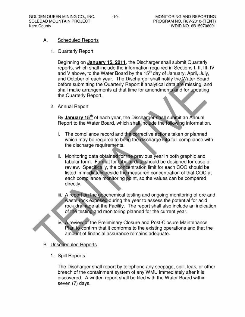
GOLDEN QUEEN MINING CO., INC. -10- MONITORING AND REPORTING SOLEDAD MOUNTAIN PROJECT PROGRAM NO. R6V-2010-(TENT) Kern County WDID NO. 6B159708001
A. Scheduled Reports 1. Quarterly Report
Beginning on January 15, 2011, the Discharger shall submit Quarterly reports, which shall include the information required in Sections I, II, III, IV and V above, to the Water Board by the 15th day of January, April, July, and October of each year. The Discharger shall notify the Water Board before submitting the Quarterly Report if analytical data are missing, and shall make arrangements at that time for amendments and for updating the Quarterly Report.
2. Annual Report By January 15th of each year, the Discharger shall submit an Annual Report to the Water Board, which shall include the following information. i. The compliance record and the corrective actions taken or planned
which may be required to bring the discharge into full compliance with the discharge requirements.
ii. Monitoring data obtained for the previous year in both graphic and
tabular form. Format for tabular data should be designed for ease of review. Specifically, the concentration limit for each COC should be listed immediately beside the measured concentration of that COC at each compliance monitoring point, so the values can be compared directly.
iii. A report on the geochemical testing and ongoing monitoring of ore and
waste rock exposed during the year to assess the potential for acid rock drainage at the Facility. The report shall also include an indication of the testing and monitoring planned for the current year.
iv. A review of the Preliminary Closure and Post-Closure Maintenance
Plan to confirm that it conforms to the existing operations and that the amount of financial assurance remains adequate.
B. Unscheduled Reports
1. Spill Reports
The Discharger shall report by telephone any seepage, spill, leak, or other breach of the containment system of any WMU immediately after it is discovered. A written report shall be filed with the Water Board within seven (7) days.

GOLDEN QUEEN MINING CO., INC. -11- MONITORING AND REPORTING SOLEDAD MOUNTAIN PROJECT PROGRAM NO. R6V-2010-(TENT) Kern County WDID NO. 6B159708001
If visual inspection and/or laboratory results indicate that the breach of the containment system is or may be a threat to water quality, it will be considered a possible release. In this case, the Monitoring and Reporting Program may need to be adjusted to include long-term monitoring at the affected point to ensure that repairs and cleanup have been effective.
2. Notice of Possible (Unconfirmed) Releases If a release is tentatively indicated, the Discharger shall notify the Water Board. The Discharger shall conduct resampling and analysis, as discussed in Section IX above, to confirm (or refute) the tentative release.
3. Report of Confirmed Release If an actual release occurs, or if a tentative release is confirmed, the Discharger shall submit a Report of Release. This report should describe the release, which monitoring points are affected, and how the release was discovered/confirmed.
4. Unscheduled Background Update Report If a release is confirmed by any means other than comparison to the background monitoring, then the Discharger shall, within 30 days, sample for all COCs at all monitoring points, and submit for laboratory analysis. The Discharger shall submit an Unscheduled Background Update Report providing the results.
5. Evaluation Monitoring Program The Discharger shall, within 90 days of discovering (or confirming) a release, submit a Revised Report of Waste Discharge proposing an Evaluation Monitoring Program meeting the requirements in section 20425, Title 27, California Code of Regulations.
6. Preliminary Engineering Feasibility Study (PEFS) Report: Corrective Action The Discharger shall, within 180 days of discovering (or confirming) a release, submit a PEFS Report meeting the requirements in section 20430, Title 27, California Code of Regulations.

GOLDEN QUEEN MINING CO., INC. -12- MONITORING AND REPORTING SOLEDAD MOUNTAIN PROJECT PROGRAM NO. R6V-2010-(TENT) Kern County WDID NO. 6B159708001
C. Violation
If monitoring data indicate violation of waste discharge requirements, the Discharger shall provide information indicating the cause of violations and action taken or planned to bring the discharge into compliance.
D. General Provisions The Discharger shall comply with the “General Provisions for Monitoring and Reporting” dated September 1, 1994, set out in Attachment MRP-3, which is made part of this Monitoring and Reporting Program.
XII. TIME SCHEDULES FOR SAMPLING PROGRAMS
A. No less than 60 days prior to initiating waste discharges at the Facility, the Discharger shall submit a detailed Sampling and Analysis Program (SAP) for the Facility. The discharge of waste at the Facility is considered the discharge of ore to the Facility.
B. No less than 60 days prior to initiating waste discharges at the Facility, the
Discharger shall submit a detailed Quality Assurance/Quality Control Plan (QA/QC Plan) for sampling and laboratory analysis. The discharge of waste at the Facility is considered the discharge of ore to the Facility.
Ordered by: ______________________________ Dated: _______________ HAROLD J. SINGER
EXECUTIVE OFFICER Attachments: MRP-1 Location of Monitoring Points
MRP-2 Well Locations MRP-3 General Provisions for Monitoring and Reporting

$: ::IJ U I
-l.
•
PROJECT No. 043-2299 FILE NAME WOR-~RP-l
OESIGN JWR , 1/06 SCALE 1>5 SHOWN I REV. A
CAOO JWR 11/06 ATTACHMENTCHECK SEQ '1/06 R[',1[W REK 11/06 MRP-1
GOLDEN QUEEN MINING CO., INC. SOLEDAD MOUNTAIN PROJECT
MOJAVE, KERN COUNTY, CALIFORNIA
LOCATION OF MONITORING POINTS
PROJECT
Tm.E
o o o v o l[) (0
W
Q
LYSIMETER UNDER RELEASE SCENARIO
MONITORING WELL
LYSIMETER
LDCS SUMP LD-1•VM-1••MW-3•
• o l[) (0
W
1· = 600'
MW-3•
81 } /11 8 o / - l 0 g (" 8 :2,50ADDmONAL LYSIMmRS:2
j Ilf)WNGRADIENT OF CELL w W \VHItRE LEAK IS DETECTED .
(50' FT. SPA9NG) ~r~ ~ ! ., _'WW~ I 1_ ._ . • ~~ ~:..,,_....:~'j~~ .. ~ ~ ~ ~
600
)
NOTES:
1. MW-1 TO BE ABANDONED.
2. LIMITS OF CELL 4 WILL BE ADJUSTED DURING FINAL DESIGN TO ACCOMMODATE MW-2.

-------
SOLEDAD MOUNTAIN IAir Monitoring Station == Siiver Queen Road
Production Well w+,Tailings Area o Private Well FIGURE 2
Proposed Project Facilities o Monitoring Well s WELL LOCA nONS $:
_ Merrill-Crowe Plant :0 _ Parking Area 500 o 500 1,000 1,500 LJ
• Date: 312712008 Frle MOOO0100\WeIlSrTUld 1'0-- Stockpile FeetARCADIS
N
ANALYSIS AREA: KERN COUNTY, CALIFORNIA
ProD8red By; JG layout: Wells Pdf
J
I

Attachment MRP-3
CALIFORNIA REGIONAL WATER QUALITY CONTROL BOARD LAHONTAN REGION
GENERAL PROVISIONS
FOR MONITORING AND REPORTING 1. SAMPLING AND ANALYSIS
a. All analyses shall be performed in accordance with the current edition(s) of the following documents:
i. Standard Methods for the Examination of Water and Wastewater ii. Methods for Chemical Analysis of Water and Wastes, EPA
b. All analyses shall be performed in a laboratory certified to perform such
analyses by the California State Department of Health Services or a laboratory approved by the Water Board. Specific methods of analysis must be identified on each laboratory report.
c. Any modifications to the above methods to eliminate known interferences
shall be reported with the sample results. The method used shall also be reported. If methods other than USEPA approved methods or Standard Methods are used, the exact methodology must be submitted for review and must be approved by the Water Board prior to use.
d. The Discharger shall establish chain-of-custody procedures to ensure that
specific individuals are responsible for sample integrity from commencement of sample collection through delivery to an approved laboratory. Sample collection, storage and analysis shall be conducted in accordance with an approved Sampling and Analysis Plan (SAP). The most recent version of the approved SAP shall be kept at the facility.
e. The Discharger shall calibrate and perform maintenance procedures on all
monitoring instruments and equipment to ensure accuracy of measurements, or shall ensure that both activities will be conducted. The calibration of any wastewater flow measuring device shall be recorded and maintained in the permanent logbook described in 2.b., below.
f. A grab sample is defined as an individual sample collected in fewer than
15 minutes. g. A composite sample is defined as a combination of no fewer than eight
individual samples obtained over the specified sampling period at equal intervals. The volume of each individual sample shall be proportional to

the discharge flow rate at the time of sampling. The sampling period shall equal the discharge period, or 24 hours, whichever period is shorter.
2. OPERATIONAL REQUIREMENTS
a. Sample Results
Pursuant to California Water Code section 13267(b), the Discharger shall maintain all sampling and analytical results including: strip charts; date, exact place, and time of sampling; date analyses were performed; sample collector’s name; analyst’s name; analytical techniques used; and results of all analyses. Such records shall be obtained for a minimum of three (3) years. This period of retention shall be extended during the course of any unresolved litigation regarding this discharge, or when requested by the Water Board.
b. Operational Log
Pursuant to California Water Code section 13267(b), an operation and maintenance log shall be maintained at the facility. All monitoring and reporting data shall be recorded in a permanent logbook.
3. REPORTING
a. For every item where the requirements are not met, the Discharger shall submit a statement of the actions undertaken or proposed which will bring the discharge into full compliance with requirements at the earliest time and submit a timetable for correction.
b. Pursuant to California Water Code section 13267(b), all sampling shall be
made available to the Water Board upon request. Results shall be retained for a minimum of three years. This period of retention shall be extended during the course of any unresolved litigation regarding this discharge, or when requested by the Water Board.
c. The Discharger shall provide a brief summary of any operational problems
and maintenance activities to the Water Board with each monitoring report. Any modifications or additions to, or any major maintenance conducted on, or any major problems occurring to the wastewater conveyance system, treatment facilities, or disposal facilities shall be included in this summary.
d. Monitoring reports shall be signed by:
i. In the case of a corporation, by a principal executive officer at least of
the level of vice-president or his duly authorized representative, if such representative is responsible for the overall operation of the facility from which the discharge originates;
ii. In the case of a partnership, by a general partner;

iii. In the case of a sole proprietorship, by the proprietor;
iv. In the case of a municipal, state or other public facility, by either a
principal executive officer, ranking elected official or other duly authorized employee.
e. Monitoring reports are to include the following:
i. Name and telephone number of individual who can answer
questions about the report. ii. The Monitoring and Reporting Program Number. iii. WDID Number.
f. Modifications
This Monitoring and Reporting Program may be modified at the discretion of the Water Board.
4. NONCOMPLIANCE
Under section 13268 of the Water Code, any person failing or refusing to furnish technical or monitoring reports or falsifying any information provided therein, is guilty of a misdemeanor and may be liable civilly in an amount of up to one thousand dollars ($1,000) for each day of violation under section 13268 of the Water Code.