CADD Services Consultant Users Group August … · cadd services consultant users group august 5th,...
68
Ohio Department of Transportation www.transportation.ohio.gov John R. Kasich, Governor • Jerry Wray, Director CADD SERVICES CONSULTANT USERS GROUP AUGUST 5 TH , 2014 Division of Engineering Office of CADD and Mapping Services
Transcript of CADD Services Consultant Users Group August … · cadd services consultant users group august 5th,...

Ohio Department of Transportation
w w w. t r a n s p o r t a t i o n . o h i o . g o v
John R. Kasich, Governor • Jerry Wray, Director
CADD SERVICES
CONSULTANT USERS GROUPAUGUST 5TH, 2014
Division of EngineeringOffice of CADD and Mapping Services
2 | CADD Services - Consultant Users Group Meeting
WELCOME CADD USERS

3 |
WELCOME CADD USERS
o Previously ODOT GMUG
o GEOPAK / MicroStation Users Group
o Last documented meeting - July, 2011
o Reboot of GMUG
o New Technology Means New Standards (Bentley
OpenRoads)
o Cover other topics relative to CADD (GENSUM Spreadsheet)
o 2 Meetings per year, Spring & Fall, (OTEC)
CADD Services - Consultant Users Group Meeting

4 |
AGENDA FOR TODAY
o 9:00am – 9:15am
o Introductions
o 9:15am – 9:30am
o ODOT CADD Website Update and Support Services
o 9:30am – 10:30am
o The Future for ODOT CADD Standards
o 10:30am – 11:30am
o GENSUM AASHTOWare Spreadsheet Overview
o 11:30am – 12:30pm
o Break for Lunch
CADD Services - Consultant Users Group Meeting

5 |
AGENDA FOR TODAY
o 12:30pm – 2:30pm
o ODOT Standards for Bentley OpenRoads Survey and Design
o 2:30pm – 2:45pm
o Question and Answer Session
o CPD Credits
o Notation on Agenda for 4.00 credits
CADD Services - Consultant Users Group Meeting

6 |
OFFICE OF CADD AND MAPPING SERVICES
o Rachel Lewis
o Administrator of CADD and Mapping Services
o Mark McCloud
o CADD Manager
o MicroStation Support
o Geopak Support
o CADD Standards Manual
CADD Services - Consultant Users Group Meeting

7 |
OFFICE OF CADD AND MAPPING SERVICES
o Fanita Cheek
o L & D Volume 3
o Plan Development Process (PDP)
o CADD Standards Manual
o MicroStation 3D Modeling Support
o Greg Gronbach
o Website Development
o MicroStation Support
o Bentley Learn Support
o Bentley Communities
CADD Services - Consultant Users Group Meeting

8 |
OFFICE OF CADD AND MAPPING SERVICES
o Jack Kerstetter
o Hardware Support
o Software Support
o Plotting Support
o VB Application Support
o Terri Silleck
o MicroStation Support
o Standard Drawing and Cell Library Updates
o CADD Application Support (i.e. AutoTurn, GuideSign, etc.)
o Special CADD Projects (i.e. Aviation to update all airport
drawings to georeference for pavement inventory)
CADD Services - Consultant Users Group Meeting

9 |
o Eric Thomas, Consultant
o OpenRoads Development
o Geopak Support
o VB Application Support
CADD Services - Consultant Users Group Meeting
OFFICE OF CADD AND MAPPING SERVICES

10 |
o ODOT CADD Services Website Update
CADD Services - Consultant Users Group Meeting
WEBSITE UPDATE AND SUPPORT SERVICES
Old ODOT CADD Website Link
New ODOT CADD Website Link

11 |
New ODOT CADD Website Link
o ODOT CADD Support Services
o CADD Services Contact Info
o Current Versions of ODOT CADD Software
o Support Links
o Service Request Form
o ITNow for Internal Tracking of Support Requests
CADD Services - Consultant Users Group Meeting
WEBSITE UPDATE AND SUPPORT SERVICES

12 |
o Redesigning of ODOTstd
o Update to current CADD Standards folder structure
o Compartmentalize Application Configurations and
Standards
o Provide ODOT Group for Project and Support Tools
o Building new DGNLIB’s for SELECTseries 3
CADD Services - Consultant Users Group Meeting
THE FUTURE FOR ODOT CADD STANDARDS

13 |
o Current ODOTstd Configuration
o V8iODOTstandards.cfg
o Local C: Drive
o ODOTV8i.pcf
o I:\ODOTstd\Projects - Site Configuration
o ODOTV8i.ucf, dfltuser.cfg
o W:\V8iUser - User Configuration
CADD Services - Consultant Users Group Meeting
THE FUTURE FOR ODOT CADD STANDARDS

14 |
o Current ODOTstd Folder Structure
o I:\ODOTstd
o I:\ODOTstd\Projects
CADD Services - Consultant Users Group Meeting
THE FUTURE FOR ODOT CADD STANDARDS

15 |
o Current ODOTstd Folder Structure
o I:\ODOTstd\V8istd
CADD Services - Consultant Users Group Meeting
THE FUTURE FOR ODOT CADD STANDARDS
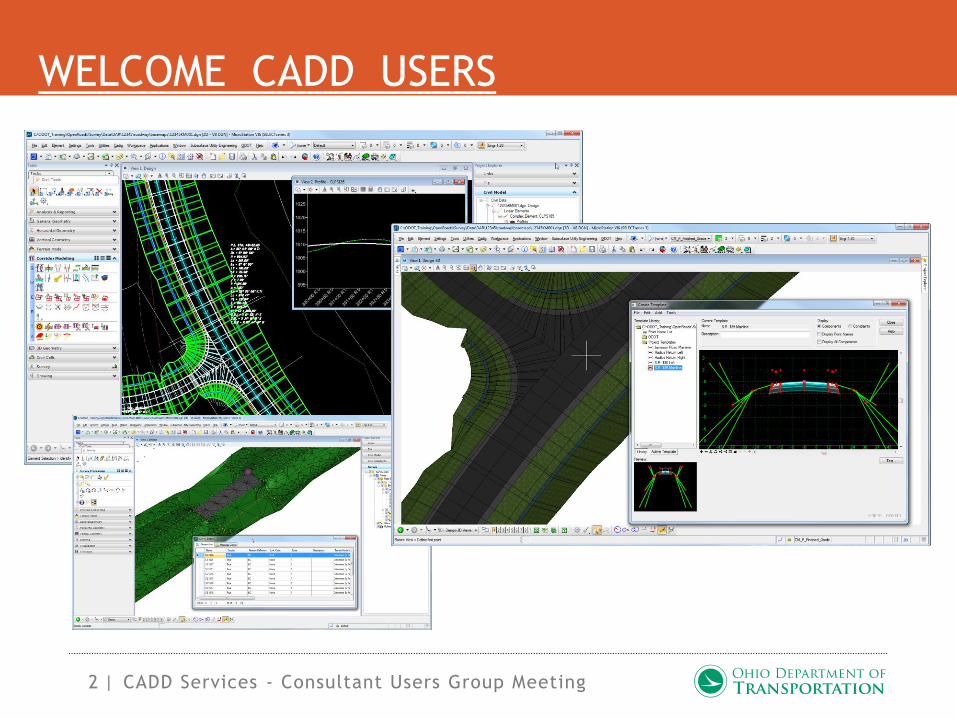
16 |
o Current ODOTstd Folder Structure
o I:\V8igstd
o Local CADD Standards
o Plot Configurations (iPLOT, Pltcfg, PenTables)
CADD Services - Consultant Users Group Meeting
THE FUTURE FOR ODOT CADD STANDARDS

17 |
o New ODOTcadd Configuration
o z_ODOT_redirect.cfg (Local / Network)
o Local C: Drive
o ODOT_Site_V8iSS3.cfg
o I:\ODOTcadd\Standards\config - Site Configuration
o UCF files, dfltuser.cfg, fkeys, buttons, custom gui, prefs
o W:\BentleySS3 - User Configuration
CADD Services - Consultant Users Group Meeting
THE FUTURE FOR ODOT CADD STANDARDS

18 |
o New ODOTcadd Folder Structure
o I:\ODOTcadd
o I:\ODOTcadd\Local
o Local CADD Standards
o Plot Configurations (IPlot, Pltcfg, PenTables)
CADD Services - Consultant Users Group Meeting
THE FUTURE FOR ODOT CADD STANDARDS

19 |
o New ODOTcadd Folder Structure
o I:\ODOTcadd\Projects
o Project PCF Files (Project specific settings)
CADD Services - Consultant Users Group Meeting
THE FUTURE FOR ODOT CADD STANDARDS

20 |
o New ODOTcadd Folder Structure
o I:\ODOTcadd\Standards
o CADD Standards for ODOT
CADD Services - Consultant Users Group Meeting
THE FUTURE FOR ODOT CADD STANDARDS
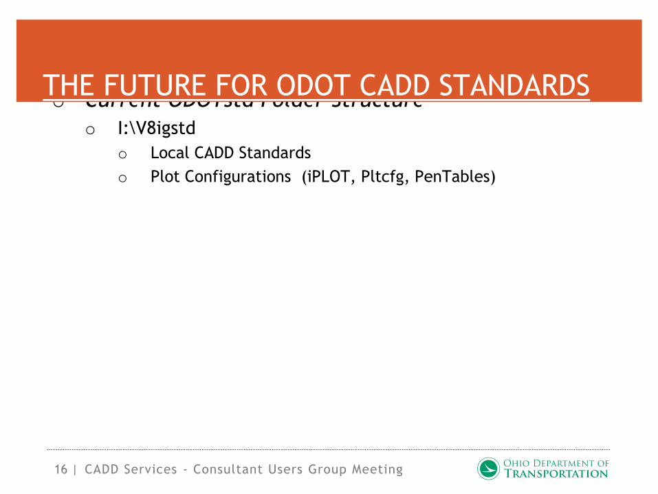
21 |
o Quarterly ODOT CADD Standards Update
o Q1 – January
o Q2 – April
o Q3 – July
o Q4 – October
o CADD Standards Installation Package
o Installation package built (complete standards in .EXE)
o Installation patch built (quarterly updates in .EXE)
o First Release - October, 2014
CADD Services - Consultant Users Group Meeting
THE FUTURE FOR ODOT CADD STANDARDS

22 |
o CADD Standards Installation Package
o Demo
CADD Services - Consultant Users Group Meeting
THE FUTURE FOR ODOT CADD STANDARDS

23 |
o CADD Services Research Items
o FHWA Every Day Counts Initiative
o 3D Engineered Models for Construction (Support for AMG)
o ODOT Consultants and Contracts on EDC Team
o Project Selected for 3D Model Deliverables
o Details of Deliverables and Workflows
o Attended PennDOT Workshop
CADD Services - Consultant Users Group Meeting
THE FUTURE FOR ODOT CADD STANDARDS
FHWA Website for 3D Models
24 |
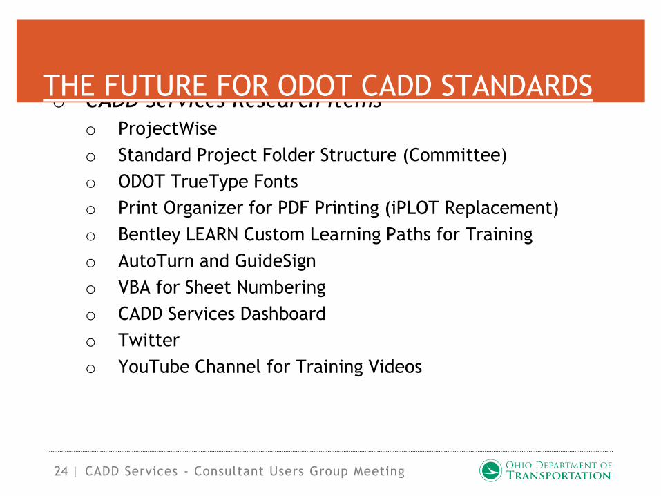
o CADD Services Research Items
o ProjectWise
o Standard Project Folder Structure (Committee)
o ODOT TrueType Fonts
o Print Organizer for PDF Printing (iPLOT Replacement)
o Bentley LEARN Custom Learning Paths for Training
o AutoTurn and GuideSign
o VBA for Sheet Numbering
o CADD Services Dashboard
o Twitter
o YouTube Channel for Training Videos
CADD Services - Consultant Users Group Meeting
THE FUTURE FOR ODOT CADD STANDARDS

25 |
o CADD Services Research Items
o ODOT Hosted CADD Training for Consultants
o Open Sourcing ODOT VBA’s (with exceptions)
CADD Services - Consultant Users Group Meeting
THE FUTURE FOR ODOT CADD STANDARDS

26 |
AUTODESK VERBIAGE
L&D VOLUME 3 – SECTION 1503
CADD Services - Consultant Users Group Meeting

27 |
AUTODESK VERBIAGE
CADD MANUAL – SECTION 101
CADD Services - Consultant Users Group Meeting

28 |
o Automating General Summary Items
o Developed for ODOT Estimating
o Initially derived from GENSUM VBA Spreadsheet
o Partnered with District 4 to develop next version
o GENSUM_VBA_AASHTOWare.xlsm
CADD Services - Consultant Users Group Meeting
GENSUM AASHTOWARE SPREADSHEET

29 |
o John Drsek
o ODOT, District 4
o Justin Hickey
o ODOT, Office of Estimating
CADD Services - Consultant Users Group Meeting
GENSUM AASHTOWARE SPREADSHEET

Ohio Department of Transportation
w w w. t r a n s p o r t a t i o n . o h i o . g o v
John R. Kasich, Governor • Jerry Wray, Director
OPENROADS IMPLEMENTATION
Eric Thomas, CADD Consultant
Office of CADD and Mapping Services

31 |
WHAT IS OPENROADS?
o A Technology, NOT a ProductFrom the Bentley Website:
• “Common Technology embedded in
InRoads, GEOPAK, and MXROAD”
• “…the continued merging of
functionality for Bentley’s civil
products”
• “Expands the products to include 3D
Modeling integration with CAD,
mapping, GIS, and business tools like
PDFs, i-models, and hypermodels”OpenRoads Implementation

32 |
WHAT IS OPENROADS?
o Not a separate installo Installed with the Bentley Civil products
o OpenRoads Horizontal Geometry tools
first appeared in SS2
Bentley OpenRoads Overview

33 |
WHAT IS OPENROADS?
o GEOPAK SS3 Released Q1 2013o Includes OpenRoads tools & improvements
o Software Functions Removed:
o Corridor Modeler and related
functionality
o Roadway Designer and related
functionality
o Site Modeler and related functionality
o Cut cross sections from DTM file
o SS2 and SS3 can be installed concurrently
Bentley OpenRoads Overview

34 |
WHAT IS OPENROADS?
o SS3 Refresh released March 11, 2014
o MicroStation SS3 08.11.09.578
o GEOPAK SS3 08.11.09.674
o Enhancements & fixes for early adopters of OpenRoads
o Includes Subsurface Utility Engineering (SUE)
o A subset of SUDA without the analysis engine
o Includes Descartes
o SUE and Descartes require a separate license
Bentley OpenRoads Overview
35 |
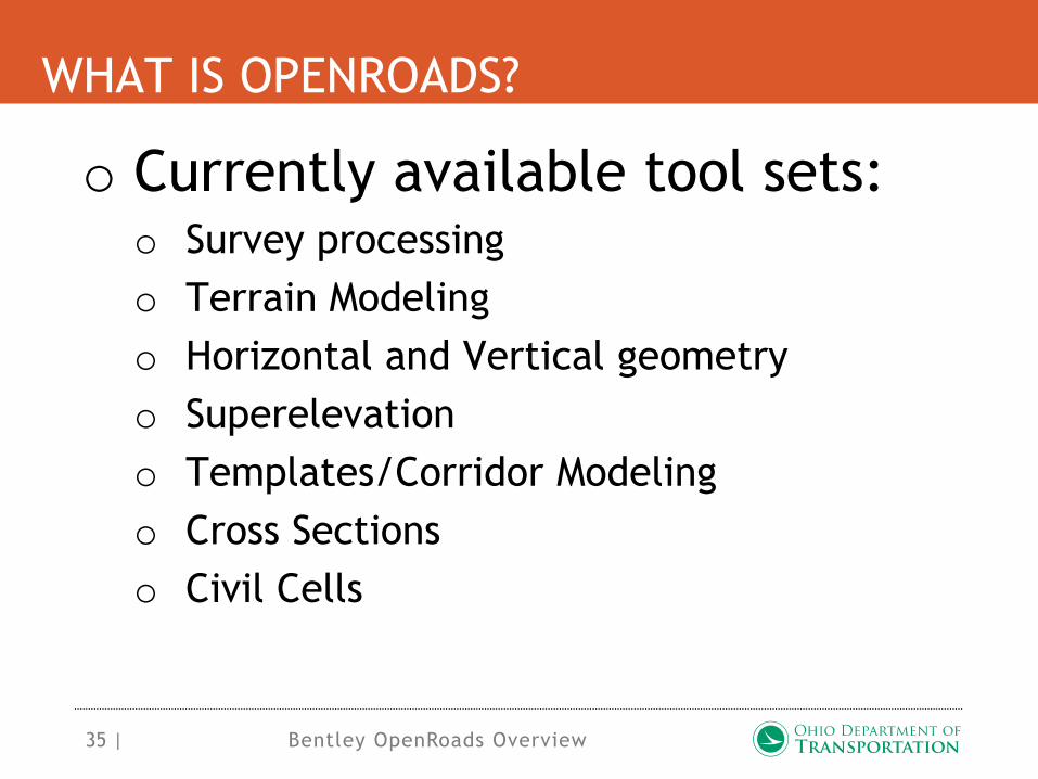
WHAT IS OPENROADS?
o Currently available tool sets:o Survey processing
o Terrain Modeling
o Horizontal and Vertical geometry
o Superelevation
o Templates/Corridor Modeling
o Cross Sections
o Civil Cells
Bentley OpenRoads Overview

36 |
WHAT IS OPENROADS?
o OpenRoads does not currently
include plan preparation toolso Revert to GEOPAK Road for plan
preparation
o OpenRoads Alignments, profiles, and
terrain models can be exported for
GEOPAK use
Bentley OpenRoads Overview

37 |
FUTURE SS3 UPDATES
o Upcoming SS3 Refresho Has been completed, awaiting final
approval
o Full GEOPAK install (not a patch)
o Requires a MicroStation update (full
install)
o Enhancements & fixes for OpenRoads
o Includes an update to Descartes
Bentley OpenRoads Overview
38 |
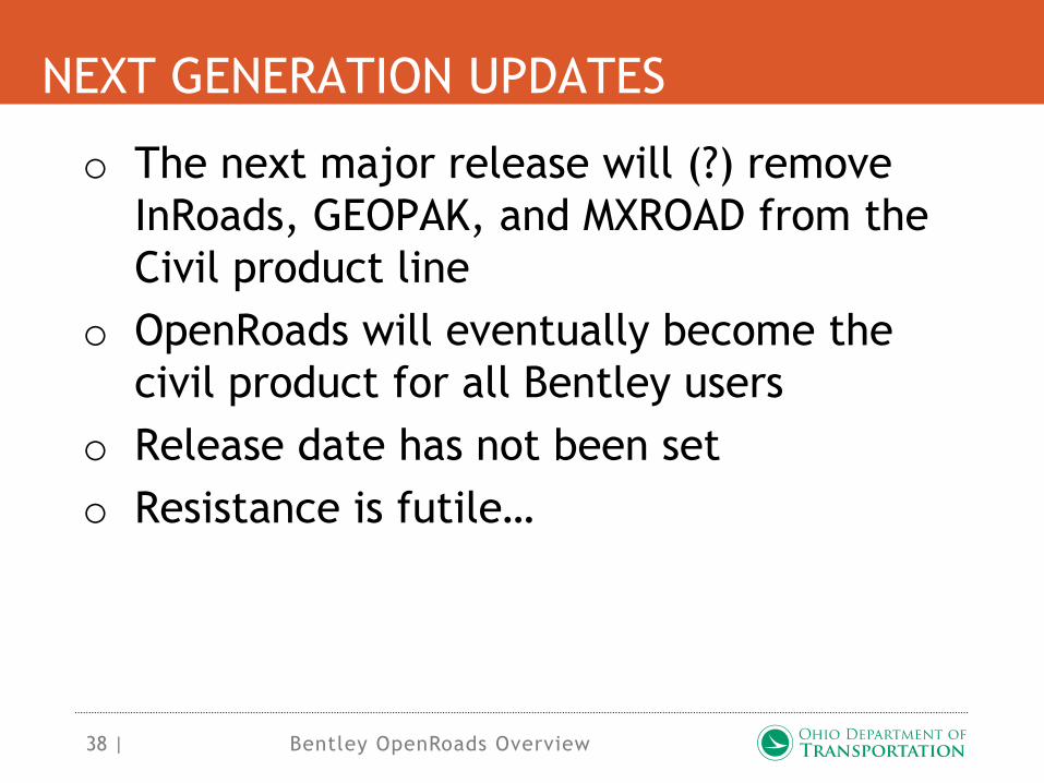
NEXT GENERATION UPDATES
o The next major release will (?) remove
InRoads, GEOPAK, and MXROAD from the
Civil product line
o OpenRoads will eventually become the
civil product for all Bentley users
o Release date has not been set
o Resistance is futile…
Bentley OpenRoads Overview

39 |
ODOT IMPLEMENTATION
o Fall 2013o OpenRoads Survey Standards developed
o Winter/Spring 2014o OpenRoads Survey training for ODOT’s
Surveyors
o Training guide available in the Standards
o Spring/Summer 2014o ODOT’s Surveyors begin using OpenRoads
Bentley OpenRoads Overview

40 |
ODOT IMPLEMENTATION
o ODOT running the following
versions:o Design personnel:
o MicroStation V8i SS2 08.11.07.443
o GEOPAK V8i SS2 08.11.07.615
o Survey personnel (currently migrating):
o MicroStation V8i SS3 08.11.09.578
o GEOPAK V8i SS3 08.11.09.674
Bentley OpenRoads Overview

41 |
ODOT IMPLEMENTATION
o Fall 2014o First release of OpenRoads standards for
Design
o Winter/Spring 2015o OpenRoads training material developed
for Design personnel
o Tentative plans are to integrate the
training into Bentley Learn
Bentley OpenRoads Overview

42 |
ODOT CADD STANDARDS
o April 18, 2014 Releaseo Includes OpenRoads standards in a
separate folder
ODOTstd/V8istd/OpenRoads
o Added User and Project configuration
files:
o ODOT_OpenRoads.ucf,
ODOT_OpenRoads.pcf
o Intended to be used with a SS3
installation to gain access to the
OpenRoads Survey StandardsBentley OpenRoads Overview
43 |
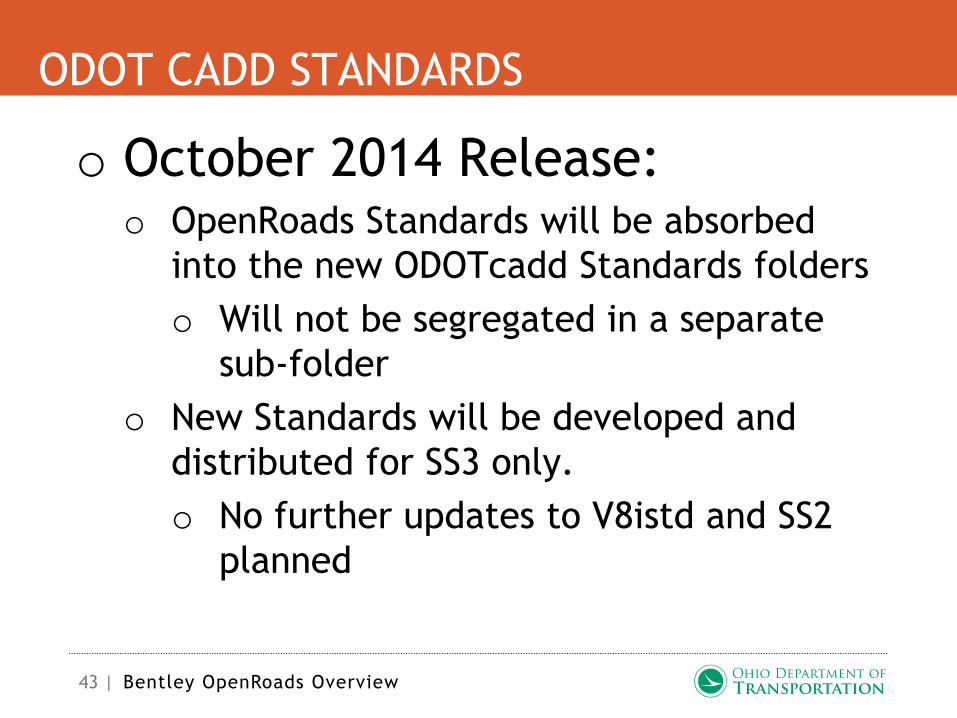
ODOT CADD STANDARDS
o October 2014 Release:o OpenRoads Standards will be absorbed
into the new ODOTcadd Standards folders
o Will not be segregated in a separate
sub-folder
o New Standards will be developed and
distributed for SS3 only.
o No further updates to V8istd and SS2
planned
Bentley OpenRoads Overview
44 |
GEOPAK/OPENROADS SURVEY
o Interface Changes:o No longer uses a Survey Project
o Task Navigation Menu
o Project Explorer
o Context Menus
o On-screen prompts
Bentley OpenRoads Overview
45 |
GEOPAK/OPENROADS SURVEY
o All data stored in the DGNo No longer uses the GPK file
o No longer creates multiple report files in the
project directory
o 3D files required for Survey Processing
o Full Annotation Scale compatibility
o Undo!
o History of changes saved in a log file
OpenRoads Implementation

46 |
GEOPAK/OPENROADS SURVEY
o All data stored in the DGN
(cont.)o Terrain Models stored in the DGN
o Terrain Models are shared by referencing
o Graphical edits update mapping and
Terrain
o Can be exported to GPK and TIN
Bentley OpenRoads Overview

47 |
GEOPAK/OPENROADS SURVEY
o Feature Management via dgn
librarieso ODOT_Feaures_Survey.dgnlib
o Defines field codes read from ODOT.smd
o Defines default survey project settings
o ODOT_Features_Terrain.dgnlib
o Defines features and element templates
for terrain model display
Bentley OpenRoads Overview

48 |
GEOPAK/OPENROADS SURVEY
o Supports multiple data typeso Trimble, Leica, Topcon, LandXML, etc…
o Customizable Text Import
Wizardo Facilitates ASCII import in user definable
data formats
o Drag and drop data processing
Bentley OpenRoads Overview

49 |
GEOPAK/OPENROADS SURVEY
o Geographic Coordinate Systems
(GCS)o Establish position of data on the earth’s
surface
o Bentley Map
o Integration with other Georeferenced data
o Google Earth, Bing Maps, OSIP imagry,
LiDAR data
o Standard GCS definitions IncludedBentley OpenRoads Overview

50 |
GEOPAK/OPENROADS SURVEY
o Geographic Coordinate Systems
(GCS)o Allows for custom GCS definitions
o Facilitates grid-to-ground conversions
o ODOT GCS Recommendations:
o Map data to the appropriate State
Plane Zone
o Establish custom GCS definition for grid
to ground conversion
o Define project specific seed files with
custom GCS definitionBentley OpenRoads Overview

51 |
GEOPAK/OPENROADS SURVEY
o Attach media files to Survey
Pointso Images
o Videos
Bentley OpenRoads Overview

52 |
GEOPAK/OPENROADS SURVEY
o Data Integrity Concernso All data is stored in the dgn file…
o Lock elements in the DGN
o Disable Survey Processing Rules (or
not)
o Use Windows to set user
permissions/access
o GPK and TIN files must be updated
manually if changes are made to the
survey information
Bentley OpenRoads Overview

53 |
GEOPAK/OPENROADS SURVEY
o ODOT Training guide is
available in the CADD
Standards:
..\V8istd\OpenRoads\TrainingGuides\
ODOT_OpenRoadsSurvey.pdf
Bentley OpenRoads Overview
54 |
GEOPAK/OPENROADS SURVEY
o Enough with the power point,
just show us how it all works…
Bentley OpenRoads Overview

55 |
GEOPAK/OPENROADS CIVIL
o Interface Enhancementso Tasks & Project Explorer
o Context Toolbars provide access to
common functions when a Civil element is
selected
o In-place editing
o Heads-up prompts
Bentley OpenRoads Overview

56 |
GEOPAK/OPENROADS CIVIL
o Feature Management via
dgnlibs and MicroStation
Element Templateso A feature defines an objects apperance in
multiple contexts
o Plan, Profile, Cross Section, 3D, etc…
o Features can define symbology from a
DDB item or a MicroStation Element
Template
Bentley OpenRoads Overview
57 |
GEOPAK/OPENROADS CIVIL
o Horizontal & Vertical Geometry Tools
o New graphical based tools
o All data stored in the DGN (no GPK)
o Recommend using a separate Geometry Basemap
o Import/Export to/from GPK
o GPK and DDB still used for centerline stationing
o Profile Model Views used to create, edit, and manage
vertical geometry
o Data is shared via references
Bentley OpenRoads Overview

58 |
GEOPAK/OPENROADS CIVIL
o Civil AccuDraw
o New Superelevation Toolso Uses existing GEOPAK preference files for
computation
o New Superelevation Editor
o CSV File Import
Bentley OpenRoads Overview

59 |
GEOPAK/OPENROADS CIVIL
o DGN Based 3D Modelingo No longer uses separate Roadway Designer
o Integrates corridor and site based
workflows to generate a single model
o Templates can be applied to individual
elements
Bentley OpenRoads Overview

60 |
GEOPAK/OPENROADS CIVIL
o DGN Based 3D Modeling (cont.)o Users can work in 2D
o Horizontal & vertical geometry,
superelevation, and templates are used to
generate a 3D model on-the-fly directly in
MicroStation
Bentley OpenRoads Overview

61 |
GEOPAK/OPENROADS CIVIL
o New Cross Section Processo No longer uses Criteria Files
o Cross Sections cut from the 3D model
o Anything you draw in the 3D model will
show up in the cross sections, although
they are not dynamic
o New Cross Section Sheet Tool
o New Cross Section Annotation Tool
Bentley OpenRoads Overview
62 |
GEOPAK/OPENROADS CIVIL
o Civil Cellso Reusable civil attributes such as
driveways, intersections, traffic islands,
etc…
o Stored in dgn libraries
o Based on design standards
o Editable when placed
o Can include horizontal & vertical
geometry, terrain elements, and linear
template definitions
Bentley OpenRoads Overview

63 |
GEOPAK/OPENROADS CIVIL
o Demonstration…
Bentley OpenRoads Overview

64 |
SHOULD I START USING OPENROADS?
o You need CADD Standards…o Survey Standards are currently available
o Design Standards to come this fall
o Bentley delivers a set of standards with
OpenRoads in the Examples workspace
Bentley OpenRoads Overview

65 |
SHOULD I START USING OPENROADS?
o Start Now:o Scope Survey sub-consultants to deliver
OpenRoads compatible data:
o Scope all data on State Plane
Coordinates with a combined Grid-to-
Ground Scale Factor
o Request ODOT Field Codes and Mapping
Codes
o You can always import a GEOPAK TIN
to an OpenRoads Terrain Model
Bentley OpenRoads Overview

66 |
SHOULD I START USING OPENROADS?
o Start Now:o Familiarize yourself with MicroStation 3D
o Learn Roadway Designer Templates
o Experiment with the OpenRoads
Horizontal and Vertical Geometry
commands
o Learn Civil AccuDraw
Bentley OpenRoads Overview

67 |
SHOULD I START USING OPENROADS?
o Start Now:o Sign up for the ODOT & Consultants BE
Community
http://communities.bentley.
com/
Bentley OpenRoads Overview