Building a New FOSS4G Technology...
41
Building a New FOSS4G Technology Workforce PHILLIP DAVIS / KURT MENKE / RICHARD SMITH / JOHN VAN HOESEN THE GEOACADEMY TEAM
Transcript of Building a New FOSS4G Technology...
Building a New FOSS4G Technology WorkforcePHILLIP DAVIS / KURT MENKE / RICHARD SMITH / JOHN VAN HOESEN
THE GEOACADEMY TEAM

The Opportunity• Global geospatial industry brings in $270 billion in annual revenue
• Geospatial is 5 to 10 times larger than the video game industry
• At least one third the size of the global airline industry
(Oxera Report, January 2013 Geospatial World)
• Research and Markets report forecasts that the global utility GIS market will grow at a compound annual growth rate (CAGR) of 9.27 % over the period 2014-2018
• In the U.S. most of the 3000 electric power utilities are small to medium-sized organizations, primarily municipal and rural electric coops.
• GIS is the only foundational view that can potentially link every operational activity of an electric utility
(Navigant Research, via Eclipse Foundation article Geoff Zeiss)

The Challenge for Open Source Adoption• Less the 5% of US colleges and universities offer training in Open Source software
• Esri higher education group reports ArcGIS used by 7,000 colleges and universities globally
• Commercial FOSS4G training is far and few between and predominantly place-based F2F
• Lack of recognized Open Source industry certification
• Commercial vendors have well-established training programs and certification pathways

The GeoAcademy Project ExperimentThe brain-fart of founding director of the National Geospatial Technology Center of Excellence (http://geotech.org) and the current GIS Project Manager for the National Information Security & Geospatial Technology Consortium (http://nisgtc.org).
Loose confederation of US-based GIS educators at colleges and universities with a personal passion and research interest in promoting open source GIS software in education.
Curriculum development effort spanning 3 years that has resulted in an integrated collection of five introductory GIS courses featuring FOSS4G solutions for the lab component.
Pedagogically based on the US Department of Labor’s Geospatial Technology Competency Model (GTCM), first published in 2010 and updated in 2014.
Developed using funds from US National Science Foundation and Department of Labor grants allowing all the material to be offered for free reuse under the Creative Commons BY 3.0 license.
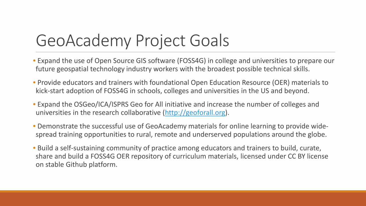
GeoAcademy Project Goals• Expand the use of Open Source GIS software (FOSS4G) in college and universities to prepare our future geospatial technology industry workers with the broadest possible technical skills.
• Provide educators and trainers with foundational Open Education Resource (OER) materials to kick-start adoption of FOSS4G in schools, colleges and universities in the US and beyond.
• Expand the OSGeo/ICA/ISPRS Geo for All initiative and increase the number of colleges and universities in the research collaborative (http://geoforall.org).
• Demonstrate the successful use of GeoAcademy materials for online learning to provide wide-spread training opportunities to rural, remote and underserved populations around the globe.
• Build a self-sustaining community of practice among educators and trainers to build, curate, share and build a FOSS4G OER repository of curriculum materials, licensed under CC BY license on stable Github platform.
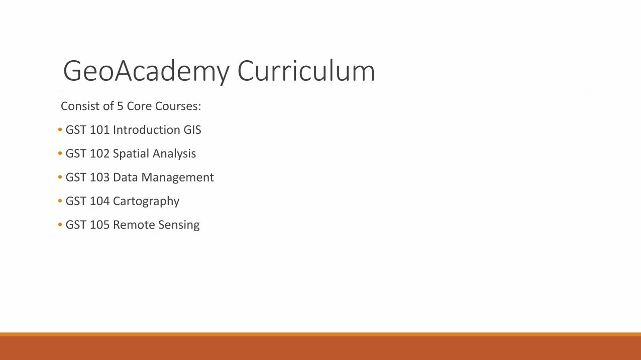
GeoAcademy CurriculumConsist of 5 Core Courses:
• GST 101 Introduction GIS
• GST 102 Spatial Analysis
• GST 103 Data Management
• GST 104 Cartography
• GST 105 Remote Sensing
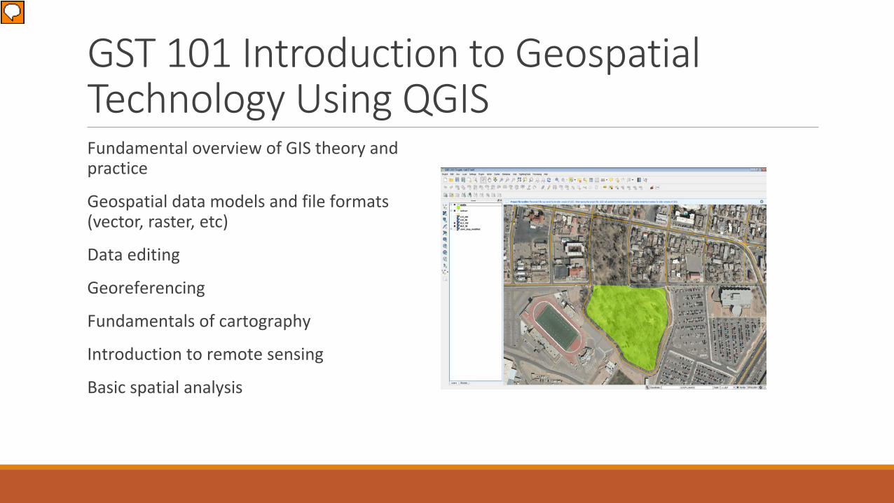
GST 101 Introduction to Geospatial Technology Using QGISFundamental overview of GIS theory and practice
Geospatial data models and file formats (vector, raster, etc)
Data editing
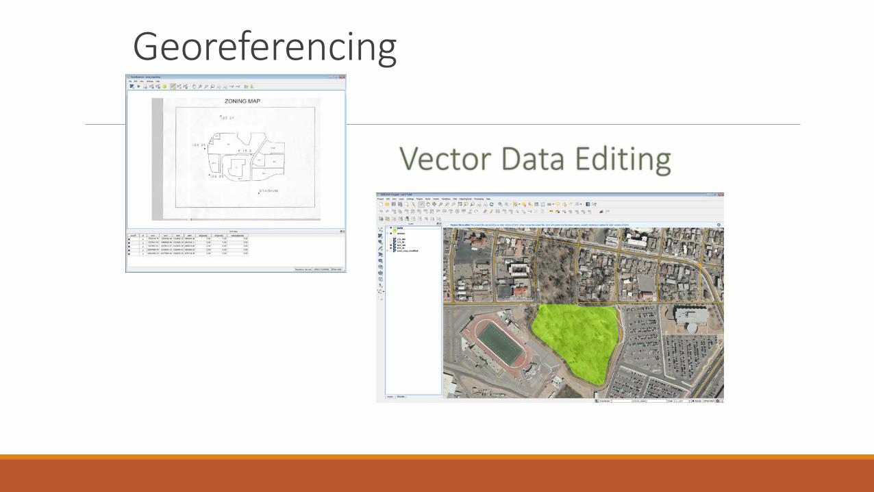
Georeferencing
Fundamentals of cartography
Introduction to remote sensing
Basic spatial analysis
Presenter
Presentation Notes
Insert a picture illustrating a season in your country.

Cartography
Georeferencing

Basic Analysis

GST 102—Spatial Analysis using QGIS
Prepare data for use in analysis
Problem solving using geospatial tools and methods
Automating workflows
Present the results of a using terminology and visualizations
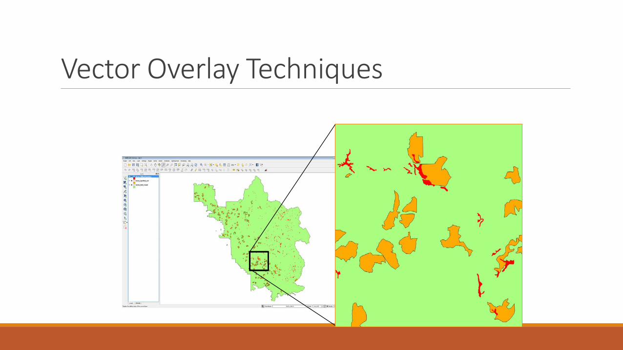
Vector Overlay Techniques

Automating Workflows

Heat Maps

Network Analysis – GRASS Plugin

Terrain Analysis

GST 103—Data Acquisition and Management using QGIS
Setting up a project database
Vector data structures
Spatial data quality
Raster data structures
Data sources

Setting up a Project Databaseusing SpatiaLite

Topology

Spatial Data Quality& Metadata

GST 104—Introduction to Cartography using QGIS and Inkscape
Categorize and describe different types of maps (thematic, reference, etc.)
Describe the components of a map (map elements)
Employ an appropriate geographic referencing system (datum, projection, coordinate system)
Select and apply ethical and appropriate data model, map scale, map elements, symbolization and color
Design professional quality maps employing cartographic principles
Critique maps for appropriate use of cartographic design principles

Working with Coordinate Systems
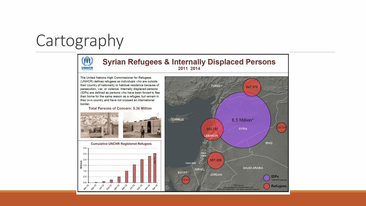
Cartography
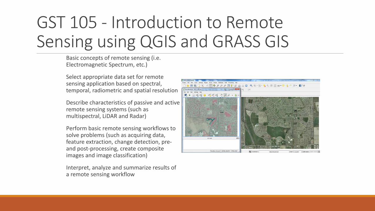
GST 105 - Introduction to Remote Sensing using QGIS and GRASS GIS
Basic concepts of remote sensing (i.e. Electromagnetic Spectrum, etc.)
Select appropriate data set for remote sensing application based on spectral, temporal, radiometric and spatial resolution
Describe characteristics of passive and active remote sensing systems (such as multispectral, LiDAR and Radar)
Perform basic remote sensing workflows to solve problems (such as acquiring data, feature extraction, change detection, pre-and post-processing, create composite images and image classification)
Interpret, analyze and summarize results of a remote sensing workflow

Band Combinations

NDVI

Supervised & Unsupervised Classification

The Results• All five courses are published for reuse on our Github: https://github.com/FOSS4GAcademy.
• More than 7,500 individuals have enrolled in one of our free course offering since June 2014.
• A dozen colleges have adopted the curriculum materials for use in their GIS programs for 2015.
• Our website has had more than 50,000 visits (http://foss4geo.wordpress.com).
• Partner colleges are now members of the GeoForAll initiative (http://geoforall.org).
• We have impacted educators, trainers, professionals, students and retirees in every continent on the globe including 3rd world nations in Asia, Africa and South America.

GeoAcademy website activitysince August 2014

GeoMOOC on Canvas Networks

Canvas GeoMOOC course offeringMarch 2015
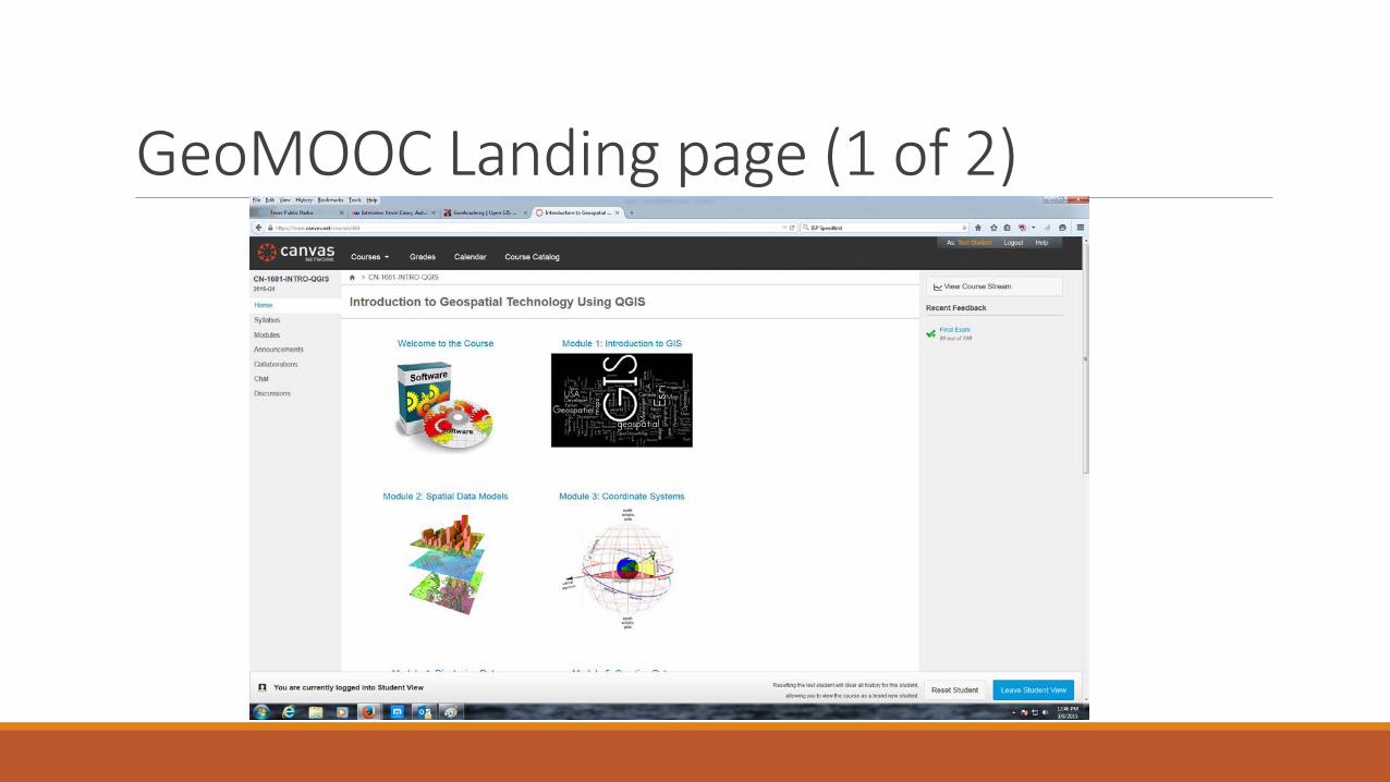
GeoMOOC Landing page (1 of 2)

GeoMOOC landing page (2 of 2)

GeoMOOC reaches 4500 enrollment

GeoMOOC Student TestimonialsAt Present I am living in Bangladesh. I am working in a International development organization as a Senior Monitoring officer-M&E. As a Monitoring personal this course will help me to mapping location with population. This Course also help me to conduct baseline survey along with different study. It would be helped me to reach my GIS skill and my future career.
My name is Jacob, and I am located in Tennessee in the United States. I am taking this course because I am an archaeologist by trade, and GIS has become an integral part of our modern methodology, and, as such, I am always looking for more training and knowledge in the field. I already have some experience with ArcGIS, but I am a proponent of open source technology so I jumped at the chance to become more familiar with QGIS.
I am currently assessing whether QGIS is suitable for teaching some of the introduction courses to GIS and remote sensing at my faculty. Besides that I am about to finish my MSc in Geoinformation Science and Earth Observations at University of Twente (The Netherlands).

GeoMOOC Student TestimonialsRecovering novice ESRI user determined to use QGIS, western N. Carolina (US). I perform botanical / wildlife / water / habitat surveys, conservation and minimum-impact development & natural resource use planning, ecological restoration & management planning and implementation. Goal is to be able to produce all my maps & data and manage data more efficiently.
I live in Akureyri in Iceland. I have been using QGIS but without any formal learning or courses. Just learning by trial and error. Now I hope to become better and more structured QGIS user.
I am based in South Africa and have always had this interest to learn about GIS and FOSSA. I am taking this course to acquire the skills necessary to carryout spatial analysis of environmental resources and understand community dynamics in a rural area.

GeoMOOC Student TestimonialsMy name is Louisa and I am currently working at a small Community Development Corporation in Boston, MA. I don't need GIS skills for my current position, but as I progress in my career they will be useful for Project Management and other jobs within the urban design field.
Hello. I am Pierre-Yves. I am working for the Belgian Technical Cooperation on a water and sanitation supply project in Niger.
I'm Inaki from Basque Country. I want to add skills in GIS to improve my analysis in planetary sciences.
I am Rania, Researcher, National Authority for Remote Sensing & Space Sciences, Cairo, Egypt. I am teaching and researching in the areas of geospatial information technology. I have PhD in Computers and Information to specialize in information systems. I am looking to start a project on improving the quality of education using FOSS. This course is important to me because it will give me the start point in using FOSS.

GeoMOOC Results• 4500 total enrolled (March 8 2015)
• 1100 completed first written assignment
• 500 completed first mapping exercise
• Engagement and completion rate matches that of the recent Penn State / Esri / CourseraGeoINT MOOC (21,000 enrolled with 1100 completers)
• Built on a shoe-string by one person and limited assistance from Canvas compared to GeoINTMOOC with Penn State + Esri + Coursera
• Demonstrates the potential for online offerings of FOSS4G technical training and education
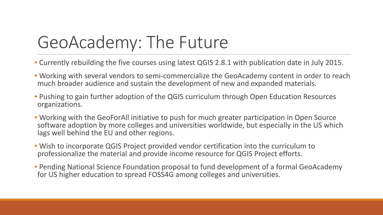
GeoAcademy: The Future• Currently rebuilding the five courses using latest QGIS 2.8.1 with publication date in July 2015.
• Working with several vendors to semi-commercialize the GeoAcademy content in order to reach much broader audience and sustain the development of new and expanded materials.
• Pushing to gain further adoption of the QGIS curriculum through Open Education Resources organizations.
• Working with the GeoForAll initiative to push for much greater participation in Open Source software adoption by more colleges and universities worldwide, but especially in the US which lags well behind the EU and other regions.
• Wish to incorporate QGIS Project provided vendor certification into the curriculum to professionalize the material and provide income resource for QGIS Project efforts.
• Pending National Science Foundation proposal to fund development of a formal GeoAcademyfor US higher education to spread FOSS4G among colleges and universities.
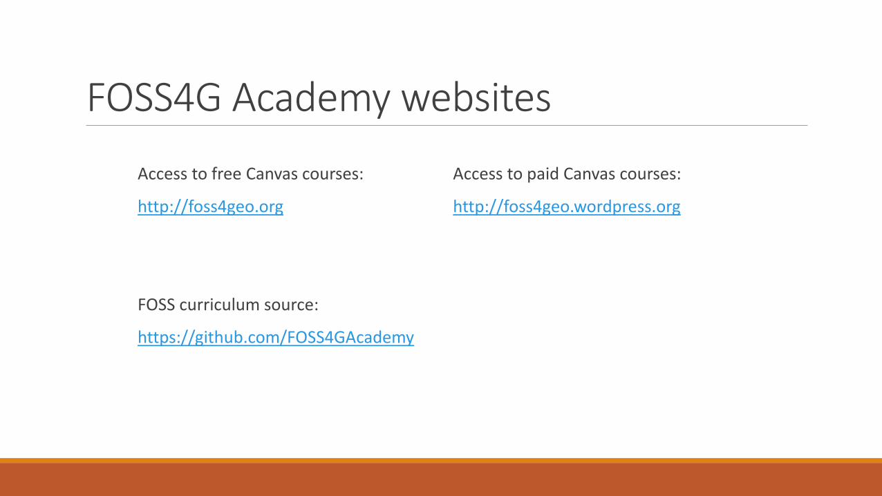
FOSS4G Academy websites
Access to free Canvas courses:
http://foss4geo.org
FOSS curriculum source:
https://github.com/FOSS4GAcademy
Access to paid Canvas courses:
http://foss4geo.wordpress.org

Contacts
Phillip Davis
John Van Hoesen
Kurt Menke
Richard Smith