Briefly about Kyrgyzstan - UN-GGIM...Situated in Central Asia and before 1991 was one of the Soviet...
25
Situated in Central Asia and before 1991 was one of the Soviet Union Republics Total area of Kyrgyzstan is 199.951 km2 (95% - mountains) The population is about 6,389 million Currency – Som (KGS) Ethnic groups: Kyrgyz - 72.6% Uzbek - 14.4% Russian - 6.4% Dungan - 1.1% Others - 5.5% 1 Briefly about Kyrgyzstan
Transcript of Briefly about Kyrgyzstan - UN-GGIM...Situated in Central Asia and before 1991 was one of the Soviet...

Situated in Central Asia and before 1991 was one of the Soviet Union Republics
Total area of Kyrgyzstan is 199.951 km2 (95% -mountains)
The population is about 6,389 million
Currency – Som (KGS)
Ethnic groups: Kyrgyz - 72.6%Uzbek - 14.4%Russian - 6.4%Dungan - 1.1%Others - 5.5%
1
Briefly about Kyrgyzstan
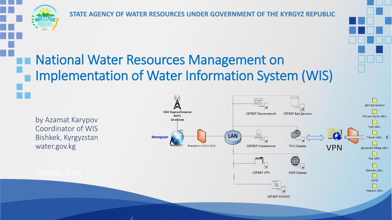
National Water Resources Management on Implementation of Water Information System (WIS)
by Azamat KarypovCoordinator of WISBishkek, Kyrgyzstanwater.gov.kg
October, 2019
2
Интернет
STATE AGENCY OF WATER RESOURCES UNDER GOVERNMENT OF THE KYRGYZ REPUBLIC

WIS Framework
3

Establishing a digital Water Information System (WIS) with online tabular and geospatial database applications accessible via the SWA website and/or VPN.
Tabular Database Applications
Geospatial database applications
Internet
VPN
4
SWA website
SWA servers
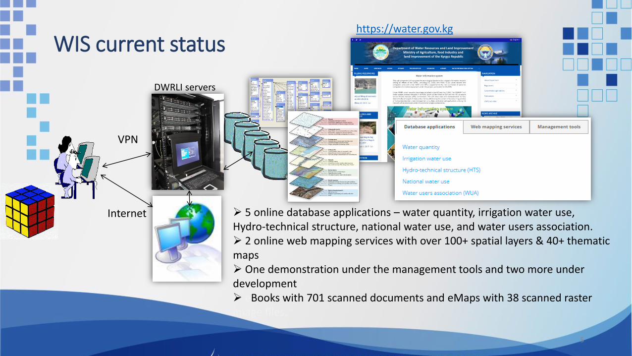
WIS current statushttps://water.gov.kg
5
Internet
VPN
DWRLI servers
5 online database applications – water quantity, irrigation water use, Hydro-technical structure, national water use, and water users association. 2 online web mapping services with over 100+ spatial layers & 40+ thematic maps One demonstration under the management tools and two more under development eBooks with 701 scanned documents and eMaps with 38 scanned raster image files.
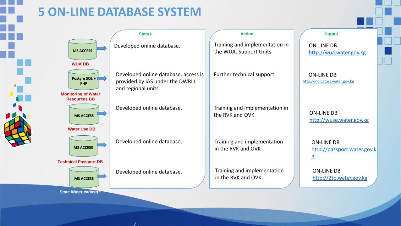
5 ON-LINE DATABASE SYSTEM
MS ACCESS
WUA DB
Postgre SQL + PHP
Monitoring of Water
Resources DB
MS ACCESS
Water Use DB
MS ACCESS
MS ACCESS
Technical Passport DB
State Water cadastre
Action
Developed online database.
Developed online database, access is provided by IAS under the DWRLI and regional units
Developed online database.
Developed online database.
Status
Training and implementation in the WUA. Support Units
Further technical support
Training and implementation in the RVK and OVK
Training and implementation in the RVK and OVK
Output
ON-LINE DBhttp://wua.water.gov.kg
http://indicators.water.gov.kg
ON-LINE DBhttp://wuse.water.gov.kg
ON-LINE DB
ON-LINE DBhttp://passport.water.gov.kg
Developed online database. Training and implementation in the RVK and OVK
ON-LINE DBhttp://2tp.water.gov.kg

30 meter resolution
Digital Elevation Model (DEM)
GEO DATABASE

WIS geospatial database built with a rich set of water resources and irrigation data with 126 vector spatial layers and two raster images. The WIS team published 100+ spatial layers and 40+ thematic maps online.
Geodatabase structure

Examples of digital maps

Thematic maps for basin planning:
• Chuy river basin- 16 maps;• Naryn-Syrdarya river basin - 28 maps;• Kara-Darya – Syrdarya river basin - 29 maps;
Examples of digital maps

Water Object Coding (WOC) and testing using the example of the Sokuluk River Basin
Rivers
Catchments
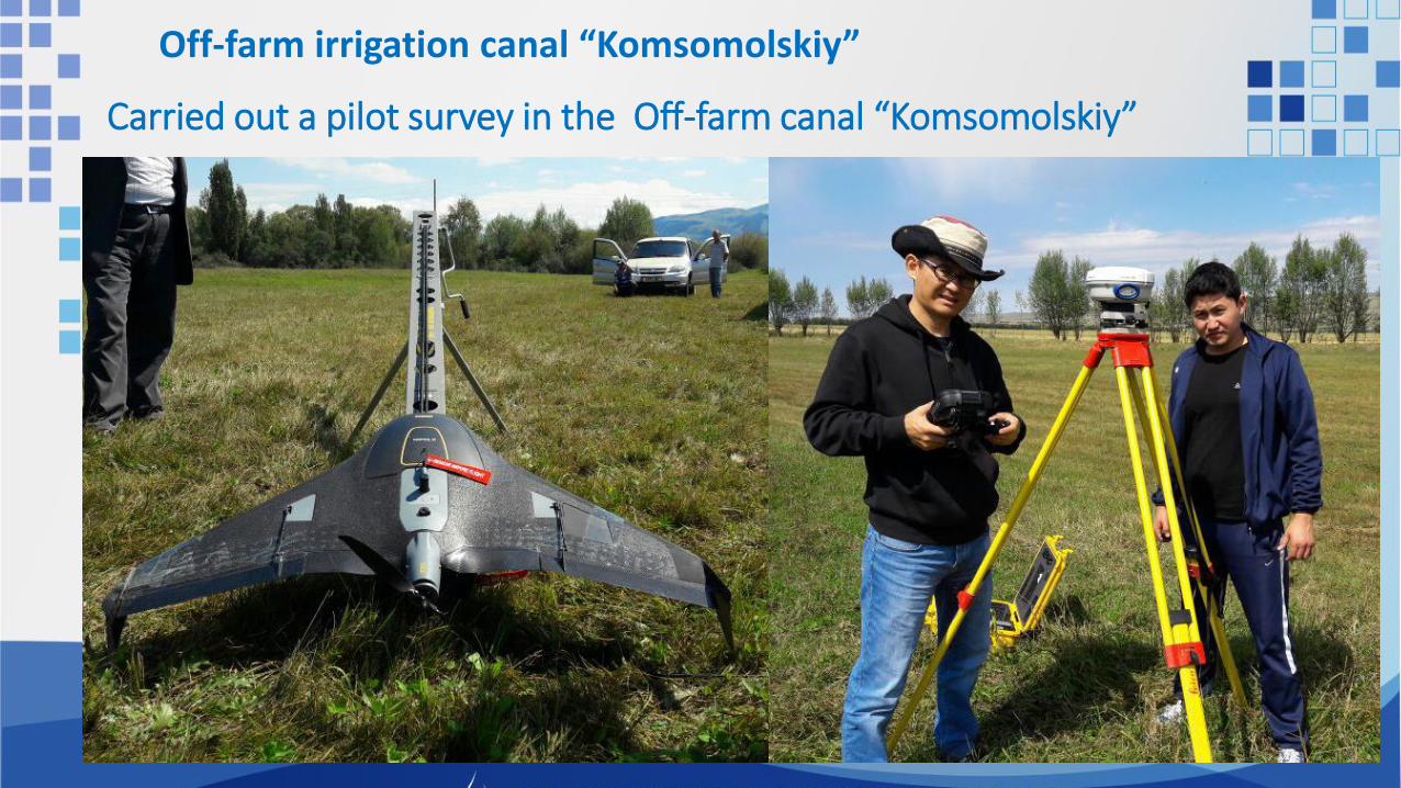
Carried out a pilot survey in the Off-farm canal “Komsomolskiy”
Off-farm irrigation canal “Komsomolskiy”

Result of UAV survey in the off-farm canal “Komsomolskiy”

WUA
«Jayilma Shapak»
ON-FARM IRRIGATION SYSTEM in THE YSSYK-KUL
Off-farm irrigation canal “Komsomolskiy”

ON-FARM IRRIGATION SYSTEM in THE YSSYK-KUL
WUA
«Jayilma Shapak»

Existing WUA maps in *.dwg formatConverted using ArcMap
Geo-referenced using satellite images and create *.shp files

Created database of AutoCAD drawings

http://water.gov.kg http://nwrmp.water.gov.kg/
Web sites

Basing computer training
Improve knowledge and awareness of database management and data collection
Advanced computer trainings (GIS, AutoCAD, Web design)
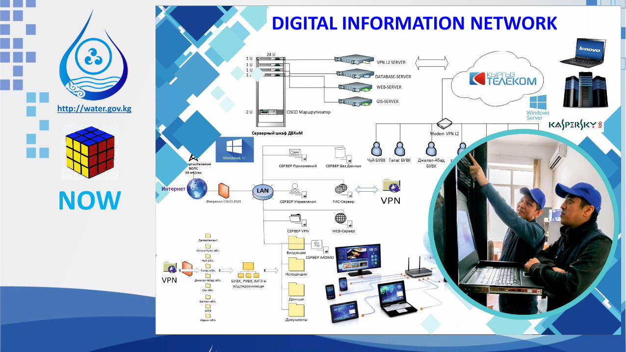
Water information system and digital information networks
Training and capacity building (2016-2019)

BEFORE
http://water.gov.kg
NOW
DIGITAL INFORMATION NETWORK

NOW
http://water.gov.kg
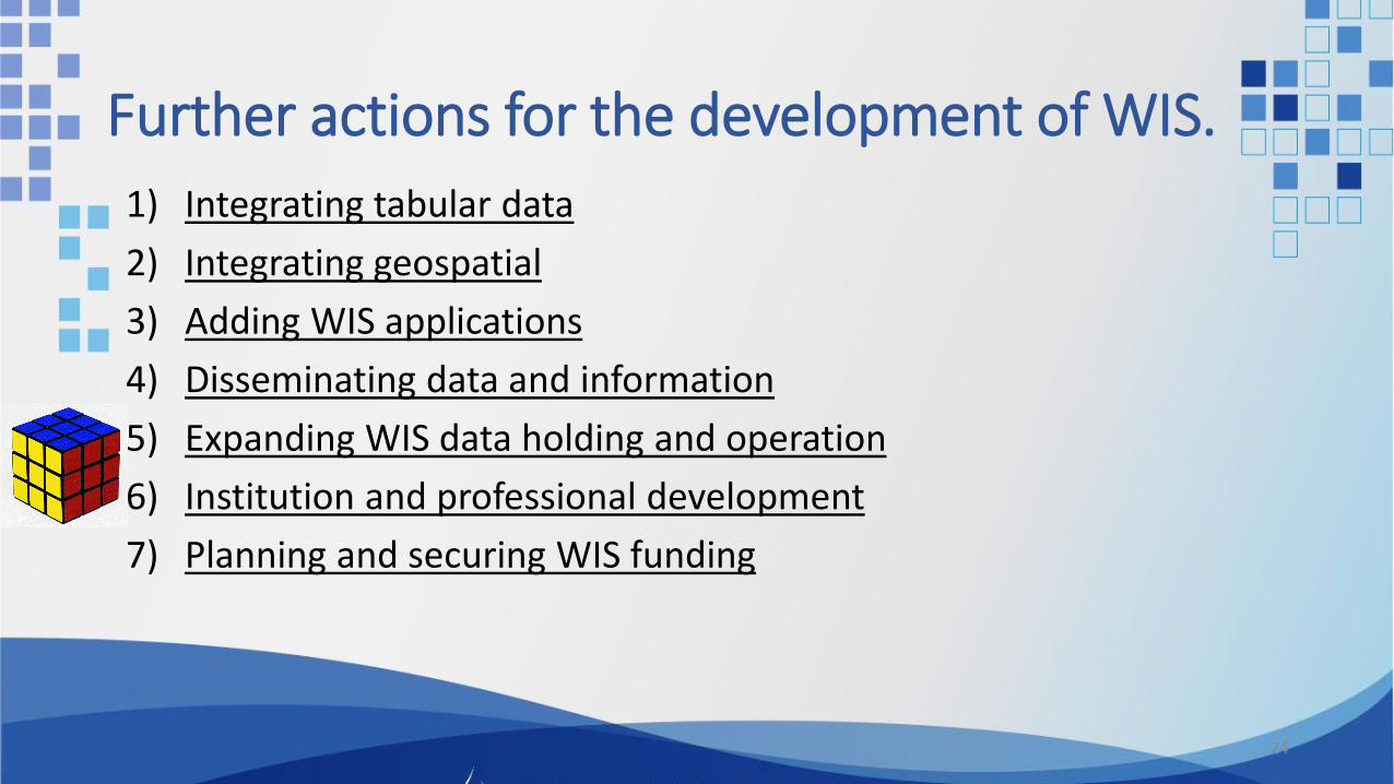
Further actions for the development of WIS.
1) Integrating tabular data
2) Integrating geospatial
3) Adding WIS applications
4) Disseminating data and information
5) Expanding WIS data holding and operation
6) Institution and professional development
7) Planning and securing WIS funding
24

25
Thank you very much for attention!