
lowimpacthydro.org Bridge... · Web viewThe major components of the Putts Bridge Project may be...
91
ESSENTIAL POWER, LLC™ c/o William P. Short III 44 West 62 nd Street P.O. Box 237173 New York, New York 10023-7173 (917) 206-0001; (201) 970-3707 [email protected] August 31, 2012 Low Impact Hydropower Institute c/o Mr. Fred Ayer Executive Director 34 Providence Street Portland, Maine 04103 Re: Application of Putts Bridge Project for Certification by the Low Impact Hydropower Institute Dear Mr. Ayer: Attached please find an application for certification by the Low Impact Hydropower Institute (“LIHI”) of the Putts Bridge Project (the “Project” or the “Facility”) of Essential Power, LLC™ (“Essential Power”). 1 In 2008, Essential Power purchased the Project. Essential Power is a Delaware limited liability company with its principal place of business at 99 Wood Avenue South, Suite 200, Iselin, New Jersey 08830. The company owns a portfolio of 1,755 megawatts of clean and efficient electricity producing power stations located in the Northeastern United States. Essential Power is wholly-owned by Industry Funds Management Pty Ltd (“IFM”), an Australian company which has completed 47 transactions in its 16-year period with approximately $5.9 billion invested in the infrastructure sector. 1 Effective January 1, 2012, the name of North American Energy Alliance, LLC (“NAEA”) changed to Essential Power, LLC™. There was no change in the ownership of NAEA or its corporate status. 1
Transcript of lowimpacthydro.org Bridge... · Web viewThe major components of the Putts Bridge Project may be...

ESSENTIAL POWER, LLC™c/o William P. Short III
44 West 62nd StreetP.O. Box 237173
New York, New York 10023-7173(917) 206-0001; (201) 970-3707
August 31, 2012
Low Impact Hydropower Institutec/o Mr. Fred AyerExecutive Director34 Providence StreetPortland, Maine 04103
Re: Application of Putts Bridge Project for Certification by the Low Impact Hydropower Institute
Dear Mr. Ayer:
Attached please find an application for certification by the Low Impact Hydropower Institute (“LIHI”) of the Putts Bridge Project (the “Project” or the “Facility”) of Essential Power, LLC™ (“Essential Power”).1 In 2008, Essential Power purchased the Project. Essential Power is a Delaware limited liability company with its principal place of business at 99 Wood Avenue South, Suite 200, Iselin, New Jersey 08830. The company owns a portfolio of 1,755 megawatts of clean and efficient electricity producing power stations located in the Northeastern United States. Essential Power is wholly-owned by Industry Funds Management Pty Ltd (“IFM”), an Australian company which has completed 47 transactions in its 16-year period with approximately $5.9 billion invested in the infrastructure sector. Additional information on Essential Power and IFM may be found at www.essentialpowerllc.com and www.industryfundsmanagement.us, respectively.
For purposes of responding to inquiries regarding the application, persons should contact the following:
Primary Contact Secondary Contact
William P. Short III John J. BahrsConsultant Vice President, Power Generation Services44 West 62nd Street Essential Power, LLC™P.O. Box 237173 99 Wood Avenue South, Suite 200New York, New York 10023-7173 Iselin, New Jersey 08830
1 Effective January 1, 2012, the name of North American Energy Alliance, LLC (“NAEA”) changed to Essential Power, LLC™. There was no change in the ownership of NAEA or its corporate status.
1

(917) 206-0001 Office (732) 623-8812 Office(201) 970-3707 Cell (201) 960-7476 [email protected] [email protected]
The Putts Bridge Project (FERC No. P-10677-001) is a 3.90 MW exempt from licensing, limited pond-and-release project located on the Chicopee River in the Towns of Wilbraham and Ludlow and City of Springfield in Hampden County, Massachusetts. The station has an estimated annual production of 15,500 MWh. A FERC exemption from licensing was issued September 11, 1992 and subsequently amended on December 29, 1999 and November 8, 2001. The Project has been in continuous compliance with its requirements for exemption from licensing since 1992.
The following text or computer files are attached to this application:
1. LIHI Questionnaire Form2. Appendix 1-1, FERC Order Granting Exemption From Licensing, Issued September
11, 1992)3. Appendix 1-2, FERC Order Amending Exemptions, Issued December 29, 19994. Appendix 1-3, FERC Order Amending Exemptions, Issued November 8, 20015. Appendix 1-4, FWS Letter Setting Minimum Flows, Dated July 14, 19896. Appendix 1-5, DOI Letter Setting Mandatory Terms and Conditions, dated July 31,
1992 7. Appendix 2, Agency Contacts8. Appendix 3-1, Description of the Facility9. Appendix 3-2, Mode of Operation10. Appendix 3-3, Locations of Major Items of the Facility11. Appendix 3-4, Site Plan of the Facility 12. Appendix 3-5, Aerial Photograph of the Facility13. Appendix 3-6, Chicopee River Profile14. Appendix 3-7, Chicopee River Watershed Map15. Appendix A, Flows16. Appendix A-1, Demonstration of Minimum Flows 17. Appendix A-2, Flow Duration Curve 18. Appendix A-3, FERC Letter, Dated October 27, 199919. Appendix A-4, ConEdison Massachusetts Letter, Dated December 6, 199920. Appendix A-5, ConEdison Development Letter, Dated March 21, 200021. Appendix A-6, Bypass Reach Water Quality Study Plan, Dated June 200022. Appendix A-7, Bypass Reach Water Quality Monitoring Study Report, Dated
November 200023. Appendix A-8, Proposed Minimum Flow and Impoundment Fluctuation Monitoring
Plan, Dated October 200124. Appendix A-9, FWS Letter, Dated November 6, 200125. Appendix A-10, MDFW Letter, Dated November 15, 200126. Appendix A-11, Accepted Minimum Flow and Impoundment Fluctuation Monitoring
Plan, Dated February 20, 201227. Appendix A-12, FWS E-mail, Dated August 27, 2012
2

28. Appendix A-13, MDEP Letter, Dated July 30, 201229. Appendix A-14, MDFW E-mail, Dated Jun 22, 201230. Appendix B, Water Quality31. Appendix B-1, Dissolved Oxygen at Gatehouse32. Appendix B-2, WMECO Exhibit E -- Environmental Report, Dated November 1989 33. Appendix B-3, WMECO Exhibit E -- Environmental Report, Appendix D -- Water
Quality Report, Dated November 198934. Appendix B-4, Chicopee River Watershed 2003 Water Quality Assessment Report35. Appendix B-5, MDEP Letter, Dated June 8, 201236. Appendix C, Fish Passage and Protection37. Appendix C-1, MDFW E-mail, Dated Jun 22, 201238. Appendix C-2, FWS E-mail, Dated August 27, 201239. Appendix D, Watershed Protection40. Appendix D-1, MDFW E-mail, Dated Jun 22, 201241. Appendix D-2, FWS E-mail, Dated August 27, 201242. Appendix E, Threatened and Endangered Species Protection43. Appendix E-1, MDFW Letter, Dated May 30, 201244. Appendix E-2, FWS Letter, Dated January 17, 201245. Appendix F, Cultural Resource Protection46. Appendix F-1, MHC Letter, Dated August 27, 201247. Appendix G, Recreation 48. Appendix G-1, Existing Recreational Facilities49. Appendix G-2, FERC Environmental Inspection Report, Dated October 21, 201050. Appendix G-3, NAEA Letter, Dated March 7, 201151. Appendix G-4, FERC Letter, Dated October 12, 201152. Appendix H, Facilities Recommended for Removal
The application is arranged such that the control document is the LIHI Questionnaire. Back-up documents are cited in the questionnaire and may be found in the appendices.
I request that you review this application and let me know if anything additional is needed in order to place this application in front of the agency contacts and eventually the board of directors of LIHI for consideration.
Sincerely yours,
William P. Short III
cc: John J. Bahrs Kim Marsili David Schmidt Nicholas Hollister
enclosures
3

APPENDIX 1-1
PUTTS BRIDGE PROJECT
FERC ORDER GRANTING EXEMPTION FROM LICENSING,ISSUED SEPTEMBER 11, 1992
A copy of FERC Order Granting Exemption from Licensing, issued September 11, 1992, may be found on the portion of the LIHI website devoted to the Putts Bridge application and is titled “Appendix 1-1 FERC Order Dated 1992_09_11.”
Spillway (right), Skimming Gate (center)and Head Gates (in background)
4

APPENDIX 1-2
PUTTS BRIDGE PROJECT
FERC ORDER AMENDING EXEMPTIONS, ISSUED DECEMBER 29, 1999
A copy of FERC Order Amending Exemptions, issued December 29, 1999, may be found on the portion of the LIHI website devoted to the Putts Bridge application and is titled “Appendix 1-2 FERC Order Dated 1999_12_29.”
Spillway
5

APPENDIX 1-3
PUTTS BRIDGE PROJECT
FERC ORDER AMENDING EXEMPTIONS, ISSUED NOVEMBER 8, 2001
A copy of FERC Order Amending Exemptions, issued November 8, 2001, may be found on the portion of the LIHI website devoted to the Putts Bridge application and is titled “Appendix 1-3 FERC Order Dated 2001_11_08.”
Powerhouse & Forebay (center)Substation (on right)
6

APPENDIX 1-4
PUTTS BRIDGE PROJECT
FISH & WILDLIFE SERVICE LETTER SETTING MINIMUM FLOWS, DATED JULY 14, 1989
A copy of Fish & Wildlife Service letter setting minimum flows, dated July 14, 1989, may be found on the portion of the LIHI website devoted to the Putts Bridge application and is titled “Appendix 1-4 FWS Letter Dated 1989_07_14.”
Powerhouse
7

APPENDIX 1-5
PUTTS BRIDGE PROJECT
DEPARTMENT OF INTERIOR LETTER SETTING MANDATORY TERMS AND CONDITIONS,
DATED JULY 31, 1992
A copy of Department Of Interior letter setting mandatory terms and conditions, dated July 31, 1992, may be found on the portion of the LIHI website devoted to the Putts Bridge application and is titled “Appendix 1-5 DOI Letter Dated 1992_07_31.”
Tailrace
8

APPENDIX 2
PUTTS BRIDGE PROJECT
AGENCY CONTACTS
Impoundment
9

Army Corps of Engineers2
Brian Valiton; (978) [email protected]
Environmental Protection AgencyRalph Abele; (617) 918-1629
Federal Energy Regulatory CommissionKimberly D. Bose, Secretary; (202) 502-8400
Federal Energy Regulatory Commission – New York Regional OfficeGerald L. Cross, Regional Engineer; (212) 273-5911
Fish and Wildlife Service Melissa Grader; (413) 548-9138, x-124
Fish and Wildlife ServiceJohn Warner; (603) 223-2541, x-15
National Marine Fisheries Service Marjorie Mooney; (978) [email protected]
National Park Service, Rivers and Special Studies BranchKevin Mendik; (617) 223-5299
Natural Resources Conservation ServiceDavid Hvizdak; (413) 253-4370
Massachusetts Department of Conservation and Recreation2 Those entities highlighted in RED supplied comments on the Putts Bridge’s Application for Exemption from License.
10

Rick Sullivan; (617) [email protected]
Massachusetts Department of Fish and GameJohn P. Sheppard; (617) 727-1843
Massachusetts Department of Environmental ProtectionRobert D. Kubit; (508) 767-2854
Massachusetts Division of Ecological RestorationRussell Cohen; (617) 626-1543
Massachusetts Division of Fisheries and WildlifeCaleb Slater; (508) 389-6331
Massachusetts Historical Commission (SHPO)Brona Simon; (617) 727-8470
American RiversBrian Graber; (202) [email protected]
American WhitewaterMark Singleton: (828) [email protected]
Appalachian Mountain ClubKen Kimball; (no telephone listing)
Conservation Law FoundationCynthia Liebman; (617) 350-0990
Connecticut River Watershed Council
11

Andrea F. Donlon, M.S.; (413) [email protected]
Pioneer Valley Trout UnlimitedPaul Beaulieu; (413) 875-1302
Trout UnlimitedJeff Reardon; (207) 622-2273
12

APPENDIX 3-1
PUTTS BRIDGE PROJECT
Description of the Facility
The Putts Bridge Project (the “Project”) is exempt from licensing by the Federal Energy Regulatory Commission (“FERC”) as Project No. 10677. The Project is owned by Essential Power, LLC (“Essential Power”).3 The project is located in the Towns of Wilbraham and Ludlow and City of Springfield in Hampden County, Massachusetts, at approximate river mile 9.2 on the Chicopee River. The Project dam crosses the town line between Springfield and Ludlow; the powerhouse is located in Ludlow. The impoundment extends in a northeasterly direction, bordering Springfield and Ludlow. The Project was originally constructed in 1918 by the Ludlow Manufacturing Company. In 1988, the Federal Energy Regulatory Commission determined that the Chicopee River was a navigable waterway under its jurisdiction and ordered WMECO to prepare an application for Exemption from Licensing.
The existing major project works include a dam with a crest elevation of 203.6 feet (NGVD), an impoundment, a concrete headgate structure, two conduits, forebay, trashrack, intake structure, a powerhouse with two generating units, a tailrace channel (normal tailrace elevations 160.9 feet) and appurtenant facilities.
The dam, built in 1918, crosses the Chicopee River in a roughly north-to-south direction, and is a concrete gravity structure approximately 223-foot long by 22-foot high. The northern abutment of the dam is contiguous with the abutment for the Ludlow Avenue Bridge. Adjacent to this abutment are a skimming gate with invert at El. 199.7 feet and a deep sluice gate with invert at El. 183.9 feet. The deck elevation at the two gates is El. 212.9 feet. A 23-foot non-overflow section extends from the gate area to the 200-foot long ogee spillway which extends across the river to the south abutment, El. 212.9 feet. A concrete retaining wall extends from the south abutment at El. 212.9 feet for approximately 133 feet.
At normal pond elevation the Putts Bridge Project impoundment extends approximately 3.3 miles upstream of the dam. At normal pond condition, the maximum surface area is approximately 65 acres at El. 205.3’. While the maximum useable storage of the reservoir is 323 acre-feet, the used storage capacity is just 65 acre-feet. While the permitted daily drawdown is 1 foot during the spring and 2 foot for the balance of the year (except during energy audits and system emergencies when this limit may be exceeded), the actual year-round drawdown is 1 foot.
The concrete headgate structure is adjacent to the northeast abutment of the dam, and has a deck elevation of 212.9 feet. Six motorized headgates, each approximately 12 feet wide by 13.3 feet high direct the flow to the underground concrete conduits that lead to the powerhouse
3 Until the late 1990s, the Project was owned by Western Massachusetts Electric Company when the Project was sold to Consolidated Edison Energy, Inc. (“CEEI”), an affiliate of Consolidated Edison Company of New York, Inc. In 2008, the Project was sold to its current owner, Essential Power.
13

forebay. A double-barreled, underground concrete conduit extends 647 feet from the impoundment to the forebay. Each barrel of the conduit is 16.5 feet high by 12.5 feet wide.
The forebay is a reinforced concrete structure measuring 40 feet wide by 104 feet long. The forebay is 41.5 feet high, with a top elevation of 210.3 feet. There is a 2.5-foot diameter spigot type drain gate at the base of the forebay, and an 18-foot wide skimming gate on the north forebay.
The trashrack is situated along the western forebay wall, extending from the floor of the forebay (El. 169.4 feet to El. 208.1 feet). There is a mechanical trash rake mounted on rails along the entire width of the trashrack. Wooden headgates, measuring 14.3 feet square, isolate the forebay from the generating units.
The Putts Bridge Project powerhouse has a concrete substructure with a brick superstructure. It measures 45 feet wide by 154 feet long. The structure houses the two operating units, No.2 and No.3, and one retired, No. 4. Unit No.1 was never installed although the turbine pit is there. Unit No.5 is a retired waterwheel exciter. The normal tailrace elevation is 160.9 feet. The tailrace canal runs 355 feet from the powerhouse in a westerly direction to where the flow re-enters the Chicopee River.
The powerhouse’s 11.5 KV generators are connected to 11.5 KV circuit breaker to a 4.5 MVA autotransformer located at WMECO’s North Street substation. At the substation, the autotransformer steps the voltage up from 11.5 KV to 13.8 KV for interconnection to WMECO’s 13.8 KV distribution system.
The Putts Bridge project is situated upstream of three other hydroelectric facilities located on the Chicopee River4 and downstream of two other dams on the Chicopee River as well as other dams on the Ware, Swift and Quaboag Rivers.5 Two of the three downstream hydroelectric facilities are owned and operated by Essential Power – Dwight Station Project (P-10675) and Indian Orchard Project (P-10678). The Red Bridge Project (P-10676) is owned and operated by Essential Power and is located upstream of the Project. The Project drains an area of 686 square miles.
Immediately upstream of the Putts Bridge Project is Collins Dam Project (P-6544) and immediately upstream of Dwight Station Project is Chicopee Falls Dam (P-6522). The Project and the other Essential Power dams on the Chicopee River have little to no control over their inflows. Collins Hydro and Chicopee Falls dams6 are owned and operated by unrelated entities as are all of the hydroelectric projects on the upstream tributaries of the Chicopee River.
4 The order of the hydroelectric dams, starting with the lowest dam, on the Chicopee River is Dwight Station Project (P-10675) river mile 1.2, Chicopee Falls Project (P-6522) river mile 3.0, Indian Orchard Project (P-10678) river mile 7.8, Putts Bridge Project (P-10677) river mile 9.2, Collins Hydro Project (P-6544) river mile 12.6 and Red Bridge Project (P-10676) river mile 15.2. 5 For example, the first dam on the Ware River is Thorndike Dam river mile 20.5 while the first dam on the Swift River is the Upper Bondsville Dam river mile 20.1. (No dams were identified on the Quaboag River).6 The owners/operators of the Collins Hydro and Chicopee Falls projects are also unrelated to each other.
14

The Putts Bridge project is operated in a limited pond-and-release mode, utilizing the useable storage capacity (65 acre-feet) afforded by a 1.0 foot drawdown during the second quarter and 2.0 foot drawdown during the balance of the year.7 The station is operated semi-automatically by float controls. The operating mode of the Putts Bridge project does not change during dry, mean or high water years. As flows vary at the Project, the number of turbines operating and the duration of operation changes, increasing and decreasing the amount of generation realized.
7 Although the Project has a two-foot drawdown for the non-spring periods of the year, the Project operates year-round with a one-foot drawdown.
15

APPENDIX 3-2
PUTTS BRIDGE PROJECT
Mode of Operation
The Putts Bridge project is operated in a limited pond-and-release mode, utilizing the useable storage capacity (65 acre-feet) afforded by a 1.0 foot drawdown during the second quarter and 2.0 foot drawdown during the balance of the year.8 The station is operated semi-automatically by float controls. The operating mode of the Putts Bridge project does not change during dry, mean or high water years. As flows vary at the Project, the number of turbines operating and the duration of operation changes, increasing and decreasing the amount of generation realized.
Initially, the exemption required a continuous minimum flow release of 247 cfs, or inflow, at the project dam to the bypass reach. The exemption also limits pond drawdowns to one foot below the top of the flashboards from April to June and two feet for the remainder of the year. This former requirement was subsequently revised.
During a June 22, 1999 meeting, FWS requested evidence that operation of the Putts Bridge Project does not impact the minimum flow release at the downstream Indian Orchard Project. In response to FWS concerns, CEEI filed on December 6, 1999, calculation tables on pond fluctuations permitted by the exemptions. Based on the results, it appears that the pond level control at the Indian Orchard Project should be set at 6 inches during the spring period. This measure would provide sufficient storage to permit the continuous discharge of the minimum flow at the Indian Orchard Project. Therefore, CEEI indicated in a December 6, 1999 letter, that it plans to operate the upgraded units within the head pond restrictions such that the total outflow from the Putts Bridge Project (i.e., the turbine discharge plus the 25 cfs minimum flow) is adequate to maintain the 247 cfs minimum flow requirement at the Indian Orchard Project.
On January 27, 2000, FWS also requested evidence that the reduced flow to the bypass reach at Putts Bridge would not create unacceptable water quality. To that end, FWS required that a water quality study be performed in order to verify that a flow of 25 cfs will protect water quality in the bypass reach. FWS also conditioned its approval on the study taking place during the summer. On June 7, 2000, after incorporating comments from FWS, MDFW and MDEP, CEEI released its Putts Bridge Bypass Water Quality Study Plan. Over a sixty-day period (between July 7 and September 6, 2000), the water was sampled at three points downstream of the dam. Data collected during the water quality monitoring plan indicated that D.O. concentrations and water temperatures in the Putts Bridge bypass reach exceeded MDEP Class B water quality standards.9 As such, it was concluded that the minimum flows, as released by the
8 Although the Project has a two-foot drawdown for the non-spring periods of the year, the Project operates year-round with a one-foot drawdown.
16

electronically operated skimmer gate at the dam, are sufficient for maintaining adequate water quality in the Putts Bridge bypass reach.
9 According to the MDEP, the Chicopee River is classified as class B water and is listed as a warm water fishery. This classification requires that dissolved oxygen levels shall not be less than 5.0 mg/L and that levels of dissolved oxygen shall not be lower than 60 percent in warm water fisheries. Water temperature shall also not exceed 28.3oC in warm water fisheries.
17

APPENDIX 3-3
PUTTS BRIDGE PROJECT
Locations of Major Items of the Facility
The major components of the Putts Bridge Project may be viewed on Google Earth and are found at the following latitudes and longitudes:
Items Latitude Longitude
223-ft. dam 420 09’23.18” N 720 29’03.95” W3.3-mile impoundment 420 09’20.01” N 720 28’57.99” Wconcrete headgate structure 420 09’24.18” N 720 29’03.22” Wconduits 420 09’25.86” N 720 29’06.03” Wforebay 420 09’28.03” N 720 29’10.68” Wtrashrack 420 09’28.18” N 720 29’10.91” Wintake structure 420 09’28.03” N 720 29’10.68” Wpowerhouse 420 09’28.21” N 720 29’11.40” Wtailrace channel 420 09’29.64” N 720 29’12.81” Wbypass reach 420 09’25.16” N 720 29’12.09” Wparking area and boat dock 420 09’10.56” N 720 28’41.93” W
18
APPENDIX 3-4
PUTTS BRIDGE PROJECT
Site Plan of the Facility
The site plan of the Putts Bridge project may be found on the portion of the LIHI website devoted to the Putts Bridge application and is titled “Appendix 3-4 Site Plan of the Facility.”
Powerhouse and Tailrace
19
APPENDIX 3-5
PUTTS BRIDGE PROJECT
Aerial Photograph of the Facility
An aerial photograph of the Putts Bridge project may be found on the portion of the LIHI website devoted to the Putts Bridge application and is titled “Appendix 3-5 Aerial Photograph of the Facility.”
20

APPENDIX 3-6
PUTTS BRIDGE PROJECT
Chicopee River Profile
The Chicopee River Profile may be found on the portion of the LIHI website devoted to the Putts Bridge application and is titled “Appendix 3-6 Chicopee River Profile.”
21
APPENDIX 3-7
PUTTS BRIDGE PROJECT
Chicopee River Watershed Map
A map of the Chicopee River Watershed may be found on the portion of the LIHI website devoted to the Putts Bridge application and is titled “Appendix 3-7 Chicopee River Watershed Map.”
22

APPENIDX A
PUTTS BRIDGE PROJECT
Flows
The Facility is in compliance with resource agency recommendations issued after December 31, 1986 regarding flow conditions for fish and wildlife protection, mitigation and enhancement (including in-stream flows, ramping and peaking rate conditions, and seasonal and episodic instream flow variations) for both the reach below the tailrace and all bypassed reaches.
Section 30(c) of the Federal Power Act and Section 408 of the Energy Security Act required the inclusion in the Putts Bridge exemption from licensing, all terms and conditions that are prescribed by state and federal fish and wildlife agencies to prevent loss of, or damage to fish and wildlife resources.
With respect to minimum flow at the Putts Bridge Project, the FWS specifically mandated the following conditions:
The Exemptee agreed to release continuously a minimum flow of 247 cfs,10 or inflow to the project, whichever is less, at the project dam to the bypass reach.
The FWS reserved the right to add and/or alter these terms and conditions as appropriate in order to carry out its responsibilities with respect to fish and wildlife resources. The Exemptee agreed, within 30 days of receipt, to file with the Commission any additional or modified mandatory terms and conditions.
The Exemptee agreed to operate the project to limit drawdown of the Project impoundment to no more than one foot below the top of the flashboards from April 1 through June 30. From July 1 through March 30 [31], the Exemptee agreed to limit drawdown to no more than 2 feet below the top of the flashboards, except during system emergencies or energy audits.11
The Licensee [Exemptee] agreed, within six months from the date of issuance of the exemption from licensing for the Project, present to the FWS for approval, a plan for monitoring project impoundment level and instantaneous bypass releases. Following approval of the plan, the Exemptee agree to measure and record impoundment level and flows according to the plan and provides records of these data to the FWS within 30 days from a request for the records.
10 The current figure is 25 cfs. Upon the completion of a D.O. analysis of the bypass reach that confirmed that adequate D.O. levels could maintain habitat for the resident fish community, FWS and MDFW consented to a permanent reduction in minimum flow from 247 cfs to 25 cfs.11 Id.
23

The Exemptee agreed to incorporate the aforementioned fish and wildlife conditions in any conveyance; by lease, sale or otherwise; of its interests so as to legally assure compliance with said conditions for as long as the Project operates under an exemption from licensing.
Initially, the exemption required a continuous minimum flow release of 247 cfs, or inflow, at the project dam to the bypass reach. The exemption also limits pond drawdowns to one foot below the top of the flashboards from April to June and two feet for the remainder of the year. This former requirement was subsequently revised.
During a June 22, 1999 meeting, FWS requested evidence that operation of the Putts Bridge Project does not impact the minimum flow release at the downstream Indian Orchard Project. In response to FWS concerns, CEEI filed on December 6, 1999, calculation tables on pond fluctuations permitted by the exemptions. Based on the results, it appears that the pond level control at the Indian Orchard Project should be set at 6 inches during the spring period. This measure would provide sufficient storage to permit the continuous discharge of the minimum flow at the Indian Orchard Project. Therefore, CEEI indicated in a December 6, 1999 letter, that it plans to operate the upgraded units within the head pond restrictions such that the total outflow from the Putts Bridge Project (i.e., the turbine discharge plus the 25 cfs minimum flow) is adequate to maintain the 247 cfs minimum flow requirement at the Indian Orchard Project.
On January 27, 2000, FWS also requested evidence that the reduced flow to the bypass reach at Putts Bridge would not create unacceptable water quality. To that end, FWS required that a water quality study be performed in order to verify that a flow of 25 cfs will protect water quality in the bypass reach. FWS also conditioned its approval on the study taking place during the summer. On June 7, 2000, after incorporating comments from FWS, MDFW and MDEP, CEEI released its Putts Bridge Bypass Water Quality Study Plan. Over a sixty-day period (between July 7 and September 6, 2000), the water was sampled at three points downstream of the dam. Data collected during the water quality monitoring plan indicated that D.O. concentrations and water temperatures in the Putts Bridge bypass reach exceeded MDEP Class B water quality standards.12 As such, it was concluded that the minimum flows, as released by the electronically operated skimmer gate at the dam, are sufficient for maintaining adequate water quality in the Putts Bridge bypass reach.
To date, the Exemptee has not been notified by the FWS, MDEP or MDFW of the need to modify, increase or decrease its minimum flow.
The Putts Bridge Project consists of a dam site located on the Chicopee River. The 18-mile long Chicopee River originates at the confluence of the Ware and Quaboag Rivers, 8.8 miles upstream, and discharges into the Connecticut River 9.2 miles downstream of the project area at Springfield, Massachusetts. The following flow parameters are extrapolated from 53
12 According to the MDEP, the Chicopee River is classified as class B water and is listed as a warm water fishery. This classification requires that dissolved oxygen levels shall not be less than 5.0 mg/L and that levels of dissolved oxygen shall not be lower than 60 percent in warm water fisheries. Water temperature shall also not exceed 28.3oC in warm water fisheries.
24

years of United States Geological Survey (“USGS”) (1929-1982) records from hydrologic gaging station No. 01177000, located on the Chicopee River at Indian Orchard, Massachusetts, located approximately 2 miles downstream of the Putts Bridge dam site. The drainage area at this gage is 689 square miles and the drainage area at the hydropower project site is 686 square miles. The mean annual flow at the project is 910 cfs (914 cfs at the gage) with a minimum and maximum historical discharge of 16 cfs, recorded on various dates between 1929 and 1931, and 43,400 cfs, recorded in September 21, 1938, respectively. Additional flow parameters for the Chicopee River related to the project area are as follows:
high flow: approximately 1,518 cfs (approximately 1,525 cfs at the gage at Indian Orchard); flow exceeded 10 percent of the time;13
low flow: approximately 224 cfs (approximately 225 cfs at the gage at Indian Orchard); flow exceeded 90 percent of the time;14
7Q10 flow: 247 cfs (the 7Q10 flow refers to the minimum 7-day average flow rate expected to occur once every 10 years and is based on 0.36 cfs per square mile of drainage area).
The dam creates an average 8.5-foot deep, 65-acre impoundment that is 3.3 mile long, with a normal surface elevation of 205.3 feet USGS datum, normal tailwater elevation of 160.9 feet and average gross head of 44.4 feet.
During the In-take Review for Red Bridge Project, it was discovered that CEEI had not completed the “Minimum Flow and Impoundment Fluctuation Monitoring Plan.” Accordingly, on February 20, 2012, Essential Power, with the concurrence of FWS, MDEP and MDFW, filed with FERC a “Minimum Flow and Impoundment Fluctuation Monitoring Plan” for the Project.
In summary, the Exemptee operates the Putts Bridge Project in a limited pond-and-release mode for the protection of water quality, aquatic resources, and aesthetic values in the Chicopee River. This operation may be temporarily modified, if required, by operating emergencies beyond the control of the Exemptee, or for short periods while performing energy audits.
13 See Appendix A-2 for a Flow Duration Curve for the Chicopee River at Indian Orchard.14 Id.
25

APPENIDX A-1
PUTTS BRIDGE PROJECT
Demonstration of Minimum Flows
A copy of the latest FERC compliance filing for the minimum flow requirements for the Putts Bridge project may be found on the portion of the LIHI website devoted to the Putts Bridge application and is titled “Appendix A-1 Demonstration of Minimum Flow Dated 2011_03_01.”
Forebay and Trash Racks (Powerhouse in background)
26

APPENIDX A-2
PUTTS BRIDGE PROJECT
Flow Duration Curve
A copy of the Flow Duration Curve at the Indian Orchard gage may be found on the portion of the LIHI website devoted to the Putts Bridge application and is titled “Appendix A-2 Flow Duration Curve Dated 1989_08.”
27

APPENIDX A-3
PUTTS BRIDGE PROJECT
FERC Letter, Dated October 27, 1999
A copy of the FERC Letter, dated October 27, 1999, may be found on the portion of the LIHI website devoted to the Putts Bridge application and is titled “Appendix A-3 FERC Letter Dated 1989_08.”
28

APPENIDX A-4
PUTTS BRIDGE PROJECT
ConEdison Massachusetts Letter, Dated December 6, 1999
A copy of a ConEdison Massachusetts Letter, dated December 6, 1999, may be found on the portion of the LIHI website devoted to the Putts Bridge application and is titled “Appendix A-4 ConEdison Massachusetts Letter Dated 1999_12_06.”
29
APPENDIX A-5
PUTTS BRIDGE PROJECT
ConEdison Development Letter, Dated March 21, 2000
A copy of a ConEdison Development Letter, March 21, 2000, may be found on the portion of the LIHI website devoted to the Putts Bridge application and is titled “Appendix A-5 ConEdison Development Letter Dated 2000_03_21.”
30

APPENDIX A-6
PUTTS BRIDGE PROJECT
Bypass Reach Water Quality Study Plan, Dated June 2000
A copy of the Bypass Reach Water Quality Study Plan, dated June 2009, may be found on the portion of the LIHI website devoted to the Putts Bridge application and is titled “Appendix A-6 Bypass Reach Water Quality Study Plan Dated 2000_06.”
31

APPENDIX A-7
PUTTS BRIDGE PROJECT
Bypass Reach Water Quality Monitoring Study Report, Dated November 2000
A copy of the Bypass Reach Water Quality Monitoring Study Report, dated November 2000, may be found on the portion of the LIHI website devoted to the Putts Bridge application and is titled “Appendix A-7 Bypass Reach Water Quality Monitoring Study Report Plan Dated 2000_11.”
32

APPENIDX A-8
PUTTS BRIDGE PROJECT
Proposed Minimum Flow and Impoundment Fluctuation Monitoring Plan, Dated October 2001
The Proposed Minimum Flow and Impoundment Fluctuation Monitoring Plan, dated October 2001, may be found on the portion of the LIHI website devoted to the Putts Bridge application and is titled “Appendix A-8 Minimum Flow and Impoundment Fluctuation Monitoring Plan Dated 2001_10.”
Head Gates (on right) and Skimming Gate (front)
33

APPENIDX A-9
PUTTS BRIDGE PROJECT
Fish and Wildlife Letter, Dated November 6, 2001
The Fish and Wildlife letter, dated November 6, 2001, may be found on the portion of the LIHI website devoted to the Putts Bridge application and is titled “Appendix A-9 United States Fish and Wildlife Letter Dated 2001_11_06.”
34

APPENIDX A-10
PUTTS BRIDGE PROJECT
Massachusetts Division of Fisheries and Wildlife Letter, Dated November 15, 2001
The Massachusetts Division of Fisheries and Wildlife letter, dated November 6, 2001, may be found on the portion of the LIHI website devoted to the Putts Bridge application and is titled “Appendix A-10 Massachusetts Division of Fisheries and Wildlife Letter Dated 2001_11_15.”
35

APPENIDX A-11
PUTTS BRIDGE PROJECT
Accepted Minimum Flow And Impoundment Fluctuation Monitoring Plan, Dated February 20, 2012
The Accepted Minimum Flow and Impoundment Fluctuation Monitoring Plan, dated February 20, 2012, may be found on the portion of the LIHI website devoted to the Putts Bridge application and is titled “Appendix A-11 Minimum Flow Monitoring Plan Dated 2012_02_20.”
36

APPENIDX A-12
PUTTS BRIDGE PROJECT
Fish and Wildlife E-mail, Dated August 27, 2012
The Fish and Wildlife e-mail, dated August 27, 2012, may be found on the portion of the LIHI website devoted to the Putts Bridge application and is titled “Appendix A-12 Fish and Wildlife E-mail Dated 2012_08_27.”
37

APPENIDX A-13
PUTTS BRIDGE PROJECT
Massachusetts Department of Environmental Protection Letter, Dated July 30, 2012
The Massachusetts Department of Environmental Protection letter, dated July 30, 2012, may be found on the portion of the LIHI website devoted to the Putts Bridge application and is titled “Appendix A-13 Massachusetts Department of Environmental Protection Letter Dated 2012_07_30.”
38

APPENIDX A-14
PUTTS BRIDGE PROJECT
Massachusetts Division of Fisheries and Wildlife E-Mail, Dated June 22, 2012
The Massachusetts Division of Fisheries and Wildlife E-Mail, dated June 22, 2012, may be found on the portion of the LIHI website devoted to the Putts Bridge application and is titled “Appendix A-13 Massachusetts Division of Fisheries and Wildlife E-Mail Dated 2012_06_22.”
39

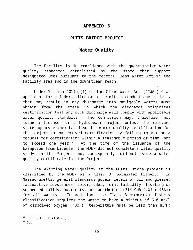
APPENIDX B
PUTTS BRIDGE PROJECT
Water Quality
The Facility is in compliance with the quantitative water quality standards established by the state that support designated uses pursuant to the federal Clean Water Act in the Facility area and in the downstream reach.
Under Section 401(a)(1) of the Clean Water Act (“CWA”),15 an applicant for a federal
license or permit to conduct any activity that may result in any discharge into navigable waters must obtain from the state in which the discharge originates certification that any such discharge will comply with applicable water quality standards. The Commission may, therefore, not issue a license for a hydropower project unless the relevant state agency either has issued a water quality certification for the project or has waived certification by failing to act on a request for certification within a reasonable period of time, not to exceed one year.16 At the time of the issuance of the Exemption from License, the MDEP did not complete a water quality study for the Project and, consequently, did not issue a water quality certificate for the Project.
The existing water quality at the Putts Bridge project is classified by the MDEP as a Class B, warmwater fishery. In Massachusetts, general standards govern levels of oil and grease, radioactive substances, color, odor, form, turbidity, floating or suspended solids, nutrients, and aesthetics (314 CMR 4.03 (1988)) for all waters. In addition, the Class B warmwater fishery classification requires the water to have a minimum of 5.0 mg/l of dissolved oxygen (“DO”); temperature must be less than 83oF; pH must be between 6.5 and 8.0 standard units, and fecal coliform bacteria counts must not be more than 200 per 100 ml sample.
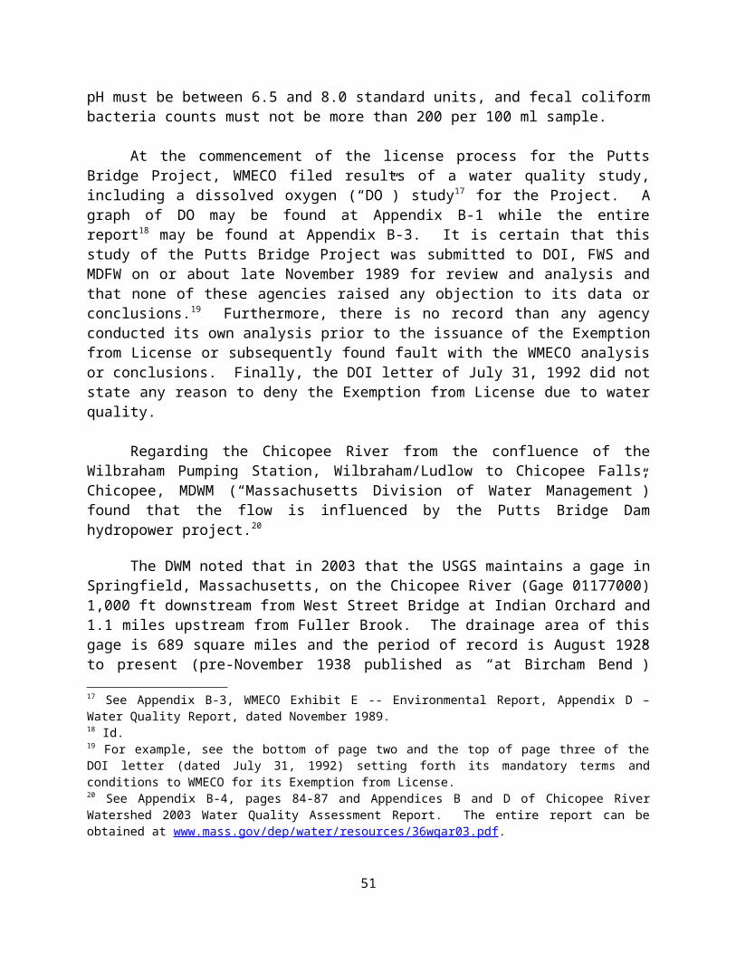
At the commencement of the license process for the Putts Bridge Project, WMECO filed results of a water quality study, including a dissolved oxygen (“DO”) study17 for the Project. A graph of DO may be found at Appendix B-1 while the entire report18 may be found at Appendix B-3. It is certain that this study of the Putts Bridge Project was submitted to DOI, FWS and MDFW on or about late November 1989 for review and analysis and that none of these agencies raised any objection to its data or conclusions.19 Furthermore, there is no record than any agency conducted its own analysis prior to the issuance of the Exemption from License or subsequently found fault with the WMECO analysis or conclusions. Finally, the DOI letter of July 31, 1992 did not state any reason to deny the Exemption from License due to water quality.
15 33 U.S.C. 1341(a)(1).16 Id.17 See Appendix B-3, WMECO Exhibit E -- Environmental Report, Appendix D – Water Quality Report, dated November 1989.18 Id.19 For example, see the bottom of page two and the top of page three of the DOI letter (dated July 31, 1992) setting forth its mandatory terms and conditions to WMECO for its Exemption from License.
40
Regarding the Chicopee River from the confluence of the Wilbraham Pumping Station, Wilbraham/Ludlow to Chicopee Falls, Chicopee, MDWM (“Massachusetts Division of Water Management”) found that the flow is influenced by the Putts Bridge Dam hydropower project.20
The DWM noted that in 2003 that the USGS maintains a gage in Springfield, Massachusetts, on the Chicopee River (Gage 01177000) 1,000 ft downstream from West Street Bridge at Indian Orchard and 1.1 miles upstream from Fuller Brook. The drainage area of this gage is 689 square miles and the period of record is August 1928 to present (pre-November 1938 published as “at Bircham Bend”) (Socolow 2005). The average discharge is 909 cfs (1928-2005) and the maximum discharge occurred on September 21, 1938 (45,200 cfs) while the minimal discharge of 16 cfs occurred several times in 1929-31 (USGS 2007 and Soclolow et al. 2005).
The USGS remarks that flow diversion has occurred since 1941 from 186 square miles in Swift River basin and at times since 1931 from 97 square miles in Ware River Basin for Boston Metropolitan District (now MA DCR) (Socolow et al 2005). Diversions have also occurred since 1950 for Chicopee, since 1952 for South Hadley, at times since 1966 for Worcester, and at times since 1955 from 6.5 square miles in Ware River Basin for Fitchburg. Diversion from Ludlow Reservoir for Springfield and, prior to 1952, for Chicopee has also occurred. Flow is regulated by power plants upstream, by Quabbin Reservoir 21 miles upstream on the Swift River since 1939, by Barre Falls Reservoir on the Ware River since 1958, by Conant Brook Reservoir since 1966, and by smaller reservoirs (Socolow 2005). Discharge records are considered to be good except for estimated daily discharges, which are poor. (Socolow et al 2005).
There are two dams on this segment of the Chicopee River: Putts Bridge Dam, at Route 21 between Ludlow and Indian Orchard (part of Springfield), and the Indian Orchard Dam, north of Route 141 adjacent to an old mill on Front Street. The Putts Bridge Dam was constructed in 1918 as a concrete gravity structure. It rises 22 feet from the bed of the Chicopee River. The Indian Orchard Dam is a cut stone dam with 28 feet of height above the river. Both dams are owned and operated by CEEI as hydroelectric power plants. They generate and release minimum flows depending on the release from the Red Bridge Dam (located further upstream on the Chicopee River) (Kleinschmidt Associates and CEEI 1999). This segment of the Chicopee River ends at the Chicopee Falls Dam, which is a hydroelectric facility owned by the City of Chicopee.
DWM conducted water quality monitoring at one station (CH06–River Street/West Street Bridge, Springfield/Ludlow) along this segment of the Chicopee River between April and October 2003 (Appendix B). In-situ parameters were measured on seven occasions, including two pre-dawn occasions. Grab samples were also collected and analyzed for TSS, turbidity, ammonia-nitrogen, and total phosphorus (Appendix B).
Dissolved oxygen, pH and temperature met criteria on all sampling dates. It should be noted though that the DWM station was below the Indian Orchard Impoundment. Total phosphorus concentrations during June and August 2003 sampling dates were slightly elevated.
20 See Appendix B-4, pages 84-87 and Appendices B and D of Chicopee River Watershed 2003 Water Quality Assessment Report. The entire report can be obtained at www.mass.gov/dep/water/resources/36wqar03.pdf.
41

Ammonia nitrogen concentrations were low on all sampling dates. The Aquatic Life Use is assessed as support for this segment of the Chicopee River based on the good water quality conditions but is given an “Alert Status” due to the presence of CSOs and the potential impacts of hydro modification due to hydropower operations.
Metcalf and Eddy (2006), as part of CSO work for the Connecticut River Bacteria Monitoring Project, collected bacteria samples at the Route 21 Bridge on the Springfield/Ludlow border. This station is upstream from the Indian Orchard Impoundment and upstream from the DWM sampling site. Metcalf and Eddy staff collected two samples along a transect. Samples were taken from the river bank east of the bridge on both sides of the river. Dry weather sampling was conducted on August 8, 2001 and wet weather sampling on three occasions: between September 25 -27, 2001; September 15-16, 2002 and October 16-18, 2002. This project had a Mass DEP-approved Quality Assurance Project Plan. The sampling conducted between September 25-27, 2001 had quality control issues and the data for this sampling are not used for purposes of this assessment report nor detailed in this report. Six samples were collected during one sampling occasions in 2001 and the E. coli geometric mean was 22.8 cfu/100 mL. In 2002 sixteen samples were collected during two wet weather sampling events and the E. coli geometric mean was 61.8 cfu/100 mL. None of the E. coli counts reported by Metcalf and Eddy (2006) and used in this report were greater than 235 cfu/ 100 mL. High fecal coliform counts were found in numerous samples but the corresponding E. coli counts were not high.
DWM conducted fecal coliform and E. coli bacteria monitoring at one station (CH06– River Street/West Street Bridge, Springfield/Ludlow) along this segment of the Chicopee River between April and October 2003 (Appendix B). This site is downstream from 13 CSOs and located just upstream from the USGS gage at Indian Orchard. There is a dam and a mill upstream from this station. The river channel is large and wide. Samples were collected by the bridge drop method at this station.
The E. coli bacteria counts in samples collected by DWM at Station CH06 were generally low. The highest E. coli bacteria count of 126 cfu/100 mL was found in the sample collected on October 15, 2003, a wet weather sampling date. It appears the elevated streamflow was largely due to rain in the upper Chicopee watershed as no significant rainfall was recorded at the NOAA rain gauge in Springfield. This wet weather sampling date may not have captured local CSO discharges. The E. coli geometric mean for Station CH06 was 35.4 cfu/100 mL.
Parameter DWM 2003 (n=6)Fecal coliform (cfu/100mL) 2 - 248
Geometric mean 39.4E. coli (cfu/100mL) 4 - 126
Geometric mean 35.4
No objectionable deposits, scums or water odor were recorded by DWM field crews although conditions were often unobservable. Water clarity was clear on all days when noted. When observable there were no phytoplankton noted and on the one occasion when periphyton was observable it was characterized as sparse. On three occasions (July 30th, July 31st and
42

August 20th) dense submerged aquatic plants were noted (principally grasses) while on the rest of sampling days aquatic plants were unobservable.
Given the low E. coli bacteria counts the Primary and Secondary Contact Recreation Uses are assessed as support. Due to the presence of CSOs both Primary and Secondary Contact Recreation Uses are listed with an “Alert Status.” Given the lack of objectionable conditions the Aesthetics Use is assessed as support.
The facility area and the downstream reach are currently identified by the US EPA as not meeting the water quality standards pursuant to Section 303(d) of the CWA.21 While the US EPA noted that pathogens are present in the Chicopee River downstream or in its upstream tributaries to the Project,22 their appearance in the Chicopee River just immediately above or below the Putts Bridge Project is neither caused by nor contributed to by Putts Bridge Project.23
Thus, the Project does not contribute to any degradation of the water quality of the Chicopee River.
21 At http://iaspub.epa.gov/tmdl_waters10/attains_impaired_waters.impaired_waters_list?p_state=MA&p_cycle=2006, information on this US EPA determination may be found.22 Ware, Quaboag and Swift Rivers.23 A similar conclusion was reached by the MDEP in its letter dated June 8, 2012. A copy of which may be found at Appendix B-5.
43

APPENDIX B-1
PUTTS BRIDGE PROJECT
Dissolved Oxygen at Gatehouse
A graph of the dissolved oxygen, covering the period from July 24 through 27, 1989, performed by Kleinschmidt Associates for WMECO for the Putts Bridge Project may be found on the portion of the LIHI website devoted to the Putts Bridge application and is titled “Appendix B-1 Dissolved Oxygen at Gatehouse Dated 1989_07_24-27.”
Powerhouse (center) and Forebay (right)
44
APPENDIX B-2
PUTTS BRIDGE PROJECT
WMECO Exhibit E -- Environmental Report
A copy of a portion of the WMECO Exhibit E -- Environmental Report, dated November 1989, may be found on the portion of the LIHI website devoted to the Putts Bridge application and is titled “Appendix B-2 WMECO Environmental Report Dated 1989_11.”
45

APPENDIX B-3
PUTTS BRIDGE PROJECT
WMECO Exhibit E -- Environmental Report, Appendix D – Water Quality Report
A copy of WMECO Exhibit E -- Environmental Report, Appendix D – Water Quality Report, dated November 1989, may be found on the portion of the LIHI website devoted to the Putts Bridge application and is titled “Appendix B-3 WMECO Water Quality Report Dated 1989_11.”
46

APPENDIX B-4
PUTTS BRIDGE PROJECT
Chicopee River Watershed2003 Water Quality Assessment Report
The Chicopee River Watershed 2003 Water Quality Assessment Report may be found on the portion of the LIHI website devoted to the Putts Bridge application and is titled “Appendix B-4 Chicopee River Watershed 2003 Water Quality Assessment Report.”
47

APPENIDX B-5
PUTTS BRIDGE PROJECT
Massachusetts Department of Environmental Protection Letter, Dated June 8, 2012
The Massachusetts Department of Environmental Protection letter, dated June 8, 2012, may be found on the portion of the LIHI website devoted to the Putts Bridge application and is titled “Appendix B-5 Massachusetts Department of Environmental Protection Letter Dated 2012_06_8.”
48

APPENDIX C
PUTTS BRIDGE PROJECT
Fish Passage and Protection
The Facility is in compliance with mandatory fish passage prescriptions for upstream and downstream passage of anadromous and catadromous fish issued by resource agencies after December 31, 1986.
Section 30(c) of the Federal Power Act and Section 408 of the Energy Security Act
require the inclusion in the Putts Bridge exemption from licensing, all terms and conditions that are prescribed by state and federal fish and wildlife agencies to prevent loss of, or damage to fish and wildlife resources.
With respect fish passage and protection, the FWS specifically mandated the following conditions:
The Exemptee agreed to construct, maintain and monitor upstream and downstream fish passage when prescribed by the FWS and/or MDFW. The Exemptee agreed to be responsible for the designs of the fish passage facilities which shall be developed in consultation with, and be approved by, the FWS, MDFW and the Connecticut River Atlantic Salmon Commission (CRASC). Furthermore, the Exemptee agreed to construct and have operational upstream and/or downstream passage facilities within two years after being notified of their need by the FWS and/or the MDFW.
The Exemptee agreed to develop plans for monitoring, maintaining and operating the upstream and downstream fish passage facilities in consultation with FWS, MDFW and CRASC. Within two years after being notified of the need for passage facilities, these plans shall be finalized and approved.
The FWS reserved the right to add and/or alter these terms and conditions as appropriate in order to carry out its responsibilities with respect to fish and wildlife resources. The Exemptee agreed, within 30 days of receipt, to file with the Commission any additional or modified mandatory terms and conditions.
The Exemptee agreed to incorporate the aforementioned fish and wildlife conditions in any conveyance; by lease, sale or otherwise; of its interests so as to legally assure compliance with said conditions for as long as the Project operates under an exemption from licensing.
49
To date, the Exemptee has not been notified by the FWS24 and/or MDFW of the need to construct and have operational within two years upstream and/or downstream passage facilities.
24 On May 12, 2011, MDFW and FWS, respectively, were asked if the Project was in compliance with its Fish Passage and Protection. Both the MDFW and FWS responded that the Project was in compliance and, despite the fact the agencies could request appropriate passage at any time, there were no pending agency request for passage.
50
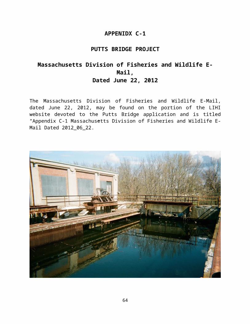
APPENIDX C-1
PUTTS BRIDGE PROJECT
Massachusetts Division of Fisheries and Wildlife E-Mail, Dated June 22, 2012
The Massachusetts Division of Fisheries and Wildlife E-Mail, dated June 22, 2012, may be found on the portion of the LIHI website devoted to the Putts Bridge application and is titled “Appendix C-1 Massachusetts Division of Fisheries and Wildlife E-Mail Dated 2012_06_22.”
Forebay Skimming Gate
51

APPENIDX C-2
PUTTS BRIDGE PROJECT
Fish and Wildlife E-mail, Dated August 27, 2012
The Fish and Wildlife e-mail, dated August 27, 2012, may be found on the portion of the LIHI website devoted to the Putts Bridge application and is titled “Appendix C-2 Fish and Wildlife E-mail Dated 2012_08_27.”
52

APPENDIX D
PUTTS BRIDGE PROJECT
Watershed Protection
The Facility is in compliance with both state and federal resource agencies recommendations for a license-approved shoreland management plan regarding protection, mitigation or enhancement of shorelands surrounding the project.
In 1992, Commission staff determined that excavation for the construction of the minimum flow powerhouse could increase the potential for erosion and sedimentation and result in short-term turbidity for the duration of the construction. For these reasons, Article 1425 was specifically included to ensure that the Exemptee, before engaging in any ground disturbance, would take protective measures to minimize erosion and sedimentation associated with the construction of the minimum flow unit powerhouse.
In 1999, the Exemptee dropped plans to install a minimum flow generation unit at the spillway. Instead, CEEI made various other improvements to the Project, none of which involved in any land-disturbing, land-clearing or spoil-producing activities. Thus, it was not
25 Article 14 states that “At least 90 days before the start of any land-disturbing, land-clearing, or spoil-producing activities, the Exemptee shall file with the Commission for approval, and with the New York Regional Office, a plan to control erosion, to control slope instability, and to minimize the quantity of sediment resulting from project construction and operation.
“The plan shall be based on actual site geological, soil, slope, drainage, and groundwater conditions and on project design, and shall include, at a minimum, the following four items: (1) a description of the actual site conditions; (2) measures to control erosion, to prevent slope instability, and to minimize the quantity of sediment resulting from project construction and operation; (3) detailed descriptions, functional design drawings, and topographic map locations of all control measures; and (4) a specific implementation schedule and details of monitoring and maintenance programs for the project construction period and for project operation.
“The Exemptee shall prepare the plan after consultation with the Soil Conservation Service and the Massachusetts Division of Fisheries and Wildlife. The Exemptee shall include with the plan documentation of consultation with the agencies and copies of agency comments and recommendations on the completed plan after it has been prepared and provided to the agencies, and specific descriptions of how the plan accommodates all of the agency comments and recommendations. The Exemptee shall allow a minimum of 30 days for the agencies to comment and make recommendations prior to filing the plan with the Commission. If the Exemptee does not adopt a recommendation, the filing shall include the Exemptee's reasons, based on geological, soil, and groundwater conditions at the site.
“The Commission reserves the right to require changes to the plan. No land-disturbing or land-clearing activities shall begin until the Exemptee is notified by the Commission that the plan is approved. Upon Commission approval, the Exemptee shall implement the plan, including any changes required by the Commission.”
53

required to obtain any pre-construction approvals from the Soil Conservation Service, the Massachusetts Division of Fisheries and Wildlife or other federal and state agencies. Nonetheless, the Exemptee remains bound by these conditions.
In the future, if Essential Power proposes to engage in any land-disturbing, land-clearing, or spoil-producing activities, it will be required to prepare a plan after consultation with the Soil Conservation Service and the Massachusetts Division of Fisheries and Wildlife. The Exemptee shall include with the plan documentation of consultation with the agencies and copies of agency comments and recommendations on the completed plan after it has been prepared and provided to the agencies, and specific descriptions of how the plan accommodates all of the agency comments and recommendations. The Exemptee shall allow a minimum of 30 days for the agencies to comment and make recommendations prior to filing the plan with the Commission. If the Exemptee does not adopt a recommendation, the filing shall include the Exemptee's reasons, based on geological, soil, and groundwater conditions at the site.
54
APPENIDX D-1
PUTTS BRIDGE PROJECT
Massachusetts Division of Fisheries and Wildlife E-Mail, Dated June 22, 2012
The Massachusetts Division of Fisheries and Wildlife E-Mail, dated June 22, 2012, may be found on the portion of the LIHI website devoted to the Putts Bridge application and is titled “Appendix C-1 Massachusetts Division of Fisheries and Wildlife E-Mail Dated 2012_06_22.”
Transformer (left) and Substation (center) withForebay and Powerhouse (in background)
55

APPENIDX D-2
PUTTS BRIDGE PROJECT
Fish and Wildlife E-mail, Dated August 27, 2012
The Fish and Wildlife e-mail, dated August 27, 2012, may be found on the portion of the LIHI website devoted to the Putts Bridge application and is titled “Appendix D-2 Fish and Wildlife E-mail Dated 2012_08_27.”
56

APPENDIX E
PUTTS BRIDGE PROJECT
Threatened and Endangered Species Protection
There are no threatened or endangered fish species listed under state or federal Endangered Species Acts present in the Facility area and/or the downstream reach. There is a non-fish species, the swamp dock, in the vicinity of the Project, which does not appear to be impacted by the Facility. This species is listed by MDFW as threaten. (A website link to a list of Massachusetts threatened, endangered or special concern species can be found in the footnote at the end of this Appendix).26
In conjunction with the Environmental Assessment prepared by WMECO in connection with its application for an Exemption from Licensing, FWS and various Massachusetts agencies were consulted to determine whether any federally listed or proposed threatened and endangered species under the jurisdiction of MDFW or FWS are known to occur in the project area, with the exception of occasional, transient, individuals, including bald eagles. Neither the FWS nor any Massachusetts agency reported that any known federally listed populations of endangered, threatened or rare vegetative, fish or wildlife species occur in the project area and none were discovered during any field survey.
Currently, the shortnose sturgeon is the only federally listed endangered fish species in Massachusetts. The habitat and distribution of this species does not include the project area. Massachusetts lists several fishes as rare; however, MDFW reported that none of these species occur in headwaters, tributaries or other upstream or immediate downstream areas of the Chicopee River drainage affected by the Putts Bridge project.
26 The Massachusetts Division of Fisheries and Wildlife maintains a list of threatened, endangered and special concern species on its website at http://www.mass.gov/dfwele/dfw/nhesp/species_info/mesa_list/mesa_list.htm. The following fish species are listed as threatened, endangered or special concern. None appear to be found in the Chicopee River immediate below or above the Putts Bridge Project (between Collins Hydro on the Chicopee River, Thorndike Dam on the Ware River and Upper Bondsville Dam on the Swift River, respectively).
Federally Endangered Species Shortnose Sturgeon (Acipenser brevirostrum)
Massachusetts Endangered Species Atlantic Sturgeon (Acipenser oxyrinchus)Lake Chub (Couesius plumbeus)Northern Redbelly Dace (Phoxinus eos)Shortnose Sturgeon (Acipenser brevirostrum)
Massachusetts Threatened Species American Brook Lamprey (Lampetra appendix) Threespine Stickleback (Gasterosteus aculeatus)
Massachusetts Special Concern Species Eastern Silvery Minnow (Hybognathus regius)Bridle Shiner (Hybognathus regius)Longnose Sucker (Catostomus catostomus)Burbot (Lota lota)
57

In its letter dated May 30, 2012, MDFW reported that no threaten, endangered or special concern fish species exist in the Facility area and/or its downstream reach; however, MDFW did report that the swamp dock (rumex verticuillatus), a plant, had been found in the vicinity of the site.
In its letter dated January 17, 2012, FWS reported that no threaten, endangered or special concern species exist in the Facility area and/or its downstream reach
58
APPENDIX E-1
PUTTS BRIDGE PROJECT
Massachusetts Division of Fisheries and Wildlife Letter, Dated May 30, 2012
The Massachusetts Division of Fisheries and Wildlife letter, dated May 30, 2012, may be found on the portion of the LIHI website devoted to the Putts Bridge application and is titled “Appendix E-1 Massachusetts Division of Fisheries and Wildlife Letter Dated 2012_05_30.”
Forebay (left) and Powerhouse (in background)
59

APPENDIX E-2
PUTTS BRIDGE PROJECT
Fish and Wildlife Letter, Dated January 17, 2012
The Fish and Wildlife letter, dated January 17, 2012, may be found on the portion of the LIHI website devoted to the Putts Bridge application and is titled “Appendix E-2 Fish and Wildlife Letter Dated 2012_01_17.”
60

APPENDIX F
PUTTS BRIDGE PROJECT
Cultural Resource Protection
The Facility is in compliance with all requirements regarding cultural resource protection, mitigation or enhancement included in its FERC exemption from license. In view of the results of discovery efforts during the licensing process and the SHPO's determination at that time, the FERC found that the Facility would have no effect on any structure, site, building, district, or object listed in or eligible for listing in the National Register of Historic Places.
During the licensing process, Commission staff specifically determined that exempting the proposed project would have no effect on National Register or eligible properties based on the Exemptee proposal to use the existing project works for its historic purpose. Article 11 was included to require the Exemptee to notify the Commission of any property transfers.27
Commission staff found that no properties of historic significance would be adversely affected by continued use of the project for hydropower as proposed. In addition, the possibility exists that properties could be adversely affected by unforeseen ground-disturbing activities or by project operation not already considered in the Environmental Assessment. For these reasons, Articles 1228 and 1329 were included to ensure that the Exemptee, before engaging in any ground
27 Article 11 states that “In addition to the notification of the Commission required by standard article 9, and within 30 days of transferring any property interests, the exemption holder must inform the Commission's New York Regional Director of the identity and address of the transferee.”
28 Article 12 states that “The Exemptee shall, before undertaking any construction activities at the project that would result in any modification of the existing historic facilities: (1) consult with the State Historic Preservation Officer (SHPO) concerning preliminary design of the new facilities to be constructed at the project to establish specific design criteria consistent with the Secretary of the Interior's "Standards for Rehabilitation; (2) afford the SHPO the opportunity to review preliminary and final design drawings of the new facilities; and (3) file the final design drawings, along with the SHPO's comments on the final design drawings, for Commission approval. The Exemptee shall undertake no construction activities at the project that would result in any modification of the existing historic facilities until informed by the Commission that the final design drawings have been approved.”
29 Article 13 states that “The Exemptee, before starting any land-clearing or land-disturbing activities within the project boundaries, including recreation developments at the project and any construction activities or alterations at or within the historic Putts [Bridge] Generating Station -- other than those land-clearing and land-disturbing activities, and construction activities and alterations at and within the historic Putts Bridge Generating Station that are specifically authorized in this license – shall consult with the State Historic Preservation Officer (SHPO).
“If the Exemptee discovers previously unidentified archeological or historic properties during the course of constructing or developing project works or other facilities at the project, the Exemptee shall stop all land-clearing and land-disturbing activities in the vicinity of the properties and consult with the SHPO.
“In either instance, the Exemptee shall file for Commission approval a cultural resource management plan (plan) prepared by a qualified cultural resource specialist after having consulted with the SHPO. The plan shall include the following items: (1) a description of each discovered property indicating whether it is listed on or eligible to be listed on the National Register of Historic Places; (2) a description of the potential effect on each discovered
61

disturbance not already considered in the Environmental Assessment, takes protective measures.
Articles 12 and 13 of the exemption preclude adverse impacts to historic resources. Article 12 required CEEI to: (1) consult with the State Historic Preservation Officer (SHPO) before undertaking any construction activity that would result in any modification of the project's existing historic facilities; and (2) file, for Commission approval, its final design drawings, including SHPO's comments on these drawings. Article 13 required that CEEI consult with the SHPO and, if necessary, develop and implement a cultural resource management plan before undertaking any project-related construction activity that is not specifically authorized by the 1992 exemption order.
Presently, Essential Power has no plans to engage in any land-disturbing, land-clearing or spoil-producing activities at the Putts Bridge Project. If these conditions change, it will be required to obtain pre-construction approvals from the Soil Conservation Service, the Massachusetts Division of Fisheries and Wildlife or other appropriate federal or state agencies.
During the LIHI In-take Review Process, the Massachusetts Historical Commission was contacted numerous times via telephone, e-mail and regular mail for its opinion on the LIHI application. However, no response was received to any inquiry other than to use the U.S. mails for inquiries. A copy of such an inquiry letter to the Massachusetts Historical Commission is attached to this filing.
property; (3) proposed measures for avoiding or mitigating effects; (4) documentation of the nature, extent, and results of consultation; and (5) a schedule for mitigating effects and conducting additional studies. The Commission may require changes to the plan.
“The Exemptee shall not begin land-clearing or land-disturbing activities within the project boundaries, including recreation developments at the project and any construction activities or alterations at or within the historic Putts [Bridge] Generating Station complex -- other than those land-clearing and land-disturbing activities, and construction activities and alterations at and within the historic Putts [Bridge] Generating Station complex that are specifically authorized in this license -- or resume such activities in the vicinity of a property, discovered during construction, until informed by the Commission that the requirements of this article have been fulfilled.”
62

APPENDIX F-1
PUTTS BRIDGE PROJECT
Massachusetts Historical Commission Inquiry Letter, Dated May 11, 2012
The Massachusetts Historical Commission inquiry letter, dated May 11, 2012, may be found on the portion of the LIHI website devoted to the Putts Bridge application and is titled “Appendix F-1 Massachusetts Historical Commission Letter Dated 2012_05_11.”
Spillway
63
APPENDIX G
PUTTS BRIDGE PROJECT
Recreation
The Facility is in compliance with the recreational access, accommodation (including recreational flow releases) and facilities conditions in its FERC license. In addition, the facility allows access to the reservoirs and downstream reaches without fees or charges.
The Putts Bridge Project is located in a primarily urban and industrial section of western Massachusetts. A large portion of the project impoundment is bordered to the north by the Minechoag Wetland. Limited seasonal boating and fishing opportunities are available at the Project. There is no formal boat access site at the project while there are informal ones, particularly along the south shore approximately ½ mile upstream of the project dam. Wildlife at the Project is prevalent in the vicinity of the Minechoag Wetland. The Minechoag Wetland has several access points, including access roads. This area is used for hiking and nature watching.
The project is required to maintain a informal boat ramp and parking area on the east side of the impoundment (south shore). The facility was required by both the Massachusetts Division of Fisheries and Wildlife and the US Fish and Wildlife Service as noted in their comment letters on the Exemption from Licensing.
In its September 30, 2010 inspection report on the Project, the Commission noted that the informal boat ramp and parking area did not meet the requirements of the Project’s Exemption from License in that the recreational facilities, while present, were not being maintained.
In a letter dated March 7, 2011, NAEA acknowledged that the car top boat ramp access for the Putt Bridge Project is owned and maintained by NAEA. NAEA's maintenance plans for 2011 are to replace the existing signage and continue to maintain the grounds for public access.
In a letter dated October 12, 2011, the Commission noted that (1) a parking lot and small boat dock are to provide angler access to the impoundment with signs and (2) NAEA had agreed to replace the existing signage and repair the existing facility as needed. Consequently, in the spring of 2012, Essential Power repaired the sign at the parking lot and cleaned the parking lot of debris.
64

APPENDIX G-1
PUTTS BRIDGE PROJECT
Existing Recreational Facilities
A map of the Existing Recreational Facilities at the Putts Bridge project may be found on the portion of the LIHI website devoted to the Putts Bridge application and is titled “Existing Recreational Facilities at the Putts Bridge Project.”
Boat Launch
65

APPENDIX G-2
PUTTS BRIDGE PROJECT
FERC Environmental Inspection Report
A copy of FERC Environmental Inspection Report, dated October 21, 2010, may be found on the portion of the LIHI website devoted to the Putts Bridge application and is titled “Appendix G-2 FERC Environmental Inspection Report Dated 2010_10_21.”
66

APPENDIX G-3
PUTTS BRIDGE PROJECT
NAEA Letter, Dated March 7, 2011
A copy of NAEA Letter, dated March 7, 2011, may be found on the portion of the LIHI website devoted to the Putts Bridge application and is titled “Appendix G-3 NAEA Letter Dated 2011_03_07.”
67

APPENDIX G-4
PUTTS BRIDGE PROJECT
FERC Letter, Dated October 12, 2011
A copy of FERC Letter, dated October 12, 2011, may be found on the portion of the LIHI website devoted to the Putts Bridge application and is titled “Appendix G-4, FERC Letter Dated 2011_10_ 12.”
68

APPENDIX H
PUTTS BRIDGE PROJECT
Facilities Recommended for Removal
There is no resource agency recommendation for removal of the dam associated with the Facility.
Boat Launch River View withDam in Background
69


