Bob Returning to Maurak
19
Bob Returning to Maurak A Flight Simulation
description
Bob Returning to Maurak. A Flight Simulation. Bob Returning to Maurak. This project was planned to determine the possible landing/crash site of Bob Norton using simulated flights. - PowerPoint PPT Presentation
Transcript of Bob Returning to Maurak
Bob Returning to MaurakA Flight Simulation
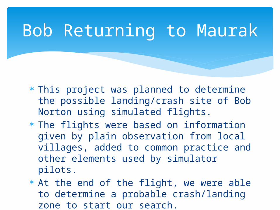
This project was planned to determine the possible landing/crash site of Bob Norton using simulated flights.
The flights were based on information given by plain observation from local villages, added to common practice and other elements used by simulator pilots.
At the end of the flight, we were able to determine a probable crash/landing zone to start our search.
Bob Returning to Maurak
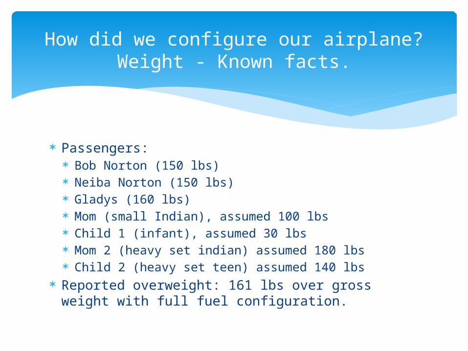
Passengers: Bob Norton (150 lbs) Neiba Norton (150 lbs) Gladys (160 lbs) Mom (small Indian), assumed 100 lbs Child 1 (infant), assumed 30 lbs Mom 2 (heavy set indian) assumed 180 lbs Child 2 (heavy set teen) assumed 140 lbs
Reported overweight: 161 lbs over gross weight with full fuel configuration.
How did we configure our airplane?Weight - Known facts.
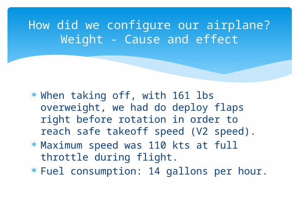
When taking off, with 161 lbs overweight, we had do deploy flaps right before rotation in order to reach safe takeoff speed (V2 speed).
Maximum speed was 110 kts at full throttle during flight.
Fuel consumption: 14 gallons per hour.
How did we configure our airplane?Weight - Cause and effect
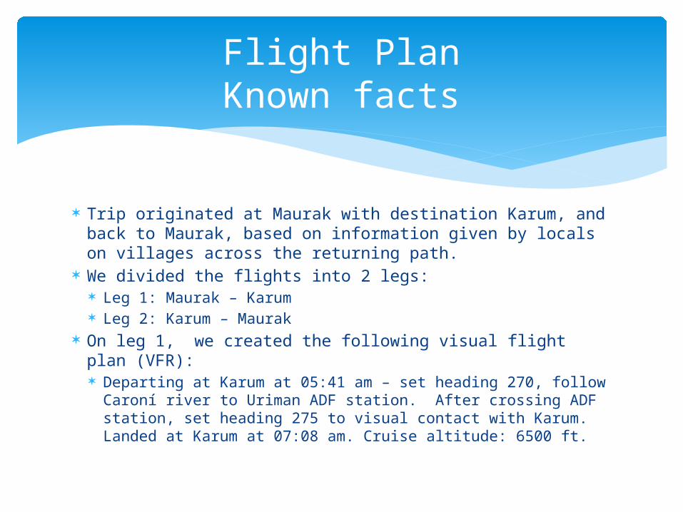
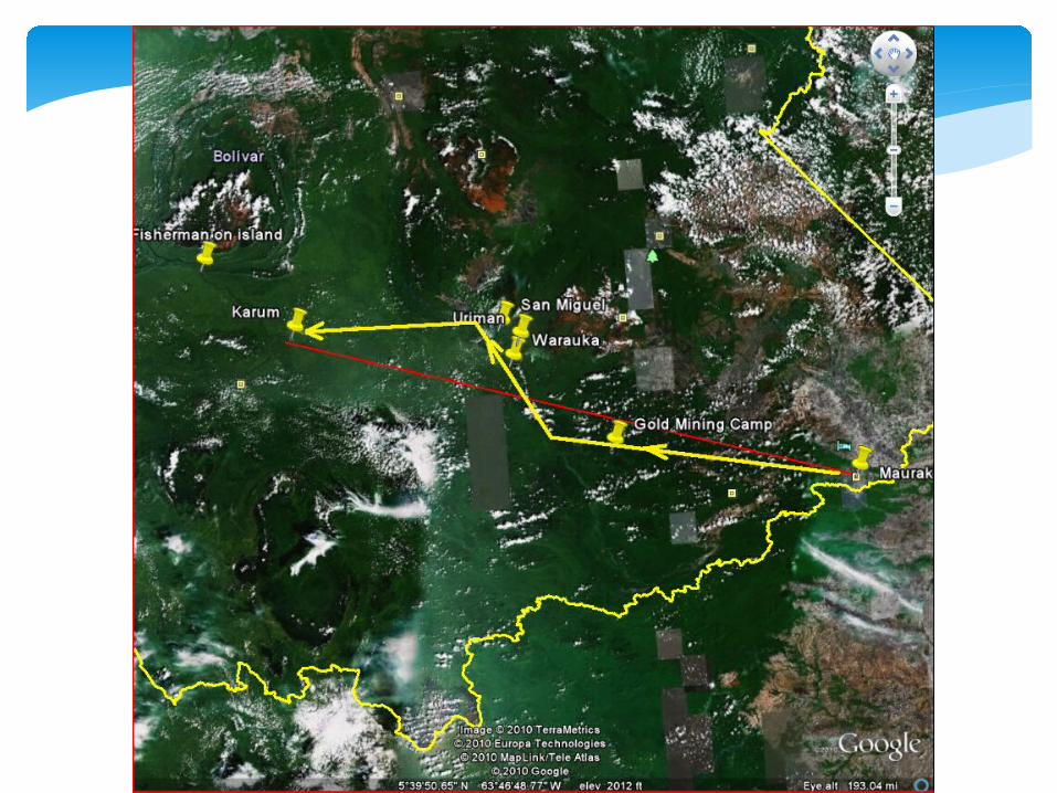
Trip originated at Maurak with destination Karum, and back to Maurak, based on information given by locals on villages across the returning path.
We divided the flights into 2 legs: Leg 1: Maurak – Karum Leg 2: Karum – Maurak
On leg 1, we created the following visual flight plan (VFR): Departing at Karum at 05:41 am – set heading 270, follow
Caroní river to Uriman ADF station. After crossing ADF station, set heading 275 to visual contact with Karum. Landed at Karum at 07:08 am. Cruise altitude: 6500 ft.
Flight PlanKnown facts
Landing at Karum
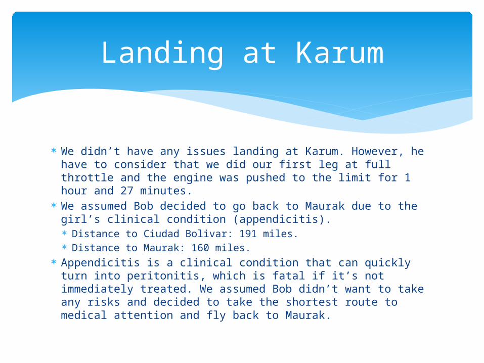
We didn’t have any issues landing at Karum. However, he have to consider that we did our first leg at full throttle and the engine was pushed to the limit for 1 hour and 27 minutes.
We assumed Bob decided to go back to Maurak due to the girl’s clinical condition (appendicitis). Distance to Ciudad Bolivar: 191 miles. Distance to Maurak: 160 miles.
Appendicitis is a clinical condition that can quickly turn into peritonitis, which is fatal if it’s not immediately treated. We assumed Bob didn’t want to take any risks and decided to take the shortest route to medical attention and fly back to Maurak.
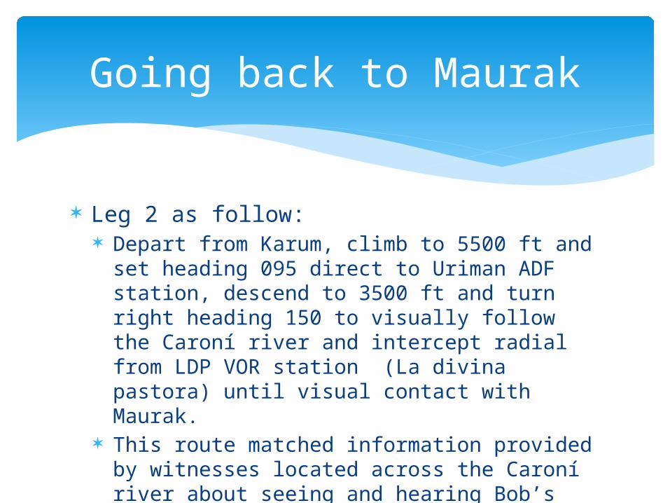
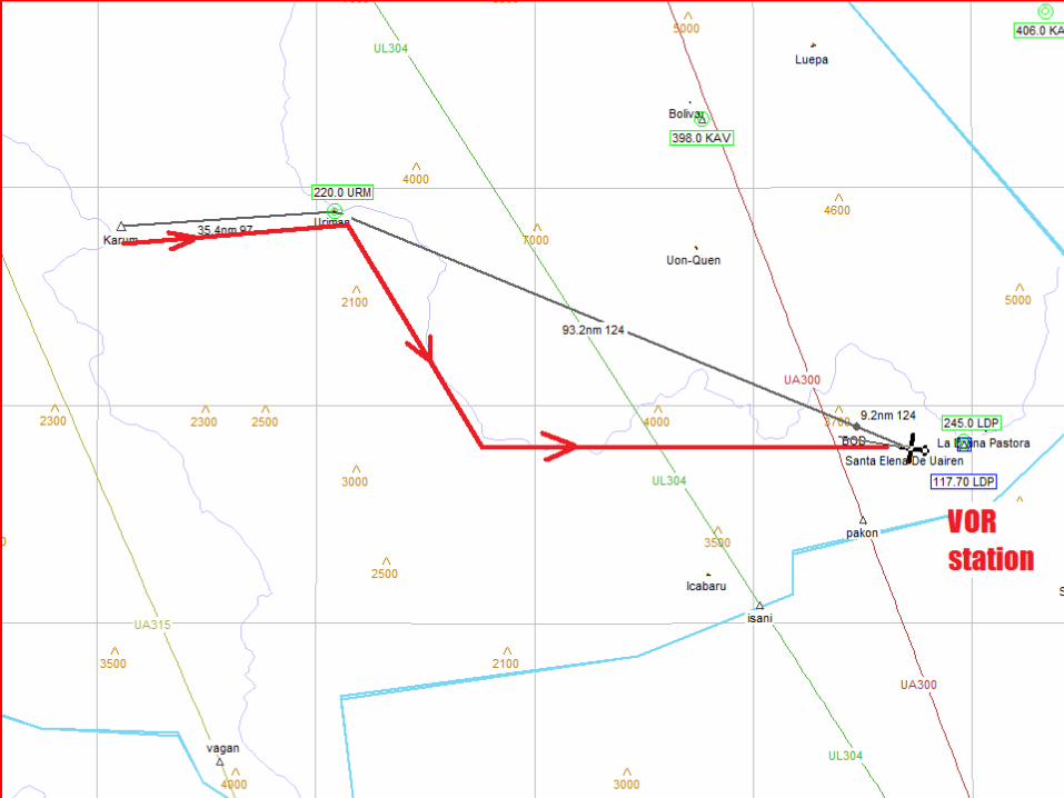
Leg 2 as follow: Depart from Karum, climb to 5500 ft and set
heading 095 direct to Uriman ADF station, descend to 3500 ft and turn right heading 150 to visually follow the Caroní river and intercept radial from LDP VOR station (La divina pastora) until visual contact with Maurak.
This route matched information provided by witnesses located across the Caroní river about seeing and hearing Bob’s plane passing by.
Going back to Maurak
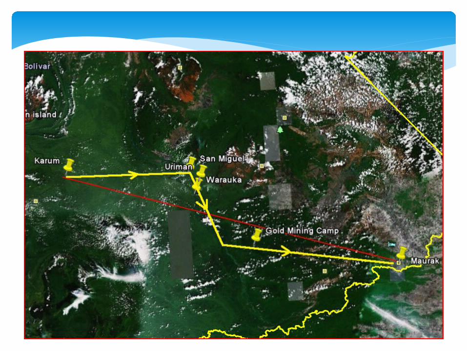
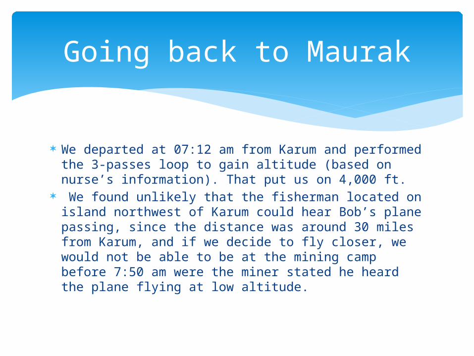
We departed at 07:12 am from Karum and performed the 3-passes loop to gain altitude (based on nurse’s information). That put us on 4,000 ft.
We found unlikely that the fisherman located on island northwest of Karum could hear Bob’s plane passing, since the distance was around 30 miles from Karum, and if we decide to fly closer, we would not be able to be at the mining camp before 7:50 am were the miner stated he heard the plane flying at low altitude.
Going back to Maurak
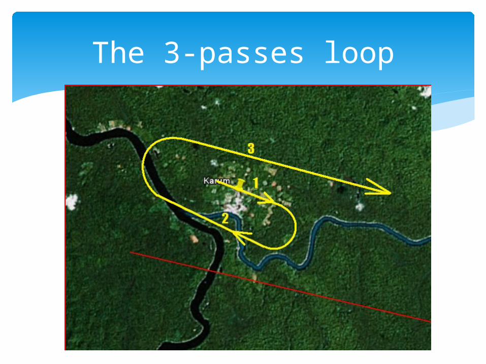
The 3-passes loop
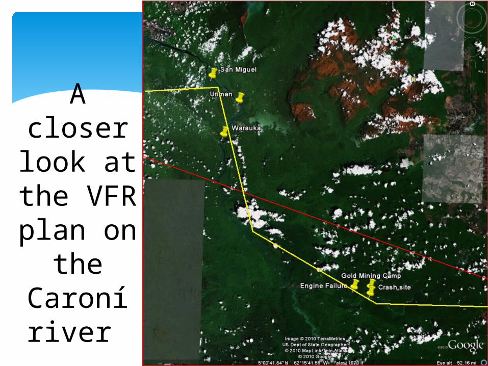
A closer look at the VFR plan on
the Caroní river.
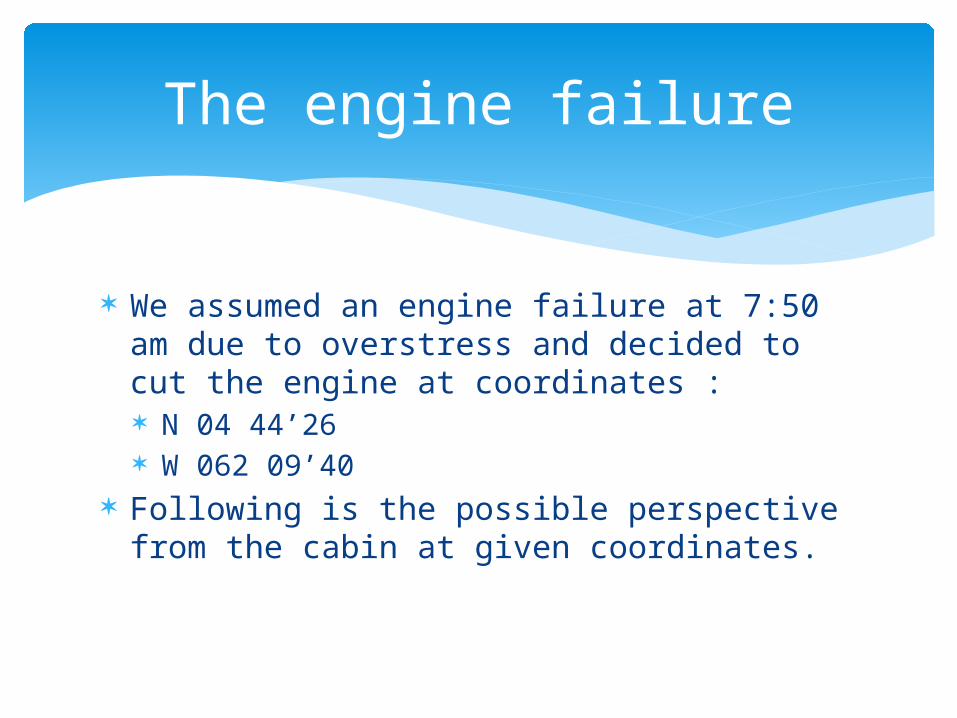
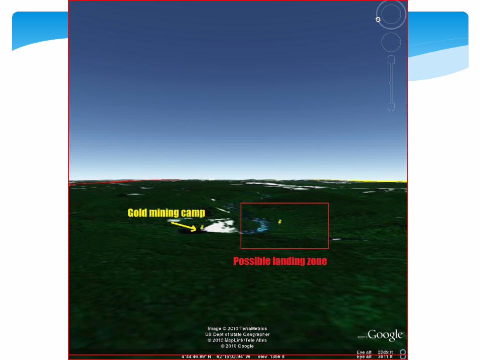
We assumed an engine failure at 7:50 am due to overstress and decided to cut the engine at coordinates : N 04 44’26 W 062 09’40
Following is the possible perspective from the cabin at given coordinates.
The engine failure
Why did we choose that area for landing?
Water source close by for survivability and transportation.
Topography with better chance for landing.
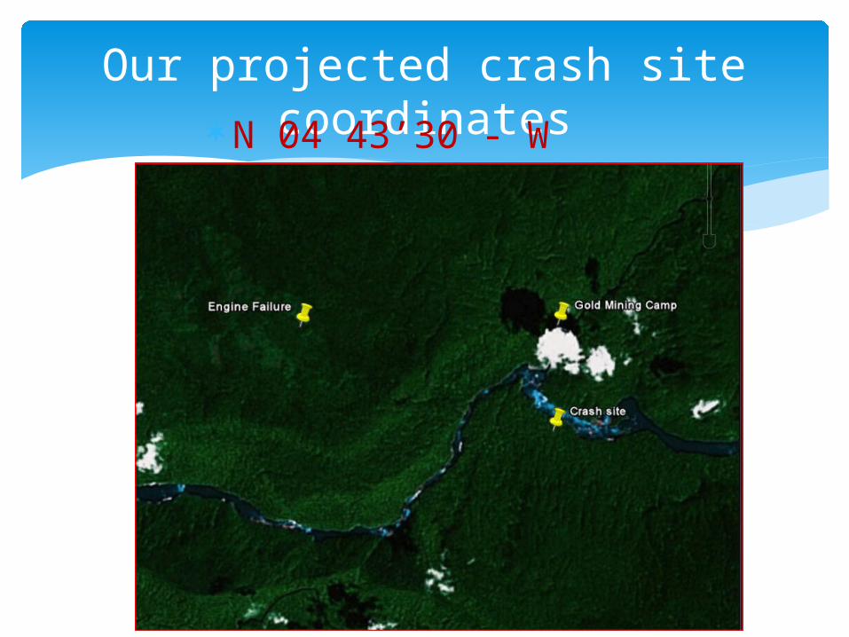
Our projected crash site coordinatesN 04 43’30 - W 062
07’12
…we’ll find them


![Returning To Heaven [Fragment]](https://static.fdocuments.in/doc/165x107/568c4df01a28ab4916a5f371/returning-to-heaven-fragment.jpg)