
BOARD OF FORESTRY AND FIRE PROTECTION - bof.fire… · state of california the natural resources...
30
STATE OF CALIFORNIA THE NATURAL RESOURCES AGENCY Edmund G. Brown, Jr., Governor BOARD OF FORESTRY AND FIRE PROTECTION P.O. Box 944246 SACRAMENTO, CA 94244-2460 Website: www.bof.fire.ca.gov (916) 653-8007 Alfredo R. Castillo, AICP Community Development Department City of Atascadero 6500 Palma Avenue Atascadero, CA 93422 October 24, 2014 Dear Mr. Castillo, The State Board of Forestry and Fire Protection (Board) is required to review and provide recommendations to the safety element of county and local government general plans when such plans are being amended. This review is in accordance with Government Code (GC) §65302.5 which requires the Board to review the fire safety elements when the general plans contains State Responsibility Areas or Very High Fire Hazard Severity Zones. Enclosed is the final review and recommendations titled “City of Atascadero Review of the Fire Safety Element.” The Board has prepared this document in cooperation with members of the San Luis Obispo Unit. Thank you for the opportunity to participate in your planning process and we look forward to working with you on these recommendations. We hope this input leads to greater protection and reduced cost and losses from wildfires to the City of Atascadero and adjacent wildlands. Sincerely, Edith Hannigan Board Staff CC: Alan Peters, SLU Board of Forestry and Fire Protection, Resource Protection Committee The Board’s mission is to lead California in developing policies and programs that serve the public interest in environmentally, economically, and socially sustainable management of forest and rangelands, and a fire protection system that protects and serves the people of the state.
Transcript of BOARD OF FORESTRY AND FIRE PROTECTION - bof.fire… · state of california the natural resources...

STATE OF CALIFORNIA THE NATURAL RESOURCES AGENCY Edmund G. Brown, Jr., Governor
BOARD OF FORESTRY AND FIRE PROTECTION P.O. Box 944246 SACRAMENTO, CA 94244-2460 Website: www.bof.fire.ca.gov (916) 653-8007
Alfredo R. Castillo, AICP Community Development Department City of Atascadero 6500 Palma Avenue Atascadero, CA 93422 October 24, 2014 Dear Mr. Castillo, The State Board of Forestry and Fire Protection (Board) is required to review and provide recommendations to the safety element of county and local government general plans when such plans are being amended. This review is in accordance with Government Code (GC) §65302.5 which requires the Board to review the fire safety elements when the general plans contains State Responsibility Areas or Very High Fire Hazard Severity Zones. Enclosed is the final review and recommendations titled “City of Atascadero Review of the Fire Safety Element.” The Board has prepared this document in cooperation with members of the San Luis Obispo Unit. Thank you for the opportunity to participate in your planning process and we look forward to working with you on these recommendations. We hope this input leads to greater protection and reduced cost and losses from wildfires to the City of Atascadero and adjacent wildlands. Sincerely, Edith Hannigan Board Staff CC: Alan Peters, SLU Board of Forestry and Fire Protection, Resource Protection Committee
The Board’s mission is to lead California in developing policies and programs that serve the public interest in environmentally, economically, and socially sustainable management of forest and rangelands, and a fire protection system that protects and serves the people of the state.

CAL FIRE
San Luis Obispo (SLU)
General Plan Safety Element Assessment
Version 3
October 21, 2014
Board of Forestry and Fire Protection
Contents
Purpose and Background
Methodology for Review and Recommendations Review Process and Timeline
Standard List of Recommendations
May 2014
Purpose and Background: The State Board of Forestry and Fire Protection (BOF/Board) is required to review and make recommendations for the fire safety element of general plan updates in accordance with Government Code (GC) §65302.5. The review and recommendations apply to those general plans with State Responsibility Area (SRA) (Public Resources Code 4125) or Very High Fire Hazard Severity Zones (VHFHSZ) (GC 51175).
The statutory requirements for the Board review and recommendations pursuant to GC 65302.5 (a)(1) and (2), and (b) are as follows:
• “The draft elements...to the fire safety element of a county’s or a city’s general
plan…shall be submitted to the Board at least 90 days prior to… the adoption or amendment to the safety element of its general plan [for each county or city with SRA or VHFHSZ].”
• “The Board shall… review the draft or an existing safety element and report its written
recommendations to the planning agency within 60 days of its receipt of the draft or existing safety element….”
• “Prior to adoption of the draft element…, the Board of Supervisors… shall consider the
recommendations made by the Board… If the Board of Supervisors…determines not to accept all or some of the recommendations…, the Board of Supervisors… shall communicate in writing to the Board its reasons for not accepting the recommendations.”
Methodology for Review and Recommendations: The Board established a standardized method to review the safety element of general plans. The methodology includes 1) examining the general plan for inclusion of factors that are important for mitigation of fire hazard and risks, and 2) making recommendations related to these factors. The evaluation factors and recommendations were developed using CAL FIRE technical documents and input from local fire departments.
Enclosed is a series of recommendations directed at communities that include:
• Some Very High Fire Hazard Severity Zone acreage and/or State Responsibility Area acreage or abut VHFHSZ/SRA
• Limited financial or physical resources • Low community support • Little to no previous wildfire protection planning efforts
The General Plan Safety Element of each jurisdiction that fits those criteria will be assessed based on the recommendations below.

Review Process and Timeline
The county, local jurisdiction, and local fire unit will receive and review technical guidance documents, the BOF checklist, and other relevant information from the Governor’s Office of Planning and Research and CAL FIRE.
The county or local jurisdiction will work closely with the local fire unit during the development of the general plan and the safety element in particular.
90 days prior to the adoption or amendment of the General Plan: The county or local jurisdiction will submit the safety element to the local fire unit for review.
No more than 30 days later: The unit will submit to the BOF their findings and recommendations.
No more than 60 days later: The Board will consider the fire unit’s recommendations and will approve or approve with amendments the recommendations at the next Board meeting.

Standard List of General Plan Safety Element Recommendations
Please click on the appropriate box to “check” whether the plan satisfies each point. Standard recommendations are included in the checklist but please highlight or add additional comments as necessary.
1.0 General Wildfire Protection Planning
1.1 General Plan references and incorporates County or Unit Fire Plan: ☒Yes ☐Partial ☐No
Recommendation: Identify, reference or create (if necessary) a fire plan for the geographic scope of the General Plan. General Plan should incorporate the general concepts and standards from any county fire plan, fire protection agency (federal or state) fire plan, and local hazard mitigation plan. Identify or reference the local Unit Fire Plan and, if applicable, the Community Wildfire Prevention Plan. Priority: ☐High ☐ Medium ☐ Low ☐N/A
Recommendation: Ensure fire plans incorporated by reference into the General Plan contain evaluations of fire hazards, assessment of assets at risk, prioritization of hazard mitigation actions, and implementation and monitoring components. Priority: ☐High ☐ Medium ☐ Low ☐N/A
1.2 Map or describe existing emergency service facilities and areas lacking services, specifically
noting any areas in SRA or VHFHSZs. ☒Yes ☐Partial ☐No
Recommendation: Include descriptions of emergency services including available equipment, personnel, and maps of facilities. Priority: ☐High ☐ Medium ☐ Low ☐N/A Recommendation: Initiate studies and analyses to identify appropriate staffing levels and equipment needs commensurate with the current and projected emergency response environment. Priority: ☐High ☐ Medium ☐ Low ☐N/A Recommendation: Establish goals and policies for emergency service training that meets or exceeds state or national standards. Priority: ☐High ☐ Medium ☐ Low ☐N/A
1.3 Inter-fire service coordination preparedness/mutual aid and multi-jurisdictional fire service
agreements. ☒Yes ☐Partial ☐No
Recommendation: Adopt the Standardized Emergency Management Systems for responding to large scale disasters requiring a multi-agency response. Ensure and review mutual aid/automatic aid and other cooperative agreements with adjoining emergency service providers.
Board of Forestry Safety Element Assessment V. 3 Page 1 of 7

Priority: ☐High ☐ Medium ☐ Low ☐N/A
2.0 Land Use Planning:
2.1 Disclose wildland urban interface hazards including Fire Hazard Severity Zones designations and other vulnerable areas as determined by CAL FIRE or fire prevention organizations. Describe or map any Firewise Communities or other fire safe communities as determined by the National Fire Protection Association, Fire Safe Council, or other organizations. ☒Yes ☐
Partial ☐No
Recommendation: Discuss and/or include local fire hazard maps. Priority: ☐High ☐ Medium ☐ Low ☐N/A
Recommendation: Adopt CAL FIRE recommended Fire Hazard Severity Zones including model ordinances developed by the Office of the State Fire Marshal for establishing VHFHSZ areas. Include a map of the zones that clearly indicates any area designated VHFHSZ. Priority: ☐High ☐ Medium ☐ Low ☐N/A
2.2 Goals and policies include mitigation of fire hazard for future development. ☒Yes ☐Partial ☐No
Recommendation: Create fire safe development codes used as standards for fire protection for new development in State Responsibility Area (SRA) within the entity’s jurisdiction that meets or exceed statewide standards in 14 California Code of Regulations Section 1270 et seq. Have the codes certified by the Board of Forestry. Priority: ☐High ☐ Medium ☐ Low ☐N/A Recommendation: Establish goals and policies for specific ordinances addressing evacuation and emergency vehicle access; water supplies and fire flow; fuel modification for defensible space; and home addressing and signing. Priority: ☐High ☐ Medium ☐ Low ☐N/A
Recommendation: Consider mitigation of previously developed areas that do not meet Title14 California Code of Regulations Section 1270 et seq. or equivalent local ordinance. Priority: ☐High ☐ Medium ☐ Low ☐N/A
2.3 The design and location of new development provides for adequate infrastructure for the safe ingress of emergency response vehicles and simultaneously allows civilian egress during an emergency: ☒Yes ☐Partial ☐No
Recommendation: Specify the local ordinances, code sections, or regulations addressing the above standards, particularly any ordinances that address right-of-way, easement, and other
Additional Wildfire Protection Planning Recommendations: Include CAL FIRE’s most recent Fire Hazard Severity Zone maps; number 4 under Policy 3.3 – update CDF to “CAL FIRE”
Board of Forestry Safety Element Assessment V. 3 Page 2 of 7

reasonable offsite and onsite improvements for a division of land which qualifies for a Parcel Map rather than a Tentative/Final Map under the Subdivision Map Act. Priority: ☐High ☐ Medium ☐ Low ☐N/A
Recommendation: Develop pre-plans for fire prone areas that address civilian evacuations to temporary safety locations. Priority: ☐High ☐ Medium ☐ Low ☐N/A
2.4 Geographic specific fire risk reduction mitigation measures. ☒Yes ☐Partial ☐No
Recommendation: Include policies and recommendations that incorporate fire safe buffers and greenbelts as part of the development planning. Ensure that land uses designated near high or very fire hazard severity zones are compatible with wildland fire protection strategies/capabilities. Priority: ☐High ☐ Medium ☐ Low ☐N/A
3.0 Housing:
3.1 Incorporation of current fire safe building codes and fire engineering features for structures in
VHFHSZ. ☒Yes ☐Partial ☐No
Recommendation: Adopt building codes for new development in State Responsibility Areas or incorporated areas with VHFHSZ that are based on those established by the Office of the State Fire Marshal in Title 19 and Title 24 CCR, referred to as the “Wildland Urban Interface Building Codes.” Priority: ☐High ☐ Medium ☐ Low ☐N/A Recommendation: Ensure new development proposals contain specific fire protection plans, actions, and codes for fire engineering features for structures in VHFHSZ. Examples include codes requiring automatic sprinklers in VHFHSZ. Priority: ☐High ☐ Medium ☐ Low ☐N/A Recommendation: Ensure residential areas have appropriate fire resistant landscapes and discontinuous vegetation adjacent to open space or wildland areas. Priority: ☐High ☐ Medium ☐ Low ☐N/A
3.2 Consideration of diverse occupancies and their effects on wildfire protection. ☒Yes ☐Partial ☐No
Recommendation: Ensure risks to uniquely occupied structures, such as seasonally
Additional Land Use Planning Recommendations:
Board of Forestry Safety Element Assessment V. 3 Page 3 of 7

occupied homes, multiple dwelling structures, or other structures with unique occupancy characteristics, are considered for appropriate and unique wildfire protection needs. Priority: ☐High ☐ Medium ☐ Low ☐N/A
3.3 Fuel modification around homes. ☒Yes ☐Partial ☐No
Recommendation: Establish ordinances in SRA or VHFHSZ for vegetation fire hazard reduction around structures that meet or exceed the Board of Forestry and Fire Protection's Defensible Space Guidelines for SRA and the Very High Fire Hazard severity zones, including vacant lots. See http://www.bof.fire.ca.gov/pdfs/Copyof4291finalguidelines9_29_06.pdf Priority: ☐High ☐ Medium ☐ Low ☐N/A
Recommendation: Reduce fuel around communities and subdivisions, considering fuels, topography, weather (prevailing winds and wind event specific to the area), fire ignitions and fire history. Priority: ☐High ☐ Medium ☐ Low ☐N/A
3.4 Identification and actions for substandard fire safe housing and neighborhoods relative to fire
hazard area. ☒Yes ☐Partial ☐No
Recommendation: Identify plans and actions to improve substandard housing structures and neighborhoods. Plans and actions should include structural rehabilitation, occupancy reduction, demolition, reconstruction, neighborhood –wide fuels hazard reduction projects, community education, and other community based solutions. Priority: ☐High ☐ Medium ☐ Low ☐N/A
Recommendation: Identify plans and actions for existing residential structures and neighborhoods, and particularly substandard residential structures and neighborhoods, to be improved to meet current fire safe ordinances pertaining to access, water flow, signing, and vegetation clearing. Priority: ☐High ☐ Medium ☐ Low ☐N/A
3.5 Assessment and projection of future emergency service needs. ☒Yes ☐Partial ☐No
Recommendation: Ensure new development includes appropriate facilities, equipment, personnel and capacity to assist and support wildfire suppression emergency service needs. Future emergency service needs should be:
• Established consistent with state or national standards. • Developed based on criteria for determining suppression resource allocation that
includes elements such as identified values and assets at risk, ignition density, vegetation type and condition, as well as local weather and topography.
• Local Agency Formation municipal services reviews for evaluating level of service, response times, equipment condition levels and other relevant emergency service information.
Priority: ☐High ☐ Medium ☐ Low ☐N/A
Board of Forestry Safety Element Assessment V. 3 Page 4 of 7

4.0 Conservation and Open Space: 4.1 Integration of open space into fire safety effectiveness. ☒Yes ☐Partial ☐No
Recommendation: Establish goals and policies for incorporating systematic fire protection improvements for open space. Specifics policies should address facilitation of safe fire suppression tactics, standards for adequate access for firefighting, fire mitigation planning with agencies/private landowners managing open space adjacent to the General Plan area, water sources for fire suppression, and other fire prevention and suppression needs. Priority: ☐High ☐ Medium ☐ Low ☐N/A
4.2 Identification of critical natural resource values relative to fire hazard areas. ☒Yes ☐Partial ☐No
Recommendation: Identify critical natural resources and other “open space” values within the geographic scope of the General Plan. Priority: ☐High ☐ Medium ☐ Low ☐N/A Recommendation: Evaluate and resolve existing laws and local ordinances which conflict with fire protection requirements. Examples include conflicts with vegetation hazard reduction ordinances and listed species habitat protection requirements. Priority: ☐High ☐ Medium ☐ Low ☐N/A
4.3 Inclusion of resource management activities to enhance protection of open space and natural
resource values. ☒Yes ☐Partial ☐No
Recommendation: Develop plans and action items for vegetation management that provides fire damage mitigation and protection of open space values. Plans should address protection of natural resource financial values, establishment of fire resilient natural resources, protection of watershed qualities, and protection of endangered species habitats. Actions should consider prescribed burning, fuel breaks, and vegetation thinning and removal Priority: ☐High ☐ Medium ☐ Low ☐N/A
Recommendation: Establish goals and policies for reducing the wildland fire hazards within the entity’s boundaries and, with the appropriate partners, on adjacent private wildlands, federal lands, vacant residential lots, and greenbelts with fire hazards that threaten the entity’s jurisdiction. Priority: ☐High ☐ Medium ☐ Low ☐N/A
Additional Housing Recommendations:
Board of Forestry Safety Element Assessment V. 3 Page 5 of 7
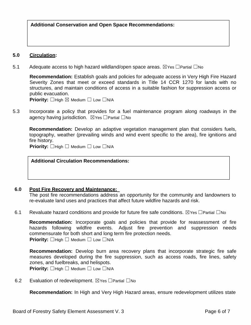
5.0 Circulation: 5.1 Adequate access to high hazard wildland/open space areas. ☒Yes ☐Partial ☐No
Recommendation: Establish goals and policies for adequate access in Very High Fire Hazard Severity Zones that meet or exceed standards in Title 14 CCR 1270 for lands with no structures, and maintain conditions of access in a suitable fashion for suppression access or public evacuation. Priority: ☐High ☒ Medium ☐ Low ☐N/A
5.3 Incorporate a policy that provides for a fuel maintenance program along roadways in the agency having jurisdiction. ☒Yes ☐Partial ☐No
Recommendation: Develop an adaptive vegetation management plan that considers fuels, topography, weather (prevailing winds and wind event specific to the area), fire ignitions and fire history. Priority: ☐High ☐ Medium ☐ Low ☐N/A
6.0 Post Fire Recovery and Maintenance: The post fire recommendations address an opportunity for the community and landowners to
re-evaluate land uses and practices that affect future wildfire hazards and risk. 6.1 Revaluate hazard conditions and provide for future fire safe conditions. ☒Yes ☐Partial ☐No
Recommendation: Incorporate goals and policies that provide for reassessment of fire hazards following wildfire events. Adjust fire prevention and suppression needs commensurate for both short and long term fire protection needs. Priority: ☐High ☐ Medium ☐ Low ☐N/A
Recommendation: Develop burn area recovery plans that incorporate strategic fire safe measures developed during the fire suppression, such as access roads, fire lines, safety zones, and fuelbreaks, and helispots. Priority: ☐High ☐ Medium ☐ Low ☐N/A
6.2 Evaluation of redevelopment. ☒Yes ☐Partial ☐No
Recommendation: In High and Very High Hazard areas, ensure redevelopment utilizes state
Additional Conservation and Open Space Recommendations:
Additional Circulation Recommendations:
Board of Forestry Safety Element Assessment V. 3 Page 6 of 7

of the art fire resistant building and development standards to improve past ‘substandard’ fire safe conditions. Priority: ☐High ☐ Medium ☐ Low ☐N/A
8.6 Long term maintenance of fire hazard reduction mitigation projects. ☒Yes ☐Partial ☐No
Recommendation: Provide polices and goals for maintenance of the post-fire-recovery projects, activities, or infrastructure. Priority: ☐High ☐ Medium ☐ Low ☐N/A
8.7 Post fire life and safety assessments. ☒Yes ☐Partial ☐No
Recommendation: Identity flood and landslide vulnerability areas related to post wildfire conditions. Priority: ☐High ☐ Medium ☐ Low ☐N/A Recommendation: Establish goals and policies that address the intersection of flood /landslide/post fire burn areas into long term public safety protection plans. These should include treatment assessment of fire related flood risk to life, methods to control storm runoff in burn areas, revegetation of burn areas, and drainage crossing maintenance. Priority: ☐High ☐ Medium ☐ Low ☐N/A
Additional Recommendations:
Additional Post Fire Recovery and Maintenance Recommendations:
Board of Forestry Safety Element Assessment V. 3 Page 7 of 7
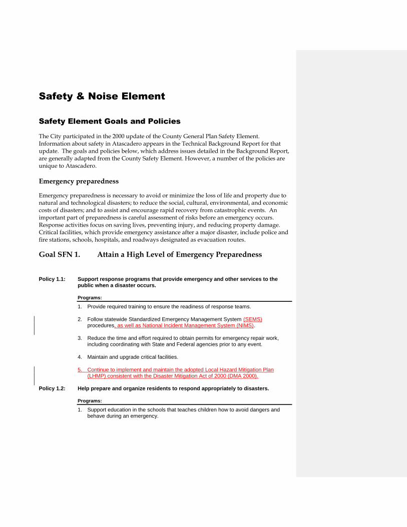
Safety & Noise Element
Safety Element Goals and Policies
The City participated in the 2000 update of the County General Plan Safety Element. Information about safety in Atascadero appears in the Technical Background Report for that update. The goals and policies below, which address issues detailed in the Background Report, are generally adapted from the County Safety Element. However, a number of the policies are unique to Atascadero.
Emergency preparedness
Emergency preparedness is necessary to avoid or minimize the loss of life and property due to natural and technological disasters; to reduce the social, cultural, environmental, and economic costs of disasters; and to assist and encourage rapid recovery from catastrophic events. An important part of preparedness is careful assessment of risks before an emergency occurs. Response activities focus on saving lives, preventing injury, and reducing property damage. Critical facilities, which provide emergency assistance after a major disaster, include police and fire stations, schools, hospitals, and roadways designated as evacuation routes.
Goal SFN 1. Attain a High Level of Emergency Preparedness
Policy 1.1: Support response programs that provide emergency and other services to the public when a disaster occurs.
Programs:
1. Provide required training to ensure the readiness of response teams.
2. Follow statewide Standardized Emergency Management System (SEMS) procedures, as well as National Incident Management System (NIMS).
3. Reduce the time and effort required to obtain permits for emergency repair work, including coordinating with State and Federal agencies prior to any event.
4. Maintain and upgrade critical facilities.
5. Continue to implement and maintain the adopted Local Hazard Mitigation Plan (LHMP) consistent with the Disaster Mitigation Act of 2000 (DMA 2000).
Policy 1.2: Help prepare and organize residents to respond appropriately to disasters.
Programs:
1. Support education in the schools that teaches children how to avoid dangers and behave during an emergency.
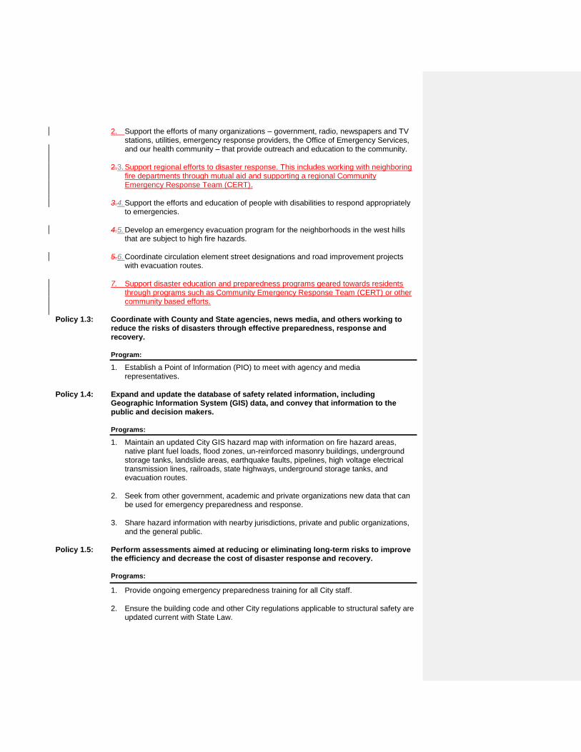
2. Support the efforts of many organizations – government, radio, newspapers and TV stations, utilities, emergency response providers, the Office of Emergency Services, and our health community – that provide outreach and education to the community.
2.3. Support regional efforts to disaster response. This includes working with neighboring fire departments through mutual aid and supporting a regional Community Emergency Response Team (CERT).
3.4. Support the efforts and education of people with disabilities to respond appropriately to emergencies.
4.5. Develop an emergency evacuation program for the neighborhoods in the west hills that are subject to high fire hazards.
5.6. Coordinate circulation element street designations and road improvement projects with evacuation routes.
7. Support disaster education and preparedness programs geared towards residents through programs such as Community Emergency Response Team (CERT) or other community based efforts.
Policy 1.3: Coordinate with County and State agencies, news media, and others working to reduce the risks of disasters through effective preparedness, response and recovery.
Program:
1. Establish a Point of Information (PIO) to meet with agency and media representatives.
Policy 1.4: Expand and update the database of safety related information, including Geographic Information System (GIS) data, and convey that information to the public and decision makers.
Programs:
1. Maintain an updated City GIS hazard map with information on fire hazard areas, native plant fuel loads, flood zones, un-reinforced masonry buildings, underground storage tanks, landslide areas, earthquake faults, pipelines, high voltage electrical transmission lines, railroads, state highways, underground storage tanks, and evacuation routes.
2. Seek from other government, academic and private organizations new data that can be used for emergency preparedness and response.
3. Share hazard information with nearby jurisdictions, private and public organizations, and the general public.
Policy 1.5: Perform assessments aimed at reducing or eliminating long-term risks to improve the efficiency and decrease the cost of disaster response and recovery.
Programs:
1. Provide ongoing emergency preparedness training for all City staff.
2. Ensure the building code and other City regulations applicable to structural safety are updated current with State Law.

Policy 1.6: Facilitate long-term recovery following a disaster.
Programs:
1. Assist with public and private rebuilding efforts, provision of housing for displaced residents, and resumption of service, business and government functions.
2. Provide assistance to agencies and organizations involved in disaster recovery.
3. Identify agencies needed to participate in assessing damage, providing citizens with care and shelter, and repairing critical infrastructure.
4. Ensure duplicate storage of essential City records.
4.5. Update and maintain the City’s Multi-Hazard Emergency Response Plan (MERP), including creating long-term disaster recovery policies and procedures.
Flooding and Dam Inundation
Flooding and its effects generally occur when heavy rainfall causes watercourses to overtop their banks. Winter storms bring large amounts of runoff to areas not accustomed to high flows, including areas damaged by fire. Runoff can carry debris and sediment that can clog drainage systems and block creek channels. Flooding may also occur in low-lying areas with poor drainage, even during moderately sized storms. Flooding can harm structures, infrastructure and crops, and can create health hazards by rupturing sewer lines and damaging septic systems. Many factors contribute to the severity of floods, including fires in watershed areas, structures and fill in flood-prone areas, and increased runoff from impervious surfaces such as roadways and rooftops. The primary measure used to delineate areas subject to flooding is the "100-year flood". Dam failure can result from a number of causes. Earthquakes, fast-rising flood waters, and structural flaws can contribute to dam breach and release of impounded water. Flooding also can occur when landslides displace large volumes of reservoir water. Dam failure can cause flooding, erosion, and debris and sediment deposition. Sudden failure of the Salinas Dam at Santa Margarita Lake could inundate an area in the City within about 1,000 feet of the Salinas River. Failure of the Atascadero Lake Dam with the lake at capacity could produce flooding about two feet deep in the Morro Flats/Tecorida area and affect about 100 residents. The State conducts periodic reviews to evaluate dam safety.
Goal SFN 2. Reduce damage to structures and danger to life caused by flooding and dam inundation.
Policy 2.1: Enforce federal regulations regarding placement of structures in floodplains, and maintain appropriate standards for development in flood-prone and poorly drained areas (refer to Figure II-8).

Programs:
1. Require an engineered floodplain and hydrologic analysis to be prepared for new development project within or directly adjacent to known 100-year flood plains.
2. Prohibit development within floodways and areas of high flood hazard potential to the extent practicable.
3. Required the lowest finished floor of new construction in low-lying or other areas with serious drainage or flooding potential to be contracted a minimum of 1-foot above the 100-year water surface elevation.
4. Prohibit development that will create new upstream or downstream flooding or drainage problems.
Policy 2.2: Reduce flood damage in areas known to be prone to flooding.
Programs:
1. Augment existing GIS and other data regarding low-lying areas with information obtained during storms.
2. Develop a prioritized list of proposed capital improvement projects for low-lying, flood-prone areas, and seek funding for those projects.
3. Perform flood-related preventive maintenance and repair, and ensure that all flood-related work in riparian areas minimizes impacts to biological resources.
Policy 2.3: Prepare the City to respond to flood emergencies.
Program:
1. Train City personnel to a level appropriate to their positions and responsibilities to respond to flood emergencies.
2. Require new subdivisions to construct a system of all weather emergency access connections consistent with the City's Emergency Evacuation Plan.
3. Identify and map appropriate evacuation routes for neighborhoods along the Salinas River.
Policy 2.4: Minimize the risk of dam failure.
Programs:
1. Work with State and Federal agencies to assist with inspection and maintenance of the Salinas and Atascadero Lake Dams.
2. Maintain a dam failure evacuation plan to guide public officials that includes use of the emergency alert system to notify the public.

Figure Error! No text of specified style in document.-1: Flood Plain Map
Formatted: Font: (Default) Book Antiqua

Figure Error! No text of specified style in document.-2: Dam Failure Inundation Map
Wildland Fires
Wildfires
Fires are an important component of the local ecosystem. Wildlands must burn or otherwise be controlled periodically to maintain ecological viability. Fuel maintenance (controlled burns, mowing, cattle grazing, fire goats and other means) has replaced uncontrolled wildfire because of threats to human habitation, and development in inappropriate locations often requires fuel modification that results in environmental damage. Fires can cause significant life, property and environmental loss. Fire hazards can be influenced by a variety of factors, including building location and construction, access, storage of flammable and hazardous materials, inadequate water supply, and response time for fire suppression personnel. Wildfire and urban fire hazards are closely related in Atascadero due to extensive residential development in hillside areas with flammable chaparral, grassland and oak woodland (especially where vegetation has not burned recently). Chaparral vegetation burns intensely at extremely high temperatures, making fires in this habitat difficult to extinguish. Northwest afternoon winds common in the western part of the City (associated with inland valley heating and cooler air currents flowing from the ocean) can cause fires to spread and shift direction quickly and unpredictably. Steep slopes also are subject to rapid flame spread and often have poor access for fire suppression equipment. The Fire Department Master Plan identifies areas of the City at higher risk for wildfires.
Goal SFN 3. Reduce the threat to life, structures, and the environment caused by fire.
Policy 3.1: Carefully site and configure new development in higher fire risk areas
Programs:
1. Encourage the clustering of lots and buildings in higher fire hazard areas to reduce the need for multiple response teams during fires.
2. Require Fire Department and Atascadero Mutual Water Company review of subdivision design to ensure adequate fire flows and access for emergency vehicles, and compliance of structures with Fire and Building Codes.
3. Require fire resistant material in building construction in fire hazard areas.
4. Require defensible space around all structures, especially in higher fire hazard areas.
Policy 3.2: Plan for adequate facilities, equipment, and personnel to meet fire fighting demands.

Programs:
1. Update the Fire Department Master Plan every five years.
2. Continue to plan for future facility, equipment, communication system, and personnel requirements.
3. Coordinate with the County to obtain information generated during the update of the Salinas River Area Plan relevant to improving fire suppression capabilities.
Policy 3.3:. Sustain the ability of the Fire Department to respond to emergencies.
Programs:
1. Prepare, adopt, and maintain standards of coverage for the Fire Department specific to the geography of Atascadero.
2. Maintain mutual aid agreements with other fire and emergency service agencies in rural areas of the community
3. Train Fire Department personnel in wildfire risk assessment.
4. Maintain a fire-related GIS database to assist decision-makers with analyzing development proposals, and update the database when new CDF/County Fire Department fire hazard severity maps become available.
5. Develop GIS based fuel load mapping in conjunction with the native tree mapping program.
6. Provide ongoing fire prevention public education programs.
7. Develop and codify uniform standards for maximum slope of streets, driveways, and fire access roads for all new development.
8. Continue to cooperate with the Atascadero Mutual Water Company to improve and expand fire flows and hydrant locations.
Policy 3.4: Adopt programs to reduce the impacts of fires.
Programs:
1. Develop regulations that balance the need for defensible area around homes with the preservation of Native Trees and habitats.
2. Inform homeowners of fire dangers, appropriate responses to fire, and ways to prevent loss.
3. Continue to promote the efforts of the Fire Safe Council.
4. Train fire fighters to educate property owners and the public.
5. Require Fire Department review of development plans to assure adequacy of access for equipment, water supplies, construction standards, and vegetation clearance.
6. Ensure that sufficient water supplies are available for protection of structures and encourage built-in fire protection systems such as sprinklers.

7. Require the installation of residential fire sprinklers on new construction throughout the Cityin all areas with a fire response time of 8-minutes or greater.
8. Amend to Municipal code to require the installation of fire sprinkler systems of all commercial and industrial buildings regardless of size.
9. Support the Memorandum of Understanding between the Atascadero City Fire Department and the Air Pollution Control District that allows burning within the Urban Reserve Line of Atascadero where a fire hazard is present and the vegetation can notcannot be abated by any other means or other alternatives.
10. Continue to review and maintain the adopted Community Wildlife Protection Plan (CWPP) by working cooperatively with the Department of Forestry and Fire Protection (CAL Fire) and the San Luis Obispo County Fire Department.

Figure Error! No text of specified style in document.-3: Fire Hazard Map

Geologic and Seismic Hazards
Geologic conditions define the stability of the ground and how a site will respond to natural forces such as erosion and earthquakes. The frequency and strength of earthquakes depend on the activity, number, and type of faults that pass through or influence a particular region. Mapped lateral faults in the vicinity of Atascadero include the potentially active Rinconada fault and the Nacimiento fault zone. The Rinconada fault (and associated Jolon fault) is mapped east of the Salinas River trending northwest. The six-mile-wide Nacimiento fault zone (trending northwest in the Santa Lucia Range southwest of the City) is classified as inactive but appears to coincide with an historic earthquake epicenter. A subsurface thrust fault (Black Mountain) lies three (3)is believed to lie a few miles east of the City. Additional potential seismic hazards that are in proximity to the City are shown in Table IV-1. Seismic (earthquake-related) hazards can result in significant public safety risks and property damage. Direct effects of earthquakes include fault rupture and groundshaking. Associated processes include liquefaction, seismic settlement, and landsliding. (Other earthquake-related hazards, such as dam inundation, fires, and unsafe structures are evaluated in separate sections of this Safety Element.) Fault rupture (displacement of the ground surface along a fault trace) typically occurs during earthquakes of magnitude 5 or greater in a linear zone around previous ruptures, and as sympathetic movement on adjacent or intersecting faults. The potentially active Rinconada Fault presents a moderate fault rupture hazard to the City. Groundshaking is motion that occurs in response to local and regional earthquakes. Table 1 lists nearby faults considered to be potential sources of relatively strong groundshaking, which development projects must consider in order to comply with standard practices regarding seismic safety. CaliforniaUniform Building Code requirements (CBCUBC; adopted as Municipal Code Title 8) establish design and construction standards intended to enable structures to withstand groundshaking. with a 10 percent chance of occurring in a 50-year period.

Table Error! No text of specified style in document.-1: Potential Groundshaking Sources
Fault Distance*
(miles)
Maximum Earthquake
Maximum Probable
Earthquake
Anticipated Acceleration
Range (g)
Rinconada and Jolon
2 7.5 7.06.25 0.4-0.6
Black Mountain 3 7.5 5.75 0.1-0.5
La Panza 9 7.5 Unknown, but assumes 55
0.1-04
Los Osos 14 7 Unknown, but assumes 55
0.1-0.2
Hosgri 22 7.5 6.5-7.5 0.1-0.2
San Andreas 27 8.25 8 0.1-0.2
San Simeon 35 unknown 6.5 unknown
*from El Camino Real/Traffic Way
Liquefaction is the sudden loss of soil strength due to rapid increase in pore water pressure during groundshaking, while seismic settlement is the reduction of soil volume (which may occur simultaneously or independent of liquefaction). Liquefaction potential increases with earthquake magnitude and groundshaking duration. Low-lying areas adjacent to Atascadero and Graves Creeks, and the Salinas River underlain by unconsolidated alluvial soil, are mapped as having high liquefaction potential. Much of the City is underlain by older alluvium, considered to possess moderate liquefaction potential. The CBCUBC requires the assessment of liquefaction potential in the design of all structures. If buildings can’t be located away from potentially liquefiable soils, the hazard typically can be mitigated by constructing deep foundations, compacting granular soils, and/or employing engineering techniques during construction. Landslides and slope instability can result from rainfall and runoff, weak soils, grading, inadequate drainage, steep slopes, adverse geologic structure, and/or earthquake activity. Slope instability can occur in the form of creep, slumping, large progressive translation or rotational failure, rockfall, debris flow, or erosion. Slope instability potential in the City generally increases with steepness and distance from the Salinas River. Some steeper areas are mapped as having very high slope failure potential. Landslides can result in damage to property and cause buildings to become unsafe due to distress or collapse during sudden or gradual slope movement. Even structures on stable ground may be exposed to hazards if they lie in the path of slope activity. The CBCUBC requires site-specific slope stability studies for hillside development. Any grading on slopes 10 percent or steeper also is subject to CEQA environmental review. Hillside developments often require nonstandard, heavily engineered designs. Building in a landslide hazard area means a property owner must accept a relatively high degree of risk. (Future

occupants or owners are not represented when cost or risk-management decisions are made that facilitate site development.)
Goal SFN 4. Minimize the potential for loss of life and property resulting from geologic and seismic hazards.
Policy 4.1: Ensure that developments, structures, and public facilities adequately address geologic and seismic hazards.
Programs:
1. Disseminate information to the public to improve awareness of geologic hazards and seismic safety.
2. Continually update information about faults and geologic hazards (including GIS data and geologic and fault mapping), and encourage the California Division of Mines and Geology to provide new and updated geologic hazard data for inclusion in the database.
3. Conduct studies to assess seismic activity within the Nacimiento fault zone in the southwestern part of the City and SOI prior to approving construction of new structures in the mapped fault traces.
4. When projects are proposed in geologically hazardous areas, require development applicants to submit reports, technical documents, and plans reviewed by a State-licensed independent geologist or geotechnical engineer, and that include that exper t’s opinion as to whether documents were prepared in accordance with standard practices, applicable codes, and regulations pertaining to geologic hazards.
Policy 4.2: Ensure that structures are designed and located to withstand strong groundshaking, liquefaction, and seismic settlement.
Programs:
1. Enforce adopted Building CodeUBC provisions pertaining to grading and construction relative to seismic hazards.
2. Update the Title 8 of the Municipal CodeUBC as necessary to promote seismic safety in structural designs.
3. Enforce building codeUBC requirements for addressing liquefaction potential in the design of structures.
4. Require geotechnical studies for development in areas with moderate to high liquefaction potential that include analysis of seismic settlement potential and specify appropriate mitigation.
Policy 4.3: Avoid development in areas at risk for slope failure when possible, and ensure that hillside developments employ appropriate design and construction techniques.
Programs:
1. Continue to require slope stability assessments by appropriate registered professionals for developments in areas of known slope instability, landslides, or slopes steeper than 10 percent.

2. Require slope stability studies for subdivisions prior to delineating lot lines and building envelopes.
3. Prohibit new development in areas of high risk landslide activity, unless plans demonstrate prior to development that the hazard can be reduced to a less than significant level.
4. Prohibit expansion of existing structures or developments in areas of high risk landslide activity, except when it will reduce the potential for loss of life and property.
5. Require development proposals to mitigate landslide and slope stability impacts on neighboring property, structures, and infrastructure.
6. Enforce building codeUBC provisions and other applicable ordinances regulating development on sloping ground.
Policy 4.4:. Improve the ability of City personnel and residents to respond to seismic emergencies.
Program:
1. Train City personnel to a level appropriate to their position and responsibilities to adequately and safely respond to seismic emergencies.
2. Encourage residents to participate in Community Emergency Response Team (CERT) training or other types of programs to improve community wide response to seismic emergencies.

Figure Error! No text of specified style in document.-4: Fault Line and Geohazard map

Hazardous Materials, Radiation, Electromagnetic Fields, Unsafe Trees and Structures
Transport along Highway 101 and the Union Pacific Railroad poses the most significant hazardous material risk in Atascadero. A hazardous material release from the highway or railroad could expose residents to significant health and safety hazards and cause substantial environmental damage. Hazardous material use by City businesses is limited and not concentrated in any specific area. Commercial hazardous material use and storage occurs at industrial operations, manufacturing businesses (such as cabinet shops), and a propane distribution terminal. Transportation, storage, and use of pesticides in agricultural and commercial settings also pose potential hazards to the public. Pesticides are regulated by the County Agricultural Commissioner’s Office. Chevron USA, Inc. and US Navy
Chevron and the US Navy oil pipelines extend from Estero Bay through Atascadero easterly to the San Joaquin Valley. The Chevron pipeline transports crude oil; use of the Navy pipeline has been abandoned. The two pipelines follow the same route through Atascadero, extending east-west from the Paradise Valley north of Route 41, crossing US 101 just north of Morro Road and then continuing easterly across Pine Mountain to the Salinas River. East of the Salinas River, the pipelines continue northeasterly through the El Pomar area to Shandon, generally paralleling Route 41. The nearest pumping station to Atascadero is several miles east of the Salinas River. The California Public Utilities Commission administers Federal regulations for the pipelines. There are no known plans for constructing new oil pipelines within the Atascadero area. Southern California Gas Company
Southern California Gas Company (SCGC) natural gas lines extend north-south and east-west from Atascadero. The north-south line follows El Camino Real and US 101, connecting southerly to San Luis Obispo and Santa Maria, and northerly to Paso Robles and beyond. The east-west line generally follows Route 41 east to Shandon. Natural gas is generally available throughout Atascadero through a local distribution system. The California Public Utilities Commission administers Federal regulations for the pipelines. There are no active plans for construction of new natural gas transmission lines (SLOCOG, 1992).

Figure Error! No text of specified style in document.-5: Major Power Line and Pipelines

Pacific Gas & Electric
Pacific Gas & Electric (PG&E) has a 70 KV electrical transmission line that extends north-south from San Luis Obispo through Atascadero and on to Paso Robles and beyond. A substation is located near Atascadero Lake. Two transmission lines also branch out from the substation westerly to Cayucos and to Harmony. Electricity is generally available throughout Atascadero through a local distribution system of mostly overhead wires (See Public Utilities section of the Land Use Element). The PG&E Diablo Canyon Power Plant is the primary radiation risk in the region. Extensive warning, reporting, and response plans have been developed to prepare for potential emergency situations at the plant. Updated information regarding the Emergency Response Plan is distributed to the public each year. Accumulations of radon (a naturally occurring gas produced by the breakdown of uranium in soil, rock, and water) inside structures can pose a significant health hazard because radon is known to cause lung cancer. The threat of radon is very low in well-ventilated structures; basements (rare in the City) are common problem areas. Any tree, especially one already damaged by disease, may pose a hazard if it (or one or more limbs) falls, which commonly happens during storms. Hazardous trees near residential dwellings should be removed consistent with the Tree Ordinance. Any building may be damaged during an earthquake, but some construction materials generally perform better than others do. Modern structures with wooden and steel framing or reinforced concrete generally withstand groundshaking with little threat of failure or major damage. Conversely, buildings made of unreinforced masonry typically provide little earthquake resistance. The City has required 20 buildings to be demolished or retrofitted to meet earthquake resistance standards.
Goal SFN 5. Reduce the potential for harm to individuals and damage to the environment from hazardous materials, radiation, electromagnetic fields, radon, and unsafe trees and structures.
Policy 5.1: Reduce the potential for exposure to humans and the environment from hazardous substances.
Programs:
1. Require businesses that use, store, or transport hazardous materials to ensure that adequate measures are taken to protect public health and safety.
2. Work with Caltrans to require all transport of hazardous materials to follow approved routes.
3. Work with Union Pacific to ensure adequate precaution and preparedness regarding rail transport of hazardous materials.
4. Coordinate with AMWC to protect well fields from hazardous materials.

Policy 5.2: Reduce the potential for pesticide exposure to humans and the environment.
Programs:
1. Ensure that emergency first responders and dispatch operators know to contact the County Agricultural Commissioner’s Office for technical assistance in the event of a pesticide-related emergency.
2. Work with pesticide applicators (including commercial users and homeowners) to ensure necessary measures are taken to protect public health and safety.
3. Provide information and technical guidance to encourage implementation of Integrated Pest Management strategies.
Policy 5.3: Minimize potential hazards and spills from oil and gas pipelines and underground storage tanks.
Program:
1. Work with pipeline owners and operators and appropriate County and State agencies to develop adequate prevention and cleanup strategies.
2. Work with property owners, AMWC and County Environmental Health to abate Leaking underground storage tanks and monitor existing tanks for leakage.
Policy 5.4: Support County efforts to maintain a high level of radiation emergency preparedness and ensure that the public receives necessary information about the Diablo Canyon Power Plant.
Program:
1. Coordinate with County and PG&E to review and update information about emergency preparedness and evacuations.
Policy 5.5: Address unreinforced masonry buildings consistent with State Law.
Program:
1. Continue to require reinforcement necessary to meet adopted structural standards of buildings identified pursuant to State law.
2. Work with property owners and the redevelopment agency to develop programs to reinforce and preserve historic masonry structures within the downtown district.
3. Utilize GIS to map the location of all unreinforced masonry buildings in the City.


![California Department of Forestry and Fire Protection · California Department of Forestry and Fire Protection 2014 FOCUS ON SAFETY [1] ... The Injury and Illness Prevention Program](https://static.fdocuments.in/doc/165x107/5bdd594e09d3f2d8568c9fc9/california-department-of-forestry-and-fire-california-department-of-forestry.jpg)


