BMLC French Module 4 Lesson 3 - jlu.wbtrain.com basic cours… · Web viewSOLT French Module 4...
62
SOLT French Module 4 Lesson 3 Student Manual
Transcript of BMLC French Module 4 Lesson 3 - jlu.wbtrain.com basic cours… · Web viewSOLT French Module 4...

SOLT French Module 4 Lesson 3Student Manual
Location and Directions


Location and Directions French SOLT 1Objectives Module 4 Lesson 3
At the end of this lesson, you will be able to provide directions and locations in French.
Identify the Compass Directions
Name directions in French Tell the cardinal points on the compass Use the vocabulary items for compass directions, such as north, south, east, and
west Explain degrees, mils, azimuth, and grid coordinates when using a compass Discuss the difference between polar and magnetic north Provide information on how to get to a certain place
Give Directions in the Field, in Town, in a Building
Request directions in the field Provide directions in the field Request directions in town Provide directions in town Request directions in a building Provide directions in a building Provide distance in meters using a map
Give Information Regarding Location
Ask and provide information on how to get to a certain location Provide reference points Describe reference points Describe natural and man-made features
78

Location and Directions French SOLT 1Introduction Module 4 Lesson 3
Scenario:Suivre les ordres!
Read the following scenario about strategic positions for a mission and answer the following questions in French, using the cardinal points. Pay close attention to pronunciation of new vocabulary and verb forms such as “aura”.
*Note to the instructor: Go over the [R] sound of some of these future tenses. Write examples on the board and bring up the difference with “going to + infinitive”. The future in this scenario is intended to show the finality of what will happen. Also, inform the students of “devrions” in the last lines of the Colonel.
Colonel: Quelle est votre position Lieutenant?
Lieutenant: Nous sommes à 2000 mètres au sud-est du village qui se trouve derrière la
colline et à 500 mètres à l’est de la rivière mon Colonel.
Colonel: Très bien, vous allez prendre quelques hommes avec vous et établir une piste
pour contourner la colline par la gauche. Nous devrions arriver près de la rivière de cette
façon, ensuite, on n’aura plus qu’à longer jusqu’au village.
Lieutenant: À vos ordres mon Colonel!
Exercise 1 (follow-up)
Answer the following questions after you practice the dialogue with a partner. Look up words that are unfamiliar and ask your instructor about meaning for new verb tenses.
1. What is the Lieutenant’s position?
2. What is behind the hill and 500 meters east of the river?
3. Why does the Lieutenant have to establish or set-up a piste?
4. What will be the last step based on the Colonel’s orders?
79

Location and Directions French SOLT 1Introduction Module 4 Lesson 3
Identify the Compass Directions
Name directions in French
The first thing you need to learn, are saying the directions: North, South, East and West. Look at the figure and learn the French equivalent. Practice repeating after your instructor.
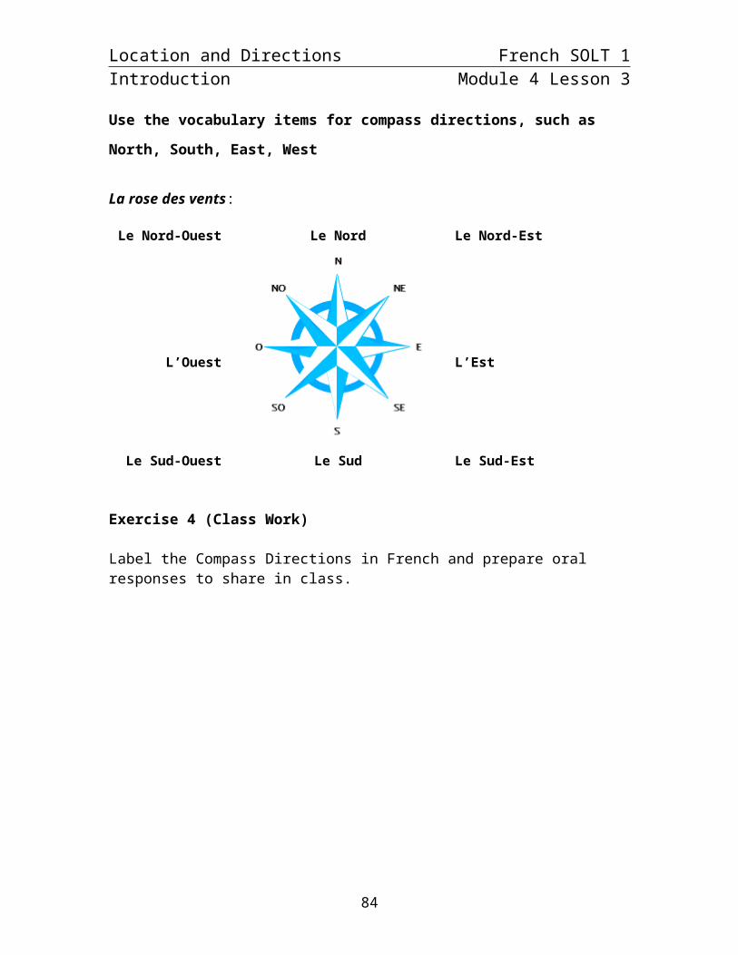
Exercise 2 (Class Work) Your instructor will read cardinal points in French. Write the appropriate point on the compass below. You will learn about degrees and the azimuth system later.
80

Location and Directions French SOLT 1Introduction Module 4 Lesson 3
Exercise 3 (Pair Work)
Refer to the map of Africa (next page) and give the location of African countries in relation to one another. Take turns giving answers for each one below.
Example: La Guinée / Le Mali La Guinée est au sud-ouest du Mali.
1. Le Niger / Le Tchad Le Niger est à l’ouest du Tchad.
2. La Côte d’Ivoire / le Ghana La Côte d’Ivoire est à l’ouest du Ghana.
3. La République Centrafricaine / le Cameroun La République Centrafricaine est à
l’est du Cameroun.
4. Le Congo / le Gabon Le Congo est à l’est du Gabon.
5. La Guinée-Bissau / le Sénégal La Guinée-Bissau est au sud du Sénégal.
81

Location and Directions French SOLT 1Introduction Module 4 Lesson 3
82

Location and Directions French SOLT 1Introduction Module 4 Lesson 3
Use the vocabulary items for compass directions, such as North, South, East, West
La rose des vents:
Le Nord-Ouest Le Nord Le Nord-Est
L’Ouest L’Est
Le Sud-Ouest Le Sud Le Sud-Est
Exercise 4 (Class Work)
Label the Compass Directions in French and prepare oral responses to share in class.
83

Location and Directions French SOLT 1Introduction Module 4 Lesson 3
Tell the cardinal points on the compass
Les outils de l'orientation: carte, boussole, altimètre: Listen as your instructor goes over the pronunciation for each compass part or function.
There are several kinds of compasses, one kind to attach to the map, one kind to attach to your thumb:
needlecompass housinggraduationorienting linestravel arroworienting arrow
aiguille capsule mobile graduationlignes nord-sudflèche de direction extrémité rouge
84
Location and Directions French SOLT 1Introduction Module 4 Lesson 3
Discuss the difference between polar and magnetic north
In the field, the direction of features is often determined by a magnetic compass which measures angles relative to Magnetic North. You can convert field measures of magnetic direction into directions that are relative to either Grid or True North.
Exercise 5 (Class Work)
Read the following description and then answer the questions in English. Your instructor will ask one student to read aloud. Underline new vocabulary words to describe different parts (functions) of a compass. Compare your answers with your classmates.
La boussole
Une boussole est un instrument constitué d’un cadran au centre duquel est fixé un axe vertical autour duquel pivote une aiguille aimantée qui indique la direction du Nord magnétique (différent du Nord géographique, du fait de la déclinaison magnétique). La déclinaison magnétique est l’angle qui sépare la direction du Nord magnétique de celle du Nord géographique. L’aiguille rouge indique toujours le pôle Nord magnétique.
1. (In your own words) what is a boussole?2. What is the French translation of magnetic deviation? déclinaison magnétique
85
Location and Directions French SOLT 1Introduction Module 4 Lesson 3
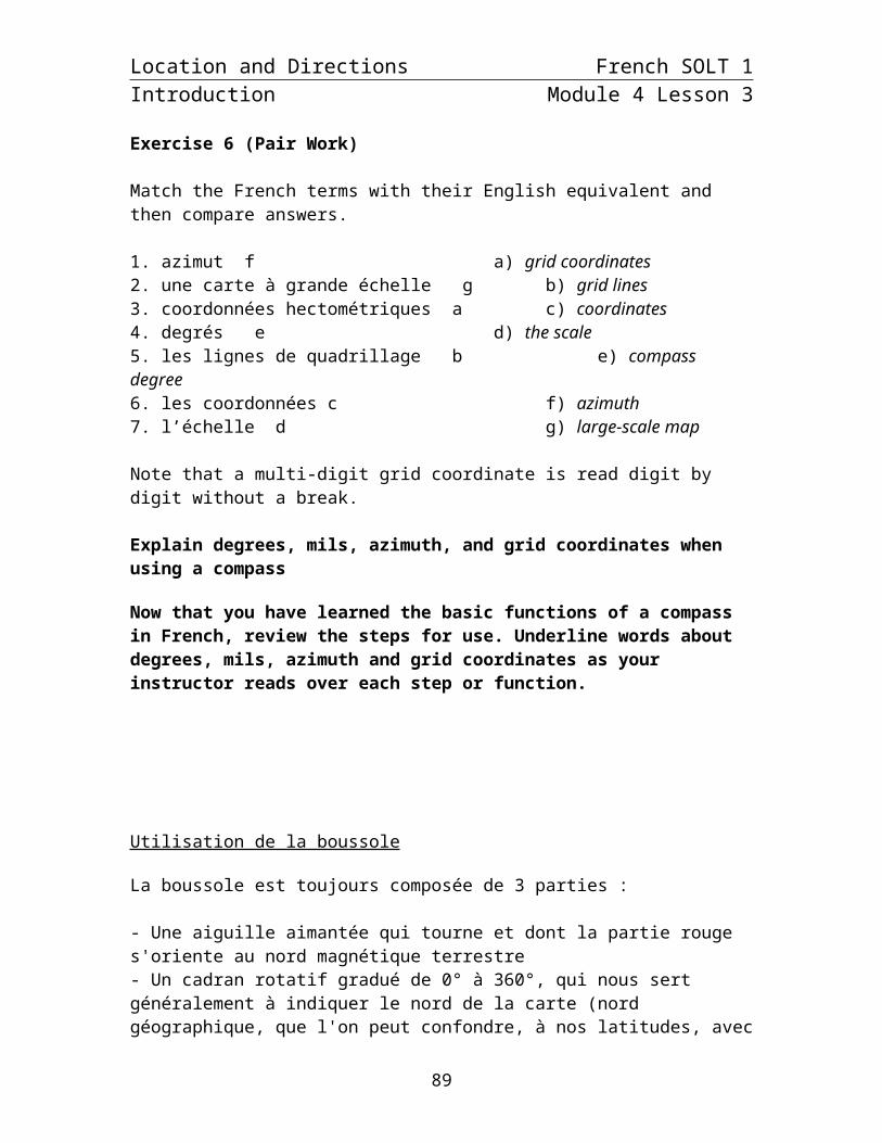
Exercise 6 (Pair Work)
Match the French terms with their English equivalent and then compare answers.
1. azimut f a) grid coordinates2. une carte à grande échelle g b) grid lines3. coordonnées hectométriques a c) coordinates4. degrés e d) the scale5. les lignes de quadrillage b e) compass degree6. les coordonnées c f) azimuth7. l’échelle d g) large-scale map
Note that a multi-digit grid coordinate is read digit by digit without a break.
Explain degrees, mils, azimuth, and grid coordinates when using a compass
Now that you have learned the basic functions of a compass in French, review the steps for use. Underline words about degrees, mils, azimuth and grid coordinates as your instructor reads over each step or function.
*Note to the instructor: Make students aware that they are not expected to follow or understand all of this text. Go over key items for comprehension of degrees, mils, azimuth and coordinates.
Utilisation de la boussole
La boussole est toujours composée de 3 parties :
- Une aiguille aimantée qui tourne et dont la partie rouge s'oriente au nord magnétique terrestre- Un cadran rotatif gradué de 0° à 360°, qui nous sert généralement à indiquer le nord de la carte (nord géographique, que l'on peut confondre, à nos latitudes, avec le nord magnétique)- Une plaquette graduée avec un repère de visée, qui nus sert généralement à indiquer la direction de marche, sur la carte, et sur le terrain.
Comment trouver le nord avec la boussole?Le nord magnétique est indiqué par l'aiguille rouge. Attention: il est légèrement différent du nord géographique (haut des cartes). Cette différence fluctue dans le temps.
Comment mesurer un azimut sur une carte à la boussole?L'azimut est l'angle que fait une direction avec le nord. Exemple: Azimut 90°: c'est l'est.1- Sur la carte, orienter le repère de visée (plaquette) sur la direction à suivre. Maintenant il ne faut plus bouger la plaquette.2- Aligner le nord du cadran rotatif avec le nord (haut) de la carte.3- Lire l'azimut directement sur la boussole (angle de la direction de marche)
86

Location and Directions French SOLT 1Introduction Module 4 Lesson 3
Exercise (Class Work)
Listen carefully to your instructor read different (specific) parts of a compass. For each number, write out the word that you hear. Check your vocabulary list beforehand and go over meaning of new or difficult words.
Instructor’s Reading:
1. Règle transparente. 2. Habitacle rotatif. 3. Point nord lumineux. 4. Flèche nord-sud gravée. 5. Lignes méridiennes de l'habitacle. 6. Aiguille de la boussole. 7. Point-indice. 8. Flèche de direction de marche. 9. Bords de la règle parallèles à la flèche de la direction de marche.10. Traits auxiliaires parallèles à la flèche de la direction de marche.11. Points lumineux.12. Échelle graduée.13. Échelle en mm et en cm.14. Courroie de cuir.
87

Location and Directions French SOLT 1Introduction Module 4 Lesson 3
Tip of the day: Cardinal Points
If combined with the other cardinal points, English speakers say, “Northeast”, “Southwest”, etc. Standard French follows this same pattern; le nord-est, le sud-ouest. However, in local Senegalese languages such as, Pulaar and Wolof, East and West are the first terms said by a local. Instead of saying northeast, one would say east of north. In addition, there are words in local languages such as, the Wolof word, “sowu” (west) that represent directions. Be aware of the subtleties in the local languages that might impede your communication skills. Listening and using the standard will guide you.
Exercise 7 (Group Work)
In groups of 3 or 4, discuss the English and French texts about the use of a compass and azimuth. Look at the diagram to help you get started. Discuss the importance of conversion and how the vocabulary in French varies from the English. Share your ideas with the class.
An azimuth is defined as a horizontal angle measured clockwise from a north base line. This north base line could be true north, magnetic north, or grid north. The azimuth is the most common military method to express direction. When using an azimuth, the point from which the azimuth originates is the center of an imaginary circle. This circle is divided into 360 degrees or 6400 mils.
Un azimut est un angle qui se mesure en degrés dans le sens des aiguilles d'une montre; cet angle est formé par la ligne du nord géographique et par la ligne de direction de marche. Si tu as une boussole en main, un azimut est le nombre de degrés entre la pointe colorée de l'aiguille de ta boussole (compte tenu de la dé- clinaison magnétique) et la ligne imaginaire qui part du centre de ta boussole et qui vise l'objet vers lequel tu veux te rendre, un arbre par exemple.
88

Location and Directions French SOLT 1Introduction Module 4 Lesson 3
Provide information on how to get to certain place
Exercise 8 (Pair Work)
Read the following orders about giving directions. One of you will be a Sergeant and the other will be a Private. Working with your partner, underline the place names or markers in the directions (given by the Sergeant). Next write a logical conclusion offered by the Private. What questions or response would he give based on the Sergeant’s directions? Be prepared to present in class.
Sergeant:Soldat, vous allez continuer sur cette piste. Au bout, vous suivrez l'azimut 68° sur 300 mètres. Ensuite, azimut 20° jusqu'au puit au milieu de la clairière. A partir de là, il y a une piste au sud du village qui longe la rivière sur 3 kilomètres et vous guidera jusq'au point de rendez-vous.
Private:
89
Location and Directions French SOLT 1Introduction Module 4 Lesson 3
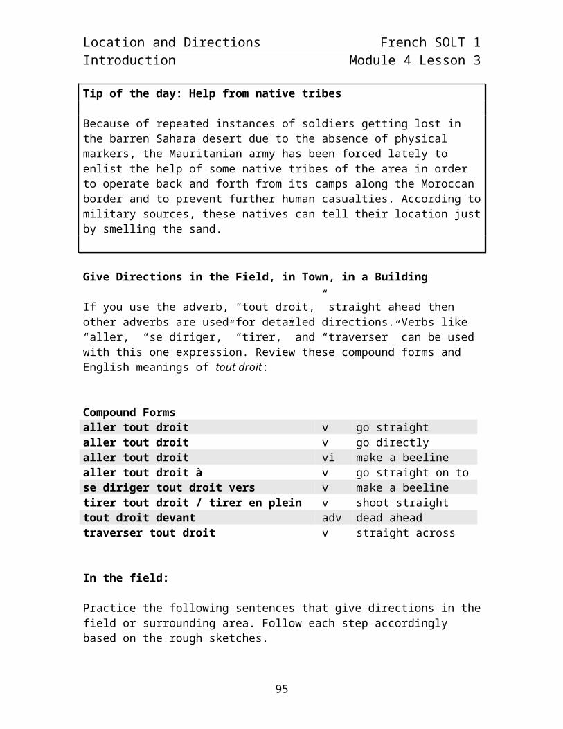
Tip of the day: Help from native tribes
Because of repeated instances of soldiers getting lost in the barren Sahara desert due to the absence of physical markers, the Mauritanian army has been forced lately to enlist the help of some native tribes of the area in order to operate back and forth from its camps along the Moroccan border and to prevent further human casualties. According to military sources, these natives can tell their location just by smelling the sand.
Give Directions in the Field, in Town, in a Building
If you use the adverb, “tout droit,” straight ahead then other adverbs are used for detailed directions. Verbs like “aller,” “se diriger,” “tirer,” and “traverser” can be used with this one expression. Review these compound forms and English meanings of tout droit:
Compound Formsaller tout droit v go straightaller tout droit v go directlyaller tout droit vi make a beelinealler tout droit à v go straight on tose diriger tout droit vers v make a beelinetirer tout droit / tirer en plein v shoot straighttout droit devant adv dead aheadtraverser tout droit v straight across
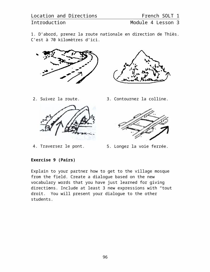
In the field:
Practice the following sentences that give directions in the field or surrounding area. Follow each step accordingly based on the rough sketches.
1. D’abord, prenez la route nationale en direction de Thiès. C’est à 70 kilomètres d’ici.
2. Suivez la route. 3. Contournez la colline.
90

Location and Directions French SOLT 1Introduction Module 4 Lesson 3
4. Traversez le pont. 5. Longez la voie ferrée.
Exercise 9 (Pairs)
Explain to your partner how to get to the village mosque from the field. Create a dialogue based on the new vocabulary words that you have just learned for giving directions. Include at least 3 new expressions with “tout droit.” You will present your dialogue to the other students.
91

Location and Directions French SOLT 1Introduction Module 4 Lesson 3
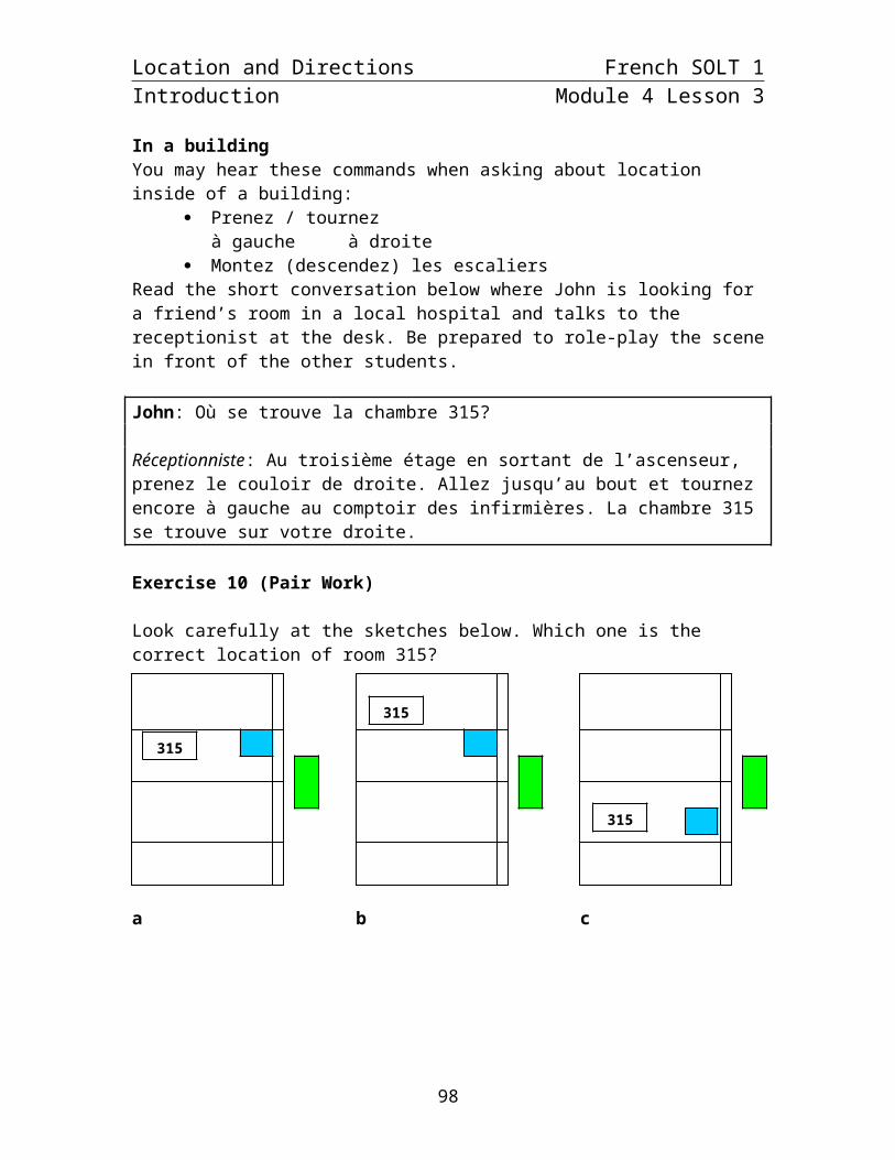
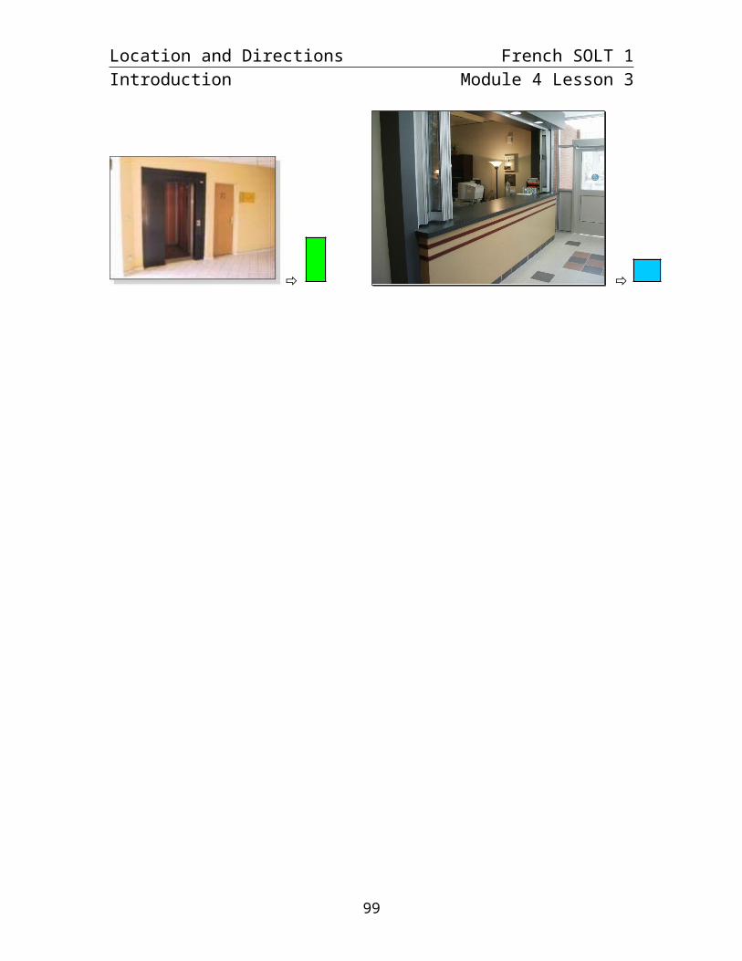
In a buildingYou may hear these commands when asking about location inside of a building:
Prenez / tournezà gauche à droite
Montez (descendez) les escaliersRead the short conversation below where John is looking for a friend’s room in a local hospital and talks to the receptionist at the desk. Be prepared to role-play the scene in front of the other students.
John: Où se trouve la chambre 315?
Réceptionniste: Au troisième étage en sortant de l’ascenseur, prenez le couloir de droite. Allez jusqu’au bout et tournez encore à gauche au comptoir des infirmières. La chambre 315 se trouve sur votre droite.
Exercise 10 (Pair Work)
Look carefully at the sketches below. Which one is the correct location of room 315?
a b c
315315
315
92

Location and Directions French SOLT 1Introduction Module 4 Lesson 3
Exercise 11 (Class Work)
Now write a few sentences to add to the conversation. What is a logical conclusion? What other directions would John need to ask for? Prepare your sentences and be prepared to match up with another student to finish the dialogue. Your instructor will pair you up and ask a few of you to present.
93

Location and Directions French SOLT 1Introduction Module 4 Lesson 3
Give Information Regarding Location
Ask and provide information on how to get to a certain location
Practice these common expressions to use for giving or asking for directions. Follow your instructor’s model.*Note the use of the command form (polite “vous”).In town:
Allez tout droit jusqu’au carrefour Go straight until the intersectionFeu (de signalisation) Traffic lightPremière rue à gauche First street on the leftDeuxième rue à droite Second street on the rightPassez devant l’hôtel Go past the hotelTraversez la rue Cross the street
En face de (on the opposite side of, across the street from): not to be confused with devant (directly in front of, past or by something).
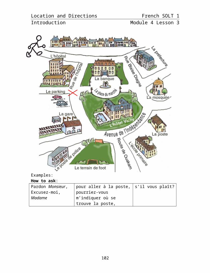
Exercise 12 (Pair Work)
After you review the expressions for asking for and giving directions to a certain location, examine the city layout or “plan” on the next page. With your partner, ask and answer questions about how to find different city landmarks. Begin with the example of the post office and continue with new places. There are many possible answers.
94
Location and Directions French SOLT 1Introduction Module 4 Lesson 3
Examples:How to ask:Pardon Monsieur,Excusez-moi, Madame
pour aller à la poste,pourriez-vous m’indiquer où se trouve la poste,
s’il vous plaît?
Answer:Vous êtes devant l’hôpital. Continuez tout droit jusqu’à l’avenue de l’Indépendance. Tournez à gauche. Passez devant l’école primaire. La poste se trouve sur la droite.
95
Location and Directions French SOLT 1Introduction Module 4 Lesson 3
Exercise 13 (Pair Work)
You are on a tour of the République démocratique du Congo (formerly Zaire). You are in Tshela and you ask your partner for directions to 2 different destinations. Your partner will ask about the other two. Look at the map below and complete the directions with as much information as possible. Be ready to present to the class.
Example: Pardon, pour aller à Kingimbi? C’est à environ 60 km d’ici. Prenez la route en direction de Luozi.
1. Pardon, pour aller à Luozi?C’est à environ 120 km d’ici. Passez Suku-Tadi, Kingimbi, et Kingila. Suivez la route pendant encore 30 km jusqu’à Luozi.
2. Excusez-moi, pouvez-vous m’indiquer la route pour aller à Banana?Allez jusqu’à Lukula. Au premier carrefour tournez à droite et suivez la route principale pendant environ 90 km. Puis prenez à gauche en direction de Banana. Le village est à environ 5 km.
3. Pardon Monsieur, la route pour aller à Matadi, s’il vous plaît?Suivez la route en direction de Lukula, mais n’allez pas jusque là. Au bout de 25 km, tournez à gauche au carrefour. Passez la ville de Seke-Banza, roulez pendant encore 20 km et au prochain carrefour tournez à gauche. Suivez la route pendant encore 40 km environ jusqu’à Matadi.
4. Excusez-moi, pour aller à Songololo?Prenez la route en direction de Luozi. Passez Suku-Tadi. En arrivant à Kingimbi, tournez à droite, en direction de Seke-Banza. Au bout de 6 km, tournez à gauche pour aller à Songololo. Suivez la route pendant environ 90 km jusqu’à Songololo.
96
Location and Directions French SOLT 1Introduction Module 4 Lesson 3
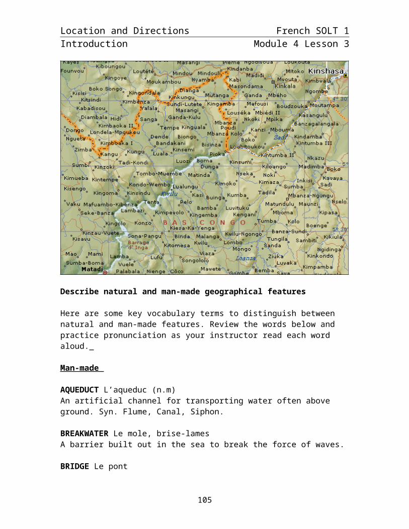
Describe natural and man-made geographical features
Here are some key vocabulary terms to distinguish between natural and man-made features. Review the words below and practice pronunciation as your instructor read each word aloud.
Man-made
AQUEDUCT L’aqueduc (n.m)An artificial channel for transporting water often above ground. Syn. Flume, Canal, Siphon.
BREAKWATER Le mole, brise-lamesA barrier built out in the sea to break the force of waves.
BRIDGE Le pontA structure spanning a river or valley etc. and affording either vehicular or pedestrian passage.
CAUSEWAY La chausséeA roadway constructed across shallow water.
97

Location and Directions French SOLT 1Introduction Module 4 Lesson 3
CUTTING An excavation through ground to maintain a grade.
CANAL Le canalAn artificial waterway constructed in the ground surface for navigation or conveyance of water.
DAM Le réservoir1. A barrier to impound water. 2. A body of water confined by a barrier.
FORD Le guéA river crossing over the bead of a stream.
LANDING A place where persons or goods are transported to and from a vessel.
LEVEE Le barrageAn embankment that prevents inundation.
LOCK L’écluse (n.f)An enclosed portion of a canal or river with gates at each end for raising or lowering of vessels.
LOOKOUT Le guet (tour de guet)A facility which provides a vista of the surrounding area.
MINE La mineAn excavation made in the earth for the purpose of extracting ores precious stones coal etc.
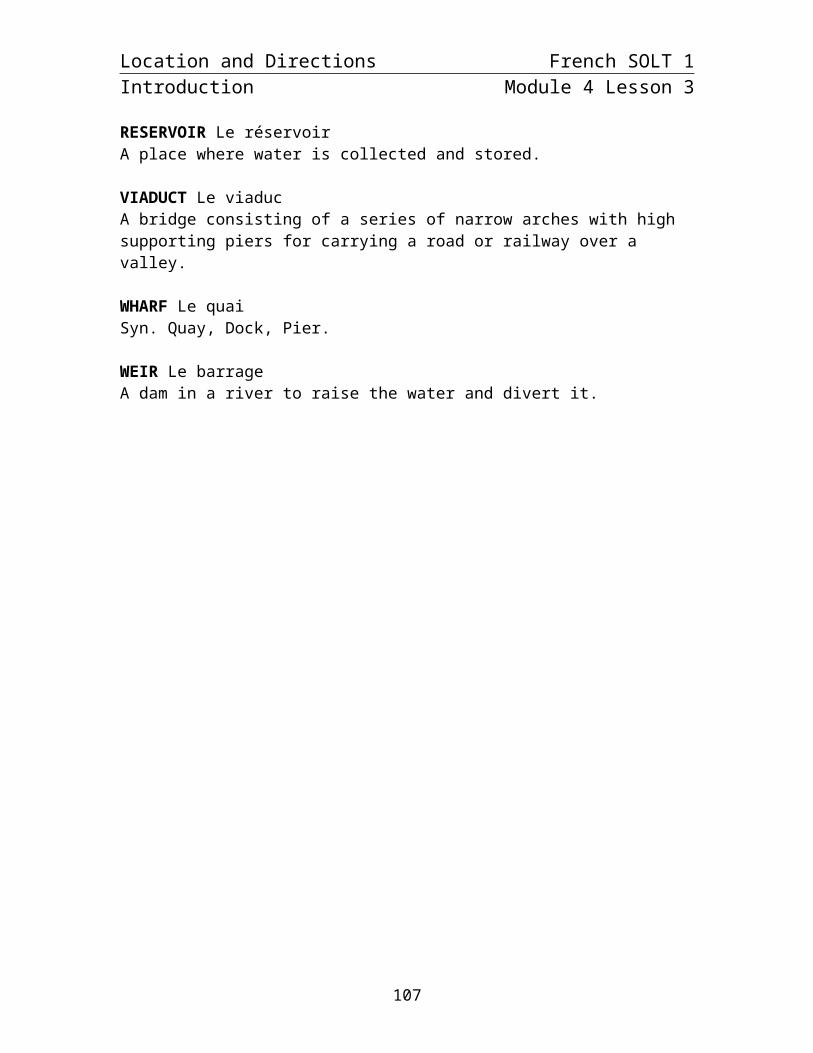
RESERVOIR Le réservoirA place where water is collected and stored.
VIADUCT Le viaducA bridge consisting of a series of narrow arches with high supporting piers for carrying a road or railway over a valley.
WHARF Le quaiSyn. Quay, Dock, Pier.
WEIR Le barrageA dam in a river to raise the water and divert it.
98
Location and Directions French SOLT 1Introduction Module 4 Lesson 3
Natural
Compare the man-made vocabulary with the following natural geographical words for land features:
cove = une anse dune = une dune hill = une colline marsh = une marécage mesa = une mesa peninsula = une péninsule, presqu’île plain = une plaine plateau = une vire, un plateau range = un chaînon reef = un récif sound = un détroit source = une source, une fontaine swamp = un marais valley = une vallée
Exercise 14 (Pair Work)
Read the following vocabulary and decide with your partner whether reference points are man-made or natural. Share you results with other pairs. A class discussion will follow.
Object Natural or man-madeune vireun maraisune écluseun quaiune sourceun guet
99
Location and Directions French SOLT 1Introduction Module 4 Lesson 3
Provide reference points and describe reference points
A landmark (un point de repère) and the overall landscape (le paysage) will help you ask about and provide reference points when giving directions. Here are some important landmarks for the countryside or village and for a city:
Constructions caractéristiques à la campagne
A la campagne les constructions les plus utiles sont celles qui se voient de loin ou qui sont isolées.
L'église et la chapelle
Les clochers des églises et leurs formes caractéristiques les rendent visibles de loin et en font d'excellents points de repères. L'Eglise est représentée par un rond vide alors que la chapelle est représentée avec un rond plein.
Les tours
Construites pour voir loin, elles sont de fait aussi visibles de beaucoup d'endroits.
Les cheminées d'usine, les moulins, les pylônes
La aussi visibles de loin. Surtout dans la campagne aux abords des villes pour les cheminées et dans certaines régions pour les moulins.
Les pylônes sont plutôt courants dans le paysage.
Constructions caractéristiques dans les villes
A la ville l'essentiel n'est pas de pouvoir voir les constructions de loin, mais de les trouver et de savoir les repérer. Pour cela il faut que le bâtiment soit connu, ainsi il sera indiqué et les gens sauront vous dire où il se trouve; il est aussi nécessaire que le bâtiment soit caractéristique pour le reconnaître en arrivant devant.
Églises (mosquées)
Le bâtiment caractéristique par excellence.
Gares
Toujours très bien indiquées dans les villes où passent le chemin de fer (malheureusement pas toutes les villes loin s'en faut). En plus il suffit de trouver la voie pour y arriver.
100

Location and Directions French SOLT 1Introduction Module 4 Lesson 3
Exercise 15 (Group Work)
In groups of 3, go over the following text and determine each one of these landmarks to find your way to a location. As a group, sketch the information and share your group ideas in a class discussion.
Points de repères :
D’abord - Une église blanche. Quand vous arrivez de [ville] vous la verrez sur votre gauche au bas d'une pente au pied de laquelle la Route 315 tourne sur la gauche à 90 degrés. N'allez pas tout droit! Suivez la 315. Lorsque vous arrivez de [ville] (en présumant que vous avez suivi les indications précédentes) vous voyez l'église sur votre droite lorsque vous approchez de la 315 en provenance du chemin [nom]. Vous devez passer devant l'église pour vous rendre chez nous.
Le prochain point de repère est la Forêt [nom]. Vous êtes à moins de deux kilomètres de chez nous.
101

Location and Directions French SOLT 1Introduction Module 4 Lesson 3
Exercise 16 (Pair Work)
With a partner, decide the importance of these city landmarks. Discuss the best ways to situate yourself or locate another landmark if given these city markers. Share your ideas with the other pairs.
Routes, chemins de fer, cours d'eaux
Infrastructures routières
Les routes sont le meilleur moyen de s'orienter à partir de la carte. Les tunnels et ponts ont aussi un symbole caractéristique.
Les chemins de fer
Les chemins de fer sont représentés par un trait noir continu. Très utiles pour s'orienter aussi.
Les cours d'eaux
Les plans d'eau et les rivières assez larges sont représentés en bleu clair. Les ruisseaux sont en trait bleu fin. Enfi les barrages sont représentés par un arc de cercle noir.
102
Location and Directions French SOLT 1Introduction Module 4 Lesson 3
Exercise 17 (Class Work)
Match the following vocabulary with the pictures below. Next, find one more vocabulary word that can be associated with each one of these 6. Share your answers with the class.
Une borneUne usineUn phareUn villageUn panneauUne mosquée
a. b. c.
d. e. f.
103

Location and Directions French SOLT 1Grammar Notes Module 4 Lesson 3
The relative pronoun dont
Like other relative pronouns that link ideas (sentences) together, dont is a relative pronoun that is commonly used to replace the preposition de + noun, as well as indicate possession. For pronunciation of “dont”, the [t] is silent.
Here are examples of sentences linked with dont where dont replaces the preposition de:
Voici la mosquée. Tu m’as parlé de la mosquée. Voici la mosquée dont tu m’as parlé. Here is the mosque you told me about.
Nous allons acheter des bonbons. Nous avons besoin de bonbons pour Halloween.Nous allons acheter les bonbons dont nous avons besoin pour Halloween.We are going to buy the candy we need for Halloween.
Here is an example of sentences linked with dont where dont indicates possession:
Je vais au ciné avec mon amie. Son père [le père de mon amie] est colonel.Je vais au ciné avec mon amie dont le père est colonel.I go to the movies with my friend whose father is a colonel.
*Note to the instructor: Go over the relative pronouns from earlier lessons. Give students examples of questions and statements that use different relative pronouns. Compare these types with dont.
Exercise 1
Fill in the blanks with the correct relative pronoun: qui, que or dont. Prepare oral responses to present in class. Be ready to explain why you used a particular pronoun. Example: Voici mon livre dont j’ai besoin.
1. Le livre dont je suis l’auteur est un roman d’aventures.
2. C’est l’histoire d’un héros qui s’appelle Indiana Jones.
3. La mission de Jones est de trouver l’arche que les Nazis ont localisée.
4. Cette arche, qui contient les tables de la Loi, est la source d’une grande puissance.
5. Marion Ravenwood, dont le médaillon est nécessaire pour localiser l’arche, est
l’ancienne amie d’Indiana Jones.
104
Location and Directions French SOLT 1Grammar Notes Module 4 Lesson 3
Exercise 2 (Pair Work)
Ask your partner some specific questions about his family, friends, etc. Next include questions (answers) about the location of a particular family / friend home. Ask him to give you directions. Introduce your partner to the class using at least 5 relative pronouns (qui, que, dont) in 10 different sentences. After the introduction, give a brief explanation of the place he told you about. Follow the model below:
Voici John dont le père a combattu pendant la seconde guerre mondiale. Tous les deux rendent visite à leurs familles deux fois par mois [...]. La famille proche de John habite à ?
105
Location and Directions French SOLT 1Vocabulary Module 4 Lesson 3
Aiguille (n.f)Aimant (n.m)Ascenseur (n.m)Azimut (n.m)Bâtiment (n.m)Borne kilométrique (n.f)Boussole (n.f)Bout du couloir (n.m)Cadran (n.m)Capsule mobile (n.f)Carte à grande échelle (n.f)Centre-ville (n.m)Clairière (n.f)Contourner (verb)Convoi (n.m)Coordonnées (n.f.pl)Degré (n.m)Descendre les escaliers (verb)Échelle (n.f)Est (n.m)Extrémité rouge (n.f)Feu de signalisation (n.m)Flèche de direction (n.f)Instrument (n.m)Ligne du quadrillage (n.f)Lignes Nord-Sud (n.f.p)Longer (verb)Lumière (n.f)Monter (verb)Nord (n.m)Ouest (n.m)Palais présidentiel (n.m)Panneau (n.m)Paysage (n.m)Piéton (n.m)Piste (n.f)Pivoter (verb)Point de repère (n.m)Poteau des services publics (n.m)Puits (n.m)Règle (n.f) Rose des vents (n.f)Sans accès à la mer (adj.)Sud (n.m)Suivre (verb)Terrain (n.m)Tout droit (adv.)Traverser (verb)
NeedleMagnetElevatorAzimuthBuildingKilometer-marker, boundary stoneCompassEnd of the hallDialCompass housingLarge-scale mapDowntownGlade (in the forest)To go around somethingConvoyCoordinatesDegreeTo go down the stairsScaleEastOrienting arrowTraffic lightsTravel arrowInstrumentGrid lineOrienting linesTo go alongside, run parallel toLightTo go upNorthWestPresidential palaceRoad signLandscapePedestrianDirt road, runway, track, lead (evidence), lap To revolve, to turn roundLandmarkUtillity poleWellRulerCompass roseLandlockedSouthTo followFieldStraight aheadTo cross
106

Location and Directions French SOLT 1Supplemental Vocabulary Module 4 Lesson 3
Anse (n.f)Aqueduc (n.m)Barrage (n.m)Chaînon (n.m)Chaussée (n.f)Colline (n.f)Détroit (n.m)Dune (n.f)Fontaine (n.f)Guét (n.m)Marais (n.m)Marécage (n.m)Mesa (n.f)Môle (n.m)Moulin (n.m)Péninsule (n.f)Plaine (n.f)Plateau (n.m)Presqu’île (n.f)Pylône (n.m)Récif (n.m)Source (n.f)Vallée (n.f)Viaduc (n.m)Vire (n.f)
Cove, bayAqueductDam, barrierRangeCausewayHillStraight, channelDuneFountainLookout, watchSwampSwampland, marshMesaBreakwaterWindmillPeninsulaPlainPlateauPeninsulaMast, poleReefSource, springValleyViaductPlateau
107
Location and Directions French SOLT 1Culture Notes Module 4 Lesson 3
Getting Directions in Senegal
In Africa, compasses are still little known to the general public and remain mostly the domain of private and governmental agencies in the performance of their various duties. Instead, African traditional systems of directions and spotting are widely used.
Natural and man-made landmarks constitute the main reference points by which Africans give or get directions. In the absence of street names and numbered housing units in many parts of cities, Africans rely on their intimate knowledge of their surroundings to move and find their way around. The reference point might be a building with distinct characteristics, a tree or simply a vendor’s stall. This physical orientation is complemented by cultural notions of what is long or short distances, in lieu of quantitative measurements. The following example is a typical way of giving directions in Senegal:
“If you go far, you will see a bakery on your right, immediately after it, there is a small street. Take a left here and you will see a yellow truck in front of a house and two women dying clothes there. Thierno’s house is the one next to it.”
For a person new to the Senegalese culture, these directions might be confusing and vague. First, how far is far. Secondly, the yellow truck or the two women dyers might not be there at the time the direction seeker arrives in the area. But for a Senegalese, these directions make sense because he or she knows that despite the deficiency in the physical clues, it is very easy to find one’s party in Senegalese neighborhoods where almost every body knows who owns a truck or dyes clothes in the area. All one needs to do is to ask a passerby and have a trustworthy source.
Maps
Like compasses, maps are not used by the vast majority of the population in Africa. With the exception of some big urban centers, it is almost impossible to get an accurate and updated city map in many places. Partly because of poor archival records and partly because of lack of map expertise and necessary funding, many city governments in Africa carry out their daily businesses without a land use master plan. In these instances, land allocation and land titling are handled in a very informal way and require witnesses from the general public in lieu of well-drawn maps. In Kaedi, Mauritania, for example, land disputes are mediated by the Préfet (government appointed administrative authority) who, because of the absence of printed land allocation maps, bases his final decision on the recommendation of witnesses to the original land ascription. Consequently, if you are planning to request a piece of land in some African cities, for whatever purposes, a city map might not tell the whole story. A visit to the chef de quartier (locally elected neighborhood chief) is the best guarantee against potential land disputes.
108

Location and Directions French SOLT 1Application Activities Module 4 Lesson 3
Activity 1
Your team has been assigned to guard the president. In order to position yourselves strategically, you need to know the exact route of a motorcade through town. Listen to your instructor read the coordinates, and then trace the route on the map.
Script: Le convoi va quitter l’Avenue Mousse Travele, et il va traverser l’Avenue de la Nation. Ensuite, il va déboucher sur l’Avenue Mamadou Konaté. Puis il va traverser les rails et va virer à droite sur l’avenue Van Vollenhoven. Il va passer devant l’hôpital et il va prendre la route de Koulikoro qui mène vers la sortie de la ville.
109

Location and Directions French SOLT 1Application Activities Module 4 Lesson 3
Activity 2
A member of your team got his jeep stuck in a marsh and radioed for help. On your way to haul him out you ask a local farmer to show you the best way to get there. Listen to the farmer’s directions (read by your instructor or a classmate) and pencil in the route on your map. Take notes when necessary. Be aware that you might not agree with the farmer on the directions he gives you.
Script: Tournez tout de suite à gauche, passez devant la ferme, puis tournez à droite. Au bout de la rue, tournez à droite, puis prenez la première à droite. Traversez le pont. Le marais se trouve sur la droite.
110

Location and Directions French SOLT 1Application Activities Module 4 Lesson 3
Activity 3 (Pair Work)
Tell your partner the location of each of the following cities of the Ivory Coast.
Example: Béoumi est au centre du pays.
1. Odienne2. Danané3. Tabou4. Bouna5. Aboisso6. Katiola7. Abidjan
111

Location and Directions French SOLT 1Application Activities Module 4 Lesson 3
Activity 4
Pair activity. Look at these two maps of Senegal. Take turns asking and answering about the location of the following Senegalese cities:Touba / Tambacounda / Dakar / St Louis / Ziguinchor
112

Location and Directions French SOLT 1Skill Enhancement Activities Module 4 Lesson 3
Activity 1
Pair activity. You need some directions to go to the following places, so you stop someone in the street. Role-play the following situation with your partner. Alternate the roles.
1. You are at the soccer field and you want to go to the bank.2. You are at the police station and you want to go to the city hall.3. You are at the city hall and you want to go to the train station.4. You are at the school and you want to go to the hospital.5. You are at the parking lot and you want to go to the mosque.
Activity 2
Pair activity. Plan and chart a route to the rendezvous point on the riverbank. Be prepared to describe your route to the class.
113

Location and Directions French SOLT 1Skill Enhancement Activities Module 4 Lesson 3
Activity 3
Pair activity. A new A-team is coming to town. You are on the phone giving directions to the captain on how to come from the airport to the base. Student A looks at the map and gives directions, student B closes his book and takes notes. Then go over the notes and trace your route on the map and check if you do reach your destination.
114

Location and Directions French SOLT 1Skill Enhancement Activities Module 4 Lesson 3
Base militaire
Aéroport
115

Location and Directions French SOLT 1Skill Enhancement Activities Module 4 Lesson 3
Activity 4
Student A
Look at your map. The cross is your location. Listen to your partner who is giving you directions over the phone on how to meet him at a certain location. Then, using the road traced on your map, give him directions.
116

Location and Directions French SOLT 1Skill Enhancement Activities Module 4 Lesson 3
Activity 4
Student B
You are on the phone with your partner. Using the road traced on your map, give him directions on where to meet you. Then, using the cross as your starting point, follow your partner’s directions.
117

Location and Directions French SOLT 1Homework Module 4 Lesson 3
Activity 1 Track 50
CD. You will hear a sightseeing tour narration called Dakar by bus. Below are pictures of the places you will pass by. Listen to the recording, and then number the pictures according to the order in which you see them.
Script: Nous sommes dans le centre-ville de Dakar. Le grand terrain devant nous est la Place de l’Indépendance. A gauche, c’est le bâtiment de l’Assemblée Nationale. Cette grande maison avec des gardes à la porte est le Palais Présidentiel. Les lumières que vous voyez là-bas au milieu de la mer c’est l’Île de Gorée.
2 Palais Présidentiel 1 Place de l’indépendance 3 Île de Gorée
Activity 2
Be prepared to explain the location of your home state (without mentioning its name) in relation to its neighboring states.
118

Location and Directions French SOLT 1Homework Module 4 Lesson 3
Activity 3 Track 51
CD. Listen to a conversation between a soldier trying to find the way to the village of Thilogne and a local who is willing to help him. Trace the way indicated and place a cross at the edge of the map where the road to Thilogne goes off the map.
Script: A: Pardon Monsieur, la route pour aller à Thilogne, s’il vous plaît? B: Thilogne? Bon, alors, vous allez tout droit, vous allez passer le lac sur votre droite, ensuite la forêt sur votre gauche. Juste après la forêt, vous allez traverser un pont. Après le pont, vous prenez la deuxième route à droite. Vous allez traverser le village…A: Quel village? B: Lexeiba. C’est à environ 8 km d’ici. Donc vous traversez Lexeiba et vous continuez tout droit. Thilogne est à 5 km de Lexeiba. A: Merci beaucoup. B: De rien.
119

Location and Directions French SOLT 1Homework Module 4 Lesson 3
Activity 4
You invited your colleague for coffee at your house. He lives next to the police station; you live behind the city hall. Write him a note to give him directions. Practice going over the note in class (without the paper).
120

Location and Directions French SOLT 1Homework Module 4 Lesson 3
Activity 5
You visit a friend who lives on the Île de Gorée. This is the note that your friend left you giving you directions to the place where you are supposed to meet after work. Read the note and trace your route on the map on the next page.
En sortant de la mairie, va tout droit et passe derrière le kiosque à musique. Au coin de la maison rouge, prends à droite et continue jusqu’à l’Avenue Boufflers. Tourne à droite au carrefour et va jusqu’à la fontaine. Je t’y attendrai à midi.
1. La Poste 2. Capitainerie 3. Castel 4. Musée de la Femme 5. Fontaine 6. Eglise 7. Musée historique 8. Ancien hopital 9. Kiosque à musique 10. Mairie 11. Maison des esclaves 12. Musée de la mer 13. Maison blanche 14. Maison rouge 15. Marché artisanal 16. Plage et batterie 17. Maison d'éducation Mariama Ba 18. Mosquée 19. Université des mutants 20. Palais du Gouverneur 21. Hostellerie des Boufflers 22. Maison du Soudan
121

Location and Directions French SOLT 1Homework Module 4 Lesson 3
23. Syndicat d'initiative (maison Jules Basse) 24. William Ponty 25. Rue des Batteries 26. Rue Blanchot 27. Rue Déserte 28. Rue Boufflers 29. Embarcadère 30. Jardin public 31. Centre médico-social de l'Ordre de Malte 32. Quai des boucaniers
122