Biological Resource Evaluation - CaltrainGatos+Creek+Brid… · LOS GATOS CREEK BRIDGE REPLACEMENT...
78
LOS GATOS CREEK BRIDGE REPLACEMENT / SOUTH TERMINAL PHASE III PROJECT Biological Resource Evaluation Santa Clara County, California Prepared for Peninsula Corridor Joint Powers Board 1250 San Carlos Avenue P.O. Box 3006 San Carlos, California 94070-1306 Prepared by HDR Engineering, Inc. 2379 Gateway Oaks Drive Suite 200 Sacramento, California 95833 November 2013
Transcript of Biological Resource Evaluation - CaltrainGatos+Creek+Brid… · LOS GATOS CREEK BRIDGE REPLACEMENT...

LOS GATOS CREEK BRIDGE REPLACEMENT / SOUTH TERMINAL
PHASE III PROJECT
Biological Resource Evaluation Santa Clara County, California
Prepared for
Peninsula Corridor Joint Powers Board 1250 San Carlos Avenue
P.O. Box 3006 San Carlos, California 94070-1306
Prepared by
HDR Engineering, Inc. 2379 Gateway Oaks Drive
Suite 200 Sacramento, California 95833
November 2013


LOS GATOS CREEK BRIDGE REPLACEMENT / SOUTH TERMINAL PHASE III PROJECT
Biological Resource Evaluation Santa Clara County, California
Prepared for
Peninsula Corridor Joint Powers Board
1250 San Carlos Avenue
P.O. Box 3006
San Carlos, California 94070-1306
Prepared by
HDR Engineering, Inc.
2379 Gateway Oaks Drive, Suite 200
Sacramento, California 95833
Contact: Todd Wong
November 2013

This page left blank intentionally.

Los Gatos Creek Bridge Replacement / South Terminal Phase III November 2013 Biological Resource Evaluation Page i
Summary
The Peninsula Corridor Joint Powers Board (JPB) which operates the San Francisco Bay Area’s Caltrain passenger rail service proposes to replace the two-track railroad bridge that crosses Los Gatos Creek, in the City of San Jose, Santa Clara County, California. The Proposed Action is needed to address the structural deficiencies and safety issues of the Caltrain Los Gatos Creek railroad bridge to be consistent with the standards of safety and reliability required for public transit, to ensure that the bridge will continue to safely carry commuter rail service well into the future, and to improve operations at nearby San Jose Diridon Station and along the Caltrain rail line.
This Biological Resources Evaluation (BRE) has been prepared to provide a summary of existing biological conditions, the potential presence of special status species and resources, an initial evaluation of impacts of the project on biological resources, and feasible avoidance and minimization measures to reduced potential impacts to a level typically considered less than significant under the California Environmental Quality Act (CEQA). This report is useful for the preparation of the proposed project’s CEQA Initial Study/Mitigated Negative Declaration and the categorical Exclusion document in compliance with the National Environmental Policy Act (NEPA).
As discussed herein, the BRE determines to what extent the proposed project may potentially impact biological resources which are subject to provisions of CEQA and NEPA. Based on existing conditions and characteristics of the study area, western pond turtle (Actinemys marmorata), pallid bat (Antrozous pallidus), hoary bat (Lasiurus cinereus), tricolored blackbird (Agelaius tricolor), Cooper’s hawk (Accipiter cooperi), and other nesting raptors and migratory birds are known to occur or have the potential to occur in the study area; therefore these species are evaluated for potential impacts. In addition, Los Gatos Creek and its associated willow riparian forest and scrub habitats meet the criteria of sensitive natural communities as defined by the California Department of Fish and Wildlife (CDFW). Los Gatos Creek is also a Water of the U.S. subject to U.S. Army Corps of Engineers (USACE), Regional Water Quality Control Board (RWQCB), and CDFW jurisdiction. Potential impacts to these sensitive natural communities are also evaluated in this BRE.
Potential impacts to the California red-legged frog, Central Valley fall/late fall-run Chinook salmon, Central California Coast steelhead are not discussed in the BRE. Impacts to these three species are discussed in a biological assessment (BA) that has been prepared for the National Marine Fisheries Service (NMFS) and U.S. Fish and Wildlife Service (USFWS) to ensure compliance with Section 7 of the Federal Endangered Species Act (ESA).
The BRE concludes that the proposed project will potentially impact sensitive natural communities/Waters of the U.S., special-status species (i.e., western pond turtle, pallid bat and hoary bat, tricolored blackbird, nesting raptors and other migratory birds, and trees); however, implementation of the recommended avoidance and minimization measures will reduce the potential impacts to a less than significant level.

Los Gatos Creek Bridge Replacement / South Terminal Phase III November 2013 Biological Resource Evaluation Page ii
This page left blank intentionally

Los Gatos Creek Bridge Replacement / South Terminal Phase III November 2013 Biological Resource Evaluation Page iii
Table of Contents
Summary .................................................................................................................................................... i
1.0 Introduction ................................................................................................................................. 1-1
1.1 Project Location ............................................................................................................... 1-1
1.2 Regulatory Requirements ................................................................................................ 1-1
1.2.1 Federal Requirements for Species Protection .................................................... 1-4
1.2.2 State Requirements for Species Protection ........................................................ 1-5
1.2.3 Protection of Wetlands and Other Waters of the United States ......................... 1-6
1.2.4 Local Policies ...................................................................................................... 1-7
2.0 Description of the Proposed Project ......................................................................................... 2-1
2.1 Purpose and Need of Proposed Project .......................................................................... 2-1
2.1.1 Existing Safety Concerns .................................................................................... 2-1
2.1.2 Need for a Tail Track .......................................................................................... 2-2
2.1.3 Purpose of the Proposed Project ........................................................................ 2-3
2.2 Project Elements .............................................................................................................. 2-3
2.3 Construction Staging ........................................................................................................ 2-5
3.0 Methodology ................................................................................................................................ 3-1
4.0 Biological Resources Potentially Occurring in Project Area ................................................. 4-1
4.1 Environmental Setting ...................................................................................................... 4-1
4.2 Habitat Types ................................................................................................................... 4-1
4.2.1 Terrestrial Habitat Types/Vegetation Communities ............................................ 4-1
4.2.2 Aquatic Habitat Types/Vegetation Communities ................................................ 4-3
4.2.3 Sensitive Natural Communities/Waters of the U.S. ............................................ 4-4
4.3 Special-Status Species .................................................................................................... 4-4
4.3.1 Special-Status Fish Species and Essential Fish Habitat .................................... 4-5
4.3.2 Special-Status Wildlife Species .......................................................................... 4-5
4.4 Trees ................................................................................................................................ 4-8
4.5 Invasive Species .............................................................................................................. 4-8
5.0 Impacts and Recommended Avoidance and Minimization Measures ................................... 5-1
5.1 Significance Criteria ......................................................................................................... 5-1
5.2 Effects of the Proposed Project ....................................................................................... 5-2
5.3 Impact Assessment and Recommended Avoidance and Minimization Measures .......... 5-5
5.3.1 Sensitive Natural Communities/Waters of the U.S. ............................................ 5-5
5.3.2 Special-Status Species ....................................................................................... 5-7
5.3.3 Trees ................................................................................................................. 5-11

Los Gatos Creek Bridge Replacement / South Terminal Phase III November 2013 Biological Resource Evaluation Page iv
5.3.4 Santa Clara Valley Habitat Conservation Plan/Natural Communities Conservation Plan ............................................................................................. 5-11
5.3.5 Invasive Species ............................................................................................... 5-12
6.0 Summary ...................................................................................................................................... 6-1
7.0 References ................................................................................................................................... 7-1
Appendix A Regionally Occurring Special-Status Species Lists .................................................. A-1
Appendix B Listed, Proposed Species, and Critical Habitat Potentially Occurring or Known to Occur in the Project Region ......................................................................................... B-1
Appendix C Lists of Plant and Animal Species Observed ............................................................. C-1
Appendix D Representative Site Photographs ............................................................................... D-1
Appendix E Aquatic Avoidance and Minimization Measures (Table 6.2) of the Santa Clara Valley Habitat Conservation Plan/Natural Communities Conservation Plan ..................... E-1
List of Figures
Figure 1-1 Regional Location of the Proposed Action ....................................................................... 1-2
Figure 1-2 Project Location Map ....................................................................................................... 1-3
Figure 2-1 Deteriorating Conditions of Los Gatos Creek Bridge ....................................................... 2-2
Figure 2-2 Los Gatos Creek Bridge Replacement / South Terminal Phase III Project Site Plan ...... 2-4
Figure 3-1 Project Site Boundary ...................................................................................................... 3-2
Figure 4-1 Biological Communities within the Project Study Area .................................................... 4-2
List of Tables
Table 2-1 Construction Stage Work Elements ................................................................................. 2-5
Table 4-1 Acreage of Waters of the U.S. in the Action Area ............................................................ 4-4
Table 5-1 Effects of the Proposed Project on Los Gatos Creek ...................................................... 5-3
List of Abbreviations and Acronyms ACE Altamont Corridor Express
AMSL Above Mean Sea Level
BA Biological Assessment
BMP Best Management Practice
BO Biological Opinion
BRE Biological Resources Evaluation

Los Gatos Creek Bridge Replacement / South Terminal Phase III November 2013 Biological Resource Evaluation Page v
Cal-IPC California Invasive Plant Council
CDFA California Department of Food and Agriculture
CDFW California Department of Fish and Wildlife (formerly CA Dept of Fish and Game)
CFR Code of Federal Regulations
CFS Cubic Feet per Second
CNDDB California Natural Diversity Database
CRLF California Red-legged Frog
CTS California Tiger Salamander
CWA Clean Water Act
DPS Distinct Population Segment
EFH Essential Fish Habitat
EMU Electric Multiple Unit
ESA Endangered Species Act
ESU Evolutionarily Significant Unit
FMP Fishery Management Plan
FTA Federal Transportation Administration
HCP Habitat Conservation Plan
JPB Peninsula Corridor Joint Powers Board
MMRP Mitigation, Monitoring, and Reporting Plan
MSFCMA Magnuson-Stevens Fishery Conservation and Management Act
MT Main Track
NCCP Natural Communities Conservation Plan
NMFS National Marine Fisheries Service
OSH Orchard Supply Hardware
PFMC Pacific Fisheries Management Council
Quad Quadrangle
ROW Right-of-way
RPA Reasonable and Prudent Alternative
RWQCB Regional Water Quality Control Board
SCVWD Santa Clara Valley Water District
SRA Shaded Riverine Aquatic (Habitat)
SWPPP Storm Water Pollution Prevention Plan
TMDL Total Maximum Daily Load
UPRR Union Pacific Railroad
USACE U.S. Army Corps of Engineers
USC U.S. Code
USFWS U.S. Fish and Wildlife Service
USGS U.S. Geological Survey

Los Gatos Creek Bridge Replacement / South Terminal Phase III November 2013 Biological Resource Evaluation Page vi
This page left blank intentionally

Los Gatos Creek Bridge Replacement / South Terminal Phase III November 2013 Biological Resource Evaluation Page 1-1
1.0 Introduction
The Peninsula Corridor Joint Powers Board (JPB) which operates the San Francisco Bay Area’s Caltrain passenger rail service proposes to replace the two-track structurally deficient railroad bridge that crosses Los Gatos Creek, in the City of San Jose, Santa Clara County, California (see Figure 1-1).
This Biological Resource Evaluation (BRE) presents the results of a database search, agency consultation, and reconnaissance level biological survey of regionally-occurring special-status species and sensitive biological resources within the Los Gatos Creek Bridge Replacement / South Terminal Phase III project area. The purpose of this report is to document the dominant plant and animal species observed at the time of the survey, to discuss the general habitat types present, and to evaluate the potential for the project site and vicinity to contain, or provide habitat for, federal or state listed special-status plant and animal species and sensitive natural communities. Additionally, this report provides standard recommended avoidance and minimization measures to reduce potential impacts to sensitive biological resources.
1.1 Project Location
As shown in Figure 1-2, the proposed project area, generally bounded by Caltrain’s San Jose Diridon Station to the north, Interstate 280 (I-280) to the south, Sunol Street to the west, and Royal Avenue on the east, occupies the width of the right-of-way (ROW) owned by JPB and extends a distance of approximately 0.4 mile.
Two tracks, Main Tracks 1 and 2 (MT1 and MT2), run parallel through the entire project area. MT1 is owned by the Union Pacific Railroad (UPRR) for freight service and MT2 is owned by the JPB for Caltrain service. Both tracks connect with San Jose Diridon Station Tracks 1 through 9 immediately south of the Park Avenue Overpass. From the Park Avenue Overpass, the double-track alignment continues southward for approximately 800 feet before passing beneath the West San Carlos Avenue vehicular bridge. Immediately south of the West San Carlos Avenue vehicular bridge, the two tracks turn in a southeasterly direction and extend approximately 200 feet across the Los Gatos Creek railroad bridge. The JPB owns and maintains the Los Gatos Creek railroad bridge. Both tracks continue southeast for approximately 500 feet before crossing Auzerais Avenue at grade. South of Auzerais Avenue, the double-track alignment continues for approximately 400 feet before reaching the project area's southern boundary immediately north of the I-280 overpass. Beyond I-280, the alignment continues south to Caltrain’s Gilroy Station.
1.2 Regulatory Requirements
The relevant federal, state, and local regulatory requirements and policies that guide the evaluation of potential impacts of the proposed project on biological resources are summarized on the following pages.

Chapter 1 Introduction
Los Gatos Creek Bridge Replacement / South Terminal Phase III November 2013 Biological Resource Evaluation Page 1-2
Figure 1-1 Regional Location of the Proposed Action

Chapter 1 Introduction
Los Gatos Creek Bridge Replacement / South Terminal Phase III November 2013 Biological Resource Evaluation Page 1-3
Figure 1-2 Project Location Map

Chapter 1 Introduction
Los Gatos Creek Bridge Replacement / South Terminal Phase III November 2013 Biological Resource Evaluation Page 1-4
1.2.1 Federal Requirements for Species Protection
Federal Endangered Species Act. The U.S. Fish and Wildlife Service (USFWS) and the National Oceanographic and Atmospheric Administration’s National Marine Fisheries Service (NMFS) enforce the provisions stipulated within the Federal Endangered Species Act of 1973 (FESA, 16 USC Section 1531 et seq.). Threatened and endangered species on the federal list (50 CFR Section 17.11, and 17.12) are protected from take, defined as direct or indirect harm, unless a Section 10 permit is granted to an entity other than a federal agency or a Biological Opinion with incidental take provisions is rendered to a federal lead agency via a Section 7 consultation. Pursuant to the requirements of FESA, an agency reviewing a proposed project within its jurisdiction must determine whether any federally listed species may be present in the project site and determine whether the proposed project will have a potentially significant impact upon such species. Under FESA, habitat loss is considered to be an impact to a species. In addition, the agency is required to determine whether the project is likely to jeopardize the continued existence of any species that is proposed for listing under FESA or to result in the destruction or adverse modification of critical habitat proposed or designated for such species (16 USC 1536[3], [4]). Therefore, project related impacts to these species or their habitats would be considered significant and would require mitigation.
Magnuson-Stevens Fishery Conservation and Management Act. The Magnuson-Stevens Fishery Conservation and Management Act (Magnuson-Stevens Act) establishes a management system for national marine and estuarine fishery resources. This legislation requires that all federal agencies consult with NMFS regarding all actions or proposed actions permitted, funded, or undertaken that may adversely affect “essential fish habitat (EFH).” EFH is defined as “waters and substrate necessary to fish for spawning, breeding, feeding, or growth to maturity.” The Magnuson-Stevens Act states that migratory routes to and from anadromous fish spawning grounds are considered EFH. The phrase “adversely affect” refers to any impact that reduces the quality or quantity of EFH. Federal activities that occur outside of EFH, but which may have an impact on EFH must also be considered in the consultation process. The Act applies to Pacific salmon, groundfish, and several pelagic species found in the Pacific.
Executive Order 11990: Protection of Wetlands. Executive Order 11990, signed May 24, 1997, directs federal agencies to refrain from assisting in or giving financial support to projects that encroach on publicly or privately owned wetlands. It further requires that federal agencies support a policy to minimize the destruction, loss, or degradation of wetlands. A project that encroaches on wetlands may not be undertaken unless the agency has determined that (1) there are no practicable alternatives to construction, (2) the project includes all practicable measures to minimize harm to wetlands affected, and (3) the impact will be minor.
Executive Order 13186: Migratory Bird Treaty Act. Under the Migratory Bird Treaty Act of 1918 (16 USC Subsection 703-712), migratory bird species and their nests and eggs are protected from injury or death; these species are listed on the federal list (50 CFR Section 10.13). Project related disturbances must be reduced or eliminated during the nesting cycle.
Executive Order 13112: Invasive Species Prevention. On Feb 3, 1999, Executive Order 13112 was signed establishing the National Invasive Species Council. Executive Order 13112 required that each federal agency whose actions may affect the status of invasive species will, to the extent practicable and permitted by law, (1) identify such actions; (2) subject to the availability of appropriations, and within Administration budgetary limits, use relevant programs

Chapter 1 Introduction
Los Gatos Creek Bridge Replacement / South Terminal Phase III November 2013 Biological Resource Evaluation Page 1-5
and authorities to: (i) prevent the introduction of invasive species, (ii) detect and respond rapidly to and control populations of such species in a cost-effective and environmentally sound manner, (iii) monitor invasive species populations accurately and reliably, (iv) provide for restoration of native species and habitat conditions in ecosystems that have been invaded, (v) conduct research on invasive species and develop technologies to prevent introduction and provide for environmentally sound control of invasive species, and (vi) promote public education on invasive species and the means to address them; and (3) not authorize, fund, or carry out actions that it believes are likely to cause or promote the introduction or spread of invasive species in the United States or elsewhere unless, pursuant to guidelines that it has prescribed, the agency has determined and made public its determination that the benefits of such actions clearly outweigh the potential harm caused by invasive species; and that all feasible and prudent measures to minimize risk of harm will be taken in conjunction with the actions. In addition, it requires that federal agencies will pursue the duties set forth in this section in consultation with the Invasive Species Council, consistent with the Invasive Species Management Plan and in cooperation with stakeholders, as appropriate, and, as approved by the Department of State, when Federal agencies are working with international organizations and foreign nations.
1.2.2 State Requirements for Species Protection
California Endangered Species Act/California Environmental Quality Act. The California Endangered Species Act (CESA) of 1970 (Fish and Game Code Section 2050 et seq., and CCR Title 14, Subsection 670.2, 670.51) prohibits the take (interpreted to mean the direct killing of a species) of species listed under CESA (14 CCR Subsection 670.2, 670.5). Under CESA, state agencies are required to consult with the California Department of Fish and Wildlife (CDFW, formerly California Department of Fish and Game (CDFG)) when preparing CEQA documents. Consultation ensures that proposed projects or actions do not have a negative effect on state-listed species. During consultation, CDFW determines whether take would occur and identifies “reasonable and prudent alternatives” for the project and conservation of special-status species. CDFW can authorize take of a state-listed species under Sections 2080.1 and 2081(b) of CDFW code in those cases where it is demonstrated that the impacts are minimized and mitigated. Take authorized under section 2081(b) must be minimized and fully mitigated. A CESA permit must be obtained if a project will result in the take of listed species, either during construction or over the life of the project. Under CESA, CDFW is responsible for maintaining a list of threatened and endangered species designated under state law (CDFG Code 2070). CDFW also maintains lists of species of special concern, which serve as “watch lists.” Pursuant to the requirements of CESA, a state or local agency reviewing a proposed project within its jurisdiction must determine whether any state-listed species may be present in the project area and determine whether the proposed project will have a potentially significant impact upon such species. Project related impacts to species on the CESA list would be considered significant and would require mitigation. Impacts to species of concern and fully protected species would be considered significant under certain circumstances.
The California Environmental Quality Act (CEQA) of 1970 (Subsections 21000-21178) requires that CDFW be consulted during the CEQA review process regarding impacts of proposed projects on rare or endangered species. These “special-status” species are defined under CEQA Guidelines subsection 15380(b) and (d) as those listed under FESA and CESA, and species that are not currently protected by statute or regulation, but would be considered rare, threatened, or endangered under these criteria, or by the scientific community. Therefore, species that are

Chapter 1 Introduction
Los Gatos Creek Bridge Replacement / South Terminal Phase III November 2013 Biological Resource Evaluation Page 1-6
considered rare or endangered are addressed in this study regardless of whether they are afforded protection through any other statute or regulation. The California Native Plant Society (CNPS) inventories the native flora of California and ranks species according to rarity (CNPS 2013a; plants on Lists 1A, 1B, and 2 are considered special-status species under CEQA.
Although threatened and endangered species are protected by specific federal and state statutes, CEQA Guidelines Section 15380(d) provides that a species not listed on the federal or state list of protected species may be considered rare or endangered if it can be shown to meet certain specified criteria. These criteria have been modeled after the definition in FESA and the section of the California Fish and Game Code dealing with rare or endangered plants and animals. Section 15380(d) allows a public agency to undertake a review to determine if a significant effect on species that have not yet been listed by either the USFWS or CDFW (i.e., candidate species) would occur. Thus CEQA provides an agency with the ability to protect a species from the potential impacts of a project until the respective government agency has an opportunity to designate the species as protected, if warranted.
California Native Plant Protection Act. The California Native Plant Protection Act of 1977 (CDFG Code Section 1900-1913) requires all state agencies to use their authority to carry out programs to conserve endangered and otherwise rare species of native plants. Provisions of the act prohibit the taking of listed plants from the wild and require the project proponent to notify CDFW at least 10 days in advance of any change in land use, which allows CDFW to salvage listed plants that would otherwise be destroyed.
Nesting Birds. California Fish and Game Code Subsections 3503, 3503.5, and 3800 prohibit the possession, incidental take, or needless destruction of birds, their nests, and eggs. California Fish and Game Code Section 3511 lists birds that are “Fully Protected” as those that may not be taken or possessed except under specific permit.
1.2.3 Protection of Wetlands and Other Waters of the United States
Any person, firm, or agency planning to alter or work in “Waters of the U.S.”, including the discharge of dredged or fill material, must first obtain authorization from the U.S. Army Corps of Engineers (USACE) under Section 404 of the Clean Water Act (CWA; 33 U.S.C. 1344). Permits, licenses, variances, or similar authorization may also be required by other federal, state, and local statutes. Section 10 of the Rivers and Harbors Act of 1899 prohibits the obstruction or alteration of navigable waters of the U.S. without a permit from USACE (33 U.S.C. 403). The CDFW requires notification prior to commencement, and possibly a Streambed Alteration Agreement pursuant to California Fish and Game Code Subsection 1601-1603, 5650F, if a proposed project would result in the alteration or degradation of a stream, river, or lake in California. The Regional Water Quality Control Board (RWQCB) may require State Water Quality Certification (CWA Section 401 permit) prior to the alteration of or discharge to Waters of the U.S. and the State.
Waters of the U.S. are defined as: all waters that are currently used, or were used in the past, or may be susceptible to use in interstate or foreign commerce, including all waters that are subject to the ebb and flow of the tide; all interstate waters including interstate wetlands; all other waters such as intrastate lakes, rivers, streams (including intermittent and ephemeral streams), mudflats, sand flats, wetlands, sloughs, prairie potholes, wet meadows, playa lakes or natural ponds, where the use, degradation, or destruction of which could affect interstate commerce; impoundments of

Chapter 1 Introduction
Los Gatos Creek Bridge Replacement / South Terminal Phase III November 2013 Biological Resource Evaluation Page 1-7
these waters; tributaries of these waters; or wetlands adjacent to these waters (33 CFR Part 328). With non-tidal waters, in the absence of adjacent wetlands, the extent of USACE jurisdiction extends to the ordinary high water mark (OHWM) – the line on the shore established by fluctuations of water and indicated by a clear, natural line impressed on the bank, shelving, changes in soil character, destruction of terrestrial vegetation, and/or the presence of litter and debris. Waters of the State are defined as “any surface water or groundwater, including saline waters, within the boundaries of the state (California Water Code Section 13050(e).”
Water quality in California is governed by the Porter-Cologne Water Quality Control Act (Porter-Cologne Act) (California Water Code § 13000 et. seq.) This act delegates responsibility to the State Water Resource Control Board (SWRCB) for water rights and water quality protection and directs the nine statewide RWQCBs to develop and enforce water quality standards within their jurisdiction. The Porter-Cologne Act requires any entity discharging waste, or proposing to discharge waste, within any region that could affect the quality of the “waters of the state” to file a “report of waste discharge” with the appropriate RWQCB. The appropriate RWQCB then must issue a permit, referred to as a waste discharge requirement (WDR). WDRs implement water quality control plans and take into consideration the beneficial uses to be protected, the water quality objectives reasonably required for that purpose, other waste discharges, and the need to prevent nuisances (California Water Code Section 13263).
1.2.4 Local Policies
Santa Clara Valley Habitat Conservation Plan/Natural Community Conservation Plan. The Santa Clara Valley Habitat Conservation Plan/Natural Community Conservation Plan (HCP/NCCP) project was initiated by the Cities of Gilroy, San Jose, and Morgan Hill, the County of Santa Clara, the Santa Clara Transportation Authority, and the Santa Clara Valley Water District (SCVWD). In cooperation with the USFWSCDFW, local stakeholder groups, and the general public, the goal of the project is to develop a long-range plan to protect and enhance ecological diversity and function within a large section of Santa Clara County, while allowing for currently planned development and growth. The HCP/NCCP was published in August 2012. Recommended mitigation has been included in this report and the project will be consistent with the preliminary conservation objectives of the Habitat Conservation (HCP) Plan.
San Jose Tree Removal Regulations. The San Jose Municipal Code (Chapter 13.28) requires that a permit be obtained for the removal of any tree over 56 inches in circumference at a height of 24 inches above grade. The Municipal Code also provides for the protection of heritage trees. Heritage trees are defined within the Municipal Code as trees which, because of factors including but not limited to its history, girth, height, species or unique quality, have been found by the City Council to have a special significance to the community.

Chapter 1 Introduction
Los Gatos Creek Bridge Replacement / South Terminal Phase III November 2013 Biological Resource Evaluation Page 1-8
This page left blank intentionally.

Chapter 2 Description of the Proposed Project
Los Gatos Creek Bridge Replacement / South Terminal Phase III November 2013 Biological Resource Evaluation Page 2-1
2.0 Description of the Proposed Project
The following sections describe the purpose and need as well as the design elements and construction phasing plan for the proposed project.
2.1 Purpose and Need of Proposed Project
The proposed project is needed to address the structural deficiencies and safety issues of the Caltrain Los Gatos Creek railroad bridge to be consistent with the standards of safety and reliability required for public transit, to ensure that the bridge will continue to safely carry commuter rail service well into the future. The project proposes to construct a third track to preserve rail service during the construction period. Following completion of construction, the third track would be retained to improve operations at nearby San Jose Diridon Station and along the Caltrain rail line.
These project needs are discussed below.
2.1.1 Existing Safety Concerns
The existing Los Gatos Creek Bridge measures 174 feet in length and 35 feet in width and is approximately 100 years old. The bridge is made up of two bridge types, steel girders on concrete piers and timber trestle on wooden pile bents (piers). There are a combined nine piers and bents in the creek including the abutments. Second-hand steel girders (now much older than 100 years) were used during the original construction of the bridge and contribute an additional risk for the structural failure of the bridge.
The existing bridge was inspected in 2005 and 2012 as part of the on-going JPB Bridge Program and many elements were found to not meet current load requirements. Although the steel spans are in good condition, the southerly timber trestle approach spans have been damaged by fire and have experienced moderate section loss. The bridge was evaluated per current industry requirements for the inspected condition and was found to rate below the current and projected service loads as well as the JPB design criteria for live load capacity (Cooper E80) for new bridges. The bridge was also analyzed for seismic capacity and found to be vulnerable during significant magnitude earthquakes. Figure 2-1 shows two photographs from the most recent bridge inspection in 2012 which highlight the deteriorating conditions of the bridge from the charring and rotting of the south bridge cap.
The bridge has reached and exceeded the 75-year useful life for which it was designed. Due to its increasing age, the compromised condition of the southerly trestle approach spans, failure of some bridge elements to meet current and projected service loads, and vulnerability in the event of a significant earthquake, the Los Gatos Creek Bridge needs to be replaced with a new structure.

Chapter 2 Description of the Proposed Project
Los Gatos Creek Bridge Replacement / South Terminal Phase III November 2013 Biological Resource Evaluation Page 2-2
Figure 2-1 Deteriorating Conditions of Los Gatos Creek Bridge
2.1.2 Need for a Tail Track
Caltrain currently operates 46 northbound and 46 southbound trains per weekday (for a total of 92 trains per day). Thirty-four of these trains originate and terminate at Tamien Station, located approximately 1.3 miles south of the Los Gatos Creek Bridge. All Caltrain service to Tamien Station and further south utilizes only one of the two tracks through the project area, MT-2.
The San Jose Diridon Station has recently completed an expansion program that included four new platform faces with extended platform lengths. The expansion allows for more trains to serve the San Jose Diridon Station and more passengers to access the Caltrain trains.
In addition to Caltrain, Altamont Corridor Express (ACE), Capitol Corridor, and Amtrak also serve Diridon Station. ACE currently operates three weekday trains to San Jose during the morning peak period and three weekday trains departing San Jose in the evening peak period. Capitol Corridor operates seven weekday trains originating and departing from San Jose Diridon Station (for a total of 14 trains per day). Amtrak Long Distance currently operates the Coast Starlight which serves San Jose Diridon Station with two trains per day (one northbound and one southbound). While ACE and Capitol Corridor trains terminate passenger service at Diridon Station, one Capitol Corridor train and three ACE trains use Tamien Station and the Tamien yard for layovers. These trains utilize MT1 through the project area from San Jose Diridon Station to Tamien Station. Since MT1 is owned by UPRR, freight service has priority use for the track.
Currently, the two tracks are sufficient to provide service through this rail corridor. However, several trains a day pass through the project area just to access the layover area at Tamien Station. There is no siding along this stretch of the Caltrain corridor; therefore non-revenue, non-passenger trains are traveling the full length between Diridon and Tamien Stations just to turn around. Moreover, other trains that terminate at San Jose Diridon Station have limited rail yard space to efficiently maneuver and change directions. A tail track extending south from San Jose Diridon Station will improve operations at San Jose Diridon Station and will be able to accommodate the trains otherwise laying over and changing direction at Tamien Station.

Chapter 2 Description of the Proposed Project
Los Gatos Creek Bridge Replacement / South Terminal Phase III November 2013 Biological Resource Evaluation Page 2-3
In addition, if there is a delay in one of the rail services, or if a train breaks down, the lack of any siding along this alignment creates a delay along the entire route. The tail track in the project area will also serve as a temporary, emergency layover area for a passenger train.
2.1.3 Purpose of the Proposed Project
The purpose of the proposed project is to replace the structurally deficient Los Gatos Creek railroad bridge and provide a tail track south of San Jose Diridon Station in order to:
- Ensure safe rail travel for Caltrain passengers and other users of the Los Gatos Creek railroad bridge;
- Improve operations at the San Jose Diridon Station and provide an efficient way for trains to change directions; and,
- Minimize system-wide delays by providing a temporary, emergency layover area.
Without the proposed project, the replacement of the Los Gatos Creek railroad bridge would not be completed and the bridge would present an increasing safety hazard to all users. In addition, operations at nearby San Jose Diridon Station would not be improved and system-wide delays would be likely to occur.
2.2 Project Elements
The proposed project consists of replacing the existing Los Gatos Creek Bridge while maintaining rail services across the bridge. The new bridge will consist of a two-track alignment over Los Gatos Creek with the addition of a tail track extending south from San Jose Diridon Station. The addition of the tail track comprises Phase III of the South Terminal Project, which includes a variety of improvements at and near the San Jose Diridon Station to improve Caltrain operations along this corridor.
Figure 2-2 illustrates the elements of the proposed project. The existing bridge consists of a north abutment, three piers in the creek area, and a series of timber bent segments on the south end; the new bridge will have a north abutment, two piers within the creek area, and a south abutment. The two tracks that currently utilize this bridge are MT1 (owned by UPRR and on the east side of the bridge) and MT2 (owned by the JPB). The new bridge will be wider than the existing bridge, with the expansion occurring on the west side to accommodate the tail track to improve operations at the San Jose Diridon Station just to the north of the project area. The tail track and several temporary tracks, known as shoofly tracks, will be used to route trains around the area under construction in order to maintain active rail service across the bridge at all times. The ultimate alignments of MT1 and MT2 over the new bridge will be generally unaltered from their current configuration.
The limits of the tail track are from approximately 300 feet north of West San Carlos Street to 300 feet south of Auzerais Avenue, where it ties back into MT2 before the alignment crosses over I-280, the southern limit of the project area. Due to spacing requirements between adjacent tracks, minor right-of-way acquisitions from two parcels on the west side of the tracks will be required. Rock slope and scour protection (riprap) will be installed on the north bank of the creek.

Chapter 2 Description of the Proposed Project
Los Gatos Creek Bridge Replacement / South Terminal Phase III November 2013 Biological Resource Evaluation Page 2-4
Figure 2-2 Los Gatos Creek Bridge Replacement / South Terminal Phase III Project Site Plan

Chapter 2 Description of the Proposed Project
Los Gatos Creek Bridge Replacement / South Terminal Phase III November 2013 Biological Resource Evaluation Page 2-5
Caltrain operates, and is required to operate, rail service on two tracks across the Los Gatos Creek Bridge at all times. In order to maintain continuous rail operations on both tracks, the construction of the replacement span must take place in three sections. Before work can start on any section, the channel flow must be diverted via a pipe and out of the way of the work. Only after the channel is diverted can the first section be constructed. Piles, piers, superstructure, and finally the track itself will be constructed only after the channel diversion is complete. However, during the winter months, when no work is taking place in the channel, the channel will be returned to its original condition. Therefore, in order to construct the new piers and bridge superstructure, Los Gatos Creek will be temporarily realigned via a diversion channel or pipe two separate times during construction.
Proposed staging and laydown areas have been identified on the west side of the existing bridge. A portion of the staging area lies on private property and temporary construction easements will be needed for this area.
2.3 Construction Staging
Replacement of the Los Gatos Creek railroad bridge is estimated to last approximately 24 months. The project’s construction staging has been designed so that all work in the stream bed will be completed in the summer period (June 15th to October 15th) to minimize impacts to the creek and wildlife. The June 15th though October 15th period is due to the salmonid migration and spawning periods that occurs outside of this window. The construction stages and major work elements are outlined in Table 2-1.
Construction trucks entering and leaving the project site will follow different routes depending of the staging area they need to reach and the most direct access to the closest freeway (I-280). Truck routes were selected assuming trucks will reach the construction site using the nearest freeway (I-280) and the local streets closest to the project site access.

Chapter 2 Description of the Proposed Project
Los Gatos Creek Bridge Replacement / South Terminal Phase III November 2013 Biological Resource Evaluation Page 2-6
Table 2-1 Construction Stage Work Elements
Construction Stage
Time period for Work
Construction Work Elements
1 – Initial out-of-creek construction
Project Start to June 15 (two to six months)
o Relocate fence by staging area o Relocate overhead and underground utilities as required o Construct north end of tail track up to bridge approach area o Install shoring and grade temporary access ramp/pathways o Construct southwest wingwall for abutment 4
2 - Season 1 in-creek construction
June 16 to October 14
o Temporarily realign channel flow o Add tie-backs and shoring as needed o Grade temporary access pathways into creek area o Construct temporary creek diversion, new sanitary sewer line under the creek, and
piers 2 and 3 for new tail track bridge o Install precast abutments and southwest wingwall caps and remove tie-backs o Adjust shoring and remove access ramps o Restore channel flow
3 - Winter out-of-creek construction
October 15 to June 15
o Construct tail track bridge superstructure o Install tail track over new track bridge o Install new fiber optic and other electrical associated with new bridge o Cut in tail track at ends on train-free weekends and begin operations
4 - Season 2 in-creek construction
June 16 to October 14
o Remove tie-backs under MT2 track and add tie-backs and shoring for MT1 o Grade temporary access pathways into creek area o Construct temporary creek diversion o Cut timber deck and remove existing MT2 section of bridge superstructure, piers, and
abutments o Construct piers, abutments, and superstructure for new MT2 bridge o Construct MT1 shoofly on approaches and across MT2 bridge o Remove existing MT1 section of bridge superstructure, piers, and abutments o Construct piers and abutments for new MT1 bridge o Grade ultimate creek channel, regrade upstream channel embankment, and place
riprap o Remove access pathways from creek area and regrade downstream channel
embankments o Restore channel flow
5 - Finish out-of-creek construction
October 15 to project completion
o Construct superstructure for new MT1 bridge o Construct new MT1 track on new bridge o Remove remaining access pathway segments o Remove temporary MT1 shoofly and return service to MT1 mainline track o Remove temporary tail track connection and return service to MT2 mainline track

Chapter 2 Description of the Proposed Project
Los Gatos Creek Bridge Replacement / South Terminal Phase III November 2013 Biological Resource Evaluation Page 2-7
This page left blank intentionally.

Los Gatos Creek Bridge Replacement / South Terminal Phase III November 2013 Biological Resource Evaluation Page 3-1
3.0 Methodology
HDR biologists Stephen Stringer, M.S. and LaTisha Saare, M.S., conducted a biological reconnaissance survey and wetland delineation of the project site on October 28, 2010. HDR biologist Jeannette Owen conducted a site visit in late 2012 to verify existing conditions. Figure 3-1 is an aerial photograph of the project site and immediate vicinity including the project study area. The preliminary project site boundary shown on Figure 3-1 is an estimate of the area that could potentially be directly impacted during construction of the proposed project based on preliminary project design. Also included in the reconnaissance surveys was an approximately 350-foot segment of Los Gatos Creek up and downstream of the preliminary project site boundary. The additional area was included in the survey for the purposes of evaluating potential areas of indirect impact as well as allowing for minor project design changes that could affect the creek. For the purposes of this report, the entire area assessed during the reconnaissance survey, which includes the preliminary project site boundary plus the approximately 350-foot segment of Los Gatos Creek up and downstream of the project site, is comprehensively referred to as the “study area.” All areas within the study area were visually assessed during the surveys.
Prior to conducting the reconnaissance surveys, a comprehensive list of regionally-occurring special-status species and sensitive natural communities was compiled from the list of reported occurrences of special-status in the California Natural Diversity Database (CNDDB) for the San Jose West, California 7.5 minute USGS topographic quad (CNDDB 2010; updated in 2013), the list of federally listed special-status species with the potential to occur in, or be affected by projects in the San Jose West quad (USFWS 2010; updated in 2013), the list of CNPS listed plant species occurring in the San Jose West quad (CNPS 2010 a and b; updated in 2013), and species known to occur in CNDDB within a five mile radius of the study area. The CNDDB, USFWS, and CNPS lists are included in Appendix A. A table of regionally-occurring special-status species was compiled from the above-mentioned sources and is included as Appendix B. Habitats present in the study area were compared to the habitat requirements of these regionally occurring special-status species and used to determine which of these species had the potential to occur in the study area. Those species with a potential to occur within the study area and/or be adversely affected by the proposed project are addressed in Section 4.3. Species whose range (geographic or elevation) does not include the study area or for which the study area does not provide suitable habitat, were eliminated from further consideration. This analysis is included in Appendix B.
In addition, HDR contacted Ms. Florence Gardipee with the USFWS, Coast Bay Delta Branch on November 8, 2010 to discuss the potential for federally listed species to occur within the study area. Ms. Gardipee indicated that California red-legged frog (Rana draytonii; CRLF) and listed fish species should be assessed for their potential to occur within the project site (F. Gardipee pers. comm.).

Chapter 3 Methodology
Los Gatos Creek Bridge Replacement / South Terminal Phase III November 2013 Biological Resource Evaluation Page 3-2
Figure 3-1 Project Site Boundary

Los Gatos Creek Bridge Replacement / South Terminal Phase III November 2013 Biological Resource Evaluation Page 4-1
4.0 Biological Resources Potentially Occurring in Project Area
This section discusses the results of the records searches and field surveys. The biological resources, including terrestrial habitat types, aquatic habitat types, vegetation communities, Waters of the U.S., special-status species, trees, and invasive species that were observed or are likely to occur in the project study area are summarized below.
4.1 Environmental Setting
Santa Clara County has a Mediterranean climate, which is characterized by extended periods of precipitation in the winter months and almost no precipitation from spring to fall. Precipitation varies within the county, depending on topography, elevation, and orographic (related to mountains) effects. Rainfall is the primary source of surface flows within Santa Clara County; however, groundwater tables contribute to the flows of some local streams. Los Gatos Creek, which runs through the study area, contributes to the Guadalupe River Watershed and is the largest tributary to the Guadalupe River. Flows within the Guadalupe River are regulated by several reservoirs throughout the watershed (ICF Jones and Stokes 2009).
The study area is surrounded by medium to high-density residential and commercial areas and is fairly level with elevations ranging from 97 to 103 feet above mean sea level (amsl). In addition to Los Gatos Creek, railroad tracks and two major surface streets, West San Carlos Street and Auzerais Avenue, run through the study area.
4.2 Habitat Types
The following habitat types are present in the project study area.
4.2.1 Terrestrial Habitat Types/Vegetation Communities
Terrestrial habitat types within the study area were classified based on habitat types occurring in the region as described in the HCP/NCCP (discussed in Section 1.2.4). A map of biological communities occurring within the study area is included as Figure 4-1. Two types of terrestrial habitat occur within the study area: urban/suburban and willow riparian forest and scrub.
Urban/suburban areas include railroad tracks and the gravel track ROW, roadways, parking lots, building fronts, the San Jose municipal multi-use trail along the left bank of Los Gatos Creek, and landscaped areas along building fronts. Urban/suburban areas within the study area are either barren of vegetation or contain horticultural species in narrow landscape strips such as around buildings and along the multi-use trail. Urban/suburban areas provide little to no habitat value for wildlife.

Chapter 4 Biological Resources Potentially Occurring in Project Area
Los Gatos Creek Bridge Replacement / South Terminal Phase III November 2013 Biological Resource Evaluation Page 4-2
Figure 1-1 Biological Communities within the Project Study Area

Chapter 4 Biological Resources Potentially Occurring in Project Area
Los Gatos Creek Bridge Replacement / South Terminal Phase III November 2013 Biological Resource Evaluation Page 4-3
The remainder of the terrestrial habitat within the study area consists of willow riparian forest and scrub. Willow riparian forest and scrub habitat types occur along the margins of active channels on intermittent and perennial streams. The dominant tree species occurring within this habitat in the study area include shining willow (Salix lasiandra), red willow (Salix laevigata), Fremont cottonwood (Populus fremontii), tree of heaven (Ailanthus altissima), black locust (Robinia psuedoacacia), box elder (Acer negundo), and California black walnut (Juglans californica var. hindsii). Understory vegetation within this community was dominated by Himalaya blackberry (Rubus armeniacus) and California blackberry (Rubus ursinus) in patches as well as a variety of non-native grasses and forbs.
The willow riparian forest and scrub habitat within the study area is heavily disturbed by human activity; there is a homeless camp providing shelter for numerous humans and pets downstream of the West San Carlos Street Bridge and numerous other small homeless camps occur up and down Los Gatos Creek within the study area. Trash, dogs, and feral cats are prevalent within the riparian habitat. A complete list of plant and animal species observed during the field surveys is included as Appendix C. Representative photos of the study area are included as Appendix D.
4.2.2 Aquatic Habitat Types/Vegetation Communities
Los Gatos Creek flows in a generally south to north direction through the study area. Los Gatos Creek originates in the hills south of the City of San Jose then flows through three impoundments (Lake Elsman, Lexington Reservoir, and Vasona Reservoir) prior to entering the study area. The segment of Los Gatos Creek in the study area receives hydrologic input from upstream lakes, reservoirs, and creeks, as well as urban and surface runoff. Los Gatos Creek also receives water from other reservoirs through a pumping system designed as part of the Santa SCVWD’s groundwater recharge system (ICF Jones and Stokes 2009). Flows within Los Gatos Creek are regulated by releases from these reservoirs and pumping systems.
Los Gatos Creek at the rail bridge is a perennial stream, but this appears to be largely due to reservoir releases over the dry season; prior to 1995, historical records report that this section of Los Gatos Creek was often dry (Balance Hydrologics 2009). Recent late-summer baseflows typically range between 1.5 and 3 cubic feet per second (cfs); prior to 1996 summer baseflows were typically either very low or dry, although peak flows from the estimated 2-year recurrence storm is approximately 1,300 cfs at the bridge (Balance Hydrologics 2009). Over the course of the site visit in October 2010 and December 2012, the creek depth fluctuated several inches with a noticeable swift decrease in flow in the afternoon hours. After exiting the study area, Los Gatos Creek flows into the Guadalupe River less than 3,000 feet downstream of the study area. The Guadalupe River then flows into Alviso Slough, which enters the southern portion of San Francisco Bay.
Los Gatos Creek is channelized and confined by levees through the study area and consists of a series of runs connected by riffles with no well developed pools. The banks of the creek are steep and covered in places with dense patches of Himalayan and native blackberry. In October 2010 and December 2012 during the reconnaissance surveys, Los Gatos Creek ranged in depth from less than six inches in riffles such as downstream of the West San Carlos Street Bridge to greater than three feet in depth in a series of runs near the upstream end of the study area. A variety of non-native vertebrate and invertebrate species were observed in Los Gatos Creek

Chapter 4 Biological Resources Potentially Occurring in Project Area
Los Gatos Creek Bridge Replacement / South Terminal Phase III November 2013 Biological Resource Evaluation Page 4-4
during the reconnaissance survey including mosquitofish (Gambusia affinis), crayfish (unknown species), minnows (Cyprinidae), and sunfish (Lepomis sp.).
Two special-status fish species have been identified as occurring within Los Gatos Creek: Central Valley Fall-Late Fall-run Chinook salmon (Oncorhynchus tshawytscha) and Central California Coast steelhead (Oncorhynchus mykiss). The SCVWD reports that several native and non-native resident fish species are also known to occur in the Guadalupe River and its tributaries (including Los Gatos Creek). Native fish species known to occur include Sacramento sucker (Catostomus occidentalis), California roach (Lavinia symmetricus), prickly sculpin (Cottus asper), and Pacific lamprey (Lampetra tridentate) (J. Nishijima pers. comm.). The area also supports introduced species, including largemouth bass (Micropterus salmoides), bluegill (Lepomis macrochirus), green sunfish (Lepomis cyanellus), goldfish (Carassius auratus), common carp (Cyprinus carpio), mosquitofish brown bullhead (Ictalurus nebulosus), and pumpkinseed (Lepomis gibbosus) (J. Nishijima pers. comm.).
4.2.3 Sensitive Natural Communities/Waters of the U.S.
Within the study area, Los Gatos Creek and its associated willow riparian forest and scrub habitats meet the criteria of sensitive natural communities as defined by CDFW. Los Gatos Creek is also a Water of the U.S. subject to USACE, RWQCB, and CDFW jurisdiction.
A delineation of wetlands and other Waters of the U.S. occurring within the study area was conducted in 2010 and 2013 is pending submission to the USACE. All areas were assessed to the degree necessary to determine the presence or absence of jurisdictional waters of the U.S. in the study area. Potentially jurisdictional waters of the U.S. occupy a total of 0.87 acres within the study area (Table 4-1). No wetland features were detected within the study area. The results of this delineation are preliminary until verified by the USACE.
Table 4-1 Acreage of Waters of the U.S. in the Project Area
Feature Length Average Width Area
Los Gatos Creek 1,141 feet 20 feet 0.87 acres/
37,783 square feet
4.3 Special-Status Species
Based on the assessment methodology outlined in Section 3.0, the following special-status species are known to occur or have the potential to occur within the study area: Central Valley Fall-Late Fall-run Chinook salmon, Central California Coast steelhead, western pond turtle (Actinemys marmorata), pallid bat (Antrozous pallidus), hoary bat (Lasiurus cinereus), Cooper’s hawk (Accipiter cooperi), tricolored blackbird (Agelaius tricolor) as well as other nesting raptors and migratory birds. California red-legged frog (Rana draytonii) is not expected to occur in the study area or in the immediate vicinity but was included for discussion due to its listing status and the presence of Los Gatos Creek in the study area.

Chapter 4 Biological Resources Potentially Occurring in Project Area
Los Gatos Creek Bridge Replacement / South Terminal Phase III November 2013 Biological Resource Evaluation Page 4-5
4.3.1 Special-Status Fish Species and Essential Fish Habitat
One federally-listed special-status fish species is known to occur in Los Gatos Creek in the study area: the Central California Coast steelhead which is listed as Threatened under ESA. Central Valley Fall-Late Fall-run Chinook salmon, a federal Species of Concern, also occurs in the study area. In addition, Los Gatos Creek is designated as EFH for the Central Valley Fall-Late Fall-run Chinook salmon. A Biological Assessment has been prepared to address potential impacts of the proposed project on federally-listed fish species and EFH (HDR, 2013). Special-status fish species are not discussed further in this document.
4.3.2 Special-Status Wildlife Species
CALIFORNIARED‐LEGGEDFROG(CRLF)
A Biological Assessment has been prepared to address potential impacts of the proposed project on federally-listed California red-legged frog (HDR, 2013). The California red-legged frog is not discussed further in this document.
WESTERNPONDTURTLE
Federal Status: None
State/CDFW Status: Species of Concern
Habitat and Biology: The western pond turtle is found in Pacific-slope drainages to an elevation of approximately 4,600 feet amsl. These turtles are found along ponds, marshes, rivers, streams, and irrigation ditches that typically have muddy or rocky bottom and grow aquatic vegetation. Preferred habitat includes well watered areas with an abundance of herbaceous aquatic vegetation, used as basking and refugia sites (Stebbins 2003). The species requires basking sites such as downed partially submerged logs, mudbanks, or mats of submergent vegetation. The species prefers habitats with stable banks and open areas to bask in, as well as underwater cover (i.e., refugia) provided by logs, large rocks, bulrushes, or other vegetation. The western pond turtle generally leaves the aquatic site only to reproduce and to hibernate, which typically takes place under leaf litter from October/November to March/April. Egg-laying typically occurs in May and June, and may take place up to 0.5 kilometers (roughly 1,640 feet) from water (Stebbins 2003).
Critical Habitat Designation: Not applicable.
CNDDB Records: Several occurrences of western pond turtle are reported in CNDDB within five miles of the study area. The nearest occurrence to the study area was from 1997 and is just over three miles south in the Guadalupe River. The species is currently presumed extant. Other occurrences are reported to the east and northwest of the study area.
Potential to Occur within the Project Study Area: No western pond turtles were observed in the study area during the biological reconnaissance surveys. Based on the habitat conditions observed during the surveys, western pond turtle is believed to have a low potential to occur in the segment of Los Gatos Creek within the study area. Los Gatos Creek does provide a permanent water source in most years, provides foraging habitat, and has sufficient cover. However, the segment of Los Gatos Creek in the study area lacks access to upland areas for

Chapter 4 Biological Resources Potentially Occurring in Project Area
Los Gatos Creek Bridge Replacement / South Terminal Phase III November 2013 Biological Resource Evaluation Page 4-6
basking and egg laying, is subject to a high level of human disturbance, and contains numerous dogs and feral cats.
TRICOLOREDBLACKBIRD
Federal Status: None
State/CDFW Status: Species of Concern
Habitat and Biology: The tricolored blackbird is a medium-sized, sexually dimorphic blackbird. Historically the bird bred along the California coast and the Central Valley of California through interior southern California to northern Baja California. Since 1980 nesting sites have been recorded in 46 California counties, however the species has essentially been extirpated as a breeder in costal locations. It typically builds its nests in a variety of substrates, although most of these are either flooded or armored. Historically, most colonies were established in freshwater marshes dominated by cattails (Typha spp.) and bulrushes (Scirpus or Schoenoplectus spp.), with willows (Salix spp.) and nettles (Urtica spp.) also common. The introduced mustards (Brassica spp.), blackberries (Rubus spp.), thistles (Circium spp.), and mallows (Malva spp.) have been commonly used for several decades. (Shuford et al. 2008)
This species is threatened by habitat loss due to water diversion and draining of wetlands, conversion to agriculture, and urbanization. In addition poaching for sale at markets and poisoning as agricultural pests are also reasons for decline in the population. (Beedy 2012)
Critical Habitat Designation: Not applicable.
CNDDB Records: The closest CNDDB occurrence for tricolored blackbird is a 1971 record over 10 miles north of study area at the Interstate 680 and Highway 17 junction.
Potential to Occur within the Project Study Area: Based on the habitat conditions observed during the surveys, tricolored blackbird has a low potential to occur in the segment of Los Gatos Creek within the study area. Los Gatos Creek does provide a permanent water source in most years, provides foraging habitat, and has sufficient cover. The Santa Clara Valley HCP/NCCP identifies riparian woodland and scrub as primary breeding habitat for this species.
PALLIDBAT
Federal Status: None
State/CDFW Status: None
Habitat and Biology: Pallid bats occur from British Columbia to Texas, and south to Baja California and central Mexico. In California, pallid bats occur throughout the state, except in the high Sierra Nevada Range from Shasta County to Kern County. Pallid bat is found in deserts, grasslands, shrublands, woodlands, and forests, and most commonly found in dry, open habitats with rocky areas, trees, buildings, or bridges for roosting. Pallid bats feed mainly in open areas on beetles and other large insects, often landing on the ground to catch prey. Colonies can range from a few individuals to over a hundred, but this species usually occurs in groups larger than 20 individuals (Wilson and Ruff 1999). Males and females typically occupy the same late-fall and winter roosts found in canyon bottoms and riparian areas (Johnston et al. 2006). After mating with males during the late-fall and winter season, females leave to form a separate maternity

Chapter 4 Biological Resources Potentially Occurring in Project Area
Los Gatos Creek Bridge Replacement / South Terminal Phase III November 2013 Biological Resource Evaluation Page 4-7
colony, often on ridge tops or other warmer situations (Johnston et al. 2006). Although crevices are important for day roosts, night roosts often include open buildings, porches, garages, highway bridges, and mines, but cover must be sufficient to protect the species from high temperatures. Pallid bat is extremely sensitive to human disturbance of roosting sites.
Critical Habitat Designation: Not applicable.
CNDDB Records: One record for pallid bat occurs in CNDDB within five miles of the study area, north of the site. This record is from 1943 and exact location is unknown. The record is estimated to be located in the general vicinity of San Jose.
Potential to Occur within the Project Study Area: The underside of the railroad and West San Carlos Ave bridges and trees in the riparian corridor could provide potential night roosting habitat for pallid bat. No bats or bat sign (e.g., droppings or noise-making within or near the bridge) were observed within the study area at the time of the field surveys. However, the biological reconnaissance surveys were not conducted during the optimal time (evening/night time) for non-roost bat observation and pallid bats could occur in the study area. A bat box occurs within the study area adjacent to the multi-use trail along Los Gatos Creek.
HOARYBAT
Federal Status: None
State/CDFW Status: None
Habitat and Biology: The hoary bat is found in a variety of forest or woodland habitats from mean sea level to 13,200 feet amsl, although the distribution is patchy in southeastern deserts (Zeiner et al.1990). Hoary bats prefer open habitats or habitat mosaics, with access to trees for cover and open areas or habitat edges for feeding (CNDDB 2013). The species is solitary and prefers to roost in the dense foliage of medium to large trees, usually at the ends of branches, 10 to 40 feet above the ground (WBWG 2005). Preferred sites are hidden from above, with few branches below, and have ground cover of low reflectivity.
Critical Habitat Designation: Not applicable.
CNDDB Records: Two records for hoary bat occur within five miles of the study area. The nearest record in CNDDB is from 1990 and encompasses the study area. This occurrence has an unknown rank, but is presumed extant. Another record for hoary bat occurs approximately two miles northwest of the study area; however, this occurrence is from 1893 and the exact location of the record is unknown. The record is estimated to be centered on Santa Clara.
Potential to Occur within the Project Study Area: Trees in the riparian corridor in and adjacent to the study area could provide potential roosting habitat for hoary bat. No bats or bat sign (e.g., droppings or noise-making within or near the bridge) were observed within the study area at the time of the field surveys. However, the biological reconnaissance surveys were not conducted during the optimal time (evening/night time) for non-roost bat observation and hoary bats could occur in the study area. A bat box occurs within the study area adjacent to the multi-use trail along Los Gatos Creek.

Chapter 4 Biological Resources Potentially Occurring in Project Area
Los Gatos Creek Bridge Replacement / South Terminal Phase III November 2013 Biological Resource Evaluation Page 4-8
OTHERRAPTORSANDMIGRATORYBIRDS
Several raptor and migratory bird species have a potential to utilize trees for nesting along the riparian corridor within and adjacent to the study area, including but not limited to species such as Cooper’s hawk. However, foraging opportunities for raptor and other bird species are limited due to the developed nature of the surrounding habitat.
Birds, such as swallows and black phoebes (Sayornis nigricans) have the potential to nest on the underside of the bridges within the study area. In addition, migratory birds, such as swallows and black phoebes, commonly nest on the undersides of bridges that cross over, or are in close proximity, to aquatic habitats such as rivers, streams, and lakes. Such bridges provide suitable nesting habitat due to their proximity to nest building material, as well as optimal foraging habitat. Aquatic habitats and associated riparian corridors provide habitat for large numbers of aquatic and terrestrial insects, which are these species primary prey items. Swallows and phoebes also collect mud and other material from nearby sources and use it to build their nests, which are composed primarily of mud (swallows) and mud and twigs (phoebes). During the biological reconnaissance surveys, one mud and twig nest was observed attached to the underside of the West San Carlos Ave Bridge. Based on the appearance of the nest and the observation of a black phoebe within the study area, the nest was believed to have been used by black phoebe during the 2010 nesting season. Several rock dove nests were also observed.
4.4 Trees
Native and non-native riparian trees occur in the riparian habitat along Los Gatos Creek within the study area; however, a tree inventory was not conducted for this report. A list of tree species encountered along Los Gatos Creek in the study area is included in Appendix C and a discussion of trees species in the riparian corridor is included in Section 4.2.1.
4.5 Invasive Species
Plant species observed in the study area were compared to the list of invasive or noxious weeds maintained by the California Invasive Plant Council (Cal-IPC; Cal-IPC 2013) and the list of noxious weeds maintained by the California Department of Food and Agriculture (CDFA; CDFA 2003). Several invasive and noxious weed species listed by Cal-IPC and CDFA occur in the study area, as would be expected due to its highly disturbed nature. Invasive and noxious weeds are identified on the plant species observed list in Appendix C. Two plant species with a Cal-IPC rating of “High” were observed in the study area and several other species with a rating of “Moderate” or “Limited” were observed. In addition, two CDFA List C species were observed.
The Cal-IPC rating system is as follows:
High – These species have severe ecological impacts on physical processes, plant and animal communities, and vegetation structure. Their reproductive biology and other attributes are conducive to moderate to high rates of dispersal and establishment. Most are widely distributed ecologically.
Moderate – These species have substantial and apparent—but generally not severe—ecological impacts on physical processes, plant and animal communities, and vegetation structure. Their reproductive biology and other attributes are conducive to moderate to

Chapter 4 Biological Resources Potentially Occurring in Project Area
Los Gatos Creek Bridge Replacement / South Terminal Phase III November 2013 Biological Resource Evaluation Page 4-9
high rates of dispersal, though establishment is generally dependent upon ecological disturbance. Ecological amplitude and distribution may range from limited to widespread.
Limited – These species are invasive but their ecological impacts are minor on a statewide level or there was not enough information to justify a higher score. Their reproductive biology and other attributes result in low to moderate rates of invasiveness. Ecological amplitude and distribution are generally limited, but these species may be locally persistent and problematic.
The CDFA List C rating means the following:
List C – State endorsed holding action and eradication only when found in a nursery; action to retard spread outside of nurseries at the discretion of the commissioner; reject only when found in a cropseed for planting or at the discretion of the commissioner.

Los Gatos Creek Bridge Replacement / South Terminal Phase III November 2013 Biological Resource Evaluation Page 5-1
5.0 Impacts and Recommended Avoidance and Minimization Measures
This section identifies the impacts of the proposed Los Gatos Creek Bridge Replacement / South Terminal Phase III Project on existing biological resources in the project study area. An assessment of the significance of these impacts is included, as well as recommended avoidance and minimization measures.
5.1 Significance Criteria
Per the regulatory requirements outlined in Section 1.2, including CEQA and NEPA statutes and guidelines, the proposed project will have a significant adverse impact on biological resources if it will:
Have a substantial adverse effect, either directly through “take” or indirectly through habitat modifications, on any species identified as Threatened, Endangered, Candidate, or proposed for candidacy by USFWS or NMFS, or as Sensitive or a Special-status Species in local or regional plans, policies, or regulations, or by USFWS, CDFW, or CNPS;
Have a substantial adverse effect on a species’ Critical Habitat as designated by NMFS or USFWS, or on EFH as designated by the Magnuson-Stevens Act;
Result in the introduction or spread of an invasive species;
Have a substantial adverse effect on any sensitive natural community identified in local or regional plans, policies, regulations, or by the USFWS or CDFW;
Have as substantial adverse effect on federally protected wetlands or other waters of the U.S. as defined by Sections 10 and 404 of the Clean Water Act, including special aquatic sites (e.g., eelgrass beds, mudflats), through direct removal, filling, hydrologic disruption, or other means;
Interfere substantially with the movement of any native resident or migratory fish or wildlife species or with established native resident or migratory wildlife corridors, or impede the use of native wildlife nursery sites;
Conflict with any local policies or ordinances protecting biological resources;
Have a substantial adverse effect on habitat for commercially or recreationally important fisheries;
Have a substantial adverse effect on waterfowl breeding or wintering habitat by reducing acreage or quality, or have a substantial adverse effect on the acreage or quality of migrant or wintering shorebird habitat; or,
Conflict with the provisions of an adopted Habitat Conservation Plan, Natural Community Conservation Plan, or other approved local, regional, or state habitat conservation plan.

Chapter 5 Impacts and Recommended Avoidance and Minimization Measures
Los Gatos Creek Bridge Replacement / South Terminal Phase III November 2013 Biological Resource Evaluation Page 5-2
5.2 Effects of the Proposed Project
The proposed project will require clearing, grubbing, and grading to construct the temporary access roads on both sides of the creek. As Table 5-1 shows, grading activities account for the predominant impacts to the biological community. Grading will temporarily remove 0.249 acres (10,850 square feet) of riparian habitat and approximately 0.203 acres (8,843 square feet) of creek habitat. Specifically, the grading of the streambed to facilitate construction of the temporary bypass channels will potentially reduce biodiversity, macro-invertebrate production, and nutrient exchange between aquatic and terrestrial ecosystems. However, the amount of streambed grading will be dependent on the size of the bypass channel/pipe, and the size of the pipe will be determined prior to construction, with direct coordination with NMFS and CDFW. The permanent and temporary impacts of the proposed project are identified in Table 5-1 and Figure 5-1.
Construction of the bridge will result in the loss of some shaded riverine aquatic (SRA) habitat and streamside vegetation. Presently, the existing fill associated with the existing bridge occupies 0.060 acres (2,616 square feet) of SRA/streamside vegetation (i.e., riparian habitat), and the existing bridge shades approximately 0.074 acres (3,230 square feet) of riparian habitat. With the construction of the proposed project, there will be a net increase of 0.003 acres (124 square feet) of fill. The installation of riprap will remove an additional 0.008 acres (362 square feet) of riparian habitat, and 0.038 acres (1,676 square feet) of creek habitat. With the construction of the proposed project, the shaded area will increase by 0.111 acres. This shading may slightly alter potential juvenile salmonid foraging and rearing habitat; however, the area of shaded habitat is negligible compared to the amount habitat present in the vicinity of the proposed project (both upstream and downstream).
All activities will occur in the dry season when fish are less likely to be present in the project area (i.e., in-water work window of June 15th through October 15th). Temporarily disturbed sections of Los Gatos Creek will be revegetated with native grasses and forbs. Emergent (rising out of water) and submergent (covered by water) vegetation will be retained where feasible, and rapidly sprouting plants, such as willows, will be cut off at ground level and root systems left intact, when removal is necessary.
The San Francisco Bay RWQCB prohibits the use of creosote-treated wood in new construction and requires that all new aquatic structures in San Francisco Bay jurisdiction need to be constructed from inert materials including steel, untreated wood, or concrete. This proposed project will bring the bridge into compliance with these RWQCB requirements by removing the existing old creosote-treated piers that supported the old bridge and replacing with new concrete structures that are more environmentally friendly. Overall, the installation of replacement concrete piles will have a beneficial long-term impact for fish habitat. Removal of the existing old creosote-treated piers will occur in the dry portions of the construction area during the June-October work window, thus preventing creosote debris from entering the waterway.

Chapter 5 Impacts and Recommended Avoidance and Minimization Measures
Los Gatos Creek Bridge Replacement / South Terminal Phase III November 2013 Biological Resource Evaluation Page 5-3
Table 5-1 Effects of the Proposed Project on Los Gatos Creek
Item Description Total Area
(Square Feet)
Area in Riparian Habitat
(Square Feet)
Area in Riparian Habitat (Acre)
Area in Creek
(Square Feet)
Area in Creek (Acre)
Existing Conditions
Existing Bridge Fill - Piers 1,350 457 0.01 893 0.021
Existing Bridge Fill - Bents 167 167 0.004 0 0
Existing Bridge Fill - Abutment 2,190 1,992 0.046 0 0
Total Existing Fill 3,707 2,616 0.06 893 0.02
Existing Bridge Shade 4,129 3,230 0.074 899 0.021
New Construction
New Bridge Fill - Piers 1,079 694 0.016 385 0.009
New Bridge Fill - Abutments 2,463 1,352 0.031 0 0
New Bridge Fill - Wingwalls 433 359 0.008 0 0
Riprap 2,038 362 0.008 1,676 0.038
Total Permanent Impacts (New Fill) 6,013 2,767 0.063 2,061 0.047
Grading 10,850 0.249 8,843 0.203
Other Temporary Impacts 9,805 0.225 3,834 0.088
Total Temporary Impacts 20,655 0.474 12,677 0.291
New Bridge Shade 10,742 8,085 0.186 2,657 0.061
Net Increase in Fill 2,306 151 0.003 1,168 0.027
Net Increase in Shade Area 6,613 4,855 0.111 1,758 0.04
Note: Quantities based on preliminary CADD information.

Chapter 5 Impacts and Recommended Avoidance and Minimization Measures
Los Gatos Creek Bridge Replacement / South Terminal Phase III November 2013 Biological Resource Evaluation Page 5-4
Figure 5-1 Permanent and Temporary Impacts of the Proposed Project on Biological Resources

Chapter 5 Impacts and Recommended Avoidance and Minimization Measures
Los Gatos Creek Bridge Replacement / South Terminal Phase III November 2013 Biological Resource Evaluation Page 5-5
5.3 Impact Assessment and Recommended Avoidance and Minimization Measures
The following impact assessment is based on the criteria summarized in Section 5.1. For each impact identified, recommended avoidance, minimization, or mitigation measures are identified.
5.3.1 Sensitive Natural Communities/Waters of the U.S. Potential Impact #1: Construction of the proposed project has the potential to impact willow riparian forest and scrub, a sensitive natural community, and Los Gatos Creek, a Water of the U.S.
Table 5.1 identifies acres of temporary and permanent impacts associated with the proposed project. Replacement of the bridge is expected to result in placement of fill within Los Gatos Creek below the OHWM. In addition, bridge replacement may require removal of woody trees and shrubs within the willow riparian forest and scrub habitat. With the implementation of avoidance and minimization measures listed below, impacts are expected to be reduced to a less than significant level.
Recommended Avoidance and Minimization Measures for Impact #1:
Construction of the project will require permit authorization from the USACE, RWQCB, and CDFW. Prior to construction, the project proponent will obtain any necessary permits from the agencies. The project proponent will implement the following Best Management Practices (BMP) and mitigate for impacts to riparian habitats and waters of the U.S. in accordance with permit requirements to achieve a minimum of a no-net loss.
Clearing within the project site will be confined to the minimal area necessary to facilitate construction activities. To ensure that construction equipment and personnel do not affect sensitive aquatic or terrestrial habitat outside of the project boundary, orange barrier fencing will be erected to clearly delineate the habitat to be avoided (the environmentally sensitive areas).
Standard construction BMPs will be implemented throughout construction, in order to avoid and minimize adverse effects to the water quality within the project site. Appropriate erosion control measures will be used (e.g., hay bales, filter fences, vegetative buffer strips or other accepted equivalents) to reduce siltation and manage contaminated runoff from the project site. An erosion control plan will be prepared and implemented throughout construction.
All disturbed soils should undergo erosion control treatment prior to October 15th and/or immediately after construction is terminated. Any disturbed soils on a gradient of over 30 percent should have erosion control blankets installed.
Construction by-products and pollutants such as petroleum products, chemicals, or other deleterious materials should not be allowed to enter into Los Gatos Creek. A plan for the emergency clean-up of any spills of fuel or other materials should be available when construction equipment is in use.
Equipment will be re-fueled and serviced at designated construction staging areas. All construction material and fill will be stored and contained in a designated area that is located away from channel areas to prevent transport of materials into

Chapter 5 Impacts and Recommended Avoidance and Minimization Measures
Los Gatos Creek Bridge Replacement / South Terminal Phase III November 2013 Biological Resource Evaluation Page 5-6
adjacent streams. The preferred distance is 100 feet from the wetted width of Los Gatos Creek. If a location closer than 100 feet is required (due to ROW) a designated staging area will be established. A stormwater berm will be constructed around the staging area to prevent any stormwater or runoff from entering the creek. In addition, a silt fence should be installed to collect any discharge, and adequate materials will be available for spill clean-up and storm events.
Construction vehicles and equipment will be maintained to prevent contamination of soil or water from external grease and oil or from leaking hydraulic fluid, fuel, oil, and grease.
Building materials storage areas containing hazardous or potentially toxic materials such as herbicides and petroleum products will be located outside of the 100-year flood zone, will have an impermeable membrane between the ground and the hazardous material, and will be bermed to prevent the discharge of pollutants to groundwater and surface runoff water.
Shaded riverine aquatic habitat or natural woody riparian habitat should be avoided or preserved to the maximum extent practicable. Any disturbed riparian vegetation should be replanted with native trees and shrubs, with appropriate irrigation, care, and monitoring to ensure that healthy riparian and shaded riverine aquatic habitat is fully established. Successful replanting is measured as 100 percent or greater replacement of original habitat function after three years.
Emergent (rising out of water) and submergent (covered by water) vegetation will be retained where feasible. Rapidly sprouting plants, such as willows, should be cut off at ground level and root systems left intact, when removal is necessary.
Upon completion of construction, temporarily disturbed sections of Los Gatos Creek will be revegetated with native grasses and forbs.
Potential Impact #2: The proposed project has the potential to create additional erosional forces on Los Gatos Creek leading to increased scour along the creek bank.
The current Los Gatos Creek Bridge has been stable for several years, but two factors may create channel instability: (1) sediment deficiency in Los Gatos Creek and, (2) flow volumes released at Lenihan Dam. The proposed new bridge and the position of its new piers has the potential to create additional erosional forces on the creek channel leading to increased scour along the upstream end of the western bank at the new western pier location. The combination of increased release volumes from the dam and the increased extent of pier alignment may increase erosional stresses on the creek bed and banks.
Recommended Avoidance and Minimization Measures for Impact # 2:
To offset the scour affects of the new pier alignment, a combination of the following mitigation options will be incorporated.
Bank slope enhancements to include:

Chapter 5 Impacts and Recommended Avoidance and Minimization Measures
Los Gatos Creek Bridge Replacement / South Terminal Phase III November 2013 Biological Resource Evaluation Page 5-7
o Install rock toe slope/ brush revetment along the western bank. The primary objective of placing a longitudinal stone toe with brush revetment is to stabilize the site. Adding the rock provides scour protection but will also increase water velocity. Adding the brush revetment adds a frictional coefficient which will slow water velocity down. Addition of woody material to the top and within the rock revetment provides an element of self-mitigation for loss of Essential Fish Habitat (EFH) and Shaded Riverine Aquatic (SRA) habitat. Addition of the woody material serves to increase structure within the creek enhancing rearing habitat for juvenile salmonids.
o Install Geotechnical Armoring to incorporate environmental enhancements of the rock slope protection.
o Install terrace wall with riparian plantings. This option includes terracing the western bank of Lost Gatos Creek for riparian planting.
o Cable large woody debris upstream and downstream of bridge.
o Bury rock slope protection. Burying rock slope protection involves burying the boulder with a minimum of one foot soil cover for riparian plantings. Jute netting is installed for primary bank stabilization while riparian plants take hold. The buried rock provides the slope protection and the soil cover provides a natural substrate to more closely resemble the natural condition.
Install rock weir. A rock weir would be installed downstream of the project site to provide hydrologic control including the reduction of water velocities and minimizing scour affects. More specifically, a weir will stabilize the riffle under the bridge, improve pool habitat downstream, and maintain or improve upstream fish-passage conditions under a wider range of flows. A weir will provide protection against incision, but will allow sediment to move downstream past the weir during high flow conditions. If the balance of hydraulic forces and upstream sediment supply changes so that riffle-gravel sediment decreases, then the slope of the riffle will decrease, which will increase the stability of the remaining gravel. If too much riffle-gravel sediment accumulates at the riffle crest, then the slope of the riffle will increase, which will increase the mobility of the accumulated gravel. If this mitigation measure option is chosen, the design of the weir will be coordinate with the NMFS, CDFW, and the San Francisco RWQCB.
JPB will develop a restoration plan to identify areas within or adjacent to the project site and within the Los Gatos Creek watershed as target areas for bank stabilization, in-stream restoration/enhancement, and riparian restoration/enhancement.
5.3.2 Special-Status Species
Potential Impact #3: Construction of the proposed project has the potential to impact western pond turtle.
Western pond turtle has a low likelihood to occur in the segment of Los Gatos Creek in the study area or in the adjacent riparian habitat. However, implementation of the proposed project has the

Chapter 5 Impacts and Recommended Avoidance and Minimization Measures
Los Gatos Creek Bridge Replacement / South Terminal Phase III November 2013 Biological Resource Evaluation Page 5-8
potential to result in impacts to individual western pond turtles if they are present in the study area during construction. Impacts to western pond turtle could occur if a turtle comes into contact with construction equipment or personnel or attempts to flee the construction area and is subject to increased chances of predation or other harm. Secondary impacts could occur if turtles are present in Los Gatos Creek and there is a temporary reduction in water quality or creek levels disrupting normal behavioral patterns. With the implementation of avoidance and minimization measures listed below, impacts are expected to be reduced to a less than significant level.
Recommended Avoidance and Minimization Measure for Impact #3:
The project proponent will implement the following measures to avoid and/or minimize impacts to the western pond turtle:
Preconstruction surveys for western pond turtle will be conducted within the study area by a CDFW approved biologist prior to the initiation of construction activities. If western pond turtle is found in the study area during preconstruction surveys, CDFW will be notified within 72 hours to determine the appropriate measures to prevent impacts to the species.
A qualified biologist will be present during initial construction activities within Los Gatos Creek and during any dewatering activities. If any western pond turtle are observed in the construction area, including any dewatered areas, they will be captured and relocated to an appropriate location up or downstream of the construction area. The qualified biologist will have the authority to stop construction until the western pond turtle can be safely relocated.
Construction personnel will participate in a worker environmental awareness program. A qualified biologist will inform all construction personnel about the life history of western pond turtle and its potential presence in the project area, and explain the state laws pertaining to protecting this species and its habitat.
Potential Impact #4: Construction of the proposed project has the potential to impact tricolored blackbird.
Recommended Avoidance and Minimization Measure for Impact #4:
The project proponent will implement the following measures to avoid and/or minimize impacts to the tricolored blackbird:
If construction is scheduled to start during the breeding season, (February 15 to September 15), preconstruction surveys for tricolored blackbird will be conducted within the study area by a CDFW approved. If tricolored blackbird nesting colonies are found in the study area during preconstruction surveys, CDFW will be notified within 72 hours to determine the appropriate measures to prevent impacts to the species. Monitoring methods as described in the Santa Clara Valley HCP/NCCP will be followed for tricolored blackbird.
A qualified biologist will be present during initial grading and earthwork activities within Los Gatos Creek. Reporting requirements for tricolored blackbird will follow the Santa Clara Valley HCP/NCCP.

Chapter 5 Impacts and Recommended Avoidance and Minimization Measures
Los Gatos Creek Bridge Replacement / South Terminal Phase III November 2013 Biological Resource Evaluation Page 5-9
Construction personnel will participate in a worker environmental awareness program. A qualified biologist will inform all construction personnel about the life history of tricolored blackbird and its presence in the project area, and explain the state laws pertaining to protecting this species and its habitat.
Potential Impact #5: Construction of the proposed project has the potential to impact pallid and hoary bats.
Pallid and hoary bats have the potential to occur in the study area and use the undersides of the bridge, trees, or the bat box in the study area for roosting. Therefore, implementation of the proposed project has the potential to impact these bat species if they are present in the study area during construction. If pallid bat and/or hoary bat are present in the study area during commencement of construction activities they could be forced to leave and find alternate roosting sites. Depending on the timing, these bat species could be forced to alter normal behavioral patterns resulting in stress or mortality. With the implementation of the avoidance and minimization measures listed below, impacts are expected to be reduced to a less than significant level.
Recommended Avoidance and Minimization Measure for Impact #5:
The project proponent will implement the following measures to avoid and/or minimize impacts to bats:
Preconstruction bat surveys will be conducted to inspect the undersides of the bridges and potential roost trees in the study area for roosting bats within 72 hours prior to commencement of construction. If no roosting bats are found, no further actions will be necessary.
If bats are detected roosting within the study area during preconstruction surveys, excluding any bats from project area roosts will be accomplished by a bat specialist prior to the onset of any construction activities. Exclusionary devices such as plastic sheeting or plastic or wire mesh can be used to allow bats to exit but not re-enter occupied roosts. Expanding foam and plywood sheets can be used to prevent bats from entering unoccupied roosts. Exclusionary devices will be removed upon completion of construction.
If construction activities in the vicinity of potential roosting sites stop for a period of two weeks or longer, surveys will be repeated prior to re-initiating construction activities.
At the discretion of the project proponent, additional bat boxes could be installed along Los Gatos Creek to provide alternate roost sites for any bats displaced by construction activities.

Chapter 5 Impacts and Recommended Avoidance and Minimization Measures
Los Gatos Creek Bridge Replacement / South Terminal Phase III November 2013 Biological Resource Evaluation Page 5-10
Potential Impact #6: Construction of the proposed project has the potential to impact nesting raptors and other migratory birds.
Implementation of the proposed project could impact raptors or other migratory birds, including swallows and black phoebes, if they were to establish nests in or adjacent to the study area prior to construction. Construction activities in the vicinity of an active nest could result in nest abandonment by adult birds or force fledging of young. However, with the implementation of the avoidance and minimization measures listed below, impacts are expected to be reduced to a less than significant level.
Recommended Avoidance and Minimization Measure for Impact #6:
The project proponent will implement the following measures to avoid and/or minimize impacts to nesting raptors and other migratory birds:
If construction begins during the typical breeding season for raptors and migratory birds (February 15 to September 15), pre-construction surveys will be conducted by a qualified biologist within 72 hours prior to commencement of construction to determine presence/absence of nests in and directly adjacent to the study area. If no nests are found during the survey, no further actions will be necessary. If nests are found, CDFW will be consulted to determine the appropriate avoidance measures. If construction begins outside of the breeding season, no pre-construction surveys are necessary.
If active nests are identified during the pre-construction surveys, they will be protected during the breeding season while the nest is occupied with adults and/or young. The occupied nest will be monitored by a qualified biologist to determine when the nest is no longer in use. Protection will include the establishment of a no-disturbance buffer around the nest and highly visible temporary construction fencing will delineate the identified buffer zone. No construction will occur within this buffer zone unless approved by CDFW.
The following additional avoidance and minimization measures will be incorporated if nesting swallows and black phoebes are identified in the project area. Swallows and black phoebes are expected to attempt to establish nests and/or occupy existing nests under the bridges in the study area prior to construction. The following measures will be followed to prevent impacts to bridge-nesting swallows or black phoebes, or any other migratory birds:
All existing unoccupied swallow and black phoebe nests found on the undersides of the bridges will be removed prior to February 15 of the construction year.
Exclusionary netting will be installed around the undersides of the bridges before February 15 of the construction year to prevent new nests from being formed, and/or prevent the reoccupation of existing nests. Netting will remain in place until the end of the typical nesting season (September 15) or the completion of construction activities, whichever is first.

Chapter 5 Impacts and Recommended Avoidance and Minimization Measures
Los Gatos Creek Bridge Replacement / South Terminal Phase III November 2013 Biological Resource Evaluation Page 5-11
5.3.3 Trees
Potential Impact #7: Construction of the proposed project has the potential to result in removal of riparian trees protected by the San Jose Municipal Code and California Fish and Game Code.
Site development will require contour grading to enable access for construction equipment and provide staging for the installation of the piers and bridge abutments. Grading will require temporary removal of approximately 0.249 acre of riparian vegetation. Construction of the proposed project could result in adverse impacts to protected trees or removal of protected trees. With the implementation of the avoidance and minimization measures listed below, impacts are expected to be reduced to a less than significant level.
Recommended Avoidance and Minimization Measure for Impact # 7:
Prior to construction, a certified arborist will assess any trees with the potential to be affected by the proposed project and will draft a report including information on location, size, and health of each tree. If it is determined that a tree over 56 inches cannot be avoided, and thus impacted by the proposed project, a tree permit will be obtained from the City of San Jose. Protected trees will be replaced at a minimum 1:1 ratio or as required within the provisions of the tree permit. Additionally, if the proposed project results in impacts to riparian trees, replacement will occur in accordance with the project’s CDFW Streambed Alteration Agreement to prevent loss of wildlife habitat along Los Gatos Creek.
Consistent with the San Jose Municipal Code, California Fish and Game Code, and Santa Clara Valley HCP/NCCP; JPB will mitigate for riparian trees that are removed during the anticipated 2 year construction either through onsite or offsite mitigation, through payment of in lieu fees, or a combination of both. Compensation of riparian trees through in lieu fees will be mitigated through the Santa Clara Valley HCP Riparian Corridor Policy at the permanent impact level.
In addition, the JPB will mitigate for the Los Gatos Creek riparian corridor by:
Planting riparian planting in temporarily disturbed sections of the project, Develop an exotic vegetation removal plan for areas along the banks of Los Gatos
Creek. The removal of exotic vegetation (i.e., giant reed, bamboo, etc.) will help restore native vegetation along the banks of Los Gatos Creek. Additional plantings of native riparian species will contribute to the overall increase in riparian and shaded riverine aquatic (SRA) habitat.
Enhance bank slopes to reduce potential scour impacts, and Contribute funds to additional in-stream programs for the Los Gatos Creek
watershed, such as funding the SCVWD in-stream programs and Santa Clara County Parks for habitat restoration. .
5.3.4 Santa Clara Valley Habitat Conservation Plan/Natural Communities Conservation Plan
Potential Impact # 8: Construction of the proposed project has the potential to conflict with the provisions of an adopted Habitat Conservation Plan, Natural Community Conservation Plan, or other approved local, regional, or state habitat conservation plan.

Chapter 5 Impacts and Recommended Avoidance and Minimization Measures
Los Gatos Creek Bridge Replacement / South Terminal Phase III November 2013 Biological Resource Evaluation Page 5-12
Six local partners (the County of Santa Clara, Santa Clara Valley Transportation Authority (VTA), SCVWD, and the Cities of San Jose, Gilroy and Morgan Hill) and two wildlife agencies (CDFW and USFWS) have prepared a multi-species habitat conservation plan, the Santa Clara Valley Habitat Conservation Plan/Natural Communities Conservation Plan (HCP/NCCP). The study area of the recently completed Santa Clara Valley HCP/NCCP primarily covers southern Santa Clara County, which includes the City of San Jose with the exception of the bayland areas. The HCP/NCCP addresses listed species and species that are likely to become listed during the plan's 50-year permit term. The project study area is located within the boundaries of the Santa Clara Valley HCP/NCCP; however, recommended mitigation has been included and the project will be consistent with the preliminary conservation objectives of the HCP.
Recommended Avoidance and Minimization Measure for Impact #8:
The avoidance and minimization measures listed in Table 6-2 of the Santa Clara Valley HCP/NCCP will apply to construction activities at Los Gatos Creek, because this creek may provide habitat for covered species (provided in Appendix E). The project will only need to comply with applicable measures identified in the table.
5.3.5 Invasive Species
Potential Impact # 9: Construction of the proposed project has the potential to result in the spread of invasive plant species.
Due to the presence of invasive plant species in the study area, implementation of the proposed project has the potential to result in further spread of existing noxious weeds. Invasive species could also be introduced into the study area by construction equipment, vehicles, personnel, or imported fill or other material. Further introduction of invasive plant species could adversely impact Los Gatos Creek and its riparian corridor. However, with the implementation of the avoidance and minimization measures listed below, impacts are expected to be reduced to a less than significant level.
Recommended Avoidance and Minimization Measure for Impact #9:
The project proponent will implement the following measures to avoid and/or minimize spread of invasive plant species:
Areas along the banks of Los Gatos Creek will be identified for exotic vegetation (i.e., giant reed, bamboo, etc.) removal. The removal of exotic vegetation will help restore native vegetation along the banks of Los Gatos Creek. Additional plantings of native riparian species will contribute to the overall increase in native riparian and SRA habitat.
The landscaping and erosion control included in the project will not use species listed as noxious weeds.
All equipment and vehicles will be thoroughly cleaned to remove dirt and weed seeds prior to being transported or driven to or from the study area.
Any borrow sites or stockpile areas will be inspected for the presence of noxious weeds or invasive plants.
If noxious weeds or invasive plants are present at borrow sites or stockpile areas, the contractor will remove approximately five inches of the surface of the material from the site before transporting to the project.

Los Gatos Creek Bridge Replacement / South Terminal Phase III November 2013 Biological Resource Evaluation Page 6-1
6.0 Summary
This BRE has been prepared for the Los Gatos Creek Bridge Replacement / South Terminal Phase III Project in order to evaluate the potential for the proposed project to impact sensitive biological resources. Based on the results of the analysis conducted in preparation of this report, the proposed project has the potential to impact two sensitive natural communities and Waters of the U.S., limited special-status species, and protected trees, and result in the introduction or spread of invasive species. With the implementation of the proposed avoidance and minimization measures, all potential adverse impacts are expected to be reduced to a less than significant level.

Chapter 6 Summary
Los Gatos Creek Bridge Replacement / South Terminal Phase III November 2013 Biological Resource Evaluation Page 6-2
This page left blank intentionally.

Chapter 7 References
Los Gatos Creek Bridge Replacement / South Terminal Phase III November 2013 Biological Resource Evaluation Page 7-1
7.0 References
Balance Hydrologics. 2009. Geomorphic Recommendations for Los Gatos Creek Railroad Bridge Replacement Project San Jose, California. Prepared for Parsons Transportation. July 2009
Beedy, Ted. 2012. Tricolored Blackbird Portal. <http://tricolor.ice.ucdavis.edu/node/440> (Accessed on Aug 8, 2013).
California Department of Food and Agriculture (CDFA). 2003. Pest ratings of noxious weed species and noxious weed seed (20 October 2003). California Department of Food and Agriculture.
California Invasive Plant Council. 2013. California Invasive Plant Inventory Database. Accessed online in May 2013 <http://www.cal-ipc.org/ip/inventory/weedlist.php>
California Natural Diversity Database (CNDDB). 2010; updated 2013. Special status species list for the San Jose West, California 7.5 minute USGS quadrangle.
California Native Plant Society (CNPS). 2010a; updated 2013. Inventory of Rare and Endangered Plants (online edition, v7-07c). California Native Plant Society. Sacramento, CA. Accessed November 2010 and May 2013 from http://www.cnps.org/inventory
______. 2010b; updated 2013. online special status plants list for the San Jose West 7.5 minute USGS quadrangle.
Hayes, M. P. and M. R. Jennings. 1986. Decline of ranid frog species in western North America: Are bullfrogs (Rana catesbeiana) responsible? Journal of Herpetology 20(4):490–509.
HDR Engineering, Inc. In prep. Los Gatos Creek Bridge Replacement NMFS Biological Assessment. Prepared for the Peninsula Corridor Joint Powers Board and the Federal Transit Administration Region IX.
ICF. August 2012. Final Santa Clara Valley Habitat Plan. Prepared for County of Santa Clara Planning Office.
Jennings, Mark R. and Hayes, Marc P. 1994. Amphibian and reptile species of special concern in California. California Dept of Fish and Game, Inland Fisheries Division.
Johnston, D. S., B. Hepburn, J. Krauel, T. Stewart, and D. Rambaldini, 2006. Winter roosting and foraging ecology of pallid bats in central coastal California. Bat Research News 47:4, p. 115.
Shuford, David W. and Thomas Gardali, editors. 2008. California Bird Species of Special Concern: A Ranked assessment of species, subspecies, and distinct populations of birds of immediate conservation concern in California. Studies of Western Birds 1. Western Field Ornithologists, Camarillo, California, and California Department of Fish and Game, Sacramento.
Stebbins, R.C. 2003. A Field Guide to Western Reptiles and Amphibians, Third Edition. Houghton Mifflin Company.
U.S. Fish and Wildlife Service (USFWS). 2002. Recovery Plan for the California Red-legged Frog (Rana aurora draytonii). U.S. Fish and Wildlife Service, Portland, Oregon. viii + 173 pp.

Chapter 7 References
Los Gatos Creek Bridge Replacement / South Terminal Phase III November 2013 Biological Resource Evaluation Page 7-2
______. 2010; updated 2013. Online special status species list for the San Jose West 7.5 minute USGS quadrangle.
Western Bat Working Group (WBWG). 2005. Species account for western mastiff bat (Eumops perotis). Available online at http://www.wbwg.org.
Wilson, D. E., and S. Ruff. 1999. The Smithsonian Book of North American Mammals. Smithsonian Institution Press, Washington D.C.
Zeiner, D. C., W. F. Laudenslayer, K. E. Mayer, and M. White. 1990. California’s Wildlife, Volume III: Mammals. California Department of Fish and Game, Sacramento, California.
PERSONALCOMMUNICATIONSJason Nishijima, Biologist, Santa Clara Valley Water District. November 3, 2010. Email correspondence
regarding fish species present in Los Gatos Creek.
Florence Gardipee, USFWS, Coast Bay Delta Branch. November 8, 2010. Phone conversation regarding
federally listed species with the potential to occur in the study area
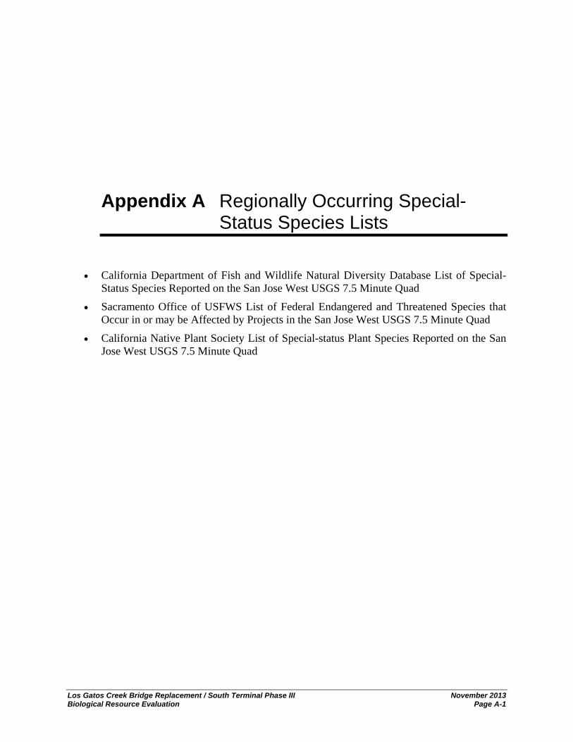
Los Gatos Creek Bridge Replacement / South Terminal Phase III November 2013 Biological Resource Evaluation Page A-1
Appendix A Regionally Occurring Special-Status Species Lists
California Department of Fish and Wildlife Natural Diversity Database List of Special-Status Species Reported on the San Jose West USGS 7.5 Minute Quad
Sacramento Office of USFWS List of Federal Endangered and Threatened Species that Occur in or may be Affected by Projects in the San Jose West USGS 7.5 Minute Quad
California Native Plant Society List of Special-status Plant Species Reported on the San Jose West USGS 7.5 Minute Quad

Appendix A Regionally Occurring Special-Status Species Lists
Los Gatos Creek Bridge Replacement / South Terminal Phase III November 2013 Biological Resource Evaluation Page A-2
This page left blank intentionally.

Los Gatos Creek Bridge Replacement / South Terminal Phase III November 2013 Biological Resource Evaluation Page B-1
Appendix B Listed, Proposed Species, and Critical Habitat Potentially Occurring or Known to Occur in the Project Region

Appendix B Listed, Proposed Species, and Critical Habitat Potentially or Known to Occur in the Project Region
Los Gatos Creek Bridge Replacement / South Terminal Phase III November 2013 Biological Resource Evaluation Page B-2
Listed, Proposed Species, and Critical Habitat Potentially Occurring or Known to Occur in the Project Region
Scientific Name/ Common Name
Federal/ State/ CNPS/
other Status
General Habitat Description Habitat Present/Absent
Rationale
Invertebrates
Euphydryas editha bayensis Bay checkerspot butterfly
FT/--/--
Bay checkerspot butterfly occurs on shallow serpentine derived or similar soils that support their host plants, Plantago erecta and Castilleja densiflora or C. exserta. This species is restricted to a few isolated populations in San Francisco, Santa Clara, Alameda, and Contra Costa counties (USFWS 2010).
A Los Gatos Creek does not provide suitable habitat for this species or its host plants.
Fish
Hypomesus transpacificus Delta smelt
FT/--/--
Delta smelt are tolerant of a wide salinity range. They have been collected from estuarine waters up to 14 ppt (parts per thousand) salinity. For a large part of their one-year life span, delta smelt live along the freshwater edge of the mixing zone (saltwater-freshwater interface), where the salinity is approximately 2 ppt. Shortly before spawning, adults migrate upstream from the brackish-water habitat associated with the mixing zone and disperse into river channels and tidally-influenced backwater sloughs. They spawn in shallow, fresh or slightly brackish water upstream of the mixing zone. Most spawning happens in tidally-influenced backwater sloughs and channel edgewaters. Although spawning has not been observed in the wild, the eggs are thought to attach to substrates such as cattails, tules, tree roots and submerged branches. Delta smelt are found only from the Suisun Bay upstream through the Delta in Contra Costa, Sacramento, San Joaquin, Solano and Yolo counties (USFWS 1995).
A Los Gatos Creek does not provide suitable habitat for this species.
Oncorhynchus mykiss Central California coastal steelhead
FT/--/--
Anadromous; occur in coastal rivers, streams and creeks from Santa Cruz County north to Russian River basin including tributaries to San Francisco Bay (NOAA Fisheries 2006). The San Francisco and San Pablo Bays serve as migration corridors for anadromous fish species as they migrate to and from the ocean and upstream spawning grounds in rivers and streams.
HP
This species is known to occur in Los Gatos Creek. A Biological Assessment is being prepared for submittal to NMFS to evaluate the potential impacts of the proposed project on this species (HDR in prep.) and it is therefore not discussed in this report.
Oncorhynchus mykiss Central Valley steelhead
FT/--/--
Steelhead spawn in rivers and streams with cool, clear, water and suitable substrate. The Central Valley Steelhead distinct population segment includes all naturally spawned anadromous O. mykiss (steelhead) populations below natural and manmade impassable barriers in the Sacramento and San Joaquin Rivers and their tributaries, excluding steelhead from San Francisco and San Pablo Bays and their tributaries, as well as two artificial propagation programs: the Coleman NFH, and Feather River Hatchery steelhead hatchery programs (NOAA Fisheries 2006). The San Francisco and San Pablo Bays serve as
A The study area is outside of the known range of this species.

Appendix B Listed, Proposed Species, and Critical Habitat Potentially or Known to Occur in the Project Region
Los Gatos Creek Bridge Replacement / South Terminal Phase III November 2013 Biological Resource Evaluation Page B-3
Scientific Name/ Common Name
Federal/ State/ CNPS/
other Status
General Habitat Description Habitat Present/Absent
Rationale
migration corridors for anadromous fish species as they migrate to and from the ocean and upstream spawning grounds in rivers and streams.
Oncorhynchus tshawytscha Central Valley spring-run Chinook salmon
FT/--/--
Chinook salmon spawn in rivers and streams with cool, clear, water and suitable substrate. The Central Valley spring-run Chinook ESU includes all naturally spawned populations of spring-run Chinook salmon in the Sacramento River and its tributaries in California, including the Feather River (64 FR 50394; September 16, 1999). One artificial propagation program is considered part of the ESU: The Feather River Hatchery spring run Chinook program (NOAA Fisheries 2005). The San Francisco and San Pablo Bays serve as migration corridors for anadromous fish species as they migrate to and from the ocean and upstream spawning grounds in rivers and streams.
A The study area is outside of the known range of this species.
Oncorhynchus tshawytscha Winter-run Chinook salmon
FE/--/--
Chinook salmon spawn in rivers and streams with cool, clear, water and suitable substrate. The Sacramento winter-run Chinook ESU includes all naturally spawned populations of winter-run Chinook salmon in the Sacramento River and its tributaries in California (59 FR 440; January 1, 1994), as well as two artificial propagation programs: Winter-run Chinook from the Livingston Stone National Fish Hatchery (NFH), and winter run Chinook in a captive broodstock program maintained at Livingston Stone NFH and the University of California Bodega Marine Laboratory (NOAA Fisheries 2005). The San Francisco and San Pablo Bays serve as migration corridors for anadromous fish species as they migrate to and from the ocean and upstream spawning grounds in rivers and streams.
A The study area is outside of the known range of this species.
Amphibians
Ambystoma californiense California tiger salamander, central population
FT/SSC/--
California tiger salamanders are generally restricted to vernal pools and seasonal ponds, including many constructed stockponds, in grassland and oak savannah plant communities from sea level to about 1,500 feet in central California. In the Coastal region, populations are scattered from Sonoma County in the northern San Francisco Bay Area to Santa Barbara County, and in the Central Valley and Sierra Nevada foothills from Yolo to Kern counties (USFWS 2009a).
A Suitable habitat for this species is not present in the study area.
Rana draytonii California red-legged
frog
FT/SSC/--
The California red-legged frog occupies a fairly distinct habitat, combining both specific aquatic and riparian components. The adults require dense, shrubby or emergent riparian vegetation closely associated with deep (greater than 2 1/3-foot deep) still or slow moving water. The largest densities of California red-legged frogs
A See discussion in text.

Appendix B Listed, Proposed Species, and Critical Habitat Potentially or Known to Occur in the Project Region
Los Gatos Creek Bridge Replacement / South Terminal Phase III November 2013 Biological Resource Evaluation Page B-4
Scientific Name/ Common Name
Federal/ State/ CNPS/
other Status
General Habitat Description Habitat Present/Absent
Rationale
are associated with deep-water pools with dense stands of overhanging willows (Salix spp.) and an intermixed fringe of cattails (Typha latifolia). Well-vegetated terrestrial areas within the riparian corridor may provide important sheltering habitat during winter. California red-legged frogs aestivate (enter a dormant state during summer or dry weather) in small mammal burrows and moist leaf litter. They have been found up to 100 feet from water in adjacent dense riparian vegetation. Studies have indicated that this species can not inhabit water bodies that exceed 70° F, especially if there are no cool, deep portions (USFWS 2002).
Reptiles
Actinemys marmorata Western pond turtle
--/SSC/--
Western pond turtle occurs from the west coast of North America from southern Washington, USA to northern Baja California, Mexico. Many populations have been extirpated and others continue to decline throughout the range, especially in southern California. This species requires aquatic habitats with suitable basking sites. Nest sites most often characterized as having gentle slopes (<15%) with little vegetation or sandy banks (CDFG 1994).
HP
Refugio Creek represents marginal habitat for this species and upland areas are heavily disturbed, not allowing for basking sites.
Mammals
Antrozous pallidus Pallid bat
--/SSC/--
Found in deserts, grasslands, shrublands, woodlands, and forests. It is most common in open dry habitats with rocky areas for roosting. Feeds mainly in open areas on beetles and other large insects, often landing on ground to catch prey. Roosts in caves, rock crevices, and buildings. Roosts must be sufficient to protect this species from high temperatures. Pallid bat is extremely sensitive to disturbance of roosting sites (CDFG 1998).
HP The study area provides suitable roosting habitat for this species.
Lasiurus cinereus Hoary bat
--/--/G5, S4
Prefers open habitats or habitat mosaics, with access to trees for cover and open areas or habitat edges for feeding. Roosts in dense foliage of medium to large trees. Preferred sites are hidden from above, with few branches below, and have ground cover of low reflectivity. Females and young tend to roost at higher sites in trees. Feeds primarily on moths and requires water (NatureServe 2009).
HP The study area provides suitable roosting habitat for this species.
Birds
Accipiter cooperi Cooper’s hawk (nesting)
--/--/G5, S3
Known to occur from Siskiyou County south to San Diego County. Also scattered nesting in interior valleys and woodlands of Coast Range from Humboldt County south, and in the western foothills of the Sierra Nevada. Habitat consists of deciduous, mixed, and evergreen forests, and deciduous stands of riparian habitat. Habitat ranges from sea level to above 2,700 meters (NatureServe 2009).
HP Suitable nesting habitat occurs within the riparian habitat in the study area.

Appendix B Listed, Proposed Species, and Critical Habitat Potentially or Known to Occur in the Project Region
Los Gatos Creek Bridge Replacement / South Terminal Phase III November 2013 Biological Resource Evaluation Page B-5
Scientific Name/ Common Name
Federal/ State/ CNPS/
other Status
General Habitat Description Habitat Present/Absent
Rationale
Athene cunicularia Burrowing owl
--/SSC/--
Resides in open, dry annual or perennial grasslands, deserts, and scrublands with low growing vegetation. This species nests underground in existing burrows created by a number of burrowing mammals, most often ground squirrels (CDFG 2008).
A Suitable habitat for this species is not present in the study area.
Falco peregrinus anatum American peregrine falcon
FD/SD,FP/--
Active nesting sites known along the coast north of Santa Barbara and other mountains in northern California. Breeds mostly in woodland, forest, and coastal habitats. Breeds near water on high cliffs or banks and will nest on human-made structures (NatureServe 2009).
A Suitable habitat for this species is not present in the study area.
Rallus longirostris obsoletus California clapper rail
FE/SE/--
Occurs in coastal wetlands and brackish areas around San Francisco Bay. In saline emergent wetlands, nests mostly in lower zones, where cordgrass is abundant and tidal sloughs are nearby. Builds a platform concealed by a canopy of woven cordgrass stems or pickleweed and gumweed. Also uses dead drift vegetation as platform. In fresh or brackish water, builds nest in dense cattail or bulrush. Forages in higher marsh vegetation, along vegetation and mudflat interface, and along tidal creeks (USFWS 2009b).
A Suitable habitat for this species is not present in the study area.
Sternula antillarum browni California least tern
FE/SE/--
Breeding colonies are located along the coast from southern California to San Francisco Bay. Occur along marine and estuarine shores where small fish are abundant. Nest in loose colonies on the ground relatively free of human or predatory disturbance (USFWS 2007).
A Suitable habitat for this species is not present in the study area.
Plants
Centromadia parryi ssp. congdonii Congdon’s tarplant
--/--/1B.1
Known occurrences in Alameda, Contra Costa, Monterey, Santa Clara, Santa Cruz, San Luis Obispo, San Mateo, and Solano counties. Found in alkaline valley and foothill grassland; elevations from 1 to 230 meters. Blooms from May to November (CNPS 2007).
A Suitable habitat for this species is not present in the study area.
Chorizanthe robusta var. robusta Robust spineflower
FE/--/1B.1
Known occurrences in Alameda, Monterey, Marin, Santa Clara, Santa Cruz, San Francisco, and San Mateo counties. Found in chaparral, cismontane woodland, coastal dunes, coastal scrub (sandy or gravelly) habitats at elevations from 3 to 300 meters. Blooms from April to September (CNPS 2007).
A Suitable habitat for this species is not present in the study area.
Malacothamnus arcuatus arcuate Bush-mallow
--/--/1B.2
Known occurrences in Santa Cruz, Santa Clara, and San Mateo counties. Habitat consists of chaparral and cismontane woodland at elevations from 15 to 355 meters. Blooms from April to September (CNPS 2007).
A Suitable habitat for this species is not present in the study area.
Malacothamnus hallii Hall’s bush-mallow
--/--/1B.2
Known occurrences in Contra Costa, Mendocino, Merced, Santa Clara, San Mateo, and Stanislaus counties. Habitat consists of chaparral and coastal scrub at elevations from 10 to 760 meters. Blooms from May to September with uncommon blooming in October
A Suitable habitat for this species is not present in the study area.

Appendix B Listed, Proposed Species, and Critical Habitat Potentially or Known to Occur in the Project Region
Los Gatos Creek Bridge Replacement / South Terminal Phase III November 2013 Biological Resource Evaluation Page B-6
Scientific Name/ Common Name
Federal/ State/ CNPS/
other Status
General Habitat Description Habitat Present/Absent
Rationale
(CNPS 2007).
Plagiobothrys glaber Hairless popcorn-flower
--/--/1A
Known from population occurrences in Alameda, Merced, Marin, San Benito, and Santa Clara counties. Presumed extinct. Habitat consists of meadows and seeps (alkaline), marshes and swamps (coastal salt); elevations 15 to 180 meters. Blooms from March to May (CNPS 2007).
A Suitable habitat for this species is not present in the study area.
Trifolium depauperatum var. hydrophilum Saline clover
--/--/1B.2
Occurs in marshes, swamps, valley and foothill grassland and vernal pools in alkaline soils. Blooms April through June (CNPS 2007).
A Suitable habitat for this species is not present in the study area.
Absent [A] - no habitat present and no further work needed. Habitat Present [HP] -habitat is, or may be present. The species may be present. Critical Habitat [CH] - project footprint is located within a designated critical habitat unit, but does not necessarily mean that appropriate habitat is present. Status: Federal Endangered (FE); Federal Threatened (FT); Federal Proposed (FP, FPE, FPT); Federal Candidate (FC), Federal Species of Concern (FSC); Federal Delisted (FD); State Endangered (SE); State Threatened (ST); Fully Protected (FP); State Rare (SR); State Species of Special Concern (SSC); State Delisted (SD); California Native Plant Society (CNPS), etc.
California Native Plant Society (CNPS)
1A = Presumed extinct or extirpated in California.
1B = Rare, threatened, or endangered in California and elsewhere.
2 = Rare, threatened, or endangered in California but more common elsewhere.
3 = Review list. Plants about which more information is needed to assign to other lists or reject.
Global Ranking
Species or Natural Community Level
G1 = Less than 6 viable element occurrences (EO) OR less than 1000 individuals OR less than 2000 acres.
G2 = 6-20 EOs OR 1000-3000 individuals OR 2000-10000 acres.
G3 = 21-100 EOs OR 3000-10000 individuals OR 10000-50000 acres.
G4 = Apparently secure; this rank is clearly lower than G3 but factors exist to cause some concern (i.e., there is some threat, or somewhat narrow habitat).
G5 = Population or stand demonstrably secure to ineradicable due to being commonly found in the world
Subspecies Level
Subspecies receive a T-rank attached to the G-rank. With the subspecies, the G-rank reflects the condition of the entire species; whereas, the T-rank reflects the global situation of just the subspecies.
State Ranking
S1 = Less than 6 EOs OR less than 100 individuals OR less than 2000 acres
S1.1 = very threatened
S1.2 = threatened
S1.3 = no current threats known
S2 = 6-20 EOs OR 1000-3000 individuals OR 2000-10000 acres
S2.1 = very threatened
S2.2 = threatened

Appendix B Listed, Proposed Species, and Critical Habitat Potentially or Known to Occur in the Project Region
Los Gatos Creek Bridge Replacement / South Terminal Phase III November 2013 Biological Resource Evaluation Page B-7
S2.3 = no current threats known
S3 = 21-100 EOs OR 3000-10000 individuals OR 10000-50000 acres
S3.1 = very threatened
S3.2 = threatened
S3.3 = no current threats known
S4 = Apparently secure within California; this rank is clearly lower than S3 but factors exist to cause some concern (i.e., there is some threat, or somewhat narrow habitat. NO THREAT RANK.
S5 = Demonstrably secure to ineradicable in California. NO THREAT RANK.
References:
California Department of Fish and Game (CDFG). 1994. Amphibian and Reptile Species of Special Concern in California. Available online at: http://www.dfg.ca.gov/wildlife/nongame/publications/docs/herp_ssc.pdf
California Department of Fish and Game (CDFG). 1998. 1998 Mammal Species of Special Concern in California. Available online at: http://www.dfg.ca.gov/wildlife/nongame/ssc/1998mssc.html
California Department of Fish and Game (CDFG). 2008. California Bird Species of Special Concern. Available online at: http://www.dfg.ca.gov/wildlife/nongame/ssc/birds.html
California Native Plant Society (CNPS). 2007. Inventory of Rare and Endangered Plants (online edition, v7-07c). California Native Plant Society. Sacramento, CA. Accessed November 2010; Updated 2013 from http://www.cnps.org/inventory
NatureServe Explorer. 2009. NatureServe Explorer species records. Accessed November 2009. Available online at: http://www.natureserve.org/explorer/
NOAA 2005. Federal Register / Vol. 70, No. 123 / Tuesday, June 28, 2005 / Rules and Regulations. Endangered and Threatened Species: Final Listing Determinations for 16 ESUs of West Coast Salmon, and Final 4(d) Protective Regulations for Threatened Salmonid ESUs.
NOAA 2006. Federal Register / Vol. 71, No. 3 / Thursday, January 5, 2006 / Rules and Regulations. Endangered and Threatened Species: Final Listing Determinations for 10 Distinct Population Segments of West Coast Steelhead
USFWS (U.S. Fish and Wildlife Service). 1995. Sacramento-San Joaquin Delta Native Fishes Recovery Plan. U.S. Fish and Wildlife Service, Portland, Oregon.
USFWS (U.S. Fish and Wildlife Service). 2002. Recovery Plan for the California Red-legged Frog (Rana aurora draytonii). U.S. Fish and Wildlife Service, Portland, Oregon.
USFWS (U.S. Fish and Wildlife Service). 2007. Sacramento Fish and Wildlife Office Species Account for California Least Turn (Sternula antillarum browni). Accessed November 2009 at http://www.fws.gov/sacramento/es/animal_spp_acct/ca_least_tern.pdf
USFWS (U.S. Fish and Wildlife Service). 2009a. Sacramento Fish & Wildlife Office Species Account for California Tiger Salamander (Ambystoma californiense). Accessed November 2009 at http://www.fws.gov/sacramento/es/animal_spp_acct/california_tiger_salamander.htm
USFWS (U.S. Fish and Wildlife Service). 2009b. Sacramento Fish & Wildlife Office Species Account for California Clapper Rail (Rallus longirostris obsoletus). Accessed November 2009 at http://www.fws.gov/sacramento/es/animal_spp_acct/ca_clapper_rail.pdf
USFWS (U.S. Fish and Wildlifer Service). 2010. Sacramento Fish and Wildlife Office Species Account for Bay Checkerspot Butterfly (Euphydryas editha bayensis). Accessed November 2010 at http://www.fws.gov/sacramento/es/animal_spp_acct/bay_checkerspot_butterfly.pdf

Appendix B Listed, Proposed Species, and Critical Habitat Potentially or Known to Occur in the Project Region
Los Gatos Creek Bridge Replacement / South Terminal Phase III November 2013 Biological Resource Evaluation Page B-8
This page left blank intentionally.

Los Gatos Creek Bridge Replacement / South Terminal Phase III November 2013 Biological Resource Evaluation Page C-1
Appendix C Lists of Plant and Animal Species Observed

Appendix C Lists of Plant and Animal Species Observed
Los Gatos Creek Bridge Replacement / South Terminal Phase III November 2013 Biological Resource Evaluation Page C-2
PLANT SPECIES OBSERVED
Family Scientific Name Common Name Noxious Weed Rating (Cal-IPC*, CDFA**)
DICOTS
Adoxaceae Sambucus mexicana Blue elderberry
Apiaceae Foeniculum vulgare Fennel Cal-IPC-
Torilis arvensis Field hedge parsley Cal-IPC-Moderate
Araliaceae Hedera helix English Ivy Cal-IPC-High
Asteraceae Artemisia douglasiana Mugwort
Bidens frondosa Beggar ticks
Carduus pycnocephalus Italian thistle Cal-IPC-Moderate; CDFA List C
Lactuca serriola Prickly lettuce
Picris echioides Bristly ox-tongue Cal-IPC-Limited
Senecio vulgaris Common groundsel
Sonchus oleraceus Common sow thistle
Xanthium strumarium Cocklebur
Fabaceae Robinia psuedoacacia Black locust Cal-IPC-Limited
Juglandaceae Juglans californica var. hindsii California black walnut
Malvaceae Malva neglecta Common cheeseweed
Oleaceae Fraxinus latifolia Oregon ash
Onagraceae Epilobium ciliatum Willow herb
Polygonaceae Polygonum arenastrum Common knotweed
Polygonum sp.
Rosaceae Rosa sp. Horticultural rose
Rubus armeniacus Himalaya blackberry Cal-IPC-High
Rubus ursinus California blackberry
Rubiaceae Galium sp. Bedstraw
Salicaceae Populus fremontii Fremont’s cottonwood
Salix laevigata Red willow
Salix lasiandra Shining willow
Sapindaceae Acer negundo Box elder
Simaroubaceae Ailanthus altissima Tree of heaven Cal-IPC-Moderate; CDFA List C
Solanaceae Solanum sp. nightshade

Appendix C Lists of Plant and Animal Species Observed
Los Gatos Creek Bridge Replacement / South Terminal Phase III November 2013 Biological Resource Evaluation Page C-3
PLANT SPECIES OBSERVED
Family Scientific Name Common Name Noxious Weed Rating (Cal-IPC*, CDFA**)
MONOCOTS
Cyperaceae Cyperus eragrostis Tall flatsedge
Poaceae Avena sp. Wild oat
Bambusa sp. Bamboo
Bromus diandrus Ripgut brome Cal-IPC-Moderate
Cynodon dactylon Bermuda grass Cal-IPC-Moderate
* Listed as an invasive or noxious weed by the California Invasive Plant Council (Cal-IPC). High – These species have severe ecological impacts on physical processes, plant and animal communities, and vegetation structure. Their reproductive biology and other attributes are conducive to moderate to high rates of dispersal and establishment. Most are widely distributed ecologically. Moderate – These species have substantial and apparent—but generally not severe—ecological impacts on physical processes, plant and animal communities, and vegetation structure. Their reproductive biology and other attributes are conducive to moderate to high rates of dispersal, though establishment is generally dependent upon ecological disturbance. Ecological amplitude and distribution may range from limited to widespread. Limited – These species are invasive but their ecological impacts are minor on a statewide level or there was not enough information to justify a higher score. Their reproductive biology and other attributes result in low to moderate rates of invasiveness. Ecological amplitude and distribution are generally limited, but these species may be locally persistent and problematic.
** Listed as a noxious weed by the California Department of Food and Agriculture. List C – State endorsed holding action and eradication only when found in a nursery; action to retard spread outside of nurseries at the discretion of the commissioner; reject only when found in a cropseed for planting or at the discretion of the commissioner.
ANIMAL SPECIES OBSERVED
Scientific Name Common Name
AMPHIBIANS
Psuedacris regilla Northern pacific treefrog
REPTILES
Sceloporus occidentalis Western fence lizard
MAMMALS
Sciurus griseus Western gray squirrel
BIRDS
Columba livia Rock dove
Sayornis nigricans Black phoebe
Vireo sp. Vireo
FISH
Gambusia affinis Mosquitofish

Appendix C Lists of Plant and Animal Species Observed
Los Gatos Creek Bridge Replacement / South Terminal Phase III November 2013 Biological Resource Evaluation Page C-4
This page left blank intentionally.

Los Gatos Creek Bridge Replacement / South Terminal Phase III November 2013 Biological Resource Evaluation Page D-1
Appendix D Representative Site Photographs

Appendix D Representative Site Photographs
Los Gatos Creek Bridge Replacement / South Terminal Phase III November 2013 Biological Resource Evaluation Page D-2
Photo 1. View of the Caltrain Bridge over Los Gatos Creek that is proposed for replacement.
Photo 2. View of the Caltrain Bridge from ground level looking upstream (south).
Photo 3. Close up view of Los Gatos Creek under the Caltrain Bridge.
Photo 4. View of Los Gatos Creek looking downstream (north) from the vicinity of the W. San Carlos St Bridge.

Appendix D Representative Site Photographs
Los Gatos Creek Bridge Replacement / South Terminal Phase III November 2013 Biological Resource Evaluation Page D-3
Photo 5. View of Los Gatos Creek under the West San Carlos Street Bridge looking upstream (south).
Photo 6. View of Los Gatos Creek upstream of the Caltrain Bridge.
Photo 7. View of Los Gatos Creek upstream of the Caltrain Bridge.
Photo 8. View of Los Gatos Creek upstream of the Caltrain Bridge.

Appendix D Representative Site Photographs
Los Gatos Creek Bridge Replacement / South Terminal Phase III November 2013 Biological Resource Evaluation Page D-4
This page left blank intentionally.

Los Gatos Creek Bridge Replacement / South Terminal Phase III November 2013 Biological Resource Evaluation Page E-1
Appendix E Aquatic Avoidance and Minimization Measures (Table 6.2) of the Santa Clara Valley Habitat Conservation Plan/Natural Communities Conservation Plan (HCP/NCCP)

Appendix E Aquatic Avoidance and Minimization Measures (Table 6.2) of the Santa Clara Valley Habitat Conservation Plan/Natural Communities Conservation Plan (HCP/NCCP)
Los Gatos Creek Bridge Replacement / South Terminal Phase III November 2013 Biological Resource Evaluation Page E-2
This page left blank intentionally.

Table 6-2. Aquatic Avoidance and Minimization Measures
ID Avoidance and Minimization MeasureGeneral
1 Minimize the potential impacts on covered species most likely to be affected by changes in hydrology and water quality.
2 Reduce stream pollution by removing pollutants from surface runoff before the polluted surface runoff reaches local streams.
3 Maintain the current hydrograph and, to the extent possible, restore the hydrograph to more closely resemble predevelopment conditions.
4 Reduce the potential for scour at stormwater outlets to streams by controlling the rate of flow into the streams.5 Invasive plant species removed during maintenance will be handled and disposed of in such a manner as to prevent
further spread of the invasive species.6 Activities in the active (i.e., flowing) channel will be avoided. If activities must be conducted in the active channel,
avoidance and minimization measures identified in this table will be applied. 7 Personnel shall prevent the accidental release of chemicals, fuels, lubricants, and non-storm drainage water into
channels. 8 Spill prevention kits shall always be in close proximity when using hazardous materials (e.g., crew trucks and other
logical locations). 9 Personnel shall implement measures to ensure that hazardous materials are properly handled and the quality of water
resources is protected by all reasonable means when removing sediments from the streams. 10 If ground disturbing activities are planned for a stream channel that is known or suspected to contain elevated levels
of mercury, the following steps should be taken. 1. Avoid disturbing soils in streams known or suspected to contain high levels of mercury. 2. Soils that are likely to be disturbed or excavated shall be tested for mercury. Soils shall be remediated if:
a. disturbed or excavated soils exposed to flood flows below the 2.33-year channel flow level exceed 1 ppm Hg, orb. disturbed or excavated soils above the 2.33-year flow level exceed 20 ppm Hg.
11 Vehicles shall be washed only at approved areas. No washing of vehicles shall occur at job sites. 12 No equipment servicing shall be done in the stream channel or immediate flood plain, unless equipment stationed in
these locations cannot be readily relocated (i.e., pumps, generators). 13 Personnel shall use the appropriate equipment for the job that minimizes disturbance to the stream bottom.
Appropriately-tired vehicles, either tracked or wheeled, shall be used depending on the situation14 If high levels of groundwater in a work area are encountered, the water is pumped out of the work site. If necessary
to protect water quality, the water shall be directed into specifically constructed infiltration basins, into holding ponds, or onto areas with vegetation to remove sediment prior to the water re-entering a creek.

Table 6-2. Continued Page 2 of 7
ID Avoidance and Minimization Measure15 If native fish or non-covered, native aquatic vertebrates are present when cofferdams, water bypass structures, and
silt barriers are to be installed, a native fish and aquatic vertebrate relocation plan shall be implemented when ecologically appropriate as determined by a qualified biologist to ensure that significant numbers of native fish and aquatic vertebrates are not stranded.Prior to the start of work or during the installation of water diversion structures, native aquatic vertebrates shall be captured in the work area and transferred to another reach as determined by a qualified biologist. Timing of work in streams that supports a significant number of amphibians will be delayed until metamorphosis occurs to minimize impacts to the resource. Capture and relocation of aquatic native vertebrates is not required at individual project sites when site conditions preclude reasonably effective operation of capture gear and equipment, or when the safety of biologist conducting the capture may be compromised.Relocation of native fish or aquatic vertebrates may not always be ecologically appropriate. Prior to capturing native fish and/or vertebrates, the qualified biologist will use a number of factors, including site conditions, system carrying capacity for potential relocated fish, and flow regimes (e.g., if flows are managed) to determine whether a relocation effort is ecologically appropriate. If so, the following factors will be considered when selecting release site(s):
1. similar water temperature as capture location;2. ample habitat availability prior to release of captured individuals; 3. presence of other same species so that relocation of new individuals will not upset the existing prey/predation
function;4. carrying capacity of the relocation location;5. potential for relocated individual to transport disease; and6. low likelihood of fish reentering work site or becoming impinged on exclusion net or screen.
Proposals to translocate any covered species will be reviewed and approved by the Wildlife Agencies. 16 When work in a flowing stream is unavoidable, the entire streamflow shall be diverted around the work area by a
barrier, except where it has been determined by a qualified biologist that the least environmentally disruptive approach is to work in a flowing stream. Where feasible, water diversion techniques shall allow stream flows to gravity flow around or through the work site.
17 Coffer dams shall be installed both upstream and downstream not more than 100 feet from the extent of the work areas. Coffer dam construction shall be adequate to prevent seepage into or from the work area. Stream flow will be pumped around the work site using pumps and screened intake hoses. All water shall be discharged in a non-erosive manner (e.g., gravel or vegetated bars, on hay bales, on plastic, on concrete, or in storm drains when equipped with filtering devices, etc.).
18 Small in-channel berms that deflect water to one side of the channel during project implementation may be constructed of channel material in channels with low flows.
19 Sumps or basins may also be used to collect water, where appropriate (e.g., in channels with low flows).20 Diversions shall maintain ambient stream flows below the diversion, and waters discharged below the project site
shall not be diminished or degraded by the diversion. All materials placed in the channel to dewater the channel shall be removed when the work is completed. Normal flows shall be restored to the affected stream as soon as is feasible and safe after completion of work at that location.
21 To the extent that stream bed design changes are not part of the project, the stream bed will be returned to as close to pre-project condition as appropriate.
22 To the extent feasible, all temporary diversion structures and the supportive material shall be removed no more than 48 hours after work is completed.
23 Temporary fills, such as for access ramps, diversion structures, or cofferdams, shall be completely removed upon finishing the work.
24 To prevent increases in temperature and decreases in dissolved oxygen (DO), if bypass pipes are used, they shall be properly sized (i.e., larger diameter pipes to better pass the flows). Use of bypass pipes may be avoided by creating a low-flow channel or using other methods to isolate the work area.

Table 6-2. Continued Page 3 of 7
ID Avoidance and Minimization Measure25 Diversions shall maintain fish passage when the project meets the following conditions: 1) the length of the area
dewatered exceeds 500 feet, and/or 2) the length of time the stream is dewatered exceeds two weeks in length. Conditions for fish passage shall be met as long as the diversion 1) maintains contiguous flows through a low flow channel in the channel bed or an artificial open channel, 2) presents no vertical drops exceeding six (6) inches and follows the natural grade of the site, 3) maintains water velocities that shall not exceed eight feet per second (8 ft/sec), and 4) maintains adequate water depths consistent with normal conditions in the project reach. An artificial channel used for fish passage shall be lined with cobble/gravel. A closed conduit pipe shall not be used for fish passage. The inlets of diversions shall be checked daily to prevent accumulation of debris.
26 Any sediment removed from a project site shall be stored and transported in a manner that minimizes water quality impacts.
27 Sediment from the San Francisco Bay Watershed, including that for reuse, will not be removed to areas any farther south than Metcalf Road in south San Jose.
28 Where practical, the removed sediments and gravels will be re-used. 29 Existing native vegetation shall be retained by removing only as much vegetation as necessary to accommodate the
trail clearing width. Maintenance roads should be used to avoid effects on riparian corridors.30 Vegetation control and removal in channels, on stream banks, and along levees and maintenance roads shall be
limited to removal necessary for facility inspection purposes, or to meet regulatory requirements or guidelines. 31 When conducting vegetation management, retain as much understory brush and as many trees as feasible,
emphasizing shade producing and bank stabilizing vegetation.If riparian vegetation is to be removed with chainsaws, consider using saws currently available that operate with vegetable-based bar oil.
32 In-channel vegetation removal may result in increased local erosion due to increased flow velocity. To minimize the effect, the top of the bank shall be protected by leaving vegetation in place to the maximum extent possible.
33 Regional Board objectives for temperature change in receiving waters (measured 100 feet downstream of discharge point) shall not be exceeded. Receiving water and discharge water may be monitored for temperature changes after a comparison of ambient temperature to pipeline water temperature suggests the potential for change.Project Design
34 Use the minimum amount of impermeable surface (building footprint, paved driveway, etc.) as practicable.35 Use pervious materials, such as gravel or turf pavers, in place of asphalt or concrete to the extent practicable.36 Use flow control structures such as swales, retention/detention areas, and/or cisterns to maintain the existing (pre-
project) peak runoff.37 Direct downspouts to swales or gardens instead of storm drain inlets.38 Use flow dissipaters at runoff inlets (e.g., culvert drop-inlets) to reduce the possibility of channel scour at the point
of flow entry.39 Minimize alterations to existing contours and slopes, including grading the minimum area necessary.40 Maintain native shrubs, trees and groundcover whenever possible and revegetate disturbed areas with local native or
non-invasive plants.41 Combine flow-control with flood control and/or treatment facilities in the form of detention/retention basins, ponds,
and/or constructed wetlands.42 Use flow control structures, permeable pavement, cisterns, and other runoff management methods to ensure no
change in post-construction peak runoff volume from pre-project conditions for all covered activities with more than 5,000 square feet of impervious surface.
43 Site characteristics will be evaluated in advance of project design to determine if non-traditional designs, such as bioengineered bank treatments that incorporate live vegetation, can be successfully utilized while meeting the requirements of the project.
44 Maintenance of natural stream characteristics, such as riffle-pool sequences, riparian canopy, sinuosity, floodplain, and a natural channel bed, will be incorporated into the project design.

Table 6-2. Continued Page 4 of 7
ID Avoidance and Minimization Measure45 Stream crossings shall incorporate a free-span bridge unless infeasible due to engineering or cost constraints or
unsuitable based on minimal size of stream (swale without bed and banks or a very small channel). If a bridge design cannot free-span a stream, bridge piers and footings will be designed to have minimum impact on the stream. A hydraulics analysis must be prepared and reviewed by the jurisdictional partner, including SCVWD as appropriate, demonstrating that piers or footings will not cause significant scour or channel erosion. Whenever possible, the span of bridges will also allow for upland habitat beneath the bridge to provide undercrossing areas for wildlife species that will not enter the creek. Native plantings, natural debris, or scattered rocks will be installed under bridges to provide wildlife cover and encourage the use of crossings.
46 Whenever possible, the span of bridges will also allow for upland habitat beneath the bridge to provide undercrossing areas for wildlife species that will not enter the creek.
47 If a culvert is used, up- and downstream ends of the culvert must be appropriately designed so that the stream cannot flow beneath the culvert or create a plunge pool at the downstream end. Preference will be given to designs that allow a natural bottom (arch culvert) and/or which do not alter natural grade.
48 Trails will be sited and designed with the smallest footprint necessary to cross through the in-stream area. Trails will be aligned perpendicular to the channel and be designed to avoid any potential for future erosion. New trails that follow stream courses will be sited outside the riparian corridor.
49 The project or activity must be designed to avoid the removal of riparian vegetation, if feasible. If the removal of riparian vegetation is necessary, the amount shall be minimized to the amount necessary to accomplish the required activity and comply with public health and safety directives.
50 If levee reconstruction requires the removal of vegetation that provides habitat value to the adjacent stream (e.g., shading, bank stabilization, food sources, etc.), then the project will include replacement of the vegetation/habitat that was removed during reconstruction unless it is determined to be inappropriate to do so by the relevant resource agencies (e.g., CDFG and USFWS).
51 All projects will be conducted in conformance with applicable County and/or city drainage policies.52 Adhere to the siting criteria described for the borrow site covered activity (see Chapter 2 for details).53 When possible, maintain a vegetated buffer strip between staging/excavation areas and receiving waters. 54 When not within the construction footprint, deep pools within stream reaches shall be maintained as refuge for fish
and wildlife by constructing temporary fencing and/or barrier so as to avoid pool destruction and prevent access from the project site.
55 For stream maintenance projects that result in alteration of the stream bed during project implementation, its low flow channel shall be returned to its approximate prior location with appropriate depth for fish passage without creating a potential future bank erosion problem.
56 Increased water velocity at bank protection sites may increase erosion downstream. Therefore, bank stabilization site design shall consider hydraulic effects immediately upstream and downstream of the work area. Bank stabilization projects will be designed and implemented to provide similar roughness and characteristics that may affect flows as the surrounding areas just upstream and downstream of the project site.
57 When parallel to a stream or riparian zone and not located on top of a levee, new trails shall be located behind the top of bank or at the outside edge of the riparian zone except where topographic, resource management, or other constraints or management objectives make this not feasible or undesirable.
58 Existing access routes and levee roads shall be used if available to minimize impacts of new construction in special status species habitats and riparian zones.
59 Trails in areas of moderate or difficult terrain and adjacent to a riparian zone shall be composed of natural materials or shall be designed (e.g., a bridge or boardwalk) to minimize disturbance and need for drainage structures, and to protect water quality.
60 Trail crossings of freshwater stream zones and drainages shall be designed to minimize disturbance, through the use of bridges or culverts, whichever is least environmentally damaging. Structures over water courses shall be carefully placed to minimize disturbance. Erosion control measures shall be taken to prevent erosion at the outfalls of drainage structures.

Table 6-2. Continued Page 5 of 7
ID Avoidance and Minimization MeasureConstruction
61 Minimize ground disturbance to the smallest area feasible. 62 Use existing roads for access and disturbed area for staging as site constraints allow. Off-road travel will avoid
sensitive communities such as wetlands and known occurrences of covered plants. 63 Prepare and implement sediment erosion control plans.
64 No winter grading unless approved by City Engineer and specific erosion control measures are incorporated.65 Control exposed soil by stabilizing slopes (e.g., with erosion control blankets) and protecting channels (e.g., using
silt fences or straw wattles).66 Control sediment runoff using sandbag barriers or straw wattles.67 No stockpiling or placement of erodible materials in waterways or along areas of natural stormwater flow where
materials could be washed into waterways.68 Stabilize stockpiled soil with geotextile or plastic covers.69 Maintain construction activities within a defined project area to reduce the amount of disturbed area.70 Only clear/prepare land which will be actively under construction in the near term.71 Preserve existing vegetation to the extent possible.72 Equipment storage, fueling and staging areas will be sited on disturbed areas or non-sensitive habitat outside of a
stream channel.73 Avoid wet season construction.74 Stabilize site ingress/egress locations.75 Dispose of all construction waste in designated areas and prevent stormwater from flowing onto or off of these areas.76 Prevent spills and clean up spilled materials.77 Sweep nearby streets at least once a day.78 In-stream projects occurring while the stream is flowing must use appropriate measures to protect water quality,
native fish and covered wildlife species at the project site and downstream of the project site. 79 If mercury contamination may be present, the channel must be dewatered prior to commencement of the activity.80 All personnel working within or adjacent to the stream setback (i.e., those people operating ground-disturbing
equipment) will be trained by a qualified biologist in these avoidance and minimization measures and the permit obligations of project proponents working under this Plan.
81 Temporary disturbance or removal of aquatic and riparian vegetation will not exceed the minimum necessary to complete the work.
82 Channel bed temporarily disturbed during construction activities will be returned to pre-project or ecologically improved conditions at the end of construction.
83 Sediments will be stored and transported in a manner that minimizes water quality impacts. If soil is stockpiled, no runoff will be allowed to flow back to the channel.
84 Appropriate erosion control measures (e.g., fiber rolls, filter fences, vegetative buffer strips) will be used on site to reduce siltation and runoff of contaminants into wetlands, ponds, streams, or riparian vegetation. Fiber rolls used for erosion control will be certified as free of noxious weed seed. Filter fences and mesh will be of material that will not entrap reptiles and amphibians. Erosion control measures will be placed between the outer edge of the buffer and the project site.
85 Seed mixtures applied for erosion control will not contain invasive nonnative species and will be composed of native species or sterile nonnative species. If sterile nonnative species are used for temporary erosion control, native seed mixtures must be used in subsequent treatments to provide long-term erosion control and slow colonization by invasive nonnatives.
86 Topsoil removed during soil excavation will be preserved and used as topsoil during revegetation when it is necessary to conserve the natural seed bank and aid in revegetation of the site.
87 Vehicles operated within and adjacent to streams will be checked and maintained daily to prevent leaks of materials that, if introduced to the water, could be deleterious to aquatic life.

Table 6-2. Continued Page 6 of 7
ID Avoidance and Minimization Measure88 Vehicles and equipment will be parked on pavement, existing roads, and previously disturbed areas.89 The potential for traffic impacts on terrestrial animal species will be minimized by adopting traffic speed limits.90 All trash will be removed from the site daily to avoid attracting potential predators to the site. Personnel will clean
the work site before leaving each day by removing all litter and construction-related materials.91 To prevent the spread of exotic species and reduce the loss of native species, aquatic species will be netted at the
drain outlet when draining reservoirs or ponds to surface waters. Captured native fish, native amphibians, and western pond turtles will be relocated if ecologically appropriate. Exotic species will be dispatched.
92 To minimize the spread of pathogens all staff working in aquatic systems (i.e., streams, ponds, and wetlands)—including site monitors, construction crews, and surveyors—will adhere to the most current guidance for equipment decontamination provided by the Wildlife Agencies at the time of activity implementation. Guidance may require that all materials that come in contact with water or potentially contaminated sediments, including boot and tire treads, be cleaned of all organic matter and scrubbed with an appropriate cleansing solution, and that disposable gloves be worn and changed between handling equipment or animals. Care should be taken so that all traces of the disinfectant are removed before entering the next aquatic habitat.
93 When accessing upland areas adjacent to riparian areas or streams, access routes on slopes of greater than 20%should generally be avoided. Subsequent to access, any sloped area should be examined for evidence of instability and either revegetated or filled as necessary to prevent future landslide or erosion.
94 Personnel shall use existing access ramps and roads if available. If temporary access points are necessary, they shall be constructed in a manner that minimizes impacts to streams.
95 To prevent inadvertent entrapment of animals during excavation, all excavated, steep-walled holes or trenches more than 2-feet deep will be covered at the close of each working day by plywood or similar materials, or provided with one or more escape ramps constructed of earth fill or wooden planks.
96 Isolate the construction area from flowing water until project materials are installed and erosion protection is in place.
97 Erosion control measures shall be in place at all times during construction. Do not start construction until all temporary control devices (straw bales, silt fences, etc.) are in place downstream of project site.
98 When needed, utilize in-stream grade control structures to control channel scour, sediment routing, and headwall cutting.Post-Construction
99 Conduct street cleaning on a regular basis100 Potential contaminating materials must be stored in covered storage areas or secondary containment that is
impervious to leaks and spills101 Runoff pathways shall be free of trash containers or trash storage areas. Trash storage areas shall be screened or
walled102 Immediately after project completion and before close of seasonal work window, stabilize all exposed soil with
mulch, seeding, and/or placement of erosion control blankets .103 All disturbed soils will be revegetated with native plants and/or grasses or sterile nonnative species suitable for the
altered soil conditions upon completion of construction. Local watershed native plants will be used if available. If sterile nonnative species are used for temporary erosion control, native seed mixtures must be used in subsequent treatments to provide long-term erosion control and slow colonization by invasive nonnatives. All disturbed areas that have been compacted shall be de-compacted prior to planting or seeding. Cut-and-fill slopes will be planted with local native or non-invasive plants suitable for the altered soil conditions.
104 Measures will be utilized on site to prevent erosion along streams (e.g., from road cuts or other grading), including in streams that cross or are adjacent to the project proponent’s property. Erosion control measures will utilize natural methods such as erosion control mats or fabric, contour wattling, brush mattresses, or brush layers. For more approaches and detail, please see the Bank Protection/ Erosion Repair Design Guide in the Santa Clara Valley Water Resources Protection Collaborative’s User Manual: Guidelines & Standards for Land Use Near Streams (Santa Clara Valley Water Resources Protection Collaborative 2006).