BGS landslide data and mapping in Britain -...
30
Kingsley Dunham Centre Keyworth Nottingham NG12 5GG Tel 0115 936 3100 © NERC All rights reserved BGS landslide data and mapping in Britain Peter Hobbs British Geological Survey [email protected]
Transcript of BGS landslide data and mapping in Britain -...

Kingsley Dunham CentreKeyworthNottingham NG12 5GGTel 0115 936 3100© NERC All rights reserved
BGS landslide data and mapping in Britain
Peter HobbsBritish Geological Survey
© NERC All rights reserved
Acknowledgements
Thanks to:
Andrew Gibson (BGS) Catherine Poulton (BGS)
© NERC All rights reserved
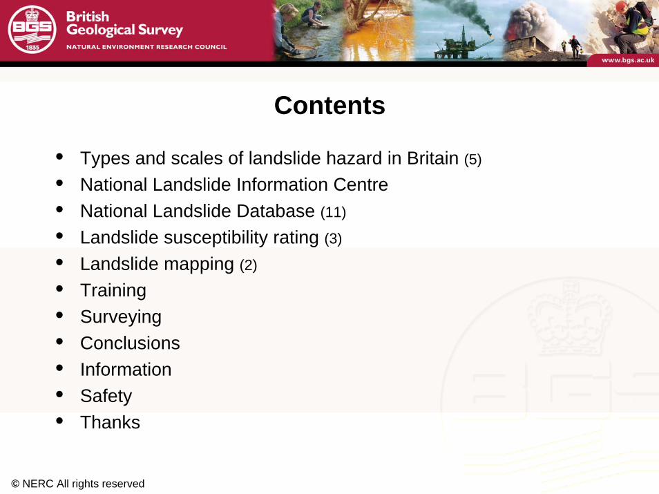
Contents
• Types and scales of landslide hazard in Britain (5)
• National Landslide Information Centre• National Landslide Database (11)
• Landslide susceptibility rating (3)
• Landslide mapping (2)
• Training• Surveying• Conclusions• Information• Safety• Thanks
© NERC All rights reserved
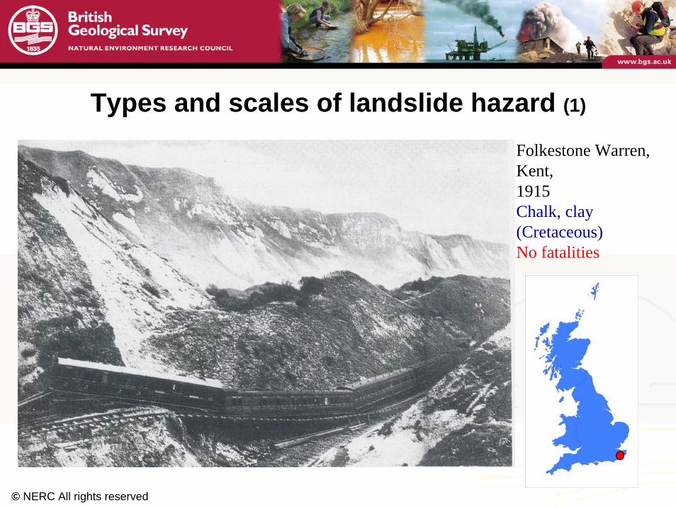
Types and scales of landslide hazard (1)
Folkestone Warren, Kent,1915Chalk, clay(Cretaceous)No fatalities
© NERC All rights reserved
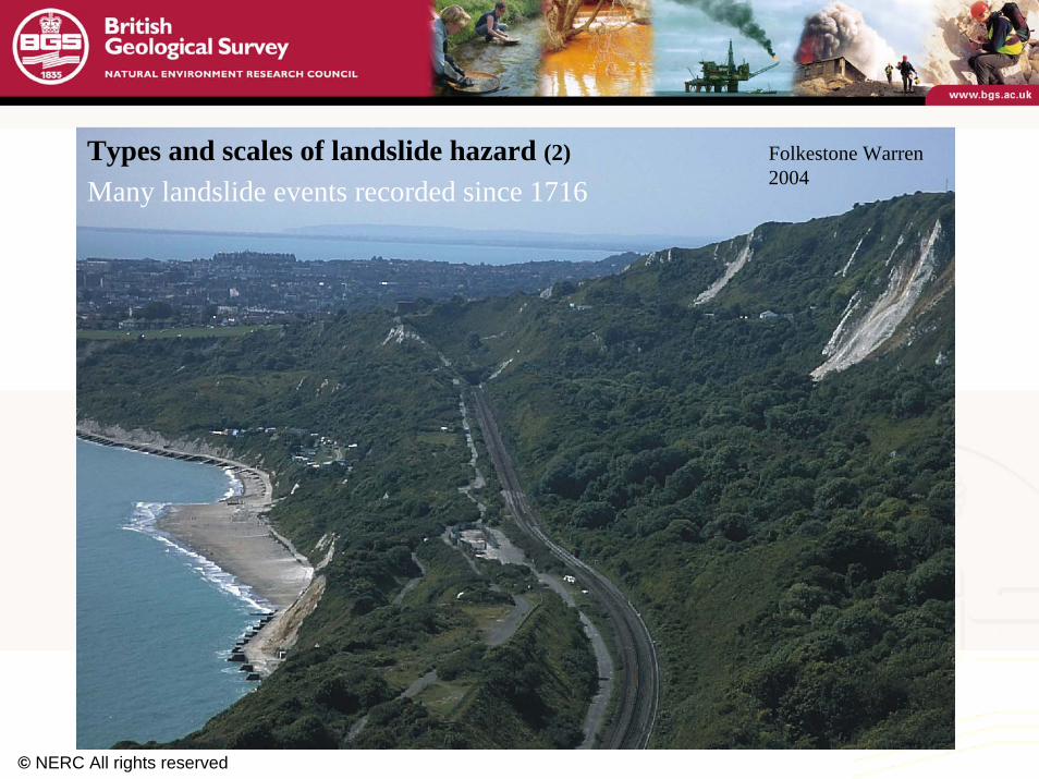
Folkestone Warren2004Many landslide events recorded since 1716
Types and scales of landslide hazard (2)
© NERC All rights reserved
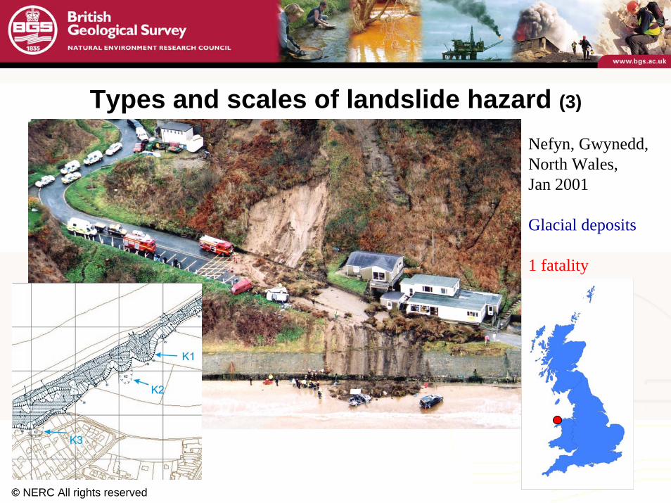
Types and scales of landslide hazard (3)
Nefyn, Gwynedd,North Wales,Jan 2001
Glacial deposits
1 fatality

© NERC All rights reserved
Types and scales of landslide hazard (4)
Whitehaven,Cumbria,Jan 2007
Mine spoil
1 fatality
News & Star (2/01/07)
Kingsley Dunham CentreKeyworthNottingham NG12 5GGTel 0115 936 3100© NERC All rights reserved
www.bgs.ac.uk
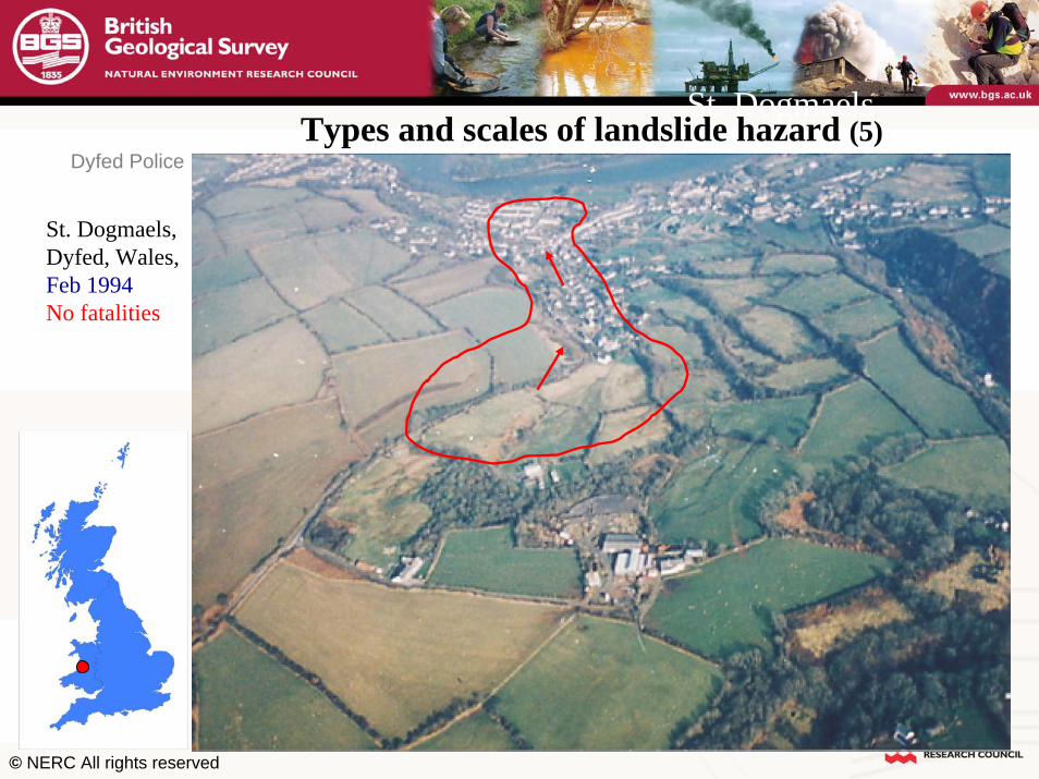
St. Dogmaels
St. Dogmaels,Dyfed, Wales,Feb 1994No fatalities
Dyfed PoliceTypes and scales of landslide hazard (5)
© NERC All rights reserved
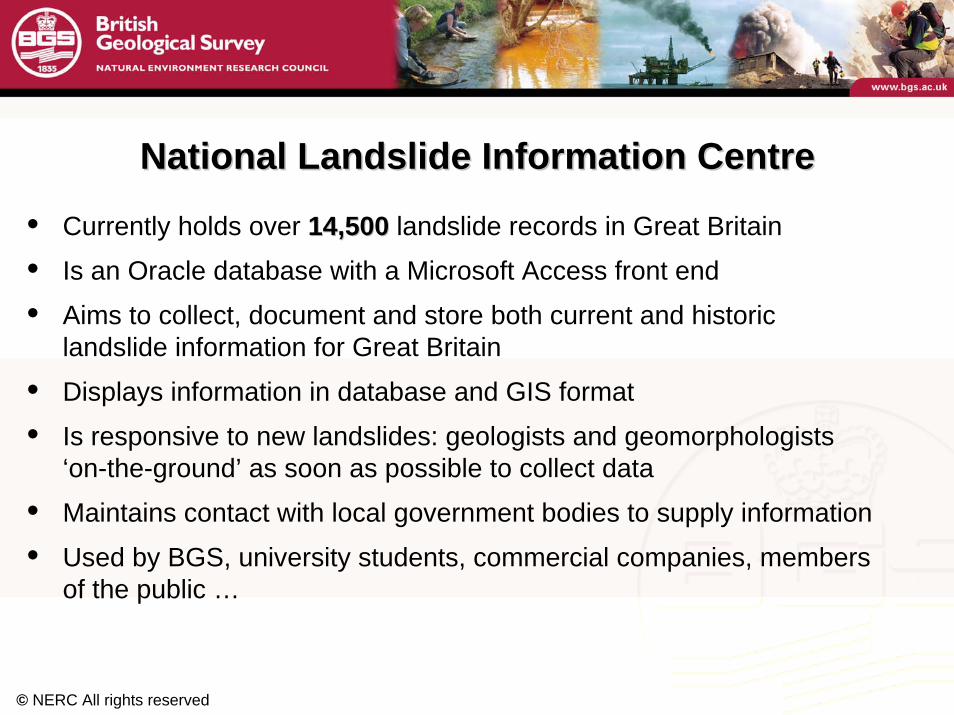
National Landslide Information CentreNational Landslide Information Centre
• Currently holds over 14,50014,500 landslide records in Great Britain
• Is an Oracle database with a Microsoft Access front end
• Aims to collect, document and store both current and historic landslide information for Great Britain
• Displays information in database and GIS format
• Is responsive to new landslides: geologists and geomorphologists‘on-the-ground’ as soon as possible to collect data
• Maintains contact with local government bodies to supply information
• Used by BGS, university students, commercial companies, members of the public …

© NERC All rights reserved
HistoryHistory• Inherited initial database from Geomorphological Services Ltd (GSL)
• This database documented landslides by trawling through reports,papers, maps etc
• Named and located landslides to eight-figure grid references
• Documented basic information for over 8000 landslides
• Included references
• This was then put into the BGS National Landslide Database in 2002
• Data from many other sources continually entered ever since
National Landslide Database National Landslide Database (1)(1)

© NERC All rights reserved
National Landslide Database National Landslide Database (2)(2)
What is recorded?What is recorded?• The National Landslide Database holds records of each landslide
EVENTEVENT.
• The database records are a summary of information collected during a survey.
• For landslides with more than one event, there can be multiple surveys linked to one Landslide ID number
• Differentiate information about landslide and surrounding slope
• All information is qualified using confidence and provenance fields with a stringent QA system
• Landslide information recorded for Great Britain only

© NERC All rights reserved
How are landslides located?How are landslides located?
• Landslides are captured as point data and are located to the highest point on the backscarp to twelve-figure grid references
• Hope to link to polygon data such as BGS geological maps in nearfuture
National Landslide Database National Landslide Database (3)(3)
408000
408000
409000
409000
410000
410000
411000
411000
3980
00
3980
00
3990
00
3990
00
4000
00
4000
00
© NERC All rights reserved
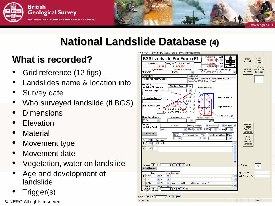
What is recorded?What is recorded?• Grid reference (12 figs)• Landslides name & location info• Survey date• Who surveyed landslide (if BGS)• Dimensions • Elevation• Material• Movement type• Movement date• Vegetation, water on landslide• Age and development of
landslide • Trigger(s)
National Landslide Database National Landslide Database (4)(4)

© NERC All rights reserved
What is recorded?What is recorded?• Slope angle and height • Slope aspect• Vegetation, water on slope• Damage caused by landslide• Geology down entire slope• Presence of faults• Fatalities and injuries• Cost with calculator to convert
into ‘today’s prices’• Any other additional information • Bibliographic references to where
information came from
National Landslide Database National Landslide Database (5)(5)

© NERC All rights reserved
Where does the information come from?Where does the information come from?• BGS geological maps (historic and current)• Reports (confidential and mainstream)• Papers• Other databases• Regional surveys• MSc, PhD theses• Local government offices• Media reports (newspapers, radio/tv reports, web pages)
National Landslide Database National Landslide Database (6)(6)
© NERC All rights reserved
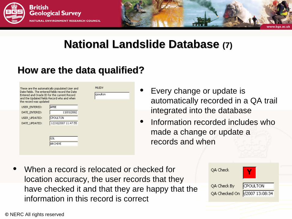
• Every change or update is automatically recorded in a QA trail integrated into the database
• Information recorded includes who made a change or update a records and when
National Landslide Database National Landslide Database (7)(7)
• When a record is relocated or checked for location accuracy, the user records that they have checked it and that they are happy that the information in this record is correct
How are the data qualified?How are the data qualified?
© NERC All rights reserved
National Landslide Database National Landslide Database (8)(8)
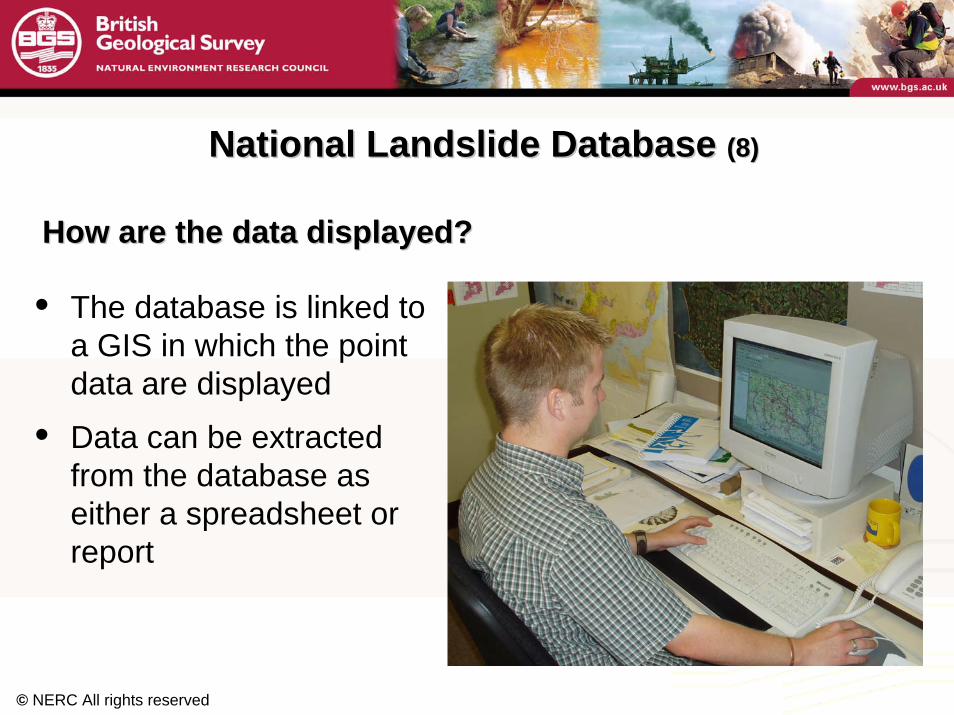
• The database is linked to a GIS in which the point data are displayed
• Data can be extracted from the database as either a spreadsheet or report
How are the data displayed?How are the data displayed?
© NERC All rights reserved
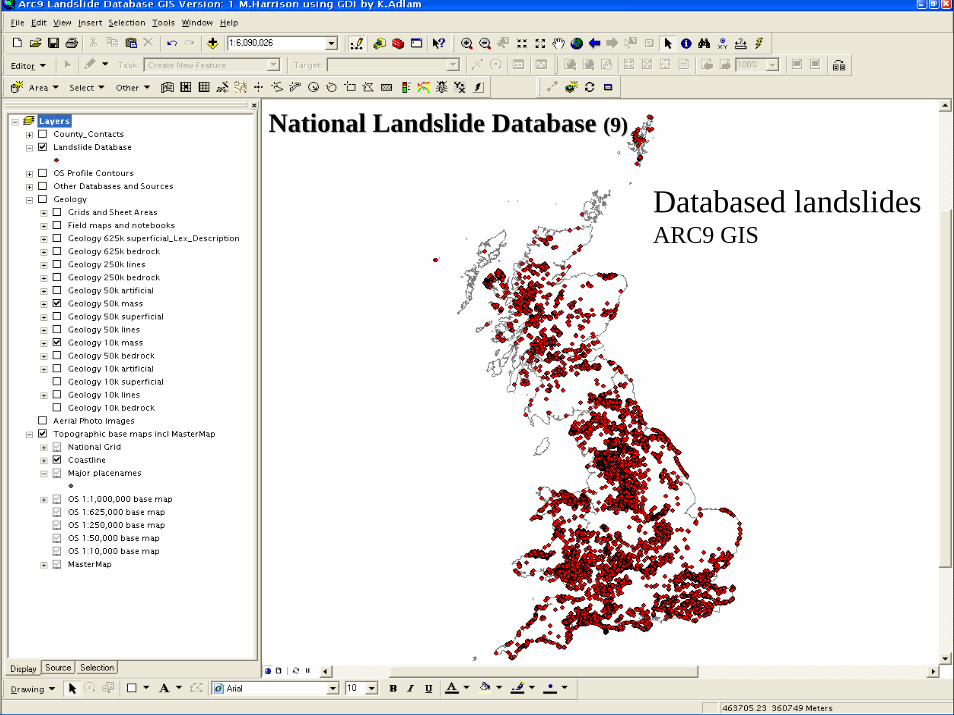
Databased landslidesARC9 GIS
National Landslide Database National Landslide Database (9)(9)
© NERC All rights reserved
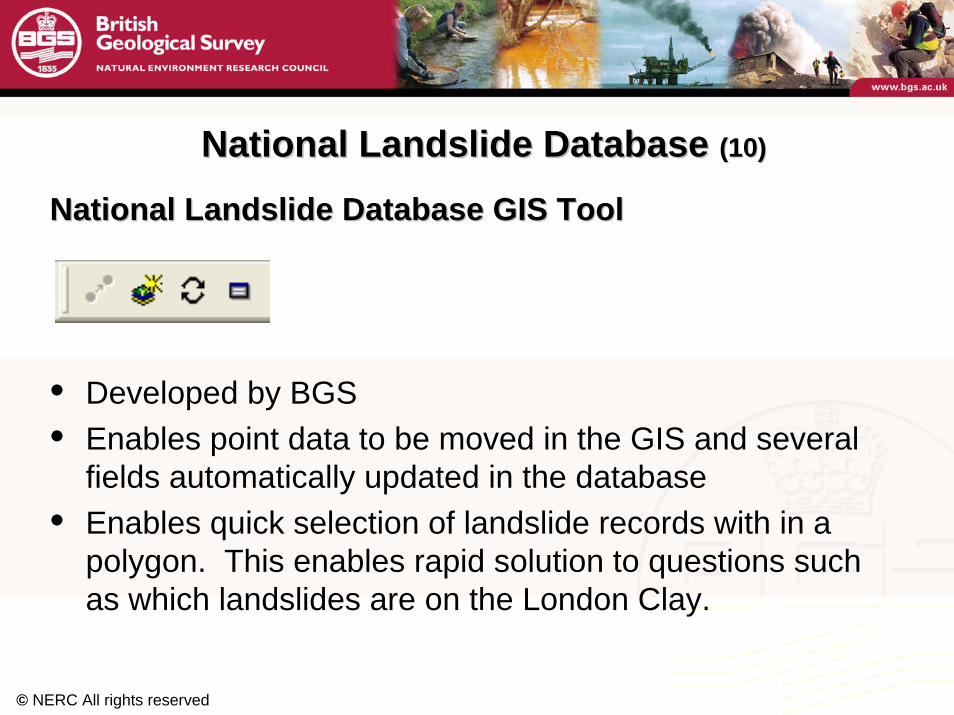
National Landslide Database GIS ToolNational Landslide Database GIS Tool
• Developed by BGS• Enables point data to be moved in the GIS and several
fields automatically updated in the database • Enables quick selection of landslide records with in a
polygon. This enables rapid solution to questions such as which landslides are on the London Clay.
National Landslide Database National Landslide Database (10)(10)

© NERC All rights reserved
National Landslide Database National Landslide Database (11)(11)
Problems encounteredProblems encounteredGSL database legacy data• Grid references not accurate enough. Are still in the process of trawling
through their records, locating the original references and re-locating the landslides – very time consuming and therefore costly
• Naming of landslides. Many are named “unnamed” which makes locating them difficult and may result in duplication of records
• Getting information from one database to another
Traditional methods of mapping landslides on geological maps• Mapped landslide deposit only and NOT the backscarp so makes locating the
highest point on the backscarp impossible
• Some geologists mapped backscarps, others didn’t
Large volume of data makes managing changes and updates difficult
© NERC All rights reserved
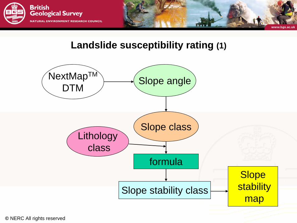
Landslide susceptibility rating (1)
NextMapTM
DTMSlope angle
Slope class
formula
Slope stability classSlopestability
map
Lithologyclass

© NERC All rights reserved
Landslide susceptibility rating (2)

© NERC All rights reserved
Landslide susceptibility rating (3)

© NERC All rights reserved
Landslide mapping (1)
GPS
Tablet PC‘Go-Book’+ ‘ARC9’ GIS+ databasepro-forma
© NERC All rights reserved
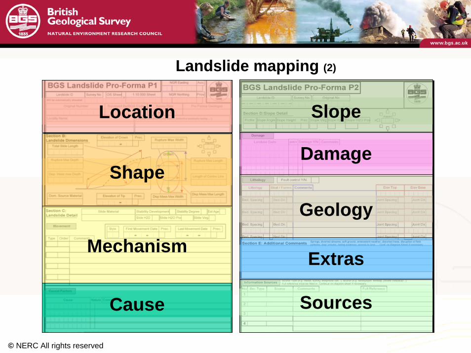
Landslide mapping (2)
Location
Shape
Mechanism
Cause
Slope
Damage
Geology
Extras
Sources
© NERC All rights reserved
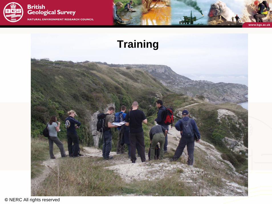
Training

© NERC All rights reserved
Surveying
Laser scanning
3D laser scanning models

© NERC All rights reserved
For more information contact:
www.bgs.ac.uk/science/physical_hazards/landslides.html
© NERC All rights reserved
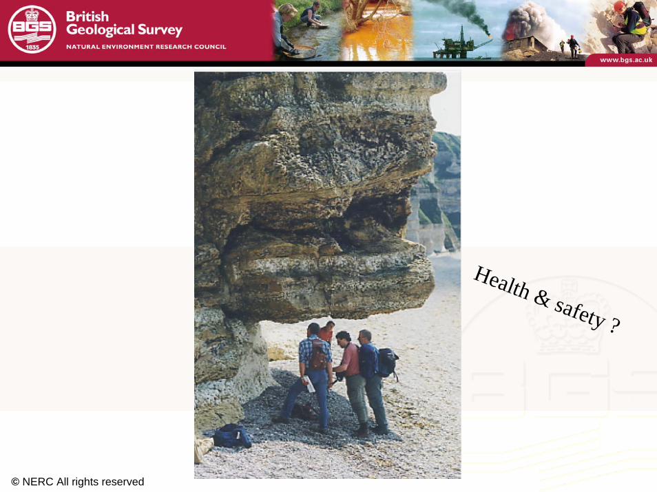
Health & safety ?

© NERC All rights reserved
Thank you