Bentley Subsurface Utility Engineering & Design - · PDF fileBentley Subsurface Utility...
35
1 | WWW.BENTLEY.COM | © 2016 Bentley Systems, Incorporated © 2016 Bentley Systems, Incorporated Bentley Subsurface Utility Engineering & Design Kevin Jackson, Bentley Systems
Transcript of Bentley Subsurface Utility Engineering & Design - · PDF fileBentley Subsurface Utility...

1 | WWW.BENTLEY.COM | © 2016 Bentley Systems, Incorporated © 2016 Bentley Systems, Incorporated
Bentley Subsurface Utility Engineering & Design
Kevin Jackson, Bentley Systems
2 | WWW.BENTLEY.COM | © 2016 Bentley Systems, Incorporated
What is Bentley Subsurface Utility Engineering?

3 | WWW.BENTLEY.COM | © 2016 Bentley Systems, Incorporated
What is Bentley Subsurface Utility Engineering?
OpenRoadsSubsurface Utility
Engineering Tools+
Bentley Subsurface Utility Engineering
3D modeling of all underground utilities
Including gravity networks
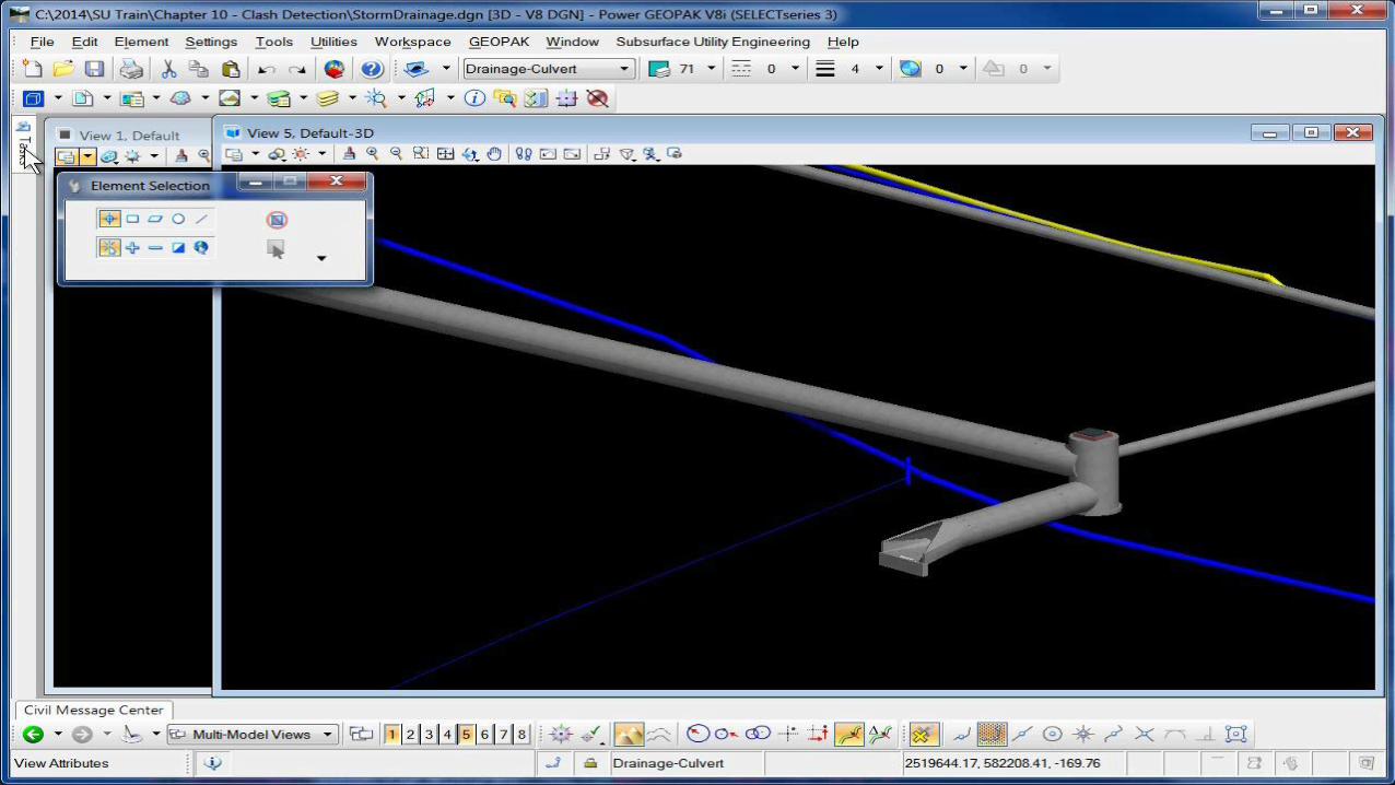
Clash Detection

4 | WWW.BENTLEY.COM | © 2016 Bentley Systems, Incorporated
Utility Feature Definitions

5 | WWW.BENTLEY.COM | © 2016 Bentley Systems, Incorporated
• Stored (usually) in DGNLIB
• Two new types (Conduit and Node)
• Specifically defines function (Comm, Electric, Gas, Petrol, Storm Water, Thermal, Waste Water, Water)
Feature Definitions
6 | WWW.BENTLEY.COM | © 2016 Bentley Systems, Incorporated
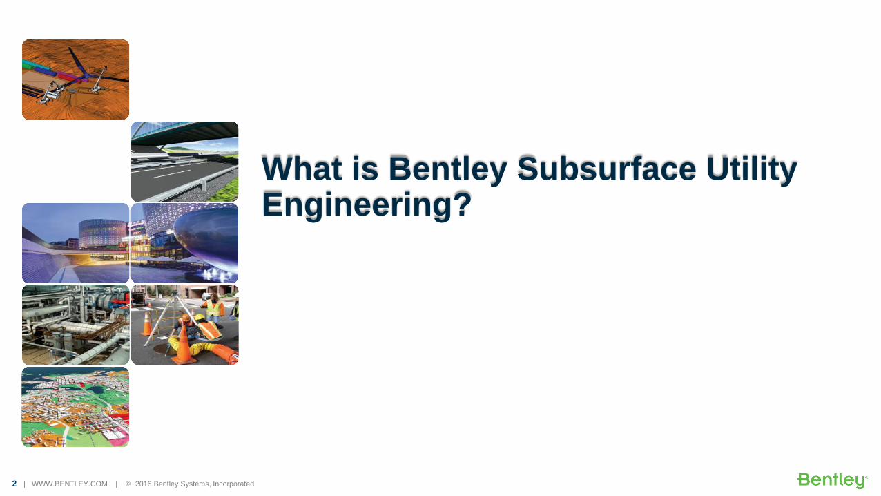
Feature Definitions Define Presentation
• Work similar to road/site/terrain feature definitions
• Link to element templates for symbology
• Utility nodes require two 3D templates.
• Cells are used very heavily in the element templates.
– 2D cells for plan
– 3D cells for 3D model
7 | WWW.BENTLEY.COM | © 2016 Bentley Systems, Incorporated
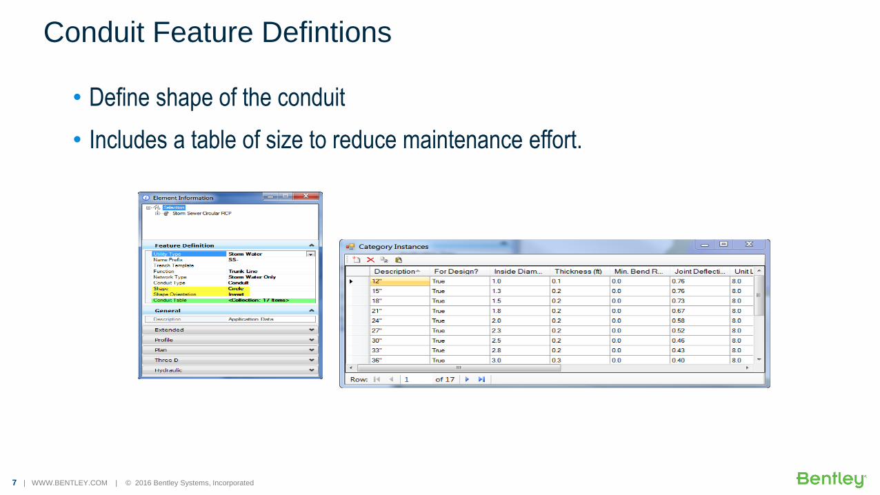
• Define shape of the conduit
• Includes a table of size to reduce maintenance effort.
Conduit Feature Defintions
8 | WWW.BENTLEY.COM | © 2016 Bentley Systems, Incorporated
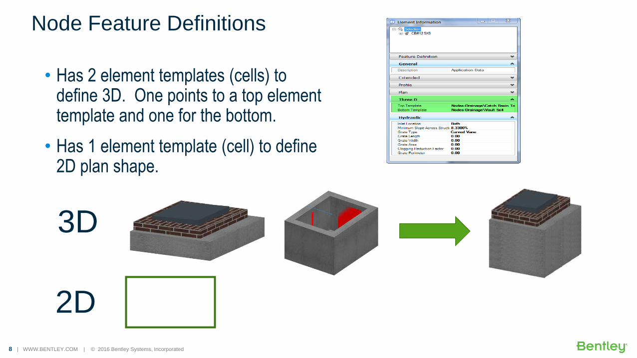
• Has 2 element templates (cells) to define 3D. One points to a top element template and one for the bottom.
• Has 1 element template (cell) to define 2D plan shape.
Node Feature Definitions
3D
2D

9 | WWW.BENTLEY.COM | © 2016 Bentley Systems, Incorporated
Import Drainage NetworksGEOPAK Drainage, InRoads S&S, MX Drainage
StormCAD, CivilStorm, SewerCAD, SewerGEMS
WaterCAD, WaterGEMS

10 | WWW.BENTLEY.COM | © 2016 Bentley Systems, Incorporated
Import from Other Formats
• Import from:
– GEOPAK Drainage
– InRoads S&S
– MX Drainage
• The following products by way of SHP file • StormCAD
• CivilStorm
• SewerCAD
• SewerGEMS
• WaterCAD
• WaterGEMS

11 | WWW.BENTLEY.COM | © 2016 Bentley Systems, Incorporated
Importing from Other Applications

12 | WWW.BENTLEY.COM | © 2016 Bentley Systems, Incorporated
Create and Edit FeaturesNode and Link Networks such as Storm/Sanitary
13 | WWW.BENTLEY.COM | © 2016 Bentley Systems, Incorporated
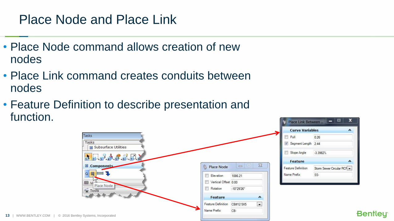
Place Node and Place Link
• Place Node command allows creation of new nodes
• Place Link command creates conduits between nodes
• Feature Definition to describe presentation and function.
14 | WWW.BENTLEY.COM | © 2016 Bentley Systems, Incorporated
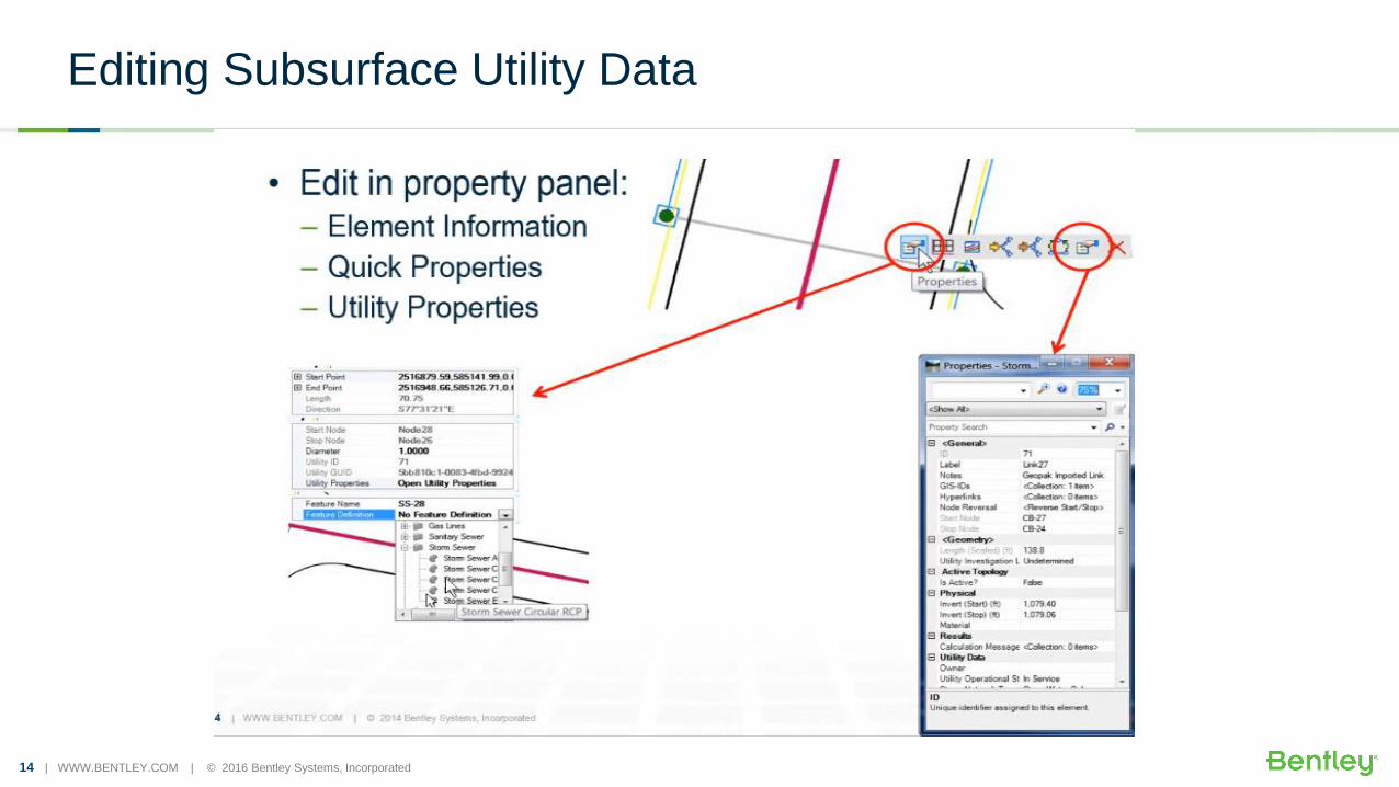
Editing Subsurface Utility Data

15 | WWW.BENTLEY.COM | © 2016 Bentley Systems, Incorporated
Editing Subsurface Utility Data

16 | WWW.BENTLEY.COM | © 2016 Bentley Systems, Incorporated
Create New Node and Link Features

17 | WWW.BENTLEY.COM | © 2016 Bentley Systems, Incorporated
Editing

18 | WWW.BENTLEY.COM | © 2016 Bentley Systems, Incorporated
Creating New FeaturesExtract Utility from Graphics Using Selection Set Method
19 | WWW.BENTLEY.COM | © 2016 Bentley Systems, Incorporated
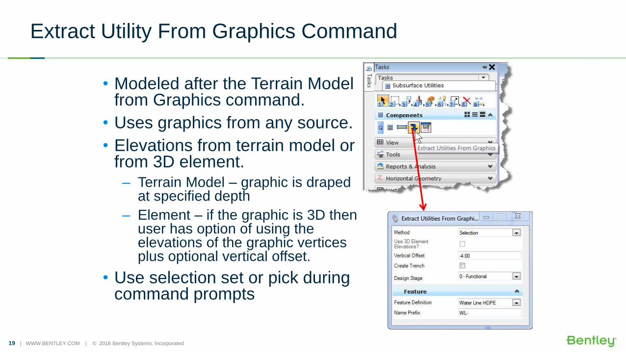
Extract Utility From Graphics Command
• Modeled after the Terrain Model from Graphics command.
• Uses graphics from any source.
• Elevations from terrain model or from 3D element.– Terrain Model – graphic is draped
at specified depth
– Element – if the graphic is 3D then user has option of using the elevations of the graphic vertices plus optional vertical offset.
• Use selection set or pick during command prompts
20 | WWW.BENTLEY.COM | © 2016 Bentley Systems, Incorporated
21 | WWW.BENTLEY.COM | © 2016 Bentley Systems, Incorporated
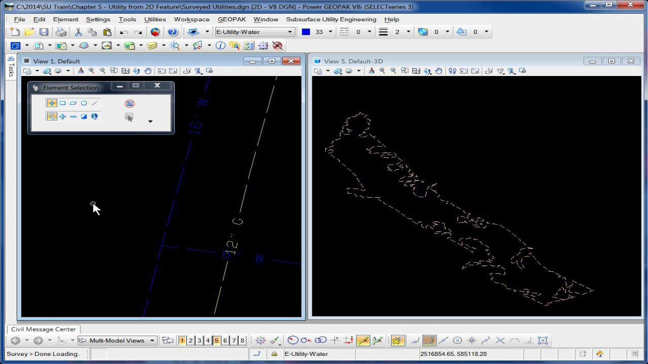
Extract from Graphics (2D)
22 | WWW.BENTLEY.COM | © 2016 Bentley Systems, Incorporated
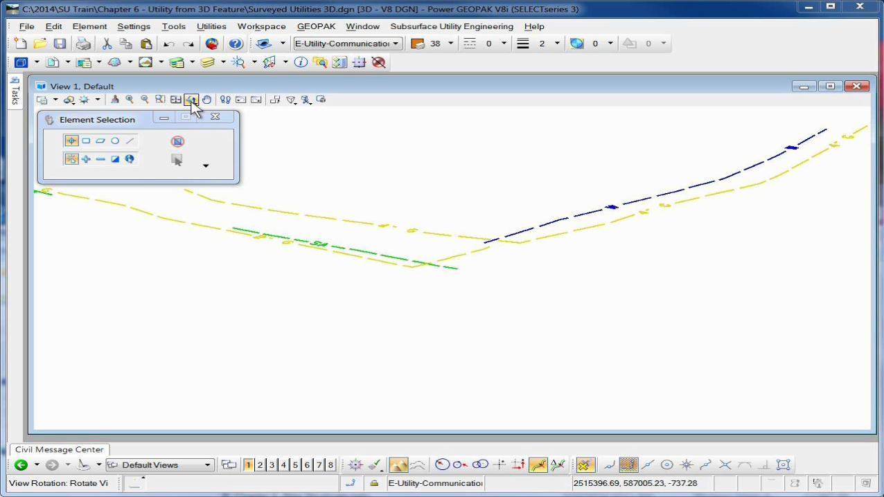
Creating New FeaturesExtract Utility from Graphics Using Utility Filter Method

23 | WWW.BENTLEY.COM | © 2016 Bentley Systems, Incorporated
• New Utility Filter type similar to Terrain Filters.
Utility Filter Manager

24 | WWW.BENTLEY.COM | © 2016 Bentley Systems, Incorporated

25 | WWW.BENTLEY.COM | © 2016 Bentley Systems, Incorporated
Proposed Utility With TrenchExtract Utility From Graphics Command
26 | WWW.BENTLEY.COM | © 2016 Bentley Systems, Incorporated
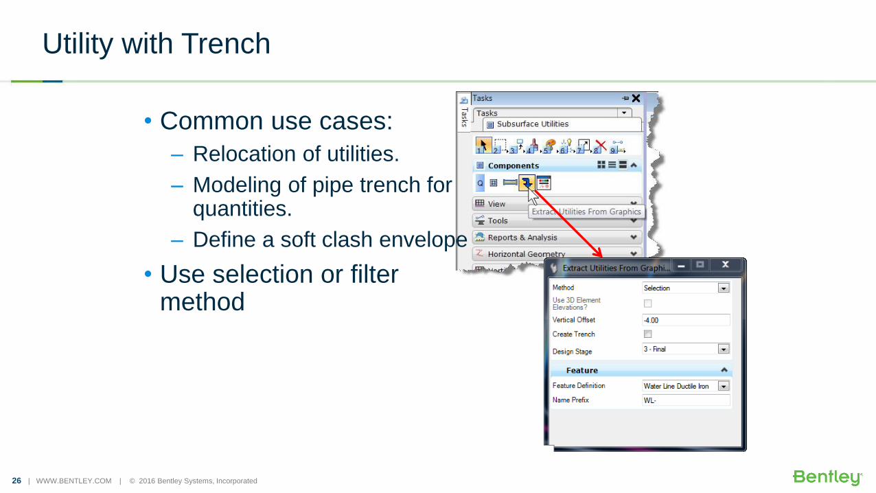
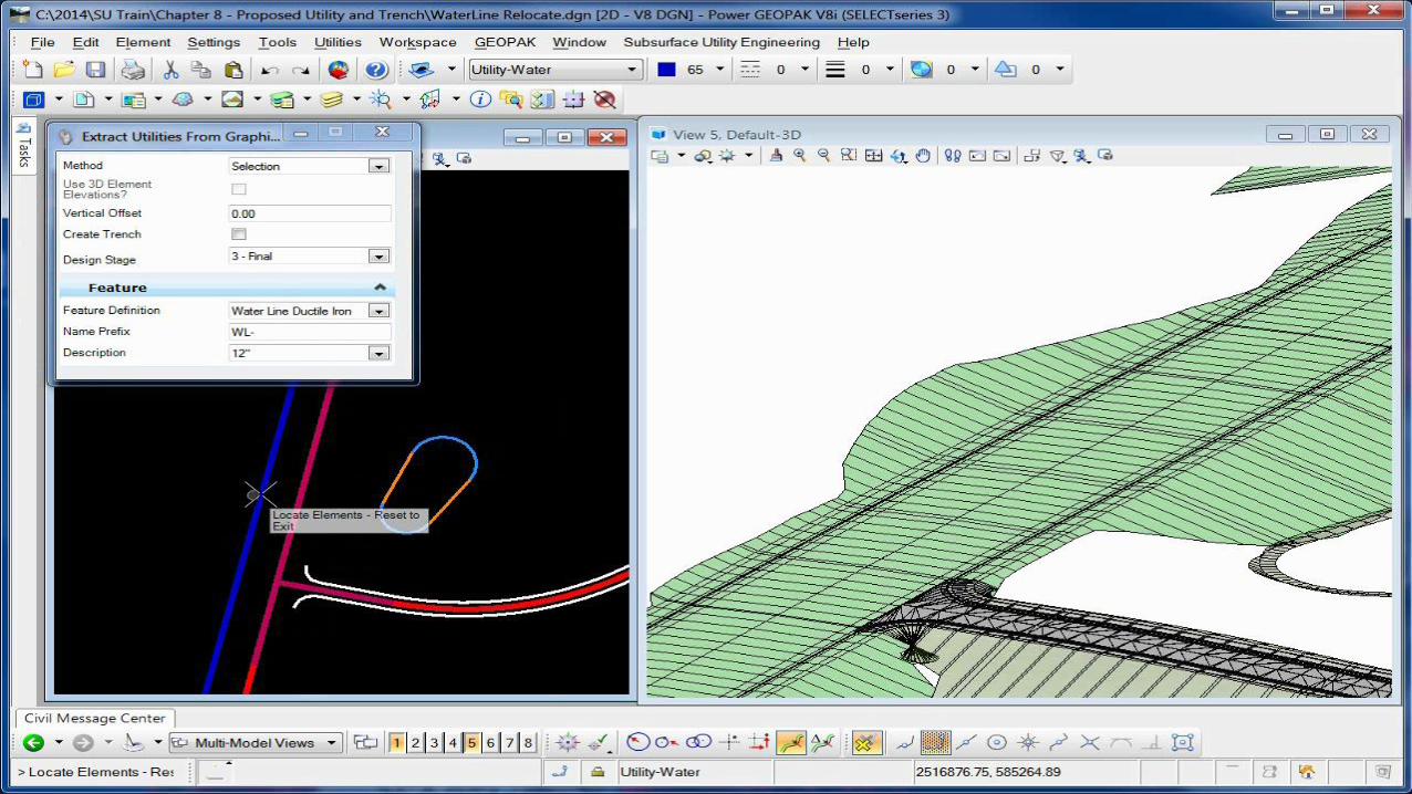
Utility with Trench
• Common use cases:
– Relocation of utilities.
– Modeling of pipe trench for quantities.
– Define a soft clash envelope
• Use selection or filter method

27 | WWW.BENTLEY.COM | © 2016 Bentley Systems, Incorporated
Trench Template in the Feature Definition
• Conduit Feature Definitions include a property for trench template.
• Which is an OpenRoads corridor design template
28 | WWW.BENTLEY.COM | © 2016 Bentley Systems, Incorporated
Proposed Utility With Trench

30 | WWW.BENTLEY.COM | © 2016 Bentley Systems, Incorporated
Model BuilderLink to External Data Sources

31 | WWW.BENTLEY.COM | © 2016 Bentley Systems, Incorporated
Model Builder
• Connects to any data source, including:– SHP
– XLS
– TXT, CSV
– Oracle Spatial
• Geospatial sources are preferred.
• Creates 2 way link for import, export and update
32 | WWW.BENTLEY.COM | © 2016 Bentley Systems, Incorporated
Why Are Geospatial Sources Preferred ?
• Geospatial data sources (such as SHP or Oracle Spatial) are preferred because they contain X,Y,Z coordinates on all vertices in addition to node connectivity information.
• Without this geospatial data, you must break line strings into simple lines to maintain fidelity in data.
– Of course, some data (such as gravity networks) are innately single line connections.

33 | WWW.BENTLEY.COM | © 2016 Bentley Systems, Incorporated
Model Builder

34 | WWW.BENTLEY.COM | © 2016 Bentley Systems, Incorporated
Conflict Detection
35 | WWW.BENTLEY.COM | © 2016 Bentley Systems, Incorporated
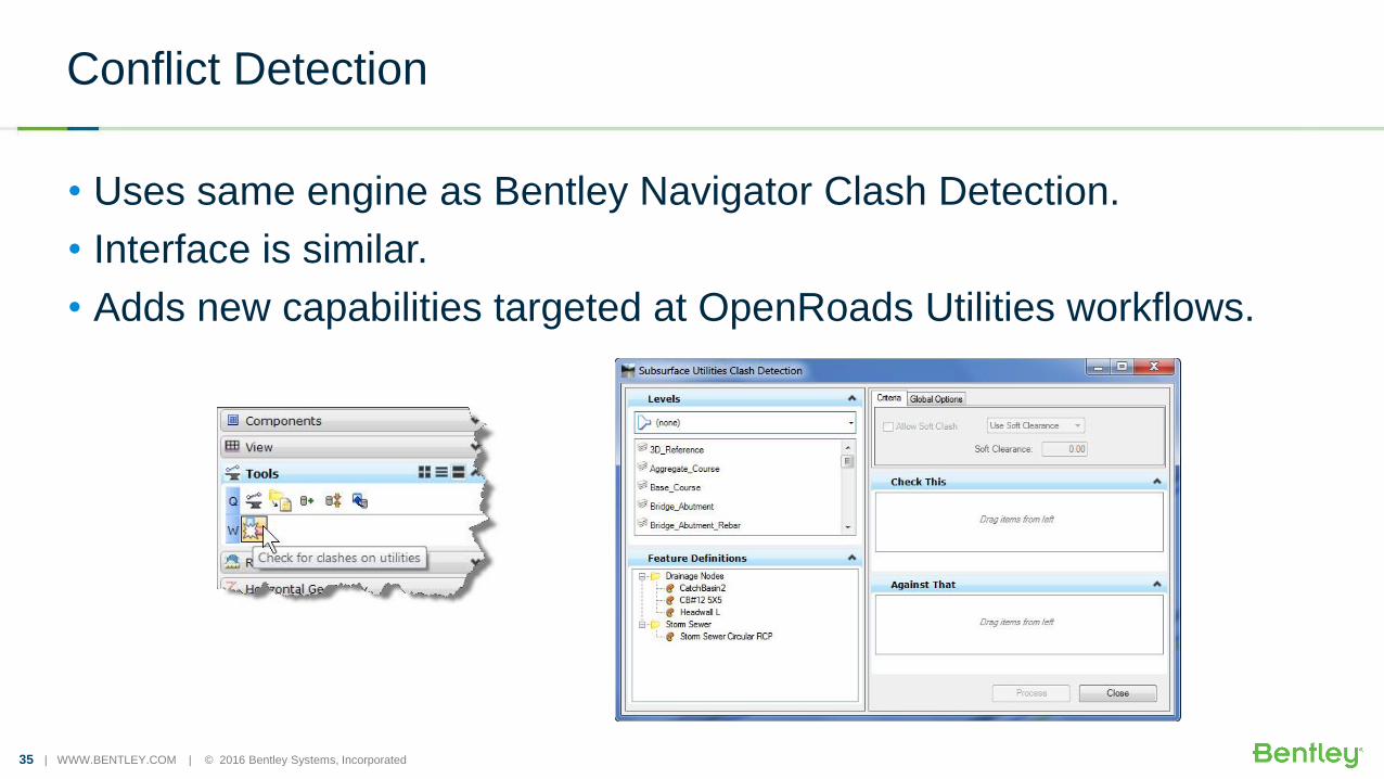
Conflict Detection
• Uses same engine as Bentley Navigator Clash Detection.
• Interface is similar.
• Adds new capabilities targeted at OpenRoads Utilities workflows.
36 | WWW.BENTLEY.COM | © 2016 Bentley Systems, Incorporated
Conflict Detection Between Utilities