Beara-Breifne Wa y Slí Bhéa ra Breifne files/bearaway_inside_v8(part1).pdf · Slí Bhéa ra...
25
Slí Bhéara Breifne Beara-Breifne Way 1 Guides to the way-marked trails volume 1 the Beara way West Cork/South Kerry text and images by Dermot Somers
Transcript of Beara-Breifne Wa y Slí Bhéa ra Breifne files/bearaway_inside_v8(part1).pdf · Slí Bhéa ra...
Slí Bhéara BreifneBeara-Breifne Way
1
Guides to the way-marked trails volume 1
the Beara wayWest Cork/South Kerry
text and images by Dermot Somers
2 3
Published by:
Beara tourism and development
the square
Castletownbere
Co. Cork
© Beara-Breifne Project, 2008.
text and images by dermot somers (©2008)
all rights reserved. No part of this publication may be copied,
reproduced or transmitted in any form or by any means, without
the prior permission of the publishers.
a catalogue record is available for this book from the British
library.
First edition: July 2008
isBN: 978-0-9559094-0-5
the beara way and beara-breifne way development committees, the author and the publishers, have taken every care to ensure that the information contained in this book is accurate at the time of writing. the walking routes described herein have been developed with the kind permission of the private landowners and farmers through whose land they pass and are not rights of way. occasionally, short sections of the route may be diverted to comply with the needs of the landowners. walkers are requested to follow these diversions when in place. the author and publisher shall have no liability in respect to any loss or damage, however caused, arising from the use of these trails or this guide.
Cover Photograph: Glengarriff harbour and Garnish island.
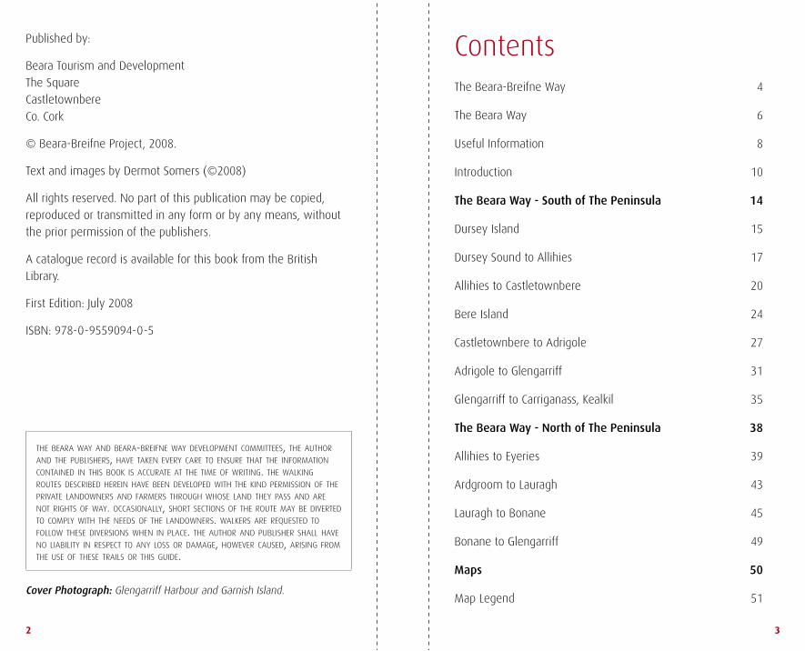
Contentsthe Beara-Breifne way 4
the Beara way 6
useful information 8
introduction 10
The Beara Way - South of The Peninsula 14
dursey island 15
dursey sound to allihies 17
allihies to Castletownbere 20
Bere island 24
Castletownbere to adrigole 27
adrigole to Glengarriff 31
Glengarriff to Carriganass, kealkil 35
The Beara Way - North of The Peninsula 38
allihies to eyeries 39
ardgroom to lauragh 43
lauragh to Bonane 45
Bonane to Glengarriff 49
Maps 50
map legend 51

Breifne, LeitrimBreifne, Leitrim
Beara, CorkBeara, Cork
The Beara-Breifne Way
4 5
the Beara-Breifne wayThe Way runs 400 km north from Beara in Co. Cork to Breifne in Co. Leitrim, following generally the line of the 17th century march of O’Sullivan Beare, the last great chieftain of west Cork.
in the words of dan sullivan,
Community representative,
kealkil, the idea was to
transform “the theme of
tribulation into a celebration of
human spirit and endurance.”
in 1602 munster was ravaged by war. the forces of elizabeth i
had defeated the irish and spanish at the Battle of kinsale and
advanced to capture the territory of donal Cam o’sullivan Beare,
Chieftain of Beara. Following a series of battles and the loss of
his stronghold, dunboy Castle, o’sullivan and his troops withdrew
to Coomerkane Valley near Glengarriff. on New year’s eve 1602,
faced with almost certain starvation, they were finally forced
to flee. a thousand men and women, including four hundred
soldiers, embarked on an epic mid-winter march, hoping to join
forces with rebel leaders in ulster.
travelling through ireland at a time of war and severe food
shortages they were seen by local chiefs as a threat and were
attacked. women carried infants and many of the camp followers
could not keep up. By the time they reached the river shannon
their numbers were severely reduced.
hemmed in by enemies, they crossed the river at night in a boat
made of the hides of slaughtered horses, the meat eaten by the
starving in the camp. two days later, at aughrim, their path was
blocked by cavalry and infantry. o’sullivan Beare’s camp had no
choice but to fight. against all odds, his exhausted band defeated
greatly superior forces, then continued to march without a rest.
as the mercenaries among o’sullivan’s followers began to drain away,
returning to their Connaught homes, the remaining refugees were
continuously threatened. on the fourteenth day, o’sullivan Beare
reached leitrim castle, stronghold of the rebel o’rourke of Breifne.
of the original one thousand followers only thirty five remained1.
the dramatic history contrasts with the beauty and diversity of the
landscapes along the Beara-Breifne way. the walk begins with a
rugged coastline, then threads a barrier of hills. there are bogs
and woodlands, riverbanks, rolling farmland and wayside villages.
the route links counties Cork, kerry, limerick, tipperary, offaly,
Galway, roscommon, sligo and leitrim, and it also connects a
series of rural communities along the entire way.
the finer detail of the route is supported by strong folk memory
and there are unbroken clan connections with the story. the
400th anniversary re-enactment of the march galvanised the
route’s communities to develop the walk. the venture could
only have come from the ground up; almost all the land used
is in private hands and access has been granted, neighbour to
neighbour, for the greater good of the wider community. the route
may be nationwide but the sense of ownership and heritage
is emphatically local. For the seasoned walker it is this local
interaction which sets the Beara-Breifne way apart.
The Beara-Breifne Way Development Committee
1 Peter Ballagh

Massmount Church
Bog asphodel, Lough Fadda
6 7
the Beara wayThe Beara-Breifne Way, links a series of way-marked routes. The local way on the Beara Peninsula is called The Beara Way. It is approximately 220 km in length and completes a circuit of impressive coastal and mountain scenery, before turning inland to Kealkil.
the Beara way was developed by the Beara tourism and
development association and links many of the peninsula’s
main attractions. these include the bird life of dursey island, the
copper-mines of allihies, the military heritage of Bere island and
the famous woods and harbour of Glengarriff. along the way there
are o’sullivan ruins near Castletownbere and kealkil, a heritage
Park at Bonane, lakes at tuosist, and lush gardens at derreen in
lauragh. megalithic remains are scattered along the coast and
throughout the uplands. ardgroom has its fine stone circle, while
the hag of Beara – ancient goddess – maintains an eerie presence
on the coast near eyeries.
the extended Beara-Breifne way takes the Beara way from
dursey, along the south coast to Glengarriff, then inland to kealkil.
Both ways follow off-road tracks and quiet back roads. however,
since traffic has increased in recent years, walkers and cyclists
are asked to take care, particularly on busy roads near towns and
villages.
the Beara-Breifne and the Beara ways cross public and private
lands and dogs are not permitted on either way. access to private
lands is by permission of local landowners, arranged by the local
community, and especial thanks are extended to both landowners
and community groups for their assistance in making this venture
possible.
The Beara Way Development Committee

8 9
useful information Emergency Service
telephone 999 or 112
ambulance, Fire Brigade, Gardaí (Police), lifeboat,
mountain/Coastal rescue
Getting to and from the Beara Peninsula
Buses: (Cork – Beara)
Bus Eireann (021) 450 8188
Harringtons (027) 74003 / (087) 267 8388
O’Donoghues (027) 70007
Taxis:
For taxis to and from Cork airport and train station please contact
Beara tourism or check the Beara-Breifne website (see below).
Accommodation and Transport on Beara
accommodation in the Beara Peninsula is mainly Bed &
Breakfast. many can book onward accommodation and arrange
to have your luggage sent ahead allowing you to enjoy a day’s
walking unhindered. or, you may prefer to remain in the same
accommodation and arrange collection by taxi. a limited local bus
service is also in operation.
hotel accommodation is available in Castletownbere, Glengarriff
and kenmare while hostels and camp sites can be found in
Castletownbere, Glengarriff, adrigole, tuosist and allihies.
the range of providers is always growing and may vary seasonally.
For the most up to date information please check the Beara-
Breifne website or contact Beara tourism (see below). Bus
timetables and taxi numbers can also be found on the website or
by contacting Beara tourism.
Tourism
Beara-Breifne Website www.beara-breifne.ie
Castletownbere Tourism Office run by
Beara Tourism and Development www.bearatourism.com
(027) 70054
this community-run tourist office offers a year-round service, with limited opening hours daily.
Fáilte Ireland, Tourist Information 1850 230 330
or (021) 425 5100
Bantry Tourist Information (seasonal) (027) 50229
Kenmare Tourist Information (seasonal) (064) 41233
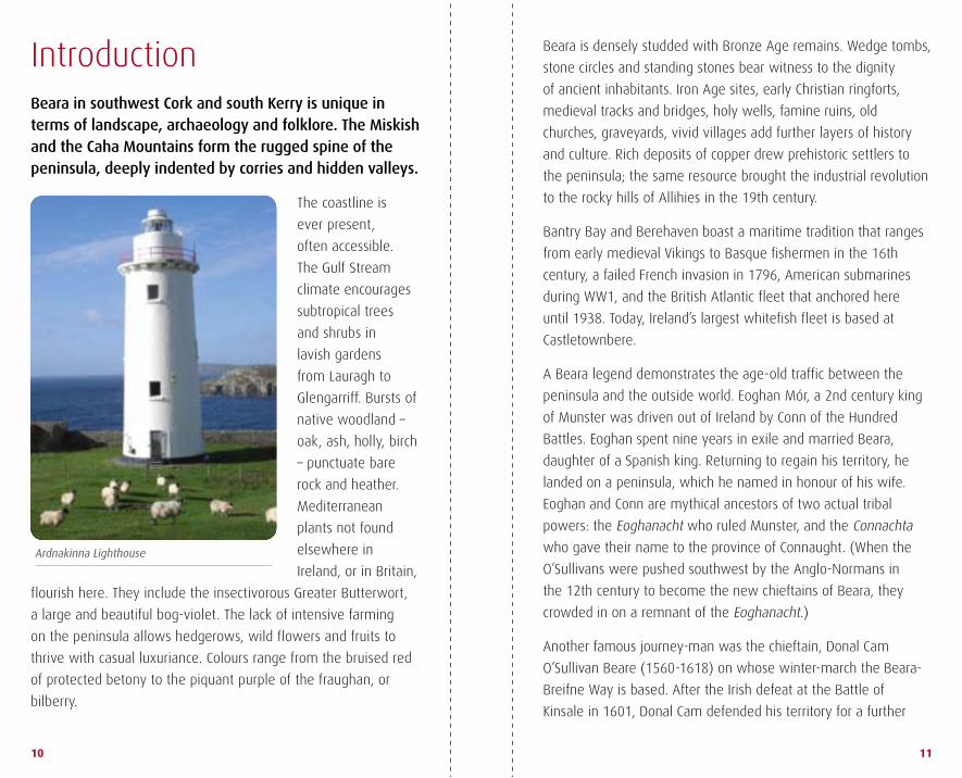
Ardnakinna Lighthouse
10 11
introductionBeara in southwest Cork and south Kerry is unique in terms of landscape, archaeology and folklore. The Miskish and the Caha Mountains form the rugged spine of the peninsula, deeply indented by corries and hidden valleys.
the coastline is
ever present,
often accessible.
the Gulf stream
climate encourages
subtropical trees
and shrubs in
lavish gardens
from lauragh to
Glengarriff. Bursts of
native woodland –
oak, ash, holly, birch
– punctuate bare
rock and heather.
mediterranean
plants not found
elsewhere in
ireland, or in Britain,
flourish here. they include the insectivorous Greater Butterwort,
a large and beautiful bog-violet. the lack of intensive farming
on the peninsula allows hedgerows, wild flowers and fruits to
thrive with casual luxuriance. Colours range from the bruised red
of protected betony to the piquant purple of the fraughan, or
bilberry.
Beara is densely studded with Bronze age remains. wedge tombs,
stone circles and standing stones bear witness to the dignity
of ancient inhabitants. iron age sites, early Christian ringforts,
medieval tracks and bridges, holy wells, famine ruins, old
churches, graveyards, vivid villages add further layers of history
and culture. rich deposits of copper drew prehistoric settlers to
the peninsula; the same resource brought the industrial revolution
to the rocky hills of allihies in the 19th century.
Bantry Bay and Berehaven boast a maritime tradition that ranges
from early medieval Vikings to Basque fishermen in the 16th
century, a failed French invasion in 1796, american submarines
during ww1, and the British atlantic fleet that anchored here
until 1938. today, ireland’s largest whitefish fleet is based at
Castletownbere.
a Beara legend demonstrates the age-old traffic between the
peninsula and the outside world. eoghan mór, a 2nd century king
of munster was driven out of ireland by Conn of the hundred
Battles. eoghan spent nine years in exile and married Beara,
daughter of a spanish king. returning to regain his territory, he
landed on a peninsula, which he named in honour of his wife.
eoghan and Conn are mythical ancestors of two actual tribal
powers: the eoghanacht who ruled munster, and the Connachta
who gave their name to the province of Connaught. (when the
o’sullivans were pushed southwest by the anglo-Normans in
the 12th century to become the new chieftains of Beara, they
crowded in on a remnant of the eoghanacht.)
another famous journey-man was the chieftain, donal Cam
o’sullivan Beare (1560-1618) on whose winter-march the Beara-
Breifne way is based. after the irish defeat at the Battle of
kinsale in 1601, donal Cam defended his territory for a further

Foxglove
Ardgroom Stone Circle and The Reeks
12 13
year against ruthless elizabethan attack. he was forced out of the
woods around Glengarriff in december 1602 with four hundred
soldiers and six hundred dependants. they struggled north
through hungry terrain in an attempt to join Gaelic allies in ulster.
o’sullivan’s midwinter march covered hundreds of miles and has
achieved cult-status in popular history. after fifteen days, donal
Cam reached leitrim Castle with thirty-five followers.
soon afterwards, o’sullivan fled to spain, continuing to seek the
support of the spanish king for the irish cause. whether or not
ireland would have fared better under spanish rule is an open
question. unlike eoghan mór, his mythical predecessor, donal Cam
never returned to Beara and the o’sullivan grip on that territory
was lost.
despite its heroic
soldiers and sailors,
it seems fitting that a
landscape as elemental
as that of Beara should
be dominated by a
personage who is
herself an everlasting
force of nature: an
Chailleach Bhéarra,
the hag of Beara.
Changeable as the
weather, she is older
than time itself. even
the indo-european cow-
goddess Boi, who gave
her name to oileán Baoi or dursey, cannot be separated from the
Cailleach. deity, witch, wise old woman, healer, medieval nun,
shaper of the landscape, she continues to surface in literature,
in academic research, in place names and in the subversive
storehouse of folk-memory.
14 15
THE BEARA WAY south of the Peninsula
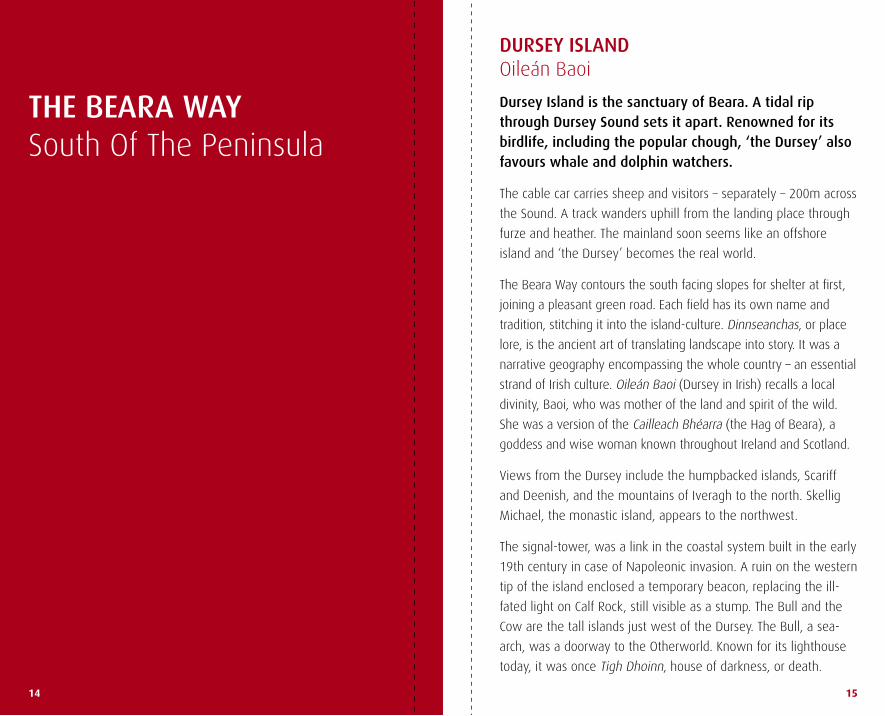
DURSEY ISLAND oileán Baoi
Dursey Island is the sanctuary of Beara. A tidal rip through Dursey Sound sets it apart. Renowned for its birdlife, including the popular chough, ‘the Dursey’ also favours whale and dolphin watchers.
the cable car carries sheep and visitors – separately – 200m across
the sound. a track wanders uphill from the landing place through
furze and heather. the mainland soon seems like an offshore
island and ‘the dursey’ becomes the real world.
the Beara way contours the south facing slopes for shelter at first,
joining a pleasant green road. each field has its own name and
tradition, stitching it into the island-culture. dinnseanchas, or place
lore, is the ancient art of translating landscape into story. it was a
narrative geography encompassing the whole country – an essential
strand of irish culture. oileán Baoi (dursey in irish) recalls a local
divinity, Baoi, who was mother of the land and spirit of the wild.
she was a version of the Cailleach Bhéarra (the hag of Beara), a
goddess and wise woman known throughout ireland and scotland.
Views from the dursey include the humpbacked islands, scariff
and deenish, and the mountains of iveragh to the north. skellig
michael, the monastic island, appears to the northwest.
the signal-tower, was a link in the coastal system built in the early
19th century in case of Napoleonic invasion. a ruin on the western
tip of the island enclosed a temporary beacon, replacing the ill-
fated light on Calf rock, still visible as a stump. the Bull and the
Cow are the tall islands just west of the dursey. the Bull, a sea-
arch, was a doorway to the otherworld. known for its lighthouse
today, it was once tigh dhoinn, house of darkness, or death.

Near Allihies
Tilickafinna
Dursey cable car
16 17
the Beara way returns by the road. tilickafinna is the most
westerly townland. a shed by the first house on the track (walking
east) is the original tigh lice Finne, ‘house of the white rock’, with
a boulder in its seaward gable.
the monastic ruin near
the cable car is probably
Franciscan. Foundations
of an o’sullivan fortress
can be seen on oileán
Beag (little island). it
was sacked by an english
force in 1602, aided by an
o’sullivan kinsman from a
hostile faction. occupants, including women and children, were
reputedly hurled over a cliff edge. the owner of the fort, diarmuid
of dursey, joined his nephew, donal Cam o’sullivan Beare and one
thousand fugitives, on the winter-march from west Cork to leitrim,
commemorated in the Beara-Breifne way.
DURSEY SOUND to ALLIHIES
Leave the car park via the stile and climb the rocky hill. Note the corduroy texture on the east facing slope of Dursey Island. ‘Lazy beds’ are old cultivation-ridges where potatoes and other crops were grown.
Follow the ridge above a cliff-rimmed cove, passing a fine stone
wall and a concrete plinth. hill views and sea vistas alternate.
Cod’s head extends northeast. Crow head, low and flattened,
reaches south. Crow island at its tip was home to the mythical
blacksmith, Goibhniu, or Goibhleann Gabha in local lore. (Gabha, a
smith.) he served the shipping trade. his cow was the legendary
Glas Goibhleann, a prodigious source
of milk. his treasure is buried on the
island but any attempt to find it sparks
a storm.
heather-slopes tilt to the shore at
Garinish Point. sandy coves and
tiny islands suggest swimming and
snorkelling. tranaduileasg, the middle
cove, is the strand of the edible
seaweed: duileasc, or ‘dulse’.
here, an extra loop of the Beara
way offers a figure-eight walk, or a varied run. From the acute
junction southeast of Garinish Quay, follow the r572 west for a
few hundred metres to a layby on the left and take the little back
road that zigzags roughly south. a track, full of damp and ferny
character, contours the hillside above the sea, ascending the slope
to a ww2 sentry box on the summit.

The engine house overlooking Allihies
Purple ‘Loosestrife’
18 19
Below, to the east, lies the Firkeel Gap. at the bottom of the slope, a
channel leads down to the road. Cobbled and slabbed in places, with
a few steps cut from the rock, it tunnels between steep banks roofed
with fuchsia.
Firkeel Gap is a complex road-junction. (the loop-walk, mentioned
earlier, returns to dursey sound from here.) otherwise, the route
breaks away behind the rugged bulk of lackacroghan. rising
gently, the track overlooks the islands and coves of Garinish,
already familiar. Cliff-scenery ahead and a glimpse of Ballydonegan
strand. the painted gables of allihies glow in the distance, like
festive bunting. Behind the town, a wall of rugged hills runs east
from knocknagallaun (hill of the standing stones) to knockoura.
Foher, on the left below, is an ominous place name. Fothair: a
grassy slope above a precipice. the cliffs at keam Point overlook
an island of rock, a popular spot once for lobster and salmon.
seine-boat fishing for mackerel, with two boats and a net,
prospered around the coast of Beara. the crew might number
a dozen or more. a net could be a hundred metres long and a
quarter of that in depth. mackerel were fished at night when
the glint of a shoal was
easily spotted. a man who
worked in the copper-mines
at allihies by day might
crew a seine-boat at night.
Big families were raised on
potatoes and fish.
a headland east of Foher
hosted an iron age fort
two thousand years ago. its
earthen ridge still stands.
along the autumn ditches, clumps of creamy yarrow (athair
thalún) with tight little florets and serrated leaves, contrast with
the buttons of blue scabious and stalks of purple loosestrife.
starched white stonecrop trails pinkish stems and green fleshy
leaves along the ground.
the bright little village of allihies (aill, a cliff) sports every colour
in the pastel range, with deeper hues for emphasis. the gaiety
enlivens its rugged setting, intensively mined for copper in the
19th century. surface ore was worked here in prehistoric times.
the Puxley family began the modern operation in 1812. (their
italianate mansion at dunboy, near Castletownbere, has lately
been restored.) sand washed out of the copper mines formed the
beach at Ballydonegan strand.
an engine house stands
on a terrace above the
town. Besides raising
ore to the surface, it
ran a steam-powered
‘man engine’ that lifted
miners 320m from the
bottom of the shaft.
when the mines closed
in 1884, many of the
miners emigrated to
michigan and montana.
‘don’t stop in america,’
was the catchcry: ‘go
straight to Butte!’ Butte became, for a time, the leading source of
copper ore in the world and retains strong family-connections with
Beara today. the allihies Copper mine museum offers detailed
information.
Fuchsia
20 21
ALLIHIES to CASTLETOWNBERE
The rocky ridge above Allihies gives way to the smooth outline of Knockgour with its crown of masts. (Gabhar, a goat). A winding lane goes east through little fields to cross the Ballydonegan river. A blocky castle on the left is not a castle at all, but an engine house built in 1845. A pump cleared water from a nearby shaft over 440m deep.
in autumn, the banks of the lane are heavy with blackberry
bushes, furze and heather. Ferns sprout among the stones,
honeysuckle sways in the
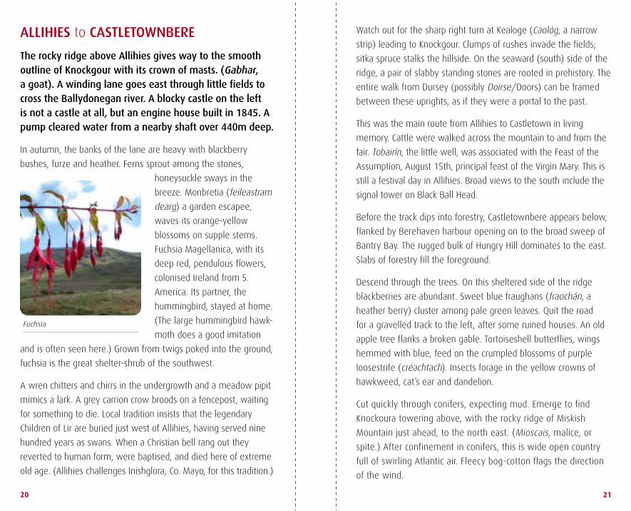
breeze. monbretia (feileastram
dearg) a garden escapee,
waves its orange-yellow
blossoms on supple stems.
Fuchsia magellanica, with its
deep red, pendulous flowers,
colonised ireland from s.
america. its partner, the
hummingbird, stayed at home.
(the large hummingbird hawk-
moth does a good imitation
and is often seen here.) Grown from twigs poked into the ground,
fuchsia is the great shelter-shrub of the southwest.
a wren chitters and chirrs in the undergrowth and a meadow pipit
mimics a lark. a grey carrion crow broods on a fencepost, waiting
for something to die. local tradition insists that the legendary
Children of lir are buried just west of allihies, having served nine
hundred years as swans. when a Christian bell rang out they
reverted to human form, were baptised, and died here of extreme
old age. (allihies challenges inishglora, Co. mayo, for this tradition.)
watch out for the sharp right turn at kealoge (Caológ, a narrow
strip) leading to knockgour. Clumps of rushes invade the fields;
sitka spruce stalks the hillside. on the seaward (south) side of the
ridge, a pair of slabby standing stones are rooted in prehistory. the
entire walk from dursey (possibly doirse/doors) can be framed
between these uprights, as if they were a portal to the past.
this was the main route from allihies to Castletown in living
memory. Cattle were walked across the mountain to and from the
fair. tobairín, the little well, was associated with the Feast of the
assumption, august 15th, principal feast of the Virgin mary. this is
still a festival day in allihies. Broad views to the south include the
signal tower on Black Ball head.
Before the track dips into forestry, Castletownbere appears below,
flanked by Berehaven harbour opening on to the broad sweep of
Bantry Bay. the rugged bulk of hungry hill dominates to the east.
slabs of forestry fill the foreground.
descend through the trees. on this sheltered side of the ridge
blackberries are abundant. sweet blue fraughans (fraochán, a
heather berry) cluster among pale green leaves. Quit the road
for a gravelled track to the left, after some ruined houses. an old
apple tree flanks a broken gable. tortoiseshell butterflies, wings
hemmed with blue, feed on the crumpled blossoms of purple
loosestrife (créachtach). insects forage in the yellow crowns of
hawkweed, cat’s ear and dandelion.
Cut quickly through conifers, expecting mud. emerge to find
knockoura towering above, with the rocky ridge of miskish
mountain just ahead, to the north east. (mioscais, malice, or
spite.) after confinement in conifers, this is wide open country
full of swirling atlantic air. Fleecy bog-cotton flags the direction
of the wind.

Derreenataggart stone circle
22 23
the view ranges north over eyeries and Coulagh Bay, past
inishfarnard island and kilcatherine Point, out across kenmare Bay
to the coast of iveragh – Caherdaniel to sneem. a sharp turn right
(south east) follows the angle of the fence down rolling moorland.
this broad valley leading to Castletownbere is studded with
antiquities, some not easy to find. a fulacht fia was a Bronze age pit
for boiling water with heated stones; perhaps for cooking, washing,
or rituals. little evidence of bone has been found at such sites to
prove that they were cooking pits. in medieval accounts, a fold of
animal skin on pointed sticks was used as a vessel for cooking meat.
local people still ‘win’ their fuel from turf banks in this valley. it’s
not unusual to find a family boiling the kettle while ‘footing’ turf,
close to a fulacht fia – a sophisticated echo of the past.
to the east, the contorted ridge of the miskish mountains crumples
against the angular bulk of hungry hill. derreenataggart stone
circle is an elegant megalithic monument, associated with the
Bronze age. (doirín an tsagairt, oak grove of the priest). many of
these ancient monuments are quietly decorated with bunches of
heather and wild flowers. Coins and pieces of quartz (grianchloch,
sunstone) are left as offerings.
THE O’SULLIVANS
the o’sullivan name is derived from súil amháin,
‘one eye’, more favourably interpreted as ‘hawk-eyed’.
still one of the most common family-names in ireland,
it is largely centred on Cork and kerry.
displaced from good land in the south-midlands by
12th century anglo-Normans, part of the o’sullivan clan
settled in Beara south of kenmare Bay.
their main income came from valuable fishing-dues, along
with port and anchorage charges paid by foreign fleets.
the o’sullivan chieftain was subject to an overlord,
macCarthy mór, who imposed costs and obligations,
including his own charge on the fisheries.
one year after the Battle of kinsale, following a bout of
guerrilla-warfare, the rule of the o’sullivans came to an
end in the winter of 1602-3 with a forced march north
from Beara to leitrim.
the o’sullivan Beare motto –
lámh foisteanach abú: the steady hand forever!

Green road
Gallán and Martello Tower
24 25
BERE ISLAND
The car ferry from Castletownbere into the west end of Bere Island crosses a kilometre and a half of sheltered water. About nine kms by three, the entire island offers a good day-walk. (Another ferry runs to the mainland from Rerrin, near the island’s east end, with a 4 km walk along the coast road to Castletownbere.)
islands have a different timeframe: a step out from the coast, a step
away from the present. Not so much oldfashioned as unhurried.
as usual, the cars are over ten years old; some with bonnets and
doors of different hues. the permanent population is about two
hundred – down from two thousand in the mid 19th century.
up the hill from the pier and turn right at the grotto. For centuries
Bere island was a British naval base. Pass a pill-box and the derelict
gun posts of the derrycreeveen Battery, ghost-guarding the west
entry to Berehaven. on the coast behind, knockgour wears a
thorny crown of masts and a rough shawl of forestry. hungry hill,
northeast, is a blunt buttress blocking access. Between them, a ring
of hills seems to cut Castletownbere off from the outside world.
But the outside world was never the irish interior: it was always
the ocean and its seaways, familiar to Greeks, romans, Vikings, the
english, the spanish – and now to the fishing-fleets of the world.
across the narrow sound, a grove of evergreen oak in front of the
rebuilt Puxley manor, reveals the site of the o’sullivan castle at
dunboy. so close, it seems, that a flat stone could be skimmed
across. Not so. the castle was destroyed in June 1602 by Carew’s
english forces. they landed first on Bere island to prepare the
attack, then shipped their
cannon to the shore at
dunboy. the siege ended
in a gory massacre of the
defenders. Forty survivors
who took to the water
were individually shot by
marksmen waiting in boats.
above the island shore,
a green road wanders
towards the fine lighthouse
on a grassy platform at
ardnakinna Point. the world
looks rinsed after morning
rain, and the sea glints like hammered silver in the midday sun.
edible mushrooms, bigger than the toecap of a boot, dot the track.
the Beara way strikes eastward through rising moorland to reach
the ruined Napoleonic signal tower. it looks as if it might have
been a target for some bored battery, but in fact it was damaged
by lightning in the 1950s and levelled by a storm soon after.

26 27
knockanallig (258m),
high point of the
island, is reached
by an excellent
track. the holy Cross
stands on a shoulder,
prominent from
the mainland, but
the actual summit
of the island is
unencumbered.
drop down into a gap. a stern standing stone (gallán) is rooted
in the very navel of the island. a Bronze age marker, it gallantly
holds the pass between the holy Cross and the martello tower
on their respective hills. (martello towers are late 18th century
fortifications, usually built to defend landing points along the
shore.) at the bottom of the hill, rerrin the harbour-village, is
reached. a regular ferry runs to a pier 4 km east of Castletownbere.
adding to its fine landscape and antiquities, the entire island is a
living museum of naval and military heritage. east of rerrin, there
are further batteries and some impressive cannon. there is also
an active army
camp. it is a relief
to find the irish
army in peaceful
possession,
after the
imperial legacy
encountered
throughout the
island.
CASTLETOWNBERE to ADRIGOLE
Leave the R572 at the Millbrook Bar. Look out for the low and lovely arches of the Aghakista bridge, where the old road from Glengarriff reached Castletownbere. Turn left on to a classic country lane, thickly hedged, with gates giving glimpses of rumpled fields.
Fine holly trees are thick with berries in late august and hazel
bushes flaunt ripening nuts. small oaks recall the dominance of
that tree in former times, as revealed in place names. (derry/
derreen means an oak-wood or grove.) in many parts of ireland,
extensive oakwoods were reduced to charcoal for smelting iron
ore, some of it imported into the country, refined, and shipped out
again. remains of these furnaces still exist in west Cork.
even in the lane, the partition between old and new, past and
present, is thin and the rumble of Castletown traffic breaks
through at times. Bere island lies behind. an armed fisheries-
patrol, slipping sleek and grey into Berehaven, recalls a complex
naval tradition. european ships had always fished the coast, but
the early 16th century saw a boom. Vast catches of hake and
herring were taken. Pilchards (large sardines) were ireland’s
most valuable export in that century. hundreds of men from the
northern regions of spain were seasonally based on the irish
coast, catching and curing fish. trading was intense. hides and
leather were the second most important irish export, with ready
markets in spain, France and italy.
even in the harsh 17th century, the fisheries yielded ‘… such
abundance of fish as few places in Christendom’. By then, the
spanish fishing fleets had shifted to terra Nova (Newfoundland
and labrador). Before the end of ww1, american battleships and
submarines were based in Berehaven.
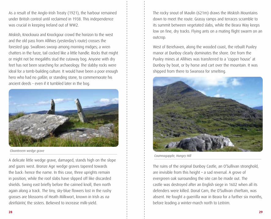
Cloontreem wedge grave
Coumnagapple, Hungry Hill
28 29
as a result of the anglo-irish treaty (1921), the harbour remained
under British control until reclaimed in 1938. this independence
was crucial in keeping ireland out of ww2.
miskish, knockoura and knockgour crowd the horizon to the west
and the old pass from allihies (yesterday’s route) crosses the
forested gap. swallows swoop among morning midges; a wren
chatters in the furze, tail cocked like a little handle. rocks that might
or might not be megaliths stud the cutaway bog. anyone with dry
feet has not been searching for archaeology. the slabby rocks were
ideal for a tomb-building culture. it would have been a poor enough
hero who had no gallán, or standing stone, to commemorate his
ancient deeds – even if it tumbled later in the bog.
a delicate little wedge grave, damaged, stands high on the slope
and gazes west. Bronze age wedge graves tapered towards
the back: hence the name. in this case, three uprights remain
in position, while the roof slabs have slipped off like discarded
shields. swing east briefly before the cairned knoll, then north
again along a track. the tiny, sky-blue flowers lost in the rushy
grasses are blossoms of heath milkwort, known in irish as na
deirfiúiríní, the sisters. Believed to increase milk-yield.
the rocky snout of maulin (621m) draws the miskish mountains
down to meet the route. Grassy ramps and terraces scramble to
its summit between vegetated slabs, while the Beara way keeps
low on fine, dry tracks. Flying ants on a mating flight swarm on an
outcrop.
west of Berehaven, along the wooded coast, the rebuilt Puxley
manor at dunboy clearly dominates the shore. ore from the
Puxley mines at allihies was transferred to a ‘copper house’ at
dunboy by boat, or by horse and cart over the mountain. it was
shipped from there to swansea for smelting.
the ruins of the original dunboy Castle, an o’sullivan stronghold,
are invisible from this height – a sad reversal. a grove of
evergreen oak surrounding the site can be made out. the
castle was destroyed after an english siege in 1602 when all its
defenders were killed. donal Cam, the o’sullivan chieftain, was
absent. he fought a guerrilla war in Beara for a further six months,
before leading a winter-march north to leitrim.

Corries on Hungry Hill
Heath Milkwort
30 31
the path swings around into the valley of the owgarriff (abha
gharbh, rough river). a farm sits in a lattice of fields and cutaway
bog under knocknagree. a walkers’ bridge crosses the river near a
deeply tempting pool. hungry hill (Cnoc daod) lifts forcefully into
view, its flanks scored and furrowed. the finest mountain in west
Cork, its character far exceeds its stature (682m). déad is a tooth.
this fits a themed ridge running south from keecragh (ravenous),
through knocknaveacal (teeth hill) and tooth mountain. another
theory offers éad, jealousy, as the root. the rib in the foreground
is the normal line of ascent.
the Beara way loops deep into the back of Coumnagapple (cirque
of the horses) west of hungry hill., the fins and folds of sandstone
are tinged with purple. a mountain ash, richly berried, hosts a
flock of thrushes. Butterwort and sundew – insectivorous – cluster
in damp hollows, digesting nitrogen from midges. Buttresses on
the track emerging from
the Glen offer short, sharp
rock climbs.
turn east, uphill. seagulls
beat their wings on the
fresh water of Park lough,
rinsing out the salt. a
red-beaked chough, black
wings indented, red legs
tucked up, swoops and
veers with an explosive
screech. a meadow pipit,
streaky brown, takes off
underfoot, lights on a wall to watch. Cross an expanse of angled
slab to reach a descending track. Quit this soon to veer along the
o’sullivan Beara way, reaching the road to adrigole before long.
ADRIGOLE to GLENGARRIFF
Adrigole is named for its inlet and branching rivers, (eadar ghabhal, in a forked place). Launch pleasantly uphill on blackberry lanes. Tussocks of bleached grass poke through tarmac, like hedgehogs in the distance. From a bush comes the warning tick! of a robin, as if cocking a tiny gun.
the purple striations of adrigole mountain seem finger-painted.
massmount Church is an enigmatic ruin overlooking adrigole
harbour and the sweep of Bantry Bay. one arm of the transept is
oddly extended. the doorway in the west gable frames a wild view
of hungry hill and its east facing corries, source of the mare’s tail
waterfall. Cross the gentle ridge, and hungry hill drops from sight.
Bronze age, iron age, early Christian and medieval landscapes
are all layered across these hillsides. Buddhist sanctuaries have
settled in. old cottages slump into the past in bushy corners. New

Water Mint
Massmount Church
32 33
dormer-homes spring up from suburban spores. a boy in a soccer
shirt dashes across the road with a pan of breakfast fat, pours it
into a ditch. the smell of
cooked bacon is a visceral
summons to the boar-
hunter in us all.
a little wedge grave at
Ballynahown is worth a
detour. it stands in its field
like a blunt hieroglyph
from a language that
we do not know. while
the neglect today is sad,
it is lucky perhaps that
these monuments have
survived at all. a blend of
superstition and respect preserved the tombs, the ringforts and
the standing stones of a vanished race. their ghosts, if we honour
them, will keep us upright in our landscape.
leitrim is a Connaught county. elsewhere, the name raises
eyebrows. it derives from liath dhroim, grey ridge, and is found
throughout the country. a fine gallán, a standing stone, broods
on a knoll at leitrim Beg. overlooking Bantry Bay, this must have
been a powerful place of memorial, or of celebration. men in furs
and skins, ignorant of iron, raised this monolith upright to be seen
from a distance.
a ringfort, its earthen bank rimmed with trees, supervises a bend
in the road. this was once the main route west. For centuries, a
track crossed the wooded slopes, fording the stream and veering
under the ringfort.
these monuments are common throughout ireland, belonging
mainly to the early Christian/early medieval era. they were farm
homesteads, generally not defensive. however, this key location,
at an important ford, conveys a militant sense of purpose. Big
herds, sometimes stolen, passed this way in both directions. Cattle
were mobile Gaelic wealth.
Quit the tarmac for a track. throughout the world, hill-people
travel routes like this on foot, knowing by name each rock on
which a load can be
leaned and rested. a
man would be famous,
not for wealth, but for
the weight of grain or
iron he carried around
the mountain. such
feats were recorded on
the dursey, at the tip of
the Beara peninsula.
at athnaclaha the
medieval eye of a
bridge (with cataract)
peers into the past,
proving again the antiquity of this hillside track. under the arch,
kidney saxifrage clusters in damp shade, its leaves sprouting grey
bristles, like an old bachelor surprised by visitors.
Contour around the front of the sugarloaf (Gabhal mhór, the big
fork) and drop into the gap between it and its rugged satellite.
the age-old track is studded with hoofprints. easy to imagine a
bawling creacht (herd) of small black cattle, raided by a party of
Beara men, funnelled through the hills into hiding.

Glengarriff harbour
Sundew
34 35
descend into an enclosed
valley, obscured by conifers.
reach a forest road, swing
right on firm ground
again. the track is fringed
with birch and with lost
rhododendron looking for
a home. swing north (left)
into a gap on the ridge
between derrynafulla and
shrone hill and descend
through mixed woodland
to reach the forest road by
the river.
the Beara way turns east (right) for Glengarriff. two kms west,
however, the magnificent valley of Coomerkane (coum of the little
pig) keeps its secrets among cliffs and corries. easy to imagine
the legendary hideout in which an eagle-chick was cheated of its
food in order to nourish a young o’sullivan prince. a cord around
the bird’s throat allowed the food to be removed when the eagles
flew off to hunt again.
derrynafulla (oakwood of the blood) is said to be the area in
which donal Cam o’sullivan Beare took his final stand against
wilmot’s army in the winter of 1602. the capture of the entire
herd of cattle and sheep on which his guerrilla force depended
put an end to resistance and o’sullivan began his famous march
from this location. the wounded and sick were left behind, stoking
fires to create a sense of military occupation. they were put to the
sword when wilmot’s men discovered the deception.
GLENGARRIFF to CARRIGANASS, KEALKIL
Heading east, quit Glengarriff via the N71. The classic frontage of the Eccles Hotel, lofty and narrow when Thackeray, Shaw and Yeats stayed here, has spread extensive wings. Glengarriff harbour shines with the promise exuded by tree-clad islands in calm water. One of these is Garinish, celebrated for its subtropical gardens.
Cobduff is the low
summit east of the
harbour, with a dark
grimace slashing
its ridge. this might
be the ‘dark mouth’
possibly referred
to in the name.
monteensudder,
derreenathirigy: the
signposts are clotted
with syllables. the little bogland of the trotting; the oak grove
of the wizened one – the names reveal that this cosmopolitan
coastline was once intensely local.
Beyond the golf course, turn left at the sign for dromgarriff (the
rough ridge). rhododendron hangs over the rising roadside; wild
strawberry plants edge the tarmac. turn right and follow a lane.
a rough track with holly trees leads up to open hillside. the views
are worth the rather turgid ground.
to the left, the fault line that forms the straois or grimace on
Cobduff is inexpressive on close acquaintance. the great gouged
ridge of the Cahas runs along the entire horizon from west to
north, and the rough triangles of the sugar loaf and shrone

Kealkil
36 37
hill pile up behind Glengarriff. the rim of the harbour is thickly
wooded, hiding development in a rich camouflage of oak, beech
and scots pine. Bantry Bay sweeps out towards the atlantic,
flanked to the south by the tranquil outline of sheep’s head
peninsula. softened by low sunlight, whiddy island wears its oil
tanks like the scars of an old accident. in January 1979, a French
tanker called the Betelgeuse offloading crude oil at the Gulf oil
terminal exploded at the dock, killing fifty people.
Veer across rough moorland on a mountain track. Below, the coast
road hums and swishes with tourist-traffic but this old route contours
across a different time and culture. when donal Cam o’sullivan
Beare slipped out of the woods beyond Glengarriff at daybreak on
december 31st, 1602, he led one thousand followers along cattle
tracks such as this from the Cahas to the shehy mountains.
the elizabethan army under wilmot did not pursue him. they
spread out instead and laid waste to the Beara peninsula. the
wounded and the sick, abandoned in the guerrilla-camp, were
put to death in the manner of the time. Fleeing Beara, o’sullivan
began a winter-journey north in a desperate bid to join forces with
his ally hugh o’Neill in ulster.
the Beara way crosses the Coomhola river at a complex junction,
swerving east under a steep slope at Cooryleary, then left on a
narrow road that veers back towards the ridge, crossing it after a
couple of kms. the road becomes a rutted lane in keeping with
the views of Coomhola and knockboy, the rugged mountains to
the north. the narrow opening of the Borlin Valley lies directly
north, with the broad ridge of Conigar on its eastern flank. there
are those who suggest that o’sullivan led his followers up the
Borlin Valley, east across the mountain ridge and steeply down
into the sanctuary of Gougane Barra. this heroic aspiration does
not accord with the terrain.
maughanasilly is macha na sailí, cattle field (or milking place) of
the willows, where five standing stones were aligned with the
most northerly point of the lunar cycle by Bronze age inhabitants
nearly 4000 years ago. a splash of colour against the stones in the
gloom of early November proved to be an offering of flowers and
an apple so vividly red that it sorely tempted this visitor.
determined to put the shehy mountains between himself and
his enemies on New year’s eve, 1602, donal Cam did not break
his journey at Carriganass, an o’sullivan castle on the kealkil road
south of maughanasilly, which was held by his own men. it had
belonged to his hostile
cousin owen o’sullivan,
from whom donal Cam had
captured it. the garrison
would shortly surrender to
wilmot, commander of the
elizabethan forces and the
last of the o’sullivan castles
on the Beara peninsula
would be lost.
Partly restored and open to visitors, the shell of the castle reveals a
typical tower-house of the time, five storeys high, surrounded by a
fortified bawn-wall. it stands above a ravine on the owvane river.
the convoy of four hundred soldiers and six hundred camp
followers kept to the cattle-tracks in the foothills and raced on
towards the Pass of keimaneigh several hours ahead. once that
barrier was crossed, Beara and the threat of pursuit would be left
behind. a different landscape, new enemies, waited beyond the
pass. For donal Cam o’sullivan Beare there would be no return.
Eyeries village
38 39
THE BEARA WAY North of the Peninsula
ALLIHIES to EYERIES
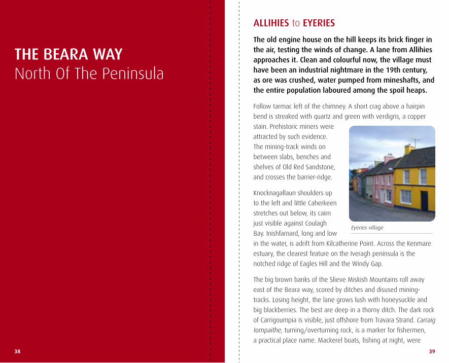
The old engine house on the hill keeps its brick finger in the air, testing the winds of change. A lane from Allihies approaches it. Clean and colourful now, the village must have been an industrial nightmare in the 19th century, as ore was crushed, water pumped from mineshafts, and the entire population laboured among the spoil heaps.
Follow tarmac left of the chimney. a short crag above a hairpin
bend is streaked with quartz and green with verdigris, a copper
stain. Prehistoric miners were
attracted by such evidence.
the mining-track winds on
between slabs, benches and
shelves of old red sandstone,
and crosses the barrier-ridge.
knocknagallaun shoulders up
to the left and little Caherkeen
stretches out below, its cairn
just visible against Coulagh
Bay. inishfarnard, long and low
in the water, is adrift from kilcatherine Point. across the kenmare
estuary, the clearest feature on the iveragh peninsula is the
notched ridge of eagles hill and the windy Gap.
the big brown banks of the slieve miskish mountains roll away
east of the Beara way, scored by ditches and disused mining-
tracks. losing height, the lane grows lush with honeysuckle and
big blackberries. the best are deep in a thorny ditch. the dark rock
of Carrigoumpia is visible, just offshore from travara strand. Carraig
iompaithe, turning/overturning rock, is a marker for fishermen,
a practical place name. mackerel boats, fishing at night, were
Cork - Kerry border
40 41
vulnerable to submerged rocks. a seine-boat accident in which
five men perished in 1918 is still remembered in Coulagh Bay.
tarmac briefly, then swing right on a green road between new
houses. miskish mountain rises ahead. the track is flanked by the
mauve-pink blossoms of native water mint, mismín mionsach,
and a thick strip of water cress, biolar, sprouting in a ditch. a
staple of the old irish diet, extolled by monks and poets, water
cress in the wild is seen now as a weed. a miracle-food in
itself, its capacity to attract liver fluke from animal waste has
undermined its appeal.
a stream is crossed by a
little bridge. the route takes
a hairpin bend, doubling
back on the opposite bank.
a heron flaps away on
vaguely prehistoric wings.
the knuckled bulk of miskish
blocks detours.
the islands of scarriff
and deenish to the west, are seen as one from this point. the
Cailleach Bhéarra, wise woman of west Cork, owned rocky land.
her sister on another peninsula sent a fertile island as a present.
Being towed across by a straw rope, it broke in two – scarriff and
deenish – and never reached Beara. No mistaking the point where
the rope was squeezed too tight. on a clear day, skellig michael,
the monastic island, hovers like a mirage west of scarriff.
the old stone barns on the back roads show how much style and
skill has been swept aside by concrete. Cross the busy r575 and
take a byroad to the shore. Ford a stream and follow a pleasant
boreen to eyeries, gallantly gay between mountains and sea.
seen from the shore, the horizon is all mountain. stumpy miskish
is just above; the long ridge through maulin towards hungry hill
runs east; knocknagallaun stands behind, a barrier crossed, the
hill-track visible. Fields around eyeries offer enough archaeology
to keep the searcher absorbed. the less patient will follow the
foreshore around the Point, with a detour to the village.
a rocky cove en route invites the swimmer. Nearby, a bed of
water-reeds (giolcach) rustles in the wind. adapted to fresh water
and salt, they are an important habitat and can also be used for
the ecological treatment of sewage. they make an excellent roof-
thatch, lasting up to sixty years.
the last of this year’s white sea campion (coireán mara) withers
among the stones, its little lampshades a brittle brown. the
headlands are matted with dwarf furze and heather, yellow and
purple still. a ruined coastguard station cries out for renovation.
Formed in the 1820s, the original irish Coast Guard, was a reserve
of the British Navy. about two thousand ‘revenue boatmen’
protected the coast and cracked down on smuggling.
dip into a little woodland full of willow, birch, holly and oak,
revealing the benign climate of this southwest coast. the road
leads circuitously to the great stone spike at Ballycrovane harbour.
(Béal an Chorraigh Bháin, mouth of the white marsh.) the elegant
pillar stone is notched with ogham, a script of the early Christian-
era, commemorating here the son of decced… the monument is
far older than the inscription. the ogham alphabet, read from the
bottom up, is composed of a series of strokes to left and right of a
centre line – usually the edge of the stone.
Further west along the road, a boulder is signposted an Chailleach
Bhéara. here, the hag, the wise woman of Beara, overlooks the
shore and waits for cosmic tides to turn. she is older than time
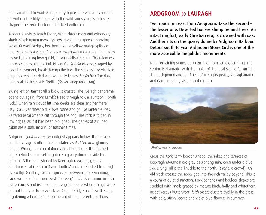
Skellig, near Ardgroom
42 43
ARDGROOM to LAURAGH
Two roads run east from Ardgroom. Take the second – the lesser one. Deserted houses slump behind trees. An intact ringfort, early Christian era, is crowned with oak. Another sits on the grassy dome by Ardgroom Harbour. Detour south to visit Ardgroom Stone Circle, one of the more accessible megalithic monuments.
Nine remaining stones up to 2m high form an elegant ring. the
setting is dramatic, with the molar of the local skellig (214m) in
the background and the finest of iveragh’s peaks, mullaghanattin
and Carrauntoohill, visible to the north.
Cross the Cork-kerry border. ahead, the rakes and terraces of
keecragh mountain are grey as slanting rain, even under a blue
sky. drung hill is the knuckle to the north. (drong, a crowd). an
old track crosses the rocky gap into the rich valley beyond. this is
a coum of quiet distinction. rock-benches and boulder-slopes are
studded with knolls graced by mature birch, holly and whitethorn.
insectivorous butterwort (leith uisce) clusters thickly in the grass,
with pale, sticky leaves and violet-blue flowers in summer.
and can afford to wait. a legendary figure, she was a healer and
a symbol of fertility linked with the wild landscape, which she
shaped. the eerie boulder is freckled with coins.
a boreen leads to lough Fadda, set in classic moorland with every
shade of sphagnum moss – yellow, russet, lime-green – hoarding
water. Grasses, sedges, heathers and the yellow-orange spikes of
bog asphodel stand out. spongy moss chokes up a wheel rut, bulges
above it, showing how quickly it can swallow ground. this relentless
process creates peat, or turf. ribs of old red sandstone, scraped by
glacial movement, break through the bog. the sinuous lake yields to
a reedy creek, freckled with water lily leaves, bacán bán. the dark
little peak to the east is skellig, (sceilg, steep rock, crag).
swing left on tarmac till a brow is crested. the iveragh panorama
opens out again, from lamb’s head through to Carrauntoohill (with
luck.) when rain clouds lift, the reeks are clear and kenmare
Bay is a silver threshold. Views come and go like lantern-slides.
serrated escarpments cut through the bog. the rock is folded in
low ridges, as if it had been ploughed. the gables of a ruined
cabin are a stark imprint of harsher times.
ardgroom (dhá dhrom, two ridges) appears below. the bravely
painted village is often mis-translated as ard Gruama, gloomy
height. wrong, both on altitude and atmosphere. the toothed
ridge behind seems set to gobble a grassy dome beside the
harbour. a theme is shared by keecragh (cíocrach, greedy),
knocknaveacal (teeth hill) and tooth mountain. Blocked from sight
by skellig, Glenbeg lake is squeezed between tooreennamna,
lackawee and Commons east. tooreen/tuairín is common in irish
place names and usually means a green place where things were
put out to dry or to bleach. Near Cappul Bridge a curlew flies up,
frightening a heron and a cormorant off in different directions.
Ringfort
44 45
a kestrel and a raven skirmish in mid air. the tawny hawk flicks
upside down; the black-plumed raven keeps its poise.
Cashelkeelty stone Circles contain massive uprights. Power lines
and forest boundaries intrude. Cashelkeelty means the stone fort
of Caoilte – one of Fionn mac Cumhail’s iron age warriors. it is far
older than that. an archaeological dig has proposed a timeline of
6,000 years. downhill, two deer – a fallow doe and fawn, white
rumps outlined in black – graze in a hollow among drifts of daisy-
like mayweed.
Continue east to join the loop road towards lauragh (láithreach,
site or location). derreen house and gardens face kilmakilloge
harbour.
the english landsdowne family formerly owned up to a hundred
thousand acres in south kerry and Beara, centred on kenmare.
their summer home, derreen house in lauragh, was the heart
of the estate. the exotic gardens surrounding the house, begun
by lord landsdowne in the 1860s, are open to the public. they
are noted for subtropical specimens such as tree ferns, bamboo
groves and giant rhododendron.
LAURAGH to BONANE
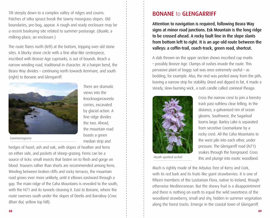
The Beara Way rises on quiet tarmac above Kilmakilloge Harbour and its mussel-farm. Though associated with earlier holy men, the area has long revered Saint Kilian as its patron. He was a 7th century martyr, popular also in Germany.
a tiny lake by Bunaw harbour in kilmakilloge was celebrated
for centuries for its floating islands, believed to have miraculous
properties. these tussocks of vegetation drew international
comment, including a 17th century latin reference from historian
Philip o’sullivan Beare in spain. the venue was intensely popular
in the 19th century, particularly for afflictions of the eye. drainage
destroyed the lake however, and little remains but a patch of
swampy ground. those who carried out the drainage died within
days, to general satisfaction.
knocknaveacal, keecragh, drung hill form the horizon behind.
sturdy knockatee (cnoc an tí, hill of the house) rears ahead. drop
into the valley past Gowlaun lough. a homely stone Circle graces
rough bogland, threatened by conifer planting. look out for a right
turn, east, at the bottom of the hill. Fields left and right of the
road contain boulder-heaps: sadly, for the itinerant antiquarian,
these are not ancient boulder-burials but modern reclamation.
Cross a stile at a bend on the r571, near tuosist. (tuath,
territory, of the uí síosta). this is o’shea country. they claim to
be descendants of the original uí síosta. the o’sullivans also had
a stronghold in this area, the ruined ardea Castle overlooking
kenmare Bay. donal Cam o’sullivan Beare was in ardea in June
1602, waiting for spanish assistance, when his own castle at
dunboy was destroyed by Crown forces and all its occupants
killed. his failure to come to their rescue is held against him.
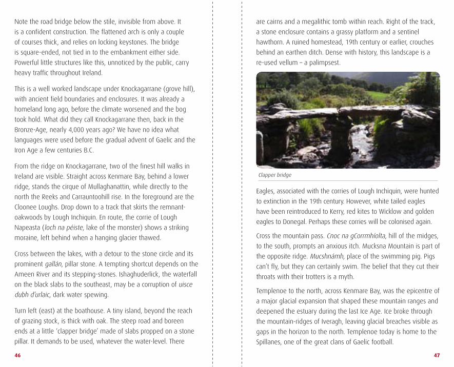
Clapper bridge
46 47
Note the road bridge below the stile, invisible from above. it
is a confident construction. the flattened arch is only a couple
of courses thick, and relies on locking keystones. the bridge
is square-ended, not tied in to the embankment either side.
Powerful little structures like this, unnoticed by the public, carry
heavy traffic throughout ireland.
this is a well worked landscape under knockagarrane (grove hill),
with ancient field boundaries and enclosures. it was already a
homeland long ago, before the climate worsened and the bog
took hold. what did they call knockagarrane then, back in the
Bronze-age, nearly 4,000 years ago? we have no idea what
languages were used before the gradual advent of Gaelic and the
iron age a few centuries B.C.
From the ridge on knockagarrane, two of the finest hill walks in
ireland are visible. straight across kenmare Bay, behind a lower
ridge, stands the cirque of mullaghanattin, while directly to the
north the reeks and Carrauntoohill rise. in the foreground are the
Cloonee loughs. drop down to a track that skirts the remnant-
oakwoods by lough inchiquin. en route, the corrie of lough
Napeasta (loch na péiste, lake of the monster) shows a striking
moraine, left behind when a hanging glacier thawed.
Cross between the lakes, with a detour to the stone circle and its
prominent gallán, pillar stone. a tempting shortcut depends on the
ameen river and its stepping-stones. ishaghuderlick, the waterfall
on the black slabs to the southeast, may be a corruption of uisce
dubh d’urlaic, dark water spewing.
turn left (east) at the boathouse. a tiny island, beyond the reach
of grazing stock, is thick with oak. the steep road and boreen
ends at a little ‘clapper bridge’ made of slabs propped on a stone
pillar. it demands to be used, whatever the water-level. there
are cairns and a megalithic tomb within reach. right of the track,
a stone enclosure contains a grassy platform and a sentinel
hawthorn. a ruined homestead, 19th century or earlier, crouches
behind an earthen ditch. dense with history, this landscape is a
re-used vellum – a palimpsest.
eagles, associated with the corries of lough inchiquin, were hunted
to extinction in the 19th century. however, white tailed eagles
have been reintroduced to kerry, red kites to wicklow and golden
eagles to donegal. Perhaps these corries will be colonised again.
Cross the mountain pass. Cnoc na gCorrmhíolta, hill of the midges,
to the south, prompts an anxious itch. mucksna mountain is part of
the opposite ridge. mucshnámh, place of the swimming pig. Pigs
can’t fly, but they can certainly swim. the belief that they cut their
throats with their trotters is a myth.
templenoe to the north, across kenmare Bay, was the epicentre of
a major glacial expansion that shaped these mountain ranges and
deepened the estuary during the last ice age. ice broke through
the mountain-ridges of iveragh, leaving glacial breaches visible as
gaps in the horizon to the north. templenoe today is home to the
spillanes, one of the great clans of Gaelic football.
Heath-spotted orchid
Cummeengeera
48 49
tilt steeply down to a complex valley of ridges and coums.
Patches of sitka spruce break the tawny moorgrass slopes. old
boundaries, pre-bog, appear. a rough and ready enclosure may be
a recent booleying-site related to summer pasturage. (Buaile, a
milking-place; an enclosure.)
the route flares north (left) at the bottom, tripping over old stone
sites. a blocky stone circle with a fine altar-like centrepiece,
inscribed with Bronze age cupmarks, is out of bounds. reach a
narrow winding road, traditional in character. at a hairpin bend, the
Beara way divides – continuing north towards kenmare, and south
(right) to Bonane and Glengarriff.
there are dramatic
views into the
knocknagorraveela
corries, excavated
by glacial action. a
fine ridge divides
the two. ahead,
the mountain road
boasts a green
median strip and
hedges of hazel, ash and oak, with slopes of heather and ferns
on either side, and pockets of sheep-grazing. Ferns can be a
source of ticks: small insects that fasten on to flesh and gorge on
blood. trousers rather than shorts are recommended among ferns.
winding between broken cliffs and rocky terraces, the mountain
road grows ever more unlikely, until it elbows eastward through a
gap. the main ridge of the Caha mountains is revealed to the south,
with the N71 and its tunnels cleaving it. east to Bonane, where the
route swerves south under the slopes of deelis and Barraboy (Cnoc
Bharr Buí, yellow top hill).
BONANE to GLENGARRIFF
Attention to navigation is required, following Beara Way signs at minor road junctions. Esk Mountain is the long ridge to be crossed ahead. A rocky fault line in the slope slants from bottom left to right. It is an age-old route between the valleys: a coffin-trail, coach-track, green road, shortcut.
a slab thrown on the upper section shows inscribed cup marks
– possibly Bronze age. Clumps of rushes invade the route. this
pervasive plant of boggy soil was once extremely useful – as
bedding, for example. also, the rind was peeled away from the pith,
leaving a narrow strip for stability. dried and dipped in fat, it made a
steady, slow-burning wick, a rush candle called coinneal fheaga.
Cross the narrow crest to join a forestry
track past ruthless clear felling. in the
distance, a galvanised rim of ocean
gleams. southwest, the sugarloaf
looms large. Barley lake is separated
from secretive Coomarkane by a
rocky crest. all the Caha mountains to
the west pile into each other, under
pressure. the Glengarriff road (N71)
snakes through the foreground. Cross
this and plunge into exotic woodland.
much is rightly made of the arbutus tree of kerry and Cork,
with its red bark and its fruits like giant strawberries. it is one of
fifteen members of the lusitanian Flora, native to ireland, though
otherwise mediterranean. But the showy fruit is a disappointment
and there is nothing on earth to equal the wild sweetness of the
woodland strawberry, small and shy, hidden in summer vegetation
along the forest tracks. emerge in the coastal town of Glengarriff.