Bayerisches Landesamt für Umwelt 3D MODELLING AT THE BAVARIAN STATE GEOLOGICAL SURVEY – EXAMPLES...
31
Bayerisches Landesamt für Umwelt 3D MODELLING AT THE BAVARIAN STATE GEOLOGICAL SURVEY – EXAMPLES FOR COOPERATION TOWARDS 3D STANDARDS G.W. Diepolder G.W. Diepolder Bavarian Environment Agency Bavarian Environment Agency Geological Survey Geological Survey GSA2011 – Three-Dimensional Geologic Mapping
-
Upload
kerry-gibbs -
Category
Documents
-
view
231 -
download
11
Transcript of Bayerisches Landesamt für Umwelt 3D MODELLING AT THE BAVARIAN STATE GEOLOGICAL SURVEY – EXAMPLES...

Bayerisches Landesamt fürUmwelt
3D MODELLING AT THE BAVARIAN STATE GEOLOGICAL SURVEY – EXAMPLES FOR COOPERATION
TOWARDS 3D STANDARDS
G.W. DiepolderG.W. Diepolder
Bavarian Environment AgencyBavarian Environment AgencyGeological SurveyGeological Survey
GSA2011 – Three-Dimensional Geologic Mapping
© LfU - Geological Survey, G.W. Diepolder (2011)
3D Modelling at the Bavarian State Geological Survey Examples for Cooperation Towards 3D Standards
Bayerisches Landesamt fürUmwelt
Why need for cooperation ? – History and current situation How ? – Internal "cooperation" – Interstate and federal cooperation
– Project-based international cooperation
– Influencing university R&D What's done and what's next ? – Summary and outlook
OUTLINE:
© LfU - Geological Survey, G.W. Diepolder (2011)
3D Modelling at the Bavarian State Geological Survey Examples for Cooperation Towards 3D Standards
Bayerisches Landesamt fürUmwelt
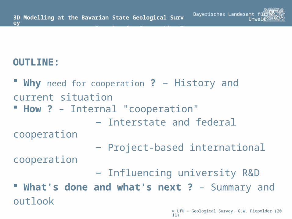
Federal organisation of Germany16 independent GSOs + 2 federal institutes (BGR, LIAG)
The Bavarian Geological Survey
is part of the Environment Agency (LfU), is neutral advisor to the state government regarding all geological issues, employs a staff of ~ 110, covers an area of ~ 70,000 km2
medium-sized GSO
© LfU - Geological Survey, G.W. Diepolder (2011)
3D Modelling at the Bavarian State Geological Survey: Background and History
Bayerisches Landesamt fürUmwelt
The Bavarian Geological Survey
for more than 150 years produced geological maps and cross-sections, thus flat-ironing the 3-dimensional concepts in the mind of the geologists. Since 1995 map production is fully digital and GIS based, but still a 2- or 2.5-dimensional issue neglecting a lot of structures and architectures of geology. Prior to improvements in visualization hardware in the 1990's it was almost impossible to capture the geologist’s visions, concepts and understanding of underlying geological processes.
© LfU - Geological Survey, G.W. Diepolder (2011)
3D Modelling at the Bavarian State Geological Survey: The Beginning
Bayerisches Landesamt fürUmwelt
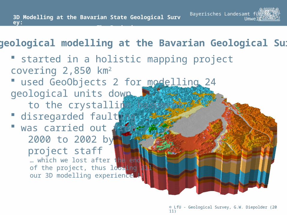
3D geological modelling at the Bavarian Geological Survey
started in a holistic mapping project covering 2,850 km2
used GeoObjects 2 for modelling 24 geological units down to the crystalline basement disregarded faulting was carried out from 2000 to 2002 by project staff … which we lost after the end of the project, thus loosing all our 3D modelling experience !!
© LfU - Geological Survey, G.W. Diepolder (2011)
3D Modelling at the Bavarian State Geological Survey: The Past
Bayerisches Landesamt fürUmwelt
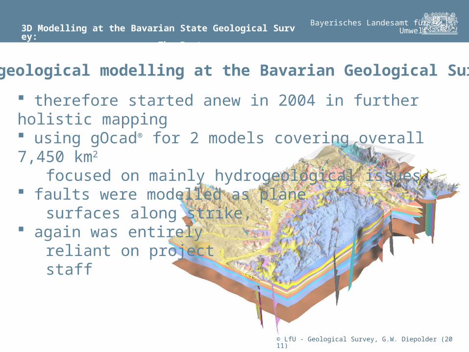
3D geological modelling at the Bavarian Geological Survey
therefore started anew in 2004 in further holistic mapping using gOcad® for 2 models covering overall 7,450 km2
focused on mainly hydrogeological issues, faults were modelled as plane surfaces along strike, again was entirely reliant on project staff

© LfU - Geological Survey, G.W. Diepolder (2011)
3D Modelling at the Bavarian State Geological Survey: The Past and Present
Bayerisches Landesamt fürUmwelt
Increased need for green energy, in particular the exploitation of hydrothermal energy, gave a major boost to the3D geological modelling at the Bavarian Geological Survey
Volume grid of the UpperJurassic aquifer underneath the Molasse basin within the outlines of Bavaria, gridded with the temperature field derived from borehole measurements (from Pamer & Diepolder 2010)
The Upper Jurassic karstified lime-stone aquifer of the Alpine foreland basin (Molasse basin), reaching down to > 5000 m, is the most important and exploitable heat reservoir in central Europe
AABB
AA
BB
© LfU - Geological Survey, G.W. Diepolder (2011)
3D Modelling at the Bavarian State Geological Survey: The Past and Present
Bayerisches Landesamt fürUmwelt
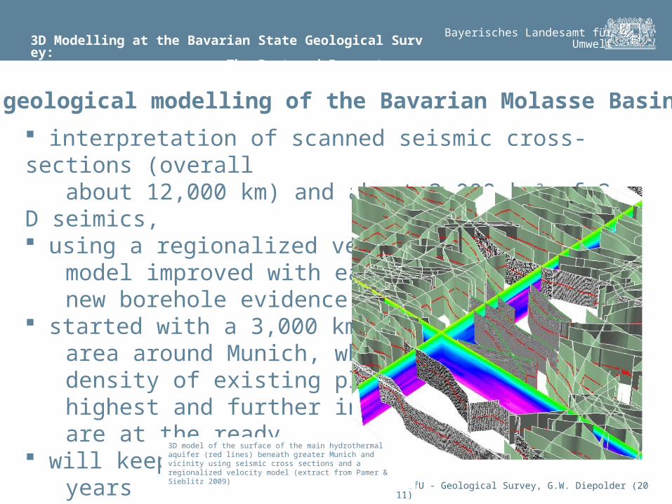
3D geological modelling of the Bavarian Molasse Basin
interpretation of scanned seismic cross-sections (overall about 12,000 km) and about 3,000 km2 of 3-D seimics, using a regionalized velocity model improved with each new borehole evidence, started with a 3,000 km2 large area around Munich, where density of existing plants is highest and further investors are at the ready will keep us busy the next years
3D model of the surface of the main hydrothermal aquifer (red lines) beneath greater Munich and vicinity using seismic cross sections and a regionalized velocity model (extract from Pamer & Sieblitz 2009)
© LfU - Geological Survey, G.W. Diepolder (2011)
3D Modelling at the Bavarian State Geological Survey: Current Situation
Bayerisches Landesamt fürUmwelt
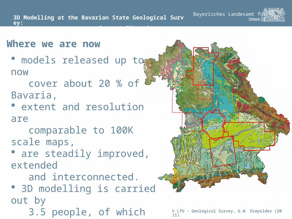
models released up to now cover about 20 % of Bavaria, extent and resolution are comparable to 100K scale maps, are steadily improved, extended and interconnected. 3D modelling is carried out by 3.5 people, of which only one is in a permanent position.
impossible to meet the challenges of the future: The subsurface issues of the "energy turnaround"
Where we are now
© LfU - Geological Survey, G.W. Diepolder (2011)
3D Modelling at the Bavarian State Geological Survey: Preparing for the New Challenges
Bayerisches Landesamt fürUmwelt
internally: spread 3D modelling among more of our staffers integration of field geologists into the model building processes interstate & federal collaboration for exchange of information, sharing best practice, and standardization of data and data access joint cross-border 3D modelling trans-national projects on shared geological structures fostering university research and development on data management and interoperability of 3D modelling issues
Need of cooperation on different levels

© LfU - Geological Survey, G.W. Diepolder (2011)
3D Modelling at the Bavarian State Geological Survey: Preparing for the New Challenges
Bayerisches Landesamt fürUmwelt
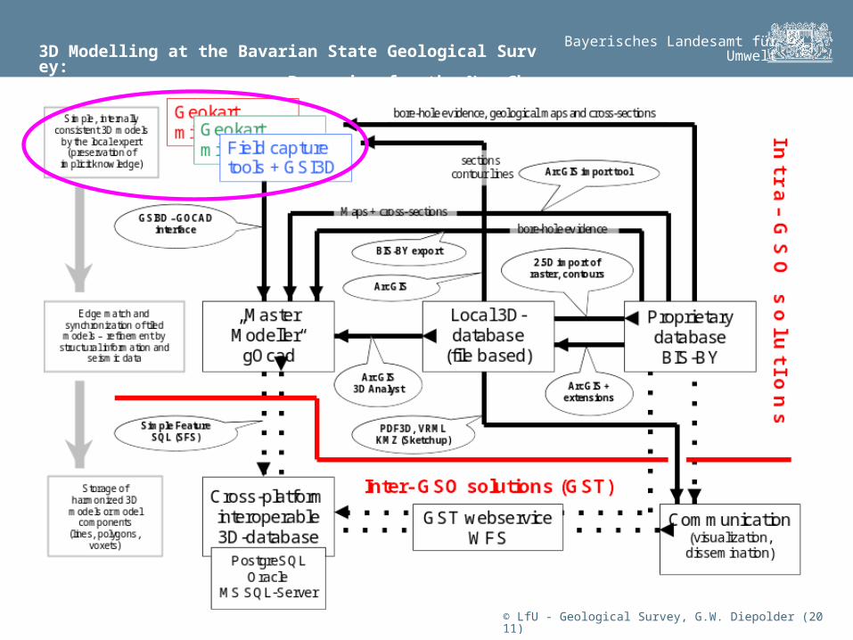
internally: spread 3D modelling among more of our staffers integration of field geologists into the model building processes by standardized workflows
Cooperation on different levels
Geology is inherently 3D. 3D models emerge from the imagination in the heads of geoscientists when working in an area. This implicit knowledge has to be made explicit and thus available to the organisation and the public. Crucial when suffering a permanent staff turnover due to fixed-term contracts.
© LfU - Geological Survey, G.W. Diepolder (2011)
3D Modelling at the Bavarian State Geological Survey: Preparing for the New Challenges
Bayerisches Landesamt fürUmwelt
© LfU - Geological Survey, G.W. Diepolder (2011)
3D Modelling at the Bavarian State Geological Survey: Interstate & Federal Collaboration
Bayerisches Landesamt fürUmwelt
internally: spread 3D modelling among more of our staffers integration of field geologists into the model building processes interstate & federal collaboration for exchange of information, sharing best practice, and standardization of data and data access joint cross-border 3D modelling trans-national projects on shared geological structures fostering university research and development on data management and interoperability of 3D modelling issues
Cooperation on different levels
© LfU - Geological Survey, G.W. Diepolder (2011)
3D Modelling at the Bavarian State Geological Survey: Interstate & Federal Collaboration
Bayerisches Landesamt fürUmwelt
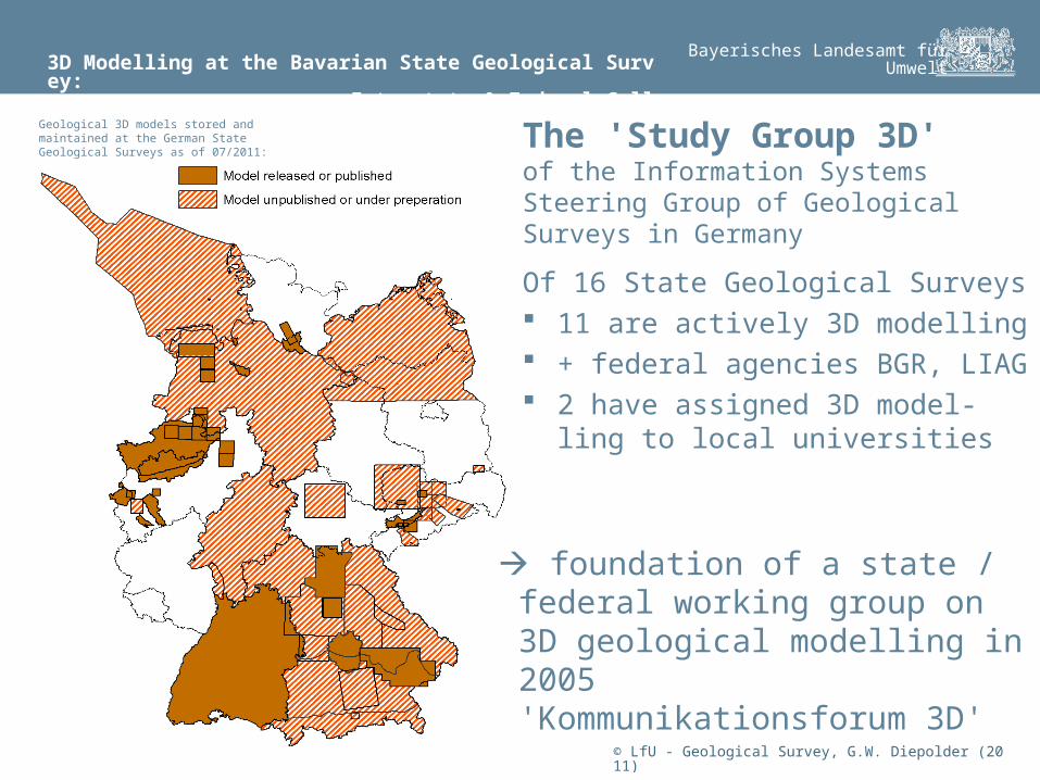
Geological 3D models stored and maintained at the German State Geological Surveys as of 07/2011:
The 'Study Group 3D'of the Information Systems Steering Group of Geological Surveys in Germany
Of 16 State Geological Surveys 11 are actively 3D modelling + federal agencies BGR, LIAG 2 have assigned 3D model-
ling to local universities
foundation of a state / federal working group on 3D geological modelling in 2005'Kommunikationsforum 3D'
© LfU - Geological Survey, G.W. Diepolder (2011)
3D Modelling at the Bavarian State Geological Survey: Interstate & Federal Collaboration
Bayerisches Landesamt fürUmwelt
is the communication platform for all 3D modelling activities of the GSOs in Germany stirs and coordinates commissions for R&D services and the exchange of proprietary developments in line with the 'Kiel Agreement' works on the semantic harmonization of technical terms, the standardization of model descriptions and data access for geological 3D models regularly meets twice per year and documents its activities in www.infogeo.de brings people together for networking and fosters collaboration by organizing workshops
The 'Study Group 3D' of the Information Systems Steering Group of Geological Surveys in Germany
© LfU - Geological Survey, G.W. Diepolder (2011)
3D Modelling at the Bavarian State Geological Survey: Interstate & Federal Collaboration
Bayerisches Landesamt fürUmwelt
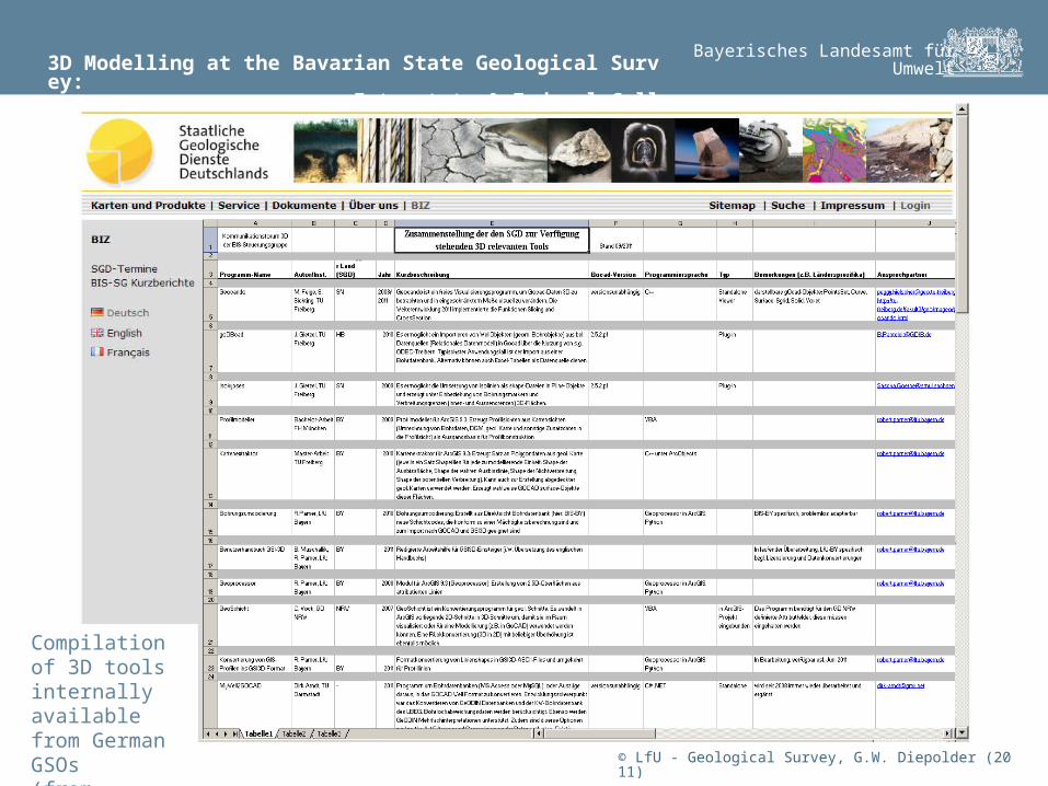
Compilation of 3D tools internally available from German GSOs(from infogeo.de)
© LfU - Geological Survey, G.W. Diepolder (2011)
3D Modelling at the Bavarian State Geological Survey: Cross-border 3D Modelling Projects: GeoMol
Bayerisches Landesamt fürUmwelt
internally: spread 3D modelling among more of our staffers integration of field geologists into the model building processes interstate & federal collaboration for exchange of information, sharing best practice, and standardization of data and data access joint cross-border 3D modelling trans-national projects on shared geological structures fostering university research and development on data management and interoperability of 3D modelling issues
Cooperation on different levels
© LfU - Geological Survey, G.W. Diepolder (2011)
3D Modelling at the Bavarian State Geological Survey: Cross-border 3D Modelling Projects: GeoMol
Bayerisches Landesamt fürUmwelt
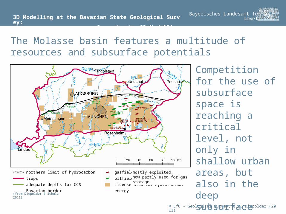
The Molasse basin features a multitude of resources and subsurface potentials
Competition for the use of subsurface space is reaching a critical level, not only in shallow urban areas, but also in the deep subsurface
northern limit of hydrocarbon traps
adequate depths for CCS
Bavarian border
gasfield
oilfield
license area for hydrothermal energy
mostly exploited, now partly used for gas storage
(from Diepolder & Schulz 2011)
© LfU - Geological Survey, G.W. Diepolder (2011)
3D Modelling at the Bavarian State Geological Survey: Cross-border 3D Modelling Projects: GeoMol
Bayerisches Landesamt fürUmwelt
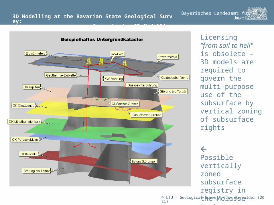
Possible vertically zoned subsurface registry in the Molasse basin
Licensing "from soil to hell" is obsolete – 3D models are required to govern the multi-purpose use of the subsurface by vertical zoning of subsurface rights

© LfU - Geological Survey, G.W. Diepolder (2011)
3D Modelling at the Bavarian State Geological Survey: Cross-border 3D Modelling Projects: GeoMol
Bayerisches Landesamt fürUmwelt
Geology and the resources and risks connected with it do not respect political boundaries. Thus we have to work trans-nationally.
Area of projected 3D model of the entire peri-alpine Molasse basin and underlying units (~ 60,000 km2 ~ 45 % in Bavaria - 1100 km SW-NEup to 140 km N-S) and data available in the Bavarian part ↓↓
© LfU - Geological Survey, G.W. Diepolder (2011)
3D Modelling at the Bavarian State Geological Survey: Cross-border 3D Modelling Projects: GeoMol
Bayerisches Landesamt fürUmwelt
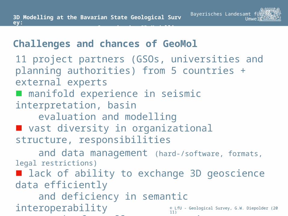
11 project partners (GSOs, universities and planning authorities) from 5 countries + external experts manifold experience in seismic interpretation, basin evaluation and modelling vast diversity in organizational structure, responsibilities and data management (hard-/software, formats, legal restrictions)
lack of ability to exchange 3D geoscience data efficiently and deficiency in semantic interoperability network of excellence attracting universities to participate inclusion of university research and development
Challenges and chances of GeoMol
© LfU - Geological Survey, G.W. Diepolder (2011)
3D Modelling at the Bavarian State Geological Survey: Fostering and Influencing University R&D
Bayerisches Landesamt fürUmwelt
internally: spread 3D modelling among more of our staffers integration of field geologists into the model building processes interstate & federal collaboration for exchange of information, sharing best practice, and standardization of data and data access joint cross-border 3D modelling trans-national projects on shared geological structures fostering university research and development on data management and interoperability of 3D modelling issues
Cooperation on different levels

© LfU - Geological Survey, G.W. Diepolder (2011)
3D Modelling at the Bavarian State Geological Survey: Fostering and Influencing University R&D
Bayerisches Landesamt fürUmwelt
© LfU - Geological Survey, G.W. Diepolder (2011)
Developments of the TU Mining Academy Freiberg: GST - a Networkbased Datastore for Spatial Geoscience Data
Bayerisches Landesamt fürUmwelt
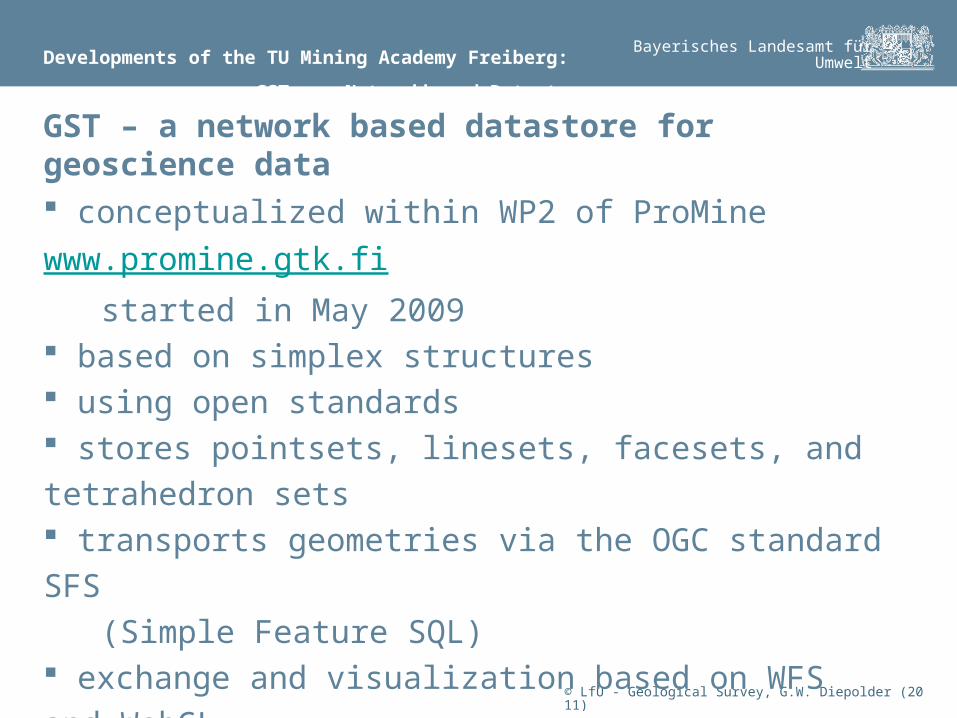
conceptualized within WP2 of ProMine www.promine.gtk.fi
started in May 2009 based on simplex structures using open standards stores pointsets, linesets, facesets, and tetrahedron sets transports geometries via the OGC standard SFS
(Simple Feature SQL) exchange and visualization based on WFS and WebGL
more info on GST: http://tu-freiberg.de/fakult3/IS4GEO/
GST – a network based datastore for geoscience data
© LfU - Geological Survey, G.W. Diepolder (2011)
Developments of the TU Mining Academy Freiberg: GST - a Networkbased Datastore for Spatial Geoscience Data
Bayerisches Landesamt fürUmwelt
© LfU - Geological Survey, G.W. Diepolder (2011)
Developments of the TU Mining Academy Freiberg: GST - a Networkbased Datastore for Spatial Geoscience Data
Bayerisches Landesamt fürUmwelt
© LfU - Geological Survey, G.W. Diepolder (2011)
Developments of the TU Mining Academy Freiberg: GST - a Networkbased Datastore for Spatial Geoscience Data
Bayerisches Landesamt fürUmwelt
successful prototypical implementation in March 2011 announcement on the OGC 3D Summit in Boulder, CO on
2011-09-20 first WebGL based visual analyses of 3D geomodells in
September 2011 demonstration workshop for major European GSOs in
Freiberg, Saxony on 2011-10-25
more info on GST: http://tu-freiberg.de/fakult3/IS4GEO/
Milestones of GST development
© LfU - Geological Survey, G.W. Diepolder (2011)
Developments of the TU Mining Academy Freiberg: The Role of German GSOs in Development of GST
Bayerisches Landesamt fürUmwelt
determination of specific needs and technical demands,
coordinated by the Study Group 3D supply of 'real' 3D geological models for implementation
in different test beds joint specification of a geo-data model for 3D models
based on GeoSciML and BoreholeML (and INSPIRE) commissions for customization of individual data bases integration of the GST developer team into GeoMol as a
'full' project partner
The role of German GSOs in development of GST
© LfU - Geological Survey, G.W. Diepolder (2011)
3D Modelling at the Bavarian State Geological Survey: Examples for Cooperation Towards 3D Standards
Bayerisches Landesamt fürUmwelt
In a medium sized GSO challenges of a complex and
continuously evolving technology such as 3D modelling
can not be solved alone. Cooperation on different levels helps to match up to
conceptual and technical advancements of 3D modelling. Cooperation on conceptual and technical issues helps to
define standardized processes and products and thus
ensures mutual benefit.
Summary
© LfU - Geological Survey, G.W. Diepolder (2011)
3D Modelling at the Bavarian State Geological Survey: Examples for Cooperation Towards 3D Standards
Bayerisches Landesamt fürUmwelt
The Study Group 3D will continue in standardization of
processes and products, eventually leading to a common
3D data model Application for EU grants for GeoMol in January 2012
implementation of the project from 2013 to 2015 Continuation and expansion of transnational networking
for a joint 3D Molasse model even if funding application fails enhanced participation of the Study Group 3D in testing and
implementation of GST
Outlook
© LfU - Geological Survey, G.W. Diepolder (2011)
3D Modelling at the Bavarian State Geological Survey: Examples for Cooperation Towards 3D Standards
Bayerisches Landesamt fürUmwelt