Bass Coast Walks and Trailsvisitbasscoast.com.au/.../2017_11_13_bass_coast_walks_71lq.pdf · Bass...
21
Walks and Trails
Transcript of Bass Coast Walks and Trailsvisitbasscoast.com.au/.../2017_11_13_bass_coast_walks_71lq.pdf · Bass...

Walks and Trails
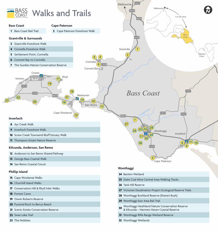
Rhyll
San Remo
Corinella
Grantville
Newhaven
Ventnor
Coronet Bay
Cape Woolamai
Cape Paterson
Cowes
WonthaggiInverloch
B460
A420
A440
B420
C435
C432
C437
C431
C441
C473
C434
C478
C436
M420
C437
6
5 43
7
109
8
2
14 12
28
26
24
27
31
32
30
29
25
1
2322 21
20
19
18
17
16
15
13
11
Powle
tt River
BassRiv
er
Melbourne
10 0 105 km
Bass Coast
Melbourne
BassCoast
WilsonsProm
1 hr 30 minsWalks and Trails
Wonthaggi
24 Baxters Wetland
25 State Coal Mine Central Area Walking Tracks
26 Tank Hill Reserve
27 Victorian Desalination Project Ecological Reserve Trails
28 Wonthaggi Bushland Reserve (Shane’s Bush)
29 Wonthaggi East Area Rail Trail
30 Wonthaggi Heathland Nature Conservation Reserve & Kilcunda – Harmers Haven Coastal Reserve
31 Wonthaggi Rifle Range Wetland Reserve
32 Wonthaggi Wetlands
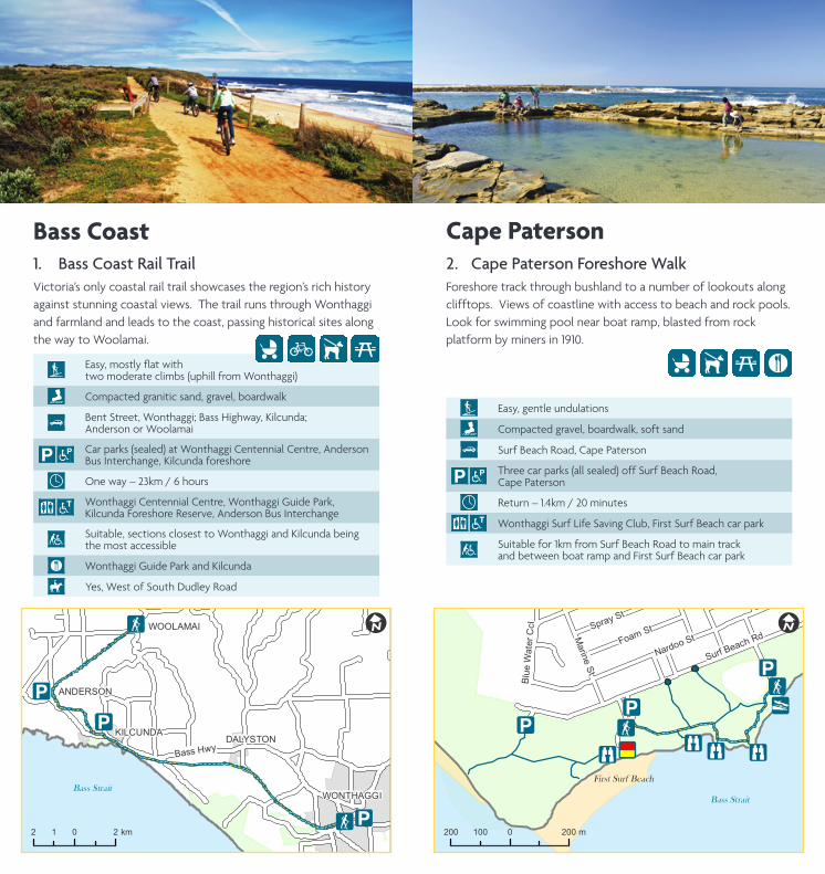
Cape Paterson
2 Cape Paterson Foreshore Walk
Inverloch
8 Ayr Creek Walk
9 Inverloch Foreshore Walk
10 Screw Creek Townsend Bluff Estuary Walk
11 Thompson Estate Nature Reserve
Phillip Island
15 Cape Woolamai Walks
16 Churchill Island Walks
17 Conservation Hill & Rhyll Inlet Walks
18 Forrest Caves
19 Oswin Roberts Reserve
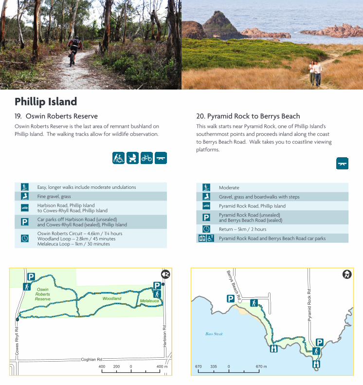
20 Pyramid Rock to Berrys Beach
21 Scenic Estate Conservation Reserve
22 Swan Lake Trail
23 The Nobbies
Kilcunda, Anderson, San Remo
12 Anderson to San Remo Shared Pathway
13 George Bass Coastal Walk
14 San Remo Coastal Circuit
Grantville & Surrounds
3 Grantville Foreshore Walk
4 Corinella Foreshore Walk
5 Settlement Point, Corinella
6 Coronet Bay to Corinella
7 The Gurdies Nature Conservation Reserve
Bass Coast
1 Bass Coast Rail Trail
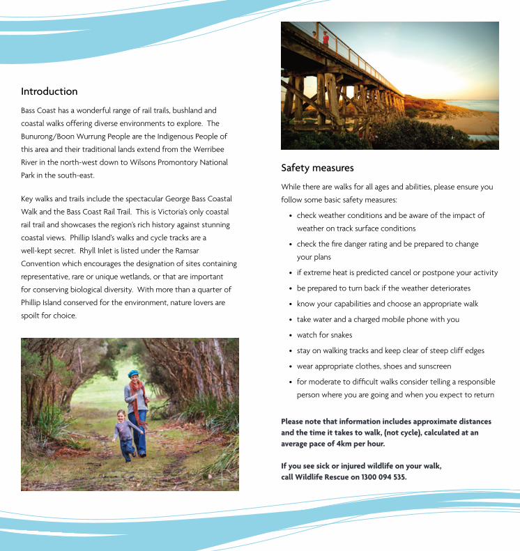
Introduction
Bass Coast has a wonderful range of rail trails, bushland and
coastal walks offering diverse environments to explore. The
Bunurong/Boon Wurrung People are the Indigenous People of
this area and their traditional lands extend from the Werribee
River in the north-west down to Wilsons Promontory National
Park in the south-east.
Key walks and trails include the spectacular George Bass Coastal
Walk and the Bass Coast Rail Trail. This is Victoria’s only coastal
rail trail and showcases the region’s rich history against stunning
coastal views. Phillip Island’s walks and cycle tracks are a
well-kept secret. Rhyll Inlet is listed under the Ramsar
Convention which encourages the designation of sites containing
representative, rare or unique wetlands, or that are important
for conserving biological diversity. With more than a quarter of
Phillip Island conserved for the environment, nature lovers are
spoilt for choice.
Safety measures
While there are walks for all ages and abilities, please ensure you
follow some basic safety measures:
• check weather conditions and be aware of the impact of
weather on track surface conditions
• checkthefiredangerratingandbepreparedtochange
your plans
• if extreme heat is predicted cancel or postpone your activity
• be prepared to turn back if the weather deteriorates
• know your capabilities and choose an appropriate walk
• take water and a charged mobile phone with you
• watch for snakes
• stay on walking tracks and keep clear of steep cliff edges
• wear appropriate clothes, shoes and sunscreen
• formoderatetodifficultwalksconsidertellingaresponsible
person where you are going and when you expect to return
Please note that information includes approximate distances and the time it takes to walk, (not cycle), calculated at an average pace of 4km per hour.
If you see sick or injured wildlife on your walk, call Wildlife Rescue on 1300 094 535.
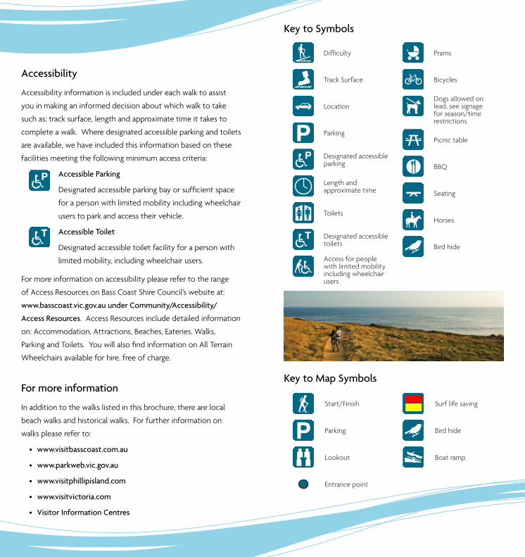
Difficulty
Track Surface
Location
i Parking
Designated accessible parking
Length and approximate time
_ Toilets
Designated accessible toilets
Access for people with limited mobility including wheelchair users
Prams
G Bicycles
ÍDogs allowed on lead, see signage for season/time restrictions
5 Picnic table
´ BBQ
Seating
È Horses
Æ Bird hide
Key to Map Symbols
F Start/Finish
i Parking
[ Lookout
Entrance point
Surf life saving
Æ Bird hide
y Boat ramp
For more information
In addition to the walks listed in this brochure, there are local
beach walks and historical walks. For further information on
walks please refer to:
• www.visitbasscoast.com.au
• www.parkweb.vic.gov.au
• www.visitphillipisland.com
• www.visitvictoria.com
• Visitor Information Centres
Accessibility
Accessibility information is included under each walk to assist
you in making an informed decision about which walk to take
such as: track surface, length and approximate time it takes to
complete a walk. Where designated accessible parking and toilets
are available, we have included this information based on these
facilities meeting the following minimum access criteria:
Accessible Parking
Designatedaccessibleparkingbayorsufficientspace
for a person with limited mobility including wheelchair
users to park and access their vehicle.
Accessible Toilet
Designated accessible toilet facility for a person with
limited mobility, including wheelchair users.
For more information on accessibility please refer to the range
of Access Resources on Bass Coast Shire Council’s website at:
www.basscoast.vic.gov.au under Community/Accessibility/
Access Resources. Access Resources include detailed information
on: Accommodation, Attractions, Beaches, Eateries, Walks,
ParkingandToilets.YouwillalsofindinformationonAllTerrain
Wheelchairs available for hire, free of charge.
Key to Symbols
SAN REMO
KILCUNDADALYSTON
WONTHAGGI
WOOLAMAI
ANDERSON
!i
!i
!F
!i!F
Phillip Island Rd
Bass Hwy
!I
2 0 21 km
Bass Strait
1. Bass Coast Rail TrailVictoria’s only coastal rail trail showcases the region’s rich history against stunning coastal views. The trail runs through Wonthaggi and farmland and leads to the coast, passing historical sites along the way to Woolamai.
Easy,mostlyflatwith two moderate climbs (uphill from Wonthaggi)
Compacted granitic sand, gravel, boardwalk
Bent Street, Wonthaggi; Bass Highway, Kilcunda; Anderson or Woolamai
iCar parks (sealed) at Wonthaggi Centennial Centre, Anderson Bus Interchange, Kilcunda foreshore
One way – 23km / 6 hours
_Wonthaggi Centennial Centre, Wonthaggi Guide Park, Kilcunda Foreshore Reserve, Anderson Bus Interchange
Suitable, sections closest to Wonthaggi and Kilcunda being the most accessible
´ Wonthaggi Guide Park and Kilcunda
È Yes, West of South Dudley Road
Bass Coast
5G Í
2. Cape Paterson Foreshore WalkForeshore track through bushland to a number of lookouts along clifftops. Views of coastline with access to beach and rock pools. Look for swimming pool near boat ramp, blasted from rock platform by miners in 1910.
Easy, gentle undulations
Compacted gravel, boardwalk, soft sand
Surf Beach Road, Cape Paterson
iThree car parks (all sealed) off Surf Beach Road, Cape Paterson
Return – 1.4km / 20 minutes
_ Wonthaggi Surf Life Saving Club, First Surf Beach car park
Suitable for 1km from Surf Beach Road to main track and between boat ramp and First Surf Beach car park
!i
Bass Strait
!i
First Surf Beach
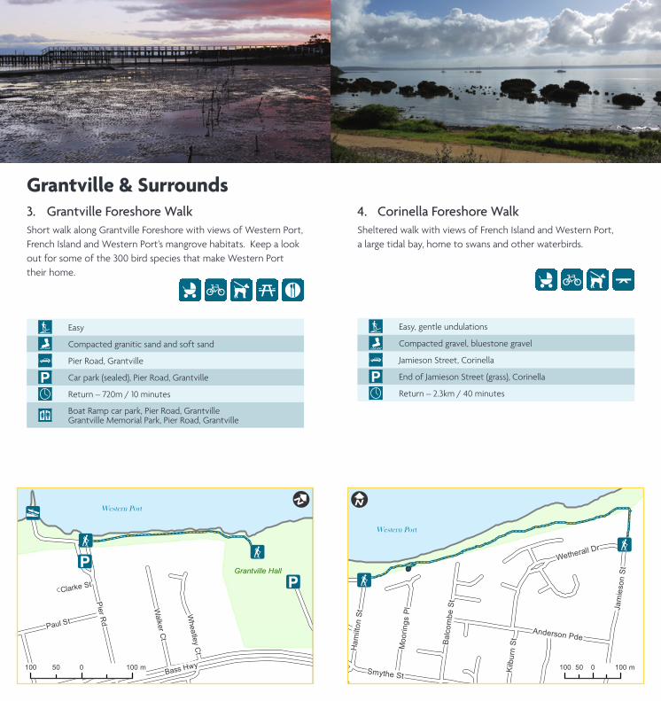
3. Grantville Foreshore WalkShort walk along Grantville Foreshore with views of Western Port, French Island and Western Port’s mangrove habitats. Keep a look out for some of the 300 bird species that make Western Port their home.
Easy
Compacted granitic sand and soft sand
Pier Road, Grantville
i Car park (sealed), Pier Road, Grantville
Return – 720m / 10 minutes
_Boat Ramp car park, Pier Road, GrantvilleGrantville Memorial Park, Pier Road, Grantville
Bass Hwy
!F!F
!i
!i
!y
Pie
r Rd
Paul St
Walk
er C
t
Whea
tley C
t
Clarke St
!I
100 0 10050 m
Grantville Hall
Western Port
Grantville & Surrounds
G ´5Í
4. Corinella Foreshore WalkSheltered walk with views of French Island and Western Port, a large tidal bay, home to swans and other waterbirds.
Easy, gentle undulations
Compacted gravel, bluestone gravel
Jamieson Street, Corinella
i End of Jamieson Street (grass), Corinella
Return – 2.3km / 40 minutes
!F
!F
!F
!F
Smythe St
Ja
mie
so
n S
t
Anderson Pde
Ba
lco
mb
e S
t
Kilb
urn
St
Wetherall Dr
Ha
milto
n S
t
Mo
ori
ng
s P
l
!I
100 0 10050 m
Western Port
ÍG

5. Settlement Point, CorinellaWalk takes you through native vegetation to lookout with views of French Island, Western Port cliffs, mangroves, seagrasses and melaleucas.
Easy
Compacted granitic sand, soil, grass
Settlement Point, Smythe Street, Corinella
i Car park (unsealed), Smythe Street, Corinella
Return – 850m / 15 minutes
Main track suitable (except in wet weather)
!F
!y
!F
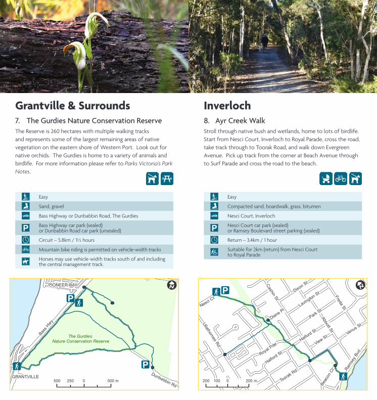
7. The Gurdies Nature Conservation ReserveThe Reserve is 260 hectares with multiple walking tracks and represents some of the largest remaining areas of native vegetation on the eastern shore of Western Port. Look out for native orchids. The Gurdies is home to a variety of animals and birdlife. For more information please refer to Parks Victoria’s Park Notes.
Easy
Sand, gravel
Bass Highway or Dunbabbin Road, The Gurdies
iBass Highway car park (sealed) or Dunbabbin Road car park (unsealed)
Circuit – 5.8km / 1½ hours
G Mountain bike riding is permitted on vehicle-width tracks
ÈHorses may use vehicle-width tracks south of and including the central management track.
!i
!F!i
!F
Bass H
wy
Dunbabbin Rd
!I
500 0 500250 m
The Gurdies Nature Conservation Reserve
PIONEER BAY
GRANTVILLE
Í5
8. Ayr Creek WalkStroll through native bush and wetlands, home to lots of birdlife. Start from Nesci Court, Inverloch to Royal Parade, cross the road, take track through to Toorak Road, and walk down Evergreen Avenue. Pick up track from the corner at Beach Avenue through to Surf Parade and cross the road to the beach.
Easy
Compacted sand, boardwalk, grass, bitumen
Nesci Court, Inverloch
iNesci Court car park (sealed) or Ramsey Boulevard street parking (sealed)
Return – 3.4km / 1 hour
Suitable for 2km (return) from Nesci Court to Royal Parade
Toora
k Rd
Beacon C
t
!i
!F
!F
!i
!i
Cashin
St
Abbott S
t
Halfo
rd S
t
Royal P
de
Fre
da S
t
Park
St
Dix
on St
Ulla
thorn
es R
d
Bass Hwy
Lavingto
n St
Venus St
View
St
Ram
sey B
vd
Nesci
Ct
Halfo
rd S
t
Dia
ne Pl
!I
200 0 200100 m
Grantville & Surrounds
ÍG
Inverloch

9. Inverloch Foreshore WalkShared pathway with access to foreshore between Cuttriss Street and Ayr Creek bridge. Views of Anderson Inlet and Point Smythe from several vantage points. Playground, picnic area and exercise stations located along the walk. An access ramp connects the walk to the beach at Rotary Centennial Park.
Easy,reasonablyflat, moderate rise near Wyeth McNamara (Rainbow) park
Concrete
Ramsey Boulevard, Inverloch and The Esplanade, Inverloch
iCar parks (sealed) in Ramsey Boulevard at Rotary Centennial Park and Wyeth McNamara (Rainbow) Park, and on The Esplanade at Inverloch Jetty and next to the Angling Club
Return – 5km / 1½ hours
_Bunurong Environment Centre, Ramsey Boulevard Rotary Centennial Park, Ramsey BoulevardThe Angling Club, The Esplanade near Cuttriss Street
´ Rotary Centennial Park, Rainbow Park
A'Beckett St
!i
!i
!F
!F
!i
!i !y
Inverloch Pde
Bass Hwy
Ram
sey B
vd
Abbott S
tVenus St
Fre
da
St
The Espla
nade
Sandy M
ount A
v
Pie
r Rd
Willia
ms S
t
!I
400 0 400200 m
Anderson Inlet
5´G Í
10. Screw Creek Townsend Bluff Estuary WalkScenic trail over boardwalks and saltmarsh over Screw Creek and up to Townsend Bluff which has views over Anderson Inlet. The track splits after the bridge at Screw Creek, the left track continuesontofishingplatformsandtherighttrackwindsuptothe lookout at Townsend Bluff.
Easy
Soft sand, compacted gravel, boardwalks and steps
Foreshore Camping Reserve Road, a continuation of The Esplanade, Inverloch
iCar park (unsealed) at the end of the Foreshore Camping Reserve
Return – 2km / 30 minutes
First part of the walk only due to soft sand before boardwalk
Screw Creek
!F!i!F
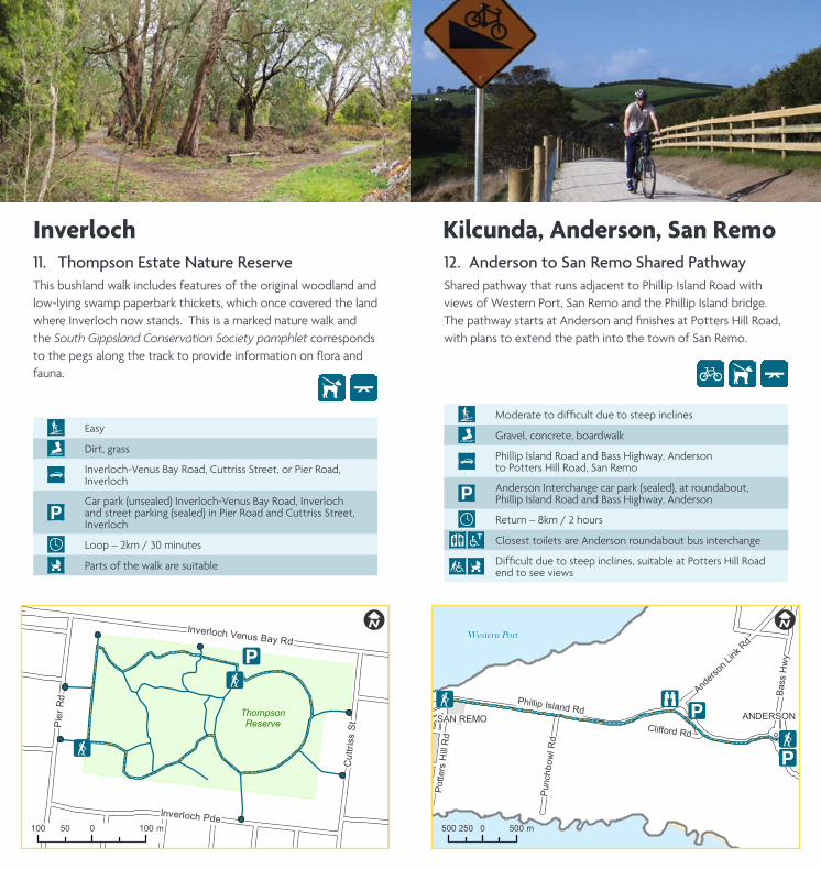
11. Thompson Estate Nature ReserveThis bushland walk includes features of the original woodland and low-lying swamp paperbark thickets, which once covered the land where Inverloch now stands. This is a marked nature walk and the South Gippsland Conservation Society pamphlet corresponds tothepegsalongthetracktoprovideinformationonfloraandfauna.
Easy
Dirt, grass
Inverloch-Venus Bay Road, Cuttriss Street, or Pier Road, Inverloch
iCar park (unsealed) Inverloch-Venus Bay Road, Inverloch and street parking (sealed) in Pier Road and Cuttriss Street, Inverloch
Loop – 2km / 30 minutes
Parts of the walk are suitable
ThompsonReserve
!F
!i
!F
Pie
r Rd
Cut
triss
St
Inverloch Pde
Inverloch Venus Bay Rd
Pym
ble
Av
!I
100 0 10050 m
Í
12. Anderson to San Remo Shared PathwayShared pathway that runs adjacent to Phillip Island Road with views of Western Port, San Remo and the Phillip Island bridge. ThepathwaystartsatAndersonandfinishesatPottersHillRoad,with plans to extend the path into the town of San Remo.
Moderatetodifficultduetosteepinclines
Gravel, concrete, boardwalk
Phillip Island Road and Bass Highway, Anderson to Potters Hill Road, San Remo
iAnderson Interchange car park (sealed), at roundabout, Phillip Island Road and Bass Highway, Anderson
Return – 8km / 2 hours
_ Closest toilets are Anderson roundabout bus interchange
Difficultduetosteepinclines,suitableatPottersHillRoadend to see views
SAN REMO
Potte
rs H
ill R
d
!i
ANDERSON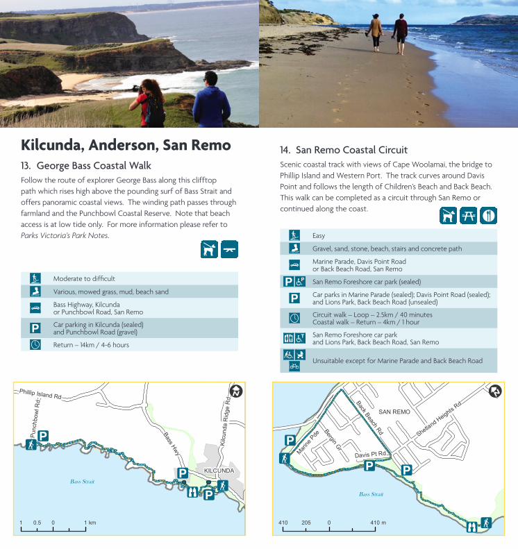
13. George Bass Coastal WalkFollow the route of explorer George Bass along this clifftop path which rises high above the pounding surf of Bass Strait and offers panoramic coastal views. The winding path passes through farmland and the Punchbowl Coastal Reserve. Note that beach access is at low tide only. For more information please refer to Parks Victoria’s Park Notes.
Moderatetodifficult
Various, mowed grass, mud, beach sand
Bass Highway, Kilcunda or Punchbowl Road, San Remo
iCar parking in Kilcunda (sealed) and Punchbowl Road (gravel)
Return – 14km / 4-6 hours
Bass Strait
!i
!F!i

!i
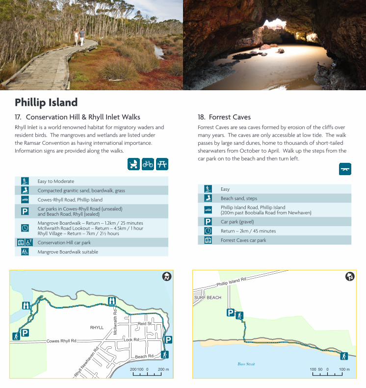
RHYLL
!F
Oswin
Roberts
ReserveMelaleuca
Woodland
!i
!F
!F !i!F
!F
Coghlan Rd
Ha
rbis
on
Rd
Co
wes R
hyll R
d
! I
400 0 400200 m
19. Oswin Roberts ReserveOswin Roberts Reserve is the last area of remnant bushland on Phillip Island. The walking tracks allow for wildlife observation.
Easy, longer walks include moderate undulations
Fine gravel, grass
Harbison Road, Phillip Island to Cowes-Rhyll Road, Phillip Island
iCar parks off Harbison Road (unsealed) and Cowes-Rhyll Road (sealed), Phillip Island
Oswin Roberts Circuit – 4.6km / 1¼ hours Woodland Loop – 2.8km / 45 minutes Melaleuca Loop – 1km / 30 minutes
G
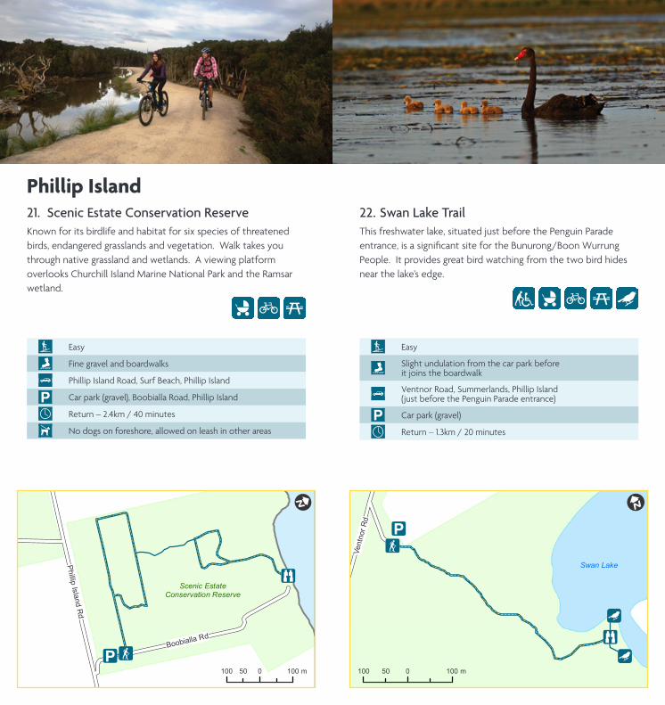
21. Scenic Estate Conservation ReserveKnown for its birdlife and habitat for six species of threatened birds, endangered grasslands and vegetation. Walk takes you through native grassland and wetlands. A viewing platform overlooks Churchill Island Marine National Park and the Ramsar wetland.
Easy
Fine gravel and boardwalks
Phillip Island Road, Surf Beach, Phillip Island
i Car park (gravel), Boobialla Road, Phillip Island
Return – 2.4km / 40 minutes
Í No dogs on foreshore, allowed on leash in other areas
!_
Scenic EstateConservation Reserve
Boobialla Rd
!F!i
!F!i
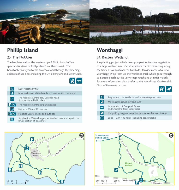
23. The NobbiesThe Nobbies walk at the western tip of Phillip Island offers spectacular views of Phillip Island’s southern coast. The boardwalk takes you to the blowhole and through the breeding colonies of sea birds including the Little Penguins and Silver Gulls.
Easy,reasonablyflat
Boardwalk around the headland, lower section has steps
The Nobbies Centre, 1320 Ventnor Road, Summerlands, Phillip Island
i The Nobbies Centre car park (sealed)
Return – 800m / 20 minutes
_ Nobbies Centre (inside and outside)
Suitable for 800m along upper level as there are steps in the lower section of boardwalk
!i
BaxtersWetland
Baxters Rd
!F
!F
!F!i
!F
!F!Æ
!i
West Area Rd
Campbell St
Sout
h D
udle
y R
d
!I
200 0 200100 m
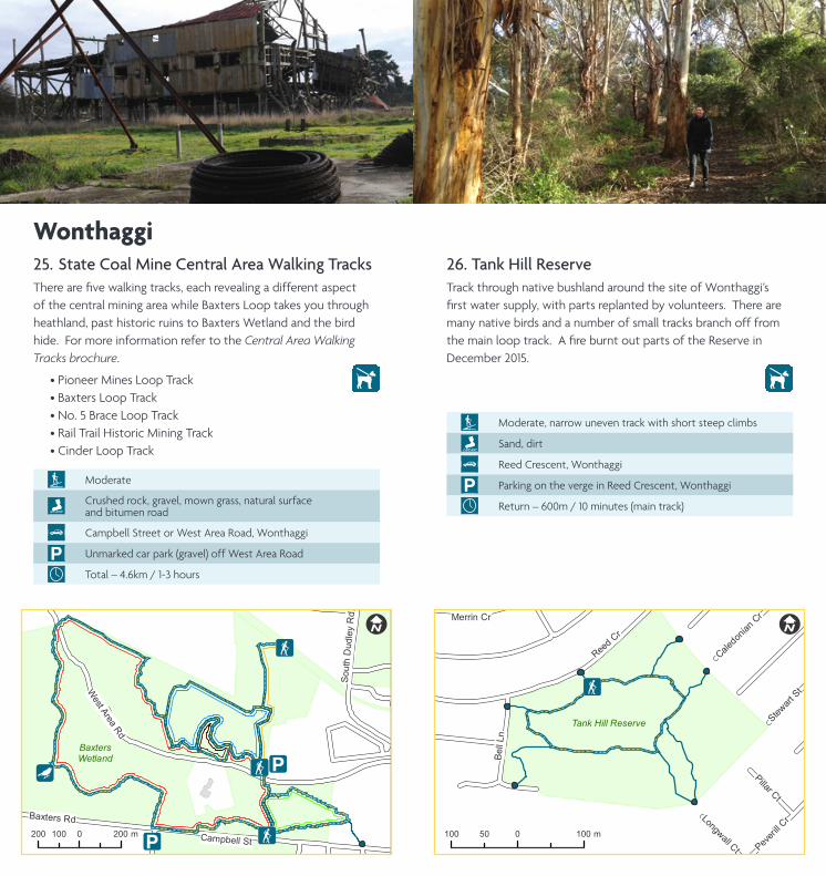
25. State Coal Mine Central Area Walking TracksTherearefivewalkingtracks,eachrevealingadifferentaspectof the central mining area while Baxters Loop takes you through heathland, past historic ruins to Baxters Wetland and the bird hide. For more information refer to the Central Area Walking Tracks brochure.
• Pioneer Mines Loop Track • Baxters Loop Track • No. 5 Brace Loop Track • Rail Trail Historic Mining Track • Cinder Loop Track
Moderate
Crushed rock, gravel, mown grass, natural surface and bitumen road
Campbell Street or West Area Road, Wonthaggi
i Unmarked car park (gravel) off West Area Road
Total – 4.6km / 1-3 hours
26. Tank Hill Reserve Track through native bushland around the site of Wonthaggi’s firstwatersupply,withpartsreplantedbyvolunteers.Therearemany native birds and a number of small tracks branch off from themainlooptrack.AfireburntoutpartsoftheReserveinDecember 2015.
Moderate, narrow uneven track with short steep climbs
Sand, dirt
Reed Crescent, Wonthaggi
i Parking on the verge in Reed Crescent, Wonthaggi
Return – 600m / 10 minutes (main track)
!F!F
Reed C
r
Bell
Ln
Pillar Ct
Peveri
ll Cr
Caledon
ian C
rMerrin Cr
Stewart
St
Longwall Ct
!I
100 0 10050 m
Tank Hill Reserve
Wonthaggi
ÍÍ

!i
!i
!F!i
!F

!i !F
Bent S
t
!F
Bass H
wy
Watt S
t
McKenzie St
Fin
cher S
t
Billson St
Carneys Rd
Queen S
t
Koru
mburr
a R
d
Loughran DrBass
Hw
y
Dow
ling S
t
!I
200 0 200100 m
29. Wonthaggi East Area Rail TrailEasy walk takes you through Fincher Street Reserve, crosses Bass Highway and continues on a sheltered path bordered by native vegetation.
Easy
Compacted granitic sand, bitumen road crossing and gravel
1 Bent Street, Wonthaggi
iCar park (sealed), Wonthaggi Centennial Centre, Bent Street, Wonthaggi
Return – 4.4km / 1 hour
_ Wonthaggi Centennial Centre
Suitable for Fincher Street Reserve only (2km return)
30. Wonthaggi Heathland Nature Conservation Reserve and Kilcunda – Harmers Haven Coastal Reserve
The 811 hectare heathland reserve is bounded by 10 kilometres of unspoiled and secluded coastline. It was formed from old coastal dunes and the developed heathland has been able to sustain a specialised vegetation cover. For more information please refer to the Wonthaggi Heathland & Coastal Reserve brochure.
Moderate
Grass, sand
Chisholm Road, Wonthaggi
i Car park (gravel), end of Chisholm Road, Wonthaggi
Loop – 6.7km / 2 hours (main track)
WonthaggiHeathlandReserve
!i!F

Thanks to all those who assisted with checking walks information including Bass Coast Shire Council staff and volunteers, Parks Victoria, Phillip Island Nature Parks and Friends of Wonthaggi Heathland & Coastal Reserve. Main cover image by Phoebe Honey.
While every reasonable effort has been made to ensure the accuracy of the information contained in this brochure, Bass Coast Shire Council does not accept any responsibility for inaccuracies, omissions, incorrect information or any action taken as a result of any information detailed. Information supplied is correct as at 1/9/2016.
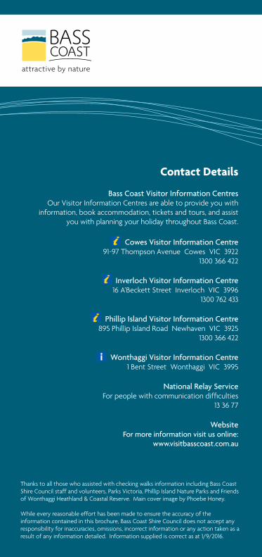
Contact Details
Bass Coast Visitor Information CentresOur Visitor Information Centres are able to provide you with
information, book accommodation, tickets and tours, and assist you with planning your holiday throughout Bass Coast.
Cowes Visitor Information Centre
91-97 Thompson Avenue Cowes VIC 39221300 366 422
Inverloch Visitor Information Centre 16 A’Beckett Street Inverloch VIC 3996
1300 762 433
Phillip Island Visitor Information Centre895 Phillip Island Road Newhaven VIC 3925
1300 366 422
Wonthaggi Visitor Information Centre1 Bent Street Wonthaggi VIC 3995
National Relay ServiceForpeoplewithcommunicationdifficulties
13 36 77
WebsiteFor more information visit us online:
www.visitbasscoast.com.au