
BASIC ASSESSMENT REPORT - srk.co.za · BASIC ASSESSMENT REPORT 2 14. Two (2) colour hard copies and...
80
BASIC ASSESSMENT REPORT 1 (For official use only) File Reference Number: 14/12/16/3/3/1/1273 Application Number: Date Received: Basic assessment report in terms of the Environmental Impact Assessment Regulations, 2010, promulgated in terms of the National Environmental Management Act, 1998 (Act No. 107 of 1998), as amended. Kindly note that: 1. This basic assessment report is a standard report that may be required by a competent authority in terms of the EIA Regulations, 2010 and is meant to streamline applications. Please make sure that it is the report used by the particular competent authority for the activity that is being applied for. 2. This report format is current as of 1 September 2012. It is the responsibility of the applicant to ascertain whether subsequent versions of the form have been published or produced by the competent authority 3. The report must be typed within the spaces provided in the form. The size of the spaces provided is not necessarily indicative of the amount of information to be provided. The report is in the form of a table that can extend itself as each space is filled with typing. 4. Where applicable tick the boxes that are applicable in the report. 5. An incomplete report may be returned to the applicant for revision. 6. The use of “not applicable” in the report must be done with circumspection because if it is used in respect of material information that is required by the competent authority for assessing the application, it may result in the rejection of the application as provided for in the regulations. 7. This report must be handed in at offices of the relevant competent authority as determined by each authority. 8. No faxed or e-mailed reports will be accepted. 9. The signature of the EAP on the report must be an original signature. 10. The report must be compiled by an independent environmental assessment practitioner. 11. Unless protected by law, all information in the report will become public information on receipt by the competent authority. Any interested and affected party should be provided with the information contained in this report on request, during any stage of the application process. 12. A competent authority may require that for specified types of activities in defined situations only parts of this report need to be completed. 13. Should a specialist report or report on a specialised process be submitted at any stage for any part of this application, the terms of reference for such report must also be submitted.
Transcript of BASIC ASSESSMENT REPORT - srk.co.za · BASIC ASSESSMENT REPORT 2 14. Two (2) colour hard copies and...

BASIC ASSESSMENT REPORT
1
(For official use only)
File Reference Number: 14/12/16/3/3/1/1273
Application Number:
Date Received:
Basic assessment report in terms of the Environmental Impact Assessment Regulations, 2010, promulgated in terms of the National Environmental Management Act, 1998 (Act No. 107 of 1998), as amended.
Kindly note that:
1. This basic assessment report is a standard report that may be required by a competent authority in terms of the EIA Regulations, 2010 and is meant to streamline applications. Please make sure that it is the report used by the particular competent authority for the activity that is being applied for.
2. This report format is current as of 1 September 2012. It is the responsibility of the applicant to ascertain whether subsequent versions of the form have been published or produced by the competent authority
3. The report must be typed within the spaces provided in the form. The size of the spaces provided is not necessarily indicative of the amount of information to be provided. The report is in the form of a table that can extend itself as each space is filled with typing.
4. Where applicable tick the boxes that are applicable in the report.
5. An incomplete report may be returned to the applicant for revision.
6. The use of “not applicable” in the report must be done with circumspection because if it is used in respect of material information that is required by the competent authority for assessing the application, it may result in the rejection of the application as provided for in the regulations.
7. This report must be handed in at offices of the relevant competent authority as determined by each authority.
8. No faxed or e-mailed reports will be accepted.
9. The signature of the EAP on the report must be an original signature.
10. The report must be compiled by an independent environmental assessment practitioner.
11. Unless protected by law, all information in the report will become public information on receipt by the competent authority. Any interested and affected party should be provided with the information contained in this report on request, during any stage of the application process.
12. A competent authority may require that for specified types of activities in defined situations only parts of this report need to be completed.
13. Should a specialist report or report on a specialised process be submitted at any stage for any part of this application, the terms of reference for such report must also be submitted.

BASIC ASSESSMENT REPORT
2
14. Two (2) colour hard copies and one (1) electronic copy of the report must be submitted to the competent authority.
15. Shape files (.shp) for maps must be included on the electronic copy of the report submitted to the competent authority.

BASIC ASSESSMENT REPORT
3
SECTION A: ACTIVITY INFORMATION
Has a specialist been consulted to assist with the completion of this section? YES
If YES, please complete the form entitled “Details of specialist and declaration of interest” for the specialist appointed and attach in Appendix I. 1. PROJECT DESCRIPTION a) Describe the project associated with the listed activities applied for
Eskom is in the process of expanding their power supply grid by supplying additional substations to areas in need of additional capacity and supplying electricity to areas with increasing electricity demand in the North West and Gauteng Province. The proposed project includes the construction of a new substation in Kashan and a power line of approximately 13 km to the existing Hekpoort Substation. The proposed Kashan Substation falls within the Gauteng Province, north-west of Mogale City and it is intended to alleviate the power supply demands experienced by Eskom in the area and to provide electrical infrastructure for future development. The proposed Kashan Substation footprint area will measure 12 000m2 and will be connected to the existing Hekpoort Substation via an 88 kV power line which runs approximately 13 km in a north easterly direction from Kashan (Gauteng Province) to Hekpoort in the North West Province. There are two proposed alternative routes for the power line which are indicated in Figure 1 below.
Figure 1: Kashan substation locality

BASIC ASSESSMENT REPORT
4
1.2 Project Locality The proposed project is situated within two provinces. The proposed Kashan substation is situated in the Gauteng province in the West Rand District Municipality and within the Mogale City Local Municipality. The proposed power line route alternatives from the Kashan substation to the existing Hekpoort substation run in a north easterly direction in Gauteng for approximately 10.34 km (Route 2) and 11.04 (Route 1). They then cross into the Madibeng Local Municipality within the Bojanala District Municipality, in the North West Province for 1.02 km (Route 2) and 1.58 km (Route 1). The proposed substation is located approximately 27 km North West of the town of Mogale City, approximately 35 km South West of the town of Madibeng, and approximately 54 km North West of Johannesburg as the crow flies. The Hartebeespoort Dam is located 25 km South West of the Kashan substation. 1.3 Specialist studies Several specialist studies have been undertaken to provide more detailed information on the environment aspects that may be affected by the proposed project. These studies addressed Ecological (Flora and Fauna), Wetland, Visual, Social, Geotechnical and Heritage aspects. The specialist reports are attached as Appendix D to this Basic Assessment Report (BAR). 1.4 Servitude Requirements The servitude width required by Eskom for the 88 kV overhead distribution line is 31 m (15.5 m from the centre of the power line) while the separation distance between an 88 kV line and any other line is 55 m. An 8m wide strip is generally required to be cleared of all trees and shrubs down the centre of distribution power line servitude for stringing purposes only. Any tree or shrub in other areas that will interfere with the operation and/or reliability of the distribution power line must be trimmed or completely cleared. Vegetation clearance for the proposed distribution power line will be minimal due to the area being mainly grassland. The Eskom Standard and specifications for vegetation clearance and invasive alien plant management for new power line construction specifications have been incorporated into the Environmental Management Programme (EMPr), which will guide the construction, operational and maintenance phases of the project. An 88 kV distribution substation normally requires a footprint of about 16 000 m2. The foot print of the Kashan Substation will be 12 000 m2. 1.6 Construction Site Camps The contactor appointed for the construction of the power line may set up one site camp but this does not necessarily need to be near the substation site. Alternatively the contractor may however prefer to use a fully serviced site in another location. 1.7 Project Process Prior to construction and site clearing for the proposed power line, the following sequential steps take place: Step 1: Feasibility and identification of line alternatives.

BASIC ASSESSMENT REPORT
5
Step 2: Basic Assessment input and environmental permitting. Step 3: Negotiation of final route with affected landowners. Step 4: Survey of the proposed route. Step 5: Selection of structures suited to the terrain and ground conditions. Step 6: Final design of the distribution line and placement of towers. Step 7: Issuing of tenders and eventually appointment of contractors for the project. Step 1 has been completed and Step 2 is in process. Construction of the power line is expected to consist of the following sequential phases: Step 8: Vegetation clearance and construction of access roads (if required). Step 9: Pegging of structures. Step 10: Construction of foundations. Step 11: Assembly and erection of structures. Step 12: Stringing of conductors. Step 13: Rehabilitation of disturbed areas and protection of erosion sensitive areas. Step 14: Testing and commissioning. Step 15: Operation and routine maintenance. It is estimated that the construction period for this project will be 18-24 months.
b) Provide a detailed description of the listed activities associated with the project as
applied for
Listed activity as described in GN R.544, 545 and 546
Description of project activity
GN R. 544 Item 10(i): The Construction of facilities or infrastructure for the transmission and distribution of electricity outside urban areas or industrial complexes with a capacity of more than 33 but less than 275 kilovolts.
A substation with a footprint of approximately 12 000 m2 m and a power line with the approximate length of 13 km.
GN R. 544, Item 11 (xi): The construction of infrastructure or structures covering 50 square metres or more where such construction occurs within a watercourse or within 32 metres of a watercourse, measured from the edge of a watercourse.
The Power line will cross a river and some wetlands en-route from the Kashan Substation to the Hekpoort Substation. The construction area required for the pylons associated with this power line may exceed 50 m2 per pylon.
GN R. 544 Item 18(i): The infilling or depositing of any material of more than 5 cubic metres into, or the dredging, excavation, removal or moving of soil, sand, shells, shell grit, pebbles or rock of more than 5 cubic metres from a watercourse.
Construction of the pylons may be necessary within wetlands which may result in the depositing of more than 5 m3 of material.
GN R. 544 Item 23: The transformation of undeveloped, vacant land to – residential, retail, commercial, recreational, industrial or institutional use, outside an urban area and where the total area to be transformed is bigger than 1 hectare but less than 20 hectares.
The proposed substation is will occupy a footprint more than 1ha in size and Eskom may clear the entire footprint area the purposes of substation construction.
GN R. 544 Item 26: Any process or activity Due to the alternative alignment crossing an

BASIC ASSESSMENT REPORT
6
identified in terms of section 53(1) of the National Environmental Management: Biodiversity Act, 2004 (Act No. 10 of 2004).
endangered ecosystem, it is possible that a threatening process may be undertaken during the construction of the power line and substation.
GN R. 546 Item 12(a) and (b): The clearance of an area of 300 square metres or more of vegetation where 75% or more of the vegetative cover constitutes indigenous vegetation. (a) Within any critically endangered or endangered ecosystem listed in terms of section 52 of the NEMBA or prior to the publication of such a list, within an area that has been identified as critically endangered in the National Spatial Biodiversity Assessment 2004; (b) Within critical biodiversity areas identified in bioregional plans;
Potential removal of more than 300 m2 in an endangered ecosystem for the alternative alignment and due to the presence of critical biodiversity areas along the proposed alignment of both alternatives.
GN R. 546 Item 13(e)(i)(gg): The clearance of an area of 1 hectare or more of vegetation where 75% or more of the vegetative cover constitutes indigenous vegetation, (e) In North West: i. Outside urban areas, in: (gg) Areas within 10 kilometres from national parks or world heritage sites or 5 km from any other protected area identified in terms of NEMPAA or from the core areas of a biosphere reserve.
Potential removal of more than 1 ha in an endangered ecosystem of which 75% or more of the vegetative cover could constitute indigenous vegetation, for the alternative alignment and due to the presence of the Cradle of Humankind (Maropeng) less than 10 km from the alternative line.
GN R. 546 Item 14(a)(i): The clearance of an area of 5 hectares or more of vegetation where 75% or more of the vegetative cover constitutes indigenous vegetation, (a) In Eastern Cape, Free State, KwaZulu- Natal, Gauteng, Limpopo, Mpumalanga, Northern Cape, Northwest and Western Cape: i. All areas outside urban areas.
Potential clearance of more than 5 ha in an endangered ecosystem of which 75% or more of the vegetative cover could constitute indigenous vegetation, for the alternative alignment and due to both alignment alternative and the substation position being outside of the urban edge.
2. FEASIBLE AND REASONABLE ALTERNATIVES “alternatives”, in relation to a proposed activity, means different means of meeting the general purpose and requirements of the activity, which may include alternatives to— (a) the property on which or location where it is proposed to undertake the activity; (b) the type of activity to be undertaken; (c) the design or layout of the activity; (d) the technology to be used in the activity; (e) the operational aspects of the activity; and (f) the option of not implementing the activity. Describe alternatives that are considered in this application as required by Regulation 22(2)(h) of GN R.543. Alternatives should include a consideration of all possible means by which the purpose and

BASIC ASSESSMENT REPORT
7
need of the proposed activity (NOT PROJECT) could be accomplished in the specific instance taking account of the interest of the applicant in the activity. The no-go alternative must in all cases be included in the assessment phase as the baseline against which the impacts of the other alternatives are assessed. The determination of whether site or activity (including different processes, etc.) or both is appropriate needs to be informed by the specific circumstances of the activity and its environment. After receipt of this report the, competent authority may also request the applicant to assess additional alternatives that could possibly accomplish the purpose and need of the proposed activity if it is clear that realistic alternatives have not been considered to a reasonable extent. The identification of alternatives should be in line with the Integrated Environmental Assessment Guideline Series 11, published by the DEA in 2004. Should the alternatives include different locations and lay-outs, the co-ordinates of the different alternatives must be provided. The co-ordinates should be in degrees, minutes and seconds. The projection that must be used in all cases is the WGS84 spheroid in a national or local projection. a) Site alternatives Please note that there is one site for the Proposed Kashan Substation
Alternative 1 (preferred alternative)
Description Lat (DDMMSS) Long (DDMMSS)
Kashan Substation 27° 35' 35.19" E 25° 54' 25.15" S
Alternative 2
Description Lat (DDMMSS) Long (DDMMSS)
Alternative 3
Description Lat (DDMMSS) Long (DDMMSS)
In the case of linear activities: Power line from Kashan substation to the Hekpoort substation Alternative: Latitude (S): Longitude (E): Alternative S1 (preferred)
Starting point of the activity The preferred alternative is “Powerline Route 2” on the Maps in Appendices A. Please refer to Appendix J for the coordinates of Alternative S1.
Middle/Additional point of the activity
End point of the activity
Alternative S2 (if any)
Starting point of the activity Alternative S2 is “Powerline Route 1” on the maps in Appendices A. Please refer to Appendix J for the coordinates of Alternative S2.
Middle/Additional point of the activity
End point of the activity
Alternative S3 (if any)
Starting point of the activity
Middle/Additional point of the activity
End point of the activity
For route alternatives that are longer than 500m, please provide an addendum with co-ordinates taken every 250 meters along the route for each alternative alignment. Please refer to Appendix J for the coordinates of the proposed power line route. For each alternative; coordinates were recorded at each turning point.

BASIC ASSESSMENT REPORT
8
In the case of an area being under application, please provide the co-ordinates of the corners of the site as indicated on the lay-out map provided in Appendix A. See Attached in Appendix A b) Lay-out alternatives
There are no lay out alternatives. Please note that details regarding the number and the type of towers and other support infrastructures associated with the power line will be confirmed during the detail design phase and following the approval of the proposed development.
Alternative 1 (preferred alternative)
Description Lat (DDMMSS) Long (DDMMSS)
Alternative 2
Description Lat (DDMMSS) Long (DDMMSS)
Alternative 3
Description Lat (DDMMSS) Long (DDMMSS)
c) Technology alternatives *Please note that there are no technological alternatives that have been assessed for this project
Alternative 1 (preferred alternative)
Alternative 2
Alternative 3
d) Other alternatives (e.g. scheduling, demand, input, scale and design alternatives) *Please note that there are no other alternatives that have been assessed for this project
Alternative 1 (preferred alternative)
Alternative 2
Alternative 3
e) No-go alternative
At present the area is only supplied by the Hekpoort substation and there is a high demand on the current supply. In the event that the proposed Kashan substation and associated power line is not constructed; the surrounding area’s network capacity could be compromised and there could be a decrease in the quality of supply which could hinder future development in these areas.

BASIC ASSESSMENT REPORT
9
Paragraphs 3 – 13 below should be completed for each alternative. 3. PHYSICAL SIZE OF THE ACTIVITY a) Indicate the physical size of the preferred activity/technology as well as alternative
activities/technologies (footprints): Alternative: Proposed Kashan Substation Size of the activity:
Alternative A11 12 000 m2
Alternative A2 (if any)
Alternative A3 (if any)
or, for linear activities: Alternative: Power line route Length of the activity:
Alternative A1 12 620 m
Alternative A2 (if any) 11 600 m
Alternative A3 (if any)
b) Indicate the size of the alternative sites or servitudes (within which the above footprints
will occur): Alternative: Power line route Size of the site/servitude:
Alternative A1 12 620 000 m2
Alternative A2 (if any) 11 600 000 m2
Alternative A3 (if any)
4. SITE ACCESS
Does ready access to the site exist? YES
If NO, what is the distance over which a new access road will be built
Describe the type of access road planned:
For construction purposes the proposed sites can be reached via the existing access roads. No roads that trigger NEMA Regulations Listed Activities will be required. The use of roads on private property will be subject to the Environmental Management Programme (EMPr) and will be determined based on discussions with landowners should it be necessary.
Include the position of the access road on the site plan and required map, as well as an indication of the road in relation to the site. 5. LOCALITY MAP
An A3 locality map must be attached to the back of this document, as Appendix A. The scale of the locality map must be relevant to the size of the development (at least 1:50 000). For linear activities of
1 “Alternative A..” refer to activity, process, technology or other alternatives.

BASIC ASSESSMENT REPORT
10
more than 25 kilometres, a smaller scale e.g. 1:250 000 can be used. The scale must be indicated on the map.). The map must indicate the following:
an accurate indication of the project site position as well as the positions of the alternative sites, if any;
indication of all the alternatives identified;
closest town(s;)
road access from all major roads in the area;
road names or numbers of all major roads as well as the roads that provide access to the site(s);
all roads within a 1km radius of the site or alternative sites; and
a north arrow;
a legend; and
locality GPS co-ordinates (Indicate the position of the activity using the latitude and longitude of the centre point of the site for each alternative site. The co-ordinates should be in degrees and decimal minutes. The minutes should have at least three decimals to ensure adequate accuracy. The projection that must be used in all cases is the WGS84 spheroid in a national or local projection).
6. LAYOUT/ROUTE PLAN A detailed site or route plan(s) must be prepared for each alternative site or alternative activity. It must be attached as Appendix A to this document. The site or route plans must indicate the following:
the property boundaries and numbers of all the properties within 50 metres of the site;
the current land use as well as the land use zoning of the site;
the current land use as well as the land use zoning each of the properties adjoining the site or sites;
the exact position of each listed activity applied for (including alternatives);
servitude(s) indicating the purpose of the servitude;
a legend; and
a north arrow. 7. SENSITIVITY MAP The layout/route plan as indicated above must be overlain with a sensitivity map that indicates all the sensitive areas associated with the site, including, but not limited to:
watercourses;
the 1:100 year flood line (where available or where it is required by DWA);
ridges;
cultural and historical features;
areas with indigenous vegetation (even if it is degraded or infested with alien species); and
critical biodiversity areas. The sensitivity map must also cover areas within 100m of the site and must be attached in Appendix A. 8. SITE PHOTOGRAPHS Colour photographs from the centre of the site must be taken in at least the eight major compass directions with a description of each photograph. Photographs must be attached under Appendix B to

BASIC ASSESSMENT REPORT
11
this report. It must be supplemented with additional photographs of relevant features on the site, if applicable. A photo report is attached in Appendix B. The photo report contains photographs from the site visit conducted in May 2014. 9. FACILITY ILLUSTRATION A detailed illustration of the activity must be provided at a scale of at least 1:200 as Appendix C for activities that include structures. The illustrations must be to scale and must represent a realistic image of the planned activity. The illustration must give a representative view of the activity. A representative facility illustration of a generic 88kV substation is attached in Appendix C. 10. ACTIVITY MOTIVATION Motivate and explain the need and desirability of the activity (including demand for the activity):
1. Is the activity permitted in terms of the property’s existing land use rights?
NO Please explain
Most of the proposed route and substation passes through privately owned agricultural farm areas. Once in place, the power line is unlikely to significantly disrupt farming activities. Eskom will acquire all servitudes and affected property owners will be permitted to use areas underneath the lines for farming.
The proposed power line route 1 also passes through land demarcated for future residential
development. The proposed substation and power line development will contribute to the future
development in the area.
2. Will the activity be in line with the following?
(a) Provincial Spatial Development Framework (PSDF) YES Please explain
The proposed development is in line with the Gauteng SDF (the proposed development will be of little significance to the North West province). Accommodation for the expansion of the population has been set out as a priority in Gauteng. Electricity infrastructure will be a necessity In order for this to occur.
(b) Urban edge / Edge of Built environment for the area YES Please explain
The urban edge surrounding the Hekpoort area has been demarcated according to the long-term
view taken of future development potential and needs of the area. The proposed substation and
power line development will alleviate current supply and contribute towards the future development in
the area.

BASIC ASSESSMENT REPORT
12
(c) Integrated Development Plan (IDP) and Spatial Development Framework (SDF) of the Local Municipality (e.g. would the approval of this application compromise the integrity of the existing approved and credible municipal IDP and SDF?).
YES Please explain
The approval of this application is in line with the IDP and SDF of the Mogale City Local Municipality. The construction of the proposed substation and power line linking the new substation to the existing Hekpoort substation will provide additional electrical infrastructure to the Mogale City Local Municipality. The approval of the proposed development will be of little significance to the Madibeng Local Municipality.
It is indicated in the Mogale City SDF that the Hekpoort, Magaliesburg and Tarlton areas experience very little development pressure as such. However, one of the aspects that does place pressure on these areas are the existence of informal settlements around these towns, which means that pressure begins to emerge for the formalisation of these informal settlements into formal townships. A number of housing initiatives are already underway in these areas which in turn require the development of supporting social facilities as provision of electricity.
It is indicated in the Mogale City IDP that emphasis is being placed on addressing urgent electrical network upgrades. The proposed substation and power line development will contribute towards these network upgrades.
(d) Approved Structure Plan of the Municipality Please explain
The proposed project entails electricity infrastructure and is therefore not applicable.
(e) An Environmental Management Framework (EMF) adopted by the Department (e.g. Would the approval of this application compromise the integrity of the existing environmental management priorities for the area and if so, can it be justified in terms of sustainability considerations?)
YES Please explain
According to the EMF from 2013 for the West Rand Municipal District, within which the Mogale City
LM is located, the project area does not fall into an area with high ecological sensitivity.
(f) Any other Plans (e.g. Guide Plan) YES Please explain
No other plan is seen to have any significant relevance to this project.
3. Is the land use (associated with the activity being applied for) considered within the timeframe intended by the existing approved SDF agreed to by the relevant environmental authority (i.e. is the proposed development in line with the projects and programmes identified as priorities within the credible IDP)?
YES Please explain
The proposed development is in line with the National Development Plan and the City of Mogale
SDF’s and IDP’s, which related to the provision and upgrade of the City of Mogale infrastructure such
as electricity supply. The proposed substation and associated power line will only provide electrical
infrastructure to the Mogale City Local Municipality. The SDF of the Madibeng Local Municipality was
not taken into consideration as the proposed development will be of little significance to the Madibeng
Local Municipality.

BASIC ASSESSMENT REPORT
13
4. Does the community/area need the activity and the associated land use concerned (is it a societal priority)? (This refers to the strategic as well as local level (e.g. development is a national priority, but within a specific local context it could be inappropriate.)
YES Please explain
The City of Mogale Local Municipality 2011/2015 IDP has identified the shortage of electricity supply to urban and residential areas of the municipality and addressing electrification backlogs as some of the core challenges. In the Mogale City LM SDF an urban edge surrounding the Hekpoort area has been demarcated for future development but according to the IDP, there is inadequate electricity bulk supply and the impact on service delivery and development remains a challenge for the area. The Madibeng Local Municipality was not taken into consideration as the proposed development will be of little significance to the Madibeng Local Municipality.
5. Are the necessary services with adequate capacity currently available (at the time of application), or must additional capacity be created to cater for the development? (Confirmation by the relevant Municipality in this regard must be attached to the final Basic Assessment Report as Appendix I.)
YES Please explain
The construction and operation of the proposed substation and associated power line will not require
any capacity increase for services such as water and sanitation from relevant Municipalities.
6. Is this development provided for in the infrastructure planning of the municipality, and if not what will the implication be on the infrastructure planning of the municipality (priority and placement of services and opportunity costs)? (Comment by the relevant Municipality in this regard must be attached to the final Basic Assessment Report as Appendix I.)
YES Please explain
The proposed project is the construction of 88kV distribution line and associated substation aimed at
improving the quality of supply. It will not require any capacity for services such as water and
sanitation from relevant Municipalities. It will however improve the quality of supply in the area.
7. Is this project part of a national programme to address an issue of national concern or importance?
YES Please explain
The proposed development has not been identified as a Strategic Integration Project (SIP). However,
the upgrading of the electricity network and infrastructure especially the substations and transmission
and distribution lines is a strategic priority towards addressing the shortage of electricity in South
Africa.

BASIC ASSESSMENT REPORT
14
8. Do location factors favour this land use (associated with the activity applied for) at this place? (This relates to the contextualisation of the proposed land use on this site within its broader context.)
YES Please explain
Although the proposed development traverses privately owned agricultural lands, the location of the
sites is strategically selected so that it is within or next to the centre of the load demand identified by
Eskom. The preferred route (S1) runs along and existing railway line. This alignment limits disruption
of farmland. The alternative power line route (S2) runs for most of its length along the R560 road, as
well as the R563.
9. Is the development the best practicable environmental option for this land/site?
YES Please explain
Most of the proposed route and the substation pass through privately owned farm land. Once in
place, the power line is unlikely to significantly disrupt farming or other activities. Eskom will acquire
all servitudes, affected property owners will be permitted to use areas underneath the lines for
farming. No buildings and tall structures or tall trees may be allowed below the lines.
10. Will the benefits of the proposed land use/development outweigh the negative impacts of it?
YES Please explain
The main negative impacts of the proposed development are the visual impacts and potential impacts
on avifauna. The negative impacts of the proposed development are low. The long-term, regional
benefits of reliable power supply will outweigh the negative impacts of the proposed substations and
associated power lines.
11. Will the proposed land use/development set a precedent for similar activities in the area (local municipality)?
YES Please explain
The placement of power lines in the area will set a precedent for the development of more power line connections and service infrastructure.
Existing electrical infrastructure in Hekpoort already set a precedent for the project in the area and for
one of the proposed layout alternatives of the new substation and power line development.
12. Will any person’s rights be negatively affected by the proposed activity/ies?
NO Please explain
The proposed power line and substation construction and operation is not anticipated to negatively affect any person’s rights. The servitude rights for the line will be acquired by Eskom and financial compensation, to be negotiated with land owners and agreed to, will be paid.
13. Will the proposed activity/ies compromise the “urban edge” as defined by the local municipality?
NO Please explain
Due to the nature of the proposed activity the urban edge, as defined by the local municipality will not be compromised.
14. Will the proposed activity/ies contribute to any of the 17 Strategic Integrated Projects (SIPS)?
NO Please explain
The proposed development has not been identified as a SIP.

BASIC ASSESSMENT REPORT
15
15. What will the benefits be to society in general and to the local communities?
Please explain
The provision of a reliable electricity network and provision of capacity for new users, allowing for
further growth and development in the area. The new development will also provide electricity to the
informal settlements surrounding the area and will serve in addressing current inequalities in access
to electricity.
16. Any other need and desirability considerations related to the proposed activity?
Please explain
The Hekpoort area experiences very little development pressure. However, one of the aspects that do
place pressure on these areas are the existence of informal settlements around these towns, which
means that pressure begins to emerge for the formalisation of these informal settlements into formal
townships. A number of housing initiatives are already underway in these areas which in turn require
the development of supporting social facilities as provision of electricity (Mogale City Local
Municipality, 2011).
17. How does the project fit into the National Development Plan for 2030? Please explain
Chapter 4 of the National Development Plan 2030 on Economic Infrastructure has outlined how the
proportion of people with access to the electricity grid should rise to at least 90 percent by 2030, with
non-grid options available for the rest. Action 2020 of The National Development Plan also considers
the Ring-fencing the electricity distribution businesses of the 12 largest municipalities (which account
for 80 percent of supply), resolve maintenance and refurbishment backlogs and develop a financing
plan, alongside investment in human capital. The proposed substation and associated power line will
only provide electrical infrastructure to the Mogale City Local Municipality. The SDF of the Madibeng
Local Municipality was not taken into consideration as the proposed development will be of little
significance to the Madibeng Local Municipality.
18. Please describe how the general objectives of Integrated Environmental Management as set out in section 23 of NEMA have been taken into account.
This report serves as a Basic Assessment report which investigated all potential impacts (social,
economic and environmental) that may result from the development including alternatives, assess
and evaluate and further provide a mitigation plan for all identified potential impacts.
Aside for the No-go option, two possible options have been chosen for the route. Potential
environmental risks have been identified and mitigation measures to alleviate potential negative
impacts have been provided for in the EMPr. Public participation has been undertaken in accordance
with NEMA and the public have and will be given further opportunity to comment on this proposed
project.

BASIC ASSESSMENT REPORT
16
19. Please describe how the principles of environmental management as set out in section 2 of NEMA have been taken into account.
This proposed development is economically and environmentally sustainable. The disturbance of biological diversity cannot be avoided however will be minimised and remediated. Pollution and degradation to the environment will be minimised and remediated. Any disturbances to cultural heritage will be avoided. The generation of limited waste during construction cannot be avoided but it will be ensured that the waste is recycled or disposed of in an acceptable manner. The EMPr will provide a management tool which will enable Eskom to ensure that all negative impacts to the environment, society and peoples environmental rights are mitigated and minimised wherever possible. The participation of all interested and affected parties has been allowed for and the opinions and concerns of interested and affected persons have been taken into account.
11. APPLICABLE LEGISLATION, POLICIES AND/OR GUIDELINES List all legislation, policies and/or guidelines of any sphere of government that are applicable to the application as contemplated in the EIA regulations, if applicable:
Title of legislation, policy or guideline
Applicability to the project Administering authority
Date
Conservation of Agricultural Resources Act, Act 43 of 1983 (CARA)
The proposed development is located within close proximity to agricultural land.
Department of Environmental Affairs (DEA)
1983
National Environmental Management Act, Act No. 107 of 1998 (NEMA), as amended & NEMA EIA Regulations, 2010: GN544, published in Government Gazette 33306 on 18 June 2010
A Basic Assessment Report (BAR) is required for this project.
Department of Environmental Affairs (DEA)
1998
National Environmental Management: Protected Areas Act, Act 57 of 2003
The proposed development is located within close proximity to the Cradle of Humankind World Heritage Site.
Department of Environmental Affairs (DEA)
2003
National Environmental Management: Biodiversity Act, Act 10 of 2004
The Gauteng Conservation Plan can be used to guide priority areas in terms of Conservation of CBA’s and ESA
Department of Environmental Affairs (DEA)
2004
National Water Act, Act No. 36 of 1998 (NWA)
The proposed distribution lines are within 500m of wetlands. A Water Use Licence is therefore required
Department of Water and Sanitation (DWAS)
1998
National Heritage Resources Act, Act No 25 of 1999
The specialist study identified a number of sites in the vicinity of the two alternative power line routes. These do not require mitigation but others, which may be affected could be
South African Heritage Resources Agency
1999

BASIC ASSESSMENT REPORT
17
identified during construction phase. In which case adequate mitigation measures will also have to be planned and mitigated.
12. WASTE, EFFLUENT, EMISSION AND NOISE MANAGEMENT a) Solid waste management
Will the activity produce solid construction waste during the construction/initiation phase?
YES
If YES, what estimated quantity will be produced per month? 10 m3
How will the construction solid waste be disposed of (describe)?
Small quantities of solid waste will be generated during the construction phase of the project. This waste will be disposed of at a licensed waste disposal facility by the contractor. Note soil excavated from trench and earth works during the grading of the substation will be used as backfill.
Where will the construction solid waste be disposed of (describe)?
Hekpoort Waste Disposal Facility.
Will the activity produce solid waste during its operational phase? NO
If YES, what estimated quantity will be produced per month?
How will the solid waste be disposed of (describe)?
If the solid waste will be disposed of into a municipal waste stream, indicate which registered landfill site will be used.
Where will the solid waste be disposed of if it does not feed into a municipal waste stream (describe)?
If the solid waste (construction or operational phases) will not be disposed of in a registered landfill site or be taken up in a municipal waste stream, then the applicant should consult with the competent authority to determine whether it is necessary to change to an application for scoping and EIA.
Can any part of the solid waste be classified as hazardous in terms of the NEM:WA? NO
If YES, inform the competent authority and request a change to an application for scoping and EIA. An application for a waste permit in terms of the NEM:WA must also be submitted with this application.
Is the activity that is being applied for a solid waste handling or treatment facility? NO
If YES, then the applicant should consult with the competent authority to determine whether it is necessary to change to an application for scoping and EIA. An application for a waste permit in terms of the NEM:WA must also be submitted with this application. b) Liquid effluent
Will the activity produce effluent, other than normal sewage, that will be disposed of NO

BASIC ASSESSMENT REPORT
18
in a municipal sewage system?
If YES, what estimated quantity will be produced per month? m3
Will the activity produce any effluent that will be treated and/or disposed of on site? NO
If YES, the applicant should consult with the competent authority to determine whether it is necessary to change to an application for scoping and EIA.
Will the activity produce effluent that will be treated and/or disposed of at another facility?
NO
If YES, provide the particulars of the facility:
Facility name:
Contact person:
Postal address:
Postal code:
Telephone: Cell:
E-mail: Fax:
Describe the measures that will be taken to ensure the optimal reuse or recycling of waste water, if any:
None, as effluent from chemical toilets on site will be disposed of at the Hartebeespoort Waste Water Treatment Works by an accredited Waste Contractor.
c) Emissions into the atmosphere
Will the activity release emissions into the atmosphere other that exhaust emissions and dust associated with construction phase activities?
NO
If YES, is it controlled by any legislation of any sphere of government?
If YES, the applicant must consult with the competent authority to determine whether it is necessary to change to an application for scoping and EIA. If NO, describe the emissions in terms of type and concentration:
d) Waste permit
Will any aspect of the activity produce waste that will require a waste permit in terms of the NEM:WA?
NO
If YES, please submit evidence that an application for a waste permit has been submitted to the competent authority e) Generation of noise
Will the activity generate noise? YES
If YES, is it controlled by any legislation of any sphere of government? NO
If YES, the applicant should consult with the competent authority to determine whether it is necessary to change to an application for scoping and EIA. If NO, describe the noise in terms of type and level:

BASIC ASSESSMENT REPORT
19
While no noise will be generated by the activity during the operational phase, noise will be generated by construction activities and vehicles during the construction phase. It will, however, be short term, localised and will occur during the construction phase only. The noise disturbance is anticipated to be during the day and less between the hours of 07h00 and 18H00.
13. WATER USE Please indicate the source(s) of water that will be used for the activity by ticking the appropriate box(es):
Municipal
Municipal water will be used for domestic use and construction activities such as cement batching and drilling.
If water is to be extracted from groundwater, river, stream, dam, lake or any other natural feature, please indicate the volume that will be extracted per month:
litres
Does the activity require a water use authorisation (general authorisation or water use license) from the Department of Water Affairs?
YES
If YES, please provide proof that the application has been submitted to the Department of Water Affairs. The applicant will apply for a Water Use Licence (WUL) from the Department of Water and Sanitation in areas where water uses are identified in terms of Section 21 of the National Water Act (Act 36 of 1998). The issuing of the WUL will be required before commencement of construction in the affected areas.

BASIC ASSESSMENT REPORT
20
14. ENERGY EFFICIENCY Describe the design measures, if any, which have been taken to ensure that the activity is energy efficient:
Electricity - Apart from the use of energy efficient lighting at the substation in the operational phase no other measures are considered. Diesel generators will be utilised for the provision of electricity where electricity connection is not readily available. Fuel and Oil - Delivery Vehicles and other construction equipment will use petrol, diesel and oil. Use and number of such vehicles and machinery will be restricted to that which is absolutely necessary for the construction activities and deliveries. Following construction only small quantities of fuel and oil will be used for periodic inspections and maintenance.
Describe how alternative energy sources have been taken into account or been built into the design of the activity, if any:
Energy efficient lighting will be used to illuminate the substation

BASIC ASSESSMENT REPORT
21
SECTION B: SITE/AREA/PROPERTY DESCRIPTION Important notes: 1. For linear activities (pipelines, etc) as well as activities that cover very large sites, it may be
necessary to complete this section for each part of the site that has a significantly different environment. In such cases please complete copies of Section B and indicate the area, which is covered by each copy No. on the Site Plan.
Two copies of Section B have been completed for each alternative power line route. Each route is located in a different setting. 2. Paragraphs 1 - 6 below must be completed for each alternative.
3. Has a specialist been consulted to assist with the completion of this section?
YES
If YES, please complete the form entitled “Details of specialist and declaration of interest” for each specialist thus appointed and attach it in Appendix I. All specialist reports must be contained in Appendix D.
Section B Copy No. (e.g. A): Alternative one

BASIC ASSESSMENT REPORT
22
Property description/physical address:
Province Gauteng Province North West Province (NW)
District Municipality
West Rand District Municipality (Gauteng) Bojanala Platinum District Municipality (NW)
Local Municipality
Mogale City Local Municipality (Gauteng) Madibeng Local Municipality (NW)
Ward Number(s) Ward 32 of Bojanala Platinum District Municipality Ward 33 of West Rand District Municipality
Farm name and number
Within Gauteng • Hartebeestfontein 472; Portion Numbers: 392, 147, 148, 149, 343, 365, 366, 309, 367, 363, 1, 388, 389, 335, 336, 375, 294, 296, 297, 166, 168, 169, 171, 371, 172, 362 370 175, 247, 176, 182. • Spokie 428; Portion Number 0 • Hekpoort 504. Portion Numbers: 323, 2, 467, 337, 153, 359,153, 406, 129, 106, 105, 152, 57, 125, 187, 186, 185, 184, 183, 180, 179, 178. Within North West Province • Bultfontein 475. Portion Numbers: 141, 157, 144.
Donrath 463 Portion 1.
Portion number
SG Code Attached as Appendix J
Where a large number of properties are involved (e.g. linear activities), please attach a full list to this application including the same information as indicated above.
Current land-use zoning as per local municipality IDP/records:
Agriculture
In instances where there is more than one current land-use zoning, please attach a list of current land use zonings that also indicate which portions each use pertains to, to this application.
Is a change of land-use or a consent use application required? YES

BASIC ASSESSMENT REPORT
23
1. GRADIENT OF THE SITE Indicate the general gradient of the site. Alternative S1:
1:50 – 1:20
Alternative S2 (if any):
Flat 1:50 – 1:20 1:20 – 1:15 1:15 – 1:10 1:10 – 1:7,5 1:7,5 – 1:5 Steeper than 1:5
Alternative S3 (if any):
Flat 1:50 – 1:20 1:20 – 1:15 1:15 – 1:10 1:10 – 1:7,5 1:7,5 – 1:5 Steeper than 1:5
2. LOCATION IN LANDSCAPE Indicate the landform(s) that best describes the site:
2.1 Ridgeline 2.4 Closed valley 2.7 Undulating plain / low hills
2.2 Plateau 2.5 Open valley 2.8 Dune
2.3 Side slope of hill/mountain 2.6 Plain 2.9 Seafront
3. GROUNDWATER, SOIL AND GEOLOGICAL STABILITY OF THE SITE Is the site(s) located on any of the following? Alternative S1: Alternative S2
(if any): Alternative S3
(if any):
Shallow water table (less than 1.5m deep) NO YES NO YES NO
Dolomite, sinkhole or doline areas NO YES NO YES NO
Seasonally wet soils (often close to water bodies)
NO
YES NO
YES NO
Unstable rocky slopes or steep slopes with loose soil
NO
YES NO
YES NO
Dispersive soils (soils that dissolve in water) NO YES NO YES NO
Soils with high clay content (clay fraction more than 40%)
NO
YES NO
YES NO
Any other unstable soil or geological feature NO YES NO YES NO
An area sensitive to erosion NO YES NO YES NO
If you are unsure about any of the above or if you are concerned that any of the above aspects may be an issue of concern in the application, an appropriate specialist should be appointed to assist in the completion of this section. Information in respect of the above will often be available as part of the project information or at the planning sections of local authorities. Where it exists, the 1:50 000 scale Regional Geotechnical Maps prepared by the Council for Geo Science may also be consulted.

BASIC ASSESSMENT REPORT
24
4. GROUNDCOVER Indicate the types of groundcover present on the site. The location of all identified rare or endangered species or other elements should be accurately indicated on the site plan(s).
Natural veld - good conditionE
Natural veld with scattered aliensE
Natural veld with heavy alien infestationE
Veld dominated by alien speciesE
Gardens
Sport field Cultivated land Paved surface Building or other structure
Bare soil
If any of the boxes marked with an “E “is ticked, please consult an appropriate specialist to assist in the completion of this section if the environmental assessment practitioner doesn’t have the necessary expertise. 5. SURFACE WATER Indicate the surface water present on and or adjacent to the site and alternative sites?
Perennial River YES
Non-Perennial River NO
Permanent Wetland YES
Seasonal Wetland NO
Artificial Wetland YES
Estuarine / Lagoonal wetland NO
If any of the boxes marked YES or UNSURE is ticked, please provide a description of the relevant watercourse. Please refer to the Aquatic Ecological Assessment and Wetland Studies attached in Appendix D.
The proposed powerline route falls within the Western Bankenveld Ecoregion, on the Magalies River which falls within the A21F. Please refer to section 9 for a description of each water course and the Aquatic Ecological Assessment and Wetland Studies attached in Appendix D for more detailed information.
6. LAND USE CHARACTER OF SURROUNDING AREA Indicate land uses and/or prominent features that currently occur within a 500m radius of the site and give description of how this influences the application or may be impacted upon by the application:
Natural area Dam or reservoir Polo fields
Low density residential Hospital/medical centre Filling station H
Medium density residential School Landfill or waste treatment site
High density residential Tertiary education facility Plantation
Informal residentialA Church Agriculture
Retail commercial & warehousing Old age home River, stream or wetland
Light industrial Sewage treatment plantA Nature conservation area
Medium industrial AN Train station or shunting yard N Mountain, koppie or ridge

BASIC ASSESSMENT REPORT
25
Heavy industrial AN Railway line N Museum
Power station Major road (4 lanes or more) N Historical building
Office/consulting room Airport N Protected Area
Military or police base/station/compound
Harbour Graveyard
Spoil heap or slimes damA Sport facilities Archaeological site
Quarry, sand or borrow pit Golf course Other land uses (describe)
If any of the boxes marked with an “N “are ticked, how will this impact / be impacted upon by the proposed activity?
If any of the boxes marked with an "An" are ticked, how will this impact / be impacted upon by the proposed activity? Specify and explain:
If any of the boxes marked with an "H" are ticked, how will this impact / be impacted upon by the proposed activity? Specify and explain:
Does the proposed site (including any alternative sites) fall within any of the following:
Critical Biodiversity Area (as per provincial conservation plan) NO
Core area of a protected area? NO
Buffer area of a protected area? NO
Planned expansion area of an existing protected area? NO
Existing offset area associated with a previous Environmental Authorisation? NO
Buffer area of the SKA? NO
If the answer to any of these questions was YES, a map indicating the affected area must be included in Appendix A. 7. CULTURAL/HISTORICAL FEATURES
Are there any signs of culturally or historically significant elements, as defined in section 2 of the National Heritage Resources Act, 1999, (Act No. 25 of 1999), including Archaeological or paleontological sites, on or close (within 20m) to the site? If YES, explain:
YES

BASIC ASSESSMENT REPORT
26
. The survey of alternative two revealed a total of nine heritage sites (Table 16.1), one of which is not older than 60 years (Site 1), (Table 16.1). The nine heritage sites are graveyard sites (Site 6, 9, 10 and 11), iron age smelting (Site 12), a small stone walled Late Iron age settlement (Site 13), an old farm house (Site 3) and a historical bridge (Site 7). However no Stone Age sites, assemblages or artefact scatters were recorded. Please refer to the heritage impact attached in Appendix D for more detailed information Table 16.1: Description and Evaluation of Cultural Heritage Sites along power line route alternative 1
Figure 16.1: view of several demolished structures (houses) situated north of the railway track (Site 1)
Site Reference No.
Site Type Statement of significance
1 House remains -
3 Historical Farm House Generally Protected – B: Medium significance
6 Graveyard Generally Protected – A: High/Medium significance
7 Historical bridge (Railway) Local/Grade 3B - High significance
9 Graveyard Generally Protected – A: High/Medium significance
10 Graveyard Generally Protected – A: High/Medium significance
11 Graveyard Generally Protected – A: High/Medium significance
12 Iron age smelting Generally Protected – B: Medium significance
13 Late iron age stone-walled settlement
Generally Protected – B: Medium significance

BASIC ASSESSMENT REPORT
27
Figure 16.2: General views of the historic farm house (Site 3)

BASIC ASSESSMENT REPORT
28
Figure 16.3:view of the graveyard (graves indicated with stone-packed bases) (Site 6)
Figure 16.4: Historic steel railway bridge (Site 7)

BASIC ASSESSMENT REPORT
29
Figure 16.5: View of the graveyard (Site 9)
Figure 16.6: General view of the graveyard (Site 10)
If uncertain, conduct a specialist investigation by a recognised specialist in the field (archaeology or palaeontology) to establish whether there is such a feature(s) present on or close to the site. Briefly explain the findings of the specialist:

BASIC ASSESSMENT REPORT
30
Will any building or structure older than 60 years be affected in any way? There are, however, buildings and structures older than 60 years in the vicinity of the proposed development.
NO
Is it necessary to apply for a permit in terms of the National Heritage Resources Act, 1999 (Act 25 of 1999)?
NO
If YES, please provide proof that this permit application has been submitted to SAHRA or the relevant provincial authority. 8. SOCIO-ECONOMIC CHARACTER a) Local Municipality Please provide details on the socio-economic character of the local municipality in which the proposed site(s) are situated. Level of unemployment:
22% in Mogale City Local Municipality, 30.4% in the Madibeng Local Municipality
Economic profile of local municipality:
Madibeng Local Municipality is located in the North West province between the Magaliesberg and Witwatersrand, and situated 60km from Rustenberg and 50km north of Pretoria. It is strategically located in relation to Gauteng, Limpopo and Harare and is positioned along the Heritage Route, linking the World Heritage Site with the Pilanesberg and Madikwe Game Reserves. It is known for its diversified economy. Currently, mining is the predominant economic activity, and the Hartebeespoort Dam is the second most visited place after the Waterfront in Cape Town. The West Rand District Management Area lies within the central-northern part of Mogale City, and this area comprises the bulk of the Cradle of Humankind World Heritage Site. Mogale City’s strongest functional urban linkage is with the City of Johannesburg. Krugersdorp and the greater Kagiso area, Mogale City’s primary urban complex, forms part of a band of development stretching from the Johannesburg Inner City westwards along the mining belt up to Krugersdorp. The largest part of Mogale City is rural in nature, with a specific urban concentration in the south-eastern part of the municipality where it interfaces with the Gauteng urban complex. The rural environment is characterised by prominent features: the Magaliesberg and Witwatersberg Ranges in the north-west. Rural towns in Mogale City are Tarlton, Magaliesburg and Hekpoort, located in the west. Urban concentration is found in the south-eastern part around Krugersdorp and Kagiso. Mogale City is the main business, social and administrative centre and fulfils a regional function. The areas around Mogale City are established middle-to-high income residential areas with the full range of urban amenities, services and facilities. The areas to the south of Krugersdorp, namely Kagiso, Azaadville and Rietvallei (referred to as the Kagiso complex), are predominantly disadvantaged settlements with more limited access to services and facilities. The Kagiso complex is physically separated from Krugersdorp's urban areas by an extensive mining belt that runs roughly in an east-west direction through the area.

BASIC ASSESSMENT REPORT
31
Level of education:
Education in Mogale City Local Municipality for people over the age of 20 is as follows: No Schooling
4.70% Higher Education
14.10% Matric
32.60 Education in Madibeng Local Municipality for people over the age of 20 is as follows: No Schooling
7.80% Higher Education
7.70% Matric
27.30%
b) Socio-economic value of the activity Please note that the following information is not yet available.
What is the expected capital value of the activity on completion? R
What is the expected yearly income that will be generated by or as a result of the activity?
R
Will the activity contribute to service infrastructure? YES
Is the activity a public amenity? NO
How many new employment opportunities will be created in the development and construction phase of the activity/ies?
What is the expected value of the employment opportunities during the development and construction phase?
R
What percentage of this will accrue to previously disadvantaged individuals? %
How many permanent new employment opportunities will be created during the operational phase of the activity?
What is the expected current value of the employment opportunities during the first 10 years?
R
What percentage of this will accrue to previously disadvantaged individuals? %
9. BIODIVERSITY Please note: The Department may request specialist input/studies depending on the nature of the biodiversity occurring on the site and potential impact(s) of the proposed activity/ies. To assist with the identification of the biodiversity occurring on site and the ecosystem status consult http://bgis.sanbi.org or [email protected]. Information is also available on compact disc (cd) from the Biodiversity-GIS Unit, Ph (021) 799 8698. This information may be updated from time to time and it is the applicant/ EAP’s responsibility to ensure that the latest version is used. A map of the relevant biodiversity information (including an indication of the habitat conditions as per (b) below) and must be provided as an overlay map to the property/site plan as Appendix D to this report.

BASIC ASSESSMENT REPORT
32
a) Indicate the applicable biodiversity planning categories of all areas on site and indicate the reason(s) provided in the biodiversity plan for the selection of the specific area as part of the specific category)
Systematic Biodiversity Planning Category If CBA or ESA, indicate the reason(s) for its selection in biodiversity plan
Critical Biodiversity Area (CBA)
Ecological Support
Area (ESA)
Other Natural Area
(ONA)
No Natural Area
Remaining (NNR)
The ESAs and CBAs associated with the proposed power line route alternative 2 are situated along the Magalies River as well as the other natural water bodies leading into the Magalies River.
b) Indicate and describe the habitat condition on site
Habitat Condition
Percentage of habitat
condition class (adding up to 100%)
Description and additional Comments and Observations
(including additional insight into condition, e.g. poor land management practises, presence of quarries,
grazing, harvesting regimes etc).
Natural 10%
The areas along the spruits could not be ploughed and here natural riparian bush is found. In contrast to Alternative 1, alternative 2 runs along the boundary of an area in which the Eco-status is “Endangered”
Near Natural (includes areas with
low to moderate level of alien invasive
plants)
20%
Some of the areas are old fields which have been dominated by Vachellia karroo shrubs.
Degraded (includes areas
heavily invaded by alien plants)
%
Transformed (includes cultivation,
dams, urban, plantation, roads, etc)
70%
Large areas within the study area are covered with either agriculture or old fields of previous agricultural practices. Consequently much of the vegetation is secondary.
c) Complete the table to indicate:
(i) the type of vegetation, including its ecosystem status, present on the site; and (ii) whether an aquatic ecosystem is present on site.
Terrestrial Ecosystems Aquatic Ecosystems
Ecosystem threat status as per the
National Environmental Management:
Critical Wetland (including rivers, depressions, channelled and unchanneled wetlands, flats,
seeps pans, and artificial wetlands)
Estuary Coastline Endangered
Vulnerable
Least

BASIC ASSESSMENT REPORT
33
Terrestrial Ecosystems Aquatic Ecosystems
Biodiversity Act (Act No. 10 of 2004)
Threatened YES NO UNSURE YES NO YES NO

BASIC ASSESSMENT REPORT
34
d) Please provide a description of the vegetation type and/or aquatic ecosystem present on site, including any important biodiversity features/information identified on site (e.g. threatened species and special habitats)
The vegetation type over the site is categorised as Mixed Bushveld. The floor of the valley is Moot Plains Bushveld and the mountain ranges on either side are Gold Reef Mountain Bushveld (EcoAgent, 2013). The mixed bushveld on the valley floor of the Magalies River is dominated by various Acacia tree species. These trees are generally denser on the more clayey soils along the riparian zone, and become more infrequent with a well-developed grass layer in the higher and sandier areas. This higher area grades into and becomes more wooded towards the adjoining mountain bushveld on either side, this does not occur on the site and is best developed along the steeper southern aspects of the ranges. Most of the proposed power line route crosses over agricultural fields and old agricultural fields which have recovered growth of natural vegetation. The proposed power line route alternative 2 also crosses 6 waterbodies. The recovered growth of natural vegetation in the old agricultural field areas is dominated by the herbaceous species Hyparrhenia hirta, Cynodon dactylon and Aristida congesta. Vachellia karroo shrubs are also scatterd over these areas.
Water Bodies An unchannelled valley bottom wetland is situated on the eastern portion of the proposed power line route and has two impoundments, one of which is located upstream along power line alternative 2 whereas the other is located downstream along power line alternative 1. The unchannelled valley bottom wetland is characterised by the grass species Imperata cylindrica as illustrated in Figure 9.1 below.
Figure 9.1: Imperata cylindrical observed within the unchannelled valley bottom wetland.
Power line route alternative 2 crosses over the Magalies River (Figure 9.2) and a tributary to the Magalies River (Figure 9.3). Both rivers had low vegetation cover; however there was limited erosion observed mainly as a result of livestock grazing and trampling within certain areas.

BASIC ASSESSMENT REPORT
35
Figure 9.2: A representative photograph of the Magalies River.
Figure 9.3: A representative photograph of the tributary to the Magalies River.
Four dams and 1 channel were found along power line route alternative 2. Most of the dams observed during site visit were created due to excavations and soil dumping as a result of historical mining activities. Therefore these features did not form part of the assessment since they are artificial. There was a pump observed where dam 1 (Please refer to the wetland specialist report in Appendix D) was located, therefore it was definitely being used for irrigation purposes. The location of Dam 5 (Please refer to the wetland specialist report in Appendix D) seems to have been a channelled valley bottom wetland previously and was transformed into a leisure park. The artificial channel was observed and may have been formed to intercept water for irrigation purposes. The channel does not display wetland characteristics as defined by DWA 2005, therefore they were not considered as natural wetlands.

BASIC ASSESSMENT REPORT
36
Based on species that were found in the ecological impact assessment conducted for the Styldrift Mine Complex a number of threatened or protected species (TOPS) (GN 389 of 2013) and invasive plant species (GNR 507 and GNR 508 of 2013) (NEM:BA No. 10 of 2004) were identified.
TOPs species potentially found in the area with reference to of GNR 389 include;
TAXON LATEST (TOPS) THREAT STATUS
Aloe Peglerae Endangered
Bowiea volubilis Vulnerable
Prunus africana Vulnerable
No prohibited invasive species were identified in terms of GNR 508.
BASIC ASSESSMENT REPORT
37
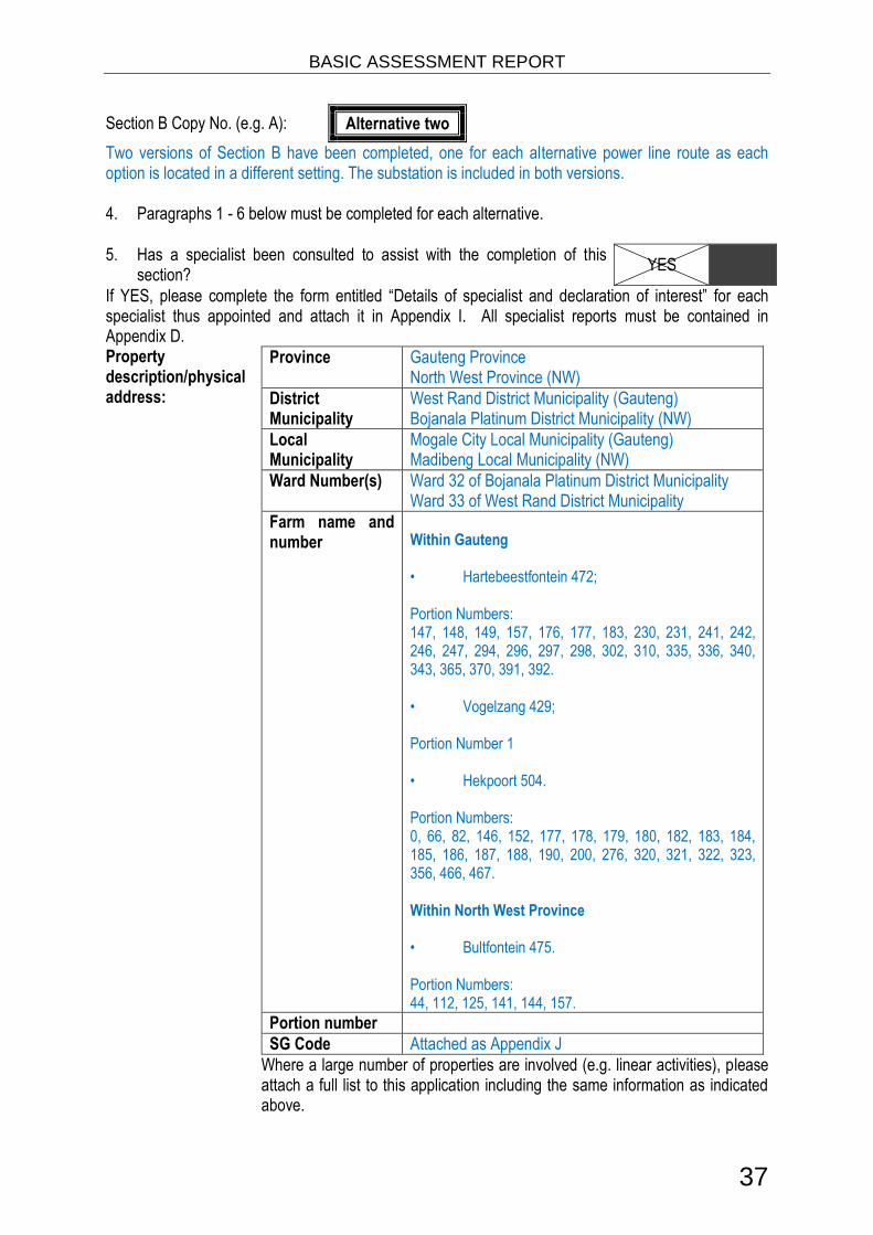
Section B Copy No. (e.g. A): Alternative two
Two versions of Section B have been completed, one for each alternative power line route as each option is located in a different setting. The substation is included in both versions. 4. Paragraphs 1 - 6 below must be completed for each alternative.
5. Has a specialist been consulted to assist with the completion of this section?
YES
If YES, please complete the form entitled “Details of specialist and declaration of interest” for each specialist thus appointed and attach it in Appendix I. All specialist reports must be contained in Appendix D. Property description/physical address:
Province Gauteng Province North West Province (NW)
District Municipality
West Rand District Municipality (Gauteng) Bojanala Platinum District Municipality (NW)
Local Municipality
Mogale City Local Municipality (Gauteng) Madibeng Local Municipality (NW)
Ward Number(s) Ward 32 of Bojanala Platinum District Municipality Ward 33 of West Rand District Municipality
Farm name and number
Within Gauteng • Hartebeestfontein 472; Portion Numbers: 147, 148, 149, 157, 176, 177, 183, 230, 231, 241, 242, 246, 247, 294, 296, 297, 298, 302, 310, 335, 336, 340, 343, 365, 370, 391, 392. • Vogelzang 429; Portion Number 1 • Hekpoort 504. Portion Numbers: 0, 66, 82, 146, 152, 177, 178, 179, 180, 182, 183, 184, 185, 186, 187, 188, 190, 200, 276, 320, 321, 322, 323, 356, 466, 467. Within North West Province • Bultfontein 475. Portion Numbers: 44, 112, 125, 141, 144, 157.
Portion number
SG Code Attached as Appendix J
Where a large number of properties are involved (e.g. linear activities), please attach a full list to this application including the same information as indicated above.

BASIC ASSESSMENT REPORT
38
Current land-use zoning as per local municipality IDP/records:
Agriculture
In instances where there is more than one current land-use zoning, please attach a list of current land use zonings that also indicate which portions each use pertains to, to this application.
Is a change of land-use or a consent use application required? YES
10. GRADIENT OF THE SITE Indicate the general gradient of the site. Alternative S1:
1:50 – 1:20
Alternative S2 (if any):
Flat 1:50 – 1:20 1:20 – 1:15 1:15 – 1:10 1:10 – 1:7,5 1:7,5 – 1:5 Steeper than 1:5
Alternative S3 (if any):
Flat 1:50 – 1:20 1:20 – 1:15 1:15 – 1:10 1:10 – 1:7,5 1:7,5 – 1:5 Steeper than 1:5
11. LOCATION IN LANDSCAPE Indicate the landform(s) that best describes the site:
2.1 Ridgeline 2.4 Closed valley 2.7 Undulating plain / low hills
2.2 Plateau 2.5 Open valley 2.8 Dune
2.3 Side slope of hill/mountain 2.6 Plain 2.9 Seafront
12. GROUNDWATER, SOIL AND GEOLOGICAL STABILITY OF THE SITE Is the site(s) located on any of the following? Alternative S1: Alternative S2
(if any): Alternative S3
(if any):
Shallow water table (less than 1.5m deep) NO YES NO YES NO
Dolomite, sinkhole or doline areas NO YES NO YES NO
Seasonally wet soils (often close to water bodies)
NO
YES NO
YES NO
Unstable rocky slopes or steep slopes with loose soil
NO
YES NO
YES NO
Dispersive soils (soils that dissolve in water) NO YES NO YES NO
Soils with high clay content (clay fraction more than 40%)
NO
YES NO
YES NO
Any other unstable soil or geological feature NO YES NO YES NO
An area sensitive to erosion NO YES NO YES NO

BASIC ASSESSMENT REPORT
39
If you are unsure about any of the above or if you are concerned that any of the above aspects may be an issue of concern in the application, an appropriate specialist should be appointed to assist in the completion of this section. Information in respect of the above will often be available as part of the project information or at the planning sections of local authorities. Where it exists, the 1:50 000 scale Regional Geotechnical Maps prepared by the Council for Geo Science may also be consulted. 13. GROUNDCOVER Indicate the types of groundcover present on the site. The location of all identified rare or endangered species or other elements should be accurately indicated on the site plan(s).
Natural veld - good conditionE
Natural veld with scattered aliensE
Natural veld with heavy alien infestationE
Veld dominated by alien speciesE
Gardens
Sport field Cultivated land Paved surface Building or other structure
Bare soil
If any of the boxes marked with an “E “is ticked, please consult an appropriate specialist to assist in the completion of this section if the environmental assessment practitioner doesn’t have the necessary expertise. 14. SURFACE WATER Indicate the surface water present on and or adjacent to the site and alternative sites?
Perennial River YES
Non-Perennial River NO
Permanent Wetland YES
Seasonal Wetland NO
Artificial Wetland YES
Estuarine / Lagoonal wetland NO
If any of the boxes marked YES or UNSURE is ticked, please provide a description of the relevant watercourse. Water Assessment Needed:
The proposed powerline route falls within the Western Bankenveld Ecoregion, on the Magalies River which falls within the A21F. Please refer to section 9 for a description of each water body and the Aquatic Ecological Assessment and Wetland Studies attached in Appendix D for more detailed information.

BASIC ASSESSMENT REPORT
40
15. LAND USE CHARACTER OF SURROUNDING AREA Indicate land uses and/or prominent features that currently occur within a 500m radius of the site and give description of how this influences the application or may be impacted upon by the application:
Natural area Dam or reservoir Polo fields
Low density residential Hospital/medical centre Filling station H
Medium density residential School Landfill or waste treatment site
High density residential Tertiary education facility Plantation
Informal residentialA Church Agriculture
Retail commercial & warehousing Old age home River, stream or wetland
Light industrial Sewage treatment plantA Nature conservation area
Medium industrial AN Train station or shunting yard N Mountain, koppie or ridge
Heavy industrial AN Railway line N Museum
Power station Major road (4 lanes or more) N Historical building
Office/consulting room Airport N Protected Area
Military or police base/station/compound
Harbour Graveyard
Spoil heap or slimes damA Sport facilities Archaeological site
Quarry, sand or borrow pit Golf course Other land uses (describe)
If any of the boxes marked with an “N “are ticked, how will this impact / be impacted upon by the proposed activity?
Railway line: Alternative 2 for the proposed power line is adjacent to the railway line. There will be minimal impact on the railway line by the substation and power line development.
If any of the boxes marked with an "An" are ticked, how will this impact / be impacted upon by the proposed activity? Specify and explain:
If any of the boxes marked with an "H" are ticked, how will this impact / be impacted upon by the proposed activity? Specify and explain:
Does the proposed site (including any alternative sites) fall within any of the following:
Critical Biodiversity Area (as per provincial conservation plan) NO
Core area of a protected area? NO
Buffer area of a protected area? NO
Planned expansion area of an existing protected area? NO
Existing offset area associated with a previous Environmental Authorisation? NO
Buffer area of the SKA? NO
If the answer to any of these questions was YES, a map indicating the affected area must be included in Appendix A.

BASIC ASSESSMENT REPORT
41
16. CULTURAL/HISTORICAL FEATURES
Are there any signs of culturally or historically significant elements, as defined in section 2 of the National Heritage Resources Act, 1999, (Act No. 25 of 1999), including Archaeological or paleontological sites, on or close (within 20m) to the site? If YES, explain:
YES
The survey of the first alternative revealed a total of four heritage sites (Table 7.1). The four heritage sites are historical sites (Sites 2, 4, 5 and 8) made up of a historical bridge (Site 2), a water canal (Site 4) a graveyard site (Site 5) and a historical house (Site 8). However no Stone Age sites, assemblages or artefact scatters were recorded. Please refer to the heritage impact attached in Appendix D for more detailed information. Table 7.1: Description and Evaluation of Cultural Heritage Sites along power line route alternative 2.
Figure 7.1: Another view of the dilapidated multi-room house (Site 2).
Site Reference No.
Site Type Statement of significance
2 Historical Bridge (Road) Generally Protected – B: Medium significance
4 Water Canal Generally Protected – B: Medium significance
5 Graveyard Generally Protected – A: High/Medium significance
8 Historical House Generally Protected – C: Low significance

BASIC ASSESSMENT REPORT
42
Figure 7.2: Another view of the dilapidated multi-room house (Site 2).
Figure 7.3: The start of a water canal (furrow) off the Magalies River with a sluice opening clearly visible.

BASIC ASSESSMENT REPORT
43
Figure 7.3: General view of the graveyard (Site 5).
Figure 7.4: General view of the historical house next to the R563 (Site 8).

BASIC ASSESSMENT REPORT
44
If uncertain, conduct a specialist investigation by a recognised specialist in the field (archaeology or palaeontology) to establish whether there is such a feature(s) present on or close to the site. Briefly explain the findings of the specialist:
Will any building or structure older than 60 years be affected in any way? There are, however, buildings and structures older than 60 years in the vicinity of the proposed development.
NO
Is it necessary to apply for a permit in terms of the National Heritage Resources Act, 1999 (Act 25 of 1999)?
NO
If YES, please provide proof that this permit application has been submitted to SAHRA or the relevant provincial authority. 17. SOCIO-ECONOMIC CHARACTER a) Local Municipality Please provide details on the socio-economic character of the local municipality in which the proposed site(s) are situated. Level of unemployment:
22% in Mogale City Local Municipality, 30.4% in the Madibeng Local Municipality
Economic profile of local municipality:
Madibeng Local Municipality is located in the North West province between the Magaliesberg and Witwatersrand, and situated 60km from Rustenberg and 50km north of Pretoria. It is strategically located in relation to Gauteng, Limpopo, Harare and the Maputo Harbour, and is positioned along the Heritage Route, linking the World Heritage Site with the Pilanesberg and Madikwe Game Reserves. It is known for its diversified economy. Currently, mining is the predominant economic activity, and the Hartebeespoort Dam is the second most visited place after the Waterfront in Cape Town. The West Rand District Management Area lies within the central-northern part of Mogale City, and this area comprises the bulk of the Cradle of Humankind World Heritage Site. Mogale City’s strongest functional urban linkage is with the City of Johannesburg. Krugersdorp and the greater Kagiso area, Mogale City’s primary urban complex, forms part of a band of development stretching from the Johannesburg Inner City westwards along the mining belt up to Krugersdorp. The largest part of Mogale City is rural in nature, with a specific urban concentration in the south-eastern part of the municipality where it interfaces with the Gauteng urban complex. The rural environment is characterised by prominent features: the Magaliesberg and Witwatersberg Ranges in the north-west. Rural towns in Mogale City are Tarlton, Magaliesburg and Hekpoort, located in the west. Urban concentration is found in the south-eastern part around Krugersdorp and Kagiso. The Krugersdorp CBD is the main business, social and administrative centre and fulfils a regional function. The areas around Krugersdorp are established middle-to-high income residential areas with the full range of urban amenities, services and facilities. The areas to the south of Krugersdorp, namely Kagiso, Azaadville and Rietvallei (referred to as the Kagiso complex), are predominantly disadvantaged settlements with more limited access to services and facilities. The Kagiso complex is physically separated from

BASIC ASSESSMENT REPORT
45
Krugersdorp's urban areas by an extensive mining belt that runs roughly in an east-west direction through the area.
Level of education:
Education in Mogale City Local Municipality for people over the age of 20 is as follows: No Schooling
4.70% Higher Education
14.10% Matric
32.60 Education in Madibeng Local Municipality for people over the age of 20 is as follows: No Schooling
7.80% Higher Education
7.70% Matric
27.30%
b) Socio-economic value of the activity Please note that the following information is not yet available.
What is the expected capital value of the activity on completion? R
What is the expected yearly income that will be generated by or as a result of the activity?
R
Will the activity contribute to service infrastructure? YES
Is the activity a public amenity? NO
How many new employment opportunities will be created in the development and construction phase of the activity/ies?
What is the expected value of the employment opportunities during the development and construction phase?
R
What percentage of this will accrue to previously disadvantaged individuals? %
How many permanent new employment opportunities will be created during the operational phase of the activity?
What is the expected current value of the employment opportunities during the first 10 years?
R
What percentage of this will accrue to previously disadvantaged individuals? %
18. BIODIVERSITY Please note: The Department may request specialist input/studies depending on the nature of the biodiversity occurring on the site and potential impact(s) of the proposed activity/ies. To assist with the identification of the biodiversity occurring on site and the ecosystem status consult http://bgis.sanbi.org or [email protected]. Information is also available on compact disc (cd) from the Biodiversity-GIS Unit, Ph (021) 799 8698. This information may be updated from time to time and it is the applicant/ EAP’s responsibility to ensure that the latest version is used. A map of the relevant biodiversity

BASIC ASSESSMENT REPORT
46
information (including an indication of the habitat conditions as per (b) below) and must be provided as an overlay map to the property/site plan as Appendix D to this report. a) Indicate the applicable biodiversity planning categories of all areas on site and indicate the reason(s) provided in the biodiversity plan for the selection of the specific area as part of the specific category)
Systematic Biodiversity Planning Category If CBA or ESA, indicate the reason(s) for its selection in biodiversity plan
Critical Biodiversity Area (CBA)
Ecological Support
Area (ESA)
Other Natural Area
(ONA)
No Natural Area
Remaining (NNR)
The ESAs and CBAs associated with the proposed power line route alternative 2 are situated along the Magalies River as well as the other natural water bodies leading into the Magalies River.
b) Indicate and describe the habitat condition on site
Habitat Condition
Percentage of habitat
condition class (adding up to 100%)
Description and additional Comments and Observations
(including additional insight into condition, e.g. poor land management practises, presence of quarries,
grazing, harvesting regimes etc).
Natural 20% Riparian vegetation is found along this proposed alternative at a number of river crossings.
Near Natural (includes areas with
low to moderate level of alien invasive
plants)
-
Degraded (includes areas
heavily invaded by alien plants)
-
Transformed (includes cultivation,
dams, urban, plantation, roads, etc)
80%
Current agricultural fields occur along the route of the power line. Old agricultural fields also occur along the route of the power line. These old fields are dominated by secondary growth of indigenous and alien vegetation.
c) Complete the table to indicate:
(i) the type of vegetation, including its ecosystem status, present on the site; and (ii) whether an aquatic ecosystem is present on site.
Terrestrial Ecosystems Aquatic Ecosystems
Ecosystem threat status as per the
National
Critical Wetland (including rivers, depressions, channelled and unchanneled wetlands, flats,
Estuary Coastline Endangered:.
Vulnerable

BASIC ASSESSMENT REPORT
47
Terrestrial Ecosystems Aquatic Ecosystems
Environmental Management:
Biodiversity Act (Act No. 10 of 2004)
Least Threatened
seeps pans, and artificial wetlands)
YES NO UNSURE YES NO YES NO
There is a short section of the route which encroaches on an endangered area. Refer to the sensitivity map in Appendix A
d) Please provide a description of the vegetation type and/or aquatic ecosystem present on site, including any important biodiversity features/information identified on site (e.g. threatened species and special habitats)
The vegetation type over the site is categorised as Mixed Bushveld. The floor of the valley is Moot Plains Bushveld and the mountain ranges on either side are Gold Reef Mountain Bushveld (EcoAgent, 2013). The mixed bushveld on the valley floor of the Magalies River is dominated by various Acacia tree species. These trees are generally denser on the more clayey soils along the riparian zone, and become more infrequent with a well-developed grass layer in the higher and sandier areas. This higher area grades into and becomes more wooded towards the adjoining mountain bushveld on either side, this does not occur on the site and is best developed along the steeper southern aspects of the ranges. Most of the proposed power line route crosses over agricultural fields and old agricultural fields which have recovered growth of natural vegetation. The proposed route also crosses a number of waterbodies. The recovered growth of natural vegetation in the old agricultural field areas is dominated by the herbaceous species Hyparrhenia hirta, Cynodon dactylon and Aristida congesta. Acacia karroo shrubs are also scatterd over these areas. Dense woody vegetation occurs in the vicinity of River crossing 4b. However, the herbaceous vegetation is in a disturbed and degraded condition. The most prominent woody species are Acacia karroo, Euclea natalensis, Searsia lancea and Acacia robusta.

BASIC ASSESSMENT REPORT
48
Water Bodies An unchannelled valley bottom wetland is situated on the eastern portion of the proposed power line route and has two impoundments, one of which is located upstream along power line alternative 2 whereas the other is located downstream along power line alternative 1. The unchannelled valley bottom wetland is characterised by the grass species Imperata cylindrica as illustrated in Figure 9.1 below.
Figure 9.1: Imperata cylindrical observed within the unchannelled valley bottom wetland.
Power line route alternative 2 crosses over the Magalies River (Figure 9.2) and a tributary to the Magalies River (Figure 9.3). Both rivers had low vegetation cover; however there was limited erosion observed mainly as a result of livestock grazing and trampling within certain areas.
Figure 9.2: A representative photograph of the Magalies River.

BASIC ASSESSMENT REPORT
49
Figure 9.3: A representative photograph of the tributary to the Magalies River.
Three dams and three channels were found along power line route alternative 2. Most of the dams observed during site visit were created due to excavations and soil dumping as a result of historical mining activities. Therefore these features did not form part of the assessment since they are artificial. There was a pump observed where dam 1 (Please refer to the wetland specialist report in Appendix D) was located, therefore it was definitely being used for irrigation purposes. Dam 2 Please refer to the wetland specialist report in Appendix D) might have been anthropogenically formed for irrigation purposes, however from what was observed on site, water was being pumped into the dam instead of being abstracted. Three artificial channels were observed and may have been formed to intercept water for irrigation purposes. None of the channels displayed wetland characteristics as defined by DWA 2005, therefore they were not considered as natural wetlands. Based on species that were found in the ecological impact assessment conducted for the Styldrift Mine Complex a number of threatened or protected species (TOPS) (GN 389 of 2013) and invasive plant species (GNR 507 and GNR 508 of 2013) (NEM:BA No. 10 of 2004) were identified. TOPs species potentially found in the area with reference to of GNR 389 include;
TAXON LATEST (TOPS) THREAT STATUS
Aloe Peglerae Endangered
Bowiea volubilis Vulnerable
Prunus africana Vulnerable
No prohibited invasive species were identied in terms of GNR 508.

BASIC ASSESSMENT REPORT
50
SECTION C: PUBLIC PARTICIPATION 1. ADVERTISEMENT AND NOTICE
Publication name Citizen
Date published 4 March 2015
Site notice position Latitude Longitude
25° 54' 12.50" S 27° 35' 37.44" E
25° 53' 12.89" S 27° 36' 40.67" E
25° 53' 46.51" S 27° 36' 2.02" E
25° 53' 46.59" S 27° 36' 48.15" E
25° 53' 46.55" S 27° 36' 48.19" E
25° 53' 54.35" S 27° 37' 52.94" E
25° 53' 26.39" S 27° 36' 44.65" E
25° 52' 35.63" S 27° 38' 9.54" E
25° 52' 40.05" S 27° 39' 9.51" E
25° 51' 56.35" S 27° 39' 31.06" E
25° 52' 14.47" S 27° 39' 56.16" E
25° 51' 15.56" S 27° 40' 27.71" E
25° 51' 17.92" S 27° 41' 37.45" E
25° 51' 3.48" S 27° 42' 3.46" E
25° 54' 12.50" S 27° 35' 37.44" E
Date placed 4 March 2015
Include proof of the placement of the relevant advertisements and notices in Appendix E1.
Site notices announcing the proposed project were placed along the proposed and alternative routes of
the proposed Kashan power line. These notices were placed conspicuous to the public and
settlements in the area. Site notices were also placed on the fence and borders of the proposed
substations. The coordinates above provide the locations of all site notices placed.
An advert announcing the proposed project was placed on 4 March 2015 in a regional newspaper,
namely The Citizen. Proof of the site notice placement and advertisement is provided in Appendix E1.
2. DETERMINATION OF APPROPRIATE MEASURES Provide details of the measures taken to include all potential I&APs as required by Regulation 54(2)(e) and 54(7) of GN R.543.
54(2)(e) using reasonable alternative
methods, as agreed to by the
competent authority, in those
instances where a person is
desiring of but unable to
participate in the process due
to—
(i) illiteracy;
Upon lodging of the application
to DEA, notification letters were
sent to landowners on whose
land/ property the proposed
power line routes run and
planned locations of substations
are situated.
On 4 March 2015 Short

BASIC ASSESSMENT REPORT
51
(ii) disability; or
(iii) any other disadvantage.
Message Service (SMS), postal
and email notification of the
proposed project was sent to all
Interested and Affected Parties
(I&APs).
On 29 April 2015 SMS, postal
and email notification of the
public open - house (discussion
meeting) and the availability of
the DBAR was sent to all
registered (I&APs). An
advertisement announcing the
details of the public open –
house was also placed in The
Citizen newspaper.
The public - open day was held
at the Hekpoort Community Hall
to provide equal opportunity for
all stakeholders from the
surrounding area to receive
information and comment on the
Draft BAR. (Please see
Appendix E2 for all proof of
notification)
No alternate methods were
requested by I&APs or required
by the competent authority.
54(3) A notice, notice board or
advertisement referred to in sub
regulation (2) must—
(a) give details of the application
which is subjected to public
participation; and
(b) state—
(i) that the application has been
submitted to the competent
authority in terms of these
Regulations[, as the case may
be];
(ii) whether basic assessment or
scoping procedures are being
applied to the application, in the
All site notices and
advertisements states the
following details:
Applicant, namely Eskom
Holdings SOC Ltd (Eskom);
(i) application has been
submitted to the Department of
Environmental Affairs (DEA) in
terms of the NEMA regulations;
(ii) A Basic Assessment is being
applied to the application and
will be undertaken by SRK
Consulting (SA);
(iii) project activities and location
of the activities to which the

BASIC ASSESSMENT REPORT
52
case of an application for
environmental authorisation;
(iii) the nature and location of
the activity to which the
application relates;
(iv) where further information on
the application or activity can be
obtained; and
(vi) the manner in which and the
person to whom representations
in respect of the application may
be made.
application relates are listed;
(iv) further information on the
application or activity can be
obtained from SRK’s public
participation office, or public
open day/ public meeting will be
held at the Hekpoort Community
Hall, or at the public places
listed below:
Hekpoort Public Library;
Hekpoort Primary School;
Hekpoort Estate agent (next to
the Lifestyle Hekpoort Village
Apteek);and
SRK Website.
(vi) Questions, comments and
suggestions may be submitted
by means of e-mail, fax,
postage, or telephonically to the
SRK public participation office.
54(4) A notice board referred to in
sub-regulation (2) must—
(a) be of a size at least 60cm by
42cm; and
(b) display the required
information in lettering and in a
format as may be determined by
the competent authority
All site notices are A2 (60cm x
42cm) in size and display the
required information as
mentioned in the section above.
54(5) Where deviation from sub-
regulation (2) may be
appropriate, the person
conducting the public
participation process may
deviate from the requirements of
that sub-regulation to the extent
and in the manner as may be
agreed to by the competent
authority.
Application letter for deviation
from aspects of the public
participation process is attached
in Appendix E4. Deviation
approval was optioned.
54(6) Where a basic assessment
report, scoping report or
environmental impact
Not applicable.

BASIC ASSESSMENT REPORT
53
assessment report as
contemplated in regulations 22,
28 and 31 respectively is
amended because it has been
rejected or because of a request
for additional information by the
competent authority, and such
amended report contains new
information, the amended basic
assessment report, scoping
report or environmental impact
assessment report must be
subjected to the processes
contemplated in regulations 21,
27 and 31, as the case may be,
on the understanding that the
application form need not be
resubmitted
Key stakeholders (other than organs of state) identified in terms of Regulation 54(2)(b) of GN R.543:
54(2)(b) Giving written notice to - Details
54(2)(b)(i) the owner or person in control of
that land if the applicant is not
the owner or person in control of
the land;
Upon lodging of the application
to DEA, notification letters were
sent to landowners on whose
land/ property the proposed as
well as alternative power line
routes run and planned locations
of substations are situated.
Upon lodging of the application
to DEA, notification letters were
sent to landowners on whose
land/ property the proposed
power line routes run and
planned locations of substations
are situated.
On 4 March 2015 Short
Message Service (SMS), postal
and email notification of the
proposed project was sent to all
Interested and Affected Parties
(I&APs).
On 29 April 2015 SMS, postal

BASIC ASSESSMENT REPORT
54
and email notification of the
public open - house (discussion
meeting) and the availability of
the DBAR was sent to all
registered (I&APs). An
advertisement announcing the
details of the public open –
house was also placed in The
Citizen newspaper. (Please see
Appendix E2 for all proof of
notification). The public - open
day was held at the Hekpoort
Community Hall to provide equal
opportunity for all stakeholders
from the surrounding area to
receive information and
comment on the Draft BAR. All
comments have been included
in the Comments and Response
Report (CRR) which forms part
of the FBAR. The CRR can be
found in Appendix E3. I&APs will
be notified of the availability of
the FBAR.
54(2)(b)(ii) the occupiers of the site where
the activity is or is to be
undertaken or to any alternative
site where the activity is to be
undertaken;
Occupiers of the site were
notified via site notification and
newspaper publications.
54(2)(b)(iii) owners and occupiers of land
adjacent to the site where the
activity is or is to be undertaken
or to any alternative site where
the activity is to be undertaken;
Notification was sent to all
I&APs upon availability of the
Draft BAR.
An advertisement was placed in
the Citizen Newspaper.
A public open - day was held at
the Hekpoort Community Hall to
provide equal opportunity for all
stakeholders from the
surrounding area to receive
information and comment on the
DBAR. All comments have
been included in the FBAR.

BASIC ASSESSMENT REPORT
55
54(2)(b)(iv) the municipal councilor of the
ward in which the site or
alternative site is situated and
any organisation of ratepayers
that represent the community in
the area;
Notification letters was sent to
relevant ward councillors upon
availability of the DBAR, which
included an invitation and details
of the public open day:
Mogale City Local Municipality,
Councillor: Ward 32;
Madibeng Local Municipality,
Councillor: Ward 29;
54(2)(b)(v) the municipality which has
jurisdiction in the area
Notification letters was sent to
relevant municipal officials upon
availability of the Draft BAR,
which will include an invitation
and details of the public open
day with jurisdiction:
Mogale City Local Municipality,
Municipal Manager;
Mogale City Local Municipality,
Environmental Manager;
Madibeng Local Municipality,
Municipal Manager;
Madibeng Local Municipality,
Environmental Manager;
West-Rand District Municipality,
Municipal Manager;
West-Rand District Municipality,
Environmental Manager;
Bojanala District Municipality,
Executive Mayor;
Bojanala District Municipality,
Municipal Manager;
and
Bojanala District Municipality,
Environmental Manager.

BASIC ASSESSMENT REPORT
56
Title, Name and Surname Affiliation/ key stakeholder status Contact details (tel number or e-mail address)
Please refer to Appendix E5 for a copy of the I&AP register
Include proof that the key stakeholder received written notification of the proposed activities as Appendix E2. This proof may include any of the following:
e-mail delivery reports;
registered mail receipts;
courier waybills;
signed acknowledgements of receipt; and/or
or any other proof as agreed upon by the competent authority. 3. ISSUES RAISED BY INTERESTED AND AFFECTED PARTIES
Summary of main issues raised by I&APs Summary of response from EAP
All comment or response received is provided in a Comments and Response Report found in Appendix E3
4. COMMENTS AND RESPONSE REPORT The practitioner must record all comments received from I&APs and respond to each comment before the Draft BAR is submitted. The comments and responses must be captured in a comments and response report as prescribed in the EIA regulations and be attached to the Final BAR as Appendix E3. Eskom is in the process of expanding their power supply grid by supplying additional substations to developing informal settlements and other areas in need of additional capacity. These areas fall within the North West and Gauteng Province. SRK has received various objections to the proposed power line which have been included in the CRR (Appendix E3). Public Participation Background: The proposed power line route appeared to provide the most feasible in terms of the overall environmental impact as well as the financial impact on the proposed project. However most comments received from stakeholders alluded to the fact that they did not want the power line to run along the proposed route. The public open-house provided a platform for the community and Eskom to engage and discuss all concerns. The majority of the community members said that it would be better for Eskom to opt for the alternative route as the preferred route (this is the route along the railway line). These comments have been recorded in the CRR attached as Appendix E3) Following the public open-house SRK received numerous letters (copies of these can be found in Appendix E6) in objection to the proposed route and provided a description of their own unique alternative route.

BASIC ASSESSMENT REPORT
57
5. AUTHORITY PARTICIPATION Authorities and organs of state identified as key stakeholders:
Authority/Organ of State
Contact person (Title, Name and Surname)
Tel No Fax No e-mail Postal address
Department of Water and Sanitation (DWS) - NW
Mr Chadwick Lobakeng
018 387 9547 [email protected] Private Bag X5 Mmabatho 2735
Mr L Bogopa 018 387 9547 [email protected] Private Bag X5 Mmabatho 2735
Department of Water and Sanitation (DWS) - Gauteng
Ms T Rakgotho
012 392 1362 012 392 1506 [email protected] Private Bag X995 Pretoria 0001
Mr M Keet 012 392 1306/7 012 392 1304 [email protected] Private Bag X995 Pretoria 0001
Gauteng Department of Agriculture and Rural Development (GDARD)
Ms Cecilia Petlane
011 555 1993 011 335 1850 [email protected]
P.O. box 8769 Johannesburg 2000
Rural, Environmental and Agricultural Development (READ)
Mr Steven Mukhola
018 389 5959 018 389 5006 [email protected]
Regional Land Claims Commission: North West Province
Mr L J Bogatshu
018 389 9600 018 389 9642 [email protected]
Private Bag X08 Mmabatho 2735
Regional Land Claims Commission: Gauteng
Mr Cindy Benyane
(012) 310 6620 [email protected]
Department of Public Works and Roads - North West Regional Office
Ms H Pretorius
018 388 1254 018 388 4547 [email protected] Private Bag X120 Mmabatho 2735
Mr Keoagele Sitase
018 387 2447 086 535 1538 / 1537
[email protected] Private Bag X120 Mmabatho 2735
Department of Public Works and Roads – Gauteng
Mr Mziwonke Dlabantu
012 406 1000 086 272 8831 [email protected] Private Bag X65 Pretoria 0001
Mogale City Local Municipality
Mr Koketso Calvin Seerane
011 668 0500 011 953 6139 [email protected] PO Box 94 Krugersdorp 1740
Mr Dan Mashitisho
011 951 2013 011 953 2547 [email protected] PO Box 94 Krugersdorp 1740
Mr Samu Mdlalose
011 660 8757 011 953 2547 [email protected] PO Box 94 Krugersdorp 1740
Madibeng Local Municipality
Monde Juta 012 318 9396 (012) 318 4203 [email protected]

BASIC ASSESSMENT REPORT
58
West Rand District Municipality
Clr Nawa Mpho
011 411 5202 011 693 7833 [email protected] Private Bag 033 Randfontein 1760
Mr M D Mokoena
011 411 5221 011 693 4306 [email protected] Private Bag 033 Randfontein 1760
Bojanala District Municipality
Mr Innocent Sirovha
[email protected] PO Box1993 Rustenburg 0300
RJL Diremelo [email protected] PO Box1993 Rustenburg 0300
Include proof that the Authorities and Organs of State received written notification of the proposed activities as appendix E4. In the case of renewable energy projects, Eskom and the SKA Project Office must be included in the list of Organs of State. 6. CONSULTATION WITH OTHER STAKEHOLDERS Note that, for any activities (linear or other) where deviation from the public participation requirements may be appropriate, the person conducting the public participation process may deviate from the requirements of that sub-regulation to the extent and in the manner as may be agreed to by the competent authority. Proof of any such agreement must be provided, where applicable. Application for any deviation from the regulations relating to the public participation process must be submitted prior to the commencement of the public participation process. A list of registered I&APs must be included as appendix E5. Copies of any correspondence and minutes of any meetings held must be included in Appendix E6.

BASIC ASSESSMENT REPORT
59
SECTION D: IMPACT ASSESSMENT The assessment of impacts must adhere to the minimum requirements in the EIA Regulations, 2010, and should take applicable official guidelines into account. The issues raised by interested and affected parties should also be addressed in the assessment of impacts. 1. IMPACTS THAT MAY RESULT FROM THE PLANNING AND DESIGN, CONSTRUCTION,
OPERATIONAL, DECOMMISSIONING AND CLOSURE PHASES AS WELL AS PROPOSED MANAGEMENT OF IDENTIFIED IMPACTS AND PROPOSED MITIGATION MEASURES
Provide a summary and anticipated significance of the potential direct, indirect and cumulative impacts that are likely to occur as a result of the planning and design phase, construction phase, operational phase, decommissioning and closure phase, including impacts relating to the choice of site/activity/technology alternatives as well as the mitigation measures that may eliminate or reduce the potential impacts listed. This impact assessment must be applied to all the identified alternatives to the activities identified in Section A(2) of this report.
Activity Impact summary Before Mitigation
After Mitigation
Proposed mitigation
Pre-Construction Phase
Socio-Ecomonic Pre-planning. There may be potential
conflict with the land owners during the pre-construction phase.
60 Maintain Current
Management
18 No
Management Required
Ensure effective communication with the land owners during construction and during site maintenance. In this respect it must be noted that there has been a direct refusal to allow the power line to be constructed on a particular farm. This is seen as a matter to be resolved between the relevant land owner and Eskom, rather than an environmental or social impact.
Pre-planning. On a site specific scale the planning of the locations of pylons and line route will determine the future potential loss in production.
48 Maintain Current
Management
36 Maintain Current
Management
Speak to all landowners regarding the anticipated use of the land and plan the power line route to minimise the impact of the project on current and future land use and production.

BASIC ASSESSMENT REPORT
60
Activity Impact summary Before Mitigation
After Mitigation
Proposed mitigation
Surface and Ground Water Design and placement of support towers within areas that are regularly inundated at the proposed substation and along both power line route alternatives.
Negative impacts on aquatic migratory corridors.
36 Maintain Current
Management
12 No
Management Required
No support structures should be constructed within the riparian areas or within the active stream channel. If at all possible all support structures should be developed above the 1: 100 year flood line and above the 1:50 year flood line as a minimum.
Construction Phase
Soil and Land Use
Site clearance along with the movement of heavy machinery at the proposed substation and along both power line route alternatives.
Ground compaction and soil erosion which could lead to the loss of soil resources.
36 Maintain Current
Management
21 No
Management Required
Soil must only be stripped from areas to be disturbed during construction or maintenance. It will be ensured that erosion controls are included in the designs of linear infrastructure. Vehicles should be restricted to travelling only on designated roadways, as far away from the wetland areas as possible to limit the ecological footprint of the proposed development activities.
Biodiversity Vegetation Removal in areas where there is current agriculture and old fields and at the proposed substation (Old fields).
Site clearance, compaction and soil erosion and the introduction of alien invasive species can impact on habitat for floral species as well as species diversity.
12 No
management Required
12 No
Management Required
Compliance in accordance with Eskom's existing Land and Biodiversity Standard (Appendix C) as well as Eskoms Vegetation Management Standard (Appendix C) shall be maintained and monitored on an annual basis. The protection of threatened or protected species (TOPS) must be carried out in accordance to NEMBA (Act 10 of 2004) Chapter 4, Part 2. This will include any amendments or

BASIC ASSESSMENT REPORT
61
Activity Impact summary Before Mitigation
After Mitigation
Proposed mitigation
Vegetation Removal in areas of dense bush along both power line route alternatives.
28 Maintain Current
Management
24 No
Management Required
changes to regulations and guidelines pertaining to the protection of TOPS. The extent of the construction site must be demarcated with construction hazard tape and no vegetation is to be removed outside of this zone. No vegetation is to be removed outside of the demarcated zones. This will prevent disturbance of natural vegetation and the establishment of alien and invader vegetation species specified by GNR 507 and 508 or any amendments to the legislation. An alien eradication and management program must be developed. Eradication and monitoring must be undertaken monthly during the construction phase and yearly during the operational phase. If herbicides need to be used to control the spread of invasive plants, only herbicides approved by the National Department of Agriculture should be used. Vehicles should be restricted to travelling only on designated roadways, as far away from the wetland areas as possible to limit the ecological footprint of the proposed development activities. Fires on site are prohibited.
Vegetation Removal along the water courses along both power line route alternatives.
32 Maintain Current
Management
24 No
Management Required
Vegetation removal at the proposed substation and along both power line route alternatives.
Disturbance of faunal habitats and the ecosystem structure and function.
12 No
Management Required
12 No
Management Required
The protection of threatened or protected species (TOPS) must be carried out in accordance to NEMBA (Act 10 of 2004) Chapter 4, Part 2. This will include any amendments or changes to regulations and guidelines pertaining to the protection of TOPS. Fires on site are prohibited. No trapping or hunting of fauna should be allowed on site during any phase of the project.

BASIC ASSESSMENT REPORT
62
Activity Impact summary Before Mitigation
After Mitigation
Proposed mitigation
Construction and positioning of pylons along both power line route alternatives.
clearance of vegetation which could result in the loss and degradation of natural bird habitat 40
Maintain Current
Management
16 No
Management Required
The protection of threatened or protected species (TOPS) must be carried out in accordance to NEMBA (Act 10 of 2004) Chapter 4, Part 2. This will include any amendments or changes to regulations and guidelines pertaining to the protection of TOPS.
The extent of the construction site must be demarcated and no vegetation is to be removed outside of this zone.
Construction of the substation and power lines along both power line route alternatives.
Degradation of habitat and disturbance negatively impacting on species of conservation concern (RDL/ NW SoER 2002/ NEMBA (2004).
40 Maintain Current
Management
20 No
Management Required
The protection of threatened or protected species (TOPS) must be carried out in accordance to NEMBA (Act 10 of 2004) Chapter 4, Part 2. This will include any amendments or changes to regulations and guidelines pertaining to the protection of TOPS. Fires on site are prohibited. No trapping or hunting of fauna should be allowed on site during any phase of the project. River banks and other ecologically sensitive areas must be rehabilitated, in consultation with a specialist, were they have been damaged once construction in that particular area is complete.
Surface and Ground Water Site clearance, construction, indisciminate driving along route Alternative 1.
Negative impacts on wetland recharge, inundation and instream flow for wetlands and rivers.
28 Maintain Current
Management
8 No
Management Required
Should any construction activities occur within these areas, relevant authorisation should be carried out according to the National Environmental Management Act (NEMA) 107 of 1998 and Section 21 c and i of the National Water Act 36 of 1998. Stripping and clearing should ideally be planned to be done during the dry season (March-August). Ensure that erosion control measures are included in the method statement for construction of the substations and associated power lines, particularly if stripping and clearing of vegetation is likely to occur during the wet season (September - April) River banks and other ecologically sensitive areas must be rehabilitated, in consultation with a specialist, were they have been damaged once construction in that particular area is

BASIC ASSESSMENT REPORT
63
Activity Impact summary Before Mitigation
After Mitigation
Proposed mitigation
Site clearance, construction, indisciminate driving along route Alternative 2.
Negative impacts on wetland recharge, inundation and instream flow for wetlands and rivers.
60 Maintain Current
Management
28 No
Management Required
Site clearing and alteration of the natural hydrological regime of water bodies identified along route Alternative 2.
Loss of resources, such as grazing and support for biodiversity this will have negative impacts on ecological and sociocultural service provision of wetlands and rivers.
24 No
Management Required
6 No
Management Required
Adequate storm water management must be incorporated into the design of the power line routes and the sub-station site in order to prevent erosion. In this regard special mention is made of the installation of drift fences to capture silt. River banks and other ecologically sensitive areas must be rehabilitated, in consultation with a specialist, were they have been damaged once construction in that particular area is complete. Conditions imposed in terms of the Water Use License (WUL) must be complied with in this respect. Existing surface water management practices for Eskom’s operations should be applied to each proposed substation and associated power line. Vehicles should be restricted to travelling only on designated roadways, as far away from the wetland areas as possible to limit the ecological footprint of the proposed development activities.
Site clearing and alteration of the natural hydrological regime of water bodies identified along route Alternative 1. 32
Maintain Current
Management
10 No
Management Required
Construction of access roads, loss of vegetation and dumping of waste along route Alternative 2.
Negative impact on instream and wetland habitat for wetlands and rivers identified.
35 Maintain Current
Management
12 No
Management Required
No dumping of waste material should be allowed. , especially close to wetland features. Enforcement of this requirement is particularly relevant close to sensitive areas such as wetlands. Litter bins should be provided and should be emptied when full, and then transported to a general waste facility. Reinforce banks and drainage features where necessary with gabions, reno mattresses and geotextiles. Conditions imposed in terms of WUL must be complied with in this respect.
Construction of access roads, loss of vegetation and dumping of waste along route Alternative 1.
70 Maintain Current
Management
12 No
Management Required

BASIC ASSESSMENT REPORT
64
Activity Impact summary Before Mitigation
After Mitigation
Proposed mitigation
It must be ensured that all hazardous storage containers and storage areas comply with the relevant SABS standards to prevent leakage. All vehicles must be regularly inspected for leaks. Spillage or leakage of materials and wastes should be reported to the project manager and cleaned up within 24 hours. Stripping and clearing should ideally be planned to be done during the dry season (March-August). Ensure that erosion control measures are included in the method statement for construction of the substations and associated power lines, particularly if stripping and clearing of vegetation is likely to occur during the wet season (September - April)
Placement of support towers in active channels during construction along both power line route alternatives.
Local changes to instream flow patterns.
48 Maintain Current
Management
15 No
Management Required
No support structures should be constructed within the riparian areas or within the active stream channel. If at all possible all support structures should be developed above the 1: 100 year flood line, or, if this is unavoidable, the 1:50 year flood line as a minimum; During construction all building materials should be kept out of the riparian areas as well as the active stream channels; All waste and remaining building materials should be removed from site on completion of the project; Vehicles should be restricted to travelling only on designated roadways, as far away from the wetland areas as possible to limit the ecological footprint of the proposed development activities.

BASIC ASSESSMENT REPORT
65
Activity Impact summary Before Mitigation
After Mitigation
Proposed mitigation
Disturbance of soils and removal of riparian vegetation along both power line route alternatives.
Increased sedimentation and turbidity.
36 Maintain Current
Management
15 No
Management Required
During construction concurrent rehabilitation is to take place as far as possible and footprint areas should be minimised as far as possible; All areas affected by construction should be rehabilitated upon completion of the construction phase of the development; River banks must be appropriately re-profiled and re-vegetated with indigenous grasses and trees. Steep banks should be stabilised with hessian sheets or other appropriate means.; During the construction and operational phases of the proposed development, erosion berms should be installed to prevent gully formation and siltation of the riparian resources. The following points should serve to guide the placement of erosion berms:
- Where the track has slope of less than 2%, berms every 50m should be installed.
- Where the track slopes between 2% and 10%, berms every 25m should be installed.
- Where the track slopes between 10%-15%, berms every 20m should be installed.
- Where the track has slope greater than 15%, berms every 10m should be installed.
- Where applicable, Eskom’s own guidelines can replace these specifications. Vehicles should be restricted to travelling only on designated roadways, as far away from the wetland areas as possible to limit the ecological footprint of the proposed development activities.

BASIC ASSESSMENT REPORT
66
Activity Impact summary Before Mitigation
After Mitigation
Proposed mitigation
Access road construction, placement of towers, vegetation clearance and pollution at the proposed substation and along both power line route alternatives.
Negative impacts on taxa sensitive to changes in water quality.
70 Maintain Current
Management
10 No
Management Required
No unnecessary support structures should be constructed within the riparian zones or active stream channels; Conditions imposed in terms of WUL must be complied with in this respect. During construction all construction materials should be kept out of the riparian or wetland zones; No dumping of waste material should be allowed, especially close to wetland features. Litter bins should be provided and should be emptied when full, and then transported to a general waste facility. Provision of appropriate sewage facilities during the construction phase (one toilet for 15 staff members). These should be located within the footprint construction area. Spillage or leakage of materials and wastes should be reported to the project manager and cleaned up within 24 hours. No maintenance or servicing of vehicles will take place on site.
Air Quality Construction activities and movement of heavy vehicles over dust roads at the proposed substation and along both power line route alternatives.
Increase in dust concentration which could affect air quality.
42 Maintain Current
Management
18 No
Management Required
Dust suppression during construction for Eskom’s operations should be applied to each proposed substations and associated power lines. Speed limits should be enforced at 30 km/h on the access roads to substations and temporary access routes along the power line servitude.

BASIC ASSESSMENT REPORT
67
Activity Impact summary Before Mitigation
After Mitigation
Proposed mitigation
Noise The use of heavy machinery at the proposed substation and along both power line route alternatives.
Noise disturbance in the vicinity.
30 Maintain Current
Management
20 No
Management Required
Maintenance equipment to comply with the standards for construction vehicles as stipulated in the IFC's Environmental, Health and Safety Regulations.
Heritage Inappropriate placement of pylons and movement of machinery.
Impact on unidentified heritage artefacts at the proposed substation and along both power line route alternatives.
30 Maintain Current
Management
12 No
Management Required
If any new artefacts of archaeological or cultural interest, which will be disturbed by the construction activities, are found, including graves, then the area will be marked and all activities in that vicinity will cease with immediate effect. SAHRA and the North West Provincial Heritage Resources Authority (NWPHRA)/the Provincial Heritage Resources Authority - Gauteng (PHRA-G) will be notified of the finding and operations at that specific site will only continue after the relevant NWPHRA has granted permission to do so. The location of the identified historical sites must be noted prior to the start of the construction phase and pylons must be positioned so that any impact on the identified historical sites is avoided.
Impact on the graveyard (High/medium significance) found along the power line route Alternative 1.
90 Improve Current
Management
12 No
Management Required
The identified graveyard sites must be noted along the proposed power line route must be fenced off with access gates installed. The location of the identified historical sites must be noted prior to the start of the construction phase and pylons must be positioned so that any impact on the identified historical sites is avoided.
Impact on the four graveyard sites (High/medium significance) identified along the power line route Alternative 2.
90 Improve Current
Management
12 No
Management Required
Impact on the historical road bridge and the historical water canal (medium significance) found along the power line route Alternative 2.
80 Improve Current
Management
12 No
Management Required
The location of the identified historical sites must be noted prior to the start of the construction phase and pylons must be positioned so that any impact on the identified historical sites is avoided.

BASIC ASSESSMENT REPORT
68
Activity Impact summary Before Mitigation
After Mitigation
Proposed mitigation
Impact on the historical farm house (low significance) found along the power line route Alternative 2.
70 Maintain Current
Management
12 No
Management Required
Impact on the railway bridge (high significance) found along the preferred power line route Alternative 1.
100 Improve Current
Management
12 No
Management Required
Impact on the Historical farm house, Iron age smelting arftifacts and the late iron age stone walled settlement (medium significance) found along the preferred power line route Alternative 1.
80 Improve Current
Management
12 No
Management Required
Waste Management Construction activities at the proposed substation and along both power line route alternatives.
Contamination of the area with general waste (litter, construction material etc.) and hazardous waste (Oils, hydrocarbon etc.) produced during the construction phase may have negative impacts on the surrounding environment.
42 Maintain Current
Management
30 Maintain Current
Management
Existing waste management practices for Eskom’s operations should be applied to each proposed substation and associated power line. Domestic waste generated on the proposed site should be collected by Eskom, or, where relevant, the appointed contractor, and disposed at the nearest Municipal landfill site. No dumping of waste material must be allowed, especially close to wetland features. Litter bins must be provided and must be emptied when full, and then transported to at the nearest licensed Municipal landfill site. Contaminated construction and maintenance waste and clean construction waste should be dealt with separately, and then removed to an approved registered waste disposal site. Oils, greases etc. should be collected and segregated in temporary storage facilities prior to disposal at a suitable facility.

BASIC ASSESSMENT REPORT
69
Activity Impact summary Before Mitigation
After Mitigation
Proposed mitigation
Traffic Parking of construction and maintenance vehicles on public roads along both power line route alternatives.
Increased safety hazard.
45 Maintain Current
Management
24 No
Management Required
Warning signs should be erected indicating the presence of construction vehicles along the envisaged routes. Speed limits should be enforced at 30 km/h on the access roads to substations and temporary access routes along the power line servitude.
Parking of construction and maintenance vehicles on public roads along route Alternative 1.
There may be traffic disruptions in the area and there may be damage to the use of the roads by heavy construction vehicles.
104 Improve Current
Management
80 Improve Current
Management
Parking on public roads will be restricted to the extent that is possible. Speed limits should be enforced at 30 km/h on the public roads used for access o substations and temporary access routes along the power line servitude.
Socio-Economic The movement of workers into the area at the proposed substation and along both power line route alternatives.
Social disruption in the area and strain on social services.
64 Maintain Current
Management
49 Maintain Current
Management
Ensure transparency over the labour process to ensure that there is no conflict in the community. Track all complaints made during the construction period and address them in accordance with the relevant specialist studies. Respond to all complaints. Where possible conduct employment of local labour in line with the Expanded Public Works Programme requirements. Ensure that there are adequate goods and basic services available for the influx of workers during the construction phase.
Removal of all crops within the servitude along both power line route alternatives.
disruption in agricultural production
130 Improve Current
Management
72 Maintain Current
Management
Ensure effective communication with the land owners during construction and during site maintenance. to ensure minimal impact on production activities. Where the area cannot be rehabilitated to its original condition within two months of the completion of construction, Eskom or its appointed contractor(s) should provide alternative income/food to the farmer

BASIC ASSESSMENT REPORT
70
Activity Impact summary Before Mitigation
After Mitigation
Proposed mitigation
for the time period required for production.
Labour required during construction at the proposed substation and along both power line route alternatives.
Positive impact on local employment opportunities.
64 Maintain Current
Management
56 Maintain Current
Management
Where possible conduct employment of local labour in line with the Expanded Public Works Programme requirements The selection process should be transparent and must include both men and women.
Change of land use beneath the line along both power line route alternatives.
Potential loss of income, negatively affecting land value.
88 Improve Current
Management
72 Maintain Current
Management
Rehabilitation of land should be made compulsory after construction phase to minimise the negative impact on land value. Compensation should be paid by the utility for the right of use over the servitude during the construction phase and post construction if necessary. Post construction impacts are likely to be negligible in the light of the fact that farmers will be allowed to use the land underneath the power line. Any loss in value should be offset via negotiation with affected landowners and take into account current norms and practice with regards compensation.
Operational Phase
Soil and Land Use Maintenance and Movement of Maintenance vehicles at the proposed substation and along both power line route alternatives.
Ground compaction and soil erosion which could lead to the loss of soil resources.
45 Maintain Current
Management
24 No
Management Required
Soil must only be stripped from areas to be disturbed during construction. A rehabilitation plan must be compiled towards the end of the construction phase and implemented as soon as possible. Stockpiled soil must be stockpiled for use during the rehabilitation process. Vehicles should be restricted to travelling only on designated roadways, as far away from the wetland areas as possible to limit the ecological footprint of the proposed development activities.

BASIC ASSESSMENT REPORT
71
Activity Impact summary Before Mitigation
After Mitigation
Proposed mitigation
Biodiversity Habitat disturbance caused by high electrical wires along both power line route alternatives.
Collisions or electricution could negatively impact on bird species of conservation concern (RDL/ NW SoER 2002/ NEMBA (2004))
90 Improve Current
Management
28 Maintain Current
Management
The protection of threatened or protected species (TOPS) must be carried out in accordance to NEMBA (Act 10 of 2004) Chapter 4, Part 2. This will include any amendments or changes to regulations and guidelines pertaining to the protection of TOPS. Install bird flaps and diverters on the erected power lines to help mitigate the bird collisions with the power lines, using Eskom guidelines as appropriate, or in consultation with a suitably qualified specialist, to ensure that adequate specifications are applied.
Surface and Ground Water Loss of vegetation along route Alternative 1.
Negative impact on refuge for aquatic species in wetlands and rivers.
35 Maintain Current
Management
12 No
Management Required
Should any construction activities occur within wetlands and rivers, relevant authorisation should be obtained in terms of the National Environmental Management Act (NEMA) 107 of 1998 and Section 21 c and i of the National Water Act 36 of 1998. Fires on site are prohibited.
Loss of vegetation along route Alternative 2.
35 Maintain Current
Management
12 No
Management Required
Indiscriminate driving and increased run off over bare areas along Alternative 1.
Negative impacts on wetland recharge, inundation and instream flow for wetlands and rivers identified.
15 No
Management Required
9 No
Management Required
No dumping of waste material must be allowed, especially close to wetland features. Litter bins must be provided and must be emptied when full, and then transported to at the nearest licensed Municipal landfill site. Speed limits should be enforced at 30 km/h on the access roads to substations and temporary access routes along the power line servitude.
Indiscriminate driving and increased run off over bare areas along Alternative 2.
20 No
Management Required
9 No
Management Required
Insufficient aftercare and maintenance as well as contamination as a result of waste dumping along Alternative 1.
Sedimentation canalisation and erosion of wetlands and rivers identified. 28
Maintain Current
Management
8 No
Management Required
No dumping of waste material should be allowed within the construction area at any stage of the development, and all building materials should be removed when construction is completed. Stripping and clearing of vegetation should ideally be planned to be done during the dry season (March-August).

BASIC ASSESSMENT REPORT
72
Activity Impact summary Before Mitigation
After Mitigation
Proposed mitigation
Insufficient aftercare and maintenance as well as contamination as a result of waste dumping along Alternative 2.
28 Maintain Current
Management
6 No
Management Required
Ensure that erosion control measures are included in the method statement for construction of the substations and associated power lines, particularly if stripping and clearing of vegetation is likely to occur during the wet season (September - April). Reinforce banks and drainage features where necessary with gabions, reno mattresses and geotextiles, or other appropriate means. All areas affected by construction should be rehabilitated upon completion of the construction phase of the development. Areas should be reseeded with indigenous grasses as required.
Ongoing disturbance of aquatic habitats and contamination of water along Alternative 1.
Negatively impact on refuge for aquatic species in rivers identified along the route.
6 No
Management Required
6 No
Management Required
No dumping of waste material must be allowed, especially close to wetland features. Litter bins must be provided and must be emptied when full, and then transported to at the nearest licensed Municipal landfill site. Vehicles should be restricted to travelling only on designated roadways, as far away from the wetland areas as possible to limit the ecological footprint of the proposed development activities.
Ongoing disturbance of aquatic habitats and contamination of water along Alternative 2.
6 No
Management Required
6 No
Management Required
Erosion caused by altered flow around the tower base and obstacles in the riparian zone along both power line route alternatives.
Build-up of sediment and increased sedimentation and turbidity.
28 Maintain Current
Management
6 No
Management Required
All areas affected by construction should be rehabilitated upon completion of the construction phase of the development; River banks must be appropriately re-profiled and re-vegetated with indigenous grasses and trees. Steep banks should be stabilised with hessian sheets, or other appropriate means; During the construction and operational phases of the proposed development, erosion berms should be installed to prevent gully formation and siltation of the riparian resources. The following points should serve to

BASIC ASSESSMENT REPORT
73
Activity Impact summary Before Mitigation
After Mitigation
Proposed mitigation
guide the placement of erosion berms: - Where the track has slope of
less than 2%, berms every 50m should be installed.
- Where the track slopes between 2% and 10%, berms every 25m should be installed.
- Where the track slopes between 10%-15%, berms every 20m should be installed.
- Where the track has slope greater than 15%, berms every 10m should be installed using Eskom guidelines as appropriate, or in consultation with a suitably qualified specialist, to ensure that adequate specifications are applied.
Vehicles should be restricted to travelling only on designated roadways, as far away from the wetland areas as possible to limit the ecological footprint of the proposed development activities.
The use of access roads, maintenance and pollution at the proposed substation and along both power line route alternatives.
Negative impact on taxa sensitive to changes in water quality.
32 Maintain Current
Management
8 No
Management Required
No dumping of waste material should be allowed, especially close to wetland features. Litter bins should be provided and should be emptied when full, and then transported to a general waste facility.
Provision of appropriate sewage facilities during the construction phase (one toilet for 15 staff members). These should be located within the footprint construction area.
Spillage or leakage of materials and wastes should be reported to the project manager and cleaned up within 24 hours. No maintenance or servicing of vehicles will take place on site.

BASIC ASSESSMENT REPORT
74
Activity Impact summary Before Mitigation
After Mitigation
Proposed mitigation
Air Quality Fire hazards along at the proposed substation and along both power line route alternatives.
Emissions resulting in air quality deterioration. 25
No Management
Required
15 No
Management Required
Emergency firefighting equipment should be made available at the proposed substations.
Noise Use of machinery for maintenance at the proposed substation and along both power line route alternatives.
Noise disturbance in the area.
12 No
Management Required
6 No
Management Required
Maintenance equipment to comply with the standards for construction vehicles as stipulated in the IFC's Environmental, Health and Safety Regulations.
Visual Presence of the Kashan substation.
Aesthetically unappealing visual impact.
100 Improve Current
Management
81 Improve Current
Management
All topsoil removed from the site, prior to construction activities, must be stored for rehabilitation purposes at the site. The natural vegetation (trees and shrubs) around the site should be retained to provide screening for the construction equipment/vehicles. During construction, dust control measures should be implemented to ensure that undue interest is not drawn to the site. If vegetation is to be cleared on site, erosion control measures should be kept in place to ensure that excessive scarring of the landscape is reduced. Investigation into the establishment of vegetation and/or the construction of man-made barriers between the sensitive viewers and the proposed development (i.e. the proposed Kashan substation) must be undertaken. Litter control measures should be kept in place to ensure that the site is maintained in a neat and tidy condition. External signage should be kept to a minimum, and where possible, without detracting from its visibility, should be attached to existing structures , to avoid free-standing signage.
Presence of Alternative 2 of the power line alignment.
90 Improve Current
Management
64 Maintain Current
Management
The presence of Alternative 1 of the power line alignment from the existing Hekpoort substation to adjacent to the railway.
90 Improve Current
Management
64 Maintain Current
Management
The presence of Alternative 1 of the power line alignment from the end of the railway alongside the unpaved road.
90 Improve Current
Management
81 Maintain Current
Management

BASIC ASSESSMENT REPORT
75
Activity Impact summary Before Mitigation
After Mitigation
Proposed mitigation
The presence of Alternative 1 of the power line alignment from the unpaved road to the proposed Kashan substation site.
90 Improve Current
Management
72 Maintain Current
Management
Waste Management Waste produced from maintenance activities at the proposed substation and along both power line route alternate ves.
Contamination of the area with general or hazardous waste.
25 No
Management Required
20 No
Management Required
Existing waste management practices for Eskom’s operations should be applied to each proposed substation and associated power line. Domestic waste generated on the proposed site should be collected by the Eskom and disposed at the nearest Municipal landfill site. No dumping of waste material must be allowed, especially close to wetland features. Litter bins must be provided and must be emptied when full, and then transported to at the nearest licensed Municipal landfill site. Contaminated construction and maintenance waste and clean construction waste should be dealt with separately, and then removed to an approved registered waste disposal site. Oils, greases etc. should be collected and segregated in temporary storage facilities prior to disposal at a suitable facility.
Traffic Parking of maintenance vehicles on the road at the proposed substation and along power line alternative 2.
Increased safety hazard.
20 No
Management Required
12 No
Management Required
Warning signs should be erected indicating the presence of construction vehicles along the envisaged routes. Speed limits should be enforced at 30 km/h on the access roads to substations and temporary access routes along the power line servitude.

BASIC ASSESSMENT REPORT
76
Activity Impact summary Before Mitigation
After Mitigation
Proposed mitigation
Socio-Economic Labour required for the operational phase at the proposed substation and along both power line route alternatives.
Positive impact on local employment opportunities.
12 No
Management Required
64 Maintain Current
Management
Available formal and informal employment opportunities must be made available to local residents and/or service providers. Where possible conduct employment of local labour in line with the Expanded Public Works Programme requirements.
Land use restrictions within the servitude at the proposed substation and along both power line route alternatives.
During operation; development with-in the servitude will be restricted as no crops or trees higher than 4 m will be allowed along the route and no structures may be developed underneath the line or with in the servitude area. Certain types of farming and land use may be negatively affected.
72 Maintain Current
Management
12 No
Management Required
Negotiation with farmers around access to land and safety is encouraged. Fencing of properties and the maintenance thereof should also be negotiated. Compensation for loss of stock where negligence on Eskom’s behalf can be proved, should take place.
No-go option No development to take place
Lack of and inconsistent electrical supply to the affected areas
120 Improve Current
Management
120 Improve Current
Management
No mitigation is possible for this impact, other than the construction of alternative infrastructure which will involve longer power line routes and possibly additional sub-stations.
A complete impact assessment in terms of Regulation 22(2)(i) of GN R.543 must be included as Appendix F. 2. ENVIRONMENTAL IMPACT STATEMENT Taking the assessment of potential impacts into account, please provide an environmental impact statement that summarises the impact that the proposed activity and its alternatives may have on the environment after the management and mitigation of impacts have been taken into account, with specific reference to types of impact, duration of impacts, likelihood of potential impacts actually occurring and the significance of impacts. It is expected that with the proposed mitigation of impacts and the implementation of the Environmental Management Plan, the expected negative impacts could be mitigated to acceptable measures. The main negative impacts during the construction phase are:
- Traffic Disruptions.

BASIC ASSESSMENT REPORT
77
Traffic disruptions must be anticipated in the light of the use of public roads for access to the substation and power line routs during the construction phase. This impact will be temporary and is unlikely to affect the entire servitude for the duration of the construction phase, as construction will not take place over the entire route at the same time. Mitigation in the form of the control of construction vehicles is possible but the impact is still rated as high post mitigation. The main negative impacts during the operational phase are the visual impacts associated with the operational phase are the visual impacts of the Kashan sub-station and the power line where it follows the route of unpaved roads. Some mitigation is possible for these impacts but they remain high post mitigation. Given the need for the development, however, this is considered acceptable. The Main positive impact during the construction phase will be potential employment opportunities that are created for the local communities.
The proposed substations and associated power lines will have long-term, regional benefits of reliable power supply and resultant socio-economic benefits. Included in this is the fact that any infrastructure development as a secondary impact will ultimately positively influence the development of the local economy through electricity provision.
Alternative A (Power line route Alternative 1)
Preferred power line alternative S1 (Route 2 on maps) will be erected along the old railway line. This route was largely favoured by members of the Hekpoort community. There are more water bodies situated along this route than there are along route alternative S2. There is therefore a slightly higher potential for impacting on surface water along this alternative. As there is no similar infrastructure along this route, the visual impact will also be slightly higher. For a portion of its length, this route passes an area classified as endangered with respect to biodiversity status, marginally encroaching on this area for a short distance.
Alternative B (Power line route Alternative 2)
Power line alternative S2 (Route 1 on maps) will be constructed along the R560 and the R563 where there is existing power line and telephone wire infrastructure. This alternative is heavily objected upon by the Landowners and other stakeholders in the Hekpoort community. This alternative also has higher negative impacts on traffic during the construction phase.
Alternative C
No-go alternative (compulsory)
At present the area is only supplied by the Hekpoort substation and there is a high demand on the current supply. The proposed development is important for the extension of electrical infrastructure and strengthening of the network to supply in the higher demand in the area. Failure to strengthen the network, by not constructing the project, will result in Eskom not being able to deliver the required demand for the expansion in the project area. The future supply may not be reliable and this could result in blackouts and major disturbance. The resultant lack of and inconsistent electrical supply could lead to the detriment of economic development directly impacting on social well-being, especially in rural developing areas.

BASIC ASSESSMENT REPORT
78
SECTION E. RECOMMENDATION OF PRACTITIONER
Is the information contained in this report and the documentation attached hereto sufficient to make a decision in respect of the activity applied for (in the view of the environmental assessment practitioner)?
YES
If “NO”, indicate the aspects that should be assessed further as part of a Scoping and EIA process before a decision can be made (list the aspects that require further assessment).
Not applicable
If “YES”, please list any recommended conditions, including mitigation measures that should be considered for inclusion in any authorisation that may be granted by the competent authority in respect of the application.
This report is intended to offer an objective assessment of the concerns, which were identified during the Basic Assessment Phase of the study as well as through the technical expertise of the the environmental practitioner and the relevant specialists. The purpose of this report is to ascertain the impact of the proposed Kashan substation as well as the associated power lines connecting to the existing Hekpoort substation. The proposed development will minimize the voltage and performance constraints and will also allow future connections in the Hekpoort area. Environmental and social impacts identified in this report should allow the relevant authority the opportunity to make an informed decision regarding the proposed activities. It is the opinion of SRK Consulting that there are no significant detrimental environmental impacts associated with the proposed substations and associated power lines that cannot be reduced to acceptable levels. The management of the negative impacts will require the implementation of mitigation measures. A site specific Environmental Management Programme (EMPr) (refer to Appendix G) must be implemented by Eskom for the proposed development. The following are recommended that:
The EMPr should be a condition of the Environmental Authorisation issued by the DEA;
The EMPr should be binding on all managers and contractors operating/utilizing the site;
The issuing of a Water Use License, and compliance with any conditions imposed by such a
license, is made a condition of the issuing of the Environmental Authorisation.
The EMPr should form part of the contractor’s tender documentation.
Is an EMPr attached? YES
The EMPr must be attached as Appendix G.

BASIC ASSESSMENT REPORT
79
The details of the EAP who compiled the BAR and the expertise of the EAP to perform the Basic Assessment process must be included as Appendix H. If any specialist reports were used during the compilation of this BAR, please attach the declaration of interest for each specialist in Appendix I. Any other information relevant to this application and not previously included must be attached in Appendix J. Manda Hinsch Pr. Sci Nat NAME OF EAP
________________________________________ 06 July 2015 SIGNATURE OF EAP DATE

BASIC ASSESSMENT REPORT
80
SECTION F: APPENDIXES The following appendixes must be attached: Appendix A: Maps Appendix B: Photographs Appendix C: Facility illustration(s) Appendix D: Specialist reports (including terms of reference) Appendix E: Public Participation Appendix F: Impact Assessment Appendix G: Environmental Management Programme (EMPr) Appendix H: Details of EAP and expertise Appendix I: Specialist’s declaration of interest Appendix J: SG Codes


