Barwick in Elmet & Scholes Neighbourhood Plan
88
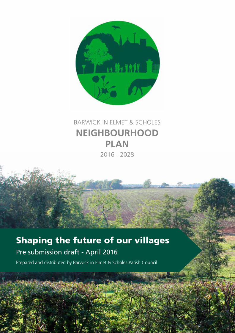
Shaping the future of our villages 2016 - 2028 Pre submission draft - April 2016 Prepared and distributed by Barwick in Elmet & Scholes Parish Council BARWICK IN ELMET & SCHOLES NEIGHBOURHOOD PLAN
-
Upload
john-fergusson -
Category
Documents
-
view
220 -
download
0
description
Draft plan for feedback by the local community.
Transcript of Barwick in Elmet & Scholes Neighbourhood Plan
Shaping the future of our villages
2016 - 2028
Pre submission draft - April 2016Prepared and distributed by Barwick in Elmet & Scholes Parish Council
BARWICK IN ELMET & SCHOLES
NEIGHBOURHOODPLAN
2 Barwick in Elmet and Scholes Neighbourhood Plan 2016
2. Background
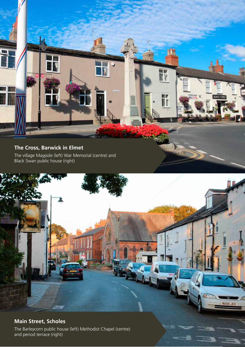
The Cross, Barwick in ElmetThe village Maypole (left) War Memorial (centre) and Black Swan public house (right)
Main Street, Scholes
The Barleycorn public house (left) Methodist Chapel (centre) and period terrace (right)
3Barwick in Elmet and Scholes Neighbourhood Plan 2016
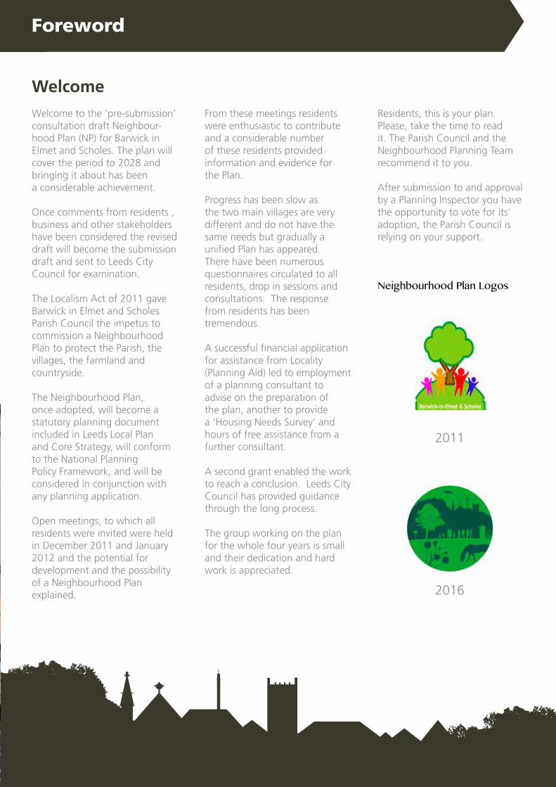
Welcome
Welcome to the ‘pre-submission’consultation draft Neighbour-hood Plan (NP) for Barwick in Elmet and Scholes. The plan will cover the period to 2028 and bringing it about has beena considerable achievement.
Once comments from residents , business and other stakeholders have been considered the revised draft will become the submission draft and sent to Leeds City Council for examination.
The Localism Act of 2011 gave Barwick in Elmet and Scholes Parish Council the impetus to commission a Neighbourhood Plan to protect the Parish, the villages, the farmland and countryside.
The Neighbourhood Plan, once adopted, will become a statutory planning document included in Leeds Local Plan and Core Strategy, will conform to the National Planning Policy Framework, and will be considered in conjunction with any planning application.
Open meetings, to which all residents were invited were held in December 2011 and January 2012 and the potential for development and the possibility of a Neighbourhood Plan explained.
From these meetings residents were enthusiastic to contribute and a considerable number of these residents provided information and evidence forthe Plan.
Progress has been slow as the two main villages are very different and do not have the same needs but gradually a unified Plan has appeared. There have been numerous questionnaires circulated to all residents, drop in sessions and consultations. The response from residents has been tremendous.
A successful financial application for assistance from Locality (Planning Aid) led to employment of a planning consultant to advise on the preparation of the plan, another to provide a ‘Housing Needs Survey’ and hours of free assistance from a further consultant.
A second grant enabled the work to reach a conclusion. Leeds City Council has provided guidance through the long process.
The group working on the plan for the whole four years is small and their dedication and hard work is appreciated.
Residents, this is your plan. Please, take the time to read it. The Parish Council and the Neighbourhood Planning Team recommend it to you.
After submission to and approval by a Planning Inspector you have the opportunity to vote for its’ adoption, the Parish Council is relying on your support.
Foreword
2011
2016
Neighbourhood Plan Logos

4 Barwick in Elmet and Scholes Neighbourhood Plan 2016
Have your say We now seek your input for our final draft before it is submitted to Leeds City Council to check for conformity with the Local Plan and for examination by an expert Planning Inspector.
It will then return to us for the referendum in due course when we hope residents will confirm their approval allowing the Plan to become a statutory planning document.
The consultation period for this draft Plan is six weeks and we hope that during this time as many residents, businesses and other consultees as possible will read this document.
Comments, or suggestions for amendments are greatly valued, and can be made by contacing the Chairman of the Neighbourhooud Planning Group, or the Clerk to the Parish Council (whose contact details can be found on the back page).
Foreword
“This is your Plan and once adopted it will represent your views as to how the parish should develop”.
Your Neighbourhood Planning Team
Claire HassellChairman, Barwick in Elmet and ScholesParish Council
Ben HoganChairman, Barwick in Elmet and Scholes Neighbourhood Plan
Team Brian Hallas David Gluck Geoff Yapp Jacque Ward Jenny Matthewson Keith Langley Keith PullenMartin RogersMichael JohnsonNeil Beaumont Philip MaudeStella Walsh

5Barwick in Elmet and Scholes Neighbourhood Plan 2016
1. Executive summary
1.1. Introduction 71.2 Key objectives 71.3 Key policies 9
2. Background 2.1 Overview 112.2 Previous community led planning 11 2.3 The Localism Act 2011 132.4 The Neighbourhood Area 132.5 The Neighbourhood Planning process 172.6 Consultation and engagement 182.7 How the Plan is organised 19
3. About the Neighbourhood Area3.1 Overview 213.2 Local governance 213.3 Connectivity with Leeds and surrounding communities 23
4. Vision and objectives4.1 Why a Neighbourhood Plan is required 254.2 Conforming with local and national policy 254.3 The vision for the future 294.4 Objectives 31
5. Key themes and policies for our Plan5.1 Introduction - delivering sustainable development 335.2 Landscape and the environment 355.3 The built environment 455.4 Housing 595.5 The economy 675.6 Community facilities 775.7 Policies Maps 85
A set of appendices to this Plan is available separately. These can be viewed atwww.barwickandscholesneighbourhoodplan.co.uk or a hard copy can berequested from the Clerk to the Council (please see back page for contact details)
Contents
6 Barwick in Elmet and Scholes Neighbourhood Plan 2016
1. Executive Summary
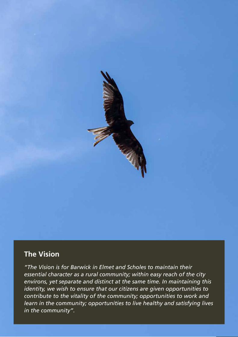
The Vision
“The Vision is for Barwick in Elmet and Scholes to maintain their essential character as a rural community; within easy reach of the city environs, yet separate and distinct at the same time. In maintaining this identity, we wish to ensure that our citizens are given opportunities to contribute to the vitality of the community; opportunities to work and learn in the community; opportunities to live healthy and satisfying lives in the community”.

7Barwick in Elmet and Scholes Neighbourhood Plan 2016
This pre-submission draft of the Barwick in Elmet and Scholes Neighbourhood Plan Plan represents the culmination of four years of hard work and sometimes heated debate.
The Parish Council, NP Steering Group, Leeds City Council, Save our Scholes and Scholes Community Forum have all played important roles in ultimately creating this draft Plan.
1. Executive Summary
1.2 Key objectives
The Plan also sets out the key objectives to see that vision realised over the next 15 years:
1.1 Introduction
1. Maintaining the environment and distinctive character
2. Ensuring sympathetic village and building design
3. Ensuring an adequate housing supply
4. Retaining strategic green corridors
5. Developing community and business infrastructure
The draft Plan is pro-growth and seeks to improve the Neighbourhood Area and the opportunities for residents and businesses.
However, it is also resolute in its intention to see Barwick in Elmet and Scholes improve for the better, for future generations with development appropriate in size and density.
”We are determined that this Plan plays its full role in supporting Leeds City Council policies to ensure Leeds is a great and a green city, whilst recognising our attractiveness to new residents who wish to live here and to share that which we are so passionate to defend.”
8 Barwick in Elmet and Scholes Neighbourhood Plan 2016
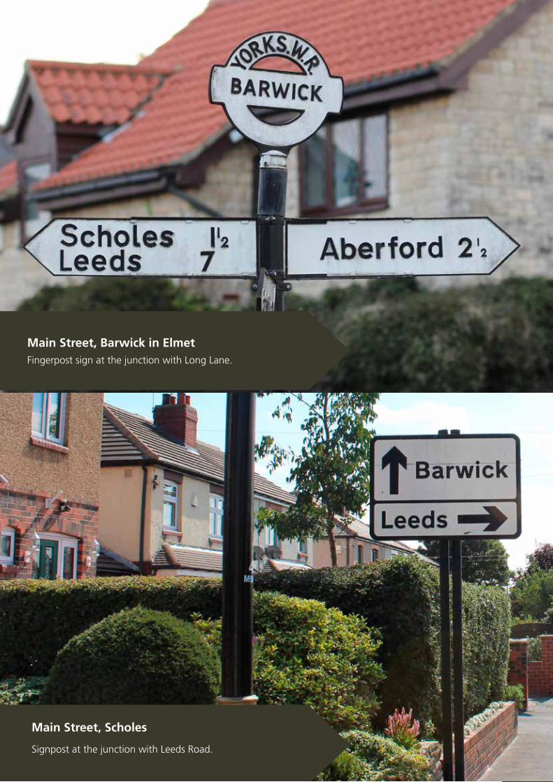
Main Street, Scholes
Signpost at the junction with Leeds Road.
Main Street, Barwick in Elmet
Fingerpost sign at the junction with Long Lane.

9Barwick in Elmet and Scholes Neighbourhood Plan 2016
1. Executive Summary
Landscape and the Environment
LE1 - conserving historic characterLE2 - enhancing the public rights of way networkLE3 - renewable energy
1.3 Key policiesThe plan also sets out clear policies for ensuring that our objectives as a community are met:
£
Community FacilitiesCF1 - retaining and protecting key community servicesCF2 - supporting primary schoolsCF3 - protection for local green spaces
The Economy
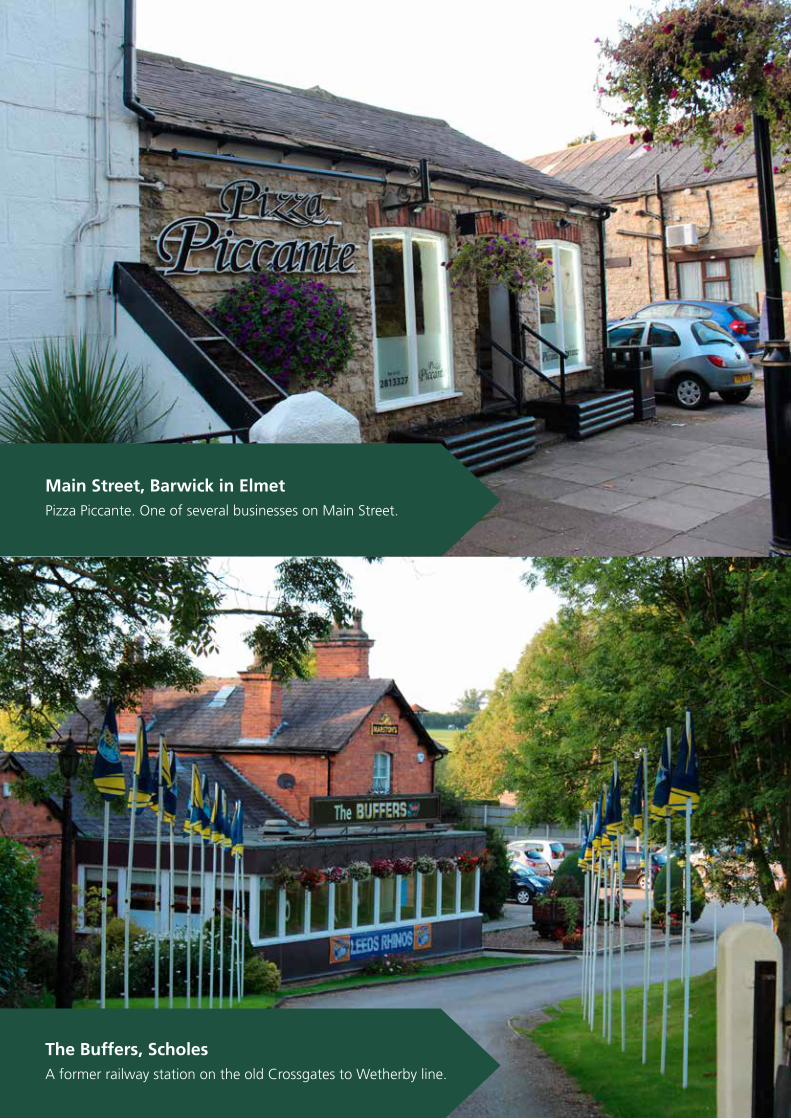
E1 - supporting small business growthE2 - enabling farm diversificationE3 - growing successful business parksE4 - supporting business activity in village centres
Housing
H1 - providing new housingH2 - type and design of new housing developments
The Built Environment
BE1 - best practice in building design BE2 - shaping streets and street sceneBE3 - improving village gatewaysBE4 - creating strategic green corridorsBE5 - drainage and flood preventionBE6 - maintaining unlit villages

10 Barwick in Elmet and Scholes Neighbourhood Plan 2016
The Cross, Barwick in Elmet
A view of the Maypole and Gascoigne Arms from Elmwood Lane.
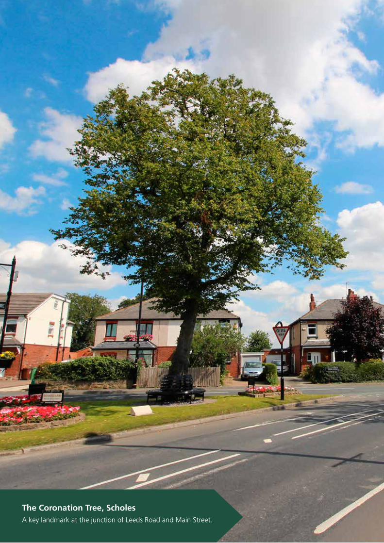
The Coronation Tree, Scholes
Planted to mark the coronation of King Edward VII.
11Barwick in Elmet and Scholes Neighbourhood Plan 2016
2.1 Overview
The parish of Barwick in Elmet and Scholes to the east of Leeds is predominantly rural.
Outside of the two main settlements the countryside and scattered hamlets and farmsteads are washed over by the West Yorkshire Green Belt and much of it is also designated locally as Special Landscape Area.
It is situated just outside the proposed East Leeds Orbital
Road (ELOR) and the proposed East Leeds Extension which provides the potential for 7,000 new dwellings and expansion of the nearby Thorpe Park Business Park.
The A64 main road from Leeds to York traverses the parish. As well as the two main villages, there is the hamlet of Potterton and scattered farm houses and residences.
In 2011, following extensive consultation and engagement around the production of a series of community-led planning documents, the Parish Council agreed to undertake the production of a Neighbourhood Plan Plan under the Community Rights provision of the Localism Act.
2.2 Previous community-led planning
In 2006 the Parish Council published its first Parish Plan -a non-statutory document that set out the parish’s aspirations for the following 5 years and a set of projects to achieve these aspirations. In 2011, this Parish Plan was refreshed and a new Action Plan produced, published in 2012.
In 2010, Leeds City Council also undertook a comprehensive refresh of the Conservation Area in Barwick in Elmet, originally designated in 1981, to produce a new Management Plan for that area.
This was followed by a similar document for the new Conservation Area for Scholes, designated in 2012: the full Management Plans are available to read on the NP website.
At the same time the Parish Council also commissioned the production of a Village Design Statement, a comprehensive description of the characteristics of the natural and built environments of the parish with the intention that it would be adopted by Leeds City Council as Supplementary Planning Guidance.
Although this Statement was produced in draft form in 2012 and submitted to Leeds City Council by the time Leeds City Council had undertaken internal scrutiny of the draft Statement, matters had been overtaken with the publishing by the Government of the Localism Act and the Parish Council was by then well on the way to producing this new draft Neighbourhood Plan, much of
which is based upon the work undertaken in the production of the draft Village Design Statement.
For all of these community-led plans, considerable consultation and engagement was undertaken with our communities and stakeholders and this work has provided the NP team with a considerable body of evidence upon which to build this new Plan.
2. Background
12 Barwick in Elmet and Scholes Neighbourhood Plan 2016
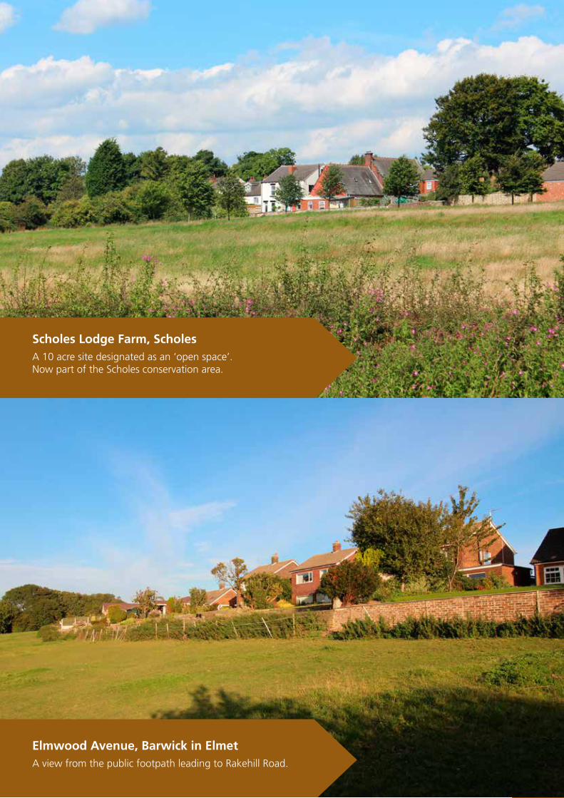
Scholes Lodge Farm, Scholes
A 10 acre site designated as an ‘open space’.Now part of the Scholes conservation area.
Elmwood Avenue, Barwick in Elmet
A view from the public footpath leading to Rakehill Road.

13Barwick in Elmet and Scholes Neighbourhood Plan 2016
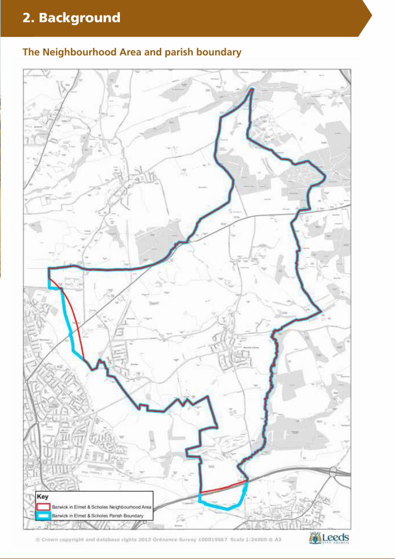
2.4 The Neighbourhood Area
Initially, the Parish Council determined to undertake the Neighbourhood Plan for the whole of the parish and sought the designation of this area as the ‘Neighbourhood Area’, i.e. the area to which the plan would apply. However, following discussions with Leeds City Council it was agreed to alter this proposed area in two ways.
First, at the southern end of Barwick in Elmet ward where it meets the historical boundary with Garforth at the Leeds-York railway line it was
agreed to instead use the M1 Motorway as the boundary for the Neighbourhood Area, recognising that this part of the parish between the M1 Motorway and the Leeds-York railway line effectively goes up to the built-up area of Garforth. The proposed route for the high speed railway, HS2, also traverses this area.
Secondly, it was also agreed that a small parcel of land in the Scholes ward that extended into the East Leeds Extension would be excluded from the Neighbourhood Area. It would,
as with Barwick in Elmet south of the M1 Motorway, be ‘cut off’ from the rest of Scholes, this time by the East Leeds Orbital Route (ELOR), and there was already significant development proposed for that sliver of land in the near future.
The final agreed boundary for the Neighbourhood Area was approved by Leeds City Council on 23rd July 2013 and is shown on the map on page 15.
2. Background
2.3 The Localism Act 2011
At the point at which the various local planning documents were being finalised, the government published its Localism Act which brought in new provisions for parishes and other neighbour-hoods to undertake a new form of local planning: the Neighbour-hood Plan.
The Localism Act set out a series of new Community Rights, in-cluding Neighbourhood Plans, as an opportunity for local com-munities like ours to take more control over planning issues in their neighbourhood.
A Neighbourhood Plan can set out a vision for our parish and planning policies for the use
and development of land. It has to support the strategic devel-opment needs of the wider area outlined in the Leeds Local Plan.However it can shape and influ-ence where that development will go and what it will look like.
If accepted by the community in a referendum, the Plan will go on to become part of the statutory planning framework for the area, and the policies and proposals contained within the Plan will be used in the determination of planning applications.
The Parish Council for Barwick in Elmet and Scholes saw the potential for this new form of
community-led planning to assist in transforming the work previ-ously undertaken into a compre-hensive plan that would have the advantage of becoming, in time, a statutory part of the Leeds Local Plan.
Hence in 2011, the Parish Council oversaw the formation of a Steering Group to lead the way on this work and to formally apply to Leeds City Council for the parish to become a designated Neighbourhood Area - an essential first step in the new Neighbourhood Planning process.
You can read more about the 2011 Localism act at:-
https://www.gov.uk/government/publications/localism-act-2011-overview

14 Barwick in Elmet and Scholes Neighbourhood Plan 2016
4. Our visions and objectives
Scholes Lodge Farm, Scholes
Looking back towards Main Street from Leeds Road.
Flats Lane, Barwick in Elmet
Looking towards the village from the surrounding fields.
15Barwick in Elmet and Scholes Neighbourhood Plan 2016
2. Background
The Neighbourhood Area and parish boundary
4. Our visions and objectives

16 Barwick in Elmet and Scholes Neighbourhood Plan 2016
2. Background
Potterton Lane, Potterton
The view towards Barwick from Potterton Hall.
Stockheld Lane, Scholes
Looking out on to open countryside.
17Barwick in Elmet and Scholes Neighbourhood Plan 2016
2. Background
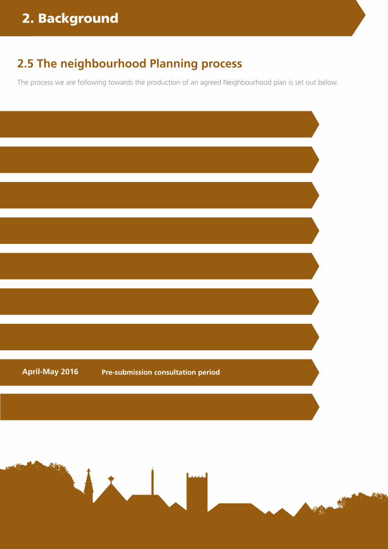
December 2011
January 2012
Spring 2012
2012/2013
Summer 2013
Winter 2014/15
Autumn 2015
April-May 2016
Public meeting calling for volunteers to form a NP Steering Group Raising awareness of potential development in the Parish
First meeting of the NP Steering GroupTerms of reference agreed
Statement of Community Involvement agreed Application to LCC for Neighbourhood Area
Community consultation eventsEvidence base development
Revised Neighbourhood Area agreed by LCCFurther community engagement and evidence base development
First draft published for consultationConsultation period: January - February 2015
Pre-submission draft prepared
Pre-submission consultation period
2.5 The neighbourhood Planning process
The process we are following towards the production of an agreed Neighbourhood plan is set out below.
Summer 2016 Final version of NP producedReferendum

18 Barwick in Elmet and Scholes Neighbourhood Plan 2016
2.6 Consultation and engagement
The Parish Council called a public meeting in December 2011 to advise residents of proposed housing developments for the area and to seek volunteers to form a Steering Group to develop a NP. A Neighbourhood Planning Steering Group with over forty residents was established.
Steering group meetings are held on a regular basis. Initially volunteers worked on collecting planning data for the two principal villages and surrounding areas. A website was established to publish information and minutes of the meetings to ensure residents were kept fully informed.
Consultation with residents was inclusive across all age groups. A series of quantitative questionnaires were distributed. A questionnaire was distributed to all residents in the Neighbourhood Area and a youth questionnaire was also completed. Two questionnaires, one for Barwick in Elmet and one for Scholes, were undertaken with businesses in the Neighbourhood Area.
Further qualitative data was collected to gain in-depth views from residents on particular aspects of the plan and the reported developments. This data informed the decision making and policy development.
Regular public meetings were held with residents to give them the opportunity to see plans and maps, ask questions and be informed about the development of the NP.
The Parish Council sent out regular quarterly newsletters. Progress reports were given at monthly Parish Council meetings and information put on the Parish Council website and Facebook page together with the NP website and Twitter account dedicated to the NP.
2. Background2. Background
1 www.barwickandscholespc.com2 www.facebook.com/pages/Barwick-Scholes-NP3 www.barwickandscholesneighbourhoodplan.co.uk
Drop-in sessions were organised so that residents could be informed on the consultation progress, their views and feedback were also sought at these events. Displays of information were made available in Barwick in Elmet in May 2012, at the annual Scholes Gala in 2012 and 2013.
In May and June 2013 a series of well attended drop-in sessions in both villages provided detailed information for residents on the site allocations and the wider Leeds City Council consultation and feedback on the NP. These were well attended sessions with an excess of 200 residents.
Save our Scholes (SoS) is a forum formed by a group of residents in 2012. SoS arranged public meetings in the village and published newsletters to highlight their concerns and support the emerging NP.
Consultation also took place via formal and informal meetings with the governors and head teachers in the schools, and local health officials.
A survey of bus transport was initiated by Leeds City Council in 2012 covering Barwick in Elmet, Scholes and Aberford with an exceptional response and a meeting was held to discuss the public transport problems
and issues in August 2013, with Metro and FirstGroup.
Consultation with landowners (and their agents) and key stakeholders/statutory consultees (such as Highways Agency, Education Leeds, NHS bodies, Network Rail/HS2, BT and neighbouring Parishes) was essential and pro-active informing these organisations of the intention to produce the NP and seeking their views.
Parish Councillors attended a range of different forums which included other parish representatives to discuss developments in NPsacross the city.

19Barwick in Elmet and Scholes Neighbourhood Plan 2016
2.7 How the draft Plan is organised
The draft Plan is split into the following sections:
3. About the Neighbourhood Area
4. Vision and objectives
5. Key themes and policies
6. Appendices
• Local Green Spaces Assessment• Housing Needs Assessment• Character area appraisal
Sets out information about the Neighbourhood Area, its villages and surrounding countryside, as context and as part of the evidence base supporting the vision, objectives and policies.
Provides the vision for the future of the Neighbourhood Area and a set of objectives that will enable us to see that vision realised.
Sets out policies for achieving the objectives, substantiated by evidence and cross referenced to national and local policy, to which policies here need to broadly conform.
A set of appendices are available separately on the NP website or from the Clerk to the Council (whose contact details can be found on the back page).These include:-
2. Background
www.barwickandscholesneighbourhoodplan.co.uk
20 Barwick in Elmet and Scholes Neighbourhood Plan 2016
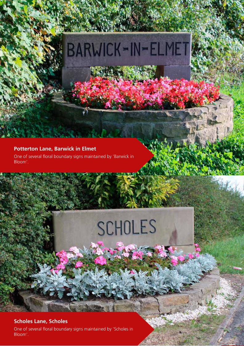
Potterton Lane, Barwick in Elmet
One of several floral boundary signs maintained by ‘Barwick in Bloom’.
Scholes Lane, Scholes
One of several floral boundary signs maintained by ‘Scholes in Bloom’.
21Barwick in Elmet and Scholes Neighbourhood Plan 2016
Barwick in Elmet and Scholes are both historic villages located approximately thirteen and eleven kilometres (8 and 7 miles) respectively from Leeds city centre and lie in the Green Belt to the east of Leeds.
Around 5,013 people (2,592 female, 2,421 male) live in the two wards of Barwick in Elmet and Scholes which comprise a little over 2,000 residential properties, with small areas of light industrial buildings with the majority of the land used for agricultural purposes. In addition to these two villages there is a small hamlet at Potterton.
Housing is primarily privately owned, although there is some local authority and social landlord housing.
The Neighbourhood Area covers 1,933 hectares, most of which is, with the exception of the two villages of Barwick in Elmet and Scholes, Green Belt . It extends from Garforth in the south and into Bramham Park in the north.
To the south, the boundary is the M1, to the east the boundary follows the Cock Beck to the Barwick in Elmet to Aberford Road and then follows the Aberford and Bramham parish boundaries northwards across the A64 Leeds - York Road into Bramham Park.
The northern boundary follows the Thorner parish boundary westwards to meet the Leeds City boundary. The western boundary of the parish goes through the existing ‘green corridor’ between the built up areas of Whinmoor, Swarcliffe and Penda’s Field and the village of Scholes. The East Leeds Orbital Route is planned to go through this corridor in the future.
The area to the north and east of Barwick in Elmet village is designated by Leeds City Council as a Special Landscape Area which requires special attention in the implementation of planning policy. In the village of Scholes 1.875 hectares of land to the west of Morwick
Grove (behind Scholes Junior and Infants School) and 32.129 hectares of land directly to the east of Scholes and stretching from the Conservation Area in the south to the top of Nook Road to the north are each designated as a ‘Protected Area of Search’ (PAS) for future housing development.
The Leeds Core Strategy 2014 identifies both Barwick in Elmet and Scholes as ‘smaller settlements’, meaning that they provide only basic service provision and so it is important that “new development in these settlements is sustainable, and contributes to the delivery of a wider mix of housing (including affordable housing), transport facilities and key services”.
Potterton is not designated in this way and is thus regarded by the Core Strategy as a place that is not suitable for future housing growth except where this is functionally required to be in a rural location
3. About the Neighbourhood Area
The Parish Council was established in 1894 as Barwick in Elmet Parish Council. Scholes joined the Parish in 1946 having previously been allied to Swarcliffe. It is the designated body responsible for the development and implementation of the NP.
Residents of the parish are represented by twelve Parish Councillors, six from Barwick in Elmet and six from Scholes.
The parish is represented at Leeds City Council by members of the Harewood and Wetherby Wards and is located within
the Outer North East quadrant of the City for administrative purposes. Alec Shelbrooke MP, currently represents the Elmet Constituency at national government level.
3.1 Overview
3.2 Local governance
22 Barwick in Elmet and Scholes Neighbourhood Plan 2016
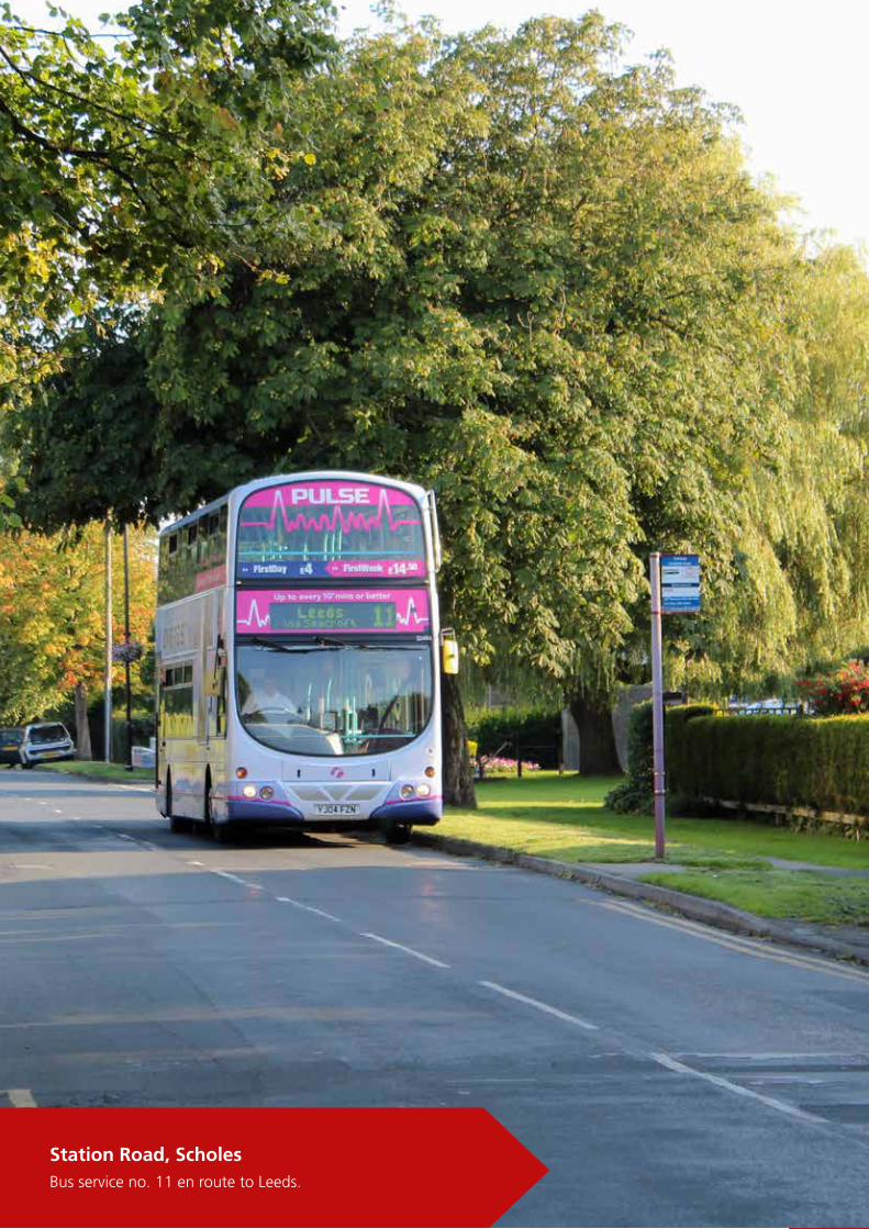
Station Road, Scholes
Bus service no. 11 en route to Leeds.

23Barwick in Elmet and Scholes Neighbourhood Plan 2016
By Road Most of the roads within the Neighbourhood Area were not constructed for modern day traffic levels. The approach roads and lanes are subject to excessive and speeding traffic particularly at peak periods. However, the narrow and winding nature of the roads through the centre of the villages does help slow traffic speeds.
Much of this traffic movement is as a result of ‘rat running’ by vehicles seeking easier access to and from the Leeds conurbation.All four of the primary access roads through the Barwick in Elmet village area have little or
no pavement for pedestrians. This does not encourage residents to walk and is a major concern to the Parish Council. Some of the main travel routes have no kerb stones to act as a separation from the public footpaths creating a hazard for both pedestrians and cyclists.
In one instance, in Scholes, access and egress to and from the main highway network from the Parish, is over a narrow former railway bridge where the weight limit is restricted.
The evidence base indicates capacity to free flow is restricted
and junctions onto the main arterial roads are thought to be at saturation particularly at peak hours when queuing occurs.
There are electronic Vehicle Activated Signs located at two of the entry roads into 30 mph areas. The width and design of the existing residential streets create problems when they are used as routes for public transport and other service vehicles because of on-street parking.
3.3 Connectivity with Leeds and surrounding communities
Public Transport
Bus services are currently considered to be inadequate by residents. There are three services serving either Barwick in Elmet or Scholes: the 64 operated by First; the 173/174, operated by Arriva; and the 11/11a operated by First.
Barwick in ElmetThe main service is provided by First. The No. 64 runs half-hourly from Aberford to Middleton shopping centre via Barwick, Crossgates and Leeds during office hours. The 173 and 174 runs from Wetherby to Wakefield via Barwick in Elmet & Garforth. The 173 runs once a day Monday to Friday. The 174 runs every two to three hours during the day Monday to Saturday.
ScholesThe main service which is provided by First is the No 11/11A which runs hourly from Scholes to Crossgates to Leeds.
PottertonThe hamlet of Potterton has no access to public transport at all to connect it to the rest of the Parish. The only public transport available is the Coastliner run by Transdev which uses the A64 and has very limited stops. It runs from Leeds to Scarborough, Whitby and Bridlington via Tadcaster and York. There are stops on the A64 close to Potterton Lane and Kiddall Lane.
3. About the Neighbourhood Area
24 Barwick in Elmet and Scholes Neighbourhood Plan 2016
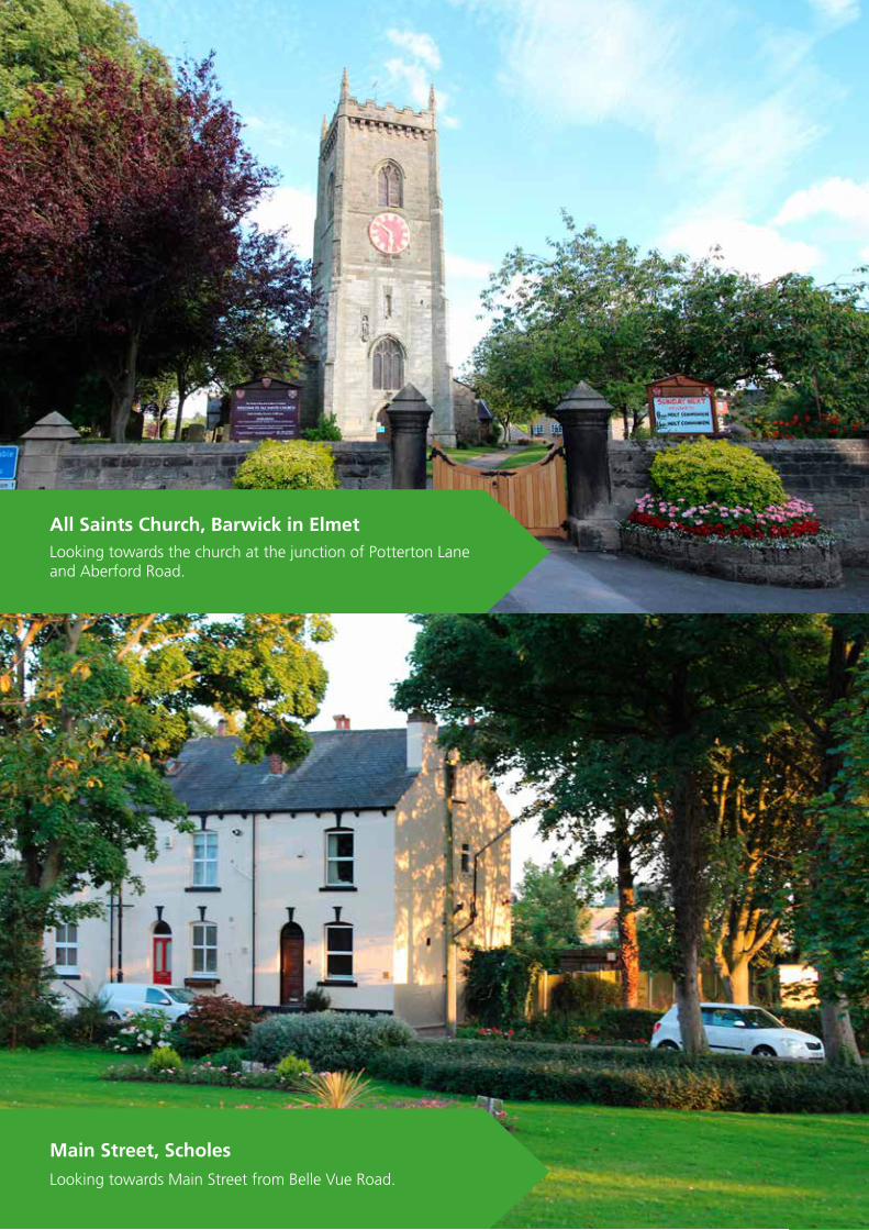
All Saints Church, Barwick in Elmet
Looking towards the church at the junction of Potterton Lane and Aberford Road.
Main Street, Scholes
Looking towards Main Street from Belle Vue Road.

25Barwick in Elmet and Scholes Neighbourhood Plan 2016
4. Vision and objectives
4.1 Why a Neighbourhood Plan is required
The NP aims to contribute to the achievement of sustainable development in the Barwick in Elmet and Scholes Neighbourhood Area through the conservation of the setting and special character of these historic villages.
Preserving green space and the Green Belt is a high priority and any new development is expected to conform and be sympathetic to the existing character of the countryside and the villages of Barwick in Elmet, Scholes and Potterton.
When Leeds City Council announced a review of the Green Belt along with a review of the Strategic Housing Land Availability Assessment (SHLAA), early indications were that if the aspirations of developers were successful then the development proposed could be overwhelming and significantly alter the nature and character of the Neighbourhood Area.
Scholes in particular could potentially be more than doubled in size and Barwick in Elmet expanded at a far faster rate than previously experienced. The proposed developments would require significant improvements in infrastructure, particularly drainage, roads and transport and could have significant environmental impacts.
Consultation revealed a dedication to maintaining the Green Belt, avoiding urban spread by ribbon development along any of the highways and a commitment to maintaining the distinct characteristics of the Neighbourhood Area and its villages.
The key findings from consultations were the very high level of support (96%) for the protection of all Green Belt land and green space and illustrated the very high value placed on these areas.
A large number of respondents commented that they placed a high value on living in a rural area and felt passionate that all of the surrounding woodlands, fields, bridleways/footpaths and meadows, whether classified as Green Belt or not, should be respected by future housing development.
4.2 Conforming with national and local policy
It is important to note that a key requirement of our Plan according to legislation is that whilst it rightly reflects local
issues, concerns and priorities, it must be in general conformity with national policy and strategic
local policy. However, there are two key policy documents that we have needed to take particular account of and these are outlined on page 27.

26 Barwick in Elmet and Scholes Neighbourhood Plan 2016
4. Our visions and objectives4. Our visions and objectives
Jubilee Gardens, Barwick in Elmet
A former churchyard and now a public garden.

27Barwick in Elmet and Scholes Neighbourhood Plan 2016
4. Vision and objectives
The NPPF sets out the government’s expectation that “a positive approach should be taken to achieving sustainable development through seeking economic, social and environmental gains jointly and simultaneously through the planning system”.
Published in March 2012 by the Department for Communities and Local Government
(DCLG), the NPPF sets out the Government’s planning policies for England and how these are to be applied. It replaces a raft of previous guidance notes and circulars, although some do remain in place for now until further detailed policy is published.
Critically, the NPPF must be taken into account in the preparation of all new local plans, including
this Neighbourhood Plan.The NPPF sets out a new range of policies within the context of achieving sustainable development, outlining economic, social and environmental dimensions within which policies can be aligned.Of particular note for this Plan are the following statements:
4.2.1 National Planning Policy Framework (NPPF)
• The presumption in favour of sustainable development• Delivering a wide choice of high quality homes• Requiring good design• Promoting healthy communities• Protecting Green Belt Land• Conserving and enhancing the natural environment• Conserving and enhancing the historic environment• The twelve core land-use planning principles:-
1. be genuinely plan led;
2. not simply about scrutiny;
3. proactively drive and support sustainable economic development;
4. secure high quality design and a good standard of amenity;
5. take account of the different roles and characters of different areas;
6. support the transition to a low-carbon future;
7. conserve and enhance the natural environment and reduce pollution;
8. re-use previously developed (brownfield) land;
9. promote mixed use developments and encourage multi-functionality for land use;
10. conserve heritage assets;
11. make the fullest possible use of public transport, walking and cycling;
12. support local strategies for health, social and cultural wellbeing for all.
28 Barwick in Elmet and Scholes Neighbourhood Plan 2016
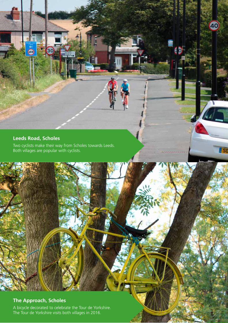
Leeds Road, Scholes
Two cyclists make their way from Scholes towards Leeds.Both villages are popular with cyclists.
The Approach, Scholes
A bicycle decorated to celebrate the Tour de Yorkshire. The Tour de Yorkshire visits both villages in 2016.

29Barwick in Elmet and Scholes Neighbourhood Plan 2016
4. Vision and objectives
The Local Development Framework (LDF) is the name given to the new system of Development Plans introduced by the Planning and Compulsory Purchase Act 2004.
The original Leeds Unitary Development Plan (UDP) was drawn up in the 1990s and approved in 2001; it was reviewed in 2006 and the Leeds UDP Review (2006) forms the Development Plan for Leeds until it is replaced by the emerging LDF. Rather than a single plan, the new LDF takes the form of a portfolio of documents including the following:-
Core Strategy - sets out strategic policies to 2028.
Site Allocations Plan - identifies land where new homes, employment and greenspaces are to be located up to 2028.
Adopted Natural Resources and Waste Local Plan - sets out management of minerals, energy, waste and water up to 2028.
Policies Map for Leeds - formerly known as the Proposals Map, this details the extent of relevant LDF policies.
Community Infrastructure Levy - sets out levels of charging to be applied to different types of development in order to fund a variety of infrastructure provision.
Neighbourhood Plans - provide community level frameworks.
There are also a range of Supplementary Planning Documents and Supplementary Planning Guidance retained from the Unitary Development Plan.
The Parish Council had previously set out its vision in the draft Barwick in Elmet and Scholes Village Design Statement 2012 and this was confirmed and refined through consultation
during the process of producing this draft Neighbourhood Plan. The vision sets out community aspirations for the sustainable development of the Neighbourhood Area over the
Plan period – until 2028 - and all of the objectives and policies contained within this Plan conform to this vision:
4.2.2 Leeds Local Development Framework (LDF) – the Local Plan
4.3 The vision for the future
The Vision
“The Vision is for Barwick in Elmet and Scholes Neighbourhood Area to maintain its essential character as a rural community; within easy reach of the city environs, yet separate and distinct at the same time. In maintaining this identity, we wish to ensure that our citizens are given opportunities to contribute to the vitality of the community; opportunities to work and learn in the community; opportunities to live healthy and satisfying lives in the community”.

30 Barwick in Elmet and Scholes Neighbourhood Plan 2016
Elmwood Lane, Barwick in Elmet
View of the Maypole across the roof tops.
Scholes Lodge Farm, Scholes
Looking back towards Main Street from Leeds Road.

31Barwick in Elmet and Scholes Neighbourhood Plan 2016
1
2
3
4
5
4. Vision and objectives
4.4 ObjectivesIn seeking to see this vision realised during the period of this Plan – from adoption through to the end of the 2020s – a set of objectives have been developed to
guide the work in the years ahead and within which to frame the Plan’s policies.
Maintaining the environment and distinctive character
To preserve and enhance the rural character of the parish, ensuring that new development is compatible with our existing built and natural environments, preserves historic features and protects and improves local landscapes.
This vision and objectives are reinforced by the NP policies which follow and, taken together, clearly support the Leeds Local Plan and National Planning Policy Framework in enabling the growth of the City
whilst minimising the impact on the environment and protecting the distinctive green character of Leeds.
Developing community and business infrastructure
To ensure residents live in communities that provide for their needs through enabling the provision of education, recreation and employment opportunities.
Ensuring sympathetic building design
To ensure that building development includes infrastructure that sustains the communities and that new development is designed to be sympathetic with the locality and the historic nature of the Neighbourhood Area.
Management of new housing
To help to deliver an adequate supply of homes available for local people who wish to remain resident in the Neighbourhood Area; and that new housing supply is implemented in such a manner that creates the least harm to rural character.
Retaining green corridors
To promote a sustainably maintained green corridor between urban east Leeds and Scholes and also to retain the open countryside between Scholes and Barwick, maintaining the integrity of the villages and to provide multi functional green infrastructure in sensitive locations.

32 Barwick in Elmet and Scholes Neighbourhood Plan 2016
Leeds Road, Barwick in Elmet
One of the main routes into the village with Flats Lane (right) and The Sycamored (left).
Leeds Road, Scholes
Looking back to Leeds Road from Scholes Lodge Farm.

33Barwick in Elmet and Scholes Neighbourhood Plan 2016
5. Key Themes and polices
At the heart of the National Planning Policy Framework (NPPF) is a presumption in favour of sustainable development, described by the NPPF as “a golden thread running through both plan- making and decision-taking”.
The Plan wholly endorses this approach, with the over-riding priority being to promote development that meets the needs of present day residents and business, without compromising the ability of future generations to meet their own needs.
This ‘golden thread’ extends through and informs all the policies that follow on and form the heart of this Plan. This means that policies are designed to positively promote opportunities which meet the needs of the Neighbourhood Area and which re-affirm its character. Equally, policies will not encourage activities that are perceived to have negative impacts for residents, businesses and communities as a whole.
In the following section we set out our policies in the following way:
Policies
Each policy is preceded by the issues the policy is designed to address and the evidence that supports the policy.
Objectives addressed
Each policy details which of the 5 Objectives is addressed by the policy.
Conformity statements
Each policy is concluded with a summary how the policy is in conformity with the National Planning Policy Framework and Leeds Core Strategy.
Taken together, these form an ambitious but achievable set of policies that complement the Leeds Local Plan, National Planning Policy Framework and other strategic plans considered and, most importantly, will enable the vision to beachieved.
Themes
Policies are ordered into five themes:
5.1 Introduction - delivering sustainable development
£
H Housing
LE Landscape and the environment
BE The built environment
E The economy
CF Community facilities

34 Barwick in Elmet and Scholes Neighbourhood Plan 2016
Nook Road, Scholes
An old post box at the junction with the Avenue.

35Barwick in Elmet and Scholes Neighbourhood Plan 2016
5.2 Landscape and the Environment (LE)
Policies
LE1 Conserving historic character
LE2 Enhancing the Public Rights of Way network
LE3 Renewable energy
Maintaining the environment and distinctive character: To preserve and enhance rural character, ensuring that new development is compatible with the existing built and natural environment, preserves historic features and protects and improves local landscapes.
Ensuring sympathetic building design: To ensure that building development includes infrastructure that sustains the communities and that new development is designed to be sympathetic with the locality and the historic nature of the Neighbourhood Area.
Objectives addressed
36 Barwick in Elmet and Scholes Neighbourhood Plan 2016
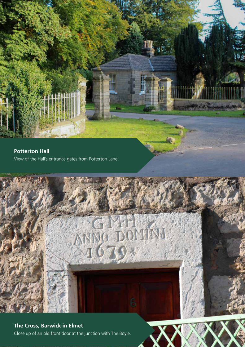
Potterton Hall
View of the Hall’s entrance gates from Potterton Lane.
The Cross, Barwick in Elmet
Close up of an old front door at the junction with The Boyle.

37Barwick in Elmet and Scholes Neighbourhood Plan 2016
Issues
Protecting the historic assets contained within the rural environment and the distinctive character of our countryside, shaped as it is by its underlying geology and centuries of human activity, has emerged as a key priority for residents.
The Neighbourhood area has extensive historical landscape features, including iron age features at Becca and Barwick in Elmet, medieval remains at Potterton and Scholes, and extensive landscape features of pre-industrial Britain. Much is protected through statute but as important are the non-protected features.
Evidence
The landscape to the east of the Parish is designated as a Special Landscape Area and defined as strategic green infrastructure in the Core Strategy, recognising in particular the multi-functionality of the estate lands at Becca, Bramham, Parlington and Potterton.
Consultations for the Village Design Statement in 2012 identified a range of non designated assets that contribute to the historic and rural character of the Neighbourhood Area. The importance of these were confirmed in consultations for this NP.
5.2.1 Conserving historic character
5.2 Landscape and the Environment (LE)
Non designated assets of importance to the Neighbourhood
Name Location
The Coronation Tree ScholesMemorial trees Station Road, ScholesWar Memorial ScholesThe Buffers/Railway Station ScholesThe Barleycorn Inn ScholesOld Council Offices ScholesLimekiln Hill East of Scholes villageMethodist chapel ScholesScholes Lodge Farm Scholes Rakehill Road Scholes-BarwickOld finger post BarwickAll Saints Church BarwickMethodist Chapel BarwickJack Heaps’ field BarwickJubilee Gardens BarwickThe Boyle BarwickNew Inn BarwickThe Black Swan BarwickThe Gascoigne Arms BarwickThe Cross BarwickThe Maypole BarwickThe Old school BarwickMiners Institute BarwickPotterton Bridge PottertonValley between Potterton and Barwick PottertonMiry Lane PottertonOld Milestone Potterton
38 Barwick in Elmet and Scholes Neighbourhood Plan 2016
Potterton Hall
View of the Hall’s entrance gates from Potterton Lane.
The Cross, Barwick in Elmet
Close up of an old front door at the junction with The Boyle.The Coronation Tree, Scholes
A key landmark at the junction of Leeds Road and Main Street.

39Barwick in Elmet and Scholes Neighbourhood Plan 2016
5.2 Landscape and the Environment (LE)
Policy LE1: Conserving historic character
Development that has an impact on the rural and historic character of the parish will only be supported where the scale of the proposal reflects the character of its locality.
(i) Any development proposals should be sensitively designed and consider the rural and historical character of the Parish, particularly where it may be visible in open landscapes, and should utilise appropriate planting and screening in order to minimise visual intrusion.
(ii) All proposed development should pay due regard to the importance of conserving those non designated historic assets identified and the character of the village
Conformity references: NPPF 17; 109-110; 118; 126-141. Leeds Core Strategy Spatial Policy 13(iii); Policy P11, P12, G2, G8, G9

40 Barwick in Elmet and Scholes Neighbourhood Plan 2016
5. Key Themes and polices for our plan
The Boyle, Barwick in Elmet
A carving in the stonework gives an indication of the ageof some of the buildings within the village
Elmwood Avenue, Barwick in Elmet
Looking out on to the open fields from the public footpath.
Scholes Lodge Farm, Scholes
One of many footpaths maintained by local volunteers.

41Barwick in Elmet and Scholes Neighbourhood Plan 2016
Issues
The accessibility of the countryside is highly valued locally for leisure purposes, primarily through the extensive network of Public Rights of Way. This network also serves the many visitors to the parish who contribute to the economy through spending in the pubs, cafes and shops.
The Rights of Way Improvement Plan (ROWIP) highlighted areas of concern relating to specific Rights of Way. However, this concern extends further to a need to see all Rights of Way to be improved and maintained to a quality standard that encourages healthy outdoor activity for all. Improvements include the need to:
- Link together existing routes with new sections to create more connections.- Improvements to gates and signage to encourage use and enable accessibility.- Improvement to surfacing.- Creation of new opportunities for off road cycling.
Plans for a new off-road cycle path along the former railway line which extends to Thorner, Bardsey and Collingham, have been long standing and taken on in recent years as a project by Sustrans and, more latterly, the Elmet Greenway Group.
Evidence
The parish has an extensive network of Public Rights of Way, including part of the Leeds Country Way. In total, the parish has over 35km of footpaths, bridleways and byways. Popular walks are well documented in locally produced literature.
Garforth golf course is a well- established facility and Bramham Park is used for a range of public and communal events throughout the year, including the Leeds Festival, Horse Trials and Scout Association regional jamborees.
The Leeds City Council Rights of Way Improvement Plan 2009-2017 highlights a number of key
improvements to the network and these are reiterated in the draft Village Design Statement which also describes a smaller number of gaps in the network that, if addressed, would significantly improve accessibility and connectivity across the Parish.
Walking and horse riding combined amount to the most popular activity amongst Parish residents (35% of respondents), with cycling, including off-road, amounting to a further 13%.
Policy LE2: Enhancing the Public Rights of Way network
(i) Proposals for improving the Public Rights of Way network will be supported, including improved signage, maintenance, retention and accessibility for users, in line with the Leeds Rights of Way Improvement Plan.
(ii) Proposals to develop a cycleway/footpath along the former railway line from Manston to Thorner will be supported.
(iii) Proposals to develop similar off road opportunities for walking, cycling and horse-riding along the route of the proposed ELOR will be supported.
Conformity references: NPPF 17; 28; 75. Leeds Core Strategy Policy P12
5.2.2 Enhancing the Public Rights of Way network
5.2 Landscape and the Environment (LE)

42 Barwick in Elmet and Scholes Neighbourhood Plan 2016
Domestic solar installation
Infrastructures should not adversely affect joining properties.

43Barwick in Elmet and Scholes Neighbourhood Plan 2016
Issues
The high quality rural environment and the historic urban environment, particularly in Conservation Areas, has the potential to be detrimentally affected by the installation of renewable energy infrastructure, such as turbines and photovoltaic cells. Such installations can be highly visible and difficult to screen or landscape.
Evidence
In recent years there have been increasing numbers of applications for installing renewable energy schemes in the Neighbourhood Area. These range from the installation of solar photo voltaic cells on roofs through to wind turbines in the open countryside.
The consultation revealed strong support for the policy of limiting energy generating infrastructure in the open countryside or in built up areas with 86% of respondents supporting.
5.2.3 Renewable energy
Policy LE3: Renewable energy
Proposals for energy generating infrastructure using renewable or low carbon energy sources to serve individual properties or groups of properties should seek to ensure that:
(i) The energy generating infrastructure is located as close as practicable and is in proportion to the scale of the existing buildings or proposed development it is intended to serve;
(ii) The siting, scale and design of the energy generating infrastructure does not negatively affect the landscape, access to the countryside, or biodiversity;
(iii) Adjoining uses and properties are not adversely affected in terms of noise, vibration, or other interference;
(iv) The energy generating infrastructure will be dismantled as soon as reasonably practicable once it is no longer required for energy generation.
Conformity references: NPPF 97-98
5.2 Landscape and the Environment (LE)
44 Barwick in Elmet and Scholes Neighbourhood Plan 2016
5. Key Themes and polices for our plan
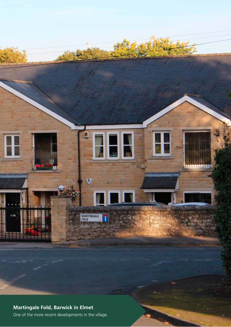
Martingale Fold, Barwick in Elmet
One of the more recent developments in the village.
45Barwick in Elmet and Scholes Neighbourhood Plan 2016
Policies
BE1 Achieving high quality and sympathetic building design
BE2 Streets and street scene
BE3 Green corridors
BE4 Drainage and flood prevention
BE5 Unlit villages
Objectives addressed
Ensuring sympathetic building design: To ensure that building development includes infrastructure that sustains the communities and that new development is designed to be sympathetic with the locality and the historic nature of the Neighbourhood Area.
Maintaining the environment and distinctive character: Topreserve and enhance the rural character of the Neighbourhood Area, ensuring that new development is compatible with the built and natural environment, preserves historic features and protects and improves local landscapes.
Ensuring an adequate housing supply: To ensure that an adequate supply of homes is available for local people who wish to remain resident in the Neighbourhood Area; and that new housing supply is implemented in such a manner that creates the least harm to the rural character of the Neighbourhood Area.
5.3 The Built Environment (BE)

46 Barwick in Elmet and Scholes Neighbourhood Plan 2016
5. Key Themes and polices for our plan
All Saints Church, Barwick in Elmet
View from the children’s playground on Welfare Avenue.
47Barwick in Elmet and Scholes Neighbourhood Plan 2016
Issues
While the communities within the Neighbourhood Area are no longer agricultural in terms of the dominant employment sector, they do maintain the character of rural communities, with respect to the landscape within which they are set, their history and heritage as reflected in the built environment and community traditions and activities.
Where new development does take place, the benefits of ensuring that this reflects the neighbourhoods which it adjoins, or is adjacent to, in terms of design, massing and other urban design features are clear in enabling the communities to grow in sympathy which each other and ensuring that new development does not overwhelm its surroundings. New development in particular needs to recognise the rurality of the existing communities and the prominence new development would have in the surrounding landscape.
Evidence
The Neighbourhood Area enjoys a rich and varied historic environment, from the brutalist architecture of Scholes’ St Philip’s Church, through to the iron age fortifications along Becca Bank. The lost medieval village at Potterton is another notable reminder of the many centuries of history of the Neighbourhood Area.
It is certain that the character of Barwick in Elmet and Scholes is strongly shaped by its history and heritage and that this is highly valued by residents and visitors alike. A living example of how the community cherishes its heritage is the celebrations which take place around the Maypole in Barwick in Elmet which draws visitors from far and wide.
Both Scholes and Barwick in Elmet have historic cores to the villages designated as Conservation Areas containing perhaps the best of the parish’s built heritage. However, the parish is blessed with a rich built heritage across the whole of the area, including isolated farm and estate houses on the
Parlington and Bramham estates. The latter estates provide strong reminders of past wealth.
In planning for any new development, the particular features of village character areas and the countryside beyond need to be taken into account, for example in the use of building materials and in the design of the existing building stock, particularly that which forms the historical core of the settlements. This applies equally to new build as to renovations, conversions and any alterations covered by permitted development.
In Barwick in Elmet and Potterton, the dominant building materials are magnesian limestone with blue (welsh) slate roofing: for Scholes, red brick is more reflective of the heritage of the place but limestone is also evident, again with blue slate the dominant roofing material. Of course, variations to this vernacular exist with red pantile roofing in particular appearing outside Conservation Areas.
The Conservation Areas in both main villages are very well maintained and provide strong indicators for how future development should take place, with many distinctive features detailed in the Conservation Area Appraisals and Management Plans and reflected on further in the draft Village Design Statement. Potterton, although too small for a Conservation Area itself, is well maintained and is distinct in the Neighbourhood Area, although not in the City, as a ‘dark’ village that is without street lighting.
Consultations revealed strong support for limiting urban sprawl into the surrounding open countryside, maintaining the open nature of the Neighbourhood Area. In addition, consultation for the first draft of this NP revealed strong support for this policy with 93% of respondents supporting proposals to maintain and improve the quality of the built environment through design policy..
5.3.1 Achieving high quality and sympathetic building design
5.3 The Built Environment (BE)
48 Barwick in Elmet and Scholes Neighbourhood Plan 2016
5. Key Themes and polices for our plan
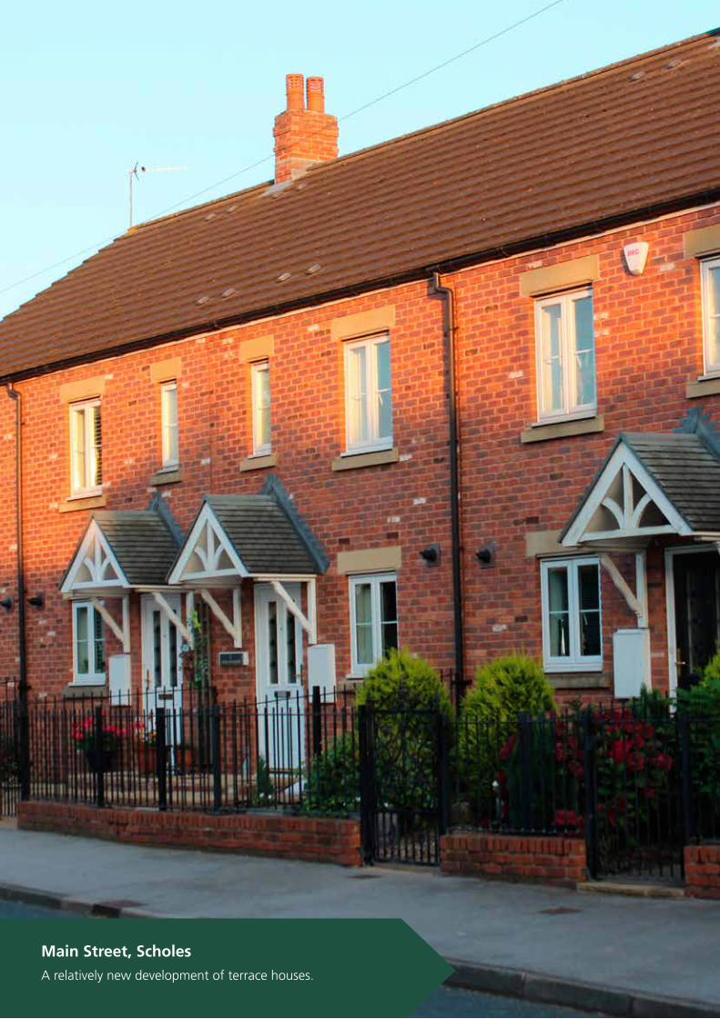
Main Street, Scholes
A relatively new development of terrace houses.

49Barwick in Elmet and Scholes Neighbourhood Plan 2016
Policy BE1: Achieving high quality and sympathetic building design
All new development must demonstrate good quality design, responding to and integrating with the surrounding community and landscape. The following set of key design principles should be adhered to unless compelling reasons can be demonstrated not to:
(i) Achieve high quality design, especially in and overlooking the Conservation Areas but in all residential areas too, that respects the scale and character of existing buildings. New development in the main villages should, wherever possible, draw upon and be inspired by the best design features of the Conservation Area of the village. This includes avoiding features such as Dormer windows, rooflights and other roof extensions, except where they are well established in the vicinity.
(ii) Local materials or materials sympathetic to the existing building and/or street scene should be used in all new development and renovations so that they are in keeping with their surroundings, particularly in Conservation Areas.
(iii) Detailing on existing buildings, particularly those in Conservation Areas or of an historic nature, needs to be conserved and replaced if possible when renovations take place. For example, in relation to doors and architraves, porches, steps; window styles and frames, sills, lintels, mullions; decorative brickwork, chimney stacks and pots.
Conformity references: NPPF 17; 55-59. Leeds Core Strategy Policy P11
5.3 The Built Environment (BE)
50 Barwick in Elmet and Scholes Neighbourhood Plan 2016
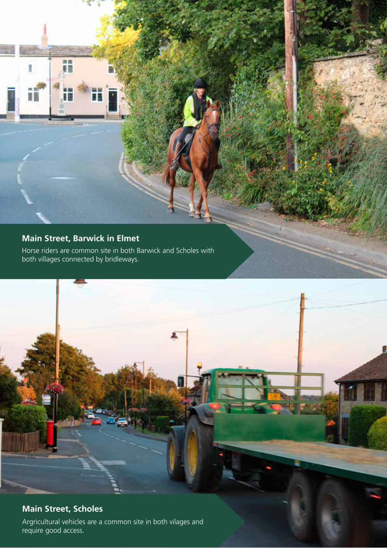
Main Street, Scholes
Argricultural vehicles are a common site in both vilages and require good access.
Main Street, Barwick in Elmet
Horse riders are common site in both Barwick and Scholes withboth villages connected by bridleways.

51Barwick in Elmet and Scholes Neighbourhood Plan 2016
Issues
The villages of the Neighbourhood Area are well conserved and maintained, both in the designated Conservation Areas and across the wider residential areas. Vehicular traffic can be significant on the main thoroughfares. These are not well designed sufficiently well to ensure encouragement of pedestrians and non-motorised modes of transport,
Around the two primary schools and in the historic centres of the two primary villages there is considerable congestion at peak hours.
Evidence
Walking, horse-riding and cycling are popular pursuits across the Neighbourhood Area. There are no dedicated cycle lanes on the public roads network currently. Both primary schools are located in the village centres and children routinely walk to and from school.
The Neighbourhood Areas suffers considerable through traffic at rush hours in particular with commuters using the main roads to access the City and the nearby motorway network. Traffic calming measures are evident in Barwick in Elmet but not in Scholes, although some recent measures have been taken in both villages to increase safety at key locations.
In both villages, on road car parking causes considerable obstruction to the flow of traffic and creates hazards for pedestrians and vehicular traffic alike, as well as other road users such as horse riders.
94% of respondents to the consultation on the first draft NP supported the policy to improve the management of the streetscene.
5.3.2 Streets and street scene
Policy BE2: Streets and street scene
Proposals for new development should seek to ensure that:
(i) Opportunities for walking are integrated wherever possible through practical measures such as the provision of and improvements to pavements and paths in the villages and improvements to the Public Rights of Way network across the wider Neighbourhood Area.
(ii) On-road car parking which serves to obstruct residential streets is minimised as far as is practicable by the provision of sufficient parking spaces on properties and well landscaped on-road parking bays. Provision should be incorporated into all new development proposals.
Conformity references: NPPF 35. Leeds Core Strategy Policy T2
5.3 The Built Environment (BE)

52 Barwick in Elmet and Scholes Neighbourhood Plan 2016
Long Lane, Barwick in Elmet
The road winding up towards the New Inn from Garforth.
Scholes Lane, Scholes
Entering the village, close to the junction with the A64.
53Barwick in Elmet and Scholes Neighbourhood Plan 2016
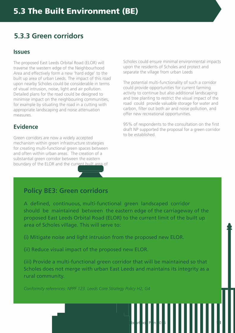
Issues
The proposed East Leeds Orbital Road (ELOR) will traverse the western edge of the Neighbourhood Area and effectively form a new ‘hard edge’ to the built up area of urban Leeds. The impact of this road upon nearby Scholes could be considerable in terms of visual intrusion, noise, light and air pollution. Detailed plans for the road could be designed to minimise impact on the neighbouring communities, for example by situating the road in a cutting with appropriate landscaping and noise attenuation measures.
Evidence
Green corridors are now a widely accepted mechanism within green infrastructure strategies for creating multi-functional green spaces between and often within urban areas. The creation of a substantial green corridor between the eastern boundary of the ELOR and the current built area of
Scholes could ensure minimal environmental impacts upon the residents of Scholes and protect and separate the village from urban Leeds
The potential multi-functionality of such a corridor could provide opportunities for current farming activity to continue but also additional landscaping and tree planting to restrict the visual impact of the road could provide valuable storage for water and carbon, filter out both air and noise pollution, and offer new recreational opportunities.
95% of respondents to the consultation on the first draft NP supported the proposal for a green corridor to be established.
5.3.3 Green corridors
Policy BE3: Green corridors
A defined, continuous, multi-functional green landscaped corridor should be maintained between the eastern edge of the carriageway of the proposed East Leeds Orbital Road (ELOR) to the current limit of the built up area of Scholes village. This will serve to:
(i) Mitigate noise and light intrusion from the proposed new ELOR.
(ii) Reduce visual impact of the proposed new ELOR.
(iii) Provide a multi-functional green corridor that will be maintained so that Scholes does not merge with urban East Leeds and maintains its integrity as a rural community. Conformity references: NPPF 123. Leeds Core Strategy Policy H2, G4
5.3 The Built Environment (BE)

54 Barwick in Elmet and Scholes Neighbourhood Plan 2016
5. Key Themes and polices for our plan
Flats Lane, Barwick in Elmet
Looking over the fields towards Garforth (with St. Mary’s church spire just visible on the horizon).
Leeds Road, ScholesLooking towards Leeds, with Scholes Lodge Farm open spaceto the right.

55Barwick in Elmet and Scholes Neighbourhood Plan 2016
Issues
Flooding from rivers (fluvial) is rare but areas susceptible to flooding, particularly from the Cock Beck, do exist in and around Barwick in Elmet. More commonplace is flooding resulting from precipitation (pluvial), particularly in Scholes where the landscape is flatter and poorly drained.
Evidence
Appendix 2 details the extent of floodzones around Barwick in Elmet and the streets in Scholes where flooding of
roads and gardens is regularly reported and recorded through consultations. Of real concern for residents of Scholes is the extent to which existing drainage has the capacity to deal with current demands, let alone future pressure resulting from new developments. In Barwick in Elmet, the Leeds Strategic Flood Risk Assessment highlights floodzones associated with the Cock Beck primarily.
While no such floodzones exist in Scholes, the flat landscape and sub-standard drainage
encourages localized street and garden flooding.
Work undertaken over the past decade by Natural England primarily has highlighted the key role that green infrastructure can play in increasing drainage and slowing surface water run-off, through increased tree planting, green spaces, permeable surfaces and improved maintenance of existing drainage measures.
95% of respondents supported the policy proposed in the first draft NP consultation.
5.3.4 Drainage and flood prevention
Policy BE4: Drainage and flood prevention
New development should aim to reduce the overall level of flood risk in the parish:
(i) Surface water management measures will be required for major development proposals to ensure that the risk of flooding both on-site and downstream is not significantly increased. The concept of Sustainable Drainage Systems (SuDS) as an alternative to conventional drainage will be supported provided that they can be shown to be suitable in the intended location and that such systems will be properly maintained.
(ii) Proposals for new green infrastructure incorporated into new developments will be supported in order to minimise impact upon the existing communities and to provide opportunities for habitat corridors, sustainable drainage and linkage to the surrounding countryside.
(iii) There is a presumption against culverting and the constricting of watercourses and their immediate environs.
Conformity references: NPPF 100-104;
5.3 The Built Environment (BE)

56 Barwick in Elmet and Scholes Neighbourhood Plan 2016
5. Key Themes and polices for our plan
Main Street, Barwick in Elmet
Period propertires on the junction of Carrfield Road.
Main Street, Scholes
Looking towards Station Road.

57Barwick in Elmet and Scholes Neighbourhood Plan 2016
Issues
In the Neighbourhood Area, only Potterton remains as a community without street lighting. Unlit or ‘dark’ villages are not uncommon in rural Leeds, although neither Barwick in Elmet nor Scholes maintain this tradition. However, the residents of the small hamlet of Potterton are keen to see the unlit nature of their community preserved.
Evidence
In the Neighbourhood Area, only Potterton remains as a community without street lighting. Unlit or ‘dark’ villages are not uncommon in rural Leeds, although neither Barwick in Elmet nor Scholes maintain this tradition. However, the residents of the small hamlet of Potterton are keen to see the unlit nature of their community preserved.
Policy BE5: Unlit villages:
In order to conserve its rural character, new development in Potterton should seek to respect and maintain the ‘dark’ nature of the hamlet. New street lighting will not be supported and new security and other lighting, for example, should be carefully designed so that it does not create unnecessary light pollution.
Conformity references: NPPF 125. Leeds Core Strategy P11
5.3.5 Unlit villages
5.3 The Built Environment (BE)

58 Barwick in Elmet and Scholes Neighbourhood Plan 2016
5. Key Themes and polices for our plan
Elmwood Lane, Barwick in Elmet
A relatively modern semi detached development.
Scholes Lodge Farm, Scholes
Another view of the dedicated ‘open space’.
59Barwick in Elmet and Scholes Neighbourhood Plan 2016
Objectives addressed
Ensuring an adequate supply of housing: To ensure that an adequate supply of homes is available for local people who wish to remain resident in the Neighbourhood Area; and that new housing supply is implemented in such a manner that creates the least harm to the rural character of the Neighbourhood Area.
Maintaining the environment and distinctive rural character: To preserve and enhance the rural character of the Neighbourhood Area, ensuring that new
development is compatible with the built and natural environment, preserves historic features and protects and improves local landscapes.
Ensuring sympathetic building design: To ensure that building development includes infrastructure that sustains the communities and that new development is designed to be sympathetic with the locality and the historic nature of the Neighbourhood Area.
Issues
Consultation with the community has revealed that there is support and need for new homes to be created in the Neighbourhood Area. There is established need to accommodate young people and young families as well as homes for older people looking to downsize in order to stay in the community.
Evidence
The Leeds Core Strategy classes both Barwick in Elmet and Scholes as ‘smaller settlements’ in the settlement hierarchy. The Core Strategy indicates that smaller settlements should take no more than 11% (8% from urban extensions and 3% from infill) of the additional housing growth required for the city as a whole. Potterton does not fall into this settlement hierarchy and is therefore not expected to accommodate any future growth, except in very special circumstances.
Both Scholes and Barwick in Elmet have a wide range of property with historic buildings and well conserved street scenes in the central area giving way to more
modern development as the village has expanded. Great care has been taken over the years to ensure that the character and integrity of the villages have been maintained.
Property prices have increased substantially over the past 10 years or so with the majority of selling prices as shown in the 2011 census falling within the following ranges (dependent on accommodation):
• Terraced £130,000 - £145,000;• Bungalows £200,000 - £265,000;• Semi–detached £160,000 - £190,000;• Detached £325,000 - £500,000.
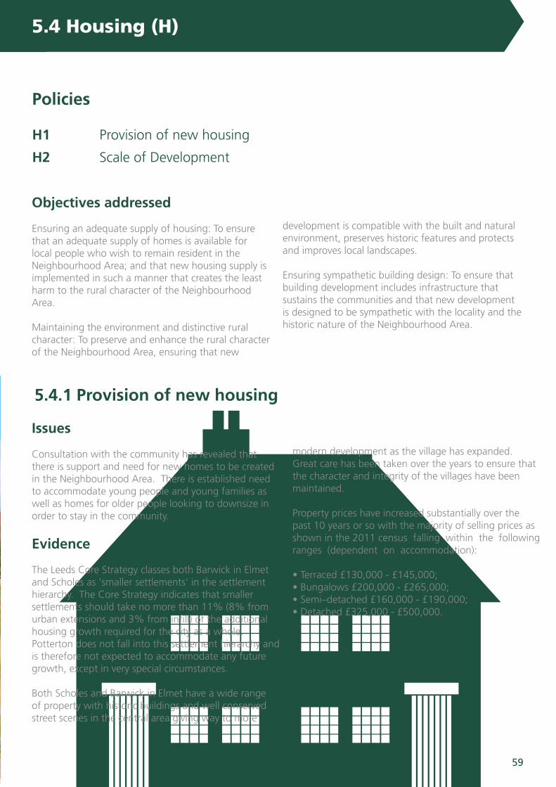
5.4 Housing (H)
Policies
H1 Provision of new housing
H2 Scale of Development
5.4.1 Provision of new housing
60 Barwick in Elmet and Scholes Neighbourhood Plan 2016
5. Key Themes and polices for our plan5. Key Themes and polices for our plan5. Key Themes and polices for our plan5. Key Themes and polices for our plan
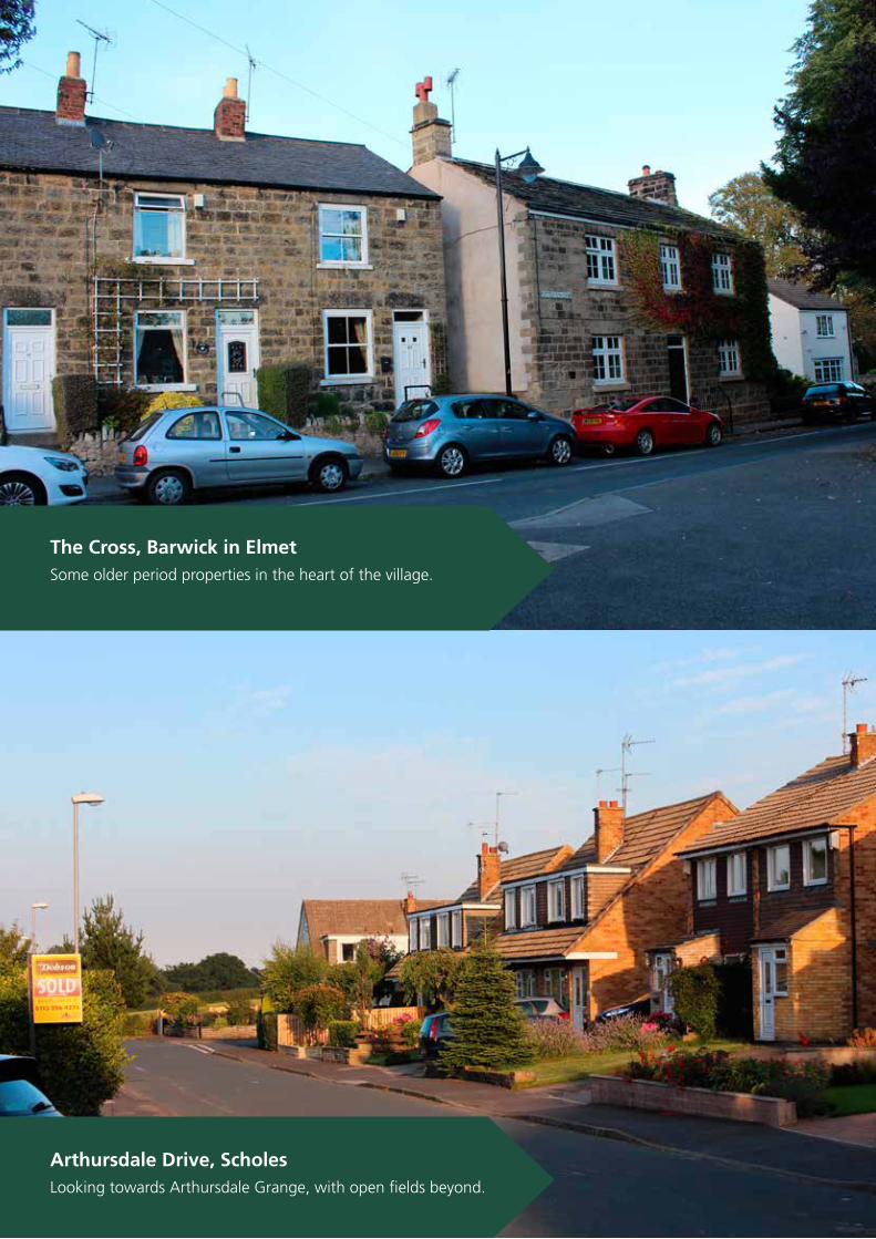
The Cross, Barwick in Elmet
Some older period properties in the heart of the village.
Arthursdale Drive, Scholes
Looking towards Arthursdale Grange, with open fields beyond.
61Barwick in Elmet and Scholes Neighbourhood Plan 2016
The East Leeds Urban Area Extension is a large strategic development that was treated in its entirety for planning development. This development, projected to provide 9,000 dwellings between Redhall and Thorpe Park plus a dual carriageway orbital relief road, is located outside the Neighbourhood Area but has the potential for considerable impact on the community of Scholes, in particular, by the generation of traffic and visual intrusion.
A Housing Needs Assessment undertaken by Chris Broughton Associates in 2015 provided the following key information about the housing characteristics and needs of the parish:
1. The evidence suggests that the parish has many features that distinguish it from the city, the region and England. Compared to these larger geographies the key differences are:
• over the decade between the 2001 and 2011 censuses the parish population has declined even though the number of households increased, due to decreasing average household size;
• there are fewer young children and young adults; • there are considerably more people over the ageof 65;
• people that are economically active are more likely to be in higher and medium level occupations;
• people are healthier and are less likely to have limitations in their day to day activities even though there is a high proportion of older residents in the parish.
2. In respect of the housing stock, the parish:
• has a very high proportion of detached houses and bungalows with a very low proportion of terraced homes, flats and apartments;
• has a high proportion (over 75%) of homes that have 3 bedrooms or more;
• generates a low supply of re-sales and re-lets as households tend to stay resident in the parish long term;
• generates high demand, driven by easy access to labour markets by road, a high quality environment and good schools. The parish is described as ‘a place to move up to’.
• is consequently more expensive than average prices for Leeds and the region
• is unlikely to be affordable to households on average income unless they can find significant deposits; and
• is unlikely to be affordable to first time buyers.
3. There is little supply of social or affordable housing in the parish. Although many households on the waiting list for social housing aspire to live in the parish, limited supply from relets means that there is only a small amount of active demand.
4. The main priorities for residents of the parish in respect of housing provision were for future homes to have on plot parking; a private garden; high standards of energy efficiency; a garage; be suited for first time buyers and older people. Residents felt that town houses and large family homes should be a low priority.
5. The information showed that over the next five years more housing would become vacant in the parish than was required by local households seeking to move home within the parish. However because of the limited diversity in the housing stock and choices made by aging households to downsize there was a mismatch between the likely supply of housing and the requirement of households seeking to move. The mismatch occurs in terms of house size, type, tenure and special features.
6. The Assessment estimates that 18 additional dwellings over 5 years are needed to meet identified need, with 11 dwellings of specified size type and tenure and a further 7 dwellings that address mobility and support needs.
The consultation on this policy in the first draft NP revealed 93% support from respondents.
5.4 Housing (H)
5.4.1 Provision of new housing
62 Barwick in Elmet and Scholes Neighbourhood Plan 2016
5. Key Themes and polices for our plan
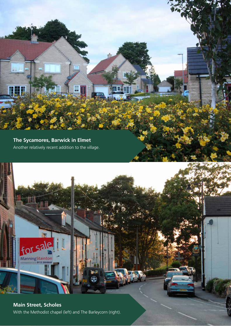
The Sycamores, Barwick in Elmet
Another relatively recent addition to the village.
Main Street, Scholes
With the Methodist chapel (left) and The Barleycorn (right).
63Barwick in Elmet and Scholes Neighbourhood Plan 2016
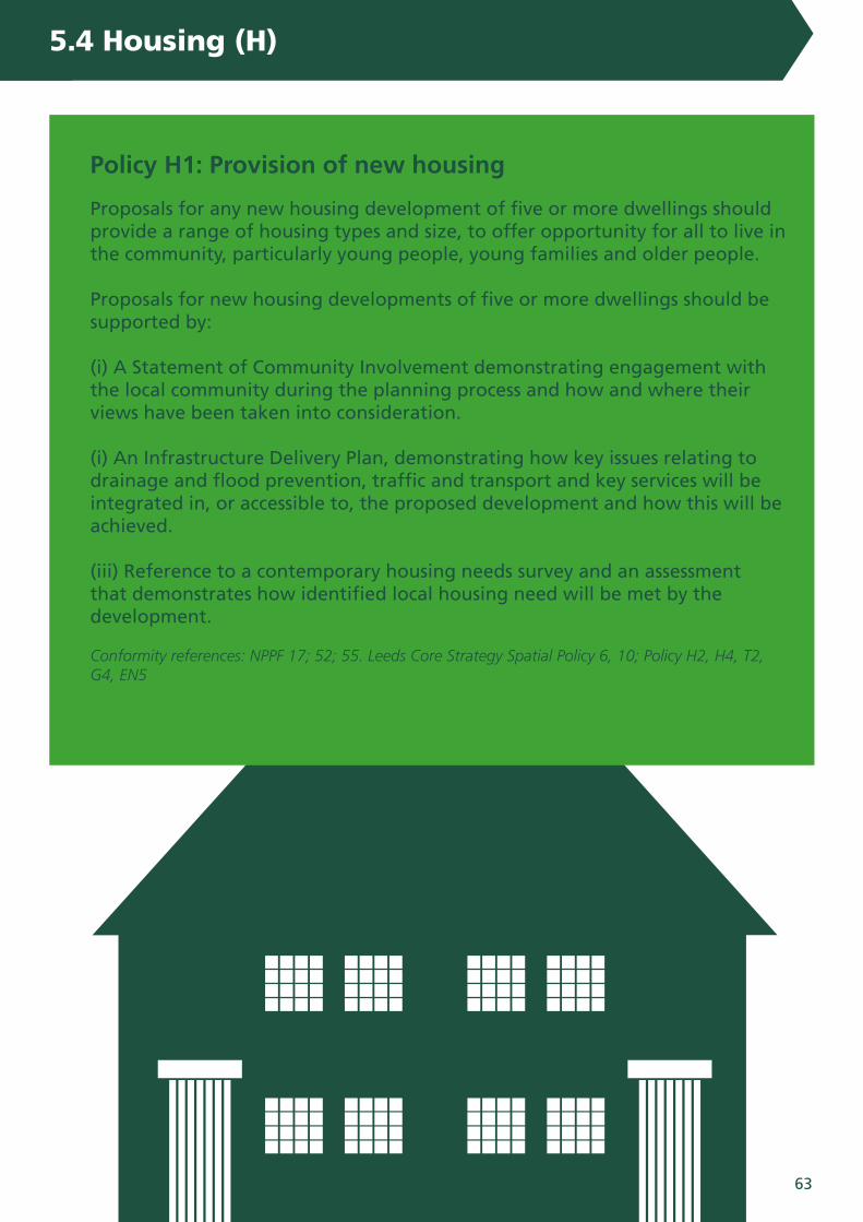
Policy H1: Provision of new housing
Proposals for any new housing development of five or more dwellings should provide a range of housing types and size, to offer opportunity for all to live in the community, particularly young people, young families and older people.
Proposals for new housing developments of five or more dwellings should be supported by:
(i) A Statement of Community Involvement demonstrating engagement with the local community during the planning process and how and where their views have been taken into consideration.
(i) An Infrastructure Delivery Plan, demonstrating how key issues relating to drainage and flood prevention, traffic and transport and key services will be integrated in, or accessible to, the proposed development and how this will be achieved.
(iii) Reference to a contemporary housing needs survey and an assessment that demonstrates how identified local housing need will be met by the development.
Conformity references: NPPF 17; 52; 55. Leeds Core Strategy Spatial Policy 6, 10; Policy H2, H4, T2, G4, EN5
5.4 Housing (H)

64 Barwick in Elmet and Scholes Neighbourhood Plan 2016
5. Key Themes and polices for our plan5. Key Themes and polices for our plan
Elmwood Court, Barwick in Elmet
Built (as the entrance stone suggests) in 1999.
Main Street, Scholes
View looking across Scholes Lodge Farm.

65Barwick in Elmet and Scholes Neighbourhood Plan 2016
Issues
It is clear from consultations that residents of the Neighbourhood Area value its rural setting very highly. Both Barwick and Scholes have extended significantly over previous decades and infrastructure such as roads, drainage and schools are now regarded as being at or near capacity., Therefore new development must respect the sustainability of the current communities and not overwhelm or overload carrying capacity.
Evidence
Accommodating new development in small villages must be sensitively designed in order to ensure that existing infrastructure is able to cope. Large new housing developments are likely to cause pressure
on schools, transport and drainage in particular. Residents are clear in their responses to surveys that the current infrastructure is already strained with school rolls under pressure, roads struggling to accommodate more traffic and all other infrastructure under considerable pressure.
The character of the built environment is highly prized by residents and the historic character of both Barwick in Elmet and Scholes is reflected in their Conservation Areas. The characteristics of the built up areas including and beyond these designated spaces is highlighted earlier in the Plan. 90% of respondents to the consultation on the first draft NP supported the policy on scale of development.
5.4.2 Type and design of new housing developments
Policy H2: Type and design of new housing developments
New development should reflect their surroundings and be similar in terms of density, footprint, separation, scale and bulk of buildings in the surrounding area. Support will be given to developments that:
(i) Provide 1 and 2 storey housing in keeping with the rest of the built form.
(ii) Provide new housing on smaller sites within established development limits that will assimilate into the existing community.
(iii) Re-use redundant buildings where possible and appropriate to provide new homes.
(iv) Reflect the existing built form, with garden and back land infill development supported only where this does not result in housing density which is out of keeping with the locality.
(v) Provide appropriate landscaping that serves to enhance and soften the visual impact of development.
Conformity references: NPPF 17; 47; 53; 55-59. Leeds Core Strategy Spatial Policy 1 (iii); Policy H3; P11.
5.4 Housing (H)
66 Barwick in Elmet and Scholes Neighbourhood Plan 2016
5. Key Themes and polices for our plan
Main Street, Barwick in Elmet
Pizza Piccante. One of several businesses on Main Street.
The Buffers, Scholes
A former railway station on the old Crossgates to Wetherby line.

67Barwick in Elmet and Scholes Neighbourhood Plan 2016
£Objectives addressed
Developing community and business infrastructure: To ensure residents live in communities that provide for their needs through enabling the provision of education, recreation and employment opportunities.
Maintaining the natural environment and distinctive character: To preserve and enhance the rural character of the Neighbourhood Area, ensuring that new development is compatible with the built and natural environment, preserves historic features and protects and improves local landscapes.
Issues
The community relies upon small businesses to provide the majority of employment opportunities for residents who do not commute out of the parish. There is a need then to become, as far as is practicable, ‘open for business’ as far as small business is concerned where impacts upon residential areas is often minimal.
Evidence
Nearly 200 people are employed by local businesses currently according to surveys, and this is likely to be a considerable under representation. There are over 160 VAT registered businesses in the parish with more that are not registered and, therefore, more or less invisible. Main Street in Barwick in Elmet and Station Road in Scholes are both home to a variety of retail and service businesses.
Agriculture is the major commercial land use in the Neighbourhood Area. Land cultivated is primarily held by tenant farmers and agricultural viability should be preserved. The land farmed has good rates of crop production averaging above 4 ton of wheat per acre. Some land is also used for oil seed rape and potatoes, with small areas used for grazing.
The villages benefit from a number of economic sites, primarily on the enterprise park on Aberford Road in Barwick in Elmet and on York Road at Morwick Hall in Scholes. Morwick Hall and the surrounding annexes provide thirty varied business users with accommodation.
The development of a business ‘start-up site’ for eighteen light industrial units and a training block has been proposed at Holmecroft, located on a brownfield site, a former scrap yard adjacent to the A64. Langland’s Garden Centre and other commercial enterprises are also located on the A64.
Retail outlets are also established in both villages, primarily in the village centres and along the main thoroughfares. In addition there are also numerous small and home based businesses including plumbers, electricians, accountancy and other sole traders who have been consulted throughout the preparation of this plan.
The consultation on the first draft NP revealed 90% support from respondents for the policy to support small businesses.
5.5.1 Small business development
5.5 The Economy (E)
Policies
E1 Small business development
E2 Farm diversification
E3 Industrial and business parks
E4 Village centres

68 Barwick in Elmet and Scholes Neighbourhood Plan 2016
5. Key Themes and polices for our plan
The Barleycorn Inn
One of two public houses in Scholes.

69Barwick in Elmet and Scholes Neighbourhood Plan 2016
£Policy E1 - Small business development:
The growth of existing small businesses and new start businesses will be supported. Consideration should be given to the effect of an increase in traffic movements, the use of larger vehicles or Heavy Goods Vehicles, or other detrimental impacts.
Conformity references: NPPF 21; 25; 28. Leeds Core Strategy Spatial Policy 8
5.5 The Economy (E)

70 Barwick in Elmet and Scholes Neighbourhood Plan 2016
Stockeld Lane, Scholes
Home to some of the local livestock.
Hall Tower Hill, Barwick in Elmet
Rare breed sheep help to keep the grass under control.

71Barwick in Elmet and Scholes Neighbourhood Plan 2016
£Issues
The character of the Neighbourhood Area is heavily dependent upon the farming community acting as custodians of the land. It is imperative that farms are able to make best use of their assets to remain economically viable units, as long as diversification does not result in loss of productive land or heritage assets or create pressure upon the transport or other infrastructure.
Evidence
The Neighbourhood Area has a number of economically active farms. Some of these have already undertaken various forms of diversification from dog kennels through to fishing lakes, bed and breakfast and farm shops. The Bramham and Parlington estates have long been active in identifying opportunities to diversify their economic base in order to maintain the integrity of the estates into the future: pressures upon production will require flexibility for landowners and farmers to ensure their operations remain viable.
93% of respondents to the consultation on the first draft NP supported the policy on farm diversification.
5.5.2 Farm diversification
Policy E2 - Farm diversification
The diversification of farms will be supported where this enables production from the land to continue and where:
(i) Diversification does not have significant negative effects upon the landscape.
(ii) It does not result in significant increased traffic by way of larger or Heavy Goods Vehicles on rural roads.
(iii) Diversification provides for sustained or increased local employment.
Conformity references: NPPF 17; 21; 28. Leeds Core Strategy Spatial Policy 8
5.5 The Economy (E)

72 Barwick in Elmet and Scholes Neighbourhood Plan 2016
5. Key Themes and polices for our plan
Morwick Hall, Scholes
A landscaped ofice park, home to several businesses.

73Barwick in Elmet and Scholes Neighbourhood Plan 2016
£Issues
Employment sites in the Neighbourhood Area in the form of industrial zones are few and where they do exist provide a valuable service to the community in providing employment and local services.
Evidence
The number and range of businesses that are located in the Neighbourhood Area is well supported by residents. The proximity to urban Leeds and to a wider transport infrastructure makes Barwick in Elmet and Scholes attractive places to locate a business, enhanced recently through the arrival of superfast broadband.
Existing business parks/industrial estates exist at Morwick Hall and Aberford Road, with a further area at Holmecroft on the A64 having been designated for industrial development (although planning permission has since lapsed).
84% of respondents to the first draft of the NP supported the proposed policy.
5.5.3 Industrial and business parks
Policy E3 - Industrial and business parks
The continuance and growth of existing industrial/business estates will be supported provided any detrimental effect on the neighbourhood is minimised.
New business parks will be supported where these utilise brownfield locations and are well linked into transport infrastructure and minimise disruption to and impact upon residential areas.
Conformity references: NPPF 21; 25; 28. Leeds Core Strategy Spatial Policy 8, 9
5.5 The Economy (E)

74 Barwick in Elmet and Scholes Neighbourhood Plan 2016
The Cross, Barwick in Elmet
Looking towards the Methodist Church.
Station Road, Scholes
Looking towards Main Street.
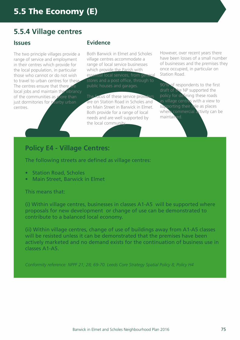
75Barwick in Elmet and Scholes Neighbourhood Plan 2016
£Issues
The two principle villages provide a range of service and employment in their centres which provide for the local population, in particular those who cannot or do not wish to travel to urban centres for these. The centres ensure that there are local jobs and maintain the vibrancy of the communities as more than just dormitories for nearby urban centres.
Evidence
Both Barwick in Elmet and Scholes village centres accommodate a range of local service businesses which provide the Parish with essential local services, from general stores and a post office, through to public houses and garages.
The focus of these service providers are on Station Road in Scholes and on Main Street in Barwick in Elmet. Both provide for a range of local needs and are well supported by the local community.
However, over recent years there have been losses of a small number of businesses and the premises they once occupied, in particular on Station Road.
90% of respondents to the first draft of the NP supported the policy for defining these roads as village centres with a view to supporting their role as places where commercial activity can be maintained.
5.5.4 Village centres
Policy E4 - Village Centres:
The following streets are defined as village centres:
• Station Road, Scholes• Main Street, Barwick in Elmet
This means that:
(i) Within village centres, businesses in classes A1-A5 will be supported where proposals for new development or change of use can be demonstrated to contribute to a balanced local economy.
(ii) Within village centres, change of use of buildings away from A1-A5 classes will be resisted unless it can be demonstrated that the premises have been actively marketed and no demand exists for the continuation of business use in classes A1-A5.
Conformity reference: NPPF 21; 28; 69-70. Leeds Core Strategy Spatial Policy 8; Policy H4
5.5 The Economy (E)

76 Barwick in Elmet and Scholes Neighbourhood Plan 2016
5. Key Themes and polices for our plan
John Rylie HouseCommunity centre, next to an area of sheltered housing.
Scholes Manor HouseCommunity centre, located on Belle Vue Road.
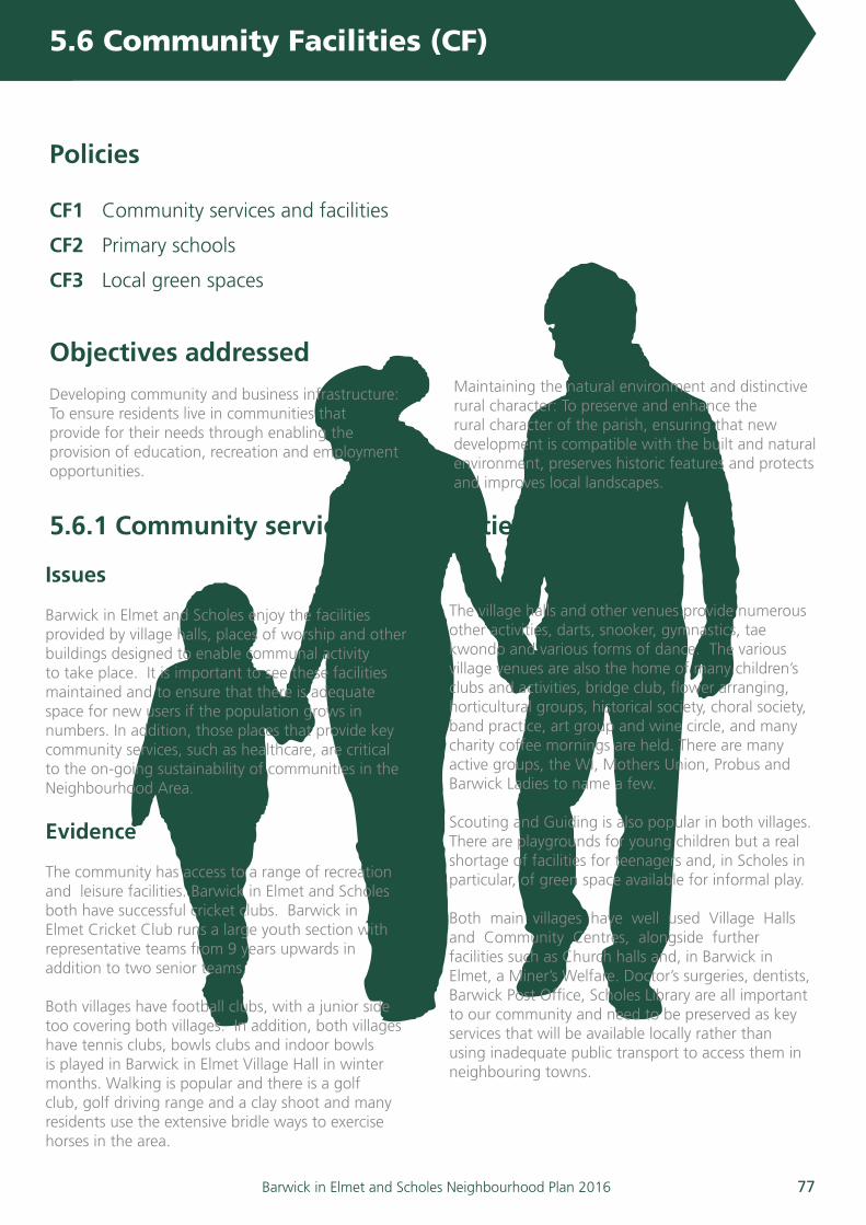
77Barwick in Elmet and Scholes Neighbourhood Plan 2016
Objectives addressed Developing community and business infrastructure: To ensure residents live in communities that provide for their needs through enabling the provision of education, recreation and employment opportunities.
Maintaining the natural environment and distinctive rural character: To preserve and enhance the rural character of the parish, ensuring that new development is compatible with the built and natural environment, preserves historic features and protects and improves local landscapes.
5.6 Community Facilities (CF)
Issues
Barwick in Elmet and Scholes enjoy the facilities provided by village halls, places of worship and other buildings designed to enable communal activity to take place. It is important to see these facilities maintained and to ensure that there is adequate space for new users if the population grows in numbers. In addition, those places that provide key community services, such as healthcare, are critical to the on-going sustainability of communities in the Neighbourhood Area.
Evidence
The community has access to a range of recreation and leisure facilities. Barwick in Elmet and Scholes both have successful cricket clubs. Barwick in Elmet Cricket Club runs a large youth section with representative teams from 9 years upwards in addition to two senior teams.
Both villages have football clubs, with a junior side too covering both villages. In addition, both villages have tennis clubs, bowls clubs and indoor bowls is played in Barwick in Elmet Village Hall in winter months. Walking is popular and there is a golf club, golf driving range and a clay shoot and many residents use the extensive bridle ways to exercise horses in the area.
The village halls and other venues provide numerous other activities, darts, snooker, gymnastics, tae kwondo and various forms of dance. The various village venues are also the home of many children’s clubs and activities, bridge club, flower arranging, horticultural groups, historical society, choral society, band practice, art group and wine circle, and many charity coffee mornings are held. There are many active groups, the WI, Mothers Union, Probus and Barwick Ladies to name a few.
Scouting and Guiding is also popular in both villages. There are playgrounds for young children but a real shortage of facilities for teenagers and, in Scholes in particular, of green space available for informal play.
Both main villages have well used Village Halls and Community Centres, alongside further facilities such as Church halls and, in Barwick in Elmet, a Miner’s Welfare. Doctor’s surgeries, dentists, Barwick Post Office, Scholes Library are all important to our community and need to be preserved as key services that will be available locally rather than using inadequate public transport to access them in neighbouring towns.
5.6.1 Community services and facilities
Policies
CF1 Community services and facilities
CF2 Primary schools
CF3 Local green spaces

78 Barwick in Elmet and Scholes Neighbourhood Plan 2016
5. Key Themes and polices for our plan
Chapel Lane, Barwick in Elmet
The main entrance to the village hall.
Main Street, Scholes
The village library.

79Barwick in Elmet and Scholes Neighbourhood Plan 2016
Barwick in Elmet has a purpose built medical facility with the ability to expand. Scholes has an older facility which will be difficult to expand on its current site and it is likely that a new medical centre will be essential if there is considerable future housing growth. There is a private dentist in Scholes.
Scholes Social Care provides support and activities for the elderly and Helping Hands in Barwick provides assistance for elderly or housebound residents. Recently Osman House, a brain injury
rehabilitation trust facility, opened in Scholes. The various churches also provide regular coffee mornings and support for residents. There is sheltered accommodation for the elderly in both villages with communal facilities.
95% of respondents to the consultation on the first draft NP supported the policy on retaining community facilities.
5.6 Community Facilities (CF)
Policy CF1: Community services and facilities:
The retention and promotion of all community facilities in their current use will be supported, including the following:-
• Community Centres & Village Halls• Public houses• Village shops & Post Office• Primary schools• Places of worship• Libraries
Any proposals for change of use will not be supported unless it can be demonstrated that:
(i) the land or building in question has fallen out of use; and
(ii) a beneficial need for the new proposal is supported by research and consultation
Conformity references: NPPF 21; 25; 28. Leeds Core Strategy Spatial Policy 8, 9
5.6.1 Community services and facilities
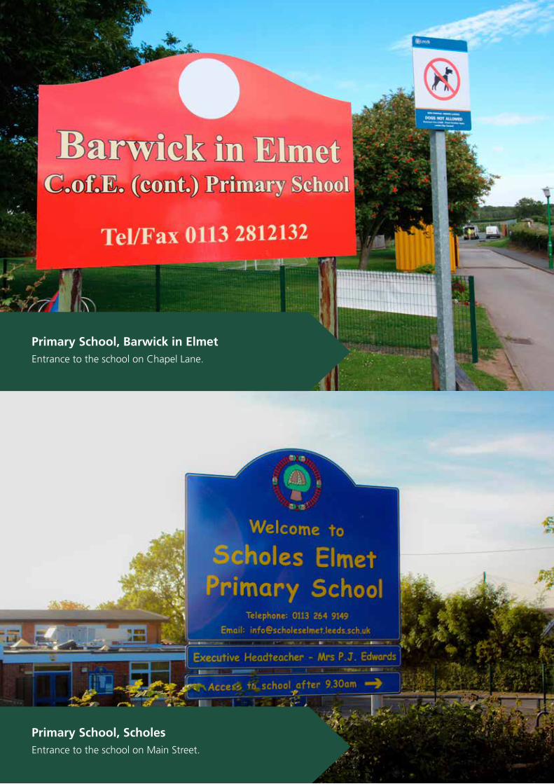
80 Barwick in Elmet and Scholes Neighbourhood Plan 2016
5. Key Themes and polices for our plan
Primary School, Barwick in Elmet
Entrance to the school on Chapel Lane.
Primary School, Scholes
Entrance to the school on Main Street.

81Barwick in Elmet and Scholes Neighbourhood Plan 2016
Issues
Both primary schools are popular with a full complement but there is increasing pressure to take more children. In many ways the schools are at the heart of their communities and are very well regarded in the community. There is a necessity, therefore, to enable the schools to grow in order to accommodate new students and to ensure their sustainability.
Evidence
The whole of the Neighbourhood Area has pressure to take more pupils than schools can currently offer at reception in the current year with projections indicating that pressure will only increase. The situation is particularly acute for Scholes in the current year but with the situation projected to equalize across both schools for 2016/17.
There is a Primary School in each village offering nursery, infants and junior education. Scholes potentially has room for expansion, although currently oversubscribed. There is additional nursery provision at Morwick Hall and in the village halls and with child minders but spaces are limited.
The village schools have land available to increase the number of classrooms. Barwick in Elmet could potentially accommodate an increase in pupil intake to 45 pupils a year which would require additional classrooms to be built. Scholes School has land available to increase the number of classrooms; however it would result in the loss of playground and green space.
All secondary education is provided outside the Parish at Garforth Academy, Corpus
Christi Catholic College, John Smeaton Academy, Tadcaster Grammar School (in North Yorkshire) and Boston Spa Comprehensive School (where the majority of children from both villages attend).
There is a small public library in Scholes with limited opening hours and the mobile library visits Barwick in Elmet.
92% of respondents to the consultation on the first draft NP supported the policy to enable the growth of the primary schools where this was required to ensure future sustainability.
5.6.2 Primary schools
Policy CF2 - Primary schools
The expansion of the primary schools, their buildings and grounds, will be supported where these provide for the ongoing sustainability of the facility and contribute to the improvement of the learning environment of the school.
Conformity references: NPPF 72;
5.6 Community Facilities (CF)
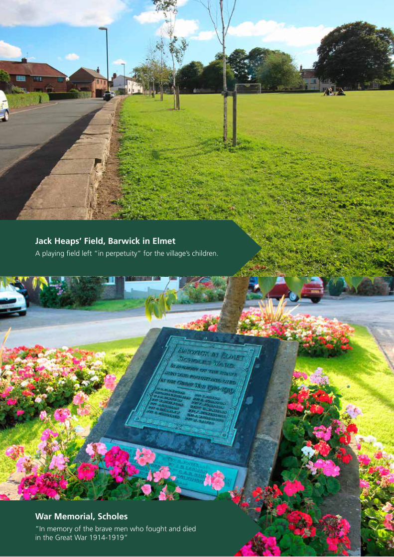
82 Barwick in Elmet and Scholes Neighbourhood Plan 2016
Jack Heaps’ Field, Barwick in Elmet
A playing field left “in perpetuity” for the village’s children.
War Memorial, Scholes
”In memory of the brave men who fought and diedin the Great War 1914-1919”

83Barwick in Elmet and Scholes Neighbourhood Plan 2016
Issues
The villages enjoy substantial open spaces presently, including Jack Heap’s Field, Scholes Lodge Field, cricket and football pitches, tennis courts and children’s play areas. These are well maintained and accessible to all members of the community.
In both villages there are well established allotments, which are sought after. The 48 allotments in Barwick in Elmet are based on land owned by the Parish Council. The 26 allotments in Scholes are on private land and are over seventy years old being established in 1941, situated adjacent to the Leeds Country Way footpath off Main Street.
The ‘In Bloom’ groups for both villages are highly pro-active and both villages have been recognised by awards in recent years.
With the exception of the two villages of Barwick in Elmet and Scholes, the Neighbourhood Area is covered by Green Belt with its associated high degree of protection from development.
Evidence
The Household Questionnaire revealed strong support in the villages for the retention of existing green space as key amenity land with its contribution to the open and historic character of each village.
Surveys of young people have also revealed considerable support for the retention of existing green space for informal recreation.
This is supported by work undertaken for the Outer North East Leeds Housing Market Character Area which revealed deficiencies in the Harewood Ward (of which Barwick in Elmet and Scholes is part) in terms of Amenity Land (-0.079ha/100 people) and Allotments (-0.082ha/1000 people). Whilst the study did show that the Harewood Ward as a whole does enjoy surplus green space in relation to Parks and Gardens, Outdoor Pitches and for Children and Young People it is notable on analysis that little of that surplus can be attributed to green space in Barwick in Elmet and Scholes.
Policy CF3, Local Green Space, contains a list of the proposed Local Green Spaces within the villages of Barwick in Elmet and Scholes. A separate annex contains a full description of each area together with the significance and rationale for each area being included on the list of Local Green Space when set against Para 77 of the NPPF. Maps of each space are also included.
88% of respondents supported the proposed policy on local green space designation in the consultation on the first draft NP.
5.6.3 Local green spaces
5.6 Community Facilities (CF)
Policy CF3 - Local green spaces
A number of locations are designated as Local Green Spaces in accordance with guidance provided in the National Planning Policy Framework (please see maps on page 85).
Any new development must provide new Local Green Space of at least the standards set out in the Local Development Plan (Leeds Core Strategy) and designation as Local Green Space will be part of the planning process. Conformity references: NPPF 69-70; 73-74; 76-77. Leeds Core Strategy Policy G4, G6

Policy CF3 - Local green spaces (continued)
Barwick in Elmet
1. Barwick in Elmet allotments.
2. Jack Heaps’ Field (including the tennis courts and children’s play area).
3a. Hall Tower Field, and The Slip.
3b. Wendel Hill and Policies Map reference SEGI 030.
4. Jubilee Gardens.
5. Barwick in Elmet Primary School playing fields.
6. Barwick in Elmet football pitch, cricket pitches and bowling green.
7. Long Lane Beck and stream banks.
8. Woodland between Long Lane and Gascoigne Court
9. Churchyard and grounds of All Saints Church.
10. Grassed area junction of The Boyle and Rakehill Road.
Scholes
11. Scholes allotments.
12. Green Court.
13. Playing Fields including Tennis Courts, Bowling green and Scout Hut/area.
14. Playing Fields, Scholes Primary School.
15. Grass verges, Memorial Trees and War Memorial, Station Road.
16. Disused railway cutting between Chippy’s pond and Scholes Lane.
17. Disused railway embankment to rear of Nook Road.
18. Surrounds of St. Philips Church.
19. Scholes Lodge Farm Field.
20. Surrounds of Manor House, Main Street.
5.6 Community Facilities (CF) 5.6 Community Facilities (CF)
84 Barwick in Elmet and Scholes Neighbourhood Plan 2016

Barwick in Elmet - Neighbourhood area
5.7 Policies Maps

Conservation area
Key
Village centre
Local green space
5.7 Policies Maps
Barwick in Elmet - Local green spaces
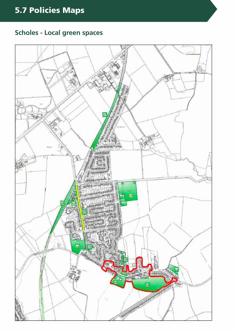
5.7 Policies Maps
Scholes - Local green spaces
5.7 Policies Maps
2016 - 2028
BARWICK IN ELMET & SCHOLES
NEIGHBOURHOODPLAN
Prepared by the Neighbourhood Planning Steering Groupand distributed by Barwick in Elmet and Scholes Parish Council
Barwick in Elmet and ScholesParish Council
Keith LangleyClerk to the Council
Tel. 0113 393 5861
Neighbourhood PlanningSteering Group
Ben HoganChairman
Neighourhood Planning Steering Group 1 Elmete Croft ScholesLeedsLS15 4BE
N.B. The closing date for correspondence relating to this draft of the plan Tuesday 31st May 2016.
£
www.barwickandscholesneighbourhoodplan.co.uk
© Copyright 2016. Barwick in Elmet and Scholes Parish Council - All Rights Reserved.
www.barwickandscholespc.com
Design and print by www.cranberrymarketing.co.uk