Barnegat Bay Ambient Monitoring Project National ... Bay Ambient Monitoring Project National...
12
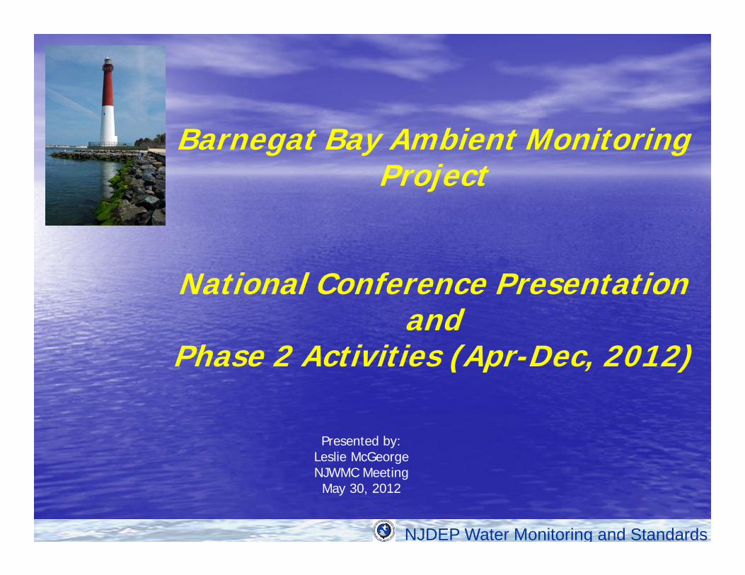
NJDEP Water Monitoring and Standards Barnegat Bay Ambient Monitoring Project National Conference Presentation and Phase 2 Activities (Apr-Dec, 2012) Presented by: Leslie McGeorge NJWMC Meeting May 30, 2012
Transcript of Barnegat Bay Ambient Monitoring Project National ... Bay Ambient Monitoring Project National...
NJDEP Water Monitoring and Standards
Barnegat Bay Ambient Monitoring Project
National Conference Presentation and
Phase 2 Activities (Apr-Dec, 2012)
Presented by:Leslie McGeorgeNJWMC MeetingMay 30, 2012

NJDEP Water Monitoring and Standards
Barnegat Bay Water Quality Monitoring Program: Objectives
• Determine type and extent of water quality impairments
• Develop models for use in directing water quality restoration or TMDL development
• Based on pollutant load responses, identify water quality or loading targets for nutrients or other pollutants

NJDEP Water Monitoring and Standards
Partnership Development• How find interested & willing partners?
• Start w/ NJ Water Monitoring Council • USGS, EPA, Water Utility, Planning Commission, University, Estuary
Program • Meet w/ entities - ask what they can do?• Add monitoring & lab partners
• County Health Dept, Local Technical High School & Sewage Utility, University, & Health Dept
• Find partners in our own agency QA Office, Forestry Center facility, AmeriCorps
• Retask existing partner work - e.g. USGS flow work
• Now have 13 partners!

NJDEP Water Monitoring and Standards
Partnership Development• Monitoring Agreements – written agreements
with each entity specifying project commitments
• Comprehensive Quality Assurance Plan- Referred to in all Partner Agreements
- Assure data of known quality & comparability of results
- Includes: Station locations/dates/ timesSample preparation – preservation & filtering in 2 labsParameters, analytical & field methodsData quality requirements/ reviewSample routing Chain of custody forms
•

NJDEP Water Monitoring and Standards
Partnership Development
• Training & QA Approval- Partner meetings on project design, sample collection, equipment calibration, and QA Office approval for field measurements ( DO, SC, T)
• Partner Communication – 1 point agency contact overall project, 1 field contact for tribs and 1 for bay, frequent emails
• Data access – Website w/ Interactive map
NJDEP Water Monitoring and Standards
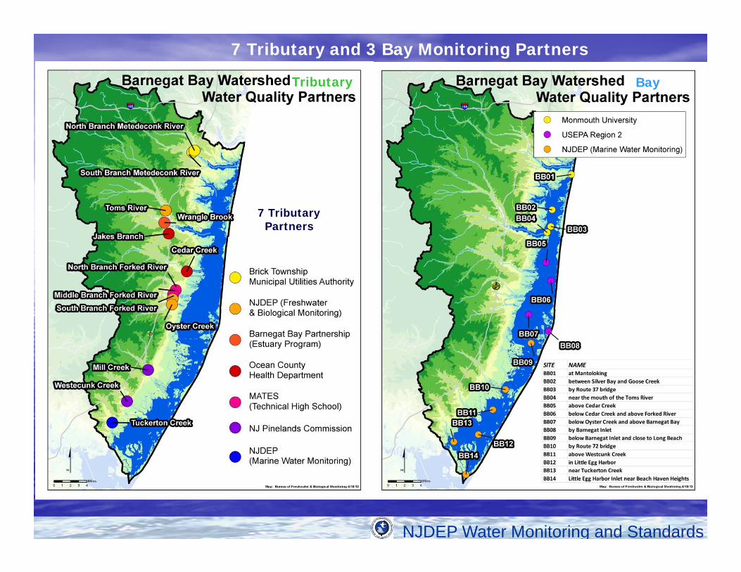
BayTributary
7 Tributary Partners
7 Tributary and 3 Bay Monitoring Partners

NJDEP Water Monitoring and Standards
Partners in
Action

NJDEP Water Monitoring and Standards
*Average Load = sum of all individual load events/number of eventsLoads = lbs/day
Preliminary Results (12 Sampling Events): Mean Nitrite-Nitrate Loadings & Concentrations
NO2+NO3

NJDEP Water Monitoring and Standards
Preliminary Results (12 Sampling Events): Mean Nitrite-Nitrate & Chlorophyll Concentrations

NJDEP Water Monitoring and Standards
What’s New in Phase 2?• New Partners
• New/Changed– Water Quality Stations
• Changed– BT06 (Cedar Creek @ Lanoka Harbor)
flow gauge & wq station relocated– BB04, BB05, BB07
moved to better catch representative wq signal• New
– BB00/BT00 (Point Pleasant Canal)
– Air Deposition Monitoring - TN• Site selection (possibly Cattus Island or BTMUA?)
NJDEP Water Monitoring and Standards
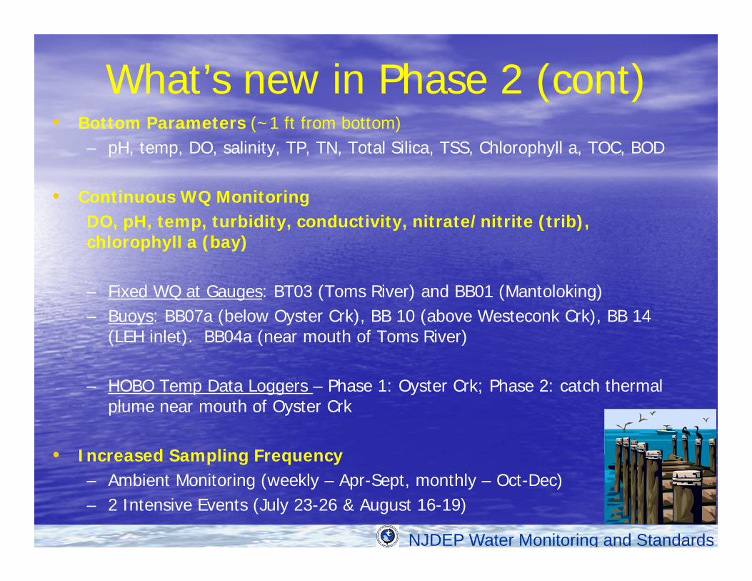
What’s new in Phase 2 (cont)• Bottom Parameters (~1 ft from bottom)
– pH, temp, DO, salinity, TP, TN, Total Silica, TSS, Chlorophyll a, TOC, BOD
• Continuous WQ MonitoringDO, pH, temp, turbidity, conductivity, nitrate/nitrite (trib), chlorophyll a (bay)
– Fixed WQ at Gauges: BT03 (Toms River) and BB01 (Mantoloking) – Buoys: BB07a (below Oyster Crk), BB 10 (above Westeconk Crk), BB 14
(LEH inlet). BB04a (near mouth of Toms River)
– HOBO Temp Data Loggers – Phase 1: Oyster Crk; Phase 2: catch thermal plume near mouth of Oyster Crk
• Increased Sampling Frequency– Ambient Monitoring (weekly – Apr-Sept, monthly – Oct-Dec)– 2 Intensive Events (July 23-26 & August 16-19)

NJDEP Water Monitoring and Standards
Barnegat Bay Website:www.state.nj.us/dep/barnegatbay/
(including Interactive Map for monitoring data)