Banister Scenic River Report
33
Cranesnest Scenic River Report Page 1 of 33 Cranesnest Scenic River Report Dickenson County Prepared By Virginia Department of Conservation and Recreation Division of Planning and Recreation Resources November 2013
Transcript of Banister Scenic River Report

Cranesnest Scenic River Report Page 1 of 33
Cranesnest Scenic River Report
Dickenson County
Prepared By Virginia Department of Conservation and Recreation
Division of Planning and Recreation Resources
November 2013

Cranesnest Scenic River Report Page 2 of 33
Table of Contents
I. REASON FOR THE STUDY ....................................................................... 3 A. Benefits of Designation ............................................................................ 3 B. Designation Process ................................................................................. 3
II. SUMMARY OF FINDINGS .......................................................................... 4
III. CORRIDOR STUDY MAP ........................................................................... 5
IV. ENVIRONMENTAL ANALYSIS .................................................................. 6
A. River Corridor Vegetation ........................................................................ 6 B. Riverbed and/or River Flow Modifications .............................................. 9 C. Human Development of Visual Corridor ................................................ 10 D. Historic Features .....................................................................................11 E. Landscape ...............................................................................................11 F. Quality of Fishery ...................................................................................11 G. Special Natural Flora/Fauna ....................................................................11 H. Water Quality ......................................................................................... 12 I. Parallel Roads ........................................................................................ 13 J. Crossings ............................................................................................... 13 K. Special Features Affecting River Aesthetics ........................................... 14 L. Public Recreational Access .................................................................... 15 M. Land Conservation ................................................................................. 15
V. LAND USE AND OWNERSHIP ................................................................. 16
VI. CONCLUSIONS AND RECOMMENDATIONS ........................................ 16
VII. CONSERVATION PLAN ............................................................................ 17
VIII. ANTICIPATED COST OF DESIGNATION ................................................ 18
IX. AGENCY COMMENTS/ RESOLUTIONS ................................................. 18
X. APPENDIX ................................................................................................. 19
A. Species Ranking definitions of DCR Natural Heritage ........................... 20 B. Letters, Comments and other support documents ................................... 23 C. Proposed Legislation .............................................................................. 33

Cranesnest Scenic River Report Page 3 of 33
I. REASON FOR THE STUDY
On behalf of the Boards of Supervisors of Dickenson County, local officials contacted the Virginia Department of Conservation and Recreation (DCR) and requested that a segment of the Cranesnest River within their jurisdiction be evaluated for possible inclusion in the Virginia Scenic River System. The river segment to be studied is described as from Route 637 to the Flannagan Reservoir Cranesnest Launch Ramp, managed by the Virginia Department of Game and Inland Fisheries. The Scenic Rivers Act, found in Title 10.1, Chapter 4, §§ 10.1-400 through 10.1-418.1 of the Code of Virginia, was enacted in 1970 as a means of recognizing the Commonwealth's scenic rivers and their immediate environs. In order to be eligible for Scenic River designation, a river, or section thereof, must contain substantial natural, scenic, recreational, and historical attributes. At the request of the locality(s), DCR evaluates a specified river segment and writes a report documenting these attributes. Since the passage of the Act, 30 river segments, totaling more than 728 miles, have received Scenic River designation from the General Assembly. A list of those rivers can be found on the Virginia Scenic Rivers website, http://dcr.cache.vi.virginia.gov/recreational_planning/documents/srlist.pdf A. Benefits of Designation
The Virginia Scenic River designation accomplishes the following:
requires all state agencies to consider visual, natural and recreational values of a Scenic
River in their planning and permitting process (§10.1-402) http://leg1.state.va.us/cgi-bin/legp504.exe?000+cod+10.1-402
requires the Federal Energy Regulatory Commission (FERC) to consider the impact of proposed hydropower or related projects on a designated Scenic River using the Scenic River report developed in the qualification process
gives riparian landowners, local citizens, and local governments a greater voice in the planning and implementation of federal and state projects that might affect the river (§10.1-406.1), http://leg1.state.va.us/cgi-bin/legp504.exe?000+cod+10.1-406.1
requires authorization by the General Assembly for the construction, operation and/or maintenance of any structure, such as a dam, that will impede the natural flow of a Scenic River (§10.1-407), http://leg1.state.va.us/cgi-bin/legp504.exe000+cod+10.1-407
allows riparian landowners to continue using their land as they did before designation, except for the §10.1-407 provision noted above (§10.1- 408), http://leg1.state.va.us/cgi-bin/legp504.exe?000+cod+10.1-408
B. Designation Process
Scenic river evaluations involve data collection from state agencies, map surveys, related literature reviews, and a field study to validate existing land use information and rank the river according to relative uniqueness or quality. Evaluations for each river or river segment take into consideration thirteen (13) different established factors or criteria, which provide a uniform gauge for all river studies. Field evaluations include canoeing or boating the stretch of river being evaluated and rating the characteristics of the resource. The evaluation criteria are:

Cranesnest Scenic River Report Page 4 of 33
River Corridor Vegetation, Riverbed and/or River Flow Modifications, Human Development of Visual Corridor, Historic Features, Landscape, Quality of Fishery, Special Natural Fauna, Water Quality, Parallel Roads, Crossings, Special Features Affecting River Aesthetics, Public Recreational Access, and Land Conservation. A summary of the evaluation results is included in Section IV of this report. The Act instructs DCR to conduct "studies of rivers or sections of rivers to be considered for designation" and to "recommend to the Governor and to the General Assembly rivers or sections thereof to be considered for designation as Scenic Rivers." This report fulfills this statutory directive.
II. SUMMARY OF FINDINGS
At the request of Dickenson County Boards of Supervisors, DCR conducted a Scenic River evaluation of the Cranesnest River from Route 637 to the Flannagan Reservoir Cranesnest Launch Ramp, managed by the Virginia Department of Game and Inland Fisheries. This report covers DCR’s findings during the study of the aforementioned Cranesnest River segment in Virginia. The DCR evaluation of the Cranesnest River corridor determined that the 10.7-mile section from Route 637 to the Flannagan Reservoir Cranesnest Launch Ramp is eligible for inclusion in the Virginia Scenic Rivers System, and its designation as a Virginia Scenic River is recommended. It is further recommended that DCR be the administering agency.

Cranesnest Scenic River Report Page 5 of 33
III. CORRIDOR STUDY MAP
The Cranesnest River in Dickenson County generally flows northeast into the Flannagan Reservoir. This report will discuss the river segment proposed for designation from Route 637 to the Department of Game and Inland Fisheries’ Flannagan Reservoir Cranesnest Launch Ramp, a distance of approximately 10.7 miles (Map 1).
Map 1: Section of the Cranesnest River Recommended for Scenic River Designation

Cranesnest Scenic River Report Page 6 of 33
IV. Environmental Analysis
In order to determine whether the proposed segment of the Cranesnest was eligible for Scenic River designation, personnel from the Division of Planning and Recreation Resources of the Department of Conservation and Recreation (DCR) and from the Community Design Assistance Center (CDAC) of Virginia Tech conducted an analysis of the river corridor. On April 16th, 2013, these personnel and an interested Dickenson County resident paddled the river to collect field data. The following is a description of the qualities and conditions of the resource that make it a candidate for the Virginia Scenic Rivers System.
A. River Corridor Vegetation
The Cranesnest River winds through a seemingly remote, forested landscape accented by periodic cliffs, bluffs, and rock outcrops. Streamside vegetation is prevalent throughout the corridor with overhanging branches providing plenty of shade (Image 1).
Image 1: Typical Vegetation Along the Cranesnest River
Cranesnest Scenic River Report Page 7 of 33
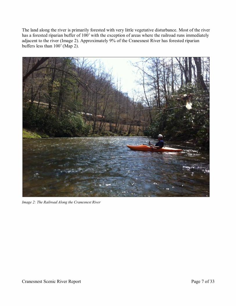
The land along the river is primarily forested with very little vegetative disturbance. Most of the river has a forested riparian buffer of 100’ with the exception of areas where the railroad runs immediately adjacent to the river (Image 2). Approximately 9% of the Cranesnest River has forested riparian buffers less than 100’ (Map 2).
Image 2: The Railroad Along the Cranesnest River

Cranesnest Scenic River Report Page 8 of 33
Map 2: Buffer Study of the Cranesnest River
Vegetation along the corridor is generally comprised of eastern hardwood forests (Map 3). Dense stands of mountain laurel and rhododendron provide an evergreen buffer along sections of the river along with several small stands of hemlock. Large beech, sycamore, river birch, red maple, tulip popular, cucumber magnolia, and hickory line the water’s edge. Early spring wildflowers include American beauty and mayapple. The vegetation along the corridor provides interesting views with a variety of forms, textures, sizes, and colors. This diversity provides year-around changes in the cover and the views from and along the river.

Cranesnest Scenic River Report Page 9 of 33
Map 3: Cranesnest River Land Cover US Geologicial Survey, Gap Analysis Program (GAP), Aug. 2011. National Land Cover, Version 2.
B. Riverbed and/or River Flow Modifications
The river section studied is a free flowing, meandering river with few obstructions for boaters. Naturally occurring rock ledges and outcrops add visual and paddling interest to the journey. Minor riffles add to the excitement of the trip but do not require advanced paddling skills and do not impact flow. A paved ford at the U.S Army Corps of Engineers’ Cranes Nest Campground requires paddlers to cross the ford or to portage a short distance (Image 3). The paved ford is the only obstruction on this river segment, and it does not interfere with river flow. Beyond the studied river section is the John W. Flannagan Reservoir where a 250-foot dam controls water entering the Pound River and creates a major obstruction for further downstream touring.

Cranesnest Scenic River Report Page 10 of 33
Image 3: Community Member, Gene Counts, Crosses the Paved Ford at the U.S. Army Corps of Engineers’ Cranes Nest Campground.
C. Human Development of Visual Corridor
The Cranesnest River corridor contains few signs of human development. Several houses and shelters may be seen along the route, but they are few and far between, and most are not visible during the summer when vegetation is in full-leaf (Image 4). Other human interventions include bridges and utility line crossings (see Section J. Crossings).
Image 4: House Along the Cranesnest River

Cranesnest Scenic River Report Page 11 of 33
D. Historic Features
According to the Department of Historic Resources, there are no known features of historical significance along the Cranesnest. However, the U. S. Army Corps of Engineers Cranes Nest Campground is a good example of the style of architecture consistent with 1970s government practices. The campground was constructed after the 1964 completion of the John W. Flannagan Dam and Reservoir, part of the Big Sandy flood protection system. E. Landscape
The Cranesnest River is located near the Town of Clintwood, VA. It is 25-miles long and flows northeast through the mountains of Dickenson County toward its confluence with the Flannagan Reservoir. The Cranesnest River is a tributary of the Pound River, which is part of the Mississippi River watershed. Major tributaries include the Tarpon Branch, the Long Branch, and the Honeycamp branch. The Cranesnest is typical of a mountain river in that it is a relatively narrow river that is strongly impacted by seasonal water levels.
F. Quality of Fishery
The Cranesnest River offers good fishing opportunities. The river and reservoir contain numerous sport fish including bass, walleye, bluegill, musky, bream, crappie, carp, and catfish.1 Alewives and gizzard shad provide forage for sport fish populations. Walleye fishing along the Cranesnest is especially good in the early spring months. The river is also stocked yearly with McConaughy rainbow and Crawford Brown trout. G. Special Natural Flora/Fauna
The Natural Heritage Program of the Department of Conservation and Recreation (DCR) identifies areas that have a biodiversity significance ranking based on the rarity, quality, and number of element occurrences they contain.
The Cranesnest River contains one state and globally significant natural heritage resource: the Big Sandy crayfish (Cambarus veteranus), ranked G2 [Global – very rare and imperiled status]/S1S2 [Subnational – critically imperiled and imperiled status] (Image 5). This rare crayfish is listed as endangered by the Department of Game and Inland Fisheries and is listed as a species of concern by the U.S. Fish and Wildlife Service. The Big Sandy crayfish are found in moderately wide streams with permanent, fast flowing pools. Its ideal river habitat has large, flat rocks situated on areas of loose gravel and sand. See ranking definitions in the Appendix.

Cranesnest Scenic River Report Page 12 of 33
In addition to the Big Sandy crayfish, several areas along the Cranesnest River have been identified as providing habitat needed to support the federally threatened species Virginia Spirea (Spirea virginiana). However, no populations currently exist along the River. The river attracts diverse populations of mammals, amphibians, reptiles, birds and insects. Sightings of bear, deer, turkey, rabbit, and quail are relatively common. Specific species of water-associated fowl to be found include the blue heron, green heron, wood duck, and kingfisher.
H. Water Quality
Visibility through the water column along the Cranesnest River is mostly clear. The water is only periodically turbid or muddy, especially after heavy rains (Image 6). Tires along the Cranesnest are present but not frequent (Image 7). Other forms of garbage were rare.
Image 6: Visibility Through the Water Column Along the Cranesnest River
Image 5: Big Sandy Crayfish (Cambarus veteranus)

Cranesnest Scenic River Report Page 13 of 33
Image 7: Tire Along the Cranesnest River The Cranesnest River fully supports aquatic life, wildlife, and recreational uses. However, the Cranesnest River is listed as impaired for “Recreation Use” due to bacteria levels. Some of the main contributors of degraded water quality are lack or inadequacies of sewage treatment facilities and acid mine drainage. I. Parallel Roads
Roads, including railroads, run parallel to much of the designated section of the Cranesnest River. The Clinchfield Railroad parallels the river from State Route 637 to State Route 83. Below the Route 649 bridge, Route 649 parallels the river on the left bank until State Route 83, upon which the lake access road parallels the river on the right side of the Flannagan Reservoir Cranesnest Launch Ramp. The lake access road is gravel and has very low traffic. Therefore, it does not greatly impact the remoteness of the river. J. Crossings
Crossings consist of roads, railroads, pipelines, and power/communication lines (Image 8). Many cross perpendicular to the Cranesnest, thereby having limited visual impact on the river experience. Roads are the most common feature to cross the Cranesnest. In situations where utility and road crossings are within close visual proximity, crossing occurrence is counted as one instead of two occurrences.

Cranesnest Scenic River Report Page 14 of 33
K. Special Features Affecting River Aesthetics
This section of the Cranesnest River is characterized by a forested, mountain landscape that feels remote and isolated. This is an intimate corridor with ample canopy which contributes to a high percentage of foreground and middleground views (Images 9-10).
Image 8: Railroad Crossing Along the Cranesnest
Image 9: Foreground View of the Cranesnest River Image 10: Middleground View of the Cranesnest River

Cranesnest Scenic River Report Page 15 of 33
The generous buffers and stream canopy contribute to a wildlife experience that can be seen and heard. The predominant auditory experience is the sound of water and the call of song birds. Periodic riffles, small waterfalls, cliffs, and rock formations provide interesting features along the river corridor (Image 11). In addition, small islands create navigational interest for paddlers (Image 12). Lastly, several small streams flow into the Cranesnest from the surrounding landscape, and they provide additional aesthetic value to this section of the river.
L. Public Recreational Access
The river allows for wet season recreational paddling. Paddlers and tubers gain river access at public bridge crossings, a boat launch ramp at Route 83, and the Flannagan Reservoir Cranesnest Launch ramp. At the latter, motor boats are able to access the Cranesnest along the study corridor by traveling upstream until they reach the paved ford at the U.S Army Corps of Engineers’ Cranes Nest Campground. During dry seasons, navigation is hindered, and short in-stream portages are required in shallow sections. The Virginia Department of Game and Inland Fisheries and US Army Corps of Engineers provide additional access information on their websites: www.dgif.virginia.gov/fishing/waterbodies/display.asp?id=49§ion=facilities www.lrh.usace.army.mil/Missions/Recreation/Virginia/JohnWFlannaganDamReservoir.aspx M. Land Conservation
Approximately thirty percent of the Cranesnest River study corridor is considered part of the John W. Flannagan Dam and Reservoir and is federally managed and protected by the US Army Corps of Engineers. The conserved area along the river begins near Route 83 and extends beyond the Flannagan Reservoir Cranesnest Launch Ramp (Map 4).
Image 11: Small Waterfall Along the Cranesnest River
Image 12: Island Along the Cranesnest River

Cranesnest Scenic River Report Page 16 of 33
Map 4: Cranesnest River Land Conservation
V. LAND USE AND OWNERSHIP
Lands in the study corridor are primarily in private ownership. These are generally forested and undeveloped. The section of the Cranesnest River in the John W. Flannagan Dam and Reservoir is available to the public for recreation purposes. Amenities along the studied section of the river corridor include Cranes Nest Campground areas #1 and #3. Recreational opportunities at the campgrounds include bicycling, boating, camping, and fishing. Development along the river is minimal and infrequently visible along the study corridor. VI. CONCLUSIONS AND RECOMMENDATIONS
The Department of Conservation and Recreation concludes that the Cranesnest River from Route 637 to the Flannagan Reservoir Cranesnest Launch Ramp, a distance of approximately 10.7 miles, is hereby eligible to be a component of the Virginia Scenic River System. Scenic River designation is warranted because of the aesthetic and recreational qualities of the river section, its environs, and its

Cranesnest Scenic River Report Page 17 of 33
unique flora and fauna. Flowing through largely forested land, this river segment has a number of interesting aesthetic features including rock formations, islands, rapids, waterfalls, cliffs, and rock outcrops. Its winding alignment and ample tree canopy promote interesting foreground views and offer a sense of remoteness and isolation. The adjacent landscape consists of few man-made features, and there is little trash or turbidity in the river. The Cranesnest River is an ecologically healthy river corridor with consistent and extensive vegetative buffers that sustain productive aquatic and avian habitats. Its natural attributes, which are the basis for its Scenic River value, are also supported by an extensive wildlife and land conservation area. This section of the Cranesnest is also home to a globally significant natural heritage resource, the Big Sandy crayfish. Considering all aspects of the Cranesnest River within Dickenson County as described in this report, DCR recommends this river segment as a good candidate for Virginia Scenic River designation. More specifically, it is recommended that:
1. the Cranesnest River from Route 637 to the Flannagan Reservoir Cranesnest Launch Ramp, a distance of approximately 10.7 miles, be recommended for Virginia Scenic River Designation; and,
2. the Department of Conservation and Recreation be appointed the Administering Agency.
VII. CONSERVATION PLAN
Several elements contribute to the conservation plan for the Cranesnest River. These elements call for a minimum effort and specific actions on the part of the General Assembly, local and state units of government, and individual and riparian landowners. Legislation establishing Virginia Scenic River designation for the section of the Cranesnest River under consideration is the first element that must be implemented. In addition to clearly expressing the policy intent of the Commonwealth with regard to protection and conservation of the river, designation will focus attention on the river as a natural resource of statewide significance. The increased attention will help ensure a greater scrutiny of plans or proposals that have the potential to significantly alter or destroy those resource qualities that make the river worthy of designation. The locality has the option of creating a local river committee that is either appointed by the DCR or the locality and that will work with the DCR to consider and manage the scenic attributes of the river (see code section § 10.1-401.A.4 and § 10.1-406.1). A second element of the Conservation Plan involves Dickenson County. Comprehensive land use plans should explicitly reflect citizens’ recognition, appreciation, and concern for the river and the valuable role it plays in the region’s quality of life. Such plans should be aimed in part at protecting the river and its environs from potential development, or at least to make sure that the development that does occur utilizes low impact development strategies as much as possible. The working ‘Dickenson County Comprehensive Plan’ supports the protection and promotion of scenic resources and surface water

Cranesnest Scenic River Report Page 18 of 33
streams. The final element of the Conservation Plan is the continued individual stewardship of local and riparian landowners. Over the years, this stewardship has been good. If not for this stewardship, the river might have lost the attributes necessary for inclusion in the Virginia Scenic River System. Through continuation of these efforts, the natural and scenic character of the river can be protected. Action by the General Assembly to designate this section of the Cranesnest River and the efforts of Dickenson County should combine to protect the natural and scenic qualities of the recommended section of the Cranesnest River for the enjoyment of future generations. Proposed Legislation is provided in the Appendix. VIII. ANTICIPATED COST OF DESIGNATION
The only anticipated direct costs as a result of the designation will be those incurred by the Department of Conservation and Recreation (DCR) as a result of its duties as administrator of the river. At present, these costs are estimated to be $1,000 per year. IX. AGENCY COMMENTS/ RESOLUTIONS
A draft report was circulated among DCR Divisions, other state agencies, and Dickenson County. Letters of support are included in Appendix B of this report. Sources:
1 Environmental Assessment: Coalfields Expressway, Section II – U.S. Department of
Transportation Federal Highway Administration and Virginia Department of Transportation. State Project No. 0121-013-772, PE-101; UPC 85126, 2012

Cranesnest Scenic River Report Page 19 of 33
X. APPENDIX
A. Species Ranking definitions of DCR Natural Heritage B. Letters, Comments and Other Support Documents C. Proposed Legislation

Cranesnest Scenic River Report Page 20 of 33
Appendix A Species Ranking Definitions of DCR Natural Heritage SCIENTIFIC
NAME
COMMON
NAME
GLOBAL
RANK
STATE
RANK
FEDERAL
STATUS
STATE
STATUS
Cambarus veteranus Big Sandy Crayfish G2 S1S2 LE Definitions of Abbreviations used on Natural Heritage Resource Lists The following ranks are used by the Virginia Department of Conservation and Recreation to set protection priorities for natural heritage resources. Natural Heritage Resources, or "NHR's," are rare plant and animal species, rare and exemplary natural communities, and significant geologic features. The criterion for ranking NHR's is the number of populations or occurrences, i.e. the number of known distinct localities; the number of individuals in existence at each locality or, if a highly mobile organism (e.g., sea turtles, many birds, and butterflies), the total number of individuals; the quality of the occurrences, the number of protected occurrences; and threats.
S1 - Critically imperiled in the state because of extreme rarity or because of some factor(s) making it especially vulnerable to extirpation from the state. Typically 5 or fewer populations or occurrences; or very few remaining individuals (<1000).
S2 - Imperiled in the state because of rarity or because of some factor(s) making it very vulnerable to extirpation from the state. Typically 6 to 20 populations or occurrences or few remaining individuals (1,000 to 3,000).
S3 - Vulnerable in the state either because rare and uncommon, or found only in a restricted range (even if abundant at some locations), or because of other factors making it vulnerable to extirpation. Typically 21 to 100 populations or occurrences (1,000 to 3,000).
S4 - Apparently secure; Uncommon but not rare, and usually widespread in the state. Possible cause of long-term concern. Usually>100 populations or occurrences and more than 10,000 individuals.
S5 - Secure; Common, widespread and abundant in the state. Essentially ineradicable under present conditions. Typically with considerably more than 100 populations or occurrences and more than 10,000 individuals.
S#B - Breeding status of an animal within the state S#N - Non-breeding status of animal within the state. Usually applied to winter resident species. S#? - Inexact or uncertain numeric rank. SH - Possibly extirpated (Historical). Historically known from the state, but not verified for an
extended period, usually > 15 years; this rank is used primarily when inventory has been attempted recently.
S#S# - Range rank; A numeric range rank, (e.g. S2S3) is used to indicate the range of uncertainty about the exact status of the element. Ranges cannot skip more than one rank.
SU - Unrankable; Currently unrankable due to lack of information or due to substantially conflicting information about status or trends.
SNR- Unranked; state rank not yet assessed. SX - Presumed extirpated from the state. Not located despite intensive searches of historical sites and
other appropriate habitat, and virtually no likelihood that it will be rediscovered. SNA- A conservation status rank is not applicable because the element is not a suitable arget for
conservation activities.

Cranesnest Scenic River Report Page 21 of 33
Global Ranks are similar, but refer to a species' rarity throughout its total range. Global ranks are denoted with a "G" followed by a character. Note GX means the element is presumed extinct throughout its range, not relocated despite intensive searches of historical sites/appropriate habitat, and virtually no likelihood that it will be rediscovered. A "Q" in a rank indicates that a taxonomic question concerning that species exists. Ranks for subspecies are denoted with a "T". The global nd state ranks combined (e.g. G2/S1) give an instant grasp of a species' known rarity. These ranks should not be interpreted as legal designations. G1 Extremely rare and critically imperiled with 5 or fewer occurrences or very few remaining
individuals; or because of some factor(s) making it especially vulnerable to extinction. G2 Very rare and imperiled with 6 to 20 occurrences or few remaining individuals; or because of
some factor(s) making it vulnerable to extinction. G3 Either very rare and local throughout its range or found locally (even abundantly at some of its
locations) in a restricted range; or vulnerable to extinction because of other factors. Usually fewer than 100 occurrences are documented.
G4 Common and apparently secure globally, although it may be rare in parts of its range, especially at the periphery.
G5 Very common and demonstrably secure globally, although it may be rare in parts of its range, especially at the periphery.
GH Formerly part of the world’s fauna with some expectation that it may be rediscovered; generally applies to species that have not been verified for an extended period (usually >15 years) and for which some inventory has been attempted recently.
GX Believed to be extinct throughout its range with virtually no likelihood of rediscovery. GU Possibly rare, but status uncertain and more data needed. G? Unranked, or, if following a numerical ranking, rank uncertain (e.g., G3?). G_G_ The rank is uncertain, but considered to be within the indicated range (e.g., G2G4) of ranks
(also, T_T_). G_Q Taxon has a questionable taxonomic assignment (e.g., G3Q) and may prove to be invalid upon
further study. G_T_ Signifies the rank of a subspecies (e.g., G5T1 would apply to a subspecies if the species is
demonstrably secure globally (G5) but the subspecies warrants a rank of T1, critically imperiled.)
FEDERAL STATUS
The Division of Natural Heritage uses the standard abbreviations for Federal endangerment developed by the U.S. Fish and Wildlife Service, Division of Endangered Species and Habitat Conservation. LE - Listed Endangered LT - Listed Threatened PE - Proposed Endangered PT - Proposed Threatened C - Candidate (formerly C1 - Candidate category 1) E(S/A) - treat as endangered because of similarity of appearance T(S/A) - treat as threatened because of similarity of appearance SOC - Species of Concern species that merit special concern (not a regulatory category)

Cranesnest Scenic River Report Page 22 of 33
STATE LEGAL STATUS
The Division of Natural Heritage uses similar abbreviations for State endangerment: LE - Listed Endangered PE - Proposed Endangered SC - Special Concern - animals that merit special concern according to VDGIF (not a regulatory category) LT - Listed Threatened PT - Proposed Threatened C – Candidate For information on the laws pertaining to threatened or endangered species, please contact: U.S. Fish and Wildlife Service for all FEDERALLY listed species; Department of Agriculture and Consumer Services, Plant Protection Bureau for STATE listed plants and insects Department of Game and Inland Fisheries for all other STATE listed animals
CONSERVATION SITES RANKING Rank is a rating of the significance of the conservation site based on presence and number of natural heritage resources; on a scale of 1-5, 1 being most significant. Sites are also coded to reflect the presence/absence of federally/state listed species: Conservation Site Ranks Legal Status of Sites B1 - Outstanding significance FL - Federally listed species present B2 - Very High significance SL - State listed species present B3 - High significance NL - No listed species present B4 - Moderate significance B5 - Of general Biodiversity significance

Cranesnest Scenic River Report Page 23 of 33
Appendix B - Letters, Comments and Other Support Documents

Cranesnest Scenic River Report Page 24 of 33

Cranesnest Scenic River Report Page 25 of 33

Cranesnest Scenic River Report Page 26 of 33

Cranesnest Scenic River Report Page 27 of 33

Cranesnest Scenic River Report Page 28 of 33
From: Conkle, Bill (DCR) Sent: Friday, September 13, 2013 3:44 PM To: PRR/GrantsList; McClary, Kelly (DCR) Subject: DCR Board Meeting - September 11 At their September 11 meeting, the DCR Board recommended adoption of the Biscuit Run Master Plan, the Widewater Master Plan Update and the Pocahontas Master Plan Amendment. Next week, we will be contacting the General Assembly to let them know these documents are available for a 30 day review. Following the 30-day review, these planning documents will be presented to the DCR Director for adoption. The DCR Board also made motions of support for Scenic River Designation for the Cranesnest River, Tye River and Banister River Extension. The Board commended us for our good work. Bill Please note our new location at the Main Street Centre: William J. Conkle, CPRP, CPSI Park Planner Virginia Department of Conservation and Recreation Division of Planning and Recreation Resources Main Street Centre, 24th Floor 600 East Main Street Richmond, Virginia 23219 804-786-5492 Fax 804-371-7899 If opportunity doesn't knock...build a door. -Milton Berle 1908-2002
Cranesnest Scenic River Report Page 29 of 33
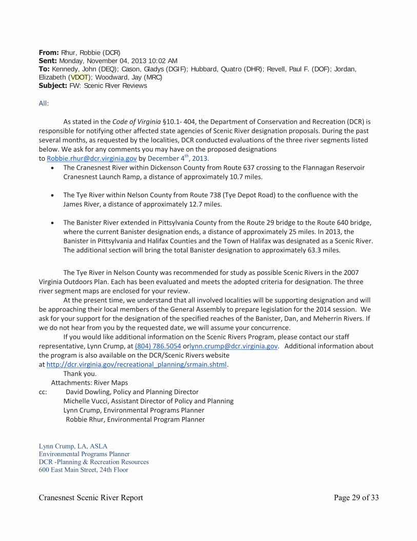
From: Rhur, Robbie (DCR) Sent: Monday, November 04, 2013 10:02 AM To: Kennedy, John (DEQ); Cason, Gladys (DGIF); Hubbard, Quatro (DHR); Revell, Paul F. (DOF); Jordan, Elizabeth (VDOT); Woodward, Jay (MRC)
Subject: FW: Scenic River Reviews All:
As stated in the Code of Virginia §10.1- 404, the Department of Conservation and Recreation (DCR) is responsible for notifying other affected state agencies of Scenic River designation proposals. During the past several months, as requested by the localities, DCR conducted evaluations of the three river segments listed below. We ask for any comments you may have on the proposed designations to [email protected] by December 4th, 2013.
The Cranesnest River within Dickenson County from Route 637 crossing to the Flannagan Reservoir Cranesnest Launch Ramp, a distance of approximately 10.7 miles.
The Tye River within Nelson County from Route 738 (Tye Depot Road) to the confluence with the James River, a distance of approximately 12.7 miles.
The Banister River extended in Pittsylvania County from the Route 29 bridge to the Route 640 bridge, where the current Banister designation ends, a distance of approximately 25 miles. In 2013, the Banister in Pittsylvania and Halifax Counties and the Town of Halifax was designated as a Scenic River. The additional section will bring the total Banister designation to approximately 63.3 miles.
The Tye River in Nelson County was recommended for study as possible Scenic Rivers in the 2007
Virginia Outdoors Plan. Each has been evaluated and meets the adopted criteria for designation. The three river segment maps are enclosed for your review.
At the present time, we understand that all involved localities will be supporting designation and will be approaching their local members of the General Assembly to prepare legislation for the 2014 session. We ask for your support for the designation of the specified reaches of the Banister, Dan, and Meherrin Rivers. If we do not hear from you by the requested date, we will assume your concurrence.
If you would like additional information on the Scenic Rivers Program, please contact our staff representative, Lynn Crump, at (804) 786.5054 [email protected]. Additional information about the program is also available on the DCR/Scenic Rivers website at http://dcr.virginia.gov/recreational_planning/srmain.shtml.
Thank you. Attachments: River Maps
cc: David Dowling, Policy and Planning Director Michelle Vucci, Assistant Director of Policy and Planning Lynn Crump, Environmental Programs Planner
Robbie Rhur, Environmental Program Planner Lynn Crump, LA, ASLA Environmental Programs Planner DCR -Planning & Recreation Resources 600 East Main Street, 24th Floor

Cranesnest Scenic River Report Page 30 of 33
Richmond, VA 23219 (804) 786-5054 From: Jordan, Elizabeth (VDOT) Sent: Tuesday, November 05, 2013 10:14 AM To: Rhur, Robbie (DCR)
Cc: Ray, Alfred C. (VDOT); Crump, Lynn (DCR) Subject: RE: Scenic River Reviews Dear Ms. Ruhr,
Thank you for providing VDOT with the opportunity to review and comment on these recommendations. Typically we do not see these until they are submitted as bills during a General Assembly session. At that time, and in most cases, we ask the bill's sponsor to add the following language:
"Nothing in this section shall preclude the Commonwealth or a local governing body from constructing, reconstructing, operating, or performing necessary maintenance on any road or bridge project."
Please feel free to contact me with any further questions or concerns.
All the best,
Liz
Elizabeth G. Jordan, Ph.D. Environmental Program Planner Virginia Department of Transportation 804-371-0877 [email protected]

Cranesnest Scenic River Report Page 31 of 33
From: Hubbard, Quatro (DHR) Sent: Tuesday, November 05, 2013 3:46 PM To: Rhur, Robbie (DCR) Cc: Bascone, Dominic (DHR); Langan, Julie (DHR) Subject: RE: Scenic River Reviews
Hi Robbie If we at DHR (meaning primarily our GIS specialist, Dominic Bascone) provided you with the locational information on the listed, eligible and eased properties in our inventory that fall within the areas of interest in each of these scenic river corridors, then that would be the extent of our comments regarding these proposed designations. Let us know if you need additional information from us. FYI – the map attachments did not come through to me on your original e-mail. Thanks! Quatro Quatro Hubbard Commonwealth of Virginia DHR Archives 2801 Kensington Avenue Richmond, VA 23221-2470 804-482-6102 804-367-2391 (fax) Website: http://www.dhr.virginia.gov
V-CRIS information and schedule now available at: http://www.dhr.virginia.gov/archives/archiv_vcrisHome.htm
FTP: https://vitashare.virginia.gov/fcweb/jsp/logon.jsp Please note: DHR Archives are open to the public Tuesdays through Thursdays from 9 am until 5 pm.

Cranesnest Scenic River Report Page 32 of 33
From: Kennedy, John (DEQ) Sent: Thursday, November 14, 2013 12:30 PM To: Rhur, Robbie (DCR) Subject: RE: Scenic River Reviews Robbie – staff in our Water Quality Standards section reviewed your list of proposed Scenic Rivers designations, and their comments are:
Offer support for the designations.
Scenic river designations do not require different water quality standards or criteria.
Hope this is helpful, John Kennedy DEQ-Office of Ecology & Infrastructure phone: 804-698-4312

Cranesnest Scenic River Report Page 33 of 33
Appendix C Proposed Legislation Proposed Legislation for the scenic river designation of the Cranesnest River in Dickenson
County
A BILL to amend the Code of Virginia by adding in Chapter 4 of Title 10.1 a section numbered § 10.1-XXX.X. , relating to Scenic Rivers. Be it enacted by the General Assembly of Virginia:
1. That the Code of Virginia is amended by adding in Chapter 4 of Title 10.1 a section numbered
10.1-XXX.X as follows:
§ 10.1-XXX.X. Cranesnest State Scenic River. The Cranesnest River in Dickenson County from Route 637 to the Flannagan Reservoir Cranesnest Launch Ramp, a distance of approximately 10.7 miles, is hereby designated a component of the Virginia Scenic Rivers System. Nothing in this section shall preclude the Commonwealth or a local governing body from constructing, reconstructing, or performing necessary maintenance on any road or bridge project.