Asia Air Survey Co., Ltd. - ffpri.affrc.go.jp · Asia Air Survey Co., ... July 2010) and the...
17
PROGRESS REPORT THE STUDY ON THE STRENGTHENING OF METHODOLOGICAL AND TECHNOLOGICAL APPROACHES FOR REDUCING DEFORESTATION AND FOREST DEGRADATION WITHIN THE REDD IMPLEMENTATION FRAMEWORK Application in Lao P.D.R March 2011 Asia Air Survey Co., Ltd.
Transcript of Asia Air Survey Co., Ltd. - ffpri.affrc.go.jp · Asia Air Survey Co., ... July 2010) and the...

PROGRESS REPORT
THE STUDY ON THE STRENGTHENING OF METHODOLOGICAL AND TECHNOLOGICAL
APPROACHES FOR REDUCING DEFORESTATION AND FOREST DEGRADATION WITHIN
THE REDD IMPLEMENTATION FRAMEWORK
Application in Lao P.D.R
March 2011
Asia Air Survey Co., Ltd.

i
PREFACE
This report describes the activities implemented from April 2010 to March 2011 in the fiscal 2010 Study on the Strengthening of Methodological and Technological Approaches for Reducing Deforestation and Forest Degradation within the REDD Implementation Framework, subsidized by the Forestry Agency, the Ministry of Agriculture, Forestry and Fisheries of Japan and having the Forest Inventory and Planning Division (FIPD), Department of Forestry, Ministry of Agriculture and Forestry of Lao PDR as the counterpart agency.
Starting in fiscal 2009, the Study activities in Lao PDR have entailed support for various initiatives on the ground, technology development, technology transfer and human capacity development, etc. In the survey and research activities in fiscal 2010, continuing to target the pilot areas of Louangphabang Province in the north of the country and Khamkeut District in Bolikhamxai Province in the center, analysis of satellite images, development of a model for estimating forest carbon stocks, simulation analysis of future deforestation and examination of the MRV system, etc. were implemented in Japan, while field reconnaissance, village surveys, forest inventories and data collection, etc. were conducted five times in an effort to enhance the content of activities. In the course of these study activities, OJT was conducted jointly with the counterparts and effort was made to develop human capacity and transfer technology via exchange of opinions and learning in workshops and technical training including a course for the counterparts in Japan.
Additionally this fiscal year, as follow-up to the fiscal 2008 Program to Support Understanding of Tropical Forests, contribution towards capacity building, etc. was made through inviting officials of the Directorate of Forestry, the Ministry of Agriculture and Rural Development of the Socialist Republic of Vietnam to workshops and training in Japan.
Furthermore, through presenting the achievements of the Study at the ISAP 2010 Conference of Experts (staged by IGES, July 2010) and the International Technical Seminar on REDD+ (staged by the Forestry and Forest Products Research Institute, February 2011) in joint name with the counterpart, we had the opportunity to widely transmit information to the world.
I hope the results of activities described herein will contribute to the realization and promotion of the REDD+ system and aid the furtherance of friendship and goodwill between Japan, Lao PDR and the Socialist Republic of Vietnam.
In closing, I would like to express my sincere gratitude for the immeasurable guidance, cooperation and advice offered by members of the International Forestry Cooperation Office of the Planning Division, Private Forest Department of the Forestry Agency, the Department of Forestry of the Ministry of Agriculture and Forestry of Lao PDR Directorate of Forestry, the Ministry of Agriculture and Rural Development of the Socialist Republic of Vietnam, other local agencies, the Japanese embassies in each country, JICA and the Advisory Committee (chaired by Haruo Sawada, Professor at the Institute of Industrial Science, the University of Tokyo).
March 2011 Mitsuru Nasu Project Manager Asia Air Survey Co., Ltd.

ii
ABBREVIATIONS
AAS Asia Air Survey Co., Ltd.
ADB Asian Development Bank
AFOLU Agriculture, Forestry and Other Land Use
ALOS Advanced Land Observing Satellite
ANSAB Asia Network for Sustainable Agriculture and Bioresources
AR-CDM Afforestation and Reforestation under CDM
AR4 IPCC Fourth Assessment Report:Climate Change 2077
ASTER Advanced Spaceborne Thermal Emission and Reflection Radiometer
ASTER/GDEM Global Digital Elevation Model
AVNIR2 Advanced Visible and Near Infrared Radiometer2
B/H Base to Height ratio
BAU Business-As-Usual
BIOTIK Biodiversity Informatics and Cooperation in Taxonomy for Interactive shared
Knowledge Base
C Carbon
CA Cellular Automata
CAD Computer Aided Design
C/P Counter Part
CDM Clean Development Mechanism
CH4 Methane
CIFOR Center for International Forestry Research
CF Current Forest
CGER Center for Global Environmental Research
CL Crop Land
CMP The Conference of the Parties serving as the Meeting of the Parties to the Kyoto
Protocol
CO Carbon Monoxide
CO2 Carbon Dioxide
COP Conference of the Parties to the UNFCCC
CUZ Controlled Used Zone
D.G. Director General
d.m. dry matter
DAFO District Agriculture and Forestry Office
DBH Diameter (at) Breast Height
DEM Digital Elevation Model
DNA Designated National Authorities
DFRC Division of Forest Resources Conservation
DOF Department of Forestry
DPFFR Division of Protection Forest Management and Forest Restoration
DSM Digital Surface Model
EGM96 Earth Gravitational Model 1996
EOS Earth-Observing-System

iii
FAO Food and Agriculture Organization
FAOSTAT FAO Statistical Database
FCD-H Forest Canopy Density
FCPF Forest Carbon Partnership Facility
FECOFUN Federation of Community Forest Users Nepal
FFPRI Forestry and Forest Products Research Institute of Japan
FIPD Forest Inventory and Planning Division
FORCOM Forest Management and Community Support Project
FRA Global Forest Resources Assessment
FSC Forest Stewardship Council
FSIP Forest Strategy 2020 Implementation Promotion Project
GCP Ground Control Point
GDP Gross Domestic Product
GEOSS Global Earth Observation System of System
GHG Greenhouse Gas
GIO Greenhouse Gas Inventory Office of Japan
GIS Geographical Information System
GL Grassland
GOFC-GOLD Global Observation of Forest and Land Cover Dynamics
GPG-LULUCF Good Practice Guidance for Land Use, Land-Use Change and Forestry
GPS Global Positioning System
GTOS Global Terrestrial Observing System
GTZ German Agency for Technical Cooperation
GWP Global Warming Potential
HAN Hanoi or Hanoi Noi Bai International Airport
HRG High Resolution Geometry
HRV High Resolution Visible Instrument
HRVIR High Resolution Visible and Infrared
IBAMA Instituto Brasileiro do Meio Ambiente e dos Recursos Naturais Renovaveis
(Brazilian Institute of Environment and Renewable Natural Resources)
ICIMOD International Centre for Integrated Mountain Development
IGES Institute for Global Environmental Strategies
IPCC Intergovernmental Panel on Climate Change
ISODATA Iterative Self-Organizing Data Analysis Technique
ITTO International Tropical Timber Organization
IUCN International Union for Conservation of Nature and Natural Resources
JAXA Japan Aerospace Exploration Agency
JBIC Japan Bank for International Cooperation
JBON Japanese Biodiversity Observation Network
JICA Japan International Cooperation Agency
JIFPRO Japan International Forestry Promotion and Cooperation Center
JOFCA Japan Overseas Forestry Consultants Association
JOPP Japan Overseas Plantation Center for Pulpwood
iv
JPEG Joint Photographic Experts Group
KFW Kreditanstalt Fuer Wiederaufbau
LAK Loa Kip
LDC Least Developed Countries
LPB Louangphabang
LPFL Oji Lao Plantation Forest Co.,LTD
LULUCF Land Use, Land-Use Change and Forestry
LUP / LA Land Use Planning and Land Allocation
LSFP 2001 Lao-Swedish Forestry Programme 2001
MAF Ministry of Agriculture and Forestry
M/P Master Plan
MARD Ministry of Agriculture and Rural Development
MCA Markov-cellular automata
METI Ministry of Economy, Trade and Industry
MODIS Moderate Resolution Imaging Spectrometer
MOP The Meeting of the Parties to the Kyoto Protocol
MOU Memorandum of Understanding
MRV Monitoring, reporting and verification or measuring, reporting and verification
N2O Nitrous Oxide
NAFRI National Agriculture and Forestry Research Institute
NAMA National Mitigation Action Plan
NASA National Aeronautics and Space Administration
NBCA National Biodiversity Conservation Area
NDSI Normalized Difference Soil Index
NDVI Normalized Difference Vegetation Index
NGD National Geographic Department
NGO Non-Governmental Organizations
NGPES The National Growth and Poverty Eradication Strategy
NIES National Institute for Environmental Studies
NIR Near Infrared
NMVOC Non-Methane Volatile Organic Compounds
NOAA National Oceanic and Atmospheric Administration
NORAD Norwegian Agency for Development Cooperation
NOx Nitrogen Oxide
NTFP Non-Timber Forest Products
o.b. over bark
OCHA Office for Coordination of Humanitarian Affair
ODA Official Development Assistance
OJT On-the-Job Training
PAFO Provincial Agriculture and Forestry Office
PALSAR Phased Array Type L-band Synthetic Aperture Radar
PAREDD Participatory Land and Forest Management Project for Reducing Deforestation in
Lao P.D.R.

v
PCM Project Cycle Management
PDM Project Design Matrix
Ph D. Philosophic Doctor (Doctor of Philosophy)
PDR People's Democratic Republic
PRISM Panchromatic Remote-sensing Instrument for Stereo Mapping
PRSP Poverty Reduction Strategy Paper
R-PIN Readiness Plan Idea Notes
RADAR Radio Detection and Ranging
RC Rate of Change
REDD Reducing Emissions from Deforestation and Forest Degradation
REDD+ Reducing Emissions from Deforestation and Forest Degradation and Enhancing
Forest Carbon Stocks
RESTEC Remote Sensing Technology Center of Japan
RMSE Root Mean Square Error
RPC Rational Polynomial Coefficients
RS Remote Sensing
RSC Remote Sensing Center
SI Shadow Index
Sida Swedish International Development Cooperation Agency
SGN Tansonnhat International Airport
SO2 Sulfur Dioxide
SPOT Satellite Pour l'Observation de la Terre
SRTM Shuttle Radar Topography Mission
SSI Scaled Shadow Index
SUFORD Sustainable Forestry and Rural Development Project
SWIR Short-Wavelength Infrared
TM,ETM,ETM+ TM:Thematic Mapper, ETM:Enhanced Thematic Mapper, ETM+:Enhanced
Thematic Mapper Plus
TAr Tropical Rain Forest
TAWa Tropical Moist Deciduous Forest
TAWb Tropical Dry Forest
TBSh Tropical Shrubland
TBWh Tropical Desert
TM Tropical Mountain Systems
TPZ Total Protection Zones
UF Unstocked Forest
UN United Nations
UN-REDD The United Nations Collaborative Programme on REDD
UNDP United Nations Development Programme
UNEP United Nations Development Programme
UNFCCC United Nations Framework Convention on Climate Change
UNESCO United Nations Educational,Scientific and Cultural Organization
UNIDO United Nations Industrial Development Organization

vi
USD United States Dollar
USGS United States Geological Survey
UTM Universal Transverse Mercator
VD Vegetation Density
VNFOREST Viet Nam Administration of Forestry
WB World Bank
WFP World Food Programme
WERI Water Resources and Environment Research Institute
WREA Water Resources and Environment Administration
WWF World Wide Fund for Nature
vii
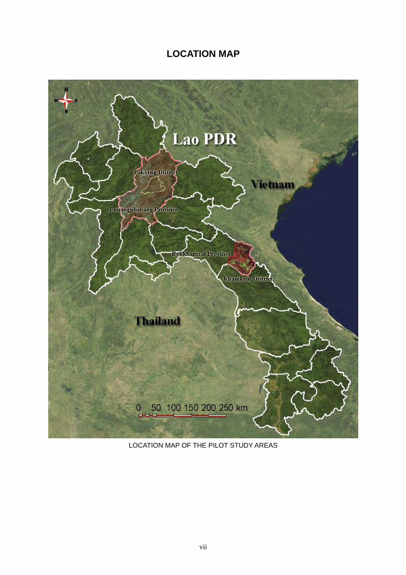
LOCATION MAP
LOCATION MAP OF THE PILOT STUDY AREAS

viii
PICTURES
< Louangphabang >
Louangphabang Airport Louangphabang City
Overview from airplane Overview
Main road closed after heavy rain Landslide by rain
Member of the forest survey the Mon tribe

ix
< Bolikhamxai >
Laksao Town Limestone land
The Vietnam border Forest
Forest sunk by the dam Closed the bridge of the main road
Illegal logging (just after logging) Member of the forest survey

x
Plot with big natural trees of Mt.Phu
Chomvoy in Khamkeuth district of
Bolikhamxai province (1,810m attitude)
The acces road to Mt. Phu Chomvoy.
Going on the tough road by jeep
Big trees over 45m of the height and 1.5m of DBH in Mt. Phu Chomvoy
Checking the location of the big trees by GPS in Mt. Phu Chomvoy

xi
There were many Castanopsis sp. Local name:Ko, Mak Ko in Louangphabang province
There were many Schima sp. in Borikhamxai province
There were many Vatica astrotricha. Local name:Mai khenphai in Borikhamxai province

xii
Meeting before the survey Setting up the plot
Checking the tree species measuring the height of the tree
Measuring the DBH Writing on the field notebook
The pass to the plot
on Mt. Phu Chomvoy of Bolikhamxai
Measuring the big tree

xiii
Measuring the height of the tree
by the C/P on Mt. Phu Chomvoy
Fokienia hodginsii sapling
on Mt. Phu Chomvoy
The house of the guide
to Mt. Phu Chomvoy in Bolikhamxai
The house of the chief of a village,
made of concrete blocks in Bolikhamxai
Deciduous trees and limestone mountain Cassava field and paddy field
in dry season in Bolikhamxai
Houaypho village Namai village
xiv
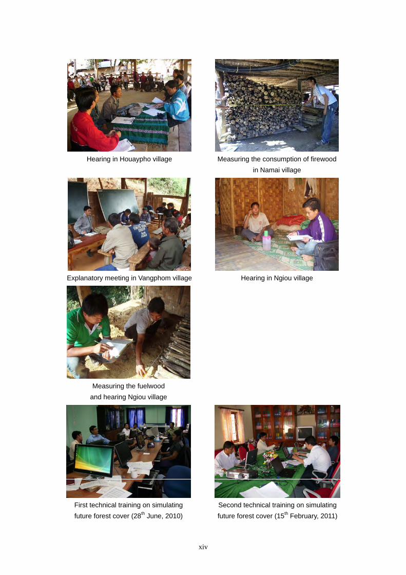
Hearing in Houaypho village Measuring the consumption of firewood
in Namai village
Explanatory meeting in Vangphom village Hearing in Ngiou village
Measuring the fuelwood
and hearing Ngiou village
First technical training on simulating
future forest cover (28th June, 2010)
Second technical training on simulating
future forest cover (15th February, 2011)

xv
CONTENTS
Preface Abbreviations Location Map Pictures Contents 1. Outline of The Study........................................................................................................................ 1-1
1.1. Background of the Study ...................................................................................................... 1-1 1.2. Objectives and Basic Policy of the Study in Fiscal 2010 ...................................................... 1-2 1.3. Signing of MOU ................................................................................................................... 1-3 1.4. Establishment and Staging of the Advisory Committee ........................................................ 1-5 1.5. Outline of Pilot Survey Areas ............................................................................................... 1-5 1.6. Outline of the Study in Fiscal 2010 and Achievements So Far ............................................. 1-6
2. Development of a Forest Monitoring System Utilizing Remote Sensing Technology .................... 2-1
2.1. Outline of Technology Development Concerning Remote Sensing ..................................... 2-1 2.2. Land Use/Cover Map Preparation Method ........................................................................... 2-3 2.3. Accuracy Analysis of Land Use/Cover Maps ....................................................................... 2-11 2.4. Forest Biomass Classing ....................................................................................................... 2-25 2.5. Additional Preparation of Land Use/Cover Maps for Forecasting Future Changes
in Forest Cover ...................................................................................................................... 2-34 2.6. Summary of Remote Sensing Analysis ................................................................................. 2-40
3. Analysis and Simulation of Forest Cover Changes ......................................................................... 3-1
3.1. Introduction......................................................................................................................... 3-1 3.2. Forest Cover Changes Based on the Available Forest Cover Statistics .............................. 3-2 3.3. Forest Cover Changes Based on Remote Sensing Analyses ............................................... 3-5 3.4. Simulation of Future Forest Cover Changes ....................................................................... 3-7 3.5. Conclusion .......................................................................................................................... 3-34 Appendices ...................................................................................................................................... 3-36
4. Technology Development for Estimating Forest Carbon Stocks ..................................................... 4-1 4.1. Outline of Technology Development for Gauging Forest Carbon Stocks .......................... 4-1 4.2. Forest Survey ...................................................................................................................... 4-5 4.3. Relation between Forest Carbon Stock and Tree Height (CS-H Model) ............................ 4-11 4.4. Relationship between Medium Resolution Satellite Images and Forest Stand Factors ...... 4-13 4.5. Tree Height Measurement based on ALOS/PRISM ........................................................... 4-15 4.6. Preparation of Forest Carbon Stock Estimation Maps ........................................................ 4-32 4.7. Summary and Issues ........................................................................................................... 4-37
5. Analysis of MRV System for REDD+ ............................................................................................. 5-1
5.1. Objectives of the MRV System ........................................................................................... 5-1 5.2. Configuration of MRV System Conditions ......................................................................... 5-2 5.3. Conceptual Design of MRV System ................................................................................... 5-3 5.4. Designing of the Forest GIS Database for the MRV System .............................................. 5-7 5.5. How to Measure Forest Carbon Stock ................................................................................ 5-17 5.6. Design of the Deforestation and Forest Degradation Forecasting Simulation System ....... 5-17 5.7. Construction of the Forest Monitoring System ................................................................... 5-17 5.8. Construction of an Integrated System ................................................................................. 5-18 5.9. Construction of the Verification System ............................................................................. 5-18 5.10. Summary ............................................................................................................................. 5-18
6. Capacity Development Activities .................................................................................................... 6-1 6.1. Objectives of Capacity Development Activities ................................................................. 6-1 6.2. Capacity Development Programs and Results .................................................................... 6-1

xvi
7. Study Achievements and Future Developments .............................................................................. 7-1 7.1. Study Achievements ........................................................................................................... 7-1 7.2. Future Developments .......................................................................................................... 7-2
Appendix
1. MOU .......................................................................................................................................... 1 2. Forest Survey Note .................................................................................................................. 10 3. List of Interviewers .................................................................................................................. 57 4. List of References .................................................................................................................... 59