Approved New Carrollton TDDP
208
-
Upload
maryland-national-capital-park-planning-commission -
Category
Documents
-
view
226 -
download
0
description
This document contains text and maps of the approved transit district development plan (TDDP) and ransit district overlay zoning map amendment for the New Carrollton Metro Station and vicinity. This plan contains an amended TDDP and transit district overlay zone (TDOZ) which together replace the 1989 Approved New Carrollton Transit District Development Plan. The plan also amends the 2002 Prince George’s County Approved General Plan, the 1994 Bladensburg-New Carrollton and Vicinity Approved Master Plan and Sectional Map Amendment, and the 1993 Landover and Vicinity Approved Master Plan and Sectional Map Amendment.
Transcript of Approved New Carrollton TDDP
Abstract
Title: ApprovedNewCarrolltonTransitDistrictDevelopmentPlanandTransitDistrictOverlayZoningMapAmendment
Author: TheMaryland-NationalCapitalParkandPlanningCommissionPrinceGeorge’sCountyPlanningDepartment
Subject: AmendedTransitDistrictDevelopmentPlanandTransitDistrictOverlayZonefortheNewCarrolltonMetroArea
Date: May2010
SourceofCopies: TheMaryland-NationalCapitalParkandPlanningCommissionPrinceGeorge’sCountyPlanningDepartment14741GovernorOdenBowieDriveUpperMarlboro,MD
SeriesNumber: 2107092306
NumberofPages: 203
Abstract: Thisdocumentcontainstextandmapsoftheapprovedtransitdistrictdevelopmentplan(TDDP)andtransitdistrictoverlayzoningmapamendmentfortheNewCarrolltonMetroStationandvicinity.ThisplancontainsanamendedTDDPandtransitdistrictoverlayzone(TDOZ)whichtogetherreplacethe1989Approved New Carrollton Transit District Development Plan.Theplanalsoamendsthe2002Prince George’s County Approved General Plan,the1994Bladensburg-New Carrollton and Vicinity Approved Master Plan and Sectional Map Amendment,andthe1993Landover and Vicinity Approved Master Plan and Sectional Map Amendment.
DevelopedbyM-NCPPCwiththeassistanceofthecommunity,theNewCarrolltonTDDPcontainsacomprehensivedevelopmentvision,developmentreviewprocessrequirements,andform-baseddevelopmentstandardsandguidelines.ItcontrolsandguidestheuseanddevelopmentofalllandwithintheNewCarrolltonTDOZfromtheinitialsubmittalofplanstotheissuanceofpermits.Together,theTDDPandTDOZareintendedtofostertransit-orienteddevelopmentthatincreasestheuseofpublictransit,maximizesreturnoninvestmentintransitfacilitiesandservices,encouragesappropriatedevelopmentneartransitstationswithcoordinatedurbandesignelements,andincreaseslocaltaxrevenue.

ii
The Maryland‑National Capital Park and Planning Commission Royce Hanson, Chairman
Samuel J. Parker, Jr., AICP, Vice Chairman
Officers PatriciaColihanBarney,ExecutiveDirectorAlWarfield,ActingSecretary-TreasurerAdrianR.Gardner,GeneralCounsel
TheMaryland-NationalCapitalParkandPlanningCommissionisabicountyagency,createdbytheGeneralAssemblyofMarylandin1927.TheCommission’sgeographicauthorityextendstothegreatmajorityofMontgomeryandPrinceGeorge’sCounties:theMaryland-WashingtonRegionalDistrict(M-NCPPCplanningjurisdiction)comprises1,001squaremiles,whiletheMetropolitanDistrict(parks)comprises919squaremiles,inthetwocounties.
TheCommissionhasthreemajorfunctions:
WThepreparation,adoption,and,fromtimetotime,amendmentorextensionoftheGeneralPlanforthephysicaldevelopmentoftheMaryland-WashingtonRegionalDistrict;
WTheacquisition,development,operation,andmaintenanceofapublicparksystem;and
W InPrinceGeorge’sCountyonly,theoperationoftheentirecountypublicrecreationprogram.
TheCommissionoperatesineachcountythroughaPlanningBoardappointedbyandresponsibletothecountygovernment.Alllocalplans,recommendationsonzoningamendments,administrationofsubdivisionregulations,andgeneraladministrationofparksareresponsibilitiesofthePlanningBoards.
ThePrinceGeorge’sCountyDepartmentofPlanning(M-NCPPC):
W Ourmissionistohelppreserve,protectandmanagethecounty’sresourcesbyprovidingthehighestqualityplanningservicesandgrowthmanagementguidanceandbyfacilitatingeffectiveintergovernmentalandcitizeninvolvementthrougheducationandtechnicalassistance.
W Ourvisionistobeamodelplanningdepartmentofresponsiveandrespectedstaffwhoprovidesuperiorplanningandtechnicalservicesandworkcooperativelywithdecision-makers,citizensandotheragenciestocontinuouslyimprovedevelopmentqualityandtheenvironmentandactasacatalystforpositivechange.
Prince George’s County Planning Board Montgomery County Planning Board SamuelJ.Parker,Jr.,Chairman RoyceHanson,ChairmanSylvesterJ.Vaughns,Vice Chairman JohnM.Robinson,Vice ChairmanSarahCavitt JosephAlfandreJesseClark JeanB.CryorJohnH.Squire AmyPresley
iii
Prince George’s CountyJack B. Johnson, County Executive
County CouncilTheCountyCouncilhasthreemainresponsibilitiesintheplanningprocess:(1)settingpolicy,(2)planapproval,and(3)planimplementation.Applicablepoliciesareincorporatedintoareaplans,functionalplans,andthegeneralplan.TheCouncil,afterholdingahearingontheplanadoptedbythePlanningBoard,mayapprovetheplanasadopted,approvetheplanwithamendmentsbasedonthepublicrecord,ordisapprovetheplanandreturnittothePlanningBoardforrevision.ImplementationisprimarilythroughadoptionoftheannualCapitalImprovementProgram,theannualBudget,thewaterandsewerplan,andadoptionofzoningmapamendments.
Council MembersThomasE.Dernoga,1st District, Council Vice ChairWillCampos,2nd DistrictEricOlson,3rd DistrictIngridM.Turner,4th DistrictAndreaHarrison,5th DistrictSamuelH.Dean,6th District CamilleExum,7th DistrictTonyKnotts,8th District MarilynnBland,9th District, Council Chairperson
Clerk of the CouncilRedisC.Floyd
iv
CoNTeNTsPlan
Foreword. . . . . . . . . . . . . . . . . . . . . . . . . . . . . . . . . . . . . . . . . . . . . . . . . . . . . . . ixPlan Highlights. . . . . . . . . . . . . . . . . . . . . . . . . . . . . . . . . . . . . . . . . . . . . . . . . . xi TheVision. . . . . . . . . . . . . . . . . . . . . . . . . . . . . . . . . . . . . . . . . . . . . . . . . . . xi PlanFramework. . . . . . . . . . . . . . . . . . . . . . . . . . . . . . . . . . . . . . . . . . . . . . . xi TheNeighborhoods. . . . . . . . . . . . . . . . . . . . . . . . . . . . . . . . . . . . . . . . xi AMultimodalTransportationSystem. . . . . . . . . . . . . . . . . . . . . . . . . . .xii SustainableandAccessibleEnvironmentalInfrastructure. . . . . . . . . . . .xii UrbanDesign. . . . . . . . . . . . . . . . . . . . . . . . . . . . . . . . . . . . . . . . . . . . .xii OtherKeyZoningandImplementationRecommendations . . . . . . . . . xiii
Introduction. . . . . . . . . . . . . . . . . . . . . . . . . . . . . . . . . . . . . . . . . . . . . . . . . . . . .1 Purpose. . . . . . . . . . . . . . . . . . . . . . . . . . . . . . . . . . . . . . . . . . . . . . . . . . . . . .1 Background. . . . . . . . . . . . . . . . . . . . . . . . . . . . . . . . . . . . . . . . . . . . . . . . . . .2 Location. . . . . . . . . . . . . . . . . . . . . . . . . . . . . . . . . . . . . . . . . . . . . . . . . .2 DemographicProfile. . . . . . . . . . . . . . . . . . . . . . . . . . . . . . . . . . . . . . . . .2 DevelopmentPattern . . . . . . . . . . . . . . . . . . . . . . . . . . . . . . . . . . . . . . . .2 DevelopmentPotential. . . . . . . . . . . . . . . . . . . . . . . . . . . . . . . . . . . . . . .7 PlanningProcess . . . . . . . . . . . . . . . . . . . . . . . . . . . . . . . . . . . . . . . . . . . . . . .7 PreliminaryPlanning. . . . . . . . . . . . . . . . . . . . . . . . . . . . . . . . . . . . . . . . .7 PublicOutreachStrategy. . . . . . . . . . . . . . . . . . . . . . . . . . . . . . . . . . . . . .8 MeetingSummaries..........................................8 Stakeholders . . . . . . . . . . . . . . . . . . . . . . . . . . . . . . . . . . . . . . . . . . . . . . .9 RelationshiptotheUnderlyingZones. . . . . . . . . . . . . . . . . . . . . . . . . . . . . . .9 RelationshiptothePrinceGeorge’sCountyZoningOrdinance. . . . . . . . . . . .9 RelationshiptoOtherPlans . . . . . . . . . . . . . . . . . . . . . . . . . . . . . . . . . . . . .10 1992MarylandEconomicGrowth,ResourceProtectionand PlanningAct. . . . . . . . . . . . . . . . . . . . . . . . . . . . . . . . . . . . . . . . . . .10 1997SmartGrowthandNeighborhoodConservationAct. . . . . . . . . . .10 2007StormwaterManagementAct. . . . . . . . . . . . . . . . . . . . . . . . . . . . .10 2009SmartandSustainableGrowthAct. . . . . . . . . . . . . . . . . . . . . . . . .10 2002GeneralPlan . . . . . . . . . . . . . . . . . . . . . . . . . . . . . . . . . . . . . . . . .11 Bladensburg-NewCarrolltonandVicinityMasterPlan(1994) andtheLandoverandVicinityMasterPlan(1993). . . . . . . . . . . . . .12 TransportationDemandManagement. . . . . . . . . . . . . . . . . . . . . . . . . . . . . .12 AmendmentProcedures. . . . . . . . . . . . . . . . . . . . . . . . . . . . . . . . . . . . . . . . .12
Vision of Transit-Oriented Development. . . . . . . . . . . . . . . . . . . . . . . . . . . . . .13 VisionStatement. . . . . . . . . . . . . . . . . . . . . . . . . . . . . . . . . . . . . . . . . . . . . .13 PlanElements . . . . . . . . . . . . . . . . . . . . . . . . . . . . . . . . . . . . . . . . . . . . . . . .15 SummaryDescription. . . . . . . . . . . . . . . . . . . . . . . . . . . . . . . . . . . . . . .17 NeighborhoodsElement. . . . . . . . . . . . . . . . . . . . . . . . . . . . . . . . . . . . .20 TransportationSystemsElement. . . . . . . . . . . . . . . . . . . . . . . . . . . . . . .25 EnvironmentalInfrastructureElement . . . . . . . . . . . . . . . . . . . . . . . . . .36 UrbanDesignElement. . . . . . . . . . . . . . . . . . . . . . . . . . . . . . . . . . . . . .43
v
Transit District Development Plan. . . . . . . . . . . . . . . . . . . . . . . . . . . . . . . . . . .55 AdministrationandApplicability. . . . . . . . . . . . . . . . . . . . . . . . . . . . . . . . . .55 NewCarrolltonTDDPComponents. . . . . . . . . . . . . . . . . . . . . . . . . . .55 SubmittalRequirements. . . . . . . . . . . . . . . . . . . . . . . . . . . . . . . . . . . . .56 ApplicabilityofSitePlanRequirements. . . . . . . . . . . . . . . . . . . . . . . . . .59 ResponsibilityforRequiredImprovements. . . . . . . . . . . . . . . . . . . . . . .61 PermittedandProhibitedUseswithintheNewCarrollton TransitDistrictOverlayZone . . . . . . . . . . . . . . . . . . . . . . . . . . . . .62 TransitDistrictOverlayZoningMapAmendment. . . . . . . . . . . . . . . . . . . . .63 Introduction. . . . . . . . . . . . . . . . . . . . . . . . . . . . . . . . . . . . . . . . . . . . . .63 PublicLandPolicy . . . . . . . . . . . . . . . . . . . . . . . . . . . . . . . . . . . . . . . . .64 ZoningInPublicRights-Of-Way . . . . . . . . . . . . . . . . . . . . . . . . . . . . . .64 LimitationsontheUseofZones. . . . . . . . . . . . . . . . . . . . . . . . . . . . . . .64 GuidelinesforCommercialZoning. . . . . . . . . . . . . . . . . . . . . . . . . . . . .65 ConditionalZoning . . . . . . . . . . . . . . . . . . . . . . . . . . . . . . . . . . . . . . . .65 TransitDistrictOverlayZones . . . . . . . . . . . . . . . . . . . . . . . . . . . . . . . .65 ComprehensiveRezoningChanges. . . . . . . . . . . . . . . . . . . . . . . . . . . . .65 Mixed-UseZoningRecommendations . . . . . . . . . . . . . . . . . . . . . . . . . .66 ApprovedMapAmendments . . . . . . . . . . . . . . . . . . . . . . . . . . . . . . . . .68 DevelopmentStrategy . . . . . . . . . . . . . . . . . . . . . . . . . . . . . . . . . . . . . . . . .103 PhasingandImplementation. . . . . . . . . . . . . . . . . . . . . . . . . . . . . . . . .103 EngineeringAssessmentofProposedVehicularCrossingsof SharedRailAlignment . . . . . . . . . . . . . . . . . . . . . . . . . . . . . . . . . .105 UrbanLandInstituteTechnicalAssistancePanelRecommendations forPublicImprovements. . . . . . . . . . . . . . . . . . . . . . . . . . . . . . . . .106 Improvements . . . . . . . . . . . . . . . . . . . . . . . . . . . . . . . . . . . . . . . . . . . . . . .106 PreliminaryPublicFacilitiesFinancingPlan . . . . . . . . . . . . . . . . . . . . .106 TransportationDemandManagement. . . . . . . . . . . . . . . . . . . . . . . . . .116 CommunityandEconomicDevelopment. . . . . . . . . . . . . . . . . . . . . . .117
Development Standards and Guidelines . . . . . . . . . . . . . . . . . . . . . . . . . . . . .127 GeneralTDDPStandardsandGuidelines. . . . . . . . . . . . . . . . . . . . . . . . . .127 GeneralBuildingEnvelopeandSiteStandardsandGuidelines. . . . . . . . . . .129 GeneralIntent. . . . . . . . . . . . . . . . . . . . . . . . . . . . . . . . . . . . . . . . . . . .129 Standards . . . . . . . . . . . . . . . . . . . . . . . . . . . . . . . . . . . . . . . . . . . . . . .129 Guidelines. . . . . . . . . . . . . . . . . . . . . . . . . . . . . . . . . . . . . . . . . . . . . . .130 Neighborhoods. . . . . . . . . . . . . . . . . . . . . . . . . . . . . . . . . . . . . . . . . . .131 GeneralOpenSpaceandStreetscapeStandardsandGuidelines. . . . . . . . . .142 GeneralIntent. . . . . . . . . . . . . . . . . . . . . . . . . . . . . . . . . . . . . . . . . . . .142 Standards . . . . . . . . . . . . . . . . . . . . . . . . . . . . . . . . . . . . . . . . . . . . . . .142 Guidelines. . . . . . . . . . . . . . . . . . . . . . . . . . . . . . . . . . . . . . . . . . . . . . .143 GroundCover. . . . . . . . . . . . . . . . . . . . . . . . . . . . . . . . . . . . . . . . . . .144 OpenSpaces. . . . . . . . . . . . . . . . . . . . . . . . . . . . . . . . . . . . . . . . . . . . .144 Plazas . . . . . . . . . . . . . . . . . . . . . . . . . . . . . . . . . . . . . . . . . . . . . . . . . .146 GeneralSquaresandGreensGuidelinesandStandards. . . . . . . . . . . . .147 Parks. . . . . . . . . . . . . . . . . . . . . . . . . . . . . . . . . . . . . . . . . . . . . . . . . . .149 Streetscapes. . . . . . . . . . . . . . . . . . . . . . . . . . . . . . . . . . . . . . . . . . . . . .150 GeneralParkingFacilitiesStandardsandGuidelines. . . . . . . . . . . . . . . . . . .163 GeneralIntent. . . . . . . . . . . . . . . . . . . . . . . . . . . . . . . . . . . . . . . . . . . .163 Standards . . . . . . . . . . . . . . . . . . . . . . . . . . . . . . . . . . . . . . . . . . . . . . .163 SharedParking . . . . . . . . . . . . . . . . . . . . . . . . . . . . . . . . . . . . . . . . . . .165
vi
On-StreetParking. . . . . . . . . . . . . . . . . . . . . . . . . . . . . . . . . . . . . . . . .166 Off-StreetParking. . . . . . . . . . . . . . . . . . . . . . . . . . . . . . . . . . . . . . . . .166 BicycleParking. . . . . . . . . . . . . . . . . . . . . . . . . . . . . . . . . . . . . . . . . . .168 BuildingFormandScaleStandardsandGuidelines. . . . . . . . . . . . . . . . . . .170 BuildingOrganizationandOrientation. . . . . . . . . . . . . . . . . . . . . . . .170 BuildingFormandHumanScale . . . . . . . . . . . . . . . . . . . . . . . . . . . . .170 VisualTreatmentofLarge-ScaleBuildingForms. . . . . . . . . . . . . . . . . .171 SpecialBuildingType:Schools . . . . . . . . . . . . . . . . . . . . . . . . . . . . . . .172 FunctionalRelationshipofMultifamilyandOtherResidential BuildingstoSurroundingPublicSpaces . . . . . . . . . . . . . . . . . . . . .173 BuildingFacadeTreatments. . . . . . . . . . . . . . . . . . . . . . . . . . . . . . . . . .174 BuildingFenestration(DesignofWindowandDoorOpenings). . . . . .175 Signage. . . . . . . . . . . . . . . . . . . . . . . . . . . . . . . . . . . . . . . . . . . . . . . . .176 Security-ConsciousBuildingDesign. . . . . . . . . . . . . . . . . . . . . . . . . . .177
Appendices. . . . . . . . . . . . . . . . . . . . . . . . . . . . . . . . . . . . . . . . . . . . . . . . . . . .181 AppendixA-ProceduralFlowchartforTDDP-TDOZMA. . . . . . . . . . . . .181 AppendixB LeadershipinEnergyandEnvironmentalDesign(LEED) Background...........................................182 EnvironmentalSiteDesign(ESD)Guidelines. . . . . . . . . . . . . . . . . . . .183 AppendixC-ProposedBonusDensityProgramfortheNewCarrollton TransitDistrictOverlayZoneMetroCore . . . . . . . . . . . . . . . . . . . . . .186 AppendixD-BikeFacilityDefinitions . . . . . . . . . . . . . . . . . . . . . . . . . . . .189 Acknowledgments. . . . . . . . . . . . . . . . . . . . . . . . . . . . . . . . . . . . . . . . . . . . . . .191
Maps
1. NewCarrolltonTDOZBoundaries. . . . . . . . . . . . . . . . . . . . . . . . . . . . . . . . .32. LocationofNewCarrolltonTDOZ. . . . . . . . . . . . . . . . . . . . . . . . . . . . . . . . .43. NewCarrolltonExistingLandUse. . . . . . . . . . . . . . . . . . . . . . . . . . . . . . . . . .64. IllustrativeVisionConceptDiagram . . . . . . . . . . . . . . . . . . . . . . . . . . . . . . .145. IllustrativeNewCarrolltonTDOZSitePlan. . . . . . . . . . . . . . . . . . . . . . . . .166. GreenInfrastructurePlanFeatures. . . . . . . . . . . . . . . . . . . . . . . . . . . . . . . . .197. NewCarrolltonTDOZNeighborhoods.............................218. IllustrativeStreetClassificationPlan. . . . . . . . . . . . . . . . . . . . . . . . . . . . . . . .289. IllustrativeTDOZParkingPlan. . . . . . . . . . . . . . . . . . . . . . . . . . . . . . . . . . .3110. IllustrativeTDOZTransitPlan . . . . . . . . . . . . . . . . . . . . . . . . . . . . . . . . . . .3311. IllustrativePedestrianandBicyclePathPlan. . . . . . . . . . . . . . . . . . . . . . . . . .3512. IllustrativeBuiltEnvironmentalFeaturesConcept. . . . . . . . . . . . . . . . . . . . .3713. IllustrativeEnvironmentalSiteDesign(ESD)Stormwater ManagementPlan. . . . . . . . . . . . . . . . . . . . . . . . . . . . . . . . . . . . . . . . . .4414. IllustrativePotentialLocationsforPublicArt. . . . . . . . . . . . . . . . . . . . . . . . .4815. IllustrativePotentialLocationsforWayfindingSignage . . . . . . . . . . . . . . . . .5016. PreferredLandUsePlan. . . . . . . . . . . . . . . . . . . . . . . . . . . . . . . . . . . . . . . . .5717.SummaryofApprovedZoningChanges. . . . . . . . . . . . . . . . . . . . . . . . . . . . .6718. ApprovedZoningMap. . . . . . . . . . . . . . . . . . . . . . . . . . . . . . . . . . . . . . . . .10219. IllustrativeTDOZNeighborhoodDevelopmentPhasingPlan. . . . . . . . . . .104
vii
Tables
1. NewCarrolltonTDDPStreetHierarchy. . . . . . . . . . . . . . . . . . . . . . . . . . . .302. ExistingandNewZoningInventory(inacres)NewCarrollton TDDP/TDOZ. . . . . . . . . . . . . . . . . . . . . . . . . . . . . . . . . . . . . . . . . . . .663. PublicFacilitiesCostEstimatesbyTDDPNeighborhoodPublicFacilities CostEstimates—MetroCoreExpendituresbetween2010and2020. . . . . 1124. EstimatedExpendituresforPublicFacilitiesEstimatedExpendituresfor PublicFacilities—2010to2015 . . . . . . . . . . . . . . . . . . . . . . . . . . . . . . . . 1135. PrinceGeorge’sCountyandMarylandStateHousingAssistance Resources . . . . . . . . . . . . . . . . . . . . . . . . . . . . . . . . . . . . . . . . . . . . . . .1246. PrinceGeorge’sCountyandMarylandStateNeighborhood RevitalizationResources . . . . . . . . . . . . . . . . . . . . . . . . . . . . . . . . . . . .1257. PrinceGeorge’sCountyandMarylandStateEconomicDevelopment Resources . . . . . . . . . . . . . . . . . . . . . . . . . . . . . . . . . . . . . . . . . . . . . . .1268. RecommendedStreetCharacteristicsandDesignCriteria . . . . . . . . . . . . . .1519. MaximumParkingRatiosforLandUseswithintheNewCarrollton TDOZ. . . . . . . . . . . . . . . . . . . . . . . . . . . . . . . . . . . . . . . . . . . . . . . . .16310. SharedParkingPercentageRequirementsbyTimePeriod. . . . . . . . . . . . . . .165

viii
ix
ThePrinceGeorge’sCountyPlanningBoardofTheMaryland-NationalCapitalParkandPlanningCommissionispleasedtomakeavailablethe2010New Carrollton Approved Transit District Development Plan and Transit District Overlay Zoning Map Amendment.Theapprovedtransitdistrictdevelopmentplancontainsrecommendationsforfuturetransit-orienteddevelopment.Theapprovedtransitdistrictoverlayzoningmapamendmentexpandsthe1989NewCarrolltonTDOZtoincludepropertiesnorthandsouthoftheNewCarrolltonMetroStation.
OnJune16,2009,theDistrictCouncilandthePlanningBoardheldajointpublichearingonthepreliminarytransitdistrictdevelopmentplanandproposedtransitdistrictoverlayzoningmapamendment.ThePlanningBoardadoptedtheplanwithmodificationsperPGCPBResolutionNo.09-120inSeptember2009.TheDistrictCouncilapprovedtheplanwithadditionalmodificationsperCR-33-2010inMay2010.
Policyguidanceforthisplancamefromthe2002Prince George’s County Approved General Plan;landuseandtransportationstudiesconductedbythePrinceGeorge’sCountyPlanningDepartment;andcountyfunctionalareamasterplans,includingthe2005Approved Countywide Green Infrastructure Plan,the2008Approved Public Safety Facilities Master Plan,andthe2009Approved Countywide Master Plan of Transportation.
Theoveralldevelopmentconceptproposedbythisplanbuildsontherecommendationsofthe2004New Carrollton Transit-Oriented Development Strategy Planning Study.InputonproposedpublicinfrastructureinvestmentswasprovidedbyanUrbanLandInstituteTechnicalAssistancePanelconvenedinJuly2007.CommunityplanningworkshopswereheldinDecember2007andApril2008.Thoseworkshopsandanextensiveoutreachprogramprovidedthecommunitywiththeopportunitytoexpressitsconcernsonplanningissues.Asaresult,thisisanapprovedplandevelopedfor—andwiththehelpof—theNewCarrolltoncommunity.
Thisplanreflectsthecounty’svisiontotransformtheNewCarrolltonMetroStationareaintoapremierehigh-intensityurbancenterandregionaldestinationanchoredbyatransformedMetrostationandfeaturingawalkablemixed-useenvironmentandadiverseresidentialcommunity.Theplanrecommendschangesinlanduseandfuturepublicinfrastructureinvestments.TheplanalsospecifiesstepsforphaseddevelopmentattheMetrostation,apreliminarypublicfacilitiesimplementationstrategy,andcommercialrevitalizationalongAnnapolisRoadbetweenVeteransParkway(MD410)andtheCapitalBeltway(I-95/I-495).Thetransitdistrictoverlayzoningmapamendmentincludeszoningchangestosupportimplementationofthelanduseconceptsinthetransitdistrictdevelopmentplan.
AsPrinceGeorge’sCounty’sonlyfull-serviceintermodaltransportationcenter,theNewCarrolltonMetroStationpresentsanuntappedopportunitytocreatealivable,pedestrian-friendly,andvibrantcommunity.Duringtheplanningprocess,weaskedarearesidentstoenvisionhowtheNewCarrolltonareawilldevelopintothatcommunity,andtoproposethechangesnecessarytomakethathappen.WearecontinuingthiseffortcountywidethroughtheEnvisionPrinceGeorge’sinitiativethathasengagedabroadcrosssectionofstakeholdersindevelopingasharedvisionforthecounty’sfuturedirectionandgrowth.WeinviteyoutovisittheEnvisionPrinceGeorge’swebsiteatwww.mncppc.org/Envisiontolearnmoreabouthowtoparticipateinthisexcitinginitiative.ThePlanningBoardappreciatesthecontributionsofthecommunityandstakeholdersthroughoutthedevelopmentoftheplan.Asaresultofthecommunity’sparticipationandcommitment,thisplanprovidesthefoundationforthecreationofavibrant,mixed-use,transit-orientedmetropolitancenteraroundtheNewCarrolltonMetroStationthatwillbenefitNewCarrolltonandPrinceGeorge’sCountycitizensandresidentsforyearstocome.
Sincerely,
SamuelJ.Parker,Jr.,AICPChairmanPrinceGeorge’sCountyPlanningBoard
Foreword

x
xi
TheNewCarrolltontransitdistrictdevelopmentplan(TDDP)istoprovidefortransit-orienteddevelopment(TOD)withintheNewCarrolltonTransitDistrictOverlayZone(TDOZ).The2002Prince George’s County Approved General PlandefinesTODasdevelopmentthatactivelyseekstoincreasetransituseanddecreaseautomobiledependencyby:
W Locatinghomes,jobs,andshoppingclosertotransitservices
W Locatingthemixofcriticallanduses(live/work/shop)incloserproximitytooneanother
W Establishinglanduse/transitlinkagesthatmakeiteasiertousetransit(railandbus)
The VisionBy2030,theNewCarrolltonMetropolitanCenterisapremierdestinationintheregioncomprisedofupto7,000housingunits;6,180,000squarefeetofoffice/retailspace;anextensivesystemofcivic,park,andopenspaces;andanefficientstreetandcirculationnetworkthatfeelswelcometopedestrians,bicyclists,andvehiculartrafficalike.TheMetrostationcomplex,rebuiltasagrandurbantransportationcenter,anchorsthecenterandbrandsitasadistinctiveurbanplace.Fivevibrantanddiverseneighborhoodswithdistinctcharactersandfunctions—rangingfromadense,mixed-useurbancoretoapreservedresidentialneighborhood—definethecenter.Concentratedandviablecommercialactivityservesasaneconomicdriverandincomegeneratorinthecountyandgeneratesaccessibleandqualityemploymentforlocalresidents.TransitandenhancedpedestrianconnectionsareaugmentedbythecompletionofthePurpleLine.AnewcrossingcarriesthePurpleLineandvehiculartrafficacrossthesharedrailalignmentbetweenareasnorthandsouthoftheMetrostation.Newparks,environmentally-sensitivedesign,andmixed-incomehousingdistinguishthecenterforitscommitmenttosustainabilityandsocialequity.
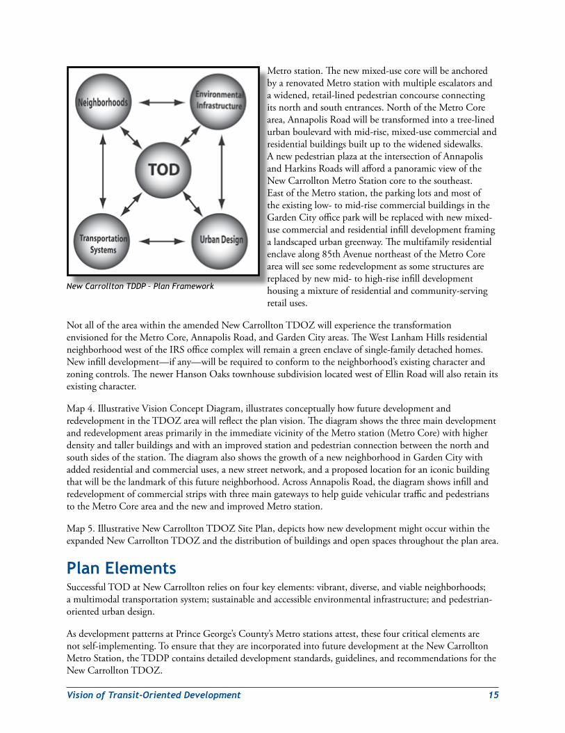
Plan FrameworkSuccessfulTODatNewCarrolltonreliesonfourkeyelements:(1)vibrant,diverse,andviableneighborhoods,(2)amultimodaltransportationsystem,(3)sustainableandaccessibleenvironmentalinfrastructure,and(4)pedestrian-orientedurbandesign.
The Neighborhoods TheNewCarrolltonTDDPidentifiesfiveneighborhoods,eachwithadistinctivecharacterandfunctionthatsupportstransit-orienteddevelopmentgoals.Theseneighborhoodsare:
WThe Metro Core—Mixed-useheartoftheTDDPwithmedium-tohigh-densitycommercial,retail,andresidentialuses.
W Annapolis Road—Primarycommercialcorridorwithmedium-densityresidentialandrevitalizedcommercialusesclusteredatmajorintersections.
W Garden City—Medium-density,mixed-useresidentialandcommercialneighborhoodwitheasyandwalkableaccesstotheMetrostationandthefuturePurpleLine.
W North Hillside Residential—Primarilyexistingresidentialneighborhood;phasedinfilldevelopmentwillbringsomecommercialandretailusesandanewpublicschool.
WWest Lanham Hills/Hanson Oaks—Preservedsingle-familydetachedandattachedneighborhoods(nozoningorlandusechangesproposedinthisneighborhood).
PlAN HiGHliGHTs
xii
A Multimodal Transportation systemThiselementconsistsofanintegratednetworkofstreets,pedestrianpathways,andtransitconnectionsthroughouttheTDOZarea.Specifically,theplanrecommends:
W UpgradingtheNewCarrolltonMetroStationtoaccommodatetheadditionalridershipthatwillbegeneratedbyfuturedevelopmentintheTDOZareaaswellasbythefuturePurpleLine.
W ReconstructingHarkinsRoad,85thAvenue,GardenCityDrive,andCorporateDriveaslandscapedboulevards.
W ConstructingabridgeortunnelcrossingtheMetrorail/Amtrak/MARCrailalignmentthatwillcarryvehicularandpedestriantrafficandafutureextensionofthePurpleLine.
W ExpandingthePennsyDrivebridgeoverpassatUS50fromtwotofourlanes.
W Creatingasystemofgreenpedestrian/bicyclepathwaystolinktheMetrostationwithotherpointsofinterestthroughouttheTDOZarea.
W Employingtraffic-calmingdesignfeaturestomakestreetssaferandmoreattractiveforpedestriansandbicyclists.
sustainable and Accessible environmental infrastructure Thiselementconsistsofnaturalfeatures,wildlifehabitat,parks,recreationandopenspaces.Specifically,theplanrecommends:
W Preserving,restoring,andenhancingexistingelementsofthe2005Approved Countywide Green Infrastructure Plan.
W DevelopingalandscapedgreenwayalongtheBeaverdamCreekstreamvalleyasamajorcommunityamenityfortheGardenCityneighborhood.
W Developingsmallor“pocket”parkstoserveneighborhoodsthatcurrentlylackopportunitiesforconnectionwithnaturallandscapes,especiallythroughouttheNorthHillsideresidentialarea.
W Ensuringthatnewandreconstructedstreetsincludesustainableorenvironmentalsitedesign(ESD)featuresintheirlandscapingtohelpreducestormwaterrunoffandimprovewaterqualityinnearbystreams.
W PreservingandimprovingtheexistingWestLanhamHillsNeighborhoodPark.
Urban designThiselementgovernsthequalityofthepublicrealmandthelayout,appearance,andrelationshipofbuildingstothestreettofosterawelcoming,pedestrian-friendly,andsustainablemetropolitancenter.Specifically,theplanrecommends:
W Creatinga“greaturbantransitcenter”attheNewCarrolltonMetroStationthatservesasagrandmultimodalspaceandgatewaytoPrinceGeorge’sCounty.
W Supportingthedevelopmentofaniconicoffice/civicbuildingintheGardenCityneighborhoodtoserveasaplace-definingvisuallandmarkfortheNewCarrolltonTDOZarea.
xiii
W CreatingaconnectedsystemofopenandgreenspacestomaketheTDOZneighborhoodsmoreattractiveandaccessibleandtocreaterecreationalopportunitiesforresidents,workers,andvisitorstothearea.
W CreatingwayfindingsignagethatisclearandattractivetohelppedestriansanddriversfindtheirwaytotheMetrostationandotherpointsofinterest.
W PlacingworksofpublicartatstrategiclocationswithintheMetrostationandinpublicopenspacesthroughouttheplanarea.
W Encouragingdeveloperstoincorporategreenroofsandothersustainableandenergyefficienttechnologiesintheirbuildings.
W Ensuringthatstreetsandopenspacesaredesignedtoprovideasafeenvironmentfortheiruserstohelppreventundesirableorillegalactivities.
other Key Zoning and implementation recommendationsW RezonetheI-1(LightIndustrial)areastoM-X-T(Mixed-Use-TransportationOriented)toencouragemixed-useddevelopmentneartheMetrostation.
W RezonetheC-S-C(CommercialShoppingCenter)areasalongAnnapolisRoadbetweenmajorintersectionstomixed-useresidential,retail,andcommercialusestocreateanurbanstreetscapewhileconcentratingfuturecommercialdevelopmentatthoseintersections.
W Establishatransportationdemandmanagementdistricttomanagetransportationimpactsandreducetrafficcongestiongeneratedbyfuturedevelopment.
W EstablishabusinessimprovementdistricttocoordinatestreetscapeimprovementsandpromotecommercialrevitalizationalongAnnapolisRoad.
W Establishataxincrementfinancingdistricttoraisefundsneededtosupporttheactivitiesofthebusinessimprovementdistrict.
W PlanforandbuildanewschoolwithintheTDOZareatoaccommodateanadditional500studentsasaresultoffutureresidentialdevelopment.
W Establishabonusdensityandintensityprogramtopromotethedevelopmentofworkforceandmixed-incomehousing,andcommercialspaceforlocalbusinesseswithintheMetroCoreneighborhood.
W Identifypublicandcommunity-basedresourcestohelphomeownersfacingforeclosureremainintheirhomes.

xiv
Purpose ThepurposeoftheNewCarrolltonTDDPandTDOZistoensurethatfuturedevelopmentaroundtheNewCarrolltonMetroStationmaximizestransitridership,revitalizestheareawhilemaintainingitssocio-economicdiversity,andadoptsasustainabledevelopmentpattern.TheTDOZwillfoster(re)developmentconducivetoNewCarrollton’sMetropolitanCenterdesignation.
TheNewCarrolltonTDDPsetsoutadevelopmentvisionfortheNewCarrolltonTransitDistrictthatarticulatesvibrantanddiverseneighborhoods,amultimodaltransportationsystem,sustainableandaccessibleenvironmentalinfrastructure,andpedestrian-orientedurbandesign.Thisvisionemphasizes:
W Transit-orienteddevelopment(TOD)neartheMetrostationandclearlydefinedneighborhoodswithdistinctcharactersandfunctions.
W Pedestrian-oriented(re)devel-opmentinthetransitdistrict.
W Protectedenvironmentallysensitiveareas,minimalimpactsofdevelopment,andexpandedrecreationalopportunitiesandtrail/bikewayconnections.
W MaximumhousingopportunitieswithinwalkingdistanceoftheMetrostation.
iNTrodUCTioNATDOZisdefinedasamappedzonethatissuperimposedoverotherzonesinadesignatedarea—referredtoasatransitdistrictperSection27-548.02oftheZoningOrdinance—aroundaMetrostationandwhichmaymodifycertainrequirementsfordevelopmentwithinthoseunderlyingzones.TheimplementationoftheNewCarrolltonTDOZiscontingentonthepreparationandapprovaloftheNewCarrolltonTDDPbythePrinceGeorge’sCountyDistrictCouncil.
ATDDPisdefinedintheZoningOrdinance(Section27-548.02)asthespecializedplanthatprovidesboththerequirementsfordevelopmentwithinaspecificTDOZandaflexibleforumforjointdevelopmentbetweenthepublicandprivatesectors.AllnewdevelopmentandredevelopmentwithintheTDOZrequiresadetailedsiteplanapprovedbythePrinceGeorge’sCountyPlanningBoardandshallbeundertakeninaccordancewiththeapplicablerequirementsofthePrinceGeorge’sCountyCodeunlessmodifiedbytherequirementsoftheTDDP.Allmandatorydevelopmentrequirementsanddesignstandardsshallapplytoallpropertieswithinthetransitdistrict,exceptasexemptedbytheAdministrationandApplicabilitysectionofthisTDDP.TheTDDPshallbebindinguponallownersofpropertywithintheTDOZ,theirheirs,successors,and/orassignees.
Transit-orienteddevelopment(TOD)isgenerallydefinedasdevelopmentthatislocatedwithinaten-minutewalkor½mileofacommuterrailorrailtransitstation(PlanningandUrbanDesignStandards,AmericanPlanningAssociation,2006).The2002Prince George’s County Approved General PlanfurtherdefinesTODasdevelopmentthatactivelyseekstoincreasetransituseanddecreaseautomobiledependencyby:
W Locatinghomes,jobsandshoppingclosertotransitservices1
W Locatingthemixofcriticallanduses(live/work/shop)incloserproximitytooneanother
W Establishinglanduse/transitlinkagesthatmakeiteasiertousetransit(railandbus)
1 Transitincludesbus,busrapidtransit(BRT),lightrailtransit/streetcar(LRT),andheavyrail,alsoknownasrapidtransit(includingsubwayandcommuterrailtrains).
2 Introduction
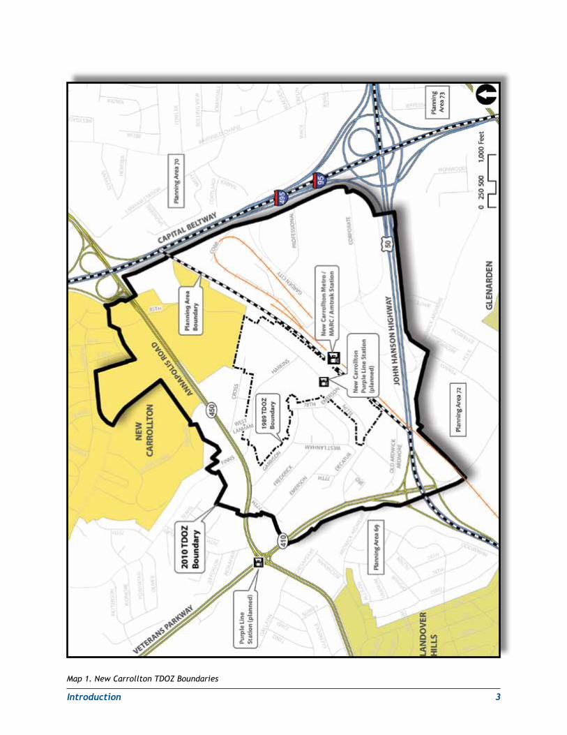
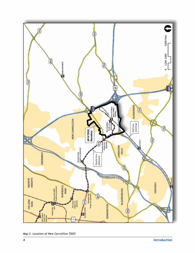
BackgroundlocationTheboundariesoftheNewCarrolltonTDOZwereestablishedpartiallyonthebasisofrecommendationscontainedinthe2004NewCarrolltonTODstudy.Theywerefurtherrefinedduringacommunity-basedplanningprocessthatincludedcommunityworkshopsheldinDecember2007andApril2008.
TheNewCarrolltonTransitDistrictoccupiesportionsofPlanningAreas(PA)69(Bladensburg–NewCarrollton)and72(Landover)incentralPrinceGeorge’sCountyjustinsidetheCapitalBeltway(I-95/I-495)(seeMap1.NewCarrolltonTDOZBoundariesandMap2.LocationofNewCarrolltonTDOZ).Itencompassesapproximately640acresincludingtheNewCarrolltonMetroStation.TheMetrostationistheterminalOrangeLineMetrostationsecuringrapidtransitaccessfromNewCarrolltontotherestofthemetropolitanregion.InadditiontoMetrorail,NewCarrolltonprovidesaccesstoMARC(MarylandAreaRegionalCommuter),Amtrak,andextensivebusservice.TheNewCarrolltonTransitDistrictcontainsaportionoftheCityofNewCarrolltonandisborderedtothewestbytheTownofLandoverHills.
demographic ProfileTheNewCarrolltonTransitDistrictOverlayZonehadapopulationof5,160in2000accordingtotheU.S.Census.Theareahadamedianhouseholdincomeof$39,317,significantlylowerthanthecounty’s$55,256average,buttrendingclosetothe2000nationalaverageof$40,816.Thismayhaveacorrelationtopovertylevelsof11.6percentintheTDOZ,significantlymorethanthecounty’slevelof7.5percent.NewCarrolltonislessethnicallydiversethantherestofthecounty.In2000,thearea’spopulationwasonly10percentwhitecomparedto26percentforthecounty.Blackresidentscomprised80.4percentoftheTDOZ’spopulationcomparedto62percentofthecounty’spopulation.ThepresenceofSpanish-speakingcommunitymembersatthecommunityworkshopssuggests,however,arecentinfluxofLatinohouseholdsintotheTDOZarea.
TheTDOZ’spopulationisproportionatelyyoungtomiddleagedwith32percentofthepopulationfallingbetweentheagesof25and44.Morethanathird(34.7percent)oftheadultresidentsintheNewCarrolltonTDOZhavecompletedhighschoolcomparedto27.3percentforthecounty,butthesamepopulationhadlowerpercentsofpopulationachievingpartialcollege,associates,bachelors,orgraduateleveldegreesthanthecounty.Inaddition,18.9percentoftheadultpopulationhaslessthananinth-gradeeducationcomparedto4.7percentforthecounty.ThesestatisticsindicatethattheremaybeaneedforhighereducationinitiativesinsocialprogramsintheTDOZ.Owner-occupieddwellingunitsintheTDOZwere38.8percentofthearea’stotalhousingstockcomparedtothecountyrateof61.8percentin2000.
development PatternLanduseintheTDOZisfragmentedduetobuiltandnaturalbarriers.TheMetroCoreisdominatedbythepartiallyelevatedsharedrailright-of-wayforMetrorail,Amtrak,andMARCthatobstructsvehicularandpedestriantrafficbetweenareastothenorthandsouth.Developmenttothesouthofthestationisconstrainedbyaprotectedwaterwayandwetlandsarea—anoffshootofBeaverdamCreek—andisolatedbymajortransportationscorridorssuchasUS50andI-495.
Themajorityofthelanddirectlyadjacenttotherailalignmentispubliclyownedandeitherundevelopedorusedfortransit-relatedsurfaceparking,twoparkinggarages,andaMetrorailstorageandinspectionyard.To
MetrorailserviceisoperatedbytheWashingtonMetropolitanAreaTransitAuthority(WMATA).AmtrakserviceisoperatedbytheNationalRailPassengerCorporation,andMARCrailserviceisprovidedbytheMarylandDepartmentofTransportation(MDOT)throughacontractwithAmtrak.
Introduction 3
Map 1. New Carrollton TDOZ Boundaries
4 Introduction
Map 2. Location of New Carrollton TDOZ
Introduction 5
thesouthoftherails,betweenUS50andI-495,theMetroEast/GardenCityofficeparkcontainsprimarily2-to12-storyofficebuildings.
Northoftherails,thelandadjacenttoI-495isoccupiedbymorethan30three-tofour-storymultifamilyrentalandcondominiumresidentialbuildingsinavarietyofconditions.AllthepropertiesabuttingAnnapolisRoad(MD 450)arecommercialinnature,eithersmall-scalestripcommercialestablishmentsorlargershoppingcenterswithparkinginfront.AlongVeteransParkway(MD410),M-NCPPCownstheWestLanhamHillsPark.Thisneighborhoodparkincludestenniscourts,abasketballcourt,aplayground,awalkingtrail,andacommunitycenter.ThisparkabutstheWestLanhamHillsneighborhood,whichcontainssmallsingle-familyresidences.Anattachedtownhomedevelopment,HansonOaks,andseveralsingle-familyhomesarelocatedsouthofEllinRoadandeastofMD410.Manyoftheresidentshavelivedintheirneighborhoodsforyearsandarestronglycommittedtopreservingtheirhomesandqualityoflifewhilemakingstrategicimprovements.ThefearsofWestLanhamHillsresidentsaboutpotentialcommunityimpactsfromfuturedevelopmentposeachallengetothecounty’splanstopromotetransit-orienteddevelopmentattheMetrostation.
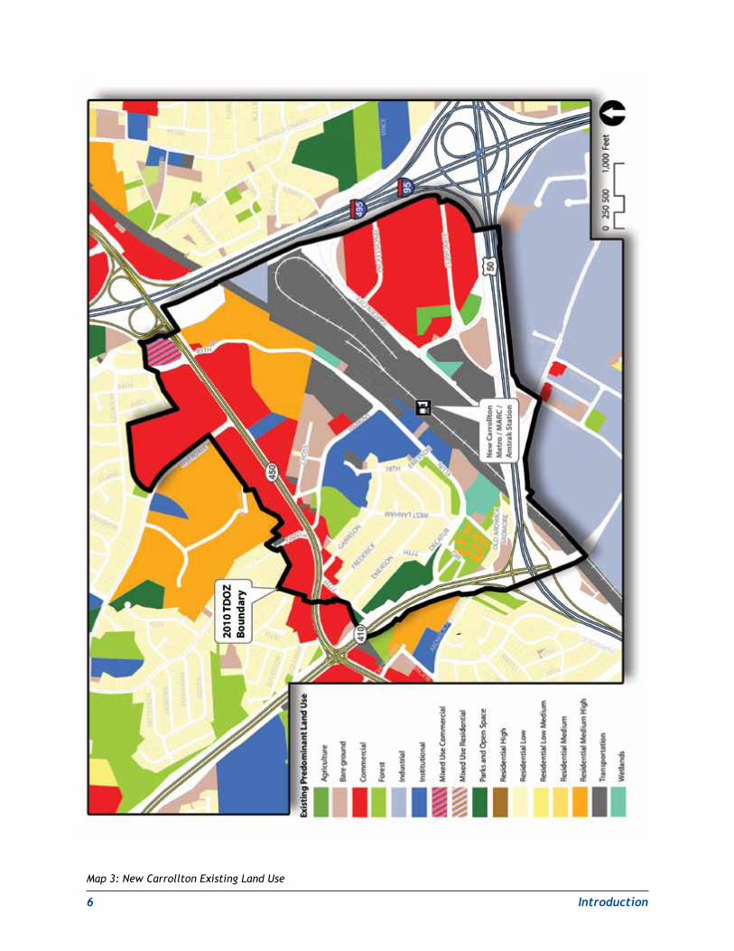
TheInternalRevenueServicecomplexandtheComputerScienceCorporation(CSC)officebuildingdominatetheintersectionofHarkinsandEllinRoadonthenorthsideoftheMetrostation.Northofthestation,asmallsingle-familyneighborhoodbacksuptoAnnapolisRoad.TheMetrostationareahasrecentlybecomethefocusofdeveloperattention.OneexampleofthisistherecentpurchaseoftheCSCofficebuildingbyadeveloperseekingtoerectanewmixed-useprojectnorthofthestation.Map3.NewCarrolltonExistingLandUsedepictsthecurrentpatternofuseswithintheTDOZarea.
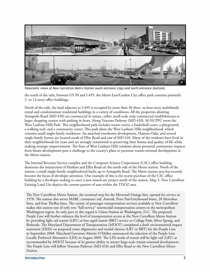
Panoramic views of New Carrollton Metro Station south entrance (top) and north entrance (bottom)
TheNewCarrolltonMetroStation,theterminalstopfortheMetrorailOrangeline,openedforservicein1978.ThestationalsoservesMARCcommuterrail,Amtrak,PeterPan/Greyhoundbuses,20Metrobuslines,andfourTheBuslines.ThevarietyofpassengertransportationservicesavailableatNewCarrolltonmakesthisstationoneofonlytwo“full-service”intermodaltransportationcentersinthemetropolitanWashingtonregion.ItsonlypeerinthisregardisUnionStationinWashington,D.C.TheproposedPurpleLinewillfurtherenhancetheleveloftransportationaccessattheNewCarrolltonMetroStationbyprovidinglightrailtransit(LRT)orbusrapidtransit(BRT)servicetoCollegePark,SilverSpring,andBethesda.TheMarylandDepartmentofTransportation(MDOT)completedadraftenvironmentalimpactstatement(DEIS)onproposedroutealignmentsandmodalchoices(LRTorBRT)forthePurpleLineinSeptember2008.MarylandGovernorMartinO’MalleyannouncedtheselectionofthePurpleLineLocallyPreferredAlternative(LPA)inAugust2009.TheLPAmodeoftransitwillbelightrail(LRT)asrecommendedbyMDOTbecauseofitsgreaterabilitytoattractlarge-scaletransit-orienteddevelopment.ThePurpleLinewillfollowVeteransParkway(MD410)andEllinRoadtotheNewCarrolltonMetroStation.
6 Introduction
Map 3: New Carrollton Existing Land Use
Introduction 7
development PotentialTheNewCarrolltonMetroStationareaisatransit,commuterrail,andvehiculartraffichubintheNationalCapitalregionandservesasagatewaytotheregionforvisitorsfromtheNortheast.Assuch,theMetrostationareaanchorssignificantresidential,office,andretaildevelopmentpotentialwithintheTDOZ.However,whilemajoremployers,suchastheIRSandthe200acreMetroEastOfficeParktothesouthofthestation,havelocatedintheareaandunderscoreditsattractivenessasacommercialofficelocation,modestnewdevelopmenthasoccurredsincetheMetrostationopened.
Recognizingitspotentialtobecomeanurbandestinationwhiledecreasingtrafficcongestionandenhancingtheemploymentoptionsandqualityoflifeofcountyresidents,theTDDPwasdevelopedtoaddressthearea’sweaknesses,identifycatalyticdevelopmentopportunities,andregulatethedesignofthearea.
Planning ProcessPreliminary PlanningInlate2003,M-NCPPCinitiatedaplanningstudyfortheNewCarrolltonMetroStationanditssurroundingcommunities.Thisstudywasintendedtodevelopavisionoffuturetransit-orienteddevelopment(TOD)aroundthestationinpreparationforanupdateofthecurrentNewCarrolltontransitdistrictdevelopmentplan(TDDP).TheexistingTDDP,whichwasenactedin1989,neededtobeupdatedtoreflectthe2002GeneralPlan’srecommendationforTODaroundtheNewCarrolltonMetroStation.Anextensivepublicparticipationefforttookplaceduring2004,includingacommunityplanningcharrettethatwasheldinMay.Thefinalplanningstudyreport,2004New Carrollton Transit-Oriented Development Strategy Planning Study,wasreleasedinDecember2004.ItrecommendedanexpansionoftheTDOZtoincludepropertiesonbothsidesoftheMetrorail/Amtrak/MARCstationcomplex.Italsorecommendedpublicinfrastructureimprovementssuchasanupgradedstationcomplexandseveralvehicularcrossingsofthesharedrailalignmenttoimproveconnectivitybetweenareasnorthandsouthofthestation.
Inearly2007,M-NCPPCandthePrinceGeorge’sCountyEconomicDevelopmentCorporationrequestedthattheUrbanLandInstitute(ULI)assembleandconductatechnicalassistancepanel(TAP)toassessthepotentialofthe2004planningstudy’srecommendedpublicimprovementstospurnewdevelopmentintheMetrostation’svicinity.M-NCPPCpreparedbriefingmaterialsforreviewbythepanel,includingapreliminaryengineeringfeasibilityassessmentoftheproposedvehicularcrossingsofthesharedrailalignment.
TheULI/TAPmetinJuly2007andmadethefollowingkeyrecommendations:
• UpgradetheNewCarrolltonMetroStationtoallowgreaterpedestrianconnectivitybetweentheareasnorthandsouthofthestation.TherearecurrentlynofundsallocatedintheWMATACapitalImprovementPlanthroughFY 2013forNewCarrolltonstationimprovements.
• Allowdevelopmentnorthandsouthofthestationtooccurindependentlyratherthantryingtocreateasingleneighborhoodthatcouldstraddlethesharedrailalignment.
• Createanenhancedpedestrianlinkagethroughthestationthatcouldbelinedwithtraveler-servingretailoutlets.
• DevelopanattractivepedestrianaxistoconnectthestationwithafutureiconicofficebuildingintheGardenCityareaneartheUS50/CapitalBeltwayinterchange.Theterm“iconicofficebuilding”identifiesthisstructureasalandmarkthatwouldbevisiblefromthenearbyfreeways(US50andI-95/I-495)andfromotherlocationswithin,andoutsideof,theTDOZ.
8 Introduction
• Considertheconstructionofvehicularcrossingsofthesharedrailrights-of-wayatthelaterstagesofdevelopmentwhensufficientadditionaldevelopmentvaluehasbeengeneratedtohelpfundtheseimprovements.
Public outreach strategyTheplanningstaffsolicitedstakeholderandcommunityinputineverystepoftheconceptualandfinalplanningfortheNewCarrolltontransitdistrictdevelopmentplan.Thepublicoutreachstrategywasdesignedaroundaseriesofstakeholderinterviews,internalcharrettesforimplementingpublicagencies,andpublicworkshops.TheinterviewsweredesignedtodevelopalistofinitialissuesandopportunitiesfortheTDOZaroundwhichinitialdesignconceptscouldbegenerated.Theinterviewswerealsousedtodevelopandrefinealistofkeystakeholders.ThepurposeofthestakeholderandcommunityworkshopswastoevaluateplausibledevelopmentscenariosfortheareaandunderstandanyneworcontinuedconcernswithdevelopmentwithintheTDOZboundaries.
Meeting summariesInputreceivedfromcommunitymeetingsandpublicagencycharrettes(hands-on,intensiveworkshops)wascarefullyconsideredinthepreparationofthispreliminaryTDDP.Theplanbalancesresponsivenesstostakeholderconcernswiththebestavailablepracticesintransit-oriented,sustainabledevelopment.
OnOctober15and16,2007,astakeholdercharretteforimplementingpublicagencieswasheldatM-NCPPCtogatherinputandfurtherdeveloppreliminarydesignconceptsbeforedisplayingthempublicly.Discussionsinthistwo-daycharrettefocusedontheoperationalandimplementationaspectsoftheconceptualdesignsaswellasmeetingthe2002GeneralPlanexpectationsthatthesitewillevolvetobeafullyfunctioningtransit-orienteddevelopmentmetropolitancenter.Followinganinitialpresentationofthearea’sexistingconditions,thecharrettewasdevotedtostrategizingconceptualdesignsandgatheringlocalknowledgefromstakeholders.
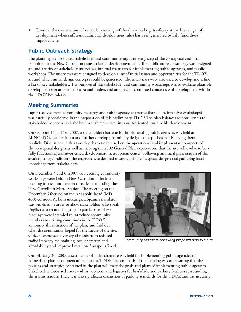
OnDecember5and6,2007,twoeveningcommunityworkshopswereheldinNewCarrollton.ThefirstmeetingfocusedontheareadirectlysurroundingtheNewCarrolltonMetroStation.ThemeetingontheDecember6focusedontheAnnapolisRoad(MD450)corridor.Atbothmeetings,aSpanishtranslatorwasprovidedinordertoallowstakeholderswhospeakEnglishasasecondlanguagetoparticipate.ThesemeetingswereintendedtointroducecommunitymemberstoexistingconditionsintheTDOZ,announcetheinitiationoftheplan,andfindoutwhatthecommunityhopedforthefutureofthesite.Citizensexpressedavarietyofneedsfromreducedtrafficimpacts,maintaininglocalcharacter,andaffordabilityandimprovedretailonAnnapolisRoad.
OnFebruary20,2008,asecondstakeholdercharrettewasheldforimplementingpublicagenciestorefinedraftplanrecommendationsfortheTDDP.Theemphasisofthemeetingwasonensuringthatthepoliciesandstrategiescontainedintheplanwillmeetthegoalsandplansofimplementingpublicagencies.Stakeholdersdiscussedstreetwidths,sections,andlogisticsforkiss’n’rideandparkingfacilitiessurroundingthetransitstation.TherewasalsosignificantdiscussionofparkingstandardsfortheTDOZandthenecessity
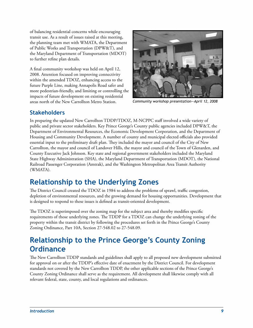
Community residents reviewing proposed plan exhibits
Introduction 9
ofbalancingresidentialconcernswhileencouragingtransituse.Asaresultofissuesraisedatthismeeting,theplanningteammetwithWMATA,theDepartmentofPublicWorksandTransportation(DPW&T),andtheMarylandDepartmentofTransportation(MDOT)tofurtherrefineplandetails.
AfinalcommunityworkshopwasheldonApril12,2008.AttentionfocusedonimprovingconnectivitywithintheamendedTDOZ,enhancingaccesstothefuturePurpleLine,makingAnnapolisRoadsaferandmorepedestrian-friendly,andlimitingorcontrollingtheimpactsoffuturedevelopmentonexistingresidentialareasnorthoftheNewCarrolltonMetroStation.
stakeholdersInpreparingtheupdatedNewCarrolltonTDDP/TDOZ,M-NCPPCstaffinvolvedawidevarietyofpublicandprivatesectorstakeholders.KeyPrinceGeorge’sCountypublicagenciesincludedDPW&T,theDepartmentofEnvironmentalResources,theEconomicDevelopmentCorporation,andtheDepartmentofHousingandCommunityDevelopment.Anumberofcountyandmunicipalelectedofficialsalsoprovidedessentialinputtothepreliminarydraftplan.TheyincludedthemayorandcounciloftheCityofNewCarrollton,themayorandcouncilofLandoverHills,themayorandcounciloftheTownofGlenarden,andCountyExecutiveJackJohnson.KeystateandregionalgovernmentstakeholdersincludedtheMarylandStateHighwayAdministration(SHA),theMarylandDepartmentofTransportation(MDOT),theNationalRailroadPassengerCorporation(Amtrak),andtheWashingtonMetropolitanAreaTransitAuthority(WMATA).
relationship to the Underlying ZonesTheDistrictCouncilcreatedtheTDOZin1984toaddresstheproblemsofsprawl,trafficcongestion,depletionofenvironmentalresources,andthegrowingdemandforhousingopportunities.Developmentthatisdesignedtorespondtotheseissuesisdefinedastransit-orienteddevelopment.
TheTDOZissuperimposedoverthezoningmapforthesubjectareaandtherebymodifiesspecificrequirementsofthoseunderlyingzones.TheTDDPforaTDOZcanchangetheunderlyingzoningofthepropertywithinthetransitdistrictbyfollowingtheproceduressetforthinthePrinceGeorge’sCountyZoningOrdinance,Part10A,Section27-548.02to27-548.09.
relationship to the Prince George’s County Zoning ordinanceTheNewCarrolltonTDDPstandardsandguidelinesshallapplytoallproposednewdevelopmentsubmittedforapprovalonoraftertheTDDP’seffectivedateofenactmentbytheDistrictCouncil.FordevelopmentstandardsnotcoveredbytheNewCarrolltonTDDP,theotherapplicablesectionsofthePrinceGeorge’sCountyZoningOrdinanceshallserveastherequirement.Alldevelopmentshalllikewisecomplywithallrelevantfederal,state,county,andlocalregulationsandordinances.
Community workshop presentation—April 12, 2008
10 Introduction
relationship to other Plans 1992 Maryland economic Growth, resource Protection and Planning ActThislegislationwasenactedtoencourageeconomicgrowth,limitsprawldevelopment,andprotectthestate’snaturalresources.ItestablishedconsistentgenerallandusepoliciestobelocallyimplementedthroughoutMaryland.Thesepolicieswerestatedintheformofeightvisions.The1992MarylandPlanningActwasupdatedwiththepassageofthe2009SmartandSustainableGrowthActof2009(seediscussionbelow).
1997 smart Growth and Neighborhood Conservation ActThisactbuildsonthefoundationoftheeightvisionsadoptedinthe1992act,asamended.Theactisnationallyrecognizedasaneffectivemeansofevaluatingandimplementingstatewideprogramstoguidegrowthanddevelopment.
In1997,theMarylandGeneralAssemblyenactedapackageoflegislationcollectivelyreferredtoastheNeighborhoodConservationandSmartGrowthInitiative.TheMarylandSmartGrowthprogramhasthreebasicgoals:tosavevaluableremainingnaturalresources,tosupportexistingcommunitiesandneighborhoods,andtosavetaxpayersmillionsofdollarsinunnecessarycostsforbuildinginfrastructuretosupportsprawl.Asignificantaspectoftheinitiativeisthesmartgrowthareaslegislation,whichrequiresthatstatefundingforprojectsinMarylandmunicipalities,otherexistingcommunities,andindustrialandplannedgrowthareasdesignatedbycountieswillreceivepriorityfundingoverotherprojects.Thesesmartgrowthareasarecalledpriorityfundingareas.
2007 stormwater Management ActThislegislationwasenactedintolawbytheMarylandGeneralAssemblyin2007.Itmandatesenvironmentallysensitivesitedesignthatwillcapturestormwateron-siteandallowittosoakintothegroundtothegreatestpracticalextent.Theactrequireson-sitestormwatermanagementsystemstomimicnaturalecosystems.Italsorecommendstheuseof“microscale”technologiessuchasgreenroofs,permeablepavements,bioswales,andraingardenstodrainareasoflessthananacre.TheMarylandDepartmentoftheEnvironment(MDE)ischargedundertheactwithdevelopingappropriaterulesandregulationstoimplementtheact’sprovisions.MDEisalsorequiredtodevelopamodelstormwatermanagementordinancethatcanbereplicatedbylocaljurisdictionsseekingtorequirenewdevelopmentintheirareastoemploygreenstormwatermanagementpractices.
2009 smart and sustainable Growth ActTheSmartandSustainableGrowthActof2009clarifiesthelinkbetweenlocalcomprehensiveplansandlocallanduseordinances.Thebillreinforcestheimportanceofplanningforsustainablegrowthanddevelopmentinalllocaljurisdictionswithinthestate.Theeightplanvisionsstatedinthe1992MarylandPlanningActarereplacedwithanupdatedandexpandedlistoftwelvevisions:
1. Ahighqualityoflifeisachievedthroughuniversalstewardshipoftheland,water,andair,resultinginsustainablecommunitiesandprotectionoftheenvironment.
2. Citizensareactivepartnersintheplanningandimplementationofcommunityinitiativesandaresensitivetotheirresponsibilitiesinachievingcommunitygoals.
3. Growthisconcentratedinexistingpopulationandbusinesscenters,growthareasadjacenttothesecenters,orstrategicallyselectednewcenters.
4. Compact,mixed-use,walkabledesignconsistentwithexistingcommunitycharacterandlocatednearavailableorplannedtransitoptionsisencouragedtoensureefficientuseoflandandtransportation
Introduction 11
resourcesandpreservationandenhancementofnaturalsystems,openspaces,recreationalareas,andhistorical,cultural,andarcheologicalresources.
5. Growthareashavethewaterresourcesandinfrastructuretoaccommodatepopulationandbusinessexpansioninanorderly,efficient,andenvironmentallysustainablemanner.
6. Awell-maintained,multimodaltransportationsystemfacilitatesthesafe,convenient,affordable,andefficientmovementofpeople,goods,andserviceswithinandbetweenpopulationandbusinesscenters.
7. Arangeofhousingdensities,types,andsizesprovidesresidentialoptionsforcitizensofallagesandincomes.
8. Economicdevelopmentandnaturalresource-basedbusinessesthatpromoteemploymentopportunitiesforallincomelevelswithinthecapacityofthestate’snaturalresources,publicservices,andpublicfacilitiesareencouraged.
9. Landandwaterresources,includingtheChesapeakeandcoastalbays,arecarefullymanagedtorestoreandmaintainhealthyairandwater,naturalsystems,andlivingresources.
10. Waterways,forests,agriculturalareas,openspace,naturalsystems,andscenicareasareconserved.
11. Government,businessentities,andresidentsareresponsibleforthecreationofsustainablecommunitiesbycollaboratingtobalanceefficientgrowthwithresourceprotection.
12. Strategies,policies,programs,andfundingforgrowthanddevelopment,resourceconservation,infrastructure,andtransportationareintegratedacrossthelocal,regional,state,andinterstatelevelstoachievethesevisions.
Together,thetwelvevisionsprovideguidingprinciplesthatdescribehowandwheregrowthcanbestoccurwithoutcompromisingthestate’snaturalandculturalresources.Theactacknowledgesthatthecomprehensiveplanspreparedbycountiesandmunicipalitiesarethebestmechanismtoestablishprioritiesforgrowthandresourceconservation.Onceprioritiesareestablished,itisthestate’sresponsibilitytosupportthem.
2002 General PlanThe2002Prince George’s County Approved General PlanprovidesbroadguidanceforthefuturegrowthofPrinceGeorge’sCounty.Thisguidanceisgiventhroughcountywidelandutilizationpoliciessuchaseconomicdevelopment,theenvironment,transportation,housing,publicfacilities,andurbandesign.Thesepoliciesfocusontheneedtoconcentratefuturedevelopment,balanceenvironmentalconcernswitheconomicdevelopment,createdevelopmentcentersthatservebothexistingandfuturecommunities,encourageagreaterrangeofhousingtypes,maintainadequatepublicfacilitiesandservicelevels,andarticulateavisionandstandardsforthedesignofthephysicalenvironment.
TheGeneralPlandelineatesthreegrowthmanagementareasknownastiers:theDevelopedTier,theDevelopingTier,andtheRuralTier.TheNewCarrolltonTransitDistrictiswithintheDevelopedTier.WithintheDevelopedTier,fourpoliciesgovernlanddevelopment:
Policy 1—Encouragemediumtohigh-density,mixed-use,transit-andpedestrian-orienteddevelopment.
Policy 2—Preserve,restore,andenhanceenvironmentalfeaturesandgreeninfrastructureelements.
Policy 3—Provideatransportationsystemthatisintegratedwithandpromotesdevelopmentandrevitalization.
Policy 4—PlanandprovidepublicfacilitiestosupportandfitintotheDevelopedTier’sdevelopmentpattern.
12 Introduction
TheGeneralPlanspecificallytargetsgrowthatalimitednumberofdesignatedcentersandwithintheDevelopedTierorientedtodirectservicebyMetrorail.TheNewCarrolltonMetroStationareaisdefinedasaMetropolitanCenter.TheGeneralPlandefinesMetropolitanCentersas“placeswhereintensiveconcentrationsoflandusesandeconomicactivitiesattractemployers,workers,andcustomersfromotherpartsofthemetropolitanWashingtonareasuchaslargegovernmentserviceormajoremploymentcenters,majoreducationcomplexes,orhigh-intensitycommercialuses”(p.47).High-densityresidentialdevelopmentmayalsobelocatedinornearMetropolitanCenters.MetropolitanCenterscaneffectivelybeservedbymasstransit.
Bladensburg‑New Carrollton and Vicinity Master Plan (1994) and the landover and Vicinity Master Plan (1993)TheNewCarrolltonTDDP/TDOZupdatesthe1989ApprovedNewCarrolltonTransitDistrictDevelopmentPlan.BecausetheNewCarrolltonTransitDistrictOverlayZoneisexpandedtoincludeportionsofPlanningAreas69(Bladensburg-NewCarrollton)and72(Landover),theTDDP/TDOZamendsthe1994 ApprovedBladensburg-New Carrollton and Vicinity Master Plan and Sectional Map Amendmentandthe1993Approved Landover and Vicinity Master Plan and Sectional Map Amendment.
Transportation demand ManagementTheGeneralPlanenvisionsqualityTODatPrinceGeorge’sCountyMetrostationssuchasNewCarrollton.ImplementingTODwithintheNewCarrolltonTDOZareawillrequirebalancingtheoptimummixanddensitiesoflanduseswiththetransportationinfrastructureandservicesthatareneededtoefficientlyaccommodatethem.ThischallengeiscomplicatedbythefactthattherearefewoptionstoaddorexpandroadstoaccommodatetheadditionalvehiculartrafficthatmayresultfromnewdevelopmentorredevelopmentwithintheNewCarrolltonTDOZ.Therefore,amultimodaltransportationnetworkthatintegratesthedevelopmentpatternwithexpandedpublictransportation,pedestrian/bicyclepathways,andtransportationdemandmanagement(TDM)initiativeswillbeneededtoaccommodatethedesireddevelopment.
TransportationdemandmanagementisdefinedinSection20A-201ofTitle20A,Transportation,ofthePrinceGeorge’sCountyCodeas“…aprocessorprocedureintendedtoreducevehicletripsduringspecifiedperiodsoftheday.Thisincludes,butisnotlimitedto,suchstrategiesascarandvanpools,transituseincentives,parkingfeesanddisincentives,improvedpedestrianandbicycleaccessandfacilities.”Title20AcontainsguidelinesforimplementingTDMstrategies,includingtheestablishmentandoperationofdesignatedtransportationdemandmanagementdistricts(TDMD).
TheNewCarrolltonTDDPauthorizestheestablishmentofaTDMDforthetransitdistrictthroughpetitiontotheCouncilinaccordancewithSection20A-204ofthePrinceGeorge’sCountyCode.Italsoauthorizestheestablishmentofatransportationdemandmanagementtechnicaladvisorycommitteetoanalyze,recommend,andimplementthepoliciesapprovedbytheDistrictCounciltoachievetheNewCarrolltonTDDP’stransportationgoals,policiesandobjectives.AmoredetaileddiscussionofTDMmaybefoundintheTransitDistrictDevelopmentPlanchapter.
Amendment ProceduresTheNewCarrolltonTDDP/TDOZhasbeenformulatedinaccordancewiththerequirementsofthePrinceGeorge’sCountyZoningOrdinance,asstipulatedinSection27-213.02through27-213.05.ThespecificstepsaregraphicallyillustratedinAppendixA:ProceduralFlowchartforTDDP-TDOZMA.TheDistrictCouncilmayamendtheTDOZasstipulatedinSection27-548.09.01,AmendmentofApprovedTransitDistrictOverlayZone.
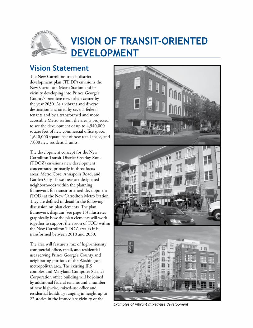
Vision statementTheNewCarrolltontransitdistrictdevelopmentplan(TDDP)envisionstheNewCarrolltonMetroStationanditsvicinitydevelopingintoPrinceGeorge’sCounty’spremierenewurbancenterbytheyear2030.AsavibrantanddiversedestinationanchoredbyseveralfederaltenantsandbyatransformedandmoreaccessibleMetrostation,theareaisprojectedtoseethedevelopmentofupto4,540,000squarefeetofnewcommercialofficespace,1,640,000squarefeetofnewretailspace,and7,000newresidentialunits.
ThedevelopmentconceptfortheNewCarrolltonTransitDistrictOverlayZone(TDOZ)envisionsnewdevelopmentconcentratedprimarilyinthreefocusareas:MetroCore,AnnapolisRoad,andGardenCity.Theseareasaredesignatedneighborhoodswithintheplanningframeworkfortransit-orienteddevelopment(TOD)attheNewCarrolltonMetroStation.Theyaredefinedindetailinthefollowingdiscussiononplanelements.Theplanframeworkdiagram(seepage15)illustratesgraphicallyhowtheplanelementswillworktogethertosupportthevisionofTODwithintheNewCarrolltonTDOZareaasitistransformedbetween2010and2030.
Theareawillfeatureamixofhigh-intensitycommercialoffice,retail,andresidentialusesservingPrinceGeorge’sCountyandneighboringportionsoftheWashingtonmetropolitanarea.TheexistingIRScomplexandMarylandComputerScienceCorporationofficebuildingwillbejoinedbyadditionalfederaltenantsandanumberofnewhigh-rise,mixed-useofficeandresidentialbuildingsranginginheightupto22storiesintheimmediatevicinityofthe
VisioN oF TrANsiT‑orieNTed deVeloPMeNT
Examples of vibrant mixed-use development
14 VisionofTransit-OrientedDevelopment
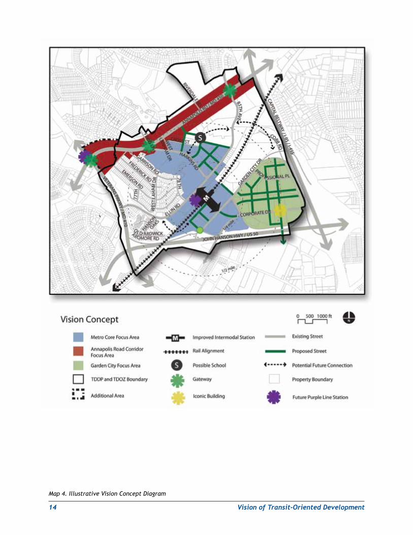
Map 4. Illustrative Vision Concept Diagram
VisionofTransit-OrientedDevelopment 15
Metrostation.Thenewmixed-usecorewillbeanchoredbyarenovatedMetrostationwithmultipleescalatorsandawidened,retail-linedpedestrianconcourseconnectingitsnorthandsouthentrances.NorthoftheMetroCorearea,AnnapolisRoadwillbetransformedintoatree-linedurbanboulevardwithmid-rise,mixed-usecommercialandresidentialbuildingsbuiltuptothewidenedsidewalks.AnewpedestrianplazaattheintersectionofAnnapolisandHarkinsRoadswillaffordapanoramicviewoftheNewCarrolltonMetroStationcoretothesoutheast.EastoftheMetrostation,theparkinglotsandmostoftheexistinglow-tomid-risecommercialbuildingsintheGardenCityofficeparkwillbereplacedwithnewmixed-usecommercialandresidentialinfilldevelopmentframingalandscapedurbangreenway.Themultifamilyresidentialenclavealong85thAvenuenortheastoftheMetroCoreareawillseesomeredevelopmentassomestructuresarereplacedbynewmid-tohigh-riseinfilldevelopmenthousingamixtureofresidentialandcommunity-servingretailuses.
NotalloftheareawithintheamendedNewCarrolltonTDOZwillexperiencethetransformationenvisionedfortheMetroCore,AnnapolisRoad,andGardenCityareas.TheWestLanhamHillsresidentialneighborhoodwestoftheIRSofficecomplexwillremainagreenenclaveofsingle-familydetachedhomes.Newinfilldevelopment—ifany—willberequiredtoconformtotheneighborhood’sexistingcharacterandzoningcontrols.ThenewerHansonOakstownhousesubdivisionlocatedwestofEllinRoadwillalsoretainitsexistingcharacter.
Map4.IllustrativeVisionConceptDiagram,illustratesconceptuallyhowfuturedevelopmentandredevelopmentintheTDOZareawillreflecttheplanvision.ThediagramshowsthethreemaindevelopmentandredevelopmentareasprimarilyintheimmediatevicinityoftheMetrostation(MetroCore)withhigherdensityandtallerbuildingsandwithanimprovedstationandpedestrianconnectionbetweenthenorthandsouthsidesofthestation.ThediagramalsoshowsthegrowthofanewneighborhoodinGardenCitywithaddedresidentialandcommercialuses,anewstreetnetwork,andaproposedlocationforaniconicbuildingthatwillbethelandmarkofthisfutureneighborhood.AcrossAnnapolisRoad,thediagramshowsinfillandredevelopmentofcommercialstripswiththreemaingatewaystohelpguidevehiculartrafficandpedestrianstotheMetroCoreareaandthenewandimprovedMetrostation.
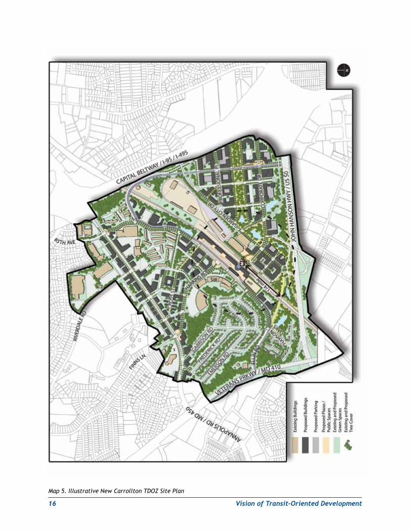
Map5.IllustrativeNewCarrolltonTDOZSitePlan,depictshownewdevelopmentmightoccurwithintheexpandedNewCarrolltonTDOZandthedistributionofbuildingsandopenspacesthroughouttheplanarea.
Plan elementsSuccessfulTODatNewCarrolltonreliesonfourkeyelements:vibrant,diverse,andviableneighborhoods;amultimodaltransportationsystem;sustainableandaccessibleenvironmentalinfrastructure;andpedestrian-orientedurbandesign.
AsdevelopmentpatternsatPrinceGeorge’sCounty’sMetrostationsattest,thesefourcriticalelementsarenotself-implementing.ToensurethattheyareincorporatedintofuturedevelopmentattheNewCarrolltonMetroStation,theTDDPcontainsdetaileddevelopmentstandards,guidelines,andrecommendationsfortheNewCarrolltonTDOZ.
New Carrollton TDDP – Plan Framework
16 VisionofTransit-OrientedDevelopment
Map 5. Illustrative New Carrollton TDOZ Site Plan
VisionofTransit-OrientedDevelopment 17
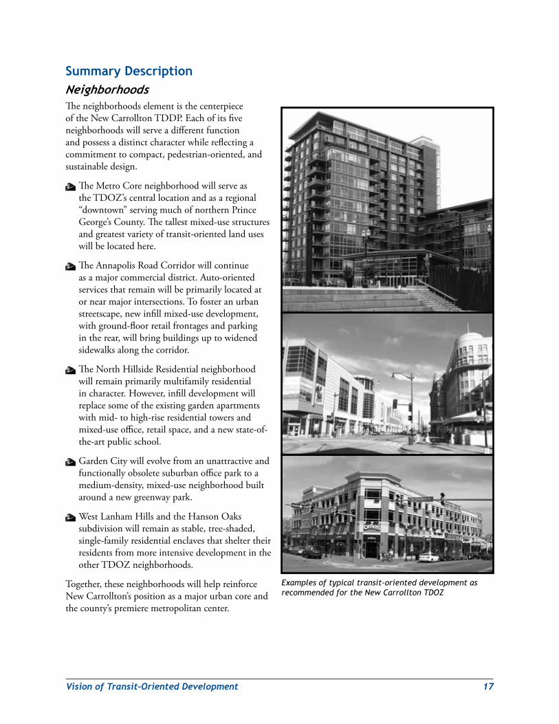
summary descriptionNeighborhoodsTheneighborhoodselementisthecenterpieceoftheNewCarrolltonTDDP.Eachofitsfiveneighborhoodswillserveadifferentfunctionandpossessadistinctcharacterwhilereflectingacommitmenttocompact,pedestrian-oriented,andsustainabledesign.
WTheMetroCoreneighborhoodwillserveastheTDOZ’scentrallocationandasaregional“downtown”servingmuchofnorthernPrinceGeorge’sCounty.Thetallestmixed-usestructuresandgreatestvarietyoftransit-orientedlanduseswillbelocatedhere.
WTheAnnapolisRoadCorridorwillcontinueasamajorcommercialdistrict.Auto-orientedservicesthatremainwillbeprimarilylocatedatornearmajorintersections.Tofosteranurbanstreetscape,newinfillmixed-usedevelopment,withground-floorretailfrontagesandparkingintherear,willbringbuildingsuptowidenedsidewalksalongthecorridor.
WTheNorthHillsideResidentialneighborhoodwillremainprimarilymultifamilyresidentialincharacter.However,infilldevelopmentwillreplacesomeoftheexistinggardenapartmentswithmid-tohigh-riseresidentialtowersandmixed-useoffice,retailspace,andanewstate-of-the-artpublicschool.
W GardenCitywillevolvefromanunattractiveandfunctionallyobsoletesuburbanofficeparktoamedium-density,mixed-useneighborhoodbuiltaroundanewgreenwaypark.
W WestLanhamHillsandtheHansonOakssubdivisionwillremainasstable,tree-shaded,single-familyresidentialenclavesthatsheltertheirresidentsfrommoreintensivedevelopmentintheotherTDOZneighborhoods.
Together,theseneighborhoodswillhelpreinforceNewCarrollton’spositionasamajorurbancoreandthecounty’spremieremetropolitancenter.
Examples of typical transit-oriented development as recommended for the New Carrollton TDOZ
18 VisionofTransit-OrientedDevelopment
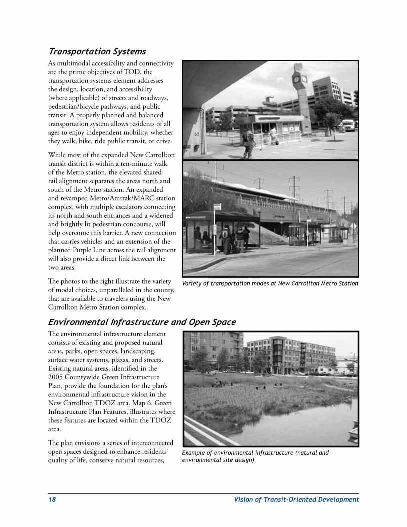
TransportationSystemsAsmultimodalaccessibilityandconnectivityaretheprimeobjectivesofTOD,thetransportationsystemselementaddressesthedesign,location,andaccessibility(whereapplicable)ofstreetsandroadways,pedestrian/bicyclepathways,andpublictransit.Aproperlyplannedandbalancedtransportationsystemallowsresidentsofallagestoenjoyindependentmobility,whethertheywalk,bike,ridepublictransit,ordrive.
WhilemostoftheexpandedNewCarrolltontransitdistrictiswithinaten-minutewalkoftheMetrostation,theelevatedsharedrailalignmentseparatestheareasnorthandsouthoftheMetrostation.AnexpandedandrevampedMetro/Amtrak/MARCstationcomplex,withmultipleescalatorsconnectingitsnorthandsouthentrancesandawidenedandbrightlylitpedestrianconcourse,willhelpovercomethisbarrier.AnewconnectionthatcarriesvehiclesandanextensionoftheplannedPurpleLineacrosstherailalignmentwillalsoprovideadirectlinkbetweenthetwoareas.
Thephotostotherightillustratethevarietyofmodalchoices,unparalleledinthecounty,thatareavailabletotravelersusingtheNewCarrolltonMetroStationcomplex.
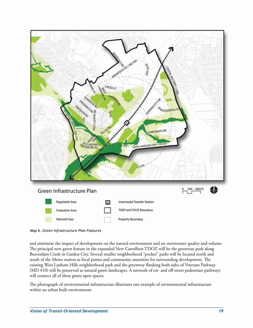
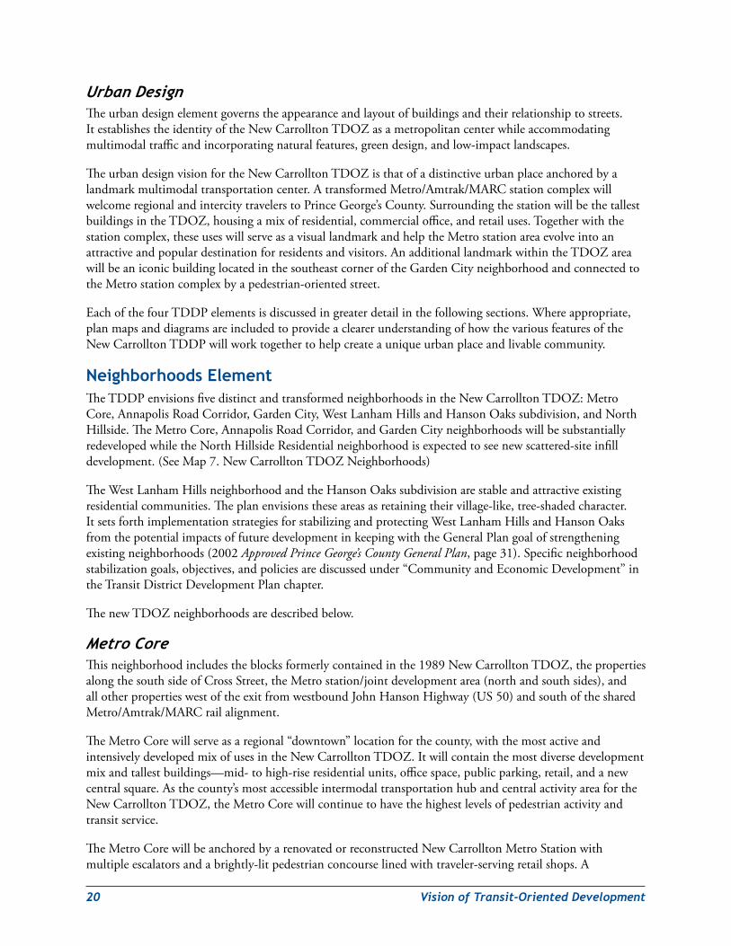
EnvironmentalInfrastructureandOpenSpaceTheenvironmentalinfrastructureelementconsistsofexistingandproposednaturalareas,parks,openspaces,landscaping,surfacewatersystems,plazas,andstreets.Existingnaturalareas,identifiedinthe2005CountywideGreenInfrastructurePlan,providethefoundationfortheplan’senvironmentalinfrastructurevisionintheNewCarrolltonTDOZarea.Map6.GreenInfrastructurePlanFeatures,illustrateswherethesefeaturesarelocatedwithintheTDOZarea.
Theplanenvisionsaseriesofinterconnectedopenspacesdesignedtoenhanceresidents’qualityoflife,conservenaturalresources,
Example of environmental infrastructure (natural and environmental site design)
Variety of transportation modes at New Carrollton Metro Station
VisionofTransit-OrientedDevelopment 19
andminimizetheimpactofdevelopmentonthenaturalenvironmentandonstormwaterqualityandvolume.TheprincipalnewgreenfeatureintheexpandedNewCarrolltonTDOZwillbethegreenwayparkalongBeaverdamCreekinGardenCity.Severalsmallerneighborhood“pocket”parkswillbelocatednorthandsouthoftheMetrostationasfocalpointsandcommunityamenitiesforsurroundingdevelopment.TheexistingWestLanhamHillsneighborhoodparkandthegreenwayflankingbothsidesofVeteransParkway(MD410)willbepreservedasnaturalgreenlandscapes.Anetworkofon-andoff-streetpedestrianpathwayswillconnectallofthesegreenopenspaces.
Thephotographofenvironmentalinfrastructureillustratesoneexampleofenvironmentalinfrastructurewithinanurbanbuiltenvironment.
Map 6. Green Infrastructure Plan Features
20 VisionofTransit-OrientedDevelopment
UrbanDesignTheurbandesignelementgovernstheappearanceandlayoutofbuildingsandtheirrelationshiptostreets.ItestablishestheidentityoftheNewCarrolltonTDOZasametropolitancenterwhileaccommodatingmultimodaltrafficandincorporatingnaturalfeatures,greendesign,andlow-impactlandscapes.
TheurbandesignvisionfortheNewCarrolltonTDOZisthatofadistinctiveurbanplaceanchoredbyalandmarkmultimodaltransportationcenter.AtransformedMetro/Amtrak/MARCstationcomplexwillwelcomeregionalandintercitytravelerstoPrinceGeorge’sCounty.SurroundingthestationwillbethetallestbuildingsintheTDOZ,housingamixofresidential,commercialoffice,andretailuses.Togetherwiththestationcomplex,theseuseswillserveasavisuallandmarkandhelptheMetrostationareaevolveintoanattractiveandpopulardestinationforresidentsandvisitors.AnadditionallandmarkwithintheTDOZareawillbeaniconicbuildinglocatedinthesoutheastcorneroftheGardenCityneighborhoodandconnectedtotheMetrostationcomplexbyapedestrian-orientedstreet.
EachofthefourTDDPelementsisdiscussedingreaterdetailinthefollowingsections.Whereappropriate,planmapsanddiagramsareincludedtoprovideaclearerunderstandingofhowthevariousfeaturesoftheNewCarrolltonTDDPwillworktogethertohelpcreateauniqueurbanplaceandlivablecommunity.
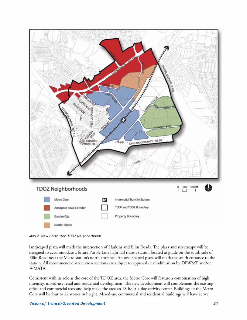
Neighborhoods elementTheTDDPenvisionsfivedistinctandtransformedneighborhoodsintheNewCarrolltonTDOZ:MetroCore,AnnapolisRoadCorridor,GardenCity,WestLanhamHillsandHansonOakssubdivision,andNorthHillside.TheMetroCore,AnnapolisRoadCorridor,andGardenCityneighborhoodswillbesubstantiallyredevelopedwhiletheNorthHillsideResidentialneighborhoodisexpectedtoseenewscattered-siteinfilldevelopment.(SeeMap7.NewCarrolltonTDOZNeighborhoods)
TheWestLanhamHillsneighborhoodandtheHansonOakssubdivisionarestableandattractiveexistingresidentialcommunities.Theplanenvisionstheseareasasretainingtheirvillage-like,tree-shadedcharacter.ItsetsforthimplementationstrategiesforstabilizingandprotectingWestLanhamHillsandHansonOaksfromthepotentialimpactsoffuturedevelopmentinkeepingwiththeGeneralPlangoalofstrengtheningexistingneighborhoods(2002Approved Prince George’s County General Plan,page31).Specificneighborhoodstabilizationgoals,objectives,andpoliciesarediscussedunder“CommunityandEconomicDevelopment”intheTransitDistrictDevelopmentPlanchapter.
ThenewTDOZneighborhoodsaredescribedbelow.
MetroCoreThisneighborhoodincludestheblocksformerlycontainedinthe1989NewCarrolltonTDOZ,thepropertiesalongthesouthsideofCrossStreet,theMetrostation/jointdevelopmentarea(northandsouthsides),andallotherpropertieswestoftheexitfromwestboundJohnHansonHighway(US50)andsouthofthesharedMetro/Amtrak/MARCrailalignment.
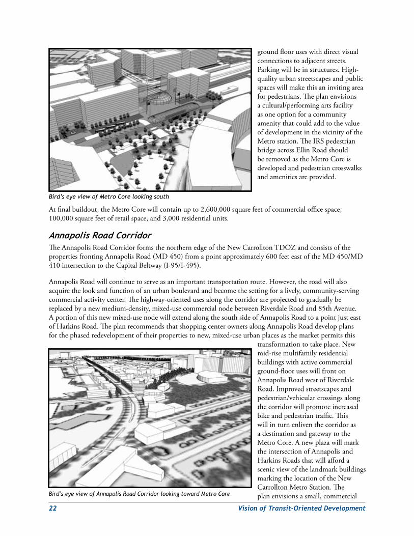
TheMetroCorewillserveasaregional“downtown”locationforthecounty,withthemostactiveandintensivelydevelopedmixofusesintheNewCarrolltonTDOZ.Itwillcontainthemostdiversedevelopmentmixandtallestbuildings—mid-tohigh-riseresidentialunits,officespace,publicparking,retail,andanewcentralsquare.Asthecounty’smostaccessibleintermodaltransportationhubandcentralactivityareafortheNewCarrolltonTDOZ,theMetroCorewillcontinuetohavethehighestlevelsofpedestrianactivityandtransitservice.
TheMetroCorewillbeanchoredbyarenovatedorreconstructedNewCarrolltonMetroStationwithmultipleescalatorsandabrightly-litpedestrianconcourselinedwithtraveler-servingretailshops.A
VisionofTransit-OrientedDevelopment 21
landscapedplazawillmarktheintersectionofHarkinsandEllinRoads.TheplazaandstreetscapewillbedesignedtoaccommodateafuturePurpleLinelightrailtransitstationlocatedatgradeonthesouthsideofEllinRoadneartheMetrostation’snorthentrance.Anoval-shapedplazawillmarkthesouthentrancetothestation.AllrecommendedstreetcrosssectionsaresubjecttoapprovalormodificationbyDPW&Tand/orWMATA.
ConsistentwithitsroleasthecoreoftheTDOZarea,theMetroCorewillfeatureacombinationofhighintensity,mixed-useretailandresidentialdevelopment.Thenewdevelopmentwillcomplementtheexistingofficeandcommercialusesandhelpmaketheareaan18-hour-a-dayactivitycenter.BuildingsintheMetroCorewillbefourto22storiesinheight.Mixed-usecommercialandresidentialbuildingswillhaveactive
Map 7. New Carrollton TDOZ Neighborhoods
22 VisionofTransit-OrientedDevelopment
groundflooruseswithdirectvisualconnectionstoadjacentstreets.Parkingwillbeinstructures.High-qualityurbanstreetscapesandpublicspaceswillmakethisaninvitingareaforpedestrians.Theplanenvisionsacultural/performingartsfacilityasoneoptionforacommunityamenitythatcouldaddtothevalueofdevelopmentinthevicinityoftheMetrostation.TheIRSpedestrianbridgeacrossEllinRoadshouldberemovedastheMetroCoreisdevelopedandpedestriancrosswalksandamenitiesareprovided.
Atfinalbuildout,theMetroCorewillcontainupto2,600,000squarefeetofcommercialofficespace,100,000squarefeetofretailspace,and3,000residentialunits.
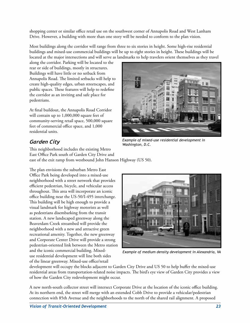
AnnapolisRoadCorridorTheAnnapolisRoadCorridorformsthenorthernedgeoftheNewCarrolltonTDOZandconsistsofthepropertiesfrontingAnnapolisRoad(MD450)fromapointapproximately600feeteastoftheMD450/MD410intersectiontotheCapitalBeltway(I-95/I-495).
AnnapolisRoadwillcontinuetoserveasanimportanttransportationroute.However,theroadwillalsoacquirethelookandfunctionofanurbanboulevardandbecomethesettingforalively,community-servingcommercialactivitycenter.Thehighway-orientedusesalongthecorridorareprojectedtograduallybereplacedbyanewmedium-density,mixed-usecommercialnodebetweenRiverdaleRoadand85thAvenue.Aportionofthisnewmixed-usenodewillextendalongthesouthsideofAnnapolisRoadtoapointjusteastofHarkinsRoad.TheplanrecommendsthatshoppingcenterownersalongAnnapolisRoaddevelopplansforthephasedredevelopmentoftheirpropertiestonew,mixed-useurbanplacesasthemarketpermitsthis
transformationtotakeplace.Newmid-risemultifamilyresidentialbuildingswithactivecommercialground-flooruseswillfrontonAnnapolisRoadwestofRiverdaleRoad.Improvedstreetscapesandpedestrian/vehicularcrossingsalongthecorridorwillpromoteincreasedbikeandpedestriantraffic.ThiswillinturnenliventhecorridorasadestinationandgatewaytotheMetroCore.AnewplazawillmarktheintersectionofAnnapolisandHarkinsRoadsthatwillaffordascenicviewofthelandmarkbuildingsmarkingthelocationoftheNewCarrolltonMetroStation.Theplanenvisionsasmall,commercialBird’s eye view of Annapolis Road Corridor looking toward Metro Core
Bird’s eye view of Metro Core looking south
VisionofTransit-OrientedDevelopment 23
shoppingcenterorsimilarofficeretailuseonthesouthwestcornerofAnnapolisRoadandWestLanhamDrive.However,abuildingwithmorethanonestorywillbeneededtoconformtotheplanvision.
Mostbuildingsalongthecorridorwillrangefromthreetosixstoriesinheight.Somehigh-riseresidentialbuildingsandmixed-usecommercialbuildingswillbeuptoeightstoriesinheight.Thesebuildingswillbelocatedatthemajorintersectionsandwillserveaslandmarkstohelptravelersorientthemselvesastheytravelalongthecorridor.Parkingwillbelocatedtotherearorsideofbuildings,mostlyinstructures.BuildingswillhavelittleornosetbackfromAnnapolisRoad.Thelimitedsetbackswillhelptocreatehigh-qualityedges,urbanstreetscapes,andpublicspaces.Thesefeatureswillhelptoredefinethecorridorasaninvitingandsafeplaceforpedestrians.
Atfinalbuildout,theAnnapolisRoadCorridorwillcontainupto1,000,000squarefeetofcommunity-servingretailspace,500,000squarefeetofcommercialofficespace,and1,000residentialunits.
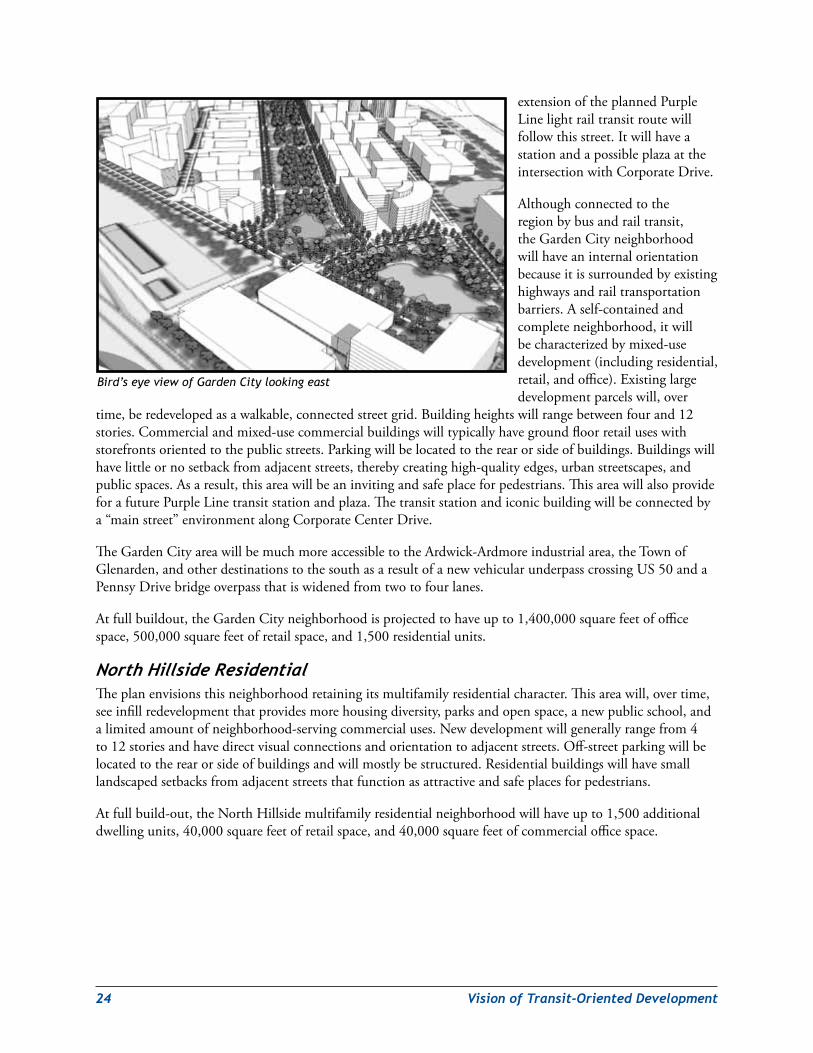
GardenCityThisneighborhoodincludestheexistingMetroEastOfficeParksouthofGardenCityDriveandeastoftheexitrampfromwestboundJohnHansonHighway(US50).
TheplanenvisionsthesuburbanMetroEastOfficeParkbeingdevelopedintoamixed-useneighborhoodwithastreetnetworkthatprovidesefficientpedestrian,bicycle,andvehicularaccessthroughout.ThisareawillincorporateaniconicofficebuildingneartheUS-50/I-495interchange.Thisbuildingwillbehighenoughtoprovideavisuallandmarkforhighwaymotoristsaswellaspedestriansdisembarkingfromthetransitstation.AnewlandscapedgreenwayalongtheBeaverdamCreekstreambedwillprovidetheneighborhoodwithanewandattractivegreenrecreationalamenity.Together,thenewgreenwayandCorporateCenterDrivewillprovideastrongpedestrian-orientedlinkbetweentheMetrostationandtheiconiccommercialbuilding.Mixed-useresidentialdevelopmentwilllinebothsidesofthelineargreenway.Mixed-useoffice/retaildevelopmentwilloccupytheblocksadjacenttoGardenCityDriveandUS50tohelpbufferthemixed-useresidentialareasfromtransportation-relatednoiseimpacts.Thebird’seyeviewofGardenCityprovidesaviewofhowtheGardenCityredevelopmentmightoccur.
Anewnorth-southcollectorstreetwillintersectCorporateDriveatthelocationoftheiconicofficebuilding.Atitsnorthernend,thestreetwillmergewithanextendedCobbDrivetoprovideavehicular/pedestrianconnectionwith85thAvenueandtheneighborhoodstothenorthofthesharedrailalignment.Aproposed
Example of mixed-use residential development in Washington, D.C.
Example of medium density development in Alexandria, VA
24 VisionofTransit-OrientedDevelopment
extensionoftheplannedPurpleLinelightrailtransitroutewillfollowthisstreet.ItwillhaveastationandapossibleplazaattheintersectionwithCorporateDrive.
Althoughconnectedtotheregionbybusandrailtransit,theGardenCityneighborhoodwillhaveaninternalorientationbecauseitissurroundedbyexistinghighwaysandrailtransportationbarriers.Aself-containedandcompleteneighborhood,itwillbecharacterizedbymixed-usedevelopment(includingresidential,retail,andoffice).Existinglargedevelopmentparcelswill,over
time,beredevelopedasawalkable,connectedstreetgrid.Buildingheightswillrangebetweenfourand12stories.Commercialandmixed-usecommercialbuildingswilltypicallyhavegroundfloorretailuseswithstorefrontsorientedtothepublicstreets.Parkingwillbelocatedtotherearorsideofbuildings.Buildingswillhavelittleornosetbackfromadjacentstreets,therebycreatinghigh-qualityedges,urbanstreetscapes,andpublicspaces.Asaresult,thisareawillbeaninvitingandsafeplaceforpedestrians.ThisareawillalsoprovideforafuturePurpleLinetransitstationandplaza.Thetransitstationandiconicbuildingwillbeconnectedbya“mainstreet”environmentalongCorporateCenterDrive.
TheGardenCityareawillbemuchmoreaccessibletotheArdwick-Ardmoreindustrialarea,theTownofGlenarden,andotherdestinationstothesouthasaresultofanewvehicularunderpasscrossingUS50andaPennsyDrivebridgeoverpassthatiswidenedfromtwotofourlanes.
Atfullbuildout,theGardenCityneighborhoodisprojectedtohaveupto1,400,000squarefeetofofficespace,500,000squarefeetofretailspace,and1,500residentialunits.
NorthHillsideResidentialTheplanenvisionsthisneighborhoodretainingitsmultifamilyresidentialcharacter.Thisareawill,overtime,seeinfillredevelopmentthatprovidesmorehousingdiversity,parksandopenspace,anewpublicschool,andalimitedamountofneighborhood-servingcommercialuses.Newdevelopmentwillgenerallyrangefrom4to12storiesandhavedirectvisualconnectionsandorientationtoadjacentstreets.Off-streetparkingwillbelocatedtotherearorsideofbuildingsandwillmostlybestructured.Residentialbuildingswillhavesmalllandscapedsetbacksfromadjacentstreetsthatfunctionasattractiveandsafeplacesforpedestrians.
Atfullbuild-out,theNorthHillsidemultifamilyresidentialneighborhoodwillhaveupto1,500additionaldwellingunits,40,000squarefeetofretailspace,and40,000squarefeetofcommercialofficespace.
Bird’s eye view of Garden City looking east
VisionofTransit-OrientedDevelopment 25
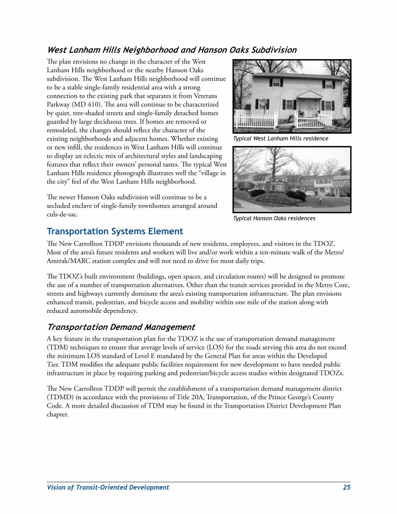
WestLanhamHillsNeighborhoodandHansonOaksSubdivisionTheplanenvisionsnochangeinthecharacteroftheWestLanhamHillsneighborhoodorthenearbyHansonOakssubdivision.TheWestLanhamHillsneighborhoodwillcontinuetobeastablesingle-familyresidentialareawithastrongconnectiontotheexistingparkthatseparatesitfromVeteransParkway(MD410).Theareawillcontinuetobecharacterizedbyquiet,tree-shadedstreetsandsingle-familydetachedhomesguardedbylargedeciduoustrees.Ifhomesareremovedorremodeled,thechangesshouldreflectthecharacteroftheexistingneighborhoodsandadjacenthomes.Whetherexistingornewinfill,theresidencesinWestLanhamHillswillcontinuetodisplayaneclecticmixofarchitecturalstylesandlandscapingfeaturesthatreflecttheirowners’personaltastes.ThetypicalWestLanhamHillsresidencephotographillustrateswellthe“villageinthecity”feeloftheWestLanhamHillsneighborhood.
ThenewerHansonOakssubdivisionwillcontinuetobeasecludedenclaveofsingle-familytownhomesarrangedaroundculs-de-sac.
Transportation systems elementTheNewCarrolltonTDDPenvisionsthousandsofnewresidents,employees,andvisitorsintheTDOZ.Mostofthearea’sfutureresidentsandworkerswillliveand/orworkwithinaten-minutewalkoftheMetro/Amtrak/MARCstationcomplexandwillnotneedtodriveformostdailytrips.
TheTDOZ’sbuiltenvironment(buildings,openspaces,andcirculationroutes)willbedesignedtopromotetheuseofanumberoftransportationalternatives.OtherthanthetransitservicesprovidedintheMetroCore,streetsandhighwayscurrentlydominatethearea’sexistingtransportationinfrastructure.Theplanenvisionsenhancedtransit,pedestrian,andbicycleaccessandmobilitywithinonemileofthestationalongwithreducedautomobiledependency.
TransportationDemandManagementAkeyfeatureinthetransportationplanfortheTDOZistheuseoftransportationdemandmanagement(TDM)techniquestoensurethataveragelevelsofservice(LOS)fortheroadsservingthisareadonotexceedtheminimumLOSstandardofLevelEmandatedbytheGeneralPlanforareaswithintheDevelopedTier.TDMmodifiestheadequatepublicfacilitiesrequirementfornewdevelopmenttohaveneededpublicinfrastructureinplacebyrequiringparkingandpedestrian/bicycleaccessstudieswithindesignatedTDOZs.
TheNewCarrolltonTDDPwillpermittheestablishmentofatransportationdemandmanagementdistrict(TDMD)inaccordancewiththeprovisionsofTitle20A,Transportation,ofthePrinceGeorge’sCountyCode.AmoredetaileddiscussionofTDMmaybefoundintheTransportationDistrictDevelopmentPlanchapter.
Typical West Lanham Hills residence
Typical Hanson Oaks residences
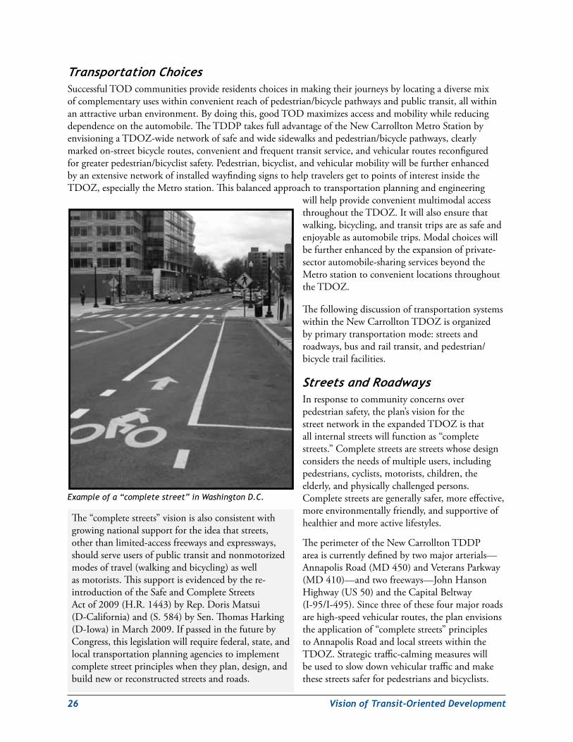
26 VisionofTransit-OrientedDevelopment
TransportationChoicesSuccessfulTODcommunitiesprovideresidentschoicesinmakingtheirjourneysbylocatingadiversemixofcomplementaryuseswithinconvenientreachofpedestrian/bicyclepathwaysandpublictransit,allwithinanattractiveurbanenvironment.Bydoingthis,goodTODmaximizesaccessandmobilitywhilereducingdependenceontheautomobile.TheTDDPtakesfulladvantageoftheNewCarrolltonMetroStationbyenvisioningaTDOZ-widenetworkofsafeandwidesidewalksandpedestrian/bicyclepathways,clearlymarkedon-streetbicycleroutes,convenientandfrequenttransitservice,andvehicularroutesreconfiguredforgreaterpedestrian/bicyclistsafety.Pedestrian,bicyclist,andvehicularmobilitywillbefurtherenhancedbyanextensivenetworkofinstalledwayfindingsignstohelptravelersgettopointsofinterestinsidetheTDOZ,especiallytheMetrostation.Thisbalancedapproachtotransportationplanningandengineering
willhelpprovideconvenientmultimodalaccessthroughouttheTDOZ.Itwillalsoensurethatwalking,bicycling,andtransittripsareassafeandenjoyableasautomobiletrips.Modalchoiceswillbefurtherenhancedbytheexpansionofprivate-sectorautomobile-sharingservicesbeyondtheMetrostationtoconvenientlocationsthroughouttheTDOZ.
ThefollowingdiscussionoftransportationsystemswithintheNewCarrolltonTDOZisorganizedbyprimarytransportationmode:streetsandroadways,busandrailtransit,andpedestrian/bicycletrailfacilities.
StreetsandRoadwaysInresponsetocommunityconcernsoverpedestriansafety,theplan’svisionforthestreetnetworkintheexpandedTDOZisthatallinternalstreetswillfunctionas“completestreets.”Completestreetsarestreetswhosedesignconsiderstheneedsofmultipleusers,includingpedestrians,cyclists,motorists,children,theelderly,andphysicallychallengedpersons.Completestreetsaregenerallysafer,moreeffective,moreenvironmentallyfriendly,andsupportiveofhealthierandmoreactivelifestyles.
TheperimeteroftheNewCarrolltonTDDPareaiscurrentlydefinedbytwomajorarterials—AnnapolisRoad(MD450)andVeteransParkway(MD410)—andtwofreeways—JohnHansonHighway(US50)andtheCapitalBeltway(I-95/I-495).Sincethreeofthesefourmajorroadsarehigh-speedvehicularroutes,theplanenvisionstheapplicationof“completestreets”principlestoAnnapolisRoadandlocalstreetswithintheTDOZ.Strategictraffic-calmingmeasureswillbeusedtoslowdownvehiculartrafficandmakethesestreetssaferforpedestriansandbicyclists.
The“completestreets”visionisalsoconsistentwithgrowingnationalsupportfortheideathatstreets,otherthanlimited-accessfreewaysandexpressways,shouldserveusersofpublictransitandnonmotorizedmodesoftravel(walkingandbicycling)aswellasmotorists.Thissupportisevidencedbythere-introductionoftheSafeandCompleteStreetsActof2009(H.R.1443)byRep.DorisMatsui(D-California)and(S.584)bySen.ThomasHarking(D-Iowa)inMarch2009.IfpassedinthefuturebyCongress,thislegislationwillrequirefederal,state,andlocaltransportationplanningagenciestoimplementcompletestreetprincipleswhentheyplan,design,andbuildneworreconstructedstreetsandroads.
Example of a “complete street” in Washington D.C.
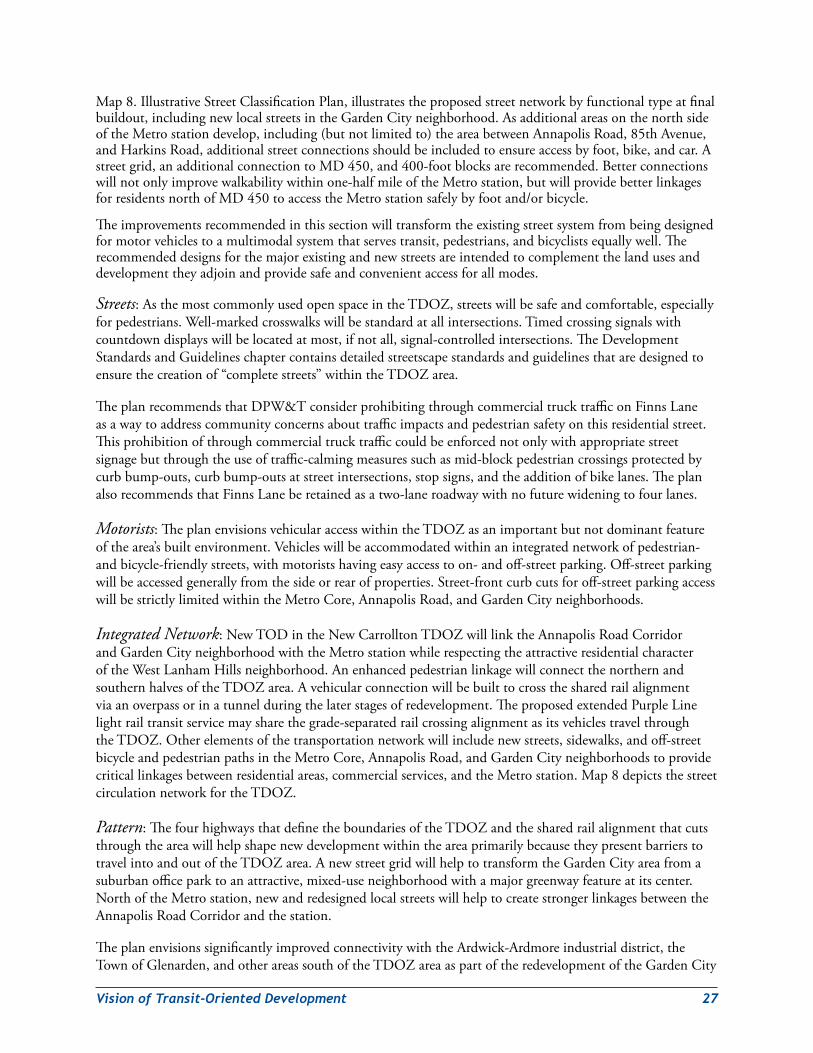
VisionofTransit-OrientedDevelopment 27
Map8.IllustrativeStreetClassificationPlan,illustratestheproposedstreetnetworkbyfunctionaltypeatfinalbuildout,includingnewlocalstreetsintheGardenCityneighborhood.AsadditionalareasonthenorthsideoftheMetrostationdevelop,including(butnotlimitedto)theareabetweenAnnapolisRoad,85thAvenue,andHarkinsRoad,additionalstreetconnectionsshouldbeincludedtoensureaccessbyfoot,bike,andcar.Astreetgrid,anadditionalconnectiontoMD450,and400-footblocksarerecommended.Betterconnectionswillnotonlyimprovewalkabilitywithinone-halfmileoftheMetrostation,butwillprovidebetterlinkagesforresidentsnorthofMD 450toaccesstheMetrostationsafelybyfootand/orbicycle.
Theimprovementsrecommendedinthissectionwilltransformtheexistingstreetsystemfrombeingdesignedformotorvehiclestoamultimodalsystemthatservestransit,pedestrians,andbicyclistsequallywell.Therecommendeddesignsforthemajorexistingandnewstreetsareintendedtocomplementthelandusesanddevelopmenttheyadjoinandprovidesafeandconvenientaccessforallmodes.
Streets:AsthemostcommonlyusedopenspaceintheTDOZ,streetswillbesafeandcomfortable,especiallyforpedestrians.Well-markedcrosswalkswillbestandardatallintersections.Timedcrossingsignalswithcountdowndisplayswillbelocatedatmost,ifnotall,signal-controlledintersections.TheDevelopmentStandardsandGuidelineschaptercontainsdetailedstreetscapestandardsandguidelinesthataredesignedtoensurethecreationof“completestreets”withintheTDOZarea.
TheplanrecommendsthatDPW&TconsiderprohibitingthroughcommercialtrucktrafficonFinnsLaneasawaytoaddresscommunityconcernsabouttrafficimpactsandpedestriansafetyonthisresidentialstreet.Thisprohibitionofthroughcommercialtrucktrafficcouldbeenforcednotonlywithappropriatestreetsignagebutthroughtheuseoftraffic-calmingmeasuressuchasmid-blockpedestriancrossingsprotectedbycurbbump-outs,curbbump-outsatstreetintersections,stopsigns,andtheadditionofbikelanes.TheplanalsorecommendsthatFinnsLaneberetainedasatwo-laneroadwaywithnofuturewideningtofourlanes.
Motorists:TheplanenvisionsvehicularaccesswithintheTDOZasanimportantbutnotdominantfeatureofthearea’sbuiltenvironment.Vehicleswillbeaccommodatedwithinanintegratednetworkofpedestrian-andbicycle-friendlystreets,withmotoristshavingeasyaccesstoon-andoff-streetparking.Off-streetparkingwillbeaccessedgenerallyfromthesideorrearofproperties.Street-frontcurbcutsforoff-streetparkingaccesswillbestrictlylimitedwithintheMetroCore,AnnapolisRoad,andGardenCityneighborhoods.
Integrated Network:NewTODintheNewCarrolltonTDOZwilllinktheAnnapolisRoadCorridorandGardenCityneighborhoodwiththeMetrostationwhilerespectingtheattractiveresidentialcharacteroftheWestLanhamHillsneighborhood.AnenhancedpedestrianlinkagewillconnectthenorthernandsouthernhalvesoftheTDOZarea.Avehicularconnectionwillbebuilttocrossthesharedrailalignmentviaanoverpassorinatunnelduringthelaterstagesofredevelopment.TheproposedextendedPurpleLinelightrailtransitservicemaysharethegrade-separatedrailcrossingalignmentasitsvehiclestravelthroughtheTDOZ.Otherelementsofthetransportationnetworkwillincludenewstreets,sidewalks,andoff-streetbicycleandpedestrianpathsintheMetroCore,AnnapolisRoad,andGardenCityneighborhoodstoprovidecriticallinkagesbetweenresidentialareas,commercialservices,andtheMetrostation.Map8depictsthestreetcirculationnetworkfortheTDOZ.
Pattern:ThefourhighwaysthatdefinetheboundariesoftheTDOZandthesharedrailalignmentthatcutsthroughtheareawillhelpshapenewdevelopmentwithintheareaprimarilybecausetheypresentbarrierstotravelintoandoutoftheTDOZarea.AnewstreetgridwillhelptotransformtheGardenCityareafromasuburbanofficeparktoanattractive,mixed-useneighborhoodwithamajorgreenwayfeatureatitscenter.NorthoftheMetrostation,newandredesignedlocalstreetswillhelptocreatestrongerlinkagesbetweentheAnnapolisRoadCorridorandthestation.
TheplanenvisionssignificantlyimprovedconnectivitywiththeArdwick-Ardmoreindustrialdistrict,theTownofGlenarden,andotherareassouthoftheTDOZareaaspartoftheredevelopmentoftheGardenCity
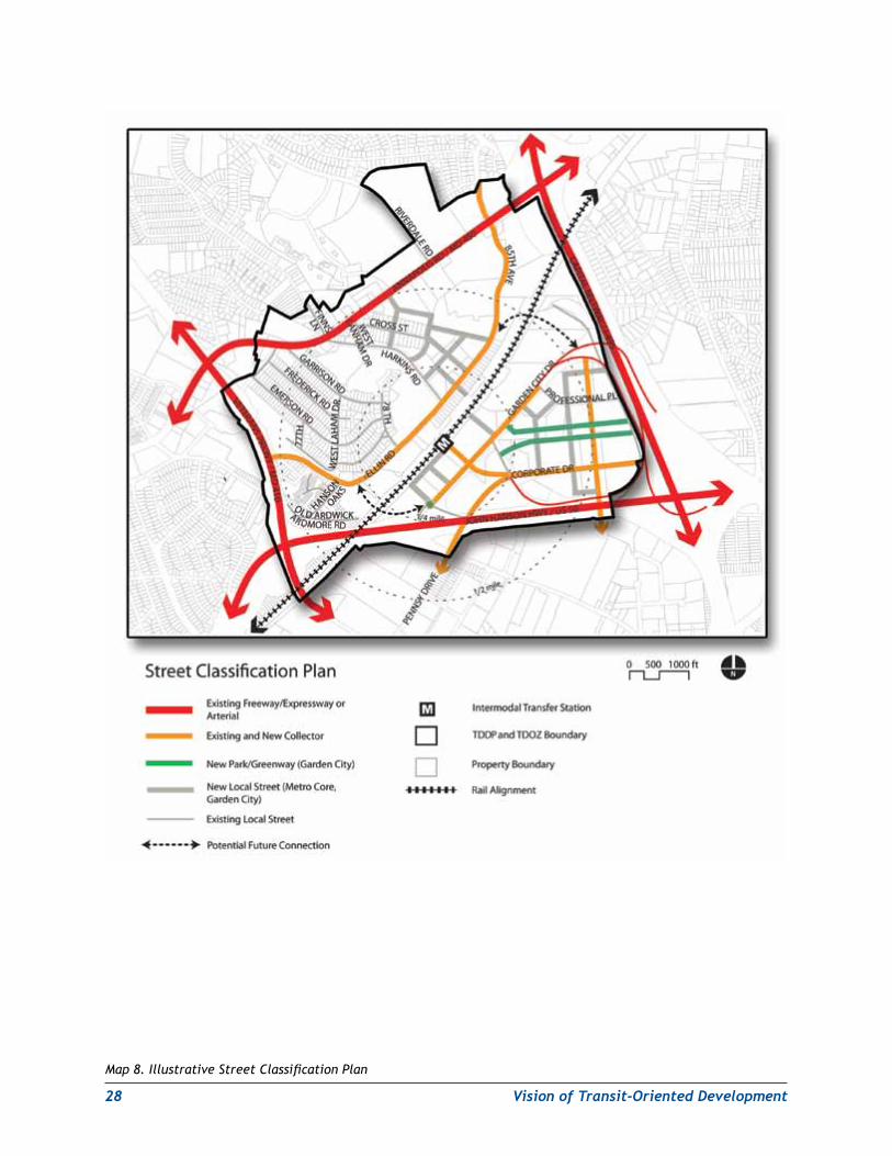
28 VisionofTransit-OrientedDevelopment
Map 8. Illustrative Street Classification Plan
VisionofTransit-OrientedDevelopment 29
businessdistrict.TheenhancedconnectivitywillbeaccomplishedpartlythroughtheconstructionofatleastonenewvehicularunderpasscrossingUS50.ThenewvehicularcrossingmightalsocarryanextendedPurpleLineunderUS50.APennsyDrive/US50overpassbridgewidenedfromitscurrentinadequatetwolanestofourlaneswillalsocontributetotheTDOZ’senhancedaccessibilitytoareassouthofUS50.
Functional Hierarchy:Theplanenvisionsprimaryconnectionstothesurroundingregionthatwillfeatureextensivelandscapinganddistinctivestreetscapes.TheseelementswillhelpidentifytheTDOZasauniqueurbanplace.Secondaryroutesthatlinkneighborhoodsandconnecttocommunitydestinationswillformtheinternalspineofthecommunity.Internalstreetsforlocalaccesswillbedesignedtoimposeslowervehiclespeedsandfunctionasplacesofshareduse.Table 1relatestheterminologyusedinthisplantodefinestreettypestothefunctionalstreetclassificationterminologycurrentlyusedbyPrinceGeorge’sCounty.
Parking:TheplanenvisionsparkingfacilitiesthatcomplementthepedestrianenvironmentintheTDOZ.Thisstandardwillapplytobothon-andoff-streetparking.(ParkingforWMATA’spatronsisdiscussedinthefollowingsectiononbusandrailtransit.)Properlysitedon-streetparkingwillserveasapedestriansafetybufferalongAnnapolisRoad,HarkinsRoad,EllinRoad,85thAvenue,andGardenCityDrive.On-streetparkingonAnnapolisRoadwillberestrictedtooff-peakhours.Off-streetparkingfacilities,whethersurfacelotsorstructuredparking,willbeaccessiblewithoutbeingunattractiveorunsafeforpedestriansandwillbedesignedtocomplementthesurroundingbuiltenvironmentoftheTDOZ(seeMap9.IllustrativeTDOZParkingPlan).Theplanenvisionspreferentialparkingforcar-sharingvehiclesinpublicparkinggaragesandatselectedon-streetlocationsthroughouttheTDOZareasubjecttotheapprovalofDPW&Tand/orSHA.
Theplanenvisionstheuseofadvancedparkingmanagementmeasures,includingsharedparkingarrangementsandelectronicparkingmanagementsystems,forstructuredparkingfacilitieslocatedwithintheNewCarrolltonTDOZaspartofanoverallstrategyforTDMintheareabasedontechnicalandeconomicfeasibility(seedetaileddiscussionofTDMintheTransitDistrictDevelopmentPlanchapter).Sharedparkingarrangementsforattacheduseswithstaggeredhoursofoperationcouldhelptoleveloutpeakperiodsofparkingdemand.Anexampleofthiswouldbeparkingsharedbetweenamedicalofficecomplexandacinemaorotherentertainmentcomplex.Anothermoretechnologicallyadvancedtool,intelligentelectronicparkingmanagementsystems,wouldincludesensorstoguidemotoriststoavailableparkingspacesandinteractiveentrancesignsthatdisplaythenumberofavailablespaceswithinafacility.ThesesystemswouldbesimilartotheelectronicparkingmanagementsystemusedintheparkinggaragesatBaltimore-WashingtonInternationalThurgoodMarshallAirport.Theywouldhelpreducetheenergywasteandairpollutiongeneratedbymotoristscruisingstreetsandparkingfacilitiesinsearchofavailableparkingspaces.
Temporarysurfacereplacementparkingforexistingbuildingsmaybeallowedonundevelopedland.TDDPparkingstandardsforlandscaping,lighting,andstormwatermaybemodifiedatthetimeofDSPtoaddressthetemporarynatureoftheparking.Suchparkingshallnotexceed30monthsofusefromthedateofitscompletion.
BusandRailTransitTransit:TheNewCarrolltonMetroStationisamajorcommunityamenitywithintheTDOZ.However,thecurrentlayoutofthestationfacilityisthatofanauto-orientedsuburbantransithubwithlargesurfaceparking,kiss-and-ride,andbusturnaroundareasonbothsidesofthestationandtwoparkinggaragesonthestation’ssouthside.Itattractsmuchmorevehiculartrafficthanfoot/bicycletraffic.Theplanenvisionsatransformedurbantransitfacilitywithconvenientmultimodalconnectionsandattractive,pedestrian-friendlytransitplazasframingitsnorthandsouthentrances.Overtime,theexistingsurfaceMetrostationparkingwillbereconfiguredasstructuredparkingandincorporatedintohigh-risemixed-useTOD.ThebusturnaroundareaswillbereconfiguredtobetteraccommodatethefuturePurpleLinestationandnewpedestrian/transitplazas.DedicatedstructuredparkingforWMATA’spark-and-ridepatronswillreplace
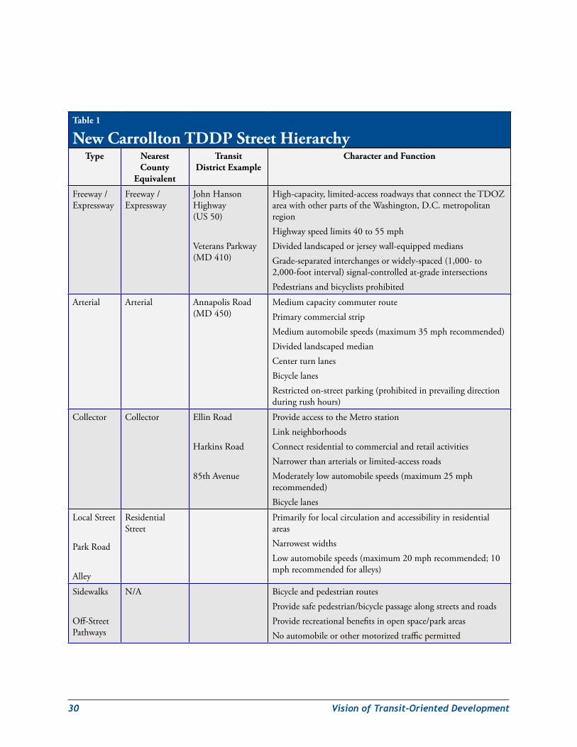
30 VisionofTransit-OrientedDevelopment
Table 1
New Carrollton TDDP Street HierarchyType Nearest
County Equivalent
Transit District Example
Character and Function
Freeway/Expressway
Freeway/Expressway
JohnHansonHighway(US50)
VeteransParkway(MD410)
High-capacity,limited-accessroadwaysthatconnecttheTDOZareawithotherpartsoftheWashington,D.C.metropolitanregionHighwayspeedlimits40to55mphDividedlandscapedorjerseywall-equippedmediansGrade-separatedinterchangesorwidely-spaced(1,000-to2,000-footinterval)signal-controlledat-gradeintersectionsPedestriansandbicyclistsprohibited
Arterial Arterial AnnapolisRoad(MD450)
MediumcapacitycommuterroutePrimarycommercialstripMediumautomobilespeeds(maximum35mphrecommended)DividedlandscapedmedianCenterturnlanesBicyclelanesRestrictedon-streetparking(prohibitedinprevailingdirectionduringrushhours)
Collector Collector EllinRoad
HarkinsRoad
85thAvenue
ProvideaccesstotheMetrostationLinkneighborhoodsConnectresidentialtocommercialandretailactivitiesNarrowerthanarterialsorlimited-accessroadsModeratelylowautomobilespeeds(maximum25mphrecommended)Bicyclelanes
LocalStreet
ParkRoad
Alley
ResidentialStreet
PrimarilyforlocalcirculationandaccessibilityinresidentialareasNarrowestwidthsLowautomobilespeeds(maximum20mphrecommended;10mphrecommendedforalleys)
Sidewalks
Off-StreetPathways
N/A BicycleandpedestrianroutesProvidesafepedestrian/bicyclepassagealongstreetsandroadsProviderecreationalbenefitsinopenspace/parkareasNoautomobileorothermotorizedtrafficpermitted
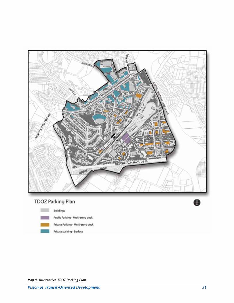
VisionofTransit-OrientedDevelopment 31
Map 9. Illustrative TDOZ Parking Plan
32 VisionofTransit-OrientedDevelopment
thesurfaceparkingontheMetrostation’snorthside.(WMATAopenedanewparkinggaragein2005asdedicatedreplacementparkingforthesurfaceparkingareaonthestation’ssouthside.)Theparkingwillbevisuallyintegratedwithsurroundingbuildingsthroughtheuseofground-floororfull-heightlinerretail/officeusesonthesidesfacingthetransitplazaandstreet.Theplanrecommendsconsiderationoftheoptiontoconvertsomeoftheseparkingspacestosharedparkingastheareaisdevelopedinaccordancewiththeplanvision.SuchsharedparkingwillhelptoreducethetotalamountofparkingneededtoservetheMetrostationandthesurroundingdevelopmentactivity.Theplanenvisionspreferentialparkingforcar-sharingvehicleswithinWMATA-ownedparkingfacilitiessubjecttoWMATAapproval.Thereplacement/conversionofexistingWMATAsurfaceparkingspacesandthedesignandconstructionofnewpublicparkingspaceswillneedtobenegotiatedandcoordinatedbetweentheappropriatepublicworksandtransitagencies(DPW&T,theMarylandDepartmentofTransportation(MDOT),andWMATA)andthedevelopersoffuturemixedandcommercialuses.
TheStateofMarylandselecteditslocallypreferredalternative(LPA)inAugust2009fortheplannedPurpleLinetransitservicebetweenNewCarrolltonandBethesda,Maryland.TheLPAwillbelightrailservice,andthestate’salignmentwillfollowVeteransParkway(MD410)andEllinRoadtoitsinterimterminusattheNewCarrolltonMetroStation.AfuturePurpleLinetransitstationstopwillbeattheintersectionofAnnapolisRoad(MD450)andVeteransParkway(MD410).The2009Approved Countywide Master Plan of TransportationenvisionsafutureextensionofthePurpleLinetoareassouthoftheNewCarrolltonMetroStation,includingLandoverGateway,Largo,Westphalia,andNationalHarbor.TheNewCarrolltonplanrecommendsclosecoordinationbetweenDPW&T,MDOT,andWMATAandthesurroundingcommunityneighborhoodsofHansonOaksandWestLanhamHillstomitigatepotentialenvironmentalimpactsfromtheplannedPurpleLine.AnewtrafficlightwillbeplacedatHansonOaksDriveandEllinRoadandsoundbarriersonUS50nearVeteransParkwaywillbeaddedtoaddresscommunityconcerns.IngressandegressalternativesshouldbeexploredfortheHansonOaksandArdwick-Ardmoreneighborhoods.
TheplanalsoenvisionsbusstopsalongAnnapolisRoad,HarkinsRoad,EllinRoad,85thAvenue,andGardenCityDrivebeingupgradedwithattractivelightedshelters,postedroutemapsandschedules,andvariablemessagesignsthattellwaitingpassengerswhenthenextbuswillarriveandwhatrouteitserves.NewbusservicemaybeaddedalongCorporateDriveandoneormoreofthenewgridstreetsintheGardenCityneighborhood.
Connectivity:AccesstotheentireMetrobusandrailsystem,theAmtrakintercity/regionalrailsystem,andtheMARCcommuterrailsystemisavailablefromtheTDOZ.OnlyoneotherMetrostationintheentireregionalMetrorailsystemhavecomparablelevelsofintermodaltransportationaccess.ThePurpleLinewill,whencompleted,providedirectservicetoMontgomeryCountyandpointssouthofNewCarrollton,includingLandover,LargoTownCenterMetro,andNationalHarbor.Giventheplan’srecommendationforatleastonevehicularcrossingofthesharedrailalignment,asingletunneloroverheadcrossingthatcarriesboththePurpleLineandothervehiculartrafficmightbeacost-effectiveoption.WMATAisconductingaseriesofdetailedaccessstudiesforMetrostationsinPrinceGeorge’sCounty.TheplanrecommendsthatWMATAincorporateconsiderationofthisissueinitsplanningforfutureaccessneedsattheNewCarrolltonMetroStation.MorespecificrecommendationsforoneormorevehicularcrossingsarepresentedaspartofthepublicfacilitiesimplementationstrategyintheTransitDistrictDevelopmentPlanchapter.
Map10.IllustrativeTDOZTransitPlan,depictstheplannedtransitnetworkthatwillservetheTDOZ.
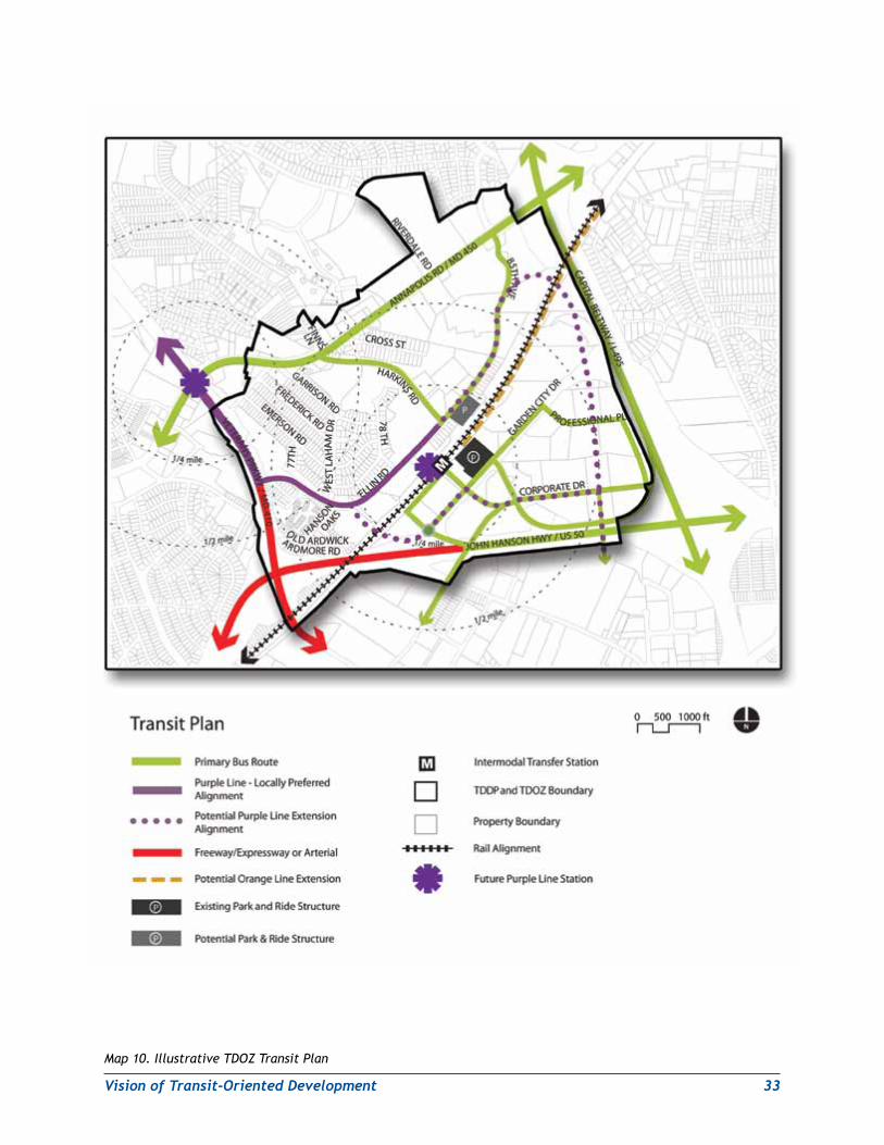
VisionofTransit-OrientedDevelopment 33
Map 10. Illustrative TDOZ Transit Plan
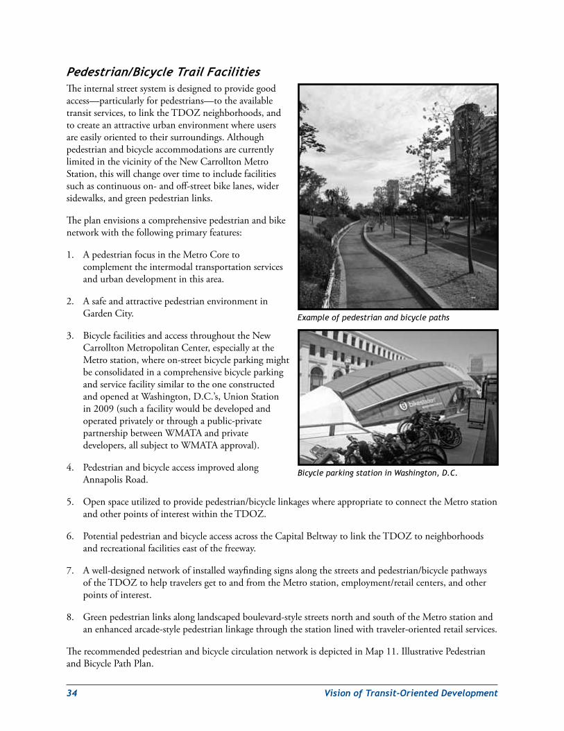
34 VisionofTransit-OrientedDevelopment
Pedestrian/BicycleTrailFacilitiesTheinternalstreetsystemisdesignedtoprovidegoodaccess—particularlyforpedestrians—totheavailabletransitservices,tolinktheTDOZneighborhoods,andtocreateanattractiveurbanenvironmentwhereusersareeasilyorientedtotheirsurroundings.AlthoughpedestrianandbicycleaccommodationsarecurrentlylimitedinthevicinityoftheNewCarrolltonMetroStation,thiswillchangeovertimetoincludefacilitiessuchascontinuouson-andoff-streetbikelanes,widersidewalks,andgreenpedestrianlinks.
Theplanenvisionsacomprehensivepedestrianandbikenetworkwiththefollowingprimaryfeatures:
1. ApedestrianfocusintheMetroCoretocomplementtheintermodaltransportationservicesandurbandevelopmentinthisarea.
2. AsafeandattractivepedestrianenvironmentinGardenCity.
3. BicyclefacilitiesandaccessthroughouttheNewCarrolltonMetropolitanCenter,especiallyattheMetrostation,whereon-streetbicycleparkingmightbeconsolidatedinacomprehensivebicycleparkingandservicefacilitysimilartotheoneconstructedandopenedatWashington,D.C.’s,UnionStationin2009(suchafacilitywouldbedevelopedandoperatedprivatelyorthroughapublic-privatepartnershipbetweenWMATAandprivatedevelopers,allsubjecttoWMATAapproval).
4. PedestrianandbicycleaccessimprovedalongAnnapolisRoad.
5. Openspaceutilizedtoprovidepedestrian/bicyclelinkageswhereappropriatetoconnecttheMetrostationandotherpointsofinterestwithintheTDOZ.
6. PotentialpedestrianandbicycleaccessacrosstheCapitalBeltwaytolinktheTDOZtoneighborhoodsandrecreationalfacilitieseastofthefreeway.
7. Awell-designednetworkofinstalledwayfindingsignsalongthestreetsandpedestrian/bicyclepathwaysoftheTDOZtohelptravelersgettoandfromtheMetrostation,employment/retailcenters,andotherpointsofinterest.
8. Greenpedestrianlinksalonglandscapedboulevard-stylestreetsnorthandsouthoftheMetrostationandanenhancedarcade-stylepedestrianlinkagethroughthestationlinedwithtraveler-orientedretailservices.
TherecommendedpedestrianandbicyclecirculationnetworkisdepictedinMap11.IllustrativePedestrianandBicyclePathPlan.
Example of pedestrian and bicycle paths
Bicycle parking station in Washington, D.C.
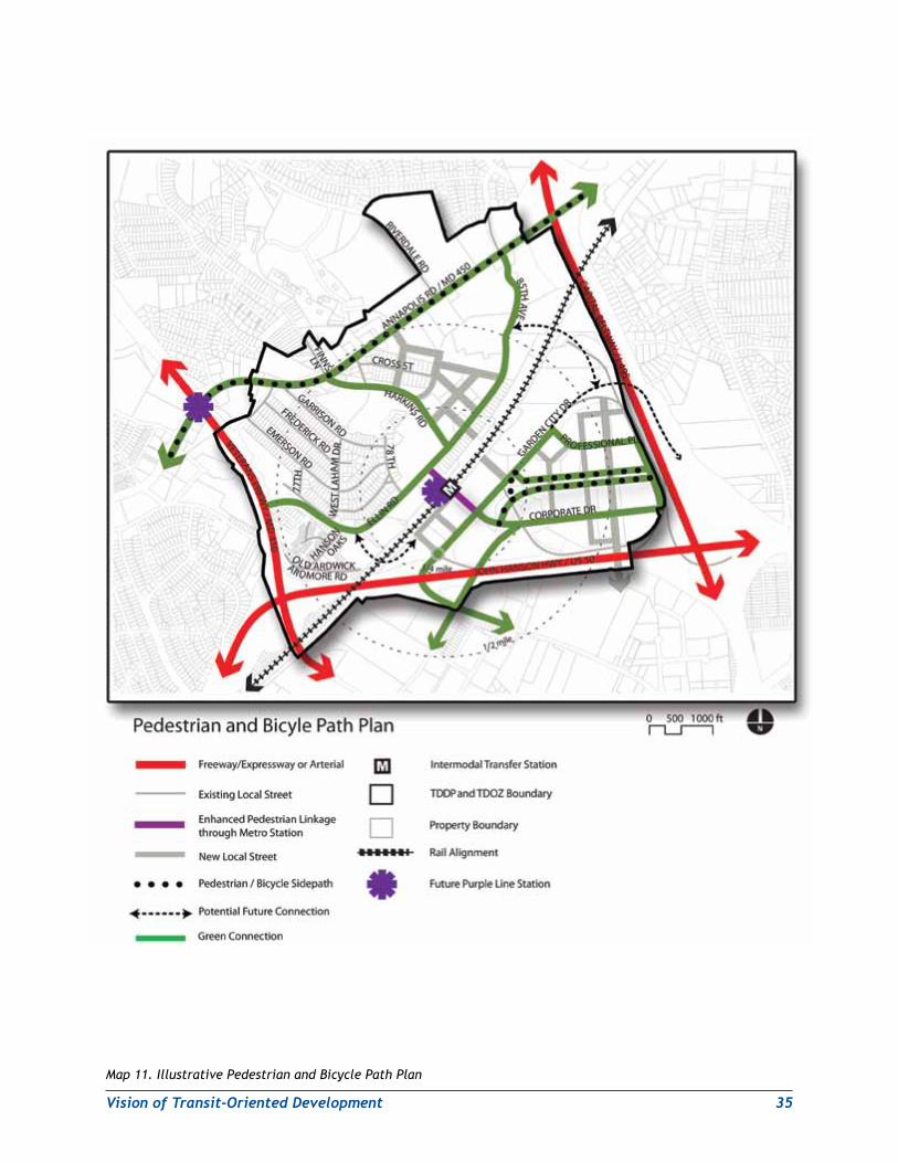
VisionofTransit-OrientedDevelopment 35
Map 11. Illustrative Pedestrian and Bicycle Path Plan
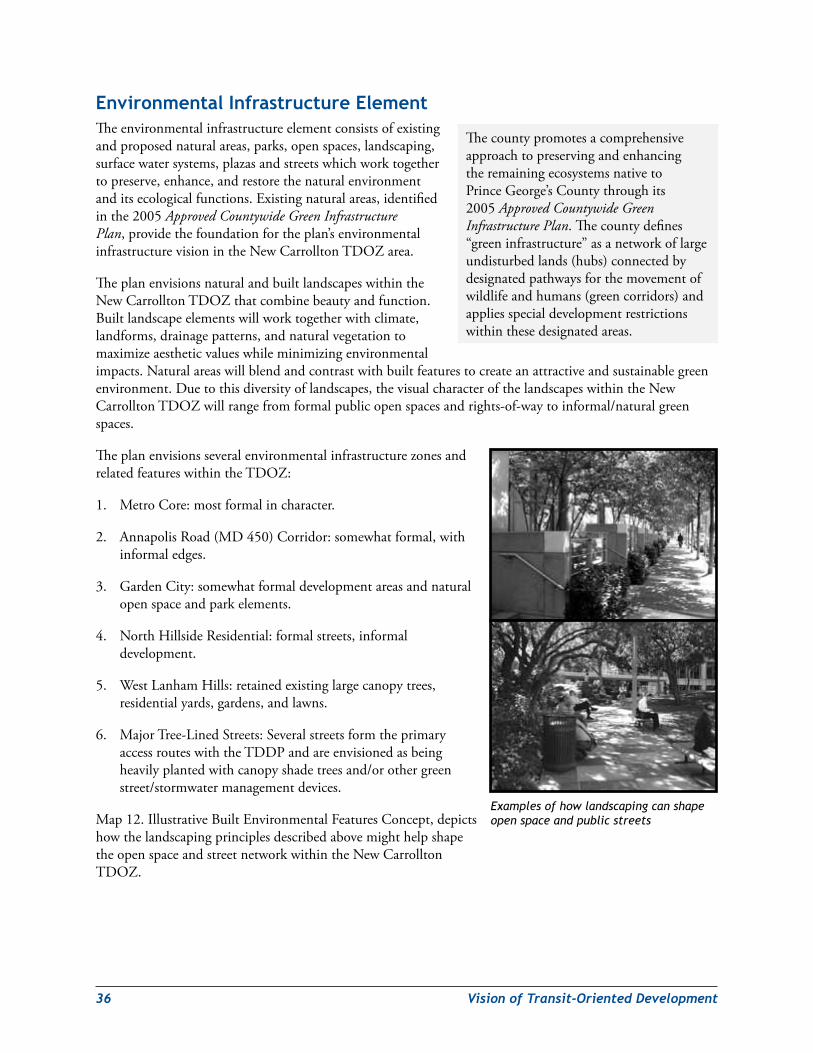
36 VisionofTransit-OrientedDevelopment
environmental infrastructure elementTheenvironmentalinfrastructureelementconsistsofexistingandproposednaturalareas,parks,openspaces,landscaping,surfacewatersystems,plazasandstreetswhichworktogethertopreserve,enhance,andrestorethenaturalenvironmentanditsecologicalfunctions.Existingnaturalareas,identifiedinthe2005Approved Countywide Green Infrastructure Plan,providethefoundationfortheplan’senvironmentalinfrastructurevisionintheNewCarrolltonTDOZarea.
TheplanenvisionsnaturalandbuiltlandscapeswithintheNewCarrolltonTDOZthatcombinebeautyandfunction.Builtlandscapeelementswillworktogetherwithclimate,landforms,drainagepatterns,andnaturalvegetationtomaximizeaestheticvalueswhileminimizingenvironmentalimpacts.Naturalareaswillblendandcontrastwithbuiltfeaturestocreateanattractiveandsustainablegreenenvironment.Duetothisdiversityoflandscapes,thevisualcharacterofthelandscapeswithintheNewCarrolltonTDOZwillrangefromformalpublicopenspacesandrights-of-waytoinformal/naturalgreenspaces.
TheplanenvisionsseveralenvironmentalinfrastructurezonesandrelatedfeatureswithintheTDOZ:
1. MetroCore:mostformalincharacter.
2. AnnapolisRoad(MD450)Corridor:somewhatformal,withinformaledges.
3. GardenCity:somewhatformaldevelopmentareasandnaturalopenspaceandparkelements.
4. NorthHillsideResidential:formalstreets,informaldevelopment.
5. WestLanhamHills:retainedexistinglargecanopytrees,residentialyards,gardens,andlawns.
6. MajorTree-LinedStreets:SeveralstreetsformtheprimaryaccessrouteswiththeTDDPandareenvisionedasbeingheavilyplantedwithcanopyshadetreesand/orothergreenstreet/stormwatermanagementdevices.
Map12.IllustrativeBuiltEnvironmentalFeaturesConcept,depictshowthelandscapingprinciplesdescribedabovemighthelpshapetheopenspaceandstreetnetworkwithintheNewCarrolltonTDOZ.
Examples of how landscaping can shape open space and public streets
ThecountypromotesacomprehensiveapproachtopreservingandenhancingtheremainingecosystemsnativetoPrinceGeorge’sCountythroughits2005Approved Countywide Green Infrastructure Plan.Thecountydefines“greeninfrastructure”asanetworkoflargeundisturbedlands(hubs)connectedbydesignatedpathwaysforthemovementofwildlifeandhumans(greencorridors)andappliesspecialdevelopmentrestrictionswithinthesedesignatedareas.
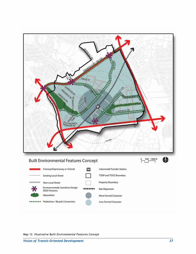
VisionofTransit-OrientedDevelopment 37
Map 12. Illustrative Built Environmental Features Concept
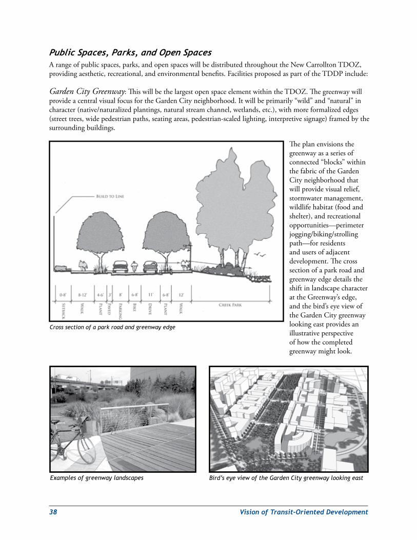
38 VisionofTransit-OrientedDevelopment
PublicSpaces,Parks,andOpenSpacesArangeofpublicspaces,parks,andopenspaceswillbedistributedthroughouttheNewCarrolltonTDOZ,providingaesthetic,recreational,andenvironmentalbenefits.FacilitiesproposedaspartoftheTDDPinclude:
Garden City Greenway:ThiswillbethelargestopenspaceelementwithintheTDOZ.ThegreenwaywillprovideacentralvisualfocusfortheGardenCityneighborhood.Itwillbeprimarily“wild”and“natural”incharacter(native/naturalizedplantings,naturalstreamchannel,wetlands,etc.),withmoreformalizededges(streettrees,widepedestrianpaths,seatingareas,pedestrian-scaledlighting,interpretivesignage)framedbythesurroundingbuildings.
Theplanenvisionsthegreenwayasaseriesofconnected“blocks”withinthefabricoftheGardenCityneighborhoodthatwillprovidevisualrelief,stormwatermanagement,wildlifehabitat(foodandshelter),andrecreationalopportunities—perimeterjogging/biking/strollingpath—forresidentsandusersofadjacentdevelopment.ThecrosssectionofaparkroadandgreenwayedgedetailstheshiftinlandscapecharacterattheGreenway’sedge,andthebird’seyeviewoftheGardenCitygreenwaylookingeastprovidesanillustrativeperspectiveofhowthecompletedgreenwaymightlook.
Cross section of a park road and greenway edge
Bird’s eye view of the Garden City greenway looking eastExamples of greenway landscapes
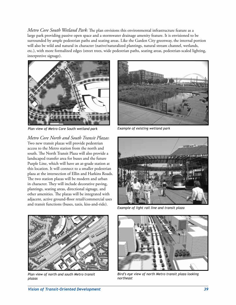
VisionofTransit-OrientedDevelopment 39
Metro Core South Wetland Park:Theplanenvisionsthisenvironmentalinfrastructurefeatureasalargeparkprovidingpassiveopenspaceandastormwaterdrainageamenityfeature.Itisenvisionedtobesurroundedbyamplepedestrianpathsandseatingareas.LiketheGardenCitygreenway,theinternalportionwillalsobewildandnaturalincharacter(native/naturalizedplantings,naturalstreamchannel,wetlands,etc.),withmoreformalizededges(streettrees,widepedestrianpaths,seatingareas,pedestrian-scaledlighting,interpretivesignage).
Metro Core North and South Transit Plazas:TwonewtransitplazaswillprovidepedestrianaccesstotheMetrostationfromthenorthandsouth.TheNorthTransitPlazawillalsoprovidealandscapedtransferareaforbusesandthefuturePurpleLine,whichwillhaveanat-gradestationatthislocation.ItwillconnecttoasmallerpedestrianplazaattheintersectionofEllinandHarkinsRoads.Thetwostationplazaswillbemodernandurbanincharacter.Theywillincludedecorativepaving,plantings,seatingareas,directionalsignage,andotheramenities.Theplazaswillbeintegratedwithadjacent,activeground-floorretail/commercialusesandtransitfunctions(buses,taxis,kiss-and-ride).
Plan view of north and south Metro transit plazas
Bird’s eye view of north Metro transit plaza looking northeast
Plan view of Metro Core South wetland park
Example of light rail line and transit plaza
Example of existing wetland park
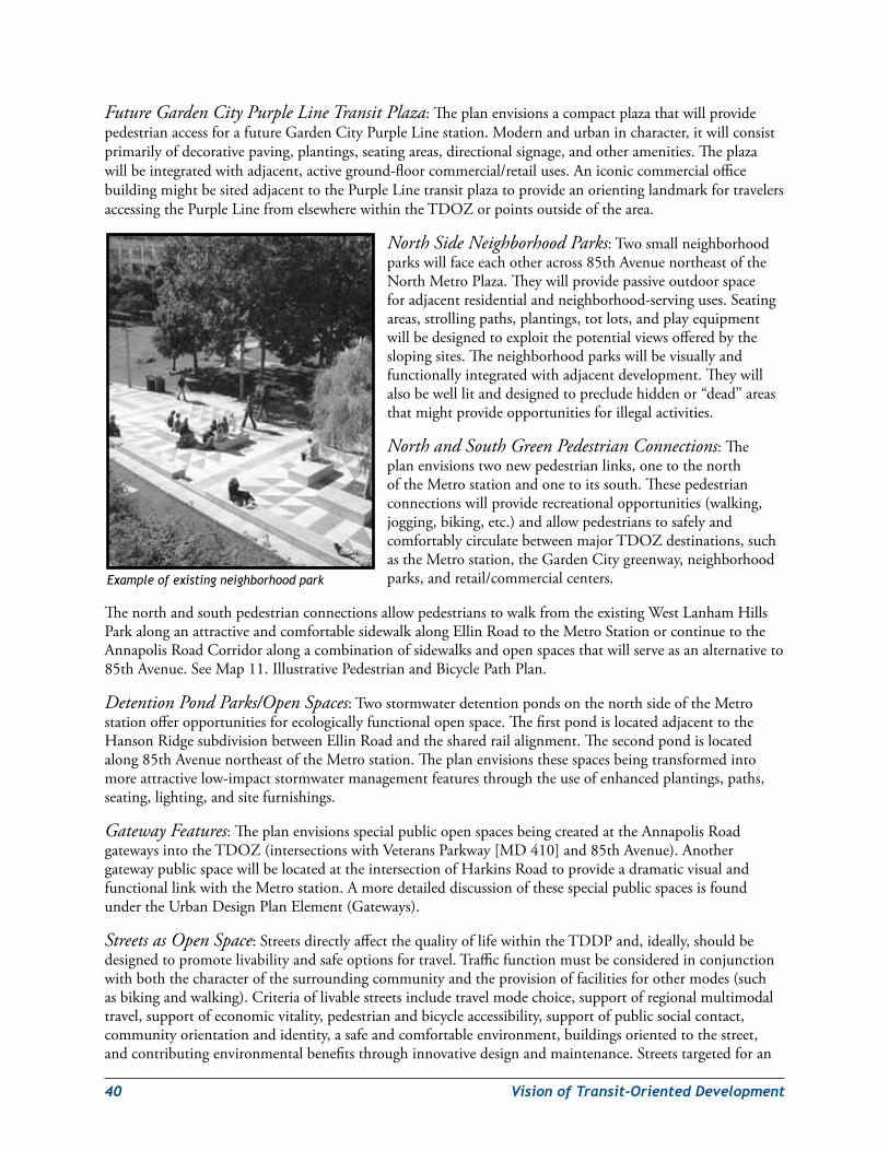
40 VisionofTransit-OrientedDevelopment
Future Garden City Purple Line Transit Plaza:TheplanenvisionsacompactplazathatwillprovidepedestrianaccessforafutureGardenCityPurpleLinestation.Modernandurbanincharacter,itwillconsistprimarilyofdecorativepaving,plantings,seatingareas,directionalsignage,andotheramenities.Theplazawillbeintegratedwithadjacent,activeground-floorcommercial/retailuses.AniconiccommercialofficebuildingmightbesitedadjacenttothePurpleLinetransitplazatoprovideanorientinglandmarkfortravelersaccessingthePurpleLinefromelsewherewithintheTDOZorpointsoutsideofthearea.
North Side Neighborhood Parks:Twosmallneighborhoodparkswillfaceeachotheracross85thAvenuenortheastoftheNorthMetroPlaza.Theywillprovidepassiveoutdoorspaceforadjacentresidentialandneighborhood-servinguses.Seatingareas,strollingpaths,plantings,totlots,andplayequipmentwillbedesignedtoexploitthepotentialviewsofferedbytheslopingsites.Theneighborhoodparkswillbevisuallyandfunctionallyintegratedwithadjacentdevelopment.Theywillalsobewelllitanddesignedtoprecludehiddenor“dead”areasthatmightprovideopportunitiesforillegalactivities.
North and South Green Pedestrian Connections:Theplanenvisionstwonewpedestrianlinks,onetothenorthoftheMetrostationandonetoitssouth.Thesepedestrianconnectionswillproviderecreationalopportunities(walking,jogging,biking,etc.)andallowpedestrianstosafelyandcomfortablycirculatebetweenmajorTDOZdestinations,suchastheMetrostation,theGardenCitygreenway,neighborhoodparks,andretail/commercialcenters.
ThenorthandsouthpedestrianconnectionsallowpedestrianstowalkfromtheexistingWestLanhamHillsParkalonganattractiveandcomfortablesidewalkalongEllinRoadtotheMetroStationorcontinuetotheAnnapolisRoadCorridoralongacombinationofsidewalksandopenspacesthatwillserveasanalternativeto85thAvenue.SeeMap11.IllustrativePedestrianandBicyclePathPlan.
Detention Pond Parks/Open Spaces:TwostormwaterdetentionpondsonthenorthsideoftheMetrostationofferopportunitiesforecologicallyfunctionalopenspace.ThefirstpondislocatedadjacenttotheHansonRidgesubdivisionbetweenEllinRoadandthesharedrailalignment.Thesecondpondislocatedalong85thAvenuenortheastoftheMetrostation.Theplanenvisionsthesespacesbeingtransformedintomoreattractivelow-impactstormwatermanagementfeaturesthroughtheuseofenhancedplantings,paths,seating,lighting,andsitefurnishings.
Gateway Features:TheplanenvisionsspecialpublicopenspacesbeingcreatedattheAnnapolisRoadgatewaysintotheTDOZ(intersectionswithVeteransParkway[MD410]and85thAvenue).AnothergatewaypublicspacewillbelocatedattheintersectionofHarkinsRoadtoprovideadramaticvisualandfunctionallinkwiththeMetrostation.AmoredetaileddiscussionofthesespecialpublicspacesisfoundundertheUrbanDesignPlanElement(Gateways).
Streets as Open Space:StreetsdirectlyaffectthequalityoflifewithintheTDDPand,ideally,shouldbedesignedtopromotelivabilityandsafeoptionsfortravel.Trafficfunctionmustbeconsideredinconjunctionwithboththecharacterofthesurroundingcommunityandtheprovisionoffacilitiesforothermodes(suchasbikingandwalking).Criteriaoflivablestreetsincludetravelmodechoice,supportofregionalmultimodaltravel,supportofeconomicvitality,pedestrianandbicycleaccessibility,supportofpublicsocialcontact,communityorientationandidentity,asafeandcomfortableenvironment,buildingsorientedtothestreet,andcontributingenvironmentalbenefitsthroughinnovativedesignandmaintenance.Streetstargetedforan
Example of existing neighborhood park
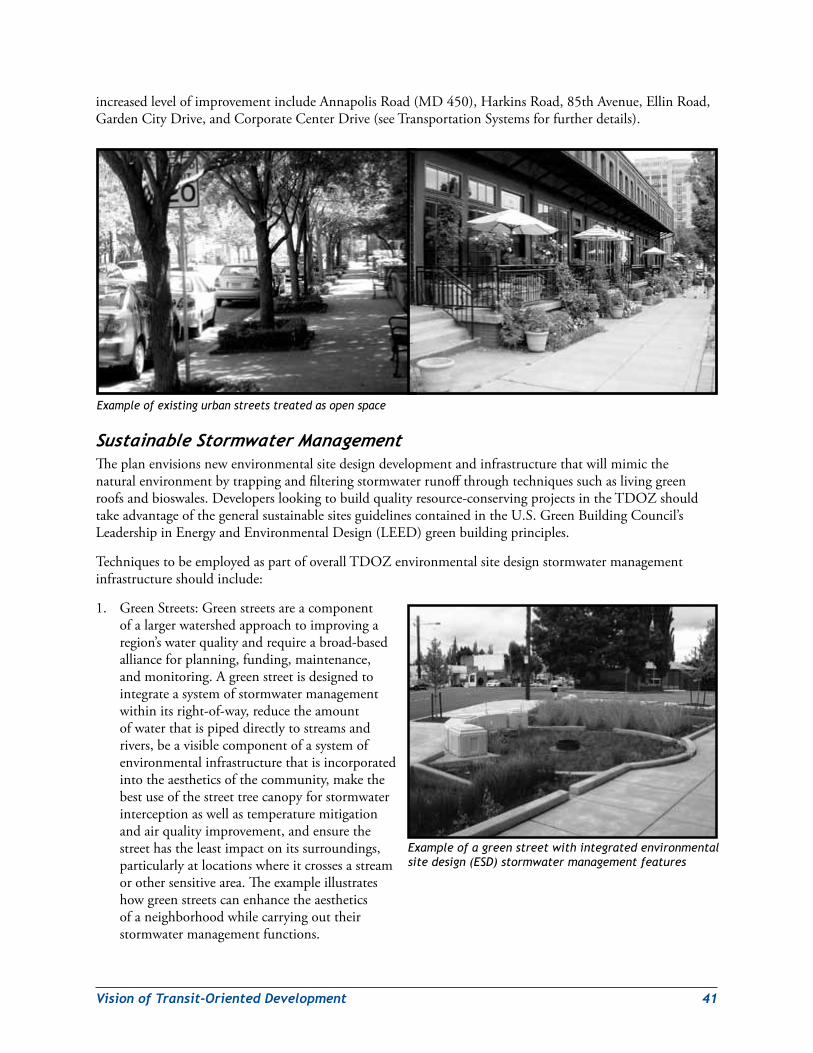
VisionofTransit-OrientedDevelopment 41
increasedlevelofimprovementincludeAnnapolisRoad(MD450),HarkinsRoad,85thAvenue,EllinRoad,GardenCityDrive,andCorporateCenterDrive(seeTransportationSystemsforfurtherdetails).
SustainableStormwaterManagementTheplanenvisionsnewenvironmentalsitedesigndevelopmentandinfrastructurethatwillmimicthenaturalenvironmentbytrappingandfilteringstormwaterrunoffthroughtechniquessuchaslivinggreenroofsandbioswales.Developerslookingtobuildqualityresource-conservingprojectsintheTDOZshouldtakeadvantageofthegeneralsustainablesitesguidelinescontainedintheU.S.GreenBuildingCouncil’sLeadershipinEnergyandEnvironmentalDesign(LEED)greenbuildingprinciples.
TechniquestobeemployedaspartofoverallTDOZenvironmentalsitedesignstormwatermanagementinfrastructureshouldinclude:
1. GreenStreets:Greenstreetsareacomponentofalargerwatershedapproachtoimprovingaregion’swaterqualityandrequireabroad-basedallianceforplanning,funding,maintenance,andmonitoring.Agreenstreetisdesignedtointegrateasystemofstormwatermanagementwithinitsright-of-way,reducetheamountofwaterthatispipeddirectlytostreamsandrivers,beavisiblecomponentofasystemofenvironmentalinfrastructurethatisincorporatedintotheaestheticsofthecommunity,makethebestuseofthestreettreecanopyforstormwaterinterceptionaswellastemperaturemitigationandairqualityimprovement,andensurethestreethastheleastimpactonitssurroundings,particularlyatlocationswhereitcrossesastreamorothersensitivearea.Theexampleillustrateshowgreenstreetscanenhancetheaestheticsofaneighborhoodwhilecarryingouttheirstormwatermanagementfunctions.
Example of existing urban streets treated as open space
Example of a green street with integrated environmental site design (ESD) stormwater management features
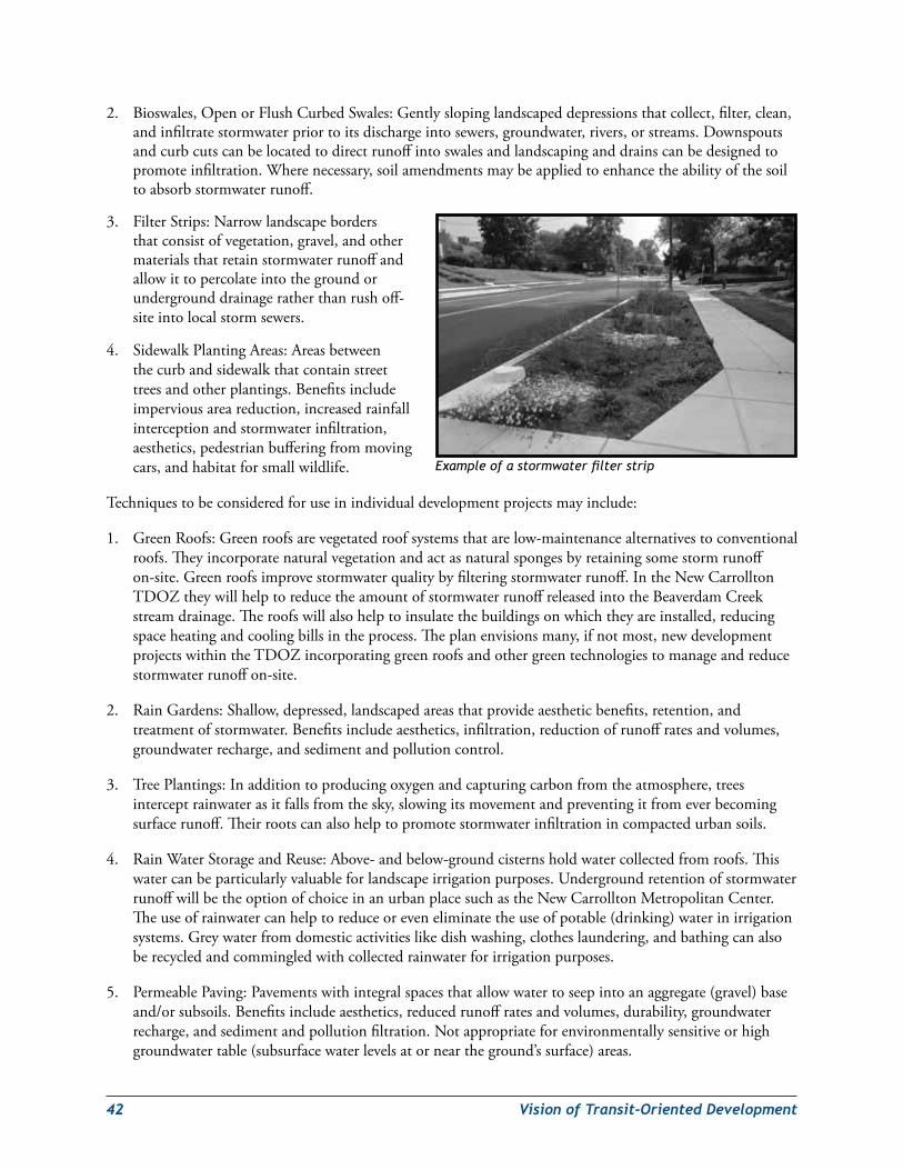
42 VisionofTransit-OrientedDevelopment
2. Bioswales,OpenorFlushCurbedSwales:Gentlyslopinglandscapeddepressionsthatcollect,filter,clean,andinfiltratestormwaterpriortoitsdischargeintosewers,groundwater,rivers,orstreams.Downspoutsandcurbcutscanbelocatedtodirectrunoffintoswalesandlandscapinganddrainscanbedesignedtopromoteinfiltration.Wherenecessary,soilamendmentsmaybeappliedtoenhancetheabilityofthesoiltoabsorbstormwaterrunoff.
3. FilterStrips:Narrowlandscapebordersthatconsistofvegetation,gravel,andothermaterialsthatretainstormwaterrunoffandallowittopercolateintothegroundorundergrounddrainageratherthanrushoff-siteintolocalstormsewers.
4. SidewalkPlantingAreas:Areasbetweenthecurbandsidewalkthatcontainstreettreesandotherplantings.Benefitsincludeimperviousareareduction,increasedrainfallinterceptionandstormwaterinfiltration,aesthetics,pedestrianbufferingfrommovingcars,andhabitatforsmallwildlife.
Techniquestobeconsideredforuseinindividualdevelopmentprojectsmayinclude:
1. GreenRoofs:Greenroofsarevegetatedroofsystemsthatarelow-maintenancealternativestoconventionalroofs.Theyincorporatenaturalvegetationandactasnaturalspongesbyretainingsomestormrunoffon-site.Greenroofsimprovestormwaterqualitybyfilteringstormwaterrunoff.IntheNewCarrolltonTDOZtheywillhelptoreducetheamountofstormwaterrunoffreleasedintotheBeaverdamCreekstreamdrainage.Theroofswillalsohelptoinsulatethebuildingsonwhichtheyareinstalled,reducingspaceheatingandcoolingbillsintheprocess.Theplanenvisionsmany,ifnotmost,newdevelopmentprojectswithintheTDOZincorporatinggreenroofsandothergreentechnologiestomanageandreducestormwaterrunoffon-site.
2. RainGardens:Shallow,depressed,landscapedareasthatprovideaestheticbenefits,retention,andtreatmentofstormwater.Benefitsincludeaesthetics,infiltration,reductionofrunoffratesandvolumes,groundwaterrecharge,andsedimentandpollutioncontrol.
3. TreePlantings:Inadditiontoproducingoxygenandcapturingcarbonfromtheatmosphere,treesinterceptrainwaterasitfallsfromthesky,slowingitsmovementandpreventingitfromeverbecomingsurfacerunoff.Theirrootscanalsohelptopromotestormwaterinfiltrationincompactedurbansoils.
4. RainWaterStorageandReuse:Above-andbelow-groundcisternsholdwatercollectedfromroofs.Thiswatercanbeparticularlyvaluableforlandscapeirrigationpurposes.UndergroundretentionofstormwaterrunoffwillbetheoptionofchoiceinanurbanplacesuchastheNewCarrolltonMetropolitanCenter.Theuseofrainwatercanhelptoreduceoreveneliminatetheuseofpotable(drinking)waterinirrigationsystems.Greywaterfromdomesticactivitieslikedishwashing,clotheslaundering,andbathingcanalsoberecycledandcommingledwithcollectedrainwaterforirrigationpurposes.
5. PermeablePaving:Pavementswithintegralspacesthatallowwatertoseepintoanaggregate(gravel)baseand/orsubsoils.Benefitsincludeaesthetics,reducedrunoffratesandvolumes,durability,groundwaterrecharge,andsedimentandpollutionfiltration.Notappropriateforenvironmentallysensitiveorhighgroundwatertable(subsurfacewaterlevelsatorneartheground’ssurface)areas.
Example of a stormwater filter strip
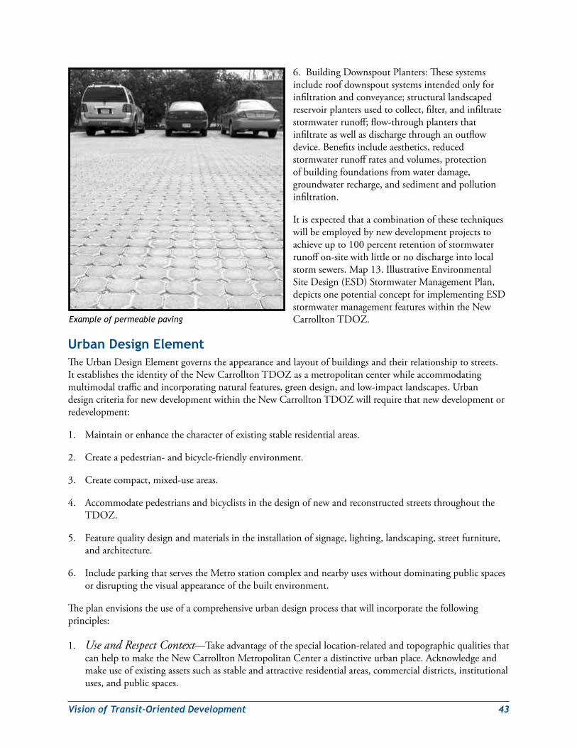
VisionofTransit-OrientedDevelopment 43
6. BuildingDownspoutPlanters:Thesesystemsincluderoofdownspoutsystemsintendedonlyforinfiltrationandconveyance;structurallandscapedreservoirplantersusedtocollect,filter,andinfiltratestormwaterrunoff;flow-throughplantersthatinfiltrateaswellasdischargethroughanoutflowdevice.Benefitsincludeaesthetics,reducedstormwaterrunoffratesandvolumes,protectionofbuildingfoundationsfromwaterdamage,groundwaterrecharge,andsedimentandpollutioninfiltration.
Itisexpectedthatacombinationofthesetechniqueswillbeemployedbynewdevelopmentprojectstoachieveupto100percentretentionofstormwaterrunoffon-sitewithlittleornodischargeintolocalstormsewers.Map13.IllustrativeEnvironmentalSiteDesign(ESD)StormwaterManagementPlan,depictsonepotentialconceptforimplementingESDstormwatermanagementfeatureswithintheNewCarrolltonTDOZ.
Urban design elementTheUrbanDesignElementgovernstheappearanceandlayoutofbuildingsandtheirrelationshiptostreets.ItestablishestheidentityoftheNewCarrolltonTDOZasametropolitancenterwhileaccommodatingmultimodaltrafficandincorporatingnaturalfeatures,greendesign,andlow-impactlandscapes.UrbandesigncriteriafornewdevelopmentwithintheNewCarrolltonTDOZwillrequirethatnewdevelopmentorredevelopment:
1. Maintainorenhancethecharacterofexistingstableresidentialareas.
2. Createapedestrian-andbicycle-friendlyenvironment.
3. Createcompact,mixed-useareas.
4. AccommodatepedestriansandbicyclistsinthedesignofnewandreconstructedstreetsthroughouttheTDOZ.
5. Featurequalitydesignandmaterialsintheinstallationofsignage,lighting,landscaping,streetfurniture,andarchitecture.
6. IncludeparkingthatservestheMetrostationcomplexandnearbyuseswithoutdominatingpublicspacesordisruptingthevisualappearanceofthebuiltenvironment.
Theplanenvisionstheuseofacomprehensiveurbandesignprocessthatwillincorporatethefollowingprinciples:
1. Use and Respect Context—Takeadvantageofthespeciallocation-relatedandtopographicqualitiesthatcanhelptomaketheNewCarrolltonMetropolitanCenteradistinctiveurbanplace.Acknowledgeandmakeuseofexistingassetssuchasstableandattractiveresidentialareas,commercialdistricts,institutionaluses,andpublicspaces.
Example of permeable paving
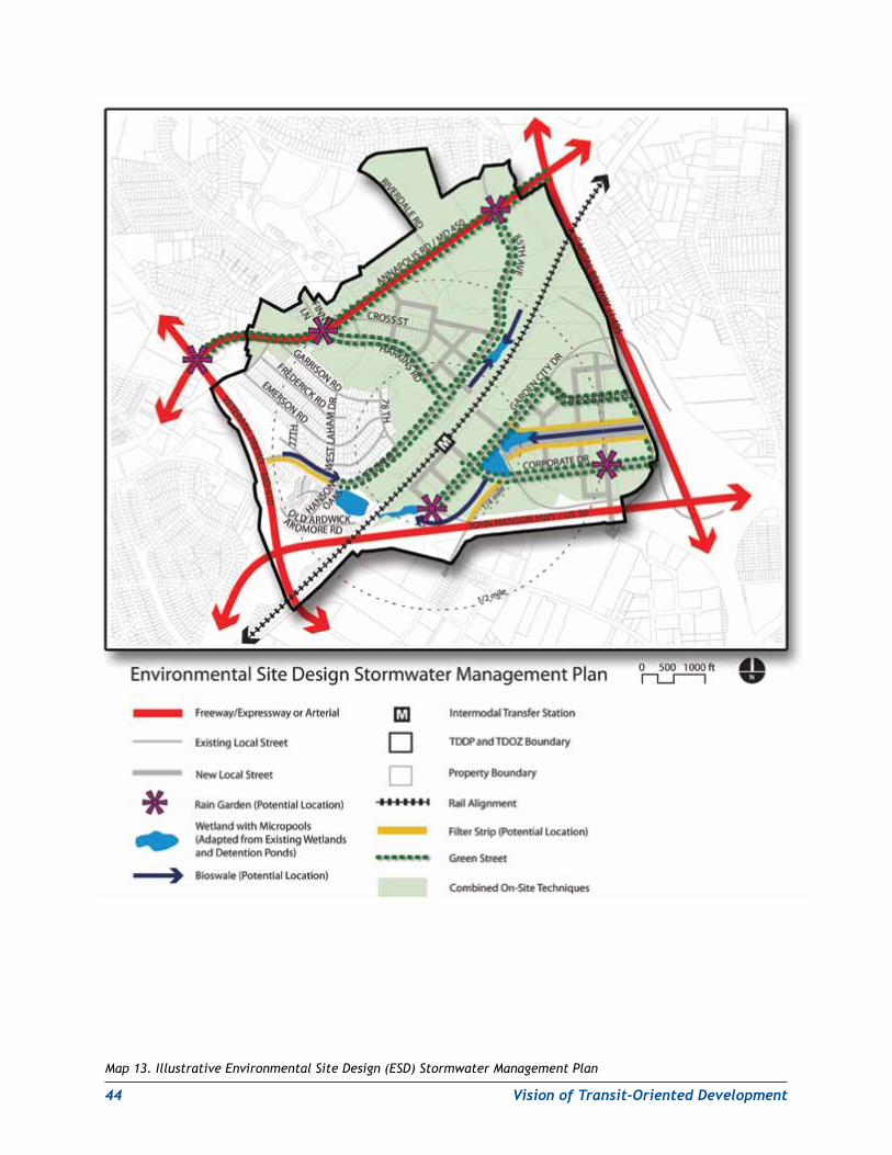
44 VisionofTransit-OrientedDevelopment
Map 13. Illustrative Environmental Site Design (ESD) Stormwater Management Plan
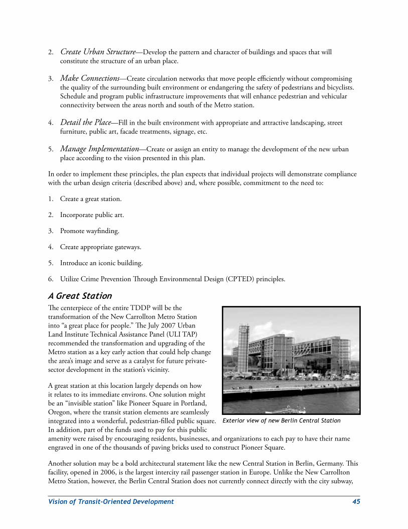
VisionofTransit-OrientedDevelopment 45
2. Create Urban Structure—Developthepatternandcharacterofbuildingsandspacesthatwillconstitutethestructureofanurbanplace.
3. Make Connections—Createcirculationnetworksthatmovepeopleefficientlywithoutcompromisingthequalityofthesurroundingbuiltenvironmentorendangeringthesafetyofpedestriansandbicyclists.ScheduleandprogrampublicinfrastructureimprovementsthatwillenhancepedestrianandvehicularconnectivitybetweentheareasnorthandsouthoftheMetrostation.
4. Detail the Place—Fillinthebuiltenvironmentwithappropriateandattractivelandscaping,streetfurniture,publicart,facadetreatments,signage,etc.
5. Manage Implementation—Createorassignanentitytomanagethedevelopmentofthenewurbanplaceaccordingtothevisionpresentedinthisplan.
Inordertoimplementtheseprinciples,theplanexpectsthatindividualprojectswilldemonstratecompliancewiththeurbandesigncriteria(describedabove)and,wherepossible,commitmenttotheneedto:
1. Createagreatstation.
2. Incorporatepublicart.
3. Promotewayfinding.
4. Createappropriategateways.
5. Introduceaniconicbuilding.
6. UtilizeCrimePreventionThroughEnvironmentalDesign(CPTED)principles.
AGreatStationThecenterpieceoftheentireTDDPwillbethetransformationoftheNewCarrolltonMetroStationinto“agreatplaceforpeople.”TheJuly2007UrbanLandInstituteTechnicalAssistancePanel(ULITAP)recommendedthetransformationandupgradingoftheMetrostationasakeyearlyactionthatcouldhelpchangethearea’simageandserveasacatalystforfutureprivate-sectordevelopmentinthestation’svicinity.
Agreatstationatthislocationlargelydependsonhowitrelatestoitsimmediateenvirons.Onesolutionmightbean“invisiblestation”likePioneerSquareinPortland,Oregon,wherethetransitstationelementsareseamlesslyintegratedintoawonderful,pedestrian-filledpublicsquare.Inaddition,partofthefundsusedtopayforthispublicamenitywereraisedbyencouragingresidents,businesses,andorganizationstoeachpaytohavetheirnameengravedinoneofthethousandsofpavingbricksusedtoconstructPioneerSquare.
AnothersolutionmaybeaboldarchitecturalstatementlikethenewCentralStationinBerlin,Germany.Thisfacility,openedin2006,isthelargestintercityrailpassengerstationinEurope.UnliketheNewCarrolltonMetroStation,however,theBerlinCentralStationdoesnotcurrentlyconnectdirectlywiththecitysubway,
Exterior view of new Berlin Central Station
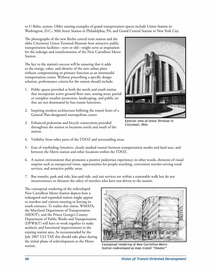
46 VisionofTransit-OrientedDevelopment
orU-Bahn,system.OlderexistingexamplesofgrandtransportationspacesincludeUnionStationinWashington,D.C.;30thStreetStationinPhiladelphia,PA;andGrandCentralStationinNewYorkCity.
ThephotographsofthenewBerlincentraltrainstationandtheolderCincinnatiUnionTerminalillustratehowattractivepublictransportationfacilities—neworold—mightserveasinspirationfortheredesignandtransformationoftheNewCarrolltonMetroStation.
Thekeytothestation’ssuccesswillbeensuringthatitaddstotheenergy,value,andidentityofthenewurbanplacewithoutcompromisingitsprimaryfunctionasanintermodaltransportationcenter.Withoutprescribingaspecificdesignsolution,performancecriteriaforthestationshouldinclude:
1. Publicspacesprovidedatboththenorthandsouthentriesthatincorporateactivegroundflooruses,seatingareas,partialorcompleteweatherprotection,landscaping,andpublicartthatarenotdominatedbybustransitfunctions.
2. InspiringmodernarchitecturebefittingthetransitheartofaGeneralPlan-designatedmetropolitancenter.
3. Enhancedpedestrianandbicycleconnectionsprovidedthroughoutthestationtolocationsnorthandsouthofthestation.
4. VisibilityfromotherpartsoftheTDOZandsurroundingareas.
5. Easeofwayfinding(intuitive,clearlymarkedroutes)betweentransportationmodesandlanduses,andbetweentheMetrostationandotherlocationswithintheTDOZ.
6. Astationenvironmentthatpromotesapositivepedestrianexperience;inotherwords,elementsofvisualsurprisesuchasunexpectedvistas,opportunitiesforpeople-watching,convenienttraveler-servingretailservices,andattractivepublicareas.
7. Bustransfer,parkandride,kiss-and-ride,andtaxiservicesarewithinareasonablewalkbutdonotinconvenienceorthreatenthesafetyoftravelerswhohavenotdriventothestation.
TheconceptualrenderingoftheredevelopedNewCarrolltonMetroStationdepictshowaredesignedandexpandedstationmightappeartotravelersandvisitorsenteringorleavingitssouthentrance.Torealizethisvision,WMATA,theMarylandDepartmentofTransportation(MDOT),andthePrinceGeorge’sCountyDepartmentofPublicWorksandTransportation(DPW&T)willhavetoworktogethertomakeaestheticandfunctionalimprovementstotheexistingstationarea.AsrecommendedbytheJuly2007ULITAP,thisshouldtakeplaceduringtheinitialphaseofredevelopmentattheMetrostation. Conceptual rendering of New Carrollton Metro
Station redeveloped as mass transit “theater”
Exterior view of Union Terminal in Cincinnati, Ohio
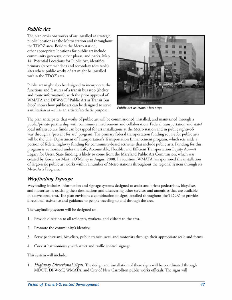
VisionofTransit-OrientedDevelopment 47
PublicArtTheplanenvisionsworksofartinstalledatstrategicpubliclocationsattheMetrostationandthroughouttheTDOZarea.BesidestheMetrostation,otherappropriatelocationsforpublicartincludecommunitygateways,otherplazas,andparks.Map14.PotentialLocationsforPublicArt,identifiesprimary(recommended)andsecondary(desirable)siteswherepublicworksofartmightbeinstalledwithintheTDOZarea.
Publicartmightalsobedesignedtoincorporatethefunctionsandfeaturesofatransitbusstop(shelterandrouteinformation),withthepriorapprovalofWMATAandDPW&T.“PublicArtasTransitBusStop”showshowpublicartcanbedesignedtoserveautilitarianaswellasanartistic/aestheticpurpose.
Theplananticipatesthatworksofpublicartwillbecommissioned,installed,andmaintainedthroughapublic/privatepartnershipwithcommunityinvolvementandcollaboration.Federaltransportationandstate/localinfrastructurefundscanbetappedforartinstallationsattheMetrostationandinpublicrights-of-waythrougha“percentforart”program.TheprimaryfederaltransportationfundingsourceforpublicartswillbetheU.S.DepartmentofTransportation’sTransportationEnhancementprogram,whichsetsasideaportionoffederalhighwayfundingforcommunity-basedactivitiesthatincludepublicarts.FundingforthisprogramisauthorizedundertheSafe,Accountable,Flexible,andEfficientTransportationEquityAct—ALegacyforUsers.StatefundingislikelytocomefromtheMarylandPublicArtCommission,whichwascreatedbyGovernorMartinO’MalleyinAugust2008.Inaddition,WMATAhassponsoredtheinstallationoflarge-scalepublicartworkswithinanumberofMetrostationsthroughouttheregionalsystemthroughitsMetroArtsProgram.
WayfindingSignageWayfindingincludesinformationandsignagesystemsdesignedtoassistandorientpedestrians,bicyclists,andmotoristsinreachingtheirdestinationsanddiscoveringotherservicesandamenitiesthatareavailableinadevelopedarea.TheplanenvisionsacombinationofsignsinstalledthroughouttheTDOZtoprovidedirectionalassistanceandguidancetopeopletravelingtoandthroughthearea.
Thewayfindingsystemwillbedesignedto:
1. Providedirectiontoallresidents,workers,andvisitorstothearea.
2. Promotethecommunity’sidentity.
3. Servepedestrians,bicyclists,publictransitusers,andmotoriststhroughtheirappropriatescaleandforms.
4. Coexistharmoniouslywithstreetandtrafficcontrolsignage.
Thissystemwillinclude:
1. Highway Directional Signs:ThedesignandinstallationofthesesignswillbecoordinatedthroughMDOT,DPW&T,WMATA,andCityofNewCarrolltonpublicworksofficials.Thesignswill
Public art as transit bus stop
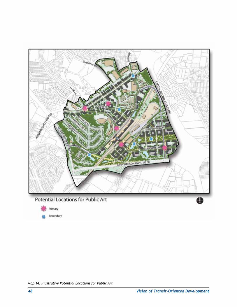
48 VisionofTransit-OrientedDevelopment
Map 14. Illustrative Potential Locations for Public Art
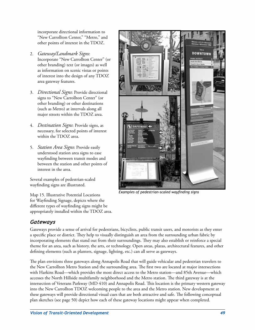
VisionofTransit-OrientedDevelopment 49
incorporatedirectionalinformationto“NewCarrolltonCenter,”“Metro,”andotherpointsofinterestintheTDOZ.
2. Gateway/Landmark Signs:Incorporate“NewCarrolltonCenter”(orotherbranding)text(orimages)aswellasinformationonscenicvistasorpointsofinterestintothedesignofanyTDOZareagatewayfeatures.
3. Directional Signs:Providedirectionalsignsto“NewCarrolltonCenter”(orotherbranding)orotherdestinations(suchasMetro)atintervalsalongallmajorstreetswithintheTDOZarea.
4. Destination Signs:Providesigns,asnecessary,forselectedpointsofinterestwithintheTDOZarea.
5. Station Area Signs:Provideeasilyunderstoodstationareasignstoeasewayfindingbetweentransitmodesandbetweenthestationandotherpointsofinterestinthearea.
Severalexamplesofpedestrian-scaledwayfindingsignsareillustrated.
Map15.IllustrativePotentialLocationsforWayfindingSignage,depictswherethedifferenttypesofwayfindingsignsmightbeappropriatelyinstalledwithintheTDOZarea.
GatewaysGatewaysprovideasenseofarrivalforpedestrians,bicyclists,publictransitusers,andmotoristsastheyenteraspecificplaceordistrict.Theyhelptovisuallydistinguishanareafromthesurroundingurbanfabricbyincorporatingelementsthatstandoutfromtheirsurroundings.Theymayalsoestablishorreinforceaspecialthemeforanarea,suchashistory,thearts,ortechnology.Openareas,plazas,architecturalfeatures,andotherdefiningelements(suchasplanters,signage,lighting,etc.)canallserveasgateways.
TheplanenvisionsthreegatewaysalongAnnapolisRoadthatwillguidevehicularandpedestriantravelerstotheNewCarrolltonMetroStationandthesurroundingarea.ThefirsttwoarelocatedatmajorintersectionswithHarkinsRoad—whichprovidesthemostdirectaccesstotheMetrostation—and85thAvenue—whichaccessestheNorthHillsidemultifamilyneighborhoodandtheMetrostation.ThethirdgatewayisattheintersectionofVeteransParkway(MD410)andAnnapolisRoad.ThislocationistheprimarywesterngatewayintotheNewCarrolltonTDOZwelcomingpeopletotheareaandtheMetrostation.Newdevelopmentatthesegatewayswillprovidedirectionalvisualcuesthatarebothattractiveandsafe.Thefollowingconceptualplansketches(seepage50)depicthoweachofthesegatewaylocationsmightappearwhencompleted.
Examples of pedestrian-scaled wayfinding signs
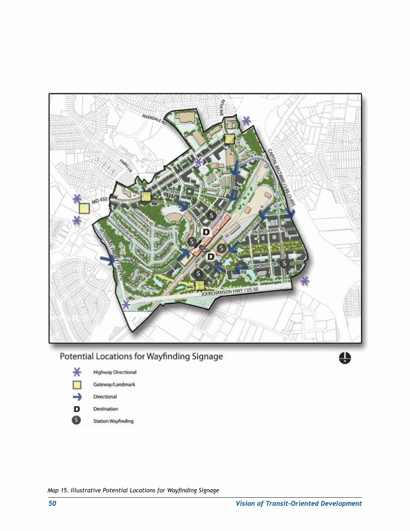
50 VisionofTransit-OrientedDevelopment
Map 15. Illustrative Potential Locations for Wayfinding Signage
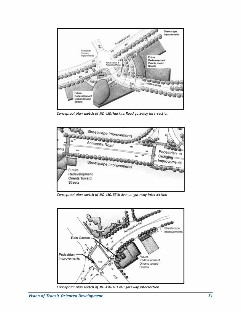
VisionofTransit-OrientedDevelopment 51
Conceptual plan sketch of MD 450/Harkins Road gateway intersection
Conceptual plan sketch of MD 450/85th Avenue gateway intersection
Conceptual plan sketch of MD 450/MD 410 gateway intersection
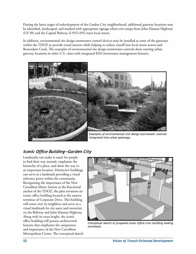
52 VisionofTransit-OrientedDevelopment
DuringthelatterstagesofredevelopmentoftheGardenCityneighborhood,additionalgatewaylocationsmaybeidentified,landscaped,andmarkedwithappropriatesignagewhereexitrampsfromJohnHansonHighway(US50)andtheCapitalBeltway(I-95/I-495)meetlocalstreets.
Inaddition,environmentalsitedesignstormwatercontroldevicesmaybeinstalledatsomeofthegatewayswithintheTDOZtoprovidevisualinterestwhilehelpingtoreducerunoffintolocalstormsewersandBeaverdamCreek.TheexamplesofenvironmentalsitedesignstormwatercontrolsshowexistingurbangatewaylocationsinotherU.S.citieswithintegratedESDstormwatermanagementfeatures.
IconicOfficeBuilding—GardenCityLandmarkscanmakeiteasierforpeopletofindtheirwayaround,emphasizethehierarchyofaplace,andshowthewaytoanimportantlocation.Distinctivebuildingscanserveasalandmarkprovidingavisualreferencepointwithinthecommunity.RecognizingtheimportanceoftheNewCarrolltonMetroStationasthefunctionalanchoroftheTDOZ,theplanenvisionsaniconicofficebuildinglocatedattheeasternterminusofCorporateDrive.ThisbuildingwilltoweroveritsneighborsandserveasavisuallandmarkforsiteusersandmotoristsontheBeltwayandJohnHansonHighway.Alongwithitsextraheight,theiconicofficebuildingwillpossessarchitecturalfeaturesthatemphasizetheuniquenessandimportanceoftheNewCarrolltonMetropolitanCenter.Theconceptualsketch
Conceptual sketch of proposed iconic office-civic building looking northwest
Examples of environmental site design stormwater controls integrated into urban gateways
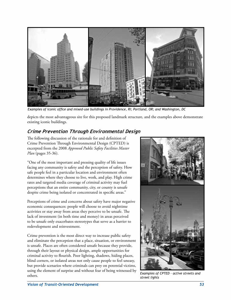
VisionofTransit-OrientedDevelopment 53
depictsthemostadvantageoussiteforthisproposedlandmarkstructure,andtheexamplesabovedemonstrateexistingiconicbuildings.
CrimePreventionThroughEnvironmentalDesignThefollowingdiscussionoftherationaleforanddefinitionofCrimePreventionThroughEnvironmentalDesign(CPTED)isexcerptedfromthe2008Approved Public Safety Facilities Master Plan(pages35-36).
“Oneofthemostimportantandpressingqualityoflifeissuesfacinganycommunityissafetyandtheperceptionofsafety.Howsafepeoplefeelinaparticularlocationandenvironmentoftendetermineswheretheychoosetolive,work,andplay.Highcrimeratesandtargetedmediacoverageofcriminalactivitymayfuelperceptionsthatanentirecommunity,city,orcountyisunsafedespitecrimebeingisolatedorconcentratedinspecificareas.”
Perceptionsofcrimeandconcernsaboutsafetyhavemajornegativeeconomicconsequences:peoplewillchoosetoavoidnighttimeactivitiesorstayawayfromareastheyperceivetobeunsafe.Thelackofinvestment(inbothtimeandmoney)inareasperceivedtobeunsafeonlyexacerbatesstereotypesthatserveasabarriertoredevelopmentandreinvestment.
Crimepreventionisthemostdirectwaytoincreasepublicsafetyandeliminatetheperceptionthataplace,situation,orenvironmentisunsafe.Placesareoftenconsideredunsafebecausetheyprovide,throughtheirlayoutorphysicaldesign,ampleopportunitiesforcriminalactivitytoflourish.Poorlighting,shadows,hidingplaces,blindcorners,orisolatedareasnotonlycausepeopletofeeluneasy,butprovidescenarioswherecriminalscanpreyonpotentialvictims,usingtheelementofsurpriseandwithoutfearofbeingwitnessedbyothers.
Examples of iconic office and mixed-use buildings in Providence, RI; Portland, OR; and Washington, DC
Examples of CPTED – active streets and street lights

54 VisionofTransit-OrientedDevelopment
CPTEDisacrimepreventionphilosophybasedonactivelydesigningthebuiltenvironmenttoreducecrimeandtheperceptionofcrimewhileenhancingthequalityofaplacetoinvitesafeinteractionamongusers.CPTEDutilizesurbandesigntechniquestoeliminateopportunitiesforcriminalactivityandfosterpositivesocialinteractionamongusersofspace.
TherearefouroverlappingCPTEDprinciples:
1. Surveillance
2. Accessmanagement
3. Territorialreinforcement
4. Qualityenvironments
Surveillanceisprovidedwhenpeoplearepresentinanenvironmentandcanseewhatisgoingon.Placeswhereallpubliclyaccessiblespacescanbeseen,withclearsightlinesandgoodlighting,providemaximumvisibilityandpromotesurveillance.Thisprincipleisalsoreferredtoas“eyesonthestreet.”
Managingaccesstoalocationattractspeopleandvehiclestoappropriateplacesandrestrictsthemfrominappropriateones.Placeswithmanagedaccessincorporatewell-definedroutes,spaces,andentrancesthatprovideforconvenientandsafemovementwithoutcompromisingsecurity.
Territorialreinforcementdefinestheboundariesbetweenpublicandprivatespaceandencouragescommunityownershipofthepublicsphere.Acleardelineationbetweenpublicandprivateownership,usingdesigntechniquessuchaslandscaping,fencing,and/orsignage,identifiestheappropriateuseofspaceandreinforcestheprideandresponsibilityofownership.
Qualityenvironmentsarewell-designed,well-maintainedplacesthatattractpeopleandprovideopportunitiesforregularsurveillance.Anattractivepublicspaceencouragesactivity,promotesrespectforcleanliness,andreducesthelikelihoodofcrimeorvandalism.Increasedpublicactivityinaqualityenvironment,inturn,improvessurveillance.
DetailedCPTEDstrategiesandguidelinesarecontainedintheDevelopmentStandardsandGuidelineschapter.
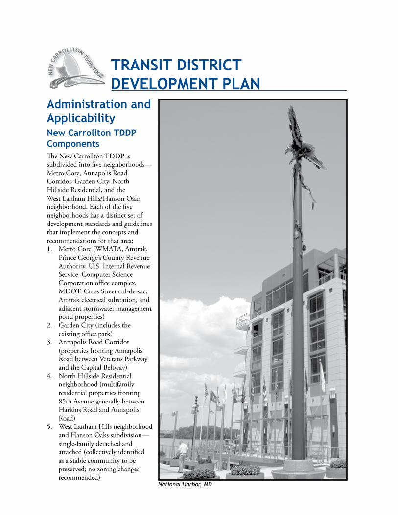
Administration and ApplicabilityNew Carrollton TddP Components TheNewCarrolltonTDDPissubdividedintofiveneighborhoods—MetroCore,AnnapolisRoadCorridor,GardenCity,NorthHillsideResidential,andtheWestLanhamHills/HansonOaksneighborhood.Eachofthefiveneighborhoodshasadistinctsetofdevelopmentstandardsandguidelinesthatimplementtheconceptsandrecommendationsforthatarea:1. MetroCore(WMATA,Amtrak,
PrinceGeorge’sCountyRevenueAuthority,U.S.InternalRevenueService,ComputerScienceCorporationofficecomplex,MDOT,CrossStreetcul-de-sac,Amtrakelectricalsubstation,andadjacentstormwatermanagementpondproperties)
2. GardenCity(includestheexistingofficepark)
3. AnnapolisRoadCorridor(propertiesfrontingAnnapolisRoadbetweenVeteransParkwayandtheCapitalBeltway)
4. NorthHillsideResidentialneighborhood(multifamilyresidentialpropertiesfronting85thAvenuegenerallybetweenHarkinsRoadandAnnapolisRoad)
5. WestLanhamHillsneighborhoodandHansonOakssubdivision—single-familydetachedandattached(collectivelyidentifiedasastablecommunitytobepreserved;nozoningchangesrecommended)
TrANsiT disTriCT deVeloPMeNT PlAN
National Harbor, MD
56 TransitDistrictDevelopmentPlan
TheTDDPcomponentsforeachneighborhoodthatguidedevelopmenttoachievethetransit-orienteddevelopment(TOD)conceptareasfollows:
1. PreferredLandUsePlan(SeeMap16.PreferredLandUsePlan)
2. StreetCirculationPlan
3. BuildingEnvelopeandBlockStandardsandGuidelines
4. OpenSpaceandStreetscapeStandardsandGuidelines
5. ParkingFacilityStandardsandGuidelines
6. BuildingFormandScaleStandardsandGuidelines
7. AppendixB:LeadershipinEnergyandEnvironmentalDesign(LEED)Background
submittal requirements ApplicantsarestronglyencouragedtomeetwithPlanningDepartmentstaffattheconceptualdesignphaseoftheirprojectstoreviewapplicablestandards,obtainapreliminaryevaluationofpotentialconformanceissues,andidentifyrequireddocumentation.Allsubmittalswillbereviewedforconformancewiththetransitdistrictdevelopmentplan(TDDP)standards.TherecommendationsoftheUrbanDesignsectionwillbeconsideredbythePlanningBoardinreviewingplanssubmittedforconceptualsiteplananddetailedsiteplan.
Eachapplicantortheapplicant’sheirs,successorsand/orassigneesshallsubmitthefollowing:
1. AerialPhotograph—Showthedevelopmentsiteandagenerallocationmap.
2. DetailedSitePlan—Includenarrativeandgraphicdescriptionsoftheproposeddevelopmentandasiteplanthatclearlyidentifies:
a. Architecturalelevations,buildingtypes,sections,perspectives,buildingmaterials,buildinglocations,andbuildingenvelopesinconformancewiththeNewCarrolltonTDDPdesignstandards.
b. AstatementexplaininghowtheproposeddevelopmentconformstotheTDDPstandards.
c. Allrequiredstreetscapeimprovementsincludingpedestriancrosswalklocationsanddesigns,sidewalks,bikeways,streettreesandotherplantings,signage(includingbicyclerouteandvehicularparking/travellanemarkings),andpavingdetails.
d. Locationofallbuildingsandotherimprovements.
e. Build-tolines.
f. Overallsitedimensions.
g. Locationofutilities.
h. Existingconditionsplanshowingexistingenvironmentalfeatures(streams,wetlands,floodplains,woodlands,andlandscapetrees;treesshouldbeclassifiedbycaliper[trunkdiameter]andtype).
i. Landscaping,buffering,andscreeningimprovements(includingtheentirepublicstreetfrontageofthedevelopmentsite).
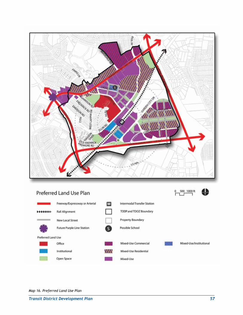
TransitDistrictDevelopmentPlan 57
Map 16. Preferred Land Use Plan
58 TransitDistrictDevelopmentPlan
j. Treeconservationplanandrelateddocumentationasrequired.
k. Pavedsurfacesandtypeofpavingmaterial.
l. Parkand/orplazalocationanddesign(whereapplicable,dependingonthethresholdsizeoftheproposeddevelopment).
m. Zoning,existingimprovements,streets,alleys,sidewalks,andcurblineswithin150feetofthesite.
n. Existingandproposedrights-of-wayandexistingstreetcenterline.
o. Parkingplan(thetotalnumberofparkingspacesbytype[on-street,surface,andstructured]andsharedparkingutilizationschedule,ifapplicable).
p. Lightingplan(lightingdetailsandspecificationsincludingtype,height,location,andmethodofilluminationinfoot-candlesforexteriorbuildingfacades,streetscapes,andoutdoorspaces).
q. Locationofpublicschool(s)orotherpublicfacilities.
3. TrafficStudyandCirculationPlan—Showallpedestrian,bicycle,andvehicularcirculationandaccessroutesonandadjacenttothedevelopmentsite.Submitatrafficimpactanalysisfortheproposedusesonthesite.
4. PhotographsandLocationsofAdjacentProperties—Ifthedevelopmentsitebordersasingle-familyresidentialneighborhood,submitphotographsandlocationsofpropertieswithin150feetthatshowbuildingmass1,scale2,materials,androofpitches3ofsingle-familyhomes.
5. SignPlan—Signpermitapplicationsshallsubmitbothsigndetailsandagraphicrepresentationofthelocationsoftheproposedsignageonallbuildings.Theplanshallincludethelocation(s),size,height,color,letteringstyle/size,constructiondetails,architecturalmaterials,specifications,andmethodofillumination.TheplanshallbeinconformancewiththesignstandardsfortheNewCarrolltonTDDP.
6. ConceptualStormwaterManagement/EnvironmentalSiteDesignPlan—SubmitallconceptualstormwatermanagementplanstothePrinceGeorge’sCountyDepartmentofPublicWorksandTransportation(DPW&T)forreviewandapproval.DPW&Tapprovalmustbeobtainedbeforebuildingorgradingpermitscanbeissued.
7. TreeConservationPlan(TCPtypewillvarywiththetypeofapplicationsubmitted)—IncludeallinformationrequiredbytheWoodlandandWildlifeHabitatConservationOrdinance,especiallythelocation,type,andcaliperofexistingtreestobepreserved.
8. OtherSupportingDocumentation—Includesupportingdocumentswhererequestedinthedevelopmentstandards(e.g.,streetscapeorparkingprovisions)orinsupportofaproposedrezoningtoanappropriatemixed-usezonecategoryconsistentwiththelanduserecommendationsoftheTDDPforthesite.
AllstreetscapelightingshallbecoordinatedwithDPW&TandtheMarylandStateHighwayAdministration(SHA).
InadditiontoconformingtoallTDDPstandards,allsiteplanapplicationsshalladdressapplicablelanduseandurbandesignguidelinescontainedintheTDDP.
1 “Buildingmass”referstothethree-dimensionalbulkofabuilding:height,width,anddepth.2 “Scale”referstothesizeofabuildinginrelationtosurroundingbuildingsorstructures.3 “Pitch”referstotheangleofslopeforaroof;aflatroofwouldhavea0angleofslope.
TransitDistrictDevelopmentPlan 59
Withtheexceptionofrequirements6(ConceptualStormwaterManagement/EnvironmentalSiteDesignPlan)and8(OtherSupportingDocumentation),allapplicationsmustmeettheaboverequirementsatthetimeofsubmissioninordertobeconsideredcomplete.Incompletesiteplanapplicationswillnotbeacceptedforsiteplanreview.
Applicability of site Plan requirementsNewdevelopmentintheTDOZissubjecttodetailedsiteplanreview.NewdevelopmentmustshowcompliancewiththeTDDPstandardsinthesiteplanreviewprocess.
NotwithstandingrequirementsintheZoningOrdinanceforapprovalofaconceptualsiteplan(CSP)intheM-X-Tandotherzones,compliancewithTDDPcomponents#1–#7(seeNewCarrolltonTDDPComponentsonpage56)attheconceptuallevelsatisfiesallrequirementsforCSPapprovalforpropertyintheTDDP.SubmissionofaCSPisthereforenotrequiredbytheTDDP;however,itisanoptionalapplicationthatmaybeusefulinresolvingconceptualdesign-relatedissues.
TheZoningOrdinancedefinesdevelopmentasanyactivitythatmateriallyaffectstheconditionoruseoflandorastructure.Redevelopment,rehabilitation,andrenovationofexistingstructuresareallformsofdevelopment.Achangefromalowerintensitytoahigherintensityuse,asindicatedinTableIIinSection4.7oftheLandscapeManual,isalsoaformofdevelopment.
ThefollowingusesareexemptedfromtheTDDPstandardsandtherequirementsofsiteplanreview.
1. Legallyexistingdevelopment.
Untilasiteplanissubmitted,allbuildings,structures,andusesthatwerelawfulorcouldbecertifiedasalegalnonconforminguseonthedateoftransitdistrictoverlayzoningmapamendment(TDOZMA)approvalareexemptfromtheTDDPstandardsandfromsiteplanreviewandarenotnonconforming.Untilasiteplanissubmitted,activeshoppingcenterswithfreestandingcommercialusesonperimeterpodsitesarealsoexemptfromtheTDDPstandardsandfromsiteplanreviewandarenotnonconforming.However,theissuanceofabuildingpermitorauseandoccupancypermitforachangeinownershipforanypropertywithfrontagealongapublicstreetshallrequirerestorationorinstallationoflandscapestrips,buffering,andscreeninginaccordancewithSections4.2and4.4oftheLandscapeManual,asmodifiedbythestreetscapestandardsofthisTDDP.Theplanrecommendstheshoppingcenterownersconsiderdevelopingplansforthephasedredevelopmentoftheirpropertiestonewmixed-useurbanplaces.
2. Legallyexistingparkingandloading.
Untilasiteplanissubmitted,alllegallyexistingparkingandloadingspacesintheTDOZthatwerelawfulandnotnonconformingonthedateofTDDP/TDOZapprovalareexemptfromtheTDDPstandardsandsiteplanreview,neednotbereducedinamountorsize,andarenotnonconforming.Thenumberofparkingspaces,loadingspaces,andlandscapingremainingaftertheacquisitionordedicationofright-of-wayfornewstreetsintheTDOZshallbedeemedasadequate.
3. Single-familyresidentialdwellings.
Alladditionstosingle-familyresidentialdwellingsareexemptfromTDDPstandardsandsiteplanreviewiftheresidentialusecontinues.
4. Multifamilydevelopment(seefollowingpage).
60 TransitDistrictDevelopmentPlan
AnadditiontoamultifamilyresidentialstructurethatwaslawfulandnotnonconformingonthedateofTDOZMAapprovalisexemptfromtheTDDPstandardsandsiteplanreviewiftheadditiondoesnotincreasethegrossfloorarea(GFA)bymorethantenpercentor1,000squarefeet,whicheverisless.
5. Nonresidentialdevelopment.
AnadditiontoanonresidentialstructurethatwaslawfulandnotnonconformingonthedateofTDDP/TDOZapprovalisexemptfromtheTDDPstandardsandsiteplanreviewiftheadditiondoesnotincreasetheGFAbymorethantenpercent.
6. Parkingfacilities.
Resurfacing,restriping,oraddinglandscapingtoparkingfacilitiesnotrequiredbytheTDDPdevelopmentstandardsareexemptfromtheTDDPstandardsandsiteplanreviewifthefacilitieswerelawfulandnotnonconformingonthedateofTDOZMAapprovalandremaininconformancewithallpreviouslyapplicableregulations.
7. Nonconformingbuildings,structures,anduses.
a. Restorationorreconstructionofanonconformingbuildingorstructure,oracertifiednonconforminguse,isexemptfromtheTDDPstandardsandsiteplanreviewifitmeetstherequirementsofSection27-243(a)(1)oftheZoningOrdinance.
b. Exceptforimprovementslistedbelowinnumber8,apropertyownermaynotexpandacertifiednonconforminguse,orauseorstructurethatwaslawfulonthedateofTDOZMAapprovalbutdoesnotconformtotheTDDPstandards,unlessadetailedsiteplanisapprovedwithfindingsthattheexpansioniscompatiblewithadjacentusesandmeetsthegoalsoftheTDDP.
8. General.
ThefollowingareexemptfromtheTDDPstandardsandsiteplanreviewiftheexistingorproposeduseispermitted:
a. Permitsforalterationorrehabilitation,withnoincreaseingrossfloorarea
b. Canopies
c. Fences
d. Decks
e. Ordinarymaintenance
f. Changesinoccupancy
g. Changesinownershipexceptforpropertieswithstreetfrontage(see1above)
h. Signs.
(1) SignsforadevelopmentthatdoesnototherwiserequireadetailedsiteplanwillbereviewedinthepermitreviewprocessforcompliancewithTDDPstandards.DeparturesforsignsthatdonotcomplywiththeTDDPstandardsandthatdonototherwiserequireadetailedsiteplanwillbereviewedinthesiteplanprocess.Signsinadevelopmentrequiringadetailedsiteplanwillalsobereviewedinthesiteplanprocess.
(2) NewandreplacementsignsaresubjecttotheTDDPstandards.
i. RefacingofanexistingsignisexemptfromtheTDDPstandards.
TransitDistrictDevelopmentPlan 61
responsibility for required improvements WithintheNewCarrolltonTDOZ,thedeveloper/propertyownershallberequiredtoconstructstreetscapeorotherpublicimprovementsaspartofanydevelopmentproject.Strongconsiderationshouldbegiventotheinclusionofappropriateenvironmentalsitedesign(ESD)structuresandfeatures.Maintenanceofpublicimprovementsshallbecoordinatedwiththeapplicablestate,county,andmunicipalagencies.Dedicationandmaintenanceofallnewrights-of-wayandstreetscapeimprovementsshallbedeterminedatthetimeofpreliminaryplanofsubdivisionapproval.
ListofImprovementsConsiderationshouldbegiventothecreationofabusinessimprovementdistrictwithintheTDOZthatwouldbechargedwithmaintainingpublicimprovements.
Examplesofimprovementsrequiredaspartofdevelopmentinclude:
W Constructingpublicspacesorfacilitiessuchasparks,plazas,schools,andcommunitymultipurposeusefacilities
W MaintainingESDstormwaterstructuresandfeatures
W Installingsidewalks,includingcurbsandgutters
W Undergroundingutilities—Thisstandardappliesonlytonewutilitiestobeplacedwithproposeddevelopmentorredevelopment.Overheadpowerlinesforstreetcarsorlightrailtrainsshallbeexemptfromthisrequirement.
W Installingstreetfurniture(benches,trashreceptacles,bicycleracks,etc.)alongprivatelymaintainedrights-of-waywithintheTDOZ
W Installingandmaintainingstreettreesandstreetlights
W Dedicatingpublicaccesseasements
W Providingpublicart
Allstreetfurnitureonprivaterights-of-waywithintheTDOZshallbemaintainedbythepropertyowner/developer.Nostreetfurnitureorpublicworksofart,otherthanpubliclymaintainedstreetlightsandstreettrees,shallbeinstalledwithinpublicrights-of-waywithoutthepermissionofDPW&Tand/ortheCityofNewCarrolltonexpressedthroughanexecutedmemorandumofunderstandingwiththedeveloper/applicant.Allnon-M-NCPPCparksandopenspaceelementswithintheTDOZshallbemaintainedinaccordancewithawrittenagreementnegotiatedbetweenthecountyandtheCityofNewCarrolltonorotherappropriatelocalentities.
ThresholdsW Alldevelopmentprojectswithmorethan100linearfeetofstreetfrontageandminimumgrossfloorarea(GFA)greaterthan35,000squarefeetofnewspaceshallbesubjecttotherequirementtoprovidestreetscapeimprovements,includingundergroundedutilities,dedicatedeasements,andpublicopenspacessuchasparksandplazas.
W Alldevelopmentprojectswith30to100linearfeetofstreetfrontageandGFAof10,000to35,000squarefeetofnewspaceshallbesubjecttotherequirementtoprovidestreetscapeimprovementswith
62 TransitDistrictDevelopmentPlan
theexceptionofundergroundedutilities,dedicatedeasements,andpublicopenspacessuchasparksandplazas.
W Alldevelopmentprojectswithlessthan30linearfeetofstreetfrontageandGFAlessthan10,000squarefeetofnewspaceshallbeexemptfromTDDPpublicimprovementrequirements.
Permitted and Prohibited Uses within the New Carrollton Transit district overlay Zone PermittedUsesIngeneral,permitteduseswithintheNewCarrolltonTDOZarethesameasthosepermittedintheunderlyingzonesaccordingtothePrinceGeorge’sCountyZoningOrdinance.Exceptionstothisrulearediscussedinthefollowingsectiononprohibiteduses.
ProhibitedUsesCertainusesthatarecurrentlypermittedwithinunderlyingzonesareincompatiblewiththeNewCarrolltonTDDPvisionoftransit-orienteddevelopment(TOD)withintheTDOZ.AsspelledoutintheGeneralPlan,TODisbydefinitiondesignedtopromotetransituseanddecreaseautomobileuse.Thisrequiresabuiltenvironmentthatismadeupofusesthatcomplementeachotheraswellashelptopromotetransituse.
TheusescontainedinthefollowinglistareincompatiblewithGeneralPlanrequirementsforsuccessfulTOD.Mostoftheusesareauto-orientedinnatureanddependonvehiculartrafficfortheirbusiness.Theseusesaretypicallyfoundinstripcommercialdevelopment,notTOD.Otherusescontainedinthislisthaveimpactsbecauseoftheirdesignorfunctionthatrenderthemincompatiblewithresidentialandmixed-useareas.Inaddition,someusesgeneratelargeamountsoftrafficandrequiresignificantamountsofparking,usuallyintheformoflargesurfaceparkinglots.Theseareasareunattractiveandunsafeforpedestriansandthereforeareincompatiblewithpedestrianandtransit-friendlydevelopment.
Thefollowinguses,andanyusethatissimilarinnatureoroperationtoanyofthese,areprohibitedasnewuseswithintheNewCarrolltonTDOZwhetherornottheyarepermittedinanyoftheunderlyingzones:
1. Drive-throughordrive-inrestaurant
2. Fast-foodrestaurantthatisnotwithinashoppingmalloranintegratedshoppingcenter,anofficebuilding,orahotel
3. Vehicle,boat,mobilehome,orcampingtrailersales,rental,repair,orstorage
4. Gasstation
5. Animalhospital
6. Motorizedbicyclerepairshop
7. Funeralparlor
8. Lawnmowersalesorrepairshop
9. Limousineservice
10. Massageestablishmentotherthanalicensedfull-servicespathatmayormaynotbepartofahotelorinn
TransitDistrictDevelopmentPlan 63
11. Methadonetreatmentcenter
12. Printingshopexceeding2,000squarefeetofgrossfloorarea
13. Pawnshop
14. Seafoodmarketcontainingmorethan3,000squarefeetofgrossretailspace
15. Amusementparkwithinawhollyenclosedshoppingmall
16. Outdoorrifle,pistol,orskeetshootingrange
17. Animalorpoultryraising(otherthancustomaryhouseholdpets)
18. Sandandgravelwet-processing
19. Satellitedishantennamorethantenfeetindiameter,toserveonlyonedwellingunit,inaccordancewithSection27-451.01
20. Taxicabdispatchingstation
21. Cemetery
Transit district overlay Zoning Map AmendmentintroductionThelanduserecommendationsintheNewCarrolltonTransitDistrictDevelopmentPlan(seeMap16.PreferredLandUsePlan)arereinforcedbythecomprehensiverezoningproposal,alsoknownasatransitdistrictoverlayzoningmapamendment(TDOZMA)(seeMap17.SummaryofApprovedZoningChanges),whichbringsthezoningoftheplanningareaintoconformancewiththelanduseplan.
TheTDOZMAwasinitiatedbythePlanningBoardinSeptember2007,withtheconcurrenceoftheDistrict(County)CouncilinOctober2007,withtheexpressintenttoprocesstheTDOZMAandtheNewCarrolltonTDDPsimultaneously.TheprocedurefollowedwasinaccordancewithCB-33-1992,whichestablishedtheframeworkfortheprocessofsimultaneousapprovaloftheTDDPandTDOZMAbytheDistrictCouncil.TheproceduralsequenceforthisconcurrentprocessisillustratedinAppendixA:ProceduralFlowchartforTDDP-TDOZMA.
ComprehensiverezoningthroughtheTDOZMAisrequiredtoimplementthelanduseplancontainedintheTDDP.TheTDOZMAhelpstoensurethatfuturedevelopmentwillbeinconformancewithcountylanduseplansanddevelopmentpolicies.Thosepolicies,inturn,shapethecounty’sabilitytoaccommodatefuturedevelopment.TheTDOZMAalsocorrectsexistingzoningthatisincompatiblewithTOD.Inaddition,theTDOZMAreducespiecemealrezoningwithintheTDOZ.Finally,theTDOZMAwillbringzoningintogreaterconformitywithcountylandusegoalsandpoliciesfortheNewCarrolltonTDOZ.DevelopmentthatconformstotherequirementsoftheNewCarrolltonTDDPwillhelpenhancethehealth,safety,andgeneralwelfareofallPrinceGeorge’sCountyresidents.
TheapprovaloftheTDOZMAwillresultintherevisionoftheofficialzoningmapforPlanningAreas69(Bladensburg-NewCarrollton)and72(Landover).ThelastapprovedsectionalmapamendmentsforPlanningAreas69and72wereenactedin1994and1993,respectively.Futurecomprehensiveexaminationsofthezoningwithinthoseportionsoftheseareaswilloccurinaccordancewiththeproceduresestablishedfortransitdistrictoverlayzoningmapamendments.
64 TransitDistrictDevelopmentPlan
ThefollowingarecomprehensiverezoningpoliciesestablishedbythePlanningBoardandDistrictCouncilforpreparationoftheTDOZMA.
Public land PolicyThispolicyisthatallpubliclandshouldbeplacedinthemostrestrictiveordominantadjacentzonethatbearstheclosestrelationshiptotheintendedcharacterofthearea.Therefore,thezoningofbothpublicandprivatelandshouldbecompatiblewithsurroundingzonesandprovideforappropriatefutureuses.
Adistinctionismadewherelargeparcelsoflandaresetasidespecificallyaspublicopenspace.Inthesecases,theR-O-S(ReservedOpenSpace)ZoneortheO-S(OpenSpace)Zoneisappliedasthemostappropriatezone,dependingontheproperty’ssize.
AlthoughfederalandstategovernmentpropertyisnotsubjecttotherequirementsoftheZoningOrdinance,thecomprehensiverezoningprocessismeanttoapplyazoningcategorytoallland,includinggovernmentproperty,regardlessofownership.TheR-O-SZoneisgenerallyappliedtofederalandstateproperties,unlessspecificusesortheintendedcharacterofthepropertyorareashouldwarrantanotherzoningcategory.ThispolicycomplieswithSection27-113ofthePrinceGeorge’sCountyZoningOrdinance.Section27-113statesthatanylandwhichisconveyedinfeesimplebytheUnitedStatesofAmericaorbytheStateofMarylandshallimmediatelybeplacedintheR-O-SZoneuntilazoningmapamendmentforthelandhasbeenapprovedbytheDistrictCouncil.
Zoning in Public rights‑of‑wayPoliciesgoverningthezoningofpublicstreetandrailroadrights-of-way(bothexistingandproposed)arecontainedinSection27-111ofthePrinceGeorge’sCountyZoningOrdinance.ThisproposedTDOZMAhasbeenpreparedinaccordancewithSection27-111.
limitations on the Use of ZonesZoningclassificationsproposedintheTDOZMAarelimitedbytherangeofzoneswithintheordinanceavailableatthetimeoffinalactionbytheDistrictCouncil.However,therearecertainrestrictionsonwhenthesemaybeappliedtoproperties(Section27-223oftheZoningOrdinance).
Reclassificationofanexistingzonetoalessintensezoneisprohibitedwhere:
(g)(1)“ThepropertyhasbeenrezonedbyZoningMapAmendmentwithinfive(5)yearspriortotheinitiationoftheSectionalMapAmendmentorduringtheperiodbetweeninitiationandtransmittaltotheDistrictCouncil,andthepropertyownerhasnotconsentedinwritingtosuchrezoning;”or
(g)(2)“BasedonexistingphysicaldevelopmentatthetimeofadoptionoftheSectionalMapAmendment,therezoningwouldcreateanonconforminguse.Thisrezoningmaybeapproved,however,ifthereisasignificantpublicbenefittobeservedbytherezoningbasedonfactspeculiartothesubjectpropertyandtheimmediateneighborhood.Inrecommendingtherezoning,thePlanningBoardshallidentifythesepropertiesandprovidewrittenjustificationsupportingtherezoningatthetimeoftransmittal.ThefailureofeitherthePlanningBoardorpropertyownertoidentifytheseproperties,orafailureofthePlanningBoardtoprovidethewrittenjustification,shallnotinvalidateanyCouncilactionintheapprovaloftheSectionalMapAmendment.”
Inordertoclarifyagivenparcelofland’slevelofprotectionfromlessintensiverezoningbyphysicaldevelopment,theZoningOrdinancestatesinSection27-223(h)that:
“Theareaofthe‘property,’asthewordisusedinSubsection(g)(2),above,istheminimumrequiredbytheZoningOrdinancewhichmakestheuselegallyexistingwhentheSectionalMapAmendmentisapproved.”
TransitDistrictDevelopmentPlan 65
Guidelines for Commercial ZoningThecomprehensiverezoningproposalwillrecommendthemostappropriateofthecommercialormixed-usezoneslistedinthePrinceGeorge’sCountyZoningOrdinance.Thechoiceofzonesisdeterminedbythecommercialneedsofthearea,theTDDPrecommendations,andthetypeofuseandstatusofdevelopmentonaffectedpropertiesandthesurroundingarea.
Conditional ZoningSafeguards,requirements,andconditionsbeyondthenormalprovisionsoftheZoningOrdinancethatcanbeattachedtoindividualzoningmapamendmentsviaconditionalzoningcannotbeusedinTDOZMAs.Inthepiecemealrezoningprocess,conditionsareusedto(1)protectsurroundingpropertiesfrompotentialadverseeffectsofaproposedzoningmapamendmentand/or(2)toenhancecoordinated,harmonious,andsystematicdevelopmentoftheRegionalDistrict(thecombinedareasofMontgomeryCountyandPrinceGeorge’sCountyexcludingtheCityofLaurel).WhenapprovedbytheDistrictCouncilandacceptedbythezoningapplicant,conditionsbecomepartofthecountyzoningmaprequirementsapplicabletoaspecificpropertyandareasbindingasanyprovisionofthecountyZoningOrdinance(seeConditionalZoningProcedures,Section27-157(b)).
Intheory,zoningactionstakenaspartofthecomprehensiverezoning(TDOZMA)processshouldbecompatiblewithotherlanduseswithouttheuseofconditions.However,theTDOZMAisnotintendedtorepealtheadditionalrequirementsdeterminedviaconditionalzoningcasesthathavebeenapprovedbeforeitsinitiation.Therefore,whenspecialconditionsforthedevelopmentofspecificpropertieshavebeenpubliclyagreeduponandhavebecomepartoftheexistingzoningmapapplicabletothoseproperties,thoseconditionsshallbebroughtforwardintheTDOZMA.Thisisaccomplishedbycontinuingtheapprovedzoningwithconditionsandshowingthezoningapplicationnumberonthenewlyadoptedzoningmap.Thisactiontakesplaceonlywhenitisfoundthattheexistingzoningiscompatiblewiththeintendedzoningpatternorwhenordinancelimitationsprecludearezoning.Similarly,findingscontainedinpreviouslyapprovedSMAsshallbebroughtforwardintheTDOZMAwherethepreviouszoningcategoryhasbeenmaintained.
Transit district overlay ZonesTDOZsmaybeincludedinaTDOZMA.However,theflexiblenatureofthesezonesrequiresabasicplanofdevelopmenttobesubmittedthroughthezoningapplicationprocessasazoningmapamendmentinordertoevaluatethecomprehensivedesignproposal.Thebasicplanidentifieslandusetypes,quantities,andrelationships.ItistheonlylegaltoolthroughwhichaTDOZcanberecognizedaspartoftheZoningOrdinance.Anapplicationmustbefiled,includingthebasicplan,andthePlanningBoardmusthaveconsideredandrecommendedapprovalofthezoningapplicationinorderfortheTDOZtobeincludedwithintheTDOZMA.Duringthecomprehensiverezoningandbeforethesubmissionofsuchproposals,propertymustbeclassifiedinaconventionalzonethatprovidesanappropriatebasedensityfordevelopment.Intheory,thebasedensityzoneallowsforanacceptablelevelofalternativedevelopmentshouldtheownerchoosenottopursuethefulldevelopmentpotentialindicatedbythesectorplan.(SeeSection27-223(b),Section27-225(b)(1),Section27-226(a)(2),andSection27-226(f )(4)).
Comprehensive rezoning ChangesToimplementthedevelopmentpoliciesandlanduserecommendationscontainedintheNewCarrolltonTDDP,manyparcelsoflandhavebeenrezonedtobringthezoningintoconformancewiththeapprovedTDDP.Thecomprehensiverezoningprocess(viatheTDOZMA)isthebestwayforthepublicsectortoachievethis.Therefore,theTDOZMAhasbeenapprovedasanamendmenttotheofficialzoningmap(s)concurrentlywiththeTDDP.
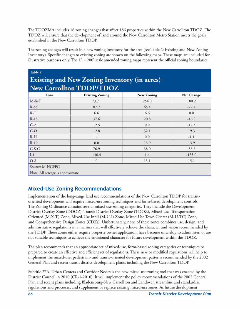
66 TransitDistrictDevelopmentPlan
TheTDOZMAincludes16zoningchangesthataffect186propertieswithintheNewCarrolltonTDOZ.TheTDOZwillensurethatthedevelopmentoflandaroundtheNewCarrolltonMetroStationmeetsthegoalsestablishedintheNewCarrolltonTDDP.
Thezoningchangeswillresultinanewzoninginventoryforthearea(seeTable2:ExistingandNewZoningInventory).Specificchangestoexistingzoningareshownonthefollowingmaps.Thesemapsareincludedforillustrativepurposesonly.The1”=200’scaleamendedzoningmapsrepresenttheofficialzoningboundaries.
Mixed‑Use Zoning recommendationsImplementationofthelong-rangelanduserecommendationsoftheNewCarrolltonTDDPfortransit-orienteddevelopmentwillrequiremixed-usezoningtechniquesandform-baseddevelopmentcontrols.TheZoningOrdinancecontainsseveralmixed-usezoningcategories.TheyincludetheDevelopmentDistrictOverlayZone(DDOZ),TransitDistrictOverlayZone(TDOZ),Mixed-Use-TransportationOriented(M-X-T)Zone,Mixed-UseInfill(M-U-I)Zone,Mixed-UseTownCenter(M-U-TC)Zone,andComprehensiveDesignZones(CDZs).Unfortunately,noneofthesezonescombinesuse,design,andadministrativeregulationsinamannerthatwilleffectivelyachievethecharacterandvisionrecommendedbytheTDDP.Thesezoneseitherrequirepropertyownerapplication,havebecomeunwieldytoadminister,orarenotsuitabletechniquestoachievetheenvisionedcharacterforfuturedevelopmentwithintheTDOZ.
Theplanrecommendsthatanappropriatesetofmixed-use,form-basedzoningcategoriesortechniquesbepreparedtocreateaneffectiveandefficientsetofregulations.Thesenewormodifiedregulationswillhelptoimplementthemixed-use,pedestrian-andtransit-orienteddevelopmentpatternsrecommendedbythe2002GeneralPlanandrecenttransitdistrictdevelopmentplans,includingtheNewCarrolltonTDDP.
Subtitle27A.UrbanCentersandCorridorNodesisthenewmixed-usezoningtoolthatwasenactedbytheDistrictCouncilin2010(CR-1-2010).Itwillimplementthepolicyrecommendationsofthe2002GeneralPlanandrecentplansincludingBladensburg-NewCarrolltonandLandover,streamlineandstandardizeregulationsandprocesses,andsupplementorreplaceexistingmixed-usezones.Asfuturedevelopment
Table 2
Existing and New Zoning Inventory (in acres) New Carrollton TDDP/TDOZ
Zone Existing Zoning New Zoning Net Change
M-X-T 73.71 254.0 180.2R-55 87.7 65.4 -22.4R-T 6.6 6.6 0.0R-18 37.6 20.8 -16.8C-2 12.5 0.0 -12.5C-O 12.8 32.1 19.3R-H 1.1 0.0 -1.1R-10 0.0 13.9 13.9C-S-C 76.9 38.0 -38.8I-1 136.4 1.4 -135.0O-S 0 15.1 15.1Source:M-NCPPCNote:Allacreageisapproximate.
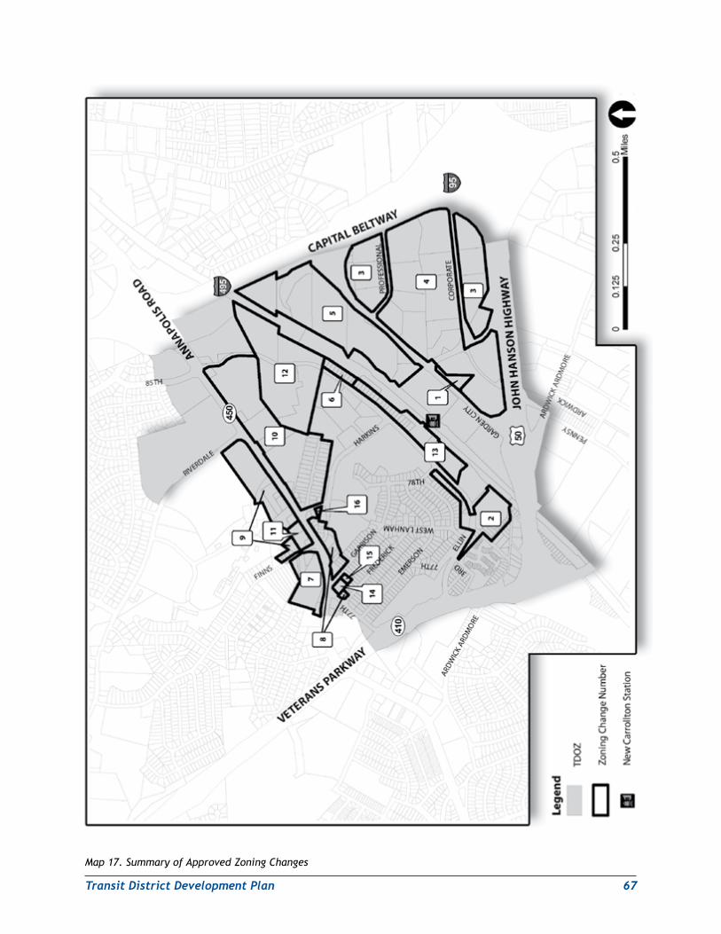
TransitDistrictDevelopmentPlan 67
Map 17. Summary of Approved Zoning Changes
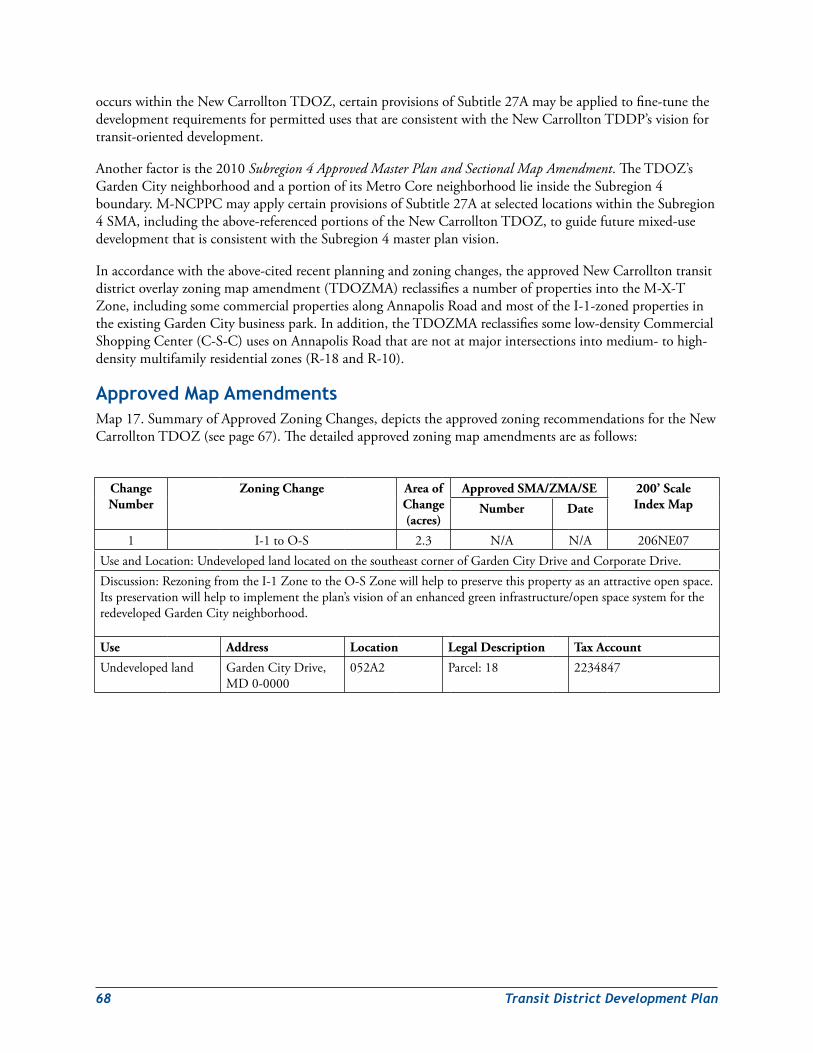
68 TransitDistrictDevelopmentPlan
occurswithintheNewCarrolltonTDOZ,certainprovisionsofSubtitle27Amaybeappliedtofine-tunethedevelopmentrequirementsforpermittedusesthatareconsistentwiththeNewCarrolltonTDDP’svisionfortransit-orienteddevelopment.
Anotherfactoristhe2010Subregion 4 Approved Master Plan and Sectional Map Amendment.TheTDOZ’sGardenCityneighborhoodandaportionofitsMetroCoreneighborhoodlieinsidetheSubregion4boundary.M-NCPPCmayapplycertainprovisionsofSubtitle27AatselectedlocationswithintheSubregion4SMA,includingtheabove-referencedportionsoftheNewCarrolltonTDOZ,toguidefuturemixed-usedevelopmentthatisconsistentwiththeSubregion4masterplanvision.
Inaccordancewiththeabove-citedrecentplanningandzoningchanges,theapprovedNewCarrolltontransitdistrictoverlayzoningmapamendment(TDOZMA)reclassifiesanumberofpropertiesintotheM-X-TZone,includingsomecommercialpropertiesalongAnnapolisRoadandmostoftheI-1-zonedpropertiesintheexistingGardenCitybusinesspark.Inaddition,theTDOZMAreclassifiessomelow-densityCommercialShoppingCenter(C-S-C)usesonAnnapolisRoadthatarenotatmajorintersectionsintomedium-tohigh-densitymultifamilyresidentialzones(R-18andR-10).
Approved Map AmendmentsMap17.SummaryofApprovedZoningChanges,depictstheapprovedzoningrecommendationsfortheNewCarrolltonTDOZ(seepage67).Thedetailedapprovedzoningmapamendmentsareasfollows:
Change Number
Zoning Change Area of Change (acres)
Approved SMA/ZMA/SE 200’ Scale Index MapNumber Date
1 I-1toO-S 2.3 N/A N/A 206NE07UseandLocation:UndevelopedlandlocatedonthesoutheastcornerofGardenCityDriveandCorporateDrive.Discussion:RezoningfromtheI-1ZonetotheO-SZonewillhelptopreservethispropertyasanattractiveopenspace.Itspreservationwillhelptoimplementtheplan’svisionofanenhancedgreeninfrastructure/openspacesystemfortheredevelopedGardenCityneighborhood.
Use Address Location Legal Description Tax Account
Undevelopedland GardenCityDrive,MD0-0000
052A2 Parcel:18 2234847
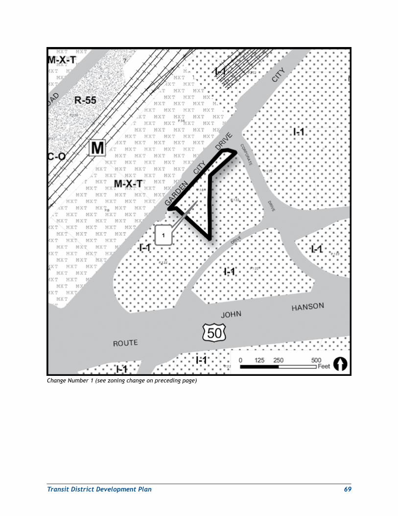
TransitDistrictDevelopmentPlan 69
Change Number 1 (see zoning change on preceding page)
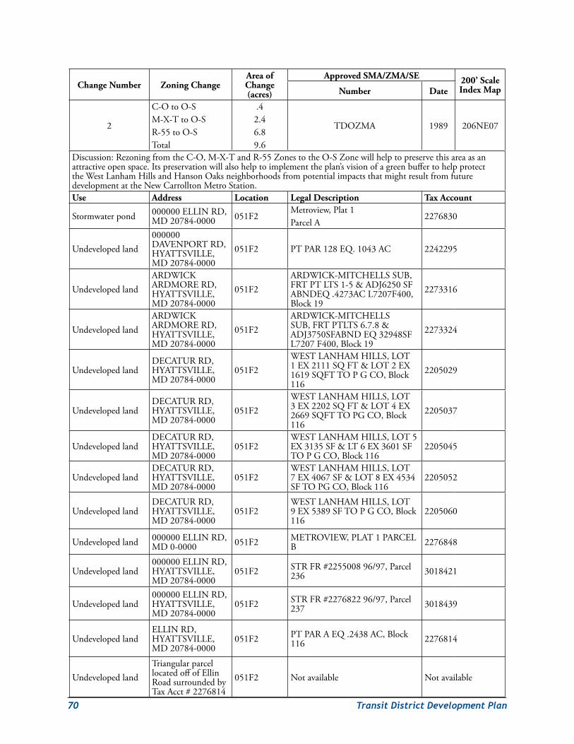
70 TransitDistrictDevelopmentPlan
Change Number Zoning ChangeArea of Change (acres)
Approved SMA/ZMA/SE 200’ Scale Index MapNumber Date
2
C-OtoO-SM-X-TtoO-SR-55toO-STotal
.42.46.89.6
TDOZMA 1989 206NE07
Discussion:RezoningfromtheC-O,M-X-TandR-55ZonestotheO-SZonewillhelptopreservethisareaasanattractiveopenspace.Itspreservationwillalsohelptoimplementtheplan’svisionofagreenbuffertohelpprotecttheWestLanhamHillsandHansonOaksneighborhoodsfrompotentialimpactsthatmightresultfromfuturedevelopmentattheNewCarrolltonMetroStation.Use Address Location Legal Description Tax Account
Stormwaterpond 000000ELLINRD,MD20784-0000 051F2
Metroview,Plat1ParcelA
2276830
Undevelopedland000000DAVENPORTRD,HYATTSVILLE,MD20784-0000
051F2 PTPAR128EQ.1043AC 2242295
UndevelopedlandARDWICKARDMORERD,HYATTSVILLE,MD20784-0000
051F2ARDWICK-MITCHELLSSUB,FRTPTLTS1-5&ADJ6250SFABNDEQ.4273ACL7207F400,Block19
2273316
UndevelopedlandARDWICKARDMORERD,HYATTSVILLE,MD20784-0000
051F2ARDWICK-MITCHELLSSUB,FRTPTLTS6.7.8&ADJ3750SFABNDEQ32948SFL7207F400,Block19
2273324
UndevelopedlandDECATURRD,HYATTSVILLE,MD20784-0000
051F2WESTLANHAMHILLS,LOT1EX2111SQFT&LOT2EX1619SQFTTOPGCO,Block116
2205029
UndevelopedlandDECATURRD,HYATTSVILLE,MD20784-0000
051F2WESTLANHAMHILLS,LOT3EX2202SQFT&LOT4EX2669SQFTTOPGCO,Block116
2205037
UndevelopedlandDECATURRD,HYATTSVILLE,MD20784-0000
051F2WESTLANHAMHILLS,LOT5EX3135SF<6EX3601SFTOPGCO,Block116
2205045
UndevelopedlandDECATURRD,HYATTSVILLE,MD20784-0000
051F2WESTLANHAMHILLS,LOT7EX4067SF&LOT8EX4534SFTOPGCO,Block116
2205052
UndevelopedlandDECATURRD,HYATTSVILLE,MD20784-0000
051F2WESTLANHAMHILLS,LOT9EX5389SFTOPGCO,Block116
2205060
Undevelopedland 000000ELLINRD,MD0-0000 051F2 METROVIEW,PLAT1PARCEL
B 2276848
Undevelopedland000000ELLINRD,HYATTSVILLE,MD20784-0000
051F2 STRFR#225500896/97,Parcel236 3018421
Undevelopedland000000ELLINRD,HYATTSVILLE,MD20784-0000
051F2 STRFR#227682296/97,Parcel237 3018439
UndevelopedlandELLINRD,HYATTSVILLE,MD20784-0000
051F2 PTPARAEQ.2438AC,Block116 2276814
UndevelopedlandTriangularparcellocatedoffofEllinRoadsurroundedbyTaxAcct#2276814
051F2 Notavailable Notavailable
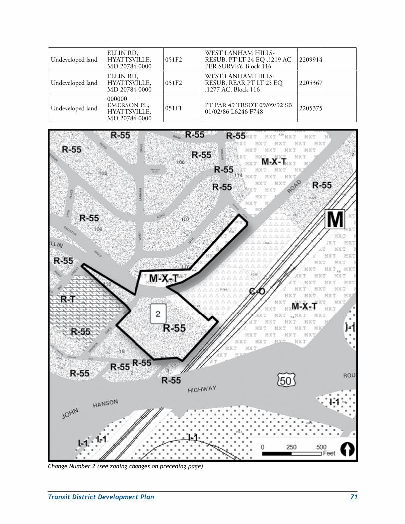
TransitDistrictDevelopmentPlan 71
UndevelopedlandELLINRD,HYATTSVILLE,MD20784-0000
051F2WESTLANHAMHILLS-RESUB,PTLT24EQ.1219ACPERSURVEY,Block116
2209914
UndevelopedlandELLINRD,HYATTSVILLE,MD20784-0000
051F2WESTLANHAMHILLS-RESUB,REARPTLT25EQ.1277AC,Block116
2205367
Undevelopedland000000EMERSONPL,HYATTSVILLE,MD20784-0000
051F1 PTPAR49TRSDT09/09/92SB01/02/86L6246F748 2205375
Change Number 2 (see zoning changes on preceding page)
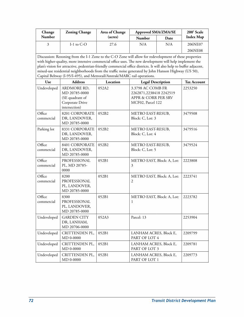
72 TransitDistrictDevelopmentPlan
Change Number
Zoning Change Area of Change (acres)
Approved SMA/ZMA/SE 200’ Scale Index MapNumber Date
3 I-1toC-O 27.6 N/A N/A 206NE07206NE08
Discussion:RezoningfromtheI-1ZonetotheC-OZonewillallowforredevelopmentofthesepropertieswithhigher-quality,moreintensivecommercialofficeuses.Thenewdevelopmentwillhelpimplementtheplan’svisionforattractive,pedestrian-friendlycommercialofficedistricts.Itwillalsohelptobufferadjacent,mixed-useresidentialneighborhoodsfromthetrafficnoisegeneratedbyJohnHansonHighway(US50),CapitalBeltway(I-95/I-495),andMetrorail/Amtrak/MARCrailoperations.
Use Address Location Legal Description Tax Account
Undeveloped ARDMORERD,MD20785-0000(SEquadrantofCorporateDriveintersection)
052A2 3.3798ACCOMBFR2262871,22384182242519APPR&CORRPERSRVMCF02,Parcel122
2253250
Officecommercial
8201CORPORATEDR,LANDOVER,MD20785-0000
052B2 METROEAST-RESUB,Block:C,Lot:3
3479508
Parkinglot 8331CORPORATEDR,LANDOVER,MD20785-0000
052B2 METROEAST-RESUB,Block:C,Lot:4
3479516
Officecommercial
8401CORPORATEDR,LANDOVER,MD20785-0000
052B2 METROEAST-RESUB,Block:C,Lot:5
3479524
Officecommercial
PROFESSIONALPL,MD20785-0000
052B1 METROEAST,Block:A,Lot:3
2223808
Officecommercial
8200PROFESSIONALPL,LANDOVER,MD20785-0000
052B1 METROEAST,Block:A,Lot:2
2223741
Officecommercial
8300PROFESSIONALPL,LANDOVER,MD20785-0000
052B1 METROEAST,Block:A,Lot:1
2223782
Undeveloped GARDENCITYDR,LANHAM,MD20706-0000
052A3 Parcel:13 2253904
Undeveloped CRITTENDENPL,MD0-0000
052B1 LANHAMACRES,BlockE,PARTOFLOT4
2209799
Undeveloped CRITTENDENPL,MD0-0000
052B1 LANHAMACRES,BlockE,PARTOFLOT3
2209781
Undeveloped CRITTENDENPL,MD0-0000
052B1 LANHAMACRES,BlockE,PARTOFLOT1
2209773
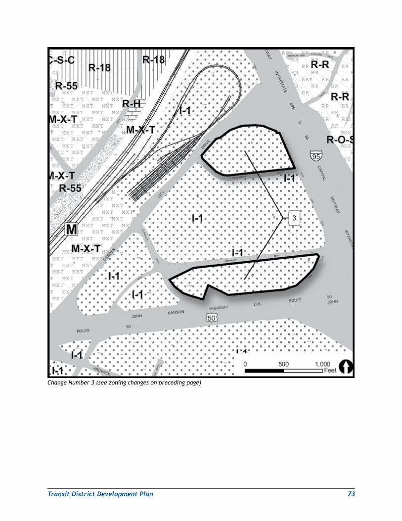
TransitDistrictDevelopmentPlan 73
Change Number 3 (see zoning changes on preceding page)
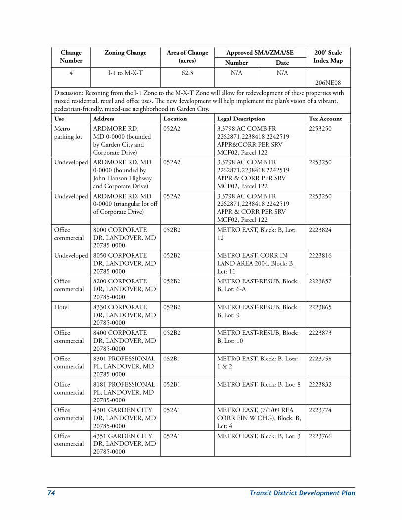
74 TransitDistrictDevelopmentPlan
Change Number
Zoning Change Area of Change (acres)
Approved SMA/ZMA/SE 200’ Scale Index MapNumber Date
4 I-1toM-X-T 62.3 N/A N/A206NE08
Discussion:RezoningfromtheI-1ZonetotheM-X-TZonewillallowforredevelopmentofthesepropertieswithmixedresidential,retailandofficeuses.Thenewdevelopmentwillhelpimplementtheplan’svisionofavibrant,pedestrian-friendly,mixed-useneighborhoodinGardenCity.Use Address Location Legal Description Tax Account
Metroparkinglot
ARDMORERD,MD0-0000(boundedbyGardenCityandCorporateDrive)
052A2 3.3798ACCOMBFR2262871,22384182242519APPR&CORRPERSRVMCF02,Parcel122
2253250
Undeveloped ARDMORERD,MD0-0000(boundedbyJohnHansonHighwayandCorporateDrive)
052A2 3.3798ACCOMBFR2262871,22384182242519APPR&CORRPERSRVMCF02,Parcel122
2253250
Undeveloped ARDMORERD,MD0-0000(triangularlotoffofCorporateDrive)
052A2 3.3798ACCOMBFR2262871,22384182242519APPR&CORRPERSRVMCF02,Parcel122
2253250
Officecommercial
8000CORPORATEDR,LANDOVER,MD20785-0000
052B2 METROEAST,Block:B,Lot:12
2223824
Undeveloped 8050CORPORATEDR,LANDOVER,MD20785-0000
052B2 METROEAST,CORRINLANDAREA2004,Block:B,Lot:11
2223816
Officecommercial
8200CORPORATEDR,LANDOVER,MD20785-0000
052B2 METROEAST-RESUB,Block:B,Lot:6-A
2223857
Hotel 8330CORPORATEDR,LANDOVER,MD20785-0000
052B2 METROEAST-RESUB,Block:B,Lot:9
2223865
Officecommercial
8400CORPORATEDR,LANDOVER,MD20785-0000
052B2 METROEAST-RESUB,Block:B,Lot:10
2223873
Officecommercial
8301PROFESSIONALPL,LANDOVER,MD20785-0000
052B1 METROEAST,Block:B,Lots:1&2
2223758
Officecommercial
8181PROFESSIONALPL,LANDOVER,MD20785-0000
052B1 METROEAST,Block:B,Lot:8 2223832
Officecommercial
4301GARDENCITYDR,LANDOVER,MD20785-0000
052A1 METROEAST,(7/1/09REACORRFINWCHG),Block:B,Lot:4
2223774
Officecommercial
4351GARDENCITYDR,LANDOVER,MD20785-0000
052A1 METROEAST,Block:B,Lot:3 2223766
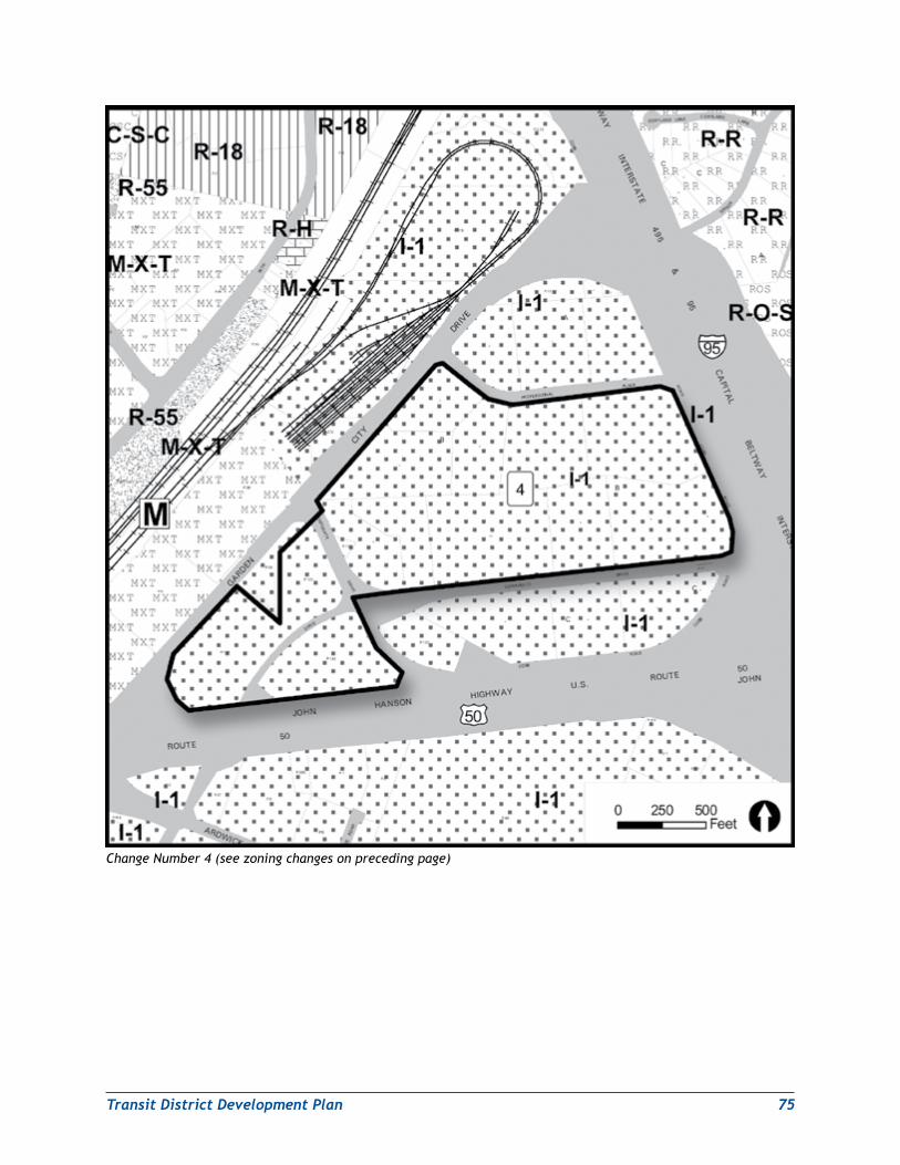
TransitDistrictDevelopmentPlan 75
Change Number 4 (see zoning changes on preceding page)
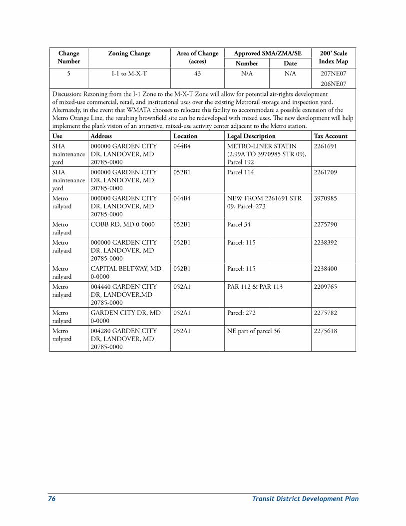
76 TransitDistrictDevelopmentPlan
Change Number
Zoning Change Area of Change (acres)
Approved SMA/ZMA/SE 200’ Scale Index MapNumber Date
5 I-1toM-X-T 43 N/A N/A 207NE07206NE07
Discussion:RezoningfromtheI-1ZonetotheM-X-TZonewillallowforpotentialair-rightsdevelopmentofmixed-usecommercial,retail,andinstitutionalusesovertheexistingMetrorailstorageandinspectionyard.Alternately,intheeventthatWMATAchoosestorelocatethisfacilitytoaccommodateapossibleextensionoftheMetroOrangeLine,theresultingbrownfieldsitecanberedevelopedwithmixeduses.Thenewdevelopmentwillhelpimplementtheplan’svisionofanattractive,mixed-useactivitycenteradjacenttotheMetrostation.Use Address Location Legal Description Tax Account
SHAmaintenanceyard
000000GARDENCITYDR,LANDOVER,MD20785-0000
044B4 METRO-LINERSTATIN(2.99ATO3970985STR09),Parcel192
2261691
SHAmaintenanceyard
000000GARDENCITYDR,LANDOVER,MD20785-0000
052B1 Parcel114 2261709
Metrorailyard
000000GARDENCITYDR,LANDOVER,MD20785-0000
044B4 NEWFROM2261691STR09,Parcel:273
3970985
Metrorailyard
COBBRD,MD0-0000 052B1 Parcel34 2275790
Metrorailyard
000000GARDENCITYDR,LANDOVER,MD20785-0000
052B1 Parcel:115 2238392
Metrorailyard
CAPITALBELTWAY,MD0-0000
052B1 Parcel:115 2238400
Metrorailyard
004440GARDENCITYDR,LANDOVER,MD20785-0000
052A1 PAR112&PAR113 2209765
Metrorailyard
GARDENCITYDR,MD0-0000
052A1 Parcel:272 2275782
Metrorailyard
004280GARDENCITYDR,LANDOVER,MD20785-0000
052A1 NEpartofparcel36 2275618
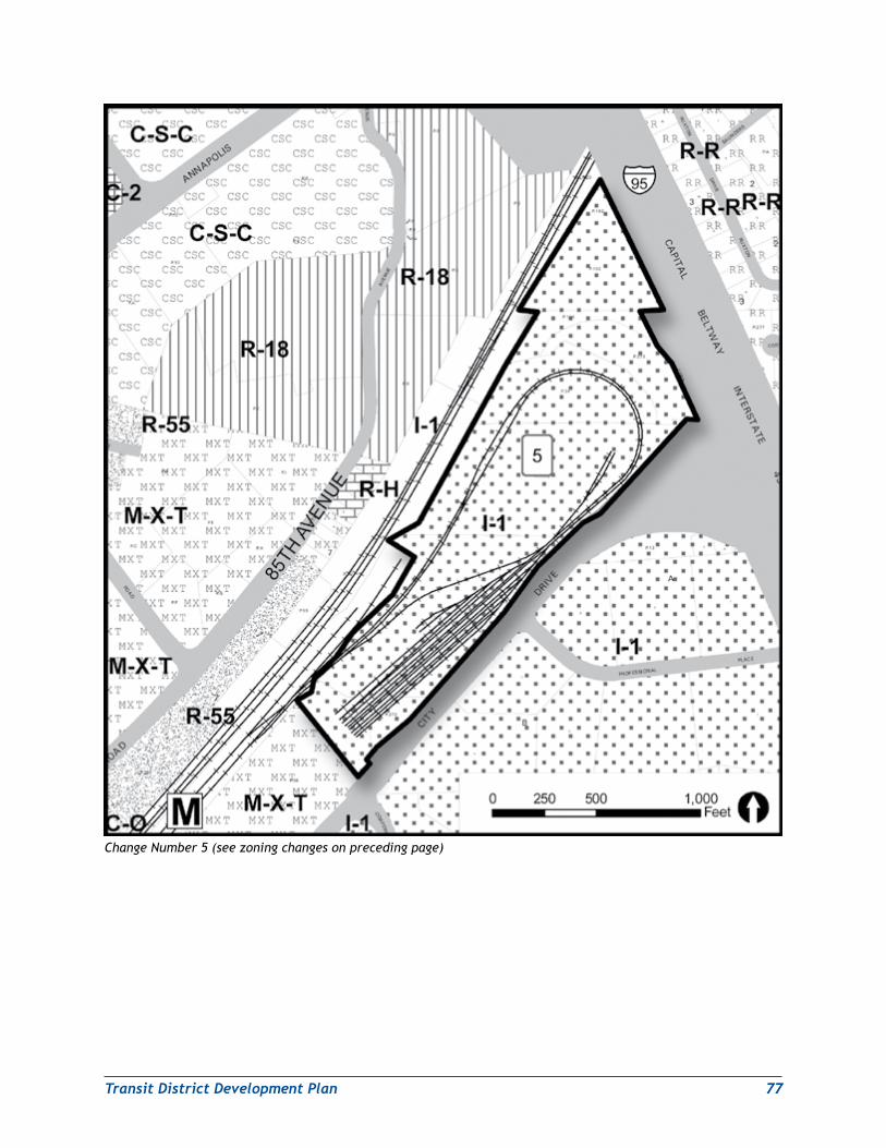
TransitDistrictDevelopmentPlan 77
Change Number 5 (see zoning changes on preceding page)
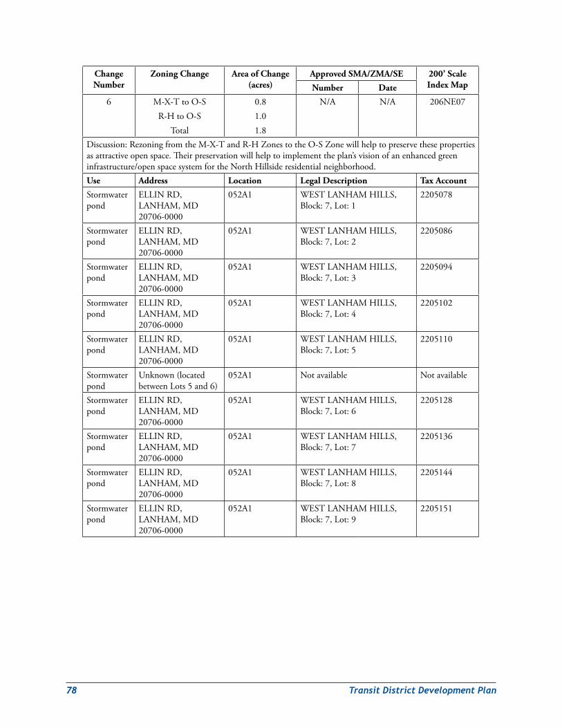
78 TransitDistrictDevelopmentPlan
Change Number
Zoning Change Area of Change (acres)
Approved SMA/ZMA/SE 200’ Scale Index MapNumber Date
6 M-X-TtoO-SR-HtoO-S
Total
0.81.01.8
N/A N/A 206NE07
Discussion:RezoningfromtheM-X-TandR-HZonestotheO-SZonewillhelptopreservethesepropertiesasattractiveopenspace.Theirpreservationwillhelptoimplementtheplan’svisionofanenhancedgreeninfrastructure/openspacesystemfortheNorthHillsideresidentialneighborhood.Use Address Location Legal Description Tax Account
Stormwaterpond
ELLINRD,LANHAM,MD20706-0000
052A1 WESTLANHAMHILLS,Block:7,Lot:1
2205078
Stormwaterpond
ELLINRD,LANHAM,MD20706-0000
052A1 WESTLANHAMHILLS,Block:7,Lot:2
2205086
Stormwaterpond
ELLINRD,LANHAM,MD20706-0000
052A1 WESTLANHAMHILLS,Block:7,Lot:3
2205094
Stormwaterpond
ELLINRD,LANHAM,MD20706-0000
052A1 WESTLANHAMHILLS,Block:7,Lot:4
2205102
Stormwaterpond
ELLINRD,LANHAM,MD20706-0000
052A1 WESTLANHAMHILLS,Block:7,Lot:5
2205110
Stormwaterpond
Unknown(locatedbetweenLots5and6)
052A1 Notavailable Notavailable
Stormwaterpond
ELLINRD,LANHAM,MD20706-0000
052A1 WESTLANHAMHILLS,Block:7,Lot:6
2205128
Stormwaterpond
ELLINRD,LANHAM,MD20706-0000
052A1 WESTLANHAMHILLS,Block:7,Lot:7
2205136
Stormwaterpond
ELLINRD,LANHAM,MD20706-0000
052A1 WESTLANHAMHILLS,Block:7,Lot:8
2205144
Stormwaterpond
ELLINRD,LANHAM,MD20706-0000
052A1 WESTLANHAMHILLS,Block:7,Lot:9
2205151
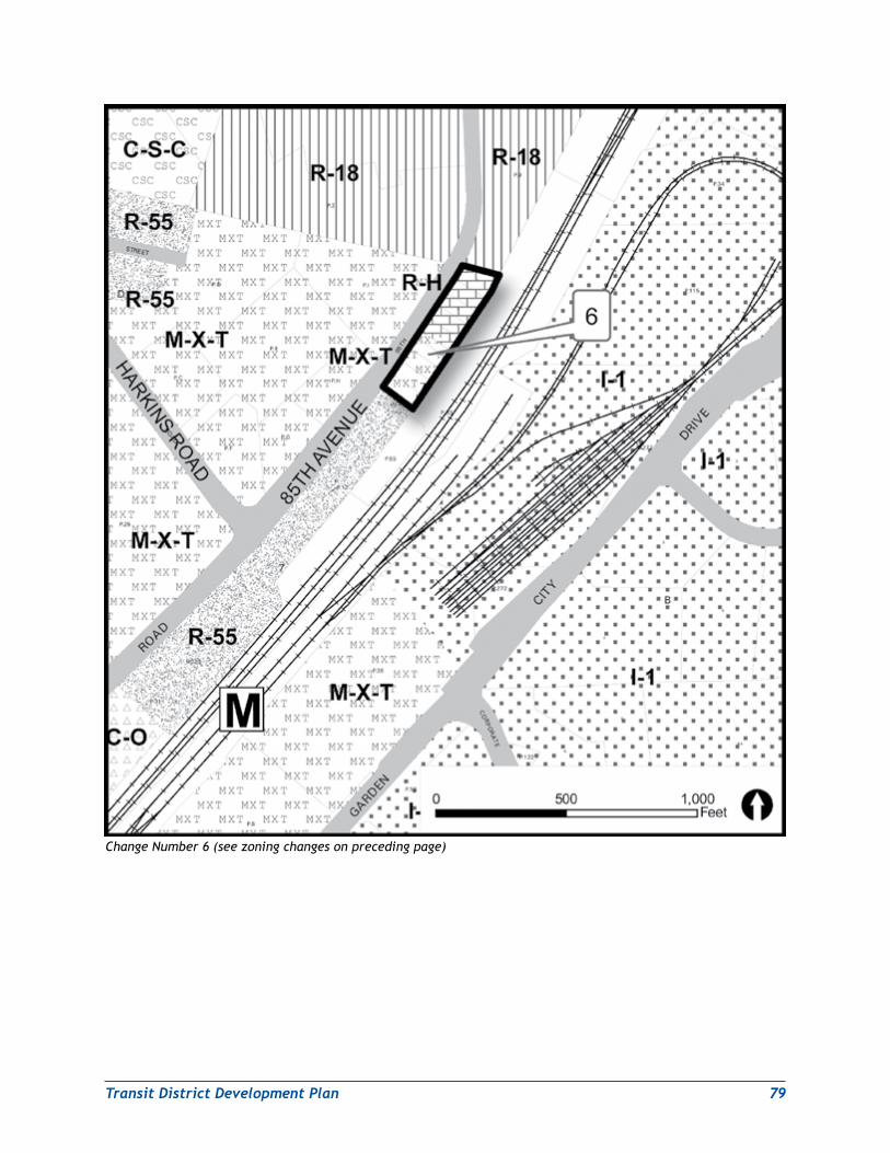
TransitDistrictDevelopmentPlan 79
Change Number 6 (see zoning changes on preceding page)
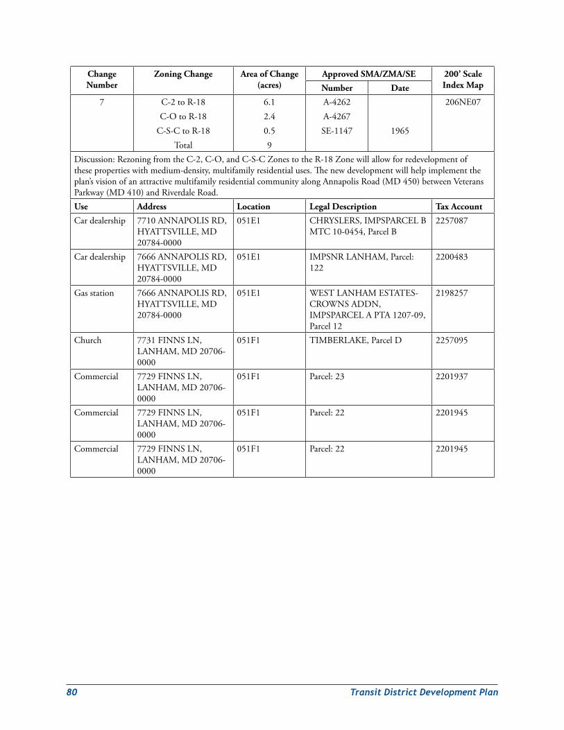
80 TransitDistrictDevelopmentPlan
Change Number
Zoning Change Area of Change (acres)
Approved SMA/ZMA/SE 200’ Scale Index MapNumber Date
7 C-2toR-18C-OtoR-18
C-S-CtoR-18Total
6.12.40.59
A-4262A-4267SE-1147 1965
206NE07
Discussion:RezoningfromtheC-2,C-O,andC-S-CZonestotheR-18Zonewillallowforredevelopmentofthesepropertieswithmedium-density,multifamilyresidentialuses.Thenewdevelopmentwillhelpimplementtheplan’svisionofanattractivemultifamilyresidentialcommunityalongAnnapolisRoad(MD450)betweenVeteransParkway(MD410)andRiverdaleRoad.Use Address Location Legal Description Tax Account
Cardealership 7710ANNAPOLISRD,HYATTSVILLE,MD20784-0000
051E1 CHRYSLERS,IMPSPARCELBMTC10-0454,ParcelB
2257087
Cardealership 7666ANNAPOLISRD,HYATTSVILLE,MD20784-0000
051E1 IMPSNRLANHAM,Parcel:122
2200483
Gasstation 7666ANNAPOLISRD,HYATTSVILLE,MD20784-0000
051E1 WESTLANHAMESTATES-CROWNSADDN,IMPSPARCELAPTA1207-09,Parcel12
2198257
Church 7731FINNSLN,LANHAM,MD20706-0000
051F1 TIMBERLAKE,ParcelD 2257095
Commercial 7729FINNSLN,LANHAM,MD20706-0000
051F1 Parcel:23 2201937
Commercial 7729FINNSLN,LANHAM,MD20706-0000
051F1 Parcel:22 2201945
Commercial 7729FINNSLN,LANHAM,MD20706-0000
051F1 Parcel:22 2201945
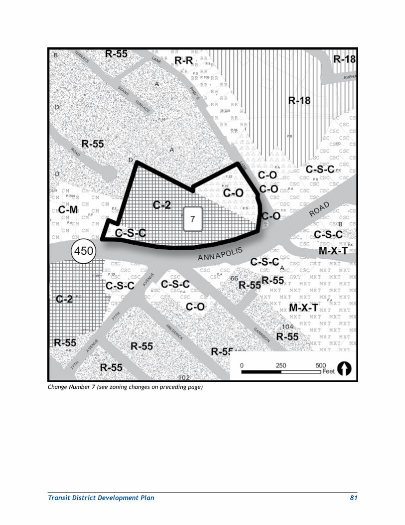
TransitDistrictDevelopmentPlan 81
Change Number 7 (see zoning changes on preceding page)
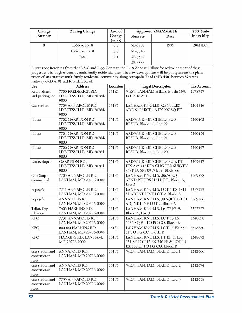
82 TransitDistrictDevelopmentPlan
Change Number
Zoning Change Area of Change (acres)
Approved SMA/ZMA/SE 200’ Scale Index MapNumber Date
8 R-55toR-18C-S-CtoR-18
Total
0.83.34.1
SE-1288SE-3546SE-3542SE-3838
1999 206NE07
Discussion:RezoningfromtheC-S-CandR-55ZonestotheR-18Zonewillallowforredevelopmentofthesepropertieswithhigher-density,multifamilyresidentialuses.Thenewdevelopmentwillhelpimplementtheplan’svisionofanattractivemultifamilyresidentialcommunityalongAnnapolisRoad(MD450)betweenVeteransParkway(MD410)andRiverdaleRoad.Use Address Location Legal Description Tax AccountRadioShackandparkinglot
7700FREDERICKRD,HYATTSVILLE,MD20784-0000
051E1 WESTLANHAMHILLS,Block:103,LOTS18&19
2178747
Gasstation 7703ANNAPOLISRD,HYATTSVILLE,MD20784-0000
051F1 LANHAMKNOLLS-GENTILESADDN,PARCELAEX297SQFT
2204816
House 7702GARRISONRD,HYATTSVILLE,MD20784-0000
051F1 ARDWICK-MITCHELLSSUB-RESUB,Block:66,Lot:22
3240462
House 7704GARRISONRD,HYATTSVILLE,MD20784-0000
051F1 ARDWICK-MITCHELLSSUB-RESUB,Block:66,Lot:21
3240454
House 7706GARRISONRD,HYATTSVILLE,MD20784-0000
051F1 ARDWICK-MITCHELLSSUB-RESUB,Block:66,Lot:20
3240447
Undeveloped GARRISONRD,HYATTSVILLE,MD20784-0000
051F1 ARDWICK-MITCHELLSSUB,PTLTS2&3(AREACHGPERSURVEY94)PTA604-097/1/09,Block:66
2209617
OneStopcommercial
7705ANNAPOLISRD,LANHAM,MD20706-0000
051F1 LANHAMKNOLLS,.067AEQABNDPTFOXHALLDR,Block:A,Lot:2
2169878
Popeye’s 7711ANNAPOLISRD,LANHAM,MD20706-0000
051F1 LANHAMKNOLLS,LOT1EX4811SFADJNELINELOT2,Block:A
2237923
Popeye’s ANNAPOLISRD,LANHAM,MD20706-0000
051F1 LANHAMKNOLLS,30SQFTLOT1ADJNELINELOT2,Block:A
2169886
Tailor/DryCleaners
7405HARKINSRD,LANHAM,MD20706-0000
051F1 LANHAMKNOLLS,L6177F719,Block:A,Lot:3
2222727
KFC 7731ANNAPOLISRD,LANHAM,MD20706-0000
051F1 LANHAMKNOLLS,LOT15EX1032SQFTTOPGCO,Block:B
2248698
KFC 000000HARKINSRD,LANHAM,MD20706-0000
051F1 LANHAMKNOLLS,LOT14EX350SFTOPGCO,Block:B
2248680
KFC HARKINSRD,LANHAM,MD20706-0000
051F1 LANHAMKNOLLS,PTLT11EX151SFLOT12EX350SF&LOT13EX350SFTOPGCO,Block:B
2248672
Gasstationandconveniencestore
ANNAPOLISRD,LANHAM,MD20706-0000
051F1 WESTLANHAM,Block:B,Lot:1 2212066
Gasstationandconveniencestore
ANNAPOLISRD,LANHAM,MD20706-0000
051F1 WESTLANHAM,Block:B,Lot:2 2212074
Gasstationandconveniencestore
7735ANNAPOLISRD,LANHAM,MD20706-0000
051F1 WESTLANHAM,Block:B,Lot:3 2212058
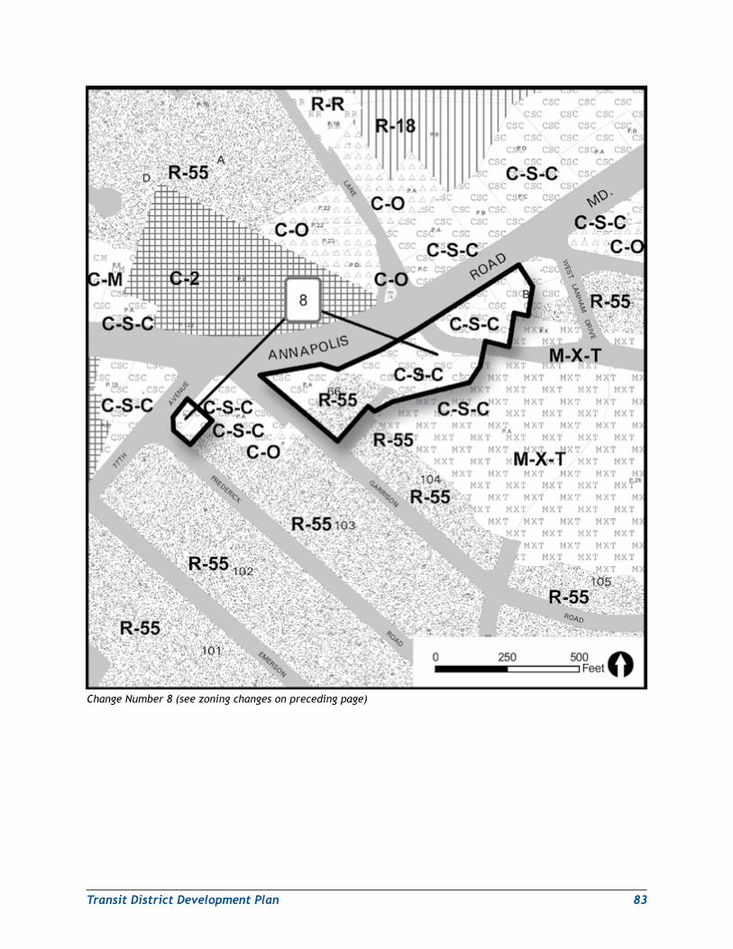
TransitDistrictDevelopmentPlan 83
Change Number 8 (see zoning changes on preceding page)
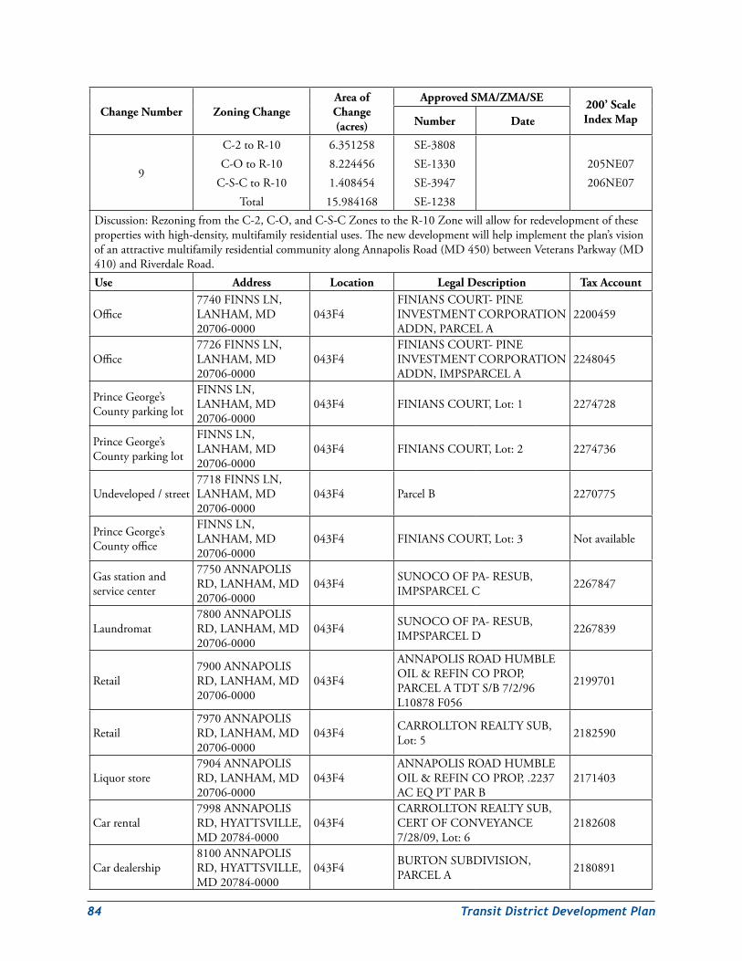
84 TransitDistrictDevelopmentPlan
Change Number Zoning ChangeArea of Change (acres)
Approved SMA/ZMA/SE 200’ Scale Index MapNumber Date
9
C-2toR-10C-OtoR-10
C-S-CtoR-10Total
6.3512588.2244561.40845415.984168
SE-3808SE-1330SE-3947SE-1238
205NE07206NE07
Discussion:RezoningfromtheC-2,C-O,andC-S-CZonestotheR-10Zonewillallowforredevelopmentofthesepropertieswithhigh-density,multifamilyresidentialuses.Thenewdevelopmentwillhelpimplementtheplan’svisionofanattractivemultifamilyresidentialcommunityalongAnnapolisRoad(MD450)betweenVeteransParkway(MD410)andRiverdaleRoad.Use Address Location Legal Description Tax Account
Office7740FINNSLN,LANHAM,MD20706-0000
043F4FINIANSCOURT-PINEINVESTMENTCORPORATIONADDN,PARCELA
2200459
Office7726FINNSLN,LANHAM,MD20706-0000
043F4FINIANSCOURT-PINEINVESTMENTCORPORATIONADDN,IMPSPARCELA
2248045
PrinceGeorge’sCountyparkinglot
FINNSLN,LANHAM,MD20706-0000
043F4 FINIANSCOURT,Lot:1 2274728
PrinceGeorge’sCountyparkinglot
FINNSLN,LANHAM,MD20706-0000
043F4 FINIANSCOURT,Lot:2 2274736
Undeveloped/street7718FINNSLN,LANHAM,MD20706-0000
043F4 ParcelB 2270775
PrinceGeorge’sCountyoffice
FINNSLN,LANHAM,MD20706-0000
043F4 FINIANSCOURT,Lot:3 Notavailable
Gasstationandservicecenter
7750ANNAPOLISRD,LANHAM,MD20706-0000
043F4 SUNOCOOFPA-RESUB,IMPSPARCELC 2267847
Laundromat7800ANNAPOLISRD,LANHAM,MD20706-0000
043F4 SUNOCOOFPA-RESUB,IMPSPARCELD 2267839
Retail7900ANNAPOLISRD,LANHAM,MD20706-0000
043F4
ANNAPOLISROADHUMBLEOIL&REFINCOPROP,PARCELATDTS/B7/2/96L10878F056
2199701
Retail7970ANNAPOLISRD,LANHAM,MD20706-0000
043F4 CARROLLTONREALTYSUB,Lot:5 2182590
Liquorstore7904ANNAPOLISRD,LANHAM,MD20706-0000
043F4ANNAPOLISROADHUMBLEOIL&REFINCOPROP,.2237ACEQPTPARB
2171403
Carrental7998ANNAPOLISRD,HYATTSVILLE,MD20784-0000
043F4CARROLLTONREALTYSUB,CERTOFCONVEYANCE7/28/09,Lot:6
2182608
Cardealership8100ANNAPOLISRD,HYATTSVILLE,MD20784-0000
043F4 BURTONSUBDIVISION,PARCELA 2180891
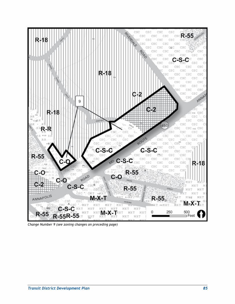
TransitDistrictDevelopmentPlan 85
Change Number 9 (see zoning changes on preceding page)
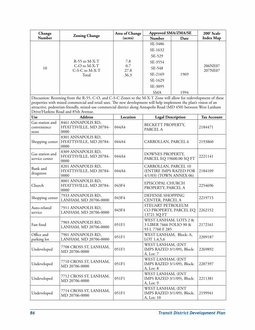
86 TransitDistrictDevelopmentPlan
Change Number Zoning Change Area of Change
(acres)Approved SMA/ZMA/SE 200’ Scale
Index MapNumber Date
10
R-55toM-X-TC-OtoM-X-T
C-S-CtoM-X-TTotal
7.80.727.836.3
SE-3486SE-1632SE-529SE-3554SE-548SE-2169SE-1629SE-3095
SMA
1969
1994
206NE07207NE07
Discussion:RezoningfromtheR-55,C-O,andC-S-CZonestotheM-X-TZonewillallowforredevelopmentofthesepropertieswithmixedcommercialandretailuses.Thenewdevelopmentwillhelpimplementtheplan’svisionofanattractive,pedestrian-friendly,mixed-usecommercialdistrictalongAnnapolisRoad(MD450)betweenWestLanhamDrive/HarkinsRoadand85thAvenue.Use Address Location Legal Description Tax AccountGasstationandconveniencestore
8461ANNAPOLISRD,HYATTSVILLE,MD20784-0000
044A4 BECKETTPROPERTY,PARCELA 2184471
Shoppingcenter8301ANNAPOLISRD,HYATTSVILLE,MD20784-0000
044A4 CARROLLAN,PARCEL6 2193860
Gasstationandservicecenter
8309ANNAPOLISRD,HYATTSVILLE,MD20784-0000
044A4 DOWNESPROPERTY,PARCELEQ19600.00SQFT 2221141
Bankanddrugstore
8201ANNAPOLISRD,HYATTSVILLE,MD20784-0000
044A4CARROLLAN,PARCEL10(ENTIREIMPSRAZEDFOR4/1/03)(TOWNANNEX06)
2184109
Church8001ANNAPOLISRD,HYATTSVILLE,MD20784-0000
043F4 EPISCOPALCHURCHPROPERTY,PARCELA 2254696
Shoppingcenter 7933ANNAPOLISRD,LANHAM,MD20706-0000 043F4 DEFENSESHOPPING
CENTER,PARCELA 2219715
Auto-relatedservice
7911ANNAPOLISRD,LANHAM,MD20706-0000 043F4
STEUARTPETROLEUMCOPROPERTY,PARCELEQ13721SQFT
2262152
Fastfood 7903ANNAPOLISRD,LANHAM,MD20706-0000 051F1
WESTLANHAM,LOTS2&3LIBER7666FOLIO90&93L7760F285
2172161
Officeandparkinglot
7901ANNAPOLISRD,LANHAM,MD20706-0000 051F1 WESTLANHAM,Block:A,
LOT1,4,5,6 2209187
Undeveloped 7708CROSSST,LANHAM,MD20706-0000 051F1
WESTLANHAM,(ENTIMPSRAZED3/1/09),Block:A,Lot:7
2269892
Undeveloped 7710CROSSST,LANHAM,MD20706-0000 051F1
WESTLANHAM,(ENTIMPSRAZED3/1/09),Block:A,Lot:8
2207397
Undeveloped 7712CROSSST,LANHAM,MD20706-0000 051F1
WESTLANHAM,(ENTIMPSRAZED3/1/09),Block:A,Lot:9
2211381
Undeveloped 7714CROSSST,LANHAM,MD20706-0000 051F1
WESTLANHAM,(ENTIMPSRAZED3/1/09),Block:A,Lot:10
2199941
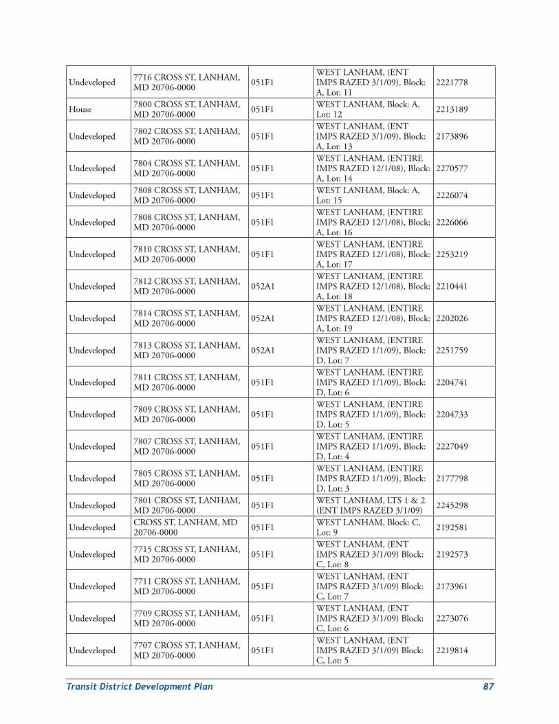
TransitDistrictDevelopmentPlan 87
Undeveloped 7716CROSSST,LANHAM,MD20706-0000 051F1
WESTLANHAM,(ENTIMPSRAZED3/1/09),Block:A,Lot:11
2221778
House 7800CROSSST,LANHAM,MD20706-0000 051F1 WESTLANHAM,Block:A,
Lot:12 2213189
Undeveloped 7802CROSSST,LANHAM,MD20706-0000 051F1
WESTLANHAM,(ENTIMPSRAZED3/1/09),Block:A,Lot:13
2173896
Undeveloped 7804CROSSST,LANHAM,MD20706-0000 051F1
WESTLANHAM,(ENTIREIMPSRAZED12/1/08),Block:A,Lot:14
2270577
Undeveloped 7808CROSSST,LANHAM,MD20706-0000 051F1 WESTLANHAM,Block:A,
Lot:15 2226074
Undeveloped 7808CROSSST,LANHAM,MD20706-0000 051F1
WESTLANHAM,(ENTIREIMPSRAZED12/1/08),Block:A,Lot:16
2226066
Undeveloped 7810CROSSST,LANHAM,MD20706-0000 051F1
WESTLANHAM,(ENTIREIMPSRAZED12/1/08),Block:A,Lot:17
2253219
Undeveloped 7812CROSSST,LANHAM,MD20706-0000 052A1
WESTLANHAM,(ENTIREIMPSRAZED12/1/08),Block:A,Lot:18
2210441
Undeveloped 7814CROSSST,LANHAM,MD20706-0000 052A1
WESTLANHAM,(ENTIREIMPSRAZED12/1/08),Block:A,Lot:19
2202026
Undeveloped 7813CROSSST,LANHAM,MD20706-0000 052A1
WESTLANHAM,(ENTIREIMPSRAZED1/1/09),Block:D,Lot:7
2251759
Undeveloped 7811CROSSST,LANHAM,MD20706-0000 051F1
WESTLANHAM,(ENTIREIMPSRAZED1/1/09),Block:D,Lot:6
2204741
Undeveloped 7809CROSSST,LANHAM,MD20706-0000 051F1
WESTLANHAM,(ENTIREIMPSRAZED1/1/09),Block:D,Lot:5
2204733
Undeveloped 7807CROSSST,LANHAM,MD20706-0000 051F1
WESTLANHAM,(ENTIREIMPSRAZED1/1/09),Block:D,Lot:4
2227049
Undeveloped 7805CROSSST,LANHAM,MD20706-0000 051F1
WESTLANHAM,(ENTIREIMPSRAZED1/1/09),Block:D,Lot:3
2177798
Undeveloped 7801CROSSST,LANHAM,MD20706-0000 051F1 WESTLANHAM,LTS1&2
(ENTIMPSRAZED3/1/09) 2245298
Undeveloped CROSSST,LANHAM,MD20706-0000 051F1 WESTLANHAM,Block:C,
Lot:9 2192581
Undeveloped 7715CROSSST,LANHAM,MD20706-0000 051F1
WESTLANHAM,(ENTIMPSRAZED3/1/09)Block:C,Lot:8
2192573
Undeveloped 7711CROSSST,LANHAM,MD20706-0000 051F1
WESTLANHAM,(ENTIMPSRAZED3/1/09)Block:C,Lot:7
2173961
Undeveloped 7709CROSSST,LANHAM,MD20706-0000 051F1
WESTLANHAM,(ENTIMPSRAZED3/1/09)Block:C,Lot:6
2273076
Undeveloped 7707CROSSST,LANHAM,MD20706-0000 051F1
WESTLANHAM,(ENTIMPSRAZED3/1/09)Block:C,Lot:5
2219814
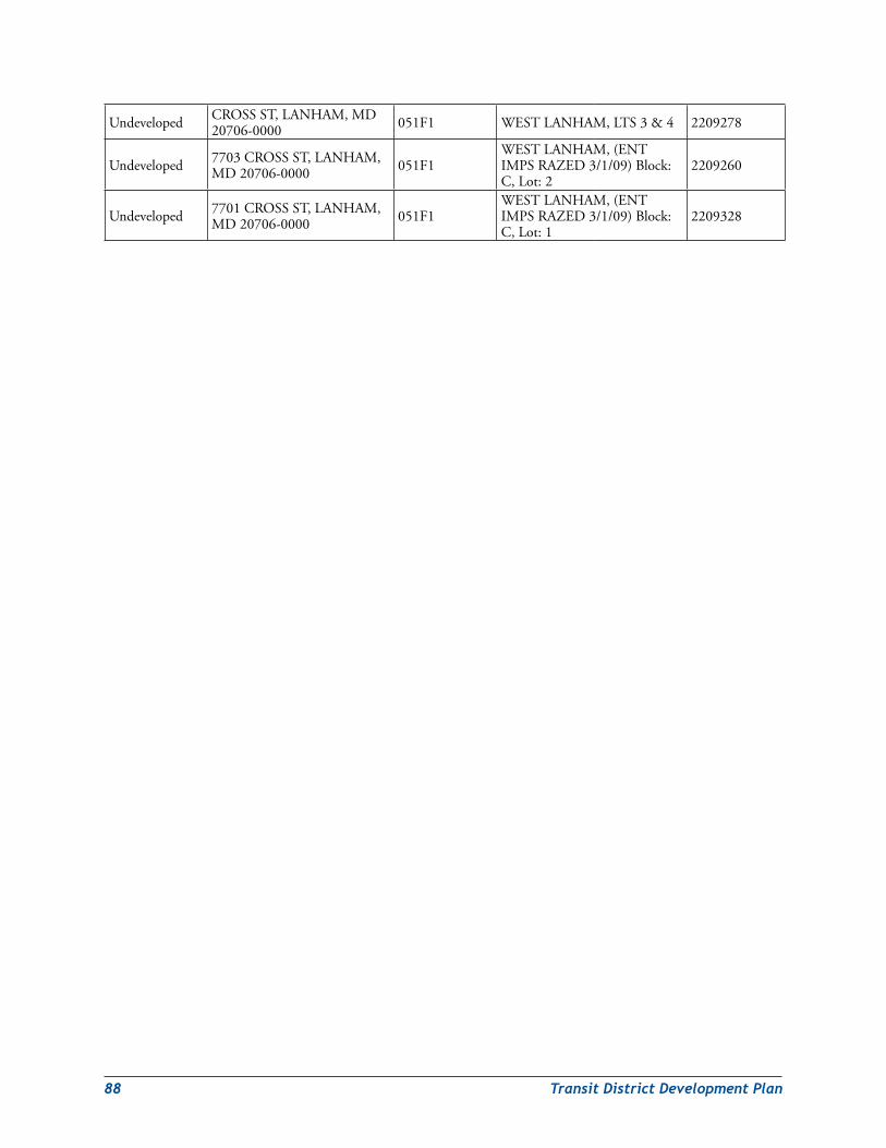
88 TransitDistrictDevelopmentPlan
Undeveloped CROSSST,LANHAM,MD20706-0000 051F1 WESTLANHAM,LTS3&4 2209278
Undeveloped 7703CROSSST,LANHAM,MD20706-0000 051F1
WESTLANHAM,(ENTIMPSRAZED3/1/09)Block:C,Lot:2
2209260
Undeveloped 7701CROSSST,LANHAM,MD20706-0000 051F1
WESTLANHAM,(ENTIMPSRAZED3/1/09)Block:C,Lot:1
2209328
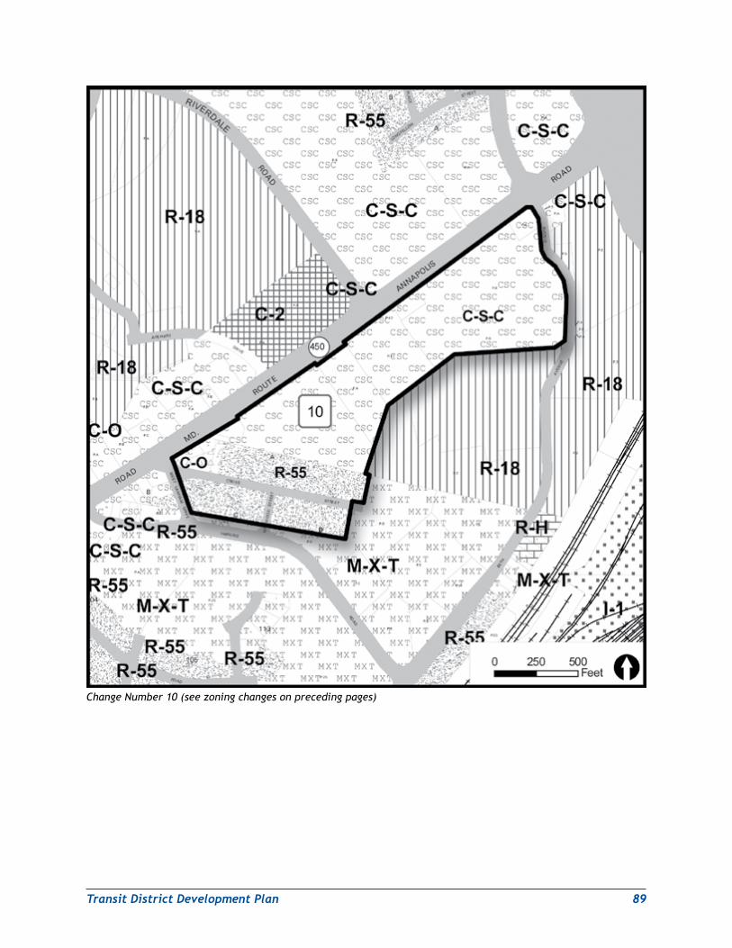
TransitDistrictDevelopmentPlan 89
Change Number 10 (see zoning changes on preceding pages)
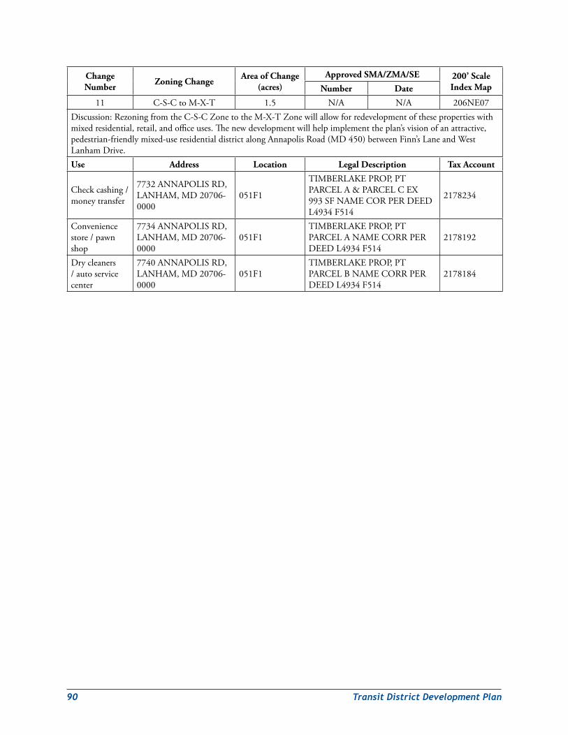
90 TransitDistrictDevelopmentPlan
Change Number Zoning Change Area of Change
(acres)Approved SMA/ZMA/SE 200’ Scale
Index MapNumber Date
11 C-S-CtoM-X-T 1.5 N/A N/A 206NE07Discussion:RezoningfromtheC-S-CZonetotheM-X-TZonewillallowforredevelopmentofthesepropertieswithmixedresidential,retail,andofficeuses.Thenewdevelopmentwillhelpimplementtheplan’svisionofanattractive,pedestrian-friendlymixed-useresidentialdistrictalongAnnapolisRoad(MD450)betweenFinn’sLaneandWestLanhamDrive.Use Address Location Legal Description Tax Account
Checkcashing/moneytransfer
7732ANNAPOLISRD,LANHAM,MD20706-0000
051F1
TIMBERLAKEPROP,PTPARCELA&PARCELCEX993SFNAMECORPERDEEDL4934F514
2178234
Conveniencestore/pawnshop
7734ANNAPOLISRD,LANHAM,MD20706-0000
051F1TIMBERLAKEPROP,PTPARCELANAMECORRPERDEEDL4934F514
2178192
Drycleaners/autoservicecenter
7740ANNAPOLISRD,LANHAM,MD20706-0000
051F1TIMBERLAKEPROP,PTPARCELBNAMECORRPERDEEDL4934F514
2178184
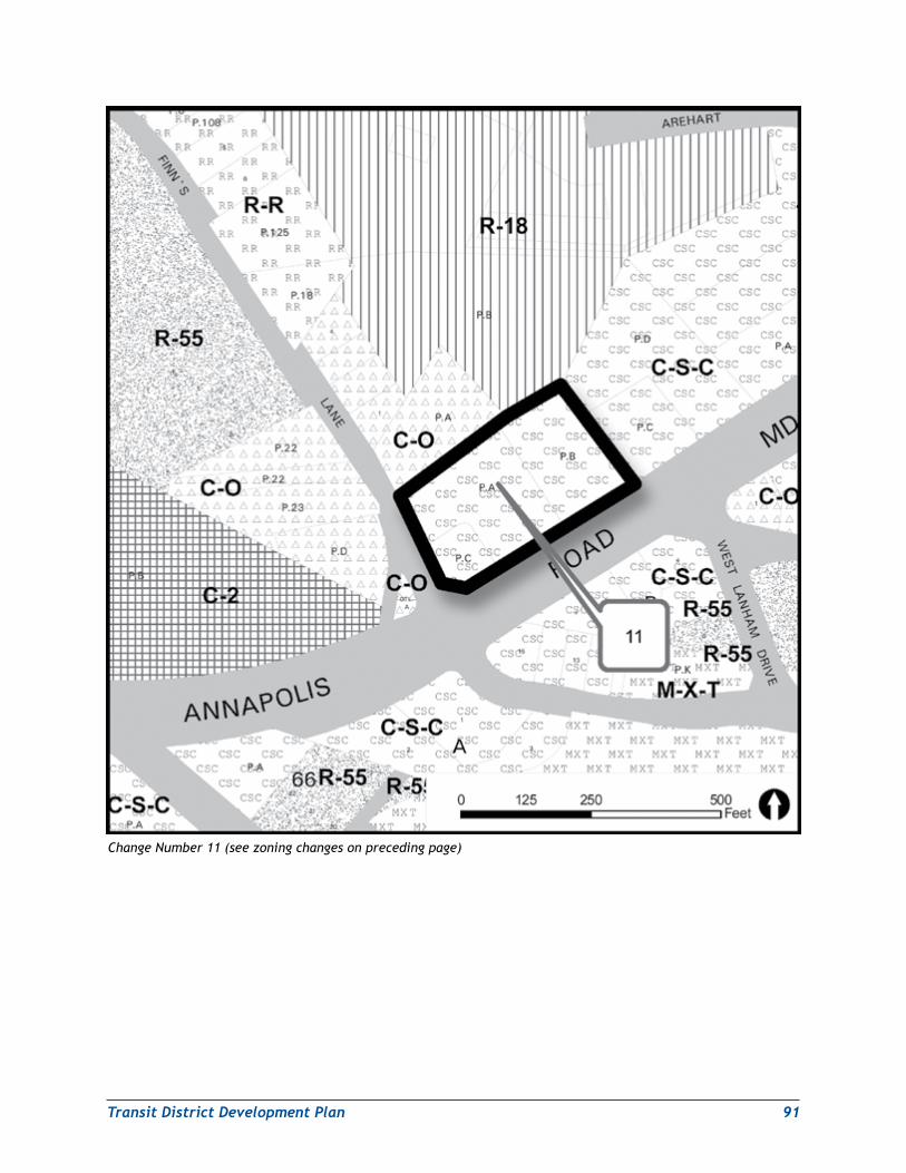
TransitDistrictDevelopmentPlan 91
Change Number 11 (see zoning changes on preceding page)
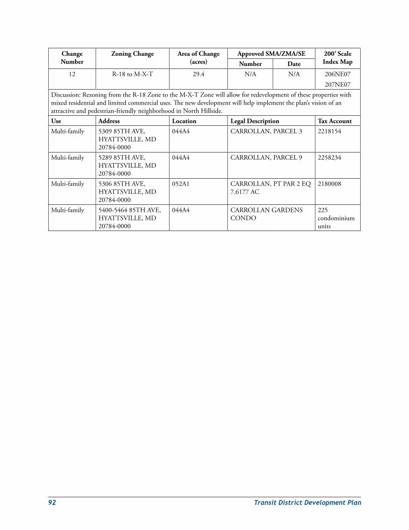
92 TransitDistrictDevelopmentPlan
Change Number
Zoning Change Area of Change (acres)
Approved SMA/ZMA/SE 200’ Scale Index MapNumber Date
12 R-18toM-X-T 29.4 N/A N/A 206NE07207NE07
Discussion:RezoningfromtheR-18ZonetotheM-X-TZonewillallowforredevelopmentofthesepropertieswithmixedresidentialandlimitedcommercialuses.Thenewdevelopmentwillhelpimplementtheplan’svisionofanattractiveandpedestrian-friendlyneighborhoodinNorthHillside.Use Address Location Legal Description Tax Account
Multi-family 530985THAVE,HYATTSVILLE,MD20784-0000
044A4 CARROLLAN,PARCEL3 2218154
Multi-family 528985THAVE,HYATTSVILLE,MD20784-0000
044A4 CARROLLAN,PARCEL9 2258234
Multi-family 530685THAVE,HYATTSVILLE,MD20784-0000
052A1 CARROLLAN,PTPAR2EQ7.6177AC
2180008
Multi-family 5400-546485THAVE,HYATTSVILLE,MD20784-0000
044A4 CARROLLANGARDENSCONDO
225condominiumunits
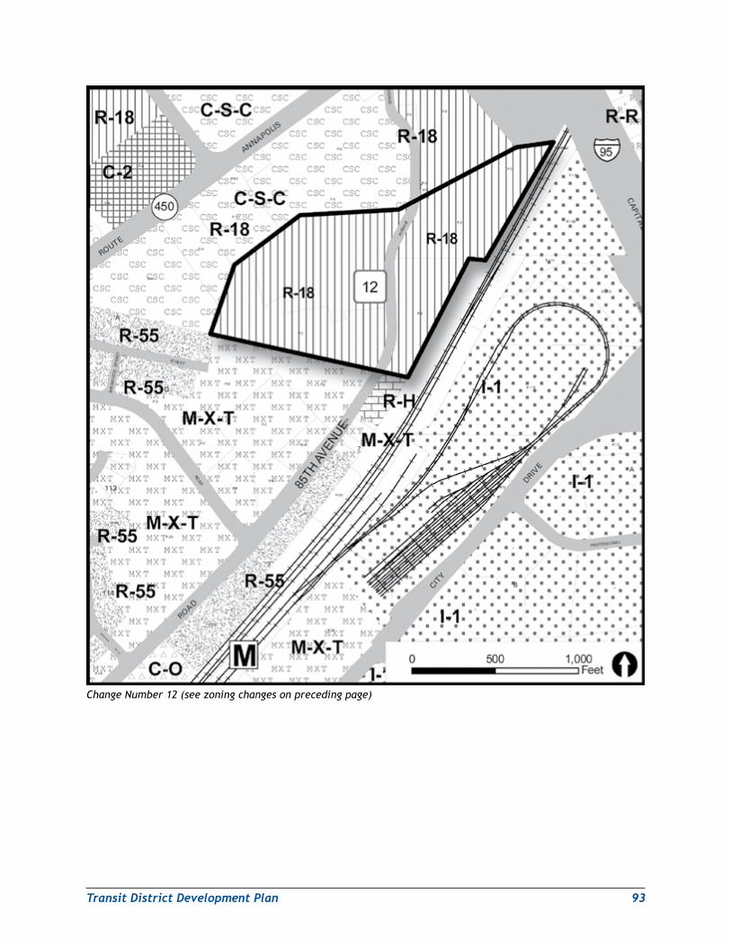
TransitDistrictDevelopmentPlan 93
Change Number 12 (see zoning changes on preceding page)
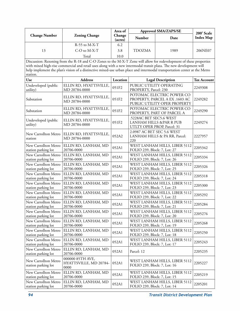
94 TransitDistrictDevelopmentPlan
Change Number Zoning ChangeArea of Change (acres)
Approved SMA/ZAPS/SE 200’ Scale Index MapNumber Date
13R-55toM-X-TC-OtoM-X-T
Total
6.23.810.0
TDOZMA 1989 206NE07
Discussion:RezoningfromtheR-18andC-OZonestotheM-X-TZonewillallowforredevelopmentofthesepropertieswithmixedhigh-risecommercialandretailusesalongwithanewintermodaltransitplaza.Thenewdevelopmentwillhelpimplementtheplan’svisionofadistinctivemixed-useurbanplaceandintermodaltransportationcenterattheMetrostation.Use Address Location Legal Description Tax AccountUndeveloped(publicutility)
ELLINRD,HYATTSVILLE,MD20784-0000 051F2 PUBLICUTILITYOPERATING
PROPERTY,Parcel:230 2249308
Substation ELLINRD,HYATTSVILLE,MD20784-0000 051F2
POTOMACELECTRICPOWERCOPROPERTY,PARCELAEX.1603ACPUBLICUTILITYOPERPROPERTY
2249282
Substation ELLINRD,HYATTSVILLE,MD20784-0000 051F2 POTOMACELECTRICPOWERCO
PROPERTY,PARTOFPARCELA 2249290
Undeveloped(publicutility)
ELLINRD,HYATTSVILLE,MD20784-0000 051F2
.5228ACBETSEC5.6WESTLANHAMHILLS&PARRPUBUTLTYOPERPROP,Parcel:31
2249274
NewCarrolltonMetrostation
ELLINRD,HYATTSVILLE,MD20784-0000 052A2
2.0987ACBETSEC5.6WESTLANHAMHILLS&PARR,Parcel:220
2227957
NewCarrolltonMetrostationparkinglot
ELLINRD,LANHAM,MD20706-0000 052A1 WESTLANHAMHILLS,LIBER5112
FOLIO239,Block:7,Lot:27 2205342
NewCarrolltonMetrostationparkinglot
ELLINRD,LANHAM,MD20706-0000 052A1 WESTLANHAMHILLS,LIBER5112
FOLIO239,Block:7,Lot:26 2205334
NewCarrolltonMetrostationparkinglot
ELLINRD,LANHAM,MD20706-0000 052A1 WESTLANHAMHILLS,LIBER5112
FOLIO239,Block:7,Lot:25 2205326
NewCarrolltonMetrostationparkinglot
ELLINRD,LANHAM,MD20706-0000 052A1 WESTLANHAMHILLS,LIBER5112
FOLIO239,Block:7,Lot:24 2205318
NewCarrolltonMetrostationparkinglot
ELLINRD,LANHAM,MD20706-0000 052A1 WESTLANHAMHILLS,LIBER5112
FOLIO239,Block:7,Lot:23 2205300
NewCarrolltonMetrostationparkinglot
ELLINRD,LANHAM,MD20706-0000 052A1 WESTLANHAMHILLS,LIBER5112
FOLIO239,Block:7,Lot:22 2205292
NewCarrolltonMetrostationparkinglot
ELLINRD,LANHAM,MD20706-0000 052A1 WESTLANHAMHILLS,LIBER5112
FOLIO239,Block:7,Lot:21 2205284
NewCarrolltonMetrostationparkinglot
ELLINRD,LANHAM,MD20706-0000 052A1 WESTLANHAMHILLS,LIBER5112
FOLIO239,Block:7,Lot:20 2205276
NewCarrolltonMetrostationparkinglot
ELLINRD,LANHAM,MD20706-0000 052A1 WESTLANHAMHILLS,LIBER5112
FOLIO239,Block:7,Lot:19 2205268
NewCarrolltonMetrostationparkinglot
ELLINRD,LANHAM,MD20706-0000 052A1 WESTLANHAMHILLS,LIBER5112
FOLIO239,Block:7,Lot:18 2205250
NewCarrolltonMetrostationparkinglot
ELLINRD,LANHAM,MD20706-0000 052A1 WESTLANHAMHILLS,LIBER5112
FOLIO239,Block:7,Lot:17 2205243
NewCarrolltonMetrostationparkinglot
ELLINRD,LANHAM,MD20706-0000 052A1 Parcel:12 2205235
NewCarrolltonMetrostationparkinglot
00000085THAVE,HYATTSVILLE,MD20784-0000
052A1 WESTLANHAMHILLS,LIBER5112FOLIO239,Block:7,Lot:16 2205227
NewCarrolltonMetrostationparkinglot
ELLINRD,LANHAM,MD20706-0000 052A1 WESTLANHAMHILLS,LIBER5112
FOLIO239,Block:7,Lot:15 2205219
NewCarrolltonMetrostationparkinglot
ELLINRD,LANHAM,MD20706-0000 052A1 WESTLANHAMHILLS,LIBER5112
FOLIO239,Block:7,Lot:14 2205201
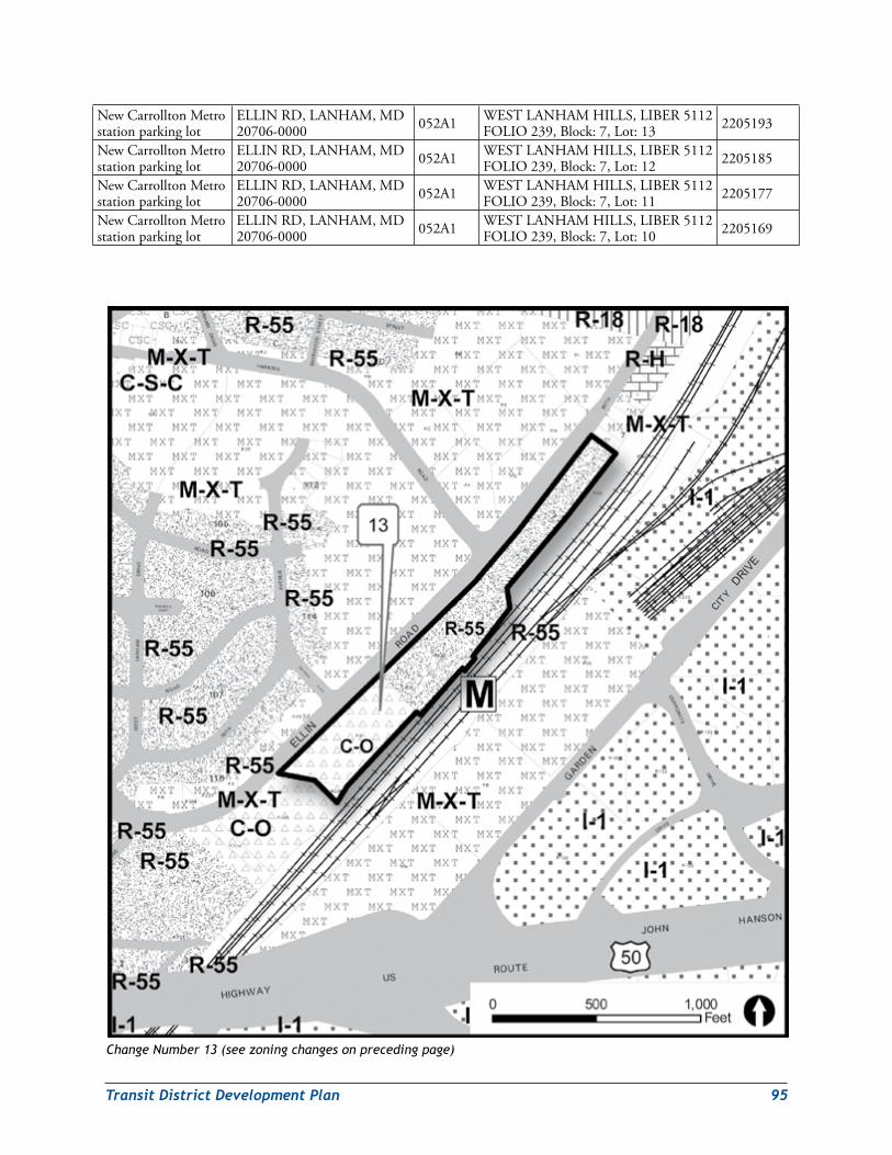
TransitDistrictDevelopmentPlan 95
NewCarrolltonMetrostationparkinglot
ELLINRD,LANHAM,MD20706-0000 052A1 WESTLANHAMHILLS,LIBER5112
FOLIO239,Block:7,Lot:13 2205193
NewCarrolltonMetrostationparkinglot
ELLINRD,LANHAM,MD20706-0000 052A1 WESTLANHAMHILLS,LIBER5112
FOLIO239,Block:7,Lot:12 2205185
NewCarrolltonMetrostationparkinglot
ELLINRD,LANHAM,MD20706-0000 052A1 WESTLANHAMHILLS,LIBER5112
FOLIO239,Block:7,Lot:11 2205177
NewCarrolltonMetrostationparkinglot
ELLINRD,LANHAM,MD20706-0000 052A1 WESTLANHAMHILLS,LIBER5112
FOLIO239,Block:7,Lot:10 2205169
Change Number 13 (see zoning changes on preceding page)
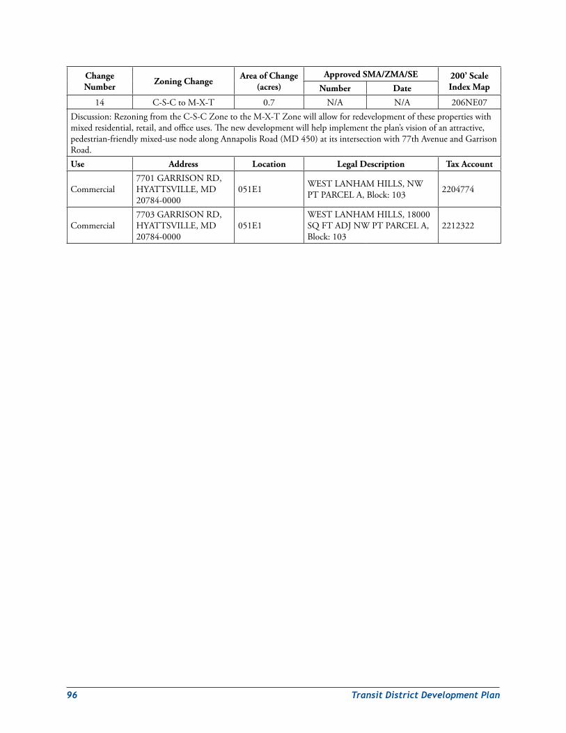
96 TransitDistrictDevelopmentPlan
Change Number Zoning Change Area of Change
(acres)Approved SMA/ZMA/SE 200’ Scale
Index MapNumber Date
14 C-S-CtoM-X-T 0.7 N/A N/A 206NE07Discussion:RezoningfromtheC-S-CZonetotheM-X-TZonewillallowforredevelopmentofthesepropertieswithmixedresidential,retail,andofficeuses.Thenewdevelopmentwillhelpimplementtheplan’svisionofanattractive,pedestrian-friendlymixed-usenodealongAnnapolisRoad(MD450)atitsintersectionwith77thAvenueandGarrisonRoad.Use Address Location Legal Description Tax Account
Commercial7701GARRISONRD,HYATTSVILLE,MD20784-0000
051E1 WESTLANHAMHILLS,NWPTPARCELA,Block:103 2204774
Commercial7703GARRISONRD,HYATTSVILLE,MD20784-0000
051E1WESTLANHAMHILLS,18000SQFTADJNWPTPARCELA,Block:103
2212322
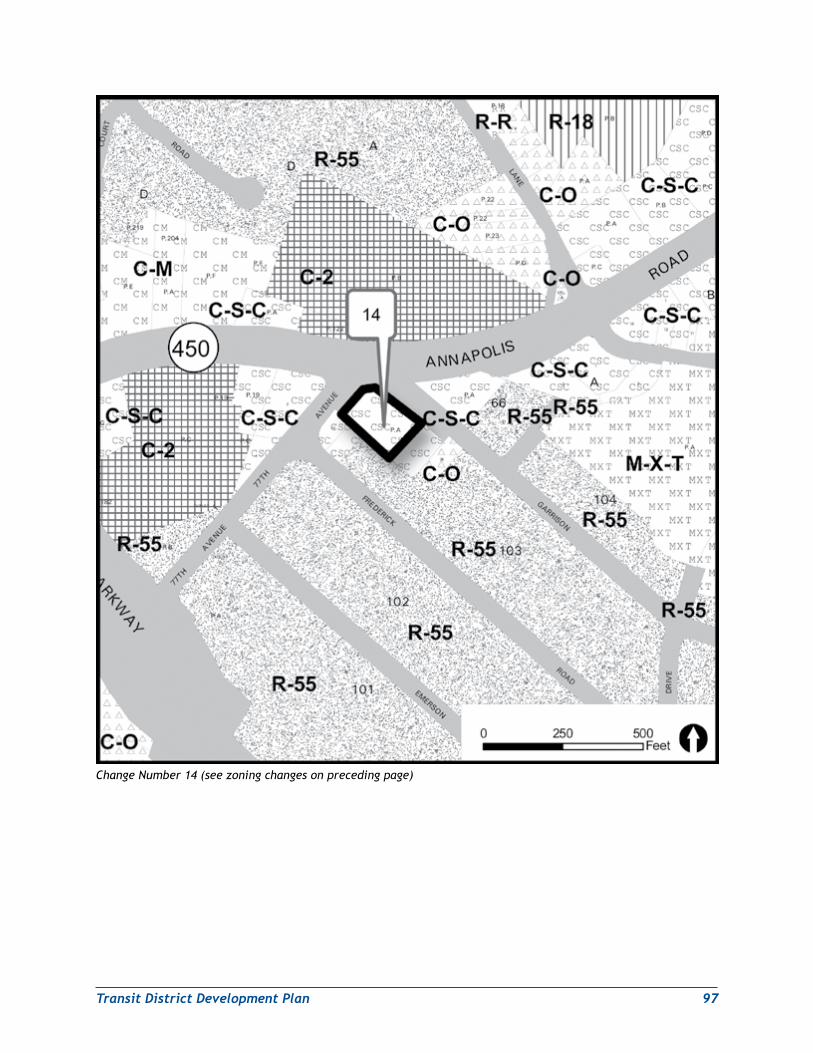
TransitDistrictDevelopmentPlan 97
Change Number 14 (see zoning changes on preceding page)
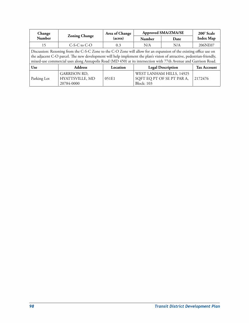
98 TransitDistrictDevelopmentPlan
Change Number Zoning Change Area of Change
(acres)Approved SMA/ZMA/SE 200’ Scale
Index MapNumber Date
15 C-S-CtoC-O 0.3 N/A N/A 206NE07Discussion:RezoningfromtheC-S-CZonetotheC-OZonewillallowforanexpansionoftheexistingofficeuseontheadjacentC-Oparcel.Thenewdevelopmentwillhelpimplementtheplan’svisionofattractive,pedestrian-friendly,mixed-usecommercialusesalongAnnapolisRoad(MD450)atitsintersectionwith77thAvenueandGarrisonRoad.Use Address Location Legal Description Tax Account
ParkingLotGARRISONRD,HYATTSVILLE,MD20784-0000
051E1WESTLANHAMHILLS,14925SQFTEQPTOFSEPTPARA,Block:103
2172476
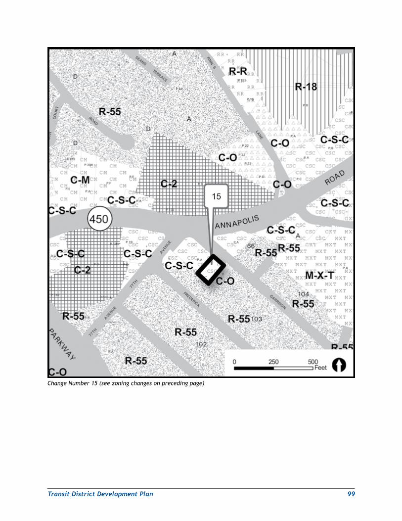
TransitDistrictDevelopmentPlan 99
Change Number 15 (see zoning changes on preceding page)
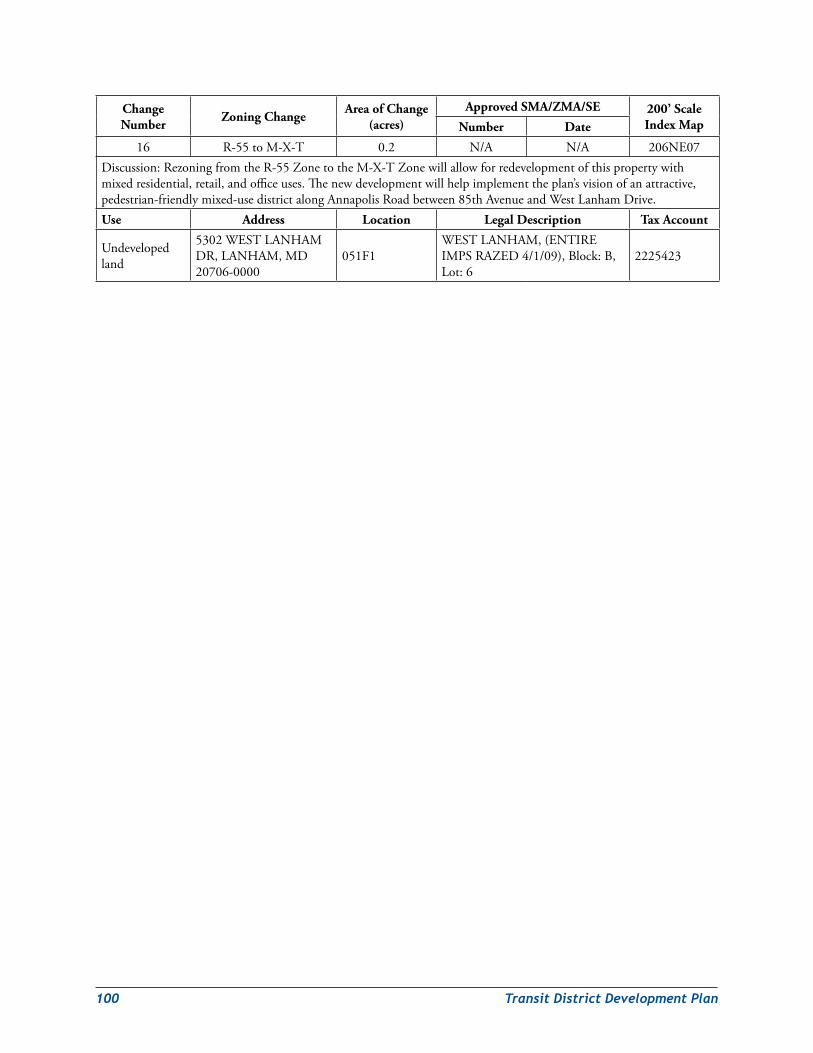
100 TransitDistrictDevelopmentPlan
Change Number Zoning Change Area of Change
(acres)Approved SMA/ZMA/SE 200’ Scale
Index MapNumber Date
16 R-55toM-X-T 0.2 N/A N/A 206NE07Discussion:RezoningfromtheR-55ZonetotheM-X-TZonewillallowforredevelopmentofthispropertywithmixedresidential,retail,andofficeuses.Thenewdevelopmentwillhelpimplementtheplan’svisionofanattractive,pedestrian-friendlymixed-usedistrictalongAnnapolisRoadbetween85thAvenueandWestLanhamDrive.Use Address Location Legal Description Tax Account
Undevelopedland
5302WESTLANHAMDR,LANHAM,MD20706-0000
051F1WESTLANHAM,(ENTIREIMPSRAZED4/1/09),Block:B,Lot:6
2225423
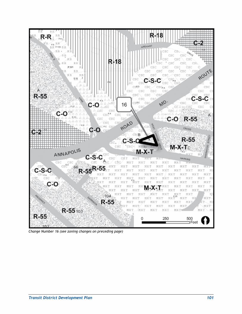
TransitDistrictDevelopmentPlan 101
Change Number 16 (see zoning changes on preceding page)
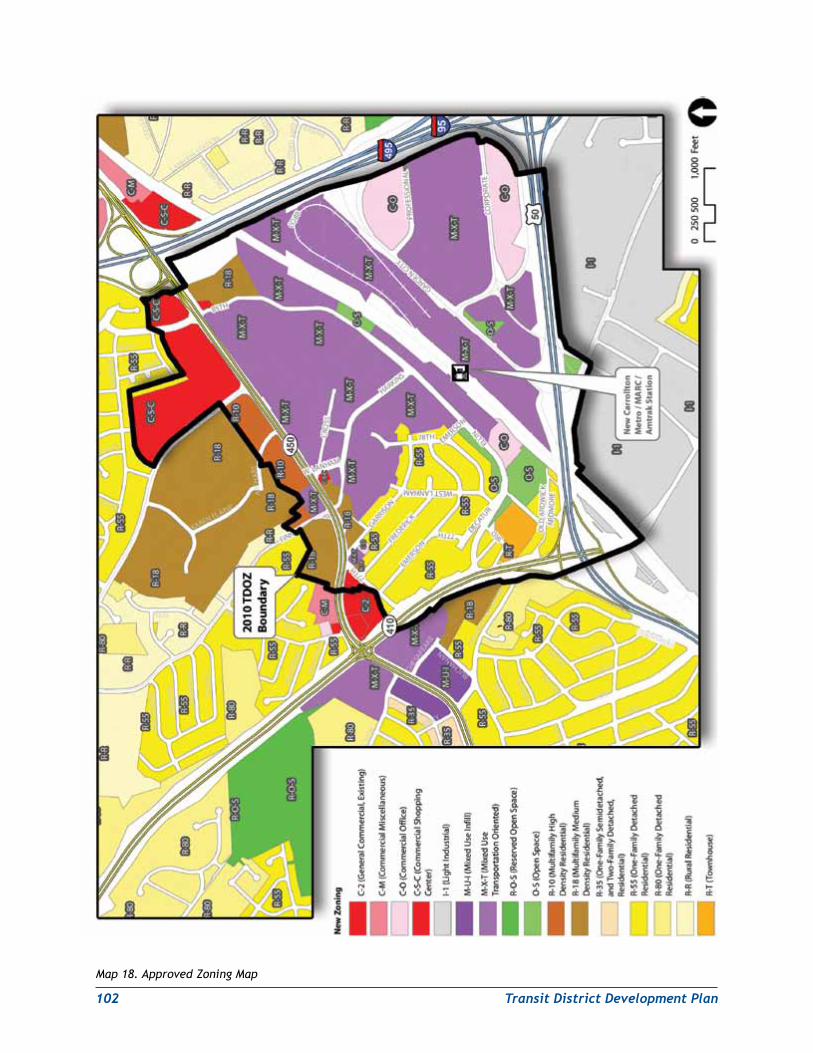
102 TransitDistrictDevelopmentPlan
Map 18. Approved Zoning Map

TransitDistrictDevelopmentPlan 103
development strategyPhasing and implementationTheNewCarrolltonTDDPenvisionsredevelopmentoftheMetrostationareatakingplaceoveran18-to20-yearperiodbeginningin2010.ThesequenceofdevelopmentisprojectedtobeginwiththeMetroCore(northside),followedbytheAnnapolisRoadCorridor,MetroCore(southside),andGardenCity.AcriticalpartoftheredevelopmentoftheTDOZwillbetherenovationandupgradingoftheMetrostationitselftoprovideanenhancedpedestrianlinkbetweendevelopmentonbothofitssides.
TheplanrecognizestheWMATAJointDevelopmentProgramastheappropriatevehiclefortheredevelopmentofWMATA-ownedjointdevelopmentsitesintheMetroCorearea.Inaddition,thenorthportionoftheMetroCoreconsistsofseverallargeparcelsunderamixtureofpublicandprivateownership.Forthesereasons,theredevelopmentofthenorthportionoftheMetroCoreareaisseenasoccurringfirst,generallybetween2010and2015.TheplannedconstructionofthePurpleLinelightrailtransitlinebeginningin2013or2014willfurtherenhancetheredevelopmentofthisarea.
TheAnnapolisRoadCorridorisseenasthenextsiteofredevelopmentactivity,withredevelopmentgenerallytakingplacebetween2013and2018.TheplanenvisionsspilloverdemandresultingfromtheongoingredevelopmentoftheMetrostationanditsimmediateenvirons.
TheMetroCore’ssouthernportionconsistsentirelyoflargeparcelsunderpublicownership.TheimplementationaladvantagesofthisfactarepartiallynegatedbytherelativeisolationoftheareafromotherpartsoftheTDOZandthesurroundingcountybyJohnHansonHighway(US50)andthesharedMetrorail/Amtrak/MARCrailalignment.TheexistenceofwetlandsattheintersectionofGardenCityDriveandCorporateDrivealsoimposesconstraintsonthepotentialforredevelopmentofstate-ownedlandsinthatarea.Forthesereasons,theredevelopmentoftheMetroCore’ssouthernportionisseenastakingplacebetween2015and2020.
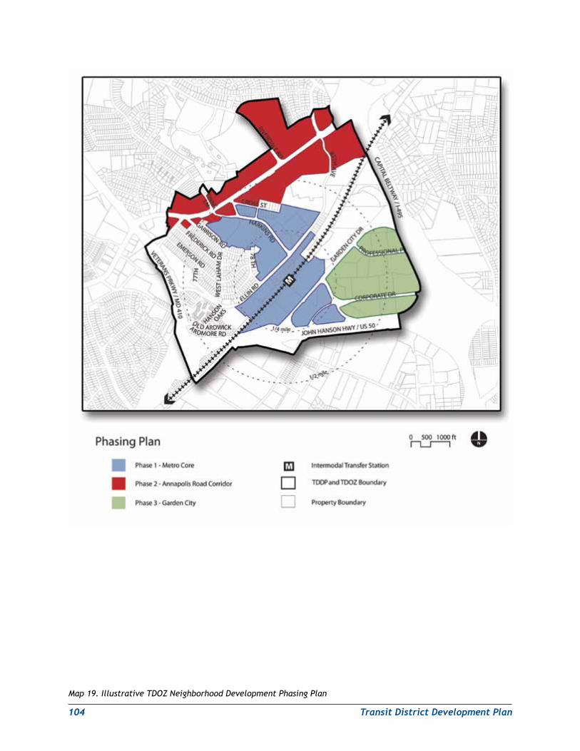
104 TransitDistrictDevelopmentPlan
Map 19. Illustrative TDOZ Neighborhood Development Phasing Plan
TransitDistrictDevelopmentPlan 105
TheGardenCityneighborhoodposesthegreatestredevelopmentchallenges.ItislocatedfartherfromtheMetrostationthananyotherneighborhoodintheTDOZarea.Inaddition,theareaconsistsofanumberoflargeparcelsthatarealmostentirelyunderprivateownership.Finally,theareaiscurrentlyafunctionallyobsoleteandunattractivesuburbanofficeparkwithnondescriptofficeblockssurroundedbyacresofsurfaceparkinglots.Nevertheless,theplanenvisionstheGardenCityareabecomingamoreviableredevelopmentsiteasredevelopmentelsewhereintheTDOZpushespropertyvaluesuptothepointwherepropertyownersmayfinditmoreprofitabletoredeveloptheirpropertiesorselltodeveloperswhoareseekingredevelopmentopportunitiesinthearea.Accordingly,redevelopmentoftheGardenCityareaisenvisionedastakingplacebetween2019and2028.Map19.IllustrativeTDOZNeighborhoodDevelopmentPhasingPlan,illustratesthelocationandsequenceofproposedphaseddevelopmentintheTDOZarea.
ThereaderisadvisedthatthetimingofredevelopmentwithintheNewCarrolltonTDOZcanonlybeestimatedatthispoint.AgreatdealdependsoncontinuingdevelopmentmarkettrendswithinPrinceGeorge’sCounty,themetropolitanWashingtonregion,andtheUnitedStates/globaleconomiesasawhole.AnotherfactorthatmustbetakenintoaccountisthepossibilitythatkeypropertyownersmayhaveplansfortheirsitesthatcouldsignificantlyimpacttheoveralldevelopmenttimetableproposedfortheNewCarrolltonTDOZarea.WhileredevelopmentoftheNewCarrolltonTDOZareaisunlikelytotakeplaceinashortertimeframeeveninthebestofeconomicconditions,aneconomicdownturncouldextendredevelopmentoftheNewCarrolltonTDOZareawellpast2030.ThetimelineillustratestheproposedtimingofdevelopmentineachTDOZneighborhoodbetween2010and2028.
engineering Assessment of Proposed Vehicular Crossings of shared rail AlignmentPartofthevisionfortheNewCarrolltonstationareaincludescreatingmoreconnectionstofacilitatestreetactivityandinteractionbetweenlandusesnorthandsouthofthestation.SeveralmajorbarrierssurroundandbisecttheNewCarrolltonTDOZarea:thetraintracksownedbytheWashingtonMetropolitanAreaTransitAuthority(WMATA),Amtrak,andMARC;JohnHansonHighway(US50)tothesouth;theCapitalBeltway(I-95/I-495)totheeast;AnnapolisRoad(MD450)tothenorth;andVeteransParkway(MD410)tothewest.Thesebarrierslimitvehicular,bicycle,orpedestrianaccessintoandwithinthearea.
PBConsult,Inc.,theconsultantsretainedtohelpM-NCPPCpreparethepreliminarydraftNewCarrolltonTDDP/TDOZ,investigatedtheengineeringfeasibilityofseveralnewcrossingsofthesharedrailalignment,US50,andI-95/I-495.Thesecrossingswererecommendedforfurtherstudyinthe2004New Carrollton Transit-Oriented Development Strategy Planning Study.
Ateachlocation,generalizeddatasuchastopography,soilconditions,andutilitieswerecollected,andaconceptualanalysiswasperformedinaccordancewithAmericanAssociationofStateHighwayandTransportationOfficials(AASHTO),MarylandStateHighwayAdministration(SHA),WMATA,andAmtrakdesignstandards.Althoughthisstudyaddressedgeneralfeasibility,moredetaileddataanddesignwouldbeneededtounderstandthespecificconstraintsandopportunitiesateachlocation.
Themostimportantcrossingoptionsconsideredbythestudywereforthesharedrailalignment.TheseincludedproposedcrossingssouthwestofthestationattheAmtrakelectricalsubstation,atHarkinsRoad,atProfessionalPlacejustnortheastofthestation,andatCobbRoadjustwestoftheCapitalBeltway.Bridgeaswellastunneloptionswereassessedfortechnicalfeasibility.TheHarkinsRoadoptionwasfoundtobeinfeasibleaseitherabridgeortunnelcrossingduetotoo-steepgrades.Thesouthwest/substationcrossingwasfoundtobeinfeasibleasabridgecrossing,aswastheProfessionalPlacecrossingoption.OnlytheCobbRoadoptionwasfoundtobetechnicallyfeasibleaseitherabridgeortunnelcrossing.At$18million,thetunneloptionwasfoundtobecheaperthanthebridgeoption($22million).PBConsultrecommendedthe
106 TransitDistrictDevelopmentPlan
tunnelcrossingoptioninordertoavoidtheadditionalexpenseofamajornewbridgeandtheneedtorelocateAmtrak’soverheadelectricalcatenaries.
Urban land institute Technical Assistance Panel recommendations for Public improvementsTheengineeringassessmentwasakeyelementofinformationprovidedbyM-NCPPCfortheUrbanLandInstitutetechnicalassistancepanel(ULI/TAP)whichmetinJuly2007toassessthepotentialofthe2004planningstudy’srecommendedpublicimprovementstospurnewdevelopmentintheMetrostation’svicinity.Severalkeyrecommendationsweremade,including:
1. UpgradingtheNewCarrolltonMetroStationtoallowgreaterpedestrianconnectivitybetweentheareasnorthandsouthofthestation.(TherearecurrentlynofundsallocatedintheWMATACapitalImprovementPlanthroughFY 2013forNewCarrolltonstationimprovements).
2. Allowingdevelopmentnorthandsouthofthestationtooccurindependently,ratherthantryingtocreateasingleneighborhoodthatcouldstraddlethesharedrailalignment.
3. Creatinganenhancedpedestrianlinkagethroughthestationthatcouldbelinedwithtraveler-servingretailoutlets.
4. DevelopinganattractivepedestrianaxistoconnectthestationwithafutureiconicofficebuildingtobebuiltintheGardenCityareaneartheUS50/CapitalBeltwayinterchange(theterm“iconicofficebuilding”identifiesthisstructureasalandmarkthatwouldbevisiblefromthenearbyfreeways(US50andI-95/I-495)andfromotherlocationswithin,andoutsideof,theTDOZ).
5. Delayingtheconstructionofvehicularcrossingsofthesharedrailrights-of-wayuntilthelaterstagesofdevelopment,whenenoughadditionaldevelopmentvaluehasbeengeneratedtohelpfundtheseimprovements.
Thefindings,conclusions,andrecommendationsoftheULIpanelwereusedtohelpshapetheupdatedNewCarrolltonTDDP.
improvementsPreliminary Public Facilities Financing PlanApreliminarydraftpublicfacilitiesfinancingplanwaspreparedbyPBConsultforM-NCPPCinordertoprovideanoverviewofpublicfacilitiesneedsfortheNewCarrolltonTDOZ,toestimatethepotentialcostsforthesefacilities,andtopresentalternativesforfinancingtheseimprovements.Highlightsofthatplanarepresentedinthissection.Thereaderiscautioned,however,thatthisinformationispreliminaryatbest,andwillrequiredetailedanalysisinordertoproduceanimplementableplan.Also,nopreliminarycostinformationwasavailablefortheplannedPurpleLinebecausetheMarylandDepartmentofTransportation(MDOT)hadnotselectedapreferredalignmentnordeterminedwhethertheservicewillbebusrapidtransitorlightrailtransitasofNovember2008.
Forthepurposesofthepreliminarypublicfacilitiesfinancingplan,phasingassumptionsweredevelopedbyPBConsult,Inc.,inaccordancewiththephasingrecommendationsoftheJuly2007ULITAPonNewCarrollton.
Thephasingplanassumesthatredevelopmentofeachneighborhoodwouldnotcommenceuntilallparcelsareassembled.Thisstrategyistypicalinrealestatedevelopmentsincehavingallparcelsassembledforaprojectmitigatestheriskthatafullplancannotberealizedbecauseofunforeseenacquisitioncostsortheinabilityto
TransitDistrictDevelopmentPlan 107
purchaseallparcels.Thelandacquisitionprocessispresumedtobeginin2008andcontinuethrough2019,uponcommencementofconstructionofthefinalneighborhood,GardenCity.
ImprovingtheexistingstationanddevelopingtheMetroCorebeforetheotherneighborhoodsposesanumberofdistinctadvantages:
1. Investinginthestationwillsendastrongsignaltopotentialdevelopersaboutthestateandcounty’scommitmenttolong-terminvestmentinthearea.
2. Fundingforstationimprovementswouldberelativelystraightforwardthroughfederalformulaandgrantprograms.
3. Developinganargumentforstationenhancementsiseasierthanredevelopmentofanisolatedlight-industryzonetoaresidentialdistrictorastrip-mallcorridortoamixed-usezone.Oncedeveloped,thetransformedstationcouldattractdeveloperinterestintheseotherTDDPneighborhoods.
4. ImplementingpublicimprovementsintheMetroCorewillcostlessthancarryingoutpublicimprovementsintheGardenCityneighborhood,whichrequiresmajorinvestmentsasanewroadnetworkandgreenwaypark.
5. DevelopinganewpublicschoolintheMetroCorewillensurethisfacility’savailabilitytomeetthedemandthatwillresultfromfutureresidentialdevelopmentintheTDOZarea.
FollowingcommencementofMetroCoredevelopment,improvementsalongtheadjacentcommercialcorridor,AnnapolisRoad,shouldbegin.PropertytaxrevenuesfromthiscommercialcorridorwouldbesignificantcomparedtothosegeneratedfromthemoreresidentialGardenCity.Thus,itmaybepossibletosetasidesomeoftheadditionaltaxrevenuegeneratedbythecorridorforuseinmeetinganyfundinggapsinGardenCity,whichwouldrequiresignificantlyhigherexpendituresonpublicfacilities(e.g.,newroadnetwork,elementaryschooltosupportnewpopulation,etc.).
Finally,programmingpublicinvestmentsintheGardenCityneighborhoodtotakeplaceinthelatterstagesofphaseddevelopmentintheTDOZareawillenablethecountytocapitalizeontheincreasedpropertyvaluesgeneratedbynewdevelopmentwithintheMetroCoreandAnnapolisRoadneighborhoods.
Todeterminebyhowmuchtheproposeddevelopmentplanwouldimpactstudyareapropertyvalues,PBConsultdevelopedapropertyvaluemodelusingGISdata,accordingtothefollowingsteps:
1. Createdadatasetofparcelswithinthethreeproposedneighborhoods
2. Estimatedparcelvalueestimationpersquarefoot,bycurrentlanduse
3. Adjustedparceldatasetwithnewproposedlanduses—oldusesarereplacedbynewones
4. Appliednewparcelvaluespersquarefoot,basedonnewlanduses
5. Developedthebaselineforecast,assumingaconservativeonepercentannualpropertyvaluegrowthrate,excludinginflation1
6. DevelopedTDDPpropertyvalueforecast
1 GivenrecentsignificantfluctuationsintherealestatepropertymarketswithintheVA-DC-MDregion,historicpropertygrowthrateshavenotbeenusedasabasisforpropertyvalueforecasts
108 TransitDistrictDevelopmentPlan
Thechangesinthebaselinevaluechartsummarizetheresultsofthisanalysis.Basedontheseresults,thetotaladditionalpropertyvaluegrowthresultingfromthemoreintensivelandusesproposedbytheTDDPcouldbeashighas160percent,fromtodaythrough2030.
ThemostcriticalpublicfacilityneedstosupportthedevelopmentofthethreeTDDPneighborhoodsinclude:
1. Publicutilities
2. Streetimprovementsandconstruction
3. Recreationalandopenspace
4. Transitimprovements
5. Improvedwayfindingsystems
6. Schools
Thetotalestimatedcostforthesefacilityimprovementsis$368,930,100(in2008dollars).Assumingacontingencyof40percent,costscouldrunashighas$517,902,140(in2008dollars).Thecostofpublicinfrastructureimprovementschartbreaksoutthecostoftheserecommendedpublicimprovementsbytypeandneighborhood.Theannualexpendituresfortheseimprovementsbytypebetweentheyears2010and2029areshowninthePublicInfrastructureCostsbyTypeandTDOZNeighborhoodchart.
ThepreliminarydraftpublicfacilitiesfinancingplanestimatedthatnewdevelopmentwithintheTDOZareacouldpotentiallygenerateapproximately$115,936,600innewincrementaltaxreceiptsthatcouldbededicatedtopublicfacilitycapitalexpenditureswithintheareaoverthetotal18-to20-yearperiodofredevelopment.Thiswouldleaveafundinggapof$252,993,500.Again,costestimatesfortheproposedPurpleLinecannotbedeterminedatthistimebecauseMDOThadnotselectedafinalalignmentormodeoftransitasofNovember2008.
Table3(Seepage112)showsthephasedbreakoutofprojectedpublicfacilityexpendituresbetween2010and2028fortheMetroCore,AnnapolisRoad,andGardenCityneighborhoods.Table4(Seepage113)depictsthephasedbreakoutofprojectedpublicfacilityexpendituresoveracomparabletimeperiodfortheentireNewCarrolltonTDOZarea.AsTable3indicates,transitexpendituresaremostlyrequiredintheshorttermtorenovatetheNewCarrolltonMetroStationandcarryoutrelatedbusserviceimprovements.Ontheotherhand,streetimprovementexpendituresare“back-loaded”intotheoutyearsofdevelopment(post-2020)primarilybecauseofthenewstreetgridthatwillbeconstructedaspartoftheredevelopmentoftheGardenCityneighborhood.Likewise,expendituresfortheproposednewpublicschoolwouldnotberequireduntilafter2020,whenresidentialbuildoutintheTDOZisexpectedtoprovidethedemandforanewelementaryschool.Finally,publicutilityexpendituresareexpectedtoberequiredbetween2010and2020aspartoftheinfrastructuresupportfornewdevelopmentintheTDOZ.
Anumberoflocalandfederalsourcescouldbetappedtohelpfundtransportationandpublicutilityimprovements.Thelocalsourcescouldalsobetappedtohelpfundrecreation,openspace,andschoolimprovements.Thesefundingsourcesaresummarizedbelow.
1. Tax Increment Financing (TIF)—Sections14-201through14-214oftheMarylandAnnotatedCode,termedthe“TaxIncrementFinancingAct,”allowanycountyormunicipalityinthestate,exceptBaltimoreCity,touseTIFasatooltoissuebondsforfinancingthedevelopmentofindustrial,commercial,orresidentialareaswithoutamendingitscharter.PrinceGeorge’sCountycurrentlyhasataxincrementfinancingdistrictfundsetup,operatedunderthesameguidelinesastheaboveMarylandState
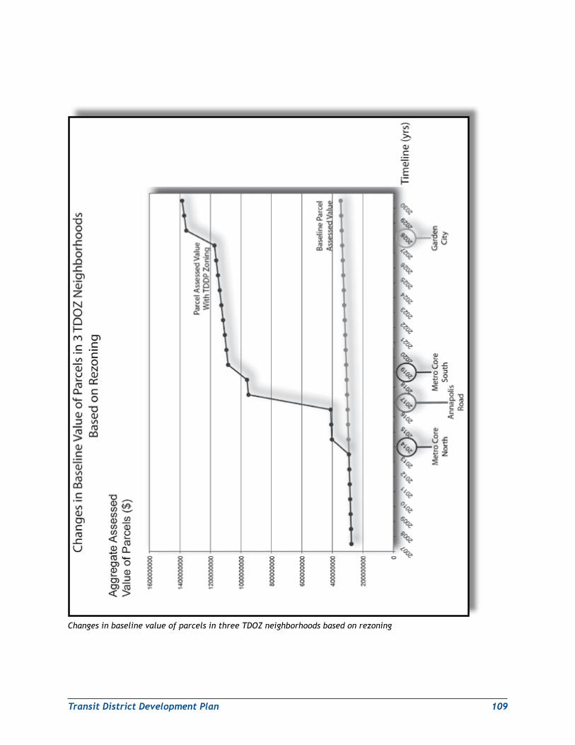
TransitDistrictDevelopmentPlan 109
Changes in baseline value of parcels in three TDOZ neighborhoods based on rezoning
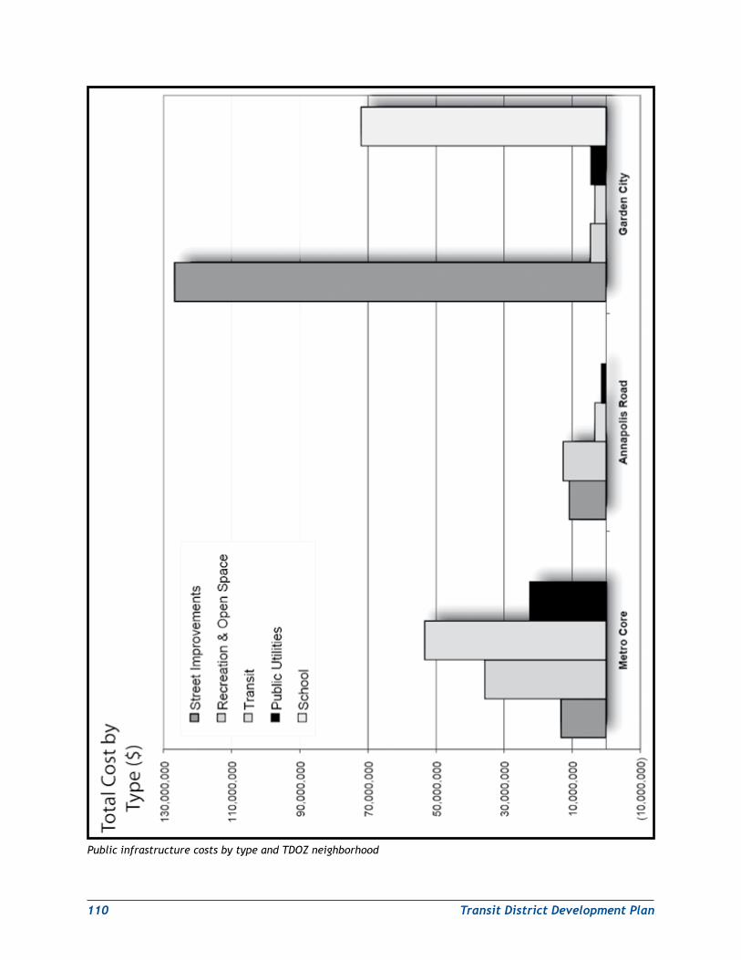
110 TransitDistrictDevelopmentPlan
Public infrastructure costs by type and TDOZ neighborhood
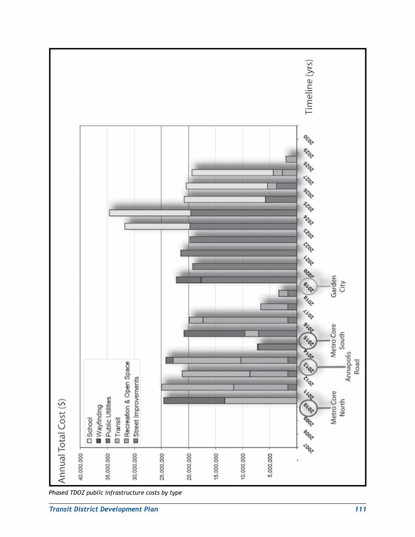
TransitDistrictDevelopmentPlan 111
Phased TDOZ public infrastructure costs by type
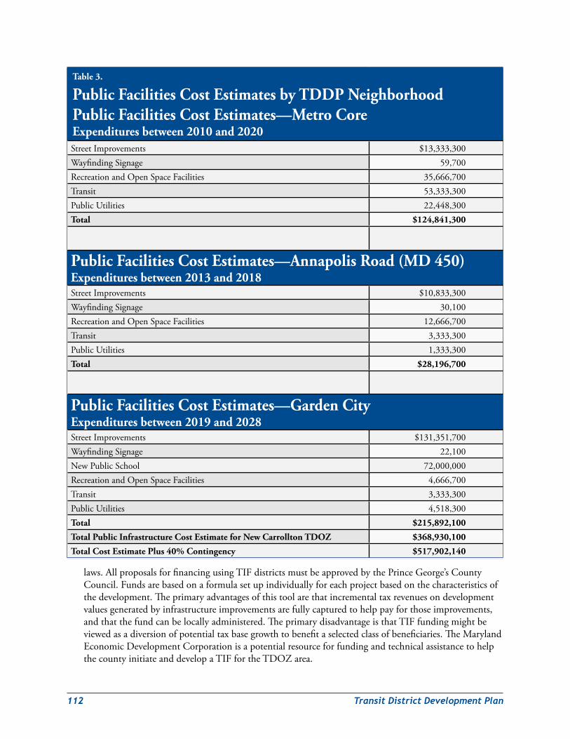
112 TransitDistrictDevelopmentPlan
Table 3.
Public Facilities Cost Estimates by TDDP Neighborhood Public Facilities Cost Estimates—Metro Core Expenditures between 2010 and 2020StreetImprovements $13,333,300WayfindingSignage 59,700RecreationandOpenSpaceFacilities 35,666,700Transit 53,333,300PublicUtilities 22,448,300Total $124,841,300
Public Facilities Cost Estimates—Annapolis Road (MD 450) Expenditures between 2013 and 2018StreetImprovements $10,833,300WayfindingSignage 30,100RecreationandOpenSpaceFacilities 12,666,700Transit 3,333,300PublicUtilities 1,333,300Total $28,196,700
Public Facilities Cost Estimates—Garden City Expenditures between 2019 and 2028StreetImprovements $131,351,700WayfindingSignage 22,100NewPublicSchool 72,000,000RecreationandOpenSpaceFacilities 4,666,700Transit 3,333,300PublicUtilities 4,518,300Total $215,892,100
Total Public Infrastructure Cost Estimate for New Carrollton TDOZ $368,930,100
Total Cost Estimate Plus 40% Contingency $517,902,140
laws.AllproposalsforfinancingusingTIFdistrictsmustbeapprovedbythePrinceGeorge’sCountyCouncil.Fundsarebasedonaformulasetupindividuallyforeachprojectbasedonthecharacteristicsofthedevelopment.Theprimaryadvantagesofthistoolarethatincrementaltaxrevenuesondevelopmentvaluesgeneratedbyinfrastructureimprovementsarefullycapturedtohelppayforthoseimprovements,andthatthefundcanbelocallyadministered.TheprimarydisadvantageisthatTIFfundingmightbeviewedasadiversionofpotentialtaxbasegrowthtobenefitaselectedclassofbeneficiaries.TheMarylandEconomicDevelopmentCorporationisapotentialresourceforfundingandtechnicalassistancetohelpthecountyinitiateanddevelopaTIFfortheTDOZarea.
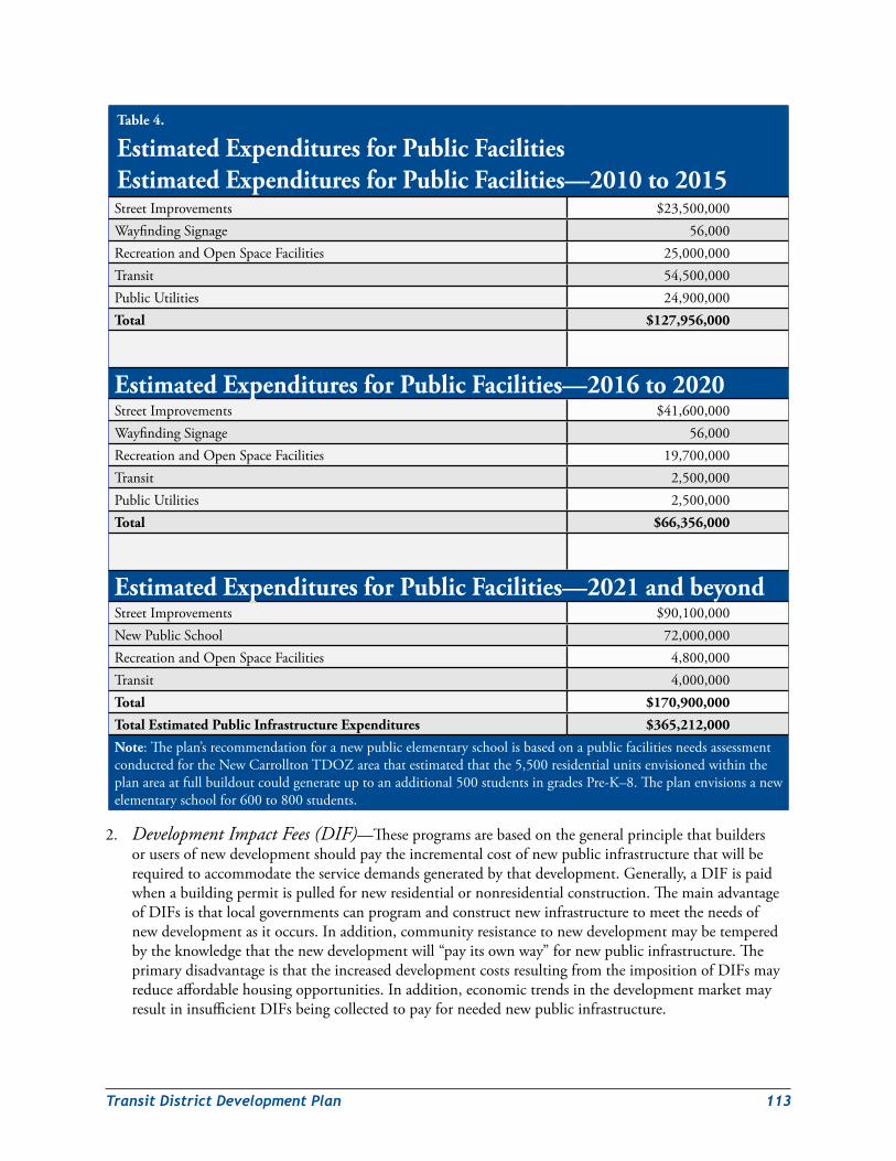
TransitDistrictDevelopmentPlan 113
2. Development Impact Fees (DIF)—Theseprogramsarebasedonthegeneralprinciplethatbuildersorusersofnewdevelopmentshouldpaytheincrementalcostofnewpublicinfrastructurethatwillberequiredtoaccommodatetheservicedemandsgeneratedbythatdevelopment.Generally,aDIFispaidwhenabuildingpermitispulledfornewresidentialornonresidentialconstruction.ThemainadvantageofDIFsisthatlocalgovernmentscanprogramandconstructnewinfrastructuretomeettheneedsofnewdevelopmentasitoccurs.Inaddition,communityresistancetonewdevelopmentmaybetemperedbytheknowledgethatthenewdevelopmentwill“payitsownway”fornewpublicinfrastructure.TheprimarydisadvantageisthattheincreaseddevelopmentcostsresultingfromtheimpositionofDIFsmayreduceaffordablehousingopportunities.Inaddition,economictrendsinthedevelopmentmarketmayresultininsufficientDIFsbeingcollectedtopayforneedednewpublicinfrastructure.
Table 4.
Estimated Expenditures for Public Facilities Estimated Expenditures for Public Facilities—2010 to 2015StreetImprovements $23,500,000WayfindingSignage 56,000RecreationandOpenSpaceFacilities 25,000,000Transit 54,500,000PublicUtilities 24,900,000Total $127,956,000
Estimated Expenditures for Public Facilities—2016 to 2020StreetImprovements $41,600,000WayfindingSignage 56,000RecreationandOpenSpaceFacilities 19,700,000Transit 2,500,000PublicUtilities 2,500,000Total $66,356,000
Estimated Expenditures for Public Facilities—2021 and beyondStreetImprovements $90,100,000NewPublicSchool 72,000,000RecreationandOpenSpaceFacilities 4,800,000Transit 4,000,000Total $170,900,000
Total Estimated Public Infrastructure Expenditures $365,212,000
Note:Theplan’srecommendationforanewpublicelementaryschoolisbasedonapublicfacilitiesneedsassessmentconductedfortheNewCarrolltonTDOZareathatestimatedthatthe5,500residentialunitsenvisionedwithintheplanareaatfullbuildoutcouldgenerateuptoanadditional500studentsingradesPre-K–8.Theplanenvisionsanewelementaryschoolfor600to800students.
114 TransitDistrictDevelopmentPlan
3. Special Tax Districts—SimilarinpurposetoTIFs,specialtaxdistrictsareestablishedtohelppayfortheinfrastructurenecessarytosupportdevelopmentorredevelopmentofanarea.Themaindifferencebetweenthetwoisthewaythetaxisassessed.WhileTIFdistrictscollecttaxesleviedonpropertyvaluesaboveanestablishedlevel(ashiftinallocationoftaxesfromthegovernmenttoaspecialprojectfund),specialtaxdistrictsincreasetheadvalorem(valueadded)taxratechargedontheproperty(orestablishesanadditionalfeebasedassessment).Thisallowstaxrevenuesfrompropertiesreceivingbenefitsfromthenewinfrastructuretobecomeavailableforthepurposesofthedistrictwithoutconstrainingthefuturetaxrevenuestreamthatestablishedgovernmentalbodiesexpecttoreceivefromincreasedpropertyvaluesandadditionaldevelopment.SpecialtaxdistrictsareauthorizedinPrinceGeorge’sCountyandallmunicipalitieswithinthestate.Theprimarybenefitofthistoolisthatincrementalinfrastructurecostsarenolongerbornesolelybythenewdevelopment.Theprimarydisadvantage—sharedwithTIFs—istheriskofpublicperceptionthatspecialtaxdistrictsmayplaceotherpartsofthecountyatadisadvantagewithregardtocollectedtaxrevenues.
4. Recordation Fees/Transfer Taxes—Arecordationfeeispaidbasedonrealestatetransactions.Feesarebasedonthevalueofthepropertyeachtimecertainlandrecordsofthecountyarechanged.Qualifyingtransactionsincludebutarenotlimitedtothechangingofaproperty’sownershipandrefinancing.RecordationtaxesaremadepossiblebyTitle12,TaxPropertyArticle,bytheAnnotatedCodeofMaryland.Recordationfeesgotothegeneralcountyfundandaredistributedasdeemedappropriate.TheprimaryadvantagefortheuseofrecordationfeesisthattheyarealreadyineffectinPrinceGeorge’sCounty.
Inadditiontorecordationfees,transfertaxesarepaidwhenanypropertychangesowners.Currently,transferfeesarefullydesignatedtotheboardofeducationandarenotexpectedtocontributetofundingforpublicinfrastructureimprovementsintheNewCarrolltonTDOZarea.
5. Parking Garage Revenue—Witharound1,700off-streetparkinggaragesandmeteredon-streetparkingthroughouttheregion,PrinceGeorge’sCountycouldpotentiallyfundsomefuturepublicinfrastructureimprovementsintheNewCarrolltonTDOZareathroughapercentageappropriationofcountyparkingrevenue.InFY2006,PrinceGeorge’sCountycollected$5,223,979inparking-relatedfees.Currentlyfundsareputintothecountygeneralfundanddistributedonanagreed-uponbasis.Theprimarybenefitofusingparkinggaragerevenuesisthattherevenuestreamispredictable.Theprimarydisadvantageisthatexistingparkingrevenuesmayalreadybededicatedforcurrentpublicimprovementprojects.Inthiscase,parkingfeesmighthavetoberaisedtohelpfundfuturepublicinfrastructureimprovementswithintheNewCarrolltonTDOZarea.
6. Joint Development Opportunities—Jointdevelopmentisamethodbywhichprivatefundsareusedtodeveloptransitpropertyresultinginprofitfortheprivatedeveloperandadevelopedassetforthetransitagency.Risksrelatedtothedevelopmentareeithersharedorbornebythetransitagencyortheprivatedeveloper.Throughjointdevelopment,atransitagencyandaprivatedevelopermaypartnertodevelopcertainassets.Itcanalsobeanarrangementwherebythetransitagencyreceivesrevenuesortransitfacilitiesandthedeveloperreceivesuseofeitherrealestateorsomeotherassetownedbythetransitagency.Theprimaryadvantageofthistoolisthesharingofriskbetweenthetransitagencyandtheprivatedeveloper.Itsprimarydisadvantageisthegreatercomplexityandtimerequiredforprojectplanning,approval,anddevelopment.
Currently,WMATAownsnearly36acresattheNewCarrolltonMetroStationsite.TheStateofMarylandownsanadditionalnineacresbetweenGardenCityDriveandthePennsyDrivebridge
TransitDistrictDevelopmentPlan 115
overpassthatiscurrentlyoccupiedbyasurfaceparkinglot.Together,thesesitesrepresentopportunitiesforsignificantnewdevelopment.
7. Federal Transit Administration (FTA) Section 5307 Urbanized Area Formula—TheFTASection5307program(49U.S.C.5307)makesfederalresourcesavailabletourbanizedareasfortransitcapitalexpenditures.Eligibleusesincludeplanning,engineeringdesign,andevaluationoftransitprojects,aswellascapitalinvestmentsinnewfixedguidewaysystems.FundsareapportionedandflowtoPrinceGeorge’sCountyaccordingtoapredeterminedformula.ForWashington,D.C.,Virginia,andMarylandthesefundswereprojectedtototal$151,201,836inFY2008.ItispresumedthatsomeofthesefundscouldbeputtowardinfrastructureorcapitalimprovementsoftheNewCarrolltonTOD.Theprimaryadvantageofthissourceisthatcountyandstatefundscouldbesignificantlyleveraged,especiallyiffederalfundingissecuredforthefuturePurpleLine.Theprimarydisadvantageistheuncertaintyofbeingawardedfundingthroughaverycompetitiveprocess,letalonewhatthegrantamountmightbe.Inaddition,thefederalfundswouldcarryadditionalrestrictionsandrequirementsforaccountabilityinthehandlingofgrantfunds.
8. Congestion Mitigation and Air Quality (CMAQ) Funds—TheCMAQprogramisjointlyadministeredbytheFederalHighwayAdministration(FHWA)andFTA.Theprogramwasreauthorizedin2005undertheSafe,Accountable,Flexible,andEfficientTransportationEquityAct:ALegacyforUsers(SAFETEA-LU).TheSAFETEA-LUCMAQprogramprovidesover$8.6billiondollarsinfundingtostatedepartmentsoftransportation,metropolitanplanningorganizations,andtransitagencies.Fundsareearmarkedforinvestmentinprojectsthatreducecriteriaairpollutantsfromtransportation-relatedsourcesoveraperiodoffiveyears.FundingisavailableforareasthatdonotmeettheNationalAmbientAirQualityStandards(nonattainmentareas)aswellasformernonattainmentareasthatarenowincompliance(maintenanceareas).TheSAFETEA-LUrequiresagenciestogiveprioritywhendistributingCMAQfundstodieselengineretrofitsandothercost-effectiveemissionreductionandcongestionmitigationactivities.Theprimaryadvantageofthissourceisthatcountyandstatefundscouldbesignificantlyleveraged.ItisalsopredictableinthesensethatfundsareprovidedtotheStateofMarylandbasedonaformula.Theprimarydisadvantageofthissourceistherestrictednumberofactivitiesthatareeligibleforfunding.
TODatNewCarrolltoncouldpotentiallyqualifyforCMAQfundingthroughitspotentialtomitigatecongestionandreducetransportation-generatedairpollution.Theestablishmentofatransportationdemandmanagementdistrict(TDMD)couldfurtherenhancetheNewCarrolltonTDOZ’spotentialtoreceiveCMAQfunding.
9. Transportation Enhancement Funds—TransportationEnhancement(TE)activitiesarefederallyfundedprojectsthatexpandtravelchoicesandenhancethetransportationexperiencebyimprovingthecultural,historic,aesthetic,orenvironmentalaspectsoftransportationinfrastructure.TEprojectsmustrelatetosurfacetransportationmodes,includinghighways,publictransit,intercitybusandrailservice,pedestrian,andbicycling.Projectscanincludebicycleandpedestrianfacilities,streetscapeimprovements,refurbishmentofhistorictransportationfacilities,andotherinvestmentsthatenhancecommunitiesandaccess.FundingforTEprojectsisprovidedthroughSAFETEA-LU.Theprimaryadvantageofthissourceisthatcountyandstatefundscouldbesignificantlyleveraged.Theprimarydisadvantageistheuncertaintyofbeingawardedfundingthroughaverycompetitiveprocess,letalonewhatthegrantamountmightbe.TheMarylandDepartmentofTransportation(MDOT)TransportationEnhancementProgramisanadditionalpotentialsourceoffederalfundsforpublictransportationinfrastructureimprovements.
116 TransitDistrictDevelopmentPlan
10.Surface Transportation Program (STP) Funds—TheSTPprovidesflexiblefundingthatmaybeusedbystatesandlocalitiestofundpublicinfrastructureimprovementsincludingbridgeprojectsonpublicroads,transitcapitalprojects,andpublicbusterminalsandfacilities.Eligibleactivitiesforfundinghavebeenexpandedtoincludeadvancedtruckstopelectrificationsystems;highaccident/highcongestionintersections;environmentalrestorationandpollutionabatement;controlofnoxiousland-dwellingandaquaticweeds;andreestablishmentofnativespecies.STPfundsintheamountof$32.5billionhavebeenauthorizedthrough2009.Fundsaredistributedamongthestatesbasedonlane-milesoffederal-aidhighways,totalvehicle-milestraveledonfederal-aidhighways,andestimatedcontributionstothehighwayaccount.Theprimaryadvantageofthisfundingsourceisitsflexibilityregardingthetypesofactivitiesthatcanbefunded.Itsprimarydisadvantageistheuncertaintyofbeingawardedfundingthroughaverycompetitiveprocess,letalonewhatthegrantamountmightbe.
Transportation demand ManagementThe2002GeneralPlanenvisionsqualityTODatDevelopedTiercentersatMetrostationssuchasNewCarrollton.ImplementingthisGeneralPlanvisionfortheDevelopedTierwillrequirebalancingtheoptimummixanddensitiesoflanduseswiththetransportationinfrastructureandservicesthatareneededtoefficientlyaccommodatethem.Tothisend,theTDDPseekstoensureaconvenientandefficienttransportationnetworkintheNewCarrolltonTDOZarea.TheTDDPalsoseekstoprotectexistingstableresidentialneighborhoodsfromaddedtraffic.
ThisTDDPispremisedontheassumptionthat,atbuildout,thepreferreddevelopmentpatternintheNewCarrolltonTransitDistrictmaygeneratelevelsofautomotivecongestionthataresomewhathigherthanatpresent.However,theTDDPisalsopredicatedontheparallelassumptionthatgreatervehicularcongestionwithintheTDOZcanbemitigatedby(1)improvementstoothercomponentsofthetransportationnetwork—particularlytransitandtransportationdemandmanagementinitiatives—and(2)ensuringthatnewdevelopmentisdesignedtobebothpedestrian-andtransit-friendly.DoingthiswillencouragesignificantlyhigheruseoftransitandmakeitdesirableandsafetousebicyclesorwalktoandwithintheTDOZ.
TherearefewoptionstoaddorexpandroadstoaccommodatetheadditionalvehiculartrafficthatmayresultfromnewdevelopmentwithintheNewCarrolltonTDOZ.Thearterialsandmajorcollectorroadsinthetransitdistrictarealreadybuiltouttotheirmasterplanrights-of-wayandalignments.Furthermore,thestreetnetworksinadjoiningneighborhoodsarenotenvisionedintheplanasplayingasignificantroleinaccommodatingfuturethroughtrafficintheTDOZ.Therefore,amultimodaltransportationnetworkthatintegratesthedevelopmentpatternwithexpandedpublictransportation,pedestrian/bicyclepathways,andtransportationdemandmanagement(TDM)initiativeswillbeneededtoaccommodatethedesireddevelopmentandtohelpensuretheoperationalintegrityofallcomponentsofthetransportationnetworkwithintheNewCarrolltonTDOZ.
TransportationdemandmanagementisdefinedinSection20A-201ofTitle20A,Transportation,ofthePrinceGeorge’sCountyCodeas“…aprocessorprocedureintendedtoreducevehicletripsduringspecifiedperiodsoftheday.Thisincludes,butisnotlimitedto,suchstrategiesascarandvanpools,transituseincentives,parkingfeesanddisincentives,improvedpedestrianandbicycleaccessandfacilities.”Title20AcontainsguidelinesforimplementingTDMstrategies,includingtheestablishmentandoperationofdesignatedtransportationdemandmanagementdistricts(TDMD).
TheNewCarrolltonTDDPauthorizestheestablishmentofaTDMDforthetransitdistrictthroughpetitiontotheCouncilinaccordancewithSection20A-204ofthePrinceGeorge’sCountyCode.Uponreceiptofthepetition,theCouncilshalldirectthePlanningBoardtoconductatransportationsystemcapacityanalysistodeterminewhetherornottransportationsystemimbalanceswillrequiretheestablishmentofaTDMD.AnyTDMDthusestablishedwillhelpimplementtheGeneralPlanpolicy(DevelopedTierPolicy3,page35)
TransitDistrictDevelopmentPlan 117
thatrecommendstransportationsystemsbebothmultimodalandintegratedwiththepreferreddevelopmentpatternsinintensive,higher-density,mixed-useareassuchastheNewCarrolltonTDOZ.
TheTDMDisintendedto:
1. EnsurethatthepreferreddevelopmentpatterncanbeachievedintheNewCarrolltonTDOZwhileoptimizingtheoveralloperationalintegrityofthetransportationnetworkinthetransitdistrictanditsenvirons.
2. Reduce,ordiverttoothermodes,thevehicletripsgeneratedbytheproposeddevelopmentandredevelopmentintheNewCarrolltonTransitDistrict,particularlysingle-occupantvehicletrips,duringpeaktrafficperiods.
3. Provideandmaintainadequate,multimodaltransportationandmobilityoptionsforthetransitdistrict’sresidents,workers,andvisitors.
4. Establishandmaintainamultimodalnetworkoftransportationservicesandfacilitiesthatsupports:
a. ThedevelopmentpatternrecommendationsforNewCarrolltonasaGeneralPlanMetropolitanCenter.
b. AllotherprovisionsoftheNewCarrolltonTDDP.
c. Goals,objectives,andpoliciesofthe2002Prince George’s County Approved General Plan.
d. Theapplicableprovisionsofthe2009Approved Countywide Master Plan of Transportation.
TheTDDPalsoauthorizestheestablishmentofatransportationdemandmanagementtechnicaladvisorycommittee(TDMTAC)toanalyze,recommend,andimplementthepoliciesrequiredtoachievetheNewCarrolltonTDDP’stransportationgoals,policies,andobjectives.TheTDMTACwillbecomposedoftransportationstafffromM-NCPPC,MDOT(MTAandSHA),WMATA,andDPW&T.
TheTDMTACwillevaluate,analyze,andmanagethetransportationdemandgeneratedbynewdevelopmentandredevelopmentinthetransitdistrictasprovidedforbyTitle20A,Subdivisions2and3.Itwillalsocoordinatethetransportationservicesneededtoaccommodatethatdevelopment,includingfeederandcommuterinterceptbusservicesanddemandmanagementprogramsforemployersintheNewCarrolltonTransitDistrict.TheTDMTACwillalsoassisttheDistrictCouncilindeterminingtransportationadequacyinthetransitdistrictinaccordancewiththeproceduresandguidelinesofTitle20AandanyotherguidanceordirectivesthatthePrinceGeorge’sCountyPlanningBoardortheDistrictCouncilprovidesinadoptingandapprovingthisTDDP.InitialstaffsupportfortheTDMTACwillbeprovidedbytheCountywidePlanningDivisionofM-NCPPC.
Community and economic developmentCommunityandEconomicDevelopmentImplementationStrategiesandToolsThevisionfortheNewCarrolltonTransitDistrictDevelopmentPlanispredicatedonthreeelements:thevariety,stability,andaffordabilityoftheTDOZarea’shousingstocktocreatediverseandstableneighborhoods;anenhancedphysicalandnaturalenvironmenttoprovideahigh-qualityoflifeforitsresidents;andthediversityandabilityofitsbusinessestogeneratehigh-qualityemploymentopportunitiesaccessibletoresidentsandcommuters.Thefollowingsectionsspelloutgoals,objectives,andstrategiestoimplementtheseelements.Strategiesareidentifiedasbeingshort-term(ST=1–3years),medium-term(MT=4–7years),orlong-term(LT=8yearsandbeyond).
118 TransitDistrictDevelopmentPlan
StableandAffordableNeighborhoodsTwokeytrendsposeathreattothestabilityanddiversityoftheneighborhoodsinandaroundtheNewCarrolltonarea—therisingcostofhomeownershipandincreasingforeclosurerates.Medianhomevaluesincreased14percentperyearfrom2000to2007translatingtoajumpinhomevaluesto$345,215in2007fromjust$135,207in2000.Sincemid-2007,however,thenationalsubprimemortgageimplosionhascausedhomevaluesandsalesvolumestodeclinesharplyinmanypartsoftheUnitedStates.AccordingtotheWashingtonPost2008HousingOutlook,eventhehotPrinceGeorge’sCountyresidentialmarkethasbeguntofeeltheeffectsofthenationalmortgagecredit/housingcrisis.WithinthepostalzipcodeareathatincludestheNewCarrolltonTDOZ(20784),medianhomevalueshaverisenlessthanonepercent($100)andhomesaleshavedropped44percentsince2007.Meanwhile,anecdotalevidenceindicatesthatforeclosuresareontheriseintheresidentialneighborhoodofWestLanhamHills.
Thesetrendsareparticularlyproblematicbecausethearea’slowermedianhouseholdincomeincreasesthesusceptibilityofhouseholdstopredatorylendingpractices.Thelowermedianhouseholdincomealsotendstoplacehomeownershipopportunitiesbeyondthereachofmanyresidents.In2007,themedianhouseholdincomewithinaone-mileradiusoftheMetrostationwasalmost$15,000lessthanthemedianincomecountywide.Meanwhile,only43percentofarearesidentswerehomeownerscomparedto64percentofresidentscountywide.
Anumberofworkforcehousinginitiativeshavebeeninitiatedbythefederalgovernment,theStateofMaryland,andPrinceGeorge’sCountysince2000.Theprimarypurposeoftheseprogramsistoenableemployeestoliveclosertotheirplacesofworkandtherebyreducethetimeandfinancialcostsassociatedwithlongcommutestoandfromwork.Thesesavingscanpotentiallyallowqualifyinghomebuyerstoaffordlargerandmoreexpensivehomesaswellasimprovetheirhouseholdqualityoflife.
ThefederalgovernmenthasplayedtheleadingroleinpromotingandfundingworkforcehousinginitiativesintheWashingtonmetropolitanregionbecauseitisthelargestemployerinthearea.ThreefederallyfundedprogramsareavailabletoassistqualifyinghomebuyersinMaryland,Virginia,andtheDistrictofColumbia.TheAmericanDreamDownpaymentInitiative(ADDI)providesdownpaymentassistance.TheHomePurchaseAssistanceProgramprovidesinterest-freeandlow-interestloansthatenableborrowerstopurchasesingle-familyhomes,condominiums,orcooperativeapartments.TheSmartCommuteProgramassistshomebuyersplanningtopurchasenewhomeslocatedwithin¼milefromapublictransitbusstoporwithin½mileofapublicrailstation.Participatinglendersinthisprogramrequireareduceddownpayment(threepercentofpurchaseprice)andincorporatethepotentialtransportationsavingsintotheircalculationofqualifyingincome.AllthreefederalprogramsareadministeredlocallyinPrinceGeorge’sCountyandotherWashington-areajurisdictions.
TheStateofMarylandofferstwoworkforcehousing-relatedprogramsforqualifyingfirst-timehomebuyers.TheDownPaymentSettlementExpenseLoanProgram(SELF)providesapartialsubsidyofclosingcosts.TheLiveNearYourWorkProgramofferssmallsettlementcostassistancegrants(threepercentoftotalsettlementcosts)tohomebuyerswhoarepurchasingahomewithin25milesoftheirplaceofemployment.
Inadditiontotheseprograms,MontgomeryCountyandtheDistrictofColumbiaincorporateinclusionaryzoningprovisionsintotheirrespectivezoningordinances.MontgomeryCountyrequiresaffordablehousingasapercentageofnewhousinginproposeddevelopmentsthatcontain20ormoreunitsinapplicablezones.TheDistrictofColumbiaawardsbonusdensityinapplicablezonesfortheproductionofaffordablehousinginproposeddevelopmentsoftenormoreunits.Inaddition,theDistrictofColumbiaspecificallytargetsworkforcehousingforpublicserviceemployeessuchasteachers,policeofficers,firefighters,andnurseswhocannotaffordtopurchasemarket-ratehousingintheDistrict.Bothjurisdictionshaveaffordableworkforcehousingtrustfundsthatwerecreatedinthelate1980s.Thesefundsaresupportedbyamixoftaxes,fees,
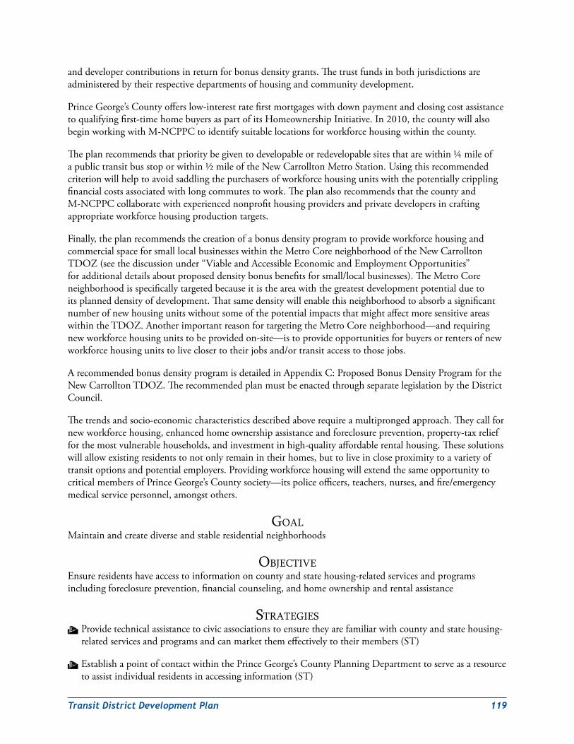
TransitDistrictDevelopmentPlan 119
anddevelopercontributionsinreturnforbonusdensitygrants.Thetrustfundsinbothjurisdictionsareadministeredbytheirrespectivedepartmentsofhousingandcommunitydevelopment.
PrinceGeorge’sCountyofferslow-interestratefirstmortgageswithdownpaymentandclosingcostassistancetoqualifyingfirst-timehomebuyersaspartofitsHomeownershipInitiative.In2010,thecountywillalsobeginworkingwithM-NCPPCtoidentifysuitablelocationsforworkforcehousingwithinthecounty.
Theplanrecommendsthatprioritybegiventodevelopableorredevelopablesitesthatarewithin¼mileofapublictransitbusstoporwithin½mileoftheNewCarrolltonMetroStation.Usingthisrecommendedcriterionwillhelptoavoidsaddlingthepurchasersofworkforcehousingunitswiththepotentiallycripplingfinancialcostsassociatedwithlongcommutestowork.TheplanalsorecommendsthatthecountyandM-NCPPCcollaboratewithexperiencednonprofithousingprovidersandprivatedevelopersincraftingappropriateworkforcehousingproductiontargets.
Finally,theplanrecommendsthecreationofabonusdensityprogramtoprovideworkforcehousingandcommercialspaceforsmalllocalbusinesseswithintheMetroCoreneighborhoodoftheNewCarrolltonTDOZ(seethediscussionunder“ViableandAccessibleEconomicandEmploymentOpportunities”foradditionaldetailsaboutproposeddensitybonusbenefitsforsmall/localbusinesses).TheMetroCoreneighborhoodisspecificallytargetedbecauseitistheareawiththegreatestdevelopmentpotentialduetoitsplanneddensityofdevelopment.ThatsamedensitywillenablethisneighborhoodtoabsorbasignificantnumberofnewhousingunitswithoutsomeofthepotentialimpactsthatmightaffectmoresensitiveareaswithintheTDOZ.AnotherimportantreasonfortargetingtheMetroCoreneighborhood—andrequiringnewworkforcehousingunitstobeprovidedon-site—istoprovideopportunitiesforbuyersorrentersofnewworkforcehousingunitstoliveclosertotheirjobsand/ortransitaccesstothosejobs.
ArecommendedbonusdensityprogramisdetailedinAppendixC:ProposedBonusDensityProgramfortheNewCarrolltonTDOZ.TherecommendedplanmustbeenactedthroughseparatelegislationbytheDistrictCouncil.
Thetrendsandsocio-economiccharacteristicsdescribedaboverequireamultiprongedapproach.Theycallfornewworkforcehousing,enhancedhomeownershipassistanceandforeclosureprevention,property-taxreliefforthemostvulnerablehouseholds,andinvestmentinhigh-qualityaffordablerentalhousing.Thesesolutionswillallowexistingresidentstonotonlyremainintheirhomes,buttoliveincloseproximitytoavarietyoftransitoptionsandpotentialemployers.ProvidingworkforcehousingwillextendthesameopportunitytocriticalmembersofPrinceGeorge’sCountysociety—itspoliceofficers,teachers,nurses,andfire/emergencymedicalservicepersonnel,amongstothers.
GoalMaintainandcreatediverseandstableresidentialneighborhoods
objectiveEnsureresidentshaveaccesstoinformationoncountyandstatehousing-relatedservicesandprogramsincludingforeclosureprevention,financialcounseling,andhomeownershipandrentalassistance
StrateGieSW Providetechnicalassistancetocivicassociationstoensuretheyarefamiliarwithcountyandstatehousing-relatedservicesandprogramsandcanmarketthemeffectivelytotheirmembers(ST)
W EstablishapointofcontactwithinthePrinceGeorge’sCountyPlanningDepartmenttoserveasaresourcetoassistindividualresidentsinaccessinginformation(ST)
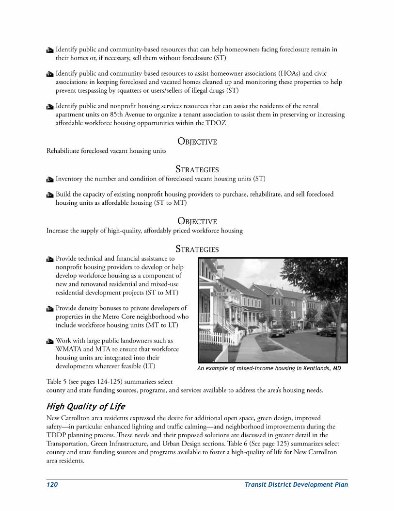
120 TransitDistrictDevelopmentPlan
W Identifypublicandcommunity-basedresourcesthatcanhelphomeownersfacingforeclosureremainintheirhomesor,ifnecessary,sellthemwithoutforeclosure(ST)
W Identifypublicandcommunity-basedresourcestoassisthomeownerassociations(HOAs)andcivicassociationsinkeepingforeclosedandvacatedhomescleanedupandmonitoringthesepropertiestohelppreventtrespassingbysquattersorusers/sellersofillegaldrugs(ST)
W Identifypublicandnonprofithousingservicesresourcesthatcanassisttheresidentsoftherentalapartmentunitson85thAvenuetoorganizeatenantassociationtoassisttheminpreservingorincreasingaffordableworkforcehousingopportunitieswithintheTDOZ
objectiveRehabilitateforeclosedvacanthousingunits
StrateGieSW Inventorythenumberandconditionofforeclosedvacanthousingunits(ST)
W Buildthecapacityofexistingnonprofithousingproviderstopurchase,rehabilitate,andsellforeclosedhousingunitsasaffordablehousing(STtoMT)
objectiveIncreasethesupplyofhigh-quality,affordablypricedworkforcehousing
StrateGieSW Providetechnicalandfinancialassistancetononprofithousingproviderstodeveloporhelpdevelopworkforcehousingasacomponentofnewandrenovatedresidentialandmixed-useresidentialdevelopmentprojects(STtoMT)
W ProvidedensitybonusestoprivatedevelopersofpropertiesintheMetroCoreneighborhoodwhoincludeworkforcehousingunits(MTtoLT)
W WorkwithlargepubliclandownerssuchasWMATAandMTAtoensurethatworkforcehousingunitsareintegratedintotheirdevelopmentswhereverfeasible(LT)
Table5(seepages124-125)summarizesselectcountyandstatefundingsources,programs,andservicesavailabletoaddressthearea’shousingneeds.
HighQualityofLifeNewCarrolltonarearesidentsexpressedthedesireforadditionalopenspace,greendesign,improvedsafety—inparticularenhancedlightingandtrafficcalming—andneighborhoodimprovementsduringtheTDDPplanningprocess.TheseneedsandtheirproposedsolutionsarediscussedingreaterdetailintheTransportation,GreenInfrastructure,andUrbanDesignsections.Table6(Seepage125)summarizesselectcountyandstatefundingsourcesandprogramsavailabletofosterahigh-qualityoflifeforNewCarrolltonarearesidents.
An example of mixed-income housing in Kentlands, MD
TransitDistrictDevelopmentPlan 121
GoalEnhancethequalityoflifeforlocalresidents
objectiveEnsureresidentshaveaccesstoinformationoncountyandstateneighborhoodrevitalizationandopenspacegrantprograms
StrateGieSW Providetechnicalassistancetocivicassociationsandothercommunity-basedorganizationstoensuretheyarefamiliarwithcountyandstateneighborhoodrevitalizationandopenspacegrantprogramsandcanmarketthemeffectivelytotheirmembers(ST)
W EstablishapointofcontactwithinthePrinceGeorge’sCountyPlanningDepartmenttoserveasaresourcetoassistindividualresidentsinaccessinginformation(ST)
Table6summarizesselectcountyandstatefundingsources,programs,andservicesavailabletopromoteneighborhoodrevitalizationandenhancepublicopenspace.
GoalEnsurethatthepublicschoolsintheTDOZareaandsurroundingcommunitiesarenotovercrowded,featurecutting-edgetechnologyandqualityinstructionalopportunities,andserveasactivecentersfortheircommunities.
objectiveConstructapublicschoolservinggradespre-kindergartenthroughtheeighthgrade(PreK–8)withintheTDOZtoachieveaschoolsystemthatoperatesat100percentofcapacityorlessateveryschoolbasedonprojectedbuildoutofthearea
StrateGieSW Developbasicstandardsandguidelinesfortheconstructionofanurban-scalePreK–8school(ST)
W PlaceafloatingPreK–8schoolsymbolwithinthemultifamilyresidentialdevelopmentareawithintheNorthHillsideResidentialNeighborhood(ST)
W Acquiresufficientlandduringtheredevelopmentprocessforanurban-scalePreK–8school(STtoMT)
W Constructanurban-scalePreK–8schoolintheNorthHillsideResidentialNeighborhood(MT)
ViableandAccessibleEconomicandEmploymentOpportunitiesExistingconditionsintheNewCarrolltonareaincludinglowerhouseholdsincomes,car-orienteddevelopment,poorbranding,andincreasingcompetitionfromotherlocationsintheregionnecessitateboththeuseofcountyandstatetoolstostimulateeconomicrevitalization,attractinvestment,andcreatehigh-qualityjobsandthecreationand/orenhancementofbusinessorganizationstopromotetheareatoinvestorsandcoordinatedevelopment.
Duringthecommunityplanningworkshops,someresidentsraisedconcernsaboutopportunitiesforlocalbusinessestoleasesuitablecommercialspaceinfuturecommercialormixed-usedevelopmentwithintheNewCarrolltonTDOZarea.Toaddresstheseconcerns,theplanrecommendsthatcommercialspaceforlocal/smallbusinessesbemadeavailableaspartofthebonusdensityprogramoutlinedinAppendixC(seeearlierdiscussionunder“StableandAffordableNeighborhoods”).
122 TransitDistrictDevelopmentPlan
AnimportantpartoftheefforttopromoteeconomicrevitalizationintheNewCarrolltonTDOZwillbethecreationofventureopportunitiesforlocalsmallbusinesses.Adequateneighborhood-servingcommercialservicesareanessentialelementinguaranteeingahighqualityoflifeforTDOZarearesidents.Theseservicesshouldbeofferednotonlybynewbusinessesbutbyviableexistingbusinessesaswell.TheplanrecommendsatargetedbusinessdevelopmentinitiativebyPrinceGeorge’sCountyandtheStateofMarylandtoassistexistingbusinessesaswellasnewstartups.Anappropriatenonprofitorquasi-publicimplementingentitysuchastheproposedBIDshouldalsobesolicitedtoparticipateinthiseffort;ifnecessary,financialand/ortechnicalassistanceshouldbeextendedtotheorganizationtohelpitbuilditscapacitytohelpimplementthebusinessdevelopmentinitiative.Newandinnovativebusinessdevelopmenttoolssuchasmicrolending,investmentclubs,andincubatorprogramsshouldbeevaluatedand,wherefeasible,usedtoassistinterestedcommunityresidentsandotherentrepreneursinstartingnewbusinessesorexpandingexistingbusinesses.
Whiletheareaqualifiesforanumberofeconomictoolsandincentives,ithasadistinguishingfeaturewhichincreasesitsattractivenesstoinvestors:theAnnapolisRoadCorridor(MD450)isastate-designatedpriorityfundingarea(PFA).Thisdesignationearnstheareapriorityconsiderationovernon-PFAsforfundingfromtheMarylandstategovernment.SelecteconomicprogramsandincentivestargetingthecorridorincludetheEnterpriseZoneTaxCredit,theJobCreationTaxCredit,andtheSustainableCommunityprograms.
Untilrecently,thecorridorhadanewcommunitydevelopmentcorporation—theAnnapolisRoadInnerBeltwayAlliance(ARIBA)—whoseprimarymissionwastopromotethephysicalimprovementandeconomicrevitalizationoftheMD450corridorbetweentheCapitalBeltwayandtheBaltimore-WashingtonParkway.Unfortunately,ARIBAwasunabletogeneratetheresourcesneededtohelpitcarryoutitsmission.Asaresult,itisnolongerinbusiness.Theplanrecommendsthatanothernonprofitorquasi-publicorganizationbeidentifiedorcreatedtoadvocateforandcoordinaterevitalizationeffortsalongAnnapolisRoad.Thatorganizationshouldbetargetedforcapacity-buildingtechnicalassistanceandseedmonies,ifnecessary.Itsadvocacyandcoordinationworkwillbecriticaltotheeconomicviabilityandtransformationofthecorridor.Ifabusinessimprovementdistrict(BID)isformed,thisorganizationmightpotentiallyplayaroleinitsadministration.Theformationofamerchantsassociationshouldalsobepursuedinordertogivelocalmerchantsadedicatedorganizationaladvocatefortheircommercialinterests.
Coordinatingdevelopment,marketinginvestmentopportunities,andmaintainingthearea’sappearanceandsafetywillbesimilarlyimportanttothesuccessoftheMetroCorearea.OnepossiblevehiclefortheseinitiativesisaBID,whichcouldinitiallyfocusonenhancingtheaesthetics,cleanliness,andpublicsafetyofthearea.AstheBIDmatured,itcoulddiversifyitsservicestoincludepromotion,coordination,andbusinessattraction.
GoalRevitalizetheNewCarrolltonTDOZareabyattracting,stimulating,andcoordinatinginvestmenttoincreaseemploymentandventureopportunities,residents’medianincome,andthecounty’staxbase
objectiveAttractnewhigh-qualitycommercial,retail,andofficedevelopment
StrateGieSW Marketthecounty’squalityhousingopportunitiesandpublicamenitiestopotentialhigher-incomeresidentstodemonstratetheattractivenessandlocationaladvantagesoftheareaandestablishhigherpricepoints(STtoLT)
W Marketthecounty’sbusinessopportunitiesandservicestocommercial/retailemployersseekinglocationstodevelopworld-classcommercialandmixed-usecommercialspace(STtoLT)
TransitDistrictDevelopmentPlan 123
objectiveStimulateandcoordinatenewinvestment
StrateGieSW Buildthetechnicalandfinancialcapacityofanexistingornewnonprofitorquasi-publicorganizationtocoordinatedevelopmentandmarketfinancialincentivestopromoteinvestmentalongtheAnnapolisRoadCorridor(ST)
W ExplorethepossibilityofestablishingandbuildingthetechnicalcapacityofaBIDtocoordinatedevelopmentandmarketthefinancialincentivestoinvestingintheMetroCorearea(MT)
objectiveEnhancetheimageandperceptionoftheMetroCoreandAnnapolisRoadCorridor
StrateGieSW Buildthetechnicalandfinancialcapacityofanexistingornewnonprofitorquasi-publicorganizationtorebrandtheAnnapolisRoadCorridorandpromoteitsassetsandopportunities(ST)
W ExplorethepossibilityofestablishingandbuildingthetechnicalcapacityofaBIDtofundspecialoperatingdistrictsandinfrastructureimprovementstoenhancesafety,security,andmaintenance(MT)
W Explorethepossibilityofestablishingatax-incrementfinancingdistrict(MT)
W Enforceallapplicablecountycodes—particularlypropertymaintenance,zoningcodes,andsignage(ST)
W Enhancesafetyandsecurityalongthecorridor(ST)
GoalProvideopportunitiesforsmall/localbusinessestobenefitfromnewinvestmentintheNewCarrolltonTDOZarea
StrateGieSW Providetechnicalassistancetoestablishedandstartuplocal/smallanddisadvantagedbusinessestoensuretheyarefamiliarwithcountyandstatebusinessdevelopmentservicesandprogramsandarepreparedtotakeadvantageoftheseresources
W ProvidedensitybonusestoprivatedevelopersofpropertiesintheMetroCoreneighborhoodwhoincludesuitablecommercialspaceforsmall/localbusinesses(MTtoLT)
Table7(seepage126)summarizesNewCarrollton’seconomicneedsandselectcountyandstatefundingsources,programs,andtoolsavailabletoaddressthem.
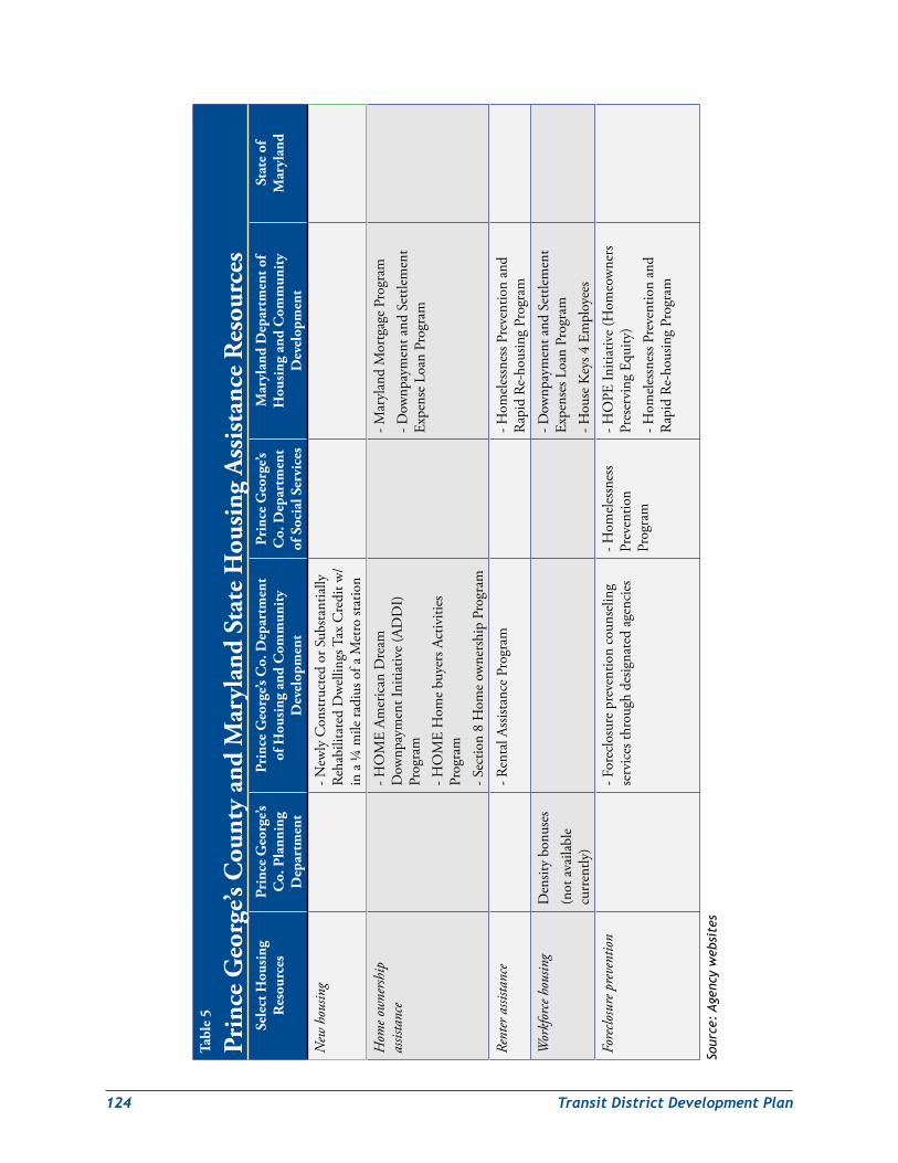
124 TransitDistrictDevelopmentPlan
Tabl
e 5
Prin
ce G
eorg
e’s C
ount
y an
d M
aryl
and
Stat
e H
ousi
ng A
ssis
tanc
e R
esou
rces
Sele
ct H
ousi
ng
Res
ourc
esPr
ince
Geo
rge’s
C
o. P
lann
ing
Dep
artm
ent
Prin
ce G
eorg
e’s C
o. D
epar
tmen
t of
Hou
sing
and
Com
mun
ity
Dev
elop
men
t
Prin
ce G
eorg
e’s
Co.
Dep
artm
ent
of S
ocia
l Ser
vice
s
Mar
ylan
d D
epar
tmen
t of
Hou
sing
and
Com
mun
ity
Dev
elop
men
t
Stat
e of
M
aryl
and
New
hou
sing
-New
lyC
onstr
ucte
dor
Sub
stant
ially
Re
habi
litat
edD
wel
lings
Tax
Cre
ditw
/in
a¼
mile
radi
uso
faM
etro
stat
ion
Hom
e ow
nersh
ip
assis
tanc
e-H
OM
EAm
eric
anD
ream
D
ownp
aym
entI
nitia
tive
(AD
DI)
Pr
ogra
m-H
OM
EH
ome
buye
rsA
ctiv
ities
Pr
ogra
m-S
ectio
n8
Hom
eow
ners
hip
Prog
ram
-Mar
ylan
dM
ortg
age
Prog
ram
-Dow
npay
men
tand
Set
tlem
ent
Expe
nse
Loan
Pro
gram
Rent
er a
ssista
nce
-Ren
talA
ssist
ance
Pro
gram
-H
omel
essn
essP
reve
ntio
nan
dR
apid
Re-
hous
ing
Prog
ram
Wor
kfor
ce h
ousin
gD
ensit
ybo
nuse
s(n
ota
vaila
ble
curr
ently
)
-Dow
npay
men
tand
Set
tlem
ent
Expe
nses
Loa
nPr
ogra
m-H
ouse
Key
s4E
mpl
oyee
s
Fore
closu
re p
reve
ntio
n-F
orec
losu
rep
reve
ntio
nco
unse
ling
serv
ices
thro
ugh
desig
nate
dag
enci
es-H
omel
essn
ess
Prev
entio
nPr
ogra
m
-HO
PEIn
itiat
ive
(Hom
eow
ners
Pr
eser
ving
Equ
ity)
-Hom
eles
snes
sPre
vent
ion
and
Rap
idR
e-ho
usin
gPr
ogra
m
Sour
ce:
Age
ncy
web
site
s
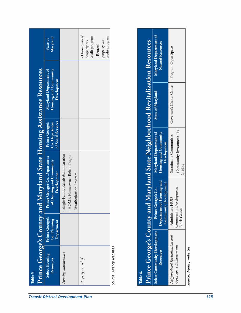
TransitDistrictDevelopmentPlan 125
Tabl
e 6.
Prin
ce G
eorg
e’s C
ount
y an
d M
aryl
and
Stat
e N
eigh
borh
ood
Rev
ital
izat
ion
Res
ourc
esSe
lect
Com
mun
ity
Dev
elop
men
t R
esou
rces
Prin
ce G
eorg
e’s C
o.
Dep
artm
ent o
f Hou
sing
and
C
omm
unit
y D
evel
opm
ent
Mar
ylan
d D
epar
tmen
t of
Hou
sing
and
Com
mun
ity
Dev
elop
men
t
Stat
e of
Mar
ylan
dM
aryl
and
Dep
artm
ent o
f N
atur
al R
esou
rces
Neig
hbor
hood
Rev
italiz
atio
n an
d O
pen
Spac
e Enh
ance
men
ts-A
dmin
ister
sHU
D
Com
mun
ityD
evel
opm
ent
Bloc
kG
rant
s
-Sus
tain
able
Com
mun
ities
-Com
mun
ityIn
vestm
entT
ax
Cre
dits
-Gov
erno
r’sG
rant
sOffi
ce-P
rogr
amO
pen
Spac
e
Tabl
e 5
Prin
ce G
eorg
e’s C
ount
y an
d M
aryl
and
Stat
e H
ousi
ng A
ssis
tanc
e R
esou
rces
Sele
ct H
ousi
ng
Res
ourc
esPr
ince
Geo
rge’s
C
o. P
lann
ing
Dep
artm
ent
Prin
ce G
eorg
e’s C
o. D
epar
tmen
t of
Hou
sing
and
Com
mun
ity
Dev
elop
men
t
Prin
ce G
eorg
e’s
Co.
Dep
artm
ent
of S
ocia
l Ser
vice
s
Mar
ylan
d D
epar
tmen
t of
Hou
sing
and
Com
mun
ity
Dev
elop
men
t
Stat
e of
M
aryl
and
Hou
sing
mai
nten
ance
-Sin
gle-
Fam
ilyR
ehab
Adm
inist
ratio
n-H
OM
EH
omeo
wne
rReh
abP
rogr
am-W
eath
eriza
tion
Prog
ram
Prop
erty
tax
relie
f-H
omeo
wne
rs’
prop
erty
tax
cred
itpr
ogra
m-R
ente
rs’
prop
erty
tax
cred
itpr
ogra
m
Sour
ce:
Age
ncy
web
site
s
Sour
ce:
Age
ncy
web
site
s
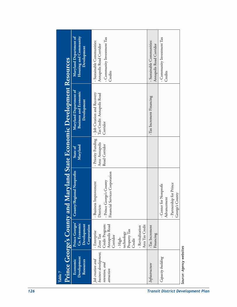
126 TransitDistrictDevelopmentPlan
Tabl
e 7
Prin
ce G
eorg
e’s C
ount
y an
d M
aryl
and
Stat
e Ec
onom
ic D
evel
opm
ent R
esou
rces
Econ
omic
D
evel
opm
ent
Res
ourc
es
Prin
ce G
eorg
es’
Co.
Eco
nom
ic
Dev
elop
men
t C
orpo
rati
on
Cou
nty/
Reg
iona
l Non
profi
tsSt
ate
of
Mar
ylan
dM
aryl
and
Dep
artm
ent o
f B
usin
ess a
nd E
cono
mic
D
evel
opm
ent
Mar
ylan
d D
epar
tmen
t of
Hou
sing
and
Com
mun
ity
Dev
elop
men
t
Job
crea
tion
and
busin
ess d
evelo
pmen
t, re
tent
ion,
and
at
tracti
on
-Ent
erpr
ise
Zone
Tax
C
redi
tPro
gram
:An
napo
lisR
oad
Cor
ridor
-Hig
h-te
chno
logy
Pr
oper
tyT
ax
Cre
dit
-Rev
italiz
atio
nAr
eaT
axC
redi
t
-Bus
ines
sIm
prov
emen
tD
istric
ts-P
rince
Geo
rge’s
Cou
nty
Fina
ncia
lSer
vice
sCor
pora
tion
-Prio
rity
Fund
ing
Area
:Ann
apol
isRo
adC
orrid
or
-Job
Cre
atio
nan
dRe
cove
ry
Tax
Cre
dit:
Anna
polis
Roa
dC
orrid
or
-Sus
tain
able
Com
mun
ities
:An
napo
lisR
oad
Cor
ridor
-Com
mun
ityIn
vestm
entT
ax
Cre
dits
Infra
struc
ture
-Tax
Incr
emen
tFi
nanc
ing
-Tax
Incr
emen
tFin
anci
ng-S
usta
inab
leC
omm
uniti
es:
Anna
polis
Roa
dC
orrid
or
Cap
acity
bui
ldin
g-C
ente
rfor
Non
profi
tAd
vanc
emen
t-P
artn
ersh
ipfo
rPrin
ce
Geo
rge’s
Cou
nty
-Com
mun
ityIn
vestm
entT
ax
Cre
dits
Sour
ce:
Age
ncy
web
site
s
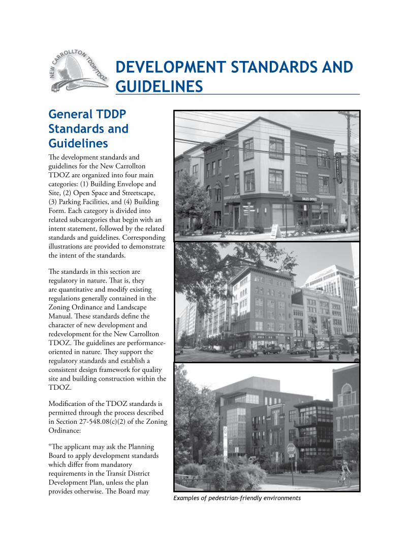
General TddP standards and GuidelinesThedevelopmentstandardsandguidelinesfortheNewCarrolltonTDOZareorganizedintofourmaincategories:(1)BuildingEnvelopeandSite,(2)OpenSpaceandStreetscape,(3)ParkingFacilities,and(4)BuildingForm.Eachcategoryisdividedintorelatedsubcategoriesthatbeginwithanintentstatement,followedbytherelatedstandardsandguidelines.Correspondingillustrationsareprovidedtodemonstratetheintentofthestandards.
Thestandardsinthissectionareregulatoryinnature.Thatis,theyarequantitativeandmodifyexistingregulationsgenerallycontainedintheZoningOrdinanceandLandscapeManual.ThesestandardsdefinethecharacterofnewdevelopmentandredevelopmentfortheNewCarrolltonTDOZ.Theguidelinesareperformance-orientedinnature.TheysupporttheregulatorystandardsandestablishaconsistentdesignframeworkforqualitysiteandbuildingconstructionwithintheTDOZ.
ModificationoftheTDOZstandardsispermittedthroughtheprocessdescribedinSection27-548.08(c)(2)oftheZoningOrdinance:
“TheapplicantmayaskthePlanningBoardtoapplydevelopmentstandardswhichdifferfrommandatoryrequirementsintheTransitDistrictDevelopmentPlan,unlesstheplanprovidesotherwise.TheBoardmay
deVeloPMeNT sTANdArds ANd GUideliNes
Examples of pedestrian-friendly environments
128 DevelopmentStandardsandGuidelines
amendanymandatoryrequirementsexceptbuildingheightrestrictionsandparkingstandards,requirementswhichmaybeamendedbytheDistrictCouncilunderproceduresinPart10A,Division1.TheBoardmayamendparkingprovisionsconcerningthedimensions,layout,ordesignofparkingspacesorparkinglots.
“InapprovingtheTransitDistrictSitePlan,thePlanningBoardshallfindthatthemandatoryrequirements,asamended,willbenefittheproposeddevelopmentandtheTransitDistrictandwillnotsubstantiallyimpairimplementationoftheTransitDistrictDevelopmentPlan,andtheBoardshallthenfindthatthesiteplanmeetsallmandatoryrequirementswhichapply.”
PerSection27-548.09.01(a)(1)oftheZoningOrdinance,theDistrictCouncilmayapproveanyofthefollowingamendmentstotheTransitDistrictdevelopmentrequirements,underproceduresinPart3,Division2,Subdivision5:
1. ChangestotheTDOZboundary;
2. Changestoanunderlyingzone;
3. Changestothelistofalloweduses,asmodifiedbytheTransitDistrictDevelopmentPlan;
4. Changestobuildingheightrequirements;and
5. ChangetotransportationdemandrequirementsorotherparkingprovisionsintheTransitDistrictDevelopmentPlanwhichdonotconcernthedimensions,layout,ordesignofparkingspacesorparkinglots.
ApropertyownermayrequesttheDistrictCouncilapproveanyoftheamendmentslistedabove.PerSection27-548.09.01(b)(2)oftheZoningOrdinance,theowner’sapplicationshallinclude:(1)astatementshowingthattheproposeddevelopmentconformswiththepurposesandrecommendationsoftheTransitDistrictDevelopmentPlan;and(2)aDetailedSitePlanorConceptualSitePlan,inaccordancewithPart3,Division9.IfaConceptualSitePlanisapprovedwithanapplication,theownermaynotobtainpermitswithoutanapprovedDetailedSitePlan.
Thedevelopmentstandardsaredistinguishedfromtheirrelatedguidelinesbytheuseoftheterms“shall,”“must,”“mayonly,”and“maynot”assetforthinSection27-108.01(19)oftheZoningOrdinance.Thesetermsmarkthedevelopmentstandardsasmandatoryrequirements.Thedevelopmentguidelinesarecharacterizedbytheuseoftheterms“may”and“should.”Theguidelinesarediscretionary.Theyarestronglyrecommended,however,asaidstoreinforcethedevelopmentvisionthatthestandardsareintendedtohelpimplement.TheNewCarrolltonTDDPdevelopmentstandardsandguidelinesapplytotheentireTDOZwiththefollowingexceptions:
1.TheBuildingEnvelopeandSiteStandardsandGuidelinesarearrangedbyneighborhood.
2.Otherstandardsandguidelinesthatarespecifictobuildingtypeorlocationarenotedinbold text.
Unlessstatedotherwise,thesedesignstandardsandguidelinesreplacethestandardsandregulationscontainedintheLandscapeManualandtheZoningOrdinanceofPrinceGeorge’sCounty.
DevelopmentStandardsandGuidelines 129
General Building envelope and site standards and GuidelinesGeneral intentToensurethedevelopmentofappropriatebuildingformsthatreinforcesafeandattractivestreetsandensureconsistentsitingofbuildingsclosetotheright-of-way,withinanattachedroworblockofmixed-use,multifamilyorcommercialbuildings,tocreateacomfortingsenseofenclosurethatdefinespublicspaceandcontributestoapedestrian-friendlyenvironment.
standardsBuildingSitingEachdeveloper,applicant,andapplicant’sheirs,successorsand/orassigneesshallberesponsibleforsitingbuildingsaccordingtotheNewCarrolltonTDDPrequirementsandshallbeobligatedtomeettheserequirementsaspartofanyapplicationfordetailedsiteplan(DSP)andbuilding/gradingpermits.NobuildingorgradingpermitsshallbeissuedwithoutaDSPthatconformstoallbuildingenvelopeandsitestandardsintheTDDP.
AlleysAlleyconstructionwithintherearsetbackshallberequiredforcommercialandmultifamilyresidentialbuildinglotsandoff-streetparkingfacilitiesunlessanalleyalreadyexistsorthedevelopmentsiteis“landlocked”bysurroundingpropertiesthatarenotpartoftheproposedredevelopment.
DedicatedRights-Of-WayforAlleysWhereanalleydoesnotexistandisnotconstructedatthetimeofdevelopment,thedevelopershalldedicatethealleyright-of-waywithintherearsetbacktothecounty.Pendingconstructionofthealley,thedeveloperorownershallmaintainthededicatedright-of-wayby,ataminimum:
1. Soddingandprovidingroutinelandscapemaintenancetothearea.
2. Keepingtheareaclearofdebris,litter,storedmaterials,andvehicles.
BuildingEntriesTheprimaryentrancetoabuildingshallbeclearlyvisiblefromthestreetandshallfrontthestreet.Buildingsfacingpublicplazasorsquaresshallhavetheirprimaryentrancesfacingthepublicspace.Buildingsoncornerlotswherestreetsofdifferentrankintersectshallhavetheirprimaryentrancesonthemoreheavilytraveledstreet.
TreatmentofBuildingFacadesonArterialandCollectorStreetsBuildingfacadesfacingAnnapolis Road,Ellin Road,Harkins Road,85th Avenue,andGarden City Driveshallbetheprimaryentryfacadeorshallbeofcomparablequalityintermsofarchitecture,materials,anddetailing.
UtilityConnectionsandServiceAreasUtilityboxes,meters,andserviceareassuchastrashenclosuresshallnotbevisiblefromthestreet.Ifthesefeaturesmustbeplacednearthepublicstreetorotherspace,theyshallbescreenedfromdirectpublicview.
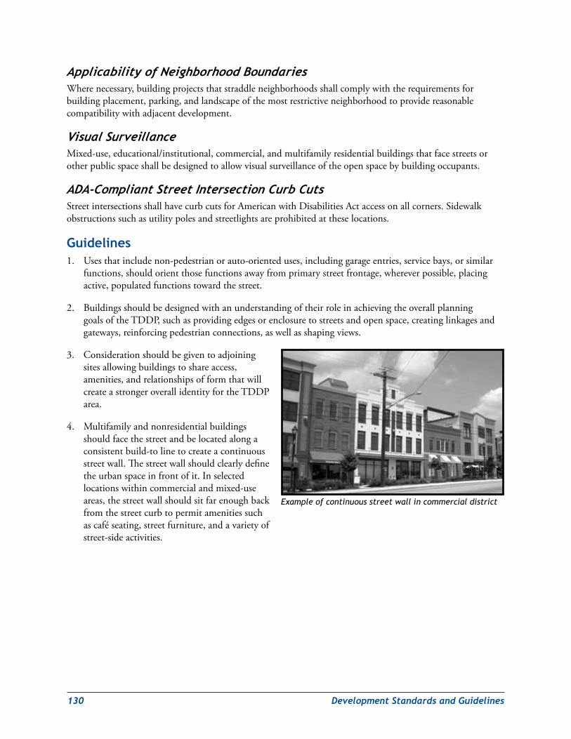
130 DevelopmentStandardsandGuidelines
ApplicabilityofNeighborhoodBoundariesWherenecessary,buildingprojectsthatstraddleneighborhoodsshallcomplywiththerequirementsforbuildingplacement,parking,andlandscapeofthemostrestrictiveneighborhoodtoprovidereasonablecompatibilitywithadjacentdevelopment.
VisualSurveillanceMixed-use,educational/institutional,commercial,andmultifamilyresidentialbuildingsthatfacestreetsorotherpublicspaceshallbedesignedtoallowvisualsurveillanceoftheopenspacebybuildingoccupants.
ADA-CompliantStreetIntersectionCurbCutsStreetintersectionsshallhavecurbcutsforAmericanwithDisabilitiesActaccessonallcorners.Sidewalkobstructionssuchasutilitypolesandstreetlightsareprohibitedattheselocations.
Guidelines1. Usesthatincludenon-pedestrianorauto-orienteduses,includinggarageentries,servicebays,orsimilar
functions,shouldorientthosefunctionsawayfromprimarystreetfrontage,whereverpossible,placingactive,populatedfunctionstowardthestreet.
2. BuildingsshouldbedesignedwithanunderstandingoftheirroleinachievingtheoverallplanninggoalsoftheTDDP,suchasprovidingedgesorenclosuretostreetsandopenspace,creatinglinkagesandgateways,reinforcingpedestrianconnections,aswellasshapingviews.
3. Considerationshouldbegiventoadjoiningsitesallowingbuildingstoshareaccess,amenities,andrelationshipsofformthatwillcreateastrongeroverallidentityfortheTDDParea.
4. Multifamilyandnonresidentialbuildingsshouldfacethestreetandbelocatedalongaconsistentbuild-tolinetocreateacontinuousstreetwall.Thestreetwallshouldclearlydefinetheurbanspaceinfrontofit.Inselectedlocationswithincommercialandmixed-useareas,thestreetwallshouldsitfarenoughbackfromthestreetcurbtopermitamenitiessuchascaféseating,streetfurniture,andavarietyofstreet-sideactivities.
Example of continuous street wall in commercial district
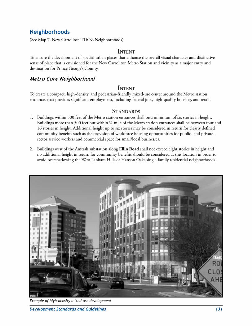
DevelopmentStandardsandGuidelines 131
Neighborhoods(SeeMap7.NewCarrolltonTDOZNeighborhoods)
intentToensurethedevelopmentofspecialurbanplacesthatenhancetheoverallvisualcharacteranddistinctivesenseofplacethatisenvisionedfortheNewCarrolltonMetroStationandvicinityasamajorentryanddestinationforPrinceGeorge’sCounty.
MetroCoreNeighborhood
intentTocreateacompact,high-density,andpedestrian-friendlymixed-usecenteraroundtheMetrostationentrancesthatprovidessignificantemployment,includingfederaljobs,high-qualityhousing,andretail.
StandardS1. Buildingswithin500feetoftheMetrostationentrancesshallbeaminimumofsixstoriesinheight.
Buildingsmorethan500feetbutwithin¼mileoftheMetrostationentrancesshallbebetweenfourand16storiesinheight.Additionalheightuptosixstoriesmaybeconsideredinreturnforclearlydefinedcommunitybenefitssuchastheprovisionofworkforcehousingopportunitiesforpublic-andprivate-sectorserviceworkersandcommercialspaceforsmall/localbusinesses.
2. BuildingswestoftheAmtraksubstationalongEllin RoadshallnotexceedeightstoriesinheightandnoadditionalheightinreturnforcommunitybenefitsshouldbeconsideredatthislocationinordertoavoidovershadowingtheWestLanhamHillsorHansonOakssingle-familyresidentialneighborhoods.
Example of high-density mixed-use development
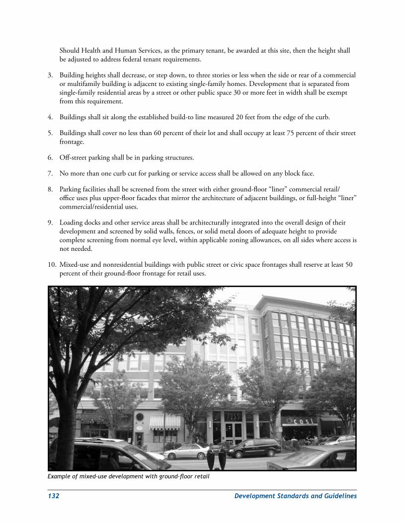
132 DevelopmentStandardsandGuidelines
ShouldHealthandHumanServices,astheprimarytenant,beawardedatthissite,thentheheightshallbeadjustedtoaddressfederaltenantrequirements.
3. Buildingheightsshalldecrease,orstepdown,tothreestoriesorlesswhenthesideorrearofacommercialormultifamilybuildingisadjacenttoexistingsingle-familyhomes.Developmentthatisseparatedfromsingle-familyresidentialareasbyastreetorotherpublicspace30ormorefeetinwidthshallbeexemptfromthisrequirement.
4. Buildingsshallsitalongtheestablishedbuild-tolinemeasured20feetfromtheedgeofthecurb.
5. Buildingsshallcovernolessthan60percentoftheirlotandshalloccupyatleast75percentoftheirstreetfrontage.
6. Off-streetparkingshallbeinparkingstructures.
7. Nomorethanonecurbcutforparkingorserviceaccessshallbeallowedonanyblockface.
8. Parkingfacilitiesshallbescreenedfromthestreetwitheitherground-floor“liner”commercialretail/officeusesplusupper-floorfacadesthatmirrorthearchitectureofadjacentbuildings,orfull-height“liner”commercial/residentialuses.
9. Loadingdocksandotherserviceareasshallbearchitecturallyintegratedintotheoveralldesignoftheirdevelopmentandscreenedbysolidwalls,fences,orsolidmetaldoorsofadequateheighttoprovidecompletescreeningfromnormaleyelevel,withinapplicablezoningallowances,onallsideswhereaccessisnotneeded.
10. Mixed-useandnonresidentialbuildingswithpublicstreetorcivicspacefrontagesshallreserveatleast50percentoftheirground-floorfrontageforretailuses.
Example of mixed-use development with ground-floor retail
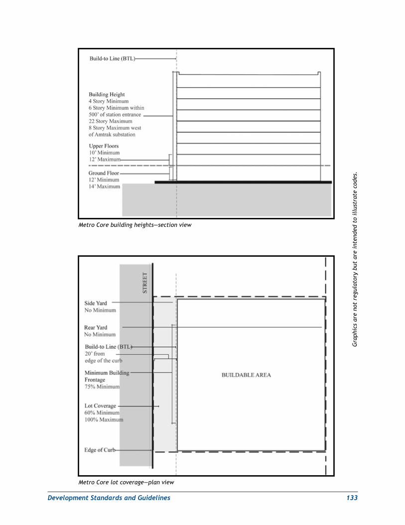
DevelopmentStandardsandGuidelines 133
Metro Core building heights—section view
Metro Core lot coverage—plan view
Gra
phic
s ar
e no
t re
gula
tory
but
are
int
ende
d to
ill
ustr
ate
code
s.
134 DevelopmentStandardsandGuidelines
11. Parkingfacilitiesandoutdoorserviceareasmustbewelllit,andtheirlightingmustbedesignedtominimizeglareimpactsonadjacentresidentialuses.
12. Switchboxesandutilitymetersmustbelocatedoutofviewfromthepublicstreet.Allutilitiesandtheirconnectionsmustbeunderground.
13. Tomitigatetheurban“heatisland”effect,therooftopsofallnewconstructionorrenovatedbuildingsover10,000squarefeetshallbedesignedinaccordancewiththeheatislandmitigationrooftreatmentcriterionspecifiedundertheLEEDforNewConstructionandMajorRenovation,Version2.2orlater.Freestandingparkinggaragesandroofswithinstalledsolarthermalorphotovoltaicenergysystemsshallbeexemptfromthisrequirement.
14. Environmentalsitedesign(ESD)stormwatermanagementtechniquesshallbeusedthroughouttheMetroCoretoprovideenhancedwaterqualitycontrolsandadditionalgreenspace.
15. Streetsthatarepartofadevelopmentproposalshallbedesignedasgreenstreets.
16. Publicplazasandothercivicspacesshallbedesignedtobesafe,sunny,andattractive,with:
a. No“dead,”poorly-lit,orhiddenareas
b. Maximumfeasiblesouthernexposure
c. Useofatleasttwoofthefollowingoptionsasdecorativeamenities:vegetationplanters,specialpavementtreatments,publicart,orstreetfurnishings
GuidelineS1. Off-streetparkingshouldbelocatedunderorbehindtheusesthattheyserve.
2. Accesstooff-streetparkingshouldbefromthesideorrearofthelot.
3. Buildingfacadesshouldformacontinuousstreetwallonblockfaces.
4. Allloadingdocksandotherserviceareasshouldbelocatedtothesideorrearoftheirdevelopmentandaccessedfromthesideorrearasappropriate.
5. Buildingsshouldshareserviceareastothegreatestextentpossible.
6. Developersofmixed-useresidentialandnonresidentialprojectsshouldincludegreenbuildingfeaturessuchasgreenroofs,renewableenergysystems,andenergyconservationfeaturesintheirdevelopmentstoreduceenvironmentalimpactsandutilityservicecosts.TheyshouldalsoseekLEEDcertificationasapotentialmarketingtoolfortheirprojects.
7. Publicstreetsandspacesshouldbewelllitatnight;publicplazasandcivicspacesshouldhavepedestrian-scalestreetlightsinstalledforpedestriansafetyandtoreinforcetheMetroCore’sdistinctphysicalcharacterafterdark.
8. Signal-controlledstreetintersectionsshouldbedesignedfortrafficcalminginordertomakethemsaferforpedestrians.Considerationshouldbegiventosuchdevicesasspeciallymarkedcrosswalks,signage,medianpedestrianrefuges(onEllin Road,85th Avenue,andGarden City Drive),trafficsignalphasing,timedpedestriansignalswithcountdowndisplays,andcurbextensionsorbumpouts.

DevelopmentStandardsandGuidelines 135
9. LeadershipinEnergyandEnvironmentalDesign(LEED)standardsforbuilding,assetforthbytheU.S.GreenBuildingCouncil(USGBC)shouldbereviewedandintegratedintothedesignandconstructionprocessforallnewdevelopmentandrenovationprojects.LEEDSilverorbettercertificationisrecommendedforallnewdevelopment.
10. VariancesshouldbeapprovedtoaddressdesignstandardsforfederaltenantbuildingonEllinRoad,particularlytoaccommodatesecurityrequirements.
GardenCityNeighborhood
intentTocreateacompact,medium-densityandpedestrian-friendlymixed-useneighborhoodeastoftheMetroCore.
StandardS1. Buildingsshallbebetween4and12storiesin
height.
2. Buildingsshallsitalongtheestablishedbuild-tolinemeasured20feetfromtheedgeofthecurb.Buildingsonlocalstreetsshallsitbetween10and15feetfromtheedgeofthecurb.
3. Buildingsshallcovernolessthan60percentoftheirlotandshalloccupyatleast75percentoftheirstreetfrontage.
4. Off-streetparkingshallbeinparkingstructures.
5. Parkingfacilitiesshallbescreenedfromthestreetwitheitherground-floor“liner”commercialretail/officeusesplusupperfloorfacadesthatmirrorthearchitectureofadjacentbuildings,orfull-height“liner”commercial/residentialuses.
6. Loadingdocksandotherserviceareasshallbearchitecturallyintegratedintotheoveralldesignoftheirdevelopmentandscreenedbysolidwalls,fences,orsolidmetaldoorsofadequateheighttoprovidecompletescreeningfromnormaleyelevel,withinapplicablezoningallowances,onallsideswhereaccessisnotneeded.
7. Mixed-useandnonresidentialbuildingswithpublicstreetorcivicspacefrontagesshallreserveatleast50percentoftheirground-floorfrontageforretailuses.
8. Parkingfacilitiesandoutdoorserviceareasmustbewelllit,andtheirlightingmustbedesignedtominimizeglareimpactsonadjacentresidentialuses.
9. Tomitigatetheurban“heatisland”effect,therooftopsofallnewconstructionorrenovatedbuildingsover10,000squarefeetshallbedesignedinaccordancewiththeheatislandmitigationrooftreatmentcriterionspecifiedundertheLEEDforNewConstructionandMajorRenovation,Version2.2orlater.Freestandingparkinggaragesandroofswithinstalledsolarthermalorphotovoltaicenergysystemsshallbeexemptfromthisrequirement.
10. Environmentalsitedesign(ESD)stormwatermanagementtechniquesshallbeusedthroughouttheGardenCityNeighborhoodtoprovideenhancedwaterqualitycontrolsandadditionalgreenspace.
Example of mixed-use medium-density development
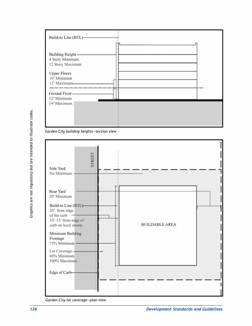
136 DevelopmentStandardsandGuidelines
Garden City building heights—section view
Garden City lot coverage—plan view
Gra
phic
s ar
e no
t re
gula
tory
but
are
int
ende
d to
ill
ustr
ate
code
s.
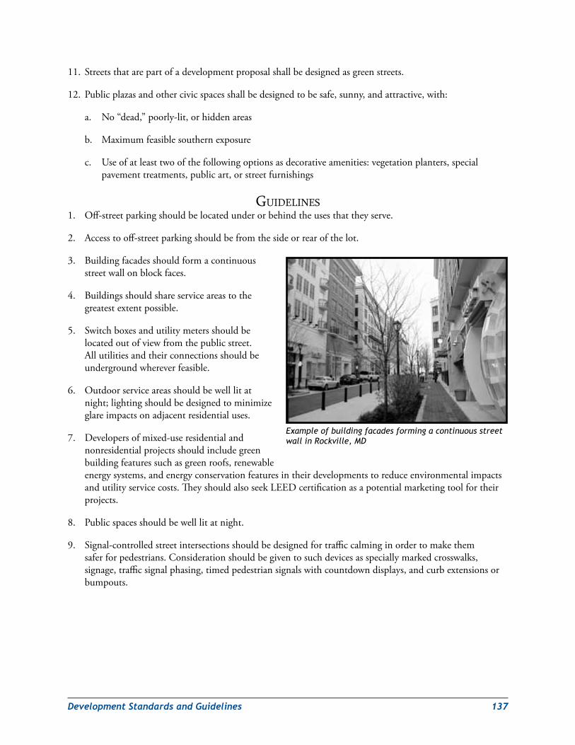
DevelopmentStandardsandGuidelines 137
11. Streetsthatarepartofadevelopmentproposalshallbedesignedasgreenstreets.
12. Publicplazasandothercivicspacesshallbedesignedtobesafe,sunny,andattractive,with:
a. No“dead,”poorly-lit,orhiddenareas
b. Maximumfeasiblesouthernexposure
c. Useofatleasttwoofthefollowingoptionsasdecorativeamenities:vegetationplanters,specialpavementtreatments,publicart,orstreetfurnishings
GuidelineS1. Off-streetparkingshouldbelocatedunderorbehindtheusesthattheyserve.
2. Accesstooff-streetparkingshouldbefromthesideorrearofthelot.
3. Buildingfacadesshouldformacontinuousstreetwallonblockfaces.
4. Buildingsshouldshareserviceareastothegreatestextentpossible.
5. Switchboxesandutilitymetersshouldbelocatedoutofviewfromthepublicstreet.Allutilitiesandtheirconnectionsshouldbeundergroundwhereverfeasible.
6. Outdoorserviceareasshouldbewelllitatnight;lightingshouldbedesignedtominimizeglareimpactsonadjacentresidentialuses.
7. Developersofmixed-useresidentialandnonresidentialprojectsshouldincludegreenbuildingfeaturessuchasgreenroofs,renewableenergysystems,andenergyconservationfeaturesintheirdevelopmentstoreduceenvironmentalimpactsandutilityservicecosts.TheyshouldalsoseekLEEDcertificationasapotentialmarketingtoolfortheirprojects.
8. Publicspacesshouldbewelllitatnight.
9. Signal-controlledstreetintersectionsshouldbedesignedfortrafficcalminginordertomakethemsaferforpedestrians.Considerationshouldbegiventosuchdevicesasspeciallymarkedcrosswalks,signage,trafficsignalphasing,timedpedestriansignalswithcountdowndisplays,andcurbextensionsorbumpouts.
Example of building facades forming a continuous street wall in Rockville, MD

138 DevelopmentStandardsandGuidelines
AnnapolisRoadNeighborhood
intentTocreatearevitalizedandenhancedmoderatedensity,mixed-usecommercialdistrictalongAnnapolisRoad(MD450).
StandardS1. Buildingsshallbebetweenthreeandeight
storiesinheight.BuildingsatthesouthwestcornerofAnnapolisRoadandWestLanhamDriveshouldbeaminimumoftwostoriesinheight.
2. BuildingsonAnnapolis Road(MD 450)shallsitalongtheestablishedbuild-to-linemeasured12feetfromtheedgeofthecurb.
3. Buildingsshallcoverbetween60percentand80percentoftheirlotandshalloccupyatleast70percentoftheirstreetfrontage.
4. Buildingswithoutrearparkingshallhaverearyardsnolessthantenfeetdeep.
5. Off-streetparkinglotsandstructuresshallbeplacedbehindtheiron-siteuses.
6. Serviceareasshallbeplacedbehindtheiron-siteuses,screenedfrompublicview,andwelllitatnight.
7. Mixed-useandnonresidentialbuildingswithpublicstreetorcivicspacefrontagesshallreserveatleast50percentoftheirground-floorfrontageforretailuses.
8. Parkingfacilitiesandoutdoorserviceareasmustbewelllit,andtheirlightingmustbedesignedtominimizeglareimpactsonadjacentresidentialuses.
9. Tomitigatetheurban“heatisland”effect,therooftopsofallnewconstructionorrenovatedbuildingsover10,000squarefeetshallbedesignedinaccordancewiththeheatislandmitigationrooftreatmentcriterionspecifiedundertheLEEDforNewConstructionandMajorRenovation,Version2.2orlater.Freestandingparkinggaragesandroofswithinstalledsolarthermalorphotovoltaicenergysystemsshallbeexemptfromthisrequirement.
10. Environmentalsitedesign(ESD)stormwatermanagementtechniquesshallbeusedthroughouttheAnnapolisRoadNeighborhoodtoprovideenhancedwaterqualitycontrolsandadditionalgreenspace.
11.Streetsthatarepartofadevelopmentproposalshallbedesignedasgreenstreets.
12. Publicplazasandothercivicspacesshallbedesignedtobesafe,sunny,andattractive,with:
a. No“dead,”poorly-lit,orhiddenareas
b. Maximumfeasiblesouthernexposure
c. Useofatleasttwoofthefollowingoptionsasdecorativeamenities:vegetationplanters,specialpavementtreatments,publicart,orstreetfurnishings
Example of medium-density mixed-use development
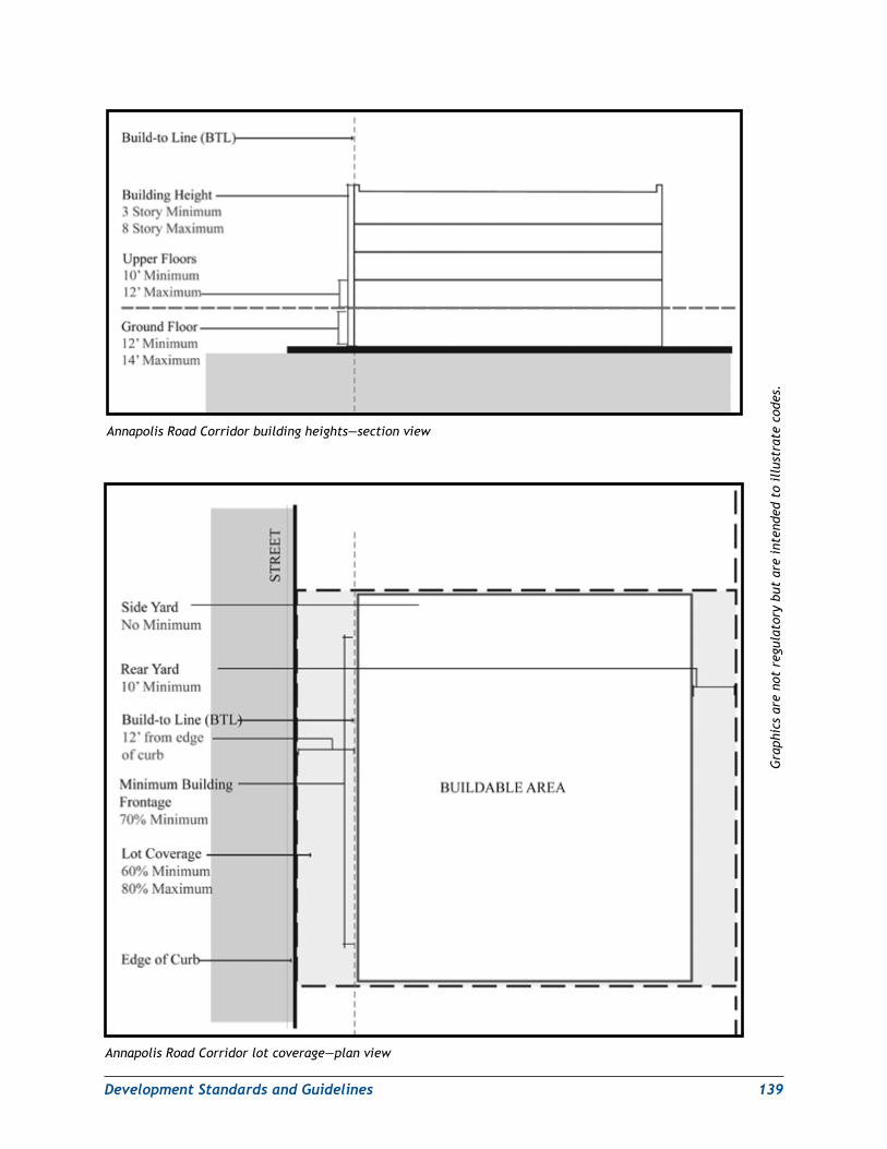
DevelopmentStandardsandGuidelines 139
Annapolis Road Corridor lot coverage—plan view
Annapolis Road Corridor building heights—section view
Gra
phic
s ar
e no
t re
gula
tory
but
are
int
ende
d to
ill
ustr
ate
code
s.
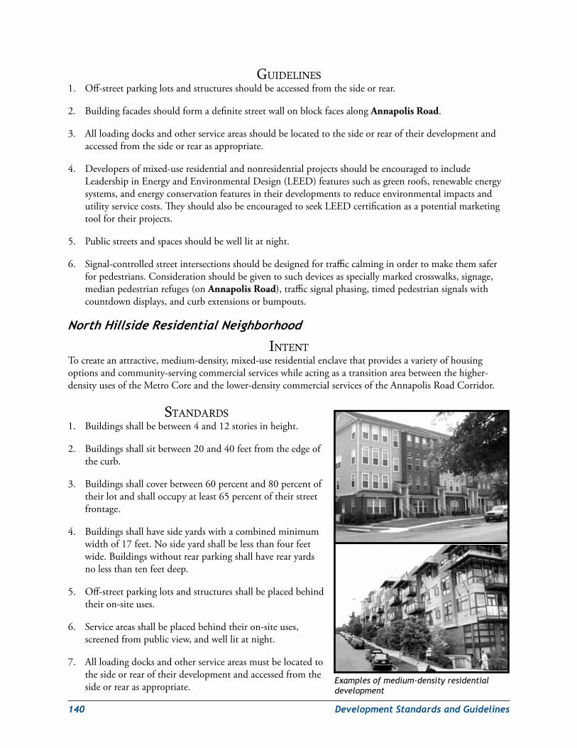
140 DevelopmentStandardsandGuidelines
GuidelineS1. Off-streetparkinglotsandstructuresshouldbeaccessedfromthesideorrear.
2. BuildingfacadesshouldformadefinitestreetwallonblockfacesalongAnnapolis Road.
3. Allloadingdocksandotherserviceareasshouldbelocatedtothesideorrearoftheirdevelopmentandaccessedfromthesideorrearasappropriate.
4. Developersofmixed-useresidentialandnonresidentialprojectsshouldbeencouragedtoincludeLeadershipinEnergyandEnvironmentalDesign(LEED)featuressuchasgreenroofs,renewableenergysystems,andenergyconservationfeaturesintheirdevelopmentstoreduceenvironmentalimpactsandutilityservicecosts.TheyshouldalsobeencouragedtoseekLEEDcertificationasapotentialmarketingtoolfortheirprojects.
5. Publicstreetsandspacesshouldbewelllitatnight.
6. Signal-controlledstreetintersectionsshouldbedesignedfortrafficcalminginordertomakethemsaferforpedestrians.Considerationshouldbegiventosuchdevicesasspeciallymarkedcrosswalks,signage,medianpedestrianrefuges(onAnnapolis Road),trafficsignalphasing,timedpedestriansignalswithcountdowndisplays,andcurbextensionsorbumpouts.
NorthHillsideResidentialNeighborhood
intentTocreateanattractive,medium-density,mixed-useresidentialenclavethatprovidesavarietyofhousingoptionsandcommunity-servingcommercialserviceswhileactingasatransitionareabetweenthehigher-densityusesoftheMetroCoreandthelower-densitycommercialservicesoftheAnnapolisRoadCorridor.
StandardS1. Buildingsshallbebetween4and12storiesinheight.
2. Buildingsshallsitbetween20and40feetfromtheedgeofthecurb.
3. Buildingsshallcoverbetween60percentand80percentoftheirlotandshalloccupyatleast65percentoftheirstreetfrontage.
4. Buildingsshallhavesideyardswithacombinedminimumwidthof17feet.Nosideyardshallbelessthanfourfeetwide.Buildingswithoutrearparkingshallhaverearyardsnolessthantenfeetdeep.
5. Off-streetparkinglotsandstructuresshallbeplacedbehindtheiron-siteuses.
6. Serviceareasshallbeplacedbehindtheiron-siteuses,screenedfrompublicview,andwelllitatnight.
7. Allloadingdocksandotherserviceareasmustbelocatedtothesideorrearoftheirdevelopmentandaccessedfromthesideorrearasappropriate.
Examples of medium-density residential development
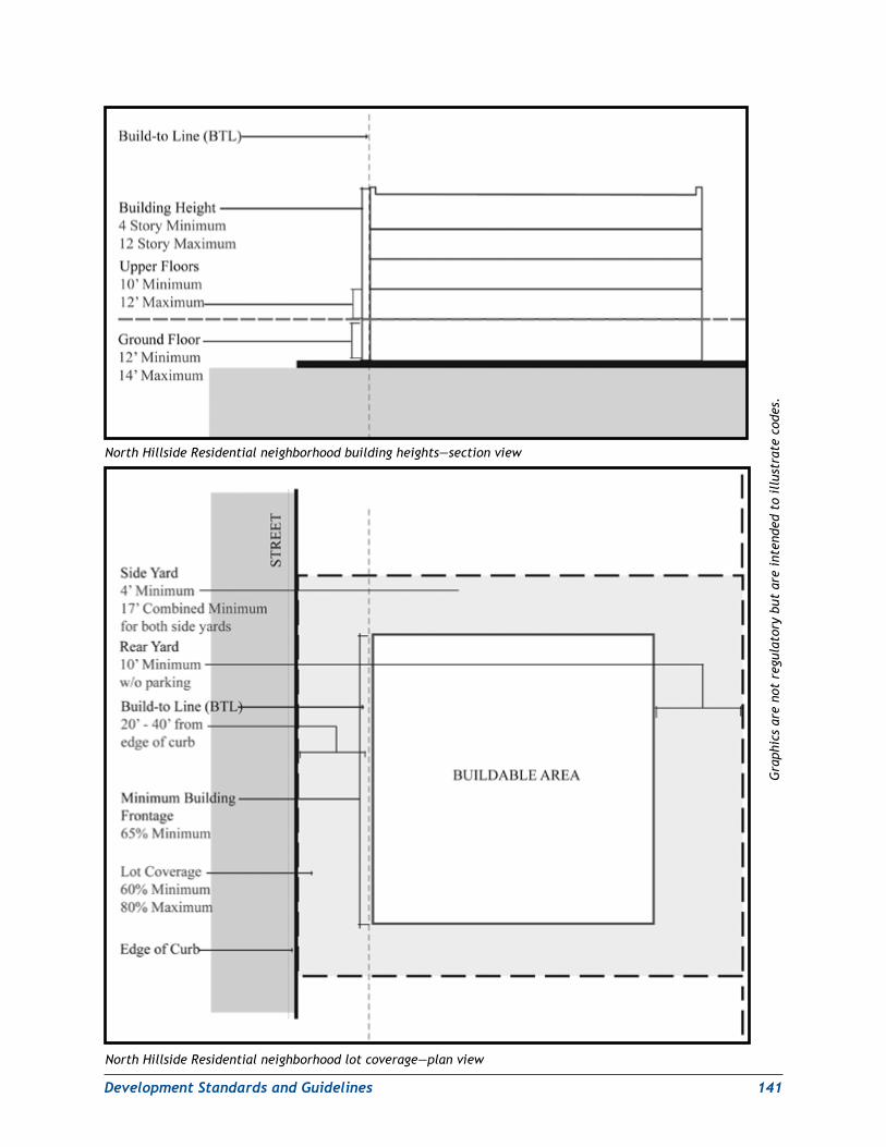
DevelopmentStandardsandGuidelines 141
North Hillside Residential neighborhood lot coverage—plan view
North Hillside Residential neighborhood building heights—section view
Gra
phic
s ar
e no
t re
gula
tory
but
are
int
ende
d to
ill
ustr
ate
code
s.
142 DevelopmentStandardsandGuidelines
8. Parkingfacilitiesandoutdoorserviceareasmustbewelllit,andtheirlightingshouldbedesignedtominimizeglareimpactsonadjacentresidentialuses.
9. Mixed-useandnonresidentialbuildingswithpublicstreetorcivicspacefrontagesshallreserveatleast25percentoftheirground-floorfrontageforretailuses.Schoolsshallbeexemptfromthisrequirement.
10. Tomitigatetheurban“heatisland”effect,therooftopsofallnewconstructionorrenovatedbuildingsover10,000squarefeetshallbedesignedinaccordancewiththeheatislandmitigationrooftreatmentcriterionspecifiedundertheLEEDforNewConstructionandMajorRenovation,Version2.2orlater.Freestandingparkinggaragesandroofswithinstalledsolarthermalorphotovoltaicenergysystemsshallbeexemptfromthisrequirement.
11. Environmentalsitedesign(ESD)stormwatermanagementtechniquesshallbeusedthroughouttheNorthHillsideResidentialNeighborhoodtoprovideenhancedwaterqualitycontrolsandadditionalgreenspace.
12.Streetsthatarepartofadevelopmentproposalshallbedesignedasgreenstreets.
13. Publicplazasandothercivicspacesshallbedesignedtobesafe,sunny,andattractive,with:
a. No“dead,”poorly-lit,orhiddenareas
b. Maximumfeasiblesouthernexposure
c. Useofatleasttwoofthefollowingoptionsasdecorativeamenities:vegetationplanters,specialpavementtreatments,publicart,orstreetfurnishings
GuidelineS1. Developersofmixed-useresidentialandnonresidentialprojectsshouldincludeLEEDfeaturessuchas
greenroofs,renewableenergysystems,andenergyconservationfeaturesintheirdevelopmentstoreduceenvironmentalimpactsandutilityservicecosts.TheyshouldalsoseekLEEDcertificationasapotentialmarketingtoolfortheirprojects.
2. Signal-controlledstreetintersectionsshouldbedesignedfortrafficcalminginordertomakethemsaferforpedestrians.Considerationshouldbegiventodevicessuchasspeciallymarkedcrosswalks,signage,trafficsignalphasing,timedpedestriansignalswithcountdowndisplays,andcurbextensionsorbumpouts.
General open space and streetscape standards and GuidelinesGeneral intentTopromotethecreationofopenspaceamenitiesthatfitinwith,andenhance,theoverallvisualandphysicalcharacterofthebuiltenvironment(buildingsandstreets).
standards1. Landscape Plan Submission:Landscapeplans,whichaddressalllandareasofalotthatarenotcovered
bybuildings,streetsorpavedareas,shallbepreparedandsubmittedwiththedetailedsiteplan(DSP).Suchplanswilldefinelandscapeconstruction,seedingandplantingmaterials,andirrigationmethods.LandscapeplansshallincorporateESDtechniquesandrelatedconservationlandscapingmeasures.
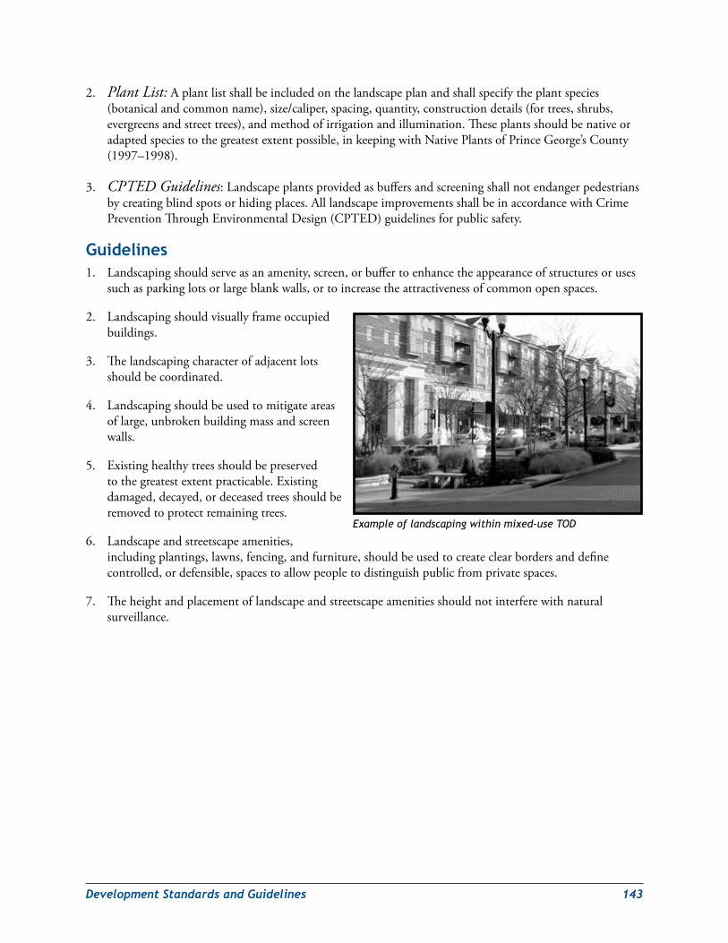
DevelopmentStandardsandGuidelines 143
2. Plant List:Aplantlistshallbeincludedonthelandscapeplanandshallspecifytheplantspecies(botanicalandcommonname),size/caliper,spacing,quantity,constructiondetails(fortrees,shrubs,evergreensandstreettrees),andmethodofirrigationandillumination.Theseplantsshouldbenativeoradaptedspeciestothegreatestextentpossible,inkeepingwithNativePlantsofPrinceGeorge’sCounty(1997–1998).
3. CPTED Guidelines:Landscapeplantsprovidedasbuffersandscreeningshallnotendangerpedestriansbycreatingblindspotsorhidingplaces.AlllandscapeimprovementsshallbeinaccordancewithCrimePreventionThroughEnvironmentalDesign(CPTED)guidelinesforpublicsafety.
Guidelines1. Landscapingshouldserveasanamenity,screen,orbuffertoenhancetheappearanceofstructuresoruses
suchasparkinglotsorlargeblankwalls,ortoincreasetheattractivenessofcommonopenspaces.
2. Landscapingshouldvisuallyframeoccupiedbuildings.
3. Thelandscapingcharacterofadjacentlotsshouldbecoordinated.
4. Landscapingshouldbeusedtomitigateareasoflarge,unbrokenbuildingmassandscreenwalls.
5. Existinghealthytreesshouldbepreservedtothegreatestextentpracticable.Existingdamaged,decayed,ordeceasedtreesshouldberemovedtoprotectremainingtrees.
6. Landscapeandstreetscapeamenities,includingplantings,lawns,fencing,andfurniture,shouldbeusedtocreateclearbordersanddefinecontrolled,ordefensible,spacestoallowpeopletodistinguishpublicfromprivatespaces.
7. Theheightandplacementoflandscapeandstreetscapeamenitiesshouldnotinterferewithnaturalsurveillance.
Example of landscaping within mixed-use TOD
144 DevelopmentStandardsandGuidelines
Ground Cover
intentToensurehealthyandattractivegroundcoverthatisvisuallyandfunctionallycompatiblewithotherlandscapingplantmaterialsusedatdevelopmentsites.
StandardS1. Sod: Allpermanentturfgrassareasanddisturbedareasnotproposedforconstructionshallbesodded
atthetimeofdevelopment.Seeding,sprigs,orsodplugsshallbeprohibitedforpermanentgroundstabilization.Sodspecificationsshallbeprovidedonthelandscapeplan.
2. Groundcover:Groundcoverspecificationsincludingname,species,quantity,andspacingshallbeprovidedonthelandscapeplan.Groundcovershallbeplantedataminimumspacingoffourinchesoncenter.
3. Mulch:Mulchshallbeshreddedhardwoodmulchthatisbrownincolorandshallbespecifiedatatwo-tothree-inchdepthonlandscapeplans.Redcedarmulchorrubbermulchshallbeprohibited.
4. Unplanted Mulch Beds:Unplantedmulchbedsshallnotexceedtensquarefeetinarea;largemulchbedsshallbeprohibited.
5. Irrigation:Allsodandgroundcoverareasshallincludeanautomatedirrigationsystemthatusescollectedrainwaterand/orrecycledgreywater(frombathingandlaunderingofclothes)tothefullestextentpossibletomaintainthehealthandvigorofthesodandgroundcover.
GuidelineSGroundcoverandlandscapingwithotherwoodyplantsmaybeusedinplaceofturfgrasstoprovidevisualvarietyandsupportstormwatercontrolfeaturesinsitelandscapes.
open spaces
intent Toensuresafe,attractiveandaccessibleopenspacesthatproviderecreationalopportunitiesandsupportforoutdoorpublicevents.
Tointegrateandutilizelandscapedesigntoenhanceopenspacesandensurethattheyfunctioneffectivelyasspecialplaces,whetherpublicorprivate.
StandardS1. Open Space Elements:Atthetimeofpreliminaryplanofsubdivisionanddetailedsiteplan(DSP),the
DSPshallbereviewedforcompliancewithparkandplazasize,location,activeandpassiverecreationamenities,parkfurniture(benches,trashreceptacles,picnictables,bollards),amenities(examples:fountains,chesstables),playequipment,artwork,lighting,andirrigation.TheDSPshallincludealllocations,quantities,anddetailsforbenches,trashreceptacles,lightingfixtures,bollards,picnictables,recreational/children’splayequipment,andartwork.
2. Parks and Plazas CPTED Guidelines:ParksandplazasshallbedesignedinaccordancewithCPTEDguidelinesforlandscapingandlightingtoprovidepedestriansafetyandsecurity.AnoteindicatingcompliancewiththeseguidelinesshallbeplacedinthegeneralnotessectionoftheDSP.
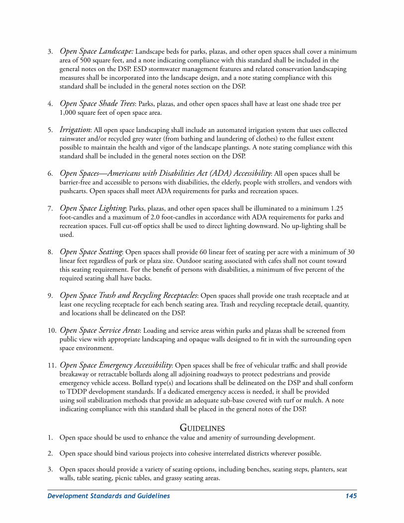
DevelopmentStandardsandGuidelines 145
3. Open Space Landscape:Landscapebedsforparks,plazas,andotheropenspacesshallcoveraminimumareaof500squarefeet,andanoteindicatingcompliancewiththisstandardshallbeincludedinthegeneralnotesontheDSP.ESDstormwatermanagementfeaturesandrelatedconservationlandscapingmeasuresshallbeincorporatedintothelandscapedesign,andanotestatingcompliancewiththisstandardshallbeincludedinthegeneralnotessectionontheDSP.
4. Open Space Shade Trees:Parks,plazas,andotheropenspacesshallhaveatleastoneshadetreeper1,000squarefeetofopenspacearea.
5. Irrigation:Allopenspacelandscapingshallincludeanautomatedirrigationsystemthatusescollectedrainwaterand/orrecycledgreywater(frombathingandlaunderingofclothes)tothefullestextentpossibletomaintainthehealthandvigorofthelandscapeplantings.AnotestatingcompliancewiththisstandardshallbeincludedinthegeneralnotessectionontheDSP.
6. Open Spaces—Americans with Disabilities Act (ADA) Accessibility:Allopenspacesshallbebarrier-freeandaccessibletopersonswithdisabilities,theelderly,peoplewithstrollers,andvendorswithpushcarts.OpenspacesshallmeetADArequirementsforparksandrecreationspaces.
7. Open Space Lighting:Parks,plazas,andotheropenspacesshallbeilluminatedtoaminimum1.25foot-candlesandamaximumof2.0foot-candlesinaccordancewithADArequirementsforparksandrecreationspaces.Fullcut-offopticsshallbeusedtodirectlightingdownward.Noup-lightingshallbeused.
8. Open Space Seating:Openspacesshallprovide60linearfeetofseatingperacrewithaminimumof30linearfeetregardlessofparkorplazasize.Outdoorseatingassociatedwithcafesshallnotcounttowardthisseatingrequirement.Forthebenefitofpersonswithdisabilities,aminimumoffivepercentoftherequiredseatingshallhavebacks.
9. Open Space Trash and Recycling Receptacles:Openspacesshallprovideonetrashreceptacleandatleastonerecyclingreceptacleforeachbenchseatingarea.Trashandrecyclingreceptacledetail,quantity,andlocationsshallbedelineatedontheDSP.
10.Open Space Service Areas:Loadingandserviceareaswithinparksandplazasshallbescreenedfrompublicviewwithappropriatelandscapingandopaquewallsdesignedtofitinwiththesurroundingopenspaceenvironment.
11.Open Space Emergency Accessibility:Openspacesshallbefreeofvehiculartrafficandshallprovidebreakawayorretractablebollardsalongalladjoiningroadwaystoprotectpedestriansandprovideemergencyvehicleaccess.Bollardtype(s)andlocationsshallbedelineatedontheDSPandshallconformtoTDDPdevelopmentstandards.Ifadedicatedemergencyaccessisneeded,itshallbeprovidedusingsoilstabilizationmethodsthatprovideanadequatesub-basecoveredwithturformulch.AnoteindicatingcompliancewiththisstandardshallbeplacedinthegeneralnotesoftheDSP.
GuidelineS1. Openspaceshouldbeusedtoenhancethevalueandamenityofsurroundingdevelopment.
2. Openspaceshouldbindvariousprojectsintocohesiveinterrelateddistrictswhereverpossible.
3. Openspacesshouldprovideavarietyofseatingoptions,includingbenches,seatingsteps,planters,seatwalls,tableseating,picnictables,andgrassyseatingareas.
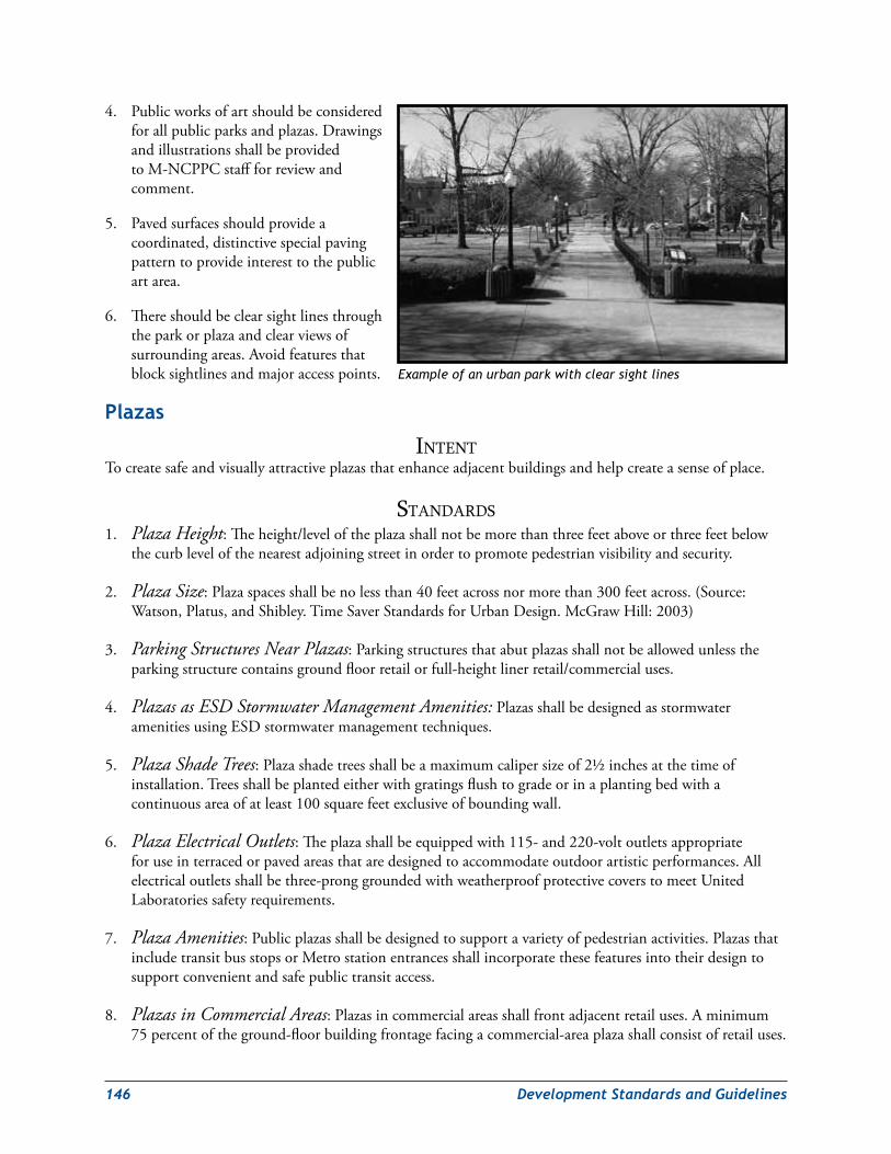
146 DevelopmentStandardsandGuidelines
4. Publicworksofartshouldbeconsideredforallpublicparksandplazas.DrawingsandillustrationsshallbeprovidedtoM-NCPPCstaffforreviewandcomment.
5. Pavedsurfacesshouldprovideacoordinated,distinctivespecialpavingpatterntoprovideinteresttothepublicartarea.
6. Thereshouldbeclearsightlinesthroughtheparkorplazaandclearviewsofsurroundingareas.Avoidfeaturesthatblocksightlinesandmajoraccesspoints.
Plazas
intentTocreatesafeandvisuallyattractiveplazasthatenhanceadjacentbuildingsandhelpcreateasenseofplace.
StandardS1. Plaza Height:Theheight/leveloftheplazashallnotbemorethanthreefeetaboveorthreefeetbelow
thecurblevelofthenearestadjoiningstreetinordertopromotepedestrianvisibilityandsecurity.
2. Plaza Size:Plazaspacesshallbenolessthan40feetacrossnormorethan300feetacross.(Source:Watson,Platus,andShibley.TimeSaverStandardsforUrbanDesign.McGrawHill:2003)
3. Parking Structures Near Plazas:Parkingstructuresthatabutplazasshallnotbeallowedunlesstheparkingstructurecontainsgroundfloorretailorfull-heightlinerretail/commercialuses.
4. Plazas as ESD Stormwater Management Amenities:PlazasshallbedesignedasstormwateramenitiesusingESDstormwatermanagementtechniques.
5. Plaza Shade Trees:Plazashadetreesshallbeamaximumcalipersizeof2½inchesatthetimeofinstallation.Treesshallbeplantedeitherwithgratingsflushtogradeorinaplantingbedwithacontinuousareaofatleast100squarefeetexclusiveofboundingwall.
6. Plaza Electrical Outlets:Theplazashallbeequippedwith115-and220-voltoutletsappropriateforuseinterracedorpavedareasthataredesignedtoaccommodateoutdoorartisticperformances.Allelectricaloutletsshallbethree-pronggroundedwithweatherproofprotectivecoverstomeetUnitedLaboratoriessafetyrequirements.
7. Plaza Amenities:Publicplazasshallbedesignedtosupportavarietyofpedestrianactivities.PlazasthatincludetransitbusstopsorMetrostationentrancesshallincorporatethesefeaturesintotheirdesigntosupportconvenientandsafepublictransitaccess.
8. Plazas in Commercial Areas:Plazasincommercialareasshallfrontadjacentretailuses.Aminimum75percentoftheground-floorbuildingfrontagefacingacommercial-areaplazashallconsistofretailuses.
Example of an urban park with clear sight lines
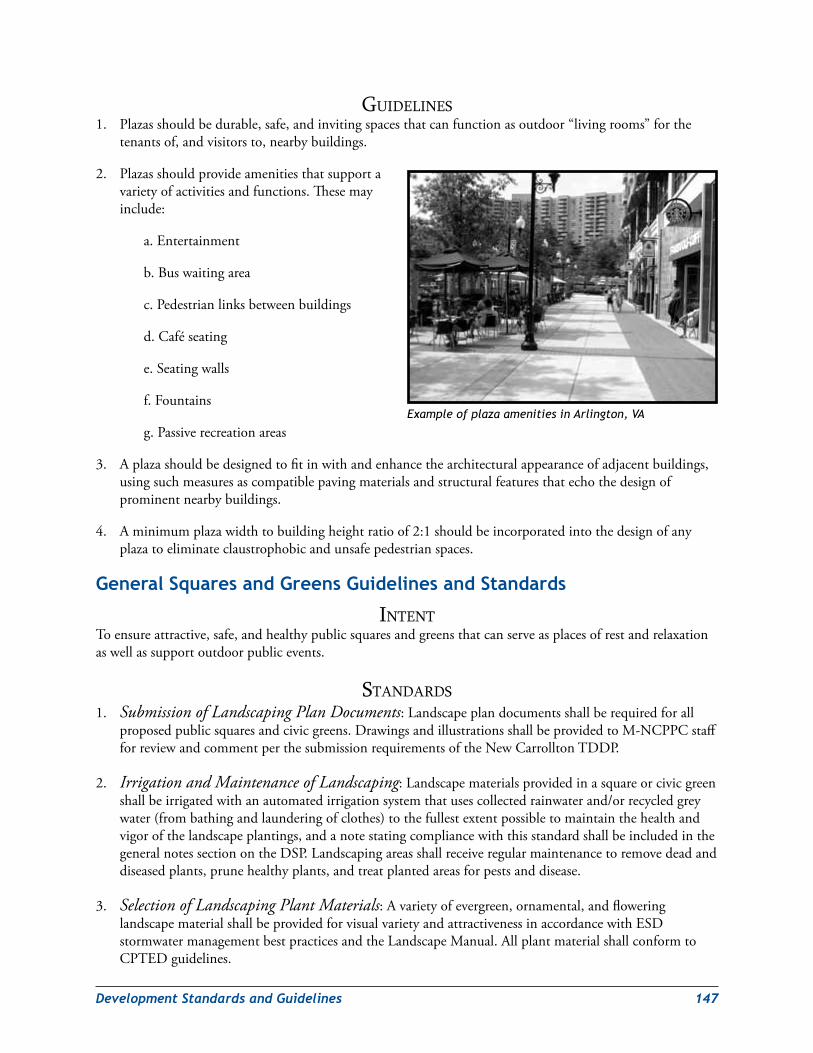
DevelopmentStandardsandGuidelines 147
GuidelineS1. Plazasshouldbedurable,safe,andinvitingspacesthatcanfunctionasoutdoor“livingrooms”forthe
tenantsof,andvisitorsto,nearbybuildings.
2. Plazasshouldprovideamenitiesthatsupportavarietyofactivitiesandfunctions.Thesemayinclude:
a.Entertainment
b.Buswaitingarea
c.Pedestrianlinksbetweenbuildings
d.Caféseating
e.Seatingwalls
f.Fountains
g.Passiverecreationareas
3. Aplazashouldbedesignedtofitinwithandenhancethearchitecturalappearanceofadjacentbuildings,usingsuchmeasuresascompatiblepavingmaterialsandstructuralfeaturesthatechothedesignofprominentnearbybuildings.
4. Aminimumplazawidthtobuildingheightratioof2:1shouldbeincorporatedintothedesignofanyplazatoeliminateclaustrophobicandunsafepedestrianspaces.
General squares and Greens Guidelines and standards
intentToensureattractive,safe,andhealthypublicsquaresandgreensthatcanserveasplacesofrestandrelaxationaswellassupportoutdoorpublicevents.
StandardS1. Submission of Landscaping Plan Documents:Landscapeplandocumentsshallberequiredforall
proposedpublicsquaresandcivicgreens.DrawingsandillustrationsshallbeprovidedtoM-NCPPCstaffforreviewandcommentperthesubmissionrequirementsoftheNewCarrolltonTDDP.
2. Irrigation and Maintenance of Landscaping:Landscapematerialsprovidedinasquareorcivicgreenshallbeirrigatedwithanautomatedirrigationsystemthatusescollectedrainwaterand/orrecycledgreywater(frombathingandlaunderingofclothes)tothefullestextentpossibletomaintainthehealthandvigorofthelandscapeplantings,andanotestatingcompliancewiththisstandardshallbeincludedinthegeneralnotessectionontheDSP.Landscapingareasshallreceiveregularmaintenancetoremovedeadanddiseasedplants,prunehealthyplants,andtreatplantedareasforpestsanddisease.
3. Selection of Landscaping Plant Materials:Avarietyofevergreen,ornamental,andfloweringlandscapematerialshallbeprovidedforvisualvarietyandattractivenessinaccordancewithESDstormwatermanagementbestpracticesandtheLandscapeManual.AllplantmaterialshallconformtoCPTEDguidelines.
Example of plaza amenities in Arlington, VA
148 DevelopmentStandardsandGuidelines
GuidelineS1. Publicworksofartshouldbeconsideredanintegralpartofthedesignforallpublicplazas.
2. Pavedsurfacesshouldprovideacoordinated,distinctivespecialpavingpatterntoprovideinteresttothepublicartarea.
Squares
intentTocreatevisuallyinterestingandattractivesquaresthatserve,alongwiththebuildingsandstreetsthatborderthem,tocreateadistinctsenseofplace.
Tocreateeasilyaccessiblepublicspaceslargeenoughtohostneighborhoodorcommunityoutdoorpublicevents.
StandardS1. Minimum Design and Performance Requirements for Squares:Surfacetreatmentandmaterials
(withintheareaback-of-curbtoback-of-curbexcludinganycivicbuilding,publicart,ormonumentfootprint)shallprovideaminimumof30percentpermeablesurfacearea(turf,groundcover,soil,ormulch).Theremainingareashallbepavedsurface.
2. Parking Structures Near Squares:Parkingstructuresthatabutsquaresshallnotbeallowedunlesstheparkingstructurecontainsgroundfloorretailorfull-heightlinerretail/commercialuses.
3 Lighting of Public Square Areas:Lightingofpublicart,pavedareas,andlandscapingshallconformtoCPTEDguidelines.Lightingdetailsandspecificationsshallbeprovidedonthelandscapeplan.LightinglevelsshallbespecifiedaccordingtotheTDDPrequirements.
GuidelineS1. Asquareshouldbesurroundedorenclosedbybuildings,evenifstreetsseparatethosebuildingsfromthe
square.Thisrelationshipofbuildingstospacehelpstocreateasenseofenclosure;i.e.,thesquarebecomesanoutdoor“livingroom”forthesurroundinguses.
2. Squaresshouldbelocatednearclustereddestinationuses,suchasciviccentersorshoppingdistricts,thatcangenerateconstantfoottrafficintoandthroughthesepublicspaces.
3. Squaresshouldbelocatedatmajorpublictransitstopstobeeasilyaccessibleforthosewhocannotdriveordonothaveaccesstoanautomobile.
4. Asquareshouldbedesignedforeasysurveillancefromanypointwithinit.ThisreinforcestheperceivedfeelingofpublicsafetyinlinewithCPTEDguidelines.
DevelopmentStandardsandGuidelines 149
Greens
intentToensurethecreationofattractivecivicgreensdesignedtoprovideasenseofplaceandencouragepassiveandactiverecreationbyresidentsandvisitors.
StandardS1. Minimum Design and Performance Requirements for Civic Greens:Surfacetreatmentand
materials(withintheareaback-of-curbtoback-of-curbexcludinganycivicbuilding,public,artormonumentfootprint)shallprovideaminimum60percentpermeablesurfacearea(turf,groundcover,soil,ormulch).Theremainingareashallbepavedsurface.ESDstormwatermanagementfeaturesshallbeincorporatedintothegreendesigntominimizeoff-siterun-offandstreambederosion.
2. Lighting of Public Greens:Lightingofpublicart,pavedareas,andlandscapingshallconformtoCPTEDguidelines.Full-cutoffopticsshallbeusedtodirectlightingdownward.Up-lightingshallbeprohibited.Lightingdetailsandspecificationsshallbeprovidedonthelandscapeplan.LightinglevelsshallbespecifiedaccordingtotheTDDPrequirements.
GuidelineS1. Greensshouldbedesignedtofunctionlikemanicuredgrassymeadowsthatinvitevisitorstosit,recline,
people-watch,orengageinactivesports.
2. Greensshouldbelocatedatmajorpublictransitstopstobeeasilyaccessibleforthosewhocannotdriveordonothaveaccesstoanautomobile.
3. Agreenshouldbedesignedforeasysurveillancefromanypointwithinit.ThisreinforcestheperceivedfeelingofpublicsafetyinlinewithCPTEDguidelines.
Parks
intentToensurethecreationofattractivepublicparksthatfeaturenaturalenvironmentsand/orrecreationalfacilitiesthatsupportbothactiveandpassiverecreation.
StandardS1. Minimum Design and Performance Requirements for Parks:Parksshallpreservenaturalareasas
primaryenvironmentalfeatures.Pavedsurfacesshallbekepttotheminimumrequiredtoprovideaccess,requiredparking,serviceareas,andteamsportsthatrequireapavedsurface,e.g.,basketballandtennis.NewparksthataretobecomepartoftheM-NCPPCgreeninfrastructuresystemshallbecoordinatedwiththeDepartmentofParksandRecreationduringtheirplanning,designandconstructionphases.
2. Community and Recreational Centers:ThelocationofthesefacilitiesshallbedeterminedbyM-NCPPCbasedontherecommendationsoftheapplicablemasterplan(LandoverorBladensburg–NewCarrollton).
3. Lighting of Parks:Lightingofpublicart,pavedareas,andlandscapingshallconformtoCPTEDguidelines.Lightingdetailsandspecificationsshallbeprovidedonthelandscapeplan.LightinglevelsshallbespecifiedaccordingtotheTDDPrequirements.Lightinginpublicparksshallbedesignedtominimizeglareinnaturalareasandnearbyresidentialcommunities.
150 DevelopmentStandardsandGuidelines
GuidelineS1. Largeparksshouldincludewell-keptareasthatinvitevisitorstosit,recline,people-watch,orengagein
activesports.Naturetrails,activitycenters,andplaygroundsshouldbeconsideredforsmallerparks.
2. Parksshouldbeintegratedintothedesignatedgreeninfrastructurenetworksothattheycanhelppreservenaturalhabitatsandlocalwildlife.
3. Parksshouldbedesignedforeasysurveillanceofrecreationfacilities,playingfields,otheropenareas,andnaturetrails.ThisreinforcestheperceivedfeelingofpublicsafetyinlinewithCPTEDguidelines.
streetscapes
General intentTocreateconsistentandinvitingstreetscapesalongresidential,commercial,andmixed-usestreetsandadistinctivevisualcharacterthroughouttheTDDParea.
Tocreate“completestreets”toprovideanenvironmentthatiseasier,safer,andmorepleasantforwalking,bicycling,anddriving.
StandardS1. Requirement for Complete Green Streets:Streetsshallaccommodateallmodesoftransportationand
integratewithaninterconnectedstreetandpedestriannetwork.StreetsshallalsobedesignedasgreenstreetsthatincorporateESDstormwatermanagementfeatures.
2. Street Characteristics and Design Criteria:Thefollowingdesignstandardsshallbeusedtoensurethatnewstreetsmeetthefunctionanddemandforthefacilitytype.Becausethefinaldesignoftheroadwaycanvaryfromsegmenttosegment(duetoadjacentlandusesanddemands),thesystemstandardizeskeycharacteristicstoprovideconsistencywhilealsoallowingflexibility.Table 8providesasummaryofkeystreetcharacteristics,designcriteria,andapplications.
3. Maximum Length of Block Perimeters:Blockperimetersshallnotexceed1,600feetmeasuredalongthepublicorprivatestreetright-of-way.
4. Maximum Length of Public and Private Streets:Blocklengthsforpublicandprivatestreetsshallnotexceed500feetbetweenthroughstreets,measuredalongthestreetright-of-way.
5. Permissible Deviations from Strict Compliance with Block Dimension Standards:Thestandardsforblockperimetersandlengthsshallbemodifiedtotheminimumextentnecessarybasedonfindingsthatstrictcompliancewiththestandardsisnotreasonablypracticalorappropriatedueto:
a. Topographicconstraints
b. Existingdevelopmentonabuttingpropertywhichprecludesthelogicalconnectionofstreetsoraccessways
c. Railroads
d. Trafficsafetyconcerns
e. Functionalandoperationalneedstocreatealargebuilding
f. Protectionofsignificantnaturalresources
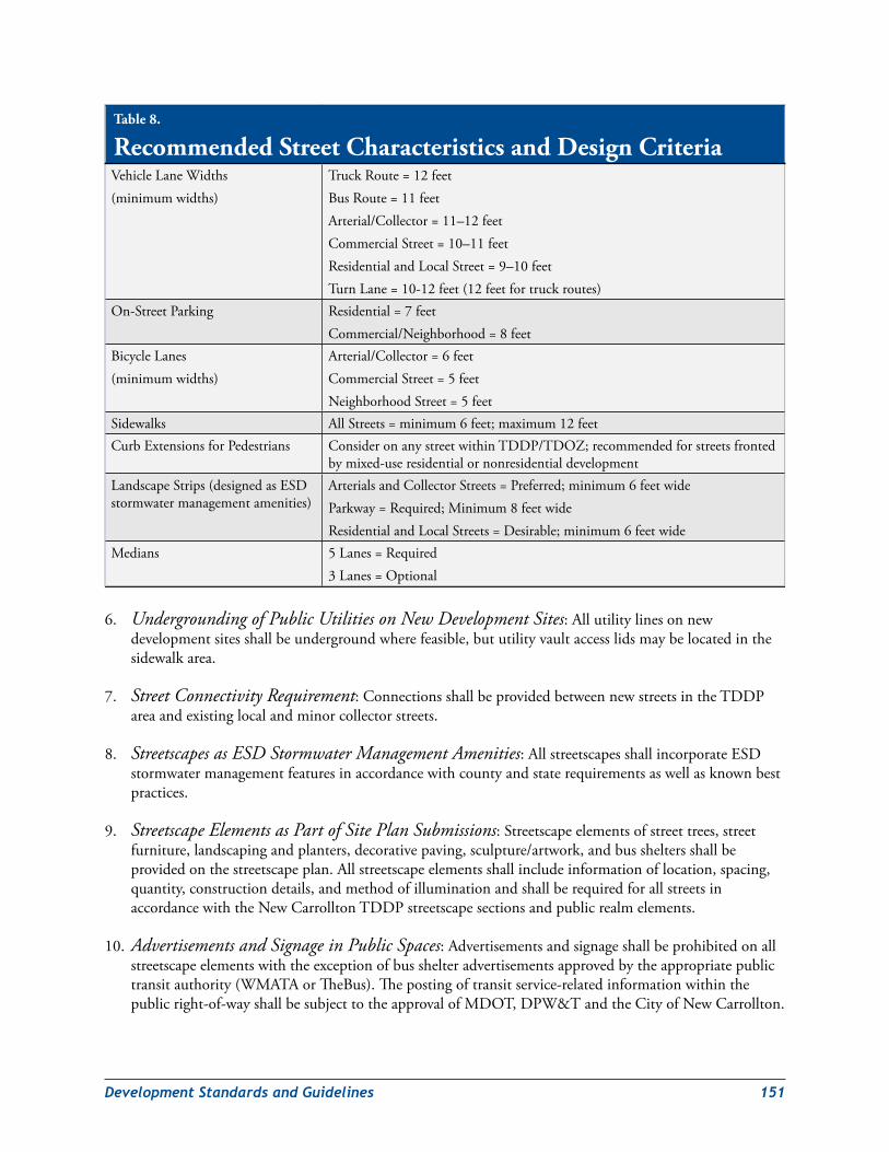
DevelopmentStandardsandGuidelines 151
6. Undergrounding of Public Utilities on New Development Sites:Allutilitylinesonnewdevelopmentsitesshallbeundergroundwherefeasible,bututilityvaultaccesslidsmaybelocatedinthesidewalkarea.
7. Street Connectivity Requirement:ConnectionsshallbeprovidedbetweennewstreetsintheTDDPareaandexistinglocalandminorcollectorstreets.
8. Streetscapes as ESD Stormwater Management Amenities:AllstreetscapesshallincorporateESDstormwatermanagementfeaturesinaccordancewithcountyandstaterequirementsaswellasknownbestpractices.
9. Streetscape Elements as Part of Site Plan Submissions:Streetscapeelementsofstreettrees,streetfurniture,landscapingandplanters,decorativepaving,sculpture/artwork,andbussheltersshallbeprovidedonthestreetscapeplan.Allstreetscapeelementsshallincludeinformationoflocation,spacing,quantity,constructiondetails,andmethodofilluminationandshallberequiredforallstreetsinaccordancewiththeNewCarrolltonTDDPstreetscapesectionsandpublicrealmelements.
10.Advertisements and Signage in Public Spaces:Advertisementsandsignageshallbeprohibitedonallstreetscapeelementswiththeexceptionofbusshelteradvertisementsapprovedbytheappropriatepublictransitauthority(WMATAorTheBus).Thepostingoftransitservice-relatedinformationwithinthepublicright-of-wayshallbesubjecttotheapprovalofMDOT,DPW&TandtheCityofNewCarrollton.
Table 8.
Recommended Street Characteristics and Design CriteriaVehicleLaneWidths(minimumwidths)
TruckRoute=12feetBusRoute=11feetArterial/Collector=11–12feetCommercialStreet=10–11feetResidentialandLocalStreet=9–10feetTurnLane=10-12feet(12feetfortruckroutes)
On-StreetParking Residential=7feetCommercial/Neighborhood=8feet
BicycleLanes(minimumwidths)
Arterial/Collector=6feetCommercialStreet=5feetNeighborhoodStreet=5feet
Sidewalks AllStreets=minimum6feet;maximum12feetCurbExtensionsforPedestrians ConsideronanystreetwithinTDDP/TDOZ;recommendedforstreetsfronted
bymixed-useresidentialornonresidentialdevelopmentLandscapeStrips(designedasESDstormwatermanagementamenities)
ArterialsandCollectorStreets=Preferred;minimum6feetwideParkway=Required;Minimum8feetwideResidentialandLocalStreets=Desirable;minimum6feetwide
Medians 5Lanes=Required3Lanes=Optional
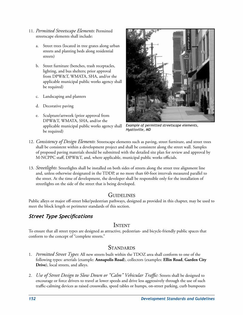
152 DevelopmentStandardsandGuidelines
11.Permitted Streetscape Elements:Permittedstreetscapeelementsshallinclude:
a. Streettrees(locatedintreegratesalongurbanstreetsandplantingbedsalongresidentialstreets)
b. Streetfurniture(benches,trashreceptacles,lighting,andbusshelters;priorapprovalfromDPW&T,WMATA,SHA,and/ortheapplicablemunicipalpublicworksagencyshallberequired)
c. Landscapingandplanters
d. Decorativepaving
e. Sculpture/artwork(priorapprovalfromDPW&T,WMATA,SHA,and/ortheapplicablemunicipalpublicworksagencyshallberequired)
12. Consistency of Design Elements:Streetscapeelementssuchaspaving,streetfurniture,andstreettreesshallbeconsistentwithinadevelopmentprojectandshallbeconsistentalongthestreetwall.SamplesofproposedpavingmaterialsshouldbesubmittedwiththedetailedsiteplanforreviewandapprovalbyM-NCPPCstaff,DPW&T,and,whereapplicable,municipalpublicworksofficials.
13.Streetlights:Streetlightsshallbeinstalledonbothsidesofstreetsalongthestreettreealignmentlineand,unlessotherwisedesignatedintheTDDP,atnomorethan60-footintervalsmeasuredparalleltothestreet.Atthetimeofdevelopment,thedevelopershallberesponsibleonlyfortheinstallationofstreetlightsonthesideofthestreetthatisbeingdeveloped.
GuidelineSPublicalleysormajoroff-streetbike/pedestrianpathways,designedasprovidedinthischapter,maybeusedtomeettheblocklengthorperimeterstandardsofthissection.
StreetTypeSpecifications
intentToensurethatallstreettypesaredesignedasattractive,pedestrian-andbicycle-friendlypublicspacesthatconformtotheconceptof“completestreets.”
StandardS1. Permitted Street Types:AllnewstreetsbuiltwithintheTDOZareashallconformtooneofthe
followingtypes:arterials(example:Annapolis Road),collectors(examples:Ellin Road,Garden CityDrive),localstreets,andalleys.
2. Use of Street Design to Slow Down or “Calm” Vehicular Traffic:Streetsshallbedesignedtoencourageorforcedriverstotravelatlowerspeedsanddrivelessaggressivelythroughtheuseofsuchtraffic-calmingdevicesasraisedcrosswalks,speedtablesorhumps,on-streetparking,curbbumpouts
Example of permitted streetscape elements, Hyattsville, MD
DevelopmentStandardsandGuidelines 153
atintersectionsandinthemiddleofblocksexceeding250feetinlength,andlandscapedmedianswithpedestriancrossingrefuges.
3. Primacy of Pedestrian Scale in Street Design:Allstreetscapeelements,includingbutnotlimitedtosignage,lighting,andstreetfurniture,shallbedesignedtopedestrianscale.Highway-scaledirectionalsignsandstreetlightsshallberestrictedtogatewayareaswhereaccessrampstoJohn Hanson HighwayandtheCapital Beltwayarelocated.Highway-scaledirectionalsignsplacedatselectedlocationsasrequiredbytheStateHighwayAdministration(SHA)tomeetestablishedhighwaysafetystandardsshallbeexemptfromthisrequirement.
4. Interconnected Street Network:Newlocalstreetsshallbedesignedasaninterconnectedstreetgridsothattrafficcapacitycanbediffusedandmaintainedacrossnumerousstreets.
GuidelineS1. Inpedestrian-orientedareas,nonvehiculartrafficshouldbeprovidedwitheverypracticaladvantageover
vehiculartrafficsolongaspublicsafetyisnotadverselyaffected.
2. Vehiculartravellanesshouldnotexceed11feetinwidth.Widerlanesencouragetraffictomoveathigherspeedsthatendangerthesafetyofpedestrians,waitingtransitriders,andbicyclists.
3. Ellin Road,85th Avenue,andotherTDOZstreetsthathavebeen,ormightbe,proposedaspossibleroutesforthefuturePurpleLineanditsproposedextensionsshouldbedesignedtoaccommodatethistransitfacilityaspartofasafe,pedestrian-friendlystreetenvironment.
Pedestrian/BikeAccesswaysWithinPublicStreetRight-of-Way
intentToprovideclearlydelineated,attractive,andsafepathwaysforpedestriansandbicyclistswithinthepublicstreetrights-of-way.
StandardS1. Requirement for Pedestrian-Scaled Amenities:Within600feetofstationentrances,pedestrian-scaled
amenitiesshallberequiredevery100squarefeetofthesidewalkarea,includingbutnotlimitedto:
a. Streetfurniture
b. Plantings
c. Distinctivepaving
d. Ornamentallighting
e. Drinkingfountains
f. Sculptures
2. Clearly Marked Pedestrian Crossings:Publicstreet,driveway,loadingarea,andsurfaceparkinglotcrossingsshallbeclearlymarkedwithtexturedaccentpavingorpaintedstripes.
3. Articulation of Sidewalk Cross Section:Thedifferentzones(curb,furnishings,through,frontage)ofasidewalkshallbearticulatedusingspecialpavingorconcretescoring.
154 DevelopmentStandardsandGuidelines
4. Sidewalks:AllsidewalksdesignatedintheTDDPshallbeconstructedaccordingtothestreetscaperequirementslistedinthissectionandshallmeetthesidewalkwidth(s)delineatedintheTDDPstreetscapesections.SidewalksnotdesignatedintheTDDPshallbeatleastfivefeetwideandshallmeetcountyspecifications.
5. Permitted Materials:Brick,precastpavers,concrete,tintedandstampedasphalt,Belgiumblock,orgranitepaversarepermittedmaterials.SamplesofproposedpavingmaterialsshallbesubmittedwiththedetailedsiteplanforreviewandapprovalbyM-NCPPCstaff.
6. Sidewalk Requirements:Sidewalksarerequiredforallstreetfrontagesalongwhichoccupiedstructures(commercial,residential,ormixed-use)occur.
7. Coordination of Proposed Bikeway Facilities in Public Stree Rights-of-Way with Appropriate Public Works Agencies:Proposednewbikewayfacilitieswithinthepublicright-of-wayofstate-maintainedroadsshallconformtoStateHighwayAdministration(SHA)-approvedstandardsandguidelines,andtheirdesign,approval,andconstructionshallbecoordinatedwithSHA.Similarcoordinationwiththeappropriatepublicworksagencyoragenciesshallberequiredforproposedbikewayfacilitieswithinotherpublicstreetrights-of-way.AppendixD:BikeFacilityDefinitionsmaybereferencedforfurtherguidanceinthedesignofthesefacilities.
GuidelineS1. Sidewalksadjacenttoundevelopedparcelsmaybetemporary.
2. Whereverpossible,widesidewalksshouldbeusedinhigher-densitycommercialandmixed-useareastoallowforamenitiessuchascaféseating,comfortablepedestrianpathways,streettrees,andstreetfurniture.
3. Privatesidewalksandwalkwaysshouldbeprovidedtoconnectstreetsidewalkstoprimarycommercialandresidentialbuildingentries,publictransportation,publicopenspaces,andparkingareasbythemostdirectroutepracticable.On-sitepedestrianwalksshouldnotsubstituteforrequiredpublicsidewalks.
4. Adjoiningdevelopmentsshouldminimizeauto/pedestrianconflictsandmaximizeconvenientaccessbetweenbuildings.
PublicOff-StreetAccessways
intentToprovideclearlydelineated,attractive,andsafepathwaysforpedestriansandbicyclistswithinblocksandotheroff-streetareas.
StandardS1. Requirements for Off-Street Pedestrian Accessways:Off-streetpedestrianaccesswaysshallincorporate
allofthefollowingdesigncriteria: a. Minimumten-footverticalclearance
b. Minimum20foothorizontalbarrierclearanceforpathway
c. Approvedpavementmaterial,withacompactedsubgrade
d. Nonskidboardwalksifwetlandconstructionisnecessary
e. Minimum100squarefeetoftrailheadareaatintersectionswithotherpedestrianimprovements
DevelopmentStandardsandGuidelines 155
2. Requirements for Off-Street Trails:Minoroff-streettrailsshallbeaminimumoffivefeetwide,haveaminimumverticalclearanceofeightfeet,aminimumtwo-foothorizontalclearancefromedgeofpathwayandbeconstructedofgravelorwoodchips,appropriateedgematerial,andwithacompactedsubgrade.
GuidelineS1. Pedestrianaccesswaysandgreenwaysshouldbeprovidedasneededtosupplementpedestrianroutesalong
publicstreets.
ParkingLotDriveways
intentToprovideaccessforoff-streetsurfacelotsthataresafeforpedestriansaswellasmotorists.
StandardS1. Parking Lot Driveways as Private Streets:Parkinglotdrivewaysthatlinkpublicstreetsand/orprivate
streetswithparkingstallsshallbedesignedasprivatestreets,unlessoneofthefollowingismet:
a. Theparkinglotdrivewayislessthan100feetlong.
b. Theparkinglotdrivewayservesoneortworesidentialunits.
c. Theparkinglotdrivewayprovidesdirectaccesstoangledparkingstalls.
2. Limits on Driveways and Curb Cuts:Nomorethanonedrivewayandassociatedcurbcutshallbepermittedperblock.
3. Connections to Adjacent Sites:Wherepossible,parkinglotsfornewdevelopmentshallbedesignedtoprovidevehicularandpedestrianconnectionstoadjacentsites.
On-SitePedestrianandBicycleCirculation
intentToprovidesafeon-siteroutesforpedestrianandbicyclecirculation.
StandardSAttractiveaccessroutesforpedestriantravelshallbeprovidedby:
1. Reducingdistancesbetweendestinationsoractivityareassuchaspublicsidewalksandbuildingentrances.Whereappropriate,developpedestrianroutesthroughsitesandbuildingstosupplementthepublicright-of-way.
2. Providinganattractive,convenientpedestrianaccesswaytobuildingentrances.
3. Bridgingacrossbarriersandobstaclessuchasfragmentedpathwaysystems,widestreets,heavyvehiculartraffic,andchangesinlevelbyconnectingpedestrianpathwayswithclearlymarkedcrossingsandinvitingsidewalkdesign.
4. Integratingsignageandlightingthatoffersinterestandsafetyforpedestrians.
5. Connectingparkingareasanddestinationswithpedestrianpathsidentifiedthroughtheuseofdistinctivepavingmaterials,pavementstriping,gradeseparations,orlandscaping.
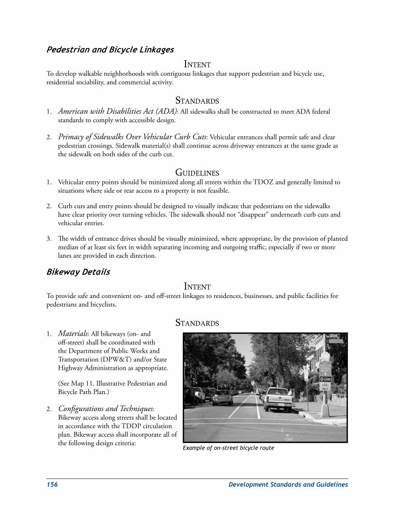
156 DevelopmentStandardsandGuidelines
PedestrianandBicycleLinkages
intentTodevelopwalkableneighborhoodswithcontiguouslinkagesthatsupportpedestrianandbicycleuse,residentialsociability,andcommercialactivity.
StandardS1. American with Disabilities Act (ADA):AllsidewalksshallbeconstructedtomeetADAfederal
standardstocomplywithaccessibledesign.
2. Primacy of Sidewalks Over Vehicular Curb Cuts:Vehicularentrancesshallpermitsafeandclearpedestriancrossings.Sidewalkmaterial(s)shallcontinueacrossdrivewayentrancesatthesamegradeasthesidewalkonbothsidesofthecurbcut.
GuidelineS1. VehicularentrypointsshouldbeminimizedalongallstreetswithintheTDOZandgenerallylimitedto
situationswheresideorrearaccesstoapropertyisnotfeasible.
2. Curbcutsandentrypointsshouldbedesignedtovisuallyindicatethatpedestriansonthesidewalkshaveclearpriorityoverturningvehicles.Thesidewalkshouldnot“disappear”underneathcurbcutsandvehicularentries.
3. Thewidthofentrancedrivesshouldbevisuallyminimized,whereappropriate,bytheprovisionofplantedmedianofatleastsixfeetinwidthseparatingincomingandoutgoingtraffic,especiallyiftwoormorelanesareprovidedineachdirection.
BikewayDetails
intentToprovidesafeandconvenienton-andoff-streetlinkagestoresidences,businesses,andpublicfacilitiesforpedestriansandbicyclists.
StandardS1. Materials:Allbikeways(on-and
off-street)shallbecoordinatedwiththeDepartmentofPublicWorksandTransportation(DPW&T)and/orStateHighwayAdministrationasappropriate.
(SeeMap11.IllustrativePedestrianandBicyclePathPlan.)
2. Configurations and Techniques:BikewayaccessalongstreetsshallbelocatedinaccordancewiththeTDDPcirculationplan.Bikewayaccessshallincorporateallofthefollowingdesigncriteria:
Example of on-street bicycle route
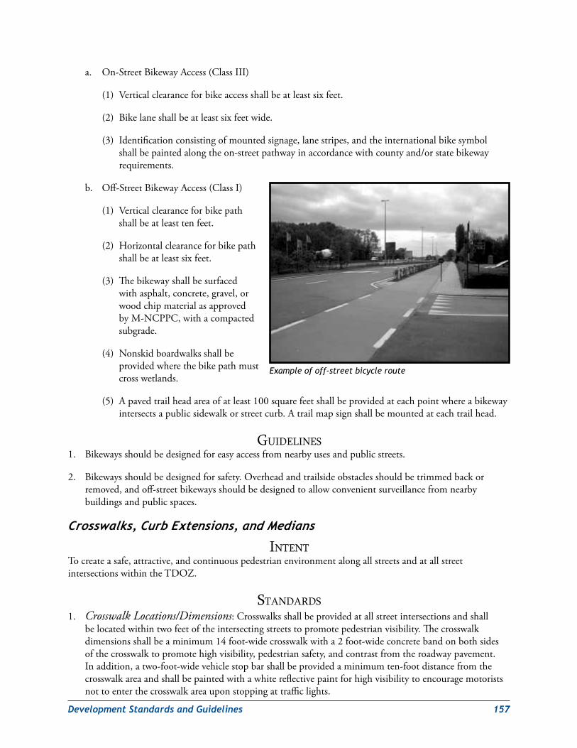
DevelopmentStandardsandGuidelines 157
a. On-StreetBikewayAccess(ClassIII)
(1) Verticalclearanceforbikeaccessshallbeatleastsixfeet.
(2) Bikelaneshallbeatleastsixfeetwide.
(3) Identificationconsistingofmountedsignage,lanestripes,andtheinternationalbikesymbolshallbepaintedalongtheon-streetpathwayinaccordancewithcountyand/orstatebikewayrequirements.
b. Off-StreetBikewayAccess(ClassI)
(1) Verticalclearanceforbikepathshallbeatleasttenfeet.
(2) Horizontalclearanceforbikepathshallbeatleastsixfeet.
(3) Thebikewayshallbesurfacedwithasphalt,concrete,gravel,orwoodchipmaterialasapprovedbyM-NCPPC,withacompactedsubgrade.
(4) Nonskidboardwalksshallbeprovidedwherethebikepathmustcrosswetlands.
(5) Apavedtrailheadareaofatleast100squarefeetshallbeprovidedateachpointwhereabikewayintersectsapublicsidewalkorstreetcurb.Atrailmapsignshallbemountedateachtrailhead.
GuidelineS1. Bikewaysshouldbedesignedforeasyaccessfromnearbyusesandpublicstreets.
2. Bikewaysshouldbedesignedforsafety.Overheadandtrailsideobstaclesshouldbetrimmedbackorremoved,andoff-streetbikewaysshouldbedesignedtoallowconvenientsurveillancefromnearbybuildingsandpublicspaces.
Crosswalks,CurbExtensions,andMedians
intentTocreateasafe,attractive,andcontinuouspedestrianenvironmentalongallstreetsandatallstreetintersectionswithintheTDOZ.
StandardS1. Crosswalk Locations/Dimensions:Crosswalksshallbeprovidedatallstreetintersectionsandshall
belocatedwithintwofeetoftheintersectingstreetstopromotepedestrianvisibility.Thecrosswalkdimensionsshallbeaminimum14foot-widecrosswalkwitha2foot-wideconcretebandonbothsidesofthecrosswalktopromotehighvisibility,pedestriansafety,andcontrastfromtheroadwaypavement.Inaddition,atwo-foot-widevehiclestopbarshallbeprovidedaminimumten-footdistancefromthecrosswalkareaandshallbepaintedwithawhitereflectivepaintforhighvisibilitytoencouragemotoristsnottoenterthecrosswalkareauponstoppingattrafficlights.
Example of off-street bicycle route
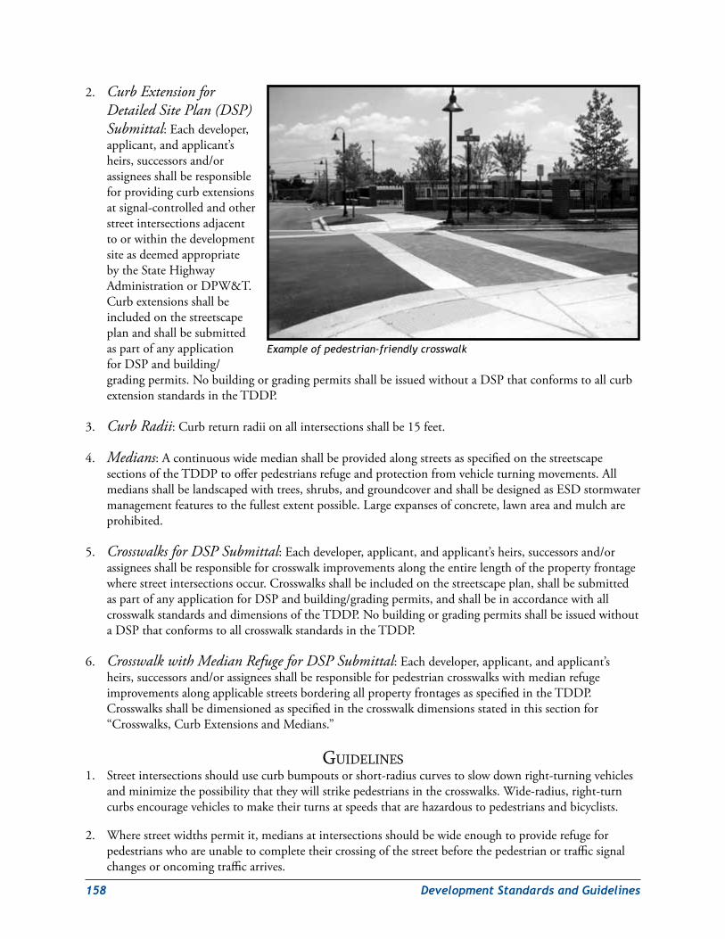
158 DevelopmentStandardsandGuidelines
2. Curb Extension for Detailed Site Plan (DSP) Submittal:Eachdeveloper,applicant,andapplicant’sheirs,successorsand/orassigneesshallberesponsibleforprovidingcurbextensionsatsignal-controlledandotherstreetintersectionsadjacenttoorwithinthedevelopmentsiteasdeemedappropriatebytheStateHighwayAdministrationorDPW&T.CurbextensionsshallbeincludedonthestreetscapeplanandshallbesubmittedaspartofanyapplicationforDSPandbuilding/gradingpermits.NobuildingorgradingpermitsshallbeissuedwithoutaDSPthatconformstoallcurbextensionstandardsintheTDDP.
3. Curb Radii:Curbreturnradiionallintersectionsshallbe15feet.
4. Medians:AcontinuouswidemedianshallbeprovidedalongstreetsasspecifiedonthestreetscapesectionsoftheTDDPtoofferpedestriansrefugeandprotectionfromvehicleturningmovements.Allmediansshallbelandscapedwithtrees,shrubs,andgroundcoverandshallbedesignedasESDstormwatermanagementfeaturestothefullestextentpossible.Largeexpansesofconcrete,lawnareaandmulchareprohibited.
5. Crosswalks for DSP Submittal:Eachdeveloper,applicant,andapplicant’sheirs,successorsand/orassigneesshallberesponsibleforcrosswalkimprovementsalongtheentirelengthofthepropertyfrontagewherestreetintersectionsoccur.Crosswalksshallbeincludedonthestreetscapeplan,shallbesubmittedaspartofanyapplicationforDSPandbuilding/gradingpermits,andshallbeinaccordancewithallcrosswalkstandardsanddimensionsoftheTDDP.NobuildingorgradingpermitsshallbeissuedwithoutaDSPthatconformstoallcrosswalkstandardsintheTDDP.
6. Crosswalk with Median Refuge for DSP Submittal:Eachdeveloper,applicant,andapplicant’sheirs,successorsand/orassigneesshallberesponsibleforpedestriancrosswalkswithmedianrefugeimprovementsalongapplicablestreetsborderingallpropertyfrontagesasspecifiedintheTDDP.Crosswalksshallbedimensionedasspecifiedinthecrosswalkdimensionsstatedinthissectionfor“Crosswalks,CurbExtensionsandMedians.”
GuidelineS1. Streetintersectionsshouldusecurbbumpoutsorshort-radiuscurvestoslowdownright-turningvehicles
andminimizethepossibilitythattheywillstrikepedestriansinthecrosswalks.Wide-radius,right-turncurbsencouragevehiclestomaketheirturnsatspeedsthatarehazardoustopedestriansandbicyclists.
2. Wherestreetwidthspermitit,mediansatintersectionsshouldbewideenoughtoproviderefugeforpedestrianswhoareunabletocompletetheircrossingofthestreetbeforethepedestrianortrafficsignalchangesoroncomingtrafficarrives.
Example of pedestrian-friendly crosswalk
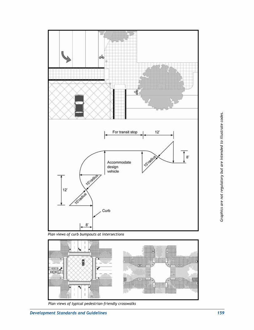
DevelopmentStandardsandGuidelines 159
Plan views of curb bumpouts at intersections
Plan views of typical pedestrian-friendly crosswalks
Gra
phic
s ar
e no
t re
gula
tory
but
are
int
ende
d to
ill
ustr
ate
code
s.
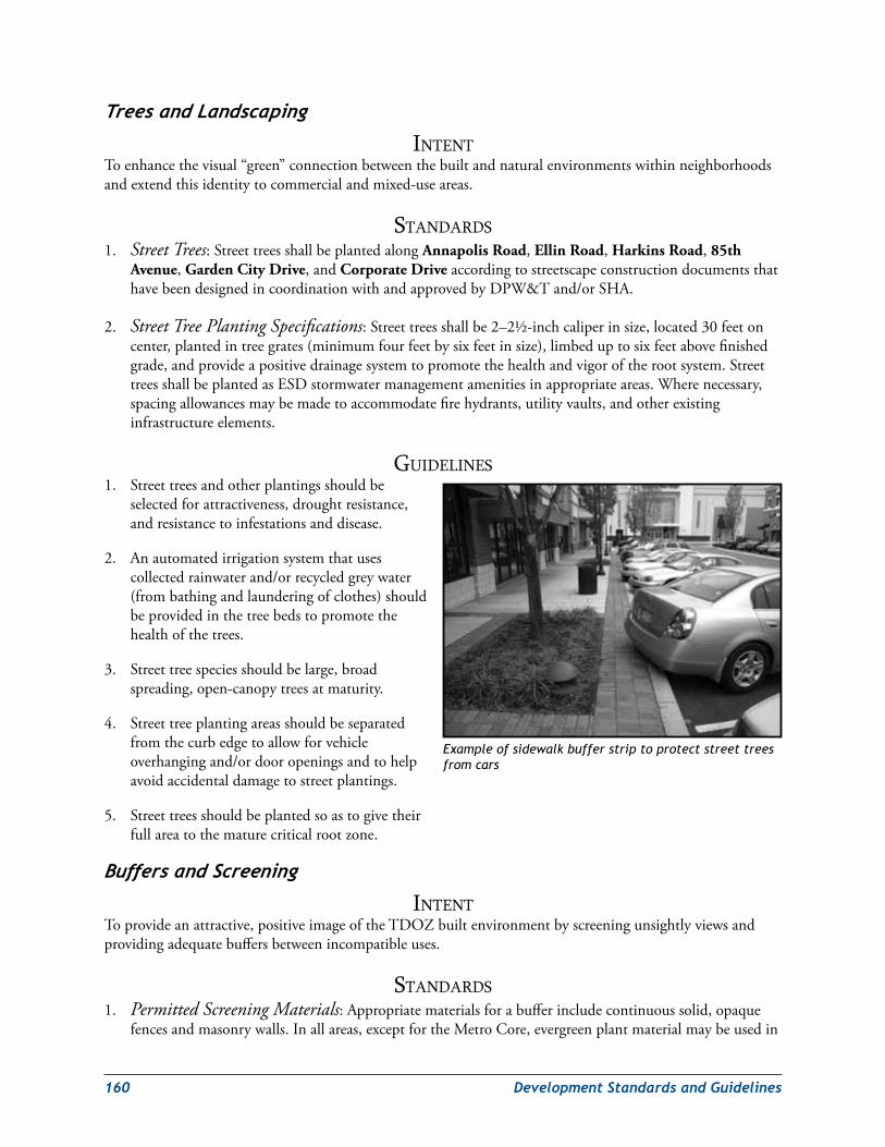
160 DevelopmentStandardsandGuidelines
TreesandLandscaping
intentToenhancethevisual“green”connectionbetweenthebuiltandnaturalenvironmentswithinneighborhoodsandextendthisidentitytocommercialandmixed-useareas.
StandardS1. Street Trees:StreettreesshallbeplantedalongAnnapolis Road,Ellin Road,Harkins Road,85th
Avenue,Garden City Drive,andCorporate DriveaccordingtostreetscapeconstructiondocumentsthathavebeendesignedincoordinationwithandapprovedbyDPW&Tand/orSHA.
2. Street Tree Planting Specifications:Streettreesshallbe2–2½-inchcaliperinsize,located30feetoncenter,plantedintreegrates(minimumfourfeetbysixfeetinsize),limbeduptosixfeetabovefinishedgrade,andprovideapositivedrainagesystemtopromotethehealthandvigoroftherootsystem.StreettreesshallbeplantedasESDstormwatermanagementamenitiesinappropriateareas.Wherenecessary,spacingallowancesmaybemadetoaccommodatefirehydrants,utilityvaults,andotherexistinginfrastructureelements.
GuidelineS1. Streettreesandotherplantingsshouldbe
selectedforattractiveness,droughtresistance,andresistancetoinfestationsanddisease.
2. Anautomatedirrigationsystemthatusescollectedrainwaterand/orrecycledgreywater(frombathingandlaunderingofclothes)shouldbeprovidedinthetreebedstopromotethehealthofthetrees.
3. Streettreespeciesshouldbelarge,broadspreading,open-canopytreesatmaturity.
4. Streettreeplantingareasshouldbeseparatedfromthecurbedgetoallowforvehicleoverhangingand/ordooropeningsandtohelpavoidaccidentaldamagetostreetplantings.
5. Streettreesshouldbeplantedsoastogivetheirfullareatothematurecriticalrootzone.
BuffersandScreening
intentToprovideanattractive,positiveimageoftheTDOZbuiltenvironmentbyscreeningunsightlyviewsandprovidingadequatebuffersbetweenincompatibleuses.
StandardS1. Permitted Screening Materials:Appropriatematerialsforabufferincludecontinuoussolid,opaque
fencesandmasonrywalls.Inallareas,exceptfortheMetroCore,evergreenplantmaterialmaybeusedin
Example of sidewalk buffer strip to protect street trees from cars
DevelopmentStandardsandGuidelines 161
combinationwithmetalpicket-type/railfencing.Plantmaterialsshallbeofanappropriatespecies,size,andquantitytoimmediatelyprovideaneffective,year-roundbuffer.
2. Prohibited Screening Materials:Chain-linkfencing(ofanytype),corrugatedmetal,corrugatedfiberglass,flatvinyl,sheetmetal,orwiremeshshallnotbeusedasascreeningmaterial.Theuseofbarbed/razorwireisnotpermitted.
3. Minimum Buffer Requirements:Theminimumbufferyardrequirements(landscapeyard)forincompatibleusesintheLandscapeManual(Section4.7)shallbereducedby50percent.Theplantunitsrequiredper100percentofthepropertylineorright-of-wayshallalsobereducedby50percent.Alternativecomplianceshallnotberequiredforthesereductions.
4 Screening of Residential Areas from Nonresidential Areas:Asix-foot-high,opaquemasonrywallorotheropaquescreeningtreatmentshallbeprovidedinconjunctionwiththereducedwidthofthebufferyardbetweenoffice/retail/commercialusesandresidentialuses.
5. Exemption of Mixed-Use Development from Bufferyard Requirement:Bufferyardsshallnotberequiredbetweenanyuseswithinapropertycontainingmixed-usedevelopmentintheMetroCore.
6. Public Safety Considerations in Placement of Screening and Landscape Elements:Theplacementofwalls,fencesandplantingsshallnotcreateblindspotsorhidingplaces.
GuidelineS1. Thebufferyardrequirementswithinthedevelopmentdistrictmaybereducedtofacilitateacompactform
ofdevelopmentcompatiblewiththeurbancharacteroftheTDOZ.
2. Theuseofwroughtironfencingshouldbelimitedtoavoidaninstitutionalorprison-likeappearance,whichmightgiveavisitortheimpressionthatthepublicspaceisunsafe.
3. Wallsandfencesshouldbeusedtodefineboundaries,provideaccesscontrol,andalsodistinguishprivateandpublicareas.
4. Materialsselectedforbuffersshouldbeofhighqualityandenhancethecharacterofthebuiltenvironment.
LightingofPublicStreetsandSpaces
intentToprovidetheoptimumleveloflightingofpublicspacesforpublicsafetywhileminimizingadverseenvironmentalimpactssuchasglareandlightpollution.
StandardS1. General Street Lighting:Standard“cobrahead”designstreetlightsshallbeinstalledalongallpublic
streetsinaccordancewithcountyorstatedesignandinstallationrequirements,whicheverisappropriate.
2. Pedestrian Streetlights:Allpedestrianstreetlightsshallbeaminimumheightof14feetandamaximumof16feet.Maximumspacingforstreetlightsshallbe60feetoncenter.Fullcut-offopticsshallbeusedtodirectlightingdownward.PedestrianstreetlightingshallbeprovidedalongsidewalksandinpublicspacesinlocationsdeemedappropriatebyDPW&Tand/orSHA.
162 DevelopmentStandardsandGuidelines
3. Permitted and Prohibited Streetlight Types:Thefollowingisalistofpermittedandprohibitedstreetlighttypes.
a. Permitted:
High-PressureSodium(HPS)
b. Prohibited:
(1) Incandescent
(2) MetalHalide(MH)
(3) MercuryVapor(MV)
(4) Halogen
(5) Fluorescent
(6) Floodlights(i.e.,noup-lighting)
AnotereferencingcompliancewiththisstandardshallbeplacedinthegeneralnotesoftheDSPandbuildingpermit.
4. Security CPTED Lighting:Securitylightingshallbeprovidedtoilluminatelandscaping,parks,andspecialfeaturesandshallbeinaccordancewithCrimePreventionThroughEnvironmentalDesign(CPTED)standards.(SeeCPTEDGuidelinesattheconclusionofthischapter.)
5. Minimum Lighting Levels:Minimumpublic/privatespacelightlevelsshallbe:
a. 2.0foot-candlesforwalkways
b. 0.5foot-candlesfortrails
c. 1.25foot-candlesforallotheroutdoorareas
6. Maximum Lighting Levels:Maximumpublic/privatespacelightinglevelsshallnotexceed:
a. 2.0foot-candlesforwalkways
b. 1.25foot-candlesfortrails
c. 1.5foot-candlesforallotheroutdoorareas
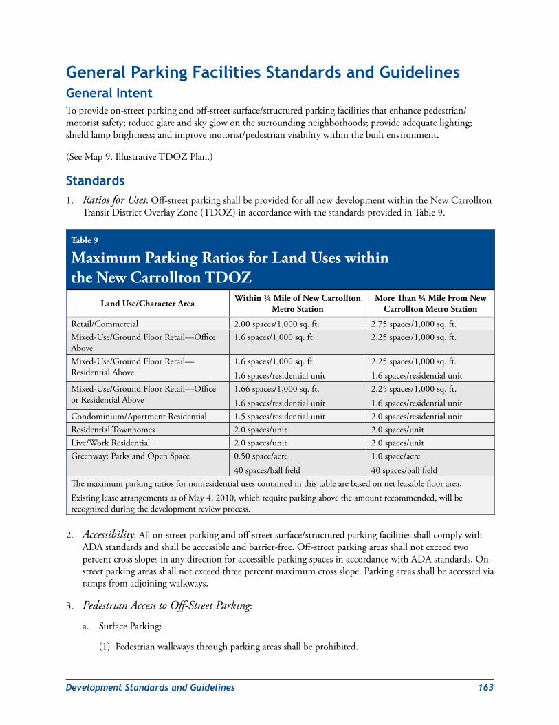
DevelopmentStandardsandGuidelines 163
General Parking Facilities standards and GuidelinesGeneral intentToprovideon-streetparkingandoff-streetsurface/structuredparkingfacilitiesthatenhancepedestrian/motoristsafety;reduceglareandskyglowonthesurroundingneighborhoods;provideadequatelighting;shieldlampbrightness;andimprovemotorist/pedestrianvisibilitywithinthebuiltenvironment.
(SeeMap9.IllustrativeTDOZPlan.)
standards1. Ratios for Uses:Off-streetparkingshallbeprovidedforallnewdevelopmentwithintheNewCarrollton
TransitDistrictOverlayZone(TDOZ)inaccordancewiththestandardsprovidedinTable9.
2. Accessibility:Allon-streetparkingandoff-streetsurface/structuredparkingfacilitiesshallcomplywithADAstandardsandshallbeaccessibleandbarrier-free.Off-streetparkingareasshallnotexceedtwopercentcrossslopesinanydirectionforaccessibleparkingspacesinaccordancewithADAstandards.On-streetparkingareasshallnotexceedthreepercentmaximumcrossslope.Parkingareasshallbeaccessedviarampsfromadjoiningwalkways.
3. Pedestrian Access to Off-Street Parking:
a. SurfaceParking:
(1) Pedestrianwalkwaysthroughparkingareasshallbeprohibited.
Table 9
Maximum Parking Ratios for Land Uses within the New Carrollton TDOZ
Land Use/Character Area Within ¼ Mile of New Carrollton Metro Station
More Than ¼ Mile From New Carrollton Metro Station
Retail/Commercial 2.00spaces/1,000sq.ft. 2.75spaces/1,000sq.ft.Mixed-Use/GroundFloorRetail—OfficeAbove
1.6spaces/1,000sq.ft. 2.25spaces/1,000sq.ft.
Mixed-Use/GroundFloorRetail—ResidentialAbove
1.6spaces/1,000sq.ft.1.6spaces/residentialunit
2.25spaces/1,000sq.ft.1.6spaces/residentialunit
Mixed-Use/GroundFloorRetail—OfficeorResidentialAbove
1.66spaces/1,000sq.ft.1.6spaces/residentialunit
2.25spaces/1,000sq.ft.1.6spaces/residentialunit
Condominium/ApartmentResidential 1.5spaces/residentialunit 2.0spaces/residentialunitResidentialTownhomes 2.0spaces/unit 2.0spaces/unitLive/WorkResidential 2.0spaces/unit 2.0spaces/unitGreenway:ParksandOpenSpace 0.50space/acre
40spaces/ballfield1.0space/acre40spaces/ballfield
Themaximumparkingratiosfornonresidentialusescontainedinthistablearebasedonnetleasablefloorarea.ExistingleasearrangementsasofMay4,2010,whichrequireparkingabovetheamountrecommended,willberecognizedduringthedevelopmentreviewprocess.
164 DevelopmentStandardsandGuidelines
(2) Perimeterwalkwaysalongtheedgeofparkingareasshallnotexceedtwopercentcrossslopeandshallbeilluminatedatexactly2.0foot-candlesforADAaccessibilitycompliance.
b. Parkingstructuresshallprovidepedestrianaccesstosurroundingmainbuildingsandshallprovidesafe(exactly2.0foot-candleillumination),direct(maximumdistanceof100feet),accessible(maximum2percentslopes),barrier-free(nosteps)pathways.
4. Construction:Constructionofon-streetparkingandoff-streetsurface/structuredparkingfacilitiesshallbecompletedforanyapproveddevelopmentbeforetheissuanceofuseandoccupancypermitsforthefirstbuilding.
5. Parking Landscaping:Landscapingshallbeprovidedforsurfaceparkingandparkingstructuresasfollows:
a. On-StreetParking:
(1) Landscapingshallbeprovidedadjacenttoon-streetparkingareaspertheNewCarrolltonTDDPstreetscapestandards.
(2) Treepitareasshallbeaminimumoffivefeetwideandfivefeetdeep.Treegratesshallbeaminimumoffourfeetwideandfourfeetdeep.Treepitareasandtreegratesshallplacethecenterofthetreeaminimumof2.5feetfromthefaceofcurbforprotectionfromopencardoors.
b. Off-StreetSurfaceParking:
(1) Parkingperimetersshallscreenviewsofcarsfromthepublicrealmwithbothathree-foothighsolidmasonrywallandevergreenshrublandscaping.
(2) Evergreenshrubsshallbeplantedattherateofthreeshrubspereverytenlinearfeetofperimeterparkingarea.
(3) Landscapedparkingislandsshallbeprovidedasabreakinparkingareasforevery20cars,dimensionedataminimumof10feetinwidthandminimum20feetinlength,plantedwitha2½-inchcalipershadetree,andshallprovidegroundcoverorshrubswithintheisland.
c. Off-StreetParkingStructures:
(1) Landscapingshallbeprovidedalongparkingstructurefoundationfacadesthatfrontthepublicrealm.
(2) Landscapingshallbeprovidedattherateofonetree(2½-inchcaliper)andthreeshrubs(24-inchheight)per10linearfeetofparkingfacade.
(3) Plantingbedsshallbeaminimumfivefeetinwidthandmeetminimumsizecriteria.
6. Parking Lighting:Lightingshallbeprovidedforsurfaceparkingandparkingstructuresasfollows:
a. On-StreetParkingandOff-StreetSurfaceParking:
(1) Fullcut-offlighting.
(2) Pedestrian-scalelightfixturesuptoamaximumheightof16feet.
(3) Streetlightsshallbeaminimum14feetandmaximum16feetinheightforon-streetparkingareasandshallbeamaximumof20feetinheightforoff-streetsurfaceparkingareas.
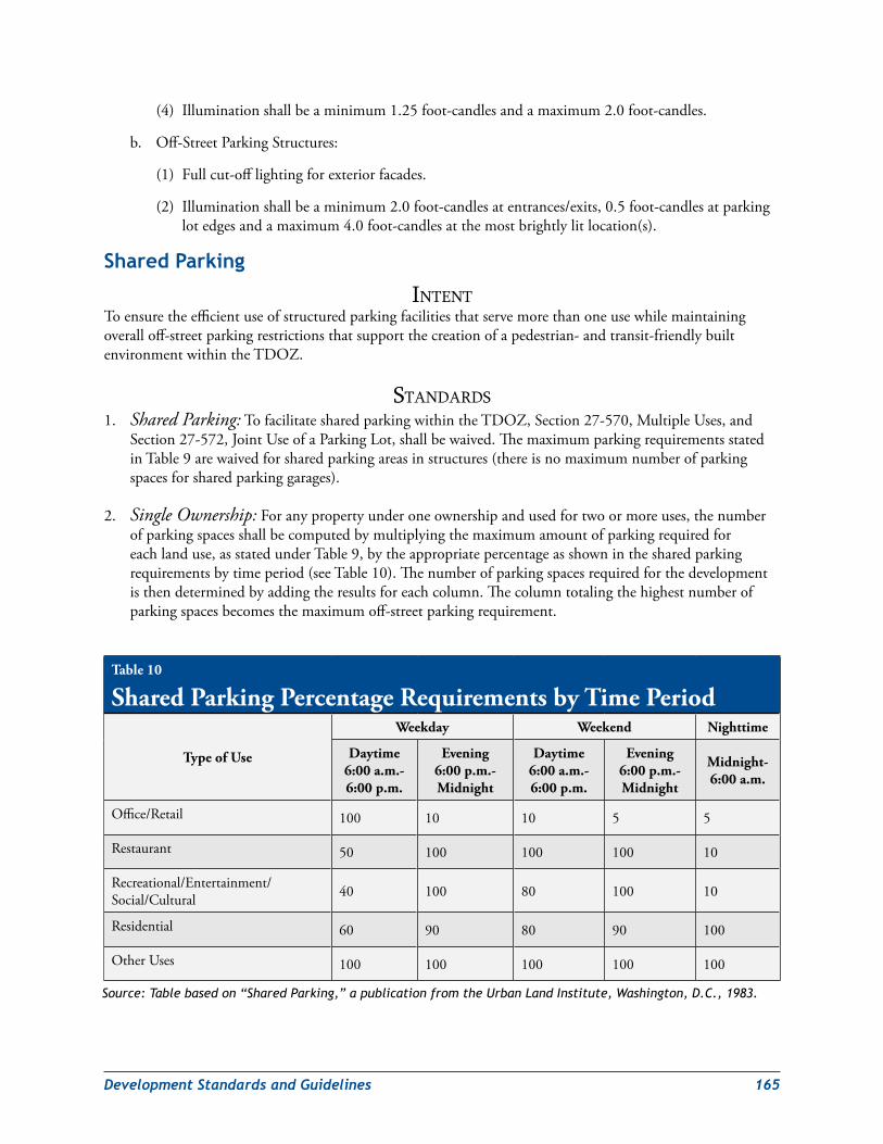
DevelopmentStandardsandGuidelines 165
(4) Illuminationshallbeaminimum1.25foot-candlesandamaximum2.0foot-candles.
b. Off-StreetParkingStructures:
(1) Fullcut-offlightingforexteriorfacades.
(2) Illuminationshallbeaminimum2.0foot-candlesatentrances/exits,0.5foot-candlesatparkinglotedgesandamaximum4.0foot-candlesatthemostbrightlylitlocation(s).
shared Parking
intentToensuretheefficientuseofstructuredparkingfacilitiesthatservemorethanoneusewhilemaintainingoveralloff-streetparkingrestrictionsthatsupportthecreationofapedestrian-andtransit-friendlybuiltenvironmentwithintheTDOZ.
StandardS1. Shared Parking:TofacilitatesharedparkingwithintheTDOZ,Section27-570,MultipleUses,and
Section27-572,JointUseofaParkingLot,shallbewaived.ThemaximumparkingrequirementsstatedinTable9arewaivedforsharedparkingareasinstructures(thereisnomaximumnumberofparkingspacesforsharedparkinggarages).
2. Single Ownership:Foranypropertyunderoneownershipandusedfortwoormoreuses,thenumberofparkingspacesshallbecomputedbymultiplyingthemaximumamountofparkingrequiredforeachlanduse,asstatedunderTable9,bytheappropriatepercentageasshowninthesharedparkingrequirementsbytimeperiod(seeTable10).Thenumberofparkingspacesrequiredforthedevelopmentisthendeterminedbyaddingtheresultsforeachcolumn.Thecolumntotalingthehighestnumberofparkingspacesbecomesthemaximumoff-streetparkingrequirement.
Table 10
Shared Parking Percentage Requirements by Time Period
Type of Use
Weekday Weekend Nighttime
Daytime 6:00 a.m.- 6:00 p.m.
Evening 6:00 p.m.- Midnight
Daytime 6:00 a.m.- 6:00 p.m.
Evening 6:00 p.m.- Midnight
Midnight- 6:00 a.m.
Office/Retail 100 10 10 5 5
Restaurant 50 100 100 100 10
Recreational/Entertainment/Social/Cultural 40 100 80 100 10
Residential 60 90 80 90 100
OtherUses 100 100 100 100 100
Source: Table based on “Shared Parking,” a publication from the Urban Land Institute, Washington, D.C., 1983.
166 DevelopmentStandardsandGuidelines
3. Multiple Ownership:Theoff-streetparkingrequirementsfortwoormoreuseswithdifferentownershipmaybesatisfiedbyprovidingajointparkingfacility,andthemaximumparkingrequirementsmaybereducedinaccordancewiththeprocedureoutlinedaboveforsharedparkingforsingleownership.
4. Certification of Shared Parking Arrangement:Wheresharedparkingisutilized,theapplicantshallprovidedetailsofthedevelopment’sproposedusesandrequiredparkingalongwithaletterfromtheparkinglotmanagercertifyingthatthelothasthecapacitytoaccommodateallparkingneedsandthattheparkingownerhasenteredintoanagreementtosharethenumberofspacesrequired.SeeTable10.
on‑street Parking
intentToregulatethedesignandlocationofon-streetparkingtoprovideconvenientaccesstoadjoininguseswithoutcompromisingpedestrian/motoristsafetyandthequalityofthestreetscapeenvironment.
StandardS1. Materials:On-streetparkingareasshallbecoordinatedwiththeDepartmentofPublicWorksand
Transportation(DPW&T)and/orStateHighwayAdministration(SHA)asappropriate.On-streetparkingshallbepermittedduringoff-peakhoursonstateandcountyroadwayssubjecttothepriorapprovalofDPW&Tand/orSHAasappropriate.
2. Siting:On-streetparkingshallnotexceedthemaximumparkingpermittedbytheNewCarrolltonTDDPdevelopmentprogramandparkingsummary.
off‑street Parking
intentToregulatethelocation,siting,anddesignofoff-streetparkingtoprovideconvenientaccesstoadjoininguseswithoutcompromisingpedestrian/motoristsafetyandthequalityofthebuiltenvironmentwithintheNewCarrolltonTransitDistrictOverlayZone.
StandardS1. Materials:Constructionmaterialsforparkinggaragesshallbeselectedaccordingtothefollowinglistof
permittedandprohibitedmaterials.
a. Permitted:
(1) Brickandtilemasonry
(2) Nativestone(orsyntheticequivalent)
(3) Precastmasonry(fortrimandcorniceelementsonly)
(4) GypsumFiberReinforcedConcrete(GFRC—fortrimelementsonly)
(5) Metal(forbeams,lintels,trimelements,andornamentationonly)
b. Prohibited:
(1) Stucco/EIFS(cementitiousfinish)
(2) Split-facedblock
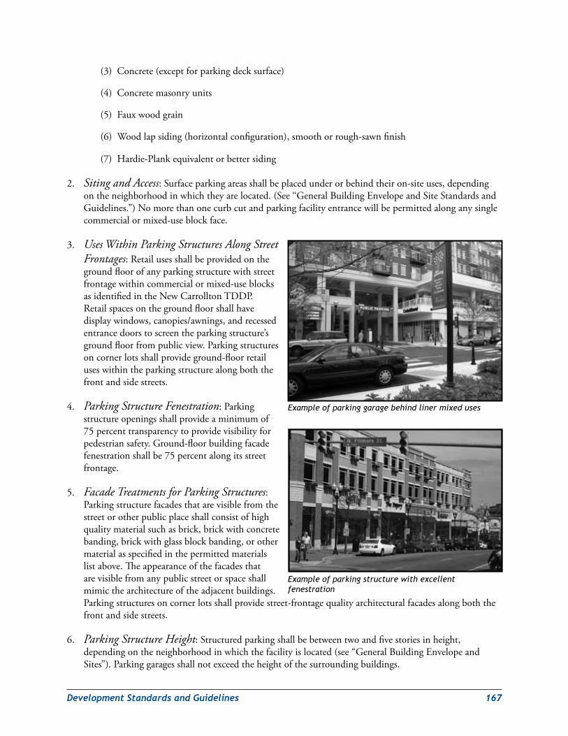
DevelopmentStandardsandGuidelines 167
(3) Concrete(exceptforparkingdecksurface)
(4) Concretemasonryunits
(5) Fauxwoodgrain
(6) Woodlapsiding(horizontalconfiguration),smoothorrough-sawnfinish
(7) Hardie-Plankequivalentorbettersiding
2. Siting and Access:Surfaceparkingareasshallbeplacedunderorbehindtheiron-siteuses,dependingontheneighborhoodinwhichtheyarelocated.(See“GeneralBuildingEnvelopeandSiteStandardsandGuidelines.”)Nomorethanonecurbcutandparkingfacilityentrancewillbepermittedalonganysinglecommercialormixed-useblockface.
3. Uses Within Parking Structures Along Street Frontages:Retailusesshallbeprovidedonthegroundfloorofanyparkingstructurewithstreetfrontagewithincommercialormixed-useblocksasidentifiedintheNewCarrolltonTDDP.Retailspacesonthegroundfloorshallhavedisplaywindows,canopies/awnings,andrecessedentrancedoorstoscreentheparkingstructure’sgroundfloorfrompublicview.Parkingstructuresoncornerlotsshallprovideground-floorretailuseswithintheparkingstructurealongboththefrontandsidestreets.
4. Parking Structure Fenestration:Parkingstructureopeningsshallprovideaminimumof75percenttransparencytoprovidevisibilityforpedestriansafety.Ground-floorbuildingfacadefenestrationshallbe75percentalongitsstreetfrontage.
5. Facade Treatments for Parking Structures:Parkingstructurefacadesthatarevisiblefromthestreetorotherpublicplaceshallconsistofhighqualitymaterialsuchasbrick,brickwithconcretebanding,brickwithglassblockbanding,orothermaterialasspecifiedinthepermittedmaterialslistabove.Theappearanceofthefacadesthatarevisiblefromanypublicstreetorspaceshallmimicthearchitectureoftheadjacentbuildings.Parkingstructuresoncornerlotsshallprovidestreet-frontagequalityarchitecturalfacadesalongboththefrontandsidestreets.
6. Parking Structure Height:Structuredparkingshallbebetweentwoandfivestoriesinheight,dependingontheneighborhoodinwhichthefacilityislocated(see“GeneralBuildingEnvelopeandSites”).Parkinggaragesshallnotexceedtheheightofthesurroundingbuildings.
Example of parking garage behind liner mixed uses
Example of parking structure with excellent fenestration
168 DevelopmentStandardsandGuidelines
7. Siting of Parking Structures With Street Frontage:Allparkingstructureswithstreetfrontageshallbelocatedatthebuild-tolines(alsoseestandard3above).Eachdeveloper,applicant,andtheapplicant’sheirs,successorsand/orassigneesshallberesponsibleforparkingstructureimprovementsasdelineatedintheNewCarrolltonTransitDistrictDevelopmentPlan(TDDP).
8. Parking Structure Entrances and Exits (Single-Family Residential):Parkingstructureentrancesandexitswithinsingle-familyresidentialareasshallnotbemorethan80squarefeetinarea,andthereshallnotbemorethantwosingle-widthgaragedoorsoronedouble-widthgaragedoorperunit.Alltownhouseandlive/workunitgaragesshallbetuck-under.
9. Parking Structure Entrances and Exits (Multifamily/Nonresidential):Parkingstructureentrancesandexitswithinmultifamilyresidentialornonresidentialareasshallnotexceed16feetclearheightand24feetclearwidthandshallnotbesitedwithin100feetoftheblockcorner.Onlyoneparkingaccessandcurbcutshallbepermittedalonganycommercialblockface.
10.Parking Structure Stairwells:Parkingstructurestairwellsshallprovideuplightingwithaminimumof2.0foot-candlesandamaximumof5.0foot-candles.Glassfacadesshallbeprovidedforhighvisibilityandopennesstoenhancepedestriansafety.Stepsshallprovideopenriserconstructiontoincreasevisibilityforpedestriansecurity.
11.Parking Structure Elevators:Parkingstructureelevatorsshallbelightedtoaminimumof5.0foot-candlesattheentrancetotheelevatorcardoorinaccordancewithADAStandards.Elevatorlandingsshallbeconstructedwithglasswallstoprovideanopenviewtoprovidepedestriansafetyandenhancedvisibility.
GuidelineS1. Allparkingstructureexteriorsshouldbearchitecturallydesignedtointegrateandbecompatiblewith
adjacentbuildingfacades.
2. Parkinggaragesshouldnotvisuallydominatetheblockwheretheyarevisiblefromthestreetorotherpublicspace.
Bicycle Parking
intentToensuretheconstructionofbicycleparkingfacilitiesthatprovideconvenientaccesstoadjoininguseswithoutcompromisingpedestrian/bicyclistsafetyandthequalityofthestreetscapeenvironment.
StandardS1. Materials:AllbicycleparkingareasshallbecoordinatedwithDPW&Tand/orSHAasappropriate.
2. Bicycle Space Required Number:Theminimumnumberofrequiredbicycleparkingspacesshallbeonebicyclespaceforevery20off-streetvehicularparkingspaces.Single-familydwellingunitsshallbeexemptfromallbicycleparkingrequirements.
3. Bicycle Space Dimensions:Bicyclespacesshallbeaminimumofsixfeetlongand2.5feetwideandshallprovideanoverheadminimumclearanceofsevenfeetincoveredspaces.Aminimumfive-foot-wideclearaisleshallbeprovidedbetweeneachrowofbicycleparkingspaces.
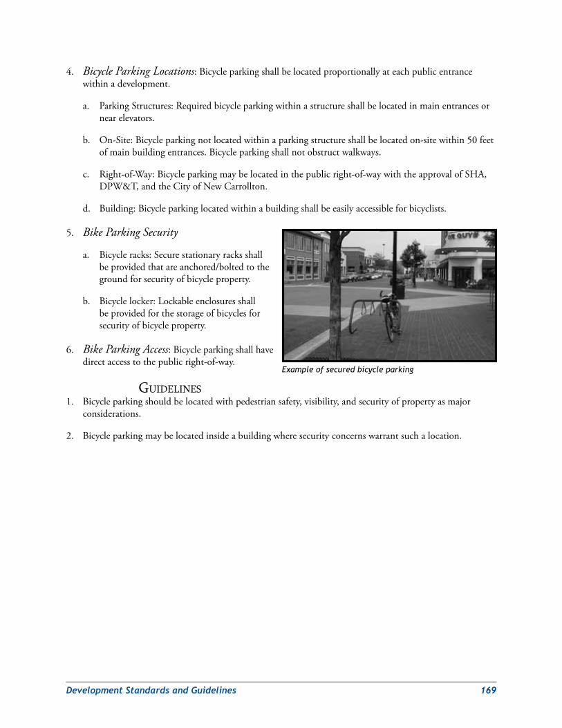
DevelopmentStandardsandGuidelines 169
4. Bicycle Parking Locations:Bicycleparkingshallbelocatedproportionallyateachpublicentrancewithinadevelopment.
a. ParkingStructures:Requiredbicycleparkingwithinastructureshallbelocatedinmainentrancesornearelevators.
b. On-Site:Bicycleparkingnotlocatedwithinaparkingstructureshallbelocatedon-sitewithin50feetofmainbuildingentrances.Bicycleparkingshallnotobstructwalkways.
c. Right-of-Way:Bicycleparkingmaybelocatedinthepublicright-of-waywiththeapprovalofSHA,DPW&T,andtheCityofNewCarrollton.
d. Building:Bicycleparkinglocatedwithinabuildingshallbeeasilyaccessibleforbicyclists.
5. Bike Parking Security
a. Bicycleracks:Securestationaryracksshallbeprovidedthatareanchored/boltedtothegroundforsecurityofbicycleproperty.
b. Bicyclelocker:Lockableenclosuresshallbeprovidedforthestorageofbicyclesforsecurityofbicycleproperty.
6. Bike Parking Access:Bicycleparkingshallhavedirectaccesstothepublicright-of-way.
GuidelineS1. Bicycleparkingshouldbelocatedwithpedestriansafety,visibility,andsecurityofpropertyasmajor
considerations.
2. Bicycleparkingmaybelocatedinsideabuildingwheresecurityconcernswarrantsuchalocation.
Example of secured bicycle parking
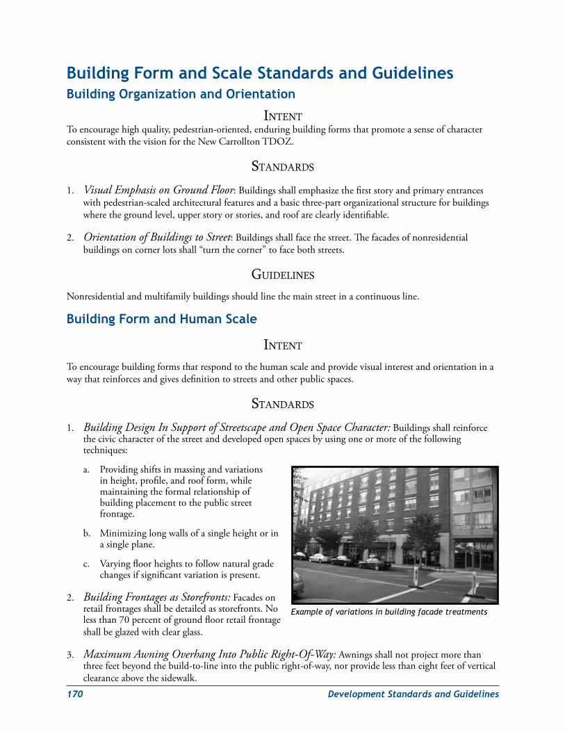
170 DevelopmentStandardsandGuidelines
Building Form and scale standards and Guidelines Building organization and orientation
intentToencouragehighquality,pedestrian-oriented,enduringbuildingformsthatpromoteasenseofcharacterconsistentwiththevisionfortheNewCarrolltonTDOZ.
StandardS
1. Visual Emphasis on Ground Floor:Buildingsshallemphasizethefirststoryandprimaryentranceswithpedestrian-scaledarchitecturalfeaturesandabasicthree-partorganizationalstructureforbuildingswherethegroundlevel,upperstoryorstories,androofareclearlyidentifiable.
2. Orientation of Buildings to Street:Buildingsshallfacethestreet.Thefacadesofnonresidentialbuildingsoncornerlotsshall“turnthecorner”tofacebothstreets.
GuidelineS
Nonresidentialandmultifamilybuildingsshouldlinethemainstreetinacontinuousline.
Building Form and Human scale
intent
Toencouragebuildingformsthatrespondtothehumanscaleandprovidevisualinterestandorientationinawaythatreinforcesandgivesdefinitiontostreetsandotherpublicspaces.
StandardS
1. Building Design In Support of Streetscape and Open Space Character:Buildingsshallreinforcetheciviccharacterofthestreetanddevelopedopenspacesbyusingoneormoreofthefollowingtechniques:
a. Providingshiftsinmassingandvariationsinheight,profile,androofform,whilemaintainingtheformalrelationshipofbuildingplacementtothepublicstreetfrontage.
b. Minimizinglongwallsofasingleheightorinasingleplane.
c. Varyingfloorheightstofollownaturalgradechangesifsignificantvariationispresent.
2. Building Frontages as Storefronts:Facadesonretailfrontagesshallbedetailedasstorefronts.Nolessthan70percentofgroundfloorretailfrontageshallbeglazedwithclearglass.
3. Maximum Awning Overhang Into Public Right-Of-Way:Awningsshallnotprojectmorethanthreefeetbeyondthebuild-to-lineintothepublicright-of-way,norprovidelessthaneightfeetofverticalclearanceabovethesidewalk.
Example of variations in building facade treatments
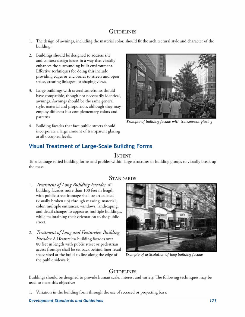
DevelopmentStandardsandGuidelines 171
GuidelineS
1. Thedesignofawnings,includingthematerialcolor,shouldfitthearchitecturalstyleandcharacterofthebuilding.
2. Buildingsshouldbedesignedtoaddresssiteandcontextdesignissuesinawaythatvisuallyenhancesthesurroundingbuiltenvironment.Effectivetechniquesfordoingthisincludeprovidingedgesorenclosurestostreetsandopenspace,creatinglinkages,orshapingviews.
3. Largebuildingswithseveralstorefrontsshouldhavecompatible,thoughnotnecessarilyidentical,awnings.Awningsshouldbethesamegeneralstyle,materialandproportion,althoughtheymayemploydifferentbutcomplementarycolorsandpatterns.
4. Buildingfacadesthatfacepublicstreetsshouldincorporatealargeamountoftransparentglazingatalloccupiedlevels.
Visual Treatment of large‑scale Building Forms
intentToencouragevariedbuildingformsandprofileswithinlargestructuresorbuildinggroupstovisuallybreakupthemass.
StandardS1. Treatment of Long Building Facades:All
buildingfacadesmorethan100feetinlengthwithpublicstreetfrontageshallbearticulated(visuallybrokenup)throughmassing,material,color,multipleentrances,windows,landscaping,anddetailchangestoappearasmultiplebuildings,whilemaintainingtheirorientationtothepublicstreet.
2. Treatment of Long and Featureless Building Facades:Allfeaturelessbuildingfacadesover80feetinlengthwithpublicstreetorpedestrianaccessfrontageshallbesetbackbehindlinerretailspacesitedatthebuild-tolinealongtheedgeofthepublicsidewalk.
GuidelineSBuildingsshouldbedesignedtoprovidehumanscale,interestandvariety.Thefollowingtechniquesmaybeusedtomeetthisobjective:
1. Variationinthebuildingformthroughtheuseofrecessedorprojectingbays.
Example of building facade with transparent glazing
Example of articulation of long building facade
172 DevelopmentStandardsandGuidelines
2. Expressionofarchitecturalorstructuralmodulesanddetail.
3. Diversityofwindowsize,shape,orpatternsthatmayrelatetointeriorfunctions.
4. Windowsrecessedbehindtheprimarywallplane.
5. Emphasisofbuildingentriesthroughprojectingorrecessedforms,detailcolor,ormaterial.
6. Variationsofmaterial,materialmodules,visiblejointsanddetails,surfacerelief,color,andtexturetobreakuplargebuildingformsandwallsurfaces.Appropriatedetailingfeaturesincludesills,headers,beltcourses,reveals,pilasters,windowbays,andsimilarfeatures.
special Building Type: schools
intentTocreatetechnologicallyadvanced,sustainable,urban-scaleschoolfacilitiesthatprovideaccessibleeducationalopportunitiestotheneighborhoodsinandaroundthetransitdistrict.
StandardS1. School Facility Size:The5,500dwellingunitsenvisionedintheplancouldgenerateupto500
additionalstudentsingradesPreK–8.Theurbanschoolshallbedesignedandconstructedtoastate-ratedcapacityof600–800students.
2. School Facility Elements:ThePreK–8schoolshallcontainthethreecriticalelementsofatraditionalmiddleschoolfacility:scienceclassrooms,computerlabs,andagymnasiumwithafullbasketballcourt.
GuidelineS1. Asharedparkingarrangementfortheschoolispreferable;PrinceGeorge’sCountyPublicSchoolsshould
coordinateparkingarrangementswithnearbyparkingfacilityoperators.On-siteparkingshouldbediscouragedexceptforphysicallychallengedemployees.
2. Schoolclassroomsforolderstudentsshouldbelocatedontheupperfloorswithyoungerstudentsassignedtoclassroomsonthelowestfloorsforsafety.
3. Aschoolbusloading/unloadingfacilityshouldbelocatedoff-streetandalongsidetheschool.
4. M-NCPPCandpublicschoolsshouldworkwithpropertyownersintheNorthHillsideResidentialNeighborhoodtoidentifytheoptimalacreageneededtosupportaschool.Acquisitionoftheurbanschoolsitewilloccurduringthepreliminaryplanofsubdivision,preferablythroughthededicationoftheneededacreagefromthepropertyownertothePrinceGeorge’sCountyBoardofEducation.
5. DedicationoftheurbanschoolsitetotheBoardofEducationshouldnotprecludetheabilityofthepropertyownertofullydeveloptheirpropertytotheextentenvisionedintheplan.
6. Theurbanschoolshouldcontaineitheron-siteopenspaceorbeadjacenttoanM-NCPPCparkfacility.Theschoolsiteshouldcontain75squarefeetofopenspaceperstudentorbeadjacenttoapark/openspacefacilitywithequivalentacreage.On-siteopenspaceincludesanyoutdoorrecreationalfacilitiesincludedontheroofoftheschoolbutnotindoorrecreationalfacilitiessuchasagymnasiumormultipurposeroom.
7. TheurbanschoolsiteshouldbewithinreasonablewalkingdistanceoftheMetrostationandpublicparking.
DevelopmentStandardsandGuidelines 173
Functional relationship of Multifamily and other residential Buildings to surrounding Public spaces
intentToensurethattheformandscaleofnewmultifamilyandsingle-familyresidentialarchitecturereinforcesthedesiredcharacterofstreetsandopenspacewithintheNewCarrolltonTDOZ.
StandardS1. Safety-Conscious Residential Building Design:Residentialbuildingsshallbedesignedtofacilitate
effectivevisualsurveillanceofallattachedprivateareasandadjacentpublicareas.
2. Taller Buildings and Solar Access:Multifamilyresidentialandnonresidentialbuildingsshallbesitedtominimizethecastingofsolarshadowsoveradjacentsingle-familydwellingsandoutdoorpublicspacessuchasplazasandcivicgreens.
3. Multifamily Buildings and Balconies:Allmultifamilybuildingsshouldprovideabalconyforeachdwellingunitabovethegroundfloortoarticulatethebuildingfacadeandtoincreasenaturalsurveillanceofthesurroundingarea.
4. Garage and Carport Visual Integration: Themassing,materials,anddetailsofagarageorcarportmustbevisuallyintegratedintothebuildingformoftheresidencetowhichitisattached.
5. Garage Door Design:Garagedoorsshallbevisuallyde-emphasizedbybreakingthemupintosmallerdoors(one-carbaysorcarriage-styledoors),incorporatingthedoorsintothearchitecturalcharacteroftheprimarystructure,placingotherarchitecturalfeaturessuchasporches,windowbays,andupperfloorsforwardofthegarage,deeplyrecessingfrontgarageentries,ororientingthegaragetothesideorrear.
GuidelineS1. Residentialbuildingsshouldbedesignedtoprovidevisualinterest,varietyandcompatibilitywiththe
humanscale.
2. Ground-floorresidentialunitsthatadjoinapublicstreetoropenspaceshouldhavedirectstreetorpublicspaceaccess.
3. Visibilityofpublicspacesfromwithinresidencesshouldpromoteasenseofpersonalandcommunitysafety.Themoreactivespaceswithintheresidencesshouldbeplacednexttothepublicstreetsandopenspacesandbeconnectedvisuallybycloselyspaceddoorandwindowopenings.
4. Newresidencesshouldbedesignedtocomplementandenhancetheadjacentnaturalenvironment,especiallytheLowerBeaverdamCreekwatershed.
5. Wheneverpossible,publicplazasandcivicsquaresshouldbelocatedonthesouthsideofnearbytallbuildingstomaximizewintertimesolarexposureandkeepthesespacesfrombecomingshadowed,dead,andcoldduringthewintermonths.
174 DevelopmentStandardsandGuidelines
Building Facade Treatments
intentTomandatetheuseofmaterialsandarchitecturaldetailswhichareappropriatetoabuilding’suse,location,andsurroundingcontext,andwhichareenvironmentallyfriendly.
StandardS1. Permitted Building Facade Materials:Street-facingbuildingfacadesshallbefacedwithquality
materialssuchasbrick,stone,ormasonry.
2. Prohibited Building Facade Materials:Tilt-upconcretepanels,smooth-facedconcretemasonrypanels,mirroredglassstucco,wood,EIFS(exteriorinsulatingfinishingsystem),concretemasonryunits,imitationorsyntheticstoneorbrickveneers,andprefabricatedmetalpanelsshallnotbepermitted.
3. Transparency in Expression of Material Properties:Allbuildingmaterialsshallvisuallyexpresstheirspecificproperties.Forexample,strongerandheaviermaterialsshallbeplacedbeneathweaker,lightermaterials.
4. Universal Compliance of (Franchise Outlet Design) Building Facades with TDDP Architectural Standards:Theexteriorfacadesandsignageofallmixed-useandnonresidentialbuildingsmustcomplywiththeTDDParchitecturalstandards.Trademarkfranchiseoutletsshallnotbepermittedexceptasancillaryretailuseshousedinlargercommercialormixed-usecommercialbuildings.Inaddition,theirexteriorfacadesandsignagemustcomplywiththeTDDParchitecturalstandards.
5. Building Frontages as Storefronts:Facadesonretailfrontagesshallbedetailedasstorefronts.Nolessthan70percentofgroundfloorretailfrontageshallbeglazedwithclearglass.
6. Parking Structure Designed as Part of a Main Building:Aparkingstructuredesignedaspartofamainbuildingmustbeintegratedwiththatbuildinginarchitecturaldesignandmaterialsutilized.
7. Integration of Architectural Components:Architecturalcomponentsshallnotappeartobestuckontothebuildingfacade;instead,theyshallappearasintegralelementsofthebuilding.
GuidelineS1. Thehighestlevelofarchitecturaldetailshouldoccuradjacenttoareasofpedestrianactivity.
2. Mixed-useresidentialandnonresidentialbuildingsshouldincludegreenbuildingfeaturessuchasgreenroofs,renewableenergysystems,andenergyconservationfeaturesintheirdevelopmentstoreduceenvironmentalimpactsandresourcecosts.DevelopersareencouragedtoseekLEEDcertificationasapotentialmarketingtoolfortheirprojects.
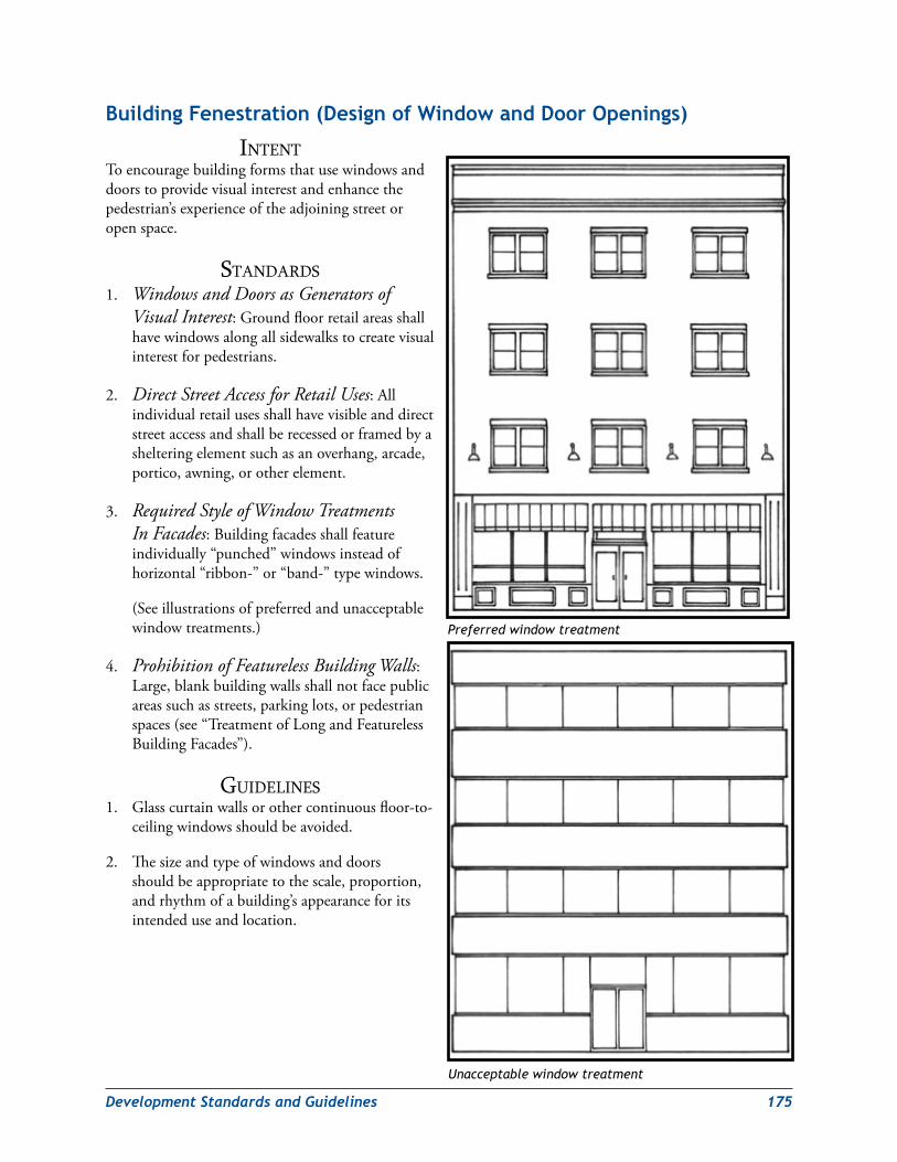
DevelopmentStandardsandGuidelines 175
Building Fenestration (design of window and door openings)
intentToencouragebuildingformsthatusewindowsanddoorstoprovidevisualinterestandenhancethepedestrian’sexperienceoftheadjoiningstreetoropenspace.
StandardS1. Windows and Doors as Generators of
Visual Interest:Groundfloorretailareasshallhavewindowsalongallsidewalkstocreatevisualinterestforpedestrians.
2. Direct Street Access for Retail Uses:Allindividualretailusesshallhavevisibleanddirectstreetaccessandshallberecessedorframedbyashelteringelementsuchasanoverhang,arcade,portico,awning,orotherelement.
3. Required Style of Window Treatments In Facades:Buildingfacadesshallfeatureindividually“punched”windowsinsteadofhorizontal“ribbon-”or“band-”typewindows.
(Seeillustrationsofpreferredandunacceptablewindowtreatments.)
4. Prohibition of Featureless Building Walls:Large,blankbuildingwallsshallnotfacepublicareassuchasstreets,parkinglots,orpedestrianspaces(see“TreatmentofLongandFeaturelessBuildingFacades”).
GuidelineS1. Glasscurtainwallsorothercontinuousfloor-to-
ceilingwindowsshouldbeavoided.
2. Thesizeandtypeofwindowsanddoorsshouldbeappropriatetothescale,proportion,andrhythmofabuilding’sappearanceforitsintendeduseandlocation.
Preferred window treatment
Unacceptable window treatment
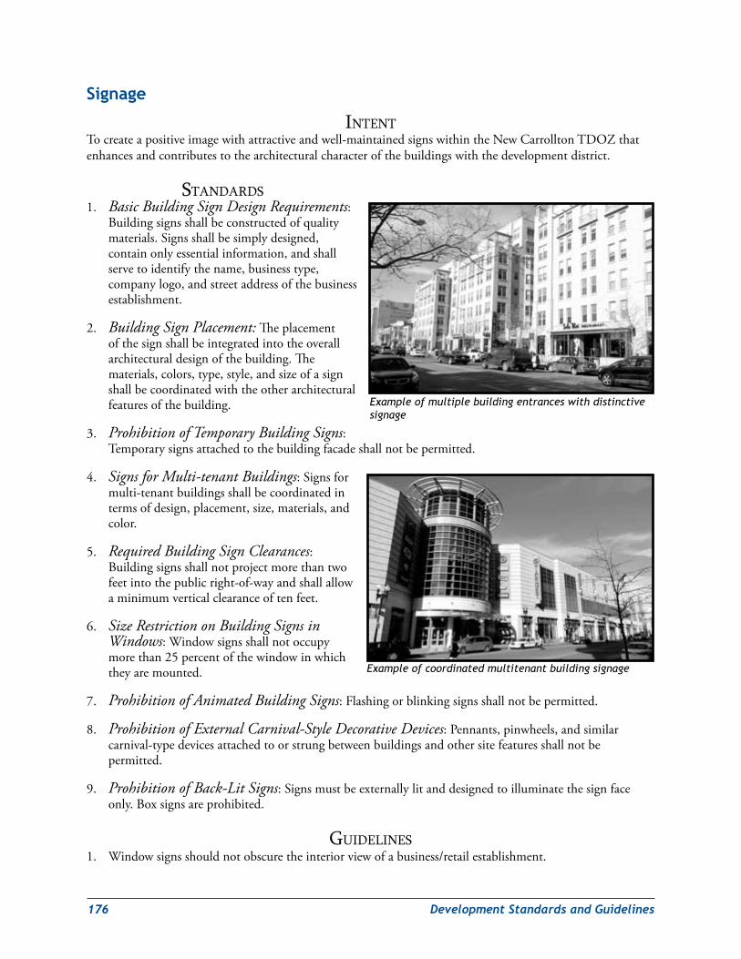
176 DevelopmentStandardsandGuidelines
signage
intentTocreateapositiveimagewithattractiveandwell-maintainedsignswithintheNewCarrolltonTDOZthatenhancesandcontributestothearchitecturalcharacterofthebuildingswiththedevelopmentdistrict.
StandardS1. Basic Building Sign Design Requirements:
Buildingsignsshallbeconstructedofqualitymaterials.Signsshallbesimplydesigned,containonlyessentialinformation,andshallservetoidentifythename,businesstype,companylogo,andstreetaddressofthebusinessestablishment.
2. Building Sign Placement:Theplacementofthesignshallbeintegratedintotheoverallarchitecturaldesignofthebuilding.Thematerials,colors,type,style,andsizeofasignshallbecoordinatedwiththeotherarchitecturalfeaturesofthebuilding.
3. Prohibition of Temporary Building Signs:Temporarysignsattachedtothebuildingfacadeshallnotbepermitted.
4. Signs for Multi-tenant Buildings:Signsformulti-tenantbuildingsshallbecoordinatedintermsofdesign,placement,size,materials,andcolor.
5. Required Building Sign Clearances:Buildingsignsshallnotprojectmorethantwofeetintothepublicright-of-wayandshallallowaminimumverticalclearanceoftenfeet.
6. Size Restriction on Building Signs in Windows:Windowsignsshallnotoccupymorethan25percentofthewindowinwhichtheyaremounted.
7. Prohibition of Animated Building Signs:Flashingorblinkingsignsshallnotbepermitted.
8. Prohibition of External Carnival-Style Decorative Devices:Pennants,pinwheels,andsimilarcarnival-typedevicesattachedtoorstrungbetweenbuildingsandothersitefeaturesshallnotbepermitted.
9. Prohibition of Back-Lit Signs:Signsmustbeexternallylitanddesignedtoilluminatethesignfaceonly.Boxsignsareprohibited.
GuidelineS1. Windowsignsshouldnotobscuretheinteriorviewofabusiness/retailestablishment.
Example of multiple building entrances with distinctive signage
Example of coordinated multitenant building signage
DevelopmentStandardsandGuidelines 177
security‑Conscious Building design
intentTobalancebuildingsecuritywithattractivebuildingdesigntoavoidtheunattractive“crimescene”lookofdecliningneighborhoodcommercialdistricts.
StandardS1. Restrictions on Replacement of Existing Windows:Existingwindowsshallnotbeblockedinor
replacedwithsmallerwindows.Replacementwindowsshallmatchtheexistingwindowindesign,materials,andsizeascloselyaspossible.
2. Prohibition of Exterior Security Features on Windows and Doors:Exteriorsecurityorburglarbarsonwindowsanddoorsshallnotbepermitted.Roll-upsecuritydoorsshallnotbepermitted.
GuidelineS1. Alternativemeansofbuildingsecurityincludingsafetyglass,lighting,andelectronicsurveillanceshould
beconsideredinplaceofsecuritybarsandroll-updoorsoverground-floorwindowsanddoors.
2. Securityscreensanddoorsshouldbeattractiveandcomplementthebuildingsonwhichtheyareinstalled.
Lighting
intentToincorporatelightingasadistinctiveandcharacter-definingelementthatenhancespublicsafetyandminimizeslightpollutionintheNewCarrolltonTDOZ.
StandardS1. Building Lighting as a Required Architectural Feature:Lightingshallbepartoftheoverall
architecturaldesignofallbuildingswithintheTDOZ.
2. CPTED Considerations in the Design of Building Lighting:Lightingshallprovideadequatesafetyandvisibilityaroundbuildingentrancesandperimeters.Exteriorlightingfixturesshallbedesignedandplacedtoavoidblindspots,minimizeglare,andeliminateshadows.
3. Control of Glare from High-Intensity Building Lighting Fixtures:High-intensitylightfixturesontheexteriorofabuildingshalldirectglareawayfromnearbyresidentialareas.
GuidelineS1. Inresidentialareasandmixed-useddevelopmentsthatincluderesidentialuses,signageshouldbelocated
andilluminatedtoavoidglareintonearbyresidentialareas.
2. Allparkingstructuresandsurfaceparkinglotsshouldbewelllit,especiallyatentrances,instairwells,andonvehicleramps.
3. Outdoorserviceareasshouldbewelllit.
178 DevelopmentStandardsandGuidelines
CrimePreventionThroughEnvironmentalDesignGuidelinesSecurityrelatestothoseaspectsofacommunity’sbuiltenvironmentthatpromoteboththeperceptionandtherealityofpersonalandpublicsafety.Securecommunitiesareattractiveplacesthatencouragethecontinuousandactiveuseofpublicandprivatespacebyresidents,workers,andvisitors.Suchactiveuseprovidesconstantinformalsurveillance—“eyesonthestreet”—andhelpstoreduceoreliminateopportunitiesforcrime.
CrimePreventionThroughEnvironmentalDesign(CPTED)isadesignmethodologythatfocusesonreducingopportunitiesforcrime,mitigatingfearofcrime,andimprovingqualityoflife.Throughthedesignandmanagementofthephysicalenvironment(buildinguses,residentialandcommercialareas,etc.)andanincreaseinpublicsafetyandeducation,CPTEDprogramshavebeenshowntoincreasecommunitysecurity.FourbasicprinciplesofCPTEDshouldbeconsideredduringsiteplanninganddesign:territoriality,naturalsurveillance,accesscontrol,andplacemaking.
1. Territorialityinvolvesdesigningphysicalattributesthatexpressownership,suchasfencing,signage,landscaping,andpavementtreatments.Physicalelementscanextendanareaofterritorialinfluenceandpotentialoffendersperceivethatareaasundesirable.Awell-maintainedhome,building,orcommunitycreatesasenseofownership,whichhelpstodetercriminals.
Provide clear border definition of controlled space.Thereareseveralwaysthiscanbeachievedincludingfences,plantings,lawn,tactilesurfaces,etc.Thesetypesofboundariesallowpeopletorecognizethattheyaretransitioningfrompublictoprivatespace.Creatingasenseofownershipordefensiblespaceisencouragedtodeterundesiredbehavior.
Provide clearly marked transitional zones.Identifypublic,semi-public,semi-private,andprivatespaces.Controlledspacemustbedemarcatedinordertomoveusersthroughtheenvironment.
Design building and site to encourage interaction.Thiswillprovideopportunitiesforthecommunitytobecomemorefamiliarwiththeirenvironmentandhelpbuildasenseofownership.
Clearly identify buildings, open space, and major circulation paths (bike path, crosswalks, etc.).Usesignageandmarkersthatareeasilyobservedfromthestreet.Thiswillidentifyareasandtheirprogrammeduses.
2. Naturalsurveillanceistheplacementofphysicalfeatures,activities,andpeopleinsuchawayastomaximizevisibility.Apotentialcriminalislesslikelytoattemptacrimeifheorsheisatriskofbeingobserved.Atthesametime,wearelikelytofeelsaferwhenwecanseeothersandbeseenbyothers.
Use physical features, activities, and people in ways that maximize the ability to see.Thiswillhelpdiscourageundesiredbehavior.Theuseofvegetationheights,streetfurniture,andbuildinglayoutcanhelpincreaseeyesontheactivities.
Design security zones that respond to the building and site relationships.Thefocusisoncreatingnaturalsurveillancesolutionsfromthestreettothebuildingfacade.
Improve sightlines.Thereshouldbeclearviewsofsurroundingareas.Designpermeablebarriersthatdonotrestrictvision.Avoidfeatures(tallvegetation,fences,etc.)thatblocksightlinesandmajoraccesspoints.
Lighting design must be incorporated into developments to ensure safety and security.Placementoflightingiscriticaltopedestrianpathways,roads,andpotentialentrapmentspaces.
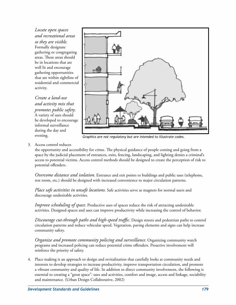
DevelopmentStandardsandGuidelines 179
Locate open spaces and recreational areas so they are visible.Formallydesignategatheringorcongregatingareas.Theseareasshouldbeinlocationsthatarewelllitandencouragegatheringopportunitiesthatarewithinsightlineofresidentialandcommercialactivity.
Create a land-use and activity mix that promotes public safety.Avarietyofusesshouldbedevelopedtoencourageinformalsurveillanceduringthedayandevening.
3. Accesscontrolreducestheopportunityandaccessibilityforcrime.Thephysicalguidanceofpeoplecomingandgoingfromaspacebythejudicialplacementofentrances,exits,fencing,landscaping,andlightingdeniesacriminal’saccesstopotentialvictims.Accesscontrolmethodsshouldbedesignedtocreatetheperceptionofrisktopotentialoffenders.
Overcome distance and isolation.Entranceandexitpointstobuildingsandpublicuses(telephone,restroom,etc.)shouldbedesignedwithincreasedconveniencetomajorcirculationpatterns.
Place safe activities in unsafe locations.Safeactivitiesserveasmagnetsfornormalusersanddiscourageundesirableactivities.
Improve scheduling of space.Productiveusesofspacesreducetheriskofattractingundesirableactivities.Designedspacesandusescanimproveproductivitywhileincreasingthecontrolofbehavior.
Discourage cut-through paths and high-speed traffic.Designstreetsandpedestrianpathstocontrolcirculationpatternsandreducevehicularspeed.Vegetation,pavingelementsandsignscanhelpincreasecommunitysafety.
Organize and promote community policing and surveillance.Organizingcommunitywatchprogramsandincreasedpolicingcanreducepotentialcrimeoffenders.Proactiveinvolvementwillreinforcethepriorityofsafety.
4. Placemakingisanapproachtodesignandrevitalizationthatcarefullylooksatcommunityneedsandintereststodevelopstrategiestoincreaseproductivity,improvetransportationcirculation,andpromoteavibrantcommunityandqualityoflife.Inadditiontodirectcommunityinvolvement,thefollowingisessentialtocreatinga“greatspace”:usesandactivities,comfortandimage,accessandlinkage,sociabilityandmaintenance.(UrbanDesignCollaborative,2002)
Graphics are not regulatory but are intended to illustrate codes.
180 DevelopmentStandardsandGuidelines
Create places that are physically compact in design.Developmentofplacemakingconceptslendsitselftonaturalsurveillance.Eyesonthestreetandconnectivitycanbeachievedwithspecialattentiontobuildinglayoutandcirculationpatterns.
Create centers of mixed-use developments near a variety of residential densities.Thisencouragesmorepedestriantravelandactiveareasnearneighborhoods.Designusescreateactivityduringdayandnighthours.Mixingcommercial,retail,education,andrecreationwithhousingallowspeopletosatisfydailyneedswithouthavingtotravelfardistances.Thesecentersbecomeamorelivelyandsafeenvironment.
Create a multimodal transportation network.Walkways,bicyclepaths,andstreetconnectivityencouragenon-autotravelbyofferingalternativeroutesthatconnecttohousing,employment,commercialservices,schools,parks,andpublictransportation.
Design pedestrian-scaled environments.Developmentshouldbedesignedtothecomfortandscaleofpeople.Vegetation,streetfurniture,lighting,andotherelementscanbeusedtoenhanceapedestrianenvironment.Thesedesignfeaturescanalsoreinforceacommunity’sidentityandhistory.
Design facility maintenance into each development project and review maintenance programs on a routine basis.Asuccessfulcomponentofplacemakingistoensurethataprogramisimplementedandissuccessfullymanagedbeyondthedesignphaseforfuturegenerationstoenjoy.
Education and community involvement is critical in the success of a “great space.”Outreachmeetingsshouldbeintegratedintothedesignprocesstodevelopanalysisofusersandpotentialsolutions.Residentsshouldformneighborhoodcommitteestoensurecontinuedinterestoncetheimplementationstrategieshavebeenestablished.
Source: National CPTED Association, Atlas Safety and Security Design, and Urban Design Collaborative
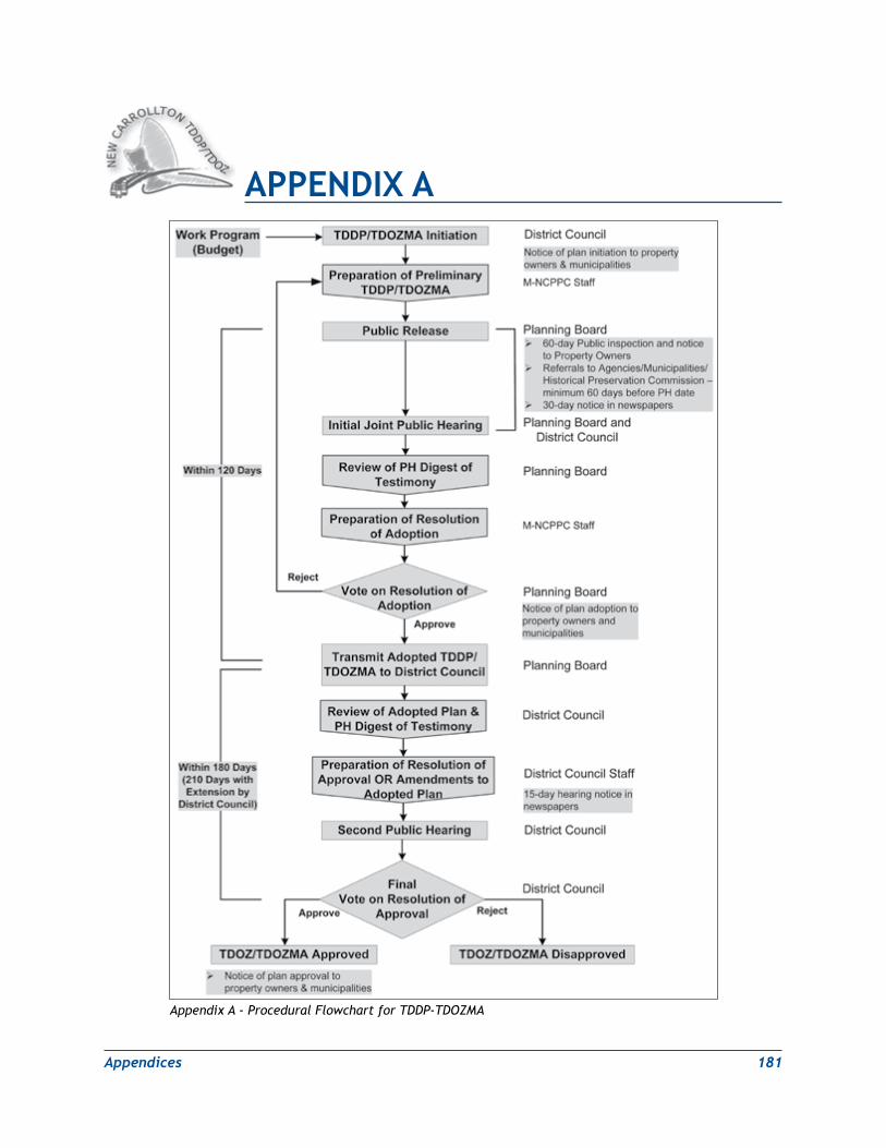
Appendices 181
APPeNdix A
Appendix A - Procedural Flowchart for TDDP-TDOZMA
182 Appendices
leadership in energy and environmental design (leed) Background and environmental site design (esd) Guidelines
A. leadership in energy and environmental design (leed) Certification ProgramAcrosstheUnitedStates,risingenergycostsandconcernsoverthepotentiallocalimpactsofglobalwarminghaveheightenedcallsbyenvironmentalorganizations,communitygroups,forward-lookingbusinessleaders,andcommunityresidentsforenergyconservationandefficiency.Inresponsetothischallenge,in2009theStateofMarylandpassedlegislationthatrequirestheMarylandDepartmentoftheEnvironmenttodevelopaplantoreducestategreenhousegasemissionsby25%below2006levelsby2020.Alteringthedesign,construction,operation,andsittingofbuildingspresentsanunprecedentedopportunitytoaddressthesecallsandachievethesegoals.AccordingtotheU.S.EnvironmentalProtectionAgency(EPA),buildings
aloneaccountfor36%oftotalenergyuse,68%oftotalelectricityconsumptionand38%oftotalcarbondioxideemissionsintheU.S.Locatingbuildingsnexttoaccessibletransitandmixinguses(suchasresidential,office,andretail)alsohasthepotentialtodramaticallyreduceenergyuseandemissions.OneofthemostprominentgreenbuildingandneighborhooddevelopmentadvocatesinthecountryistheU.S.GreenBuildingCouncil(USGBC),amemberorganizationcomposedof18,000companiesandorganizations,80localchaptersandaffiliates,and155,000LEEDcredentialedprofessionals.Topromoteandfacilitateenvironmentallyandsociallyresponsible,healthy,andprosperousbuiltenvironments,USGBCcreatedanewumbrellaratingsystem–LeadershipinEnergyandEnvironmentalDesign(LEED).LEEDisacertificationprogramandnationallyrecognizedratingsystemforthedesign,constructionandoperationofhighperformancegreenbuildings.LEEDpromotessustainableandenvironmentallyresponsibledevelopmentbyrecognizingabuilding’sperformanceinsitedevelopment,waterandenergyefficiency,materialsselectionandindoorenvironmentalquality.Greendesignandconstructionconfersnotonlyhealthandenvironmentalbenefits,butalsogenerateseconomicdividends.Itreducesoperatingcosts,improvesastructure’slongevity,andcanenhancebuildingmarketabilityandoccupantproductivity.Certifyingabuildingand/ordevelopmentmayqualifyabuilderforahostofstateandlocalgovernmentinitiativesandincentivesaswellasincreaseitsvalueandexposuretopotentialclientsand/orbuyers.Additionalinformationisavailableathttp://www.usgbc.org.TheGeneralPlan-designatedNewCarrolltonMetropolitanCenter’sstrategiclocationandtransitaccess,anddevelopablesitesmakeLEEDforNeighborhoodDevelopment(LEEDND)andLEEDforNewConstructionthetwomostpertinentLEEDratingsystemsfortheNewCarrolltonTransitDistrictDevelopmentPlan.
LEED building plaque
APPeNdix B
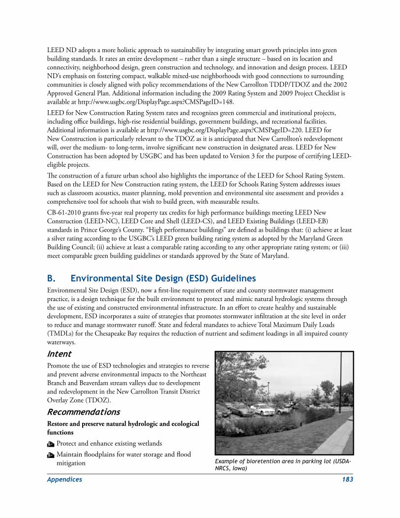
Appendices 183
LEEDNDadoptsamoreholisticapproachtosustainabilitybyintegratingsmartgrowthprinciplesintogreenbuildingstandards.Itratesanentiredevelopment–ratherthanasinglestructure–basedonitslocationandconnectivity,neighborhooddesign,greenconstructionandtechnology,andinnovationanddesignprocess.LEEDND’semphasisonfosteringcompact,walkablemixed-useneighborhoodswithgoodconnectionstosurroundingcommunitiesiscloselyalignedwithpolicyrecommendationsoftheNewCarrolltonTDDP/TDOZandthe2002ApprovedGeneralPlan.Additionalinformationincludingthe2009RatingSystemand2009ProjectChecklistisavailableathttp://www.usgbc.org/DisplayPage.aspx?CMSPageID=148.LEEDforNewConstructionRatingSystemratesandrecognizesgreencommercialandinstitutionalprojects,includingofficebuildings,high-riseresidentialbuildings,governmentbuildings,andrecreationalfacilities.Additionalinformationisavailableathttp://www.usgbc.org/DisplayPage.aspx?CMSPageID=220.LEEDforNewConstructionisparticularlyrelevanttotheTDOZasitisanticipatedthatNewCarrollton’sredevelopmentwill,overthemedium-tolong-term,involvesignificantnewconstructionindesignatedareas.LEEDforNewConstructionhasbeenadoptedbyUSGBCandhasbeenupdatedtoVersion3forthepurposeofcertifyingLEED-eligibleprojects.TheconstructionofafutureurbanschoolalsohighlightstheimportanceoftheLEEDforSchoolRatingSystem.BasedontheLEEDforNewConstructionratingsystem,theLEEDforSchoolsRatingSystemaddressesissuessuchasclassroomacoustics,masterplanning,moldpreventionandenvironmentalsiteassessmentandprovidesacomprehensivetoolforschoolsthatwishtobuildgreen,withmeasurableresults.CB-61-2010grantsfive-yearrealpropertytaxcreditsforhighperformancebuildingsmeetingLEEDNewConstruction(LEED-NC),LEEDCoreandShell(LEED-CS),andLEEDExistingBuildings(LEED-EB)standardsinPrinceGeorge’sCounty.“Highperformancebuildings”aredefinedasbuildingsthat:(i)achieveatleastasilverratingaccordingtotheUSGBC’sLEEDgreenbuildingratingsystemasadoptedbytheMarylandGreenBuildingCouncil;(ii)achieveatleastacomparableratingaccordingtoanyotherappropriateratingsystem;or(iii)meetcomparablegreenbuildingguidelinesorstandardsapprovedbytheStateofMaryland.
B. environmental site design (esd) GuidelinesEnvironmentalSiteDesign(ESD),nowafirst-linerequirementofstateandcountystormwatermanagementpractice,isadesigntechniqueforthebuiltenvironmenttoprotectandmimicnaturalhydrologicsystemsthroughtheuseofexistingandconstructedenvironmentalinfrastructure.Inanefforttocreatehealthyandsustainabledevelopment,ESDincorporatesasuiteofstrategiesthatpromotesstormwaterinfiltrationatthesitelevelinordertoreduceandmanagestormwaterrunoff.StateandfederalmandatestoachieveTotalMaximumDailyLoads(TMDLs)fortheChesapeakeBayrequiresthereductionofnutrientandsedimentloadingsinallimpairedcountywaterways.
IntentPromotetheuseofESDtechnologiesandstrategiestoreverseandpreventadverseenvironmentalimpactstotheNortheastBranchandBeaverdamstreamvalleysduetodevelopmentandredevelopmentintheNewCarrolltonTransitDistrictOverlayZone(TDOZ).
RecommendationsRestore and preserve natural hydrologic and ecological functions
W ProtectandenhanceexistingwetlandsW Maintainfloodplainsforwaterstorageandfloodmitigation Example of bioretention area in parking lot (USDA-
NRCS, Iowa)
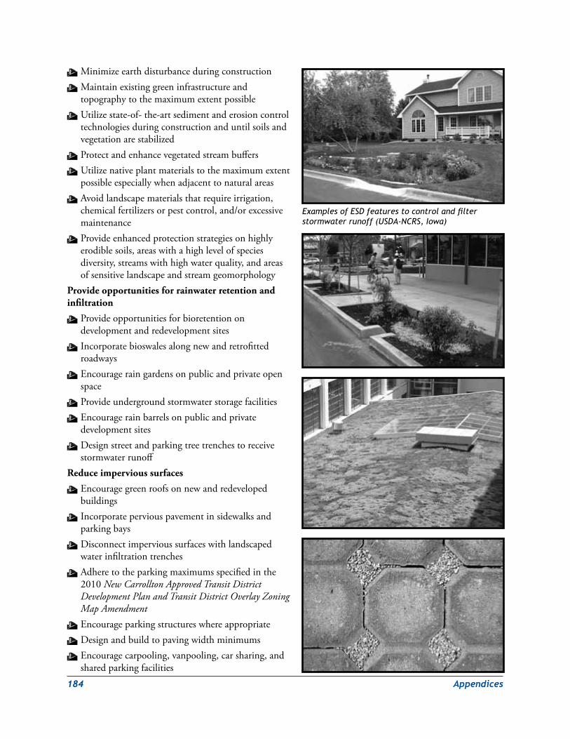
184 Appendices
W MinimizeearthdisturbanceduringconstructionW Maintainexistinggreeninfrastructureandtopographytothemaximumextentpossible
W Utilizestate-of-the-artsedimentanderosioncontroltechnologiesduringconstructionanduntilsoilsandvegetationarestabilized
W ProtectandenhancevegetatedstreambuffersW Utilizenativeplantmaterialstothemaximumextentpossibleespeciallywhenadjacenttonaturalareas
W Avoidlandscapematerialsthatrequireirrigation,chemicalfertilizersorpestcontrol,and/orexcessivemaintenance
W Provideenhancedprotectionstrategiesonhighlyerodiblesoils,areaswithahighlevelofspeciesdiversity,streamswithhighwaterquality,andareasofsensitivelandscapeandstreamgeomorphology
Provide opportunities for rainwater retention and infiltration
W Provideopportunitiesforbioretentionondevelopmentandredevelopmentsites
W Incorporatebioswalesalongnewandretrofittedroadways
W Encourageraingardensonpublicandprivateopenspace
W ProvideundergroundstormwaterstoragefacilitiesW Encouragerainbarrelsonpublicandprivatedevelopmentsites
W Designstreetandparkingtreetrenchestoreceivestormwaterrunoff
Reduce impervious surfaces
W Encouragegreenroofsonnewandredevelopedbuildings
W Incorporateperviouspavementinsidewalksandparkingbays
W Disconnectimpervioussurfaceswithlandscapedwaterinfiltrationtrenches
W Adheretotheparkingmaximumsspecifiedinthe2010New Carrollton Approved Transit District Development Plan and Transit District Overlay Zoning Map Amendment
W EncourageparkingstructureswhereappropriateW DesignandbuildtopavingwidthminimumsW Encouragecarpooling,vanpooling,carsharing,andsharedparkingfacilities
Examples of ESD features to control and filter stormwater runoff (USDA-NCRS, Iowa)
Appendices 185
Redevelop in response to existing and created microclimate conditions
W Utilize“whiteroofs”whereappropriateW PlantshadetreestoreduceenergyconsumptioninbuildingsandtoprovidedesirableoutdoorspacesW ProvidevegetationwhereappropriatetobufferharshwinterwindsW OrientopenspacesandbuildingstotakeadvantageofsolarwarmingandcoolingbreezesW Donotsiteororientbuildingstocreatewindtunnelsorsunlesscanyons
Promote long-term sustainability
W Siteanddevelopurbanopenspacesandparksaspartofaconnectedsystemwithmulti-modalaccessibilityasappropriate
W DevelopmaintenanceandmanagementplansforparksandopenspaceW Organizepublic/privatepartnershipstoconstructhighlyvisibleESDprojectsthatpromotecommunitysupportandeducation
W Supporttheformationofcommunitygrassrootsorganizationsthatcontributetotheon-goingdevelopmentandmaintenanceofparklandandopenspace
186 Appendices
APPeNdix CProposed Bonus density Program for the New Carrollton Transit district overlay Zone Metro CoreThe following outlines the proposed density bonus program for commercial, mixed‑use and residential development in the Metro Core neighborhood of the New Carrollton Transit district overlay Zone.
1. Purpose
Thepurposeofthedensitybonusprogramistoincentivizetheprovisionofpublicbenefits–newworkforcehousingandopportunitiesforlocalbusinesses–withintheNewCarrolltonMetroCoreneighborhoodinaccordancewiththegoalsandstrategiesoftheNewCarrolltonTransitDistrictDevelopmentPlan(TDDP).
2. Objectives
W Toproducemixed-income,workforcehousingopportunitiesforPrinceGeorge’sCountyresidentsandworkersincloseproximitytotheNewCarrolltonMetrostation.
W Toprovideeconomicopportunitiesforlocalbusinessesandexpandemploymentoptionsforlocalresidents.
3. Definitions
W “Workforcehousingunit”meansaunitsetasideforsaleorrenttomoderate-incomehouseholdsasdefinedbythedensitybonusprogram.
W “Moderate-incomehousehold”meansahouseholdofoneormoreindividualswithatotalannualincomeadjustedforhouseholdsizeequaltobetween60%and100%oftheAreaMedianIncome(AMI)asdefinedbytheU.S.DepartmentofHousingandUrbanDevelopmentfortheWashington,DCmetropolitanarea.
W “Localbusiness”meansaprivatefor-profitfirmorenterpriseownedatleast51%byoneormoreresidentsofPrinceGeorge’sCounty,Marylandwithnocorporateornationalheadquartersoutsidethecounty,andlicensedtooperatewithinthecounty.
4. Applicability
Thedensitybonusprogramappliestoallnewresidential,commercial,andmixed-useconstructionintheMetroCoreareaasdesignatedbytheNewCarrolltonTransitDistrict
DevelopmentPlan(seeMap1.MetroCoreNeighborhood).Allpublicbenefitsgeneratedbythedensitybonusprogramshallbeprovidedon-site.
5. Exemptions
Thefollowingshallbeexemptfromtherequirementsofthedensitybonusprogram:
Appendices 187
W Allnewdevelopmentthatdoesnotincluderesidential,commercial,ormixedresidential/commercialuses.
W Allnewdevelopmentbyfederal,stateorcountyagenciesorforfederalorstatetenants.
W ProjectsforwhichDetailedSitePlanswereapprovedpriortotheeffectivedateofapprovaloftheTDDP.
6. Eligibility
Tobeeligiblerentersorbuyersofworkforcehousingunits,householdsmusthaveatotalannualincomeadjustedforhouseholdsizeequaltobetween60%and100%oftheAreaMedianIncomeasdefinedbytheU.S.DepartmentofHousingandUrbanDevelopment(HUD)fortheWashington,DCmetropolitanarea.
7. Workforce Housing Requirements for Rental Projects
Rentsbasedupontheactualincomeofahouseholdshallbeestablishedsothatthehouseholdwillnotexpendmorethanapproximately30%ofitsannualincomeonrentandutilities.
8. Workforce Housing Requirements for Ownership Units
Purchasepricesbasedupontheactualincomeofahouseholdshallbeestablishedsothatthehouseholdwillnotexpendmorethanapproximately30%ofitsannualincomeonmortgagepayments,includingprincipal,interest,propertyinsuranceandtaxes,homeownerassociationorcondominiumfees,andutilities.
9. Resale Restrictions Applicable to Workforce Ownership Units
Forthesecondandallsubsequentsalesofaworkforcehousingunitforaminimumof30yearsfromthedateofinitialowneroccupancy,theresalepriceshallnotexceedthepurchasepricepaidbyeachsellerplusthecostsoftheimprovementspermittedbyregulationtobeaddedtothepurchaseprice,whichamountshallbeeithermultipliedbythepercentagebywhichtheconsumerpriceindexhasrisenorfallensincethedateonwhichthatsellerpurchasedtheproperty,orcalculatedpursuanttoanotherformulaasdeterminedandpublishedbythePrinceGeorge’sCountyDepartmentofHousingandCommunityDevelopment(DepartmentofHousing).
10. Rental Restrictions for Workforce Ownership Units
WTheownershallinitiallyresideintheworkforceownershipunitforaperiodofnotlessthanfiveyears.
WTheownershallprovidenoticetotheDepartmentofHousingpriortorentingoftheworkforceownershipunitofhisorherintenttorenttheunit.
WTheownershallnotrentorleasetheworkforceunitformorethanoneyearoutofanyseven-yearperiod.
W Anyleaseorrentalagreementfortheleaseorrentalofaworkforceownershipunitpursuanttothissectionshallbeinwriting.
W Anyleaseorrentalagreementshallbesubjecttotheincomerestrictionssetforthinthisprogram.
11. Duration of Provisions
Workforcehousingunitsthatareprovidedshallremainasworkforcehousingforaminimumof30yearsfromthedateofinitialowneroccupancyforownershipworkforcehousingunitsandforthelifeoftheprojectforrentalworkforcehousingunits.
188 Appendices
12. Workforce Housing Unit Requirements
WTheworkforcehousingunitsshallbedistributedthroughouttheresidentialcomponentofabuildingandshallnotconstitutemorethan20%ofthehousingunitsonanyfloorofabuilding.
WThetypeofownershipoftheworkforcehousingunitsshallbethesameasthetypeofownershipfortherestofthehousingunitsinabuilding(i.e.ifthemarket-ratehousingismadeupofowner-occupiedunits,theworkforcehousingshallbemadeupofowner-occupiedunits).
WThedistributionofworkforceunittypesshallbecomparabletothedistributionofmarket-rateunittypes(e.g.ifonebedroomscomprise20%ofthemarket-ratehousing,one-bedroomsshouldcomprise20%oftheworkforcehousing).
W Innocaseshalltheworkforcehousingunitsbemorethan10%smallerthanthecomparabledwellingunitsinabuilding,basedonnumberofbedrooms,orlessthan600squarefeetforaonebedroomunit,800squarefeetforatwobedroomunit,or1,000squarefeetforathreebedroomunit,whicheverisless.
WTheworkforcehousingunitsshallbeavailableforoccupancyinatimeframecomparabletotheavailabilityoftherestofthedwellingunitsinabuilding.
WTheexteriordesign,materials,andfinishoftheworkforcehousingunitsshallbecomparablewiththerestofthedwellingunitsinabuilding.
WTheinterioramenitiesoftheworkforcehousingunitssuchasfinishesandappliancesshallbecomparabletothemarket-rateunits.
W Allworkforcehousingunitsshallbeconstructedon-site.
13. Local Business Requirements
Theprogrammayincludeaprovisiontodedicatesquarefootageinthedevelopmentforlocalandemergingbusinesses.
14. Certificate of Compliance
Priortoissuingacertificateofoccupancy,anagreementinaformacceptabletotheDepartmentofHousingthataddressespricerestrictions,homebuyerortenantqualifications,long-termaffordability,andanyotherapplicabletopicsoftheworkforcehousingunitsshallberecordedwiththeDepartmentofHousing.Thisagreementshallbeacovenantrunningwiththelandandshallbebindingontheassigns,heirsandsuccessorsoftheapplicant.
15. Violations
Theprogramshouldrecitespecificpenaltiesforviolationsoftheprovisions.

Appendices 189
Bike Facility definitions1.BikeLanes—On-roaddedicatedone-waybicyclefacilitiesstripedandsignedinaccordancewiththeAmericanAssociationofStateHighwayandTransportationOfficials(AASHTO)GuidefortheDevelopmentofBicycleFacilities.
2.BufferedBikeLanes—On-roadandoff-roaddedicatedone-waybicyclefacilities.Roadsaresignedandsignalizedforbicycleuse.Bufferedbikelanesarealsoreferredtoascycletracks.
3.BicycleBuffers—Acombinationofphysicalspaceandhorizontalelements,suchasstone,brick,concrete,berms,fencesorwalls,andon-roadstriping,establishedtomitigatetensionbetweenvehicles,bicycles,andpedestrians.
4.SidepathsandMultiusePathways—Off-roadbidirectionalmultiusefacilitiesadjacenttomajorroads.
5.SharedUseRoads—Roadsandsharedspaceusedbybicycleandvehicles.Shareduseroadscancontainpaintedmarkingsontravellanesorbicyclistscanutilizewideoutsidelanesandwideshouldersoron-roadsharedspacethatcanbesignedand/orsignalized).
6.HardSurfaceTrails—Recreationaltrailsandothermultiusebidirectionaltrails.
7.NaturalSurfaceTrails—Unpavedtrailsandfootpathsforhiker,biker,andequestrianuse.
8.WaterTrails—Kayak,boat,andcanoetrailsfornon-motorizedwatercraft.
9.Bicycle-CompatibleRoads—Roadsthataredesignedtobecompatiblewithbicycleandpedestrianfacilitiesandthatfacilitatethesemodesoftransportation.A“bicyclecompatible”roadrecommendationmeansthattheroadshouldincorporatetheappropriateorfeasiblebicyclefacility.AppropriatenessisevaluatedbythePlanningBoardandtheimplementingagencyforeachspecificprojectdependingoncommunityneeds,environmentalconstraints,andright-of-wayconstraints,withfinaldeterminationbytheCountyCouncil.Duetosite-specificconstraints,theroadagenciesfrequentlyneedflexibilitywhendeterminingthemosteffectivewaytoaccommodatebikesalongaparticularroad.
10.Bicycle(Bike)Route—Asegmentofasystemofbikewaysdesignatedbythejurisdictionoragencyhavingauthoritywithappropriatedirectionalandinformationalmarkersandsignage,withorwithoutaspecificbicycleroutenumber.
11.Bikeway—Athoroughfareortrailsuitableforbicyclesthatmayeitherexistwithintheright-of-wayofothermodesoftransportation,suchashighways,oralongseparateandindependentcorridors.
Note: AllfacilitiesareevaluatedaccordingtothestandardsapprovedbythePrinceGeorge’sCountyPlanningBoard,withfinaldeterminationbytheCountyCouncil.FacilitiesonroadsownedandmaintainedbytheMarylandStateHighwayAdministrationandthePrinceGeorge’sCountyDepartmentofPublicWorksandTransportationaresubjecttoreviewbytheirrespectiveagencyforconsistencywiththeiragencystandards.
APPeNdix d

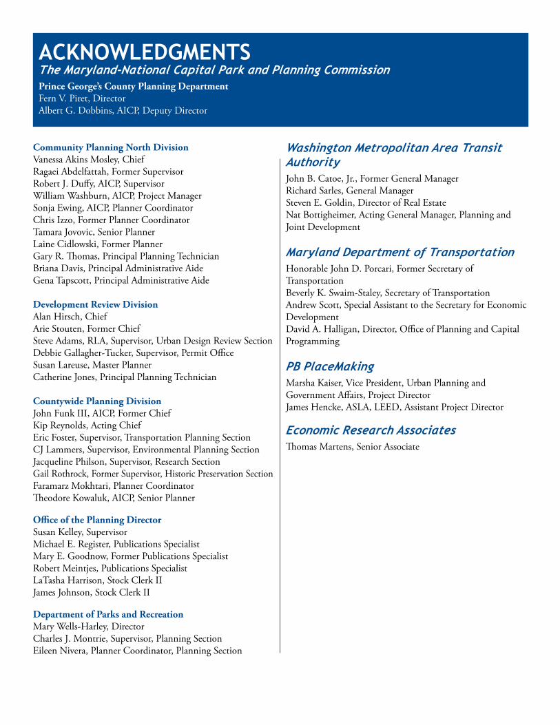
ACKNowledGMeNTsTheMaryland-NationalCapitalParkandPlanningCommissionPrince George’s County Planning DepartmentFernV.Piret,DirectorAlbertG.Dobbins,AICP,DeputyDirector
Community Planning North DivisionVanessaAkinsMosley,ChiefRagaeiAbdelfattah,FormerSupervisorRobertJ.Duffy,AICP,SupervisorWilliamWashburn,AICP,ProjectManagerSonjaEwing,AICP,PlannerCoordinatorChrisIzzo,FormerPlannerCoordinatorTamaraJovovic,SeniorPlannerLaineCidlowski,FormerPlannerGaryR.Thomas,PrincipalPlanningTechnicianBrianaDavis,PrincipalAdministrativeAideGenaTapscott,PrincipalAdministrativeAide
Development Review DivisionAlanHirsch,ChiefArieStouten,FormerChiefSteveAdams,RLA,Supervisor,UrbanDesignReviewSectionDebbieGallagher-Tucker,Supervisor,PermitOfficeSusanLareuse,MasterPlannerCatherineJones,PrincipalPlanningTechnician
Countywide Planning DivisionJohnFunkIII,AICP,FormerChiefKipReynolds,ActingChiefEricFoster,Supervisor,TransportationPlanningSectionCJLammers,Supervisor,EnvironmentalPlanningSectionJacquelinePhilson,Supervisor,ResearchSectionGailRothrock,FormerSupervisor,HistoricPreservationSectionFaramarzMokhtari,PlannerCoordinatorTheodoreKowaluk,AICP,SeniorPlanner
Office of the Planning DirectorSusanKelley,SupervisorMichaelE.Register,PublicationsSpecialistMaryE.Goodnow,FormerPublicationsSpecialistRobertMeintjes,PublicationsSpecialistLaTashaHarrison,StockClerkIIJamesJohnson,StockClerkII
Department of Parks and RecreationMaryWells-Harley,DirectorCharlesJ.Montrie,Supervisor,PlanningSectionEileenNivera,PlannerCoordinator,PlanningSection
WashingtonMetropolitanAreaTransitAuthorityJohnB.Catoe,Jr.,FormerGeneralManagerRichardSarles,GeneralManagerStevenE.Goldin,DirectorofRealEstateNatBottigheimer,ActingGeneralManager,PlanningandJointDevelopment
MarylandDepartmentofTransportationHonorableJohnD.Porcari,FormerSecretaryofTransportationBeverlyK.Swaim-Staley,SecretaryofTransportationAndrewScott,SpecialAssistanttotheSecretaryforEconomicDevelopmentDavidA.Halligan,Director,OfficeofPlanningandCapitalProgramming
PBPlaceMakingMarshaKaiser,VicePresident,UrbanPlanningandGovernmentAffairs,ProjectDirectorJamesHencke,ASLA,LEED,AssistantProjectDirector
EconomicResearchAssociatesThomasMartens,SeniorAssociate