Applications of Geographic Analysis in Parole and Probation
56
The author(s) shown below used Federal funds provided by the U.S. Department of Justice and prepared the following final report: Document Title: Applications of Geographic Analysis in Parole and Probation Author(s): Keith Harries Document No.: 191836 Date Received: January 14, 2002 Award Number: 99-CE-VX-0005 This report has not been published by the U.S. Department of Justice. To provide better customer service, NCJRS has made this Federally- funded grant final report available electronically in addition to traditional paper copies. Opinions or points of view expressed are those of the author(s) and do not necessarily reflect the official position or policies of the U.S. Department of Justice.
Transcript of Applications of Geographic Analysis in Parole and Probation

The author(s) shown below used Federal funds provided by the U.S.Department of Justice and prepared the following final report:
Document Title: Applications of Geographic Analysis in Paroleand Probation
Author(s): Keith Harries
Document No.: 191836
Date Received: January 14, 2002
Award Number: 99-CE-VX-0005
This report has not been published by the U.S. Department of Justice.To provide better customer service, NCJRS has made this Federally-funded grant final report available electronically in addition totraditional paper copies.
Opinions or points of view expressed are thoseof the author(s) and do not necessarily reflect
the official position or policies of the U.S.Department of Justice.

PROPERTY OF National Criminal Justice Reference Serrice (NCJRS) 80x 6000 Qockvilie, MD 20849-6000
FINAL RESEARCH REPORT
APPLICATIONS OF GEOGRAPHIC ANALYSIS IN PAROLE AND PROBATION
GRANT #1999-CE-VX-0005
Revised August, 2001 To: Debra Stoe
National Institute of Justice 810 Seventh Street, N.W. Washington D.C. 2053 1
[Overnight Zip 200011 Phone: (202) 6 16-7036 Fax: (202) 616-0275
From: Keith Harries, Principal Investigator Department of Geography & Environmental Systems
University of Maryland Baltimore County 1000 Hilltop Circle
Baltimore, MD 21250 Phone: (410) 455-2095
E-Mail: [email protected] Fax: (410) 455-1056
Approved By:
Eate;
U.S. Department of Justice.those of the author(s) and do not necessarily reflect the official position or policies of the has not been published by the Department. Opinions or points of view expressed are This document is a research report submitted to the U.S. Department of Justice. This report

2
~~
TABLE OF CONTENTS
TABLE OF CONTENTS ................................................................................................................................. 2
LIST OF FIGURES ............................................................................................................................................ 3
EXECUTIVE SUMMARY ............................................................................................................................... 6
INTRODUCTION ............................................................................................................................................. 8
Project Objectives and Goals .............................................................................................................. 8
Research Design and Methodology ................................................................................................. 11
Project Limitations .............................................................................................................................. 12
Conclusion ........................................................................................................................................... 15
WHAT WAS DONE? ...................................................................................................................................... 16
INTRODUCTION VIA AGGRAVATED ASSAULT DATA ............................................................... 16
DRUG TREATMENT DATA ....................................................................................................................... 18
1 . USING DRUG TREATMENT DATA . FROM DATABASE TO MAP ....................... 18
OBJECnVE ........................................................................................................................ 19
STEPS .................................................................................................................................... 19
GEOCODING: MATCHING DATA ADDRESSES TO THE BASE MAP ...................... 20
L M P O R T M NOTE ......................................................................................................... 23
2 . USING DRUG TREATMENT DATA: ASKING QUESTIONS AND MAPPING RESULTS ............................................................................................................................................. 24
0BJEG"VE ........................................................................................................................ 24
STEPS .................................................................................................................................... 24
3 . USING DRUG TREATMENT DATA OPTIMIZING THE LOCATIONS OF TREATIKENT FACILITIES .......................................................................................................... 26
0BJEG"VE ........................................................................................................................ 26
STEPS .................................................................................................................................... 27
SEX OFFENDER DATA ............................................................................................................................... 33
1 . SEX OFFENDERS: AGENTS, OFFENDERS, AND SCHOOLS ................................... 33
U.S. Department of Justice.those of the author(s) and do not necessarily reflect the official position or policies of the has not been published by the Department. Opinions or points of view expressed are This document is a research report submitted to the U.S. Department of Justice. This report

3
OBJECnVES ...................................................................................................................... 33
S7EPS .................................................................................................................................... 33
2 . SEX OFFENDERS: HOT SPOTS. HIGH SCHOOLS. AND LINKING INTAKE FORMS TO PLACES ....................................................................................................................... 35
OBJECnVES ...................................................................................................................... 35
STEPS .................................................................................................................................... 35
2 . SEX OFFENDERS: HOT SPOTS. HIGH SCHOOLS. AND LINKING INTAKE FORMS TO PLACES ....................................................................................................................... 40
0BJECnVE.S ...................................................................................................................... 40
S7EP.S .................................................................................................................................... 40
CONCLUSION ................................................................................................................................................. 45
REFERENCES .................................................................................................................................................. 46
APPENDIX I . ADDENDUM TO AGENCY MEMORANDUM OF UNDERSTANDING INDICATING SPECIFIC RESPONSIBILITIES OF THE PARTIES TO THE AGREEI"T. WITH SIGNATORIES AND DATES ........................................................................................................ 49
Purpose and Proposal ....................................................................................................................................... 50
Project Objectives ............................................................................................................................... 50
Agreements ......................................................................................................................................................... 51
Software Licensing .............................................................................................................................. 51
Security ................................................................................................................................................. 52
APPENDIX I1 . LETTER O F SUPPORT FROM FORMER DIVISION DIRECTOR THOMAS H . WILLIAMS ........................................................................................................................... 55
LIST OF FIGURES
Figure 1 . Layout from an introductory analysis to demonstrate mapping of point data in the vicinity of the Division of Parole and Probation offices in Reisterstown Plaza. Baltimore ................................ 17
Figure 2 . Common problems encountered in the process of matching data to a streets base map ..... 23
Figure 3 . Query to separate Agent xxxx cases that are single and unemployed . Agent's name intentionally obscured ....................................................................................................................................... 25
Figure 4 . Agents xxxx. xxxx, and xxxx cases separated using individual queries . Agent names intentionally obscured ....................................................................................................................................... 25
U.S. Department of Justice.those of the author(s) and do not necessarily reflect the official position or policies of the has not been published by the Department. Opinions or points of view expressed are This document is a research report submitted to the U.S. Department of Justice. This report

4
Figure 5. All cases mapped with uniquely colored symbols. Note that it is virtually impossible to discriminate among agents using this method, suggesting that it is better to separate them using individual queries. Agent names intentionally obscured .............................................................................. 26
Figure 6. Service Area and Street Network dialog box ............................................................................... 28
Figure 7. “Add location by address” location on ArcView button bat..................................................... 28
Figure 8. “Locate address” dialog box ............................................................................................................ 29 I
Figure 9. Ready to solve the Service Area and Street Networ~ ................................................................ 29 i Figure 10. Selecting intersection between active theme and service area. ............................................... 30
Figure 11. The “raw” data showing the domiciles of drug treatment clien ............................................. 30
Figure 12. Density surface smoothes the point data to make it more legible and to reveal hot spots. Large dots represent approximate centroids as starting points for experimenting with optima . . . locations for drug treatment f a ~ a e s ............................................................................................................. 31
Figure 13. Three locations account for 401 (66Yo) of the 607 dients in treatment Zones are located at 0.5,1.0, 1.5, and 2.0 street miles from each hypothetical facility address. Points in zones represent clients within the 2-mile street distance. There is no double counting .................................................... 32
Figure 14. Sex Offenders within 2500 foot lugh school buffers, Baltimore Ci ...................................... 34
Figure 15. Sex offenders within 2500 ft hgh school buffers, sorted by current agent. Names of agents and offenders intentionally obscured .............................................................................................................. 34
Figure 16. This new theme will show sex offenders located in o f f i d state Hot Spots. Theme table can be used to generate a report of the 32 offenders involved. ................................................................. 36
Figure 17. Hot link dialog window. This dialog links new “Formphoto” field in database to the location of the image file. ................................................................................................................................. 37
Figure 18. Hot link button on toolbar. When in use, the cursor t u r n s into a hghtning symbol which is then used to click on the points of interest. .............................................................................................. 38
Figure 19. When the point representing the offender location is clicked on, the form image pops up. This image is a randomly selected television personality and does not represent any person associated with the Division of Parole and Probation .................................................................................................... 39
Figure 20. Multiple queries used to create multiple shapefiles as a basis for complex cross- classification and report preparation ............................................................................................................... 41
Figure 21. Crystal Reports screen with Object Linking and Embedding (OLE). In this example, the map generated in Arcview has been embedded in the report and would be dynamically updated as changed in Arcview. This could simplify and expedite the updating of regularly scheduled reports accompanied by maps. ...................................................................................................................................... 42
U.S. Department of Justice.those of the author(s) and do not necessarily reflect the official position or policies of the has not been published by the Department. Opinions or points of view expressed are This document is a research report submitted to the U.S. Department of Justice. This report

5
Figure 22. Maximum Supervision offenders from one agent’s caseload with 2,500 foot buffers of all Baltimore City high schools, and agent’s other clients. Agent’s and offenders’ names intentionally obscured. ............................................................................................................................................................. 43
Figure 23. Detail from Figure 22. Maximum Supervision offenders from agent’s caseload within 2,500 foot buffers at Carroll Park High School. Agent’s and offenders’ names intentionally obscured.43
Figure 24. Crystal Reports list generated from an Arcview query. Part of Agent xxx’s dient list was queried to display those offenders under maximum supervision with offense code and type of supervision. Name of agent and names of offenders intentionally obscured ............................................
Page numbers for figures are approximate
U.S. Department of Justice.those of the author(s) and do not necessarily reflect the official position or policies of the has not been published by the Department. Opinions or points of view expressed are This document is a research report submitted to the U.S. Department of Justice. This report

6
APPLICATIONS OF GEOGRAPHIC ANALYSIS IN PAROLE AND PROBATION
GRANT #1999-CE-VX-0005
~~
EXECUTIVE SUMMARY
The advent of community-based supervision in parole and probation agencies has led
to a new need for detailed locational information relating to all aspects of necessary tasks.
Agencies need to know where their offenders are located: Where do they live? Where do
they work? How are treatment facilities located with respect to the offenders needing
treatment? Where are sex offenders? What is the distribution of offenders with respect to
hot spots’ of crime? How can law enforcement agencies know, in a timely manner, where
parolees and probationers are located? Who are the mandatory releasees this week and
where did they go? Is there any connection between an outbreak of crime and the
domicile or place of work (or route to and from work) of a parolee or probationer? This project was designed to assist the Maryland Division of Parole and Probation in
developing the capability to answer such questions. Hardware and software were
provided, in addition to training and consulting on matters relating to the development of
in-house capabilities in the realm of geographic information systems (GIs). Three staff
members received intensive training in the application of GIS tools to data provided by
the Division in the course of calendar year 2000. At the conclusion of this training, the
staff members were capable of taking raw data from the Division database, parsing and
geocoding it, querying it, mapping the results and incorporating them in reports.
Databases subjected to analysis in the course of this project dealt with aggravated assault,
treatment data and sex offender data. Meetings were held with management and staff and
“he term “hot spot” has two meanings in this report. The generic meaning refers to any cluster of crimes. When capitalized, as in “Hot Spot,” the reference is to the government Hot Spot crime reduction program involving areas oficially designated as such and qualifying for specific forms of support, such as a storefront police presence. For additional information on the manner in which the formal Hot Spot program relates to the Maryland Division of Parole and Probation, see: http://ns I .dpscs.state.md.us/pnp/hotspot.shtml.
U.S. Department of Justice.those of the author(s) and do not necessarily reflect the official position or policies of the has not been published by the Department. Opinions or points of view expressed are This document is a research report submitted to the U.S. Department of Justice. This report

7
representatives of other law enforcement agencies, including Baltimore City and County
Police Departments, and the Police Departments of Anne Arundel and Howard Counties
with a view to assisting in the integration of GIS tools and database access across agency
boundaries. Division management have now expressed the intention of increasing GIs capabilities in the near future as tools to be used in the new Proactive Community Supervision (PCS) model.
U.S. Department of Justice.those of the author(s) and do not necessarily reflect the official position or policies of the has not been published by the Department. Opinions or points of view expressed are This document is a research report submitted to the U.S. Department of Justice. This report

8
INTRODUCTION
PROJECT OBJECTIVES AND GOALS
As noted in the project proposal, new emphasis on community probation has
given new prominence to questions relating to the location of parolees and probationers
and their relationship to various elements of communities, including the resources needed
for supervision. The Proactive Community Supervision (PCS) model represents a radical
departure from prior practice in the Maryland Division of Parole and Probation (DPP). With a net increase of 5,33 1 offenders admitted to Maryland prisons between 1990 and
1996 (DPP, 2000), it became clear that alternatives to incarceration would have to be explored, and the model eventually adopted, the PCS, places a premium on information
and communication. Consistent with this, a Division report called for a technology
upgrade:
Additional technology needed under the PCS model includes digital cameras,
electronic surveillance technology, and Geographic Information Systems (GIS) to
map offender locations for planning purposes and resource allocations (DPP, 2000).
Virtually every activity embedded in the new PCS model can benefit from the support
of GIS tools. In an article detailing various aspects of PCS, Division Director Judith
Sachwald noted, for example, that
Under PCS, agents are assigned to supervise offenders in a specific neighborhood
or area . . . PCS takes agents into the community to do the bulk of their work . . . Agents work with [offenders] to identiQ and guide them to the services they need to
fight addictions, gain basic job skills and education, and find a decent job (Sachwald,
2000).
This brief quotation points to a sample of the rich variety of geographic data that
could be used to support agents in the field. Agents work in speczjk neighborhoods in the 0
U.S. Department of Justice.those of the author(s) and do not necessarily reflect the official position or policies of the has not been published by the Department. Opinions or points of view expressed are This document is a research report submitted to the U.S. Department of Justice. This report

9
community and guide offenders to needed services. Thus quite apart from the basic need
to map offenders in order find out where they are, information on those neighborhoods
and communities can help agents fblfill their responsibilities relating to treatment,
employment, and other services. Such information can be mapped and related to the
geography of offenders in order to optimize the match-ups between offenders and
services.
This suggestion is only the tip of the iceberg of possibilities for spatial analysis in
support of community crime prevention in a PCS framework. Great concern, for
example, focuses on recidivism, which can itself be represented on a map of recidivists
symbolizing a dichotomy between those who did and did not complete treatment. Is recidivism (or failure to complete treatment) more prevalent in some neighborhoods than
others? Why? Are needed support services lacking in those neighborhoods? What
adjustments can be made to improve access? Another tool mentioned in the recent reports
on PCS is risk assessment. This too can be mapped, either as individual risk scores or
cumulative scores across neighborhoods or communities, or both, in order to provide a
better community perspective on risk.
Examples of questions relevant to a geographic perspective include:
Where are persons under supervision located with respect to:
Crime hot spots (both formally and informally defined);
0 Other probationers or parolees;
0 The subjects of protective orders; and
The availability of drug treatment and other needed services, including
the agency office serving as the focus of community-based efforts.
Other relevant questions include:
0 What type of offender lives where?
U.S. Department of Justice.those of the author(s) and do not necessarily reflect the official position or policies of the has not been published by the Department. Opinions or points of view expressed are This document is a research report submitted to the U.S. Department of Justice. This report

10
0 What are offenders doing?
0 How can agent travel time to offenders be minimized?
0 Does the administrative geography of the DPP need to be adjusted so
that boundaries reflect functional areas with respect to PCS
management?
0 Can geographic analysis of agent caseloads help evaluate agent
performance?
The primary objective of this project was to introduce and transfer GIS technology to
the DPP. Prior to this project, in Baltimore City locational information to facilitate
responses to questions in the DPP was compiled manually by zip code. This system was
slow, labor-intensive, and error prone. Furthermore, even when data were compiled, the
capacity for analysis was severely limited owing to the inflexibility of the available
information. Zip codes are too coarse as units of analysis, containing in Baltimore City
an average of more than 22,000 persons. With zip codes as the underlying units of
observation, subjects of a locational analysis may in reality be located anywhere within
the zip code area, rendering the “pinpointing” of information impossible. This project
enhanced the ability of the DPP to analyze and to display information relating to its
clientele with much greater precision through the introduction of geographic information
system (GIS) technology in partnership with the University of Maryland Baltimore
County (UMBC). The project has assisted DPP in moving toward analytical self-
sufficiency in the realm of GIS through the development of a research partnership
between DPP and UMBC.
Specific project goals included:
purchasing a computer, GIs software, and base maps;
obtaining raw data from DPP and parsing and geocoding the data;
U.S. Department of Justice.those of the author(s) and do not necessarily reflect the official position or policies of the has not been published by the Department. Opinions or points of view expressed are This document is a research report submitted to the U.S. Department of Justice. This report

11
0 selecting and training DPP staff on GIS technology through
working on various exercises
0 acting as a catalyst to enhance the interface between DPP and its law
enforcement partners with respect to the sharing of data amenable to
analysis in GIs; and
0 showing the value to DPP management of GIS technology within
community corrections.
RESEARCH DESIGN AND METHODOLOGY
GIS capabilities were "twinned" at both the DPP and UMBC, in order to conduct
a process of technology transfer, training, and analysis over a period of 12 months. Data
were transferred to UMBC for processing and analysis, and products were returned to
DPP to demonstrate how practical assistance could be provided in the caseload
management process. In order to build in-house analytical capability at DPP, agency
personnel were assigned on a limited basis to learn how to use GIS and related programs.
This project was designed to support DPP initiatives to include the supervision of sex
offenders throughout Baltimore City (known as Region II), whether probationers,
parolees, or mandatory releasees. The original intent also included other special
populations, such as Hot Spots and Drug Court, whether at the Circuit or District Court
level, However, time did not permit extension of the project to these specific
populations. Future plans would include using this technology for the Marylund
Correctional Options Program (COP) that stresses community supervision and
accountability, and Break the Cycle, which emphasizes testing, sanctions and treatment
for addicted offenders, and other special programs. Although the limited time available
for the project did not permit inclusion of these initiatives, the project did use GIS for
mapping drug offenders and their accessibility to substance abuse treatment facilities in
Baltimore City. These offenders comprise the bulk of the populations in COP and Break
the Cycle.
U.S. Department of Justice.those of the author(s) and do not necessarily reflect the official position or policies of the has not been published by the Department. Opinions or points of view expressed are This document is a research report submitted to the U.S. Department of Justice. This report

12
PROJECT LIMITATIONS
The project was designed to start January 1,2000 and terminate December 3 1,2000.
The Organization and Management plan reflected this time frame (Table 1). In order to*
ensure a rapid start to the project, and to enable the Principal Investigator to dedicate an
appropriate fraction of his time to the project, the PI was able to obtain a one c o m e
reduction in teaching load the Spring semester, 2000. To M h e r ensure adequate support
for the anticipated major start-up effort, and to adhere to the Organization and
Management Plan, a Research Assistant was hired effective January 2000. No start-up
problems were anticipated. As the letter of support from former Director Thomas Williams (Appendix II) indicated: “I understand that the project, if funded, would take
place in calendar year 2000. The Organization and Management Plan appears to outline
a logical series of achievable steps and we could accommodate this schedule.” [Emphasis
added.]
Meetings were held with DPP staff as early as possible in 2000 in order to ensure that
the project would commence as scheduled. The PI initially met with two DPP staff on
January loth to discuss the project objectives and goals, as well as to establish an initial
working relationship. Based on that meeting, it was determined that other DPP staff and
staff from the Department of Public Safety and Correctional Services’ (DPSCS)
Information Technology and Communications Division (ITCD) needed to be present at
the next meeting. Specifically, meetings were held at DPP on February 3 (the earliest
possible date manageable by all parties), February 29, and March 28.
At each meeting, the necessity of access to data and the designation of project
personnel within DPP were stressed repeatedly. Also at each meeting, assurances were
received to the effect that these requirements would soon be met. As time passed,
however it became clear that the Organization and Management Plan was falling
seriously behind schedule. In addition, it was determined by ITCD staff at the March 28
meeting, that a Memorandum of Understanding (MOU) would be needed between DPP,
UMBC, ITCD, and the Department’s Assistant Attorney General before data could be
given to the PI and the project could begin. This requirement had not been mentioned in 0
U.S. Department of Justice.those of the author(s) and do not necessarily reflect the official position or policies of the has not been published by the Department. Opinions or points of view expressed are This document is a research report submitted to the U.S. Department of Justice. This report

13
the original support letter or in any prior conversations, planning meetings, or other
communications.
The MOU was needed in order for the PI to receive access to confidential records on
offenders. The DPCS is extremely carefbl with the use and dissemination of data. The
MOU was a necessity. Assurances were received to the effect that the MOU would be
made available within two weeks following the March 28 meeting. However, given the
bureaucratic culture of govemment, and the numerous signatures required, the MOU did
not become operational until late June (Appendix I), thus cutting in half the time
available for the project. In order to meet the project objectives and goals, the entire
project would have to be condensed into the second half of 2000, the shaded area in
Table I, an impossible task.
In Spring 2000, while waiting for the MOU to materialize, the PI and his assistant,
lacking “real” data, put considerable effort into attempting to adapt published ESRI
exercises for the DPP environment. This effort was ultimately deemed unproductive
since the ESRI materials were too abstract, even with modification, to make for a suitable
training environment for DPP personnel.
As soon as the MOU was signed, ITCD staff began to extract the required data so it
could be transmitted to the PI. While waiting for the data to be extracted and transmitted,
the PI installed and configured the hardware and software at DPP. In addition, DPP s t f l
were selected and committed to the project. The staff selected to participate on this project included a trainer-for-trainers, highly computer literate; the DPP’s Management
Information Systems (MIS) Manager, who is responsible for preparing DPP’s ad hoc
reports; and the MIS Manager’s Assistant. The assumption was that at least one
(presumably the trainer-for-trainers) would then go on to diffise GIS throughout the
agency. The release time necessary for training these individuals was paid for out of grant
funds. Training sessions were held with those three persons on an approximately weekly
basis, from July through September, with some exceptions due to illness or other
conflicting responsibilities. However, the staff were committed to this project, and
enthusiastic.
U.S. Department of Justice.those of the author(s) and do not necessarily reflect the official position or policies of the has not been published by the Department. Opinions or points of view expressed are This document is a research report submitted to the U.S. Department of Justice. This report

14
On June 26", the PI and research assistant met with DPP staff and staff fiom the
Howard County Police and Baltimore County Police Departments to explore how data
could be shared among the different agencies. At this meeting, a presentation on the
Regional Crime Analysis System (RCAS) was conducted by Philip Canter of the
Baltimore County Police Department. This meeting served as a catalyst for enhancing
the relationships between these agencies with respect to the sharing of data amenable to
analysis in GIs.
In late September, the PI pointed out that the two data sets that had been provided
(Drug Treatment and Sex Ofsenders) had been exploited as much as possible, and new
data would now be needed in order to take the project forward. No additional data were
forthcoming. However, it was agreed that the PI should make a presentation to DPP
managers and others in order to demonstrate the potential of GIS within DPP and to
generate new ideas for using GIS technology. It was anticipated that this meeting would
take place in October. The plan was to have the presentation at the monthly DPP
Leadership meeting so that DPP's regional administrators statewide and executive staff
could see the same presentation. However, it was not possible to put this meeting on the
DPP Leadership Team's meeting agenda due to previously scheduled presenters for
October, November, and December and January. By February, the Monday morning
meeting time presented a schedule conflict for the PI.
Although this large group meeting did not take place as anticipated, the PI did meet
on February 13,2001 with two executive managers at DPP, the Executive Deputy
Director Richard Sullivan and Deputy Director Debra Kafami; Patrick McGee, the
Correctional Options Program Manager; and Elizabeth Bartholomew, Research
Coordinator for the DPP's Center for Sex Offender Management (CSOM) collaborative
program planning grant. The PI shared the results of the exercises, which demonstrated
how this technology could be used in DPP. Mr. McGee was extremely interested in
using the GIS technology with his offenders, in particular, Hot Spot offenders who were
assigned to his span of control in January 2001. Ms. Bartholomew also expressed interest
in GIS technology in relation to tracking sex offenders, in particular, the proximity of
their homes to schools, childcare centers, and playgrounds. The Executive Deputy
/ I
U.S. Department of Justice.those of the author(s) and do not necessarily reflect the official position or policies of the has not been published by the Department. Opinions or points of view expressed are This document is a research report submitted to the U.S. Department of Justice. This report

15
Director Sullivan and Deputy Director Kafmi were interested in using GIS
technology in relationship to management issues, such as the assignment of caseloads
according to offenders’ geographic location and where to locate DPP offices. From this
meeting, it was agreed that a mutually convenient meeting for DPP staff and the PI would
be scheduled this Spring to further explore the use of this technology in relationship to
the DPP’s new Proactive Community Supervision model. Eventually, a presentation was
scheduled for September 10,2001.
CONCLUSION
From the PI’S perspective, the discontinuity between the obvious interest in the
project at the agency on the one hand, and the extraordinary delays, on the other, is
puzzling, and may provide a lesson for other potential collaborations. Implementing a
new project while an organization is undergoing significant operational and cultural
changes is apparently extremely difficult. Also, one must not forget that government is
often bureaucratic. The weak link in a collaboration between a public agency and a
university-based PI may be that the PI is completely dependent on the agency for the
material resources for the project, but the agency has total control over those resources,
so the PI is in effect at the mercy of the agency.
U.S. Department of Justice.those of the author(s) and do not necessarily reflect the official position or policies of the has not been published by the Department. Opinions or points of view expressed are This document is a research report submitted to the U.S. Department of Justice. This report

16
I
WHAT WAS DONE?
Training was carried out with three individuals fiom the Division of Parole and
Probation. This training involved the application of GIS tools to three data sets relating
to Baltimore City:
Aggravated assaults (as a stop gap while waiting for actual DPP data)
Drug treatment, i.e. offenders in treatment for addiction or other conditions
demanding therapy of some sort
Sex offenders
INTRODUCTION VIA AGGRAVATED ASSAULT DATA
The three personnel participating in the orientation to GIS had no prior experience
with GIs, or computer mapping in any form, and they also varied in general computer
expertise, with two being very experienced, and one much less so. In order to
demonstrate in a simple way how local data could be mapped; and prior to the provision
of data relating to parole and probation issues, a previously-acquired data set of
Baltimore City aggravated assaults was made part of the first analysis. The focal point of the geographic area was the Division of Parole and Probation office (Reisterstown Plaza)
where the instruction was taking place. This analysis demonstrated the mapping of point
data and the use of elementary queries, such as the selection of all incidents that occurred
on the street (shown in yellow in figure l), in addition to incidents that occurred with and
without injury. The concept of buffering was also illustrated via the placement of a one
mile buffer around the Reisterstown Plaza location and the mapping of incidents that
occurred within that buffer zone.
i
U.S. Department of Justice.those of the author(s) and do not necessarily reflect the official position or policies of the has not been published by the Department. Opinions or points of view expressed are This document is a research report submitted to the U.S. Department of Justice. This report

17
Assaults within a one mile radius of Reisterstown Plaza
Not injured m Relsterstown Plaza
Assaults within I mile 0 One mile bmer from RP
Aggravated assautts A/ Baltimore streets
N
os 0 1.8 Miles V s
Figure 1. Layout from an introductory analysis to demonstrate mapping of point data in the vicinity of the Division of Parole and Probation offices in Reisterstown Plaza, Baltimore.
i
U.S. Department of Justice.those of the author(s) and do not necessarily reflect the official position or policies of the has not been published by the Department. Opinions or points of view expressed are This document is a research report submitted to the U.S. Department of Justice. This report

18
~ ~ ~~
DRUG TREATMENT DATA
1. USING DRUG TREATMENT DATA - FROM DATABASE TO MAP
The analyses undertaken in the course of this project assumed no prior knowledge on
the part of the personnel involved, and built skills incrementally by employing data and
problems likely to engage the interest of the trainees. The background resource
employed for reference purposes was Getting to Know ArcYiew GIs (Second edition,
1997), published by Environmental Systems Research Institute, Jnc. (ISBN 1 86242 019
X). The trainees were strongly encouraged to work through the book in order to reinforce
the skills developed in the course of the regular instruction sessions. Page references in
the following materials relate to this book.
In the material that follows, edited versions of the training materials have been
included in order to illustrate the issues addressed by the project. This report has also
been designed to act as a guide for any DPP personnel who may wish to work through
examples given that the data and all these projects are still available on the computer
provided as part of this grant. All that is necessary to make the GIS system at DPP
hctional is a valid license from ESFU who provided permission for the use of the
UMBC license for the duration of the project. This licensing arrangement regarded the
DPP project as an extension of UMBC’s lab facility on a temporary basis, through
December 3 1 , 2000. Licensed copies of digital streets data bases have been provided to
DPP.
In the following materials, the format generally adopted states the objective to be
addressed, followed by the steps necessary to accomplish that objective, as well as the
products that emerged fiom the activity. Readers may wish to skip “steps” which will be
of more interest to persons wishing to emulate the activities presented
U.S. Department of Justice.those of the author(s) and do not necessarily reflect the official position or policies of the has not been published by the Department. Opinions or points of view expressed are This document is a research report submitted to the U.S. Department of Justice. This report

19
OBJECTIVE
0 Take raw DPP data in text format, parse it, convert it to dBase format,
and geocode it in order to make the data compatible with ArcView.
STEPS
0 Identify the relevant file as supplied on floppy disk (OBII.txt, 168k)
0 Open MS Excel or similar spreadsheet or database program. (MS Access is OK, of course.)
0 In excel, go to Data, Get External Data, Import Text File (or just
double click the file name).
Step through the Text Import Wizard, using the Fixed Field Guide
sheet (attached) to help you determine where column breaks should be
and what type of data you are dealing with.
step 1.
0 Data are Fixed Width.
Start import at Row 1.
File origin Windows (ANSI).
Step2.
0 Click on column guide to insert breaks at appropriate locations.
I
Click on and drag to remove lines at inappropriate locations.
Step3.
U.S. Department of Justice.those of the author(s) and do not necessarily reflect the official position or policies of the has not been published by the Department. Opinions or points of view expressed are This document is a research report submitted to the U.S. Department of Justice. This report

20
0 Click on column headers to select the columns and make decisions
about the designations of each column, such as whether it i s text, date,
etc. Only a few date columns need to be changed.
0 Finish. (Excel offers the opportunity to place the data in the current
worksheet - OK.) Data are now in an Excel worksheet, properly
formatted.
0 File, Save As, then rename the file and select B a s e N format.
0 Message appears. Click OK.
0 Message appears. Click Yes.
Your file is now compatible with ArcView, but needs to be geocoded
(linked to the street map) before it can be mapped and analyzed. See
Chapter 26 in Text.
GEOCODING: MATCHING DATA ADDRESSES TO THE BASE MAP
Open ArcView and create a new View. Add Citystreetsshp theme.
See CD entitled Baltimore City Streets Reference File for Geocoding.
Open the Attribute table for the streets theme.
0 [Note how this table is structured and consult p. 26-4 for additional
explanation.]
Go to the Project table of Contents and click Tables, Add, and open
the Sex Offenders table.
0 Rename the Address Field so that it can be identified for geocoding
purposes. (Table, Properties, provide the appropriate alias.)
I
0 Make the View active.
U.S. Department of Justice.those of the author(s) and do not necessarily reflect the official position or policies of the has not been published by the Department. Opinions or points of view expressed are This document is a research report submitted to the U.S. Department of Justice. This report

21
0 Theme Menu, Properties.
0 Click the Geocoding icon.
Select the ‘U.S. Streets’ Address Style if not already displayed.
0 (See pages 26-6,26-7 for more explanation.)
0 View, Geocode Addresses.
0 Go to Address Table drop down list and select the Sex Offenders dbf
table.
0 Have ‘Address’ show in the Address Field box.
0 Click Batch Match.
[Program links addresses to locations on the streets map.]
0 Results should show 514 (85%) as a ‘Good Match.’ (This is pretty
good.)
0 We now need to deal with ‘No Match’ records (88 = 14’%0)
0 Click Interactive Re-match. (See Handling Un-Matched Addresses, p.
26-14.)
0 No candidate appears for the first unmatched address, so we will relax
the criteria for matching.
0 Click Preferences in the Geocoding Editor box.
Reduce Spelling Sensitivity to a low level. This will result in the
display of virtually all candidates for the address under review. This is
U.S. Department of Justice.those of the author(s) and do not necessarily reflect the official position or policies of the has not been published by the Department. Opinions or points of view expressed are This document is a research report submitted to the U.S. Department of Justice. This report

22
important since the street addresses in the source file are
contaminated with lots of “junk;” see illustration attached.
0 Check ‘Review candidates . . . when. . . ‘ and check relevant boxes.
0 ClickOK.
0 Click ContinueNext, as necessary, and go through all unmatched
records, as follows:
0 Compare ‘upper’ addresses with the address that shows in the ‘lower’
box. If a match seems reasonable, click Match.
0 ClickDone.
0 Click Done in the Re-Match Addresses box.
0 Make the new geocoded shapefile active so you can see the points on
the streets map. {Make sure the geocoded file is saved where you can
find it.)
i
Note that the address data are contaminated by various errors and inconsistencies,
such as the addition of the city name to the street address as shown below.
U.S. Department of Justice.those of the author(s) and do not necessarily reflect the official position or policies of the has not been published by the Department. Opinions or points of view expressed are This document is a research report submitted to the U.S. Department of Justice. This report

23
i
Figure 2. Common problems encountered in the process of matching data to a streets base map.
IMPORTANT NOTE
Problems like this can be avoided by making sure that the address records are as
“clean” as possible at the source. Coordination is necessary between the parties
responsible for reporting addresses, and those responsible for geocoding and analysis.
Without such coordination, a substantial amount of data will be lost.
Some problems can be overcome via interactive matching, but in other cases records
will be lost to the process of geographic analysis owing to the lack of a geocodable
address.
U.S. Department of Justice.those of the author(s) and do not necessarily reflect the official position or policies of the has not been published by the Department. Opinions or points of view expressed are This document is a research report submitted to the U.S. Department of Justice. This report

24
2. USING DRUG TREATMENT DATA: ASKING QUESTIONS AND
MAPPING RESULTS
OBJECTIVE
Develop queries from the Drug treatment data and map the resulting patterns.
STEPS
0 Write a series of queries that will separate the caseloads of several
agents.
0 Create separate shape files for each and make distinctive symbols.
0 Write a query that will create a shape file to show where all Agent-. ---
xxxx’s clients are who are single and employed.
0 Write a query that will identify the locations of all younger clients
(born since 1969).
0 Modify the legend for the Drug treatment file so as to give each agent
a distinctive symbol, illustrating how to avoid the steps taken above to
create separate symbolization for each agent.
0 Develop other queries that address real issues concerning the Drug
treatment data, and convert them into shapefiles that illustrate the
analyses.
U.S. Department of Justice.those of the author(s) and do not necessarily reflect the official position or policies of the has not been published by the Department. Opinions or points of view expressed are This document is a research report submitted to the U.S. Department of Justice. This report

25
Figure 3. Query to separate Agent xxxx cases that are single and unemployed. Agent's name intentionally obscured.
Figure 4. Agents xxxx, xxxx, and xxxx cases separated using individual queries. Agent names intentionally obscured.
U.S. Department of Justice.those of the author(s) and do not necessarily reflect the official position or policies of the has not been published by the Department. Opinions or points of view expressed are This document is a research report submitted to the U.S. Department of Justice. This report

26
Figure 5 . All cases mapped with uniquely colored symbols. Note that it is virtually impossible to discriminate among agents using this method, suggesting that it is better to separate them using individual queries. Agent names intentionally obscured.
3. USING DRUG TREATMENT DATA: OPTIMIZING THE LOCATIONS
OF TREATMENT FACILITIES
OBJECTIVE
General background for the Drug treatment data was developed in the previous two
sections involving geocoding the data, examining the general distribution, and isolating
data for clients of specific agents.
In this example, approximate locations are established for treatment facilities that will
satisfy the criteria of the fewestpossible facilities serving the largest number of clients
U.S. Department of Justice.those of the author(s) and do not necessarily reflect the official position or policies of the has not been published by the Department. Opinions or points of view expressed are This document is a research report submitted to the U.S. Department of Justice. This report

27
with the smallestpossible travel distances. Locations are established initially by
visual inspection based on a smoothed surface of client locations (“hot spots”). e l
Facilities located at (approximately) 1300 N. Carey St., 1000 N. Chester St. and 3800
Yell St, with service areas extending 2 miles from each location as measured in the street
network (not as the crow flies, but real street distance) would serve 66% of the 607 1
clients.
In this case study, two extensions of ArcView will be used: Spatia2 Analyst and
Network Analyst.
STEPS
0 Create a project called Location and add the Treatment (25) and
Streets themes.
0 Make sure the Streets theme is indexed; use the Theme-Properties-
Geocoding dialog to do this if it has not already been done.
0 Go to Analysis (this is the Spatial Analyst extension) and select
Calculate Density. Accept the defaults.
0 When this surface is turned on, the lowest class interval of the density
layers will obscure the map. Turn this layer off by double clicking the
theme, double clicking that class, and making the symbol (foreground)
empty be selecting the “X” box in the Color Palette.
0 You will now see a smoothed density surface of the drug treatment
clients. This will be used to visually estimate centroids (central
locations) with respect to these “hot spots.” See Maps 1 and 2 in the
sequence below.
i
Temporarily, make Streets the top layer. Using the Info tool, and
visml inspection, estimate three locations that look as if they would be
U.S. Department of Justice.those of the author(s) and do not necessarily reflect the official position or policies of the has not been published by the Department. Opinions or points of view expressed are This document is a research report submitted to the U.S. Department of Justice. This report

central to the largest number of clients. Make them in or near the
hot spots as indicated on Map 2. Record these addresses to the nearest
block. Add to map with View, Locate Address.
0 Make the Streets theme active,’ and click on Network, Find Service
Area. This box will come up:
Figure 6 . Service Area and Street Network dialog box.
0 Two new themes are created, “Sarea” (Service Area) and “Snet”
(Street Network). Click on the Add Location by Address button
shown below:
Figure 7. “Add location by address” location on ArcView button bar.
0 The following window will come up. Enter the first of your three
addresses and click OK. f
U.S. Department of Justice.those of the author(s) and do not necessarily reflect the official position or policies of the has not been published by the Department. Opinions or points of view expressed are This document is a research report submitted to the U.S. Department of Justice. This report

29
e
e
e
Figure 8. “Locate address” dialog box.
The data will then be entered in the SaredSnet window, like this:
Figure 9. Ready to solve the Service Area and Street Network.
Double click the “miles” field and change the values to those shown
above, or other values you consider appropriate.
Click the Solve button. The Service Area and related Street Network
will now be available as themes (Figure 13).
Find out how many Drug treatment clients would be served by making
the Treatment theme active and then click Theme, Select by theme,
making the result a shapefile, and then viewing the resulting Attribute
table and reading the number of cases in the table, and recording that
number.
U.S. Department of Justice.those of the author(s) and do not necessarily reflect the official position or policies of the has not been published by the Department. Opinions or points of view expressed are This document is a research report submitted to the U.S. Department of Justice. This report

30
Figure 10. Selecting intersection between active theme and service area.
Figure 1 1. The “raw” data showing the domiciles of drug treatment clients.
U.S. Department of Justice.those of the author(s) and do not necessarily reflect the official position or policies of the has not been published by the Department. Opinions or points of view expressed are This document is a research report submitted to the U.S. Department of Justice. This report

31
Figure 12. Density surface smoothes the point data to make it more legible and to reveal hot spots. Large dots represent approximate centroids as starting points for experimenting with optimal locations for drug treatment facilities.
e
U.S. Department of Justice.those of the author(s) and do not necessarily reflect the official position or policies of the has not been published by the Department. Opinions or points of view expressed are This document is a research report submitted to the U.S. Department of Justice. This report

32
Figure 13. Three locations account for 401 (66%) of the 607 clients in treatment. Zones are located at 0.5, 1.0, 1.5, and 2.0 street miles from each hypothetical facility address. Points in zones represent clients within the 2-mile street distance. There is no double counting.
U.S. Department of Justice.those of the author(s) and do not necessarily reflect the official position or policies of the has not been published by the Department. Opinions or points of view expressed are This document is a research report submitted to the U.S. Department of Justice. This report

33
~
SEX OFFENDER DATA
1. SEX OFFENDERS: AGENTS, OFFENDERS, AND SCHOOLS
OBJECTIVES
Geocode raw data for sex offenders and create a report that shows offenders
domiciled within half a mile of schools, and the agents assigned to them, in alphabetical
order. This could provide the basis for information supplied to agents to advise them of
the offenders in their caseload who represent the highest risk to school students, at least
as represented by proximity to schools.
STEPS
0 Take raw DPP data in text format, parse it, convert it to B a s e format,
and geocode it in order to make the data compatible with ArcView.
0 Add themes for Baltimore City Schools, and
0 Create separate themes (shapefiles) for each type of school
(elementary, middle, high) and add these themes to the view.
0 Create buffers at an approximately half mile radius (2500 feet) around
each type of school and create new themes for each type of school that
show the Sex Offender domiciles that intersect the buffers for each
school type. Add these new themes to the view.
In turn, make each theme table active and alphabetize (ascending
order) the field that represents the agent currently responsible for
offenders. This will have the effect of separating the offenders into
groups for each agent.
U.S. Department of Justice.those of the author(s) and do not necessarily reflect the official position or policies of the has not been published by the Department. Opinions or points of view expressed are This document is a research report submitted to the U.S. Department of Justice. This report

34
Figure 14. Sex Offenders within 2500 foot high school buffers, Baltimore City
Figure 15. Sex offenders within 2500 ft high school buffers, sorted by current agent. Names of agents and offenders intentionally obscured.
U.S. Department of Justice.those of the author(s) and do not necessarily reflect the official position or policies of the has not been published by the Department. Opinions or points of view expressed are This document is a research report submitted to the U.S. Department of Justice. This report

35
2. SEX OFFENDERS: HOT SPOTS, HIGH SCHOOLS, AND LINKING
0 INTAKE FORMS TO PLACES
OBJECTIVES
0 Show official Hot Spots and find out which Sex Offenders are located
in Hot Spots, and make a report of those names.
0 Show where Hot Spots overlap with High School 2500 ft buffer zones.
0 Show how Division of Parole & Probation forms and offender photos
(or any other documents) can be linked to map points representing the
addresses of those offenders so that the form and photo can be
instantly recalled by clicking on the points.
-. STEPS
Objective: Which Offenders are located in Hot Spots?
0 Add theme Hot Spots.shp
0 Make Sex offenders(06).shp the active theme.
0 Add theme: Hotspot.shp
0 Theme > Select by theme > [Complete as indicated below] > New Set
U.S. Department of Justice.those of the author(s) and do not necessarily reflect the official position or policies of the has not been published by the Department. Opinions or points of view expressed are This document is a research report submitted to the U.S. Department of Justice. This report

36
Figure 16. This new theme will show sex offenders located in official state Hot Spots. Theme table can be used to generate a report of the 32 offenders involved.
Objective: m e r e do Hot Spots overlap with High School Buffer Zones?
To show where Hot Spots overlap with High School 2500 ft buffer zones, it is
necessary to find out where polygon themes intersect:
0 In View mode, go to Tools > Intersect themes > Select: Hotspotshp,
Hotspot ID
0 Select: High School 2500 ft Buffers
New theme appears automatically, showing where Hot Spots overlap
the High School buffer zones.
Objective: Link Offender Location on Map to Paper Record
0 To show how Division of Parole and Probation or other DOC forms
and photos can be linked, it is necessary to scan both the form and the
photo(s). This is a simple matter, but we will skip this step and rely on
previously scanned materials.
U.S. Department of Justice.those of the author(s) and do not necessarily reflect the official position or policies of the has not been published by the Department. Opinions or points of view expressed are This document is a research report submitted to the U.S. Department of Justice. This report

37
0 Add theme Form&Photo.shp, select it, and move it to the top layer
to make the four points visible. e 0 Adjust symbolization as necessary. Do not make symbol larger than
10 points. The target symbol may be best for reasons that will become
clear.
0 Go to Theme > Properties > Make window conform to the following:
Figure 17. Hot link dialog window. This dialog links new “Formphoto” field in database to the location of the image file.
0 Make sure the images to be used are in the same directory as the theme
table. The image file in this example is man1 .gif.
0 When this is complete, the lightning symbol button on the tool bar will
light up, as follows:
U.S. Department of Justice.those of the author(s) and do not necessarily reflect the official position or policies of the has not been published by the Department. Opinions or points of view expressed are This document is a research report submitted to the U.S. Department of Justice. This report

38
Figure 18. Hot link button on toolbar. When in use, the cursor turns into a lightning symbol which is then used to click on the points of interest.
0 Click on it, and then click on the center of each of the “FormPhoto”
points on the map, in turn. The form with the picture of each offender
should pop up. Maximize each window as it comes up to reveal
greater detail.
U.S. Department of Justice.those of the author(s) and do not necessarily reflect the official position or policies of the has not been published by the Department. Opinions or points of view expressed are This document is a research report submitted to the U.S. Department of Justice. This report

39
DPP-SUP43 (Rev.: 446) DEPARTMENT of PUBUC
CABB RECORD .INPUT - INTA
Figure 19. When the point representing the offender location is clicked on, the form image pops up. This image is a randomly selected television personality and does not represent any person associated with the Division of Parole and Probation.
U.S. Department of Justice.those of the author(s) and do not necessarily reflect the official position or policies of the has not been published by the Department. Opinions or points of view expressed are This document is a research report submitted to the U.S. Department of Justice. This report

40
2. SEX OFFENDERS: HOT SPOTS, HIGH SCHOOLS, AND LINKING
INTAKE FORMS TO PLACES a OBJECTIVES
0 Create shapefiles for the major offense categories.
0 Create shapefiles for each case type.
0 Create shapefiles for each supervision level.
0 Create shapefiles for a specific agent and for cases involving
maximum supervision for that agent.
Create a CrystaZ Reports report to summarize this information for the agent, including
the two maps relevant to this agent. Include in the Crystal Report Client, Current Agent,
Offense Code, Case Type, and Supervision Level, or other variables of your choice. See
sample output attached.
. -.
STEPS
Create the following shapfiles, or equivalents:
0 Supervision levels
0 Major offense categories
0 Casetypes
0 Specific agent and category of supervision (Figure 20)
U.S. Department of Justice.those of the author(s) and do not necessarily reflect the official position or policies of the has not been published by the Department. Opinions or points of view expressed are This document is a research report submitted to the U.S. Department of Justice. This report

Figure 20. Multiple queries used to create multiple shapefiles as a basis for complex cross-classification and report preparation.
U.S. Department of Justice.those of the author(s) and do not necessarily reflect the official position or policies of the has not been published by the Department. Opinions or points of view expressed are This document is a research report submitted to the U.S. Department of Justice. This report

42
Figure 21. Crystal Reports screen with Object Linking and Embedding (OLE). In this example, the map generated in ArcView has been embedded in the report and would be dynamically updated as changed in ArcView. This could simplify and expedite the updating of regularly scheduled reports accompanied by maps.
U.S. Department of Justice.those of the author(s) and do not necessarily reflect the official position or policies of the has not been published by the Department. Opinions or points of view expressed are This document is a research report submitted to the U.S. Department of Justice. This report

43
Agent XXX Clients under Maximum Supervision, Other Clients, and High
School Locations with 2,500ft buffers (Sex offenders)
Figure 22. Maximum Supervision offenders from one agent’s caseload with-2,500 foot buffers of all Baltimore City high schools, and agent’s other clients. Agent’s and offenders’ names intentionally obscured.
Agent Xm’s Two Maximum Supervision Clients Close to Carroll Park High School
(Sex Offenders A and B)
Figure 23. Detail from Figure 22. Maximum Supervision offenders from agent’s caseload within 2,500 foot buffers at Carroll Park High School. Agent’s and offenders’ names intentionally obscured. 0
U.S. Department of Justice.those of the author(s) and do not necessarily reflect the official position or policies of the has not been published by the Department. Opinions or points of view expressed are This document is a research report submitted to the U.S. Department of Justice. This report

44
AGENT- SUMMARYREPORT
CLIENTS UNDER MAXIMUM SUPERVISION
El El
August 28,2000
806 135 804 134 282 641 804 804 1 52 152 I 52 1 52 1 52 152 134 201 149 1 52 a23 152 282 706 706 964 524 155 442 155 149 I52 804 158 149
PRO PRO PRO MAN PRO PRO PRO PRO PRO PRO PRO PRO MAN PRO PRO PRO PRO PRO PRO PRO PRO PRO PRO PRO PRO PRO PRO PRO PRO PRO PRO
M M M M M M M M M M M M M M M M M M M M M M M M M M M M M M M
IAX Ax Ax Ax VUE ux LAX Ax Ax VUE Ax Ax Ax Ax Ax Ax Ax Ax Ax Ax Ax Ax Ax AX Ax Ax Ax AX Ax Ax Ax
Figure 24. Crystal Reports list generated from an ArcView query. Part of Agent XXX’s client list was queried to display those offenders under maximum supervision with offense code and type of supervision. Name of agent and names of offenders intentionally obscured.
U.S. Department of Justice.those of the author(s) and do not necessarily reflect the official position or policies of the has not been published by the Department. Opinions or points of view expressed are This document is a research report submitted to the U.S. Department of Justice. This report

45
CONCLUSION
As originally conceptualized, this project would have diffised ideas about
applications of GIS tools primarily through a process of training trainers and presenting
demonstrations for managers and agents. While the project limitations already described
at some length reduced its effectiveness, it now seems that DPP will adopt GIS tools in
the near future, but through an approach putting more emphasis on embedding GIS
components in grant proposals that would acquire new resources, rather than building in-
house capability fiom the ground up with existing resources. The latter course may have
been impossible fiom the outset given the scarcity of resources and the intense
competition for them.
This project generated three products:
0 Hardware in the form of a computer, software, an external Zip drive,
and other peripherals intended to ease the transition to applications of
GIS
0 A set of activities, most of which are embedded in this report, designed
to illustrate how GIS tools could help streamline work in DPP
0 Intangible benefits growing out of discussions with DPP management
and staff in which the benefits of GIS were explained and reinforced
on numerous occasions, sometimes with the support of GIS analysts
fiom other agencies, including Baltimore City and Baltimore County
PDs, Anne Arundel County PD, Howard County PD, and others who
were invited to participate in round table discussions during year 2000.
In the long term it is likely that the intangibles will yield the most significant results.
Training, while imparting short-term skills, is of little use if the skills are not practiced on
a day-to-day basis. Everyone involved in the use of technology knows that skills left e
U.S. Department of Justice.those of the author(s) and do not necessarily reflect the official position or policies of the has not been published by the Department. Opinions or points of view expressed are This document is a research report submitted to the U.S. Department of Justice. This report

46
unpracticed soon erode. When combined with changes in software systems, dormancy
translates to paralysis. Continuous application had been the expectation when this project
was planned; indeed, had that not been a reasonable expectation the project would have
been designed quite differently.
*
REFERENCES
Davis, D.E. (2001) GIs for Evegmne. Redlands, CA: ESRI Press.
Division of Parole and Probation (2000). Proactive Community Supervision: A
Plan for Making Maryland Communities Safer. Report to the Budget Committees of the
Maryland General Assembly. Baltimore, MD.
Ormsby, T. (Ed.), et al. (2001). Getting to Know ArcGIS Desktop: Bgsics of .
Arc View, ArcEditor, and ArcInfo. Redlands, CA. w
Sachwald, J. (2000?) Proactive Community Supervision: Opening Windows to
Effective Intervention. Baltimore, MD: Maryland Division of Parole and Probation.
U.S. Department of Justice.those of the author(s) and do not necessarily reflect the official position or policies of the has not been published by the Department. Opinions or points of view expressed are This document is a research report submitted to the U.S. Department of Justice. This report

e 47
Project start
Team Meeting
Acquire
ment Equip-
TABLE 1. ORGANIZATION AND MANAGEMENT PLAN (YEAR 2000)
(Shaded area represents time actually available on-site for the training element of this project.)
~
FEB
ream Meeting Install & config- ure
ment Equip-
MAR
DPP Training. Data
& analysis
coding
Research report
APR
Team Meeting DPP Training. Data
& analysis
coding
MAY
DPP Training Data
& analysis
coding
~
Research report
ream Meeting DPP
Data
& analysis
r e g coding
U.S. Department of Justice.those of the author(s) and do not necessarily reflect the official position or policies of the has not been published by the Department. Opinions or points of view expressed are This document is a research report submitted to the U.S. Department of Justice. This report

APPENDIX I. ADDENDUM TO AGENCY MEMORANDUM OF
UNDERSTANDING INDICATING SPECIFIC RESPONSIBILITIES OF
THE PARTIES TO THE AGREEMENT, WITH SIGNATORIES AND
DATES
0
U.S. Department of Justice.those of the author(s) and do not necessarily reflect the official position or policies of the has not been published by the Department. Opinions or points of view expressed are This document is a research report submitted to the U.S. Department of Justice. This report

MEMORANDUM OF UNDERSTANDING
BETWEEN THE MARYLAND DIVISION OF PAROLE AND PROBATION,
THE INFORMATION TECHNOLOGY AND COMMUNICATIONS
DIVISION &
THE UNIVERSITY OF MARYLAND BALTIMORE COUNTY
PURPOSE AND PROPOSAL
Mapping offender data will assist the Division of Parole and Probation in its mission to create safer communities.
The purpose of this project is to establish modest geographic information systems (GIS) mapping capabilities “twinned” at the Division of Parole and Probation (DPP) and the University of Maryland Baltimore County (UMBC), with the goal of conducting a process of technology transfer, training, and analysis during the remainder of calendar year 2000.
a Offender data will be transferred to UMBC for processing and analysis and interpretive information will be returned to DPP to provide immediate practical assistance in the caseload management process. In order to build in-house analytical capability at DPP, select agency personnel will be trained in the use of GIS and related programs.
PROJECT OBJECTIVES
This project is designed to analyze DPP geographical offender populations to make communities safer. The following are objectives of this project for the Division of Parole and Probation:
0 Truining. At least three individuals within the agency will be trained in the basic use of GIS technology.
0 Program Planning. GIs will be used to determine its practical application for general program planning or special agency initiatives.
a 0 Resource Allocation. Map analysis tools may be used for a resource allocation and
U.S. Department of Justice.those of the author(s) and do not necessarily reflect the official position or policies of the has not been published by the Department. Opinions or points of view expressed are This document is a research report submitted to the U.S. Department of Justice. This report

5 1
determining facility/office location.
0 Distribution of Workloads. Caseloads could be optimized, or balanced, among regions or individual offices. A redistricting program could be used to draw and periodically redraw districts based on the distribution of cases to equalize the distribution of workloads. Similarly, districts could be drawn to facilitate the equalization of workloads for warrant service.
0 Community Supervision. With the growing importance of community supervision, parole and probation agents are now more likely to be assigned to specific areas in the community so that they have more contact with offenders under supervision, community resources, and local and municipal police departments. GIS technology can be used to enhance law enforcement objectives and community safety.
0 Specialized Caseload Supervision. Mapping technology can be used to enhance tracking of offenders in specialized caseloads or programs with special supervision requirements. This would not be real time “tracking” but a monitoring process over time.
0 Mapping Areas Restricted to OfSenders. This technology can be used to identify areas that offenders have been ordered to avoid for the protection of specific or potential victims in the community.
0 Mapping Dangerous or High Crime Areas. Other applications in community supervision could include mapping areas where parole and probation agents may be vulnerable and should be partnered or accompanied by a police officer when conducting home or site visits.
0 Travel Plans. Map analysis of offender geography can be used to determine the most efficient route for sequencing visits to homedsites. If visits to specific individuals have to be made at certain times, a route can be designed to minimize travel time and distance from one address to the next.
AGREEMENTS
SOFTWARE LICENSING
The program to be used is known as ArcView, a product of Environmental Systems Research Institute, Inc. (ESRI). This software is available at UMBC, and the principal investigator has discussed licensing issues with the regional ESRI representative who regards the use of ArcView software at the Division of Parole and Probation as a temporary extension of the UMBC license for training purposes. However, at the termination of this project, it will be necessary for the Division of Parole and Probation to obtain its own fiee-standing license if it has not already done so. a
U.S. Department of Justice.those of the author(s) and do not necessarily reflect the official position or policies of the has not been published by the Department. Opinions or points of view expressed are This document is a research report submitted to the U.S. Department of Justice. This report

52
Another key element of the project is the availability of up-to-date digital base- maps of Baltimore City, with associated “coverages” such as police district and post geography. The principal investigator has negotiated with the Baltimore Regional Council a 1-5 seat lab license on the ground that what we are dealing with is essentially a two seat lab with the two work stations in separate places. This will permit the properly licensed use of the Baltimore base map at both locations until the termination of the project. Subsequently, however, the Division of Parole and Probation will need to obtain a free standing license to continue to use this product. The appropriate base map has / been acquired. I Sharing of Data Elements
The Information Technology and Communications Division of the Department of Public Safety and Correctional Services will provide the data elements from OBSCIS II, specifically intake entry data from the Case Record Input-Intake form (DPP-SUP-53), to Dr. Keith Harries for transfer of information.
Research
Under this agreement, the principal investigator may conduct limited research to provide analysis for data as requested by the Division of Parole and Probation. The principal investigator is also a signatory of a User Agreement between the Department of Public Safety and Correctional Services and a Non-Criminal Justice Agency, in the event that the transfer of data elements yield criminal history information. (See Attached)
SECURITY
At UMBC, the workstation to be dedicated to this project will be housed in a secure room not accessible to the general student or faculty population, protected with a motion sensing security system. In addition, the computer itself and individual files will be password protected. Only Keith Harries (Principal Investigator), Holly Warrenfeltz (Intern), and Greg Baker, Manager of Management Information Services for the Division of Parole and Probation, would have access to these files. Any security breach due to a criminal act, or act of God, such as fire or flood, would be immediately reported to the Division of Parole and Probation.
At the end of the project, all data and data files will be returned to the Division of Parole and Probation.
PROPERTY OF National Criminal Justice Reference Service (NCJRS) Box 6000 Rockville. MD 20849-6000
U.S. Department of Justice.those of the author(s) and do not necessarily reflect the official position or policies of the has not been published by the Department. Opinions or points of view expressed are This document is a research report submitted to the U.S. Department of Justice. This report

53
IN WITNESS WHEREOF, this Memorandum of Understanding is entered into on the date last Mow written.
Signatory Agencies:
“be Division of Parole and Probation
Idondon Technology and Communications Division
The University ofMa1~1ancl Baltimore County
d- c
$ l L i A - h h L / Susan Howe Baron
Assistant Attorney General
U.S. Department of Justice.those of the author(s) and do not necessarily reflect the official position or policies of the has not been published by the Department. Opinions or points of view expressed are This document is a research report submitted to the U.S. Department of Justice. This report

5 5
I
APPENDIX 11. LETTER OF SUPPORT FROM FORMER DIVISION
DIRECTOR THOMAS H. WILLIAMS
U.S. Department of Justice.those of the author(s) and do not necessarily reflect the official position or policies of the has not been published by the Department. Opinions or points of view expressed are This document is a research report submitted to the U.S. Department of Justice. This report
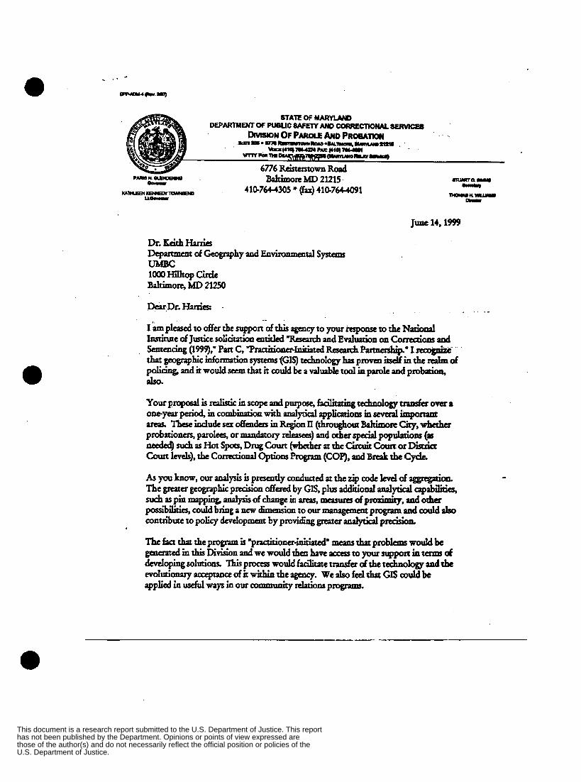
a
Baltimom MD 2l215 41B7644305 * (fax) 41G764-4091
June 14,1999
1’- p l d to offer the support ofthis agency to your rrspanse to the Npiopul lascinne of JuseiCrsolicitnion entitled “Raeuch and Evaluation on Corrutim and
thp geographic information systems(GIS) tubologyhas provcn S i n the & of policing, and it wouldseem that it could be a duable tdiaparolcandpr&tion, h.
S a n c n c i a g ( 1 9 9 Q ) , ’ P a I t C , T ~ ~ ~ ~ P P u a a a s h i p ‘ I n c o g e i E c
U.S. Department of Justice.those of the author(s) and do not necessarily reflect the official position or policies of the has not been published by the Department. Opinions or points of view expressed are This document is a research report submitted to the U.S. Department of Justice. This report

57
U.S. Department of Justice.those of the author(s) and do not necessarily reflect the official position or policies of the has not been published by the Department. Opinions or points of view expressed are This document is a research report submitted to the U.S. Department of Justice. This report