Appendix D Scope of Work for ARCG II Restoration Workplans ... · Scope of Work for . ARCG II...
27
Appendix D Scope of Work for ARCG II Restoration Workplans I. Purpose The purpose of this Scope of Work is to set forth the requirements for the Restoration Workplans to be developed by the ARCG II and submitted to the Trustees for review and approval pursuant to the Consent Decree. II. Restoration Properties 1. Certain Restoration Properties have been identified and approved by the Trustees for acquisition and/or restoration by the ARCG II. 2. Additional Restoration Properties may be identified by either the Trustees or the ARCG II for acquisition and/or restoration by the ARCG II, upon approval by the Trustees. Once any Additional Restoration Property has been identified, the Trustees will provide direction to the ARCG II on the elements to be included in any Specific Restoration Workplan. III. Restoration Workplan Requirements (General) The Restoration Workplans for each Restoration Property and each Additional Restoration Property shall include: 1. Topographic maps showing the location of the Property relative to all other Restoration Properties and the Ashtabula River and Harbor. 2. The total acreages of each Property, as well as an estimate from aerial photographs and GIS, or other mapping software, of the acreages of various habitat types existing on each Property. 3. A brief description of the ecological value of the Property and natural resource services provided by the Property. A brief description of wetlands and other features on the Property which may be enhanced through actions such as control of exotic and/ or invasive species, establishment of native species, or
Transcript of Appendix D Scope of Work for ARCG II Restoration Workplans ... · Scope of Work for . ARCG II...

Appendix D
Scope of Work for
ARCG II Restoration Workplans
I. Purpose
The purpose of this Scope of Work is to set forth the requirements for the Restoration
Workplans to be developed by the ARCG II and submitted to the Trustees for review and
approval pursuant to the Consent Decree.
II. Restoration Properties
1. Certain Restoration Properties have been identified and approved by the Trustees
for acquisition and/or restoration by the ARCG II.
2. Additional Restoration Properties may be identified by either the Trustees or the
ARCG II for acquisition and/or restoration by the ARCG II, upon approval by the
Trustees.
Once any Additional Restoration Property has been identified, the Trustees will provide
direction to the ARCG II on the elements to be included in any Specific Restoration
Workplan.
III. Restoration Workplan Requirements (General)
The Restoration Workplans for each Restoration Property and each Additional
Restoration Property shall include:
1. Topographic maps showing the location of the Property relative to all other
Restoration Properties and the Ashtabula River and Harbor.
2. The total acreages of each Property, as well as an estimate from aerial
photographs and GIS, or other mapping software, of the acreages of various
habitat types existing on each Property.
3. A brief description of the ecological value of the Property and natural resource
services provided by the Property. A brief description of wetlands and other
features on the Property which may be enhanced through actions such as
control of exotic and/ or invasive species, establishment of native species, or

2
establishment of hydraulic connections to the Ashtabula River and Harbor and
a plan for implementation of such activities, including restoration performance
measures, to enhance natural resource services provided by the Property. The
Trustees may, at their discretion, require Workplan Supplements for such
activities.
4. A brief description of trash and/or debris, if any, on the Property and a plan
for removal of such.
5. Detailed Restoration Project cost estimates and an implementation schedule
for items 4 and 5 above.
The ARCG II shall obtain all permits required for implementation of the Restoration
Projects. The reasonable costs incurred by the ARCG II in the development of the
general Restoration Workplans and the implementation thereof constitute Qualified Costs
as defined in Section IV, Paragraph 4.y of the Consent Decree.
IV. Restoration Workplan Requirements (Specific)
Ashtabula Township Park Commission [formerly CDM] Property
In addition to the General Requirements described above, the Restoration Workplan
for the Ashtabula Township Park Commission (ATPC) [formerly CDM] Property
shall include:
1. A detailed design for construction of a small (12 - 20 car) parking lot on the
ATPC [CDM] Property with access from East 24th
Street. The parking lot will
be constructed of gravel or other pervious materials and will connect to a trail
around the wetland and to the canoe launch described below.
2. A detailed design for construction of a canoe launch on the ATPC [CDM]
Property in proximity to East 24th
Street, including a pathway from the parking
lot described above. All structures should be built with recycled materials and
the pathway from the parking lot to the canoe launch should be constructed with
pervious materials.
3. A detailed design for construction of a boardwalk running along the northern
border of the approximately 6 acre wetland located on the ATPC [CDM]
Property. The boardwalk should follow the upland border of the existing
wetland and, to the extent possible, be constructed of recycled materials.
Crushed stone or other pervious material should be used to provide a trail
between the boardwalk and the East 24th
Street parking lot. The boardwalk
shall have at least one look-out point that shall include weather resistant signage

3
describing wetland plant and animal species and interactions, as well as benefits
and services provided by wetlands.
4. A detailed design for removal of exotic and/or invasive species and replanting
of native vegetation throughout the ATPC [CDM] Property, including the
approximately 6 acres of wetland.
5. A detailed design of wetland restoration for the approximately 6 acre wetland.
Cost estimates will be based on planting 10 tree species from Table 1, 10
shrub/sub-canopy tree species from Table 2, and 10 herbaceous wetland species
from Table 3. The trees and shrubs will be planted to a design density of at least
500 individuals per acre. The herbaceous species will be planted at a design
seed planting density of at least 18 pounds per acre. The detailed design of
wetland restoration will incorporate the findings of a wetland delineation,
performed by the ARCG II according to the up-to-date version of the 1987
Corps of Engineers Wetland Delineation Manual (Technical Report Y-87-1), on
the approximately 6 acre wetland during leaf-out, optimally in late spring of
2010, and the planting requirements specified above, unless otherwise specified
by the Trustees.
Table 1: Tree Species
Scientific Name Common Name Wetland Indicator Status
1
Habitat
Acer negundo Box Elder FAC+ riparian forest Acer rubrum Red Maple FAC wet woods surrounding pool Acer saccharinum Silver Maple FACW wet woods surrounding pool
and riparian forest Carya cordiformis Bitternut Hickory FACU+ riparian forest Carya laciniosa Shellbark Hickory FAC wet woods surrounding pool Juglans nigra Black Walnut FACU riparian forest Platanus occidentalis
Sycamore FACW- riparian forest
Populus deltoides Cottonwood FAC riparian forest Quercus bicolor Swamp White
Oak FACW+ wet woods surrounding pool
Quercus palustris Pin Oak FACW wet woods surrounding pool Quercus rubra Red Oak FACU- riparian forest Tilia americana American
Basswood FACU riparian forest
Ulmus americana American Elm FACW- wet woods surrounding pool Ulmus rubra Slippery Elm FAC riparian forest
1 USDA. Interpreting Wetland Indicator Status. URL: http://plants.usda.gov/wetinfo.html (Site Visited: 12
Mar 2010)

4
Table 2: Shrub/Small Tree Species
Scientific Name Common Name Wetland Indicator
Status
Habitat
Asimina triloba Paw Paw FACU+ drier areas of riparian forest Cephalanthus occidentalis
Buttonbush OBL within pool
Cornus sericea Red-Osier Dogwood
FACW+ at edge of pool
Corylus americana American Hazelnut
FACU- drier areas of riparian forest
Ilex verticillata Winterberry FACW+ at edge of pool and in wetter areas of riparian forest
Lindera benzoin Spicebush FACW- in wetter areas of riparian forest
Morus rubra Red Mulberry FACU drier areas of riparian forest Ptelea trifoliata Hop-Tree FAC drier areas of riparian forest Rosa palustris Swamp Rose OBL within pool Salix discolor Pussy Willow FACW at edge of pool Sambucus canadensis
Common Elderberry
FACW- at edge of pool
Staphylea trifolia Bladdernut FAC riparian forest (near river) Viburnum prunifolium
Blackhaw FACU drier areas of riparian forest
Viburnum recognitum
Northern Arrowwood
FACW- at edge of pool
Table 3: Wetland Herbaceous Species
Scientific Name Common Name Wetland Indicator
Status
Glyceria striata Fowl Manna Grass
OBL
Cinna arundinacea Wood Reed FACW+
Leersia virginica Whitegrass FACW
Dryopteris carthusiana
Spinulose Wood Fern
FAC+
Onoclea sensibilis Sensitive Fern FACW
Impatiens capensis Jewelweed FACW
Lysimachia ciliata Fringed Loosestrife
FACW
Boehmeria cylindrica False Nettle
FACW+
Mimulus alatus Sharpwing Monkeyflower
OBL
Carex tribuloides Blunt Broom Sedge
FACW+
Carex lupulina Hop Sedge OBL
Carex grayi Gray's Sedge FACW+
Carex crinita Fringed Sedge OBL
Scirpus polyphyllus Leafy Bulrush OBL

5
6. Detailed cost estimates and an implementation schedule for items 1 through 5
above.
Additional Restoration Properties
In addition to the General Requirements described above, the Restoration Workplan
for any Additional Restoration Property shall include:
1. A detailed design for construction, if applicable.
2. A detailed design for removal of exotic and/or invasive species and replanting
of native vegetation, if applicable. The design shall include restoration
performance measures and, if applicable, shall be consistent with Ohio EPA’s
wetland monitoring program.
3. A performance monitoring plan, if applicable.
4. Detailed Restoration Project cost estimates and an implementation schedule for
applicable items 1, 2 and 3 above.
The reasonable costs incurred by the ARCG II in the development of the specific
Restoration Workplans and the implementation thereof constitute Qualified Costs as
defined in Section IV, Paragraph 4.y of the Consent Decree.
V. Progress Reports
During the period of the development and implementation of the Restoration Workplans,
the ARCG II shall submit brief (1 to 2 page) monthly progress reports delineating the
status of the Restoration Projects. The Progress Report for each month shall be submitted
by the 10th
day of the following month. The frequency of the Progress Reports may be
reduced as agreed to by the Trustees. The progress reports shall include:
1. Activities conducted during the period;
2. Problems encountered during the period;
3. Schedule variances and corrective actions, if necessary;
4. Projected activities for the next month;
5. Documents related to or appertaining to conservation agreements; and,
6. Status of permits, applications, and Qualified Costs.

6
VI. Deliverables
The following deliverables will be generated and submitted to the Trustee representatives
for approval as per the schedule below. Note that some specific deliverables may be
streamlined or waived at the discretion of the Trustees.
DELIVERABLE (UNLESS WAIVED
BY THE TRUSTEES)
DUE DATE
Restoration Workplans Due 90 days after the effective date of the
Consent Decree for Restoration Properties
acquired prior to the Effective Date of the
Consent Decree; or due 60 days after
Additional Restoration Properties have
been acquired or identified.
Progress Reports By the 10th
day of the subsequent month
during the period of implementation of the
Restoration Workplan(s), unless the due
date is modified or the requirement is
waived by the Trustees
Restoration Completion Report In accordance with the Consent Decree,
paragraph 22
Deliverables shall be submitted via electronic mail to the individuals at the addresses
specified below, unless those individuals or their successors give notice of a change to
the ARCG II in writing:
Dave Devault, U.S. Fish and Wildlife Service, [email protected]
Kevin Tloczynski, U.S. Fish and Wildlife Service, [email protected]
Sheila Abraham, Ohio EPA, [email protected]
Regan Williams, Ohio EPA, [email protected]

Appendix E
Environmental Covenant Template

To be recorded with Deed Records - ORC 317.08
ENVIRONMENTAL COVENANT This Environmental Covenant is entered into by __________________ (Owner), the United States Fish and Wildlife Service (FWS), the National Oceanic and Atmospheric Administration (NOAA) and the Ohio Environmental Protection Agency (Ohio EPA) pursuant to Ohio Revised Code (ORC) §§ 5301.80 to 5301.92 for the purpose of subjecting the Property to the activity and use limitations set forth herein. Background
. The Ashtabula River, approximately 40 miles long, flows through the northeast quadrant of Ashtabula County to Lake Erie. The approximately 137 square mile watershed is located south of the city of Ashtabula, Ohio. Beginning in the 1940's, the sediments and associated floodplains became contaminated with a variety of contaminants, including volatile organic compounds (VOCs), semi-volatile organics, polycyclic aromatic hydrocarbons (PAHs), polychlorinated biphenyls (PCBs), heavy metals and low-level radionuclides.
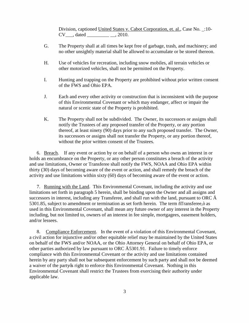
Fields Brook, a 3-mile tributary of the Ashtabula River, was designated a Superfund Site and placed on the National Priorities List (NPL) in 1983; the Remedial Investigation (RI) began in 1985 with a Record of Decision (ROD) issued in 1986. Under an agreement with the United States Environmental Protection Agency pursuant to the Great Lakes Legacy Act, an agreement with the United States Army Corps of Engineers pursuant to the Water Resources Development Act, and separate agreements with the Ohio Environmental Protection Agency, the Ashtabula City Port Authority and the members of the Ashtabula River Cooperating Group II, contaminated sediment was dredged from a segment of the Ashtabula River in 2007 and 2008. A dedicated landfill was constructed for the contaminated sediment. The Ashtabula River watershed and associated natural resources, including macroinvertebrates, fish and fish-eating birds, were substantially impacted as a result of the contamination. Negotiations between the responsible parties and the natural resource trustees, i.e., the FWS, NOAA and Ohio EPA (Trustees), in conjunction with the United States Department of Justice and the Ohio Attorney General, resulted in a settlement filed in the United States District Court, Northern District of Ohio, Eastern Division, captioned United States v. Cabot Corporation, et. al.
, Case No. _:10-CV__, dated _______ __, 2010. The Administrative Record for this Site, including the Natural Resource Restoration Plan & Environmental Assessment for the Ashtabula River and Harbor Site (Restoration Plan), is maintained at Ohio EPA’s Northeast District Office, 2110 East Aurora Road, Twinsburg, Ohio.
Now therefore, Owner, and the FWS, NOAA and Ohio EPA agree to the following: 1. Environmental Covenant
. This instrument is an environmental covenant developed and executed pursuant to ORC §§ 5301.80 to 5301.92.
2. Property. This Environmental Covenant concerns an approximately __ acre tract of real property, located _________________, in ___________ , Ashtabula County, Ohio, identified as

permanent parcel number __-___-__-___-__, and more particularly described in Exhibit A attached hereto and hereby incorporated by reference herein (Property). 3. Owner
. ___________ (Owner), [located at] __________ currently owns the Property.
4. Holder
. [Owner, whose address is listed above, is the holder of the Environmental Covenant.]
5. Activity and Use Limitations. As part of the Restoration Plan approved by the Trustees pursuant to the settlement filed in the United States District Court, Northern District of Ohio, Eastern Division, captioned United States v. Cabot Corporation, et. al.
, Case No. _:10-CV___, dated _________ __, 2010, Owner hereby imposes the following activity and use limitations on the Property and agrees to comply with such limitations:
A. The Property shall be kept in its natural state, i.e., no building, billboards or other structures of any kind, either temporary or permanent, shall be placed or erected on the Property, unless otherwise expressly provided hereunder.
B. There shall be no filling, excavating, or removal of top soil, sand, gravel, or rock,
minerals or other materials on or at the Property, nor any building of roads or change in topography of the land in any manner, other than that caused by the forces of nature, except in accordance with the Restoration Plan approved by the Trustees pursuant to the settlement filed in the United States District Court, Northern District of Ohio, Eastern Division, captioned United States v. Cabot Corporation, et. al.
, Case No. _:10-CV___, dated __________ __, 2010.
C. The control, management and eradication of animal or plant species on the Property must be pursuant to a Non-Native, Noxious or Nuisance Species Control Plan approved by the FWS, Reynoldsburg, Ohio Field Office. Methods must comply with the State and Federal requirements and manufacturer guidelines.
D. No power or petroleum transmission lines may be constructed, nor any other
interests in the Property shall be granted for this purpose. However, the Owner reserves the right to maintain and repair telephone, electric, water, wells, or other utility lines or mains on existing easements needed to provide for the needs of the Owner, successors or assigns. The area affected by the repair work shall be the minimum necessary to accomplish the task. Upon completion of all construction for such utilities, the area shall be restored to its previous state.
E. No towers for communication or otherwise shall be constructed on the Property.
F. No trees, ground cover or other vegetation shall be removed from the Property, except that which is necessary to: maintain foot paths and trails; restore natural habitat areas; promote natural vegetation; protect life and property; or comply with the Restoration Plan approved by the Trustees pursuant to the settlement filed in the United States District Court, Northern District of Ohio, Eastern
3
Division, captioned United States v. Cabot Corporation, et. al.
, Case No. _:10-CV___, dated _________ __, 2010.
G. The Property shall at all times be kept free of garbage, trash, and machinery; and no other unsightly material shall be allowed to accumulate or be stored thereon.
H. Use of vehicles for recreation, including snow mobiles, all terrain vehicles or
other motorized vehicles, shall not be permitted on the Property.
I. Hunting and trapping on the Property are prohibited without prior written consent of the FWS and Ohio EPA.
J. Each and every other activity or construction that is inconsistent with the purpose of this Environmental Covenant or which may endanger, affect or impair the
natural or scenic state of the Property is prohibited.
K. The Property shall not be subdivided. The Owner, its successors or assigns shall notify the Trustees of any proposed transfer of the Property, or any portion thereof, at least ninety (90) days prior to any such proposed transfer. The Owner, its successors or assigns shall not transfer the Property, or any portion thereof, without the prior written consent of the Trustees.
6. Breach
. If any event or action by or on behalf of a person who owns an interest in or holds an encumbrance on the Property, or any other person constitutes a breach of the activity and use limitations, Owner or Transferee shall notify the FWS, NOAA and Ohio EPA within thirty (30) days of becoming aware of the event or action, and shall remedy the breach of the activity and use limitations within sixty (60) days of becoming aware of the event or action.
7. Running with the Landlimitations set forth in paragraph 5 herein, shall be binding upon the Owner and all assigns and
. This Environmental Covenant, including the activity and use
successors in interest, including any Transferee, and shall run with the land, pursuant to ORC § 5301.85, subject to amendment or termination as set forth herein. The term “Transferee,” as used in this Environmental Covenant, shall mean any future owner of any interest in the Property including, but not limited to, owners of an interest in fee simple, mortgagees, easement holders, and/or lessees.
8. Compliance Enforcement
a civil action for injunctive and/or other equitable relief may be maintained by the United States on behalf of the FWS and/or NOAA, or the Ohio Attorney General on behalf of Ohio EPA, or other parties authorized by law pursuant to ORC § 5301.91. Failure to timely enforce compliance with this Environmental Covenant or the activity and use limitations contained herein by any party shall not bar subsequent enforcement by such party and shall not be deemed a waiver of the party’s right to enforce this Environmental Covenant. Nothing in this Environmental Covenant shall restrict the Trustees from exercising their authority under applicable law.
. In the event of a violation of this Environmental Covenant,

4
9. Rights of AccessDepartment of Natural Resources, their agents, contractors, and employees, [and] the County of Ashtabula [, and the City of Ashtabula – if the property is located in the City] the right of access to the Property for implementation or enforcement of this Environmental Covenant.
. Owner hereby grants to the FWS, NOAA, Ohio EPA, the Ohio
10. Compliance Reporting
Ohio EPA, [and] the County of Ashtabula [and the City of Ashtabula], on an annual basis, written documentation verifying compliance with this Environmental Covenant.
. Owner or any Transferee shall submit to the FWS, NOAA,
11. Notice upon Conveyance
. Each instrument hereafter conveying any interest in the Property, or any portion thereof, shall contain a notice of the activity and use limitations set forth in this Environmental Covenant, and provide the recorded location of this Environmental Covenant. The notice shall be substantially in the following form:
THE INTEREST CONVEYED HEREBY IS SUBJECT TO AN ENVIRONMENTAL COVENANT, DATED , 20__, RECORDED IN THE DEED OR OFFICIAL RECORDS OF THE ASHTABULA COUNTY RECORDER ON ___________, 20__, IN [DOCUMENT ____, or BOOK___, PAGE ____,].
Owner shall notify the FWS, NOAA and Ohio EPA within ten (10) days after each conveyance of an interest in the Property. Owner’s notice shall include the name, address, and telephone number of the Transferee, a copy of the deed or other documentation evidencing the conveyance, and a survey map that shows the boundaries of the property being transferred. 12. Representations and Warranties
. Owner hereby represents and warrants to the other signatories hereto:
A. that the Owner is the sole owner of the Property; B. that the Owner holds fee simple title to the Property which is subject to the following
interests or encumbrances: ____________________________________________; C. that the Owner has the power and authority to enter into this Environmental
Covenant, to grant the rights and interests herein provided and to carry out all obligations hereunder;
D. that the Owner has identified all other persons that own an interest in or hold an
encumbrance on the Property and notified such persons of the Owner’s intention to enter into this Environmental Covenant; and,
E. that this Environmental Covenant will not materially violate or contravene or
constitute a material default under any other agreement, document or instrument to which Owner is a party or by which Owner may be bound or affected.
13. Amendment. This Environmental Covenant may be amended by consent of all of the following: the Owner or a Transferee; the FWS; NOAA; and the Ohio EPA, pursuant to ORC §

5
5301.90 and other applicable law. The term, “Amendment” as used in this Environmental Covenant, shall mean any changes to the Environmental Covenant, including the activity and use limitations set forth herein, or the elimination of one or more activity and use limitations when there is at least one activity and use limitation remaining. This Environmental Covenant may be amended only by a written instrument duly executed by the Regional Director of the FWS, the General Counsel of NOAA (or his/her designee), the Director of Ohio EPA and the Owner or Transferee of the Property, as applicable. Within thirty (30) days of signature by all requisite parties on any amendment of this Environmental Covenant, the Owner or Transferee shall file such instrument for recording with the Ashtabula County Recorder’s Office, and shall provide a file and date-stamped copy of the recorded instrument to the FWS, NOAA and Ohio EPA. 14. Severability
. If any provision of this Environmental Covenant is found to be unenforceable in any respect, the validity, legality, and enforceability of the remaining provisions shall not in any way be affected or impaired.
15. Governing Law
. This Environmental Covenant shall be governed by and interpreted in accordance with the laws of the State of Ohio.
16. Recordation
. Within thirty (30) days after the date of the final required signature upon this Environmental Covenant, Owner shall file this Environmental Covenant for recording, in the same manner as a deed to the Property, with the Ashtabula County Recorder’s Office.
17. Effective Date
. The effective date of this Environmental Covenant shall be the date upon which the fully executed Environmental Covenant has been recorded as a deed record for the Property with the Ashtabula County Recorder.
18. Distribution of Environmental Covenant
. The Owner shall distribute a file- and date-stamped copy of the recorded Environmental Covenant to: the FWS; NOAA; Ohio EPA; [and] the County of Ashtabula [; and, the City of Ashtabula– if the property is located in the City].
19. Notice
. Unless otherwise notified in writing by or on behalf of the current owner, the FWS or Ohio EPA, any document or communication required by this Environmental Covenant shall be submitted to:
Regional Director Ashtabula River Site Coordinator U.S. Fish and Wildlife Service DERR Region 3 Ohio EPA 1 Federal Drive 2110 East Aurora Road Fort Snelling, Minnesota 55111 Twinsburg, Ohio 44087 General Counsel’s Office for Natural Resources/NE NOAA Office of General Counsel 55 Great Republic Drive Gloucester, Massachusetts 01930

6
[Chairman [Brenda Stephens, Administrative Assistant Ashtabula Township Park Commission Ashtabula Township Park Commission 120 Manola Avenue 120 Manola Avenue Ashtabula, OH 44004] Ashtabula, OH 44004] The undersigned [representative of] Owner represents and certifies that [he/she] is authorized to execute this Environmental Covenant. IT IS SO AGREED: [__________________________________] [Owner] ___________________________________ [signature] [title] ______________________________ Printed Name and Title Date State of ) ) ss: County of ) Before me, a notary public, in and for said county and state, personally appeared _______ , [a duly authorized representative of __________ ________________________________], who acknowledged to me that [he/she] did execute the foregoing instrument [on behalf of ___________________________]. IN TESTIMONY WHEREOF, I have subscribed my name and affixed my official seal this day of , 20__. ____________________________________________ Notary Public
____________________________________________ Date of My Commission Expiration

7
OHIO ENVIRONMENTAL PROTECTION AGENCY __________________________________ __________________________ Chris Korleski, Director Date State of Ohio ) ) ss: County of Franklin ) Before me, a notary public, in and for said county and state, personally appeared Chris Korleski, the Director of Ohio EPA, who acknowledged to me that he did execute the foregoing instrument on behalf of Ohio EPA. IN TESTIMONY WHEREOF, I have subscribed my name and affixed my official seal this day of , 20__. ____________________________________________ Notary Public
____________________________________________ Date of My Commission Expiration

8
U.S. Fish & Wildlife Service ____________________________________ __________________________ Robyn Thorson, Regional Director, Region 3 Date State of _________________________ )
) ss: County of ) Before me, a notary public, in and for said county and state, personally appeared Robyn Thorson, a duly authorized representative of the FWS, who acknowledged to me that she did execute the foregoing instrument on behalf of the FWS. IN TESTIMONY WHEREOF, I have subscribed my name and affixed my official seal this day of , 20__.
__________________________________________ Notary Public
__________________________________________ Date of My Commission Expiration

9
National Oceanic and Atmospheric Administration ____________________________________ __________________________ [name] [title] Date State of _________________________ )
) ss: County of ) Before me, a notary public, in and for said county and state, personally appeared ________ _________, a duly authorized representative of NOAA, who acknowledged to me that [he/she] did execute the foregoing instrument on behalf of NOAA. IN TESTIMONY WHEREOF, I have subscribed my name and affixed my official seal this day of , 20__.
__________________________________________ Notary Public
__________________________________________ Date of My Commission Expiration
This instrument prepared by: Mark J. Navarre, Esq. Supervising Attorney Ohio EPA 50 West Town Front Street Columbus, Ohio 43216

Appendix F
Trustee Memorandum of Understanding