New Hampshire State fish hatchery effluent discharge and EPA/NPDES permit story.

APPENDIX 1 Permit to Operate an Industrial Effluent Works


APPENDIX 2 Adjacent Land Photos

Upshore view – toward North Maskepetoon Point

Downshore view – inside Kadla Coulee/Maskepetoon Bay

Open water view

APPENDIX 3 Feed Ingredient Lists
Note: Information is Proprietary to WWS


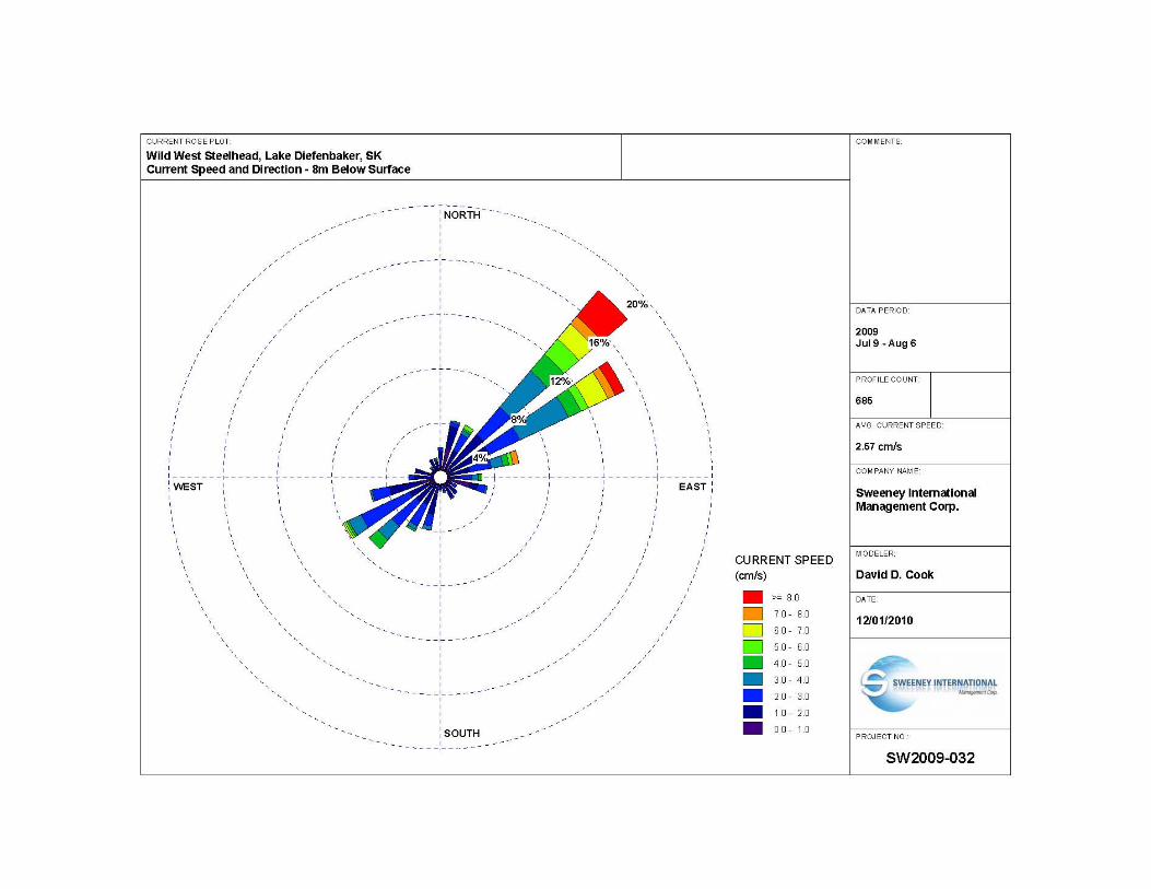
APPENDIX 4 Frequency Distribution Graphs and Current Rose Plots
Note: Data was collected by DFO – Fresh Water Institute
Graphs were produced by SIMCorp


APPENDIX 5 Land Use Map

Note: This is a section of the land use map produced by Waterwolf (see http://www.waterwolf.org/PDFs/WW_LandUseMap_v3.pdf)
Gravel Road
Secondary Highway
Kadla Coulee
Cactus Bay
Gravel Road
Secondary Highway
Kadla Coulee
Cactus Bay

APPENIDX 6 Public Involvement Letters