AP HUMAN GEOGRAPHY - West Linn · AP HUMAN GEOGRAPHY . POLITICAL GEOGRAPHY . The study of human...
140
AP HUMAN GEOGRAPHY POLITICAL GEOGRAPHY
Transcript of AP HUMAN GEOGRAPHY - West Linn · AP HUMAN GEOGRAPHY . POLITICAL GEOGRAPHY . The study of human...

AP HUMAN GEOGRAPHY POLITICAL GEOGRAPHY

The study of human political organization of the earth. Study political organization at three scales Supranational National (country) Subnational (local)
Political Geography
Creating ownership over a defined space Can be your backyard or an entire country
Territoriality
NOT A STATE
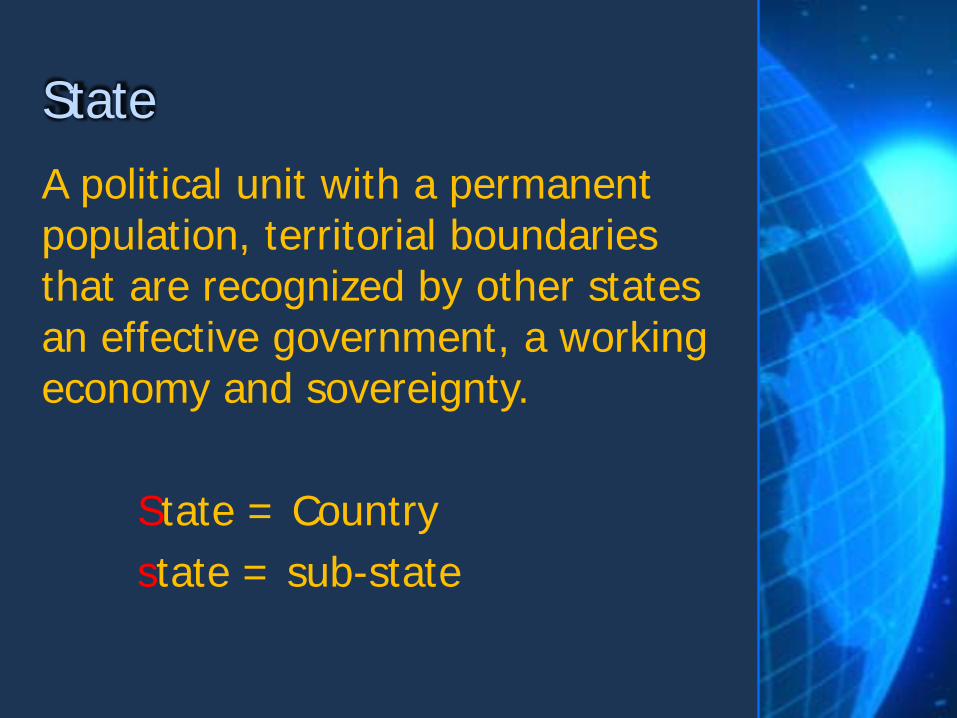
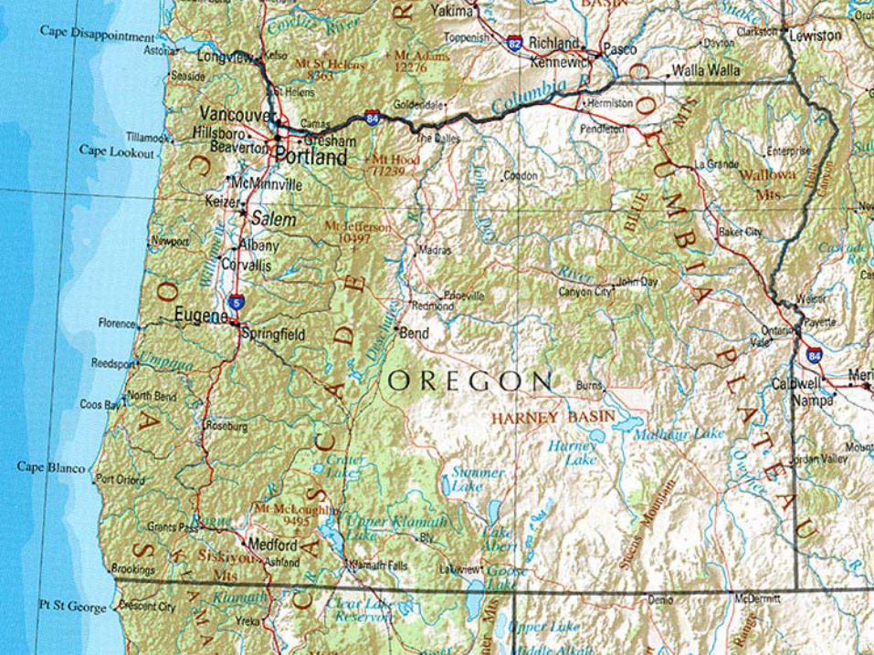
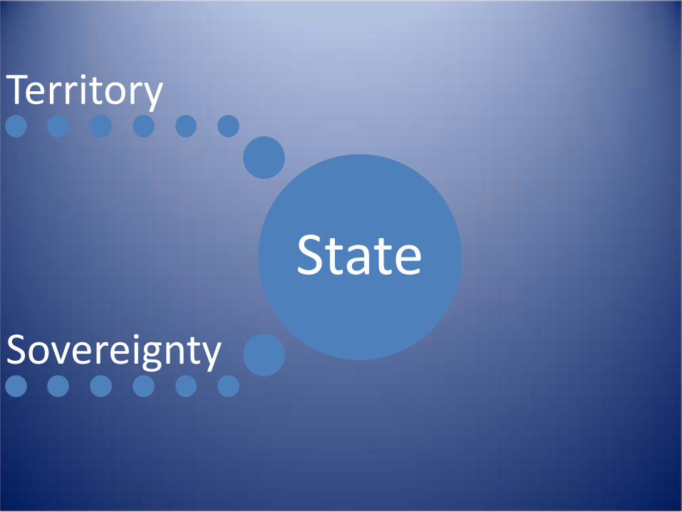
A political unit with a permanent population, territorial boundaries that are recognized by other states an effective government, a working economy and sovereignty. State = Country state = sub-state
State
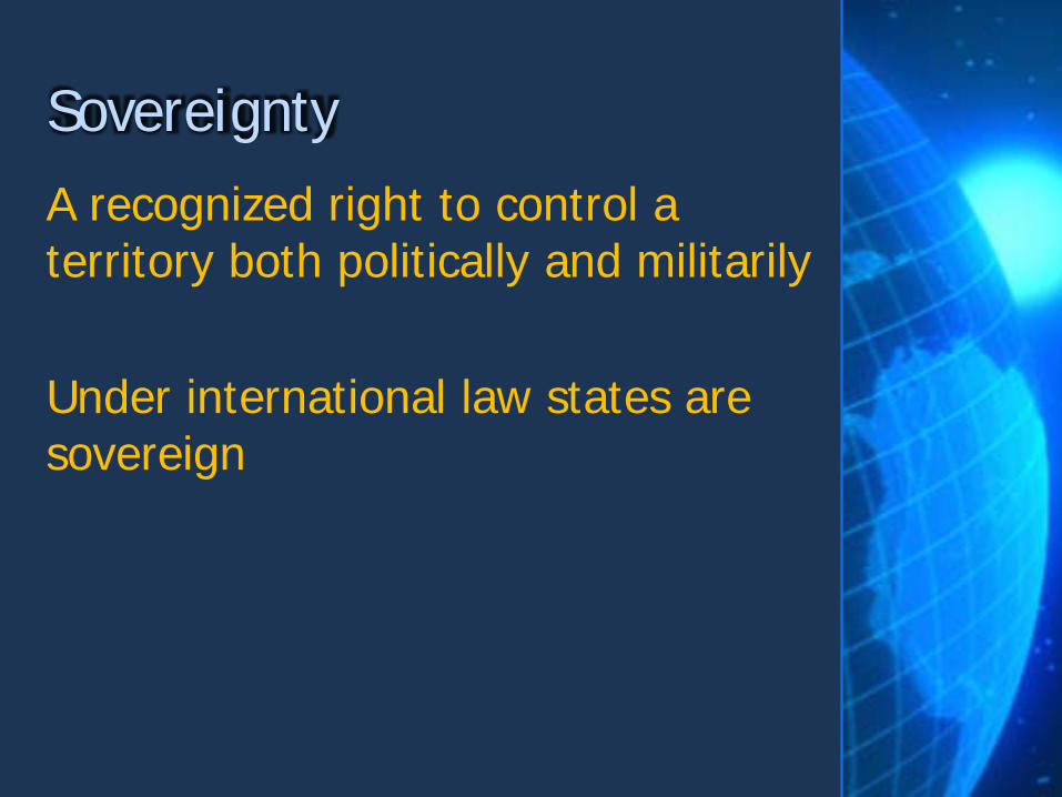
A recognized right to control a territory both politically and militarily Under international law states are sovereign
Sovereignty

•Has space or territory with recognized boundaries •Has a permanent population •Has economic activity and an organized economy – regulates foreign and domestic trade and issues money •Has the power of social engineering, such as education •Has a transportation system •Has a government which provides public services and police power •Has sovereignty. No other state exercises control over the territory •Has external recognition by other states
Qualifications for Statehood

Microstate • A very small State, such as Singapore.
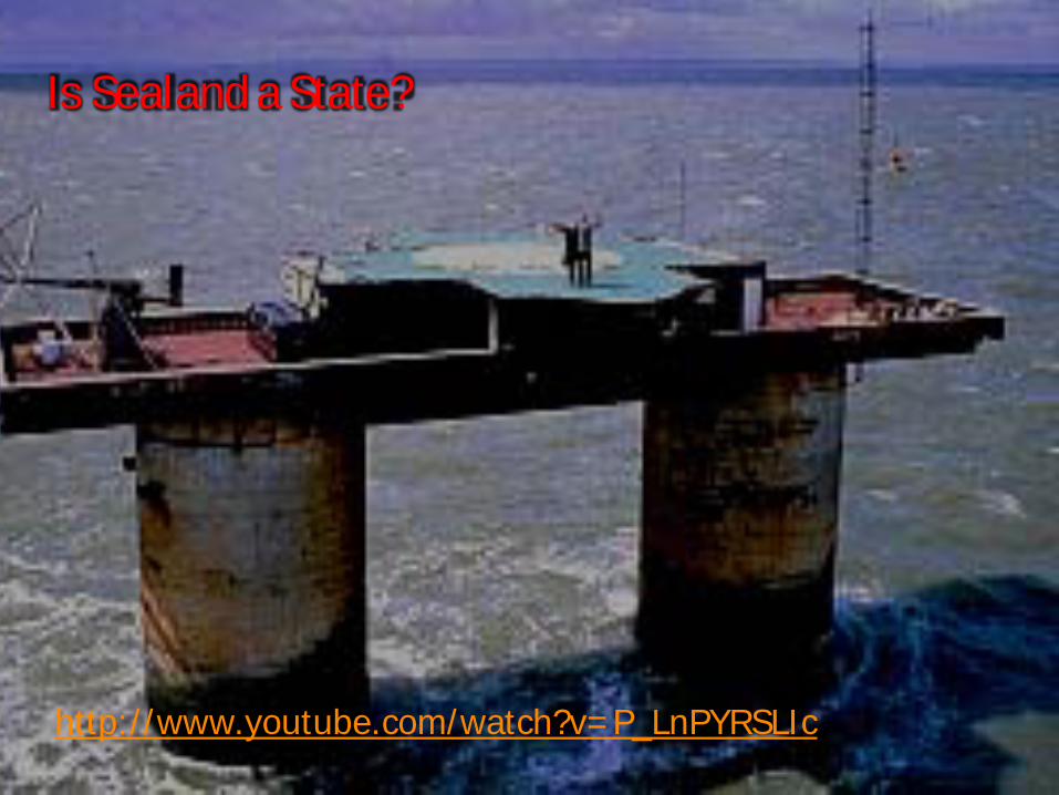
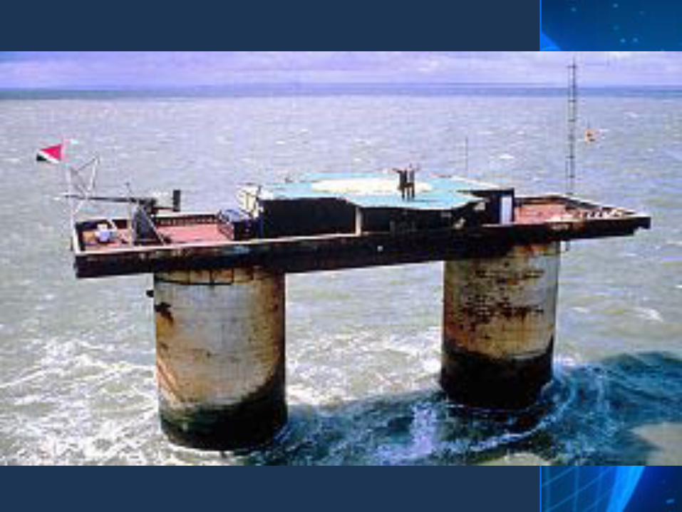
Is Sealand a State?
http://www.youtube.com/watch?v=P_LnPYRSLIc
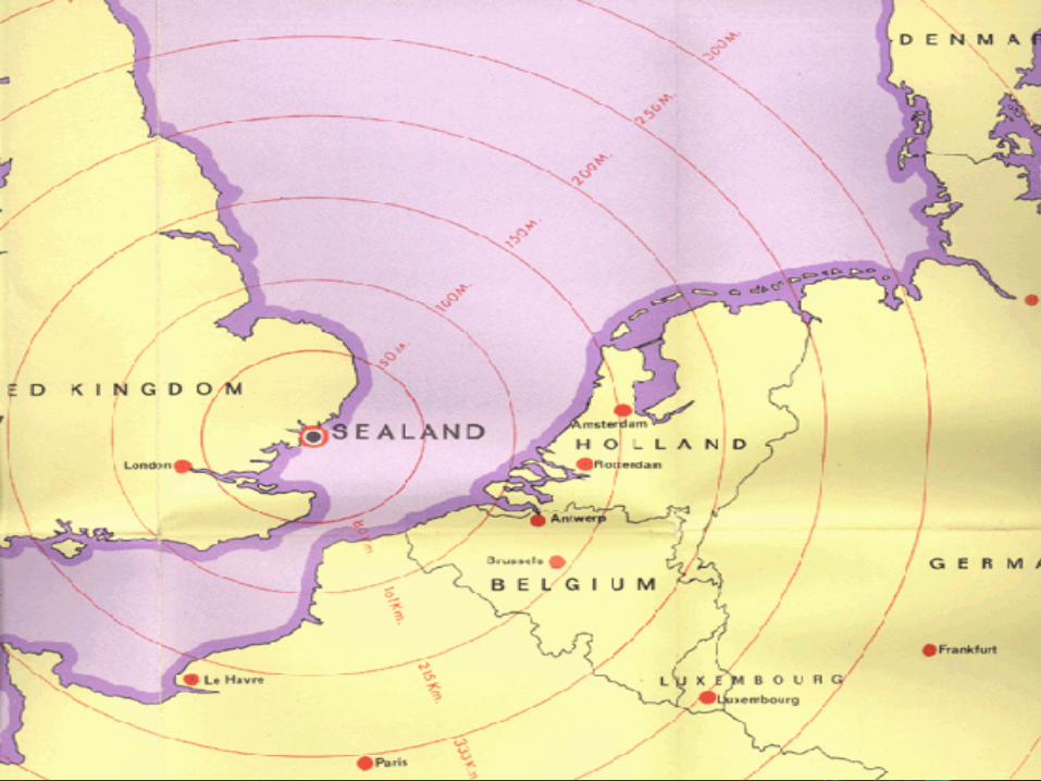

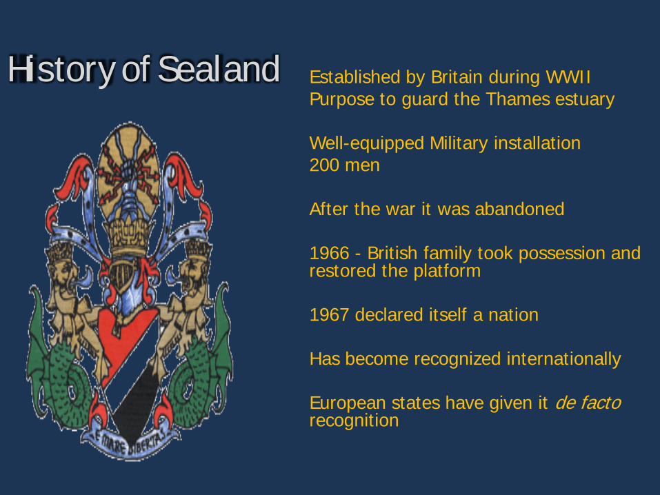
History of Sealand Established by Britain during WWII Purpose to guard the Thames estuary Well-equipped Military installation 200 men After the war it was abandoned 1966 - British family took possession and restored the platform 1967 declared itself a nation Has become recognized internationally European states have given it de facto recognition
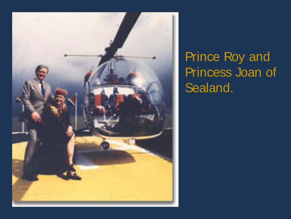
Prince Roy and Princess Joan of Sealand.
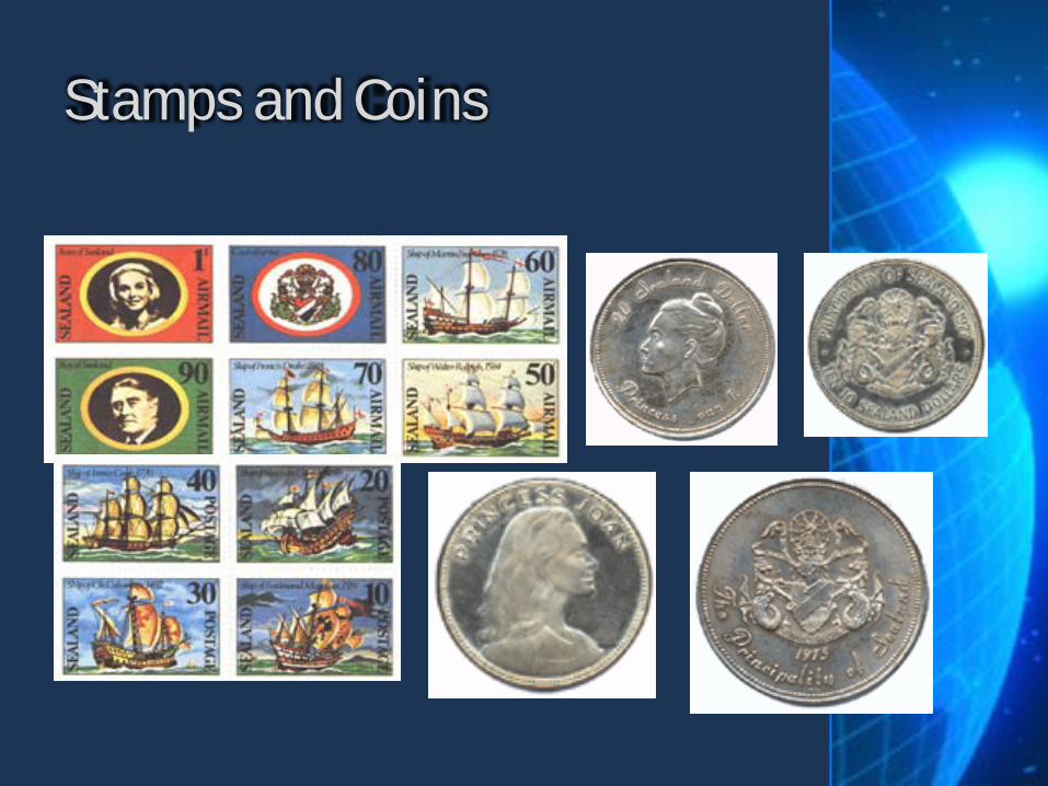
Stamps and Coins
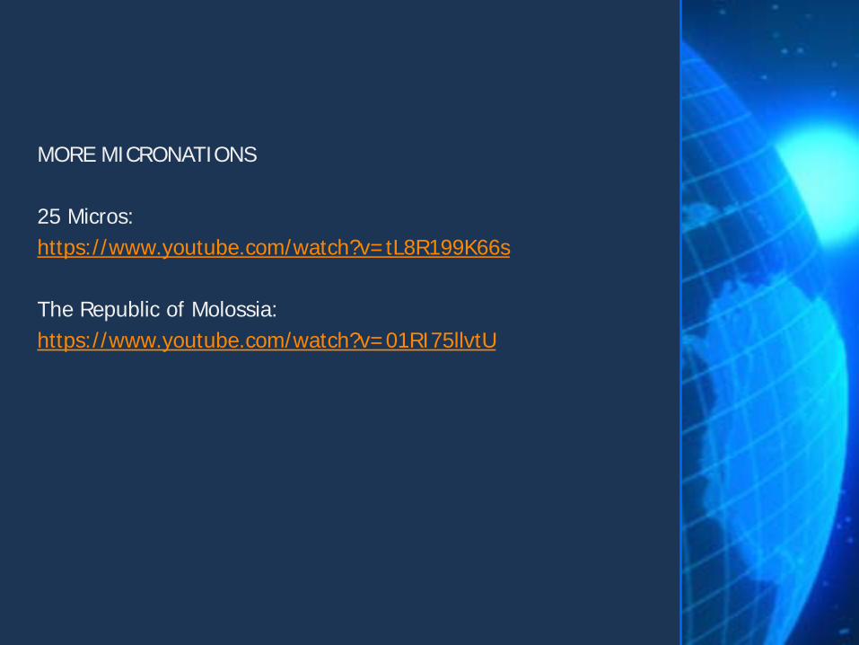
MORE MICRONATIONS 25 Micros: https://www.youtube.com/watch?v=tL8R199K66s The Republic of Molossia: https://www.youtube.com/watch?v=01RI75llvtU
The right of a state to defend sovereign territory against incursion from other states
Territorial integrity
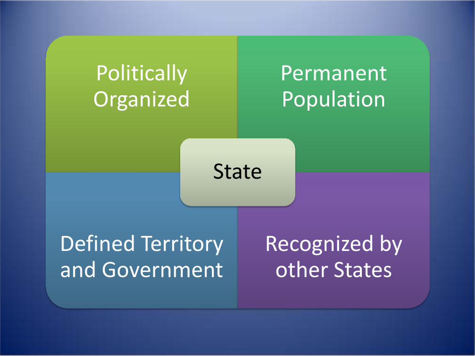
Politically Organized
Permanent Population
Defined Territory and Government
Recognized by other States
State
State
Territory
Sovereignty

How many States (countries) in the world?
• https://www.youtube.com/watch?v=4AivEQmfPpk

What did we have before States?
EMPIRES
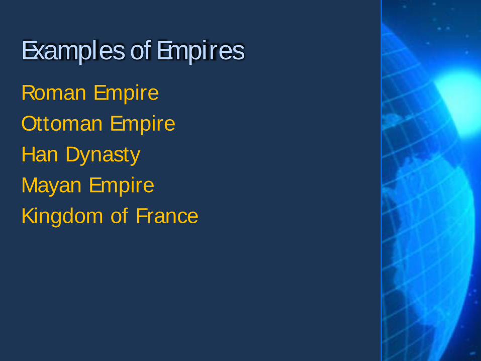
Roman Empire Ottoman Empire Han Dynasty Mayan Empire Kingdom of France
Examples of Empires
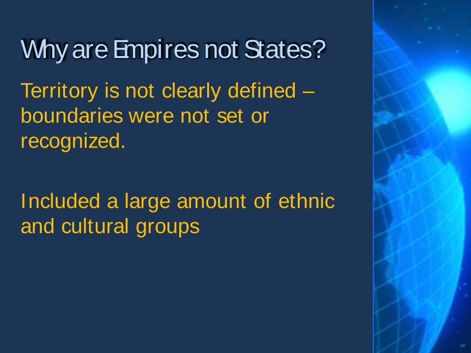
Territory is not clearly defined – boundaries were not set or recognized. Included a large amount of ethnic and cultural groups
Why are Empires not States?
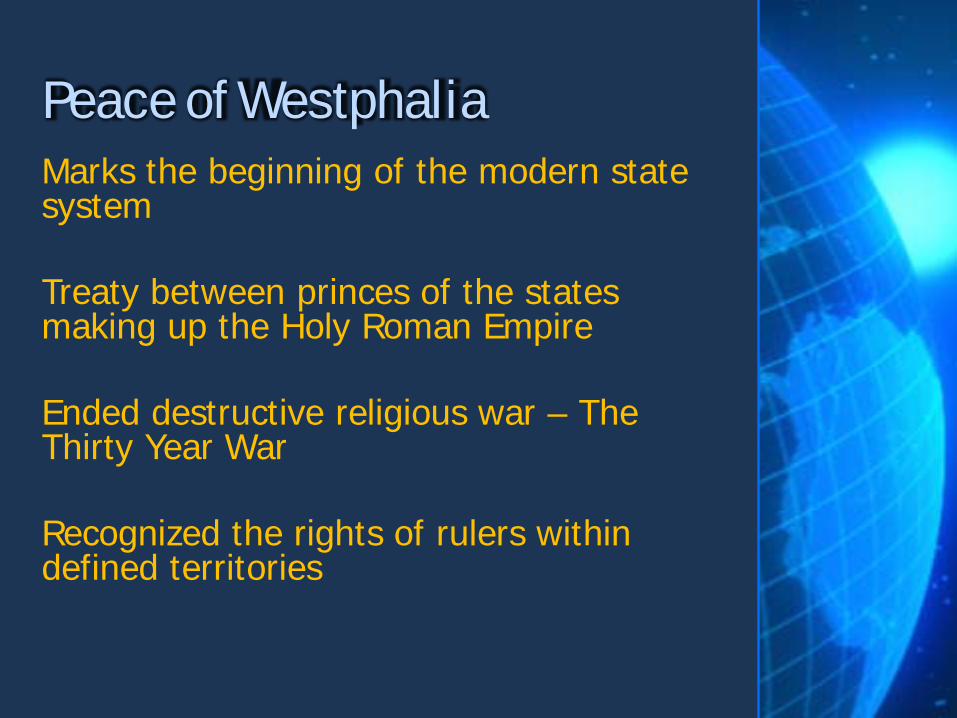
Marks the beginning of the modern state system Treaty between princes of the states making up the Holy Roman Empire Ended destructive religious war – The Thirty Year War Recognized the rights of rulers within defined territories
Peace of Westphalia
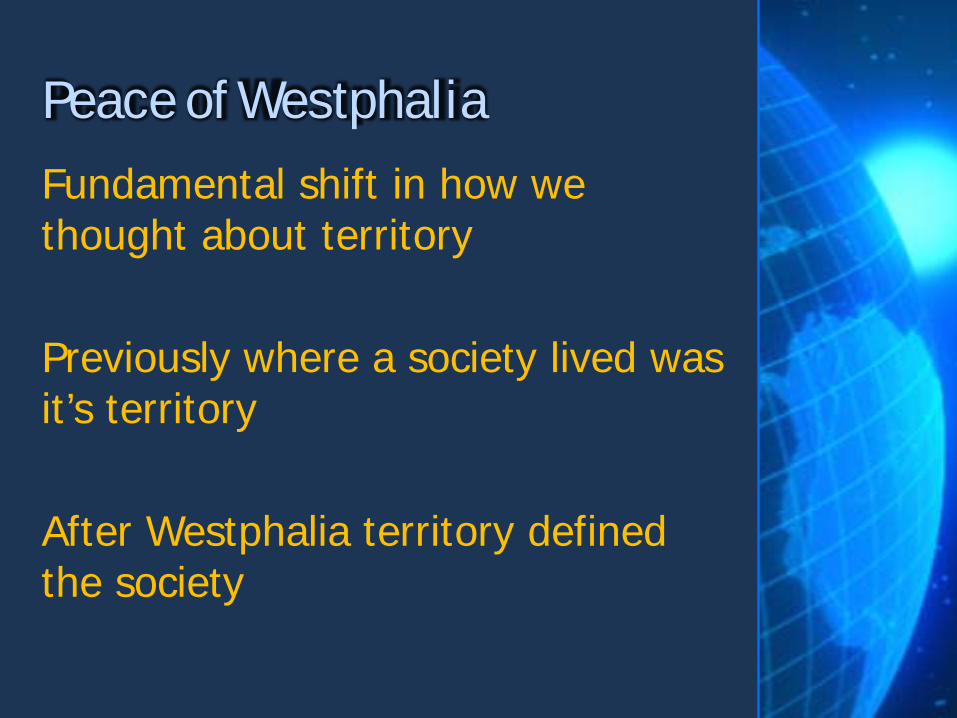
Fundamental shift in how we thought about territory Previously where a society lived was it’s territory After Westphalia territory defined the society
Peace of Westphalia

Political Divisions
States
Nations Nation-States

A group of people who think of themselves as one based on a shared culture and history. May share religion, language, an ethnicity, etc.
Nation

Culturally Defined
Shared Culture
Not defined by territory
“An Imagined Community”
Nation
Nations
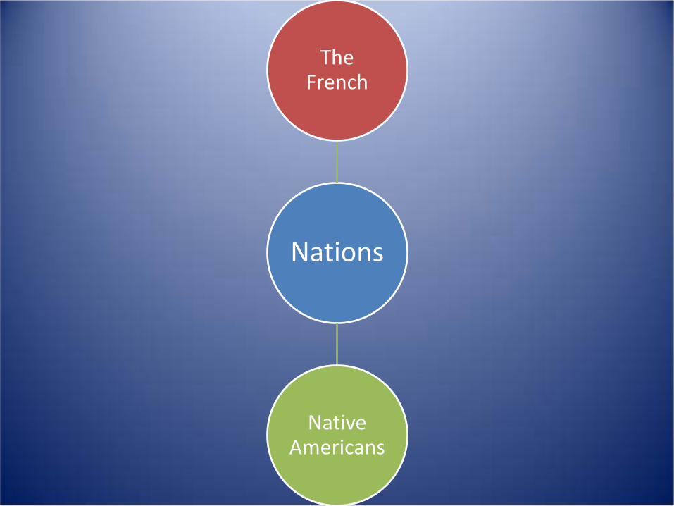
The French
Native Americans

Nations?
Italy
Great Britain

Not Nations
Italy
Great Britain

A politically organized area in which a nation and state occupy the same space. An ATTEMPT to marry the concepts of nation and state into one big happy territory.
Nation-State
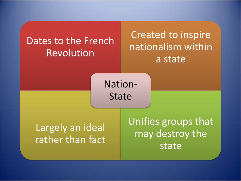
Dates to the French Revolution
Created to inspire nationalism within
a state
Largely an ideal rather than fact
Unifies groups that may destroy the
state
Nation-State
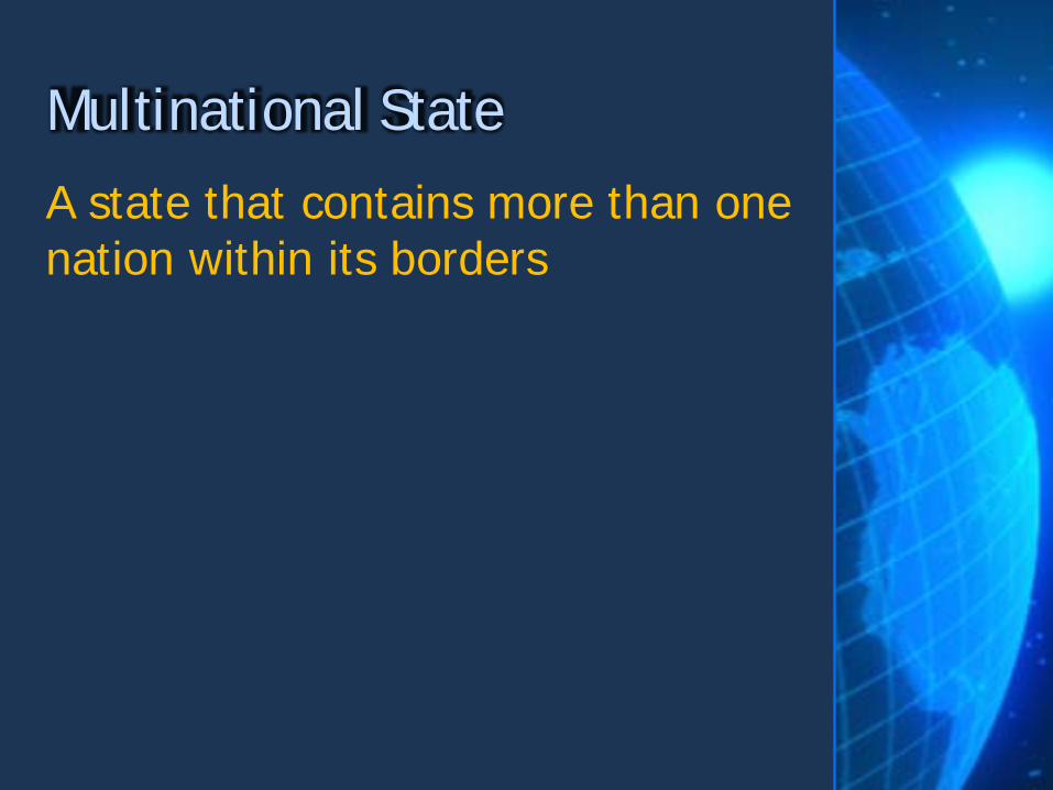
A state that contains more than one nation within its borders
Multinational State
When a nation stretches across borders and across states
Multistate Nation
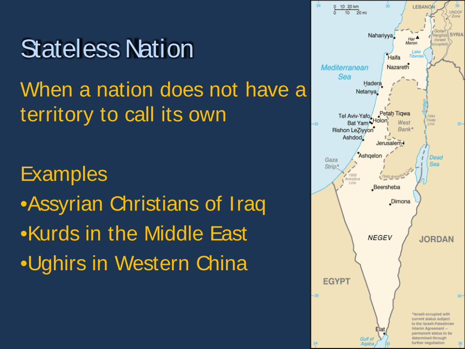
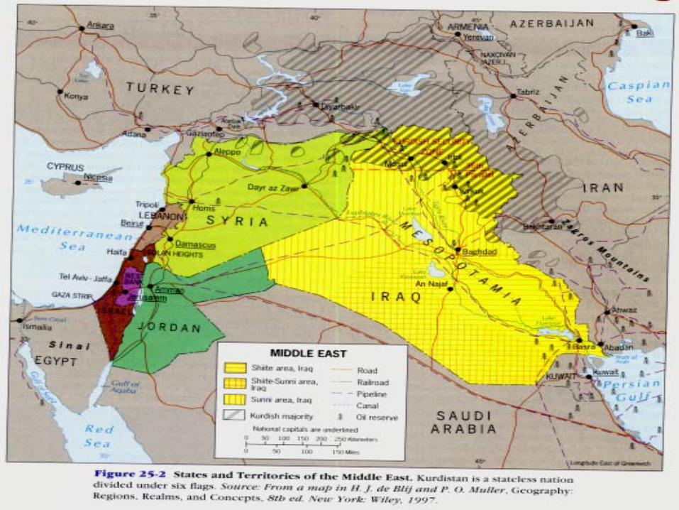
When a nation does not have a territory to call its own Examples •Assyrian Christians of Iraq •Kurds in the Middle East •Ughirs in Western China
Stateless Nation

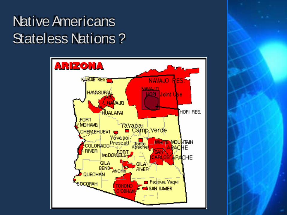
Native Americans Stateless Nations ?
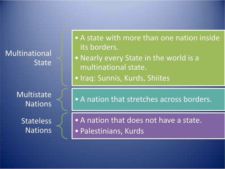
Multinational State
•A state with more than one nation inside its borders.
•Nearly every State in the world is a multinational state.
• Iraq: Sunnis, Kurds, Shiites
Multistate Nations •A nation that stretches across borders.
Stateless Nations
•A nation that does not have a state. • Palestinians, Kurds
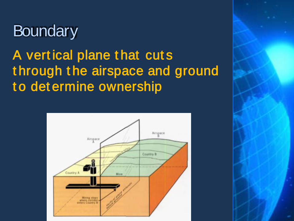
A vert ical plane t hat cut s t hrough t he airspace and ground t o det ermine ownership
Boundary
Boundaries drawn based on a grid system – such as line of latitude or longitude.
Geometric Boundary
Boundaries that follow an agreed upon feature in the natural landscape.
Physical Political Boundary
Boundaries are normally created in a treaty like legal document.
Defining (boundaries)
The drawing of a boundary on a map.
Delimiting

Creating visible means to mark a boundary – steel posts, fences, walls, etc.
Demarcating
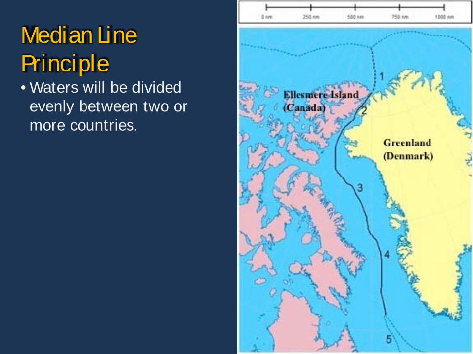
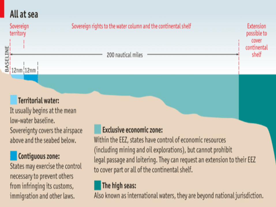
Median Line Principle • Waters will be divided evenly between two or more countries.
Antecedent Boundaries • Boundary lines that existed before human cultures developed into their current form.
• Many physical boundaries grew from antecedent boundaries
• Kentucky and Indiana grew as distinct cultures around an already existing divider – the Ohio River.
Subsequent Boundaries • Divided space resulted from human interaction and negotiation after settlement.

Superimposed • Boundaries forcibly put on the landscape by outside parties, such as invaders or supranational organizations.
• Example - The UN created borders of Israel.
Relict • Boundary that no longer functions as a border.
• Example – The Berlin Wall

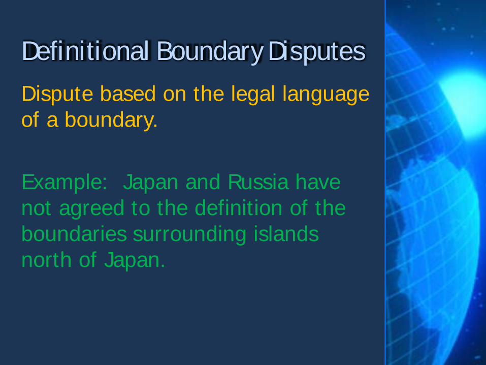
Dispute based on the legal language of a boundary. Example: Japan and Russia have not agreed to the definition of the boundaries surrounding islands north of Japan.
Definitional Boundary Disputes

Countries agree on the definition, but not on where the boundary exists on the earth or on a map. Example: Saudi Arabia and Yemen have agreed to a border, but not to exactly where that border is located.
Locational Boundary Disputes
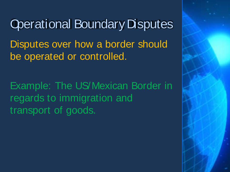
Disputes over how a border should be operated or controlled. Example: The US/Mexican Border in regards to immigration and transport of goods.
Operational Boundary Disputes
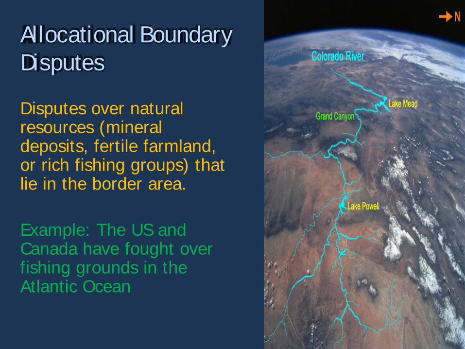
Disputes over natural resources (mineral deposits, fertile farmland, or rich fishing groups) that lie in the border area. Example: The US and Canada have fought over fishing grounds in the Atlantic Ocean
Allocational Boundary Disputes
The relationship between a state’s geographic shape, size, relative location and its political situation.
Territorial Morphology
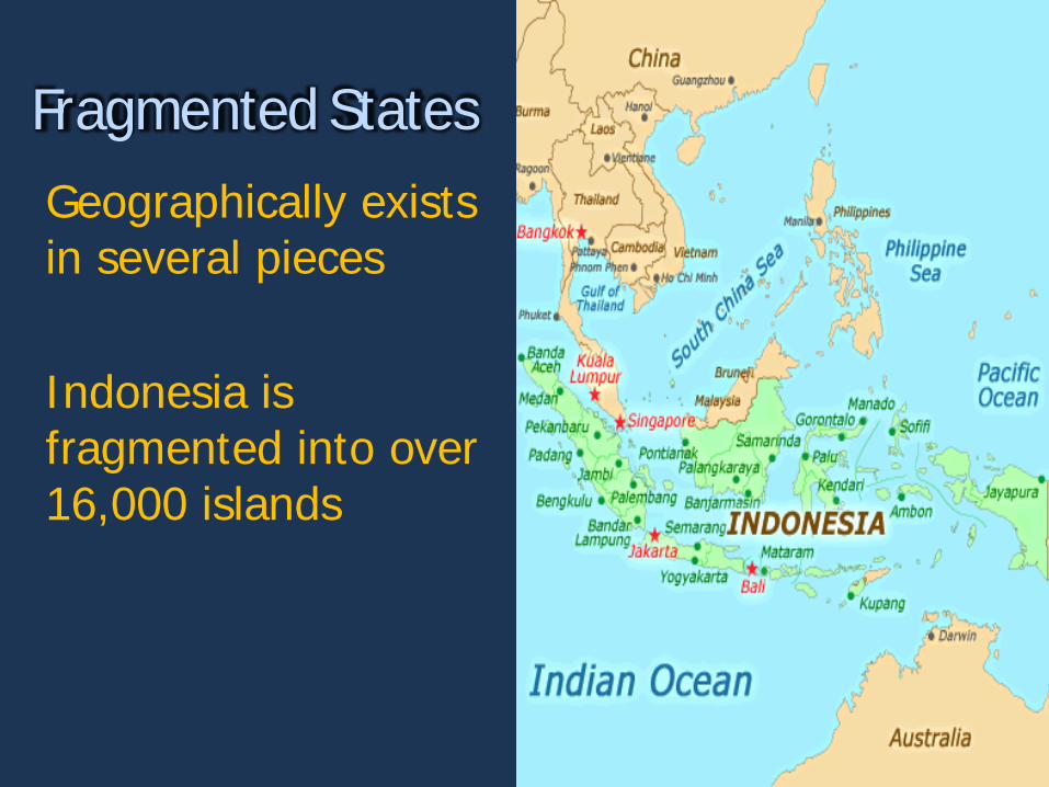
Geographically exists in several pieces Indonesia is fragmented into over 16,000 islands
Fragmented States
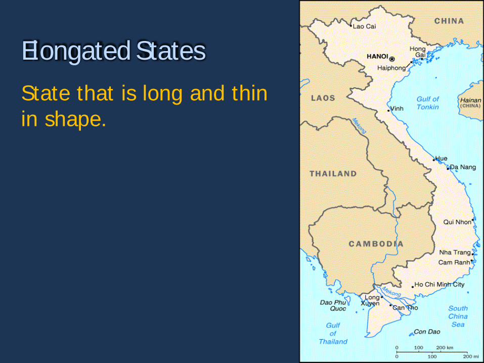
State that is long and thin in shape.
Elongated States
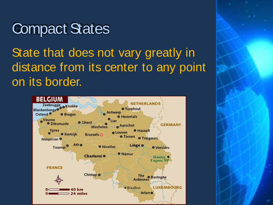
State that does not vary greatly in distance from its center to any point on its border.
Compact States
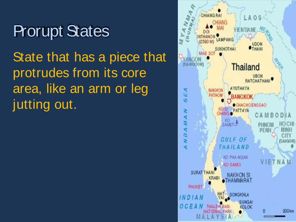
State that has a piece that protrudes from its core area, like an arm or leg jutting out.
Prorupt States
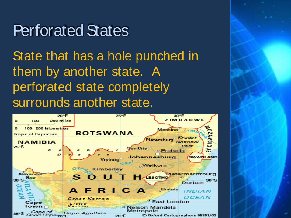
State that has a hole punched in them by another state. A perforated state completely surrounds another state.
Perforated States
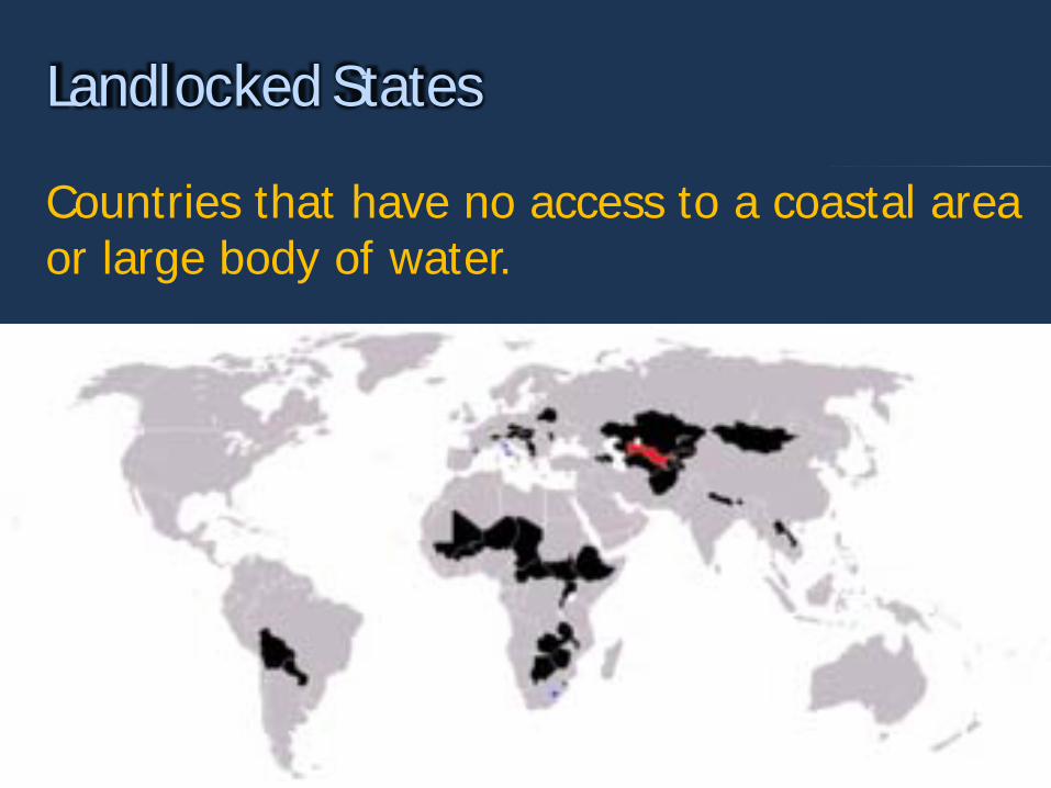
Countries that have no access to a coastal area or large body of water.
Landlocked States
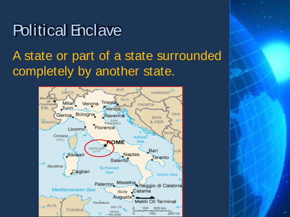
A state or part of a state surrounded completely by another state.
Political Enclave

A part of a state almost completely separated from the rest of the country.
Political Exclave

The Most Complex Borders in the World – Part 1: https://www.youtube.com/watch?v=gtLxZiiuaXs The Most Complex Borders in the World – Part 2: https://www.youtube.com/watch?v=3ZdkqqjosCM
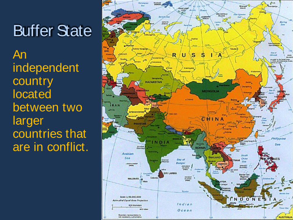
An independent country located between two larger countries that are in conflict.
Buffer State
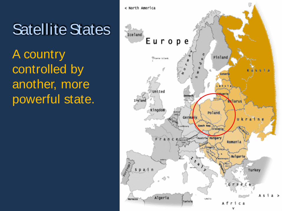
A country controlled by another, more powerful state.
Satellite States

A state or group of states that exist within a sphere of competition between larger states and is often culturally, economically and politically fragmented.
Shatterbelt

Regions where boundaries are weakly developed, territoriality is unclear and not well established.
Frontiers
Territ ory size & shape can inf luence polit ical st abilit y – bot h int ernally and ext ernally (border) . A. Choose the state shape that you believe
would be the least stable and explain why. Use at least one real world example to make your point.
B. Choose the state shape that you believe would be the most stable and explain why. Use at least one real world example
Be sure to address both internal and border stability.

A STORY ABOUT STUFF
or
How to steal stuff from other territories and make yourself filthy rich.
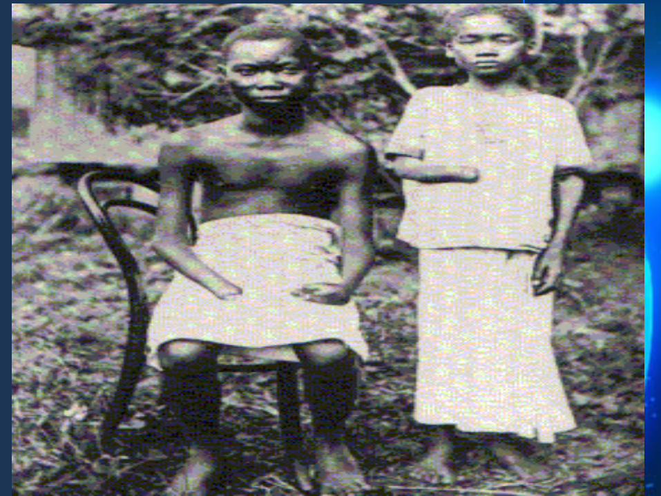
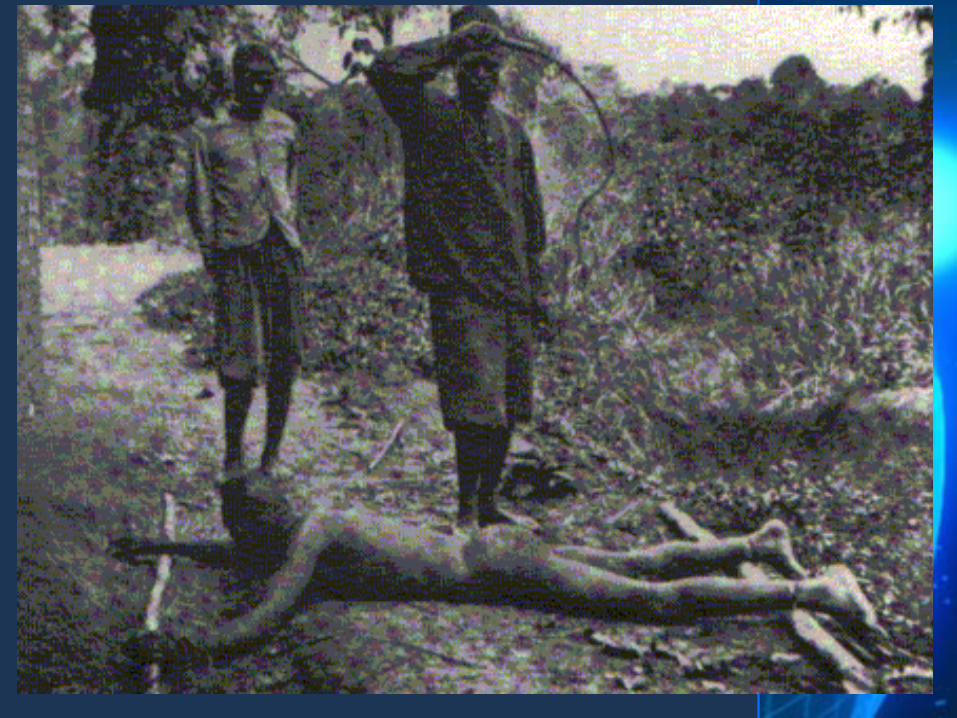
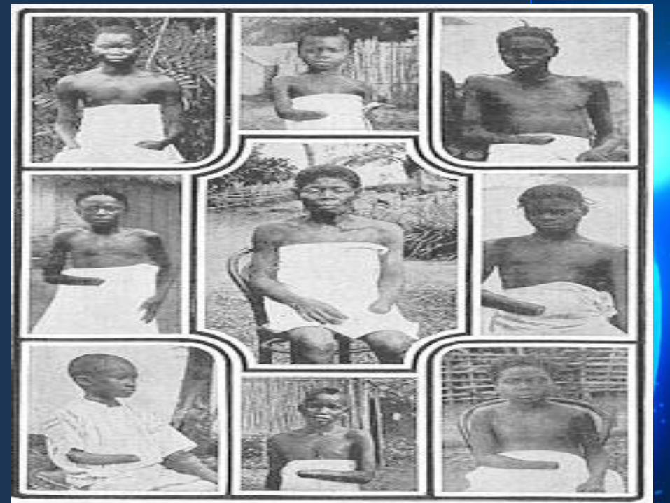
COLONIALISM
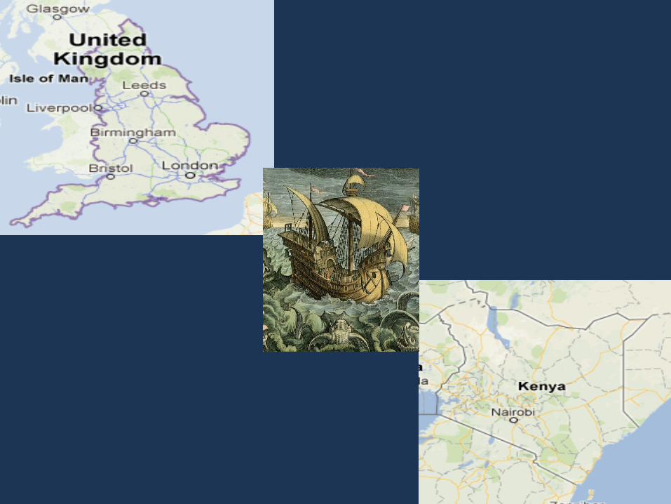

Establishing a new territory by a group of people who keep their ties to their home government. The control of one state over another place Often the colonizer has a more industrialized economy Major factor in colonialism was the industrial revolution
Colonialism
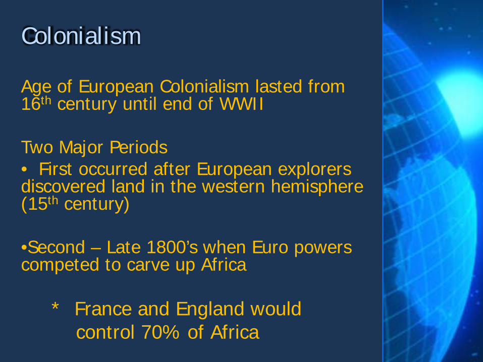
Age of European Colonialism lasted from 16th century until end of WWII Two Major Periods • First occurred after European explorers discovered land in the western hemisphere (15th century) •Second – Late 1800’s when Euro powers competed to carve up Africa
* France and England would control 70% of Africa
Colonialism

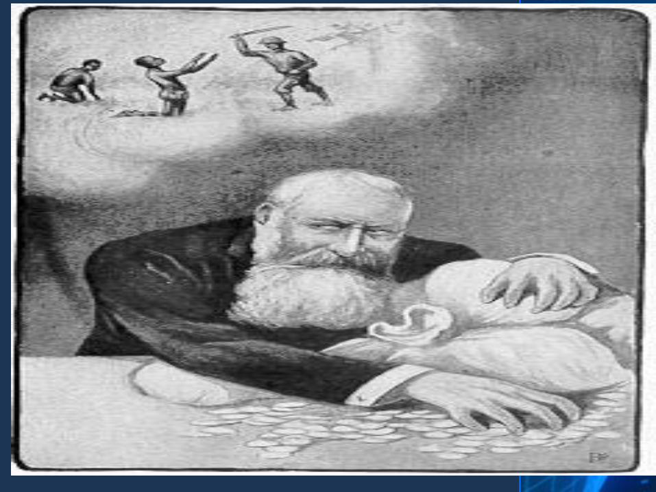
An economic system where a state acquires colonies that provide it with the raw materials to ship back home and use in making products for the population of the mother country
Mercantilism

The process of establishing political, social and economic dominance over a colonized area
Imperialism

MERCANTILISM, COLONIALISM, IMPERIALISM ? Mercantilism: Economic System – Make money by establishing colonies and using the resources to make products and goods back home. Colonialism: The act of establishing the territory Imperialism: The act of dominating the territory
What’s the Difference
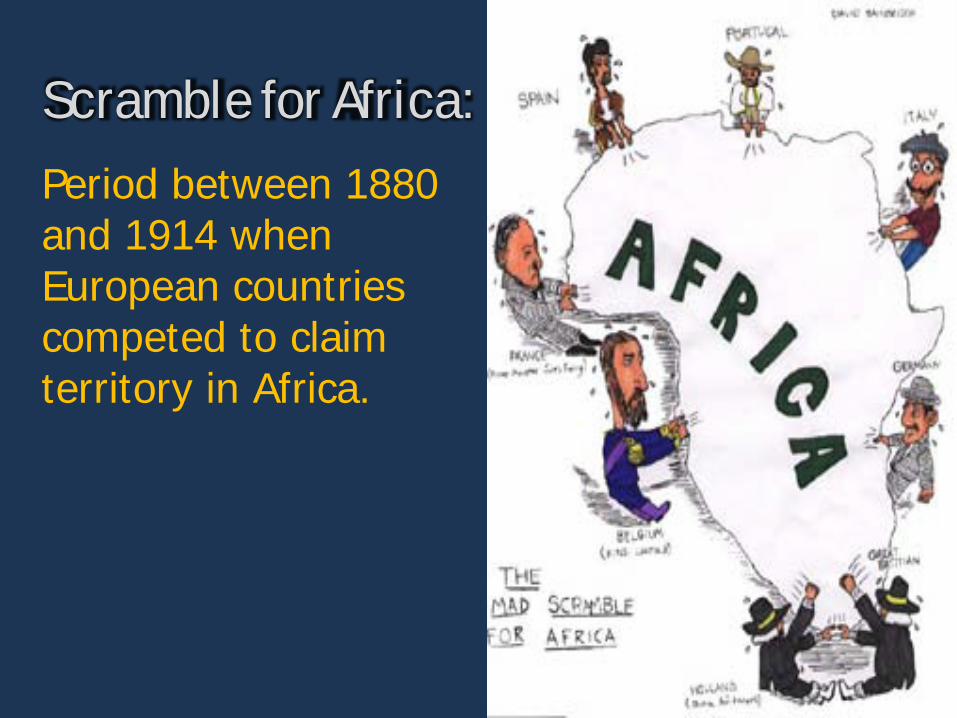
Period between 1880 and 1914 when European countries competed to claim territory in Africa.
Scramble for Africa:
Berlin Conference (1884): Called together all the European powers to lay down rules for the division of Africa. Agreed that any European power could claim land in Africa by notifying other nations of their claims and showing they could control the area

European Motives for Imperialism
Motive #1 - Industry and Technology
To improve their economies they needed new markets and raw materials. Technological advances led to the Europeans ability to dominate (maxim guns, steamboats, quinine)
Motive #2 - Nationalism
Pride in one’s country led to a heated competition among the European nations. The more lands you controlled showed how strong you were as a country.
Motive #3 - Racism and Social Darwinism
Social Darwinism : Idea that one race is better than another Survival of the fittest: Those who are the fittest would enjoy wealth and success. If others suffered or were exterminated that was nature.
Motive #4 - Civilizing Mission
Missionaries wanted to Christianize and “civilize” the peoples of non-Europeans societies.
Colonialism in 10 Minutes http://www.youtube.com/watch?v=Pw12KGSj53k
Superimposed Borders and Colonialism

http://thedailyshow.cc.com/videos/kovgs5/sir-archibald-mapsalot-iii
Continued Borders Issues in Israel
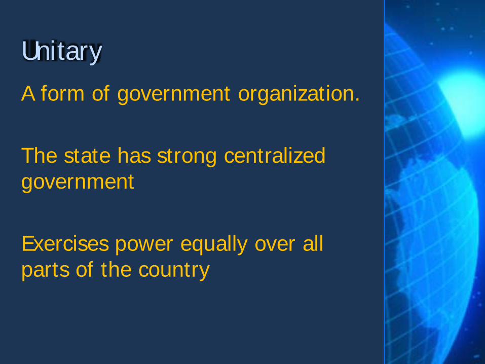
A form of government organization. The state has strong centralized government Exercises power equally over all parts of the country
Unitary
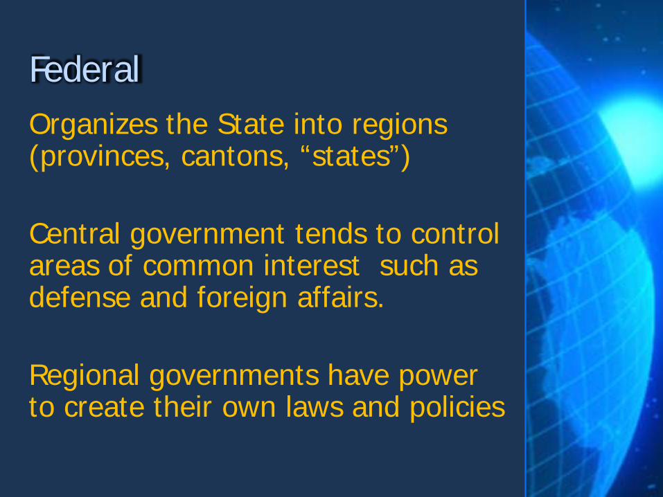
Organizes the State into regions (provinces, cantons, “states”) Central government tends to control areas of common interest such as defense and foreign affairs. Regional governments have power to create their own laws and policies
Federal

The idea that the people are the ultimate sovereign The people are the nation and have ultimate power over what happens in the state
Democracy

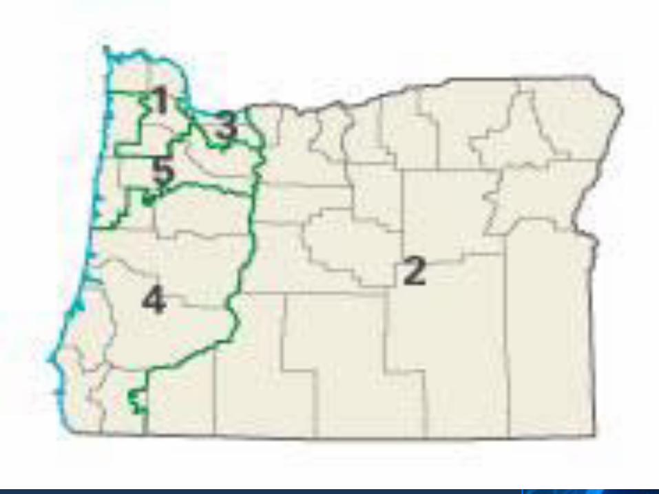
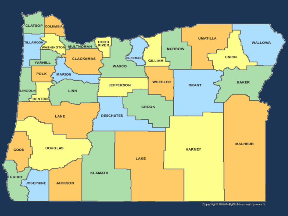
System where each representative is elected from a territorially defined district.
Territorial Representation
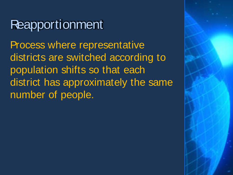
Process where representative districts are switched according to population shifts so that each district has approximately the same number of people.
Reapportionment

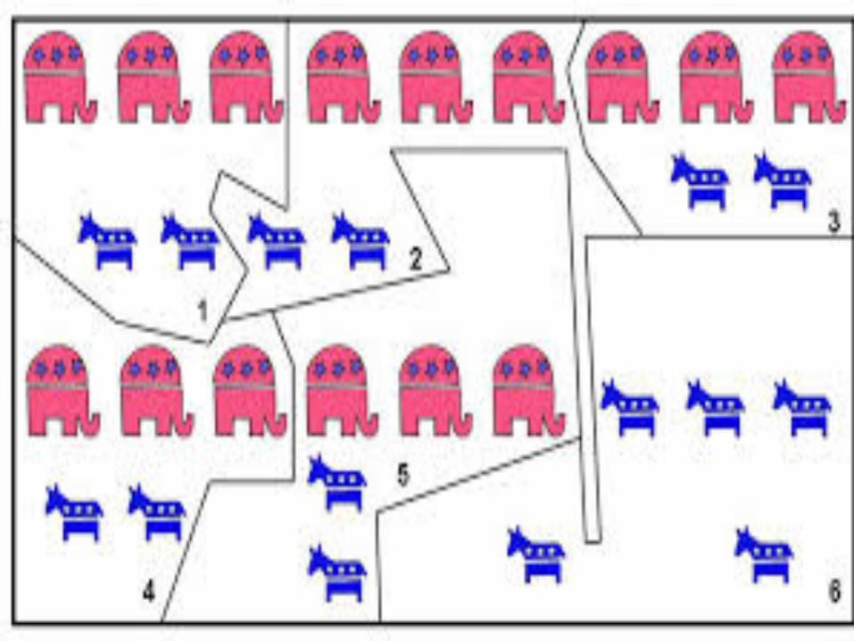
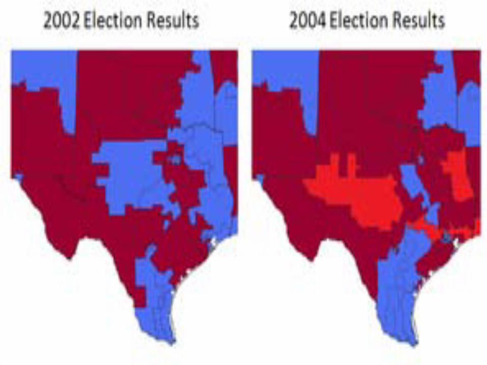
Redistricting to create an advantage for one political party Divides districts to give one party a majority in most districts.
Gerrymandering
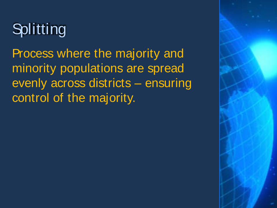
Process where the majority and minority populations are spread evenly across districts – ensuring control of the majority.
Splitting
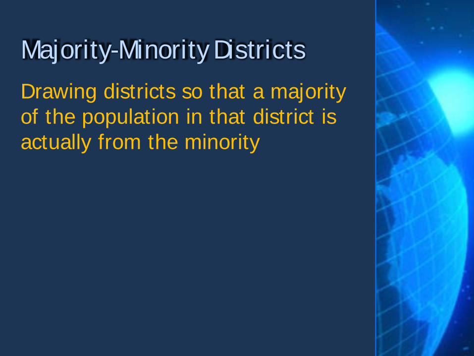
Drawing districts so that a majority of the population in that district is actually from the minority
Majority-Minority Districts


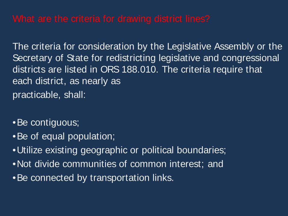
What are the criteria for drawing district lines? The criteria for consideration by the Legislative Assembly or the Secretary of State for redistricting legislative and congressional districts are listed in ORS 188.010. The criteria require that each district, as nearly as practicable, shall: •Be contiguous; •Be of equal population; •Utilize existing geographic or political boundaries; •Not divide communities of common interest; and •Be connected by transportation links.
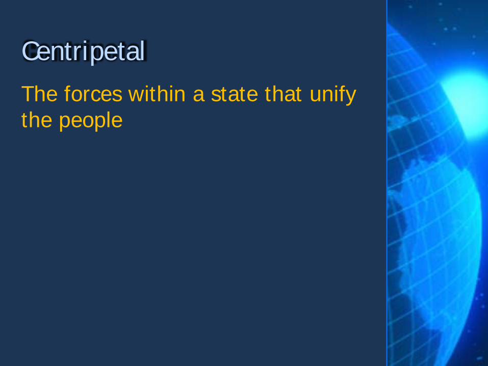
The forces within a state that unify the people
Centripetal
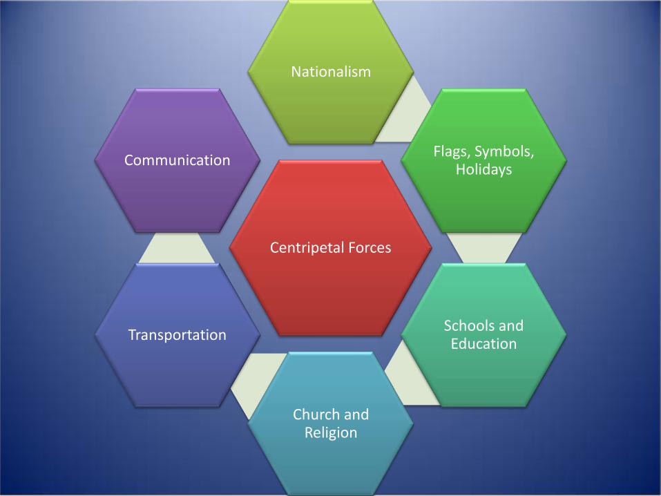
Centripetal Forces
Nationalism
Flags, Symbols, Holidays
Schools and Education
Church and Religion
Transportation
Communication
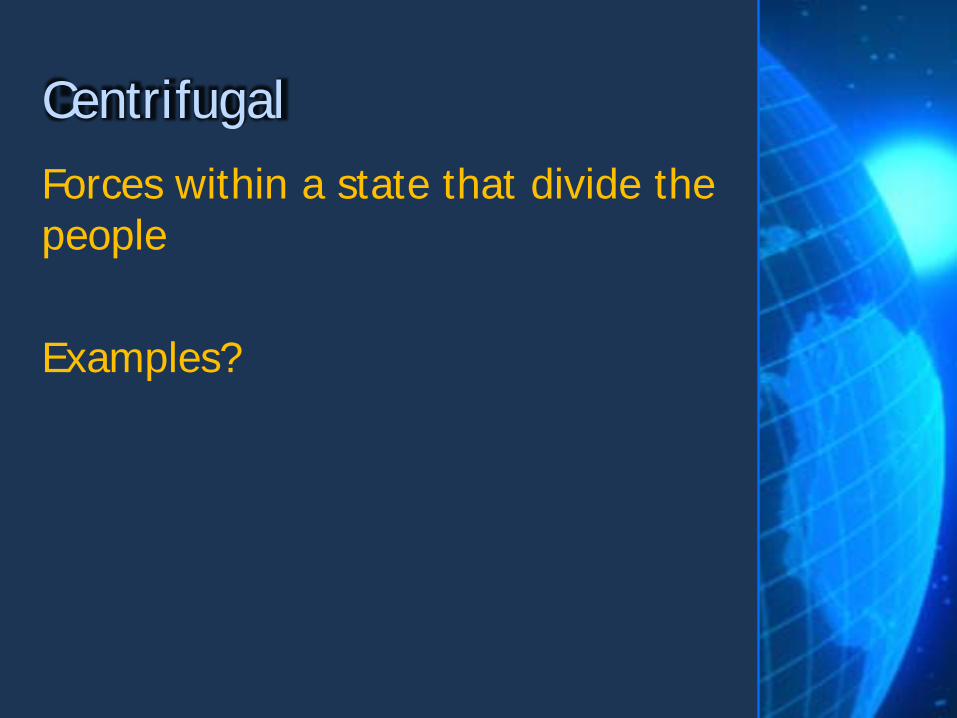
Forces within a state that divide the people Examples?
Centrifugal
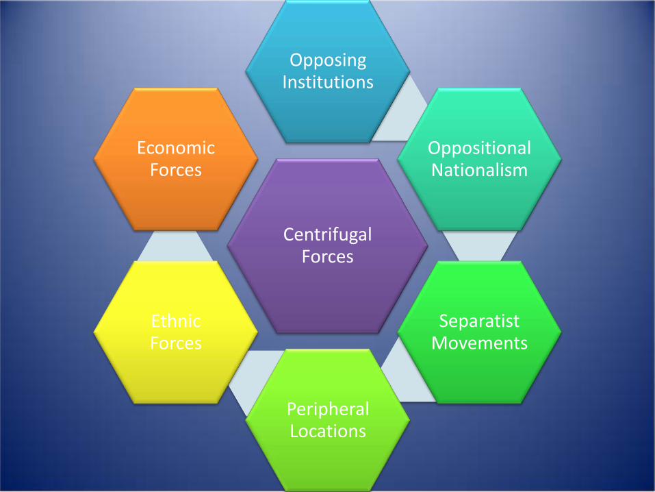
Centrifugal Forces
Opposing Institutions
Oppositional Nationalism
Separatist Movements
Peripheral Locations
Ethnic Forces
Economic Forces
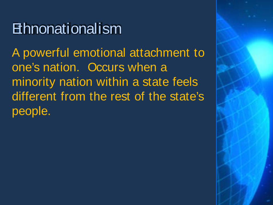
A powerful emotional attachment to one’s nation. Occurs when a minority nation within a state feels different from the rest of the state’s people.
Ethnonationalism
A movement by a nation to reunite its parts when they have been spread across borders.
Irrendentism

Process where regions within a state demand and gain political strength and autonomy at the expense of the central government.
Devolution
Balkanization • The process of fragmentation or division of a region or state into smaller regions.

The movement of social, political and economic out of the hands of states. Modern trade, communication and travel has lessened the effects of boundaries Example: Schengen Area - 26 European countries that have abolished passport and any other type of border control at their common borders.
Deterritorialization
Actions taken by a state to solidify control over its territory. US building a fence along the Mexican border.
Reterritorialization
An entity composed of three or more states that forge an association and form an administrative structure for mutual benefit and to pursue shared goals.
Supranational Organization
http://www.learner.org/series/powerofplace/page3.html Examples / Information from video will be fair game for exam! - General knowledge and how it applies to HG
Power of Place Supranationalism and Devolution
International relations, as influenced by geographical factors.
Geopolitics
School of geopolitics which focused on how to become powerful and strategies for maintaining power.
Classical Geopolitcs
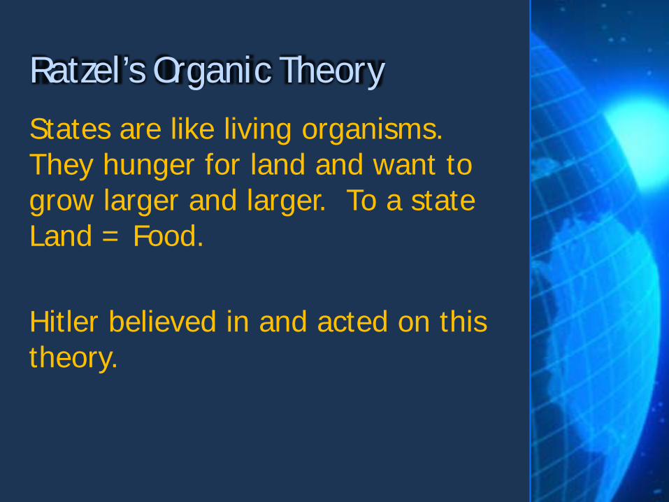
States are like living organisms. They hunger for land and want to grow larger and larger. To a state Land = Food. Hitler believed in and acted on this theory.
Ratzel’s Organic Theory

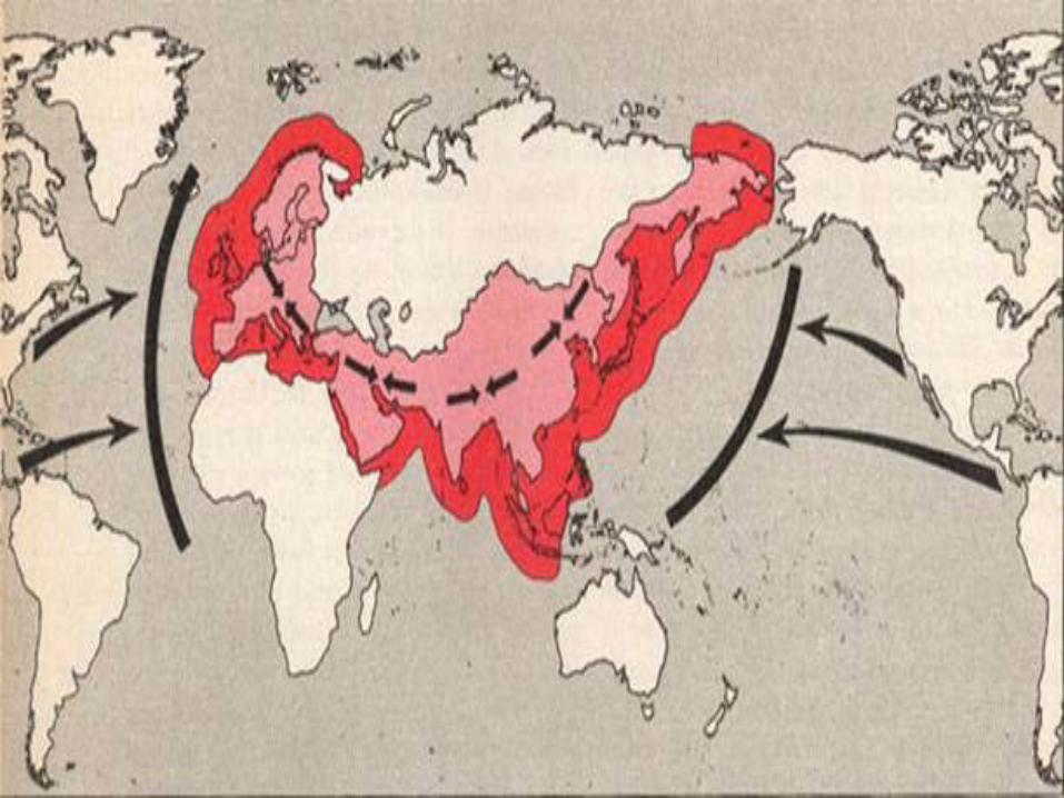
Halford Mackfinder Era of sea power was ending and control over land would be the key to power. Controlling Eurasia would be the key to dominating the world.
Heartland Theory


Theory that the rimland of Euroasia was the key to power Rimland was the periphery – extending from Western Europe, Southeast, South and East Asia. Important to balance power in the rimland to prevent a global power from emerging
Rimland Theory
School of geopolitics that focuses on explaining the geographical assumptions and perspectives of international actors. Analyzes why countries act. Used to predict what will happen in a region and how government should respond. Determines a countries foreign policy decisions.
Critical Geopolitics
https://news.vice.com/video/how-the-us-created-the-islamic-state
Cold War Theory Democratic allies must protect lands from falling to the communists, because if one country (domino) fell under the power of communism others in the region would also fall. Believed that this would result in communist domination of the world. Led to Vietnam war.
The Domino Theory
World order in which one dominant state makes political decisions and its allies follow. Allies have no say in the decision making process US decided to invade Iraq – expected allies to support and even join in the invasion.
Unilateralism

The process of placing a price on a good, service or idea and then buying selling and trading that item. Companies create new products and create demand for the products through marketing.
Commodification

Global Commons • The ‘Global Commons’ refers to resources or areas that lie outside of the political reach of any one nation State.
• International law identifies four global commons:
• The High Seas • The Atmosphere • Antarctica • Outer Space.

Law of the Sea • A collection of international laws and treaties that set rules for how States will use the oceans.
UNCLOS – UN Convention on the Law of the Sea • Coastal States have claim to the sea up to 12 nautical miles from the shoreline
• Must allow commercial ships from other countries to pass through these waters
• Coastal state can claim up to 200 nautical miles as an exclusive economic zone, over which it has control of resources (oil, fish, etc.)
• If there is not 200 nautical miles between two or more countries than the median line principle will be used.