Anssi M. Lensu, Senior Lecturer, PhD, University of ...
16
Anssi M. Lensu, Senior Lecturer, PhD, University of Jyväskylä, Jyväskylä, Finland Faruk P.S. Mamugy, PhD Student, Eduardo Mondlane University, Maputo, Mozambique
Transcript of Anssi M. Lensu, Senior Lecturer, PhD, University of ...

Anssi M. Lensu, Senior Lecturer, PhD, University of Jyväskylä, Jyväskylä, Finland
Faruk P.S. Mamugy, PhD Student, Eduardo Mondlane University, Maputo, Mozambique
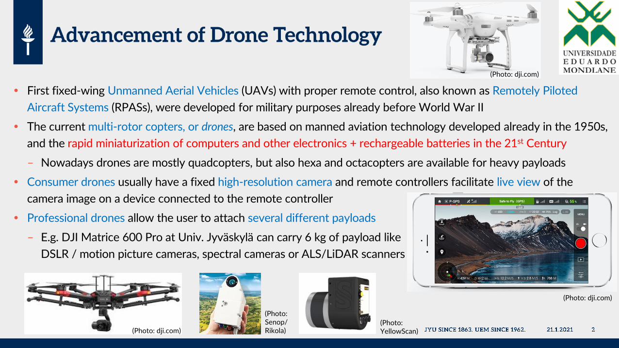
First fixed-wing Unmanned Aerial Vehicles (UAVs) with proper remote control, also known as Remotely Piloted
Aircraft Systems (RPASs), were developed for military purposes already before World War II
The current multi-rotor copters, or drones, are based on manned aviation technology developed already in the 1950s,
and the rapid miniaturization of computers and other electronics + rechargeable batteries in the 21st Century
– Nowadays drones are mostly quadcopters, but also hexa and octacopters are available for heavy payloads
Consumer drones usually have a fixed high-resolution camera and remote controllers facilitate live view of the
camera image on a device connected to the remote controller
Professional drones allow the user to attach several different payloads
– E.g. DJI Matrice 600 Pro at Univ. Jyväskylä can carry 6 kg of payload like
DSLR / motion picture cameras, spectral cameras or ALS/LiDAR scanners
(Photo: dji.com)
(Photo: dji.com)
(Photo: dji.com)
(Photo:YellowScan)
(Photo:Senop/Rikola)

Possibility to take aerial photographs
– Very high-resolution images (even 1-2 cm/pixel)
– Can help accessing target areas in difficult terrain
With photogrammetry (and overlapping images) it is
possible to create truly orthogonal image mosaics
and Digital Elevation Models
Possibility to use special remote sensing equipment
– (Hyper)spectral cameras
– Airborne Laser Scanning (ALS/LiDAR) devices
Can photograph same target areas repeatedly
– More often than satellites, also when cloudy
– Allows observation of e.g. seasonal changes
Lower costs (compared to other aerial photography)
– Drones inexpensive compared to planes, manned
helicopters, or aerial photography services
– Training needed for drone operation takes only
days or weeks (not months or years)
– Many software packages are inexpensive
Software packages have become quite versatile due
to the large number of customers
Drone (pixel size 2.63 cm) WorldView-2 (pixels 2 m)
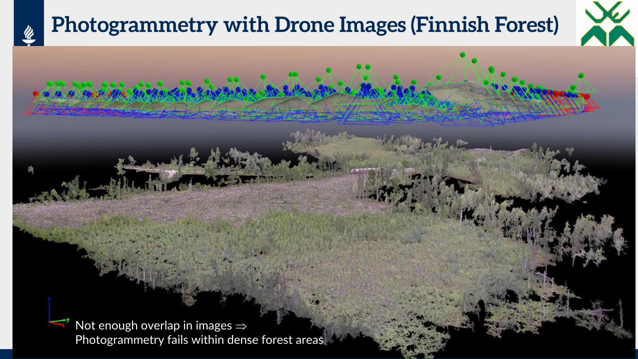
Not enough overlap in images Photogrammetry fails within dense forest areas

Sensitivity to environmental conditions
– Some drones tolerate light rain, but…
– Rain or fog makes images useless (and may cause
short circuits in the electronics of the drone)
– Strong wind may prohibit flights altogether, or
at least increases the risks of collisions
Drone battery lasts only about 20 to 40 minutes
– Reduces the size of the mapped area if the number
of flight batteries is limited
– Charging takes usually about 1 hour / battery
Some software programs, like flight planning, may
require a constant Internet connection
– May be difficult to arrange at some locations
Legislative limitations, such as
Drone needs to be seen all the time (flights beyond
visible line-of-sight require special permits)
– This limits the maximum observation distance to
about 700 meters and may reduce mission size
– Dense forests may make observation difficult
Flight altitude is limited to 150 (or 120) meters
– Reduces the area covered by single images
– Increases distortions at off-nadir parts of images
Maximum mapped area size is only about 1 km2
– Larger areas need to be split into pieces
Mapping Finnish forests is difficult with mosaicking
Some programs require a lot of computing power!
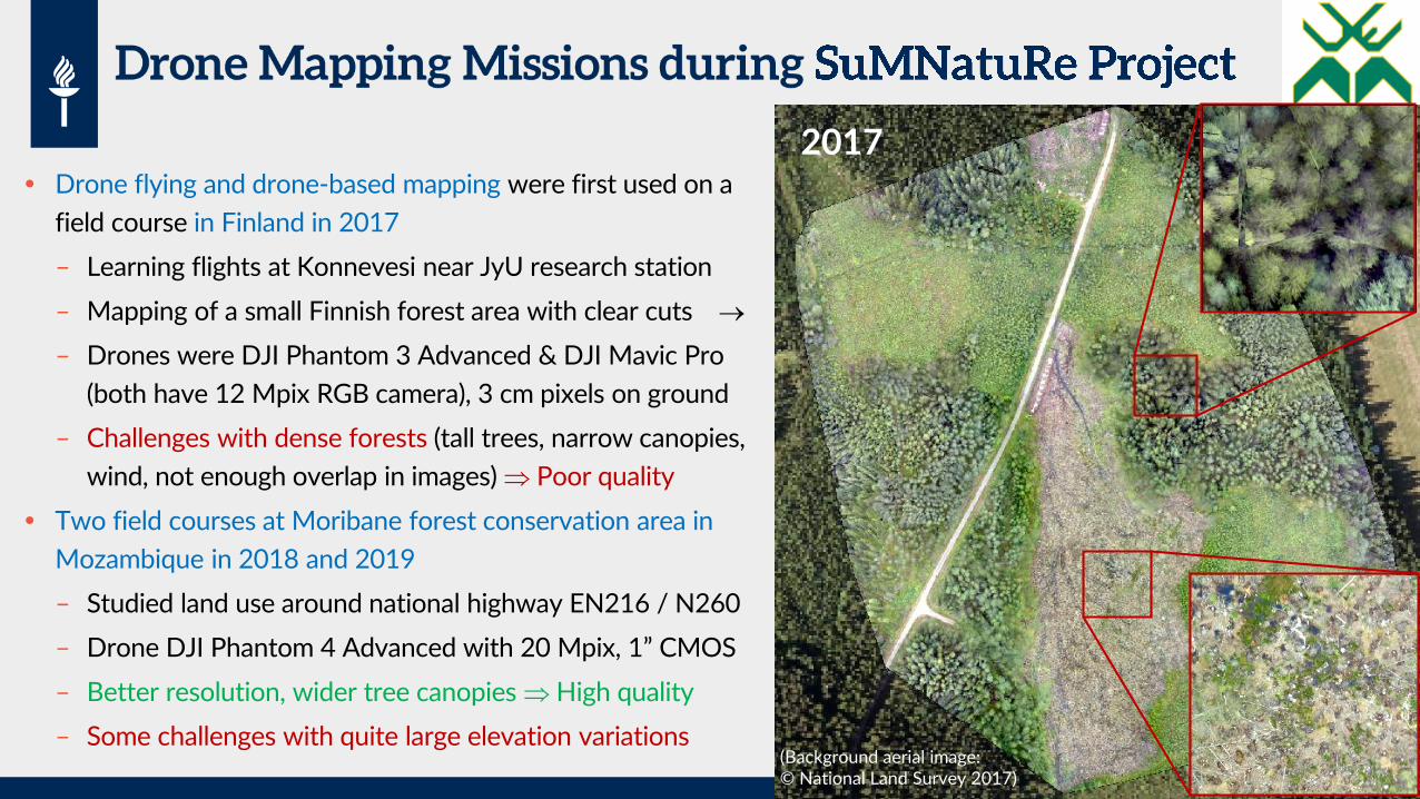
Drone flying and drone-based mapping were first used on a
field course in Finland in 2017
– Learning flights at Konnevesi near JyU research station
– Mapping of a small Finnish forest area with clear cuts
– Drones were DJI Phantom 3 Advanced & DJI Mavic Pro
(both have 12 Mpix RGB camera), 3 cm pixels on ground
– Challenges with dense forests (tall trees, narrow canopies,
wind, not enough overlap in images) Poor quality
Two field courses at Moribane forest conservation area in
Mozambique in 2018 and 2019
– Studied land use around national highway EN216 / N260
– Drone DJI Phantom 4 Advanced with 20 Mpix, 1” CMOS
– Better resolution, wider tree canopies High quality
– Some challenges with quite large elevation variations
2017
(Background aerial image:© National Land Survey 2017)

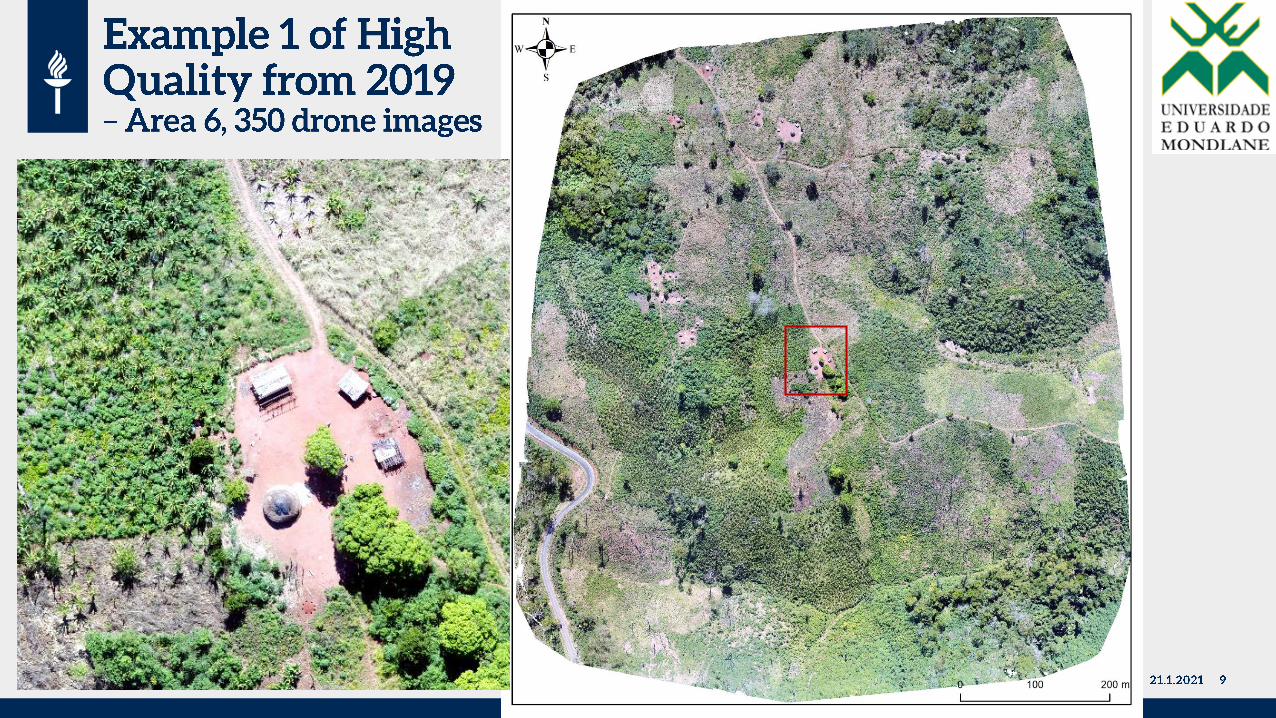
2018 2019
Pixelsizes
on thegroundvaried
between2.5 and8.0 cm
(dependson flightaltitude).
Yearssupport
eachothers.
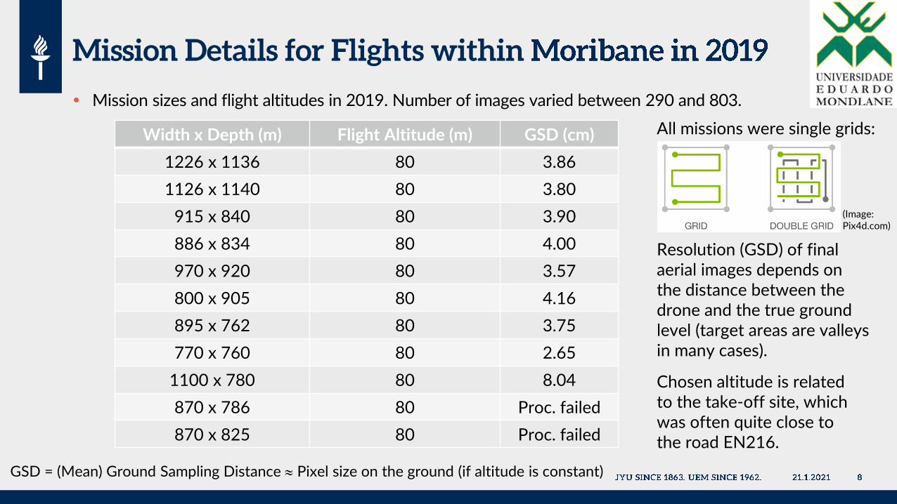
Mission sizes and flight altitudes in 2019. Number of images varied between 290 and 803.
Width x Depth (m) Flight Altitude (m) GSD (cm)
1226 x 1136 80 3.86
1126 x 1140 80 3.80
915 x 840 80 3.90
886 x 834 80 4.00
970 x 920 80 3.57
800 x 905 80 4.16
895 x 762 80 3.75
770 x 760 80 2.65
1100 x 780 80 8.04
870 x 786 80 Proc. failed
870 x 825 80 Proc. failed
GSD = (Mean) Ground Sampling Distance Pixel size on the ground (if altitude is constant)
All missions were single grids:
Resolution (GSD) of finalaerial images depends onthe distance between thedrone and the true groundlevel (target areas are valleysin many cases).
Chosen altitude is relatedto the take-off site, whichwas often quite close tothe road EN216.
(Image:Pix4d.com)

(Basedon 333drone
images)
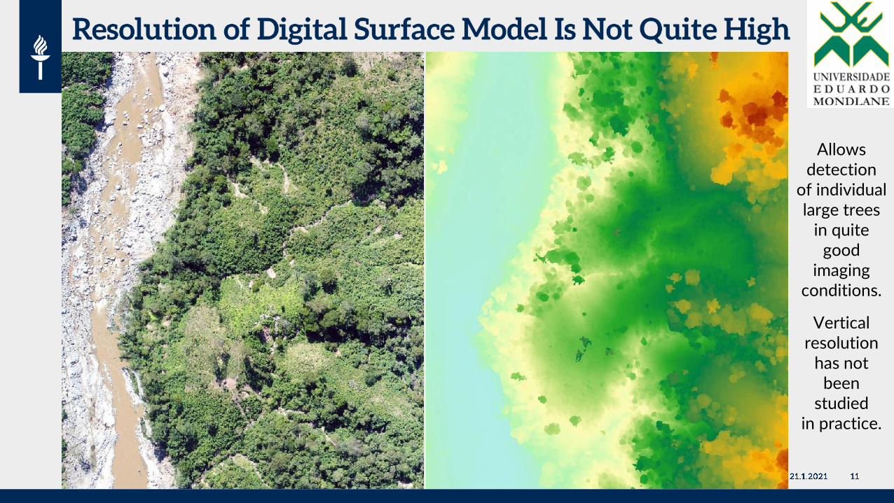
Allowsdetection
of individuallarge trees
in quitegood
imagingconditions.
Verticalresolution
has notbeen
studiedin practice.

During the field trips in May 2018, and 2019 environmental conditions were great
– A large proportion of the year is useless due to rain
The forests in Moribane are dense and contain trees with wide canopies, which makes photogrammetric
mosaicking easier compared to Finland
– You do not see the ground level, but 3-D reconstruction of digital surface models is easier
– In Finland, trees are tall, and their canopies are quite narrow (like Norway Spruce)
Large elevation differences may make the combining of some image sets difficult
– This is mainly a problem in the mountainous areas
– This also reduces the resolution of the images from a few centimeters to about 10 cm
– Drone collision risks to trees also increase quite a lot
Continuous cover forests make the observation of the drone difficult
– We started the flights mostly from the roadsides, but such open areas do not exist everywhere
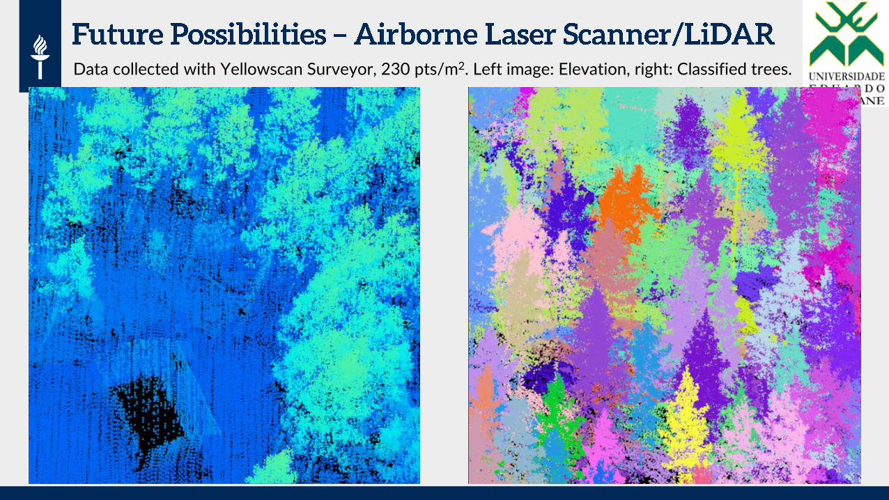
Data collected with Yellowscan Surveyor, 230 pts/m2. Left image: Elevation, right: Classified trees.
In order to get high quality, high resolution images:
– Purchase a high-quality drone with a good camera (large CCD/CMOS sensor size, Field-of-view 70 – 85)
– Choose a calm day (or only light wind) if photographing e.g. trees of a forest
– If you need to photograph really difficult terrain, consider using double grid missions
– Define large overlap between consecutive images and between flight lines ( 70%)
– Define the flying altitude large enough (70 – 80 meters) to reduce off-nadir distortions of final images,
unless you need ultra-high-resolution sub-centimeter images
– Use professional flight planning software, like DroneDeploy, Pix4Dcapture, etc.
To process the images into mosaics, use professional software or cloud services
– This may involve a big number of parameters (like in Pix4Dmapper Pro), which you should learn carefully
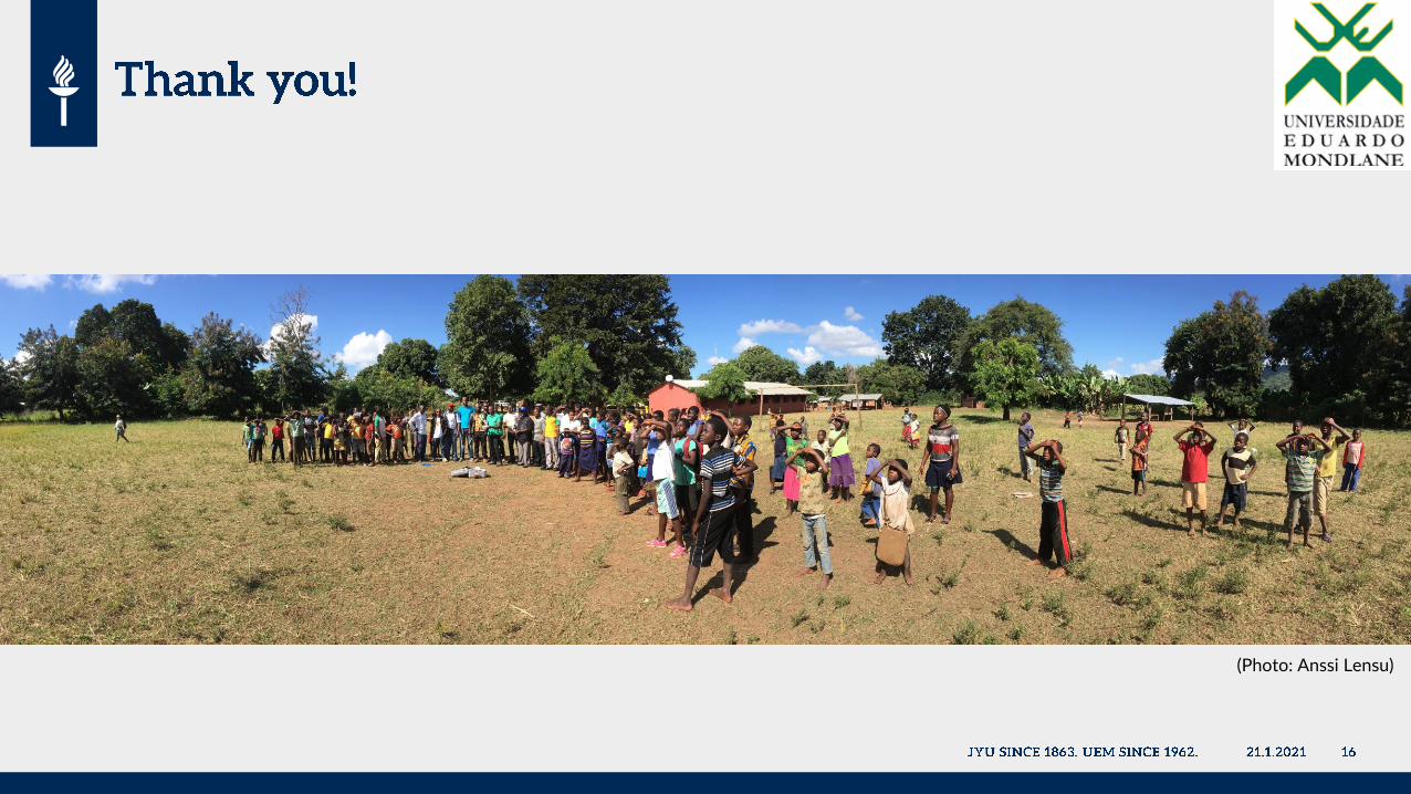
(Photo: Anssi Lensu)