Announcements Lab groups 3A and 4A hand in kits after lecture today. Lab groups 3B and 4B pick up...
48
Announcements Lab groups 3A and 4A hand in kits after lecture today. Lab groups 3B and 4B pick up lab kits Wednesday. Midterm #2 on Friday. Exam review session Wednesday.
-
Upload
bertram-joseph -
Category
Documents
-
view
216 -
download
1
Transcript of Announcements Lab groups 3A and 4A hand in kits after lecture today. Lab groups 3B and 4B pick up...

Announcements
Lab groups 3A and 4A hand in kits after lecture today.
Lab groups 3B and 4B pick up lab kits Wednesday.
Midterm #2 on Friday. Exam review session Wednesday.

Survey question: In Arizona, how do winter precipitation and temperatures typically differ from average conditions with a strong El Niño?
A) Winter precipitation and temperatures are about the same as average
B) Winter temperatures and precipitation are both above average
C) Winter temperatures and precipitation are both below average
D) Winter temperatures are above average and precipitation is below average
E) Winter temperatures are below average and precipitation is above average.
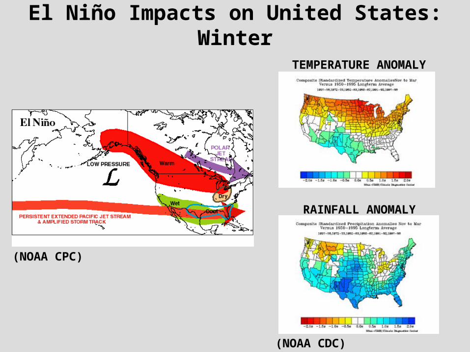
El Niño Impacts on United States: Winter
(NOAA CDC)
(NOAA CPC)
TEMPERATURE ANOMALY
RAINFALL ANOMALY

La Niña Impacts on United States: Winter
TEMPERATURE ANOMALY
RAINFALL ANOMALY
(NOAA CPC)
(NOAA CDC)
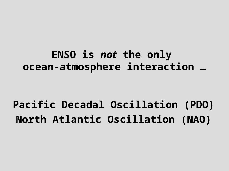
ENSO is not the only ocean-atmosphere interaction …
Pacific Decadal Oscillation (PDO)
North Atlantic Oscillation (NAO)

Pacific Decadal Oscillation (PDO)
Shift in Pacific ocean sea surface temperatures and pressure on a timescale of 20 to 30 years
Tends to reinforce ENSO impacts over North America and is perhaps important for summer climate.
Physical mechanism is still an area of active research!
POSITIVE PDO NEGATIVE PDO
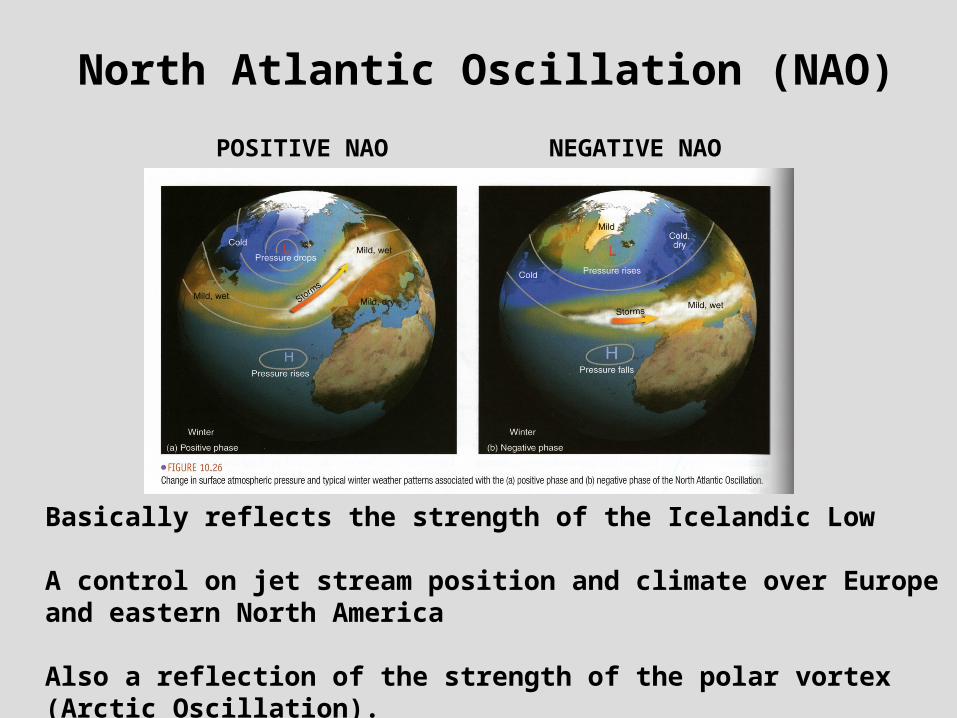
North Atlantic Oscillation (NAO)
POSITIVE NAO NEGATIVE NAO
Basically reflects the strength of the Icelandic Low
A control on jet stream position and climate over Europe and eastern North America
Also a reflection of the strength of the polar vortex (Arctic Oscillation).

What happens in the Pacific Ocean controls the position of the monsoon ridge in the early part of the summer.
THIS AFFECTS THE ONSET OF THE MONSOON AND EARLY SUMMER RAINFALL IN ARIZONA.(Castro et al. 2001)
North American summer climate teleconnection to Pacific SST

NATS 101 Section 4: Lecture 21
Air Masses

Air Mass: A relatively large body of air (1000s of sq. mi) with similar temperature and moisture characteristics.
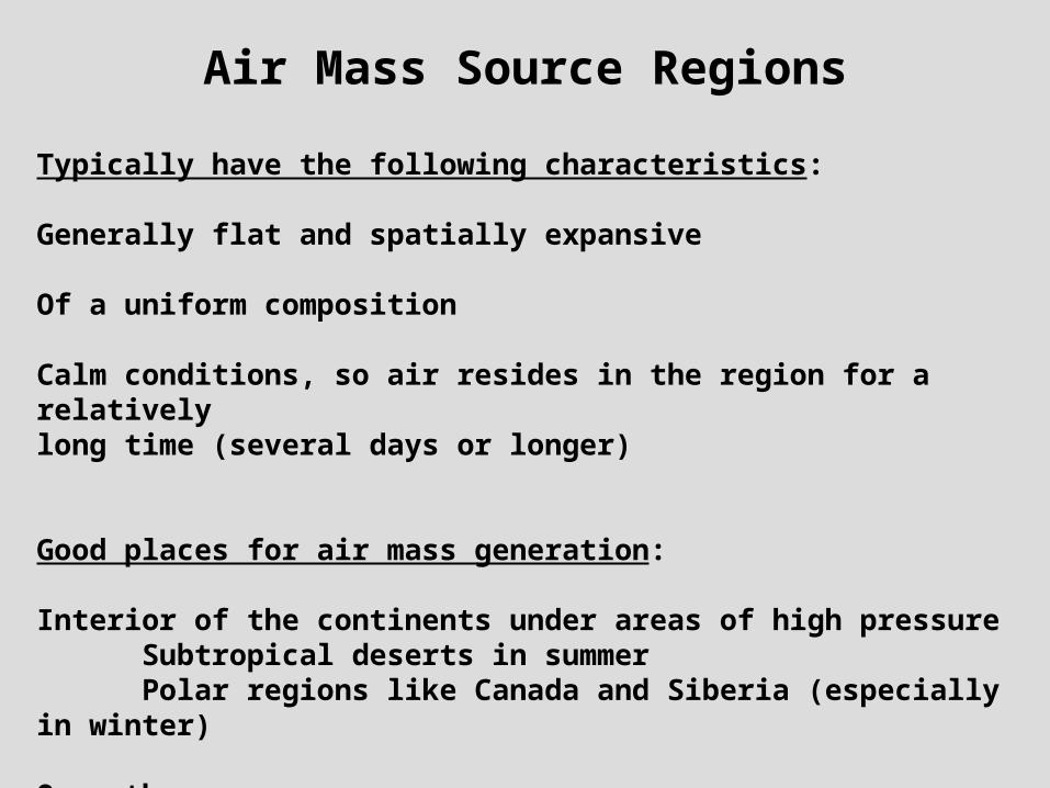
Air Mass Source Regions
Typically have the following characteristics:
Generally flat and spatially expansive
Of a uniform composition
Calm conditions, so air resides in the region for a relatively long time (several days or longer)
Good places for air mass generation:
Interior of the continents under areas of high pressureSubtropical deserts in summerPolar regions like Canada and Siberia (especially in winter)
Over the oceans

When air masses “clash” in mid-latitudes,
exciting weather can happen…
Supercell thunderstorms that spawn tornadoes are most prevalent in “tornado alley” in the central U.S.
Three different airmasses clash here.
WARM WARM AND DRY AND DRY
AIRAIR
COLD AND DRY AIRCOLD AND DRY AIR
WARM WARM AND AND
MOIST AIRMOIST AIR

Air Mass Classification System
First Lowercase Letter:
Indicates whether air originates over an ocean or continent
m = Maritimec = Continental
Second Uppercase Letter
Indicates whether air originates over tropical or polar latitudes.
T = TropicsP = Poles
From combining these four, all the air masses can be described.

Air masses that affect North America
CONTINENTAL CONTINENTAL POLAR (cP)POLAR (cP)
MARITIME MARITIME POLAR (mP)POLAR (mP)MARITIME MARITIME
POLAR (mP)POLAR (mP)
CONTINENTAL CONTINENTAL TROPICAL (cT)TROPICAL (cT)
MARITIMEMARITIMETROPICAL TROPICAL
(mT)(mT)MARITIMEMARITIMETROPICAL TROPICAL
(mT)(mT)

Continental polar (cP) air masses in the Northern Hemisphere originate in the northernmost parts of North America
and Asia over vast snow covered plains
EXCEPT for Antarctica, these are the coldest spots on Earth.

Continental polar (cP) air mass source regions in N. Hemisphere
NORTHERNNORTHERNCANADACANADA
SIBERIASIBERIA
SIBERIASIBERIA
NORTHERN CANADANORTHERN CANADA

Why does it get so cold in Northern Canada and Siberia?
Three factors:
Vast snow covered surfaces: affects BOTH shortwave and longwave radiation
Small amount of solar radiation
They are land masses—and land has a low specific heat.
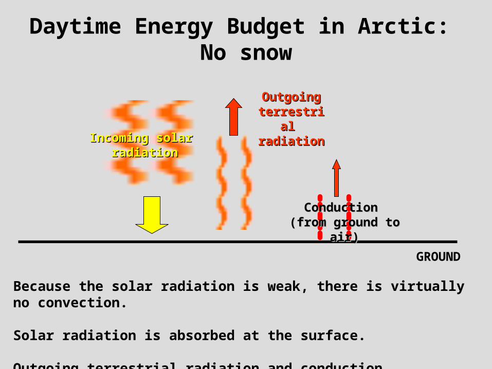
Daytime Energy Budget in Arctic: No snow
Incoming solar Incoming solar radiationradiation
Outgoing Outgoing terrestrial terrestrial radiationradiation
Because the solar radiation is weak, there is virtually no convection.
Solar radiation is absorbed at the surface.
Outgoing terrestrial radiation and conduction.
GROUND
Conduction Conduction (from ground to air)(from ground to air)

Daytime Energy Budget in Arctic with snow = Cooler surface
Incoming solar Incoming solar radiationradiation
IncreasedIncreasedoutgoing outgoing
terrestrial terrestrial radiationradiation
Most of the solar radiation is reflected because of the high albedo of snow (about 70—90% reflected).
Increased outgoing longwave radiation because snow is nearly a perfect blackbody.
SNOW COVERED GROUND
Conduction Conduction (from ground to air)(from ground to air)
Reflected solar Reflected solar radiationradiation

Nighttime Energy Budget in Arctic: No snow
Outgoing Outgoing terrestrial terrestrial radiationradiation
Radiational cooling creates a temperature inversion.
GROUND
Conduction(from air to ground)
Solar radiation Solar radiation shut offshut off
COLDCOLD
WARMWARM

Nighttime Energy Budget in Arctic: with snow = cooler temperatures
IncreasedIncreasedoutgoing outgoing
terrestrial terrestrial radiationradiation
Increased radiational cooling creates a very deep temperature inversion.
The temperature inversion may not be broken at all during the day if the solar radiation is weak enough—which is typical in winter.
SNOW COVERED GROUND
Conduction(from air to ground)
Solar radiation Solar radiation shut offshut off
VERY COLDVERY COLDDEEP INVERSIONDEEP INVERSION
WARMWARM

Winter solsticeNorthern Hemisphere
Summer solsticeSouthern Hemisphere
Date of winter solstice: December 21
\
The amount of incoming solar radiation associated with the seasons is also a big factor in creating very cold air masses
Arctic in winter:
Very little daylight—if any at all
Large solar zenith angle
Result: radiational cooling is maximized.

Upper Air Sounding
Northwest Territories,
Canada
March 5, 2007
Surface Temp. below -30 °C
INVERSION
LIGHT AND VARIABLE WINDSNEAR SURFACE

March 5, 2007Surface
Temperature Analysis
COLD COLD cP AIRcP AIR

March 5, 2007Dew point
analysis
VERY DRYVERY DRY

March 5, 2007500-mb Winds

Lake Effect Snow

March 5, 2007Surface and Radar Obs.: Upstate NY
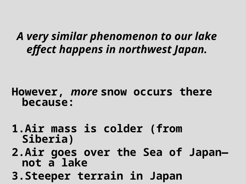
A very similar phenomenon to our lake effect happens in northwest Japan.
However, more snow occurs there because:
1.Air mass is colder (from Siberia)2.Air goes over the Sea of Japan—not a
lake3.Steeper terrain in Japan

Japanese Satellite ImageMarch 5, 2007
SEA OF SEA OF JAPANJAPAN
COLD SIBERIAN cP AIRCOLD SIBERIAN cP AIR
HOKKAIDO HOKKAIDO ISLANDISLAND

SAPPORO, JAPAN
AVG. ANNUAL SNOWFALL IN SAPPORO, JAPAN = 16 FEETThey make good Japanese beer there too…

Sapporo Snow Festival

Arctic Outbreaks in U.S.Flow directs cP air from Canada or Siberia
Airflow and temperatures during severe December arctic outbreaks
East of the Rockies favored because no topographic barriers to stop cold arctic air.
In the most severe outbreaks, below freezing temperatures can reach the Gulf of Mexico.
The number of Arctic outbreaks in a given winter has to do with the strength of the Arctic Oscillation.

December 1983 Arctic Outbreak
The “core” of the cold air is located underneath the surface high.
Cold air is typically so shallow and dense it can’t cross the Rocky Mountains.

Maritime polar (mP) air mass
LL
Forms when continental polar air moves over the ocean. The ocean moistens the air and makes it conditionally unstable.
The type of air mass associated with semi-permanent low pressure areas in the Pacific and Atlantic during winter.
Lutgens and Tarbuck

Cloud Streets: A sign of an cP air mass being modified to mP
Similar to Lake Effect snow process. Cold air passes over relatively warmer water, clouds form, atmosphere moistens and warms.

Continental modification of mP air mass
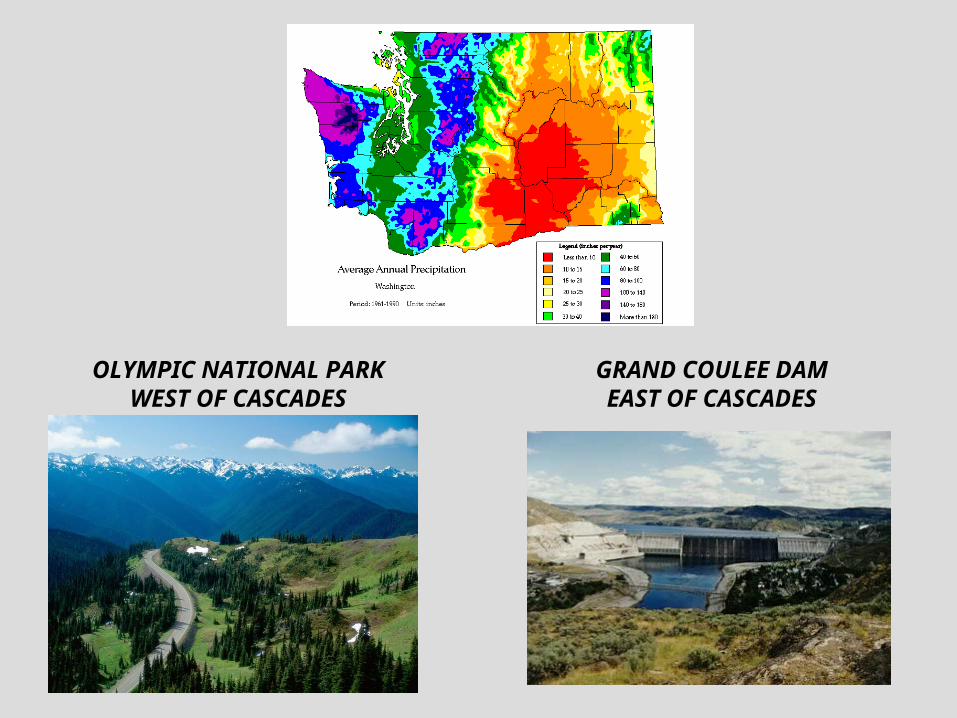
OLYMPIC NATIONAL PARKWEST OF CASCADES
GRAND COULEE DAMEAST OF CASCADES

mP air masses and U.S. East Coast
mPmP
A moisture source for east coast snowstorms
NOAA imagery

Maritime Tropical (mT) air masses
These originate over warm tropical oceans.
Williams, The Weather Book

mT air mass weather over oceans
Moist humid air in a mT airmass has A LOT of potential energy.Why??
This energy can be released in thunderstorms—which sometimes organize into tropical cyclones.

The Pineapple ExpressAn example of an atmospheric river
mTmT
If the jet stream picks up this moisture from the tropics, this can result in very heavy rains along the west coast in winter.

Continental tropical (cT) air mass
Williams, The Weather Book
Originate in the interior of continents in desert regions—like Arizona!

In the U.S., the “center” of cT air mass is defined by the position of the monsoon ridge—which sits right above the Mexican Plateau and
Arizona during most of the summer.

Monsoon ridge position for hottest days in Phoenix and Tucson: late June 1990
When a ridge like this persists for a long time in the central U.S., drought conditions are the result.
Such conditions are favored in La Niña years and a low phase of the Pacific Decadal Oscillation.
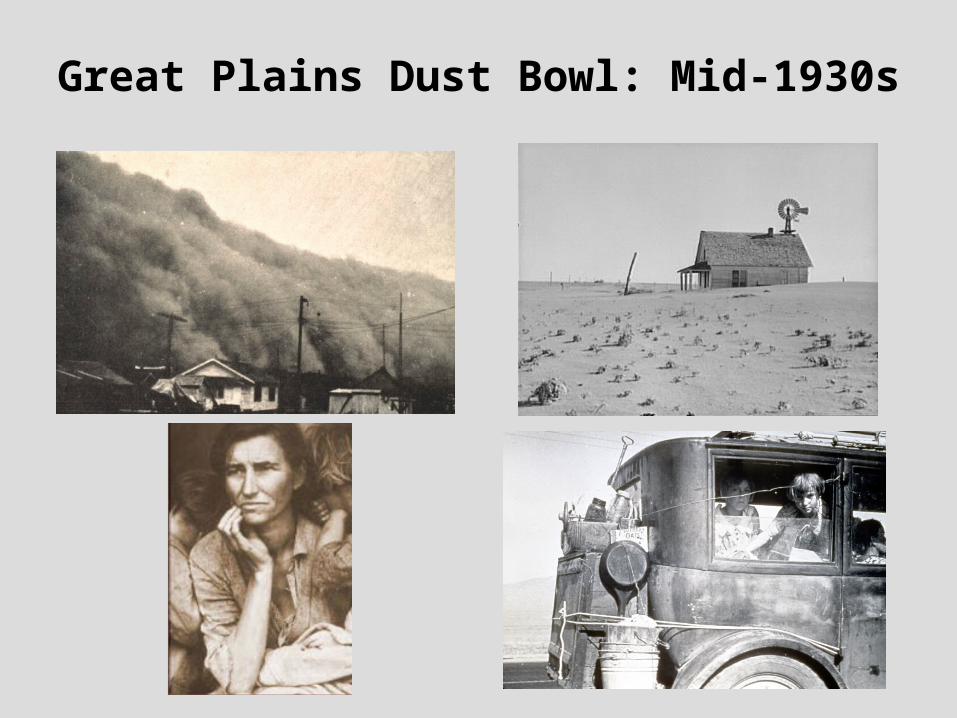
Great Plains Dust Bowl: Mid-1930s

Summary of Lecture 21An air mass is a relatively large body of air with similar temperature and moisture characteristics. Their source regions are flat, uniform, and expansive. These include the interior of continents, in polar or desert regions, or over the oceans.
Air masses are classified by origin:Maritime (m) vs. Continental (c)Tropical (T) vs. Polar (P)
cP air originates over Canada and Siberia because these areas have large amounts of snow cover and a small amount of solar radiation. These cause arctic outbreaks, mainly in the eastern U.S., and lake effect snows.
mP air forms when cP air moves over the ocean and modifies. As such air masses pass over continents, the mountains can wring out their moisture.
mT air originates over tropical oceans and is very moist with lots of potential energy for thunderstorms.
cT air originates in hot and dry desert regions. In N. America, the center of cT air is defined by the position of the monsoon ridge.

Reading Assignment and Review Questions
Reading: Chapter 11, pp. 296-306 (8th ed.) pp. 298-309 (9th ed.)
Chapter 11 Questions
Questions for Review: 1,2,3,4,7,8,10,11
Questions for Thought: 1,2,4
Problems and Exercises: 1