![Dolomitization (AAPG Course Notes 24) [Lynton Stuart Land]](https://static.fdocuments.in/doc/165x107/577cc61f1a28aba7119dc7be/dolomitization-aapg-course-notes-24-lynton-stuart-land.jpg)
Anderson Knox CO2 paper 12-11-08 - University of Kentucky · Algal Thrombolites, Dolomitization and...
17
Algal Thrombolites, Dolomitization and Porosity Trends in the Knox Dolomite: Implications for Sequestration Warren H. Anderson Kentucky Geological Survey [email protected] http://photos1.blogger.com/blogger/4566/894/1600/strom-structure.0.jpg Hamblin Pool, Shark Bay Acknowledgements • Academic, MS-Ph.D Dissertations • Industry – Mining Companies – Oil and Gas Companies – Consultants • Research-USGS, KGS, Surveys Ordovician Cambrian System Series Central Kentucky (Cincinnati Arch) Indiana Ohio Eastern Kentucky (Rome Trough) Joachim Do St. Peter Ss Knox sub- group Eau Claire Fm St. Peter Ss Wells Creek Fm Dutchtown Fm Prarie du Chien Fm Potosi Do Eau Claire Fm Beekman- town Do Copper Ridge Do Rose Run Ss Knox Group Beekmantow n Do Copper Ridge Do Rose Run Ss Knox Group Maynardsville Ls Nolichucky Sh Eau Clair e Fm Maryvill e Ls Kerbel Ss Conasauga Fm Eau Claire Fm Wells Creek Fm Beekman- town Do Copper Ridge Do Rose Run Knox Group Wells Creek Fm Eau Claire Fm Knox Supergroup Beekman- town Gp Copper Ridge Gp * Western Kentucky (Rough Creek Graben) Conasauga Gp St. Peter Ss Wells Creek Fm Ibexian White Rockian Ord. III Areni g Trema- docian Mo- hawk- ian Middl e Lower Upper St. Croixian Paibian un- named Darri- wilian North Amer. Interna- tional Rough Creek Graben Ro me T r ough Gr env i ll e F r o n t Illinois Basin A p pal a c h i an B a s in C i n ci n n at i A r ch Find lay Arch Kankakee Arc h Location Greb
Transcript of Anderson Knox CO2 paper 12-11-08 - University of Kentucky · Algal Thrombolites, Dolomitization and...
Algal Thrombolites, Dolomitization and
Porosity Trends in the Knox Dolomite:
Implications for Sequestration
Warren H. AndersonKentucky Geological Survey
http://photos1.blogger.com/blogger/4566/894/1600/strom-structure.0.jpg
Hamblin Pool, Shark Bay
Acknowledgements
• Academic, MS-Ph.D Dissertations
• Industry
– Mining Companies
– Oil and Gas Companies
– Consultants
• Research-USGS, KGS, Surveys
Ord
ovi
cia
nC
am
brian
System Series Central Kentucky
(Cincinnati Arch)
Indiana OhioEastern
Kentucky
(Rome Trough)Joachim Do
St. Peter Ss
Knox sub-
group
Eau Claire Fm
St. Peter Ss
Wells Creek FmDutchtown Fm
Prarie
du Chien
Fm
Potosi
Do
Eau Claire Fm
Beekman-
town Do
Copper
Ridge Do
Rose Run Ss
Kn
ox
Gro
up
Beekmantow
n Do
Copper
Ridge Do
Rose Run Ss
Kn
ox
Gro
up
Maynardsville Ls
Nolichucky Sh
Eau Clair
e Fm
Maryvill
e Ls
Kerbel Ss
Conasauga
Fm
Eau
Claire Fm
Wells
Creek Fm
Beekman-
town Do
Copper
Ridge Do
Rose Run
Kn
ox
Gro
up
Wells Creek Fm
Eau Claire Fm
Kn
ox
Su
pe
rgro
up
Beekman-
town Gp
Copper
Ridge Gp
*
Western Kentucky
(Rough Creek
Graben)
Co
na
sa
ug
a
Gp
St. Peter Ss
Wells Creek Fm
Ibe
xia
n
White
RockianOrd.
III
Areni
g
Trema-
docian
Mo-
hawk-
ian
Mid
dl
e
Low
er
Upper
St.
Cro
ixia
n
Pa
ibia
n
un-
named
Darri-
wilian
North
Amer.
Interna-tional
Rough Creek
Graben
Rome
Tro
ugh
Gre
nvi
lle
Fr o
nt
Illinois
Basin
Appa
lach
ian
Basin
Cin
cin
nati
Arc
hFin
dla
y A
rch
Kankakee
Arch
Location
Greb
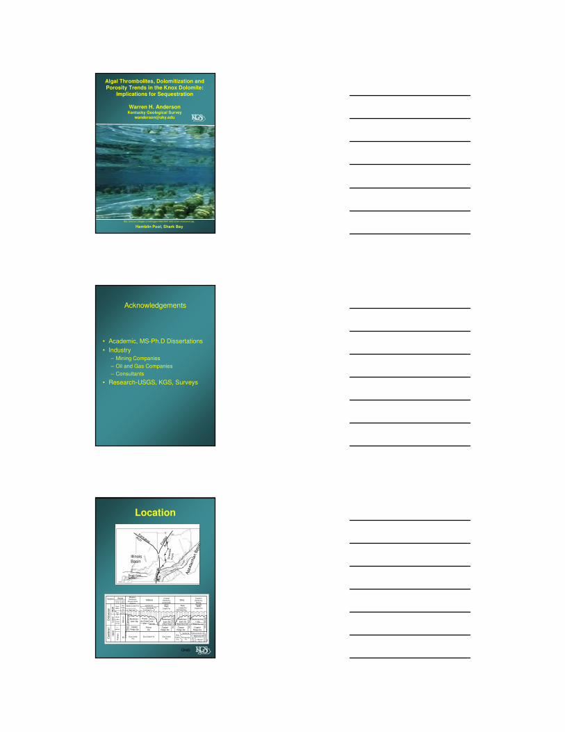
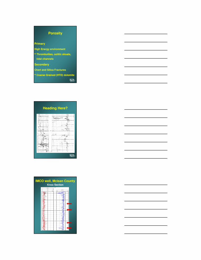
South Central KentuckyMineral District
Stratigraphic ColumnSouthern Kentucky
Knox Lithology
• The Knox is a repetitive sequence of shallow
water carbonate rocks consisting of subtidalalgal dominated bioclastic calcarenitescontaining abundant oolities and quartz sand.
• The shallow ocean was hypersaline containing
oolite shoals, algal colonies, tidal channels, intertidal lagoons, and supratidal evaporite
flats.
• Organosedimentary structures: Thrombolitecolonies formed in deep subtidal
environments. Other algal features formed in intertidal and supratidal environments.
• Diagenesis consisted of multiple episodes of dolomitization, silicification, fracturing,
mineralization, and the post Knox unconformity.
• Hydrothermal dolomites (HTD) and base metal
mineralization occurred as a late stage event creating coarse grained HTD and permeable
pathways.
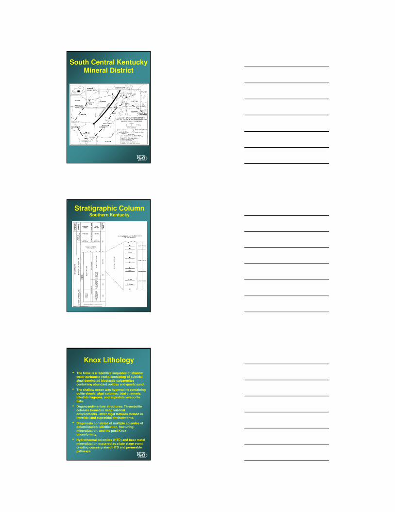
Sharks Bay, Australia
Dill, 1987
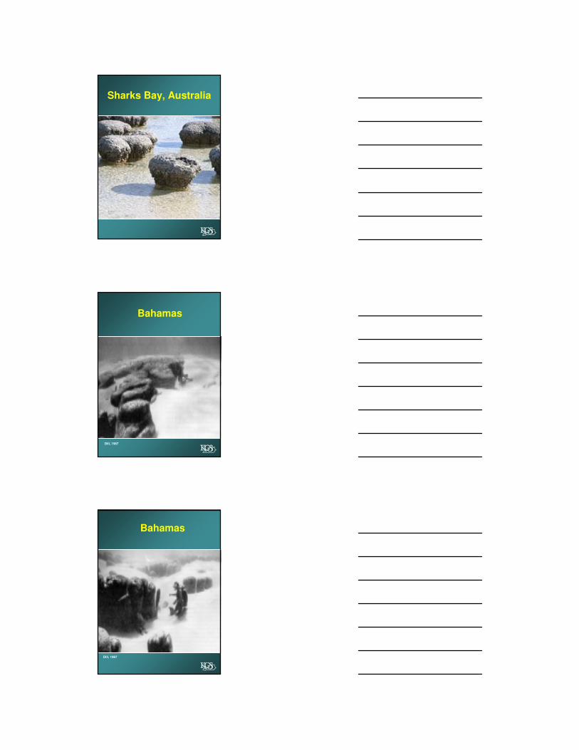
Bahamas
Dill, 1987
Bahamas

Section of Thrombolite
http://photos1.blogger.com/blogger/4566/894/1600/strom-structure.0.jpg
Algal Stromatolite-Knox Dolomite
Cumberland County, Ky
2000 foot depth, upper KnoxDotted line represents sphalerite mineralization
Knox core showing fenestral porosity typical in
algal stromatolites
Dupont Wad No. 1 2816 feet
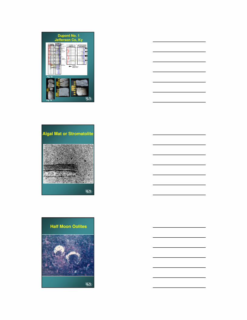
200GAMMA RAY
16CALIPER
2 3BULK DENSITY
30 -10NEUTRON POROSITY
30
00
St. Peter Ss
Probable vuggy/fractureddolomite zones
0
6
0 200GAMMA RAY
5 15CALIPER
2 3BULK DENSITY
30 -10NEUTRON POROSITY
140 40SONIC
20
00
2500
30
00
35
00
40
00
45
00
RoseRun Ss?
Eau Claire
Beekman-
town
CopperRidge Dol.
Fig. 18
Fig. 19
Dupont No. 1Jefferson Co, Ky
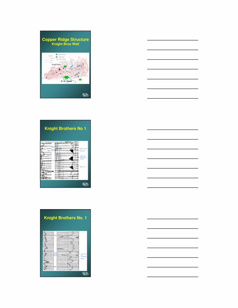
Algal Mat or Stromatolite
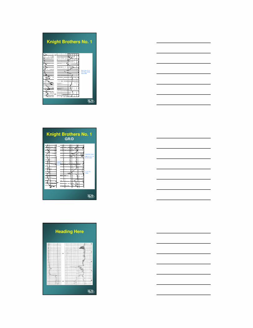
Half Moon Oolites

Aggrading Dolomitization
HTD
Copper Ridge Structureshowing probable locations
of algal colonies

Copper Ridge Isopach
• Southern Kentucky
• Eastern Kentucky
• West central Kentucky
Cross Section Correlations
Cross Section
Locations

Location MapBales No. 1
Knuckles Well
Bales No 1—OutcropCopper Ridge 4960-6102 ft
Harris, 1967
Bales No 1
Harris, 1967

Stromatolites
Union Co. TN
http://www.discoveret.org/etgs/trips/sharps_chapel/sharps_chapel.htm
Cumberland Gap Area Knuckles No 1
Rose Run
Copper Ridge StructureKnight Bros Well
Knight Bros
Knight Brothers No 1
CMS, Cr Xl, Br
OO Chert
CMS, OO
Chert, Cr Xl
Dark Br
CMS, Fn Xl
Perf
Zones
Knight Brothers No. 1
Cavern
Zone in
Dupont
V. Cr Xl, Cr
OO
chert,CMS,
Broken
Knight Brothers No. 1
Dolo, limy, Cr xl,
OO, Piso, sandy,
trace CMS
Knight Brothers No. 1GR/D
Dolomite, brown
Med-Cr Xl, Cr Xl
Br OO Chert
Cr Xl, Por
Chert,
Dupont
Injection
Zone
Heading Here
Porosity
Primary
High Energy environment
• Thrombolites, oolitic shoals,
tidal channels
Secondary
Chert and Silica Fractures
• Coarse Grained (HTD) dolomite
Heading Here?
IMCO well, Mclean CountyKnox Section

Ballardsville Field, Oldham County, Kentucky
Top Knox
Gas shows in initial
wells. Porosity
zones were converted to gas
storage
TD
TD
TD
Fig. 23
This is being drafted
Top of Knox
TD
Fig. 22
This is being drafted fault margin will be included
Fig. 24
Texaco Heddrick Well?
Top of Knox

Knox PaleotopographyMorrow Co, Ohio
200 foot relief on unconformity
Eagle CreekGas Storage Field
Grant County, Kentucky
150-200 feet relief
Knox PaleotopographySouthern Kentucky
350-400 foot relief
Knox porosity zonein Ashlock Field
Figure Structure Maps
387644 (10)
10-B-49
1750S, 360E
EL PAM CO, INC
Well #: 1
Farm: COPELAND,
JESSE LEE
El 942
5424 No4 (9)
JARVIS DRILLING CO,
INC
Well #: 4
Farm: LYONS,
JEROME
el 775
Top of Knox Pay Zone
2-B-49
119S, 682W
Operator: FREEDOM OIL CO, INC
Well #: 1
Farm: COFFEY, B M
Perm
El 578
1700
-700
-750
-650
1400
-650
-700
1400
-700
-650
WC
KN
Fig 10
Fig 11
Fig 12
Header Here?
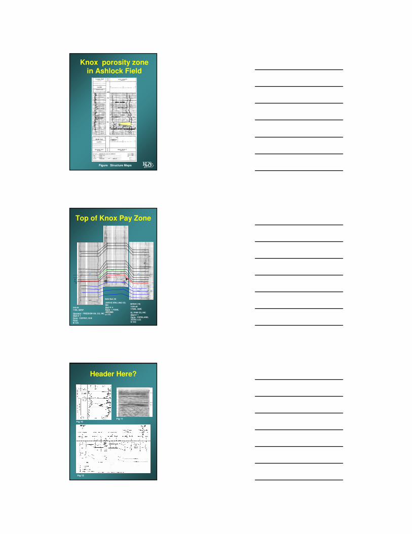
KnoxStructure
MapsM-5 Chert
Perkins, 1969
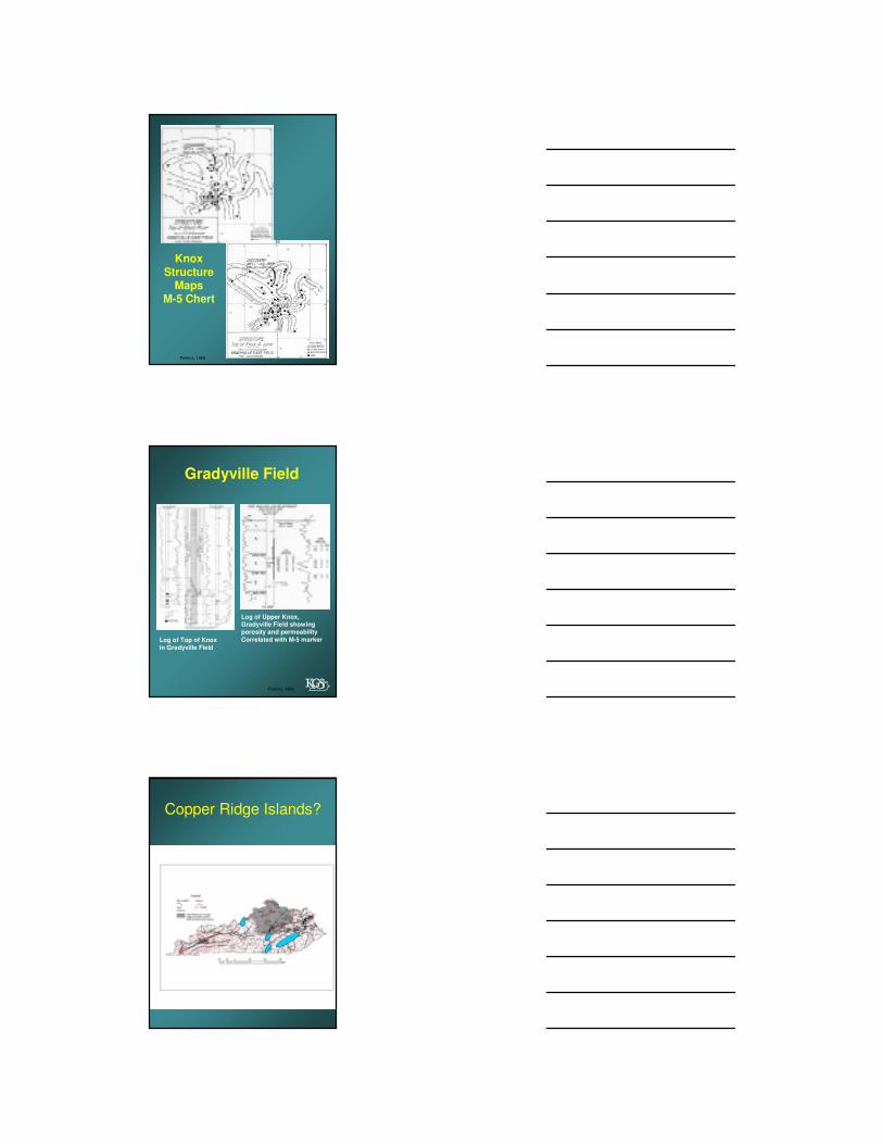
Log of Top of Knox
in Gradyville Field
Log of Upper Knox, Gradyville Field showing
porosity and permeability
Correlated with M-5 marker
Gradyville Field
Perkins, 1969
Copper Ridge Islands?
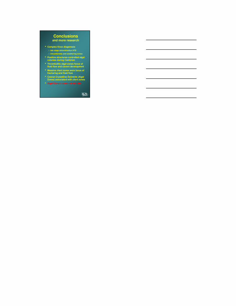
Conclusionsand more research
• Complex Knox diagenesis
o late stage dolomitization HTD
o Unconformity and weathering zones
• Positive structures controlled algal
colonies during Cambrian
• Thrombolitic algal zones focus of
fluid flow and cavern development
• Massive chert zones were focus of
fracturing and fluid flow
• Coarse Crystalline Dolomite (Algal
Zones) associated with chert zones
• Algal/Cavern zones correlatable