Ancient Egypt - · PDF fileIf an Egyptian needed to travel North from Thebes to Giza, his boat...
27
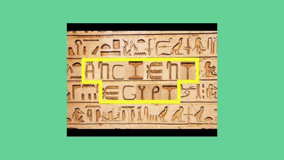
Ancient Egypt Life Along the Nile River 2018
Transcript of Ancient Egypt - · PDF fileIf an Egyptian needed to travel North from Thebes to Giza, his boat...
Ancient EgyptLife Along the Nile River
2018
Geography
How Does Geography affect the way that people live?
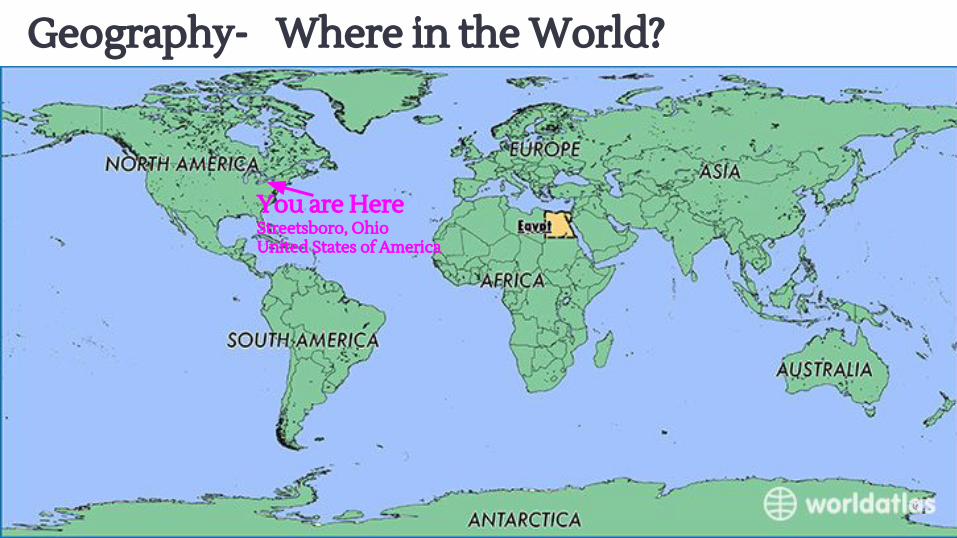
Geography- Where in the World?
You are HereStreetsboro, OhioUnited States of America
Geography- Where in the World?
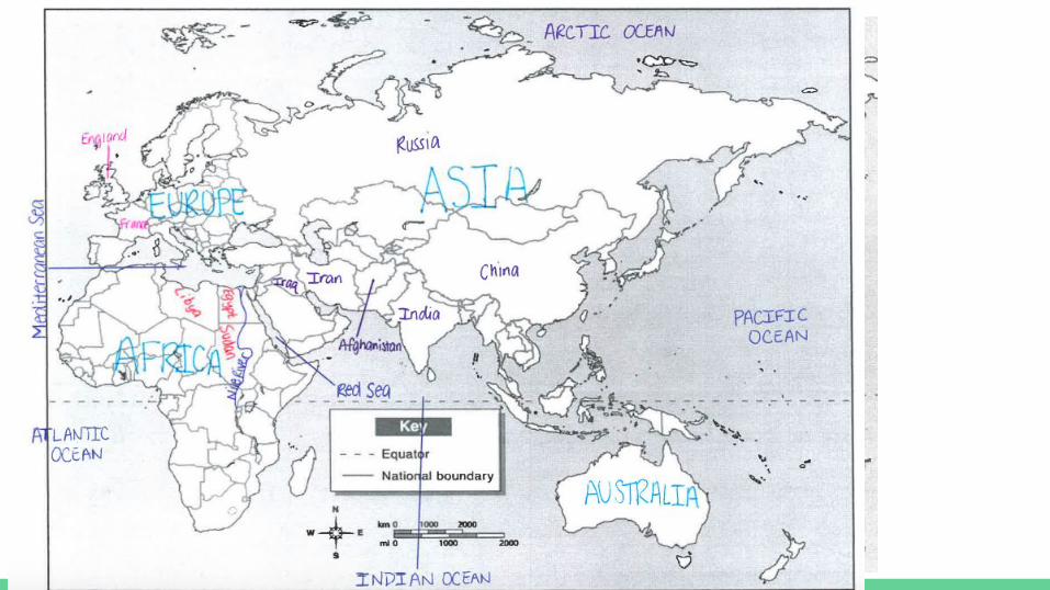
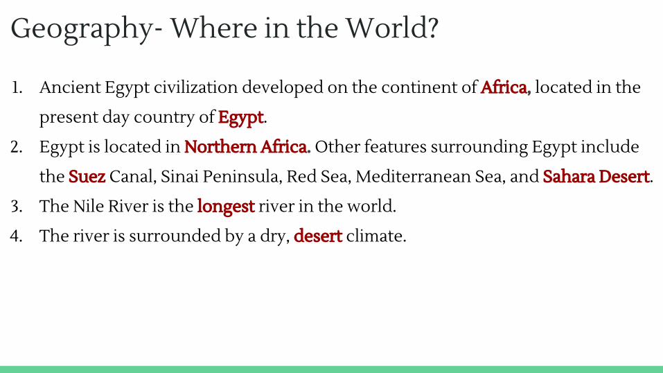
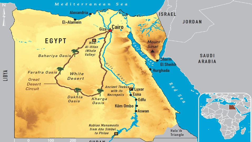
1. Ancient Egypt civilization developed on the continent of Africa, located in the
present day country of Egypt.
2. Egypt is located in Northern Africa. Other features surrounding Egypt include
the Suez Canal, Sinai Peninsula, Red Sea, Mediterranean Sea, and Sahara Desert.
3. The Nile River is the longest river in the world.
4. The river is surrounded by a dry, desert climate.
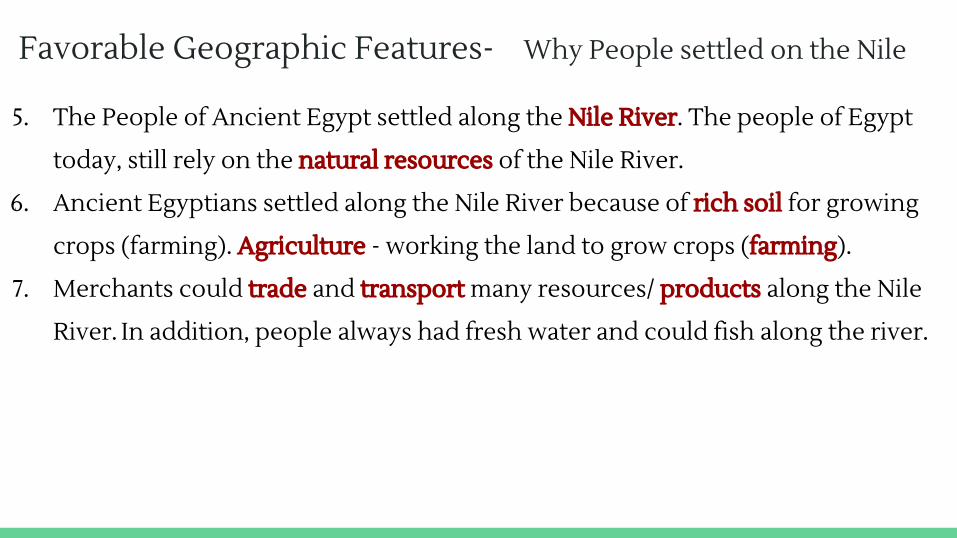
Favorable Geographic Features- Why People settled on the Nile
5. The People of Ancient Egypt settled along the Nile River. The people of Egypt
today, still rely on the natural resources of the Nile River.
6. Ancient Egyptians settled along the Nile River because of rich soil for growing
crops (farming). Agriculture - working the land to grow crops (farming).
7. Merchants could trade and transport many resources/ products along the Nile
River. In addition, people always had fresh water and could fish along the river.
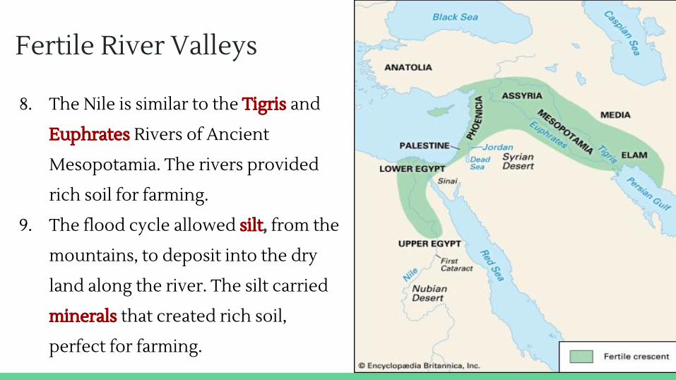
Fertile River Valleys
8. The Nile is similar to the Tigris and
Euphrates Rivers of Ancient
Mesopotamia. The rivers provided
rich soil for farming.
9. The flood cycle allowed silt, from the
mountains, to deposit into the dry
land along the river. The silt carried
minerals that created rich soil,
perfect for farming.
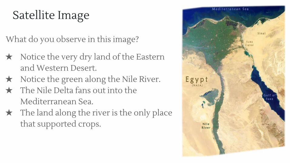
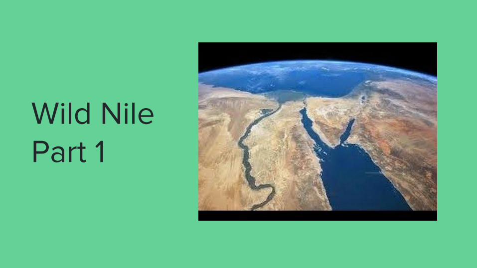
Satellite Image
What do you observe in this image?
★ Notice the very dry land of the Eastern and Western Desert.
★ Notice the green along the Nile River.★ The Nile Delta fans out into the
Mediterranean Sea.★ The land along the river is the only place
that supported crops.
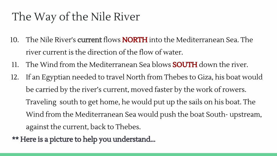
The Way of the Nile River
10. The Nile River's current flows NORTH into the Mediterranean Sea. The
river current is the direction of the flow of water.
11. The Wind from the Mediterranean Sea blows SOUTH down the river.
12. If an Egyptian needed to travel North from Thebes to Giza, his boat would
be carried by the river’s current, moved faster by the work of rowers.
Traveling south to get home, he would put up the sails on his boat. The
Wind from the Mediterranean Sea would push the boat South- upstream,
against the current, back to Thebes.
** Here is a picture to help you understand...
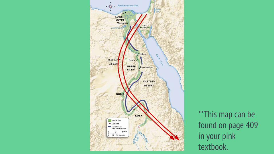
**This map can be found on page 409 in your pink textbook.
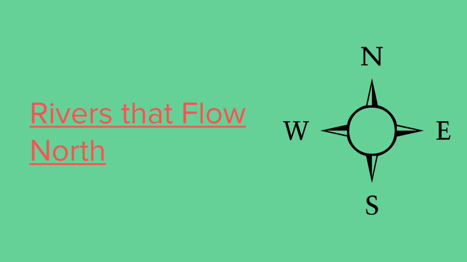
Rivers that Flow North
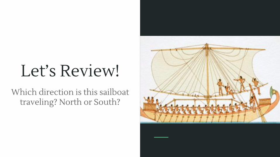
Let’s Review!Which direction is this sailboat
traveling? North or South?
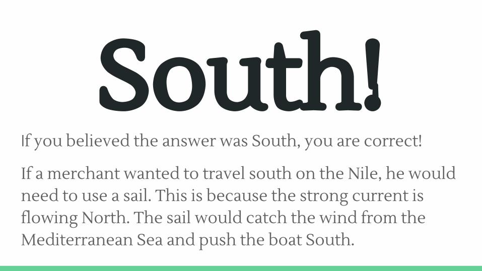
South!If you believed the answer was South, you are correct!
If a merchant wanted to travel south on the Nile, he would need to use a sail. This is because the strong current is flowing North. The sail would catch the wind from the Mediterranean Sea and push the boat South.
Geography- Source and Mouth
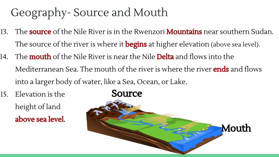
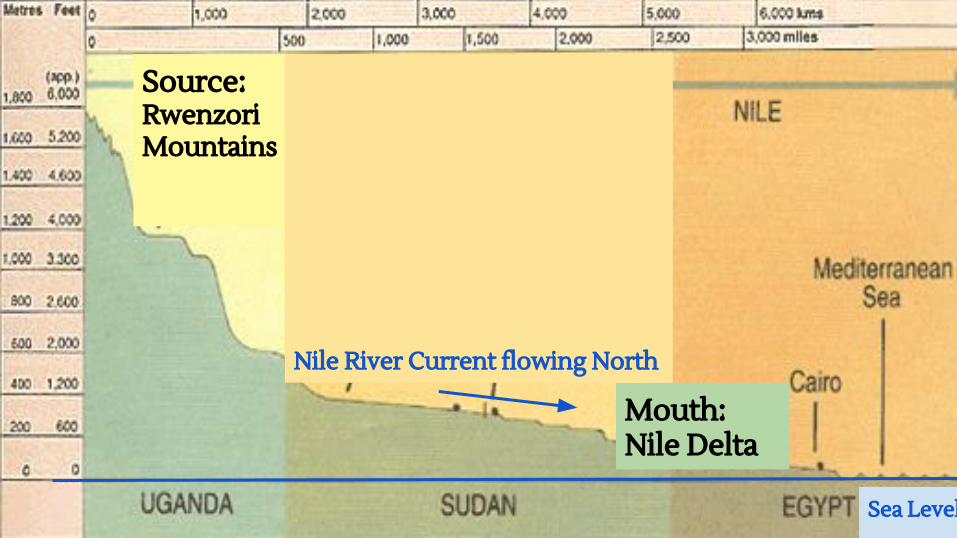
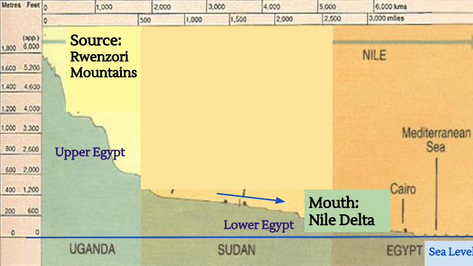
13. The source of the Nile River is in the Rwenzori Mountains near southern Sudan.
The source of the river is where it begins at higher elevation (above sea level).
14. The mouth of the Nile River is near the Nile Delta and flows into the
Mediterranean Sea. The mouth of the river is where the river ends and flows
into a larger body of water, like a Sea, Ocean, or Lake.
15. Elevation is the
height of land
above sea level.Mouth
Source
Sea Level
Mouth: Nile Delta
Source: RwenzoriMountains
Nile River Current flowing North
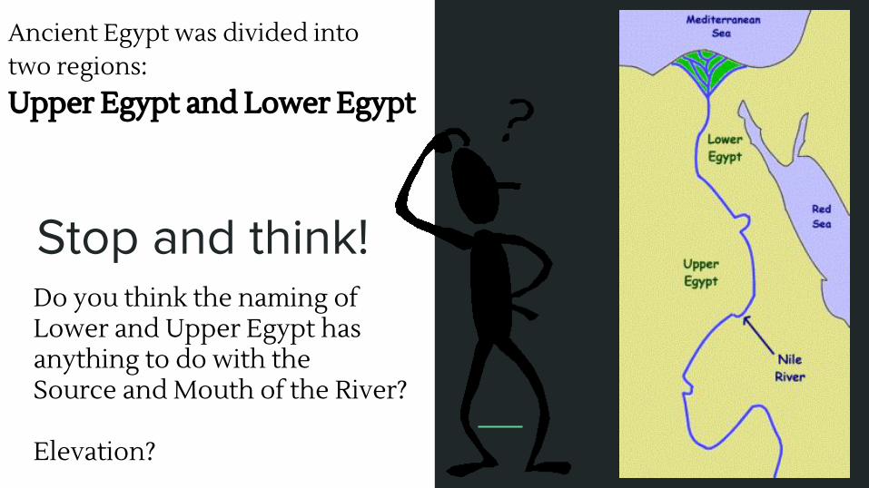
Stop and think!Do you think the naming of Lower and Upper Egypt has anything to do with the Source and Mouth of the River?
Elevation?
Ancient Egypt was divided into two regions:Upper Egypt and Lower Egypt
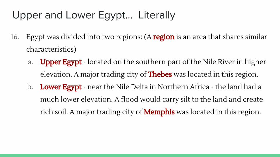
Upper and Lower Egypt… Literally
16. Egypt was divided into two regions: (A region is an area that shares similar
characteristics)
a. Upper Egypt - located on the southern part of the Nile River in higher
elevation. A major trading city of Thebes was located in this region.
b. Lower Egypt - near the Nile Delta in Northern Africa - the land had a
much lower elevation. A flood would carry silt to the land and create
rich soil. A major trading city of Memphis was located in this region.
Sea Level
Mouth: Nile Delta
Source: RwenzoriMountains
Upper Egypt
Lower Egypt
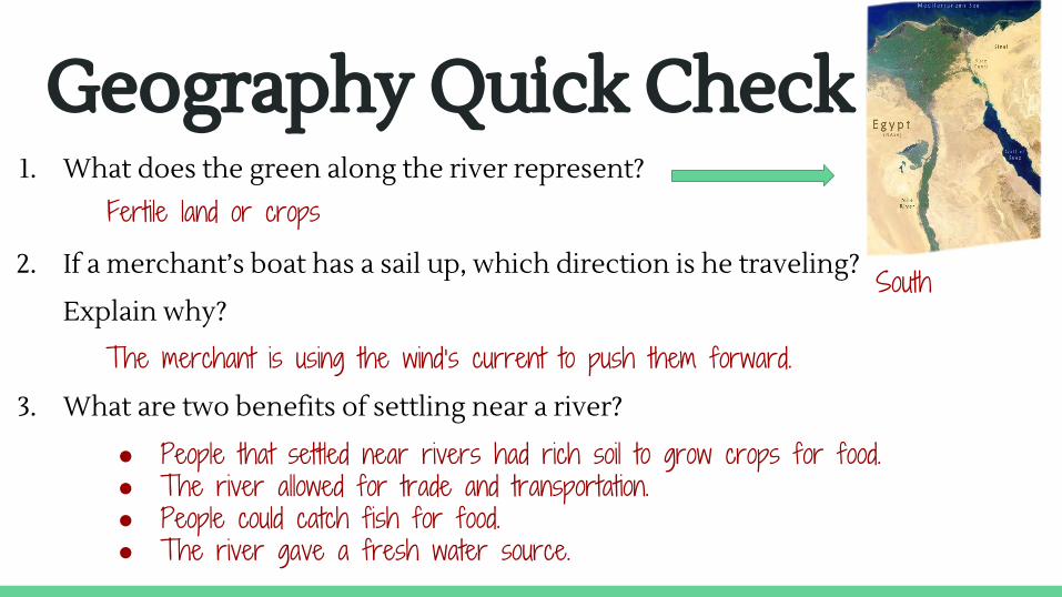
Geography Quick Check 1. What does the green along the river represent?
2. If a merchant’s boat has a sail up, which direction is he traveling?
Explain why?
3. What are two benefits of settling near a river?
● People that settled near rivers had rich soil to grow crops for food.● The river allowed for trade and transportation.● People could catch fish for food.● The river gave a fresh water source.
Fertile land or crops
South
The merchant is using the wind’s current to push them forward.
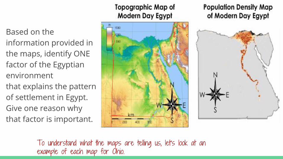
Based on the information provided in the maps, identify ONE factor of the Egyptian environment that explains the pattern of settlement in Egypt. Give one reason why that factor is important.
To understand what the maps are telling us, let’s look at an example of each map for Ohio.
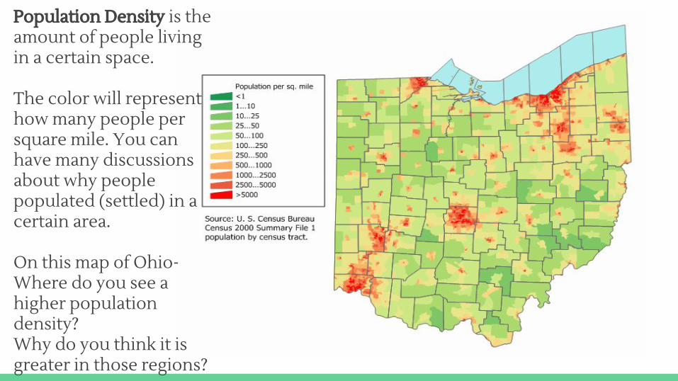
Population Density is the amount of people living in a certain space.
The color will represent how many people per square mile. You can have many discussions about why people populated (settled) in a certain area.
On this map of Ohio- Where do you see a higher population density? Why do you think it is greater in those regions?
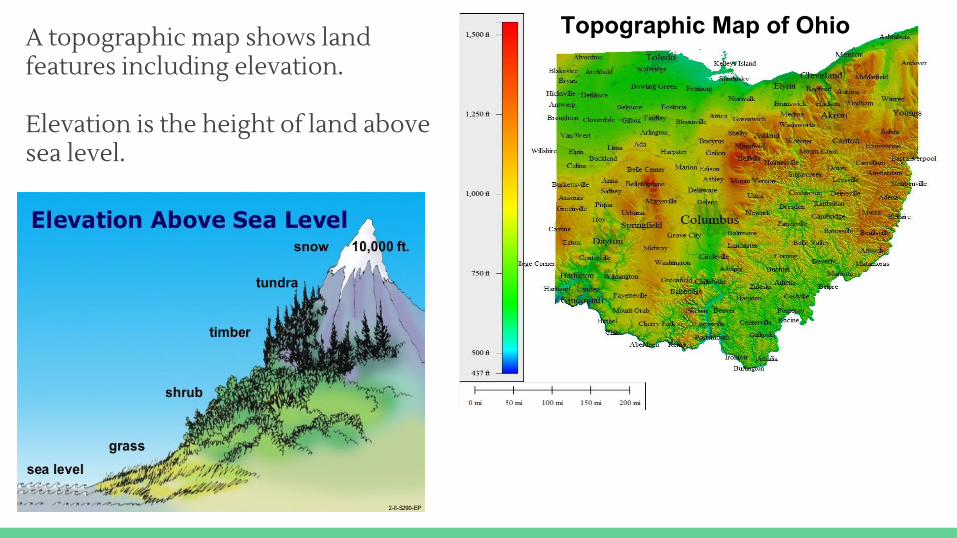
A topographic map shows land features including elevation.
Elevation is the height of land above sea level.
Topographic Map of Ohio
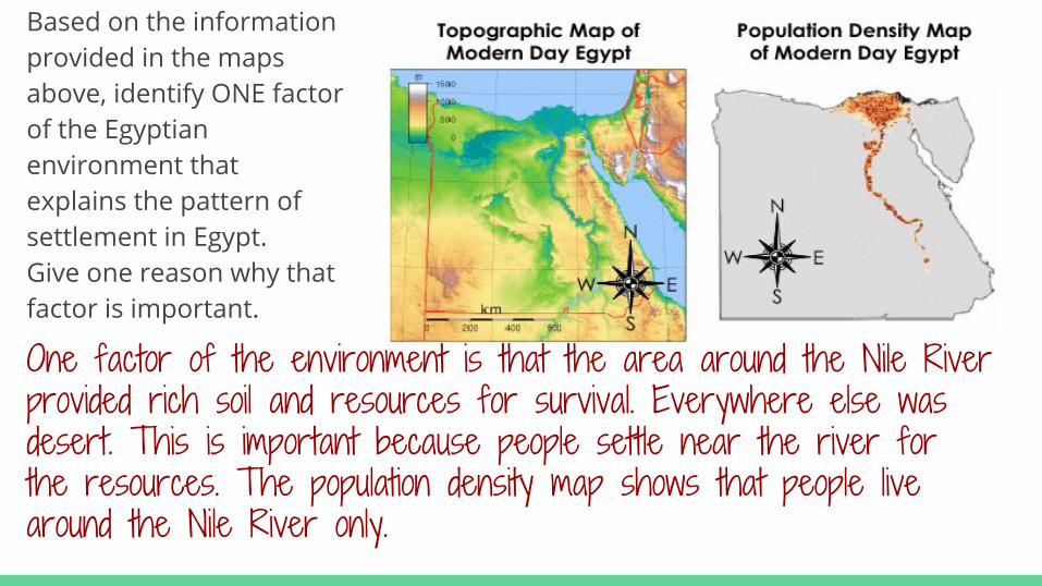
Based on the information provided in the maps above, identify ONE factor of the Egyptian environment that explains the pattern of settlement in Egypt. Give one reason why that factor is important.
One factor of the environment is that the area around the Nile River provided rich soil and resources for survival. Everywhere else was desert. This is important because people settle near the river for the resources. The population density map shows that people live around the Nile River only.
Nile River Rafting Photos:
http://www.nytimes.com/slideshow/2009/05/24/travel/20090524-uganda-slide-show_index-5.html
Nile Rafting video with music
https://www.youtube.com/watch?v=omCel4B-ESc
National Geographic “Wild Nile”
https://www.youtube.com/watch?v=IHSv-qmo6yg
Egyptian Music with Slideshow pictureshttps://www.youtube.com/watch?v=XzTBNfQ7_GA