ALTONA FOREST HIKING TRAILSaltonaforest.org/documents/AltonaForestHikingTrailsGuideSection1.pdf ·...
24
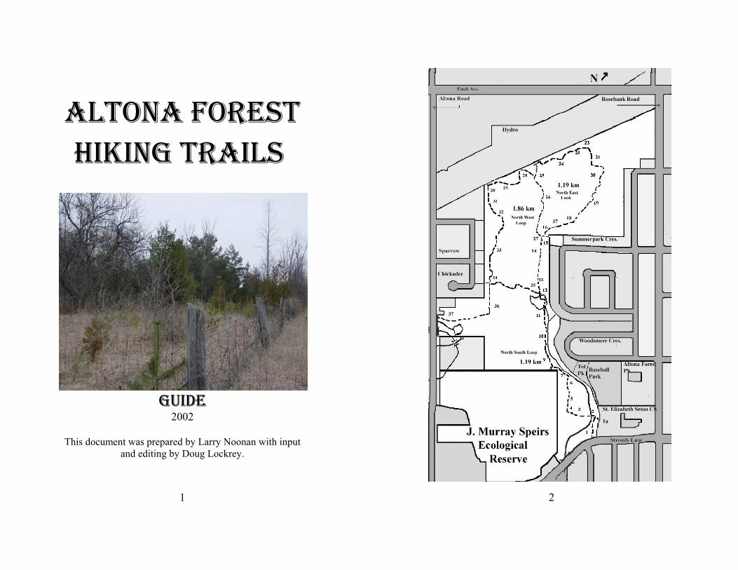
1 ALTONA FOREST HIKING TRAILS GUIDE 2002 This document was prepared by Larry Noonan with input and editing by Doug Lockrey. 2
Transcript of ALTONA FOREST HIKING TRAILSaltonaforest.org/documents/AltonaForestHikingTrailsGuideSection1.pdf ·...
1
ALTONA FORESTHIKING TRAILS
GUIDE2002
This document was prepared by Larry Noonan with inputand editing by Doug Lockrey.
2
3
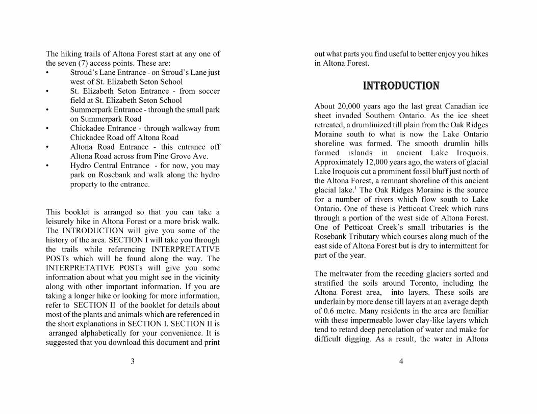
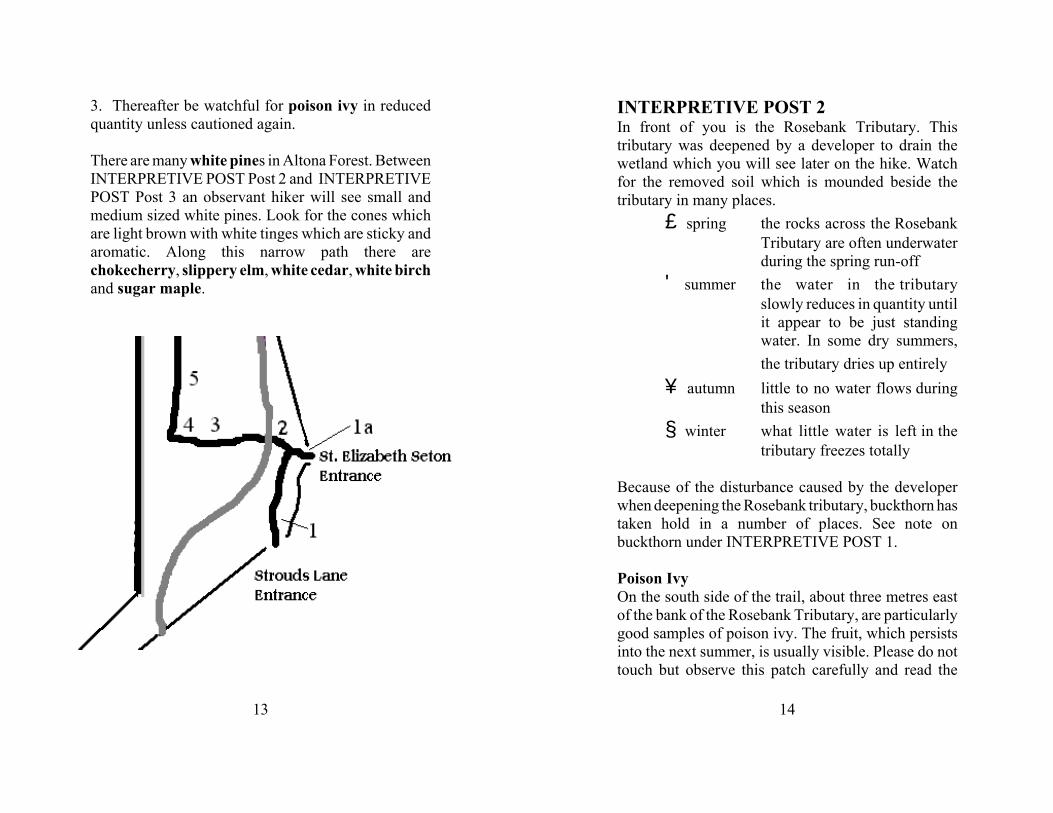
The hiking trails of Altona Forest start at any one ofthe seven (7) access points. These are:• Stroud’s Lane Entrance - on Stroud’s Lane just
west of St. Elizabeth Seton School• St. Elizabeth Seton Entrance - from soccer
field at St. Elizabeth Seton School• Summerpark Entrance - through the small park
on Summerpark Road • Chickadee Entrance - through walkway from
Chickadee Road off Altona Road• Altona Road Entrance - this entrance off
Altona Road across from Pine Grove Ave. • Hydro Central Entrance - for now, you may
park on Rosebank and walk along the hydroproperty to the entrance.
This booklet is arranged so that you can take aleisurely hike in Altona Forest or a more brisk walk.The INTRODUCTION will give you some of thehistory of the area. SECTION I will take you throughthe trails while referencing INTERPRETATIVEPOSTs which will be found along the way. TheINTERPRETATIVE POSTs will give you someinformation about what you might see in the vicinityalong with other important information. If you aretaking a longer hike or looking for more information,refer to SECTION II of the booklet for details aboutmost of the plants and animals which are referenced inthe short explanations in SECTION I. SECTION II is arranged alphabetically for your convenience. It issuggested that you download this document and print
4
out what parts you find useful to better enjoy you hikesin Altona Forest.
INTRODUCTION
About 20,000 years ago the last great Canadian icesheet invaded Southern Ontario. As the ice sheetretreated, a drumlinized till plain from the Oak RidgesMoraine south to what is now the Lake Ontarioshoreline was formed. The smooth drumlin hillsformed islands in ancient Lake Iroquois.Approximately 12,000 years ago, the waters of glacialLake Iroquois cut a prominent fossil bluff just north ofthe Altona Forest, a remnant shoreline of this ancientglacial lake.1 The Oak Ridges Moraine is the sourcefor a number of rivers which flow south to LakeOntario. One of these is Petticoat Creek which runsthrough a portion of the west side of Altona Forest.One of Petticoat Creek’s small tributaries is theRosebank Tributary which courses along much of theeast side of Altona Forest but is dry to intermittent forpart of the year.
The meltwater from the receding glaciers sorted andstratified the soils around Toronto, including theAltona Forest area, into layers. These soils areunderlain by more dense till layers at an average depthof 0.6 metre. Many residents in the area are familiarwith these impermeable lower clay-like layers whichtend to retard deep percolation of water and make fordifficult digging. As a result, the water in Altona
5
Forest saturates the upper soil horizons andaccumulates in depressions. The topography variesfrom uniformly level to gently undulating, exceptwhere man-made drainage channels have been dugthrough the overburden.2
Roaming First Nations hunters followed the meltingglaciers 6,000 to 7,000 years ago. These hunters rovedmuch of Ontario. Stone spear points and other artifactshave been found in many parts of Pickering includingin Altona Forest. The earliest of these artifacts hasbeen dated to 2000 B.C. About 100 B.C. some limitedfarming by Iroquoian Indians was carried out alongmany of the rivers in the region. By 1100 A.D., FirstNations people were hunting, gathering and farming invarious parts of what is now Pickering. These tribesconstantly moved as the soil was depleted and gamebecame scarce. Evidence of villages have been foundalong Duffin’s Creek, around Frenchman’s Bay, onConcession 3 north-east of Pickering Village and onKingston Road west of the Rouge valley. Although itis unlikely that any early inhabitants farmed AltonaForest, because of the poor soil, they did travel upPetticoat Creek and along Rosebank Tributary intoAltona Forest in search of game.
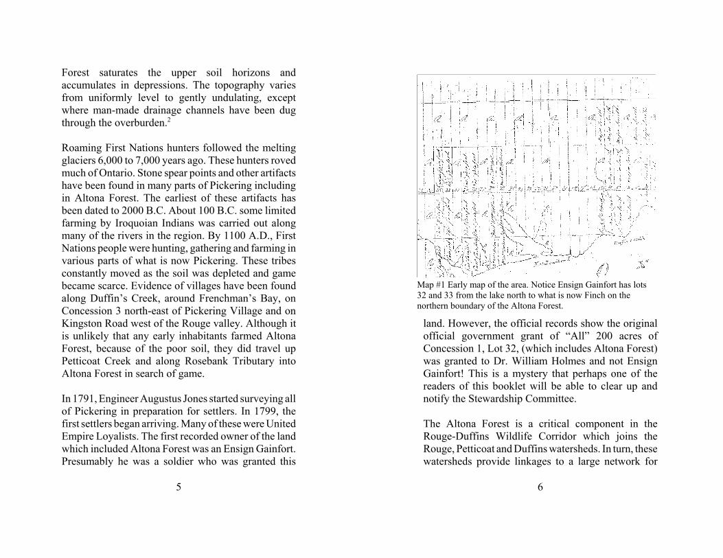
In 1791, Engineer Augustus Jones started surveying allof Pickering in preparation for settlers. In 1799, thefirst settlers began arriving. Many of these were UnitedEmpire Loyalists. The first recorded owner of the landwhich included Altona Forest was an Ensign Gainfort.Presumably he was a soldier who was granted this
6
Map #1 Early map of the area. Notice Ensign Gainfort has lots32 and 33 from the lake north to what is now Finch on thenorthern boundary of the Altona Forest.
land. However, the official records show the originalofficial government grant of “All” 200 acres ofConcession 1, Lot 32, (which includes Altona Forest)was granted to Dr. William Holmes and not EnsignGainfort! This is a mystery that perhaps one of thereaders of this booklet will be able to clear up andnotify the Stewardship Committee.
The Altona Forest is a critical component in theRouge-Duffins Wildlife Corridor which joins theRouge, Petticoat and Duffins watersheds. In turn, thesewatersheds provide linkages to a large network for
7
wildlife movement to the Oak Ridges Moraine, LakeSimcoe and Lake Ontario. The Altona Forest and thelarger Rouge-Duffins Wildlife Corridor provide vitalhabitat, contribute to wildlife movement and enhancethe health and biodiversity of plants and animals eastof Toronto.3 The Altona Forest consists of matureforest with old growth characteristics and numerousearly- to mid-secessional growth areas, such as oldfields and wet meadows. A person who walks all of thetrails of Altona Forest will experience all of thesediverse vegetation communities.
Altona Forest is a unique urban forest. Less than halfof one percent of the wooded habitat remaining in theGreater Toronto Area (GTA) provides mature interiorforest habitat that has a core area at least 300 metresfrom the forest edge. Altona Forest is one of the fewlarge areas remaining, adjacent to Lake Ontario, where
8
migrating birds have the protection of forest cover forresting and feeding during migration.4
No matter which entrance to Altona Forest you use, thenumbered stations in this booklet correspond tonumbered posts which you will find along the way.INTERPRETIVE POST Number 1 is located throughthe Stroud’s Lane Entrance. The numbers progressfrom that point northward.
PLANTS AND ANIMALS OF ALTONAFOREST
The trees of Altona Forest are many and varied. Theyinclude uncommon trees for southern Ontario,including white elm and blue beech. The trails ofAltona Forest will take you through hardwood forests,softwood forests and mixed forests. Specific stationswill refer to many of the trees and shrubs that grow inAltona Forest. Identification diagrams and hints will begiven for each season.
Wildflowers are so named because they havedeveloped over time without human intervention.Many were thought to be weeds as they grew so freelyin the meadows and fields. Because of habitatdestruction and pollution factors, many have becomeendangered. Many varieties of wildflowers are foundin Altona Forest. Wildflowers and other seasonalplants will be reference, where possible d according toseason.
9
‚spring ' summer
„ autumn † winter
The animals of Altona Forest are also varied with somespecies which might surprise you. It will be uncommonfor any hiker to see many animals, as some arenocturnal, while most of the others are very good athiding when people are near. However, with care andsome luck while walking very quietly on the trails youmay see one or more of the following: deer,woodpeckers, coyotes, racoons, red tailed hawks,rabbits, ruffed grouse, various song birds, foxesand much more.
Most of the plants and animals which are typed in boldin the booklet are written up in more detail in SectionII.
SECTION IINTERPRETIVE POST 1Welcome to Altona Forest. Please read theintroduction which is found at the beginning of thisbooklet.
You are entering the Altona Forest at the southeastside. For a short distance you will be travelling besidethe Rosebank Tributary. From here the RosebankTributary travels under Stroud’s Lane and joins up
10
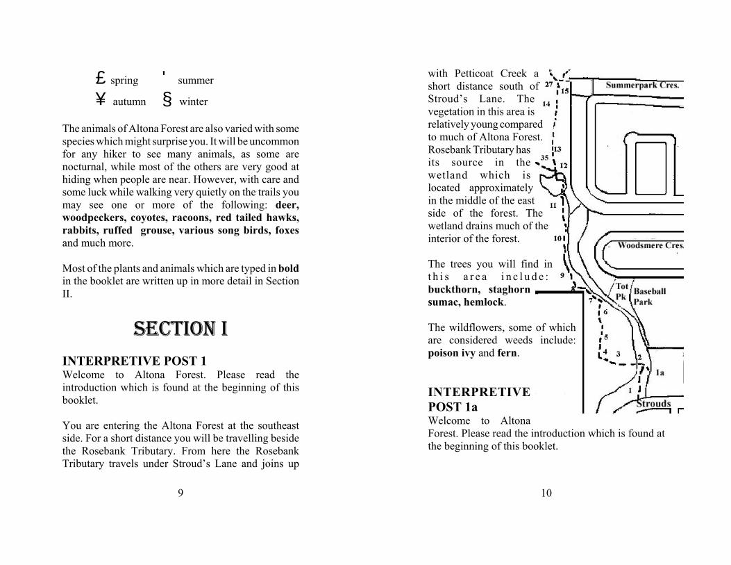
with Petticoat Creek ashort distance south ofStroud’s Lane. Thevegetation in this area isrelatively young comparedto much of Altona Forest.Rosebank Tributary hasits source in thewetland which islocated approximatelyin the middle of the eastside of the forest. Thewetland drains much of theinterior of the forest.
The trees you will find int h i s a r e a i n c l u d e :buckthorn, staghornsumac, hemlock.
The wildflowers, some of whichare considered weeds include:poison ivy and fern.
INTERPRETIVEPOST 1aWelcome to AltonaForest. Please read the introduction which is found atthe beginning of this booklet.
11
This trail proceeds west and then northto the Summerpark Entrance. The
distance from here to the SummerparkEntrance is approximately 1.19 km.
You might want to have a brief look at the smallclearing just to the south of this INTERPRETIVEPOST. Ground cover and wildflowers found in thisarea, include: white clover, red clover, plantain,vetch, yarrow, Queen Anne’s lace, chicory,goldenrod, aster and small staghorn sumac.
Butterflies which you might be lucky enough to see inthis clearing or in the clearing along the northwest loopinclude: monarch, cabbage white, cabbage yellow,and red admiral.
12
Poison Ivy with small flowers inthe spring. This picture was taken
at Post 1a where it is abundantagainst the fence and along then
path.
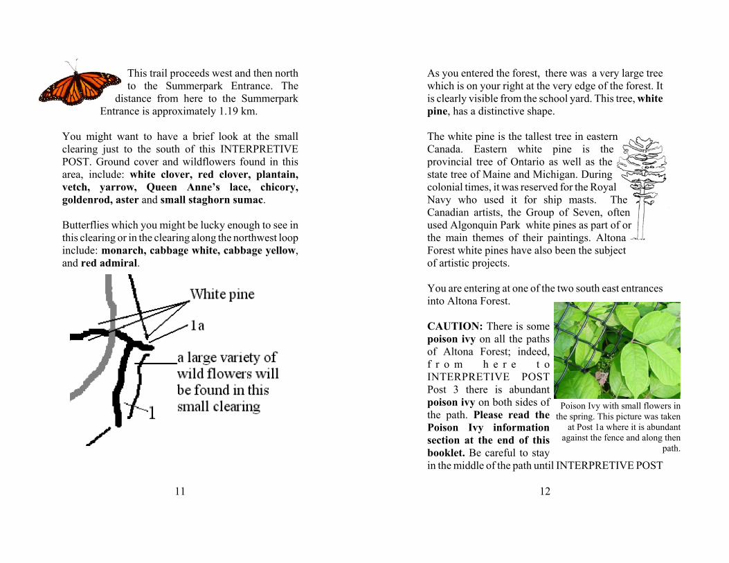
As you entered the forest, there was a very large treewhich is on your right at the very edge of the forest. Itis clearly visible from the school yard. This tree, whitepine, has a distinctive shape.
The white pine is the tallest tree in easternCanada. Eastern white pine is theprovincial tree of Ontario as well as thestate tree of Maine and Michigan. Duringcolonial times, it was reserved for the RoyalNavy who used it for ship masts. TheCanadian artists, the Group of Seven, oftenused Algonquin Park white pines as part of orthe main themes of their paintings. AltonaForest white pines have also been the subjectof artistic projects.
You are entering at one of the two south east entrancesinto Altona Forest.
CAUTION: There is somepoison ivy on all the pathsof Altona Forest; indeed,f r o m h e r e t oINTERPRETIVE POSTPost 3 there is abundantpoison ivy on both sides ofthe path. Please read thePoison Ivy informationsection at the end of thisbooklet. Be careful to stayin the middle of the path until INTERPRETIVE POST
13
3. Thereafter be watchful for poison ivy in reducedquantity unless cautioned again.
There are many white pines in Altona Forest. BetweenINTERPRETIVE POST Post 2 and INTERPRETIVEPOST Post 3 an observant hiker will see small andmedium sized white pines. Look for the cones whichare light brown with white tinges which are sticky andaromatic. Along this narrow path there arechokecherry, slippery elm, white cedar, white birchand sugar maple.
14
INTERPRETIVE POST 2In front of you is the Rosebank Tributary. Thistributary was deepened by a developer to drain thewetland which you will see later on the hike. Watchfor the removed soil which is mounded beside thetributary in many places.
‚ spring the rocks across the RosebankTributary are often underwaterduring the spring run-off
' summer the water in the tributaryslowly reduces in quantity untilit appear to be just standingwater. In some dry summers,the tributary dries up entirely
„ autumn little to no water flows duringthis season
† winter what little water is left in thetributary freezes totally
Because of the disturbance caused by the developerwhen deepening the Rosebank tributary, buckthorn hastaken hold in a number of places. See note onbuckthorn under INTERPRETIVE POST 1.
Poison IvyOn the south side of the trail, about three metres eastof the bank of the Rosebank Tributary, are particularlygood samples of poison ivy. The fruit, which persistsinto the next summer, is usually visible. Please do nottouch but observe this patch carefully and read the
15
notes on poison ivy in INTERPRETIVE POST 1section of this booklet.
Cross the Rosebank Tributary using . Watch for whitepine near the path for about 20 metres west of thetributary.
Pileated woodpeckers can sometimes be heard or seenin the trees along this part of the trail.
INTERPRETIVE POST 3You are now entering a hardwood forest. Notice thechange in plant life and upperstorey cover above yourhead. The upperstorey shades the ground and results inthe growth of shade-loving flowering plants and shade-tolerant trees.
The amount of poison ivy along this wider path fromhere to the wetland is much reduced from the trail youhave just left. Poison ivy does not like shade.However, there is the occasional poison ivy plantalong the way so please look where you step if you getclose to the edge of the path.
You are in a hardwood forest. Hardwood trees arethose which lose their leaves in the autumn. Most ofthe trees in this section are sugar maple, white ash,slipper elm, white birch (some very large ones), andironwood. There are very few white cedar. Trout lilyis common in this and the rest of the hardwoodforested parts of Altona Forest. Trillium can also beseen in the spring along this part of the path and past
16
Dr. J. Murray Speirs
INTERPRETIVE POSTs 4 to 14. Please be carefulwith any trilliums that you see, as they are tenderplants and it is illegal in Ontario to pick or transplanttrillium. (Trillium is Ontario’s provincial flower.)
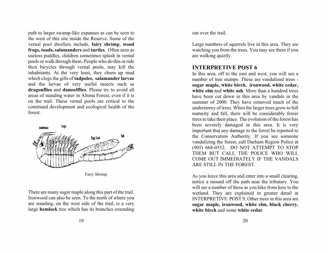
INTERPRETIVE POST 4Dr. J. Murray Speirs Ecological Reserve is locatedimmediately to the west of this INTERPRETIVEPOST. Please do not enter the Reserve but stay on theofficial path. The Reserve is an ecologically sensitivearea and there are not public paths through it.
Dr. J. Murray Speirs was aPickering resident for morethan 50 years. A graduate ofthe University of Illinois,where he received hisdoctorate in 1946 for histhesis, Local and migratorymovements of the AmericanRobin in Eastern NorthAmerica, he went on to teachat the University of Torontofor many years. He was anauthor, teacher, researcher, naturalist and avid birdwatcher. He co-founded the Pickering Naturalists in1977. His love of birds led him to write and publishthe two-volume book Birds of Ontario in 1985. In1995, he donated a large piece of his property in theAltona Forest to the Toronto and Region ConservationAuthority in order to ensure that this site would remaina place for scientific research, monitoring and study of
17
nature. Thus the Dr. J. Murray Speirs EcologicalReserve came into existence.
Dr. Speirs’ long and distinguished career wasacknowledged in November of 2000, when GovernorGeneral Adrienne Clarkson visited his Altona Roadhome to invest him in the Order of Canada. Dr. Speirspassed away on Monday September 3, 2001. Hislegacy lives on in his family, his students, his friendsand the many natural areas, including Altona Forest,which he worked to preserve.
You will notice as you walk north from here, that thepart of the Reserve is usually very wet with marsh typebodies of water and vernal5 pools in many areas westof the path.
18
The trees in this area include a very large sugarmaple. As you walk along the path which now goes ina north/south direction, look for more sugar maples ofvarious sizes, white ash and some hemlock.
INTERPRETIVE POST 5This INTERPRETIVE POST is located beside aunique tree in this area, the blue-beech. Look for atree with a trunk which looks like a muscular arm.Beyond this tree is more of the Reserve swamp area.You may notice, depending on the time of year and theamount of rain, a number of small fresh water poolstowards the Reserve. These are called vernal pools andyou might see a number of them along the trail in otherlocations.
Vernal pools are important ingredients to the freshwater world. Because of the nature of the ground inAltona Forest, shallow topsoil with hard clay and rockunderneath and the fact that the forest is protected,vernal pools are more common here than many otherparts of Pickering. The name comes from the Latinword for “spring”, which is the season when vernalpools fill with fresh water from snow melt and rain.These pools, which can last from just a few days in thespring to a couple of months, quickly become aquatichabitats for a great variety of species which haveadapted to a short wet-dry life cycle. Lack of largerpredators, which inhabit the cool waters of largerponds, rivers and creeks, give vernal pool dwellers arelatively uninterrupted development time. In AltonaForest, vernal pools range from small puddles near the
19
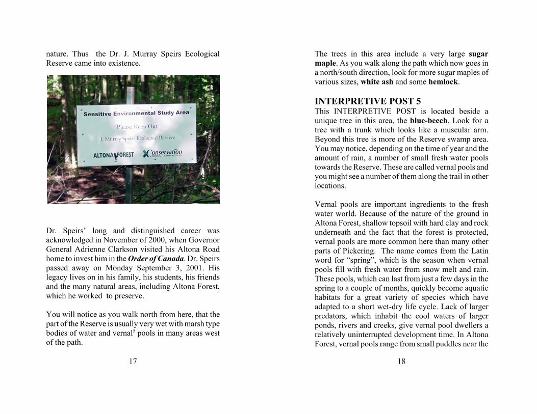
Fairy Shrimp
path to larger swamp-like expanses as can be seen tothe west of this site inside the Reserve. Some of thevernal pool dwellers include, fairy shrimp, woodfrogs, toads, salamanders and turtles. Often seen asuseless puddles, children sometimes splash in vernalpools or walk through them. People who do this or ridetheir bicycles through vernal pools, may kill theinhabitants. At the very least, they churn up mudwhich clogs the gills of tadpoles, salamander larvaeand the larvae of very useful insects such asdragonflies and damselflies. Please try to avoid allareas of standing water in Altona Forest, even if it ison the trail. These vernal pools are critical to thecontinued development and ecological health of theforest.
There are many sugar maple along this part of the trail.Ironwood can also be seen. To the north of where youare standing, on the west side of the trail, is a verylarge hemlock tree which has its branches extending
20
out over the trail.
Large numbers of squirrels live in this area. They arewatching you from the trees. You may see them if youare walking quietly.
INTERPRETIVE POST 6In this area, off to the east and west, you will see anumber of tree stumps. These are vandalized trees -sugar maple, white birch, ironwood, white cedar,white elm and white ash. More than a hundred treeshave been cut down in this area by vandals in thesummer of 2000. They have removed much of theunderstorey of trees. When the larger trees grow to fullmaturity and fall, there will be considerably fewertrees to take their place. The evolution of the forest hasbeen severely damaged in this area. It is veryimportant that any damage to the forest be reported tothe Conservation Authority. If you see someonevandalizing the forest, call Durham Region Police at(905) 668-0552. DO NOT ATTEMPT TO STOPTHEM BUT CALL THE POLICE WHO WILLCOME OUT IMMEDIATELY IF THE VANDALSARE STILL IN THE FOREST.
As you leave this area and enter into a small clearing,notice a mound off the path near the tributary. Youwill see a number of these as you hike from here to thewetland. They are explained in greater detail atINTERPRETIVE POST 9. Other trees in this area aresugar maple, ironwood, white elm, black cherry,white birch and some white cedar.
21
Wild grape
Spotted Joe Pye Weed
You will notice that there are a number of large whitebirch trees on the ground in this area. There are alsosome large dead white birch to the west of the trail.These trees are returning to the soil. Many insects andvarious types of fungi are breaking down the nutrientsin these logs. This type of debris is natural and a vitalpart of the natural ecosystem of Altona Forest.
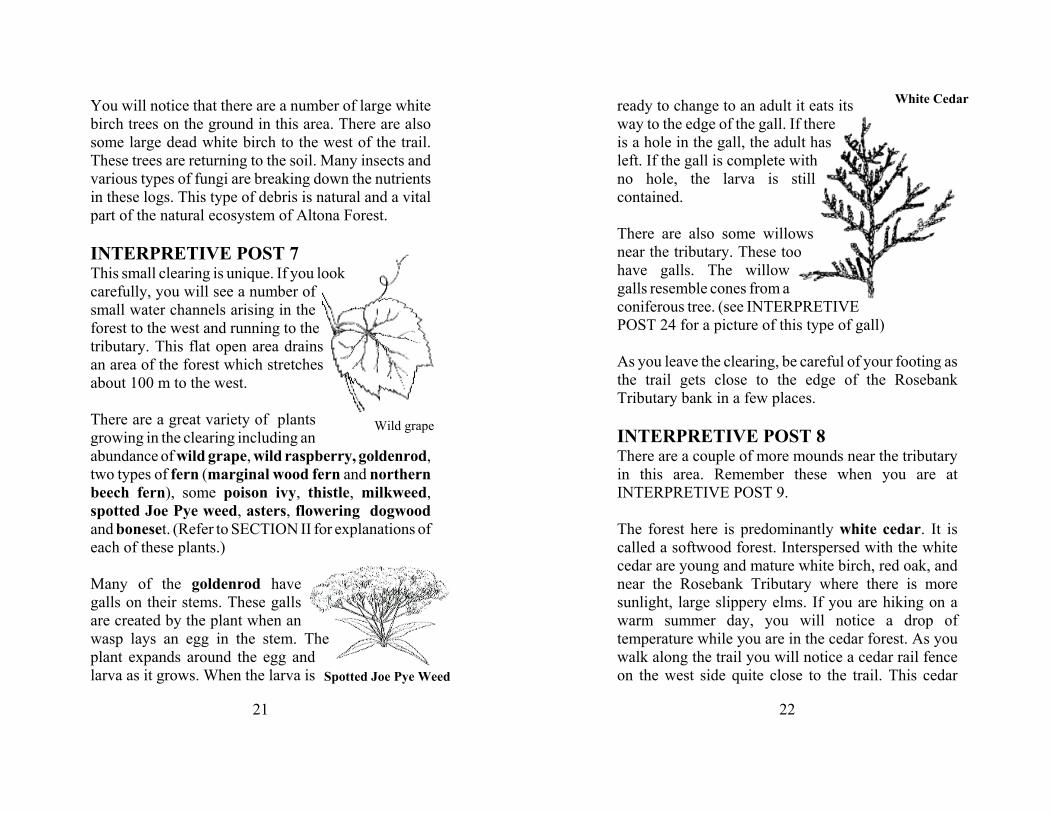
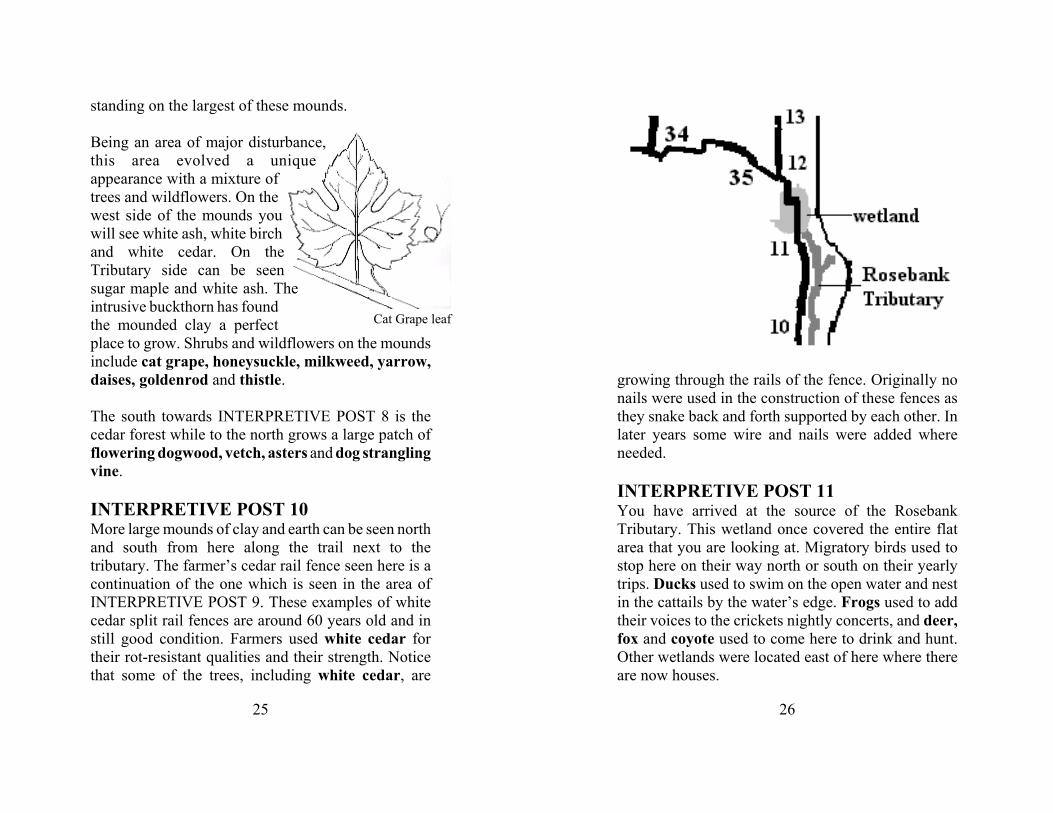
INTERPRETIVE POST 7This small clearing is unique. If you lookcarefully, you will see a number ofsmall water channels arising in theforest to the west and running to thetributary. This flat open area drainsan area of the forest which stretchesabout 100 m to the west.
There are a great variety of plantsgrowing in the clearing including anabundance of wild grape, wild raspberry, goldenrod,two types of fern (marginal wood fern and northernbeech fern), some poison ivy, thistle, milkweed,spotted Joe Pye weed, asters, flowering dogwoodand boneset. (Refer to SECTION II for explanations ofeach of these plants.)
Many of the goldenrod havegalls on their stems. These gallsare created by the plant when anwasp lays an egg in the stem. Theplant expands around the egg andlarva as it grows. When the larva is
22
White Cedarready to change to an adult it eats itsway to the edge of the gall. If thereis a hole in the gall, the adult hasleft. If the gall is complete withno hole, the larva is stillcontained.
There are also some willowsnear the tributary. These toohave galls. The willowgalls resemble cones from aconiferous tree. (see INTERPRETIVEPOST 24 for a picture of this type of gall)
As you leave the clearing, be careful of your footing asthe trail gets close to the edge of the RosebankTributary bank in a few places.
INTERPRETIVE POST 8There are a couple of more mounds near the tributaryin this area. Remember these when you are atINTERPRETIVE POST 9.
The forest here is predominantly white cedar. It iscalled a softwood forest. Interspersed with the whitecedar are young and mature white birch, red oak, andnear the Rosebank Tributary where there is moresunlight, large slippery elms. If you are hiking on awarm summer day, you will notice a drop oftemperature while you are in the cedar forest. As youwalk along the trail you will notice a cedar rail fenceon the west side quite close to the trail. This cedar
23
fence was built at least 55 years ago. Cedar was usedby the farmers to mark boundaries or, moreimportantly, keep livestock from roaming away. Thisfence was likely built to keep cattle from escaping.Most of the cedars here are 50 to 65 years old. Thefarmer’s field here, failing as an area that couldsupport crops, was likely used to graze cattle.
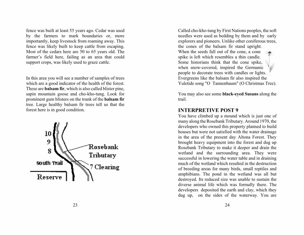
In this area you will see a number of samples of treeswhich are a good indicator of the health of the forest.These are balsam fir, which is also called blister pine,sapin mountain goose and cho-kho-tung. Look forprominent gum blisters on the trunk of the balsam firtree. Large healthy balsam fir trees tell us that theforest here is in good condition.
24
Called cho-kho-tung by First Nations peoples, the softneedles were used as bedding by them and by earlyexplorers and pioneers. Unlike other coniferous trees,the cones of the balsam fir stand upright.When the seeds fall out of the cone, a conespike is left which resembles a thin candle.Some historians think that the cone spike,when snow-covered, inspired the Germanicpeople to decorate trees with candles or lights.Evergreens like the balsam fir also inspired theYuletide song "O Tannenbaum" (O Christmas Tree).
You may also see some black-eyed Susans along thetrail.
INTERPRETIVE POST 9You have climbed up a mound which is just one ofmany along the Rosebank Tributary. Around 1970, thedevelopers who owned this property planned to buildhouses but were not satisfied with the water drainagein the area of the present day Altona Forest. Theybrought heavy equipment into the forest and dug upRosebank Tributary to make it deeper and drain thewetland and the surrounding area. They weresuccessful in lowering the water table and in drainingmuch of the wetland which resulted in the destructionof breeding areas for many birds, small reptiles andamphibians. The pond in the wetland was all butdestroyed. Its reduced size was unable to sustain thediverse animal life which was formally there. Thedevelopers deposited the earth and clay, which theydug up, on the sides of the waterway. You are
25
Cat Grape leaf
standing on the largest of these mounds.
Being an area of major disturbance,this area evolved a uniqueappearance with a mixture oftrees and wildflowers. On thewest side of the mounds youwill see white ash, white birchand white cedar. On theTributary side can be seensugar maple and white ash. Theintrusive buckthorn has foundthe mounded clay a perfectplace to grow. Shrubs and wildflowers on the moundsinclude cat grape, honeysuckle, milkweed, yarrow,daises, goldenrod and thistle.
The south towards INTERPRETIVE POST 8 is thecedar forest while to the north grows a large patch offlowering dogwood, vetch, asters and dog stranglingvine.
INTERPRETIVE POST 10More large mounds of clay and earth can be seen northand south from here along the trail next to thetributary. The farmer’s cedar rail fence seen here is acontinuation of the one which is seen in the area ofINTERPRETIVE POST 9. These examples of whitecedar split rail fences are around 60 years old and instill good condition. Farmers used white cedar fortheir rot-resistant qualities and their strength. Noticethat some of the trees, including white cedar, are
26
growing through the rails of the fence. Originally nonails were used in the construction of these fences asthey snake back and forth supported by each other. Inlater years some wire and nails were added whereneeded.
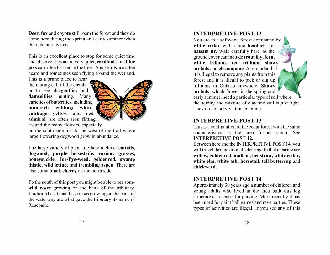
INTERPRETIVE POST 11You have arrived at the source of the RosebankTributary. This wetland once covered the entire flatarea that you are looking at. Migratory birds used tostop here on their way north or south on their yearlytrips. Ducks used to swim on the open water and nestin the cattails by the water’s edge. Frogs used to addtheir voices to the crickets nightly concerts, and deer,fox and coyote used to come here to drink and hunt.Other wetlands were located east of here where thereare now houses.
27
Deer, fox and coyote still roam the forest and they docome here during the spring and early summer whenthere is more water.
This is an excellent place to stop for some quiet timeand observe. If you are very quiet, cardinals and bluejays can often be seen in the trees. Song birds are oftenheard and sometimes seen flying around the wetland.This is a prime place to hearthe mating call of the cicadaor to see dragonflies anddamselflies hunting. Manyvarieties of butterflies, includingmonarch, cabbage white,cabbage yellow and redadmiral, are often seen flittingaround the many flowers, especiallyon the south side just to the west of the trail wherelarge flowering dogwood grow in abundance.
The large variety of plant life here include: cattails,dogwood, purple loosestrife, various grasses,honeysuckle, Joe-Pye-weed, goldenrod, swampthistle, wild lettuce and trembling aspen. There arealso some black cherry on the north side.
To the south of this post you might be able to see somewild roses growing on the bank of the tributary.Tradition has it that these roses growing on the bank ofthe waterway are what gave the tributary its name ofRosebank.
28
INTERPRETIVE POST 12You are in a softwood forest dominated bywhite cedar with some hemlock andbalsam fir. Walk carefully here, as theground cover can include trout lily, fern,white trillium, red trillium, showyorchids and elecampane. A reminder thatit is illegal to remove any plants from thisforest and it is illegal to pick or dig uptrilliums in Ontario anywhere. Showyorchids, which flower in the spring andearly summer, need a particular type of soil wherethe acidity and mixture of clay and soil is just right.They do not survive transplanting.
INTERPRETIVE POST 13This is a continuation of the cedar forest with the samecharacteristics as the area further south. SeeINTERPRETIVE POST 12. Between here and the INTERPRETIVE POST 14, youwill travel through a small clearing. In that clearing arewillow, goldenrod, mullein, bedstraw, white cedar,white elm, white ash, horsetail, tall buttercup andchickweed.
INTERPRETIVE POST 14Approximately 30 years ago a number of children andyoung adults who lived in the area built this logstructure as a centre for playing. More recently it hasbeen used for paint ball games and rave parties. Thesetypes of activities are illegal. If you see any of this
29
type of activity, please phone 911 and report what yousee. Do not attempt to stop or interrupt these activities.The police will come immediately if you tell them theillegal activity is still going on.
This area was cleared of trees many years ago.Farming was attempted and an apple orchard wasplanted here. Look around. You can see some of thevery large apple trees. In the fall there are many appleson the ground here. It is a very good area to see avariety of animals in the fall as they come to collectthe apples.
Cicada can often be heard in the trees nearby.
30
Wild grape
Dog-stranglingvine
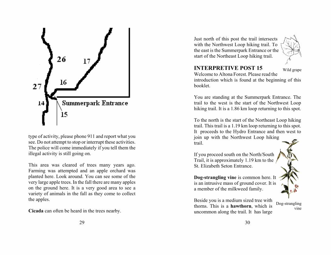
Just north of this post the trail intersectswith the Northwest Loop hiking trail. Tothe east is the Summerpark Entrance or thestart of the Northeast Loop hiking trail.
INTERPRETIVE POST 15Welcome to Altona Forest. Please read theintroduction which is found at the beginning of thisbooklet.
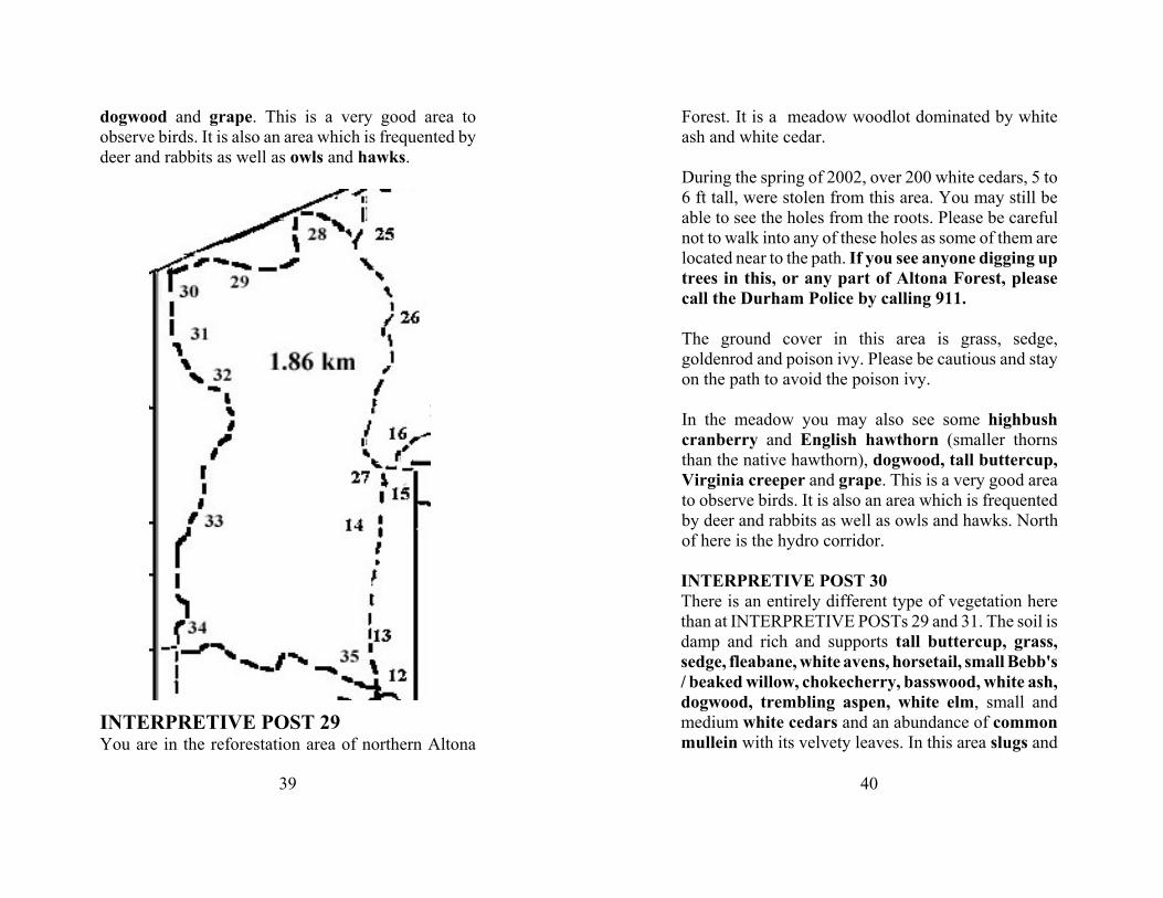
You are standing at the Summerpark Entrance. Thetrail to the west is the start of the Northwest Loophiking trail. It is a 1.86 km loop returning to this spot.
To the north is the start of the Northeast Loop hikingtrail. This trail is a 1.19 km loop returning to this spot.It proceeds to the Hydro Entrance and then west tojoin up with the Northwest Loop hikingtrail.
If you proceed south on the North/SouthTrail, it is approximately 1.19 km to theSt. Elizabeth Seton Entrance.
Dog-strangling vine is common here. Itis an intrusive mass of ground cover. It isa member of the milkweed family.
Beside you is a medium sized tree withthorns. This is a hawthorn, which isuncommon along the trail. It has large
31
Note the different growing habit of anumber of cedar trees in this area.
and small thorns. Some of its thorns have thorns!
Other trees in this area include buckthorn, slipperyelm and white cedar.
Ground growth common on this part of the pathincludes coltsfoot, purple loosestrife, goldenrod,wild grape, bull thistle, dog-strangling vine andaster.
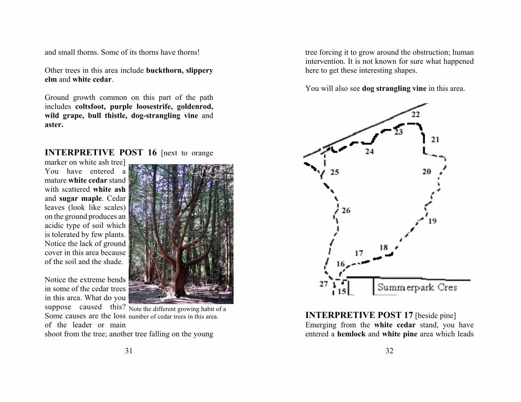
INTERPRETIVE POST 16 [next to orangemarker on white ash tree]You have entered amature white cedar standwith scattered white ashand sugar maple. Cedarleaves (look like scales)on the ground produces anacidic type of soil whichis tolerated by few plants.Notice the lack of groundcover in this area becauseof the soil and the shade.
Notice the extreme bendsin some of the cedar treesin this area. What do yousuppose caused this?Some causes are the lossof the leader or mainshoot from the tree; another tree falling on the young
32
tree forcing it to grow around the obstruction; humanintervention. It is not known for sure what happenedhere to get these interesting shapes.
You will also see dog strangling vine in this area.
INTERPRETIVE POST 17 [beside pine]Emerging from the white cedar stand, you haveentered a hemlock and white pine area which leads
33
into a large area of medium sized sugar maple treeswhich make up the upper and under storey. Shrubs andflowers here include (seasonally): baneberry, jack-in-the-pulpit, trilliums, meadow rue, blue cohosh andtoothworts.
INTERPRETIVE POST 18 [near hemlockwhich is just before two large beech trees]This area has large hemlocks and a number of beechtrees, two of which are located near where you arestanding. Notice the elephant-like colour and texture ofthe trunk of the beech.
Look around and you will see some large wind falls.These are trees which have been blown over by thewind. The roots are sticking out of the ground. Oftenthe trees continue to grow after this. In Altona Forestwindfalls are common because the soil is very shallowand beneath the soil is a mixture of clay and rocks. Toa large degree, we have the shallow soil to thank forthe preservation of Altona Forest. It is this conditionwhich made this area not suitable for farming. As aresult the forest was allowed to develop and stay in amore natural state. Eventually it was recognized as animportant natural and environmental area andpreserved. If the soil was better, the farming wouldhave been better and all the trees would have been cutdown and the land cleared first for crops and then forhouses.
As you walk on from here, you will see some woodfern, arrowleaf asters, baneberry and blue cohosh
34
growing beside the trail.
INTERPRETIVE POST 19[near fallen treewhich must be cut for the trail]There are a number of trees on the ground in this area.Some have bracket fungus growing on them. Thebracket fungus or polypore fungus, has a mass ofpores on the underside and it often looks like a shelf onthe dead tree. Like other fungi, this one helps breakdown the dead trees and deliver the nutrients back tothe earth.
INTERPRETIVE POST 20Look around here to see two trees with unique bark.One, sometimes called the corn flake tree, has barkwith large scales which resemble corn flakes pastedonto the trunk. This is the black cherry.
Another unique tree here has bark which looks like thewhite birch as it peels back in papery sections. Thecolour of the bark is a dark yellow. This tree is yellowbirch.
Around this area and along the trail, look our for thefollowing: fern, rattlesnake root, jack-in-the-pulpit andvery large hemlocks.
INTERPRETIVE POST 21[near intermittenttributary]You are standing near an unnamed intermittenttributary. The soil and clay have been washed away to
35
expose the rocks. You can clearly see here why thisarea was not successful as farm land.
In this area and along the trail you might see ostrichfern, jack-in-the-pulpit, barren strawberry, andmoss on the ground and rocks. Trees in this area areironwood, large hemlock, sugar maples andbasswood.
INTERPRETIVE POST 22 [pine forest]You are at the edge of a white pine forest. Notice theground. The pine needles in this area are so thick thatin many places nothing else will grow. This is one waytrees can eliminate competition.
INTERPRETIVE POST 23[two orangemarkers]CAUTION: From this INTERPRETATIVE POST #23through INTERPRETATIVE POST #24, 25, 26 and27, there is an abundance of poison ivy. STAY ONTHE TRAIL and do not venture off even a little.
Here is a moist area with white cedar and aspen andsome dead trees which may have been killed by themoisture. Aspen and cedars like the moist conditionshere but many other trees do not.
On the trail in this area look out for barrenstrawberry, buttercups, horsetail, mullein,barberry, milkweed, enchanters night shade andpoison ivy.
36
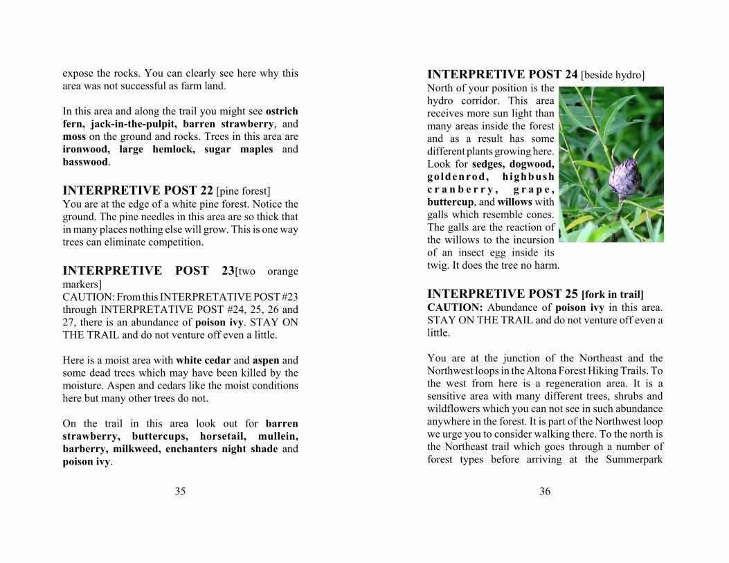
INTERPRETIVE POST 24 [beside hydro]North of your position is thehydro corridor. This areareceives more sun light thanmany areas inside the forestand as a result has somedifferent plants growing here.Look for sedges, dogwood,goldenrod, h ighbushc r a n b e r r y , g r a p e ,buttercup, and willows withgalls which resemble cones.The galls are the reaction ofthe willows to the incursionof an insect egg inside itstwig. It does the tree no harm.
INTERPRETIVE POST 25 [fork in trail]CAUTION: Abundance of poison ivy in this area.STAY ON THE TRAIL and do not venture off even alittle.
You are at the junction of the Northeast and theNorthwest loops in the Altona Forest Hiking Trails. Tothe west from here is a regeneration area. It is asensitive area with many different trees, shrubs andwildflowers which you can not see in such abundanceanywhere in the forest. It is part of the Northwest loopwe urge you to consider walking there. To the north isthe Northeast trail which goes through a number offorest types before arriving at the Summerpark
37
Entrance.
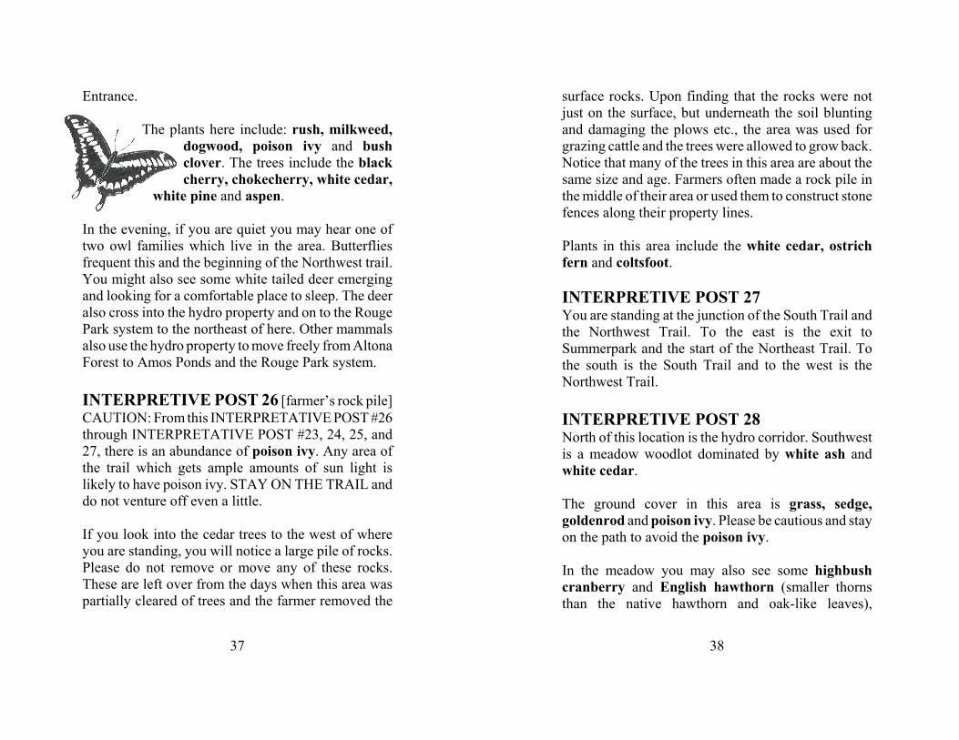
The plants here include: rush, milkweed,dogwood, poison ivy and bushclover. The trees include the blackcherry, chokecherry, white cedar,
white pine and aspen.
In the evening, if you are quiet you may hear one oftwo owl families which live in the area. Butterfliesfrequent this and the beginning of the Northwest trail.You might also see some white tailed deer emergingand looking for a comfortable place to sleep. The deeralso cross into the hydro property and on to the RougePark system to the northeast of here. Other mammalsalso use the hydro property to move freely from AltonaForest to Amos Ponds and the Rouge Park system.
INTERPRETIVE POST 26 [farmer’s rock pile]CAUTION: From this INTERPRETATIVE POST #26through INTERPRETATIVE POST #23, 24, 25, and27, there is an abundance of poison ivy. Any area ofthe trail which gets ample amounts of sun light islikely to have poison ivy. STAY ON THE TRAIL anddo not venture off even a little.
If you look into the cedar trees to the west of whereyou are standing, you will notice a large pile of rocks.Please do not remove or move any of these rocks.These are left over from the days when this area waspartially cleared of trees and the farmer removed the
38
surface rocks. Upon finding that the rocks were notjust on the surface, but underneath the soil bluntingand damaging the plows etc., the area was used forgrazing cattle and the trees were allowed to grow back.Notice that many of the trees in this area are about thesame size and age. Farmers often made a rock pile inthe middle of their area or used them to construct stonefences along their property lines.
Plants in this area include the white cedar, ostrichfern and coltsfoot.
INTERPRETIVE POST 27You are standing at the junction of the South Trail andthe Northwest Trail. To the east is the exit toSummerpark and the start of the Northeast Trail. Tothe south is the South Trail and to the west is theNorthwest Trail.
INTERPRETIVE POST 28North of this location is the hydro corridor. Southwestis a meadow woodlot dominated by white ash andwhite cedar.
The ground cover in this area is grass, sedge,goldenrod and poison ivy. Please be cautious and stayon the path to avoid the poison ivy.
In the meadow you may also see some highbushcranberry and English hawthorn (smaller thornsthan the native hawthorn and oak-like leaves),
39
dogwood and grape. This is a very good area toobserve birds. It is also an area which is frequented bydeer and rabbits as well as owls and hawks.
INTERPRETIVE POST 29You are in the reforestation area of northern Altona
40
Forest. It is a meadow woodlot dominated by whiteash and white cedar.
During the spring of 2002, over 200 white cedars, 5 to6 ft tall, were stolen from this area. You may still beable to see the holes from the roots. Please be carefulnot to walk into any of these holes as some of them arelocated near to the path. If you see anyone digging uptrees in this, or any part of Altona Forest, pleasecall the Durham Police by calling 911.
The ground cover in this area is grass, sedge,goldenrod and poison ivy. Please be cautious and stayon the path to avoid the poison ivy.
In the meadow you may also see some highbushcranberry and English hawthorn (smaller thornsthan the native hawthorn), dogwood, tall buttercup,Virginia creeper and grape. This is a very good areato observe birds. It is also an area which is frequentedby deer and rabbits as well as owls and hawks. Northof here is the hydro corridor.
INTERPRETIVE POST 30There is an entirely different type of vegetation herethan at INTERPRETIVE POSTs 29 and 31. The soil isdamp and rich and supports tall buttercup, grass,sedge, fleabane, white avens, horsetail, small Bebb's/ beaked willow, chokecherry, basswood, white ash,dogwood, trembling aspen, white elm, small andmedium white cedars and an abundance of commonmullein with its velvety leaves. In this area slugs and
41
snails with beige shells with dark brown stripes arecommon.
INTERPRETIVE POST 31This meadow has an abundance of wildflowers andsmall trees. The plants include hawkweed, buttercup,white avens, white ash, white pine, black cherry andchokecherry. This is another area frequented by avariety of birds as well as deer, rabbits and coyote.
INTERPRETIVE POST 32You are in a mature white cedar stand with somedogwood, moss and wood fern but mostly very littleunderstorey. Look at the ground and look above. Theground is covered with a mat of dried cedar leaveswhile there is very little light coming through theupperstorey of cedars. These factors combine todiscourage an abundance of understorey growth.
You might notice the occasional large apple tree alongthe path. The reason for this is not clear but this areawas a farmers field in the 1940s and there is an oldapple orchard on the east side of Altona Forest not toofar from here.
INTERPRETIVE POST 33White pine and white cedar are dominant in this area.Notice the ground cover of pine needles and the lack ofan understorey. Watch out for large apple trees withscaly bark (very different from the other trees in thisarea). The apple trees may have been here before the
42
cedar trees as they are very old. You will see somebaneberry and dog-strangling vine where the sunlight reaches the ground.
INTERPRETIVE POST 34Welcome to Altona Forest. Please read theintroduction which is found at the beginning of thisbooklet. To the west of this post is the exit fromChickadee. From here you can proceed north along theNorthwest Loop toward INTERPRETIVE POST # 33,east toward the NorthSouth trail towardINTERPRETIVE POST #35 or south towards theAltona Road entrance and INTERPRETIVE POST #36.
The North West Trail is approximately 1.86 km long
43
Trails left under the bark ofa tree attacked by a bark beetle.
if you return to this spot.
In this area there are a number of fallen and decayingtrees. Some of the logs which have been on the groundfor a number of years no longer have the barkprotecting the inner wood. On some of these trees youcan see evidence of the bark beetle. These blackishbrown, small and fat insects have enlarged tips on theirs h o r t c l u b - s h a p e dantennae. They attackboth live and dead trees.When the eggs hatchunder the bark, thelarvae make extensivetunnels which resemblecomplicated road systems. Someof these tunnels are visible on someof the old treeswhich have had thebark rot off.
Look out for large apple trees, white cedar, whitepine, hemlock, dog strangling vine and white ashtowards the edge of the forest.
Along the east trail you will also see (in season) someCanada Mayflower, true Solomon’s seal, wild lily ofthe valley, trilliums, baneberry, dog strangling vine,wood fern and spikenard.
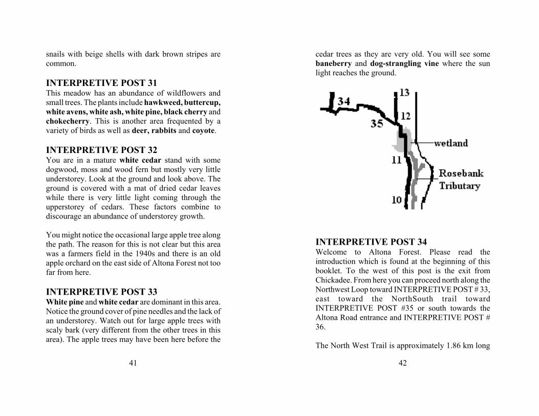
INTERPRETIVE POST 35You are at the junction of the NorthSouth trail. To the
44
south is the wetland. To the north is the trail to theSummerpark Entrance. To the west is the ChickadeeEntrance.
INTERPRETIVE POST 36You are entering a mixed forest with a variety of treetypes.
INTERPRETIVE POST 37Welcome to Altona Forest. Before going on, pleaseread the introduction at the beginning of this booklet.
This is INTERPRETIVE POST 37. Although it is thebeginning of the hiking trail starting from AltonaRoad, this post was the last one placed on the hikingtrails inside the forest, thus the number. From here youwill hike north to the Chickadee Entrance where youcan continue north or proceed east.
The area around you was once the drive way and yardsof a home situated beside Petticoat Creek. Petticoat
45
Creek is situated in the valley to the immediate southof here, just beyond the parking lot. From herePetticoat Creek flows into private property and then tothe other side of Altona Road before flowing in asoutheastern direction under Sheppard Ave, CN Railtracks, the 401 highway and into Petticoat CreekConservation Area before emptying into Lake Ontario.
Rest of this information to be determined when thetrail location is finalized.
NOTES ON POISON IVY
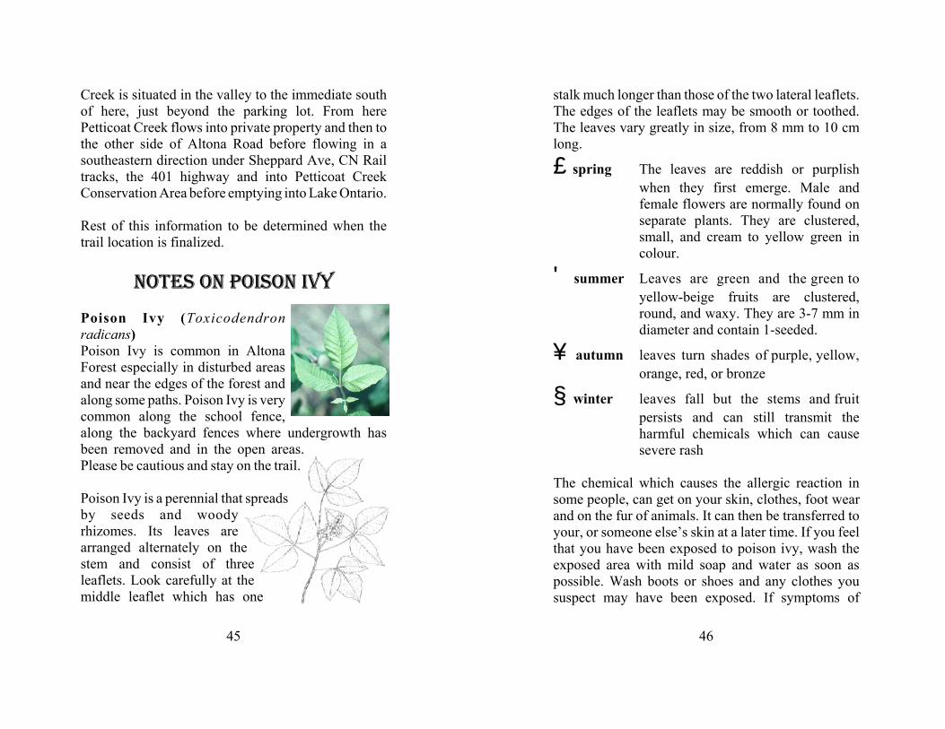
Poison Ivy (Toxicodendronradicans)Poison Ivy is common in AltonaForest especially in disturbed areasand near the edges of the forest andalong some paths. Poison Ivy is verycommon along the school fence,along the backyard fences where undergrowth hasbeen removed and in the open areas.Please be cautious and stay on the trail.
Poison Ivy is a perennial that spreadsby seeds and woodyrhizomes. Its leaves arearranged alternately on thestem and consist of threeleaflets. Look carefully at themiddle leaflet which has one
46
stalk much longer than those of the two lateral leaflets.The edges of the leaflets may be smooth or toothed.The leaves vary greatly in size, from 8 mm to 10 cmlong.
‚spring The leaves are reddish or purplishwhen they first emerge. Male andfemale flowers are normally found onseparate plants. They are clustered,small, and cream to yellow green incolour.
' summer Leaves are green and the green toyellow-beige fruits are clustered,round, and waxy. They are 3-7 mm indiameter and contain 1-seeded.
„ autumn leaves turn shades of purple, yellow,orange, red, or bronze
† winter leaves fall but the stems and fruitpersists and can still transmit theharmful chemicals which can causesevere rash
The chemical which causes the allergic reaction insome people, can get on your skin, clothes, foot wearand on the fur of animals. It can then be transferred toyour, or someone else’s skin at a later time. If you feelthat you have been exposed to poison ivy, wash theexposed area with mild soap and water as soon aspossible. Wash boots or shoes and any clothes yoususpect may have been exposed. If symptoms of

47
1.Altona Forest Environmental Management Plan, TheMetropolitan Toronto and Region Conservation Authority,March 29, 1996, page 1
2.Altona Forest Environmental Management Plan, TheMetropolitan Toronto and Region Conservation Authority,March 29, 1996, page 1
3.Altona Forest Environmental Management Plan, TheMetropolitan Toronto and Region Conservation Authority,March 29, 1996, page 1
4.Altona Forest Environmental Management Plan, TheMetropolitan Toronto and Region Conservation Authority,March 29, 1996, page 1
itching or rash appear, see a doctor immediately.