Redalyc.An Alternative Item Count Technique in Sensitive Surveys
Upload
truongthuanCategory
view
220download
0
Alternative Technique for Surveying andMonitoring Mohave Ground Squirrels
2010-11 Results
DRECP BriefingDavid DelaneyPhilip Leitner
Small herbivorous, endemic rodent found in desert-scrub habitat of the western Mojave Desert
Smallest geographic range of Xerospermophilus ground squirrels in California, about 2 million hectares
MGS are primarily on DoD (34.5%), BLM (31.8%) and private lands (31.0%)
MGS are listed as threatened in CA
MGS is a priority 1 Species-at-Risk for the Army
MGS are currently being considered for federal listing
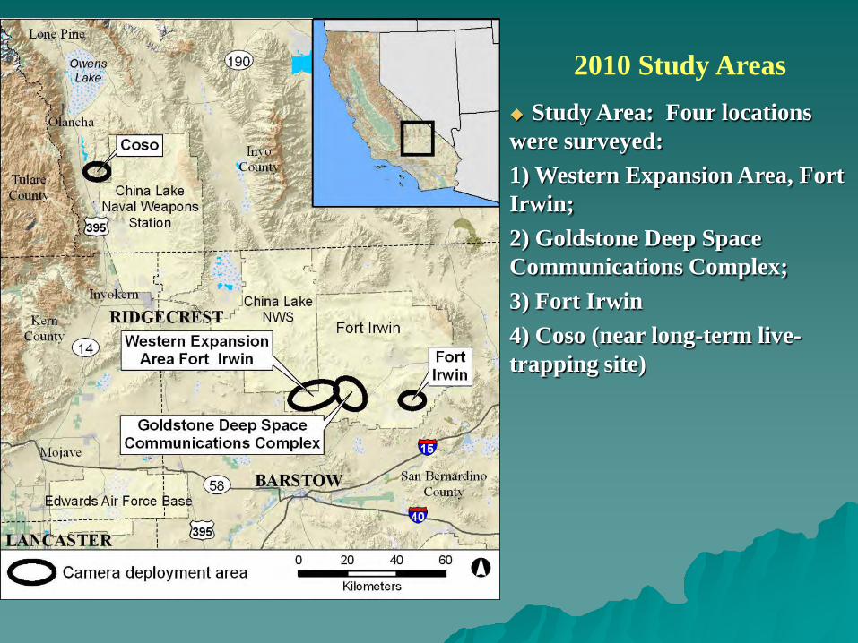
2010 Study Areas Study Area: Four locations were surveyed: 1) Western Expansion Area, Fort Irwin;2) Goldstone Deep Space Communications Complex;3) Fort Irwin4) Coso (near long-term live-trapping site)
Study Objectives
Confirm that ground squirrels readily visit bait stations and are not bothered by camera trap equipment
Compare the effectiveness of camera traps in detecting ground squirrel presence vs. live-trapping
Determine if MGS and RTGS are readily distinguishable using camera traps?
Determine if MGS marked with unique shave patterns were distinguishable using camera trap systems
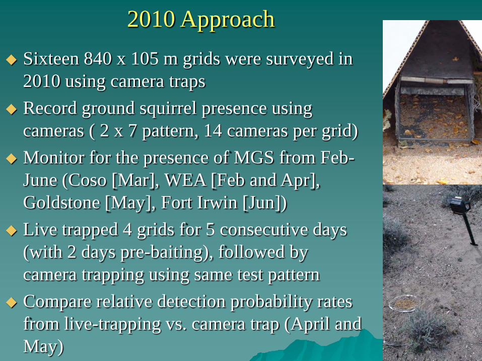
2010 Approach Sixteen 840 x 105 m grids were surveyed in
2010 using camera traps Record ground squirrel presence using
cameras ( 2 x 7 pattern, 14 cameras per grid) Monitor for the presence of MGS from Feb-
June (Coso [Mar], WEA [Feb and Apr], Goldstone [May], Fort Irwin [Jun])
Live trapped 4 grids for 5 consecutive days (with 2 days pre-baiting), followed by camera trapping using same test pattern
Compare relative detection probability rates from live-trapping vs. camera trap (April and May)
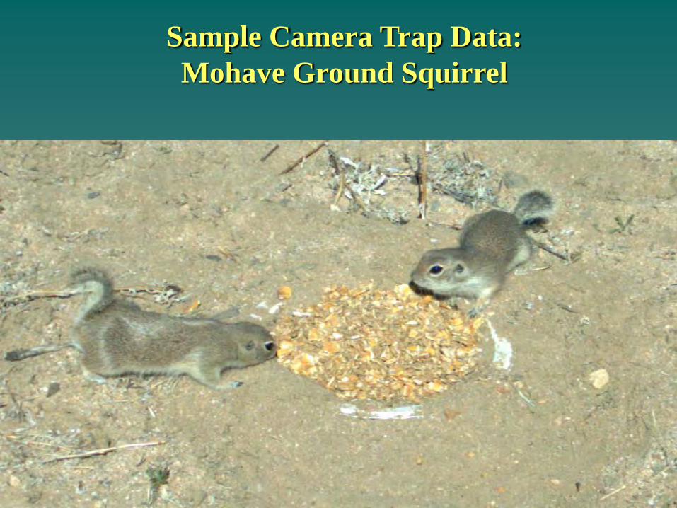
Sample Camera Trap Data: Mohave Ground Squirrel
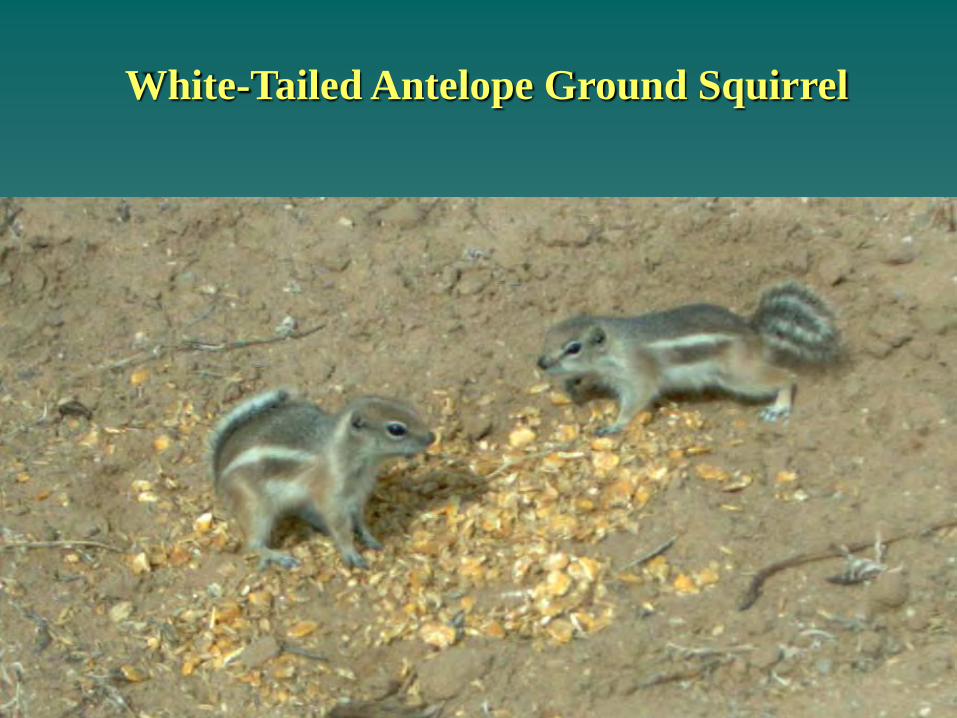
White-Tailed Antelope Ground Squirrel
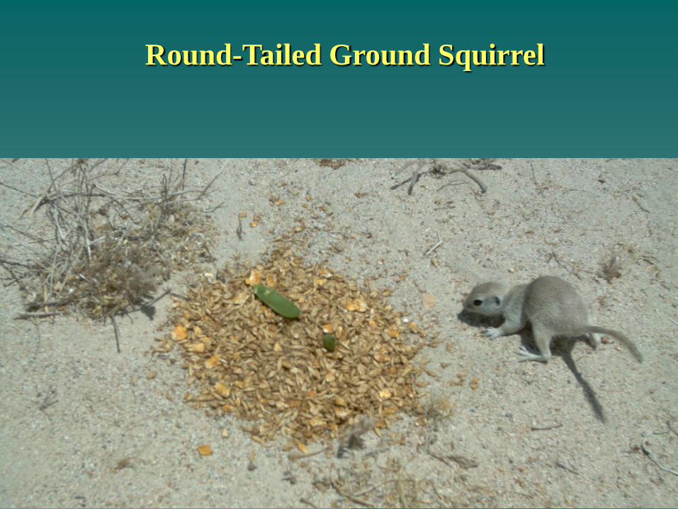
Round-Tailed Ground Squirrel
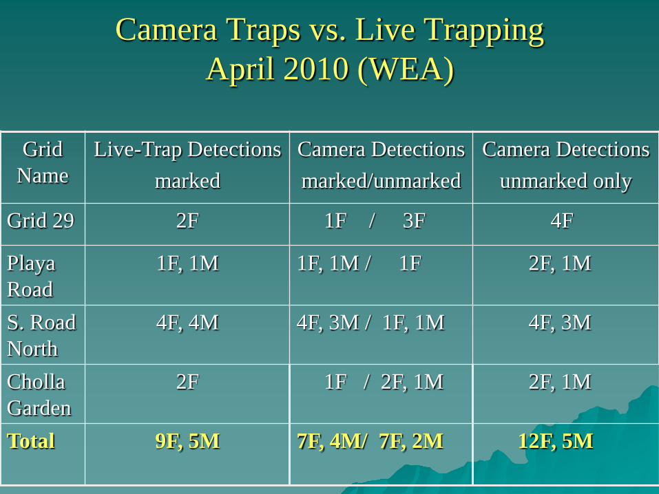
Camera Traps vs. Live TrappingApril 2010 (WEA)
Grid Name
Live-Trap Detectionsmarked
Camera Detectionsmarked/unmarked
Camera Detectionsunmarked only
Grid 29 2F 1F / 3F 4F
Playa Road
1F, 1M 1F, 1M / 1F 2F, 1M
S. Road North
4F, 4M 4F, 3M / 1F, 1M 4F, 3M
Cholla Garden
2F 1F / 2F, 1M 2F, 1M
Total 9F, 5M 7F, 4M/ 7F, 2M 12F, 5M
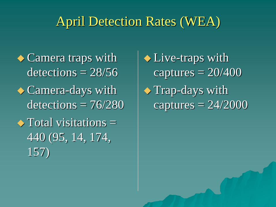
April Detection Rates (WEA)
Camera traps with detections = 28/56
Camera-days with detections = 76/280
Total visitations = 440 (95, 14, 174, 157)
Live-traps with captures = 20/400
Trap-days with captures = 24/2000
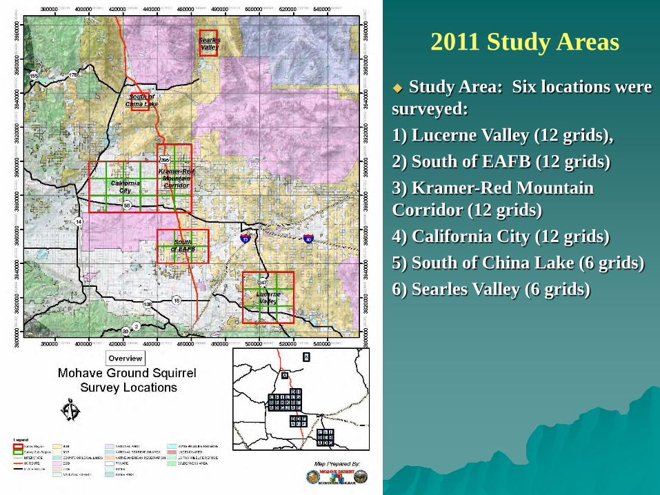
Study Area: Six locations were surveyed: 1) Lucerne Valley (12 grids),2) South of EAFB (12 grids)3) Kramer-Red Mountain Corridor (12 grids)4) California City (12 grids)5) South of China Lake (6 grids)6) Searles Valley (6 grids)
2011 Study Areas
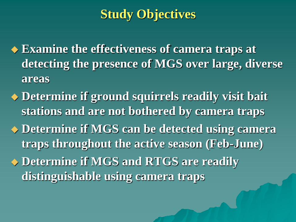
Study Objectives
Examine the effectiveness of camera traps at detecting the presence of MGS over large, diverse areas
Determine if ground squirrels readily visit bait stations and are not bothered by camera traps
Determine if MGS can be detected using camera traps throughout the active season (Feb-June)
Determine if MGS and RTGS are readily distinguishable using camera traps
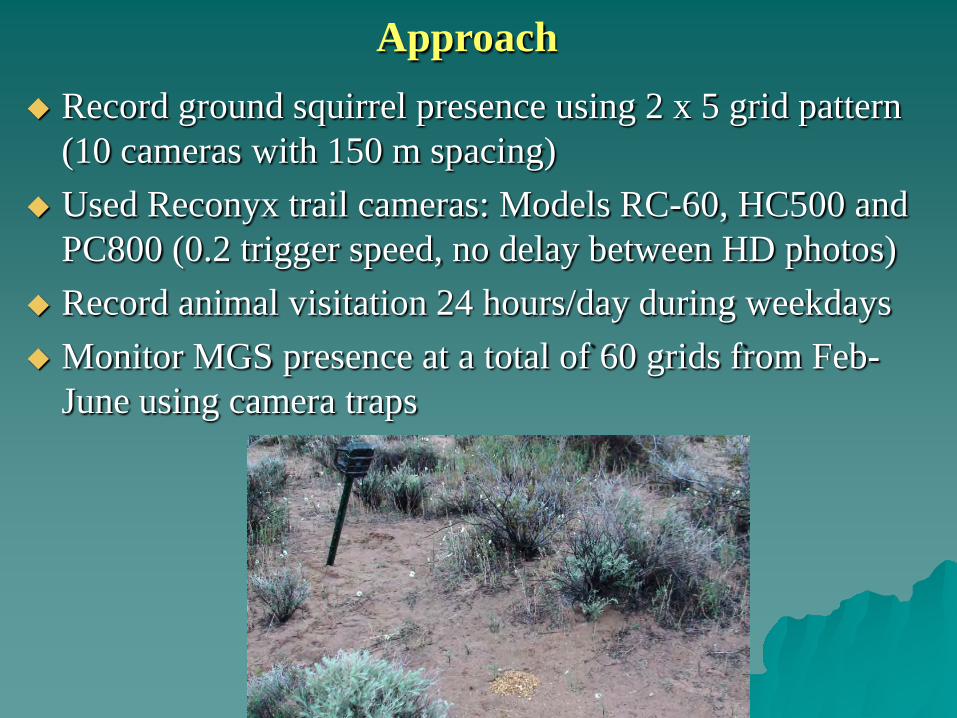
Approach Record ground squirrel presence using 2 x 5 grid pattern
(10 cameras with 150 m spacing) Used Reconyx trail cameras: Models RC-60, HC500 and
PC800 (0.2 trigger speed, no delay between HD photos) Record animal visitation 24 hours/day during weekdays Monitor MGS presence at a total of 60 grids from Feb-
June using camera traps
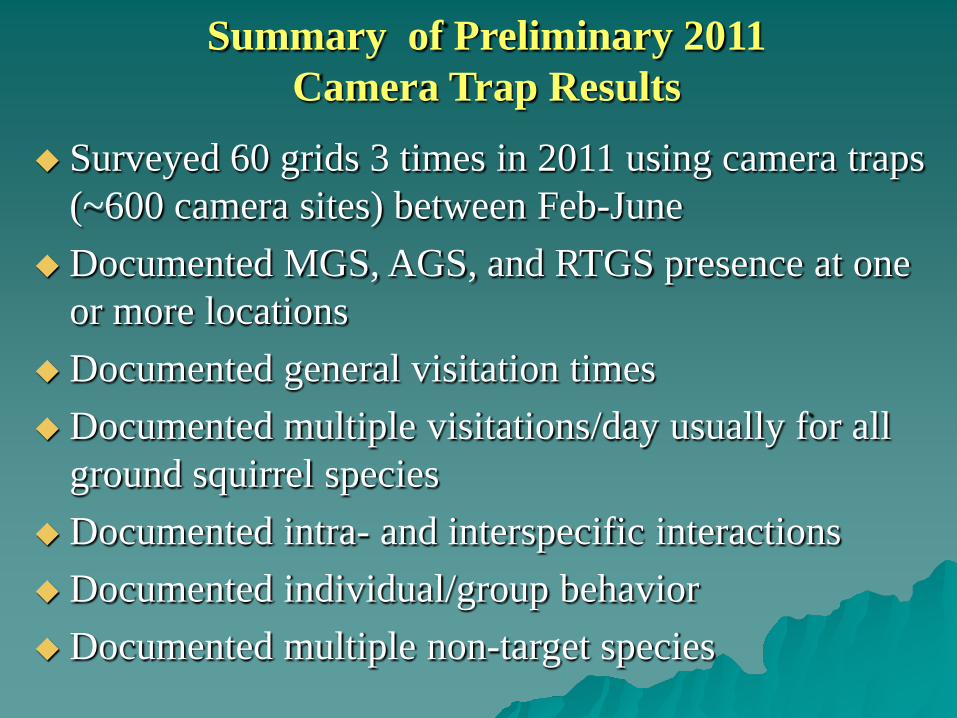
Summary of Preliminary 2011 Camera Trap Results
Surveyed 60 grids 3 times in 2011 using camera traps (~600 camera sites) between Feb-June
Documented MGS, AGS, and RTGS presence at one or more locations
Documented general visitation timesDocumented multiple visitations/day usually for all
ground squirrel speciesDocumented intra- and interspecific interactionsDocumented individual/group behaviorDocumented multiple non-target species
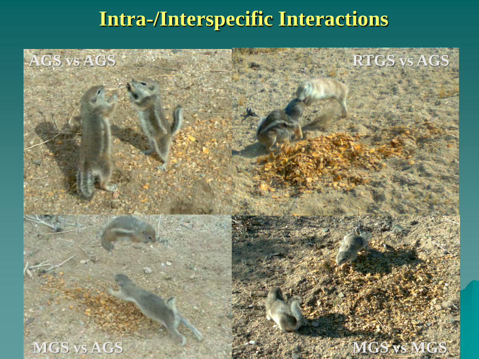
Intra-/Interspecific Interactions
AGS vs AGS RTGS vs AGS
MGS vs AGS MGS vs MGS
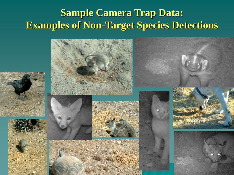
Sample Camera Trap Data: Examples of Non-Target Species Detections
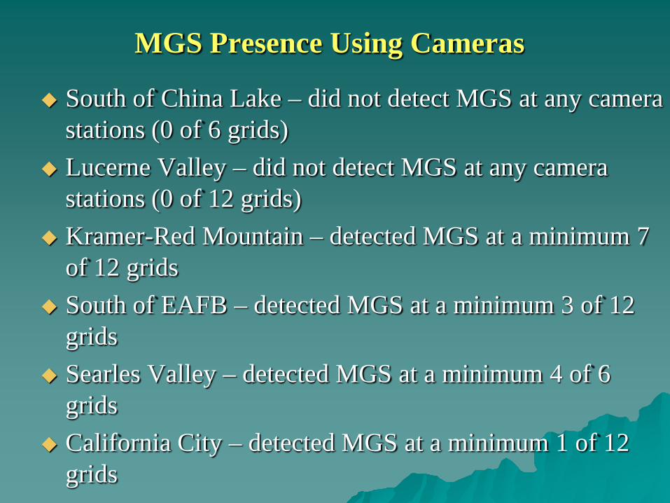
MGS Presence Using Cameras
South of China Lake – did not detect MGS at any camera stations (0 of 6 grids)
Lucerne Valley – did not detect MGS at any camera stations (0 of 12 grids)
Kramer-Red Mountain – detected MGS at a minimum 7 of 12 grids
South of EAFB – detected MGS at a minimum 3 of 12 grids
Searles Valley – detected MGS at a minimum 4 of 6 grids
California City – detected MGS at a minimum 1 of 12 grids
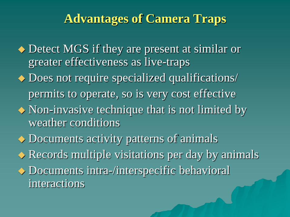
Advantages of Camera Traps
Detect MGS if they are present at similar or greater effectiveness as live-traps
Does not require specialized qualifications/permits to operate, so is very cost effective
Non-invasive technique that is not limited by weather conditions
Documents activity patterns of animals Records multiple visitations per day by animalsDocuments intra-/interspecific behavioral
interactions
Advantages of Live Trapping
Collect definitive demographic data: sex, age, reproductive condition
By marking animals, gain an indication of abundance
Trapping is essential to obtain tissue samples for genetic work or to radio-tag individuals
Possible Future Uses of Camera Traps
Determine the number of camera trap systems needed to fully sample conventional grid to directly compare with live-trapping surveys
Utilize camera traps to locate future trapping sites to improve the cost effectiveness of live-trapping
Investigate food preferences of MGS to possibly improve live-trapping effectiveness
Investigate how MGS interact with live-traps to possibly improve trapping effectiveness
Investigate if PIT tag reading devices can be effectively used in concert with camera traps/feeding stations
Camera Trap Research in 2012 Fort Irwin, BLM, CDFG, MDEP, CSU-Stanislaus/ESRP
and CERL have provided resources to expand MGS surveys using camera traps on non-DoD lands
Continue large scale field test of the camera trap survey technique
Provide data to help validate the PACT model that the CEC PIER program is evaluating
Help to field test the MGS habitat suitability model that the USGS is developing
Vegetation sampling data will be directly applicable with ongoing CDFG vegetation mapping projects
Research findings will be applicable across DoD and non-DoD lands
Project results will improve our knowledge of MGS distribution
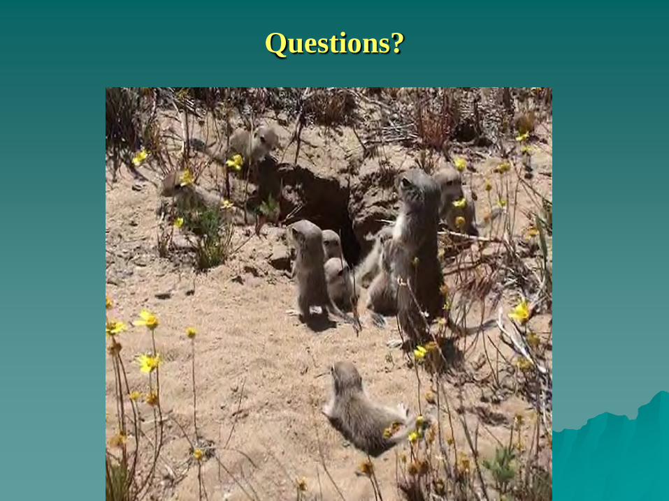
Questions?