Alternate Position, Navigation & Time APNT for Civil … · 2011-06-10 · Alternate Position,...
21
Alternate Position, Navigation & Time APNT for Civil Aviation For Working Group B of the International GNSS Committee Shanghai, May 2011 by Per Enge & Leo Eldredge Work supported by the Federal Aviation Administration under CRDA 08-G-007. This briefing is NOT intended to convey a US Government position; rather, it is provided to facilitate a working-level discussion and exchange of ideas.
Transcript of Alternate Position, Navigation & Time APNT for Civil … · 2011-06-10 · Alternate Position,...
Alternate Position, Navigation & TimeAPNT for Civil Aviation
For Working Group B of the International GNSS Committee
Shanghai, May 2011by Per Enge & Leo Eldredge
Work supported by the Federal Aviation Administration under CRDA 08-G-007.
This briefing is NOT intended to convey a US Government position; rather, it is provided to facilitate a
working-level discussion and exchange of ideas.
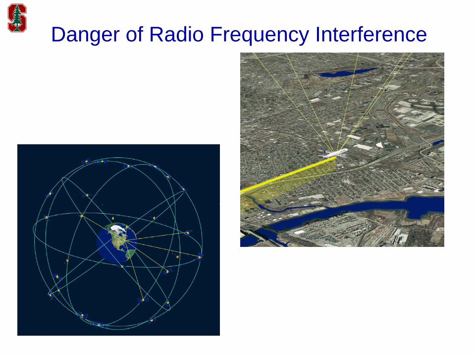
Danger of Radio Frequency Interference
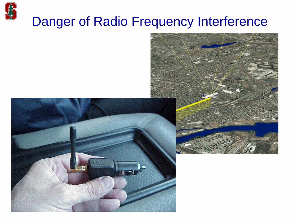
Danger of Radio Frequency Interference

… and a few more “Personal Privacy Devices”
$55 Ebay
$110 Ebay $335 Ebay$92 Ebay
$152 Ebay$40 GPS&GSM
$83 GPS&GSM
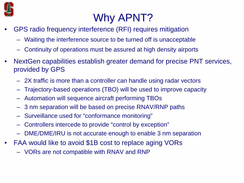
Why APNT?• GPS radio frequency interference (RFI) requires mitigation
– Waiting the interference source to be turned off is unacceptable– Continuity of operations must be assured at high density airports
• NextGen capabilities establish greater demand for precise PNT services, provided by GPS– 2X traffic is more than a controller can handle using radar vectors– Trajectory-based operations (TBO) will be used to improve capacity– Automation will sequence aircraft performing TBOs– 3 nm separation will be based on precise RNAV/RNP paths– Surveillance used for “conformance monitoring”– Controllers intercede to provide “control by exception”– DME/DME/IRU is not accurate enough to enable 3 nm separation
• FAA would like to avoid $1B cost to replace aging VORs– VORs are not compatible with RNAV and RNP
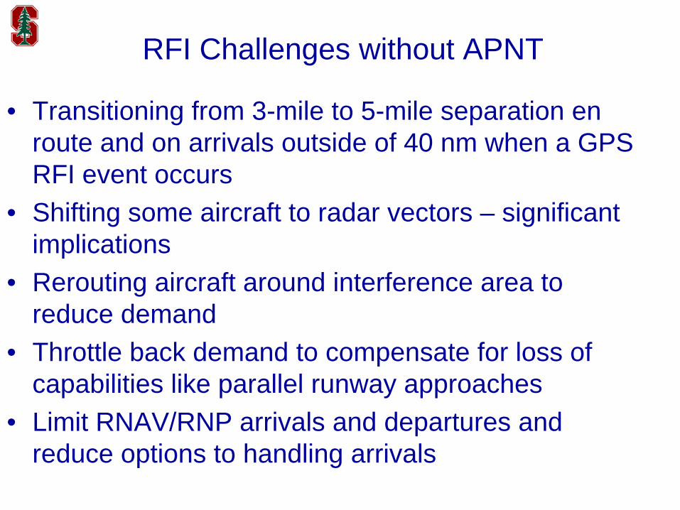
RFI Challenges without APNT
• Transitioning from 3-mile to 5-mile separation en route and on arrivals outside of 40 nm when a GPS RFI event occurs
• Shifting some aircraft to radar vectors – significant implications
• Rerouting aircraft around interference area to reduce demand
• Throttle back demand to compensate for loss of capabilities like parallel runway approaches
• Limit RNAV/RNP arrivals and departures and reduce options to handling arrivals
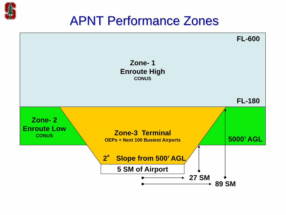
APNT Performance Zones
5 SM of Airport
Zone- 1Enroute High
CONUS
FL-600
FL-180
5000’ AGL
Zone- 2Enroute Low
CONUS Zone-3 TerminalOEPs + Next 100 Busiest Airports
2° Slope from 500’ AGL
27 SM89 SM
8
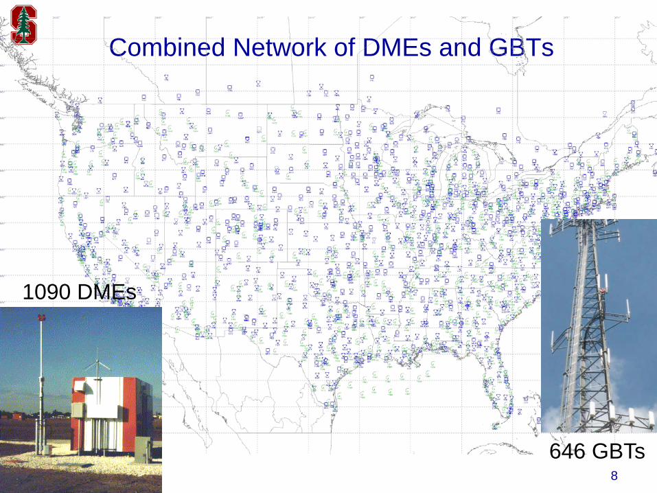
Combined Network of DMEs and GBTs
1090 DMEs
646 GBTs
9
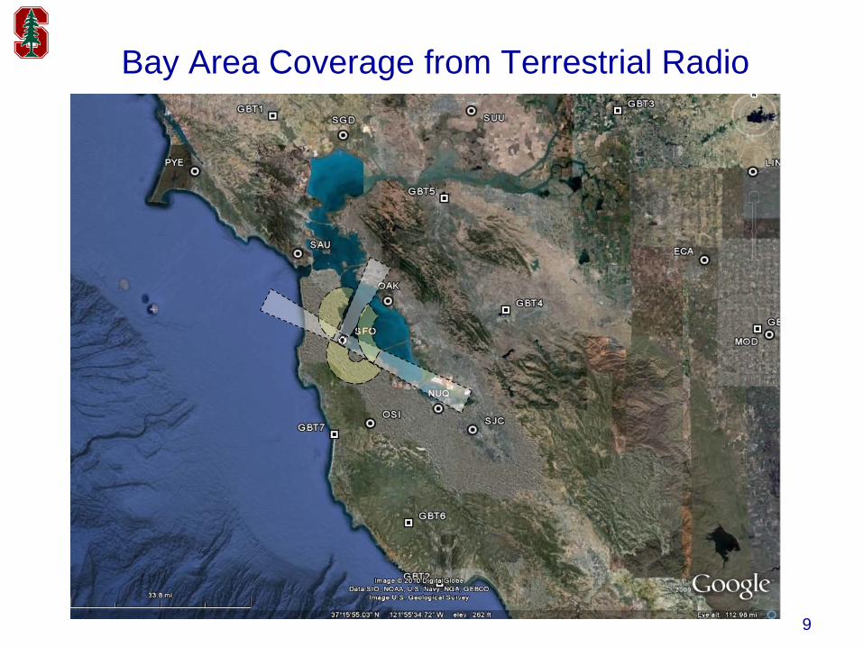
Bay Area Coverage from Terrestrial Radio
1010
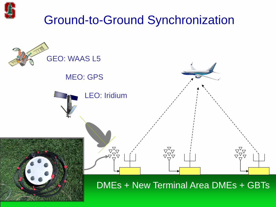
DMEs + New Terminal Area DMEs + GBTs
GEO: WAAS L5
MEO: GPS
LEO: Iridium
Ground-to-Ground Synchronization

11
Ground-to-Air Synchronization
request/reply(aka two-way ranging
or true range)
one-way ranging(aka pseudo-range)
DMEs + Planned DMEs + GBTs
12
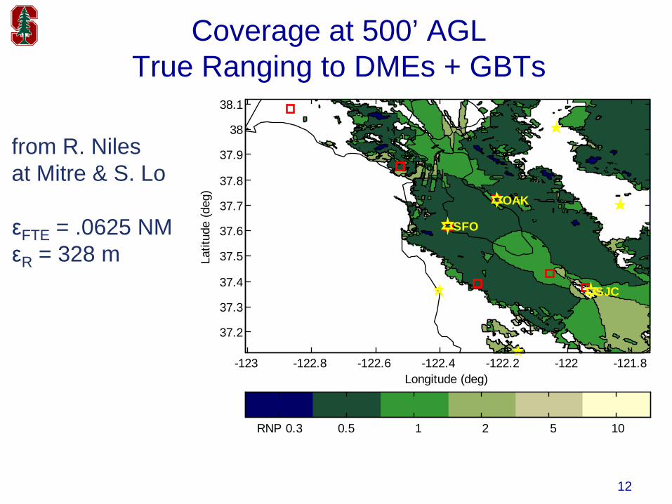
Coverage at 500’ AGLTrue Ranging to DMEs + GBTs
from R. Niles at Mitre & S. Lo
εFTE = .0625 NMεR = 328 m
Longitude (deg)
Latit
ude
(deg
)
SFO
OAK
SJC
-123 -122.8 -122.6 -122.4 -122.2 -122 -121.8
37.2
37.3
37.4
37.5
37.6
37.7
37.8
37.9
38
38.1
RNP 0.3 0.5 1 2 5 10
13
Longitude (deg)
Latit
ude
(deg
)
SFO
OAK
SJC
-123 -122.8 -122.6 -122.4 -122.2 -122 -121.8
37.2
37.3
37.4
37.5
37.6
37.7
37.8
37.9
38
38.1
RNP 0.3 0.5 1 2 5 10
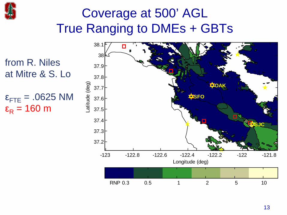
Coverage at 500’ AGLTrue Ranging to DMEs + GBTs
from R. Niles at Mitre & S. Lo
εFTE = .0625 NMεR = 160 m
14
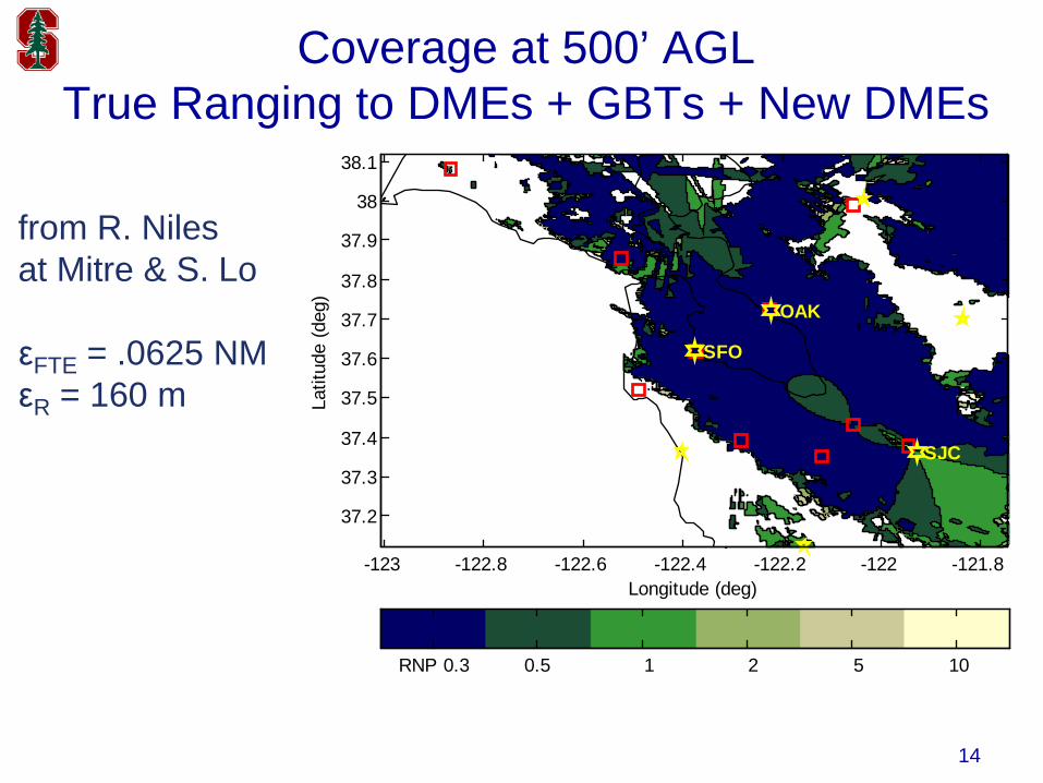
Coverage at 500’ AGLTrue Ranging to DMEs + GBTs + New DMEs
from R. Niles at Mitre & S. Lo
εFTE = .0625 NMεR = 160 m
Longitude (deg)
Latit
ude
(deg
)
SFO
OAK
SJC
-123 -122.8 -122.6 -122.4 -122.2 -122 -121.8
37.2
37.3
37.4
37.5
37.6
37.7
37.8
37.9
38
38.1
RNP 0.3 0.5 1 2 5 10
15
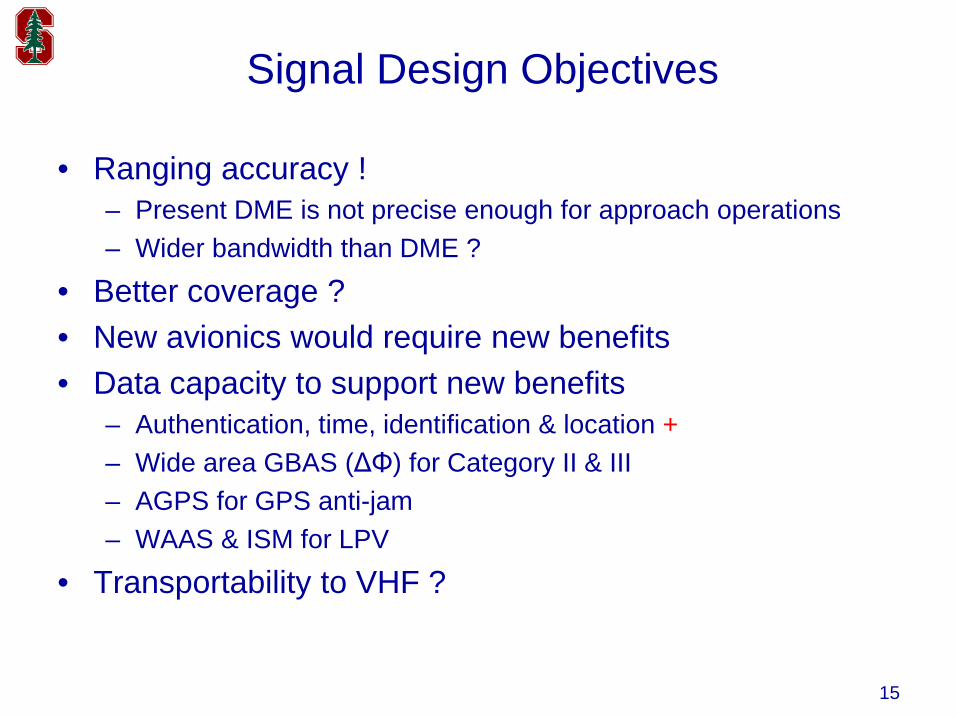
Signal Design Objectives
• Ranging accuracy !– Present DME is not precise enough for approach operations– Wider bandwidth than DME ?
• Better coverage ?• New avionics would require new benefits• Data capacity to support new benefits
– Authentication, time, identification & location +– Wide area GBAS (ΔΦ) for Category II & III– AGPS for GPS anti-jam– WAAS & ISM for LPV
• Transportability to VHF ?
16
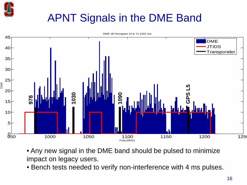
APNT Signals in the DME Band
• Any new signal in the DME band should be pulsed to minimize impact on legacy users.• Bench tests needed to verify non-interference with 4 ms pulses.
950 1000 1050 1100 1150 1200 12500
5
10
15
20
25
30
35
40
45DME all histogram (X & Y) 1522 sta
Freq (MHz)
Coun
t
DMEJTIDSTransponder
1030
1090
978
GPS
L5
1717
UAT
FMS
TR
VOR
R
VHF CommT
GNSS
ADS-B Positionout
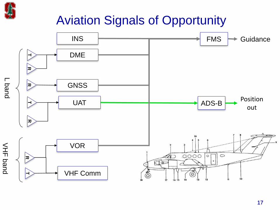
Aviation Signals of Opportunity GuidanceINS
RR
DMET
L bandV
HF band
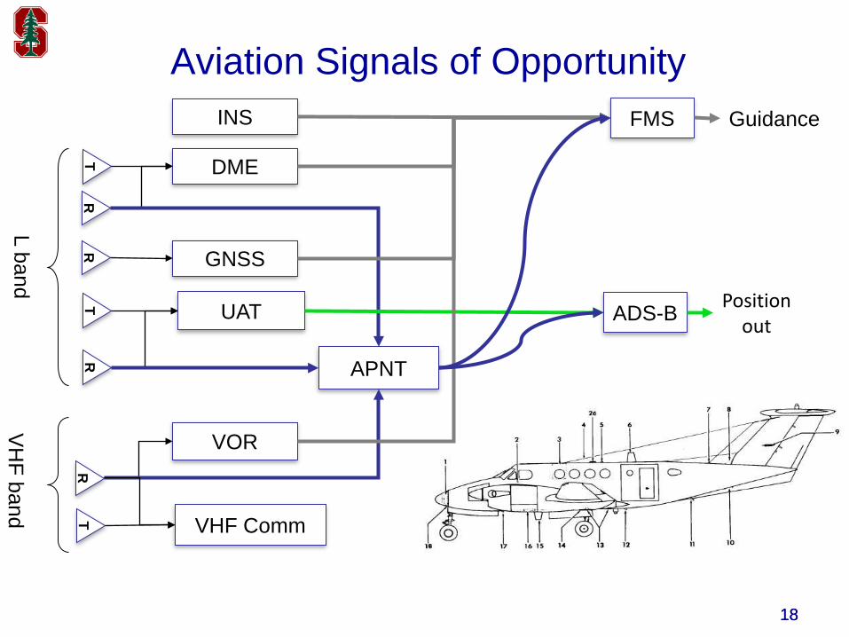
1818
UAT
FMS
TR APNT
VOR
R
VHF CommT
GNSS
ADS-B Positionout
Aviation Signals of Opportunity GuidanceINS
RR
DMET
L bandV
HF band
19
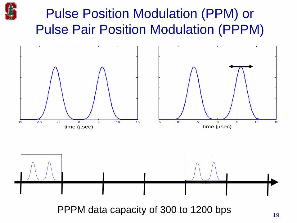
Pulse Position Modulation (PPM) orPulse Pair Position Modulation (PPPM)
15 -10 -5 0 5 10 15
time (µsec)15 -10 -5 0 5 10 15
time (µsec)
15 -10 -5 0 5 10 15
time (µsec)15 -10 -5 0 5 10 15
time (µsec)
PPPM data capacity of 300 to 1200 bps
20
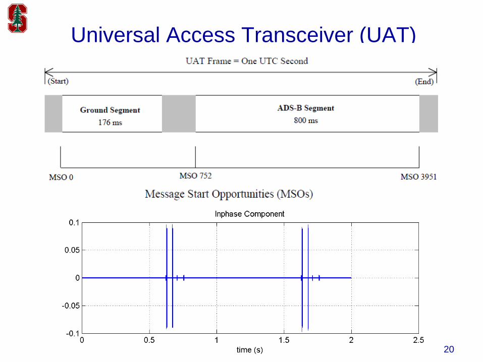
Universal Access Transceiver (UAT)
21
Summary
• 200,000 civil aircraft rely on GPS• With NextGen, our reliance is increasing• Consolidate & re-purpose ground navigation aids• Backup GPS RNAV & RNP to ensure NextGen
success