AGF-216 lecture 2016: Norwegian participation in space and satellite activities
77
Norwegian participation in space and satellite activities AFG-216 Pål Brekke Norwegian Space Centre
-
Upload
university-centre-in-svalbard -
Category
Science
-
view
625 -
download
0
Transcript of AGF-216 lecture 2016: Norwegian participation in space and satellite activities
Norwegian participation in space and satellite activities AFG-216
Pål BrekkeNorwegian Space Centre
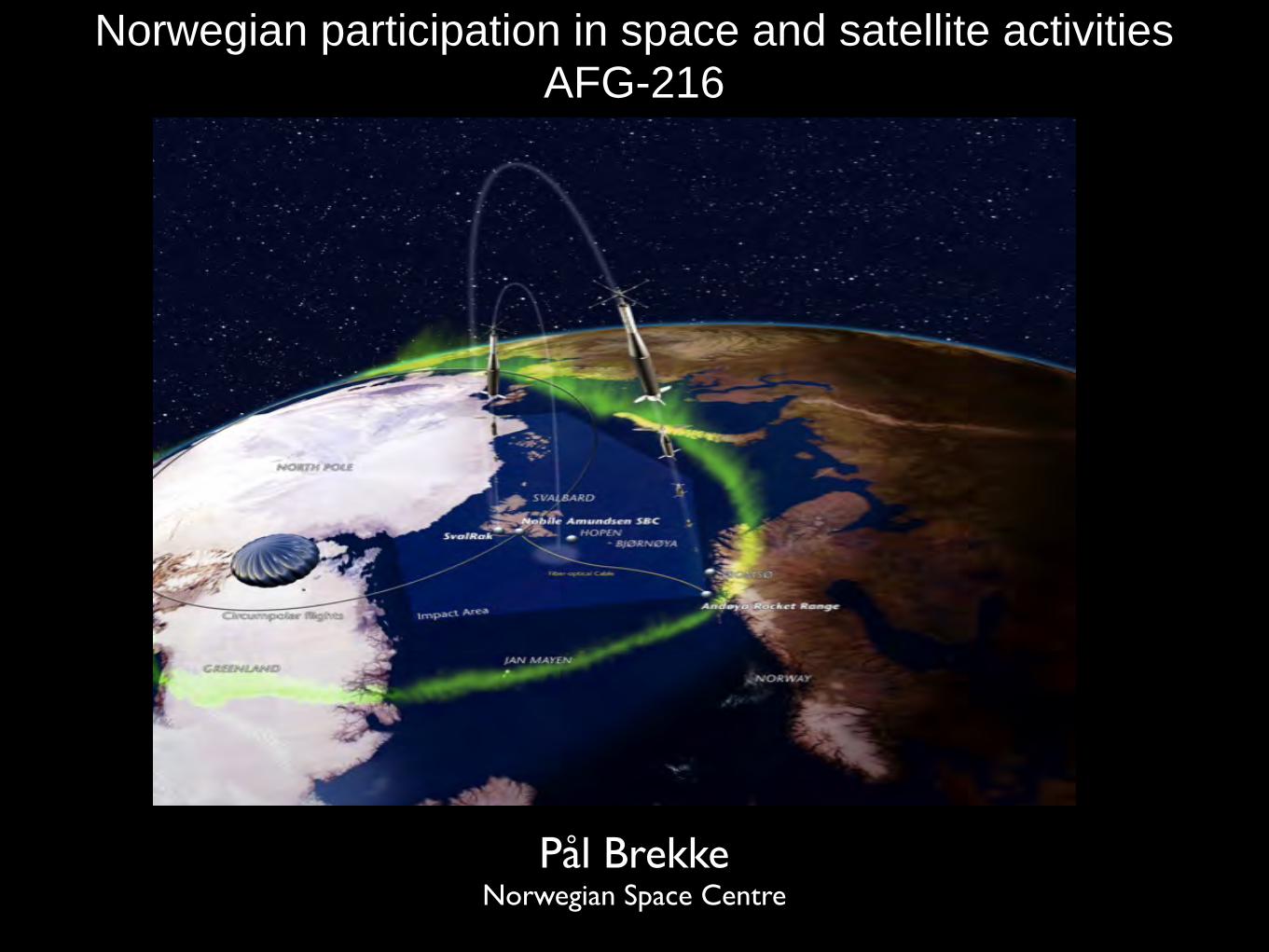
2
Geostationary (GEO)
Low earth orbiting (LEO)
Medium Erath orbiting (MEO)
MEO (15.000-25.000km)
GEO (36.000km)
LEO (300-1.000km)
Satellite orbits
3
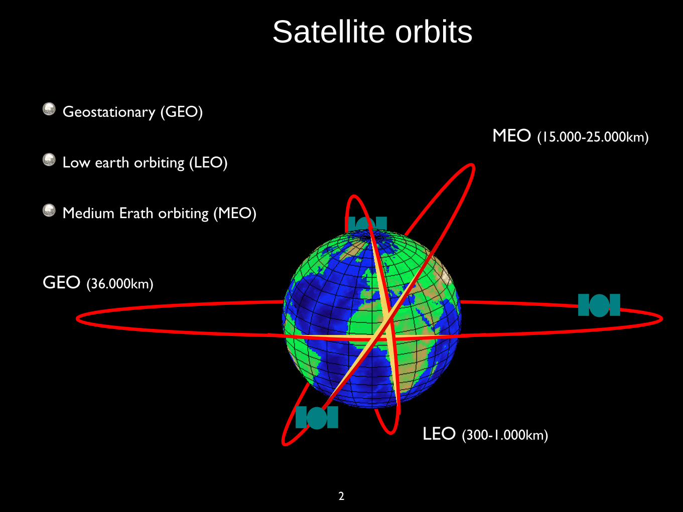
Norway - small space nation on top of the world
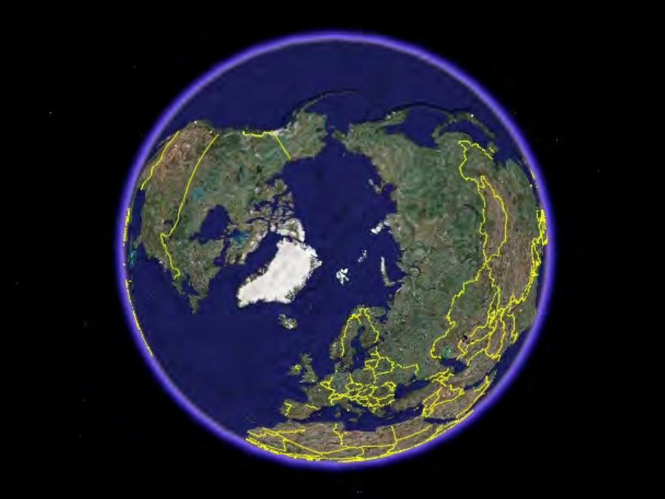
4
5
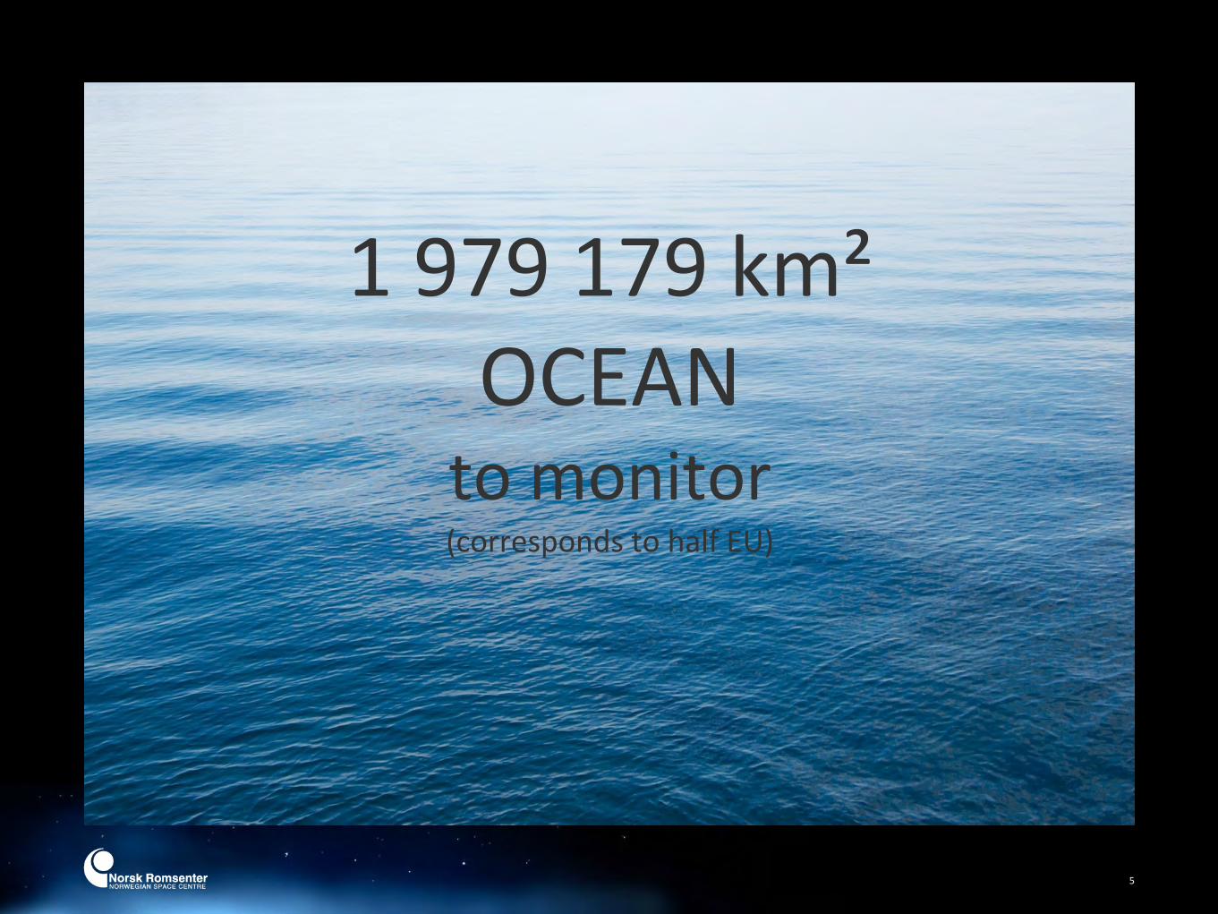
1 979 179 km²OCEANto monitor(corresponds to half EU)
6
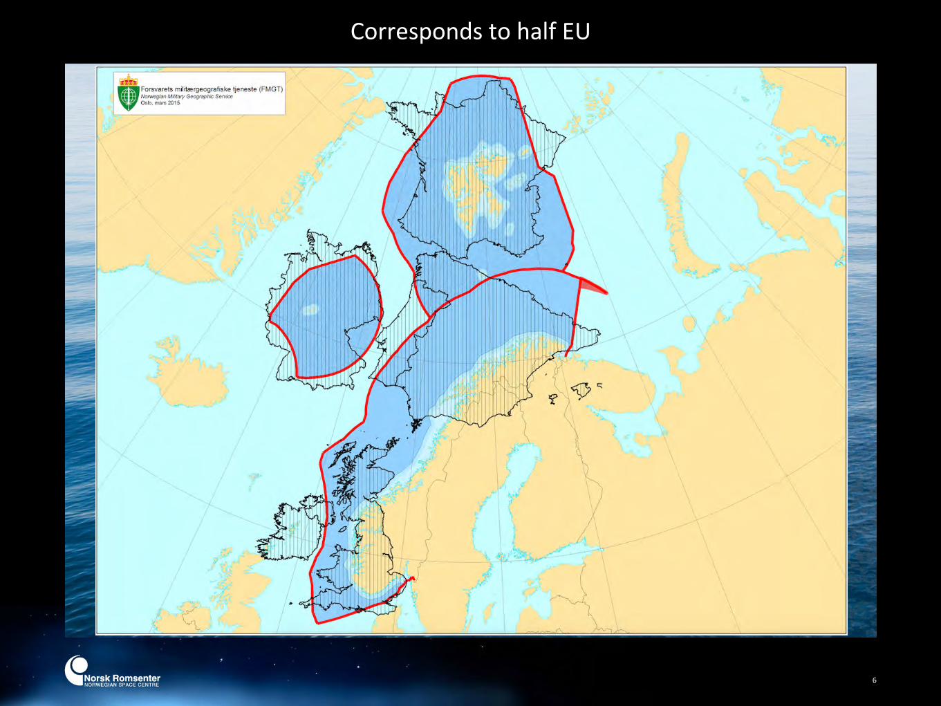
1 979 179 km²OCEAN
to survey/manage(corresponds to half EU)
Corresponds to half EU

Why is the ArcFc important to Norway? Norway has apart from Russia, Europe’s largest area to manage, mostly in the ArcFc or the High ArcFc
Norway and Russia manages one of the worlds largest well managed fish stocks in the Barents Sea
ExploitaFon of oil-‐ and gas resources
More traffic through the Northern Sea Route increases traffic in Norwegian waters
Opening of new sailing routes across the ArcFc basin creates issues concerning safety and rescue

06/28/13
In brief
8
The Norwegian Space Centre is a government agency under the Ministry of Trade and IndustryEstablished in 1987 when Norway joined the European Space AgencyCoordinates Norwegian space acFviFes internaFonally, with focus on ESA and the EUCoordinates naFonal space acFviFes38 employees at Skøyen, OsloBudget 2014: NOK 850 millionAdministers government ownership in
Andøya Rocket Range AS (90%)Space Norway (100%) which owns
Kongsberg Satellite Services AS (50%)
The Norwegian Space Centre
02/16/14
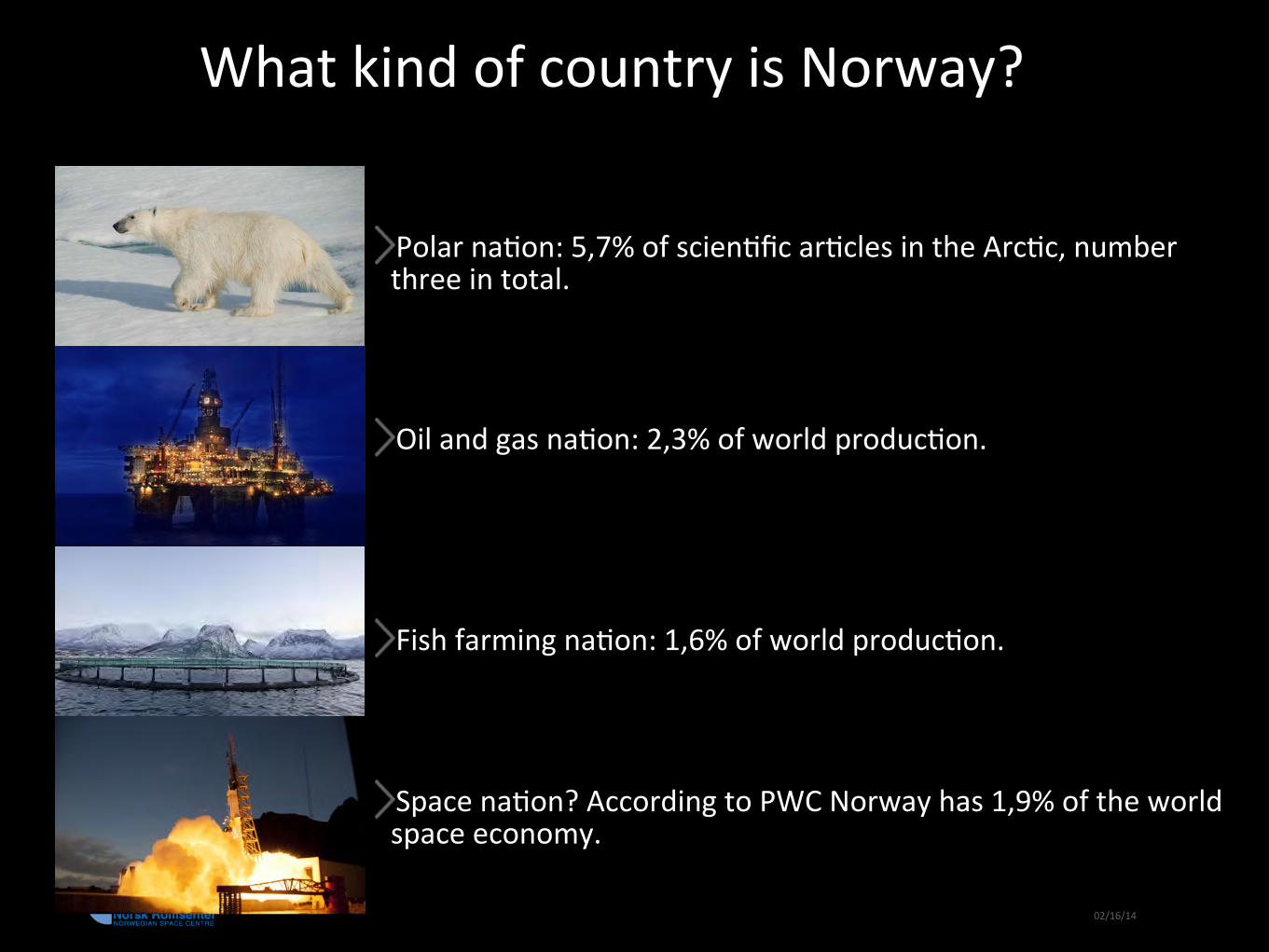
What kind of country is Norway?
Polar naFon: 5,7% of scienFfic arFcles in the ArcFc, number three in total.
Oil and gas naFon: 2,3% of world producFon.
Fish farming naFon: 1,6% of world producFon.
Space naFon? According to PWC Norway has 1,9% of the world space economy.

02/13/14
NaFonal prioriFes
TelecommunicaFonNavigaFonEarth observaFonIndustrial development based on ESA and EU programmesGround infrastructureSpace research and space related basic research
10
11
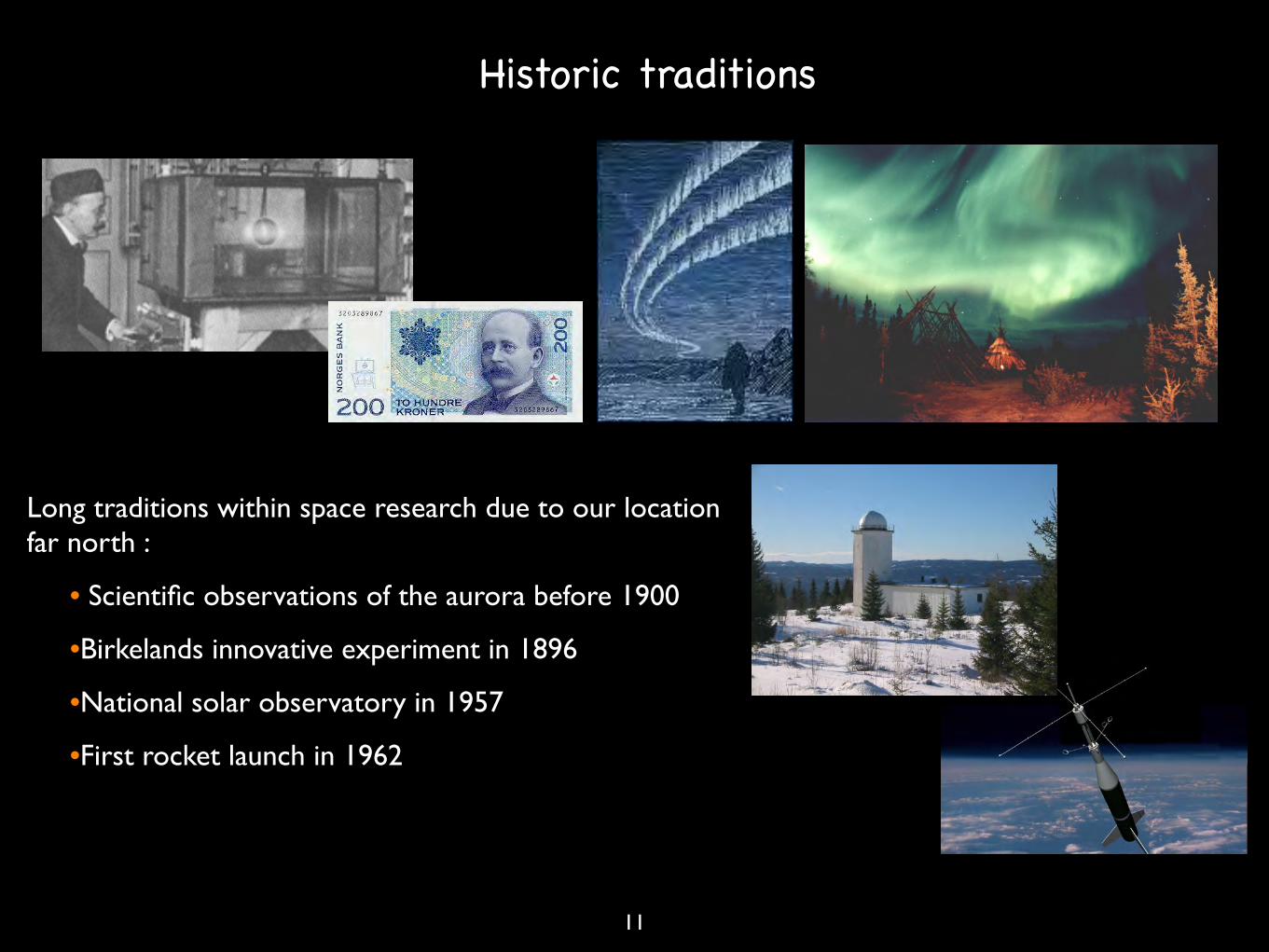
Long traditions within space research due to our location far north :
• Scientific observations of the aurora before 1900
•Birkelands innovative experiment in 1896
•National solar observatory in 1957
•First rocket launch in 1962
Historic traditions

12
Solar Physics in Norway
Institute of theoretical astrophysivs was established by Professor Rosseland in 1934 and built with help from the Rockefeller Foundation.
The National Solar Observatory was opened in 1957. Provided satellite tracking for US Airforce in the 50s and 60s.
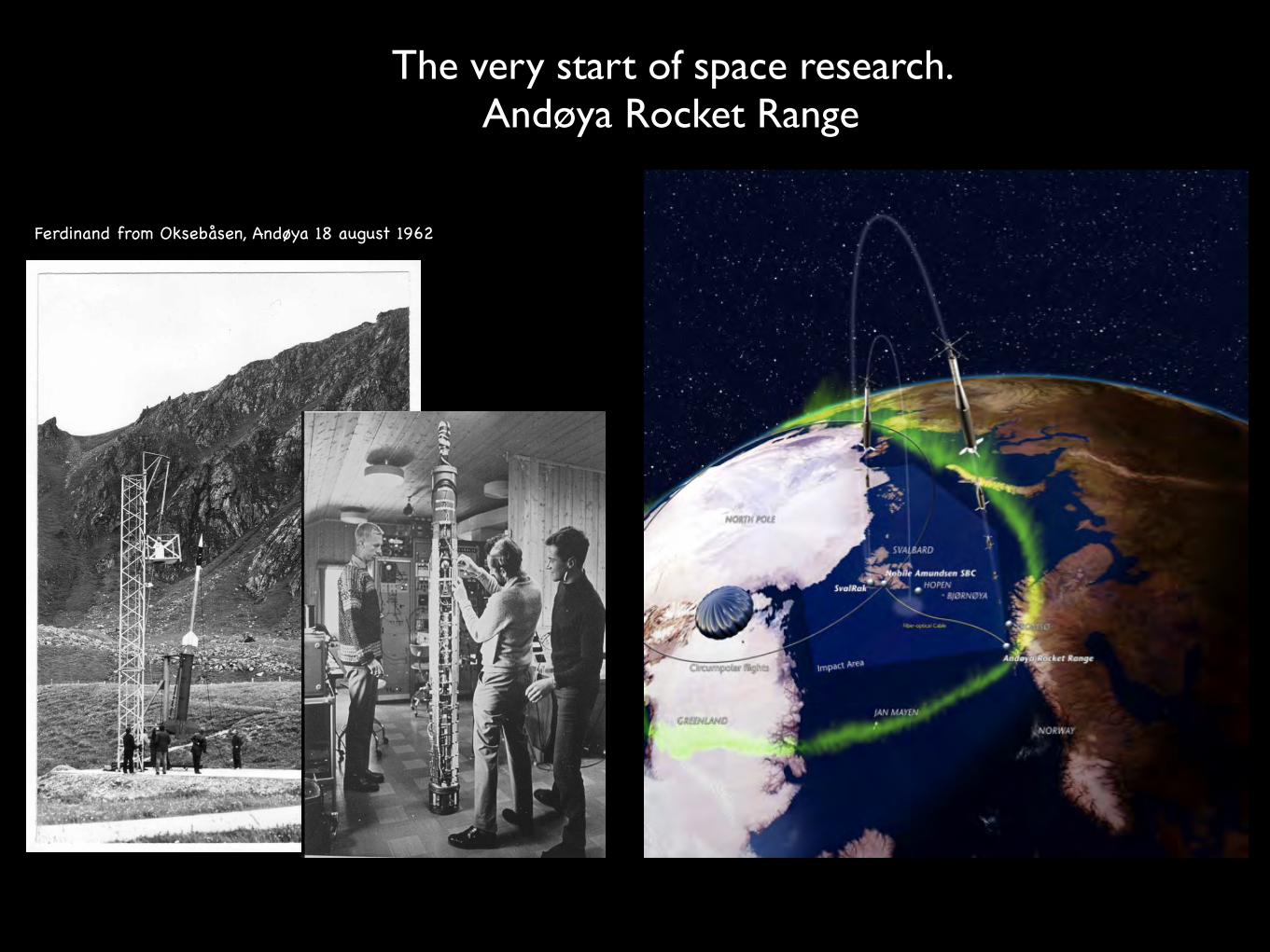
The very start of space research. Andøya Rocket Range
Ferdinand from Oksebåsen, Andøya 18 august 1962
Clean rooms -‐ now and then!
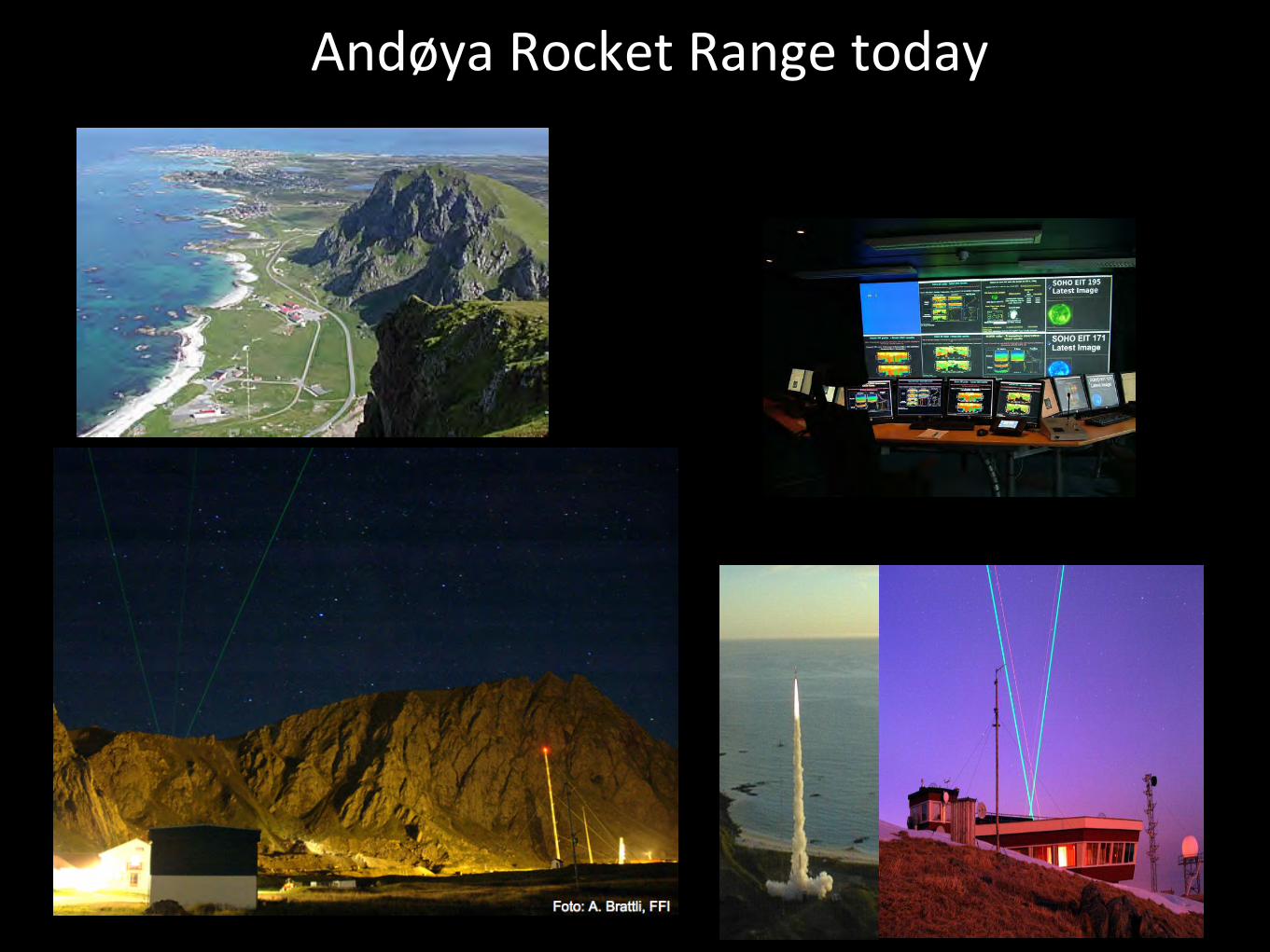
Andøya Rocket Range today
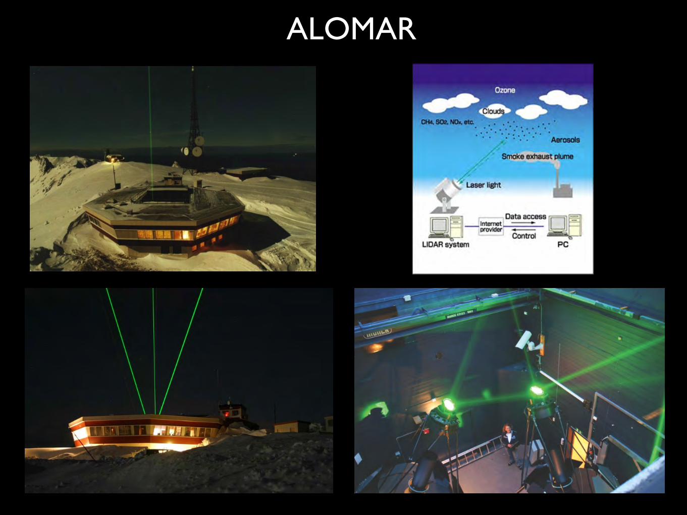
ALOMAR
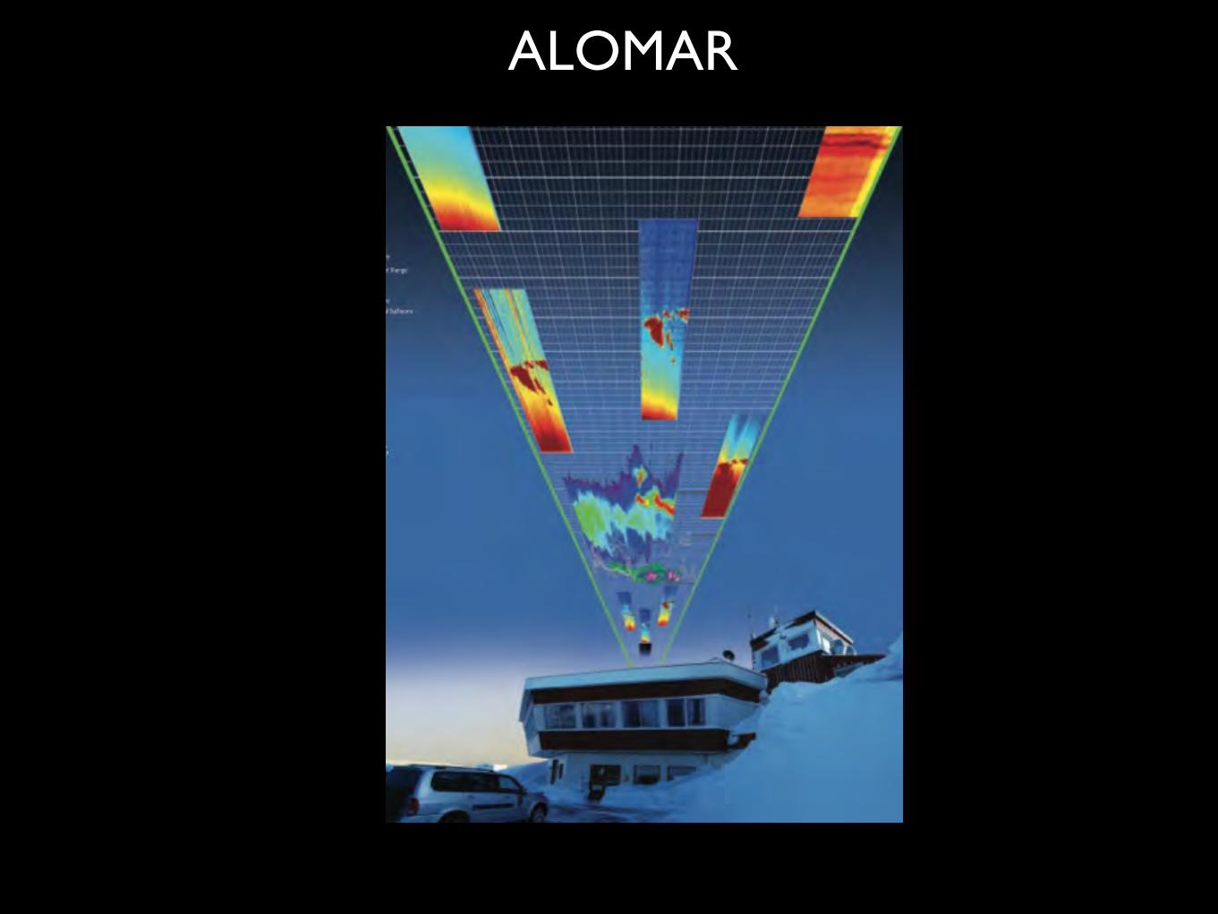
ALOMAR
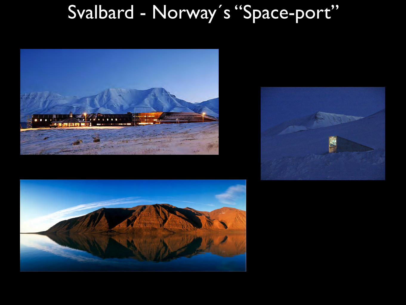
Svalbard - Norway´s “Space-port”
01/30/14
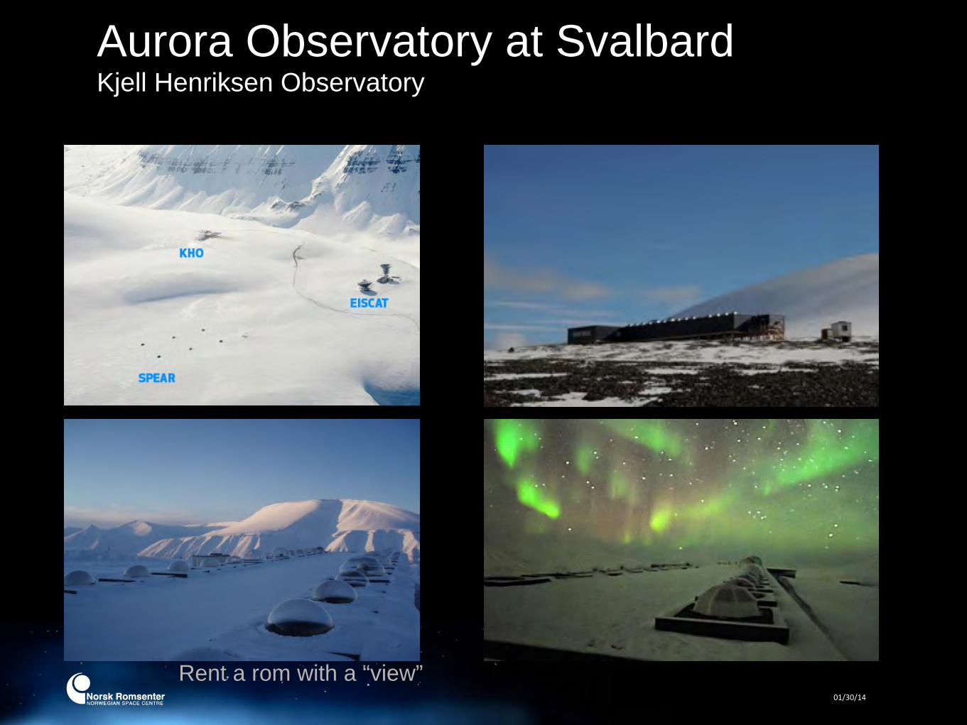
Aurora Observatory at SvalbardKjell Henriksen Observatory
Rent a rom with a “view”
01/30/14
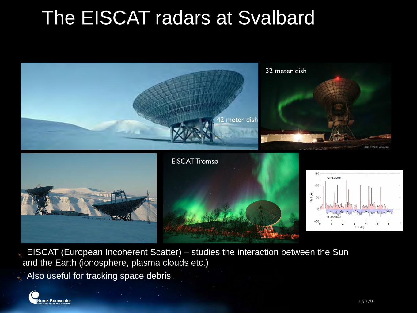
The EISCAT radars at Svalbard
42 meter dish
32 meter dish
EISCAT Tromsø
EISCAT (European Incoherent Scatter) – studies the interaction between the Sun and the Earth (ionosphere, plasma clouds etc.)Also useful for tracking space debris
01/30/14 21
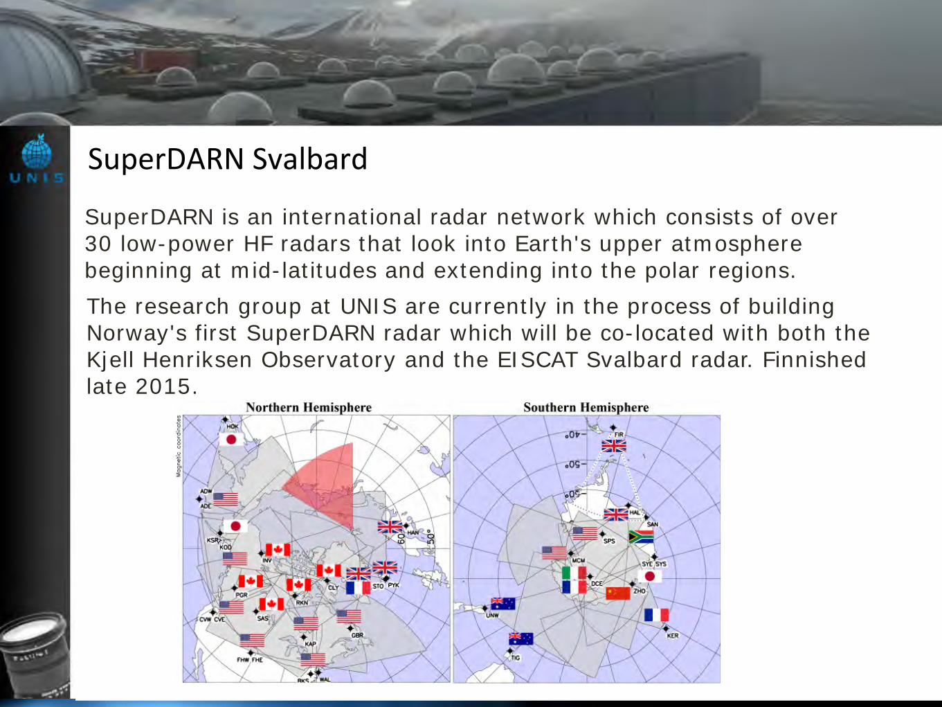
SuperDARN is an international radar network which consists of over 30 low-power HF radars that look into Earth's upper atmosphere beginning at mid-latitudes and extending into the polar regions.The research group at UNIS are currently in the process of building Norway's first SuperDARN radar which will be co-located with both the Kjell Henriksen Observatory and the EISCAT Svalbard radar. Finnished late 2015.
SuperDARN Svalbard
06/28/13
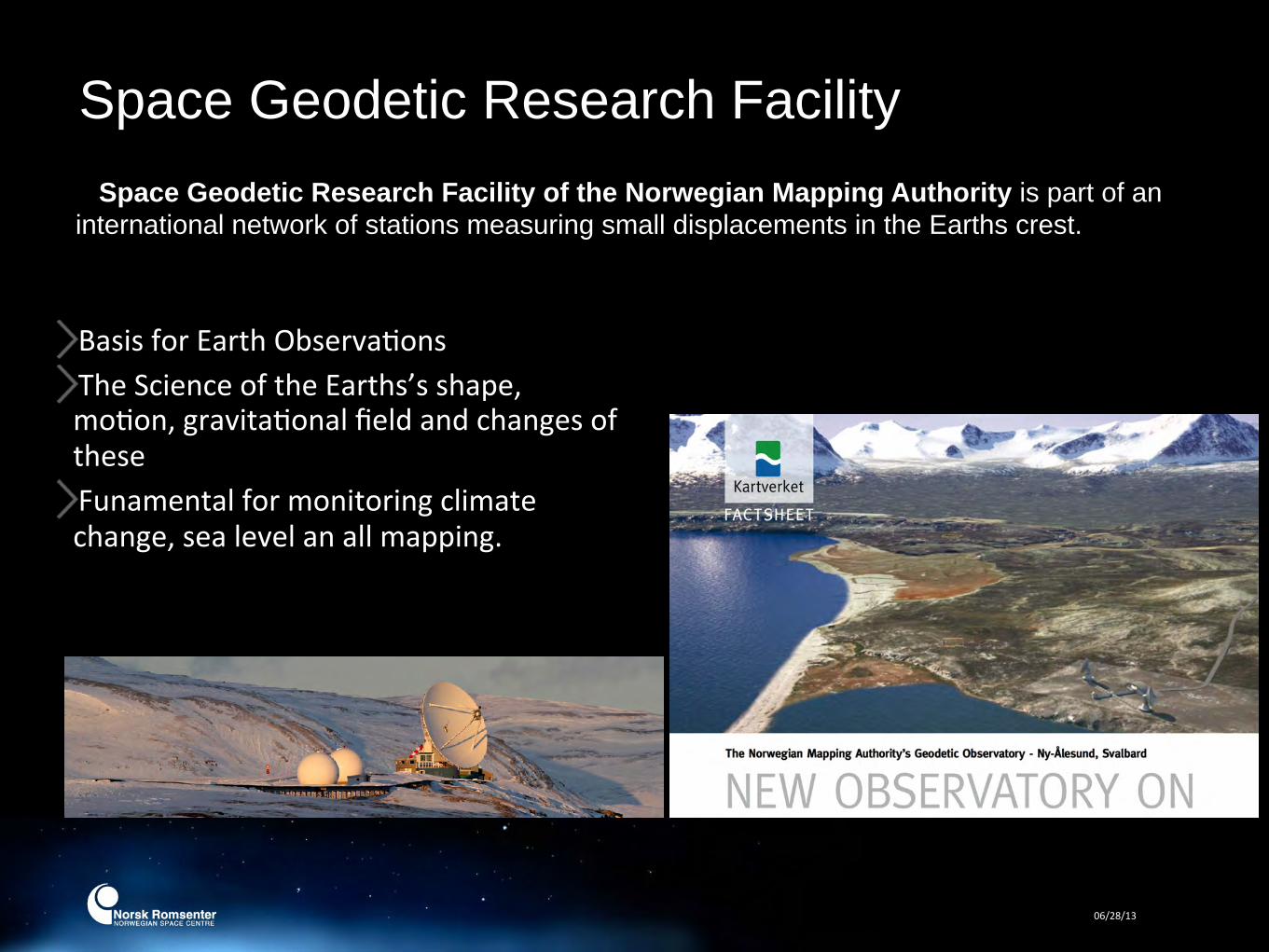
Space Geodetic Research Facility Space Geodetic Research Facility of the Norwegian Mapping Authority is part of an
international network of stations measuring small displacements in the Earths crest.
Basis for Earth ObservaFonsThe Science of the Earths’s shape, moFon, gravitaFonal field and changes of theseFunamental for monitoring climate change, sea level an all mapping.
06/28/13
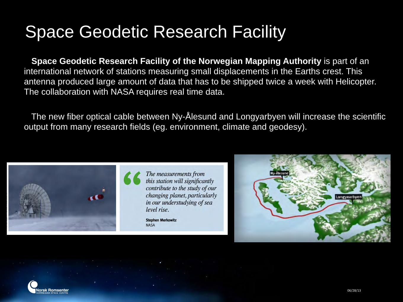
Space Geodetic Research Facility Space Geodetic Research Facility of the Norwegian Mapping Authority is part of an
international network of stations measuring small displacements in the Earths crest. This antenna produced large amount of data that has to be shipped twice a week with Helicopter. The collaboration with NASA requires real time data.
The new fiber optical cable between Ny-Ålesund and Longyarbyen will increase the scientific
output from many research fields (eg. environment, climate and geodesy).

Svalbard - a test bed for future Mars missions AMASE – Arctic Mars Analoge Svalbard Expedition is a Norwegian run cooperating
project (ESA, NASA/JPL and Carnegie Institution of Washington) where future Mars rovers and instruments are being tested at Svalbard every summer.
25
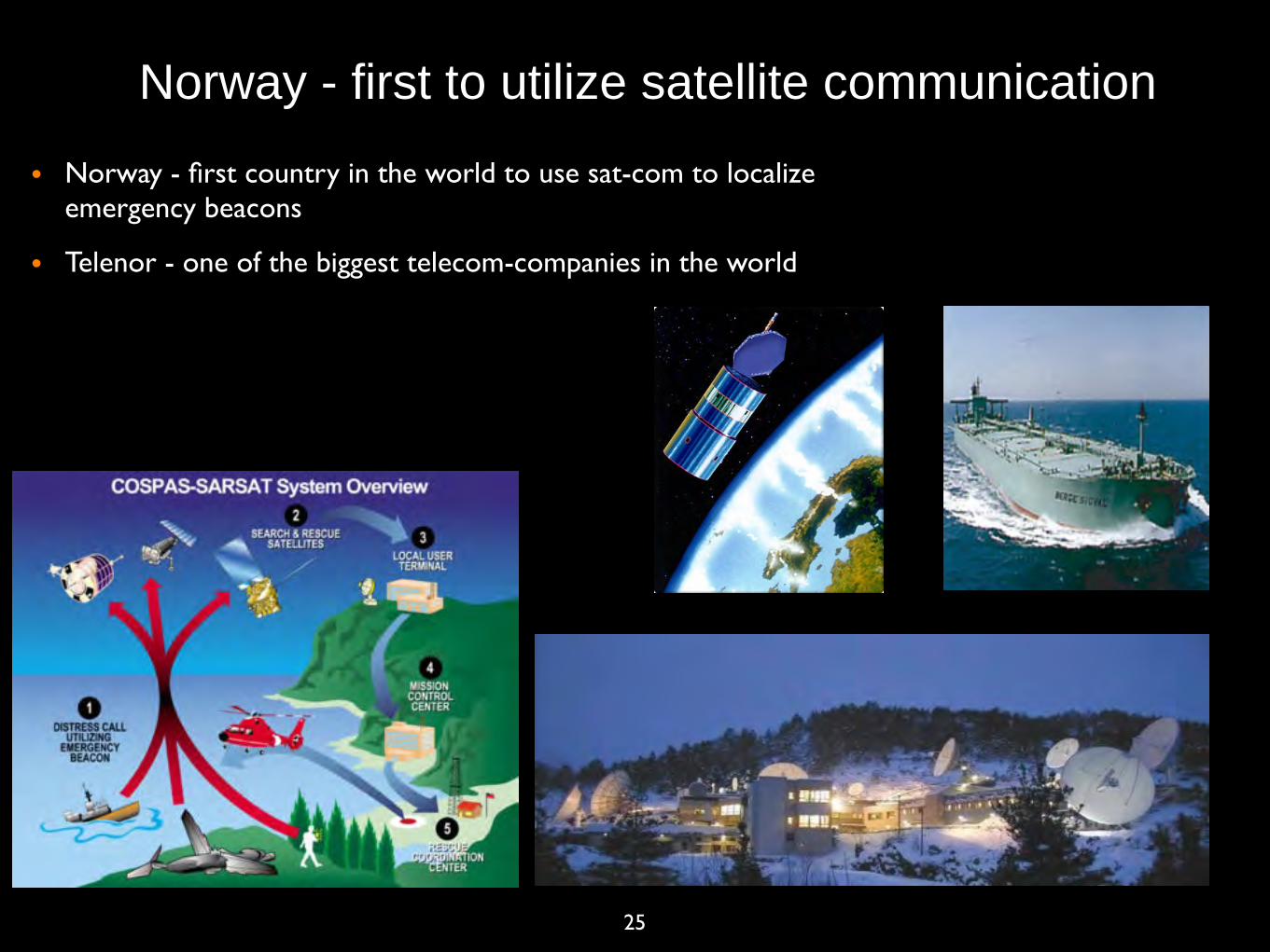
• Norway - first country in the world to use sat-com to localize emergency beacons
• Telenor - one of the biggest telecom-companies in the world
Norway - first to utilize satellite communication

26
• Satellite phones important for rescue workers, human aids personnel, journalists etc. in war zones or disaster areas.
• First broad-band satellite phone developed in Norway 2 years ago
Norway - leading in satellite phone systems

27
• Most communication satellites launced today includes 100 kg of electronics from a small company in south Norway (NORSPACE). Even the Chinese buys “hand made” electronics from Norway.
Norway - satellite communication

02/16/14
Why Space in the ArcFc

29
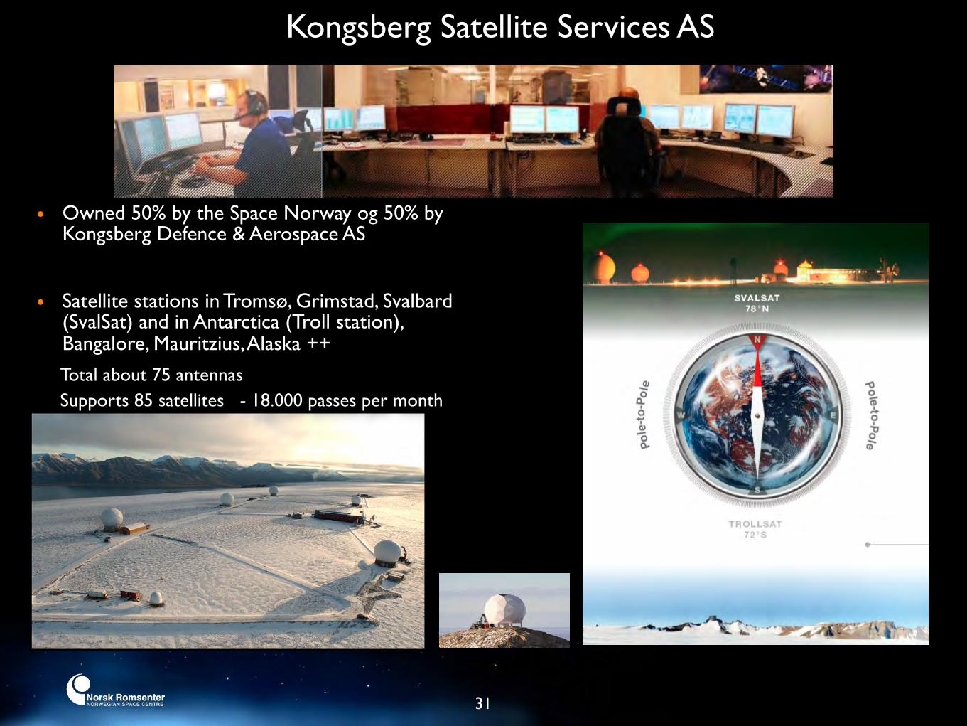
KSAT - The World Leader in Ground Station Networks
31
• Owned 50% by the Space Norway og 50% by Kongsberg Defence & Aerospace AS
• Satellite stations in Tromsø, Grimstad, Svalbard (SvalSat) and in Antarctica (Troll station), Bangalore, Mauritzius, Alaska ++
Kongsberg Satellite Services AS
Total about 75 antennas Supports 85 satellites - 18.000 passes per month
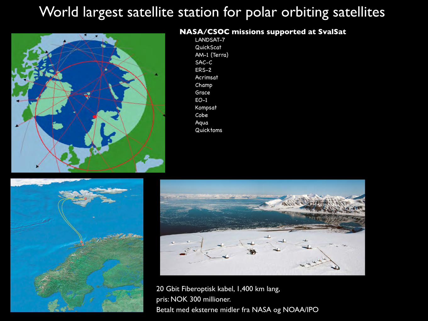
NASA/CSOC missions supported at SvalSatLANDSAT-7QuickScatAM-1 (Terra)SAC-CERS-2Acrimsat ChampGraceEO-1KompsatCobeAqua Quicktoms
World largest satellite station for polar orbiting satellites
20 Gbit Fiberoptisk kabel, 1,400 km lang, pris: NOK 300 millioner. Betalt med eksterne midler fra NASA og NOAA/IPO
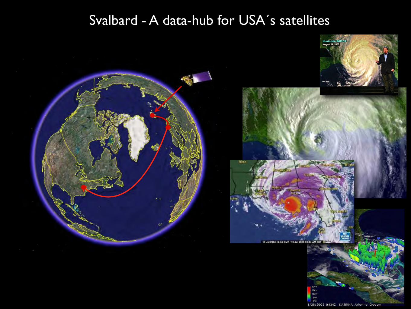
Svalbard - A data-hub for USA´s satellites

Surface Displacement using inSAR observations
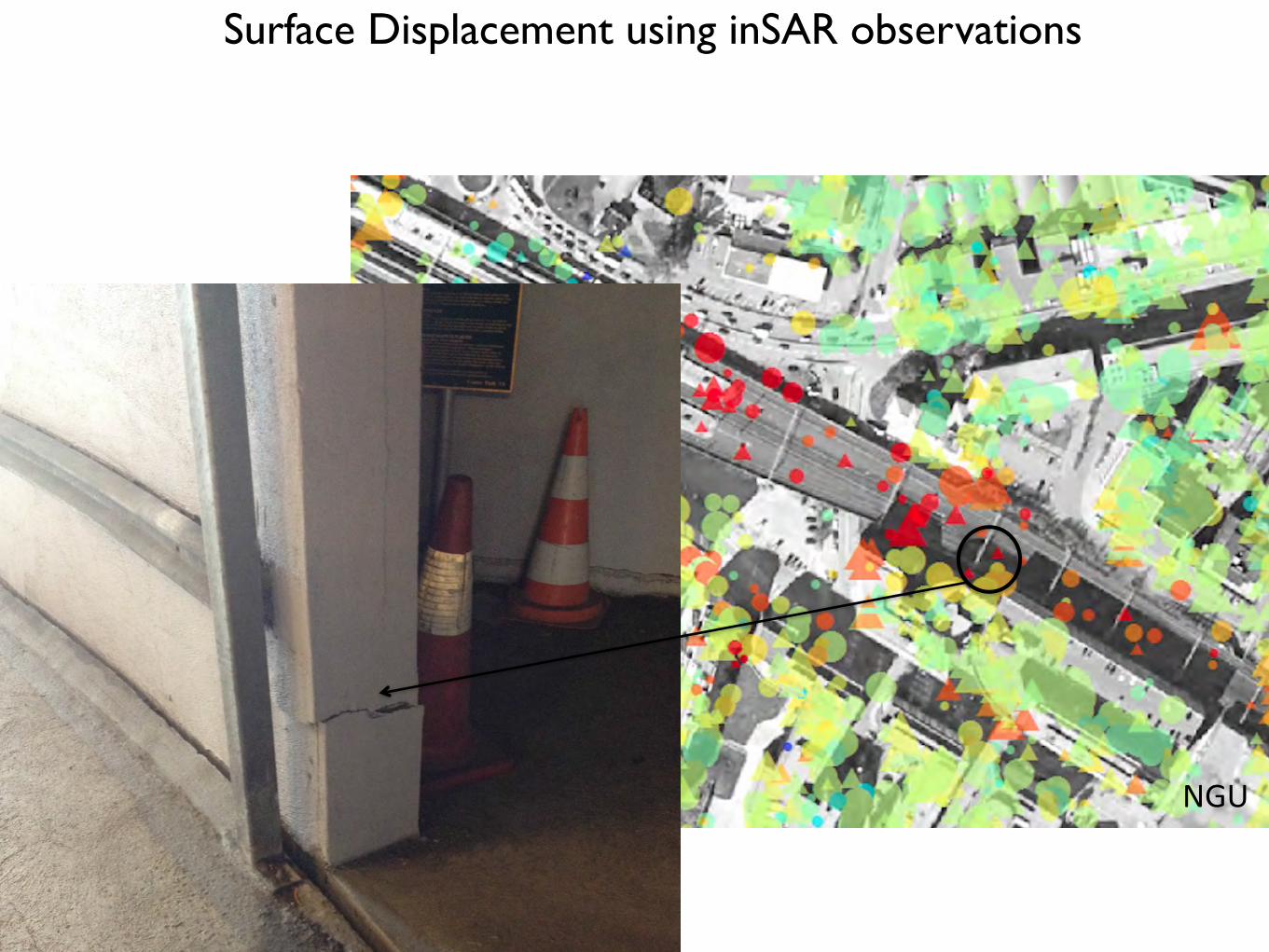
NGU
Surface Displacement using inSAR observations
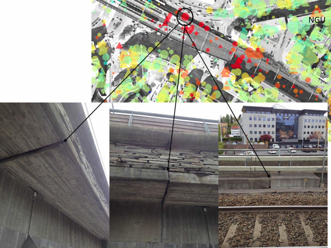
NGU
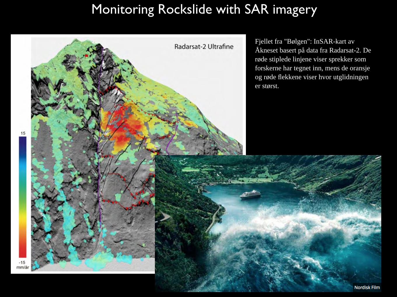
Monitoring Rockslide with SAR imagery
Fjellet fra "Bølgen": InSAR-kart av Åkneset basert på data fra Radarsat-2. De røde stiplede linjene viser sprekker som forskerne har tegnet inn, mens de oransje og røde flekkene viser hvor utglidningen er størst.

38
First operational oil spill detection from satellitesRadar satellites can “see” oil spills day and night and through clouds
Oil spill from a Norwegian platform in 2004
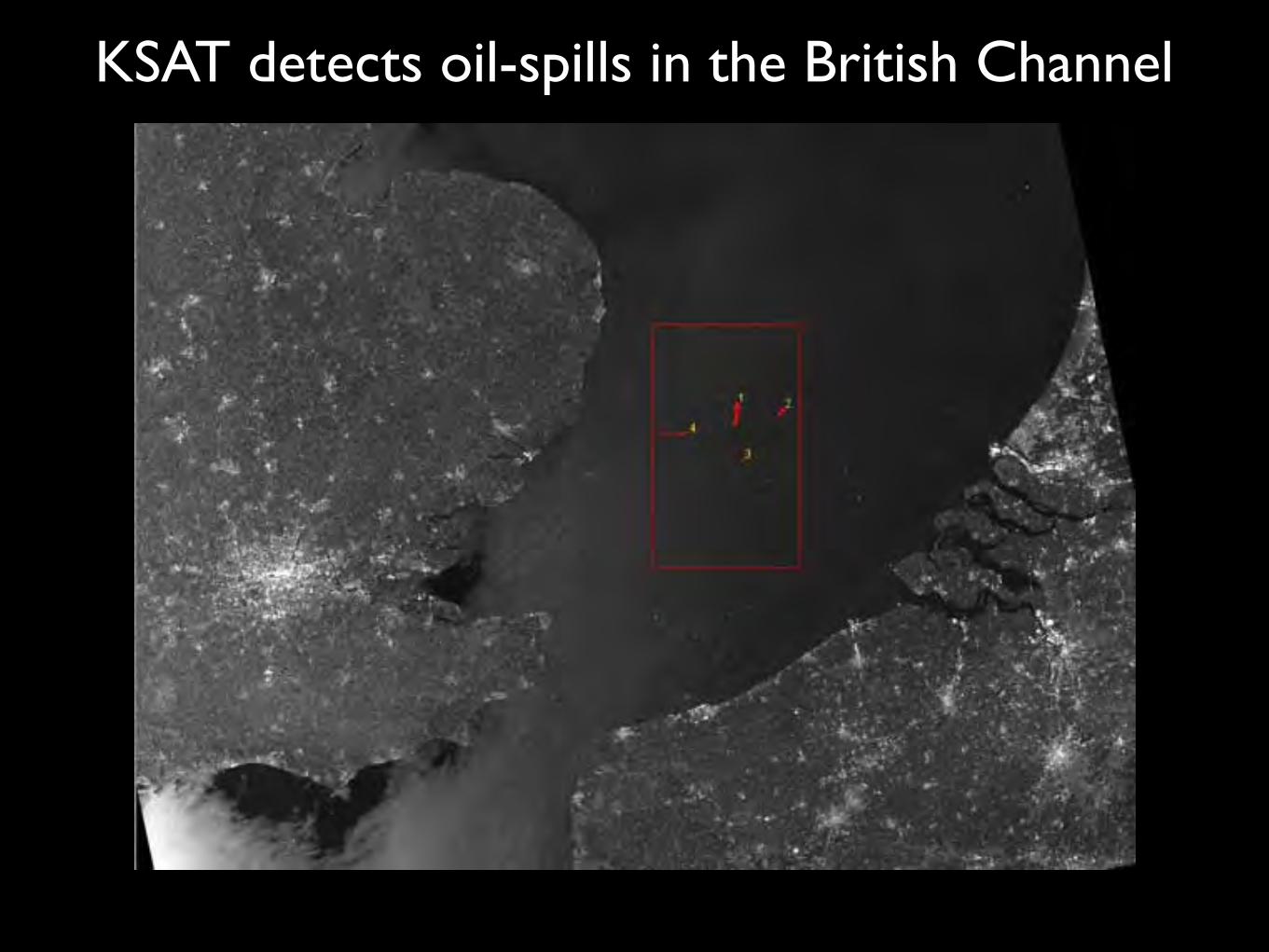
KSAT detects oil-spills in the British Channel
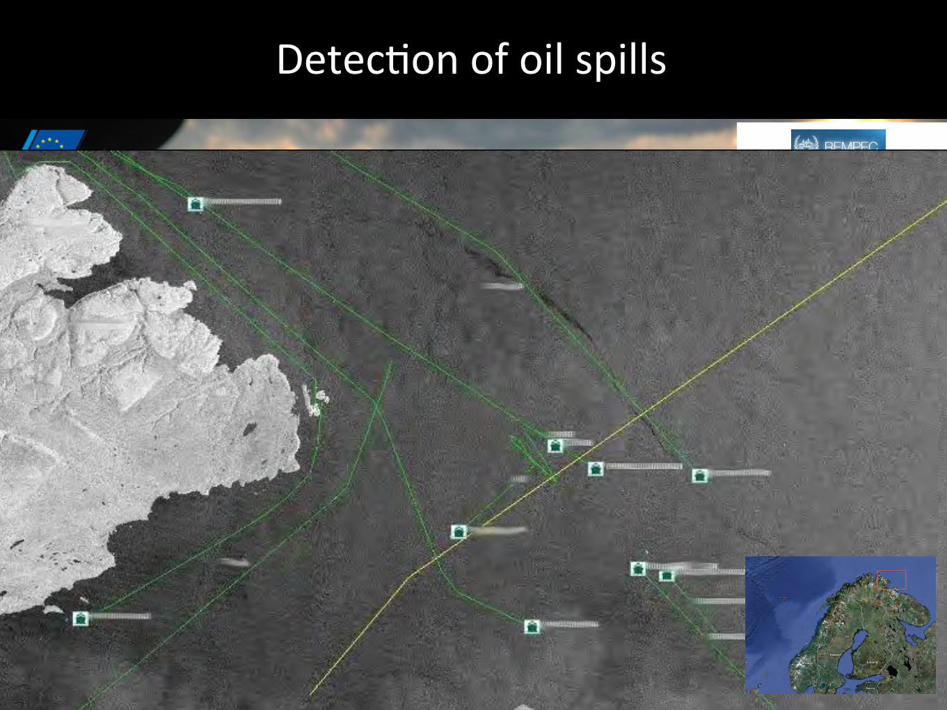
DetecFon of oil spills

WORLD CLASS – through people, technology and dedication/ / 17-Jan-14
EMSA CSN Detection ExampleOil spill detected by KSAT, alert through EMSA
41
ESA2009/processed by KSATOil spill detected by KSAT, alert through EMSA, Verified by Coastguard airplane. 14.02.2009

17-Jan-14
Service – but always not real pollution
42
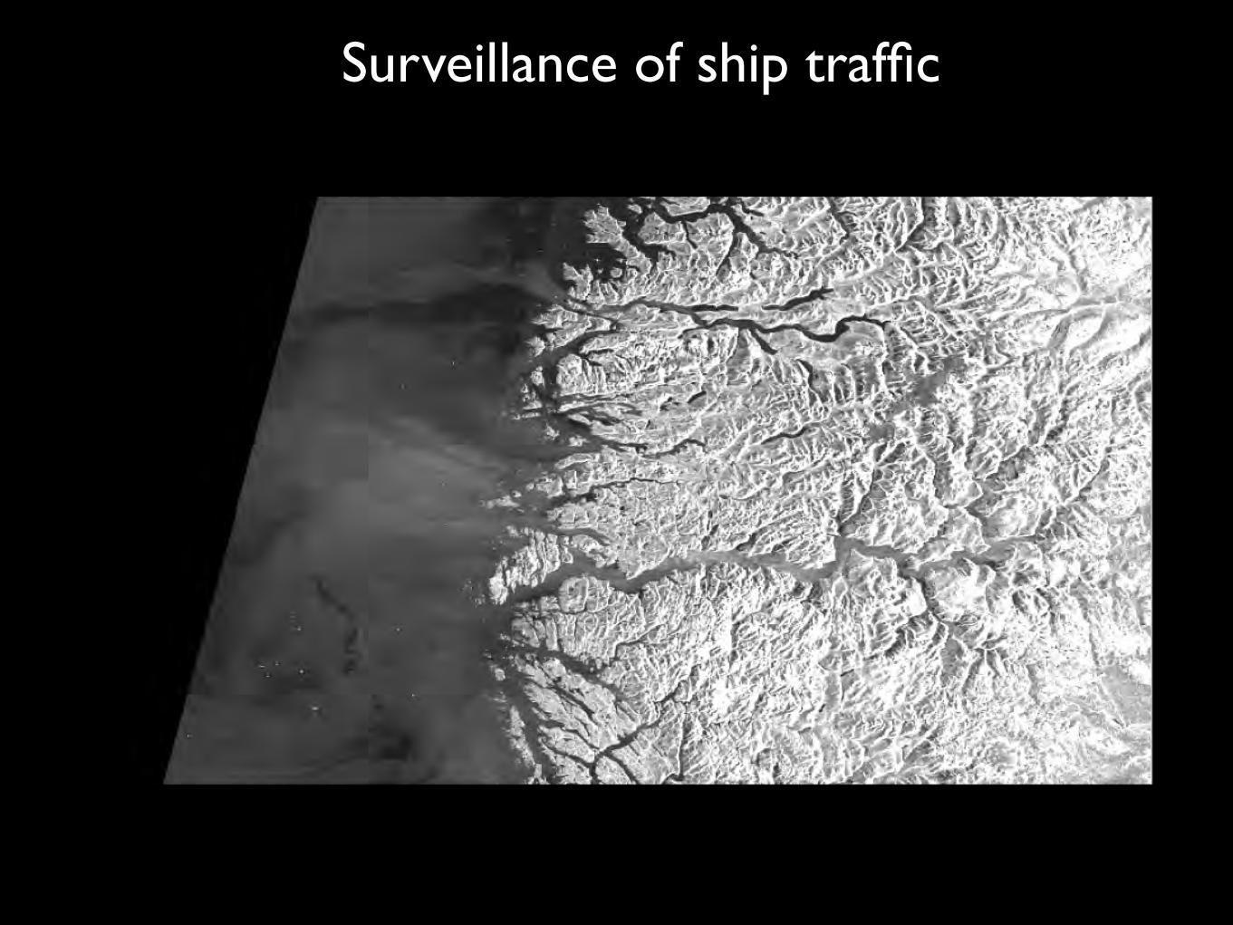
Surveillance of ship traffic
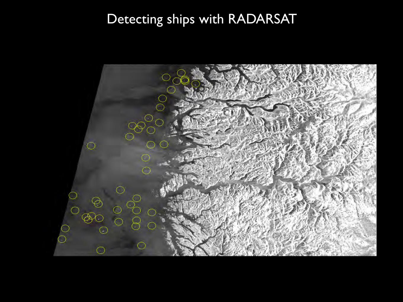
Detecting ships with RADARSAT
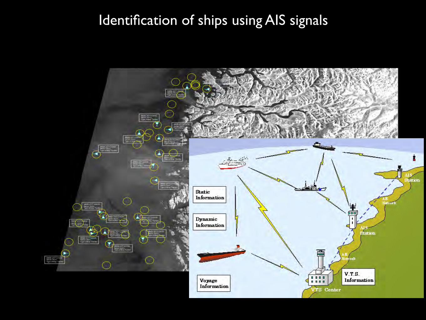
Identification of ships using AIS signals

RADARSAT-2 can see ships - but not identify them
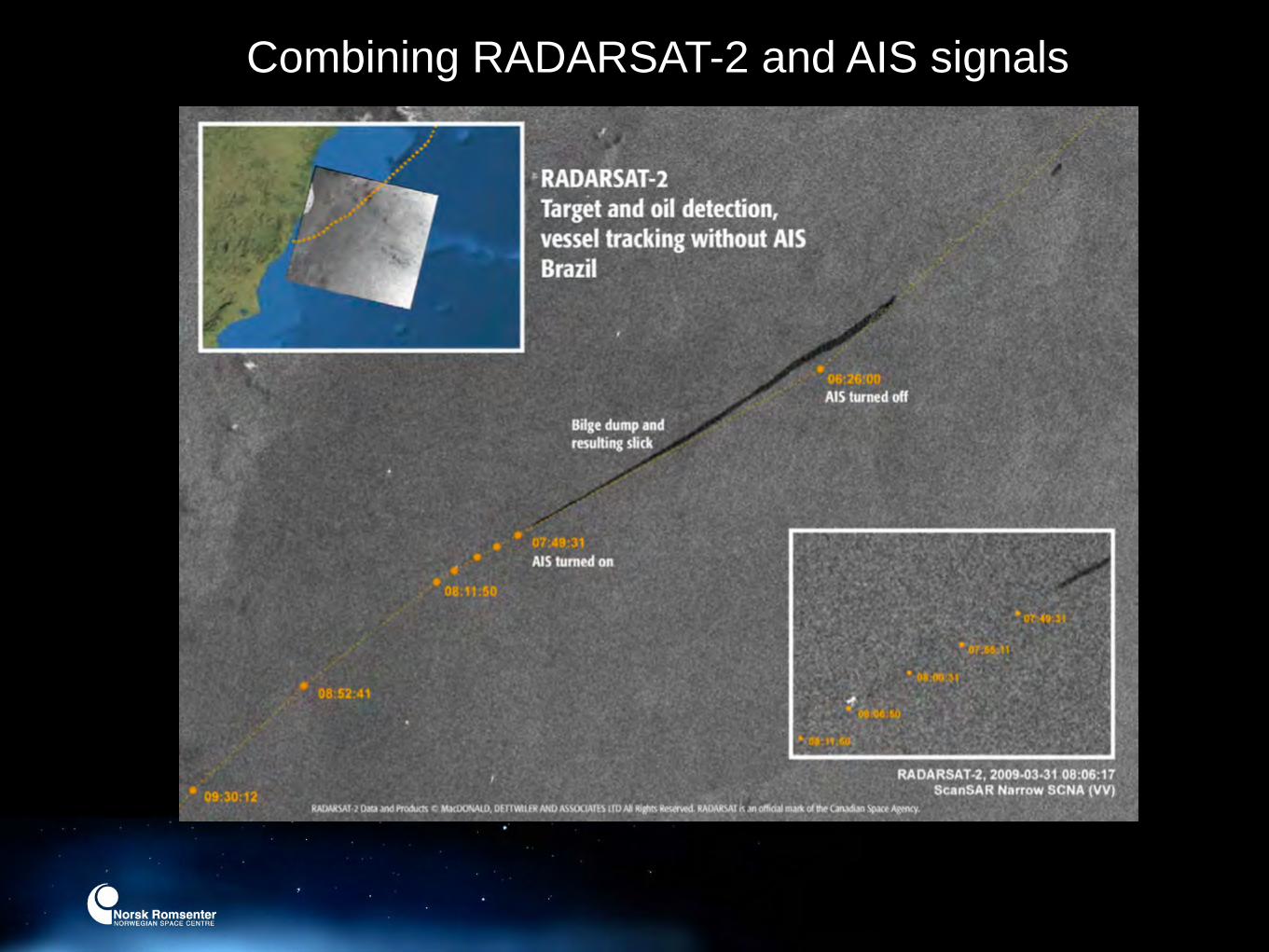
Combining RADARSAT-2 and AIS signals
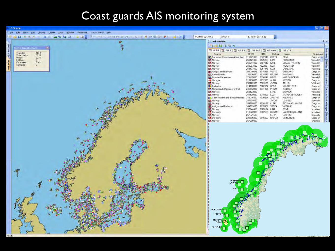
Coast guards AIS monitoring system
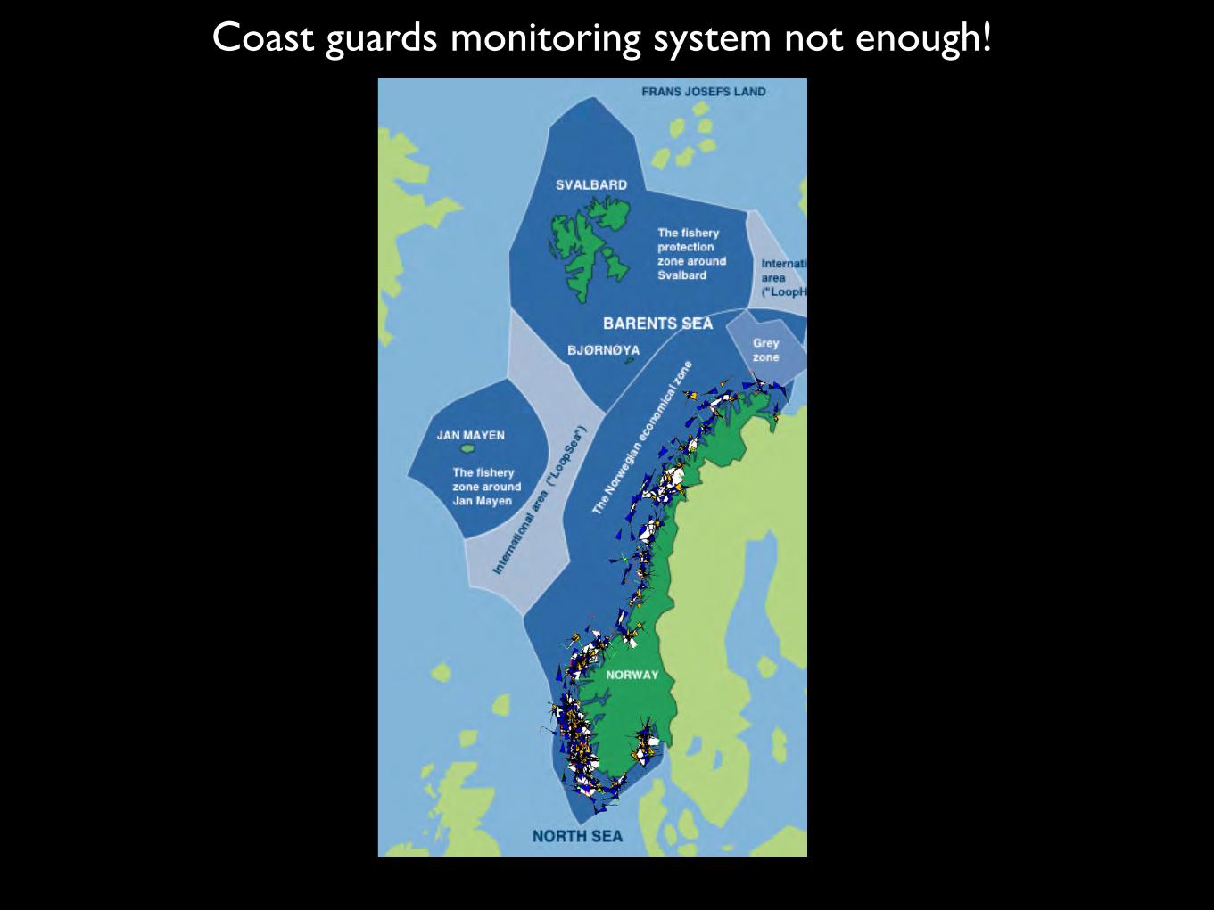
Coast guards monitoring system not enough!

The Rudolf-satellite (NCUBE)
Can AIS signals be received from space?Can we track a reindeer?

• Launch: NORAIS was launched in September, antenna late 2009
• EVA later this year for antenna deployment on Columbus
• Start of experiment: Early 2010
• Main goal: AIS signal tests in crowded areas
Test version of AISsat (NORAIS) was installed at ISS
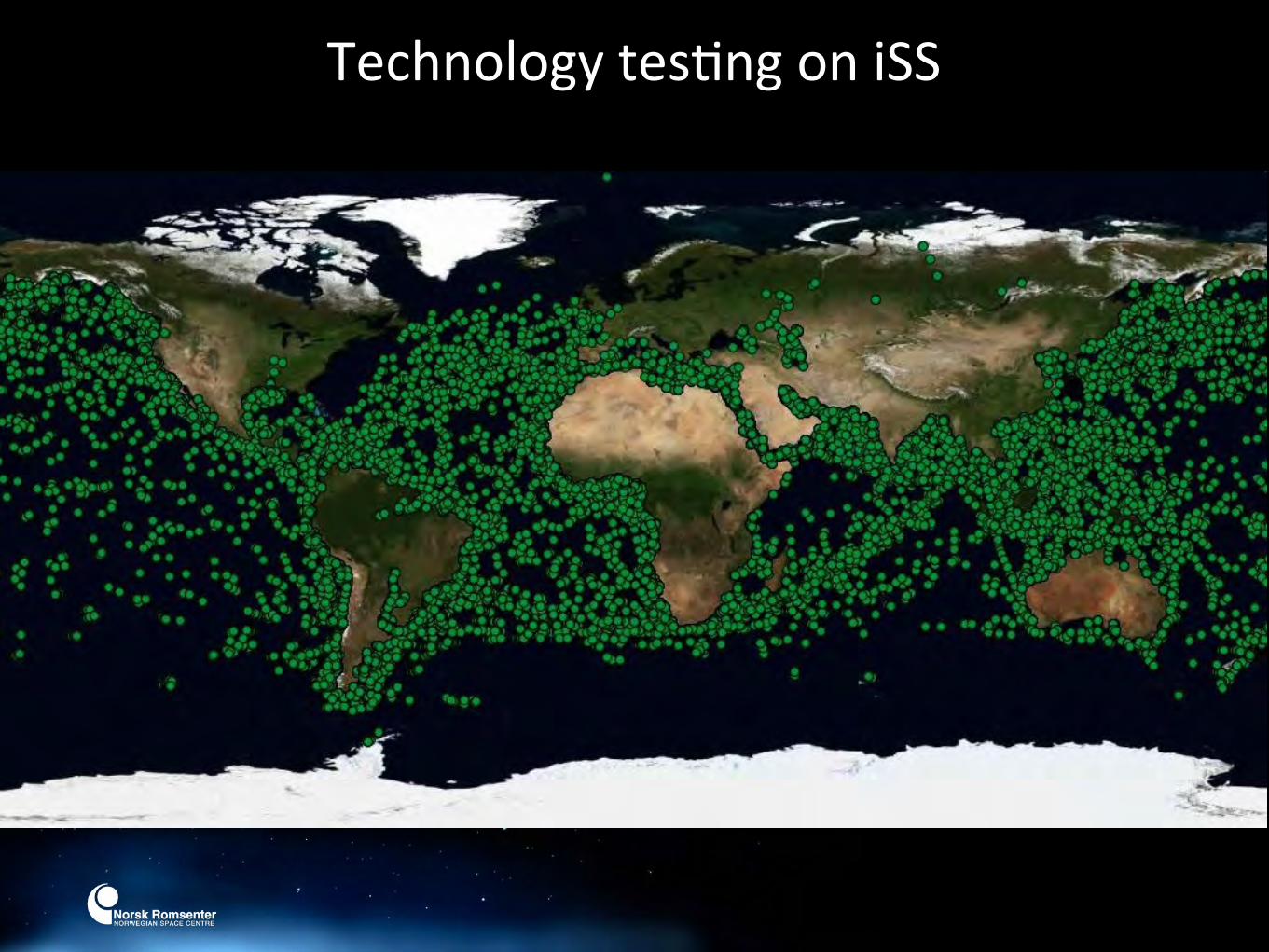
Technology tesFng on iSS
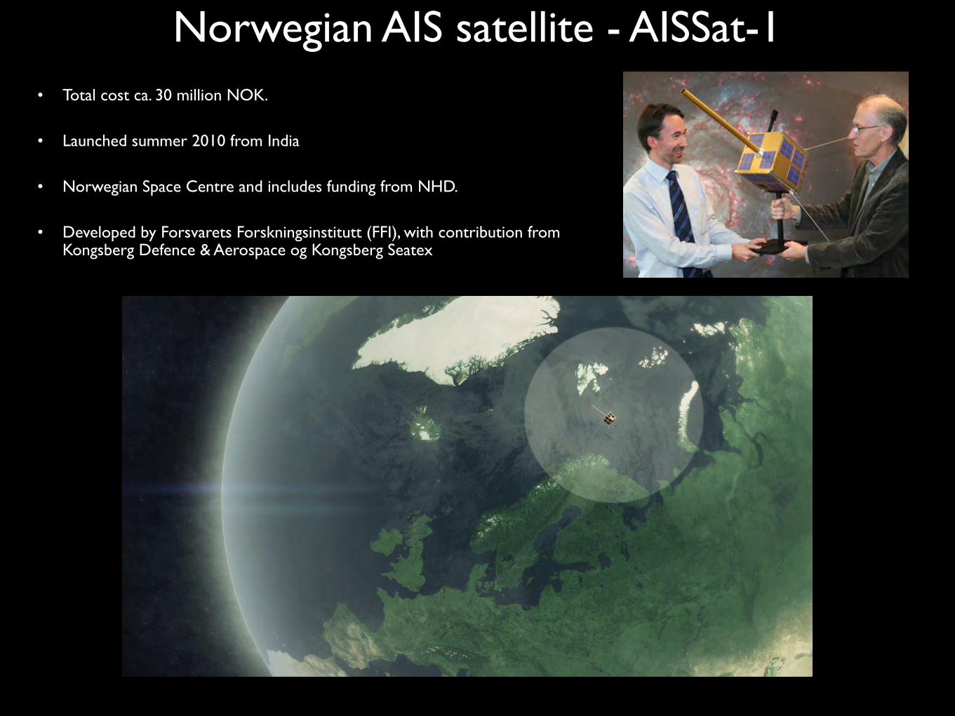
• Total cost ca. 30 million NOK.
• Launched summer 2010 from India
• Norwegian Space Centre and includes funding from NHD.
• Developed by Forsvarets Forskningsinstitutt (FFI), with contribution from Kongsberg Defence & Aerospace og Kongsberg Seatex
Norwegian AIS satellite - AISSat-1

AisSat-1 supports Japan

Vessels and ice
55


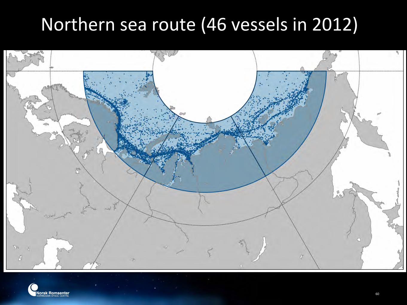
Northern sea route (46 vessels in 2012)
60

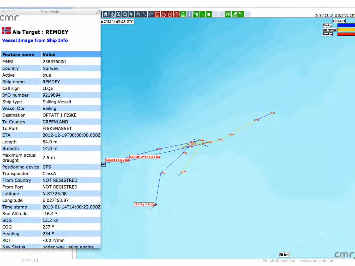
Two vessels at Bear Island – No AIS received
Compilation FFI
Norsk Romsenter – www.romsenter.no02/11/13
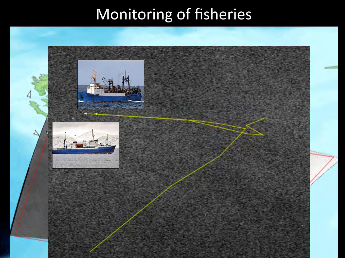
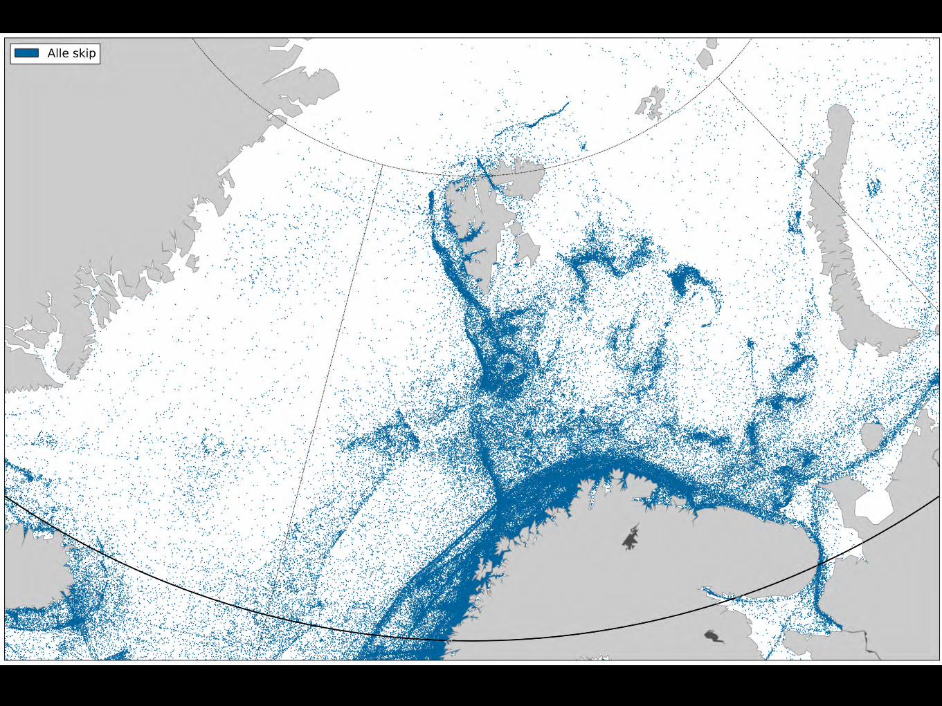
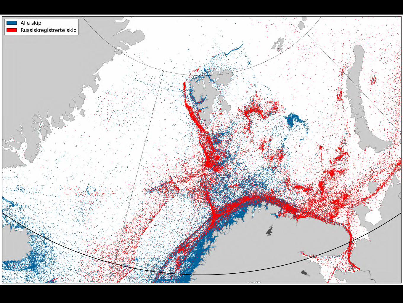
Monitoring of fisheries

© KONGSBERG 26 August 2003KONGSBERG October 25, 2014 64
Oil Spill and Ship Detection: Extended service information
Combining RADARSAT-2 and AisSat
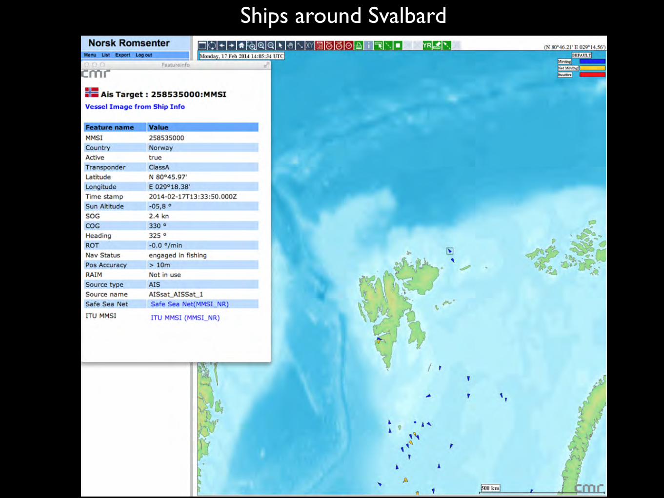
Ships around Svalbard
66
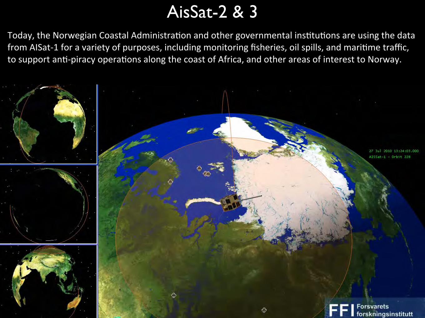
Today, the Norwegian Coastal AdministraBon and other governmental insBtuBons are using the data from AISat-‐1 for a variety of purposes, including monitoring fisheries, oil spills, and mariBme traffic, to support anB-‐piracy operaBons along the coast of Africa, and other areas of interest to Norway.
AisSat-2 & 3
67
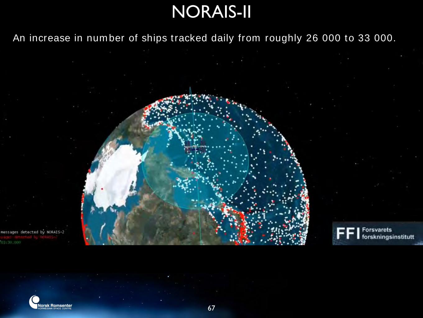
NORAIS-IIAn increase in number of ships tracked daily from roughly 26 000 to 33 000.
68
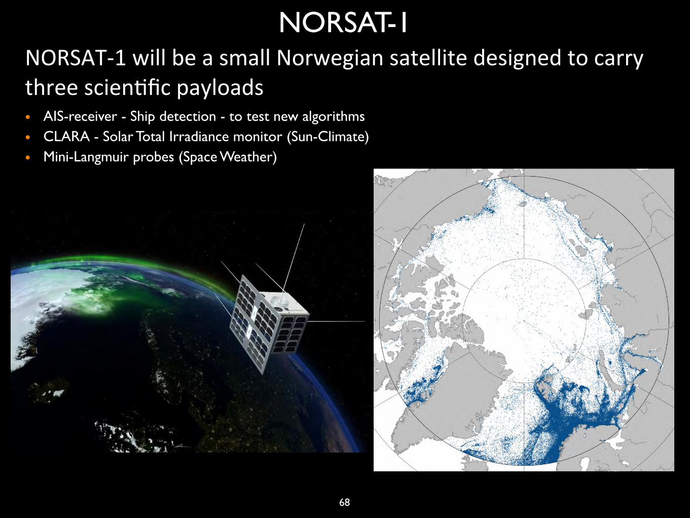
• AIS-receiver - Ship detection - to test new algorithms• CLARA - Solar Total Irradiance monitor (Sun-Climate)• Mini-Langmuir probes (Space Weather)
NORSAT-1NORSAT-‐1 will be a small Norwegian satellite designed to carry three scienBfic payloads
Canadian - Norwegian space collaboration
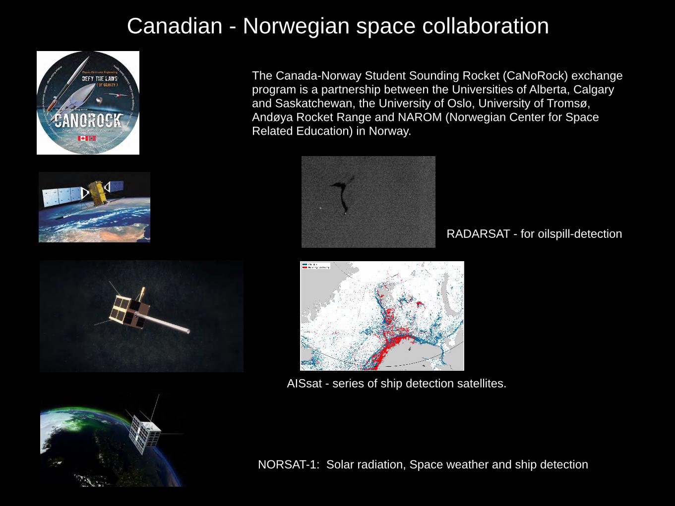
The Canada-Norway Student Sounding Rocket (CaNoRock) exchange program is a partnership between the Universities of Alberta, Calgary and Saskatchewan, the University of Oslo, University of Tromsø, Andøya Rocket Range and NAROM (Norwegian Center for Space Related Education) in Norway.
AISsat - series of ship detection satellites.
RADARSAT - for oilspill-detection
NORSAT-1: Solar radiation, Space weather and ship detection

The Norwegian government is establishing an integrated mariBme monitoring system
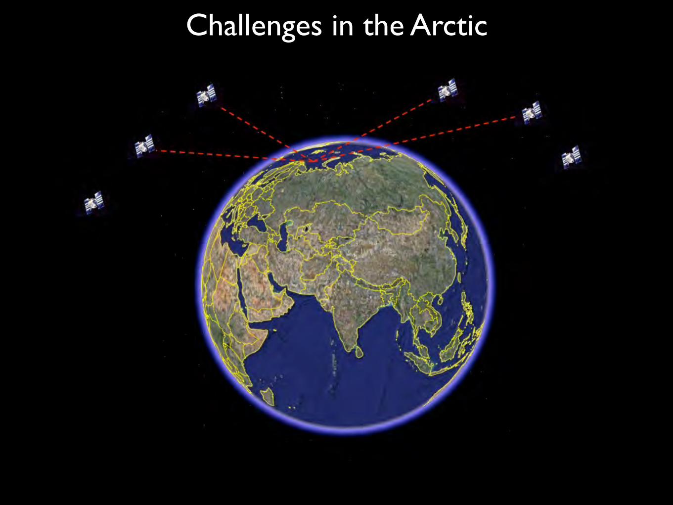
Challenges in the Arctic

Theoretical (80o)
Practical (76o)
Problems occur (72o)
Theoretical (80o)
Practical
Problems Occur
Limited Broadband in the North

Satellite communication in the Arctic
”Existing satellite communication systemes have little or no coverage north of 75 degree. The Norwegian Space Centre is exploring possible concepts for satellite communiction north of 75 degree.”
Kilde: Regjeringens statusrapport nordområdene (2014)
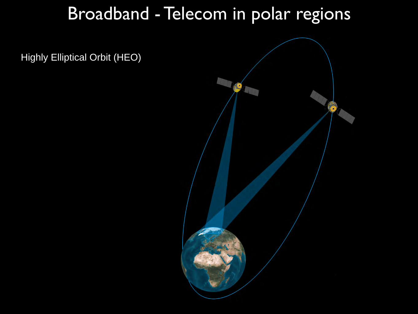
Broadband - Telecom in polar regions
Highly Elliptical Orbit (HEO)

Wy Space Activities in the ArcticSpace technology is perfect for use in the Arctic since satellites can cover vast areas with relatively small amount of infrastructure and without harming the environment.
- Earth observations
- Navigation
- Communictaion
- Research
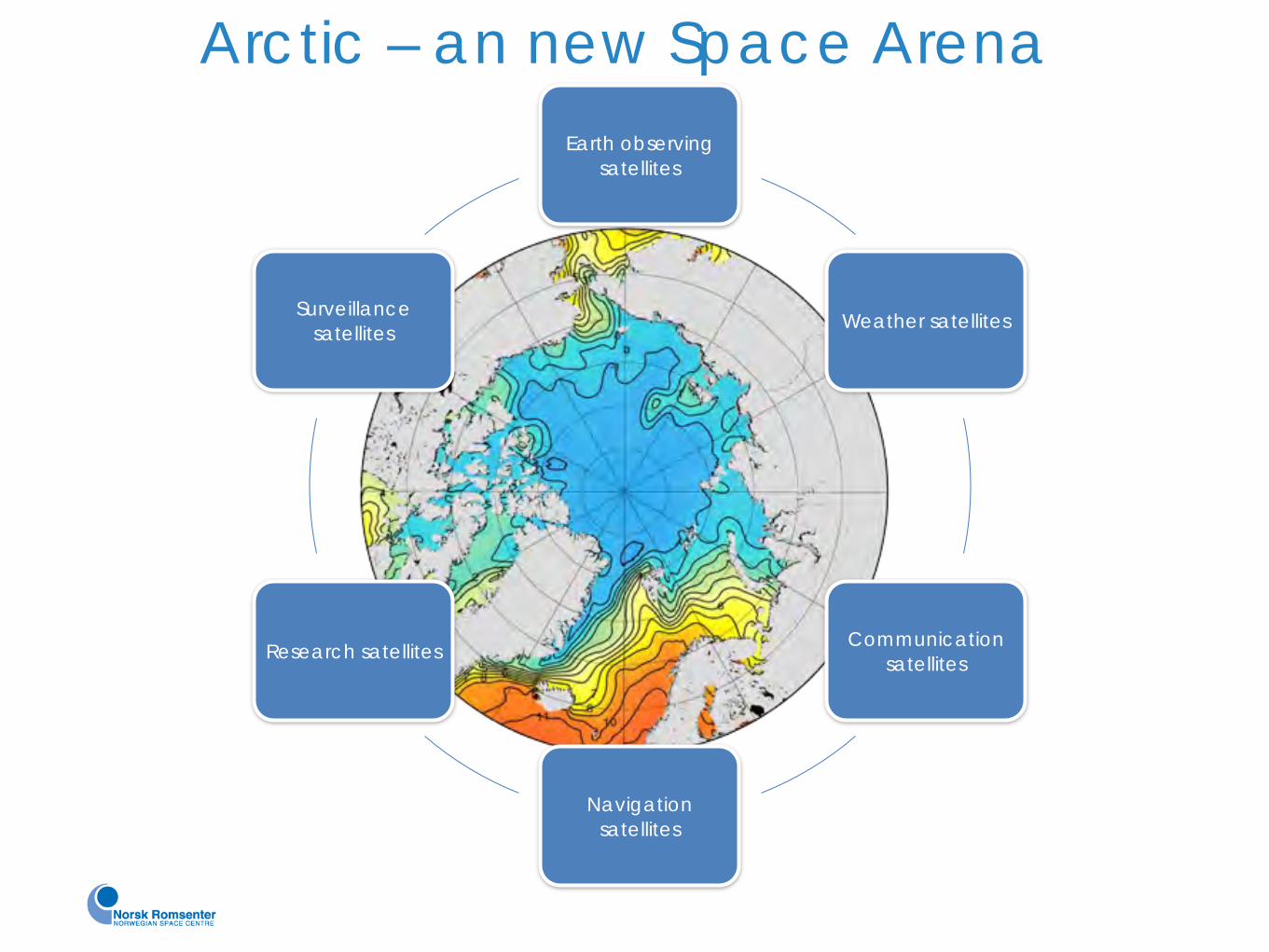
Earth observing satellites
Weather satellites
Communication satellites
Navigation satellites
Research satellites
Surveillance satellites
Arctic – an new Space Arena

But few - or none - of our challenges in the Arctic can be solved without secure access to satellite systems
Space is not the solution to all our challenges