Resilience Increases Your Sales Success! So- How Resilient Are You?

The Strategic Use of Spatial Data for Urban Resilience
ICLEI Resilient Cities
Bonn, Germany
May, 2013
Mark Sorensen, CEO The GPC Group
Proposition
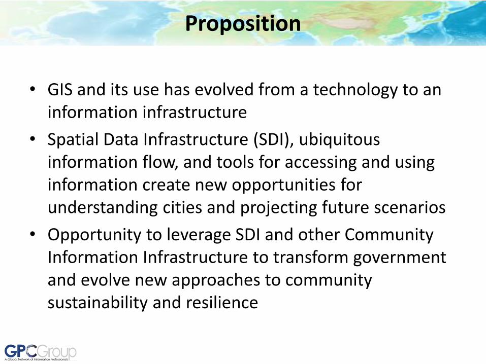
• GIS and its use has evolved from a technology to an information infrastructure
• Spatial Data Infrastructure (SDI), ubiquitous information flow, and tools for accessing and using information create new opportunities for understanding cities and projecting future scenarios
• Opportunity to leverage SDI and other Community Information Infrastructure to transform government and evolve new approaches to community sustainability and resilience
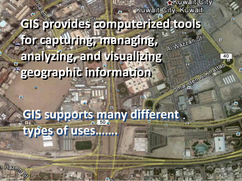
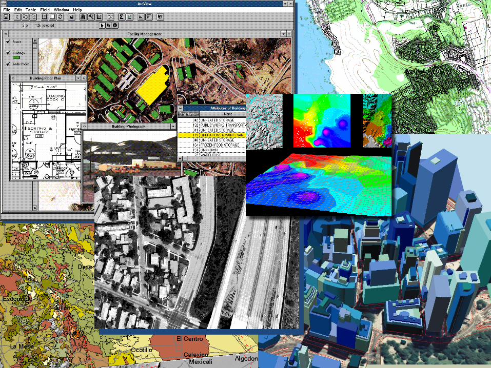
GIS provides computerized tools for capturing, managing, analyzing, and visualizing geographic information
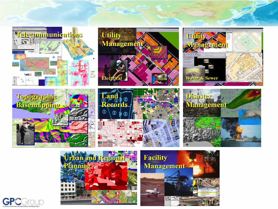
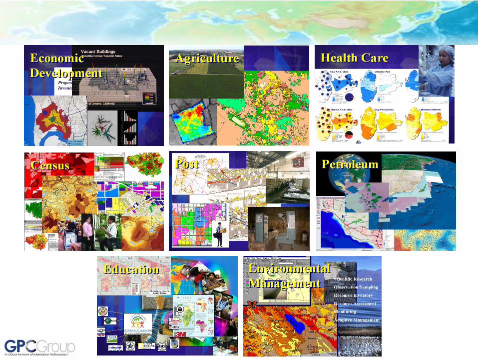
GIS supports many different types of uses…….
eMISK
Copyright © eMisk November 2011
Find station details and quality level of pollutants.
Module highlights:
Our Environment Status
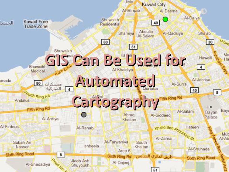
GIS Can Be Used for Automated Cartography
More importantly, GIS has analysis, query and
visualization tools to support many important uses
Intro to GIS and Best Practices
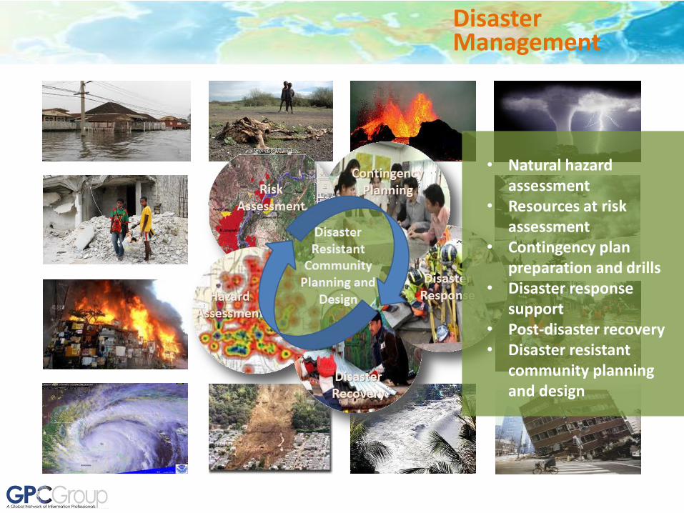
Disaster Management
• Natural hazard assessment
• Resources at risk assessment
• Contingency plan preparation and drills
• Disaster response support
• Post-disaster recovery • Disaster resistant
community planning and design

2010 Haiti Earthquake
2004 Banda Aceh Tsunami
1994 Northridge , USA Earthquake
2011 Horn of Africa Famine
Disaster Management
GIS has been used extensively to aid in responses to nearly every major natural disaster since the early 1990’s

Climate Change
GIS provides a critical capability for understanding current and potential future impacts of climate change, and options for resiliency planning
• Climate change risk assessment and contingency planning
• Emissions reduction planning
• Carbon offsets project planning and design (REDD, Blue Carbon, etc.)
• Awareness building • Ongoing monitoring
and assessment

GIS provides the tools to understand and assess the intersection of local and regional natural and socioeconomic systems, and to plan and develop communities and economies that can evolve in ways that are sustainable, resilient and adaptable to disruptive change, and supportive of human and ecological well-being and social equity.
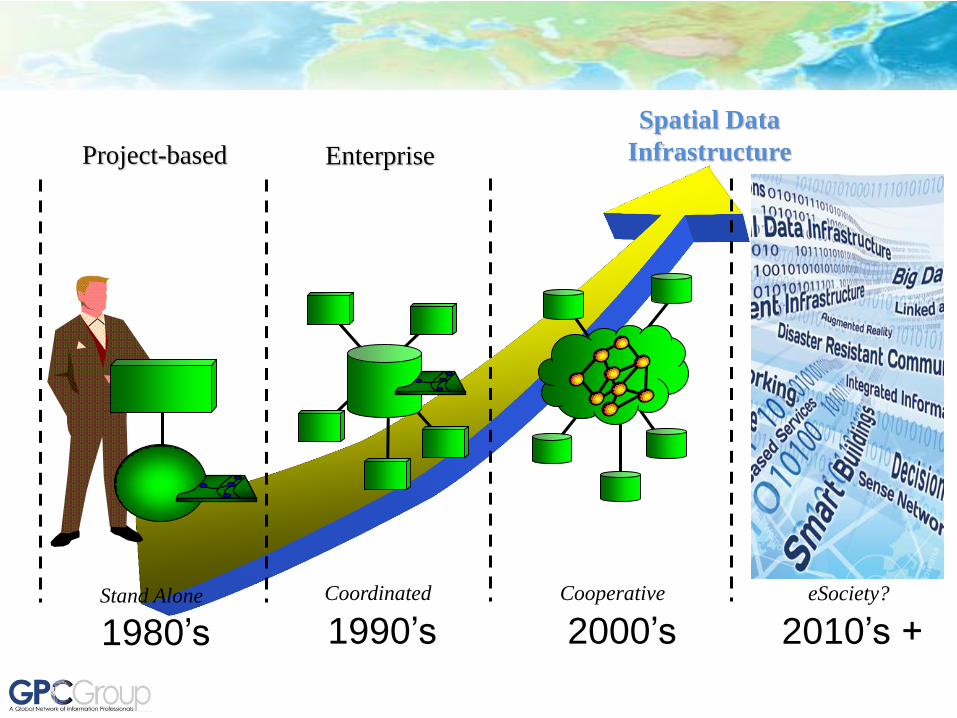
Project-based
Stand Alone
Enterprise
Coordinated
Spatial Data
Infrastructure
Cooperative
1980’s 1990’s 2000’s eSociety?
2010’s +
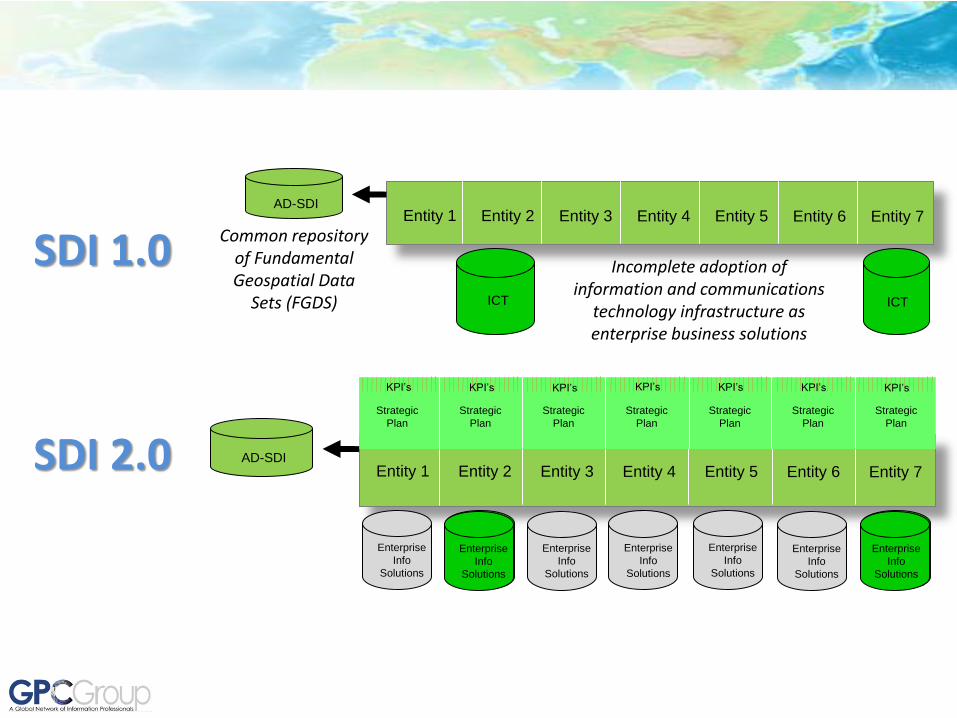
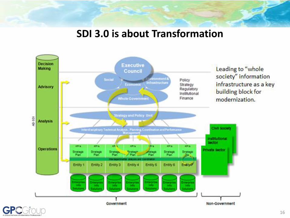
SDI 1.0 Entity 1 Entity 2 Entity 3 Entity 4 Entity 5 Entity 6 Entity 7
AD-SDI
ICT ICT
Common repository of Fundamental Geospatial Data
Sets (FGDS)
Incomplete adoption of information and communications
technology infrastructure as enterprise business solutions
Entity 1 Entity 2 Entity 3 Entity 4 Entity 5 Entity 6 Entity 7
Strategic
Plan
Strategic
Plan
Strategic
Plan
Strategic
Plan
Strategic
Plan
Strategic
Plan
Strategic
Plan
KPI’s KPI’s KPI’s KPI’s KPI’s KPI’s KPI’s
AD-SDI
Enterpris
e Info
Solutions
Enterpris
e Info
Solutions
Enterprise
Info
Solutions
Enterprise
Info
Solutions
Enterprise
Info
Solutions
Enterprise
Info
Solutions
Enterprise
Info
Solutions
Enterprise
Info
Solutions
Enterprise
Info
Solutions
SDI 2.0
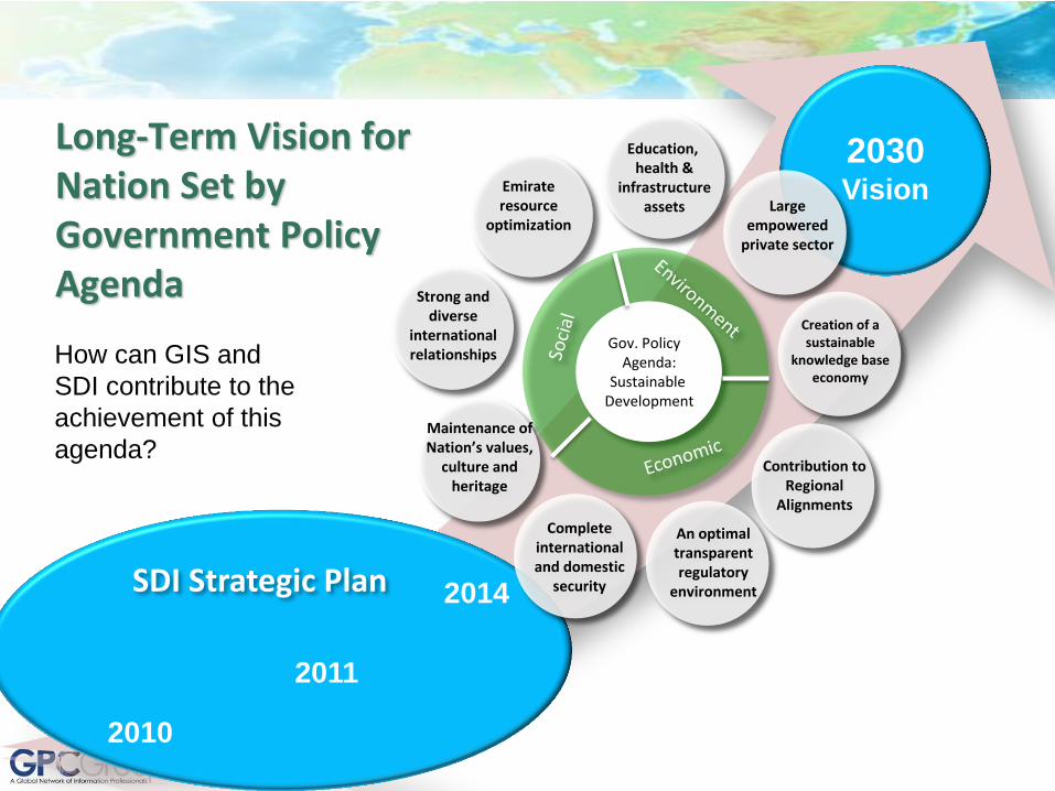
Long-Term Vision for Nation Set by Government Policy Agenda
How can GIS and
SDI contribute to the
achievement of this
agenda?
2030 Vision
2010
2011
2014 SDI Strategic Plan
Education, health &
infrastructure assets Large
empowered private sector
Creation of a sustainable
knowledge base economy
Emirate resource
optimization
Strong and diverse
international relationships
Complete international and domestic
security
An optimal transparent regulatory
environment
Gov. Policy Agenda:
Sustainable Development
Maintenance of Nation’s values,
culture and heritage
Contribution to Regional
Alignments
16
SDI 3.0 is about Transformation
17
Decision Support
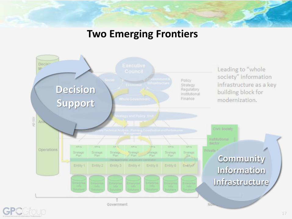
Two Emerging Frontiers
Community Information
Infrastructure
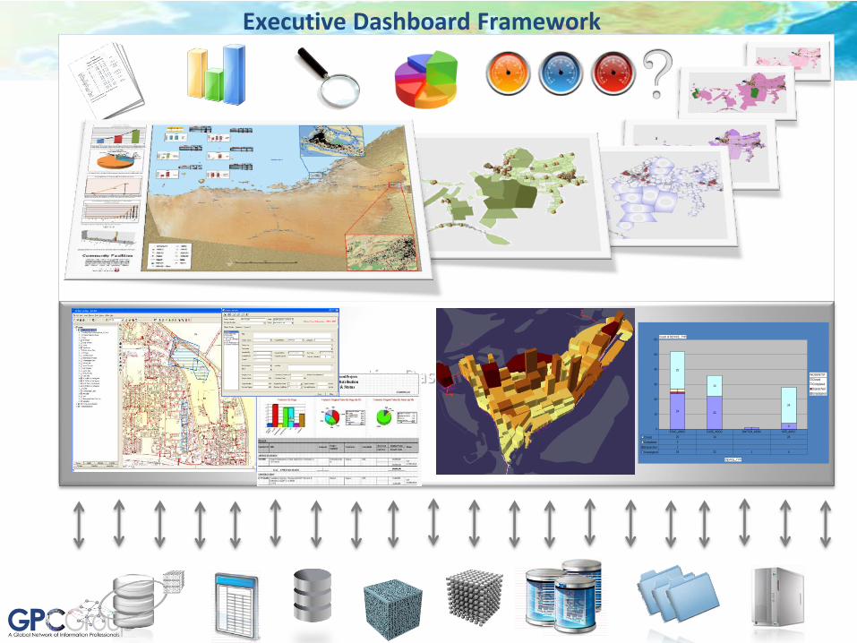
Executive Dashboard framework
2422
14
12
25
14
24
0
10
20
30
40
50
60
Closed
Completed
Dispatched
Unassigned
Closed 25 14 24
Completed 2
Dispatched 1
Unassigned 24 22 1 4
ESVC_ADDC FUSE_ADDC SWITCH_ADDC XFR_ADDC
Count of DEVICE_TYP
DEVICE_TYP
INCIDENTST
Executive Dashboard Framework

19
Decision Support
Two Emerging Frontiers
Community Information
Infrastructure

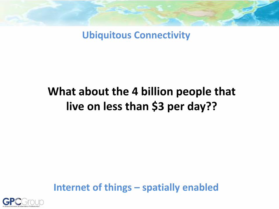
Ubiquitous Connectivity
Internet of things – spatially enabled
Ubiquitous Connectivity
Internet of things – spatially enabled
What about the 4 billion people that live on less than $3 per day??

22
• Cell phone adoption faster than any other technology adoption in history;
• Mobile telephony and basic computing in wide usage in the developing world and growing rapidly;
• Basic technology only requires basic literacy, but encourages increased literacy and technology familiarity through usage for practical purposes.
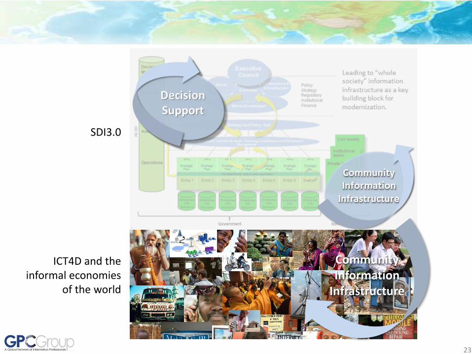
23
Community Information
Infrastructure
ICT4D and the informal economies
of the world
SDI3.0

Big Data
DSS
Social Media
F1 Advancing urban resilience through the strategic use of spatial data Presentations Date: Saturday, June 1, 2013 Time: 16:30-18:00 Rooms: S27-28

Is it worth exploring the potential for a track dedicated to “Smart Cities for Urban Resilience” for 2014 Conference??