Adapting to Sea Level Rise Joseph F. Bouchard, Ph.D. Captain, U.S. Navy (Ret.) Presentation to the...
30
Adapting to Sea Level Rise Joseph F. Bouchard, Ph.D. Captain, U.S. Navy (Ret.) Presentation to the Virginia Ship Repair Association June 21, 2011
-
Upload
dwight-larry -
Category
Documents
-
view
213 -
download
0
Transcript of Adapting to Sea Level Rise Joseph F. Bouchard, Ph.D. Captain, U.S. Navy (Ret.) Presentation to the...

Adapting to Sea Level Rise
Joseph F. Bouchard, Ph.D.Captain, U.S. Navy (Ret.)
Presentation to theVirginia Ship Repair Association
June 21, 2011

Overview
• Impact of Sea Level Rise
• Adaptation Strategies
• Adaptation Efforts in Hampton Roads

Source: Chesapeake Bay Program Science and Technical Advisory Committee (STAC), “Climate Change and the Chesapeake Bay: State-of-the-Science Review and Recommendations,” April 21, 2008, pp. 18, 81.
Focus on Sea Level Rise
Projected increase through 2100:About 0.7 to 1.6 m (2' 4" to 5' 3")
The Historical Record: Sea Level Rise in Chesapeake Bay

Source: John Boon, Ph.d., “Sea Coast And Sea Level Trends,” 2008, pp. 4, 5. Dr. Boon is Professor Emeritus, Virginia Institute of Marine Science, College of William and Mary, School of Marine Science
Sea Level Rise in Chesapeake BayIs It Accelerating?

The Coastal Vulnerability Index shows the relative vulnerability of the coast to future rise in sea-level. Most of the Virginia Coast is Very High Risk.
Source:US Geologic Survey, “National Assessment of Coastal Vulnerability to Sea-Level Rise: Preliminary Results for the U.S. Atlantic Coast,” U.S. Geological Survey Open-File Report 99-593. E. Robert Thieler and Erika S. Hammar-Klose, Woods Hole, Massachusetts, 1999. http://pubs.usgs.gov/of/1999/of99-593/
USGS Coastal Vulnerability Index
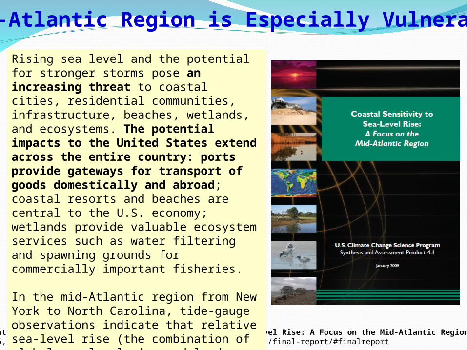
U.S. Climate Change Science Program, Coastal Sensitivity to Sea-level Rise: A Focus on the Mid-Atlantic Region, pp. 1-2January 16, 2009. http://www.climatescience.gov/Library/sap/sap4-1/final-report/#finalreport
Rising sea level and the potential for stronger storms pose an increasing threat to coastal cities, residential communities, infrastructure, beaches, wetlands, and ecosystems. The potential impacts to the United States extend across the entire country: ports provide gateways for transport of goods domestically and abroad; coastal resorts and beaches are central to the U.S. economy; wetlands provide valuable ecosystem services such as water filtering and spawning grounds for commercially important fisheries.
In the mid-Atlantic region from New York to North Carolina, tide-gauge observations indicate that relative sea-level rise (the combination of global sea-level rise and land subsidence) rates were higher than the global mean and generally ranged between 2.4 and 4.4 millimeters per year, or about 0.3 meters (1 foot) over the twentieth century.
Mid-Atlantic Region is Especially Vulnerable

Risk to Hampton Roads from Sea Level Rise:#2 in the United States

Risk to Hampton Roads from Sea Level Rise:#10 in the World
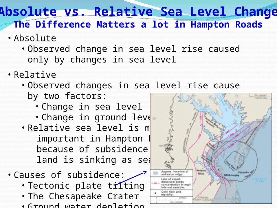
Absolute vs. Relative Sea Level ChangeThe Difference Matters a lot in Hampton Roads
• Absolute• Observed change in sea level rise caused only by changes in sea
level
• Relative• Observed changes in sea level rise cause by two factors:
• Change in sea level• Change in ground level
• Relative sea level is more important in Hampton Roads because of subsidence – the land is sinking as sea level rises
• Causes of subsidence:• Tectonic plate tilting• The Chesapeake Crater• Ground water depletion

Impact of Sea Level Rise (I)Inundation

Impact of Sea Level Rise (II)Shoreline Erosion

Impact on the Insurance IndustryThe Insurance Industry is Factoring Sea Level Rise into Risk Assessments

Impact on Norfolk

Norfolk & PortsmouthHurricane Storm Surge
Sea levelRise
IncreasesStorm Surge

Impact on the Virginia Beach Oceanfront
Source: Skip Stiles, Wetlands Watch

Impact on the Northrop Grumman Shipyard

Governor’s Commission on Climate ChangeAdaptation and Sequestration Working Group
Recommendations•Acquire high resolution topographic data for all of coastal Virginia (LIDAR)
•Base all State and Local planning on:
• Temperature increase of approximately 3.6°F
• Sea level rise of 2.3 feet, but tailored to local relative sea level rise
• Greater instability in weather patterns and precipitation
•Closely monitor trends and adjust policies as necessary
Adaption Recommendations

Adapting to Sea Level Rise:Protect
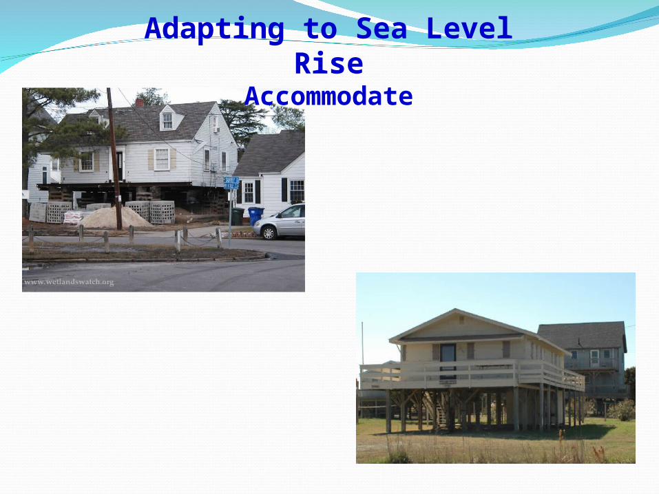
Adapting to Sea Level RiseAccommodate
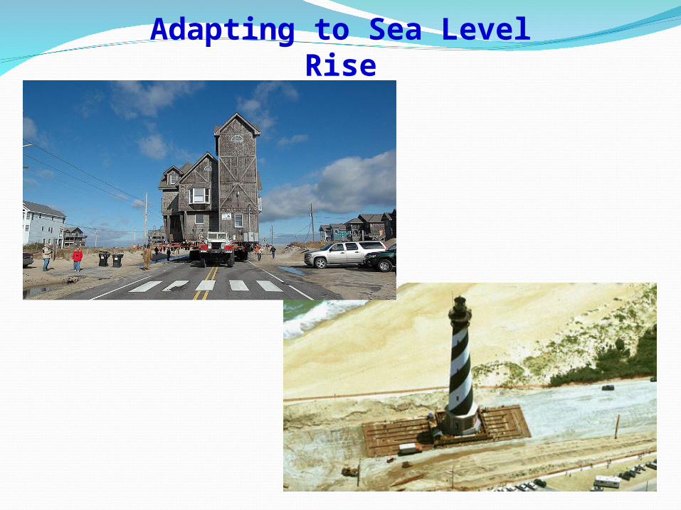
Adapting to Sea Level RiseRetreat

Climate change will be one of the greatest challenges for Hampton Roads, the United States, and the world to deal with over the next century. Climate change is already occurring and will continue to have large impacts on populations around the world.
Planning for climate change now may help mitigate its impacts while also reducing the costs of any necessary adaptation.
http://www.hrpdc.org/Documents/Phys%20Planning/2010/Climate_Change_Final_Report_All.pdf
Adaptation Efforts in Hampton Roads:Hampton Roads Planning District Commission

Norfolk has Launched Adaptation Planning

Transportation Risk Assessment

Hurricane Isabel Flooding at Langley AFB, September 2003
Langley Air Force Base: ProtectDaily PressLangley AFB wants $5.5 million in flood protectionBy David MacaulayApril 7, 2010Langley Air Force Base is seeking more than $5 million in federal funds to protect it against storm surges that have caused massive damage at the base in past years.
Projects:•Shoreline stabilization: “Living shoreline”•Replace existing seawall•Reinforcement under takeoff and landing zones

Images Source: Naval Facilities Engineering Command, Atlantic Divisionhttps://portal.navfac.navy.mil/portal/page/portal/navfac/navfac_ww_pp/navfac_navfaclant_pp/tab36140/piers.pdf
21 feet above sea level
Utilities suspended from upper deck.
On old single deck piers utilities are suspended below the deck, close to the water.
As sea level has risen over the last 60 years, utilities suspended beneath old single deck piers have become increasingly vulnerable to damage from sea water immersion and are less accessible for maintenance.
Naval Station Norfolk Piers: Accommodate

We Have Been Warned!
Rear Admiral David W. Titley, Ph.D. Oceanographer of the NavyDirector, Task Force Climate Change
“Climate Change and the U.S. Navy”December 2, 2010Old Dominion University

Regardless of what you may think about the causes of climate change, remember this:
•Sea level rise and inundation increase can be seen and measured in Hampton Roads – they are happening now.
•DOD and the Navy take it seriously and are already spending hundreds of millions to adapt to sea level rise and inundation.
•Economic loss from failure to adapt is much greater than the cost of adaptation. Adaptation planning is long overdue.
•Effective adaptation plans will have an increasing impact on the competitiveness of shipyards.
• The Navy is already looking into the impact of inundation on shipyards and ship repair contracts.
Conclusions
Shipyards that adapt will win,shipyards that fail to adapt will fail.

Navy Task Force Assesses Changing ClimateBy Bob Freeman, Special to American Forces Press Service, July 31, 2009
Rapidly diminishing sea ice, melting glaciers, rising sea levels, increased storm severity -- all are possible consequences of a climate that mounting evidence suggests is changing significantly.
As the scientific community works to understand the changing climate, the chief of naval operations has created a task force, headed by Rear Adm. David Titley, the Navy's senior oceanographer, to better understand and evaluate its implications for maritime security.
“Task Force Climate Change was initiated … to assess the Navy’s preparedness to respond to emerging requirements, and to develop a science-based timeline for future Navy actions regarding climate change,” Titley explained in a July 28 interview.
Two merchant ships transit Northeast PassageSummer 2009
Questions?

Climate Change in Coastal Virginia
Air and Water Temperature
Sea Level Rise
Unstable Weather Patterns
By 2080~2100Air temperature increase of about 3.6° F,
range of 2.5° F to 5.3° F
Variability in precipitation patternsFrequency of extreme weather eventsIntensity of extreme weather events
By 2100:About 1 m, range 0.7 to 1.6 m
(About 3’4”, range 2' 4" to 5' 3”)

Major Storms in H.R., 1970-2008