Activities in the Northern Management Area PowerPoint · PDF file · 2017-11-20to...
37
GFNMS and MBNMS Joint Sanctuary Advisory Council Meeting August 21, 2013 Activities in the Northern Management Area
Transcript of Activities in the Northern Management Area PowerPoint · PDF file · 2017-11-20to...

GFNMS and MBNMS Joint Sanctuary Advisory Council Meeting August 21, 2013
Activities in the Northern Management Area

Along San Mateo Coast and Marin Headlands
Interpretive Signs

• Interpretive Stairway & Trail • 2 Docent Training Classes
Fitzgerald Marine Reserve
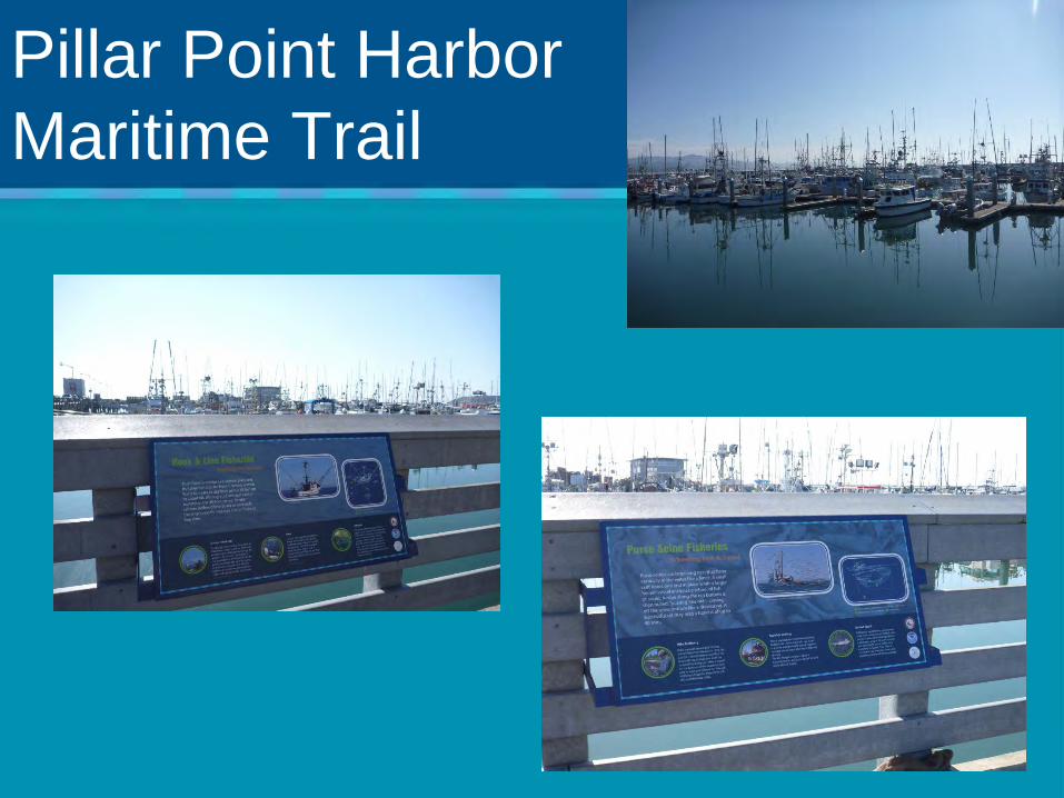
Pillar Point Harbor Maritime Trail

Pigeon Point Lighthouse

Exploration Series

Abalone Soirée’ at Mavericks Event Center
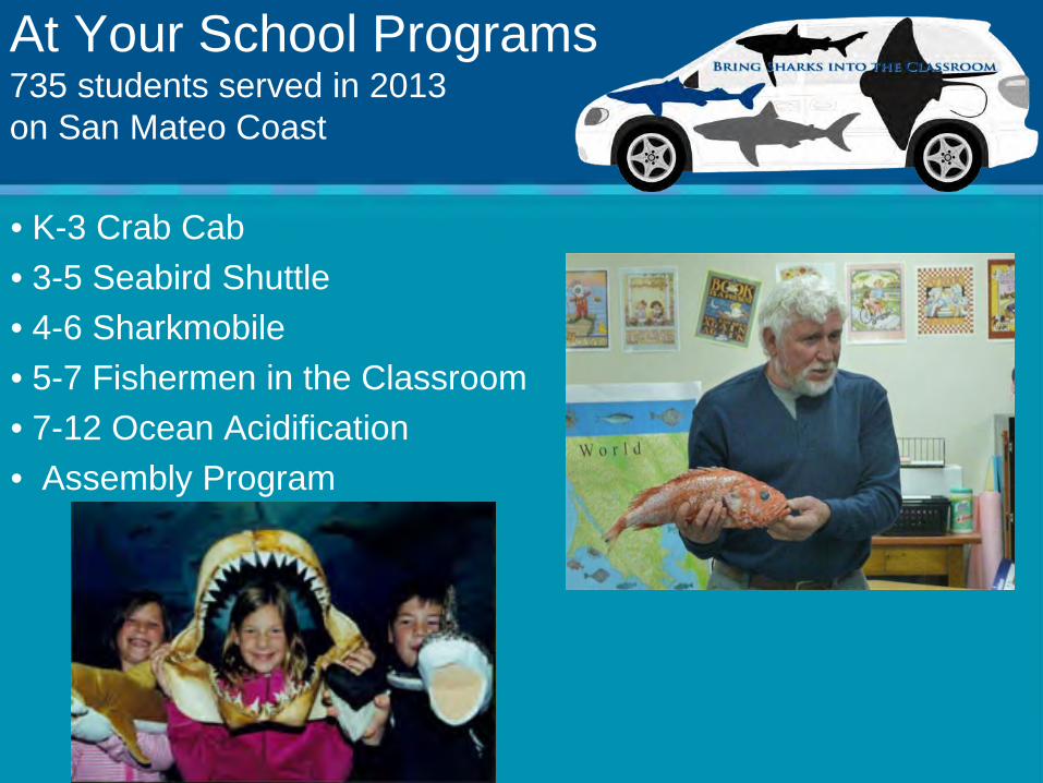
• K-3 Crab Cab • 3-5 Seabird Shuttle • 4-6 Sharkmobile • 5-7 Fishermen in the Classroom • 7-12 Ocean Acidification • Assembly Program
At Your School Programs 735 students served in 2013 on San Mateo Coast
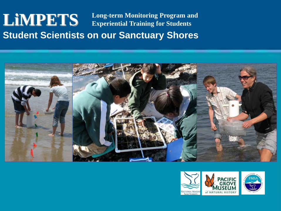
LiMPETS Student Scientists on our Sanctuary Shores
Long-term Monitoring Program and Experiential Training for Students

Key Aspects of LiMPETS
LiMPETS is well established • Spans 600 miles of coastline • 26 rocky intertidal sites and 37 sandy
beach sites LiMPETS is successful • Engage 5,000 students in collecting data LiMPETS is a model citizen science program • Data informing MLPA baseline
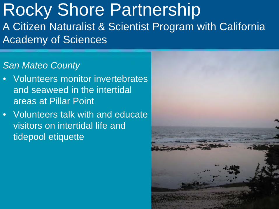
Rocky Shore Partnership A Citizen Naturalist & Scientist Program with California Academy of Sciences
San Mateo County • Volunteers monitor invertebrates
and seaweed in the intertidal areas at Pillar Point
• Volunteers talk with and educate visitors on intertidal life and tidepool etiquette

Rocky Shore Partnership A Citizen Naturalist & Scientist Program with California Academy of Sciences
San Mateo County Future plans • Implement MPA Watch in
partnership the Ocean Science Trust and San Mateo MPA Collaborative
• Expand surveys to Fitzgerald Marine Reserve
• Expand work with LiMPETS

ACCESS: Applied California Current Ecosystem Surveys • Partnership between Point Blue,
CBNMS, GFNMS, FMSA, University of Hawaii, SFSU, BML
• Collects integrated data to model biological hotspots and resources at risk
• Transect lines 5-10 are within MBNMS
• Project associated with Whale Aware to gather near “real time” data on whales at risk in MBNMS, GFNMS, CBNMS, CINMS
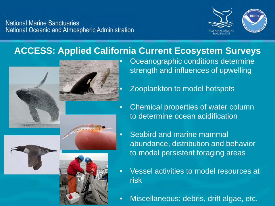
• Oceanographic conditions determine strength and influences of upwelling
• Zooplankton to model hotspots
• Chemical properties of water column to determine ocean acidification
• Seabird and marine mammal abundance, distribution and behavior to model persistent foraging areas
• Vessel activities to model resources at risk
• Miscellaneous: debris, drift algae, etc.
ACCESS: Applied California Current Ecosystem Surveys
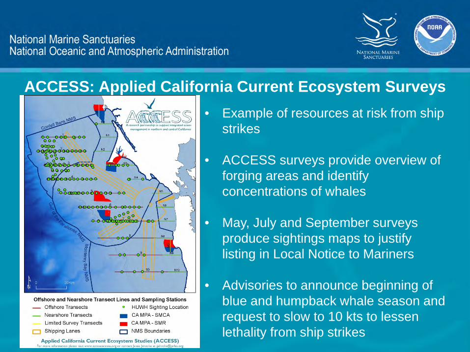
ACCESS: Applied California Current Ecosystem Surveys • Example of resources at risk from ship
strikes
• ACCESS surveys provide overview of forging areas and identify concentrations of whales
• May, July and September surveys produce sightings maps to justify listing in Local Notice to Mariners
• Advisories to announce beginning of blue and humpback whale season and request to slow to 10 kts to lessen lethality from ship strikes

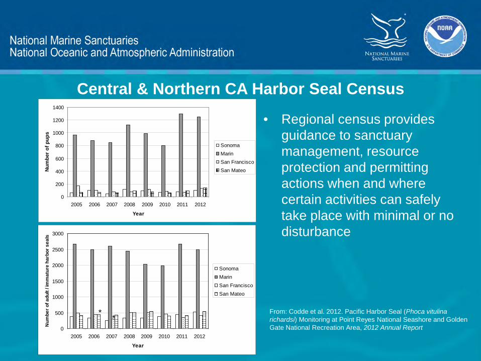
Central & Northern CA Harbor Seal Census
• Census occurs throughout the pupping, breeding and molting seasons, March – July, Sea Ranch south through San Mateo Co.
• Census is performed in partnership with 9 other organizations
• Sampling design enables the data to be integrated with other regional surveys for a regional census

• GFNMS and FMSA staff and volunteers perform counts at San Mateo Co breeding and haul-outs
• Regional census provides data on population, location of haul-outs and breeding areas, on-set of breeding and seasonality of pupping
Central & Northern CA Harbor Seal Census
0
200
400
600
800
1000
1200
1400
2005 2006 2007 2008 2009 2010 2011 2012
Year
Num
ber o
f pup
s
SonomaMarinSan FranciscoSan Mateo
0
500
1000
1500
2000
2500
3000
2005 2006 2007 2008 2009 2010 2011 2012
Year
Num
ber o
f adu
lt / i
mm
atur
e ha
rbor
sea
ls
SonomaMarinSan FranciscoSan Mateo
**
• Regional census provides
guidance to sanctuary management, resource protection and permitting actions when and where certain activities can safely take place with minimal or no disturbance
From: Codde et al. 2012. Pacific Harbor Seal (Phoca vitulina richardsi) Monitoring at Point Reyes National Seashore and Golden Gate National Recreation Area, 2012 Annual Report
Central & Northern CA Harbor Seal Census
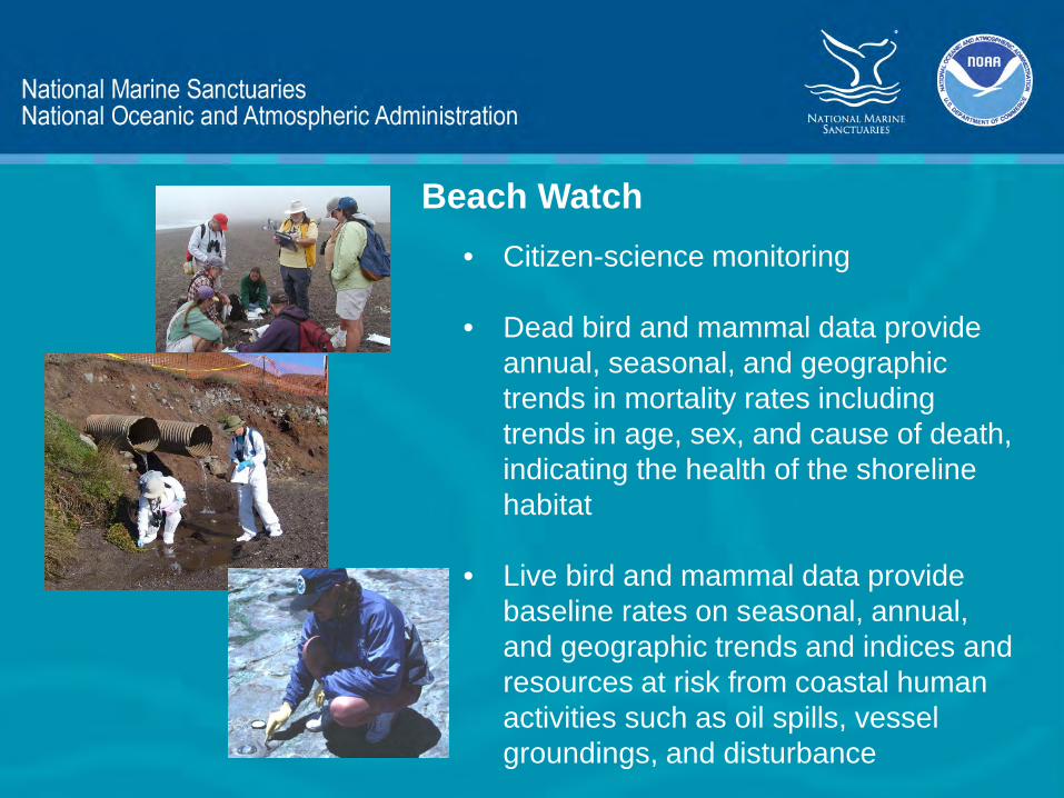
Beach Watch • Citizen-science monitoring
• Dead bird and mammal data provide
annual, seasonal, and geographic trends in mortality rates including trends in age, sex, and cause of death, indicating the health of the shoreline habitat
• Live bird and mammal data provide baseline rates on seasonal, annual, and geographic trends and indices and resources at risk from coastal human activities such as oil spills, vessel groundings, and disturbance

• Oil and tarball data provide information on the location, amount, source and trends of oil pollution
• Beached birds, oiled birds and tarballs are deposited at different locations due to bottom topography, prevailing surface currents, locations of vessel traffic lanes and nearby colonies
• This information is used for planning restoration, over $52M resulted from BW NRDA
Beach Watch
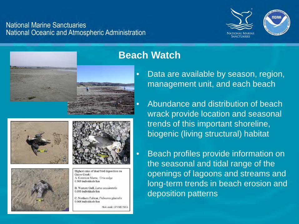
Beach Watch
• Data are available by season, region, management unit, and each beach
• Abundance and distribution of beach wrack provide location and seasonal trends of this important shoreline, biogenic (living structural) habitat
• Beach profiles provide information on the seasonal and tidal range of the openings of lagoons and streams and long-term trends in beach erosion and deposition patterns

• Wildlife Protection Area Designations
• Bird and mammal mortality events
• Natural resource damage assessment
• Effects of mariculture industry
• Wildlife entanglement
• Waste management practices
• Listed species monitoring
Beach Watch – Management Uses

Beach Watch – Response, NRDA & Restoration
• Beach Watch provides historic baseline deposition rates
• Early detection and reporting • Network of experienced wildlife
reconnaissance surveyors who can respond quickly in oil events
• Documentation of impacts on outer beaches, wildlife and human use
• Collection of tarballs and oiled feather
samples as evidence

Emergency Response
GFNMS Emergency Response Plan and online Portfolio • Includes Northern Mgmt Area • Specifies protocols / response actions
for spills within NMA in coordination with MBNMS staff
Regular participation in ACP Mtgs and drills Regular participation in Abandoned Vessels Workgroup Meetings

Vessel Groundings Respond regularly to vessel groundings within NMA • In CY 2012, 3 out of 8 groundings
within NMA • In CY 2013 (thus far) 3 out of 3
groundings within NMA Incidents within NMA often require significant staff time given high interest from the community Working with Pillar Point Harbor District, USCG, SLC, and state legislature on addressing boat groundings


Recommendations Apply to Northern Management Area
• TSS changes • Whale Sighting
Network • Commercial
Mariner Outreach

Permitting
Mavericks Surf Contest • Annual permitting • Enforcement coordination with OLE,
CDFW and USCG • GFNMS staff participation during event
(wildlife disturbances, MPWC usage) White Shark Research • TOPP Program White Shark Research
(Ano Nuevo) • Programmatic Environmental Assessment
Ongoing permitted research at Fitzgerald Marine Reserve

Ocean Climate Initiative
Objectives •Coordinate across GFNMS program areas to integrate climate into the work we do.
•Coordinate partnerships to address climate change impacts to sanctuary resources.
•Work within and outside of NOAA to form an alliance to share resources and knowledge in the Bay Area.
Goal Address local climate change impacts through
fostering awareness, advocating solutions, and promoting action to build ecosystem resilience and sustainability.

OCI: Climate Smart Conservation
Green Operations: Reducing Our Carbon Footprint WG developed over 130 strategies, annual emissions audits: http://farallones.noaa.gov/about/facilities.html
Research and Monitoring
WG developing Ocean Climate Indicators Monitoring Inventory and Plan by Fall 2013: http://farallones.noaa.gov/manage/climate/indicators.html
Climate Smart Adaptation
Currently developing 2 year project plan. Targeting kick off with focal resources workshop in Winter 2013.
Communication
Initiating Fall/Winter 2013 with GFNMS education team.

Our Coast–Our Future
www.prbo.org/ocof
• Online decision support tools for SLR and storms with 40 different scenario combinations in mapping tool.
• Currently available from Half Moon Bay to Bodega Head, will also cover SF Bay by Aug 2014.
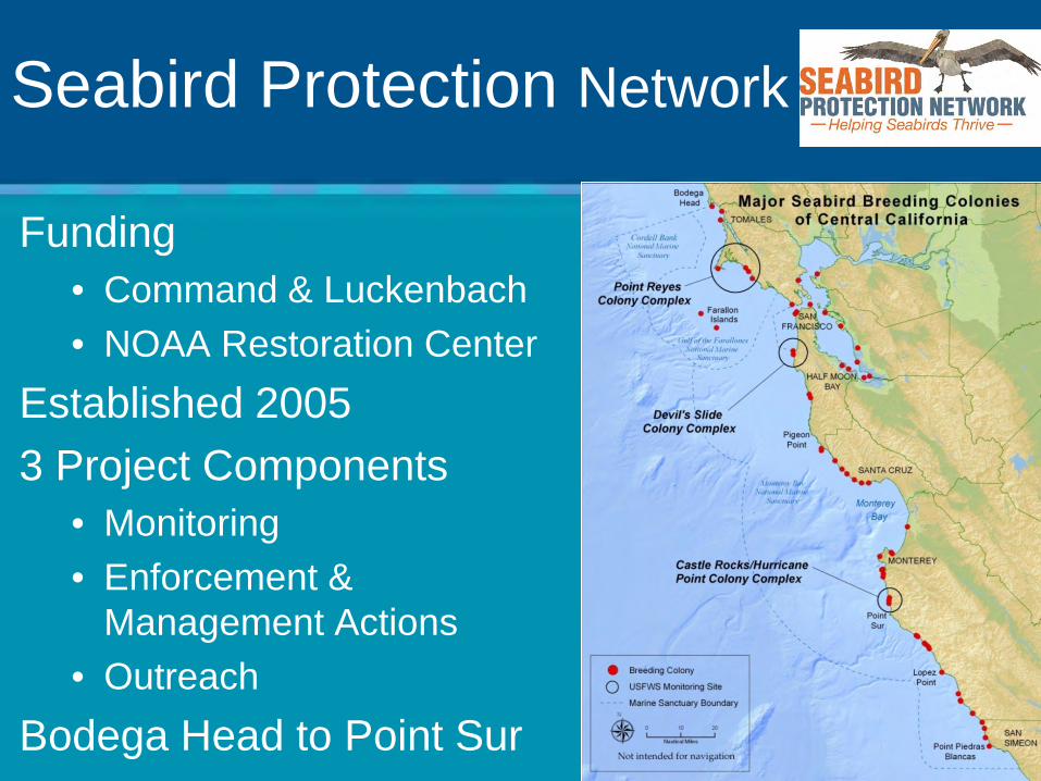
Seabird Protection Network
Funding • Command & Luckenbach • NOAA Restoration Center
Established 2005 3 Project Components
• Monitoring • Enforcement &
Management Actions • Outreach
Bodega Head to Point Sur

Bodega Head – Pt. Sur est. 2005 Funded by Luckenbach oil spill mitigation
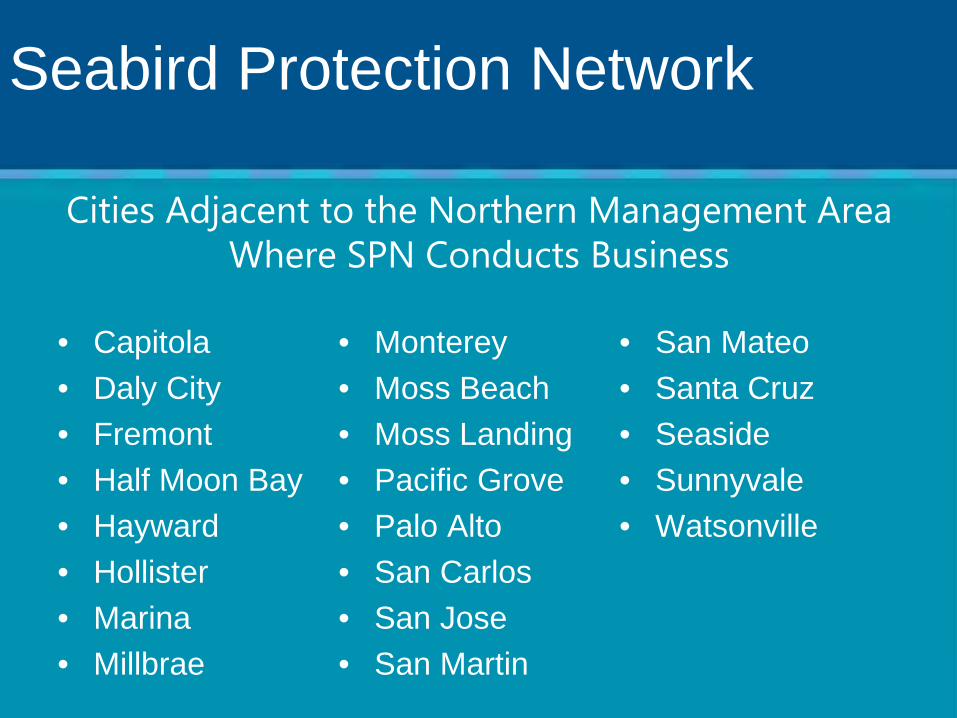
• Capitola • Daly City • Fremont • Half Moon Bay • Hayward • Hollister • Marina • Millbrae
• Monterey • Moss Beach • Moss Landing • Pacific Grove • Palo Alto • San Carlos • San Jose • San Martin
• San Mateo • Santa Cruz • Seaside • Sunnyvale • Watsonville
Cities Adjacent to the Northern Management Area Where SPN Conducts Business
Seabird Protection Network

Number of Individuals Reached through Presentations Conducted in Northern
Management Area, 2007 – 2013
Annual mailings: 407 – pilots; 720 boaters
MPA Collaborative Implementation Project Pillar Point Harbor signage
Aerial Patrol Surveys – USCG Air Auxiliary
Water bird Disturbance Symposium Pilot & kayak businesses
from NMA
Seabird Protection Network

Seabird Protection Network

Thank You! Adam Contreras Abby Nickels Amy Dean Benet Ducan Brad Damitz Brian Johnson Carolyn Gibson Carol Preston Dru Devlin Erica Warren Jan Roletto
Justin Holl Karen Carlson Karen Reyna Kelley Higgason Kirsten Lindquist Leslie Abramson Mai Maheigan MaryJane Schramm Max Delaney Peter Winch Rebecca Johnson
Rietta Homan Sage Tezak Taylor Nairn Tim Reed Tinya Hoang
![Aff Presentation%20to%20 Customer[1]](https://static.fdocuments.in/doc/165x107/5593fe7c1a28abbb7f8b467b/aff-presentation20to20-customer1.jpg)