A737 Dalry Bypass Photo Viewpoint R1 - Transport Scotland · July 2012 PNE January 2013 January...
7
GC July 2012 PNE January 2013 January 2013 AS January 2013 GC FOR INFORMATION 00 Figure 9.26 NTS Photo Viewpoint R1 IN ASSOCIATION WITH REV DRAWING TITLE SCALE @ A3 DRAWING NO ENGINEER CHECKED BY: APPROVED BY: DATE: DATE: DATE DESIGN BY: DATE: DRAWN BY: DATE: BY CHKD REVISIONS AMENDMENTS REV CLIENT PROJECT TITLE APP'D This map is based upon Ordnance Survey material with the permission of Ordnance Survey on behalf of the Controller of Her Majesty's stationery Office (c) Crown copyright 2012. Any unauthorised reproduction infringes Crown copyright and may lead to prosecution or civil proceedings. Scottish Executive Licence number : 100046668 2012 . A737 Dalry Bypass Environmental Statement DRAWING STATUS
Transcript of A737 Dalry Bypass Photo Viewpoint R1 - Transport Scotland · July 2012 PNE January 2013 January...
GC
July 2012
PNE
January 2013January 2013
AS
January 2013
GC
FOR INFORMATION
00Figure 9.26
NTS
Photo Viewpoint R1
IN ASSOCIATION WITH
REV
DRAWING TITLE
SCALE @ A3 DRAWING NO
ENGINEER
CHECKED BY:
APPROVED BY:
DATE:
DATE:DATE
DESIGN BY:
DATE:
DRAWN BY:
DATE:BY CHKDREVISIONS
AMENDMENTS
REV
CLIENT PROJECT TITLE
APP'D
This map is based upon Ordnance Survey material with the permission of OrdnanceSurvey on behalf of the Controller of Her Majesty's stationery Office (c) Crowncopyright 2012. Any unauthorised reproduction infringes Crown copyright and
may lead to prosecution or civil proceedings. Scottish Executive Licence number :100046668 2012.
A737 Dalry Bypass
Environmental Statement
DRAWING STATUS

GC
July 2012
PNE
January 2013January 2013
AS
January 2013
GC
FOR INFORMATION
00Figure 9.27
NTS
Photo Viewpoint R2
IN ASSOCIATION WITH
REV
DRAWING TITLE
SCALE @ A3 DRAWING NO
ENGINEER
CHECKED BY:
APPROVED BY:
DATE:
DATE:DATE
DESIGN BY:
DATE:
DRAWN BY:
DATE:BY CHKDREVISIONS
AMENDMENTS
REV
CLIENT PROJECT TITLE
APP'D
This map is based upon Ordnance Survey material with the permission of OrdnanceSurvey on behalf of the Controller of Her Majesty's stationery Office (c) Crowncopyright 2012. Any unauthorised reproduction infringes Crown copyright and
may lead to prosecution or civil proceedings. Scottish Executive Licence number :100046668 2012.
A737 Dalry Bypass
Environmental Statement
DRAWING STATUS
GC
June 2012
PNE
January 2013January 2013
AS
January 2013
GC
FOR INFORMATION
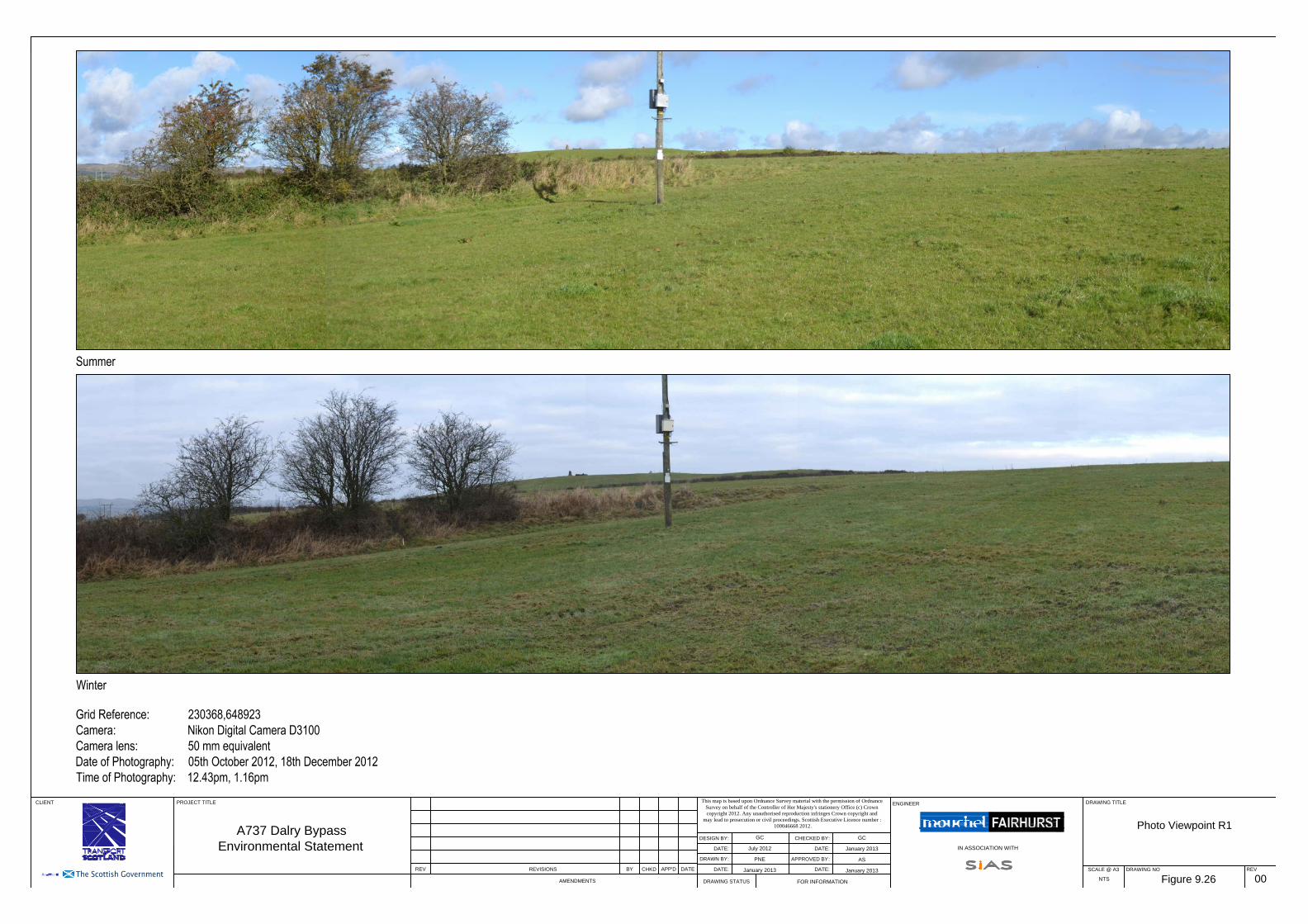
00Figure 9.28
NTS
Photo Viewpoint S
IN ASSOCIATION WITH
REV
DRAWING TITLE
SCALE @ A3 DRAWING NO
ENGINEER
CHECKED BY:
APPROVED BY:
DATE:
DATE:DATE
DESIGN BY:
DATE:
DRAWN BY:
DATE:BY CHKDREVISIONS
AMENDMENTS
REV
CLIENT PROJECT TITLE
APP'D
This map is based upon Ordnance Survey material with the permission of OrdnanceSurvey on behalf of the Controller of Her Majesty's stationery Office (c) Crowncopyright 2012. Any unauthorised reproduction infringes Crown copyright and
may lead to prosecution or civil proceedings. Scottish Executive Licence number :100046668 2012.
A737 Dalry Bypass
Environmental Statement
DRAWING STATUS

GC
June 2012
PNE
January 2013January 2013
AS
January 2013
GC
FOR INFORMATION
00Figure 9.29
NTS
Photo Viewpoint T
IN ASSOCIATION WITH
REV
DRAWING TITLE
SCALE @ A3 DRAWING NO
ENGINEER
CHECKED BY:
APPROVED BY:
DATE:
DATE:DATE
DESIGN BY:
DATE:
DRAWN BY:
DATE:BY CHKDREVISIONS
AMENDMENTS
REV
CLIENT PROJECT TITLE
APP'D
This map is based upon Ordnance Survey material with the permission of OrdnanceSurvey on behalf of the Controller of Her Majesty's stationery Office (c) Crowncopyright 2012. Any unauthorised reproduction infringes Crown copyright and
may lead to prosecution or civil proceedings. Scottish Executive Licence number :100046668 2012.
A737 Dalry Bypass
Environmental Statement
DRAWING STATUS

GC
July 2012
PNE
January 2013January 2013
AS
January 2013
GC
FOR INFORMATION
00Figure 9.30
NTS
Photo Viewpoint U
IN ASSOCIATION WITH
REV
DRAWING TITLE
SCALE @ A3 DRAWING NO
ENGINEER
CHECKED BY:
APPROVED BY:
DATE:
DATE:DATE
DESIGN BY:
DATE:
DRAWN BY:
DATE:BY CHKDREVISIONS
AMENDMENTS
REV
CLIENT PROJECT TITLE
APP'D
This map is based upon Ordnance Survey material with the permission of OrdnanceSurvey on behalf of the Controller of Her Majesty's stationery Office (c) Crowncopyright 2012. Any unauthorised reproduction infringes Crown copyright and
may lead to prosecution or civil proceedings. Scottish Executive Licence number :100046668 2012.
A737 Dalry Bypass
Environmental Statement
DRAWING STATUS

GC
January 2013
SDR
January 2013January 2013
AS
January 2013
GC
FOR INFORMATION
00Figure 9.31
NTS
Photomontage 1
Grid Reference: 230999,650284
Viewpoint elevation: 71.6 mAOD
Camera: Nikon Digital Camera D3100
Camera lens: 50 mm equivalent
Number of Frames: 2
Existing Photograph
Proposed Photomontage
Date of Photography: 25th October 2012
Time of Photography: 10.30am
Horizontal angle of view: 82 degrees (cylindrical)
Vertical Crop: 20%
Viewing Distance: 25cm
IN ASSOCIATION WITH
REV
DRAWING TITLE
SCALE @ A3 DRAWING NO
ENGINEER
CHECKED BY:
APPROVED BY:
DATE:
DATE:DATE
DESIGN BY:
DATE:
DRAWN BY:
DATE:BY CHKDREVISIONS
AMENDMENTS
REV
CLIENT PROJECT TITLE
APP'D
This map is based upon Ordnance Survey material with the permission of OrdnanceSurvey on behalf of the Controller of Her Majesty's stationery Office (c) Crowncopyright 2012. Any unauthorised reproduction infringes Crown copyright and
may lead to prosecution or civil proceedings. Scottish Executive Licence number :100046668 2012.
A737 Dalry Bypass
Environmental Statement
DRAWING STATUS

GC
January 2013
SDR
January 2013January 2013
AS
January 2013
GC
FOR INFORMATION
02Figure 9.32
NTS
Photomontage 2
Grid Reference: 229981,648704
Viewpoint elevation: 46.1 mAOD
Camera: Nikon Digital Camera D3100
Camera lens: 50 mm equivalent
Number of Frames: 2
Existing Photograph
Proposed Photomontage
Date of Photography: 04th October 2012
Time of Photography: 4.49pm
Horizontal angle of view: 82 degrees (cylindrical)
Vertical Crop: 20%
Viewing Distance: 25cm
IN ASSOCIATION WITH
REV
DRAWING TITLE
SCALE @ A3 DRAWING NO
ENGINEER
CHECKED BY:
APPROVED BY:
DATE:
DATE:DATE
DESIGN BY:
DATE:
DRAWN BY:
DATE:BY CHKDREVISIONS
AMENDMENTS
REV
CLIENT PROJECT TITLE
APP'D
This map is based upon Ordnance Survey material with the permission of OrdnanceSurvey on behalf of the Controller of Her Majesty's stationery Office (c) Crowncopyright 2012. Any unauthorised reproduction infringes Crown copyright and
may lead to prosecution or civil proceedings. Scottish Executive Licence number :100046668 2012.
A737 Dalry Bypass
Environmental Statement
DRAWING STATUS
01 Revised following revised road alignment, culvert added and further mitigation. SDR AS AS
02 Minor revisions. SDR SWG SWG