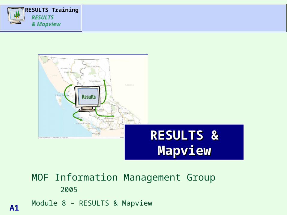
A1 Agenda RESULTS Training RESULTS & Mapview RESULTS & Mapview MOF Information Management Group 2005...
41
RESULTS Training RESULTS & Mapview A1 Agenda Agenda RESULTS & RESULTS & Mapview Mapview MOF Information Management Group 2005 Module 8 – RESULTS & Mapview
-
Upload
adela-roberts -
Category
Documents
-
view
223 -
download
1
Transcript of A1 Agenda RESULTS Training RESULTS & Mapview RESULTS & Mapview MOF Information Management Group 2005...
RESULTS TrainingRESULTS & Mapview
A1
AgendaAgenda
RESULTS & RESULTS & MapviewMapview
MOF Information Management Group 2005
Module 8 – RESULTS & Mapview
RESULTS TrainingRESULTS & Mapview
A2
AgendaAgenda
What we will cover:
Overview presentation
RESULTS - Show me the maps?
Where is the link to Mapview?
What can I do in Mapview?
CRS query work and where we are headed to tie to Mapview
Questions and Answers
Training AgendaTraining Agenda
RESULTS TrainingRESULTS & Mapview
A3
AgendaAgendaLearning ObjectivesLearning Objectives
• Know where maps are stored in RESULTS
• Know the differences between RESULTS rendered map versus GML in LRDW viewed via Mapview
• Understand what ROSC is and its significance to spatial outputs interpretations in Mapview
• Have an understanding on how to work some basic features in Mapview
RESULTS TrainingRESULTS & Mapview
A4
AgendaAgendaDirection for Mandatory ESFDirection for Mandatory ESF
Memo on mandatory electronic data submission signed by Tim Sheldan, Assistant Deputy Minister, dated March 14, 2005
“The Executive has endorsed the following recommendation:
1. For private land where Crown has reservation on the timber, non-major applications of forestry licences to cut, and range tenures, ESF will continue to be done internally by Ministry unless the tenure applicants choose to do it themselves.
2. For all other tenure, ESF should be done by licensees starting
June 1, 2005.”

RESULTS TrainingRESULTS & Mapview
A5
AgendaAgenda
Licensees e-CommerceSubmits XML (text) and GML (map) Schema
MSRM/MOF Electronic Submission FrameworkInfrastructure validates information based on(automated process) schema and mapping standards
ESF FrameworkAccepts or Rejects submission
Goes into RESULTS and Rejection notice sent back Land Resource to licenseesData Warehouse with confirmation of successful submission
RESULTS Data FlowRESULTS Data Flow
RESULTS TrainingRESULTS & Mapview
A6
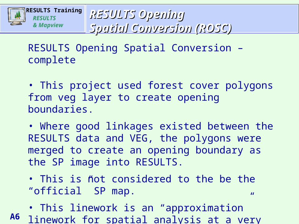
AgendaAgendaRESULTS Opening RESULTS Opening Spatial Conversion (ROSC)Spatial Conversion (ROSC)
RESULTS Opening Spatial Conversion – complete
• This project used forest cover polygons from veg layer to create opening boundaries.
• Where good linkages existed between the RESULTS data and VEG, the polygons were merged to create an opening boundary as the SP image into RESULTS.
• This is not considered to the be the “official” SP map.
• This linework is an “approximation” linework for spatial analysis at a very rudimentary level.
• ROSC had 58% success rate - converted 108,500 of 186,000 openings

RESULTS TrainingRESULTS & Mapview
A7
AgendaAgendaRESULTS Opening RESULTS Opening Spatial Conversion (ROSC)Spatial Conversion (ROSC)
RESULTS 186,000 openings
ROSC created RESULTS opening boundaries for 102,000 openings
Licensee ESF Submissions
Licensee ESF Submissions
ROSC created linework 58% of existing in RESULTS.
As Licensees start submitting their data via ESF, this will either: - provide better updates for existing openings. - provide linework for all new openings.
Therefore RESULTS textual data will always be the most complete.Through time, RESULTS spatial data will become more complete.
RESULTS TrainingRESULTS & Mapview
A8
AgendaAgenda One-way StreetOne-way Street
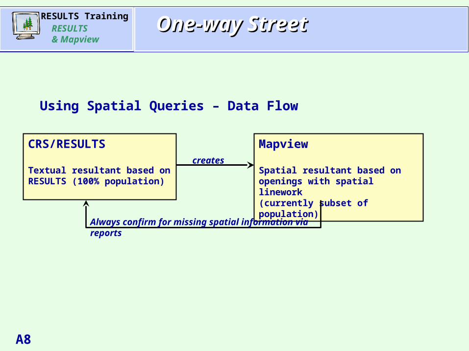
Using Spatial Queries – Data Flow
CRS/RESULTS
Textual resultant based on RESULTS (100% population)
Mapview
Spatial resultant based on openings with spatial linework (currently subset of population)
creates
Always confirm for missing spatial information via reports
RESULTS TrainingRESULTS & Mapview
A9
AgendaAgenda RESULTS vs LRDWRESULTS vs LRDW
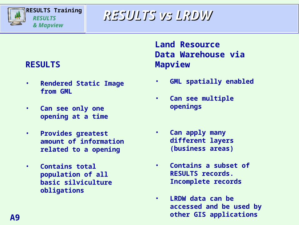
RESULTS
• Rendered Static Image from GML
• Can see only one opening at a time
• Provides greatest amount of information related to a opening
• Contains total population of all basic silviculture obligations
Land ResourceData Warehouse viaMapview
• GML spatially enabled
• Can see multiple openings
• Can apply many different layers (business areas)
• Contains a subset of RESULTS records. Incomplete records
• LRDW data can be accessed and be used by other GIS applications
RESULTS TrainingRESULTS & Mapview
A10
AgendaAgenda Differences in Mapping ToolsDifferences in Mapping Tools
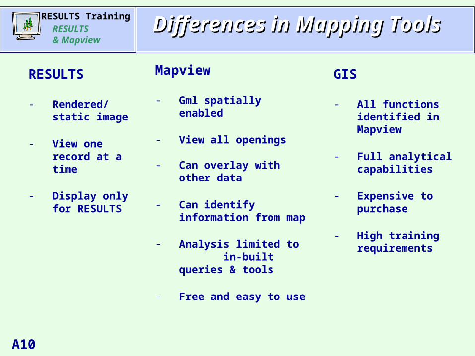
RESULTS
- Rendered/static image
- View one record at a time
- Display only for RESULTS
Mapview
- Gml spatially enabled
- View all openings
- Can overlay with other data
- Can identify information from map
- Analysis limited to in-built queries & tools
- Free and easy to use
GIS
- All functions identified in Mapview
- Full analytical capabilities
- Expensive to purchase
- High training requirements
RESULTS TrainingRESULTS & Mapview
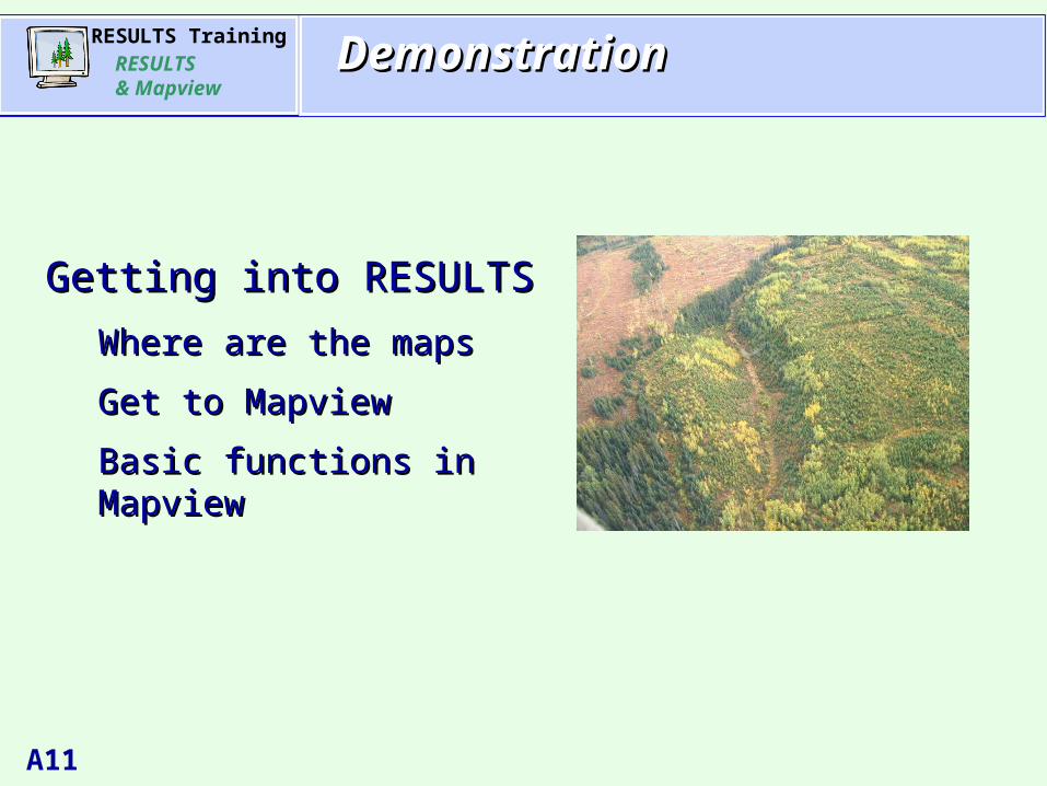
A11
AgendaAgenda
Getting into RESULTSGetting into RESULTS
Where are the maps Where are the maps
Get to MapviewGet to Mapview
Basic functions in MapviewBasic functions in Mapview
DemonstrationDemonstration

RESULTS TrainingRESULTS & Mapview
A12
AgendaAgenda1-SP Map (ROSC)1-SP Map (ROSC)
RESULTS TrainingRESULTS & Mapview
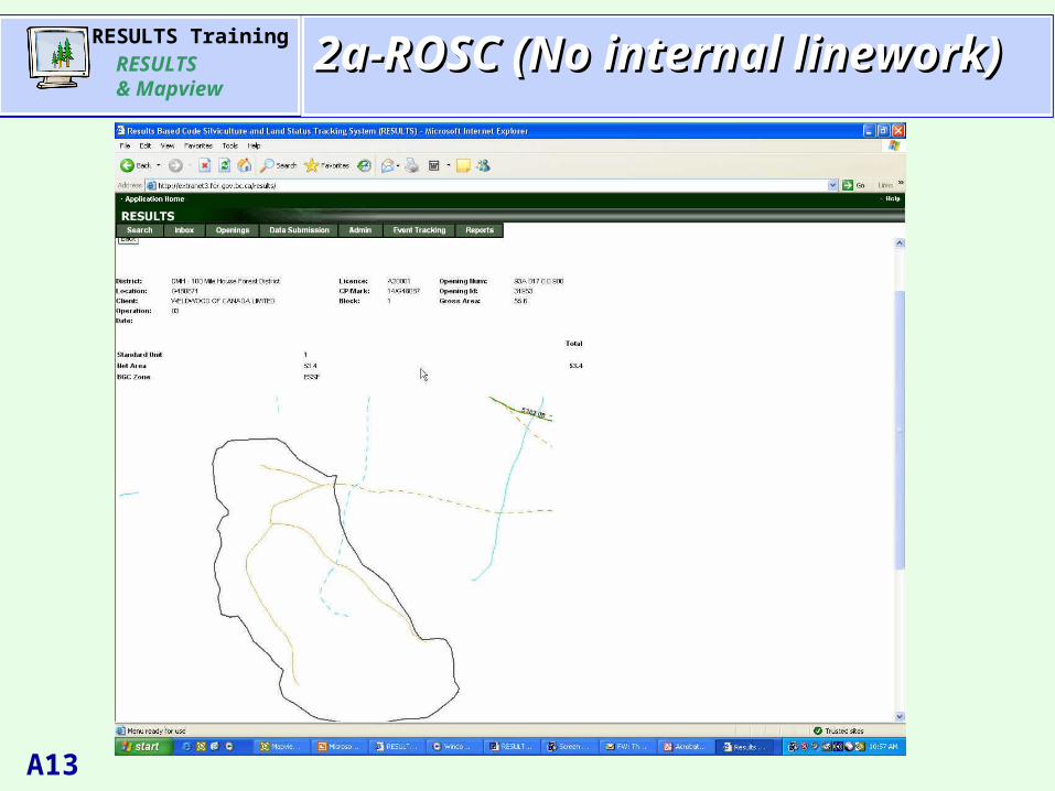
A13
AgendaAgenda2a-ROSC (No internal linework)2a-ROSC (No internal linework)

RESULTS TrainingRESULTS & Mapview
A14
AgendaAgenda2b-Openings with NO ROSC2b-Openings with NO ROSC
Only 58% Openings have ROSC converted opening linework.
The remaining 42% will have no image available in the SP Map image unless there is subsequent submission by licensees.
RESULTS TrainingRESULTS & Mapview
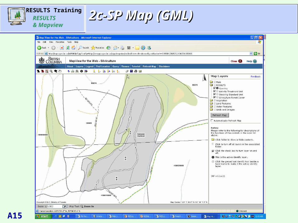
A15
AgendaAgenda2c-SP Map (GML)2c-SP Map (GML)
RESULTS TrainingRESULTS & Mapview
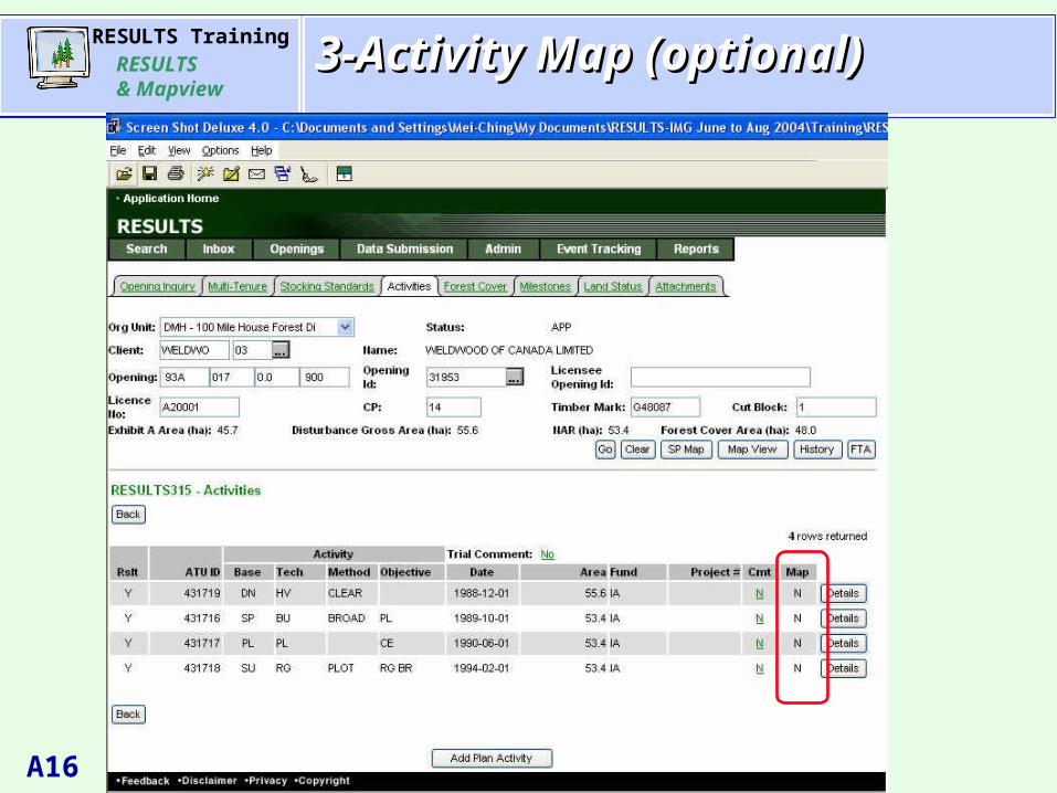
A16
AgendaAgenda3-Activity Map (optional)3-Activity Map (optional)
RESULTS TrainingRESULTS & Mapview
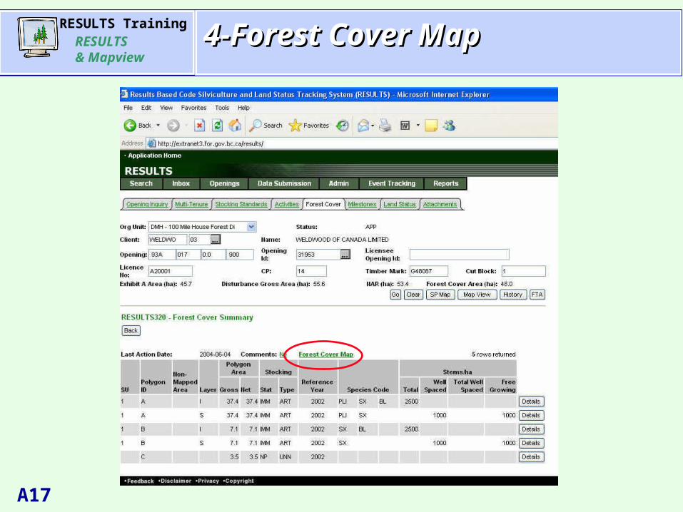
A17
AgendaAgenda4-Forest Cover Map4-Forest Cover Map

RESULTS TrainingRESULTS & Mapview
A18
AgendaAgenda5-Forest Cover Map via gml5-Forest Cover Map via gml
RESULTS TrainingRESULTS & Mapview
A19
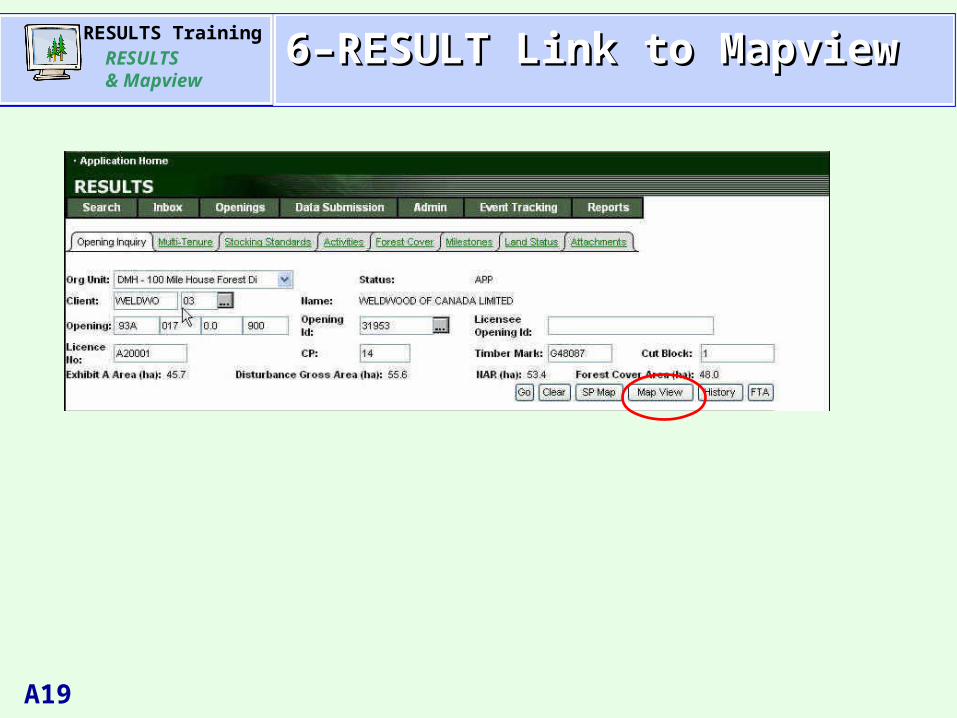
AgendaAgenda6–RESULT Link to Mapview 6–RESULT Link to Mapview
RESULTS TrainingRESULTS & Mapview
A20
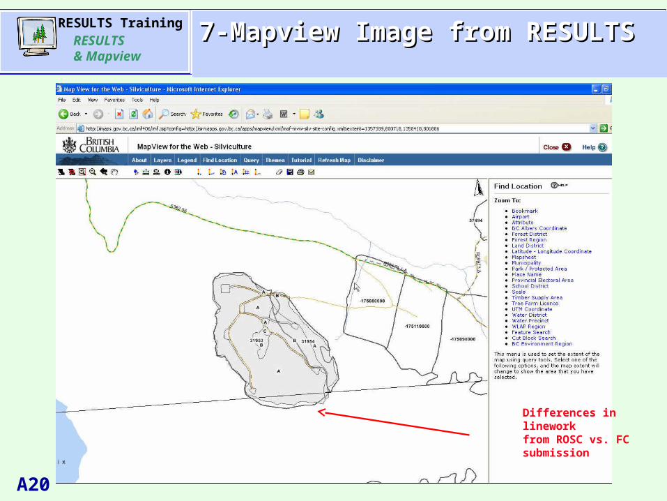
AgendaAgenda7-Mapview Image from RESULTS7-Mapview Image from RESULTS
Differences in lineworkfrom ROSC vs. FC submission
RESULTS TrainingRESULTS & Mapview
A21
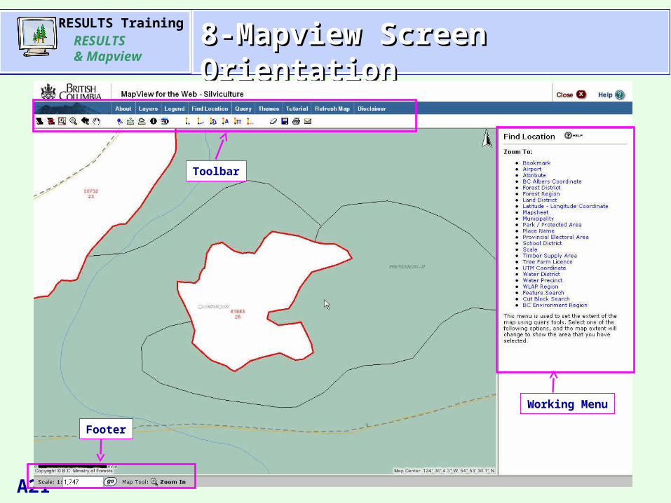
AgendaAgenda8-Mapview Screen Orientation8-Mapview Screen Orientation
Toolbar
Working Menu
Footer
RESULTS TrainingRESULTS & Mapview
A22
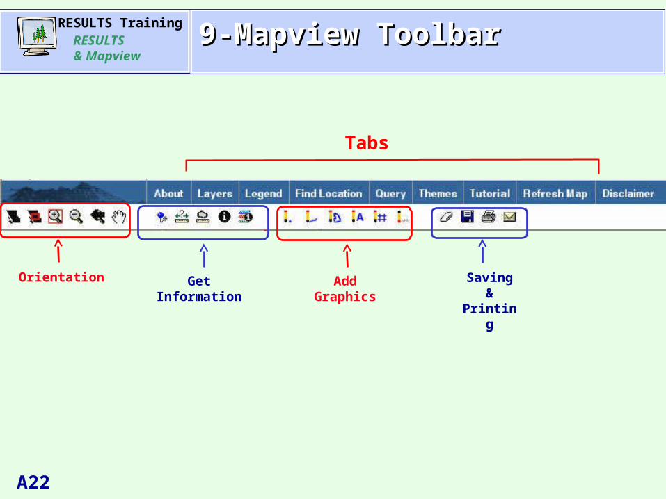
AgendaAgenda9-Mapview Toolbar9-Mapview Toolbar
Tabs
Orientation AddGraphics
GetInformation
Saving &Printing
RESULTS TrainingRESULTS & Mapview
A23
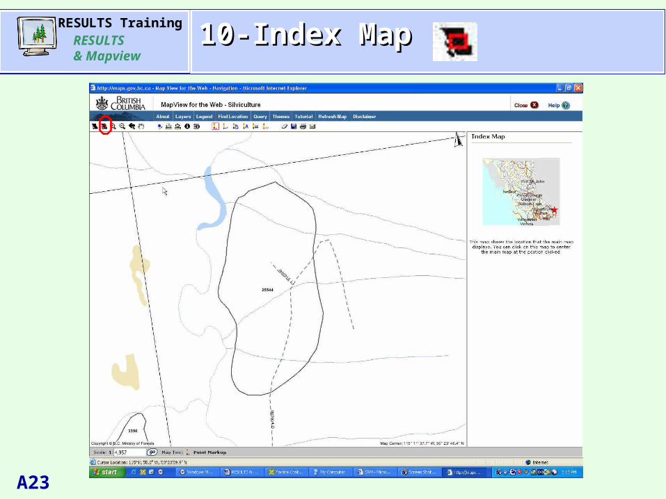
AgendaAgenda10-Index Map10-Index Map
RESULTS TrainingRESULTS & Mapview
A24
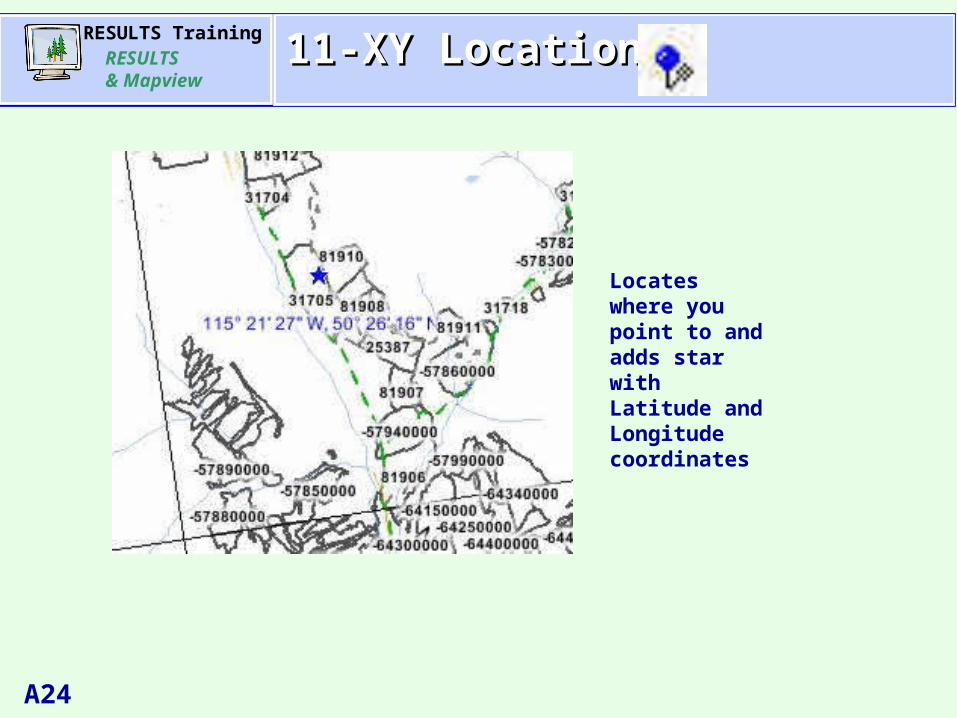
AgendaAgenda11-XY Location11-XY Location
Locates where you point to and adds star with Latitude and Longitude coordinates
RESULTS TrainingRESULTS & Mapview
A25
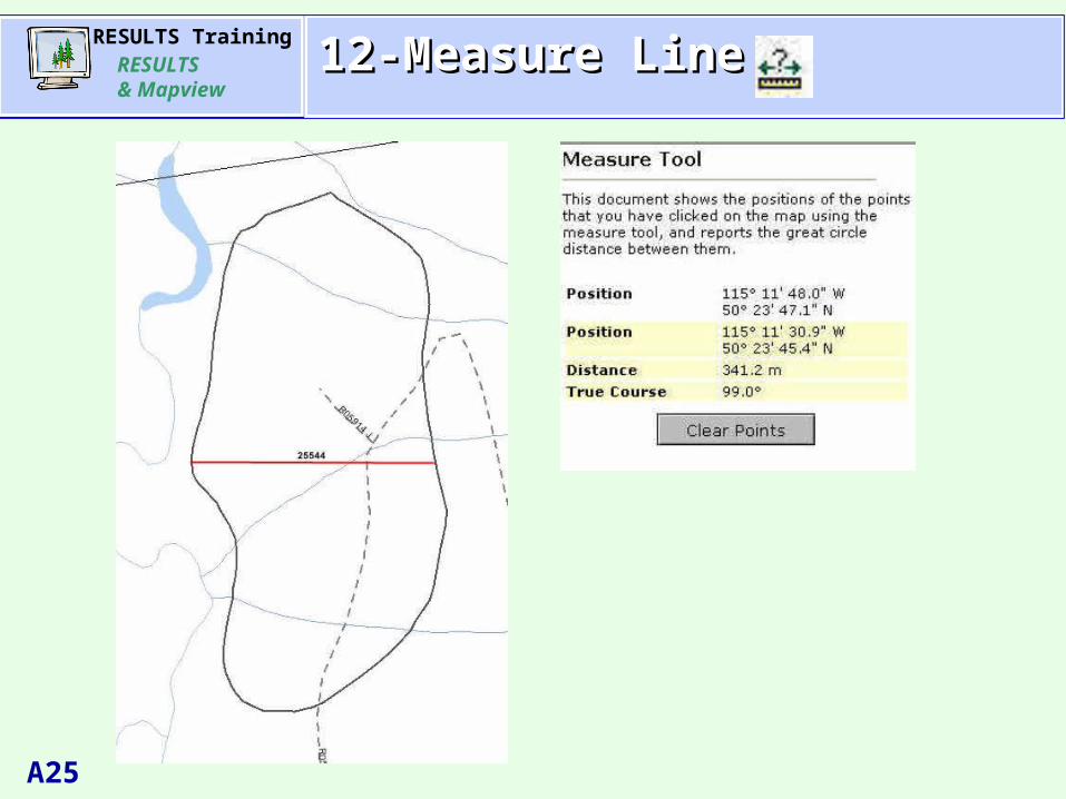
AgendaAgenda12-Measure Line12-Measure Line
RESULTS TrainingRESULTS & Mapview
A26
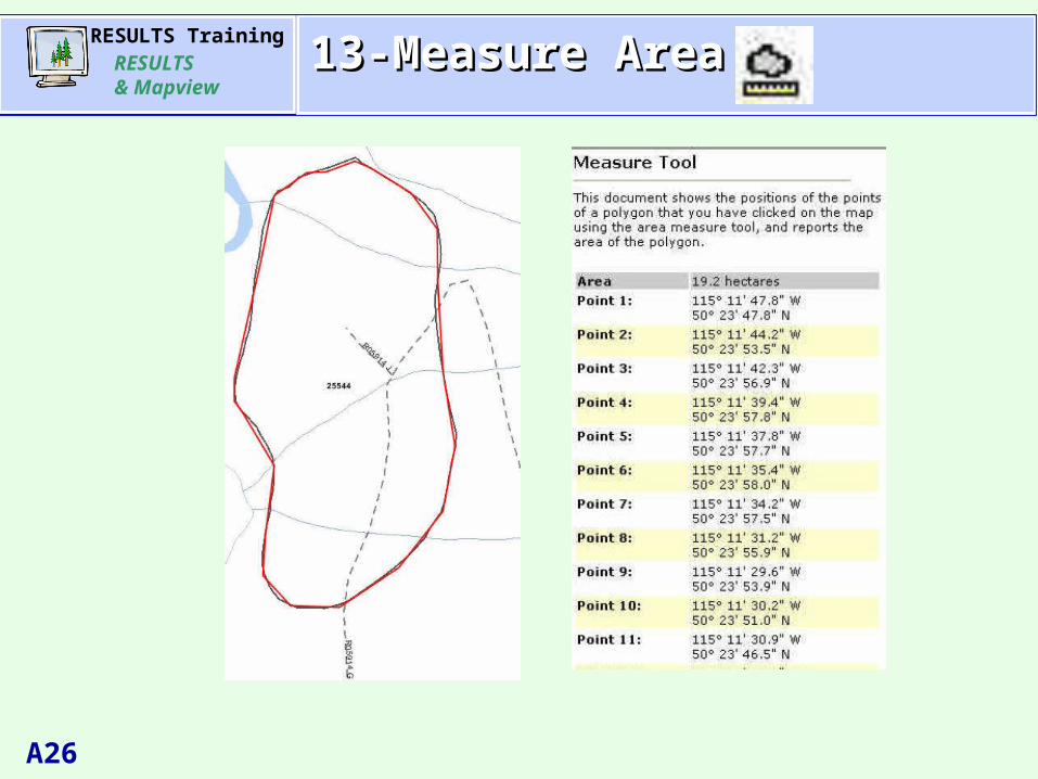
AgendaAgenda13-Measure Area13-Measure Area
RESULTS TrainingRESULTS & Mapview
A27
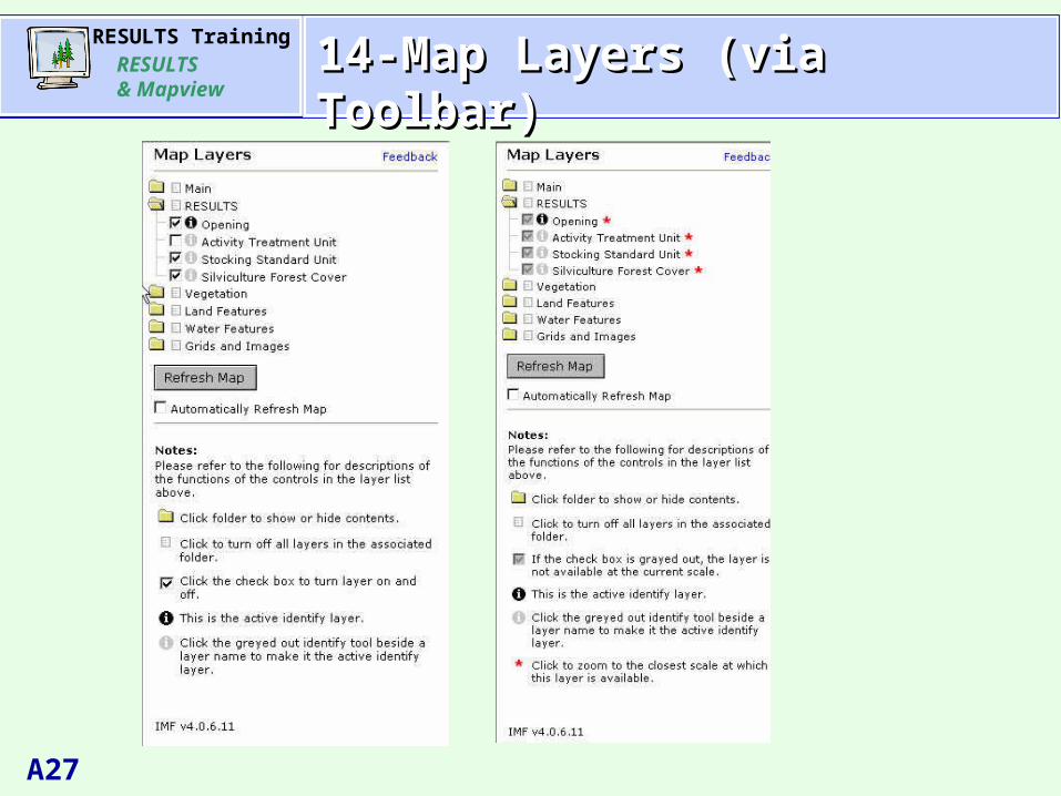
AgendaAgenda14-Map Layers (via Toolbar)14-Map Layers (via Toolbar)
RESULTS TrainingRESULTS & Mapview
A28
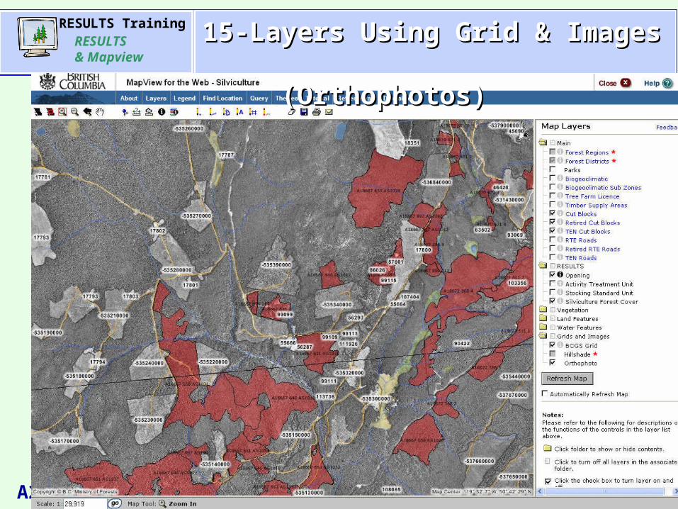
AgendaAgenda15-Layers Using Grid & Images 15-Layers Using Grid & Images (Orthophotos) (Orthophotos)
RESULTS TrainingRESULTS & Mapview
A29
AgendaAgenda
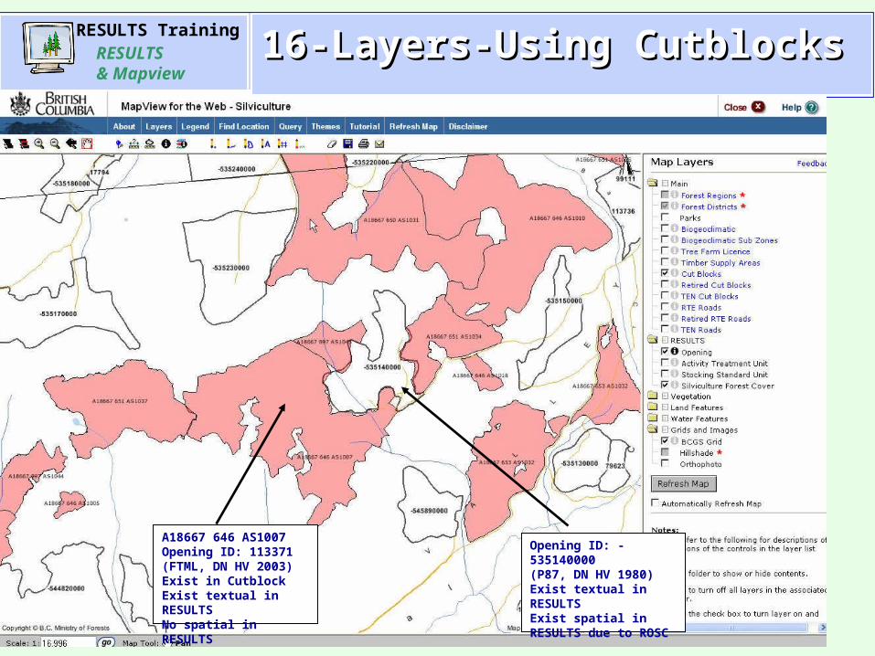
A18667 646 AS1007Opening ID: 113371(FTML, DN HV 2003)Exist in CutblockExist textual in RESULTSNo spatial in RESULTS
Opening ID: -535140000(P87, DN HV 1980)Exist textual in RESULTSExist spatial in RESULTS due to ROSC
16-Layers-Using Cutblocks16-Layers-Using Cutblocks
RESULTS TrainingRESULTS & Mapview
A30
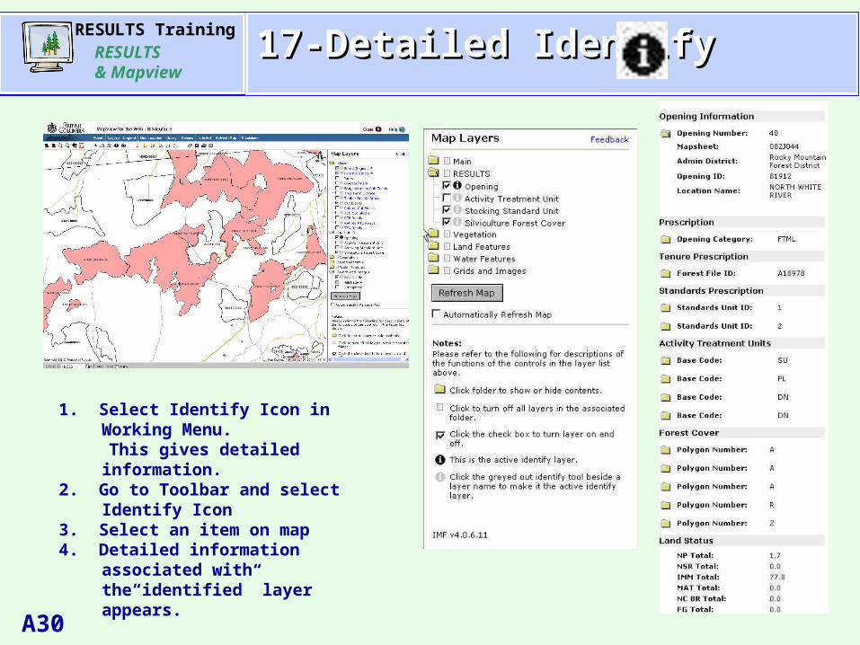
AgendaAgenda17-Detailed Identify17-Detailed Identify
1. Select Identify Icon in Working Menu. This gives detailed information.2. Go to Toolbar and select Identify Icon3. Select an item on map4. Detailed information associated with
the“identified” layer appears.
RESULTS TrainingRESULTS & Mapview
A31
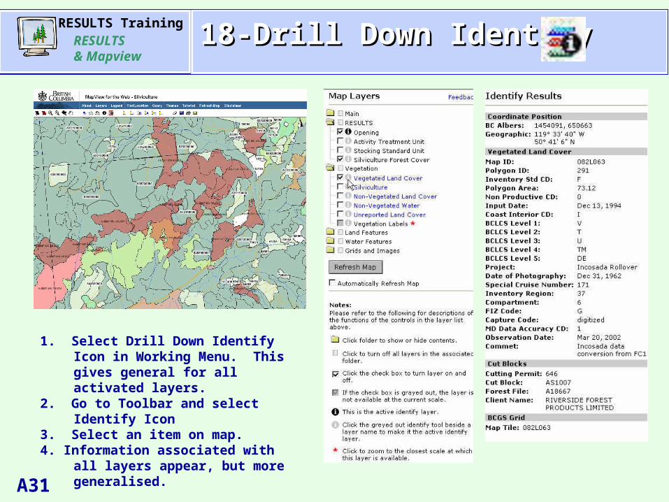
AgendaAgenda18-Drill Down Identify18-Drill Down Identify
1. Select Drill Down Identify Icon in Working Menu. This gives general for all activated layers.
2. Go to Toolbar and select Identify Icon3. Select an item on map.4. Information associated with all layers
appear, but more generalised.

RESULTS TrainingRESULTS & Mapview
A32
AgendaAgenda19-Saving Your Work19-Saving Your Work
Session information is saved on the Mapview server and is removed if not used after 90 days.

RESULTS TrainingRESULTS & Mapview
A33
AgendaAgenda20-Printing & Sending your Work20-Printing & Sending your Work
RESULTS TrainingRESULTS & Mapview
A34
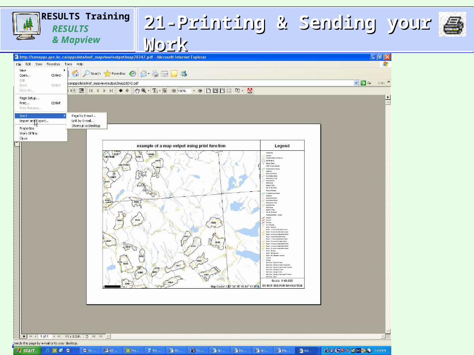
AgendaAgenda21-Printing & Sending your Work21-Printing & Sending your Work
RESULTS TrainingRESULTS & Mapview
A35
AgendaAgenda
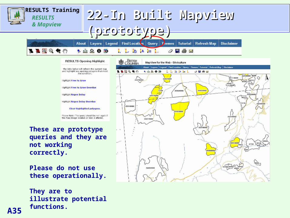
These are prototype queries and they are not working correctly.
Please do not use these operationally.
They are to illustrate potential functions.
22-In Built Mapview (prototype)22-In Built Mapview (prototype)
RESULTS TrainingRESULTS & Mapview
A36
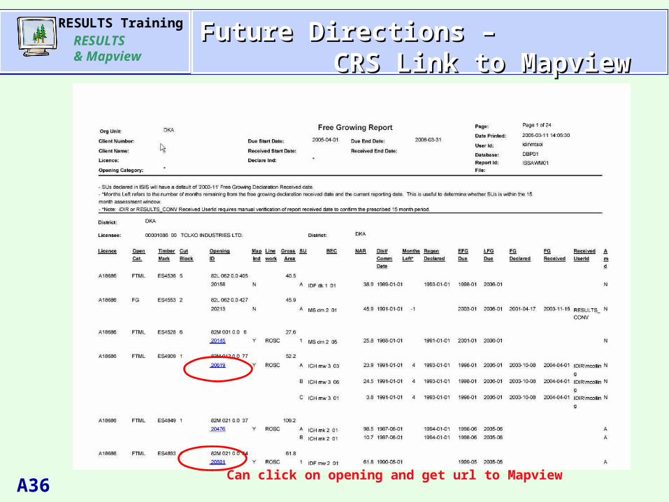
AgendaAgenda
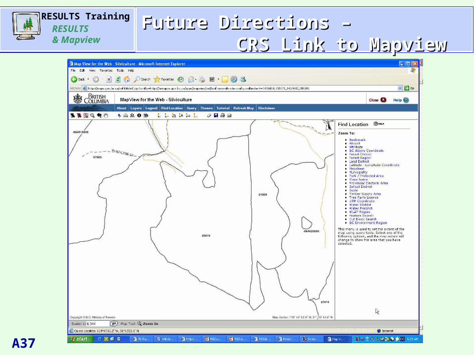
Can click on opening and get url to Mapview
Future Directions – Future Directions – CRS Link to MapviewCRS Link to Mapview
RESULTS TrainingRESULTS & Mapview
A37
AgendaAgendaFuture Directions – Future Directions – CRS Link to MapviewCRS Link to Mapview
RESULTS TrainingRESULTS & Mapview
A38
AgendaAgenda
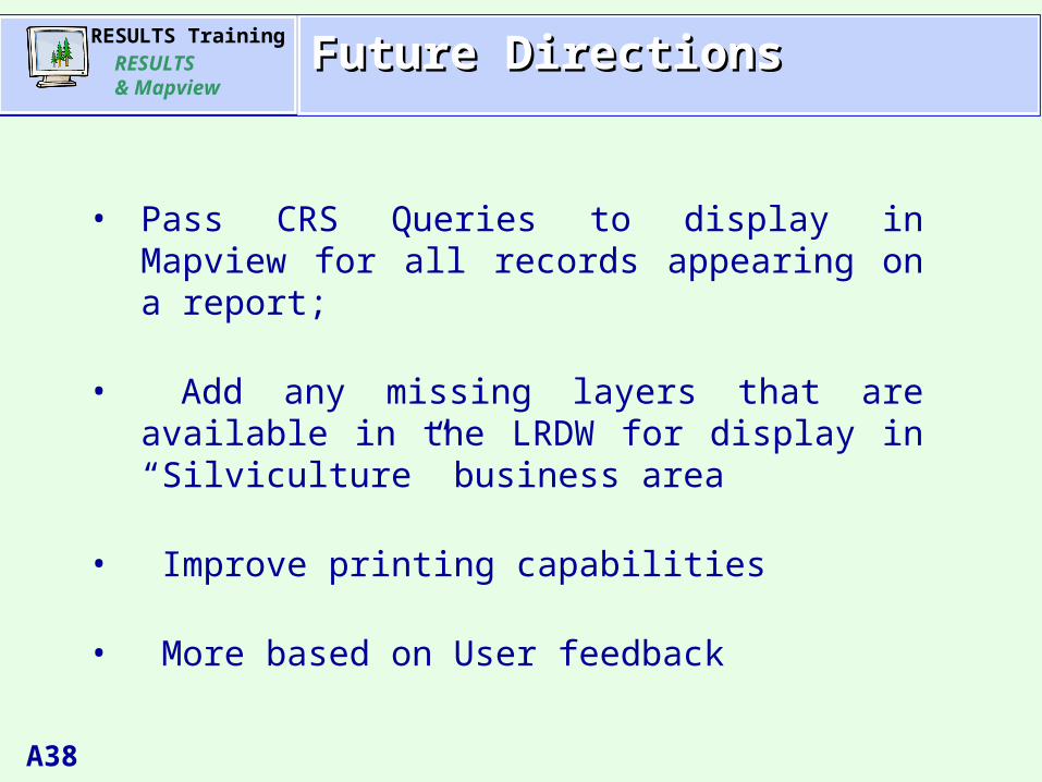
• Pass CRS Queries to display in Mapview for all records appearing on a report;
• Add any missing layers that are available in the LRDW for display in “Silviculture” business area
• Improve printing capabilities
• More based on User feedback
Future DirectionsFuture Directions
RESULTS TrainingRESULTS & Mapview
A39
AgendaAgendaResourcesResources
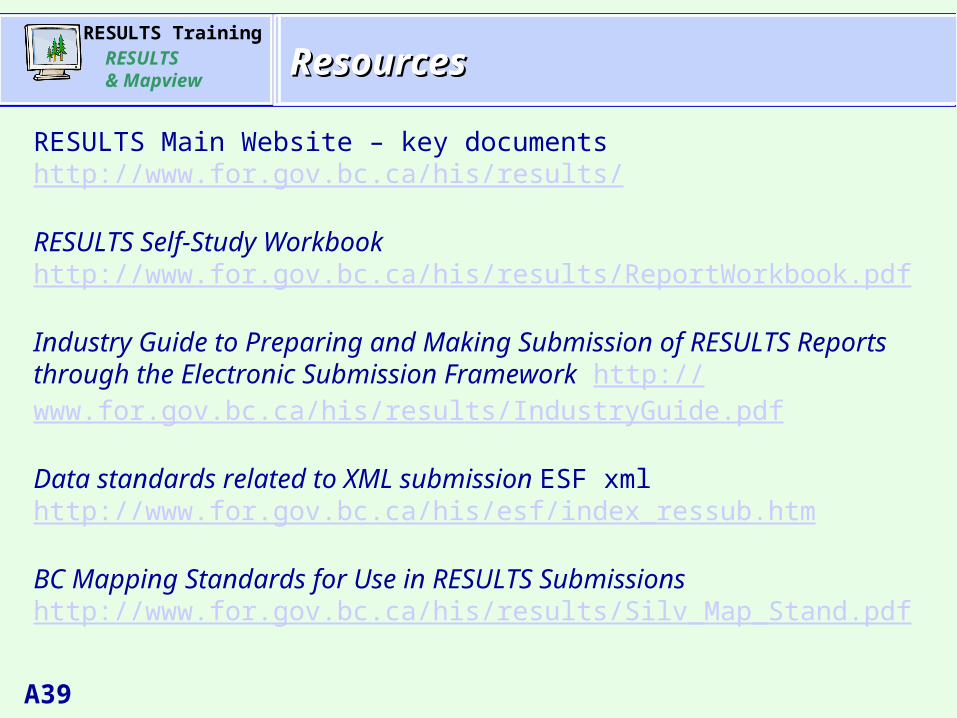
RESULTS Main Website – key documentshttp://www.for.gov.bc.ca/his/results/
RESULTS Self-Study Workbookhttp://www.for.gov.bc.ca/his/results/ReportWorkbook.pdf
Industry Guide to Preparing and Making Submission of RESULTS Reports through the Electronic Submission Framework http://www.for.gov.bc.ca/his/results/IndustryGuide.pdf
Data standards related to XML submission ESF xml http://www.for.gov.bc.ca/his/esf/index_ressub.htm
BC Mapping Standards for Use in RESULTS Submissionshttp://www.for.gov.bc.ca/his/results/Silv_Map_Stand.pdf

RESULTS TrainingRESULTS & Mapview
A40
AgendaAgenda Where to find HELP?Where to find HELP?
Handout provided for this session
On-line Help Menu via RESULTS or Mapview Toolbar Tutorial
Self-Study Reporting Workbook
Business Application SupportVia phone: 250-387-8888;Via e-mail to :
In gov’t: APPHELP Outside gov’t: [email protected]
RESULTS TrainingRESULTS & Mapview
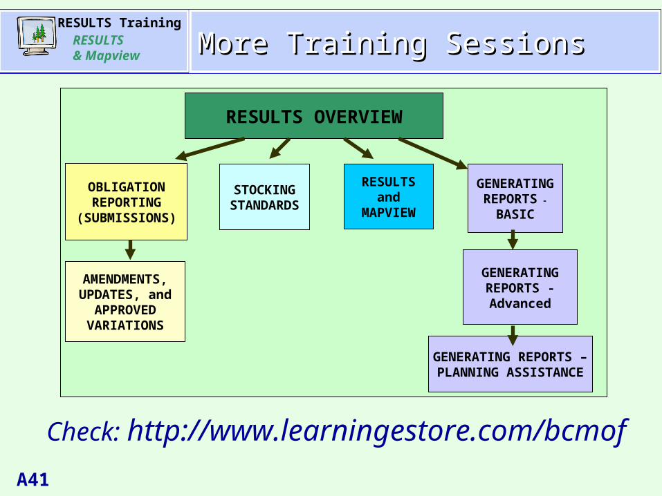
A41
AgendaAgenda
Check: http://www.learningestore.com/bcmof
More Training SessionsMore Training Sessions
RESULTS OVERVIEW
OBLIGATION REPORTING
(SUBMISSIONS)
AMENDMENTS, UPDATES, and
APPROVED VARIATIONS
STOCKING STANDARDS
RESULTS and
MAPVIEW
GENERATING REPORTS -
BASIC
GENERATING REPORTS - Advanced
GENERATING REPORTS – PLANNING ASSISTANCE