A Visitor's Guide to Emerald City Welcome.pdf
10
A Production of the Emerald City Tourism Board A Visitor’s Guide to Emerald City
-
Upload
czar-santos -
Category
Documents
-
view
507 -
download
5
description
Emerald City is a new setting for Mutants & Masterminds Third Edition and is designed to be the perfect place for new characters to establish themselves as heroes of the city. The set of books includes the Player's Guide to Emerald City (for players), Secrets of Emerald City and the Emerald City Knights adventure series (for GMs), and a giant map of Emerald City, all in a slipcase. Everything you need to start a new series with your friends.
Transcript of A Visitor's Guide to Emerald City Welcome.pdf
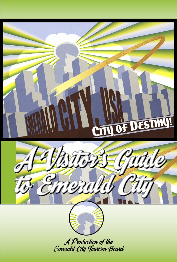
A Production of the Emerald City Tourism Board
A Visitor’s Guide to Emerald City
INTRODUCTIONINTRODUCTION
Emerald City, USAThe City of DestinyEmerald City, USA
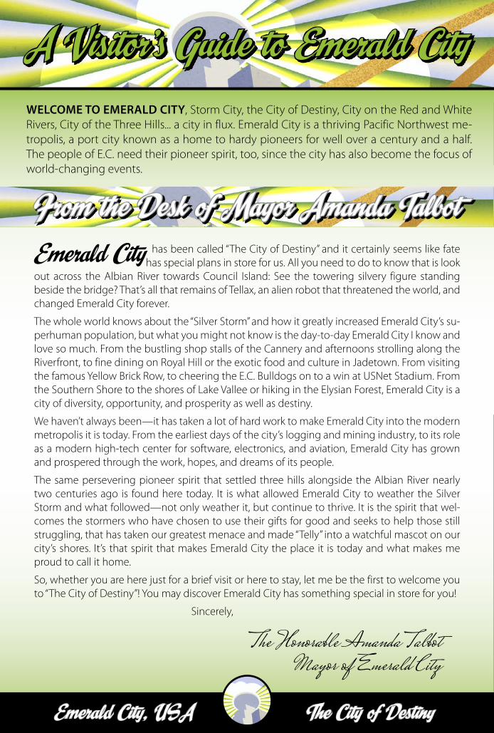
A Visitor’s Guide to Emerald CityWELCOME TO EMERALD CITY, Storm City, the City of Destiny, City on the Red and White Rivers, City of the Three Hills... a city in flux. Emerald City is a thriving Pacific Northwest me-tropolis, a port city known as a home to hardy pioneers for well over a century and a half. The people of E.C. need their pioneer spirit, too, since the city has also become the focus of world-changing events.
Emerald City has been called “The City of Destiny” and it certainly seems like fate has special plans in store for us. All you need to do to know that is look
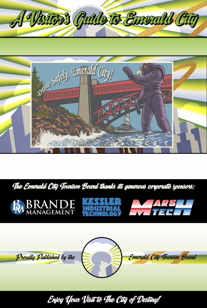
out across the Albian River towards Council Island: See the towering silvery figure standing beside the bridge? That’s all that remains of Tellax, an alien robot that threatened the world, and changed Emerald City forever.
The whole world knows about the “Silver Storm” and how it greatly increased Emerald City’s su-perhuman population, but what you might not know is the day-to-day Emerald City I know and love so much. From the bustling shop stalls of the Cannery and afternoons strolling along the Riverfront, to fine dining on Royal Hill or the exotic food and culture in Jadetown. From visiting the famous Yellow Brick Row, to cheering the E.C. Bulldogs on to a win at USNet Stadium. From the Southern Shore to the shores of Lake Vallee or hiking in the Elysian Forest, Emerald City is a city of diversity, opportunity, and prosperity as well as destiny.
We haven’t always been—it has taken a lot of hard work to make Emerald City into the modern metropolis it is today. From the earliest days of the city’s logging and mining industry, to its role as a modern high-tech center for software, electronics, and aviation, Emerald City has grown and prospered through the work, hopes, and dreams of its people.
The same persevering pioneer spirit that settled three hills alongside the Albian River nearly two centuries ago is found here today. It is what allowed Emerald City to weather the Silver Storm and what followed—not only weather it, but continue to thrive. It is the spirit that wel-comes the stormers who have chosen to use their gifts for good and seeks to help those still struggling, that has taken our greatest menace and made “Telly” into a watchful mascot on our city’s shores. It’s that spirit that makes Emerald City the place it is today and what makes me proud to call it home.
So, whether you are here just for a brief visit or here to stay, let me be the first to welcome you to “The City of Destiny”! You may discover Emerald City has something special in store for you!
Sincerely,
The Honorable Amanda TalbotMayor of Emerald City
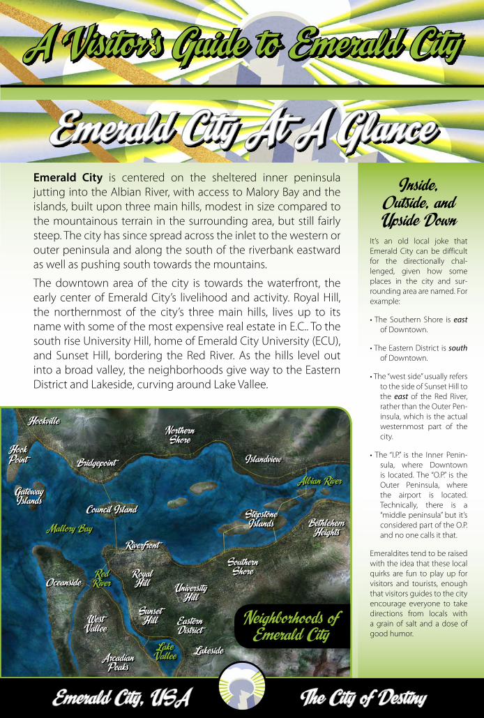
Emerald City At A Glance
From the Desk of Mayor Amanda Talbot
Hook Point
The City of DestinyEmerald City, USA
A Visitor’s Guide to Emerald CityA Visitor’s Guide to Emerald City
Emerald City is centered on the sheltered inner peninsula jutting into the Albian River, with access to Malory Bay and the islands, built upon three main hills, modest in size compared to the mountainous terrain in the surrounding area, but still fairly steep. The city has since spread across the inlet to the western or outer peninsula and along the south of the riverbank eastward as well as pushing south towards the mountains.
The downtown area of the city is towards the waterfront, the early center of Emerald City’s livelihood and activity. Royal Hill, the northernmost of the city’s three main hills, lives up to its name with some of the most expensive real estate in E.C.. To the south rise University Hill, home of Emerald City University (ECU), and Sunset Hill, bordering the Red River. As the hills level out into a broad valley, the neighborhoods give way to the Eastern District and Lakeside, curving around Lake Vallee.
Inside, Outside, and Upside Down
It’s an old local joke that Emerald City can be difficult for the directionally chal-lenged, given how some places in the city and sur-rounding area are named. For example:
• The Southern Shore is east of Downtown.
• The Eastern District is south of Downtown.
• The “west side” usually refers to the side of Sunset Hill to the east of the Red River, rather than the Outer Pen-insula, which is the actual westernmost part of the city.
• The “I.P.” is the Inner Penin-sula, where Downtown is located. The “O.P.” is the Outer Peninsula, where the airport is located. Technically, there is a “middle peninsula” but it’s considered part of the O.P. and no one calls it that.
Emeraldites tend to be raised with the idea that these local quirks are fun to play up for visitors and tourists, enough that visitors guides to the city encourage everyone to take directions from locals with a grain of salt and a dose of good humor.
Emerald City At A Glance
Sunset Hill
University Hill
Royal Hill
Southern Shore
West Vallee
Oceanside
Lakeside
Islandview
Northern Shore
Bridgepoint
Bethlehem Heights
Hookville
Hook Point
Gateway Islands
Riverfront
Council Island Stepstone IslandsMallory Bay
Albian River
Red River
Lake Vallee
Eastern District
Arcadian Peaks
Neighborhoods of Emerald City
Emerald City, USAThe City of DestinyEmerald City, USA
A Visitor’s Guide to Emerald City
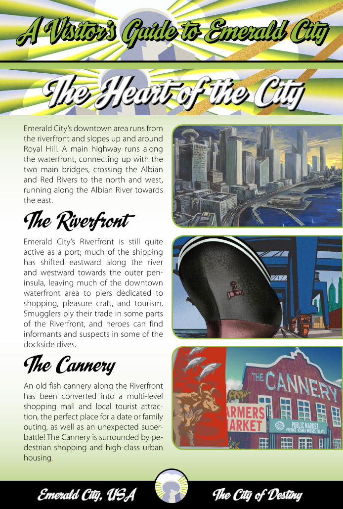
The Heart of the CityEmerald City’s downtown area runs from the riverfront and slopes up and around Royal Hill. A main highway runs along the waterfront, connecting up with the two main bridges, crossing the Albian and Red Rivers to the north and west, running along the Albian River towards the east.
The RiverfrontEmerald City’s Riverfront is still quite active as a port; much of the shipping has shifted eastward along the river and westward towards the outer pen-insula, leaving much of the downtown waterfront area to piers dedicated to shopping, pleasure craft, and tourism. Smugglers ply their trade in some parts of the Riverfront, and heroes can find informants and suspects in some of the dockside dives.
The CanneryAn old fish cannery along the Riverfront has been converted into a multi-level shopping mall and local tourist attrac-tion, the perfect place for a date or family outing, as well as an unexpected super-battle! The Cannery is surrounded by pe-destrian shopping and high-class urban housing.
The City of DestinyEmerald City, USA
A Visitor’s Guide to Emerald CityA Visitor’s Guide to Emerald City
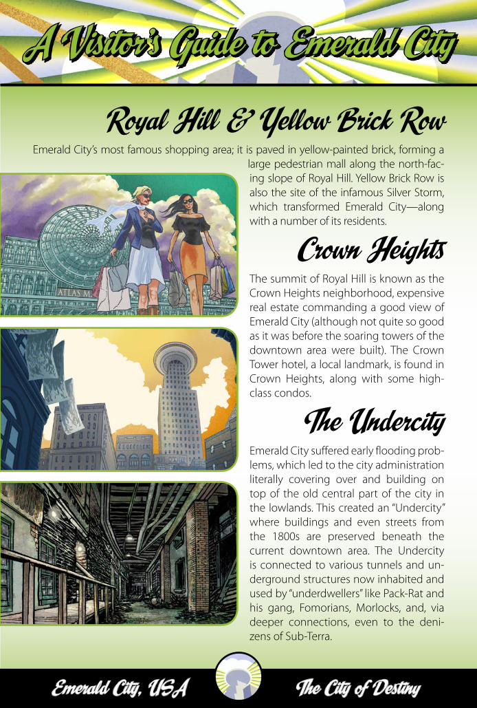
The Heart of the City Royal Hill & Yellow Brick RowEmerald City’s most famous shopping area; it is paved in yellow-painted brick, forming a
large pedestrian mall along the north-fac-ing slope of Royal Hill. Yellow Brick Row is also the site of the infamous Silver Storm, which transformed Emerald City—along with a number of its residents.
Crown HeightsThe summit of Royal Hill is known as the Crown Heights neighborhood, expensive real estate commanding a good view of Emerald City (although not quite so good as it was before the soaring towers of the downtown area were built). The Crown Tower hotel, a local landmark, is found in Crown Heights, along with some high-class condos.
The UndercityEmerald City suffered early flooding prob-lems, which led to the city administration literally covering over and building on top of the old central part of the city in the lowlands. This created an “Undercity” where buildings and even streets from the 1800s are preserved beneath the current downtown area. The Undercity is connected to various tunnels and un-derground structures now inhabited and used by “underdwellers” like Pack-Rat and his gang, Fomorians, Morlocks, and, via deeper connections, even to the deni-zens of Sub-Terra.
Emerald City, USAThe City of DestinyEmerald City, USA
A Visitor’s Guide to Emerald City
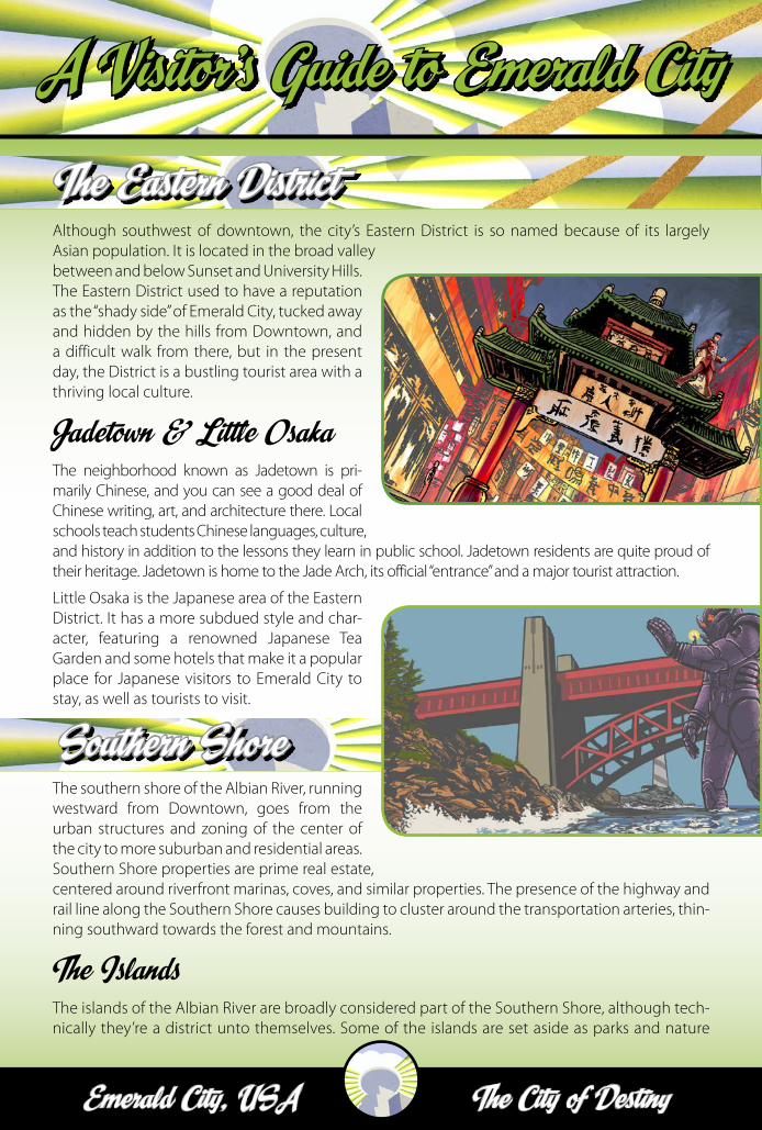
Although southwest of downtown, the city’s Eastern District is so named because of its largely Asian population. It is located in the broad valley between and below Sunset and University Hills. The Eastern District used to have a reputation as the “shady side” of Emerald City, tucked away and hidden by the hills from Downtown, and a difficult walk from there, but in the present day, the District is a bustling tourist area with a thriving local culture.
Jadetown & Little OsakaThe neighborhood known as Jadetown is pri-marily Chinese, and you can see a good deal of Chinese writing, art, and architecture there. Local schools teach students Chinese languages, culture, and history in addition to the lessons they learn in public school. Jadetown residents are quite proud of their heritage. Jadetown is home to the Jade Arch, its official “entrance” and a major tourist attraction.
Little Osaka is the Japanese area of the Eastern District. It has a more subdued style and char-acter, featuring a renowned Japanese Tea Garden and some hotels that make it a popular place for Japanese visitors to Emerald City to stay, as well as tourists to visit.
The southern shore of the Albian River, running westward from Downtown, goes from the urban structures and zoning of the center of the city to more suburban and residential areas. Southern Shore properties are prime real estate, centered around riverfront marinas, coves, and similar properties. The presence of the highway and rail line along the Southern Shore causes building to cluster around the transportation arteries, thin-ning southward towards the forest and mountains.
The IslandsThe islands of the Albian River are broadly considered part of the Southern Shore, although tech-nically they’re a district unto themselves. Some of the islands are set aside as parks and nature
The Eastern District
Southern Shore
The City of DestinyEmerald City, USA
A Visitor’s Guide to Emerald CityA Visitor’s Guide to Emerald City
preserves, while others are inhabited, connected by narrow bridges and ferry service. A home on the Islands is a sure sign of success in the area, as they feature some of the most expensive real estate in Emerald City.
The south- and westernmost of the three hills occupied by Emerald City, Sunset Hill is named for the vista of the sun setting over it, seen from the other (eastern) parts of the city. It was once the site of stately turn-of-the-century homes a reasonable distance from both Crown and Uni-versity Hills, affording residents a degree of privacy. More and more, as the city has expanded, Sunset Hill has become urbanized, and many of those stately homes are now businesses, apart-ments, or condos, although some have been restored to their original condition and remain
private homes.
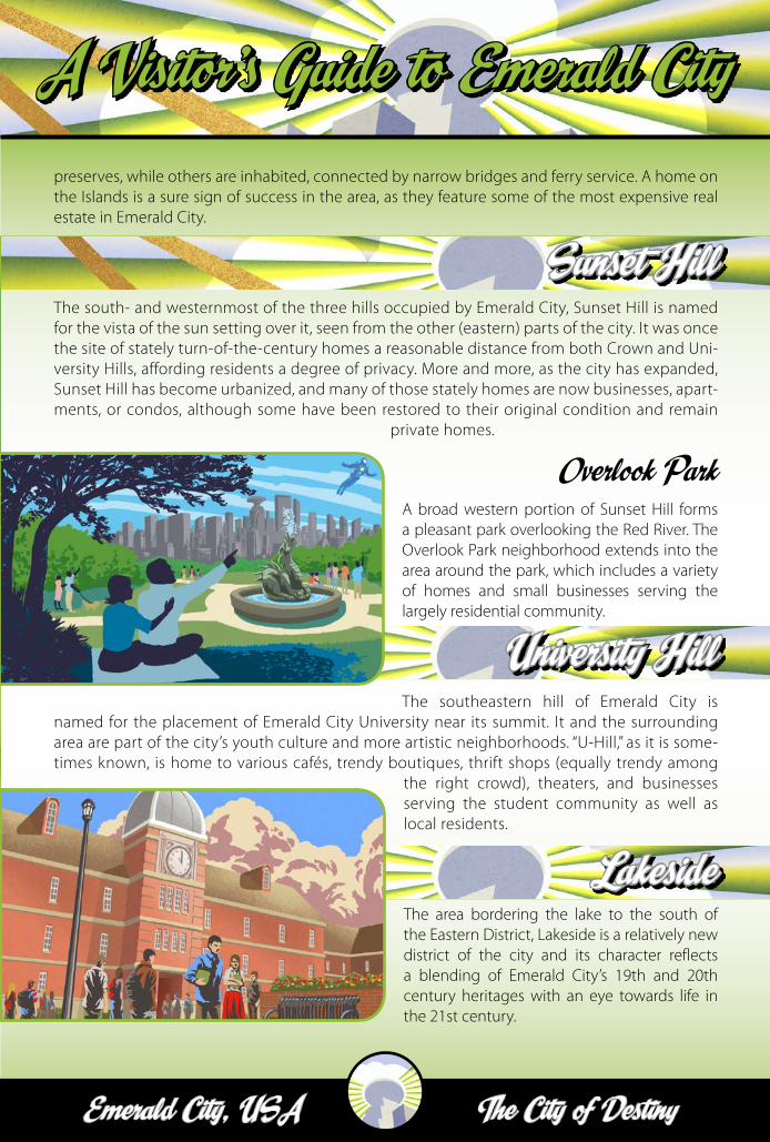
Overlook ParkA broad western portion of Sunset Hill forms a pleasant park overlooking the Red River. The Overlook Park neighborhood extends into the area around the park, which includes a variety of homes and small businesses serving the largely residential community.
The southeastern hill of Emerald City is named for the placement of Emerald City University near its summit. It and the surrounding area are part of the city’s youth culture and more artistic neighborhoods. “U-Hill,” as it is some-times known, is home to various cafés, trendy boutiques, thrift shops (equally trendy among
the right crowd), theaters, and businesses serving the student community as well as local residents.
The area bordering the lake to the south of the Eastern District, Lakeside is a relatively new district of the city and its character reflects a blending of Emerald City’s 19th and 20th century heritages with an eye towards life in the 21st century.
Sunset Hill
University Hill
Lakeside
Emerald City, USAThe City of DestinyEmerald City, USA
A Visitor’s Guide to Emerald City
Bridges & HighwaysAs in most cities in the United States, most people in Emerald City get around by car, and the city faces the usual traffic congestion prob-lems of modern urban areas, al-though not nearly as severe as some.
Major highways run north-south, cutting across the Albian River and heading westerly towards the Outer Peninsula, across the Red River as well. The main east-west highway runs along the southern shore of the Albian River. Once the main arteries leave the greater metropolitan area, the landscape quickly gives away to forest and some open farmland.
Emerald City has been a successful site for the AutoTemp car-rental service. Unlike conven-tional car-rental agencies, AutoTemp provides rental cars located in dedicated parking spots throughout the city. Members can reserve a car online (often using an Internet-enabled smart-phone) and return the vehicle to any open Au-toTemp parking spot when they are done using it. Charges are accumulated per hour, or portion of an hour. The service is popular with urban residents who primarily use public transport, but occasionally need a car, and prefer it to the expense of owning one.
TaxisEmerald City has several active taxi companies pro-viding service throughout the greater metro area. Emerald City Cabs are noted for their distinctive
green-painted vehicles. The fleet of Pacific Taxi is slightly newer, while the reliable Gold Cab service fields more traditional yellow-painted taxis. Various private limousine ser-vices also operate in E.C., from sleek sedans to massive stretch models (up to and in-cluding the stretch SUV).
BusesPublic transport in Emerald City is dominated by the city bus lines which, together with the newer light rail service, forms the Greater Emerald City Com-muter Organization, or “GECCO” as it is locally known, complete with cartoon lizard mascot. Buses run most hours of the day and night on a regular schedule, with less downtime in the central urban areas, and a lighter schedule the further out one gets from Downtown.
The central ten-block area of downtown is a “Free Ride Zone” for the city bus system: anyone can get on or off the buses at stops here without paying, but taking a bus outside of the Free Ride Zone requires a transfer to a paying bus, and taking a bus anywhere else in the city likewise requires a fare. The Free Ride Zone has been an effective tool for combating traffic congestion in the heart of the city, encouraging more public transport use by locals and visitors alike.
Bus companies also move passengers in and out of the Emerald City area, following the north-
south and eastward highways. Given the city’s
Emerald City covers a broad area, although not as large as some urban sprawls. As with any expand-ing and developing city, transportation is a regular concern, and Emerald City has a number of ways in which residents, commuters, and visitors get from place to place.
Getting Around the City
The City of DestinyEmerald City, USA
A Visitor’s Guide to Emerald CityA Visitor’s Guide to Emerald City
relative isolation, many visitors arrive and depart via bus, especially if they live only a few hours away and a flight would be prohibitively expen-sive. Nighttime bus trips through the Arcadian Forest area or the highway passes through the Atlas Mountains have some adventure poten-tial, should a bus full of innocent people run into something unusual.
RailAlthough it lacks a subway system, Emerald City boasts a substan-tial amount of surface light rail. The major project of the GECCO for the past decade, the light rail system connects the Outer and Inner Peninsulas, bringing passengers to and from the airport and business and suburban areas on both sides of the Red and Bronze Rivers. It also allows passengers to circumnavigate the three hills area of the Inner Peninsula, more easily reaching the outskirts of the city.
WaterwaysLocated at the mouth of the Albian River where it flows into Malory Bay and the Pacific Ocean, Emerald City has always been a port city with an active waterfront.
Cargo ships from all across the Pacific Rim make their way into Malory Bay on a regular basis. Much of the shipping that once came into the city’s downtown waterfront has shifted west-ward to the Outer Peninsula. There, the shore is lined with commercial docks and broad holding areas for stacks of rectangular, colorful shipping containers. Massive cranes capable of loading and off-loading these containers dominate the docks and this part of the shoreline.
Further upriver, the waterfront is more given to tourist and commuter traffic, with ferries taking
passengers across the river and bay and north and eastward to the islands. Many of the downtown docks have converted over to pedestrian malls and similar attractions, although some still serve as tie-ups for pleasure craft and private boats.
More of the same is found along the Southern Shore, where there are marinas and even some homes with private waterfront access and their own docks. Tour boats sail the length of the city along the Albian and back, and nighttime cruises are popular in the warmer months of the year.
Air TravelEmerald City’s main airport is Ben-jamin Jacobs International (code: BJI), also known locally as simply “Jacobs” or, more affectionately, as “Benjy.” It’s located on the north-ern point of the Outer Peninsula and sees daily flights from points across the United States, Canada, and the Pacific Rim, particularly China and Japan.
Nolan Aircraft also operates its own private air-field—Nolan Field—to the south of Jacobs. Nolan uses the field for test flights and corporate air travel, as well as leasing facilities to other com-panies. Nolan Field is limited primarily to cargo transport and some private business flights, rather than commercial passenger air travel, al-though it has served as an emergency landing field for troubled passenger craft in the past.
Small helicopter and seaplane services fly out of Emerald City. They are primarily aimed at tour-ists looking to see the sights of the area from the sky, campers and outdoor adventurers making their way along the coast or inland, and business travelers able to afford a private chopper ride to or from the airports. Some buildings downtown have helipads, mainly hospitals for patient evacu-ations and some corporate facilities. News agen-
cies also make use of helicopters for reporting.
A Visitor’s Guide to Emerald City
Enjoy Your Visit to The City of Destiny!
The Emerald City Tourism Board thanks its generous corporate sponsors:
Proudly Published by the Emerald City Tourism Board
CHAPTER 1: EMERALD CITY HISTORY