A Vision for ArcGIS - esri.ca · For Applying Geography GIS Provides the Framework and Process...
44
A Vision for ArcGIS Applying Geography Everywhere
Transcript of A Vision for ArcGIS - esri.ca · For Applying Geography GIS Provides the Framework and Process...
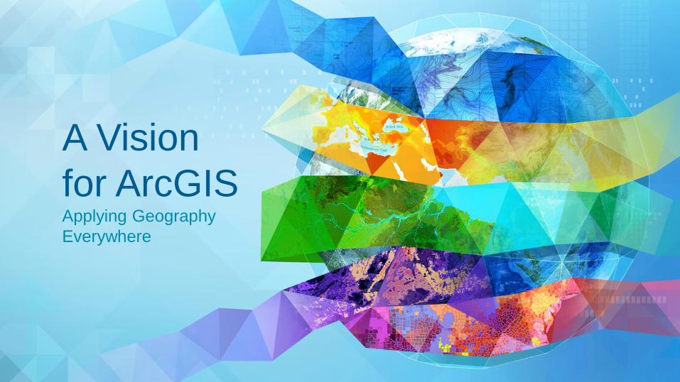
A Vision
for ArcGIS Applying Geography
Everywhere

WELCOME

PURPOSE

A Network of GIS Professionals
Are Awakening the World to the Power of Web GIS You
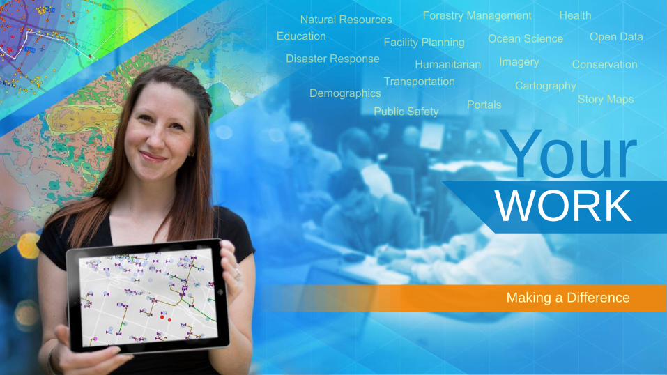
Your WORK
Making a Difference

Your Work Open Maps and Open Data

Applying Geography Everywhere
Vision

Geography The Integrating Science
of Our World
Providing Content and Context
for Understanding Everything
. . . Helping Address
Our Global Challenges
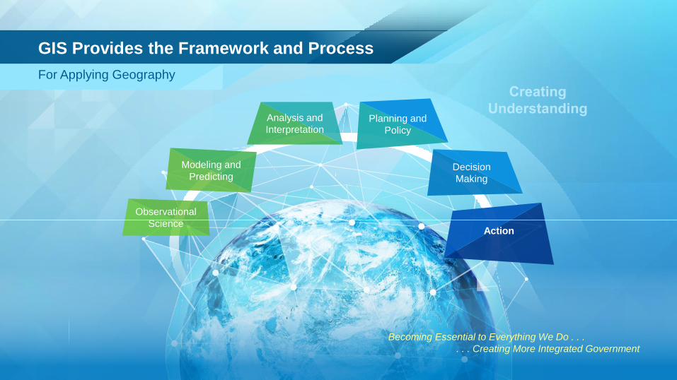
For Applying Geography
GIS Provides the Framework and Process
Observational
Science
Modeling and
Predicting
Analysis and
Interpretation Planning and
Policy
Decision
Making
Action
Becoming Essential to Everything We Do . . .
. . . Creating More Integrated Government
3D
Visualization Analytics
Apps
Collaborative
Applications
Open
Configurable
Agile Easier
Ready to Use
Implementation
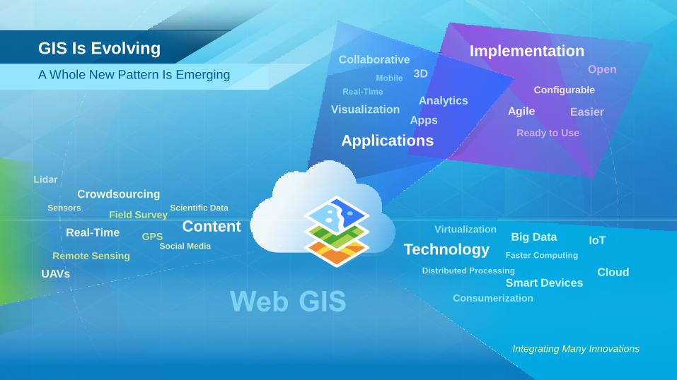
GPS
UAVs
Real-Time
Crowdsourcing Sensors Scientific Data
Remote Sensing
Field Survey
Social Media
Content Big Data
Cloud
Virtualization IoT
Consumerization
Smart Devices
Technology
Integrating Many Innovations
A Whole New Pattern Is Emerging
GIS Is Evolving
Integrating Existing Systems . . .
. . . Creating a System of Systems
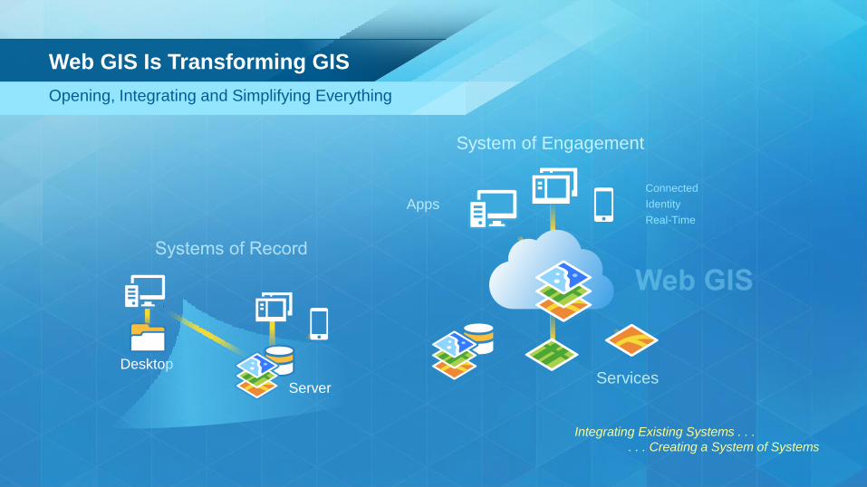
Apps
Desktop
Server
Identity
Real-Time
Web GIS Is Transforming GIS
Opening, Integrating and Simplifying Everything
System of Engagement
Connected
Services

Opening Access and Engaging Everyone
Planning
Shared Geographic
Understanding
Management
GIS Department
Management
External Stakeholders
GIS Department
Planning
Open Data Community
Field Workers
Web GIS is Democratizing GIS
Creating Shared Information and Facilitating Collaboration
Apps
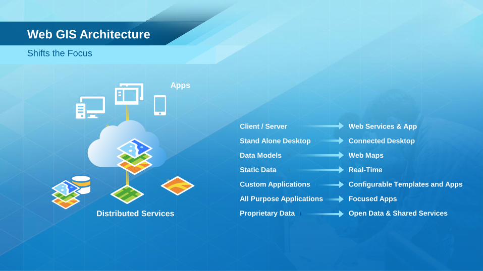
Client / Server Web Services & App
Stand Alone Desktop Connected Desktop
Data Models Web Maps
Static Data Real-Time
Custom Applications Configurable Templates and Apps
All Purpose Applications Focused Apps
Proprietary Data Open Data & Shared Services
Distributed Services
Web GIS Architecture
Shifts the Focus

Providing Everyone the Geographic Advantage
Knowledge
Workers
Open Data
Community GIS
Professionals
Casual
Users
Executives
Web GIS Empowers GIS Professionals
Expanding Your Impact Across the Organization

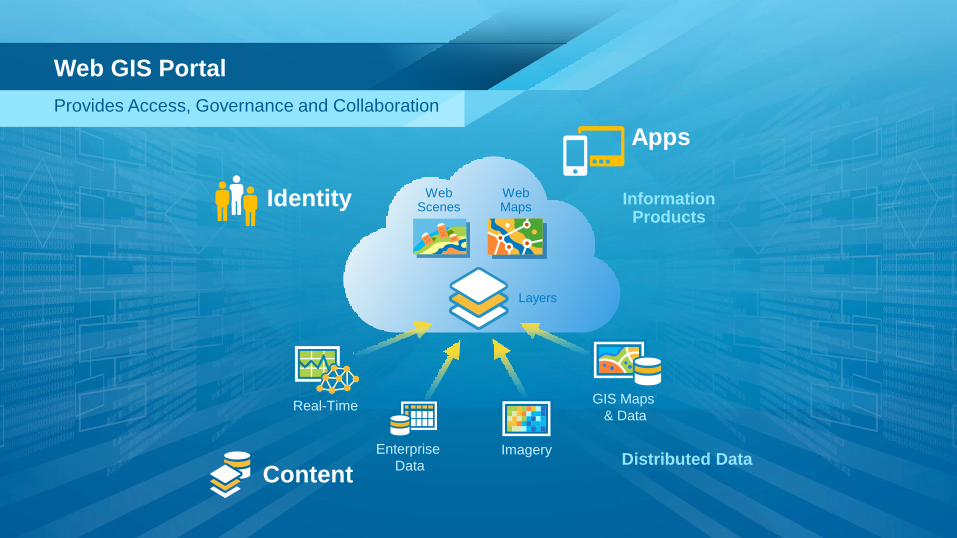
Layers
Real-Time
Enterprise
Data Imagery
Web Maps
Web Scenes
GIS Maps
& Data
Distributed Data
Information Products
Geoinformation Model
Abstracts and Organizes Geospatial Data
Layers
Real-Time
Enterprise
Data Imagery
Web Maps
Web Scenes
GIS Maps
& Data
Identity
Distributed Data
Web GIS Portal
Provides Access, Governance and Collaboration
Information Products
Apps
Content
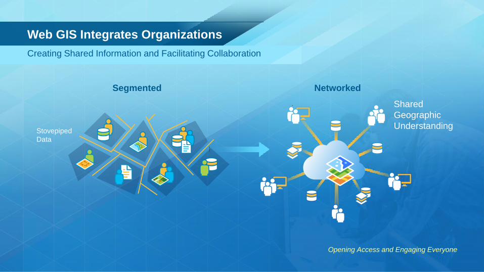
Web GIS Integrates Organizations
Opening Access and Engaging Everyone
Networked Segmented
Creating Shared Information and Facilitating Collaboration
Shared
Geographic
Understanding Stovepiped
Data
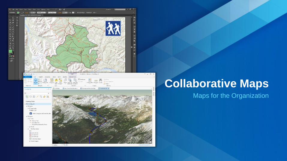
Collaborative Maps Maps for the Organization

ArcGIS A System for Innovation
Mapping
Real-Time
Data Management
Imagery
Big Data
Mobile
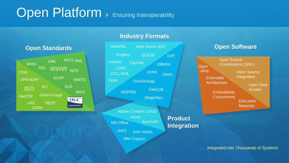
Industry Formats
Open Standards
Open Platform Ensuring Interoperability
. . . Integrated into Thousands of Systems
Open Software
REST
OPENDAP
WMS WCS
CSW
GML
WFS
KML
WMTS
WPS
SLD
GeoPackage
SOAP
IFC
LAS
NetCDF
SQL
Extensible
Architecture
Open Source
Integration
Education
Materials
Open Source
Contributions (300+)
Embeddable
Components
Open
APIs
Open Data
Access
JSON
Product
Integration AutoCAD
SAP HANA
IBM Cognos
Adobe Creative Cloud
AWS
Azure
MS Office
Imagery
DBMSs
DXF
DWG COLLADA
OLEDB
FileGDB
AIXM
WaterML
CityGML
INSPIRE
OneGeology
Hadoop
DGN
Web Scene (I3S)
LERC
Shapefiles
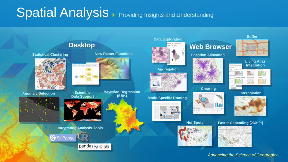
Advancing the Science of Geography
Aggregation
Hot Spots
Charting
Mode-Specific Routing
Statistical Clustering
Web Browser Desktop
Interpolation Anomaly Detection
Living Atlas Integration
New Raster Functions
Bayesian Regression (EBK)
Scientific Data Support
Faster Geocoding (230+%)
Location Allocation
Buffer
Spatial Analysis Providing Insights and Understanding
Integrating Analysis Tools
Data Exploration
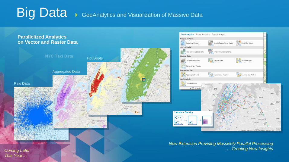
New Extension Providing Massively Parallel Processing
. . . Creating New Insights
Big Data GeoAnalytics and Visualization of Massive Data
Raw Data
Parallelized Analytics on Vector and Raster Data
Aggregated Data
Hot Spots
Coming Later
This Year…

Real-Time Integrating and Leveraging Dynamic Data
• Monitoring, Analysis and Alerting
• Stationary and Moving Events
• Large and High-Velocity Data Streams
Enabling Real-Time GIS Applications . . .
. . . Powering Responsive Action
Boston Marathon
GeoEvent
Server
Integrating Sensor Networks and IoT
Real Time Data
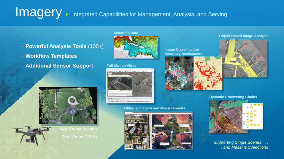
Supporting Single Scenes . . .
. . . and Massive Collections
• Powerful Analysis Tools (100+)
• Workflow Templates
• Additional Sensor Support
Imagery Integrated Capabilities for Management, Analysis, and Serving
Oblique Imagery and Measurements
Object-Based Image Analysis
Dynamic Processing Chains
Scientific Data
Full-Motion Video
UAV/Drone Support
Drone2Map (NEW)
Image Classification
Accuracy Assessment
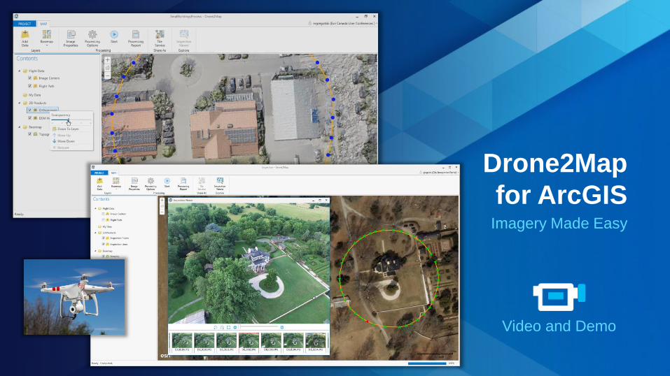
Drone2Map
for ArcGIS Imagery Made Easy
Video and Demo

Thousands of Maps and Layers
Ready-to-Use
Authoritative
Online Content A Living Atlas of the World
Millions of User Contributions . . . Billions of Views per Week
Basemaps | Imagery | Demographics | Landscape
Land Cover
Elevation
HIFLD Open
A16 Layers
NAIP
Federal Content
Landsat/GLDAS
NOAA
Statistics/Population
Basemaps
Images
Tens of Thousands of
Open Data Sets
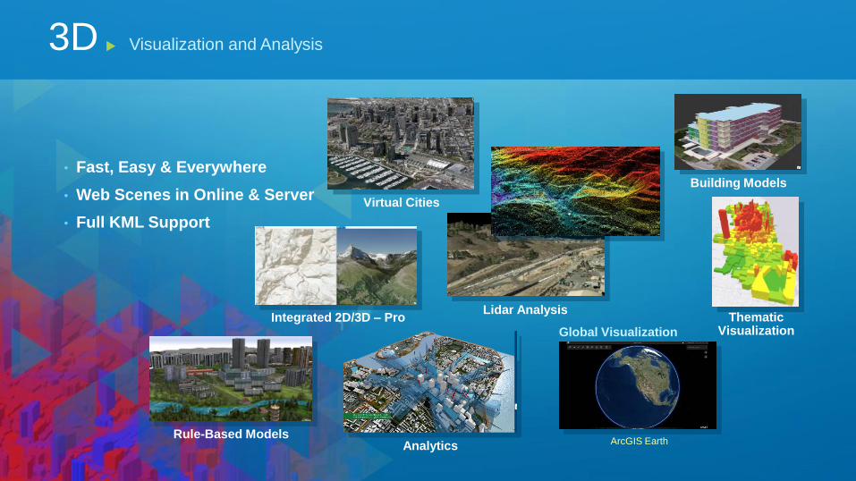
• Fast, Easy & Everywhere
• Web Scenes in Online & Server
• Full KML Support
3D Visualization and Analysis
Building Models
Lidar Analysis Thematic
Visualization
Virtual Cities
Rule-Based Models
Integrated 2D/3D – Pro
Analytics
Global Visualization
ArcGIS Earth

ArcGIS Earth 3D Data Visualization
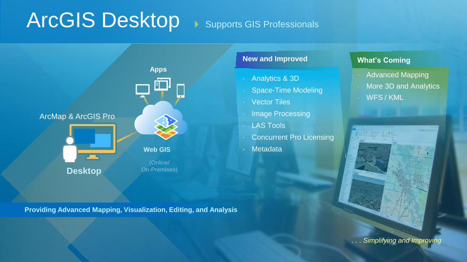
. . . Simplifying and Improving
ArcGIS Desktop Supports GIS Professionals
Apps
Providing Advanced Mapping, Visualization, Editing, and Analysis
Desktop
ArcMap & ArcGIS Pro
New and Improved
• Analytics & 3D
• Space-Time Modeling
• Vector Tiles
• Image Processing
• LAS Tools
• Concurrent Pro Licensing
• Metadata Web GIS
(Online/
On-Premises)
What’s Coming
• Advanced Mapping
• More 3D and Analytics
• WFS / KML
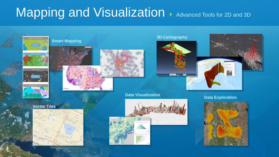
Smart Mapping
Mapping and Visualization Advanced Tools for 2D and 3D
Vector Tiles
3D Cartography
Data Visualization Data Exploration

Vector Tiles Basemap Configuration
and Creation
Easy, Powerful, and Ready-to-Use
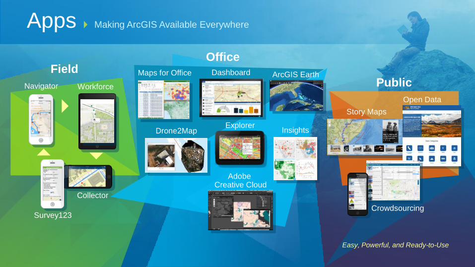
Apps Making ArcGIS Available Everywhere
Public
Story Maps
Open Data
Office
ArcGIS Earth Dashboard Maps for Office Field
Navigator
Collector
Survey123
Workforce
Explorer Insights Drone2Map
Adobe Creative Cloud
Crowdsourcing

Enabling App Creation
Design Once, Run Everywhere . . .
Widgets
Web AppBuilder
AppStudio
(Apple, Android,
Windows, Linux)
Configurable Templates
HTML5/JavaScript
Native Apps
Providing Easy, Configurable, and Extensible Tools
App Builders
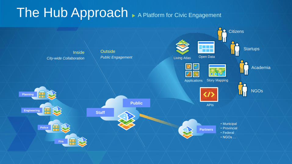
Staff
Public
Partners
• Municipal
• Provincial
• Federal
• NGOs …
Citizens
Startups
Academia
NGOs
Outside
Public Engagement
Inside
City-wide Collaboration Open Data Living Atlas
Story Mapping
APIs
Applications
Engineering
Police
Fire
Planning
A Platform for Civic Engagement The Hub Approach
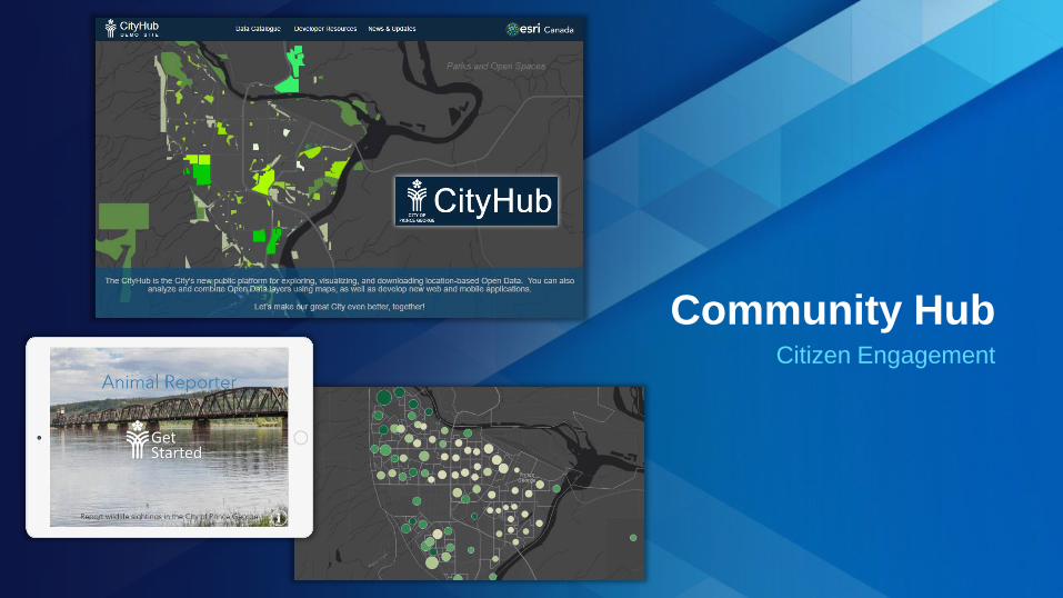
Community Hub Citizen Engagement

Road Map Incremental and Groundbreaking Advancements
. . . Focused on Quality, User Needs, and Innovation
Pro 1.1
Crowdsourcing
Real-time
Utility networks
Location awareness
Massive 3D
Vector tiles
Web raster analysis
Advanced navigation
Modeling
Big data GeoAnalytics
Insights 10.3.1
Pro 1.2 10.4
Incremental Software Release
Mobile
UAV/Drone
Continuous Online Improvements
Distributed GIS
10.4.1
10.5
Analytic Engines
Raster Analytics
Pro 1.4
Pro 1.3
User Roles
2015
2016
2017

Insights App
• New Paradigm (Visual, Intuitive, Responsive)
• Dynamic Analysis
• Very Fast Data Access
Extending and Complementing Traditional Analysis
Transforming Understanding with Interactive Analysis
Linked and Responsive Charts and Maps
On-The-Fly Visual Models
Integrated Spatial and Tabular Analysis
Insights
Coming Later
This Year…

Insights Analytics for Understanding

Making a Difference
Strong and Growing
Education
Services
Support
Products
Partners
Contributing to Society
Esri
Advancing GIS and Applications

Professional Development
Lifelong Learning

Committed to Your Success
Partner Ecosystem
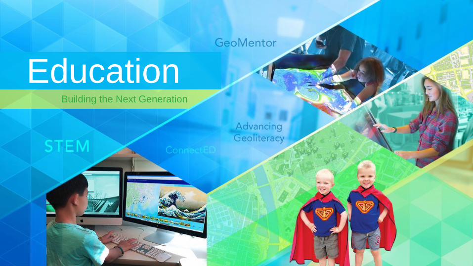
Building the Next Generation
Education
2016

![[Arcgis] Riset ArcGIS JS & Flex](https://static.fdocuments.in/doc/165x107/55cf96d7550346d0338e2017/arcgis-riset-arcgis-js-flex.jpg)