A tool to complement extension services and foster active ...
10
A tool to complement extension services and foster active farmers’ participation and knowledge exchange GeoFarmer App GeoFarmer is an app designed to support experience exchanges between farmers – be they positive or negative – so that they can learn from each other by asking questions and by sharing suggestions on how their crop, animal and farm management can be improved. Project implementers can also use it to obtain continuous feedback and follow up with farmers during project implementation. GeoFarmer is a flexible tool that can be used for data collection (including spatial functionalities and location data to geo-reference information), as a knowledge library, or for efficient monitoring and evaluation of agricultural technologies and practices implemented by farmers. Summary Authors Anton Eitzinger, Mona Bartling, Christian Feil, Osana Bonilla-Findji, Nadine Andrieu and Andy Jarvis. Keywords E-extension; Digital agriculture; Peer-to-peer sharing; Collaborative farming; Data-collection; Agricultural development projects. KEY MESSAGES Sharing experiences and information is crucial for farmers to collaboratively improve their agricultural practices and crop-specific knowledge. ICT-based extension (e-extension) combined with data-driven agronomy is providing added value to traditional extension approaches. For research projects, GeoFarmer can facilitate two-way interaction and better follow-up with the farming community. GeoFarmer helps to democratize extension services and provide an alternative to the often one-way top-down traditional extension services. GeoFarmer was conceptualized as a tool that provides near real-time, multi-way data flows that support processes of co-innovation and cost-effective monitoring and evaluation in agricultural development projects. GeoFarmer uses thematic or location-based channels to provide a project-like structure and has distinct roles for moderator, facilitator, geo-manager and simple user, and it works offline. INFONOTE
Transcript of A tool to complement extension services and foster active ...

A tool to complement extension services and foster activefarmers’ participation and knowledge exchange
GeoFarmer App
GeoFarmer is an app designed to support experience exchanges between farmers – be they positive or negative – so that they can learn from each other by asking questions and by sharing suggestions on how their crop, animal and farm management can be improved. Project implementers can also use it to obtain continuous feedback and follow up with farmers during project implementation. GeoFarmer is a flexible tool that can be used for data collection (including spatial functionalities and location data to geo-reference information), as a knowledge library, or for efficient monitoring and evaluation of agricultural technologies and practices implemented by farmers.
Summary
AuthorsAnton Eitzinger, Mona Bartling, Christian Feil, Osana Bonilla-Findji, Nadine Andrieu and Andy Jarvis.
KeywordsE-extension; Digital agriculture; Peer-to-peer sharing; Collaborative farming; Data-collection; Agricultural development projects.
KEY MESSAGES
Sharing experiences and information is crucial for farmers to collaboratively improve their agricultural practices and crop-specific knowledge.
ICT-based extension (e-extension) combined with data-driven agronomy is providing added value to traditional extension approaches.
For research projects, GeoFarmer can facilitate two-way interaction and better follow-up with the farming community.
GeoFarmer helps to democratize extension services and provide an alternative to the often one-way top-down traditional extension services.
GeoFarmer was conceptualized as a tool that provides near real-time, multi-way data flows that support processes of co-innovation and cost-effective monitoring and evaluation in agricultural development projects.
GeoFarmer uses thematic or location-based channels to provide a project-like structure and has distinct roles for moderator, facilitator, geo-manager and simple user, and it works offline.
INFONOTE

2 | INFONOTE GeoFarmer App
The rise of digital agriculture
could be the most
transformative and disruptive
change for smallholder
farmers since the Green
Revolution six decades ago.
Digital agriculture will not
only change how farmers
work, but will fundamentally
transform every part of the
agri-business value chain. The
biggest challenge, however, is
to make digital transformation
inclusive and sustainably
increase farmers’ living
income; this is especially true
for most of the world’s half-
billion smallholder farmers.
Improving their precarious
situation is often the target of
global development agencies,
but interventions sometimes
fall short of desired outcomes
due to their top-down nature
and lack of mechanisms for
scaling.
Introduction
Agricultural extension service functionsSharing information is crucial as farmers prefer to make their decisions based on discussions and their own experiences rather than following top-down generalized recommendations. In countries with a strong reliance on agriculture, traditional extension services play a major role in disseminating knowledge, technologies and agricultural information to improve livelihoods in rural areas. In addition, agricultural information resource centers, agricultural shows, and community-managed plots are all important sources of knowledge but hardly reach scale. To increase productivity, however, a farmer needs context and site-specific agronomic advice, and traditional extension approaches often cannot meet the requirements in a spatially comprehensive and timely manner. The Feed the Future Developing Local Extension Capacity (DLEC) project divides extension functions into six steps:1
1. Diagnose problems that farmers face.
2. Make farmers aware of the benefits of context-specific improved practices.
3. Enable environments for farmers to try new practices.
4. Experiment with good practices.
5. Remind farmers what they have learned.
6. Get feedback from farmers regarding what they do not understand and what additional information they need to adapt practices accordingly.
1 Source: www.agrilinks.org/activities/feed-future-developing-local-extension-capacity-project

3A tool to complement extension services and foster active farmers’ participation and knowledge exchange |
ICT-based extension (e-extension) to close the last-mile information gapDigital extension or e-extension, consisting of the use of short text or audio messages, visual delivery via mass media (TV) or video, audio programs (radio or talking books), or digital applications, is complementary to traditional extension with the benefit of maximizing the use of information and communications technologies (ICTs) and can enhance dialogue and knowledge-sharing of farmers. Furthermore, ICTs can bring to scale traditional extension approaches and can level out the lack of technical assistance and extension staff, and bring information to marginalized areas. Complementary to e-extension, open and distance learning can be used to better reach extension workers and farmers, deliver practical knowledge about farming and share training opportunities for use of digital tools, therefore mitigating negative effects of the digital divide.
E-extension services, as a complementary approach to traditional extension services, can improve farm productivity via decision-support services on mobile apps or other digital platforms; using many sources of information – weather data, land-use maps, soil
sensor data, satellite/drone imageries, etc. However, e-extension needs to be implemented together with data-driven agronomy approaches that analyze insights from collected data and provides site-specific recommendations for farmers, and support the introduction of e-extension by capacity building on ICT literacy. To be efficient and fulfill their promised potential, e-extension services depend upon multi-information sources and analytics, otherwise, they are just a digitized traditional extension channel. Around the world, governmental agencies, non-governmental organizations (NGOs), private sector companies and start-ups are developing and deploying ICT tools that either aid extension agents or take over the role of extension agents all together in areas where traditional extension services are unavailable to farmers. However, the quality of existing ICT-based e-extension services can be greatly enhanced by improving interoperability between single-solutions and integrating near-real time information from data-driven agronomy that provides more precise and timely advice to farmers.
Farmer-to-farmer knowledge sharingPeer-to-peer information sharing among farmers, together with data-driven smart farming, could lead to the desired digital revolution in agriculture. ICT-based tools can help to foster knowledge sharing among farmers. To leverage digital tools, youth can play a major role in helping older farmers in using such tools. Further, in rural areas where extension services are insufficient, farmers often trust other community members more than they trust external technical agents, therefore, they can manage their crops and farms better if they can communicate their experiences, both positive and negative, with each other, and learn from practical experiences of other farmers. Research has shown that farmers are more likely to make decisions based on input from peers, and ICTs, such as GeoFarmer, show great potential to increase communication among smallholders, and also with other experts from the sector by reducing the transaction costs in information services, and also reducing the information asymmetry.

4 | INFONOTE GeoFarmer App
GeoFarmer is complementary to digital extension services, and the community can use it. GeoFarmer was conceptualized as a tool that enables a multi-way communication channel between farmers and researchers and among groups of farmers; allowing community workers and smallholders to easily collect and share information during project interventions. For example, development agencies can tailor the tool and create a new communication channel to gather effective feedback and to respond to the emergent needs of their beneficiaries. Farmers can use the same communication channel to access information and best practice knowledge about farming that was shared by other farmers or extension workers. GeoFarmer provides near real-time, multi-way data flows that support processes of co-innovation in agricultural development projects. It can be used as a cost-effective ICT-based platform to monitor agricultural production systems with interactive feedback between the users, within pre-defined geographical domains, called channels.
GeoFarmer was developed using Progressive Web Application (PWA) technology; therefore, it is platform-independent and can be used with any standard Internet browser on either a personal computer or mobile device such as a smartphone. It can also be added to the home screen of smartphones, where it acts like a standard app. GeoFarmer works online as well as offline, which benefits the user in areas with limited Internet coverage.
GeoFarmer Tool“An app like this gives farmers a voice and helps close the communication gap between people working in the development sector, researchers working on development technologies, and farmers. We are better at understanding farmers’ needs and we’re more responsive to emerging opportunities and unanticipated challenges.” Andy Jarvis,Alliance Associate Director General - Research, Innovation and Strategy

5A tool to complement extension services and foster active farmers’ participation and knowledge exchange |
Figure 1. Screenshots showing the GeoFarmer app.
The potential of GeoFarmer is to be a generic tool that uses a basic framework for interactive stakeholder participation processes. The GeoFarmer app (https://GeoFarmer.org) was developed based on the GeoCitizen framework, and being part of its developer-community. The basic framework for citizen participation was further developed by the International Center for Tropical Agriculture (CIAT) in collaboration with the University of Salzburg Interfaculty Department of Geoinformatics (Z_GIS) for the special requirements of agricultural development projects.
ChannelsGeoFarmer uses channels to provide a project-like structure. These channels have specific unique characteristics, such as language, geographical location, topics and target communities. For example, farmers from villages in Northern Ghana implementing climate-smart agricultural practices within a specific research program could be part of a GeoFarmer channel ‘Implementing climate-smart agriculture practices in Northern Ghana.’ All users (farmers, facilitators) from this geographic area can subscribe to this channel, which is managed by at least one moderator user. New channels can be created upon request to the GeoFarmer platform team. Additionally, a geo-data
manager can change standard maps and replace them through own created map composites.
User rolesIn a Geo-Farmer channel, a user can have four distinct roles: a moderator, a facilitator, a geo-data manager, or a user. Users with a moderator role can access advanced functionalities for general channel management, such as the management of user roles and surveys. Users with a facilitator role support farmers in using GeoFarmer, e.g. in doing surveys as interviews where the identity of the surveyed farmer remains anonymous by using an infeasible to invert hash value instead of the farmer’s identity. Facilitators can be extension agents, lead farmers, or community group leaders. Users with a geo-data manager role can create customized maps and manage the geospatial information in a channel, for example, including available online map services or by uploading a paper-scanned historical map; they could be students from a local university. Farmers as users are providing content-like comments or media files, asking or answering questions and responding to surveys using the GeoFarmer app. They can also share best practices and step-by-step instructions about good agricultural practices they have practiced on their farms.
6 | INFONOTE GeoFarmer App
The user story
1 Miriam is a coffee farmer. She lives in a remote part of Colombia’s coffee highlands. She loves to talk to other coffee farmers about new practices that can overcome some of the challenges in coffee cultivation.
2 However, she doesn’t often get access to good advisory services. The local extensionist visits her very rarely, and she relies on the information she gets from input sellers and buyers. Miriam learned from her local community group about GeoFarmer, an app where she can communicate with other farmers and share experiences about coffee farming, both positive and negative.
3 After a training event at the local community house, she installs GeoFarmer and joins a community channel called ‘Coffee farmers in Colombia.’
4 Using GeoFarmer, she starts publishing questions about a disease that her coffee bushes have recently had and which she has never seen before.
5 Very quickly she gets answers from other farmers from her region. One farmer called Carlos, from a different department, shares step-by-step instructions on how to deal with the disease. The information is very helpful for Miriam, and she rates Carlos instructions with five stars.
6 After using GeoFarmer for a while, Miriam gets an invitation from a non-profit organization to participate in a science project, and she provides feedback about her coffee farm and the other challenges she and her family are facing.
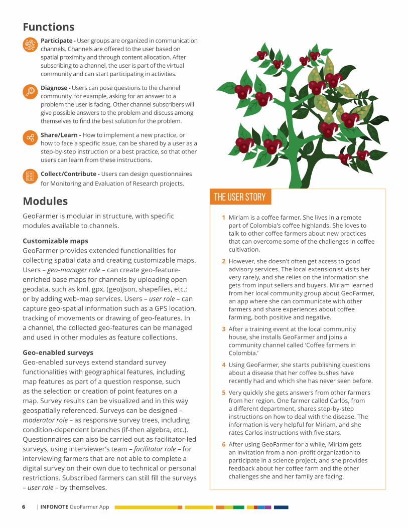
FunctionsParticipate - User groups are organized in communication channels. Channels are offered to the user based on spatial proximity and through content allocation. After subscribing to a channel, the user is part of the virtual community and can start participating in activities.
Diagnose - Users can pose questions to the channel community, for example, asking for an answer to a problem the user is facing. Other channel subscribers will give possible answers to the problem and discuss among themselves to find the best solution for the problem.
Share/Learn - How to implement a new practice, or how to face a specific issue, can be shared by a user as a step-by-step instruction or a best practice, so that other users can learn from these instructions.
Collect/Contribute - Users can design questionnaires for Monitoring and Evaluation of Research projects.
ModulesGeoFarmer is modular in structure, with specific modules available to channels.
Customizable mapsGeoFarmer provides extended functionalities for collecting spatial data and creating customizable maps. Users – geo-manager role – can create geo-feature-enriched base maps for channels by uploading open geodata, such as kml, gpx, (geo)json, shapefiles, etc.; or by adding web-map services. Users – user role – can capture geo-spatial information such as a GPS location, tracking of movements or drawing of geo-features. In a channel, the collected geo-features can be managed and used in other modules as feature collections.
Geo-enabled surveysGeo-enabled surveys extend standard survey functionalities with geographical features, including map features as part of a question response, such as the selection or creation of point features on a map. Survey results can be visualized and in this way geospatially referenced. Surveys can be designed – moderator role – as responsive survey trees, including condition-dependent branches (if-then algebra, etc.). Questionnaires can also be carried out as facilitator-led surveys, using interviewer’s team – facilitator role – for interviewing farmers that are not able to complete a digital survey on their own due to technical or personal restrictions. Subscribed farmers can still fill the surveys – user role – by themselves.

7A tool to complement extension services and foster active farmers’ participation and knowledge exchange |
SHARE PARTICIPATE
ASK
1
3
5
2
6
4

8 | INFONOTE GeoFarmer App
Use cases and pilots
GeoFarmer was tested and deployed alongside three development projects, including the Climate-Smart Villages Network established as part of the CGIAR Research Program on Climate Change, Agriculture and Food Security (CCAFS).
TanzaniaIn 2015, Farmers in Lushoto, in the Usambara Mountains in North-Eastern Tanzania, were the first to use GeoFarmer as part of a citizen scientist project to test and manage climate-smart agricultural practices. One practice included the adoption of manure composting amongst the farming community in Lushoto, to increase productivity, reduce costs and diminish reliance on chemical fertilizers. GeoFarmer was used to collect feedback from farmers about their awareness, knowledge and use of the practice,
Collaboration (peer-to-peer knowledge sharing)The Collaboration module allows users to easily provide specific input and best practice cases to their communities and ask others for feedback in certain fields of interest, building a common knowledge base. Farmers – user role – can ask a question to the channel community, and other users can provide answers. Users can share step-by-step instructions on how to implement agricultural practices, and other channel subscribers can rate and comment on the best practice.
Sketch mapsOn Sketch maps, users – user role – can share their input on a specific issue or communicate their ideas in a creative way by drawing freehand on a digital map. Results can be easily integrated into further discussions or processes. Users – geo-manager role – can create individual channel maps by uploading geographic point, line or polygon features.
Farm calculator (beta)The Farm calculator module is a tool allowing the prospective quantitative assessment of the trade-offs and synergies between various objectives of farming activities. After users’ input of requested data – facilitator or user role – compound variables are calculated following defined metrics that are defined by another user – moderator role – and provide insights on farm performance for defined criteria.
Push notifications (beta)Push notifications assist process managers – moderator role – in keeping their communities up to date on the latest developments of their projects and initiatives, as platform (push) notifications or Short-Message-Service (SMS).
and to georeference community demonstration plots and to carry out surveys.
UgandaBetween 2017 and 2019, in the project Climate-Smart Coffee and Cocoa (CSCC), an empirical usability study was carried out with farmers groups on Mount Elgon in Uganda. As interactive maps provide new information or enrich existing information by geospatially referencing it, the study aimed to design new interactive maps for farmers. Researchers evaluated mapping interfaces with different functionalities and styles against farmers’ ease of use.
Other countries in Latin America, sub-Saharan Africa, South Asia and South-East AsiaSince 2017, GeoFarmer has been used for CCAFS’ integrated monitoring system in Climate-Smart Villages in Colombia, Guatemala, Honduras, Nicaragua, Ghana, Uganda, Ethiopia, India, Nepal, Bangladesh, Senegal and Vietnam, to evaluate adoption and perceived benefits of climate-smart agriculture (CSA) options and to understand their barriers to adoption. Using the geo-enabled survey module with the survey-tree function, a set of 40 robust and standard indicators (15 Core and 25 descriptive) covering the Productivity/Food Security, Adaptation and Mitigation CSA pillar has been developed and applied at household and farm level.

9A tool to complement extension services and foster active farmers’ participation and knowledge exchange |
Beyond the ICT app, GeoFarmer aims to integrate the technology with other mobile apps to address missing interoperability. The current reality of data collection at farm level is that most smallholder farmers do not keep farm records, and different actors from research, academia, non-profit, governmental institutions and the private sector, all collect farm data for their own use. In many cases, they even collect the same data, from the same area, and sometimes even from
GeoFarmer is a new app that helps to democratize agro-advisory and extension services and provide an alternative to the often one-way, top-down traditional extension services. However, e-extension, as complementary to traditional extension services, is still out of the reach of many farmers because of a lack of connectivity in rural areas, missing capacity building and poor usability of ICT applications. GeoFarmer is complementary to e-extension services and to the community.
GeoFarmer enables a multi-way communication channel between farmers and researchers and among groups of farmers, allowing community workers and smallholders to easily collect and share information during project interventions. The functions of GeoFarmer allow for active participation of farmers, auto-diagnose by asking questions that are answered
by peers, sharing of best practices to help others, and contribute through feedback to science and development projects. GeoFarmer was tested and deployed in three use cases alongside development projects in Latin America, sub-Saharan Africa, South Asia and South-East Asia.
For the next development phase, GeoFarmer will be integrated with other mobile apps to solve the problem of missing interoperability of data collected by different actors from research, academia, non-profit, governmental institutions and the private sector. Integrating the different e-extension service systems will help to establish innovative monitoring systems and produce smart metrics for the supply side, and innovate around the development of unique services for the farmer.
Conclusions and outlook
Why another app?
Atzmanstorfer K; Resl R; Eitzinger A; Izurieta X. 2014. The GeoCitizen-Approach: Community-Based Spatial Planning – an Ecuadorian Case Study. Cartography and Geographic Information Science 00 (00):1–12. https://doi.org/10.1080/15230406.2014.890546
Atzmanstorfer K; Eitzinger A; Marin BE; Parra Arteaga A; González Quintero B; Resl R. 2016. HCI-Evaluation of the GeoCitizen-Reporting App for Citizen Participation in Spatial Planning and Community Management among Members of Marginalized Communities in Cali, Colombia. GI Forum 4(1):117–132. https://doi.org/10.1553/giscience2016_01_s117
Bartling M; Sotelo S; Eitzinger A; Atzmanstorfer K. 2016. Press the Button: Online/Offline Mobile Applications in an Agricultural Context. GI Forum 4(1):106-116. https://doi.org/10.1553/giscience2016_01_s106
Further reading Bartling M; Bernd R; Eitzinger A; Zurita-Arthos L. 2019. A Multi-National Human-
Computer Interaction Evaluation of the Public Participatory GIS GeoCitizen. GI_Forum, 7(1):19-39. https://doi.org/10.1553/giscience2019_01_s19
Eitzinger A; Sayula G; Benjamin T; Rodríguez B; Winowiecki L; Läderach P; Koech N; Twyman J. 2015. Using Science Knowledge and Expert Feedback to Accelerate Local Adoption: Climate Smart Technologies and Practices Meet ICT Tools. Cali, Colombia. https://doi.org/10.13140/RG.2.1.2733.3289
Eitzinger A; Cock J; Atzmanstorfer K; Binder CR; Läderach P; Bonilla-Findji O; Bartling M; Mwongera C; Zurita L; Jarvis A. 2019. GeoFarmer: A Monitoring and Feedback System for Agricultural Development Projects. Computers and Electronics in Agriculture 158 (June 2018):109–121. https://doi.org/10.1016/j.compag.2019.01.049
the same farmers. From an efficiency standpoint, bringing diverse data sources together would help service providers to innovate around new information services, and farmers to better understand and cope with on-farm risks. However, there are still barriers to data interoperability among e-extension solutions, such as missing coordination and collaboration between multiple institutions, missing trust, and lack of standards.

Agrilinks. 2019. Feed the Future Developing Local Extension Capacity Project. Agrilinks, 27 Mar 2019, www.agrilinks.org/activities/feed-future-developing-local-extension-capacity-project
Babu SC; Ramesh N; Shaw C. 2015. The current status and role of private extension: A literature review and a conceptual framework. In: Zhou Y; Babu SC (Eds.). Knowledge Driven Development: Private Extension and Global Lessons. Shirley Decker-Lucke, London, United Kingdom, pp. 7–55.
https://doi.org/http://dx.doi.org/10.1016/B978-0-12-802231-3.00002-4
Carbonell IM. 2016. The ethics of big data in big agriculture. Internet Policy Rev. 5, 1–13. https://doi.org/10.14763/2016.1.405
Eastwood C; Ayre M; Nettle R; De la Rue B. 2019. Making Sense in the Cloud: Farm Advisory Services in a Smart Farming Future. NJAS - Wageningen Journal of Life Sciences, no. December 2018: 100298. https://doi.org/10.1016/j.njas.2019.04.004
Jain PK; Hansra BS; Babu SC. 2019. Open and distance learning for capacity development of extension professionals, Agricultural Extension Reforms in South Asia. Elsevier Inc. https://doi.org/10.1016/b978-0-12-818752-4.00015-1
Jiménez D; Dorado H; Cock J; Prager SD; Delerce S; Grillon A; Andrade Bejarano M; Benavides H; Jarvis A; Bejarano MA; Benavides H; Jarvis A. 2016. From Observation to Information: Data-Driven Understanding of on Farm Yield Variation. PLoS One 11, e0150015. https://doi.org/10.1371/journal.pone.0150015
Bibliography
www.ccafs.cgiar.org www.bioversityinternational.orgwww.zgis.at
Feb 2020
www.cgiar.orgwww.ciat.cgiar.org
The Alliance is part of CGIAR, the world’s largest agricultural research and innovation partnership for a food-secure future dedicated to reducing poverty, enhancing food and nutrition security, and improving natural resources.
Kansiime MK; Alawy A; Allen C; Subharwal M; Jadhav A; Parr M. 2019. Effectiveness of mobile agri-advisory service extension model: Evidence from Direct2Farm program in India. World Dev. Perspect. 13, 25–33. https://doi.org/10.1016/j.wdp.2019.02.007
Lioutas ED; Charatsari C; La Rocca G; De Rosa M. 2019. Key questions on the use of big data in farming: An activity theory approach. NJAS - Wageningen J. Life Sci. 100297. https://doi.org/10.1016/j.njas.2019.04.003
Oyinbo O; Chamberlin J; Vanlauwe B; Vranken L; Kamara YA; Craufurd P; Maertens M. 2019. Farmers’ preferences for high-input agriculture supported by site-specific extension services: Evidence from a choice experiment in Nigeria. Agric. Syst. 173, 12–26. https://doi.org/10.1016/j.agsy.2019.02.003
Shepherd M; Turner JA; Small B; Wheeler D. 2018. Priorities for Science to Overcome Hurdles Thwarting the Full Promise of the ‘Digital Agriculture’ Revolution. Journal of the Science of Food and Agriculture, no. August. https://doi.org/10.1002/jsfa.9346
Wiseman L; Sanderson J; Zhang A; Jakku E. 2019. Farmers and their data: An examination of farmers’ reluctance to share their data through the lens of the laws impacting smart farming. NJAS - Wageningen J. Life Sci. 90–91, 100301. https://doi.org/10.1016/j.njas.2019.04.007
Wyche S; Steinfield C. 2016. Why Don’t Farmers Use Cell Phones to Access Market Prices? Technology Affordances and Barriers to Market Information Services Adoption in Rural Kenya. Inf. Technol. Dev. 22, 320–333. https://doi.org/10.1080/02681102.2015.1048184
CONTACT:Anton EitzingerCIAT Climate Change Scientist [email protected]
Eitzinger A; Bartling M; Feil C; Bonilla-Findji O; Andrieu N; Jarvis A. 2020. GeoFarmer app: A tool to complement extension services and foster active farmers’ participation and knowledge exchange. Infonote. International Center for Tropical Agriculture (CIAT); University of Salzburg Interfaculty Department of Geoinformatics (Z_GIS). Cali, Colombia. 10 p.
Correct citation
Watch video introducing GeoFarmer app https://bit.ly/2SZ9ezk