A Report on - SSEC, UW-Madison · International TOVS Study Conference-XVIII Working Group Report iv...
139
Transcript of A Report on - SSEC, UW-Madison · International TOVS Study Conference-XVIII Working Group Report iv...
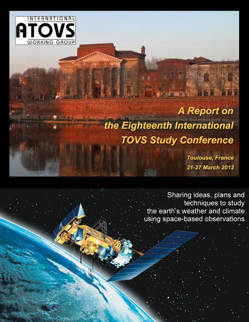

A Report on The Eighteenth International TOVS Study Conference
Météo-France Conference Center Toulouse, France 21-27 March 2012 Conference sponsored by: ABB Bomem CNES
CNRS/INSU CPTEC/INPE
ECMWF EUMETSAT GeoMetWatch ITT Exelis Kongsberg Spacetec JPSS Met Office, UK Meteo France NASA NOAA /NESDIS / GOES-R Program Office NOAA / NESDIS / STAR Orbital Systems SSEC at University of Wisconsin-Madison VCS Engineering WMO
Report prepared by: Stephen English and Allen Huang
ITWG Co-Chairs Leanne Avila and Maria Vasys Editors
Published and Distributed by: University of Wisconsin-Madison
1225 West Dayton Street Madison, WI 53706 USA
ITWG Web Site: http://cimss.ssec.wisc.edu/itwg/
March 2013
i
FOREWORD The International TOVS Working Group (ITWG) is convened as a sub-group of the International Radiation Commission (IRC) of the International Association of Meteorology and Atmospheric Physics (IAMAP). ITWG has also provided reports to the Coordination Group for Meteorological Satellites (CGMS) and this now has been also formally recognised as a sub-group of CGMS. The ITWG continues to organise International TOVS Study Conferences (ITSCs) which have met approximately every 18 to 24 months since 1983. Through this forum, operational and research users of satellite sounding data including the TIROS Operational Vertical Sounder (TOVS), the Advanced TOVS (ATOVS) and other atmospheric sounding data built on the TOVS heritage. Working group members exchange information on data processing methods, derived products, and the impacts of radiances and inferred atmospheric temperature, moisture, and cloud fields on numerical weather prediction (NWP) and climate studies. These Technical Proceedings available on-line bring together the papers of the scientific presentations and posters from the Eighteenth International TOVS Study Conference (ITSC-XVIII) hosted by Météo-France at the Météo-France Conference Center, Toulouse, France, 21-27 March 2012. The ITSC-XVIII conference report is also available which summarises the scientific exchanges and outcomes of the meeting. The ITWG Web site contains electronic versions of the conference presentations, posters and publications which can be downloaded (http://cimss.ssec.wisc.edu/itwg/). Together, these documents and Web pages reflect a highly successful meeting in Toulouse. An active and mature community of TOVS and ATOVS data users exists, and considerable progress and positive results were reported at ITSC-XVIII in a number of areas, including many related to the ATOVS system, use of IASI and AIRS measurements, and to the other current and scheduled advanced sounders. ITSC-XVIII was sponsored by industry, government agencies and a university, including the CNES, CNRS/INSU, ECMWF, Météo-France, WMO, the University of Wisconsin-Madison Space Science and Engineering Center, ABB, CPTEC/INPE, EUMETSAT, GeoMetWatch, ITT Exelis, JPSS, Kongsberg Spacetec AS, the Met Office (UK), NASA, NOAA/GOES-R Program Office, NOAA/NESDIS/STAR, Orbital Systems, and VCS Engineering. The support of these groups is gratefully acknowledged. We wish to thank the local organizing committee from Météo-France, especially to Dr. Vincent Guidard, Dr. Jean-Antoine Maziejewski and Météo-France colleagues for their exceptional effort and talent in leading the local organization, and to Maria Vasys, Bill Bellon and Leanne Avila (University of Wisconsin-Madison) for all their administrative and logistical support. Details of Reports and Proceedings of ITSC-XVIII and from previous conferences are also available from the Web site. Stephen English Allen Huang Co-Chair ITWG Co-Chair ITWG ECMWF (U.K.) University of Wisconsin-Madison

International TOVS Study Conference-XVIII Working Group Report
iii
TOVS STUDY CONFERENCE (ITSC-XVIII) Toulouse, France: 21-27 March 2012 International TOVS Working Group (ITWG) Co-Chairs Stephen English, ECMWF, UK Hung-Lung Allen Huang, University of Wisconsin-Madison, USA Organizing Committee for ITSC-XVIII Stephen English, ECMWF, UK Hung-Lung Allen Huang, University of Wisconsin-Madison, USA
Vincent Guidard, Météo-France, France Jean-Antoine Maziejewski, Météo-France, France
Leanne Avila, University of Wisconsin-Madison, USA Bill Bellon, University of Wisconsin-Madison, USA Maria Vasys, University of Wisconsin-Madison, USA ITSC-XVIII Participants Joerg Ackermann EUMETSAT Germany Filipe Aires Estrellus France Bjarne Amstrup Danish Meteorological Institute Denmark Paolo Antonelli SSEC, UW-Madison USA Jose Aravequia CPTEC/INPE Brazil Raymond Armante LMD/CNRS France Nigel Atkinson Met Office UK Thomas August EUMETSAT Germany Fabrizio Baordo ECMWF UK Bill Bellon SSEC, UW-Madison USA Camille Birman Météo-France/CNRS, CNRM-GAME/CEN France Anna Booton Met Office UK Eva Borbas SSEC, UW-Madison USA Niels Bormann ECMWF UK Sid-Ahmed Boukabara NOAA/NESDIS/STAR/JCSDA USA Pascal Brunel Météo-France France Xavier Calbet EUMETSAT Germany William Campbell Naval Research Laboratory USA Virginie Capelle LMD/CNRS, Ecole Polytechnique France Laure Chaumat NOVELTIS France Ruiyue Chen IMSG at NOAA/NESDIS/STAR USA Jordi Chinaud CNES France Simone Coelho CPTEC/INPE Brazil Andrew Collard IMSG@NCEP/EMC USA Dorothee Coppens EUMETSAT Germany David Crain GeoMetWatch USA Cyril Crevoisier LMD/CNRS, Ecole Polytechnique France Geoff Cureton SSEC, UW-Madison USA Luis Gustavo de Goncalves CPTEC/INPE Brazil Godelieve Deblonde Environment Canada Canada Enza Di Tomaso ECMWF UK Amy Doherty Met Office UK Christopher Down Australian Bureau of Meteorology Australia Stephen English ECMWF UK Reima Eresmaa ECMWF UK
International TOVS Study Conference-XVIII Working Group Report
iv
John Eyre Met Office UK Francois Faijan Météo-France France Robin Faulwetter Deutcher Wetterdienst Germany Michelle Feltz AOS/SSEC, UW-Madison USA Lars Fiedler EUMETSAT Germany Evan Fishbein NASA Jet Propulsion Laboratory USA Nadia Fourrie Météo-France/CNRS, CNRM-GAME/GMAP France Victoria Sol Galligani LERMA, Observatoire de Paris France Antonia Gambacorta NOAA/NESDIS/STAR USA Ray Garcia SSEC, UW-Madison USA Kevin Garrett RTI @ NOAA/NESDIS/STAR USA Sebastien Gaugain CNES France Mitchell Goldberg NOAA USA Stephanie Guedj Météo-France/CNRS, CNRM-GAME/GMAP France Vincent Guidard Météo-France/CNRS, CNRM-GAME/GMAP France Hyo-Jin Han Seoul National University South Korea Sylvain Heilliette Environment Canada Canada Dirceu Herdies CPTEC/INPE Brazil James Hocking Met Office UK Gerrit Holl Luleå University of Technology Sweden Allen Huang SSEC, UW-Madison USA Tim Hultberg EUMETSAT Germany Katja Hungershoefer Deutscher Wetterdienst Germany Elsa Jacquette CNES France Nicole Jacquinet Laboratoire de Meteorologie Dynamique France Denis Jouglet CNES France Brian Kahn NASA Jet Propulsion Laboratory USA Anton Kaifel Center for Solar Energy and Hydrogen Research Germany Fatima Karbou Météo France/CNRS, CNRM-GAME/CEN France Yoonjae Kim Korea Meteorological Administration South Korea Thomas King NOAA/NESDIS/STAR USA Dieter Klaes EUMETSAT Germany Thomas Kleespies NOAA/NESDIS (retired) USA Robert Knuteson SSEC, UW-Madison USA Christina Koepken-Watts Deutscher Wetterdienst Germany Eun-Han Kwon Seoul National University South Korea Jerome Lafeuille WMO Switzerland Allen Larar NASA Langley Research Center USA Lydie Lavanant Météo-France France Jung-Rim Lee NMSC/KMA South Korea Jun Li SSEC/UW-Madison USA Christopher Lietzke ITT Exelis USA Magnus Lindskog Swedish Meteorological and Hydrological Institute Sweden Xu Liu NASA Langley Research Center USA Zhiquan Liu NCAR USA Vincent Lonjou CNES France Cristina Lupu ECMWF UK Jean-Francois Mahfouf Météo-France/CNRS, CNRM-GAME/GMAP France Graeme Martin SSEC, UW-Madison USA Pauline Martinet Météo-France/CNRS, CNRM-GAME/GMAP France Guido Masiello DIFA, University of Basilicata Italy Marco Matricardi ECMWF UK Will McCarty NASA/Global Modeling and Assimilation Office USA Anthony McNally ECMWF UK Louis-Francois Meunier Météo-France/CNRS, CNRM-GAME/GMAP France Yann Michel Météo-France/CNRS, CNRM-GAME/GMAP France Scott Mindock SSEC, UW-Madison USA Patrick Moll Météo-France/CNRS, CNRM-GAME/GMAP France Jean-Luc Moncet AER USA Lotte Kroer Myrvoll Kongsberg Spacetec Norway
International TOVS Study Conference-XVIII Working Group Report
v
Stuart Newman Met Office UK Akira Okagaki Japan Meteorological Agency Japan Kozo Okamoto Meteorological Research Institute of JMA Japan Maxime Paul LERMA France Ed Pavelin Met Office UK Eric Pequignot CNES France Tuuli Perttula Finnish Meteorological Institute Finland Thierry Phulpin CNES France Indira Rani Pillai NCMRWF, Ministry of Earth Sciences India Jean Pla CNES France Christelle Ponsard Moltek/EUMETSAT Germany Gloria Cristina Pujol National Meteorological Service Argentina Florence Rabier Météo-France/CNRS, CNRM-GAME/GMAP France Roger Randriamampianina Hungarian Meteorological Service Hungary Henry Revercomb SSEC, UW-Madison USA Pascale Roquet CMS Météo-France France Stephane Rousseau CNES France Benjamin Ruston Naval Research Laboratory – Monterey USA Muriel Saccoccio CNES France Nathalie Saint-Ramond Météo-France/CNRS, CNRM-GAME/GMAP France Peter Schluessel EUMETSAT Germany Annika Schomburg Deutscher Wetterdienst Germany Joerg Schulz EUMETSAT Germany Harald Schyberg Norwegian Meteorological Institute Norway Nathalie Selbach Deutscher Wetterdienst Germany Carmine Serio DIFA, University of Basilicata Italy Awdhesh Sharma NOAA/NESDIS USA Bruna Silveira CPTEC/INPE Brazil William Smith SSEC, UW-Madison and Hampton University USA Anders Soerensen EUMETSAT Germany B.J. Sohn Seoul National University South Korea Yi Song RTI at NOAA/NESDIS/STAR USA Martin Stengel Deutscher Wetterdienst Germany Laura Stewart Met Office UK Olaf Stiller Deutscher Wetterdienst Germany Kathleen Strabala SSEC, UW-Madison USA Larrabee Strow UMBC Department of Physics USA Claudia Stubenrauch LMD CNRS, Ecole Polytechnique France Bomin Sun NOAA/NESDIS/STAR USA Thibaud Thonat LMD/CNRS, Ecole Polytechnique France Stephen Tjemkes EUMETSAT Germany David Tobin SSEC, UW-Madison USA Lucio Torrisi CNMCA, Italian Meteorology Center Italy Bernard Tournier NOVELTIS France Robert Tubbs Met Office UK Paul van Delst NOAA/NWS/NCEP/EMC – IMSG USA Maria Vasys SSEC, UW-Madison USA Gilles Verner Environment Canada Canada Jerome Vidot Météo-France France Anais Vincensini Météo-France/CNRS, CNRM-GAME/GMAP France KungHwa Wang University of Maryland USA Elisabeth Weisz SSEC, UW-Madison USA Peter Weston Met Office UK Yin Yang National Meteorological Center China Vladimir Zavyalov SDL, Utah State University USA Daniel Zhou NASA Langley Research Center USA

International TOVS Study Conference-XVIII Working Group Report
vi
ITSC-XVIII Group Photo at Météo-France Conference Center Toulouse, France

International TOVS Study Conference-XVIII Working Group Report
vii
TABLE OF CONTENTS
FOREWORD ....................................................................................................................... I
ITSC-18 SPONSORS ........................................................................................................... II
1. EXECUTIVE SUMMARY ............................................................................................... 1
1.1 INTRODUCTION 1
1.2 SUMMARY OF MAJOR CONCLUSIONS 2
1.3 FUTURE PLANS 4
1.4 ACKNOWLEDGEMENTS 4
SUMMARY OF ACTIONS AND RECOMMENDATIONS .......................................................... 5
2. WORKING GROUP REPORTS ..................................................................................... 18
2.1 RADIATIVE TRANSFER AND SURFACE PROPERTY MODELLING 18
2.2 CLIMATE 23
2.3 DATA ASSIMILATION AND NUMERICAL WEATHER PREDICTION 32
2.4 ADVANCED SOUNDERS 41
2.5 INTERNATIONAL ISSUES AND FUTURE SYSTEMS 44
2.6 PRODUCTS AND SOFTWARE 50
3. TECHNICAL SUB-GROUP REPORTS ............................................................................. 55
3.1 REGIONAL ATOVS TRANSMISSION SYSTEM (RARS) 55
LIST OF ACRONYMS ........................................................................................................ 59
ITSC-XVIII AGENDA ......................................................................................................... 62
ITSC-XVI ABSTRACTS ....................................................................................................... 73

1
1. EXECUTIVE SUMMARY
1.1 INTRODUCTION The eighteenth International TOVS Study Conference, ITSC-XVIII, was held in the Météo-France conference facility in Toulouse between 21 and 27 March 2012. One hundred and fifty four participants attended the Conference and provided scientific contributions. Twenty countries and three international organizations were represented: Argentina, Australia, Brazil, Canada, China, Taiwan, Denmark, France, Germany, Hungary, India, Italy, Japan, Norway, Poland, South Korea, Sweden, Switzerland, United Kingdom, United States, ECMWF, EUMETSAT, and the WMO. For the third successive meeting the number of attendees broke the record for the highest ever record attendance. The Working Groups had very productive discussions and it was again encouraging to see a large number of new, younger scientists participating. ITSC-XVIII was sponsored by industry and government agencies and by the University of Wisconsin-Madison’s Space Science and Engineering Center. The industry and government agencies included: CNRS/INSU, the World Meteorological Organization (WMO), Météo France, ECMWF, VCS Engineering, Kongsberg Spacetec, ABB, ITT Exelis, the Met Office, INPE/CPTEC, CNES, EUMETSAT, NOAA/NESDIS/STAR, NOAA/GOES-R Program Office, GeoMetWatch, Orbital Systems, NASA and JPSS. The support of these groups is gratefully acknowledged. The great success of ITSC-XVIII can be attributed to the excellent support provided by the local organising committee from Météo-France and the administrative and logistical support provided by Maria Vasys, Bill Bellon and Leanne Avila (University of Wisconsin-Madison). Most of the meeting was occupied with ten sessions of oral presentations and their associated poster papers. Each poster paper was also allocated a 2-minute oral summary to highlight the scientific contents. The range of issues covered included the following:
• Current, new and future observing systems; • Operational reports from space agencies and NWP centres; • Data assimilation applications; • Climate applications; • Processing software systems; • Advanced Sounder science; • Radiative transfer models; • Atmospheric chemistry and composition; • Cloud and precipitation applications; and • Retrieval science.
There were 50 longer format oral presentations, 100 oral poster introductions, and the working group and technical sub-group presentations and the actual working group meetings during the conference. The conference agenda and all of the talks and many of the posters can be viewed at the ITWG Web site, located at http://cimss.ssec.wisc.edu/itwg/itsc/itsc18 Working Groups were formed to consider six key areas of interest to the ITWG, including:
• Radiative Transfer, • Climate, • Data Assimilation and Numerical Weather Prediction,

2
• Advanced Sounders, • International Issues and Future Systems, and • Products and Software.
The Working Groups reviewed recent progress in the above areas, made recommendations on key areas of concern and identified items for action. Working Group reviews and recommendations comprise an important part of the ITSC-XVIII Working Group Report. A summary of the key points arising from the conference is presented below. During the Conference, a session on Working Group status reports considered activities that had taken place since ITSC-XVII in California. This session also reviewed progress on the Action Items and Recommendations identified by the ITSC-XVII Working Groups. Many of these items formed the basis for further discussion by the Working Groups at ITSC-XVIII. Technical sub-groups also met during ITSC-XVIII to discuss developments and plans concerning specific software packages, shared and in common use, and microwave frequency protection. Brief reports on these sub-group meetings are provided in section 3.
1.2 SUMMARY OF MAJOR CONCLUSIONS The ITSC-XVIII presentations, posters, Working Group meetings and discussions documented significant issues in many areas and identified areas for future activity. In particular, 58 action items and 78 recommendations were reported by 6 working groups. The main conclusions and recommendations from ITSC-18 are summarised below. The full list of action items and recommendations from each working group can be found in the working group reports. Highlights and recommendations from ITSC-XVIII will be submitted to CGMS for reporting at CGMS-40 in November 2012.
1. To CGMS and space agencies: the constellation of at least three orbits (early morning, morning, and afternoon), each with full sounding capabilities (IR and MW), should be maintained. The overpass times of operational satellites with sounding capability (IR and MW) should be coordinated between agencies to maximize their value.
2. To CMA: to consider the redeployment of the FY3 LEO mission to an early morning orbit.
3. To Russian Space Agency: the Russian Federation to make the Meteor-M mission a fully contributing component of the Global Observing System (GOS) by providing the global data sets from this mission in a timely manner with all necessary ancillary information.
4. To CGMS: to consider the potential implications of various funding schemes and public-private partnership with respect to the global technical coordination of the space-based observing system pursued by CGMS, and with respect to data policy, and to establish an appropriate mechanism to ensure that such initiatives can be globally coordinated by CGMS and open data accessibility is guaranteed.
5. To CGMS and Space agencies: to better plan the sequence of satellite launches into the polar orbit to minimise the risk of instrument failures and gaps in the time series of observations. Space agencies should consider this for the further planning of the space-based architecture for climate monitoring.
3
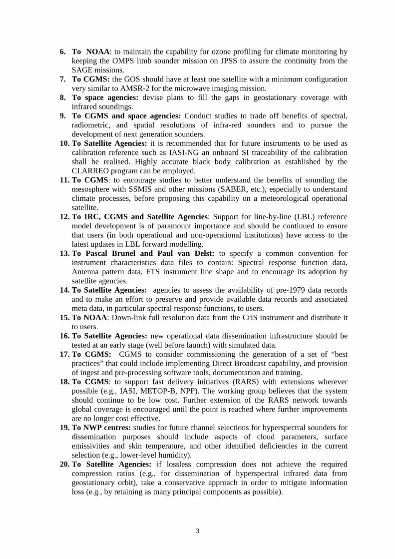
6. To NOAA: to maintain the capability for ozone profiling for climate monitoring by keeping the OMPS limb sounder mission on JPSS to assure the continuity from the SAGE missions.
7. To CGMS: the GOS should have at least one satellite with a minimum configuration very similar to AMSR-2 for the microwave imaging mission.
8. To space agencies: devise plans to fill the gaps in geostationary coverage with infrared soundings.
9. To CGMS and space agencies: Conduct studies to trade off benefits of spectral, radiometric, and spatial resolutions of infra-red sounders and to pursue the development of next generation sounders.
10. To Satellite Agencies: it is recommended that for future instruments to be used as calibration reference such as IASI-NG an onboard SI traceability of the calibration shall be realised. Highly accurate black body calibration as established by the CLARREO program can be employed.
11. To CGMS: to encourage studies to better understand the benefits of sounding the mesosphere with SSMIS and other missions (SABER, etc.), especially to understand climate processes, before proposing this capability on a meteorological operational satellite.
12. To IRC, CGMS and Satellite Agencies: Support for line-by-line (LBL) reference model development is of paramount importance and should be continued to ensure that users (in both operational and non-operational institutions) have access to the latest updates in LBL forward modelling.
13. To Pascal Brunel and Paul van Delst: to specify a common convention for instrument characteristics data files to contain: Spectral response function data, Antenna pattern data, FTS instrument line shape and to encourage its adoption by satellite agencies.
14. To Satellite Agencies: agencies to assess the availability of pre-1979 data records and to make an effort to preserve and provide available data records and associated meta data, in particular spectral response functions, to users.
15. To NOAA: Down-link full resolution data from the CrIS instrument and distribute it to users.
16. To Satellite Agencies: new operational data dissemination infrastructure should be tested at an early stage (well before launch) with simulated data.
17. To CGMS: CGMS to consider commissioning the generation of a set of “best practices” that could include implementing Direct Broadcast capability, and provision of ingest and pre-processing software tools, documentation and training.
18. To CGMS: to support fast delivery initiatives (RARS) with extensions wherever possible (e.g., IASI, METOP-B, NPP). The working group believes that the system should continue to be low cost. Further extension of the RARS network towards global coverage is encouraged until the point is reached where further improvements are no longer cost effective.
19. To NWP centres: studies for future channel selections for hyperspectral sounders for dissemination purposes should include aspects of cloud parameters, surface emissivities and skin temperature, and other identified deficiencies in the current selection (e.g., lower-level humidity).
20. To Satellite Agencies: if lossless compression does not achieve the required compression ratios (e.g., for dissemination of hyperspectral infrared data from geostationary orbit), take a conservative approach in order to mitigate information loss (e.g., by retaining as many principal components as possible).
4
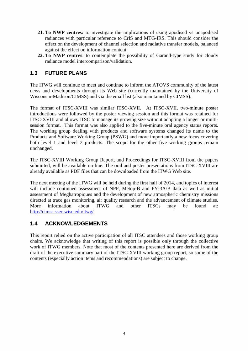
21. To NWP centres: to investigate the implications of using apodised vs unapodised radiances with particular reference to CrIS and MTG-IRS. This should consider the effect on the development of channel selection and radiative transfer models, balanced against the effect on information content.
22. To NWP centres: to contemplate the possibility of Garand-type study for cloudy radiance model intercomparison/validation.
1.3 FUTURE PLANS The ITWG will continue to meet and continue to inform the ATOVS community of the latest news and developments through its Web site (currently maintained by the University of Wisconsin-Madison/CIMSS) and via the email list (also maintained by CIMSS). The format of ITSC-XVIII was similar ITSC-XVII. At ITSC-XVII, two-minute poster introductions were followed by the poster viewing session and this format was retained for ITSC-XVIII and allows ITSC to manage its growing size without adopting a longer or multi-session format. This format was also applied to the five-minute oral agency status reports. The working group dealing with products and software systems changed its name to the Products and Software Working Group (PSWG) and more importantly a new focus covering both level 1 and level 2 products. The scope for the other five working groups remain unchanged. The ITSC-XVIII Working Group Report, and Proceedings for ITSC-XVIII from the papers submitted, will be available on-line. The oral and poster presentations from ITSC-XVIII are already available as PDF files that can be downloaded from the ITWG Web site. The next meeting of the ITWG will be held during the first half of 2014, and topics of interest will include continued assessment of NPP, Metop-B and FY-3A/B data as well as initial assessment of Meghatropiques and the development of new atmospheric chemistry missions directed at trace gas monitoring, air quality research and the advancement of climate studies. More information about ITWG and other ITSCs may be found at: http://cimss.ssec.wisc.edu/itwg/ 1.4 ACKNOWLEDGEMENTS This report relied on the active participation of all ITSC attendees and those working group chairs. We acknowledge that writing of this report is possible only through the collective work of ITWG members. Note that most of the contents presented here are derived from the draft of the executive summary part of the ITSC-XVIII working group report, so some of the contents (especially action items and recommendations) are subject to change.

5
SUMMARY OF ACTIONS AND RECOMMENDATIONS RADIATIVE TRANSFER AND SURFACE PROPERTY MODELLING Action RTSP-1
On indicated members to provide either the dataset or information about it (URLs, etc) to be hosted, or linked to, on the RTSP-WG website.
Action RTSP-2
On indicated members to provide either the dataset or information about it (URLs, etc) to be hosted, or linked to, on the RTSP-WG website.
Action RTSP-3
Co-Chairs to compile list of available models and publish on RTSP-WG website (with associated links as appropriate.)
Recommendation RTSP-1
Based upon the actions RTSP-1, RTSP-2, and RTSP-3, contemplate the possibility of Garand-type study for cloudy radiance model intercomparison/validation.
Action RTSP-4
Marco Matricardi to provide line-by-line dataset of LTE vs non-LTE computations. Data, or links to data, to be placed on the RTSP-WG website.
Action RTSP-5
Marco Matricardi to contact Manuel Lopez-Puertas to investigate the wider distribution of vibrational temperature profile data.
Recommendation RTSP-2
Introduce non-LTE effects in fast models. Action RTSP-6
Jean-Luc Moncet, Xu Liu, and James Hocking to provide feedback and current+planned capabilities of their respective fast models regarding unapodised radiances.
Recommendation RTSP-3
Encourage development of fast unapodised RT models. Action RTSP-7
ITSC members to contact RTSP-WG co-chairs regarding information on available sensor data.
Action RTSP-8
Paul van Delst to create a sensor acronym glossary on RTSP-WG web site. Recommendation RTSP-4
6
Pascal Brunel and Paul van Delst to specify a common convention for instrument characteristics data files to contain:
• Spectral response function data. • Antenna pattern data. • FTS instrument line shape.
Recommendation RTSP-5 Create a repository of sensor characteristics data for RT modeling community accessible via the RTSP-WP page.
Recommendation RTSP-6
Space agencies supply digitised channel system responses for BOTH microwave, infrared, and visible instruments.
Recommendation RTSP-7
Delivery of instrument characteristics as early as possible (even if not the final version – or especially so) to allow analysis of data in an RT modeling context.
Action RTSP-9
ITWG Co-Chairs to identify contacts for various programs (MetOp, JPSS, etc.; similar for Chinese, Japanese, Indian, Russian, Korean, etc. programs) and inform RTSP-WG Co-Chairs.
Action RTSP-10
Ben Ruston to provide report from Surface Properties Technical Sub-Group. COMPLETED.
Recommendation RTSP-8
Develop BRDF models for snow and ice. Action RTSP-11
RTSP-WG Co-Chairs to list reference model candidates on RTSP-WG website. Action RTSP-12
Eva Borbas, Fatima Karbou, Catherine Prigent, and Filipe Aires to provide information and guidance for determining a file convention.
Action RTSP-13
Stuart Newman to provide the CAVIAR MT-CKD-form of the updated IR water vapour continuum and associated documentation for use in generating transmittance training sets for RTTOV and CRTM.
Action RTSP-14
Carmine Serio to provide measured continua coefficients for the far-IR and associated documentation (see Serio, C. et al. 2012, JQSRT).
Action RTSP-15
Nicole Jacquinet to provide documentation on the relationship between spectroscopic databases and other quantities such as line coupling coefficients and continua.

7
Recommendation RTSP-9 Fast RT developers update their training datasets and coefficients when new spectroscopy becomes available.
Recommendation RTSP-10
Encourage validation and intercomparison of LBL models/spectroscopy to assess the impact of spectroscopic uncertainties and the differences between line-by-line models. The members of the RTSP working group recognise this is a project that will require a large effort.
Recommendation RTSP-11
Support for line-by-line (LBL) reference model development is of paramount importance and should be continued to ensure that operational centres have access to the latest updates in LBL forward modelling.
CLIMATE Action Climate-1
ITWG co-chairs to communicate recommendations climate 2-11, 13, 14 and 20, to CGMS.
Action Climate-2 Dieter Klaes to distribute the information on the planned EUMETSAT overlap requirement to the Working Group.
Recommendation Climate-1
Consider a session at next ITSC specifically on analyses of overlap requirements for continuity across changes in platform or technology (e.g. HIRS2/3/4 to AIRS, IASI and CrIS, SSMI to SSMIS).
Action Climate-3
ITWG Co-Chairs and Climate WG Chairs to consider this recommendation when planning the next ITSC.
Recommendation Climate-2
Agencies to consider the option of a fourth orbital plane in the next release of the vision for the Global Observing System to realise an improved sampling of the diurnal cycle with hyperspectral IR observations in the case that more than three polar orbiters are available in space.
Recommendation Climate-3
Space agencies to better plan the sequence of satellite launches into the polar orbit to minimise the risk of instrument failures and gaps in the time series of observations. Space agencies should consider this for the further planning of the space-based architecture for climate monitoring.
Recommendation Climate-5
US DoD to stretch out the DSMP mission by flying all remaining DMSP satellites in a single orbital plane.
8
Recommendation Climate-6
DMSP follow-on satellites should have a minimum configuration very similar to AMSR-2 for the microwave imaging mission. The sounding mission should maintain the current SSMIS mesosphere channels.
Recommendation Climate-7
Agencies to make an effort to archive and make accessible pre-launch instrument characterisation and algorithm software in particular for older missions launched prior to the year 2000.
Recommendation Climate-8
Agencies to continue with the implementation of common data and metadata standards such as CF and contents. This task shall be attached to existing CGMS actions on the interoperability of archives. Agreements shall be applied in GSICS and SCOPE-CM initiatives.
Action Climate-4
Jerome Lafeuille to inform Climate WG chairs on future developments on CLARREO type instruments flight opportunities.
Recommendation Climate-9
The realisation of absolute calibration missions (such as CLARREO) is further supported including flight opportunities on the ISS.
Recommendation Climate-10
It is recommended that for future IR instruments to be used as calibration reference such as IASI-NG an onboard SI traceability of the calibration shall be realised. Highly accurate black body calibration as established by the CLARREO program shall be employed to characterise IASI-NG instruments.
Recommendation Climate-11
To agencies to support GRUAN to provide and sustain high quality in-situ observations with value for satellite operator cal/val activities.
Recommendation Climate-12
It is recommended to consider radiosonde launches matching overpass times of IASI, AIRS, etc. at least four times a month at each station under favourable conditions (clear sky). In addition the redundancy concept needs to be strengthened to further increase the value of GRUAN for satellite operators.
Action Climate-5
Martin Stengel to communicate Recommendation Climate-12 to the GRUAN workshop in June 2012 and to report the outcome to the Climate WG.
Recommendation Climate-13
Space agencies to continue and strengthen their activities on inter-calibration of the HIRS series in the frameworks of GSICS and SCOPE-CM.

9
Action Climate-6 Joerg Schulz to distribute the ERA-CLIM report to the working group.
Recommendation Climate-14
To agencies to assess the availability of pre-1979 data records and to make an effort to preserve and provide available data records and associated meta data, in particular spectral response functions, to users.
Recommendation Climate-15
CM-SAF to assess if their plans could be adapted to a complete cloud property data record from TOVS to IASI.
Action Climate-7
Martin Stengel to provide information on the CM-SAF plan to the WG. Recommendation Climate-16
ESA to further consider the use of third party sounding data in the ESA-CCI phase-2 and to start collaboration with the SCOPE-CM initiative on the cloud ECV.
Action Climate-8
Thierry Phulpin to communicate to ESA-CCI. Recommendation Climate-17
To EUMETSAT and NOAA to reprocess IASI Level-2 products following the planned IASI Level-1 reprocessing.
Action Climate-9
Joerg Schulz to communicate Climate Recommendation 17 to EUMETSAT. Mitch Goldberg to communicate Climate Recommendation 17 to NOAA.
Recommendation Climate-20
EUMETSAT and other agencies to produce PC scores along with the planned IASI Level-1 data reprocessing activities and to conduct applicable studies to better understand the use of PC scores in the generation of multi-instrument CDRs.
Action Climate-10
Joerg Schulz to communicate to EUMETSAT.
Action Climate-11 Martin Stengel to assess the status and update the Climate Group web pages.
Action Climate 12
ITWG Co-Chairs and Climate WG lead to invite key presentations for ITSC-XIX on the utilisation of sounding instruments for climate.

10
DATA ASSIMILATION AND NUMERICAL WEATHER PREDICTION Recommendation DA/NWP-1 to all relevant space agencies
The constellation of at least three orbits (early morning, morning, and afternoon), each with full sounding capabilities (IR and MW), should be maintained. The overpass times of operational satellites with sounding capability (IR and MW) should be coordinated between agencies to maximize coverage (including, e.g., China, India).
Recommendation DA/NWP-2 to JAXA and partner agencies
GCOM-W data should be made available to the international NWP user community in real time and in BUFR.
Action DA/NWP-1 on ITSC Co-Chairs
To bring recommendations 1, 2, and 17 to the attention of CGMS.
Recommendation DA/NWP-3 to NOAA/NESDIS NOAA/NESDIS should consider establishing a similar capability with two complementary downlink stations for current and future polar orbiting satellites (e.g., NOAA, NPP, JPSS).
Recommendation DA/NWP-4 to WMO
To support fast delivery initiatives (RARS) with extensions wherever possible (e.g., IASI, METOP-B, NPP). The working group believes that the system should continue to be low cost. Further extension of the RARS network towards global coverage is encouraged until the point is reached where further improvements are no longer cost effective.
Recommendation DA/NWP-5 to Space Agencies
New operational data dissemination infrastructure should be tested at an early stage (well before launch) with simulated data.
Recommendation DA/NWP-6 to Space Agencies
There should be open access to new satellite data for all NWP centres to help with calibration and validation.
Recommendation DA/NWP-7 for NWP centres
Critically review options for remapping ATMS data (e.g., 3x3 averaging, FFT methods, Backus-Gilbert methods) with particular reference to quality control issues.
Action DA/NWP-2 on NWP Centres
Share results regarding remapping ATMS data with the NWP community via the NWP WG email list.
Recommendation DA/NWP-8 to NOAA and EUMETSAT
Consider harmonising the format and content of AMSU-A/MHS/AMSU-B files with respect to these noise estimates and also between RARS and global products.
Recommendation DA/NWP-9 to Space Agencies and data providers
When designing new or modified BUFR formats, please circulate drafts to the NWP community via the NWP Working Group for feedback, prior to submission to WMO.

11
Recommendation DA/NWP-10 to the NWP community Studies for future channel selections for dissemination purposes should include aspects of cloud parameters, surface emissivities and skin temperature, and other identified deficiencies in the current selection (e.g., lower-level humidity).
Recommendation DA/NWP-11 to space agencies
To consider using temporal and spatial characteristics to achieve a lossless compression for such hyperspectral sounders.
Recommendation DA/NWP-12 to space agencies
If lossless compression does not achieve the required compression ratios, take a conservative approach in order to mitigate information loss (e.g., by retaining as many principal components as possible).
Recommendation DA/NWP-13 to NWP centres and space agencies
To consider the implications from possible future use of PC compression for data dissemination, in particular in terms of
• Required frequency of updates to the PC-set that might result from long-term trends of the evolution of the atmospheric state and the instrument.
• Differences in the observation errors and Jacobians of reconstructed radiances.
Action DA/NWP-3 on Tom King To consider the investigation of time series of AIRS reconstruction scores to determine effects from long-term trends.
Action DA/NWP-4 on Andrew Collard
To collect pertinent information relevant to the use of PC compression on a web-page under the NWP WG web-site.
Recommendation DA/NWP-14 to NWP centres
To investigate the implications of using apodised vs. unapodised radiances with particular reference to CrIS and MTG-IRS. This should consider the effect on the development of channel selection and radiative transfer models, balanced against the effect on information content.
Action DA/NWP-5 on NWP centres
Continue to provide information on instrument channels assimilated and their observation error for inclusion on the NWP Working Group pages.
Action DA/NWP-6 on NWP centres
Send additions to the content on the NWP working group regional data assimilation page to Roger Randriamampianina ([email protected]).
Recommendation DA/NWP-15 to NWP WG members
To use the NWP working group mailing list ([email protected]) for questions or to alert other centres to data problems.
Action DA/NWP-7 on Robert Tubbs
To e-mail the NWP working group with the NWP SAF monitoring web-site and to request further information on its use from NWP working group members.
12
Action DA/NWP-8 on Robert Tubbs
To check that the links on the NWP working group monitoring web-site are consistent with those on the NWP SAF monitoring page, before the NWP working group monitoring web-site gets replaced with a link to the NWP SAF monitoring page.
Action DA/NWP-9 on NWP working group members
If you have evidence of RFI, please send these to Niels Bormann ([email protected]) for inclusion on the NWP working group RFI web page.
Action DA/NWP-10 on NWP WG co-chairs
To set up an SSMI/S web-page with information on quality control and bias correction experiences, and to NWP working group members to contribute to this page.
Recommendation DA/NWP-16 for NRL
To review the quality flags provided in the BUFR data for SSMI/S to flag any known erroneous data.
Action DA/NWP-11 on Roger Randriamampianina
To e-mail the NWP Working Group with a proposal for a bias correction intercomparison exercise. This will cover both regional and global data assimilation models.
Action DA/NWP-12 on NWP centres
To consider Roger's proposals and to provide feedback and data as appropriate. Action DA/NWP-13 on ITSC members
If you have estimates of revised channel characteristics resulting from post-launch diagnostics, please email these to Paul van Delst ([email protected]).
Recommendation DA/NWP-17 to funding bodies of NWP centres and space agencies
Consider, as part of the cost of satellite programs, providing computational and personnel resources targeted at operational NWP centres to optimise the public’s return on investment from these expensive measurement systems.
ADVANCED SOUNDERS Recommendation AS-1 to space agencies (e.g., NOAA, JAXA)
Devise plans to fill gaps in geostationary coverage with infrared soundings.
Action AS-1 ITWG Co-Chairs to present the concern of this group to CGMS.
Recommendation AS-2 to space agencies
1. Pursue the development of advanced microwave sounders with high spectral resolution and reduced noise in order to enhance vertical resolution of temperature and moisture soundings under partial and non-precipitating cloud conditions.
2. Extend developments of microwave receiver technology to enable high spectral resolution measurements with lower noise in the 50-60 GHz region.

13
Action AS-2 ITWG Co-Chairs to present the recommendation of this group to relevant space agencies (e.g., NASA, ESA, JAXA).
Recommendation AS-3 to space agencies
1. Conduct studies to trade off benefits of spectral, radiometric, and spatial resolutions of infrared sounders.
2. Consider the development of active techniques for future systems (lidar, radar, GPS). Action AS-3
ITWG Co-Chairs to present the concerns of this group to space agencies. Recommendation AS-4 to NOAA
1. Develop plans for the next generation infrared sounders (evolution of CrIS) for the JPSS-2 and follow-on satellites.
2. Pursue the development of next generation sounders, which support higher spatial resolution and denser spatial sampling, complementary to the high spectral and high radiometric resolution of IASI-NG; this includes the highest spectral resolution being maintained in all bands and the elimination of band gaps.
Action AS-4
ITWG Co-Chairs to present the recommendation of this group to NOAA. Recommendation AS-5 to users
1. Preserve hyperspectral information in CrIS data by utilising either full CrIS spectra or unapodised radiances if a sub-set of spectral samples is utilised.
2. Develop radiative transfer codes for the use with unapodised radiances. 3. Develop radiative transfer codes in PC space and educate users to make use of these in
data assimilation (and retrieval). Or 4. Ensure apodised radiance channel sub-set is representative, i.e. channel subset sufficiently
covers spectral band(s) of interest and noise representation includes apodisation and inter-channel correlations.
Recommendation AS-6 to EUMETSAT
Preserve hyperspectral resolution information in CrIS data from EARS by either distributing full CrIS spectra or disseminating unapodised spectral samples if a sub-set needs to be distributed.
Action AS-5
ITWG Co-Chairs to present the concern of this group to EUMETSAT. Recommendation AS-7 to NOAA
Down-link full resolution data from the CrIS instrument and distribute it to users. Action AS-6
ITWG Co-Chairs to present the concern of this group to NOAA. Action AS-7 to ITWG
Report current state of compression techniques. Recommendation AS-8 to space agencies
Pursue advancement of loss-less compression techniques for hyperspectral sounders.
14
INTERNATIONAL ISSUES AND FUTURE SYSTEMS Action IIFS-1
To draw all the frequency management and RFI information together on the ITWG web site, making the RFI issue visible on the first page. (Steve English, in consultation with Jean Pla, to provide input to the webmasters Leanne Avila and Bill Bellon).
Action IIFS-2
To update the frequency management pages taking into account the outcome of WRC-12 (Jean Pla to provide input to the webmasters Leanne Avila and Bill Bellon).
Action IIFS-3
All ITWG members detecting anomalies that are suspected to be caused by RFI in 1400-1427 MHz and other bands are requested to report to Jean Pla ([email protected]) as the ITWG coordinator for frequency matters, and to their national radiofrequency management authority (Note: J. Pla can provide guidance on who the authority is and how to characterize and address the matter with the radio-frequency authorities).
Recommendation IIFS-1
All ITWG members to ensure that their Direct Readout stations are registered with the national radio frequency authorities.
Recommendation IIFS-2
CMA to consider the redeployment of LEO mission to an early morning orbit, in accordance with the following priority order (from an ITWG perspective): (1) Early morning, (2) Afternoon, (3) Mid-morning.
Recommendation IIFS-3
CGMS to consider the potential implications of various funding schemes and public-private partnership with respect to the global technical coordination of the space-based observing system pursued by CGMS, and with respect to data policy, and to establish an appropriate mechanism to ensure that such initiatives can be globally coordinated by CGMS and open data accessibility is guaranteed.
Recommendation IIFS-4
The Russian Federation to make the Meteor-M mission a fully contributing component of the GOS by providing the global data sets from this mission in a timely manner with all necessary ancillary information.
Recommendation IIFS-5
CGMS to consider defining a set of “best practices” that could include implementing Direct Broadcast capability, and provision of ingest and pre-processing software tools, documentation and training.
Recommendation IIFS-6
CMA to facilitate the delivery of FY3 software and user support.

15
Recommendation IIFS-7 CGMS to inform the ITWG of the draft standard for LEO Direct Broadcast in X-Band and seek feedback from ITWG.
Action IIFS-4
WMO to perform a survey on whether there remains a requirement for a low data rate service in the L-Band in addition to the X-Band High Data Rate for future LEO missions.
Recommendation IIFS-8
JAXA to consider including a Direct Broadcast capability aboard GCOM-W2. Recommendation IIFS-9
Satellite operators, ITWG Members and WMO to advance the extension of RARS to new satellite systems.
Recommendation IIFS-10
NOAA and EUMETSAT to explore dissemination of Principal Components of the full CrIS spectrum in the context of RARS.
Recommendation IIFS-11
JMA to consider a broadcast service to facilitate access to Himawari-8 and -9 data in particular for users in Pacific islands that have limited Internet connectivity.
Recommendation IIFS-12
CGMS satellite operators to investigate the potential use of satellite-to-satellite communication (e.g. Tracking and Data Relay Satellite System, TDRSS) as a mechanism to support timely collection and redistribution of polar-orbiting satellite data in future systems.
PRODUCTS AND SOFTWARE Action PSWG-1
Decide on a solution for working group user driven content and set up logins. This is needed because the group needs to add and edit content online without needing a web admin. Ray Garciá and Scott Mindock.
Action PSWG-2
As part of the ITWG website redesign, the SSSP (now PSWG) web content should be reviewed for inactive or non-relevant links. Bill Bellon.
Action PSWG-3
Review currently available processing systems and software packages that can be obtained by the user community, and identify gaps. This is needed so that recommendations can be made to product and software development teams to add new features. Nigel Atkinson and Anna Booton.
Recommendation PSWG-1 to EUMETSAT
Investigate the feasibility of releasing the official IASI Level 2 retrieval algorithm in software form. This is needed because IASI users would like to be able to run the software in real-time using direct broadcast data for nowcasting applications.
16
Action PSWG-4 ITWG to request that IASI Level 2 software be made available. PSWG Co-Chairs
Action PSWG-5
Investigate how IASI Level 2 software could be made available. Dorothée Coppens Recommendation PSWG-2 to CIMSS
We recommend that CIMSS continues to support IAPP for POES processing, and investigates whether it could be adapted for Metop-B, and also Suomi NPP.
Action PSWG-6
Send request to CIMSS for continued support for IAPP for Metop-B, and investigate feasibility of adapting it for Suomi NPP. Nathalie Selbach
Recommendation PSWG-3 to GeoMetWatch (GMW)
Request that GMW clarifies its policy on data and software availability and licensing. This is needed so that the user community knows what to expect from GMW data in future.
Action PSWG-7
Liase with the International Issues and Future Systems working group to forward request for information to GeoMetWatch. PSWG Co-Chairs.
Recommendation PSWG-4 to RTTOV team
RTTOV team to investigate improving memory usage related to the IR emissivity atlas. Action PSWG-8
Send technical details and examples of memory usage to RTTOV team. Tim Hultberg. Recommendation PSWG-5 to CRTM team
CRTM to implement UWIREMIS database, similar to RTTOV. Action PSWG-9
Request CRTM team to add UWIREMIS database support. Allen Huang. Recommendation PSWG-6
Working group to assemble and disseminate information on vendors for DB antenna systems and contact information.
Action PSWG-10
Assemble a list of DB vendors, contact information, and capabilities. Liam Gumley. Recommendation PSWG-7
Review sources of information on validation data for satellite products and ensure links are available on Working group website.
Action PSWG-11
Review links on the validation section of the website and add any new sources of information. Lydie Lavanant.
Recommendation PSWG-8 to ITWG members
ITWG members should work with NOAA STAR Sounding validation team if they have temperature and moisture products they wish to validate.
Action PSWG-12
Provide contact information on the working group website for anyone who wishes to contact STAR validation team. Bomin Sun
17
Recommendation PSWG-9
ATMS, VIIRS, and CrIS SDR calibration traceability must be improved to allow users to investigate detailed instrument performance.
Action PSWG-13
Investigate ways to expose or save calibration information from the RDR files. Ray Garciá, Nigel Atkinson.
Action PSWG-14
In order to maintain a record of product provenance, create a set of guidelines for metadata to be associated with satellite products. Geoff Cureton
Recommendation PSWG-10 to JPSS Project
JPSS Project should investigate ways to streamline or improve data volume to reduce bandwidth needed for distribution. For example, request NOAA CLASS to apply internal HDF5 compression.
Action PSWG-15
Send request to JPSS Program Scientist for CLASS to offer optional internal HDF5 compression. Nigel Atkinson, Liam Gumley.
Action PSWG-16
Assemble the currently available studies on infrared sounder field of view size and write up a summary. Lydie Lavanant
Action PSWG-17
Assemble a table of currently available software for visualization and analysis of satellite products, including version numbers, capabilities, sensors and formats supported, and download links. Nathalie Selbach
Action PSWG-18
Create a Python cookbook for satellite products including Suomi NPP, EOS, POES, and Metop, in coordination with PyTroll developers. Ray Garciá, Geoff Cureton, Graeme Martin, Scott Mindock.
Recommendation PSWG-11
Collect lessons learned from working with NPP/JPSS and GOES-R algorithms and provide to NOAA/JPSS.
Action PSWG-19
Write an “ADL Lessons Learned” document and submit to JPSS Program. Graeme Martin, Ray Garciá.
Action PSWG-20
Write a guide to “Compiling Portable Binary Code” and make available to ITWG online. Graeme Martin, Ray Garciá
Action PSWG-21
Advertise on ITWG website and associated software package websites that users can contribute their own algorithms or software for product generation. Kathy Strabala.
18
2. WORKING GROUP REPORTS
2.1 RADIATIVE TRANSFER AND SURFACE PROPERTY MODELLING Web site: https://groups.ssec.wisc.edu/groups/itwg/rtsp
Working Group Members: Paul van Delst (Co-Chair), Marco Matricardi (Co-Chair), Jose A. Aravequia, Raymond Armante, Eva Borbas, Pascal Brunel, Xavier Calbet, Virginie Capelle, Enza Di Tomaso, James Hocking, Gerrit Holl, Nicole Jacquinet, Tom Kleespies, Robert Knuteson, Guido Masiello, Stuart Newman, Benjamin Ruston, Carmine Serio, Olaf Stiller, Jerome Vidot, Peter K.H. Wang 2.1.1 Clouds and aerosols Profile and Observation Data Collect existing profile and observation (in-situ and radiance) datasets for use in comparisons, and in validating the cloudy/scattering RT models. Current list:
• DARDAR (CALIOP, CALYPSO). Only for ice. (Jerome Vidot) • C3VP (Paul van Delst) • Ongoing work at UKMO for validation (Stuart Newman) • Rydberg, Frank Evans (Gerrit Holl) • MACC for aerosols (Marco Matricardi)
Action RTSP-1
On indicated members to provide either the dataset or information about it (URLs, etc) to be hosted, or linked to, on the RTSP-WG website.
Optical Properties Datasets (IR and MW, spherical and non) Collect existing cloud and aerosol optical properties datasets used by RT models for use in comparisons, and in validating the cloudy/scattering RT models. Current list:
• Baran (meas. + calcs) dataset (Jerome Vidot) • Gang Hong (MW only calcs, includes polarisation) (Gerrit Holl) • OPAC (meas. + calc) dataset. GADS as well. (Nicole Husson/Virginie Capelle) • RTTOV calculated dataset (Marco Matricardi) • CRTM calculated dataset (Paul van Delst)
Action RTSP-2 On indicated members to provide either the dataset or information about it (URLs, etc) to be hosted, or linked to, on the RTSP-WG website.
Reference RT Model for Scattering List available models for generating cloud- and/or aerosol- affected radiances for use as a reference. For example,
• LBLRTM+optical properties+DISORT • 4A+DISORT • VLIDORT (similar to DISORT but with Jacobians)
19
Action RTSP-3 Co-Chairs to compile list of available models and publish on RTSP-WG website (with associated links as appropriate).
Cloudy Radiance Model Intercomparison and Validation Intercomparison and validation of cloudy radiative transfer models is difficult to outline without first defining the input data sets, the particle optical properties, and a reference calculation. Recommendation RTSP-1
Based upon the actions RTSP-1, RTSP-2, and RTSP-3, contemplate the possibility of Garand-type study for cloudy radiance model intercomparison/validation.
2.1.2 Fast Model New Features Non-LTE Several items regarding the implementation of non-LTE in fast models were discussed, specifically:
• What channels are affected (daytime/nightime)? • Where to get the vibration temperature profiles? (Manuel Lopez-Puertas, IAA) • Are all the isotopologues of affected molecules in the spectroscopic database? • What are the accuracies of the current fast model parameterisations?
The following actions were introduced to facilitate the implementation of non-LTE effects in fast models. Action RTSP-4
Marco Matricardi to provide line-by-line dataset of LTE vs non-LTE computations. Data, or links to data, to be placed on the RTSP-WG website.
Action RTSP-5
Marco Matricardi to contact Manuel Lopez-Puertas to investigate the wider distribution of vibrational temperature profile data.
Recommendation RTSP-2
Introduce non-LTE effects in fast models. Unapodised Radiance Models for FTS Sensors Radiative transfer models to compute unapodised radiances are not currently used operationally, but their development anticipates a future need. For example, the baseline for MTG-IRS is for unapodised radiances. The currently available candidates to generate unapodised radiances are
• OSS (Jean-Luc Moncet) • PCRTM (Xu Liu) • RTTOV/PC_RTTOV (James Hocking)
Alternative methodologies were also discussed, e.g. deapodisation – all channels only.
20
Action RTSP-6 Jean-Luc Moncet, Xu Liu, and James Hocking to provide feedback and current+planned capabilities of their respective fast models regarding unapodised radiances.
Recommendation RTSP-3
Encourage development of fast unapodised RT models. 2.1.3 Instruments Sensors Sensors for which instrument characteristics are required are shown in Table 1 below. New Sensors Old Sensors1 Meteor-M FY-3B SSU SCAMS (Nimbus-6) EPS-NG IASI-NG PMR (Nimbus-6) SSMR (Seasat) MTG-IRS GIFTS/STORM HIRS (Nimbus-6) SSM/T (DMSP) Iridium VTPR (NOAA 2-5) SSM/T-2 (DMSP)
Table 1: List of sensors for which instrument characteristics are required. Action RTSP-7
ITSC members to contact RTSP-WG co-chairs regarding information on available sensor data.
Action RTSP-8
Paul van Delst to create a sensor acronym glossary on RTSP-WG web site. Recommendation RTSP-4
Pascal Brunel and Paul van Delst to specify a common convention for instrument characteristics data files to contain:
• Spectral response function data. • Antenna pattern data. • FTS instrument line shape.
Recommendation RTSP-5 Create a repository of sensor characteristics data for RT modeling community accessible via the RTSP-WP page.
Sensor Characteristics Generation of fast model coefficients for sensors requires timely delivery of sensor characteristics data to RT model developers. Satellite radiance data cannot be effectively used in either NWP or retrieval schemes if the RT model does not accurately reflect the sensor response. The data typically required are:
• Spectral Response Functions (SRFs) • Channel polarisations, • Antenna temperature corrections
1 From Saunders, R. “RTTOV coefficients for old satellite sensors”, MetOffice/ERA-CLIM report.

21
• FTS line shape. Information on spectral sampling, and how to best handle the band edges should also be supplied.
Recommendation RTSP-6 Space agencies supply digitised channel system responses for BOTH microwave, infrared, and visible instruments.
Recommendation RTSP-7
Delivery of instrument characteristics as early as possible (even if not the final version – or especially so) to allow analysis of data in an RT modeling context.
Action RTSP-9
ITWG Co-Chairs to identify contacts for various programs (MetOp, JPSS, etc.; similar for Chinese, Japanese, Indian, Russian, Korean, etc. programs) and inform RTSP-WG Co-Chairs.
2.1.4 Surface Properties Action RTSP-10
Ben Ruston to provide report from Surface Properties Technical Sub-Group. COMPLETED.
BRDF implementations for fast RT models are required for all land surface types. For example, Jerome Vidot’s BRDF model is for land, but need similar for snow and ice (water can use analytical model). Recommendation RTSP-8
Develop BRDF models for snow and ice. Additionally, an interface can be provided for users to input their own model data into the fast RT models. Surface property physical reference models should be identified for use in validating fast RT surface property modelling. The reference models should have the following characteristics:
• Be themselves validated. • Include angular dependence. • Be valid on both micro- and macroscopic scales. • Be usable with dedicated surface property missions (e.g. SMOS, SMAP)
Some initial reference model candidates mentioned were • MW: CMEM, QC/DMRT • IR: Snyder’s model. • NWP-SAF RTTOV Emissivity data2.
Action RTSP-11
RTSP-WG Co-Chairs to list reference model candidates on RTSP-WG website.
2 http://research.metoffice.gov.uk/research/interproj/nwpsaf/rtm/emissivity

22
To ease the implementation of emissivity atlases and databases in fast RT models, a convention for datafile formats should be investigated. The questions to be answered regarding content are:
• What quantities, units, spectral sampling, spectral resolution, spatial resolution, and temporal resolution are required?
• What ancillary information is required? E.g., surface type, quality control, error characteristics, etc.
• What naming conventions should be used? Action RTSP-12
Eva Borbas, Fatima Karbou, Catherine Prigent, and Filipe Aires to provide information and guidance for determining a file convention.
2.1.5 Spectroscopy and forward models Continuum updates from CAVIAR.
• MT-CKD-type of format for continuum coefficients allows for easy insertion into LBLRTM – which is the forward model employed by RTTOV and CRTM to generate the transmittance data used to train the regression models.
• There is a dependence of continua parameterisation on line spectroscopy so the MT-CKD-type of continua updates are not necessarily transferable to other LBL models.
Action RTSP-13
Stuart Newman to provide the CAVIAR MT-CKD-form of the updated IR water vapour continuum and associated documentation for use in generating transmittance training sets for RTTOV and CRTM.
Action RTSP-14
Carmine Serio to provide measured continua coefficients for the far-IR and associated documentation (see Serio, C. et al. 2012, JQSRT).
Action RTSP-15
Nicole Jacquinet to provide documentation on the relationship between spectroscopic databases and other quantities such as line coupling coefficients and continua.
Spectroscopy is updated continously, in both the microwave and infrared. Recommendation RTSP-9
Fast RT developers update their training datasets and coefficients when new spectroscopy becomes available.
Recommendation RTSP-10
Encourage validation and intercomparison of LBL models/spectroscopy to assess the impact of spectroscopic uncertainties and the differences between line-by-line models. The members of the RTSP working group recognise this is a project that will require a large effort.
Recommendation RTSP-11
Support for line-by-line (LBL) reference model development is of paramount importance and should be continued to ensure that operational centres have access to the latest updates in LBL forward modelling.
23
2.2 CLIMATE Web site: http://cimss.ssec.wisc.edu/itwg/cwsg/
Jörg Schulz (Co-Chair), Thierry Phulpin (Co-Chair), Ruiyue Chen, Mitch Goldberg, Anton Kaifel, Dieter Klaes, Byung-Ju Sohn, Martin Stengel, and Claudia Stubenrauch Satellite data play an increasingly influential role in monitoring climate variability and change as well as understanding climate processes. They will continue to do so in the new era of climate services as the need for increased spatial and temporal fidelity as well as global coverage in our observational datasets increases. In particular data from sounding instruments are proven useful for the provision of a multitude of GCOS Essential Climate Variables such as temperature and water vapour profiles, as well as several trace gases. In addition, the IR sounders IASI, AIRS and also CrIS are increasingly used to improve the HIRS instrument radiance records and also records of geostationary instruments such as MVIRI on the Meteosat First and SEVIRI on the Meteosat Second Generation satellites. This will result in improved Fundamental Climate Data Records that can be utilised for improved ECV CDRs and in NWP based reanalysis. The climate Working Group considered five specific areas in their discussions:
• Current programs and mission planning; • Ensuring the data record – This includes data archiving and meta data issues and
activities leading to a better interoperability of space agencies’ archives; • Cal / Val Activities – Consideration of space- and ground-based activities, in
particular if those meet the needs for improving the sounding data CDRs; • Planned and ongoing analysis – Considers work programmes for climate research and
analysis that are in operation or advanced planning; and • Strategy for data compression – Considers to what extent compressed data are being
used for the construction of ECV CDRs and if not what is the plan to (or not to) utilise them.
It was envisaged that these five areas would cover the continuum of points participants wished to raise. Because of the limited size of the working group the discussed points may not reflect the use of sounding data for climate in its entirety. Thus, the working group also briefly discussed its internal administration considering a concept to strengthen the attendance of key players in climate research to future ITSCs. Several recommendations to CGMS arose from the discussions in the group. The submission of them is summarised in the following action for the ITWG co-chairs. Action Climate-1
ITWG co-chairs to communicate recommendations climate 2-11, 13, 14 and 20, to CGMS.
2.2.1 Current Programs / Missions in Planning Temporal Instrument Overlap Requirements The discussion on this topic has been almost a standing item in climate working group deliberations for well over a decade. General recommendations had been made before and there was little value to be gained in repetition. The associated GCOS climate monitoring
24
principle calls for a sufficient temporal overlap of observations to assure the construction of a reliable FCDR over time. However, ITSC-XVII already stated that quantitative estimates of the needed overlap that will likely be instrument specific are only scattered in the literature and no systematic assessment has recently been made. Increasing overlap requirements may present a substantial burden to space agencies as they can be cost drivers and also increase the complexity of ground segments with parallel operations of more than one instrument. The Working Group noted that EUMETSAT is planning an overlap requirement for the EPS-SG programme. To support such activities there is a need to robustly quantify recommendations in GCOS climate monitoring principles on temporal overlaps required when the satellite technology changes. A systematic assessment of the impact of different overlap strategies and their fundamental value vis-à-vis the cost should be undertaken to serve as a baseline for overlap requirements for currently planned missions. Current inter-calibration activities as presented at the conference represent an opportunity to study needed overlaps among different sensors. Action Climate-2
Dieter Klaes to distribute the information on the planned EUMETSAT overlap requirement to the Working Group.
Recommendation Climate-1
Consider a session at next ITSC specifically on analyses of overlap requirements for continuity across changes in platform or technology (e.g. HIRS2/3/4 to AIRS, IASI and CrIS, SSMI to SSMIS).
Action Climate-3
ITWG Co-Chairs and Climate WG Chairs to consider this recommendation when planning the next ITSC.
Diurnal Sampling / Orbital Slots The diurnal variation associated with the solar heating cycle is one of the most fundamental components accounting for variability in the weather and climate systems. In fact, the variability of water vapour at various spatio-temporal scales has been an important issue in climate study because of its association with radiative cooling and latent heating and its interactions with the cloud system. Despite its importance, diurnal variations of deep convection, precipitation, cloudiness, outgoing longwave radiation, and upper tropospheric humidity are still far from our understanding. Considering that hyperspectral IR measurements provide ample opportunities of studying the influences of cloud, moisture and lapse rate changes on the radiation budget and thus the climate change, an adequate diurnal sampling, e.g., every 3 hours, would be needed to better facilitate the use of hyperspectral measurements from various satellites for studying diurnal variations. Currently, the vision for the Global Observing System foresees a 4 hourly sampling maintaining three orbital planes, but realized are only two orbital planes at the moment. Assuming that the GCOS climate monitoring principle on sensor overlap in each orbital plane is followed, the WG is of the opinion that for climate it would be more beneficial to increase the periodicity of observations instead of planning for back-up satellites for each orbital plane.
25
Recommendation Climate-2 Agencies to consider the option of a fourth orbital plane in the next release of the vision for the Global Observing System to realise an improved sampling of the diurnal cycle with hyperspectral IR observations in the case that more than three polar orbiters are available in space.
Additionally, the WG agreed that adequate sampling of the diurnal cycle also requires complete coverage with geostationary imagery around the globe carrying a minimum set of common channels, i.e., at least the historically used channels. Coordination of Polar Orbiting Satellite Launches The Working Group noted that plans for satellite launches are not well coordinated among international agencies. For instance launches of NOAA Suomi NPP satellite took place in October 2011 and the launch of Metop-B was planned for May 2012. The launches close together in time lead to an increased risk of instrument failures with an increased risk for a gap in the observational record that cannot easily be recovered. Recommendation Climate-3
Space agencies to better plan the sequence of satellite launches into the polar orbit to minimise the risk of instrument failures and gaps in the time series of observations. Space agencies should consider this for the further planning of the space-based architecture for climate monitoring.
Continuity of Atmospheric Composition Observations for Climate Monitoring Vertically resolved ozone measurements are essential for climate monitoring and are largely provided by limb sounding instruments. The Working Group noted that the OMPS limb sounder is also planned for the NOAA JPSS mission because it is needed to provide continuity for ozone profiling in the future. Working Group members were made aware that in the case of budget problems the OMPS limb sounder mission may not be kept on the JPSS programme. Recommendation Climate-4
NOAA to maintain the capability for ozone profiling for climate monitoring by keeping the OMPS limb sounder mission on JPSS to assure the continuity from the SAGE missions.
DMSP Satellites and DMSP Follow On The WG discussed the long-term continuity of these increasingly critical microwave imager/sounder instruments. It was noted that the DMSP F-19 satellite launch is now planned between October 2013 and September 2014. The launch of the last satellite will follow in an as-needed schedule without a specified year. DMSP satellites are currently flying in early and mid morning orbit. The WG noted that the new launch plan slightly improves the situation compared to 2010 also providing time to solve technical issues with the SSMIS instruments. The US Air Force at the direction from Congress terminated the Defense Weather Satellite System in January 2012. Although the Air Force is left with a budget to work on an unspecified follow-on system, concerns remain to whether a conically scanning microwave imager/sounder system is a high priority. This is further endangering the continuity of microwave imaging/sounding in the early morning orbit.
26
Considering the launch schedule for the last two DMSP satellites and the unclear situation with the follow-on program, the WG considers it best if the last two DMSP satellites would be launched into the same orbital plane with a preference for the early morning orbit. A microwave imaging capability is also planned for EUMETSAT’s EPS-SG programme maintaining major channels similar to the SSM/I but not adding low frequency (6.9, 10.65 GHz) channels mostly needed for SST products. After longer discussion the Working Group came to the consensus that a minimum configuration for a DMSP follow on microwave imager should be the AMSR-2 channel configuration. The WG also briefly discussed the value of the SSMIS mesosphere channels that are also not part of EUMETSAT’s EPS-SG mission. However, the WG could not assess today’s level of exploitation of the SSMIS mesosphere channels for climate monitoring. Recommendation Climate-5
US DoD to stretch out the DSMP mission by flying all remaining DMSP satellites in a single orbital plane.
Recommendation Climate-6
DMSP follow-on satellites should have a minimum configuration very similar to AMSR-2 for the microwave imaging mission. The sounding mission should maintain the current SSMIS mesosphere channels.
The WG also discussed the current space agency planning concerning the observation of the Earth radiation budget and the solar constant. The current planning sees only one CERES and TSIS instruments covering the very important broadband observations of the Earth Radiation Budget and the Solar Constant. One of the major shortcomings is the observation of aerosol optical depth. As these observations are highly critical to climate monitoring the risk of gaps and failure is very high. A gap in solar constant observations cannot be recovered. The WG urges the space agencies to initiate the development of a contingency concept for the Earth Radiation Budget and solar constant observations such as CERES and TSIS. The planning should become part of the space-based architecture for climate monitoring. The WG group agreed to only note the discussion but not to raise a specific recommendation and action on this from the ITWG because this theme is beyond the scope of the ITWG. 2.2.2 Data Archiving – Ensuring the Data Record Archival of Prelaunch Characterisation and Software as Documentation For the preservation of prelaunch characterisation of instruments, algorithm software and all mission and instrument related, the Working Group rates meta-data as very important. It was reported that some new activities have been started, e.g., at EUMETSAT, to screen older mission and instrument event databases with the aim of extracting information on all events that potentially change the resulting radiance data and transferring the information into better digestible formats for later use. However, pre-launch characterisation information for old instruments often only exists on paper in folders stored in bookshelves of offices. Here also document archaeology becomes necessary to preserve the most important information for the future.

27
Also the archival, description and provision of software that was used to process data from Level 0 to Level 1 and further to Level 2 was seen as important. The NOAA Climate Data Record program has started the provision of software for its projects as a mandatory deliverable. The value of the software provision is more seen for openly documenting the implementation of methodology that is described in peer reviewed publications and other documents rather than that users can implement the software for their own use. Recommendation Climate-7
Agencies to make an effort to archive and make accessible pre-launch instrument characterisation and algorithm software in particular for older missions launched prior to the year 2000.
Definition and Provision of Common Metadata in FCDR and TCDRs The WG also briefly discussed current activities to further align the standards such as the CF standard for data and metadata. Under debate is also the metadata content (what should be the common minimum?) of mission data, intermediate products and derived quantities. The discussion was triggered by the increasing need for the availability of satellite data records for the validation of climate models in the context of Climate Model Intercomparison Projects (CMIP) for the IPCC. Also extremely valuable in this context is the distribution of tools with the data that allow for format and grid, e.g., satellite product to climate model grid conversions. A further alignment of data and metadata standards is also seen as extremely useful to foster the interoperability of satellite data archives. Recommendation Climate-8
Agencies to continue with the implementation of common data and metadata standards such as CF and contents. This task shall be attached to existing CGMS actions on the interoperability of archives. Agreements shall be applied in GSICS and SCOPE-CM initiatives.
2.2.3 Cal / Val Activities The WG noted some progress with the inclusion of the metrology community into the process of establishing traceability in the characterisation of measurements, in particular pre-launch characterisation. Metrology experts were for instance consulted by GSICS in the context of establishing a traceable error characterisation of satellite-inter-calibration. In addition, the metrology standpoint has become part of first steps towards the architecture for space-based climate monitoring initiated by the WMO. However, the concepts still need to be better implemented in the current activities of the Climate Data Record construction. CLARREO Type Missions As at ITSC-XVII the WG discussed the situation around the proposed NASA CLARREO absolute calibration mission as such missions are seen as very important to climate. The postponement of the mission is a major drawback for the establishment of a traceable reference system for space-based observations at least in the infrared. However, as part of the CLARREO program blackbody calibration to mK level was established that can be used for the characterisation of EUMETSAT’S IASI-NG planned for the EPS-SG program. Although the WG was informed about potential opportunities to fly CLARREO type instruments on the ISS. The WG expects that future IR interferometers such as IASI-NG will
28
be needed as reference for other instruments in the next decades. Thus, the use of the best available on ground black body calibration is very important. Action Climate-4
Jerome Lafeuille to inform Climate WG chairs on future developments on CLARREO type instruments flight opportunities.
Recommendation Climate-9
The realisation of absolute calibration missions (such as CLARREO) is further supported including flight opportunities on the ISS.
Recommendation Climate-10
It is recommended that for future IR instruments to be used as calibration reference such as IASI-NG an onboard SI traceability of the calibration shall be realised. Highly accurate black body calibration as established by the CLARREO program shall be employed to characterise IASI-NG instruments.
GRUAN Activities around the GCOS Reference Upper Air Network have evolved since the last ITSC and in June 2012 a workshop on the extension of the GRUAN network is planned. However, the WG noted that the radiosonde data planned for GRUAN are currently launched at synoptic times that are not optimal for the usage in satellite cal/val activities. In addition the use of ground-based remote sensing instruments to better enable uncertainty studies needs to be strengthened. The WG agrees that engagement of space agencies into the GRUAN process is needed to enhance its value in the context of cal/val of satellite missions. In particular the availability of ground-based remote sensing data, e.g., from lidars and microwave radiometers is seen as important to increase the value of GRUAN sites for satellite operators. Recommendation Climate-11
To agencies to support GRUAN to provide and sustain high quality in-situ observations with value for satellite operator cal/val activities.
Recommendation Climate-12
It is recommended to consider radiosonde launches matching overpass times of IASI, AIRS, etc. at least four times a month at each station under favourable conditions (clear sky). In addition the redundancy concept needs to be strengthened to further increase the value of GRUAN for satellite operators.
Action Climate-5
Martin Stengel to communicate Recommendation Climate-12 to the GRUAN workshop in June 2012 and to report the outcome to the Climate WG.
TOVS/ATOVS HIRS Series Presentations at ITSC-XVIII have shown that several activities such as in LMD and CM-SAF are underway to produce CDRs using the complete series of TOVS/ATOVS/AIRS and IASI observations. All activities rely on the availability of inter-calibrated HIRS radiance data referenced to IASI and/or AIRS. The inter-calibration of the HIRS radiances referenced to IASI is currently under study at NOAA STAR and EUMETSAT.
29
The WG noted that the existing activities might need improved coordination in the frameworks of GSICS and SCOPE-CM to optimise the generation, provision and utilisation of the HIRS radiance data. Recommendation Climate-13
Space agencies to continue and strengthen their activities on inter-calibration of the HIRS series in the frameworks of GSICS and SCOPE-CM.
2.2.4 Planned and ongoing analysis Data reanalysis: pre-1979 data records The WG discussed the need to secure, document and provide satellite data records prior to 1979. This is of particular importance for ongoing preparation of new global reanalyses. Within the European ERA-CLIM project concerned with the preparation of the next 20th century reanalysis at ECMWF, Roger Saunders has made an attempt to identify and to describe the status and availability of early satellite data records. It is evident that more work and resources are needed to rescue such data records and to make them fit for use in reanalysis activities. Action Climate-6
Joerg Schulz to distribute the ERA-CLIM report to the working group. Recommendation Climate-14
To agencies to assess the availability of pre-1979 data records and to make an effort to preserve and provide available data records and associated meta data, in particular spectral response functions, to users.
Cloud property CDRs and ESA CCI The generation of cloud property data records from sounders has been successfully demonstrated at ITSC-XVIII, e.g., by presentations from Kahn and Stubenrauch. However, the ESA CCI project on the cloud ECV currently does not consider the use of sounding data, partly because of restrictions imposed by ESA on the project, partly by the funding scheme used for the CCI. The EUMETSAT Climate Monitoring SAF is considering such a cloud data record but only using TOVS/ATOVS data. In the USA cloud data records are produced mostly using AIRS and MODIS. The presentations at the conference and the discussions in the WG strengthened the impression that several activities are planned and performed but not necessarily internationally coordinated. The WG sees value in better coordination of the activities to generate a reliable cloud ECV record from sounding data. Recommendation Climate-15
CM-SAF to assess if their plans could be adapted to a complete cloud property data record from TOVS to IASI.
Action Climate-7
Martin Stengel to provide information on the CM-SAF plan to the WG. Recommendation Climate-16
ESA to further consider the use of third party sounding data in the ESA-CCI phase-2 and to start collaboration with the SCOPE-CM initiative on the cloud ECV.
30
Action Climate-8
Thierry Phulpin to communicate to ESA-CCI. IASI Level-2 reprocessing At ITSC-XVIII a successful use of IASI trace gas retrievals reprocessed by EUMETSAT was reported. To better facilitate the climatological analysis of IASI trace gas products a full reprocessing of the IASI Level-2 product including temperature and humidity profiles as well as trace gas products is needed. Recommendation Climate-17
To EUMETSAT and NOAA to reprocess IASI Level-2 products following the planned IASI Level-1 reprocessing.
Action Climate-9
Joerg Schulz to communicate Climate Recommendation 17 to EUMETSAT. Mitch Goldberg to communicate Climate Recommendation 17 to NOAA.
2.2.5 Strategy for data compression PC scores Due to the large data volumes that can be expected with future sounders such as the MTG-IRS the distribution and/or efficient use of full Level-1 data for reprocessing may become difficult in the future. The WG discussed the matter despite the fact that not many experts on PC scores were participating. The WG noted that data assimilation activities and also some retrieval schemes related to temperature and humidity profiles make already direct use of PC scores. However, current cloud property retrieval schemes employing sounder data mostly use radiances as input and not many plans exist to prepare retrieval schemes that can use PC scores. The WG noted that it also may become very difficult to construct a PC score CDR when instruments change as the scores are trained on one specific instrument. To enable the community to further study this issue the following recommendation is made. Recommendation Climate-20
EUMETSAT and other agencies to produce PC scores along with the planned IASI Level-1 data reprocessing activities and to conduct applicable studies to better understand the use of PC scores in the generation of multi-instrument CDRs.
Action Climate-10
Joerg Schulz to communicate to EUMETSAT.
2.2.6 Strengthening of ITWG Climate Group The number of presentations on climate and the number of participants in the Climate Working Group was rather small at ITSC-XVIII. This makes it more difficult to overlook all relevant issues concerning sounding data in relation to climate monitoring. However, all participants agreed that the group is useful and needed. The WG is of the strong opinion that the next ITSC shall see more dedicated talks on climate. This should be assured by inviting key presentations early enough and by refurbishing the Climate WG web pages on the ITWG web site.

31
Action Climate-11 Martin Stengel to assess the status and update the Climate Group web pages.
Action Climate 12
ITWG Co-Chairs and Climate WG lead to invite key presentations for ITSC-XIX on the utilisation of sounding instruments for climate.

32
2.3 DATA ASSIMILATION AND NUMERICAL WEATHER PREDICTION Working group members: Niels Bormann (Co-Chair, ECMWF), Andrew Collard (Co-Chair, NCEP), José Aravequia (CPTEC), Bjarne Amstrup (DMI), Fabrizio Baordo (ECMWF), William Campbell (NRL), Luis De Gonçalves (CPTEC), Enza Di Tomaso (ECMWF), Nadia Fourrié (Météo France), Stéphanie Guedj (Météo France), Wei Han (CMA), Min-Jeong Kim (NCEP), Yoonjae Kim (KMA), Thomas King (NESDIS), Christina Köpken-Watts (DWD), Dirceu Herdies (CPTEC), Jung-Rim Lee (KMA), Jun Li (UW Madison), Magnus Lindskog (SMHI), Zhiquan Liu (NCAR), Cristina Lupu (ECMWF), Pauline Martinet (Météo France), Akira Okagaki (JMA), Kozo Okamoto (JMA & ECMWF), Ed Pavelin (Met Office), Roger Randrianmampianina (OMSZ & met.no), Indira Rani (NCMRWF), Harald Schyberg (Norw.Met.Inst.), Bruna Silveira (CPTEC), Yi Song (NESDIS), Robert Tubbs (Met Office), Gilles Verner (EC), Anaïs Vincensini (Météo France) 2.3.1 Introduction ITSC-18 again saw a very strong contribution from the NWP community, leading to a large working group on Data Assimilation and NWP, with 33 experts representing 16 operational NWP centres. Due to other commitments, the former co-chair Godelieve Deblonde (EC) stepped down at this meeting. The working group thanked Godelieve for her contributions and hard work for the NWP Working Group over the years. Andrew Collard (NCEP) replaced her as new co-chair. Several presentations and posters at ITSC-18 captured a range of new research developments in NWP. Highlights included:
• First experiences with data from NPP, in particular ATMS. • Developments in the assimilation of cloud information, including aspects of channel
selection and radiative transfer. • Further developments and progress in the assimilation of surface-sensitive channels
over land or sea ice. • First efforts in the direct assimilation of principal component scores.
Data denial experiments and other forecast impact diagnostics continue to highlight the substantial impact from the assimilation of satellite sounder data in NWP. 2.3.2 Polar Orbiting Constellation Over the years, many observation impact experiments have demonstrated benefits from using MW and IR sounding data from three or more polar orbiting systems in NWP, compared to using data from just two orbits. An even spacing of orbits (early morning, morning and afternoon orbits) ensures the most homogeneous coverage, with benefits for forecast impact. With the recent cancellation of the polar orbiting satellite program of the US Department of Defense (DoD), such sounding capabilities in the early morning orbit are not secured in the future. The working group expressed its concern about this development. At the same time, the working group noted the promising developments and plans of other space agencies, in particular the Chinese FY-3 series, for which instruments from the first experimental satellites show encouraging data quality and availability. The working group sees potential in an optimized coordination between space agencies in this respect, and therefore strongly recommends international cooperation to ensure a better harmonization of orbits.
33
Recommendation DA/NWP-1 to all relevant space agencies The constellation of at least three orbits (early morning, morning, and afternoon), each with full sounding capabilities (IR and MW), should be maintained. The overpass times of operational satellites with sounding capability (IR and MW) should be coordinated between agencies to maximize coverage (including, e.g., China, India).
The cooperation between JAXA and NASA regarding GCOM-W and in particular AMSR-2 data was noted by the working group, and members reaffirmed their interest in obtaining the AMSR-2 data. It was not clear whether data access agreements are in place such that the data will be openly available to the wider user community via the JAXA/NASA partnership. The working group supports efforts already underway in this respect. Recommendation DA/NWP-2 to JAXA and partner agencies
GCOM-W data should be made available to the international NWP user community in real time and in BUFR.
Action DA/NWP-1 on ITSC Co-Chairs
To bring recommendations 1, 2, and 17 to the attention of CGMS. 2.3.3 Data Timeliness Timeliness of operational satellite data continues to be of great importance for the optimized use of the data in operational NWP. As shown at the meeting, data located towards the end of the assimilation period tends to have the largest impact in 4DVAR systems, and these data are most affected by data timeliness. Regional forecasting systems (often feeding warning applications) have even tighter cut-off times than global systems and rely on very swift data distribution. The community greatly appreciates the joint efforts between EUMETSAT and NASA that led to the MetOp downlink station in Antarctica which greatly aids the timeliness for MetOp data and led to a significant increase in the data usage at many centres. The WG encourages that similar capabilities are established for other current and future operational satellites. Recommendation DA/NWP-3 to NOAA/NESDIS
NOAA/NESDIS should consider establishing a similar capability with two complementary downlink stations for current and future polar orbiting satellites (e.g., NOAA, NPP, JPSS).
The working group also continues to support other low-cost initiatives to improve timeliness, such as the Regional ATOVS Retransmission Services (RARS), coordinated by WMO, which improves timeliness even further, down to less than 30 min. In particular, the WG welcomes the upcoming and planned extensions to IASI, MetOp-B, and NPP data. In the same context, the working group regrets that the Safety Net system (network of distributed downlink stations) has not been confirmed for the future JPSS. This makes it especially important to ensure that RARS capabilities are established and maintained also during the JPSS era. Recommendation DA/NWP-4 to WMO
To support fast delivery initiatives (RARS) with extensions wherever possible (e.g., IASI, METOP-B, NPP). The working group believes that the system should continue to be low cost. Further extension of the RARS network towards global coverage is

34
encouraged until the point is reached where further improvements are no longer cost effective.
2.3.4 Suomi NPP and Cal/Val of Future Instruments ITSC-18 saw first results being presented from the new instruments of Suomi NPP, with encouraging results from initial monitoring and assimilation trials of ATMS data in NWP systems participating in the cal/val phase. CrIS data availability has been very limited so far for NWP centres, but initial results from instrument teams suggest that the instrument is functioning well. European members of the NPP cal/val team (Met Office and ECMWF) noted that the provision of real-time data in BUFR during the cal/val phase was sub-optimal and did not meet the requirements of these cal/val team members. The expected data stream (dissemination via EUMETCast with collaboration between EUMETSAT and NDE) has not been routinely established at the time of ITSC-18, i.e., five months after launch. It is appreciated that some of the delays are a result of the restructuring of the NPP program, and community efforts to mitigate these issues are gratefully acknowledged. Working group members also appreciated the provision of simulated ATMS and CrIS data well before launch, which assisted many members in the preparation and testing of their systems as well as allowing the content of the distributed data files to be finalised. However, the final dissemination mechanism for real data appears to have been untested, and was disjoint from the successful simulation efforts, leading to substantial delays in the dissemination of the real data. To improve the situation for future systems the working group made the following recommendation. Recommendation DA/NWP-5 to Space Agencies
New operational data dissemination infrastructure should be tested at an early stage (well before launch) with simulated data.
The Working Group also notes that NWP is now an integral part of cal/val efforts, with many examples of how NWP can contribute to an early validation of Level 1 data and the identification and correction of problems. To further aid and improve the calibration and validation of new data it is considered useful to distribute the data widely at an early stage, as this will ensure the maximum feedback from a large number of users. It is recognized that data quality and characteristics will be subject to change during the cal/val phase, and data availability might be intermittent. Recommendation DA/NWP-6 to Space Agencies
There should be open access to new satellite data for all NWP centres to help with calibration and validation.
The WG notes that ATMS brings a number of novel aspects that will need to be investigated to optimize data usage in NWP while building on the AMSU-A/MHS heritage. Temperature sounding channels require footprint averaging to reduce noise, and several methods have been suggested to achieve this (3x3 averaging, FFT methods, Backus-Gilbert methods). Also, for AMSU-A, channels 1 & 2 are widely used for cloud detection. On ATMS these channels have a significantly larger footprint than the other sounding channels, and the implications
35
deserve further attention. Given limited resources at many centres, it is recommended that results from such investigations are shared in the community to optimize data usage. Recommendation DA/NWP-7 for NWP centres
Critically review options for remapping ATMS data (e.g., 3x3 averaging, FFT methods, Backus-Gilbert methods) with particular reference to quality control issues.
Action DA/NWP-2 on NWP Centres
Share results regarding remapping ATMS data with the NWP community via the NWP WG email list.
2.3.5 Noise Estimates in BUFR for Microwave Sounder Data EUMETSAT is planning to disseminate instrument NEdT estimates in the BUFR Level 1c products for METOP AMSU-A/MHS, information that is also now available for ATMS. The working group welcomes these plans as this additional information should be beneficial for the selection and use of the data. The addition of similar information in the NOAA satellite data is encouraged, and the move should also be harmonized for both global and RARS data as far as possible. Recommendation DA/NWP-8 to NOAA and EUMETSAT
Consider harmonising the format and content of AMSU-A/MHS/AMSU-B files with respect to these noise estimates and also between RARS and global products.
The working group was not certain whether the above addition requires changes to the BUFR definitions currently used for AMSU-A/MHS/AMSU-B data, or whether the information could be appended to the existing sequences. In any case, the group recommends wide and early consultation and information regarding this or similar modifications or new definitions. Recommendation DA/NWP-9 to Space Agencies and data providers
When designing new or modified BUFR formats, please circulate drafts to the NWP community via the NWP Working Group for feedback, prior to submission to WMO.
2.3.6 Data Dissemination for Hyperspectral Infrared Sounders Channel selection It was noted that as the use of hyperspectral infrared sounder data evolves, making further use of the cloud and surface information that is contained in the radiances, it might be necessary to revise the channel selected for dissemination to reflect this. For example, additional channels might be required to obtain information on the microphysical properties of clouds that may not have been considered initially. It might also be necessary to add channels where the current channel selection may be deficient. In all cases it is important for the NWP community to critically review any suggestions, as in many cases the number of channels that may be added to existing selections is limited. Recommendation DA/NWP-10 to the NWP community
Studies for future channel selections for dissemination purposes should include aspects of cloud parameters, surface emissivities and skin temperature, and other identified deficiencies in the current selection (e.g., lower-level humidity).
36
Data Compression For future hyperspectral sounders (particularly geostationary imagers such as MTG-IRS) it will be challenging to losslessly disseminate all data. The working group encourages further study into lossless compression through the exploitation of temporal and spatial correlations. However, it is understood that the optimal approach may require spectral compression through principal component analysis where a small amount of information is lost with the discarded PCs. If this is the case the working group strongly recommends that a very conservative approach is followed and that the approach does not rely on studies (theoretical or otherwise) that indicate that the information can be retained with only a small number (less than one hundred) principal components. Recommendation DA/NWP-11 to space agencies
To consider using temporal and spatial characteristics to achieve a lossless compression for such hyperspectral sounders.
Recommendation DA/NWP-12 to space agencies
If lossless compression does not achieve the required compression ratios, take a conservative approach in order to mitigate information loss (e.g., by retaining as many principal components as possible).
If hyperspectral infrared sounder data are disseminated as a set of principal component amplitudes, the data will most likely be assimilated at the NWP centres as either reconstructed radiances or remapped into a new set of PCs consistent with the forward model being used (see the talk by Matricardi et al. at this meeting). The use of reconstructed radiances for assimilation has been demonstrated at both ECMWF and the Met Office but questions remain concerning whether the principal component method for data compression will continue to provide all the information of the full channel set. Three questions that arose from the working group discussion:
1) What is the effect of long term changes in the instrument performance and the atmospheric state (e.g., increasing CO2) on the principal components being employed?
2) To what degree are the Jacobians of reconstructed radiances similar to those of the original channels or (as the reconstructed radiances are a linear combination of the full spectrum) can cloud contamination in high-peaking channels be an issue?
3) What is the best way to treat the observation errors for principal components and reconstructed radiances to ensure the greatest impact from these measurements?
Recommendation DA/NWP-13 to NWP centres and space agencies
To consider the implications from possible future use of PC compression for data dissemination, in particular in terms of
• Required frequency of updates to the PC-set that might result from long-term trends of the evolution of the atmospheric state and the instrument.
• Differences in the observation errors and Jacobians of reconstructed radiances.
As nearly ten years of AIRS data are now available, one possible way to quantify the stability of the principal component selection is to examine the time-series of the reconstruction scores from the NESDIS reconstructed radiances product (noting the times that the principal components were recalculated).

37
Action DA/NWP-3 on Tom King
To consider the investigation of time series of AIRS reconstruction scores to determine effects from long-term trends.
The working group also noted that many researchers currently working in NWP have had limited experience with the principal component analysis of hyperspectral infrared data. It was suggested that a central repository of resources on this subject be collated on the NWP working group web page. Action DA/NWP-4 on Andrew Collard
To collect pertinent information relevant to the use of PC compression on a web-page under the NWP WG web-site.
2.3.7 Use of Unapodised vs Apodised Radiances for Hyperspectral IR
Sounders It was noted that applying an apodisation function to Band 1 CrIS data resulted in an attenuation of the amplitude of the resonance in the interferogram that corresponds to the line structure in the 15μm CO2 band. While the apodisation is reversible if all channels are available, a loss of information in the assimilation process is possible if care is not taken to properly account for the resulting correlated observation errors. It has therefore been suggested at this ITSC meeting that efforts be made to move towards the assimilation of unapodised radiances. Initially this will require the addition of the capability to model unapodised radiances to the fast radiative transfer models that are used in operational NWP (RTTOV and CRTM). It was recognised that other changes to the assimilation system may be required such as revised channel selections, observation errors and possibly moving from brightness temperatures to radiances. It is therefore also important to justify this additional effort by quantifying beforehand the expected impact on analyses of using the apodised versus unapodised data. Recommendation DA/NWP-14 to NWP centres
To investigate the implications of using apodised vs. unapodised radiances with particular reference to CrIS and MTG-IRS. This should consider the effect on the development of channel selection and radiative transfer models, balanced against the effect on information content.
2.3.8 Working Group Support to NWP Community The ITSC NWP working group is recognized as an ideal forum to exchange information and inform/update NWP users about new developments, aided by Wiki-pages and a dedicated email list. Survey For several meetings, the survey on the use of ATOVS data has been capturing the broad developments in the assimilation of sounder data in NWP. Ahead of this meeting, hyperspectral IR data were included in the survey, and the latest results are to be posted on the NWP working group web pages. Also, NWP centres were encouraged to share more detailed information on channel selection and observation error usage as part of this survey, and four centres provided such information. Further contributions are encouraged.

38
Action DA/NWP-5 on NWP centres
Continue to provide information on instrument channels assimilated and their observation error for inclusion on the NWP Working Group pages.
NWP WG web-site and email list Several other activities were started at the last ITSC meeting to further foster information exchange, for instance in the area of regional data assimilation, where issues such as bias correction and background error specification may require solutions that differ from the practice for global systems. A website dedicated to this is now available (see https://groups.ssec.wisc.edu/groups/itwg/nwp/regional_data_assimilation). Further input is required to make the page a useful repository. Also, the NWP Working Group email list could be used more effectively, and its increased use is encouraged, for instance for questions regarding data usage or to alert the community of data problems. Action DA/NWP-6 on NWP centres
Send additions to the content on the NWP working group regional data assimilation page to Roger Randriamampianina ([email protected]).
Recommendation DA/NWP-15 to NWP WG members
To use the NWP working group mailing list ([email protected]) for questions or to alert other centres to data problems.
Monitoring statistics from NWP systems provide invaluable information about the performance of data assimilation systems and satellite instruments. The group noted that currently there are two websites where links to monitoring pages of NWP centres are collected, one maintained by the NWP working group, and one by the NWP SAF. To streamline these efforts, the group decided that one well-maintained page would be more beneficial, provided it gives a complete picture. Action DA/NWP-7 on Robert Tubbs
To e-mail the NWP working group with the NWP SAF monitoring web-site and to request further information on its use from NWP working group members.
Action DA/NWP-8 on Robert Tubbs
To check that the links on the NWP working group monitoring web-site are consistent with those on the NWP SAF monitoring page, before the NWP working group monitoring web-site gets replaced with a link to the NWP SAF monitoring page.
Working group members whose centres are not yet included on the NWP SAF monitoring site are encouraged to email Robert Tubbs with the required links. At the last ITSC meeting, an activity was started to collect evidence from existing Radio Frequency Interference (RFI) or research into potential impacts of RFI in NWP systems. A website has been set up (https://groups.ssec.wisc.edu/groups/itwg/nwp/rfi_and_nwp), including examples for Windsat, SMOS, and AMSR-E. We need to be able to document instances of RFI so that evidence can be presented to the relevant national authorities who may be able to remove offending illegal transmissions.

39
Action DA/NWP-9 on NWP working group members
If you have evidence of RFI, please send these to Niels Bormann ([email protected]) for inclusion on the NWP working group RFI web page.
During ITSC, it was recognised that the information on this website should get greater visibility in the context of RFI issues usually discussed in the International Issues Working Group, and efforts in this respect will be coordinated between Niels Bormann and Jean Pla. SSMI/S Investigations at various centres have highlighted problems with SSMI/S data resulting from a range of instrument issues. A means of sharing this experience, in particular in terms of bias correction and quality control between centres, would be beneficial. Also, if there are established ways of identifying data that is known to be of poorer quality, it would be best if these were incorporated into reliable flagging of such problems in the disseminated data. Action DA/NWP-10 on NWP WG co-chairs
To set up an SSMI/S web-page with information on quality control and bias correction experiences, and to NWP working group members to contribute to this page.
Recommendation DA/NWP-16 for NRL
To review the quality flags provided in the BUFR data for SSMI/S to flag any known erroneous data.
Bias Correction Intercomparison Following on from a suggestion at the last ITSC meeting, the group discussed the usefulness and scope of a bias correction intercomparison exercise, and it was reaffirmed that interest in this activity exists especially for regional data assimilation. Such an activity should compare the results of bias corrections, as well as providing information on the methods typically used. Further details about how this should be done and what should be compared still need to be formulated to allow an efficient intercomparison exercise. Action DA/NWP-11 on Roger Randriamampianina
To e-mail the NWP Working Group with a proposal for a bias correction intercomparison exercise. This will cover both regional and global data assimilation models.
Action DA/NWP-12 on NWP centres
To consider Roger's proposals and to provide feedback and data as appropriate. Updated Channel Characteristics NWP systems or Simultaneous Nadir Overpass (SNO)-methods have been used to revise channel characteristics such as central pass-band frequencies for microwave instruments or spectral response functions for IR sounders. The group noted that it would be useful to collect this information at a central location, as such updates have been shown to reduce some air mass-dependent biases and therefore aid the assimilation of the affected data. The channel characteristics web-page of the Radiative Transfer Working Group seems a logical place for this, and Paul van Delst agreed to include such information.

40
Action DA/NWP-13 on ITSC members If you have estimates of revised channel characteristics resulting from post-launch diagnostics, please email these to Paul van Delst ([email protected]).
2.3.9 Invest Resources in Operational Data Assimilation to Fully Realise
Potential of New Satellite Data New satellite programs can cost hundreds of millions of Euros/Dollars and yet it can take many years to learn to properly exploit the data in NWP. Additional investment in operational NWP (which while still expensive is only a few percent of the satellites themselves) therefore represents an efficient path for improving the cost/benefit ratio for satellite observations. This additional investment should focus on improved computational resources (allowing more sophisticated models to be run and more resources for research); development of new assimilation techniques (many centres are still not running 4DVar thereby reducing the impact of observations with high temporal frequency) and improvement to the forecast models, as well as methods focussed on the particular observations themselves. Investment in operational NWP is preferred as research conducted in this paradigm from the start is more easily transferred to operational status. It is also noted that the larger the number of operational centres able to conduct cutting-edge research, the more likely that breakthroughs will be made in the use of satellite data. Recommendation DA/NWP-17 to funding bodies of NWP centres and space agencies
Consider, as part of the cost of satellite programs, providing computational and personnel resources targeted at operational NWP centres to optimise the public’s return on investment from these expensive measurement systems.
41
2.4 ADVANCED SOUNDERS Working Group members: William L. Smith (Co-Chair), Peter Schlüssel (Co-Chair), Thomas August, Reima Eresmaa, Francois Fajan, Robin Faulwetter, Evan Fishbein, Kevin Garrett, Mitch Goldberg, Hyo-Jin Han, Sylvain Heilliette, Allen Huang, Brian Kahn, Allen Larar, Chris Lietzke, Will McCarty, Laura Stewart, Thibaud Thonat, Bernard Tournier, Peter Weston, Vladimir Zavyalov, Daniel Zhou 2.4.1 Introduction This working group focuses on scientific issues affecting the optimal performance of advanced satellite sounder systems. The working group reviews the status of the development of advanced sounder systems and recommends changes pertaining to instrument specification, performance, data processing, and utilisation. For the purpose of this group, “Advanced Sounders” are defined as instruments that present significant new scientific and technological challenges and which require new methods for data processing and utilization. Thus, Advanced Sounders currently include high spectral/spatial resolution passive infrared and microwave sounders and active sensors. 2.4.2 Potential Observation Gaps in Geostationary IR Sounding The WMO vision of the GOS in 2025 asks for a complete coverage of infrared sounders in geostationary orbit; current implementation plans of space agencies only partially consider an implementation. The group recognises a growing concern of potential observation gaps, particularly over America and the Pacific Ocean. Recommendation AS-1 to space agencies (e.g., NOAA, JAXA)
Devise plans to fill gaps in geostationary coverage with infrared soundings.
Action AS-1 ITWG Co-Chairs to present the concern of this group to CGMS.
2.4.3 High Spectral Resolution MW Sounding Vertical resolution of temperature and water vapour soundings in the microwave region has been limited through noisy receivers. Recent advancements in microwave receiver technology enable high spectral resolution measurements in the microwave regions between 118 and 183 GHz with low noise. Recommendation AS-2 to space agencies
3. Pursue the development of advanced microwave sounders with high spectral resolution and reduced noise in order to enhance vertical resolution of temperature and moisture soundings under partial and non-precipitating cloud conditions.
4. Extend developments of microwave receiver technology to enable high spectral resolution measurements with lower noise in the 50-60 GHz region.
Action AS-2
ITWG Co-Chairs to present the recommendation of this group to relevant space agencies (e.g., NASA, ESA, JAXA).

42
2.4.4 Infrared FOV Size Along with high radiometric and spectral resolution, the user communities need infrared sounders with higher spatial resolution and denser spatial sampling to increase the likelihood of clear soundings, commensurate with finer grid size of future NWP models. With new technological developments the employment of infrared detector arrays, which allow for higher spatial resolution at reasonable noise increase, seems feasible. Increasing horizontal resolution will also demand an increase in vertical resolution. Significantly higher vertical resolution can only be obtained by utilising active techniques such as lidar, radar, and GPS. Recommendation AS-3 to space agencies
3. Conduct studies to trade off benefits of spectral, radiometric, and spatial resolutions of infrared sounders.
4. Consider the development of active techniques for future systems (lidar, radar, GPS).
Action AS-3
ITWG Co-Chairs to present the concerns of this group to space agencies. Recommendation AS-4 to NOAA
3. Develop plans for the next generation infrared sounders (evolution of CrIS) for the JPSS-2 and follow-on satellites.
4. Pursue the development of next generation sounders, which support higher spatial resolution and denser spatial sampling, complementary to the high spectral and high radiometric resolution of IASI-NG; this includes the highest spectral resolution being maintained in all bands and the elimination of band gaps.
Action AS-4
ITWG Co-Chairs to present the recommendation of this group to NOAA. 2.4.5 Apodisation of CrIS Data While CrIS provides a spectral resolution that is closely adapted to the CO2 line spacing, the apodisation of the spectra reduces the resolution to an extent that information is lost in radiances of single spectral samples which in turn has a damaging effect on the vertical resolution. Most NWP users today make use of a sub-set of spectral samples and therefore will suffer from lost vertical resolution if they select apodised radiances. Users must be enabled to access the full hyperspectral resolution information content of the CrIS data. Recommendation AS-5 to users
4. Preserve hyperspectral information in CrIS data by utilising either full CrIS spectra or unapodised radiances if a sub-set of spectral samples is utilised.
5. Develop radiative transfer codes for the use with unapodised radiances. 6. Develop radiative transfer codes in PC space and educate users to make use of these
in data assimilation (and retrieval). Or 4. Ensure apodised radiance channel sub-set is representative, i.e. channel subset
sufficiently covers spectral band(s) of interest and noise representation includes apodisation and inter-channel correlations.
43
Recommendation AS-6 to EUMETSAT Preserve hyperspectral resolution information in CrIS data from EARS by either distributing full CrIS spectra or disseminating unapodised spectral samples if a sub-set needs to be distributed.
Action AS-5
ITWG Co-Chairs to present the concern of this group to EUMETSAT. 2.4.6 Full Resolution CrIS Data While CrIS data are measured at high spectral resolution only spectrally sub-sampled data in mid and short-wave bands are down-linked from the Suomi NPP satellite and distributed to users. The users desire full-resolution spectra in all three bands to fully exploit the data. Recommendation AS-7 to NOAA
Down-link full resolution data from the CrIS instrument and distribute it to users. Action AS-6
ITWG Co-Chairs to present the concern of this group to NOAA. 2.4.7 Data compression Future high-resolution sounders will provide data volumes that demand data compression for space-to-ground links as well as for ground transportation. Compression techniques must be exploited to reduce data transmission costs.
Action AS-7 to ITWG
Report current state of compression techniques. Recommendation AS-8 to space agencies
Pursue advancement of loss-less compression techniques for hyperspectral sounders.
44
2.5 INTERNATIONAL ISSUES AND FUTURE SYSTEMS Working Group members: John Eyre (Co-Chair), Jerome Lafeuille (Co-Chair), Godelieve Deblonde, Steve English, Mitch Goldberg, Allen Huang, Dieter Klaes, Christelle Ponsard, Gloria Pujol, Anders Soerensen 2.5.1 Introduction The ITSC-18 Working Group on International Issues and Future Systems convened on Saturday 24 March 2012 and discussed the following topics:
• Frequency protection, • Global planning and CGMS baseline, • Early morning orbit sounding, • Geostationary sounding, and • Data access issues.
2.5.2 Frequency Protection The WG considered an input from Jean Pla about passive microwave measurements, which are designated in the international Radio Regulation (RR) as “Earth Exploration Satellite Service (EESS) (passive).” Some frequency bands are allocated to EESS (passive) only, all emissions are then prohibited in these bands; other bands are shared between passive and active services. The protection of frequency bands used by passive sensors for environmental applications has been advocated in several publications and events: “ITU/WMO Seminar on use of radio spectrum for meteorology: weather, water and climate monitoring and prediction” (September 2009); ITU-D report “Utilization of ICT (Information and Communication Technologies) for disaster management, resources, and active and passive space-based sensing systems as they apply to disaster and emergency relief situations” (December 2007); ITU-R recommendation “ITU-D Question 24/2 on ICT and climate change”; ITU-R Report RS.2165 “Identification of degradation due to interference and characterization of possible interference mitigation techniques for passive sensors operating in the Earth Exploration Satellite Service (passive).” Protection is now ensured in the 24 GHz band – after a difficult debate with the automotive industry promoting Short Range Radars. The recent World Radio Conference 2012 (WRC-12) in Geneva adopted a WRC Resolution providing the protection of the purely passive bands (86-92 GHz) from out of band emissions derived from the fixed service in operation below and above this band. Experience shows that some passive frequency bands are contaminated by Radio Frequency Interference (RFI) of various origins: mobile, fixed, radiolocation, satellite broadcasting. The 6-7 GHz band is identified in the RR as a frequency band where measurements are carried out over oceans, and it is widely used for Sea Surface Temperature monitoring. In addition, this band is unfortunately well known to experience RFI which makes its use problematic for applications over land. Other bands with high risk of RFI are for example: 1.4, 10.6 and 18.6 GHz. In the case of 1.4 GHz, RFI are affecting the measurements acquired by SMOS (See SMOS presentation at ITSC-18) as well as SAC-D/Aquarius, and would affect the future NASA SMAP mission.

45
The WG clarified that strongly erroneous data can be easily detected through monitoring and eliminated, but with the resulting impact that data will be missing. When the RFI is moderate (i.e. “low RFI levels”), as indicated in the ITSC-18 presentation and relevant ITU-R recommendation, the error may not be detected and an artificial bias can affect the measurement. The WG agreed that all frequency protection matters of interest to the ITWG should be accessible in the ITWG website through the “frequency” page: http://cimss.ssec.wisc.edu/itwg/groups/frequency/ and recommended that the NWP survey result page, which contains some reports on RFI effects, should point to this frequency page. In addition, it will be useful to update the RFI and frequency management information taking into account the outcomes of the WRC-12. Action IIFS-1
To draw all the frequency management and RFI information together on the ITWG web site, making the RFI issue visible on the first page. (Steve English, in consultation with Jean Pla, to provide input to the webmasters Leanne Avila and Bill Bellon).
Action IIFS-2
To update the frequency management pages taking into account the outcome of WRC-12 (Jean Pla to provide input to the webmasters Leanne Avila and Bill Bellon).
The WG stressed the importance of gathering feedback from the ITWG community on whether RFI is occurring or is increasing in some bands, in order to provide a basis for suitable regulatory action within ITU-R or CEPT. For all passive frequency bands processed by meteorological agencies, except for the band 1400-1427 MHz where RFI are monitored by ESA and relevant space and radio agencies, if certain microwave data are flagged as doubtful or wrong by NWP centres, it would be worth sharing this information. In particular, it would be useful to know for instance whether the RFI events are random or systematic over the same geographical area. If possible, ITWG should identify the consequences and operational impact of the lack of data on a specific area. This kind of information could be useful to inform radio agencies responsible for these interferences over their territory. The WG welcomed the intention of CNES to raise the following new Question within ITU-R Working Party 7C about RFI: “technical and regulatory issues on RFI within passive bands,” noting that this would involve: collection of RFI data, Radio Regulation enforcement, future possible actions for improving the situation, and operational impact of RFI on the NWP models. Action IIFS-3
All ITWG members detecting anomalies that are suspected to be caused by RFI in 1400-1427 MHz and other bands are requested to report to Jean Pla ([email protected]) as the ITWG coordinator for frequency matters, and to their national radiofrequency management authority (Note: J. Pla can provide guidance on who the authority is and how to characterize and address the matter with the radio-frequency authorities).
On another aspect of radio frequency interference the WG discussed the importance of registering local Direct Broadcast reception stations with the national Radio Frequency Authorities. In many countries both the L-band around 1.7 GHz and the X-band around 7.8
46
GHz are shared between meteorological satellites and point-to-point radio links. It is the task of the local Radio Frequency Authorities to coordinate the shared utilization of the two bands. Registering a local Direct Broadcast reception stations with the national Radio Frequency Authorities provides a level of protection against new point-to-point links that could cause interference to the meteorological satellite data reception. Recommendation IIFS-1
All ITWG members to ensure that their Direct Readout stations are registered with the national radio frequency authorities.
2.5.3 Global Planning and CGMS Baseline J. Lafeuille described the new baseline adopted by CGMS for the operational contribution of CGMS members to the Global Observing System (GOS), in response to the WMO Vision for the GOS in 2025. The updated baseline includes a number of missions that are new with respect to the previous baseline: GEO hyperspectral IR sounding (in some locations), lightning detection, imagery and sounding on three sun-synchronous orbital planes, scatterometry, radio-occultation, radar altimetry, microwave imagery, Earth Radiation budget broad band measurements, atmospheric chemistry, and space weather. The new baseline also acknowledges the need for consistent calibration, contingency planning, and direct broadcast when appropriate. (See:http://www.wmo.int/pages/prog/sat/documents/CGMS_Baseline-operational-contribution-to-GOS-CGMS39-2011.pdf) The WG expressed its high appreciation of the CGMS baseline, which was considered as a breakthrough for the Global Observing System. It then discussed the status of the implementation of this baseline as concerns sounding missions, and identified particular implementation issues regarding the early morning orbit and the geostationary orbit, as discussed below. 2.5.4 Early Morning Orbit Sounding The WG recalled that ITSC-17 identified a risk for sounding mission in the early morning orbit. The risk had now materialized after the recent cancellation of DWSS. Informed of CMA’s consideration to redefine one of its missions to the early morning, the group strongly encouraged CMA to implement such a change. Should one of the am or pm FY-3 missions be redeployed to this purpose, the group expressed the view that maintaining an FY-3 mission on the mid-morning orbit could have a lower priority given the well established status of the METOP/EPS programme for the time being, whereas the transition from Suomi-NPP to JPSS still appears critical. Recommendation IIFS-2
CMA to consider the redeployment of LEO mission to an early morning orbit, in accordance with the following priority order (from an ITWG perspective): (1) Early morning, (2) Afternoon, (3) Mid-morning.
2.5.5 Geostationary Orbit Sounding Regarding geostationary satellites the group acknowledges the need for completing the hyperspectral coverage in the MTSAT, GOES-W and GOES-E fields of view. The

47
Geometwatch initiative could be a mechanism to mobilize resources from several contributors in order to move forward in these areas, but this approach raises some concerns:
• data policy: such a mission would only contribute to the GOS if the data are made available and can be exchanged internationally, without excluding developing countries
• global planning: such mission should not be undertaken outside of the CGMS coordination framework, in order to optimize the use of global resources.
The WG understands that the GeoMetWatch initiative was awarded a license by NOAA and might be an avenue for NOAA and other agencies to contribute to the international constellation of hyperspectral infrared sounders complying with the WMO Vision for the GOS in 2025. It suggested that CGMS considers the implications of such private or public-private partnership initiatives and the appropriate mechanisms or practices ensuring that global coordination and open data accessibility are secured. Recommendation IIFS-3
CGMS to consider the potential implications of various funding schemes and public-private partnership with respect to the global technical coordination of the space-based observing system pursued by CGMS, and with respect to data policy, and to establish an appropriate mechanism to ensure that such initiatives can be globally coordinated by CGMS and open data accessibility is guaranteed.
2.5.6 Data Access The WG reviewed the recommendations formulated at ITSC-17 and generated updated recommendations or actions. Meteor-M Global Data The WG noted that Meteor-M/MSU-MR data were disseminated in Direct Broadcast by HRPT/LRPT whilst MTVZA data were still under investigation by Roshydromet/Planeta. Furthermore, an hyperspectral IR sounder (IKFS) is planned for Meteor-M N2. Recommendation IIFS-4
The Russian Federation to make the Meteor-M mission a fully contributing component of the GOS by providing the global data sets from this mission in a timely manner with all necessary ancillary information.
The WG reaffirmed that NWP centres were willing and interested to assist Roshydromet/Planeta for sensor validation through MTVZA and MSU-MR data monitoring, which could help to detect and diagnose sensor anomalies, e.g. in the case of permanent or transient discrepancies. Direct Broadcast Satellite agencies operating environmental polar satellites should provide, or continue to provide, a Direct Broadcast capability in their polar environmental satellite systems, and make available in a timely manner the Direct Broadcast data processing (L0 to L1, and/or L1 to L2) software, documentation, and related training. The WG suggested that this requirement to provide Direct Broadcast and detailed software, documentation and training be incorporated in a set of “CGMS best practices.”
48
Direct Broadcast is actually available on NOAA, Metop, Meteor-3M, FY-3-B, and Suomi-NPP. The group welcomes the availability of AAPP and the announced release of CSPP and FY3L0/L1PP. The WG noted that a BUFR conversion module for NPP data would be included within AAPP, which is interfaced with CSPP. The WG appreciated that CMA has published an installation users’ guide and a procedure to request the software, but some users were still experiencing difficulties to obtain the FY3L0/L1PP software. Recommendation IIFS-5
CGMS to consider defining a set of “best practices” that could include implementing Direct Broadcast capability, and provision of ingest and pre-processing software tools, documentation and training.
Recommendation IIFS-6
CMA to facilitate the delivery of FY3 software and user support. X-Band and L-Band The WG noted that future generation LEO sun-synchronous are planned to use X-Band for Direct Broadcast, either as the single frequency band or in combination with the L-Band. It acknowledged that this evolution was motivated by the need to convey considerable higher data rate than HRPT, but noted that these new services would no longer be compatible with any CGMS standard for LEO data dissemination. The WG welcomed the action taken by EUMETSAT, on behalf of CGMS and in response to ITWG, to consider harmonization of the appropriate layers of the future LEO Direct Broadcast services in the X-Band, for instance as concerns frequency or transmission protocols based on CCSDS standards. The WG wished to be kept informed of the progress of this action and would be ready to provide feedback. Recommendation IIFS-7
CGMS to inform the ITWG of the draft standard for LEO Direct Broadcast in X-Band and seek feedback from ITWG.
Furthermore, if a high data rate service were implemented, it is not clear whether there would remain a requirement for Low Data Rate service in the L-Band. On one hand, moving to X-Band is a technological trend that goes along with the increased data throughput of advanced sensors and which renders the X-Band reception more affordable than it used to be; users interested in low rate data can access reduced data sets in many cases via the Internet or via retransmission systems (possibly based on RARS). On the other hand, the L-Band remains less expensive because geometrical specifications for L-Band antenna are less demanding than for the X-Band; the L-Band is also less sensitive to atmospheric attenuation and is assigned to EESS space-to-Earth use by the ITU. The WMO wishes to consult the user community before providing guidance in this respect, and the WG supported this approach. Action IIFS-4
WMO to perform a survey on whether there remains a requirement for a low data rate service in the L-Band in addition to the X-Band High Data Rate for future LEO missions.
Noting the important role that GCOM-W plays for MW imagery in the new CGMS baseline, it would be very useful to include a Direct Broadcast capability on GCOM-W2.
49
Recommendation IIFS-8
JAXA to consider including a Direct Broadcast capability aboard GCOM-W2. Near-real Time Data Retransmission NOAA and DOD had been invited to consider the use of the SafetyNet as a joint ground system ensuring timely availability of data from the JPSS and DMSP-Follow-on missions. Noting that the SafetyNet is not confirmed, the group stressed the need to put appropriate resources and priority in the expansion of RARS to mitigate the impact on data timeliness. In this respect the need was identified to optimize the information retransmitted from hyperspectral sensors such as CrIS and IASI. Recommendation IIFS-9
Satellite operators, ITWG Members and WMO to advance the extension of RARS to new satellite systems.
Recommendation IIFS-10
NOAA and EUMETSAT to explore dissemination of Principal Components of the full CrIS spectrum in the context of RARS.
The WG also renewed its recommendations regarding geostationary data dissemination and the use of data relay satellites. Recommendation IIFS-11
JMA to consider a broadcast service to facilitate access to Himawari-8 and -9 data in particular for users in Pacific islands that have limited Internet connectivity.
Recommendation IIFS-12
CGMS satellite operators to investigate the potential use of satellite-to-satellite communication (e.g. Tracking and Data Relay Satellite System, TDRSS) as a mechanism to support timely collection and redistribution of polar-orbiting satellite data in future systems.

50
2.6 PRODUCTS AND SOFTWARE Working Group members: Liam Gumley (Co-Chair, SSEC, UW), Nathalie Selbach (Co-Chair, DWD), Nigel Atkinson (Co-Chair, Met Office), Jörg Ackermann (EUMETSAT), Anna Booton (Met Office), Dorothée Coppens (EUMETSAT), Geoff Cureton (SSEC, UW), Ray Garciá (SSEC, UW), Allen Huang (SSEC, UW), Tim Hultberg (EUMETSAT), Katja Hungershöfer (DWD), Lydie Lavanant (Météo France), Graeme Martin (SSEC, UW), Scott Mindock (SSEC, UW), Christelle Ponsard (EUMETSAT), Pascale Roquet (Météo France), Simone Sievert (CPTEC, INPE), Kathy Strabala (SSEC, UW), Bomin Sun (NOAA) 2.6.1 Introduction The Satellite Sounder Science and Products working group was originally formed more than 10 years ago in order “to create a forum for scientific algorithms and products from operational and research weather satellites, and to promote scientific exchange among the international group of researchers and product developers.” For much of that time Tony Reale and Lydie Lavanant have been co-chairs, but both are now stepping down. The Group expressed its appreciation to Tony and Lydie for all their hard work. During that time much has changed, not least of which has been the increased availability of satellite information on the Internet. A focus of the group in the past has been to provide web resources, but it was felt that it is now appropriate to define a new scope for the group to reflect evolving requirements. The scope covers:
1. Both Level 1 and Level 2 satellite products; 2. Software tools and packages for generating, analyzing, and visualizing products; 3. Enabling end users to obtain or generate the products they need; 4. End user feedback and training; 5. Exchange of information for validation of products; 6. Informing the user community about requirements for future missions; and 7. Informing agencies about requirements of the users.
The group decided that a new name would be appropriate, to reflect the change in emphasis: Products and Software Working Group. Liam Gumley, Nathalie Selbach and Nigel Atkinson were affirmed as new co-chairs. Discussion topics were prompted by: (i) the ITSC co-chairs, (ii) matters arising from the Direct Broadcast Technical Sub-group, and (iii) matters raised by group members. 2.6.2 Web Site The SSSP web site remains a useful resource, but much of it is out of date. Some sections are no longer needed; others need updating. To facilitate this, group members need to have the ability to modify and create pages. Action PSWG-1
Decide on a solution for working group user driven content and set up logins. This is needed because the group needs to add and edit content online without needing a web admin. Ray Garciá and Scott Mindock.
Action PSWG-2
As part of the ITWG website redesign, the SSSP (now PSWG) web content should be reviewed for inactive or non-relevant links. Bill Bellon.
51
2.6.3 Availability of Software Packages and Data A large number of processing packages are now available for users to do their own processing of data, e.g. Direct Readout end-to-end processing of raw data to level 2 products. However, a few gaps have been noted. It would be helpful to list the available packages, together with contact information. This will allow gaps to be identified. Action PSWG-3
Review currently available processing systems and software packages that can be obtained by the user community, and identify gaps. This is needed so that recommendations can be made to product and software development teams to add new features. Nigel Atkinson and Anna Booton.
IASI Level 2 processing is not currently available to users in the form of a software package, though it is the intention of CIMSS to provide this as part of CSPP. The group felt that the EUMETSAT IASI Level 2 software would benefit the community if it could be provided in software package form. Recommendation PSWG-1 to EUMETSAT
Investigate the feasibility of releasing the official IASI Level 2 retrieval algorithm in software form. This is needed because IASI users would like to be able to run the software in real-time using direct broadcast data for nowcasting applications.
Action PSWG-4
ITWG to request that IASI Level 2 software be made available. PSWG Co-Chairs
Action PSWG-5 Investigate how IASI Level 2 software could be made available. Dorothée Coppens
The IAPP software package developed at CIMSS is currently applied on an operational basis at several organisations around the world. One of them is the EUMETSAT Satellite Application Facility on Climate Monitoring using IAPP for the generation of ATOVS based environmental data records as well as for the processing of climate data records. CPTEC/INPE also currently applies IAPP and provides the retrievals to its users. In order to be able to continue the processing of these data sets using data from new satellites and sensors such as Metop-B and NPP and/or to deal with possible upcoming problems with existing sensors, updates of the retrieval algorithms or coefficients will be needed. Recommendation PSWG-2 to CIMSS
We recommend that CIMSS continues to support IAPP for POES processing, and investigates whether it could be adapted for Metop-B, and also Suomi NPP.
Action PSWG-6
Send request to CIMSS for continued support for IAPP for Metop-B, and investigate feasibility of adapting it for Suomi NPP. Nathalie Selbach
Recommendation PSWG-3 to GeoMetWatch (GMW)
Request that GMW clarifies its policy on data and software availability and licensing. This is needed so that the user community knows what to expect from GMW data in future.
Action PSWG-7
Liase with the International Issues and Future Systems working group to forward request for information to GeoMetWatch. PSWG Co-Chairs.

52
2.6.4 Issues Affecting other ITWG Working Groups It was noted that EUMETSAT had to modify the memory usage of RTTOV in order for it to run efficiently in the IASI L2 processor. Specifically, the handling of the IR emissivity atlas needed modification. Recommendation PSWG-4 to RTTOV team
RTTOV team to investigate improving memory usage related to the IR emissivity atlas. Action PSWG-8
Send technical details and examples of memory usage to RTTOV team. Tim Hultberg. Recommendation PSWG-5 to CRTM team
CRTM to implement UWIREMIS database, similar to RTTOV. Action PSWG-9
Request CRTM team to add UWIREMIS database support. Allen Huang. 2.6.5 Direct Broadcast Reception With the advent of NPP, Metop-B and FY-3, some existing stations (e.g. Brazil and Argentina, who contribute to RARS) will have to upgrade their equipment. Currently it is not easy to identify vendors. Recommendation PSWG-6
Working group to assemble and disseminate information on vendors for DB antenna systems and contact information.
Action PSWG-10
Assemble a list of DB vendors, contact information, and capabilities. Liam Gumley. 2.6.6 Product Validation Routine access to currently available validation datasets of collocated radiosonde, NWP soundings or active space-borne instruments with polar/geostationary satellite products as provided by operational agencies, for example NOAA, EUMETSAT, CIMSS, would provide users with important information to routinely validate and tune their respective scientific algorithms. Numerous cross validation datasets comparing specific products for existing operational and research satellite and ground sensors or during field campaigns also exist across the operational and research community and coordination is needed to identify suitable studies and give access to this information. Recommendation PSWG-7
Review sources of information on validation data for satellite products and ensure links are available on Working group website.
Action PSWG-11
Review links on the validation section of the website and add any new sources of information. Lydie Lavanant.
Recommendation PSWG-8 to ITWG members
ITWG members should work with NOAA STAR Sounding validation team if they have temperature and moisture products they wish to validate.

53
Action PSWG-12 Provide contact information on the working group website for anyone who wishes to contact STAR validation team. Bomin Sun
2.6.7 Level 1 Format Issues Concern was expressed over the SDR (Sensor Data Record) content for the NPP instruments. For NOAA POES instruments (AMSU, MHS, HIRS, AVHRR), the “level 1b” format includes all the quantities directly measured by the instruments, including raw counts for earth views, space views and internal target views. This is of great benefit for scientists who may be studying the instrument characteristics in years to come, and provides traceability between measured quantities and the calibrated radiances. This is not the case for the NPP SDRs: no information on calibration view readings is available in the SDR; this is in principle contained in the RDR (Raw Data Record), but RDRs cannot be read by ordinary users. The Group considers it essential to provide this information in some form. As a work-around it may be possible for SSEC to provide a tool to export key information from the RDR into a more usable form, at least for ATMS. Recommendation PSWG-9
ATMS, VIIRS, and CrIS SDR calibration traceability must be improved to allow users to investigate detailed instrument performance.
Action PSWG-13
Investigate ways to expose or save calibration information from the RDR files. Ray Garciá, Nigel Atkinson.
Action PSWG-14
In order to maintain a record of product provenance, create a set of guidelines for metadata to be associated with satellite products. Geoff Cureton
Another drawback with the SDR format is that it is not designed for efficient communication over limited bandwidths. For example, VIIRS geolocation files are very large, and for some channels the radiances are represented as floating point numbers that do not compress well. Scaled integers are generally preferred because they are smaller and the precision is well defined. Currently NOAA/CLASS does not provide a user option to compress the data prior to download. The group recognised the efforts being made by EUMETSAT to devise an improved VIIRS SDR format for use in EARS - and to provide a user tool to read and create the new format. Recommendation PSWG-10 to JPSS Project
JPSS Project should investigate ways to streamline or improve data volume to reduce bandwidth needed for distribution. For example, request NOAA CLASS to apply internal HDF5 compression.
Action PSWG-15
Send request to JPSS Program Scientist for CLASS to offer optional internal HDF5 compression. Nigel Atkinson, Liam Gumley.
2.6.8 Infrared Sounder FOV Size This is a scientific issue that is expected to be discussed in more detail by other Working Groups. Nevertheless, this Group has an interest in ensuring that results of scientific studies are collated and made available to decision makers. Decreasing the IR FOV size of sounders allows selection of more clear situations but has an impact in the amplification of the noise. Also, different technologies such as ‘intelligent’ pointing view (versus a fixed view) in a FOV or a matrix of detectors allow different processing approaches. Several studies have already been conducted by different teams (e.g., CNES,

54
CIMSS, Météo-France,..) to determine the scientific impact of these different techniques on NWP, climate and weather forecasting applications. Action PSWG-16
Assemble the currently available studies on infrared sounder field of view size and write up a summary. Lydie Lavanant
2.6.9 Visualisation, analysis and development of software packages A continuing action from previous ITSCs is to provide information on techniques and software available to users to allow then to visualise and analyse satellite products. This field has evolved considerably in recent years, thanks to efforts by SSEC, NOAA (e.g. NPROVS Profile Display), and others. Action PSWG-17
Assemble a table of currently available software for visualization and analysis of satellite products, including version numbers, capabilities, sensors and formats supported, and download links. Nathalie Selbach
Action PSWG-18
Create a Python cookbook for satellite products including Suomi NPP, EOS, POES, and Metop, in coordination with PyTroll developers. Ray Garciá, Geoff Cureton, Graeme Martin, Scott Mindock.
On the issue of package development, the “standard” practice of operational agencies contracting out software development to industry has been shown in many instances to be unhelpful to users. The industry code often has to be worked on extensively before it can be used by, for example, DB users. Recommendation PSWG-11
Collect lessons learned from working with NPP/JPSS and GOES-R algorithms and provide to NOAA/JPSS.
Action PSWG-19
Write an “ADL Lessons Learned” document and submit to JPSS Program. Graeme Martin, Ray Garciá.
It was recognised that SSEC has gained much experience over the years in providing code to users that can be installed and run with a minimum of effort. It could be helpful to other groups (e.g., NWP SAF for AAPP and RTTOV, and Nowcasting SAF) if this experience was shared. Action PSWG-20
Write a guide to “Compiling Portable Binary Code” and make available to ITWG online. Graeme Martin, Ray Garciá
Similarly, other users are encouraged to share their software tools. The SSEC team is happy to assist in making contributed software more widely available, and the NWP SAF team is also keen to gather input from users. Action PSWG-21
Advertise on ITWG website and associated software package websites that users can contribute their own algorithms or software for product generation. Kathy Strabala.

55
3. TECHNICAL SUB-GROUP REPORTS
3.1 REGIONAL ATOVS TRANSMISSION SYSTEM (RARS) Sub-group members: Jérôme Lafeuille (Co-Chair, WMO), Christelle Ponsard (Co-Chair, EUMETSAT), José A. Arevéquia (INPE/CPTEC), Nigel Atkinson (Met Office, NWP SAF), Niels Bormann (ECMWF), David Bradley (remotely, Environment Canada), Simone M. Sievert Costa (INPE/CPTEC), Christopher Down (BOM), John Eyre (Met Office), Mitch Goldberg (NOAA/NESDIS), Dirceu L. Herdies (INPE/CPTEC), Allen Huang (CIMSS), Dieter Klaes (EUMETSAT), Akira Okagaki (JMA), Jean Pla (CNES), Gloria Pujol (SMN Argentina), Anders M. Soerensen (EUMETSAT), Yoshihiro Tahara (remotely, JMA), Gilles Verner (Environment Canada), Chunfang Wang (remotely, CMA)
3.1.1 General Matters
The group highlighted that RARS/ATOVS products were used by an increasing number of NWP centres as shown by the ITWG enquiry. It strongly supported the extension of RARS to new satellite data including METOP, NPP and ultimately FY-3, considering the great benefit expected from advanced sounding instrument data. It was considered particularly timely given the recent launch of Suomi-NPP to be followed soon by Metop-B. A guiding principle for the RARS product definition is that the regional products delivered through the RARS should be as close as possible to the “global products” delivered by the agency responsible for the respective satellite.
3.1.2 RARS Extension to METOP Report EUMETSAT reported on the status of and plans for Metop data retransmission in EARS. For Metop/ATOVS, the operating mode will be the same as for NOAA/ATOVS. For IASI, EUMETSAT has selected a set of HRPT stations that will acquire, process and directly forward the data to the EUMETCast uplink station via a dedicated IP-VPN network. The onward dissemination will then be performed through EUMETCast. In addition, the products are sent to DWD for injection to the GTS. The IASI products will be contained in a single file per satellite pass and will include the EUMETSAT selection of 366 channels plus the 300 Principal Components scores. (See details on: http://www.eumetsat.int/idcplg?IdcService=GET_FILE&dDocName=PDF_TEN_010839_EARS_OSS&RevisionSelectionMethod=LatestReleased ). EUMETSAT has implemented at each station a computer running AAPP together with the IASI Level 1 processor (OPS-LRS). N. Atkinson indicated that both AAPP and OPS-LRS are distributed by the NWP SAF (http://www.nwpsaf.org/) and are freely available to any interested user. It was stressed that AAPP requires Metop Level 0 as input (Note: If not already delivered by the receiving station, the Level 0 can be generated by the “Metopizer” freeware available from EUMETSAT: http://www.eumetsat.int/Home/Main/DataAccess/SupportSoftwareTools/index.htm?l=en).
56
EUMETSAT further indicated that, for the IASI processing, powerful servers are required to meet the specified timeliness. Discussion The group welcomed the report from EUMETSAT and recommended initiating activities to apply the same approach in all regions. It identified actions which are summarized in the last section of this report. As concerns North America, the group encouraged NOAA, Environment Canada, and EUMETSAT to work towards integrating the relevant North American stations into the EARS/IASI service. As concerns the Asia–Pacific region it was noted that a number of stations were already processing or prepared to process Metop data; the processing software can be obtained from the NWP-SAF; computing facilities need be installed; as concerns the telecommunication aspects, the solution should be determined at the regional level through discussion within the APSDEU group taking into account the respective locations of the stations and of the GTS hubs, the bandwidth constraints, and relevant regional capabilities (e.g., CMACast). In Brazil, INPE is in the process of implementing several METOP receiving stations; it should follow the same approach as EUMETSAT and consider a means (e.g., FTP push) to forward the products to the appropriate GTS hub (e.g., Brasilia). In Argentina, the Córdoba and Marambio stations still need to be equipped for Metop; SMN and CONAE are strongly encouraged to upgrade these stations as soon as possible.
• Noting that IASI products for one pass amount to around 8.5 MB, the group discussed the possible optimization of the product size through, e.g., providing the PC scores only. Since the product content is configurable in AAPP, it was concluded that adjustments could be made at a later stage when NWP centres will have evaluated the products and, e.g., confirmed readiness to use PC scores.
• It was clarified that once Metop acquisition is established, the retransmission of Metop/ATOVS products could be a useful initial objective, with the understanding that IASI products would follow as soon as the telecommunication capabilities are in place.
• Y. Tahara raised the need to define appropriate filenames and/or bulletin headers for the new products, and to update the RARS documentation accordingly (http://www.wmo.int/pages/prog/sat/documents/RARS_coding-summary.xls)
3.1.3 RARS Extension to Suomi-NPP Report For Suomi-NPP, N. Atkinson and A. Huang informed the group on the availability of AAPP and CSPP software respectively. CSPP performs Level 1 processing which delivers Sensor Data Records (SDR) in HDF5 format for ATMS, CrIS and VIIRS instruments. AAPP has been updated to ingest these SDRs, perform CrIS channel selection, and BUFR encoding. CSPP can be downloaded from: http://cimss.ssec.wisc.edu/cspp/ EUMETSAT presented their plans for the EARS/ATMS, EARS/CrIS and EARS/VIIRS. For EARS/ATMS, the products will include all 22 channels, whereas for EARS/CrIS the product will include the NOAA selected 399 channels and cloud information derived from VIIRS.

57
Discussion The group welcomed these reports and recommended initiating activities to apply the same approach as EUMETSAT in all regions. It identified actions which are summarized in the last section of this report. As indicated for RARS/Metop, the use of PC scores should be considered for RARS/CrIS products. The group encouraged NOAA, Environment Canada, and EUMETSAT to work towards integrating the relevant North American stations into the EARS/CrIS and EARS/ATMS services. CMA was invited to check the readiness for Metop and NPP of its three RARS stations, and upgrade these stations if necessary. As concerns South America, at least two stations are planned to be upgraded for NPP in Brazil in 2012, and in Argentina the Córdoba station still needs to be equipped for NPP. Telecom issues for NPP/CrIS RARS products are the same as for as for Metop/IASI products. 3.1.4 Way Forward and Milestones
Actions should be taken by the participating organizations to:
1. Implement or upgrade the receiving stations for Metop and for NPP (See Annex 1); 2. Implement adequate servers; 3. Install the CSPP and AAPP processing software to be obtained respectively from
CIMSS and from the NWP-SAF; 4. Organize the telecommunication aspects, which should be addressed at the regional
level taking into account the respective locations of the stations and of the GTS hubs, and the bandwidth constraints.
5. Initiate as soon as possible the retransmission of Metop/ATOVS products, which should not raise any telecom difficulties;
6. Define filenames and/or bulletin headers for the new products, and update the RARS documentation accordingly;
7. Proceed with the retransmission of Metop/IASI and Suomi-NPP products once the telecommunication scheme is in place for these higher data volumes, and inform the NWP user community.
8. Seek feedback from NWP community as concerns the adequacy of product contents and consider adjustments if relevant.
The telecommunication scheme should be investigated in each Region, and the outcome of these investigations be reviewed at the latest at the joint NAEDEX-APSDEU meeting (22-26 Oct 2012, Exeter, UK). 3.1.5 Other Business As concerns routine operations, the group noted the need to develop and implement a procedure to react efficiently in the case of anomalies (geolocation errors, erroneous headers, etc).

58
Annex 1 : List of initial candidate stations (as of March 2012)
Metop Stations NPP Stations EARS
Svalbard Metop received Svalbard Planned: Q2 2012 Lannion Metop received Lannion NPP-ready Moscow Metop received Moscow TBC Athens Metop received Athens Planned: Q2 2012 Kangerlussuaq Metop ready Kangerlussuaq Planned: Q3 2012 Maspalomas Metop received Maspalomas NPP-ready Edmonton Metop ready Edmonton Planned: April 2012 Gander Metop ready Gander Planned: 2012 Monterey Metop received Monterey TBC Wallops Island Metop received Wallops Island TBC Gilmore Creek Metop received Ewa Beach (Hawaii) Metop received Miami Metop received St Denis (Reunion) Metop received Muscat Metop received Khabarovsk Metop ready Novosibirsk Metop ready
South America RARS Cachoeira Paulista Planned: 2012 Cachoeira Paulista Planned: 2012 Cuiabá METOp ready Cuiabá Planned: 2012 Brasilia Potential: 2012 Manaus Potential: 2012 Natal/INPE Planned: 2012 Córdoba Being planned Córdoba Upgrade needed Ushuaia/Tierra de fuego Being planned
Marambio Being planned
Asia-Pacific RARS Melbourne CribPt Metop ready Melbourne NPP ready Darwin Metop ready Darwin NPP ready Perth Metop ready Perth NPP ready Townsville Metop ready Townsville NPP ready Casey NPP ready Kiyose Metop ready Kiyose NPP by end of March Beijing Metop ready (TBC) Bejing NPP planned (TBC) Guangzhou Metop ready (TBC) Guangzhou NPP planned (TBC) Urumqi Metop ready (TBC) Urumqi NPP planned (TBC) Maupuia Planned Maupoia X-Band Jincheon Metop ready Singapore X-Band Fiji Metop capable
Other stations Exeter Exeter Being equipped

59
LIST OF ACRONYMS
AAPP: Advanced ATOVS Processing Package AIRS: Atmospheric InfraRed Sounder AMSR: Advanced Microwave Scanning Radiometer AMSU: Advance Microwave Sounding Unit APSDEU: Asia Pacific Satellite Data Exchange and Utilisation ATMS: Advanced Technology Microwave Sounder ATOVS: Advanced TIROS Operational Vertical Sounders BRDF: Bi-directional Reflection Distribution Function BUFR: Binary Universal Form for the Representation of meteorological data C3VP: Canadian CloudSat/CALIPSO Validation Project CALIOP: Cloud-Aerosol LIdar with Orthogonal Polarization CALIPSO: Cloud-Aerosol Lidar and Infrared Pathfinder Satellite Observations CAVIAR: Continuum Absorption at Visible and Infrared wavelengths and its Atmospheric
Relevance CDR: Climate Data Record CERES: Clouds and the Earth's Radiant Energy System CGMS: Coordination Group for Meteorological Satellites CIMSS: Cooperative Institute for Meteorological Satellite Studies CLARREO: Climate Absolute Radiance and Refractivity Observatory CLASS: Comprehensive Large Array-data Stewardship System CM-SAF: Satellite Application Facility on Climate Monitoring CMA: Chinese Meteorological Agency CMEM: Community Microwave Emission Modelling Platform CMIP: Climate Model Intercomparison Projects CNES: Centre National d'Etudes Spatiales CrIS: Cross-track Infrared Sounder CRTM: Community Radiative Transfer Model CSPP: Community Satellite Processing Package DARDAR: raDAR/liDAR DB: Direct Broadcast DISORT: Discrete Ordinate Radiative Transfer DMSP: Defense Meteorological Satellites Program DoD: Department of Defense (US) DWD: Deutscher Wetterdienst (German Weather Service) DWSS: Defense Weather Satellite System EARS: EUMETSAT Advanced Retransmission Service ECMWF: European Center for Medium Range Weather ECV: Essential Climate Variables EESS: Earth Exploration-Satellite Service EOS: Earth Observing System EPS: EUMETSAT Polar Satellite EPS-NG: EUMETSAT Polar Satellite-Next Generation ERA-CLIM: European Reanalysis of Global Climate Observations ESA: European Space Agency ESA-CCI: European Space Agency-Climate Change Initiative EUMETSAT: European Organization for the exploitation of meteorological satellites
60
FCDR: Fundamental Climate Data Record FFT: Fast Fourier Transform FOV: Field of View FTS: Fourier Transform Spectrometer FY-3: LEO satellite from China GCOM-W/GCOM-W2: Global Change Observation Missions GCOS: Global Climate Observing System GIFTS: Geostationary Imaging Fourier Transform Spectrometer GMW: GeoMetWatch GOES: Geostationary Operational Environmental Satellite GOS: Global Observing System GPS: Global Positioning System GRUAN: GCOS Reference Upper Air Network GSICS: Global Space-Based Inter-Calibration System GTS: Global Telecommunications System HDF: Hierarchical Data Format HIRS: High-Resolution Infrared Radiation Sounder HRPT: High Resolution Picture Transmission IASI: Infrared Atmospheric Sounding Interferometer IASI-NG: IASI- Next Generation IKFS: Russian Advanced Fourier spectrometer IPCC: Intergovernmental Panel on Climate Change IR: Infrared ISS: International Space Station ITSC: International TOVS Study Conference ITU: International Telecommunication Union ITWG: International TOVS Working Group JAXA: Japan Aerospace Exploration Agency JPSS: Joint Polar Satellite System LBL: Line By Line LBLRTM: Line By Line Radiative Transfer Model LEO: Low Earth Orbit LRPT: Low Resolution Picture Transmission LTE: Local Thermodynamic Equilibrium MACC: Monitoring Atmospheric Composition and Climate MetOp: Meteorological Operational MHS: Microwave Humidity Sounder MSU-MR: Russian VIS/IR Imaging Radiometer for Meteor MT-CKD: water vapor continuum model developed by E.J. Mlawer, D.C. Tobin and S.A.
Clough, using the original CKD formulation as its foundation MTG-IRS: Meteosat Third Generation - Infrared Radiometric Sounder MTVZA: Russian Imaging/Sounding Microwave Radiometer MVIRI: Meteosat Visible and InfraRed Imager MW: Microwave NAEDEX: North America Europe Data Exchange NASA: National Aeronautics and Space Administration NESDIS: National Environmental Satellites, Data, and Information Service NOAA: National Oceanic and Atmospheric Administration NPROVS: NOAA PROducts Validation System NRL: Naval Research Laboratory

61
OMPS: Ozone Mapping and Profiler Suite OPAC: Optical Properties of Aerosols and Clouds OPS: Operations OPS-LRS: Operational Software. – Local Reception Station (IASI level 1 processor) OSS: Optimal Spectral Sampling PC: Principal Component PMR: Pressure Modulator Radiometer POES: Polar Operational Environmental Satellite PSWG: Products and Software Working Group RARS: Regional ATOVS Retransmission Services RDR: Raw Data Record RFI: Radio Frequency Interference RR: Radio Regulation RT: Radiative Transfer RTM: Radiative Transfer Model RTTOV: Radiative Transfer for TOVS SABER: Sounding of the Atmosphere using Broadband Emission Radiometry SAC-D: Satellite for Scientific Applications-D SAF: Satellite Application Facility SAGE: Stratospheric Aerosol and Gas Experiment SCAMS: Scanning Microwave Spectrometer SCOPE-CM: Sustained, Co-Ordinated Processing of Environmental Satellite Data for
Climate Monitoring SDR: Sensor Data Record SMAP: Soil Moisture Active-Passive SMHI: Sweden's Meteorological and Hydrological Institute SMOS: Soil Moisture and Ocean Salinity SNO: Simultaneous Nadir Overpass SRF: Spectral Response Function SSEC: Space Science and Engineering Center SSMI: Special Sensor Microwave Imager SSMIS: Special Sensor Microwave Imager/Sounder SSMR: Scanning Multichannel Microwave Radiometer SSU: Stratospheric Sounding Unit STAR: Center for Satellite Applications and Research STORM: Sounding & Tracking Observatory for Regional Meteorology Suomi NPP: Suomi National Polar-orbiting Partnership TCDR: Thematic Climate Data Record TDRSS: Tracking and Data Relay Satellite System TOVS: TIROS Operational Vertical Sounder TSIS: Total Solar Irradiance Sensor UKMO: UK Met Office UPP: Unified Pre-processor (SSMIS) VIIRS: Visible/Infrared Imager Radiometer Suite VLIDORT: Linearized vector radiative transfer model VTPR: Vertical Temperature Profile Radiometer WG: Working Group WMO: World Meteorological Organization
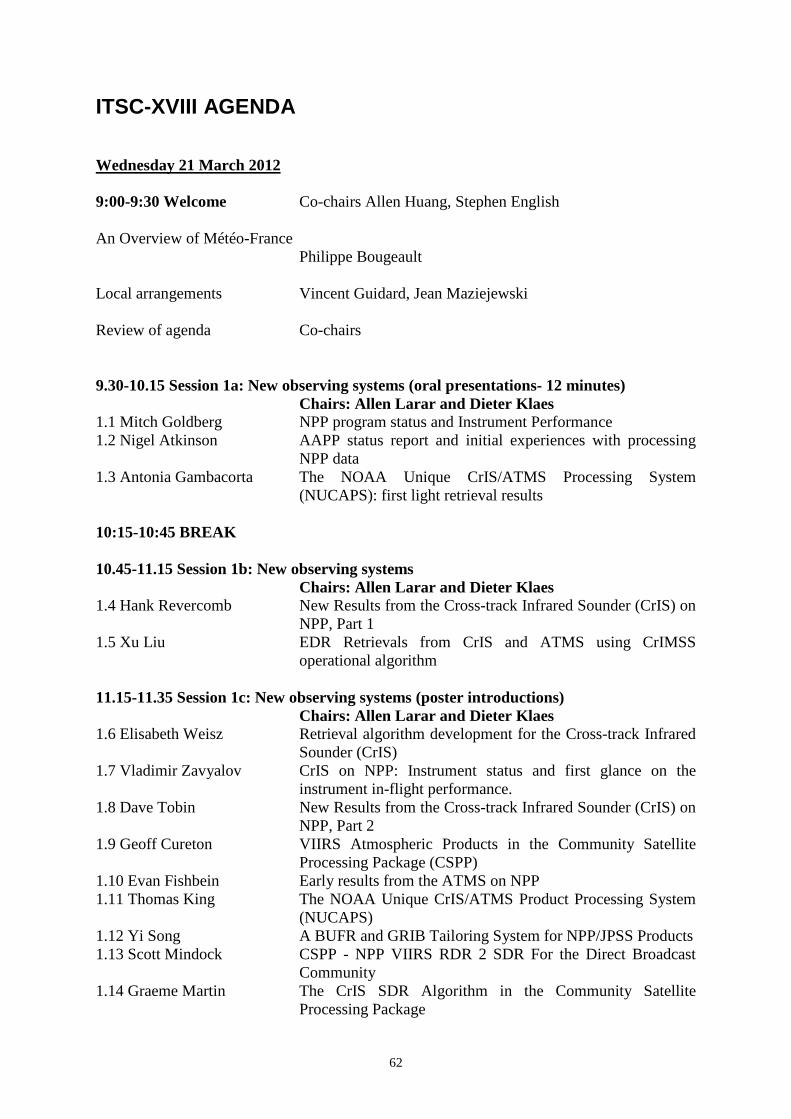
62
ITSC-XVIII AGENDA
Wednesday 21 March 2012 9:00-9:30 Welcome Co-chairs Allen Huang, Stephen English An Overview of Météo-France Philippe Bougeault Local arrangements Vincent Guidard, Jean Maziejewski Review of agenda Co-chairs 9.30-10.15 Session 1a: New observing systems (oral presentations- 12 minutes) Chairs: Allen Larar and Dieter Klaes 1.1 Mitch Goldberg NPP program status and Instrument Performance 1.2 Nigel Atkinson AAPP status report and initial experiences with processing
NPP data 1.3 Antonia Gambacorta The NOAA Unique CrIS/ATMS Processing System
(NUCAPS): first light retrieval results 10:15-10:45 BREAK 10.45-11.15 Session 1b: New observing systems Chairs: Allen Larar and Dieter Klaes 1.4 Hank Revercomb New Results from the Cross-track Infrared Sounder (CrIS) on
NPP, Part 1 1.5 Xu Liu EDR Retrievals from CrIS and ATMS using CrIMSS
operational algorithm 11.15-11.35 Session 1c: New observing systems (poster introductions) Chairs: Allen Larar and Dieter Klaes 1.6 Elisabeth Weisz Retrieval algorithm development for the Cross-track Infrared
Sounder (CrIS) 1.7 Vladimir Zavyalov CrIS on NPP: Instrument status and first glance on the
instrument in-flight performance. 1.8 Dave Tobin New Results from the Cross-track Infrared Sounder (CrIS) on
NPP, Part 2 1.9 Geoff Cureton VIIRS Atmospheric Products in the Community Satellite
Processing Package (CSPP) 1.10 Evan Fishbein Early results from the ATMS on NPP 1.11 Thomas King The NOAA Unique CrIS/ATMS Product Processing System
(NUCAPS) 1.12 Yi Song A BUFR and GRIB Tailoring System for NPP/JPSS Products 1.13 Scott Mindock CSPP - NPP VIIRS RDR 2 SDR For the Direct Broadcast
Community 1.14 Graeme Martin The CrIS SDR Algorithm in the Community Satellite
Processing Package

63
1.15 Ben Ruston Use of NPP data in the US Navy's Global Assimilation System
1.16 Amy Doherty Early analysis of ATMS data at the Met Office 11.35-12.05 Session 1d: New observing systems Chairs: Allen Larar and Dieter Klaes 1.17 Niels Bormann Initial results from using ATMS and CrIS data at ECMWF 1.18 Andrew Collard Toward assimilation of CrIS and ATMS in the NCEP Global
Model 12.05-13.00 Session 2a: Future Observing Systems (Agency poster introductions) Chairs: Jerome Lafeuille and Hank Revercomb 2.1 Jerome Lafeuille WMO plans 2.2 Dieter Klaes EUMETSAT Plans 2.3 Thierry Phulpin CNES Programmes For Meteorology, Climate And
Atmospheric Composition 2.4 Kozo Okamoto JMA and JAXA plans 2.5 Mitch Goldberg NOAA 2.6 Jun Li China 2.7 Alexander Uspensky (tbc) Russia 13.00-14.15 LUNCH 14.15-15.15 Session 2b: Future Observing Systems Chairs: Jerome Lafeuille and Hank Revercomb 2.8 Jean Pla Radio Frequency Interference in Earth Exploration Satellite
Service (passive) bands 2.9 Peter Schluessel EUMETSAT Polar System - Second Generation 2.10 Tony McNally Future degradation of the polar orbiting satellite network -
how will it affect Numerical Weather Prediction? 2.11 Cyril Crevoisier IASI-New Generation onboard EPS-SG: Expected impact on
accuracy and vertical resolution for atmospheric variables 15:15-16:15 Session 1c, 2a Poster Viewing including tea break 16.15-16.30 Session 2b: Future Observing Systems (oral presentations - 12 minutes) Chairs: Jerome Lafeuille and Hank Revercomb 2.12 David Crain GeoMetWatch-STORM: Towards Building an Optimal Scale
Coupled Next-Generation Geostationary Ultra-spectral Measurements for Improving Regional Weather and Environmental Forecast
16.30-16.35 Session 2c: Future Observing Systems (poster introductions) Chairs: Jerome Lafeuille and Hank Revercomb 2.13 Stephanie Guedj Future benefits of high-density radiance data from MTG in
the AROME fine-scale weather forecast model 16.35-16.45 Session 3: Current Observing Systems (poster introductions) Chairs: Ed Pavelin and Kozo Okamoto 3.1 Eric Pequignot IASI on MetOp-A & B: Performance Status

64
3.2 Ruiyue Chen Assessing the Stability of Jason/TOPEX Microwave Radiometers Using AMSU and AMSR-E
3.3 Anna Booton An assessment of the characteristics of SSMIS from F-16 to F-18
3.4 Niels Bormann Evaluation of FY-3 instruments in the ECMWF system 3.5 Noelle Scott Results and discussion of the LMD coupled LEO/LEO
intercalibration and stand-alone validation approaches for IASI and HIRS on board MetopA
16.45-17.10 Session 4a: NWP centre reports (poster introductions) Chairs: Ed Pavelin and Kozo Okamoto 4.1 Akira Okagaki Recent development of satellite data assimilation at JMA 4.2 Tony McNally Developments in Satellite Data Assimilation at ECMWF 4.3 Gilles Verner Status of operational satellite data assimilation at
Environment Canada 4.4 Roger Randriamampianina The use of satellite radiances at the Hungarian
Meteorological Service 4.5 Jean-Francois Mahfouf Recent developments on satellite data assimilation at Meteo-
France 4.6 Harald Schyberg Developments on assimilation of IASI in the Norwegian
HARMONIE regional NWP model 4.7 Bill Campbell AMSU-A Assimilation in COAMPS/NAVDAS 4.8 Andrew Collard NCEP status report 4.9 Luis Gustavo de Goncalves Recent progresses of the use of satellite observation in
the CPTEC/INPE data assimilation systems 4.10 Ed Pavelin An Update on the Operational Use of Satellite Sounding Data
at the Met Office 4.11 Indira Rani The NWP system at NCMRWF and the use of satellite data 17.15-18.00 Poster 18.00-20.00 Ice breaker and poster viewing session 2c, 3, 4a Thursday 22 March 2012 09.00-10.15 Session 4b: Assimilation studies Chairs: Tony McNally and John Eyre 4.12 Nadia Fourrie Assimilation of advanced sounder cloudy radiances in global
NWP model and retrieval of cloud parameters from IASI over Antarctica
4.13 Cristina Lupu Wind tracing from SEVIRI clear and overcast radiance assimilation
4.14 Marco Matricardi The direct assimilation in the ECMWF 4D-Var system of principal component scores derived from shortwave IASI spectra
4.15 Pauline Martinet New developments for the use of microphysical variables for the assimilation of IASI radiances in convective scale models
4.16 Anais Vincensini IASI radiances assimilation over land. 10:15-10:45 BREAK
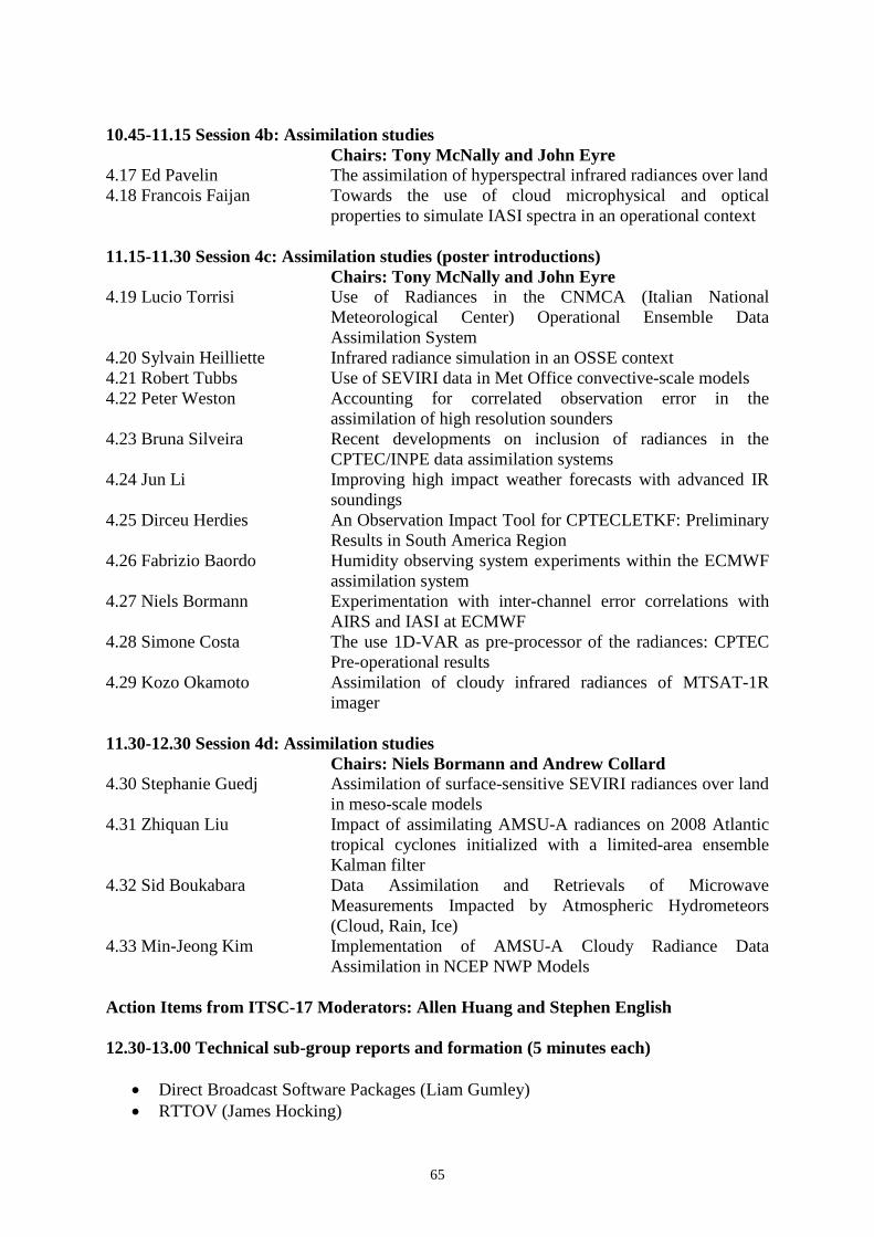
65
10.45-11.15 Session 4b: Assimilation studies Chairs: Tony McNally and John Eyre 4.17 Ed Pavelin The assimilation of hyperspectral infrared radiances over land 4.18 Francois Faijan Towards the use of cloud microphysical and optical
properties to simulate IASI spectra in an operational context 11.15-11.30 Session 4c: Assimilation studies (poster introductions) Chairs: Tony McNally and John Eyre 4.19 Lucio Torrisi Use of Radiances in the CNMCA (Italian National
Meteorological Center) Operational Ensemble Data Assimilation System
4.20 Sylvain Heilliette Infrared radiance simulation in an OSSE context 4.21 Robert Tubbs Use of SEVIRI data in Met Office convective-scale models 4.22 Peter Weston Accounting for correlated observation error in the
assimilation of high resolution sounders 4.23 Bruna Silveira Recent developments on inclusion of radiances in the
CPTEC/INPE data assimilation systems 4.24 Jun Li Improving high impact weather forecasts with advanced IR
soundings 4.25 Dirceu Herdies An Observation Impact Tool for CPTECLETKF: Preliminary
Results in South America Region 4.26 Fabrizio Baordo Humidity observing system experiments within the ECMWF
assimilation system 4.27 Niels Bormann Experimentation with inter-channel error correlations with
AIRS and IASI at ECMWF 4.28 Simone Costa The use 1D-VAR as pre-processor of the radiances: CPTEC
Pre-operational results 4.29 Kozo Okamoto Assimilation of cloudy infrared radiances of MTSAT-1R
imager 11.30-12.30 Session 4d: Assimilation studies Chairs: Niels Bormann and Andrew Collard 4.30 Stephanie Guedj Assimilation of surface-sensitive SEVIRI radiances over land
in meso-scale models 4.31 Zhiquan Liu Impact of assimilating AMSU-A radiances on 2008 Atlantic
tropical cyclones initialized with a limited-area ensemble Kalman filter
4.32 Sid Boukabara Data Assimilation and Retrievals of Microwave Measurements Impacted by Atmospheric Hydrometeors (Cloud, Rain, Ice)
4.33 Min-Jeong Kim Implementation of AMSU-A Cloudy Radiance Data Assimilation in NCEP NWP Models
Action Items from ITSC-17 Moderators: Allen Huang and Stephen English 12.30-13.00 Technical sub-group reports and formation (5 minutes each)
• Direct Broadcast Software Packages (Liam Gumley) • RTTOV (James Hocking)
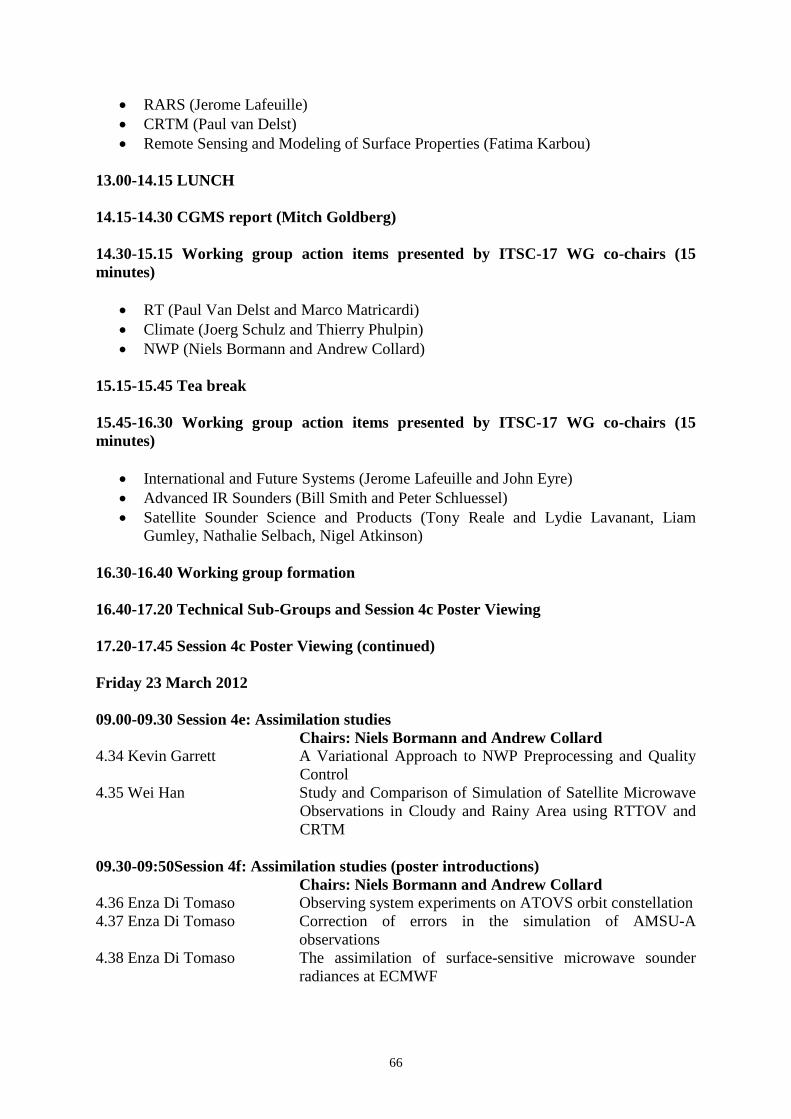
66
• RARS (Jerome Lafeuille) • CRTM (Paul van Delst) • Remote Sensing and Modeling of Surface Properties (Fatima Karbou)
13.00-14.15 LUNCH 14.15-14.30 CGMS report (Mitch Goldberg) 14.30-15.15 Working group action items presented by ITSC-17 WG co-chairs (15 minutes)
• RT (Paul Van Delst and Marco Matricardi) • Climate (Joerg Schulz and Thierry Phulpin) • NWP (Niels Bormann and Andrew Collard)
15.15-15.45 Tea break 15.45-16.30 Working group action items presented by ITSC-17 WG co-chairs (15 minutes)
• International and Future Systems (Jerome Lafeuille and John Eyre) • Advanced IR Sounders (Bill Smith and Peter Schluessel) • Satellite Sounder Science and Products (Tony Reale and Lydie Lavanant, Liam
Gumley, Nathalie Selbach, Nigel Atkinson) 16.30-16.40 Working group formation 16.40-17.20 Technical Sub-Groups and Session 4c Poster Viewing 17.20-17.45 Session 4c Poster Viewing (continued) Friday 23 March 2012 09.00-09.30 Session 4e: Assimilation studies Chairs: Niels Bormann and Andrew Collard 4.34 Kevin Garrett A Variational Approach to NWP Preprocessing and Quality
Control 4.35 Wei Han Study and Comparison of Simulation of Satellite Microwave
Observations in Cloudy and Rainy Area using RTTOV and CRTM
09.30-09:50Session 4f: Assimilation studies (poster introductions) Chairs: Niels Bormann and Andrew Collard 4.36 Enza Di Tomaso Observing system experiments on ATOVS orbit constellation 4.37 Enza Di Tomaso Correction of errors in the simulation of AMSU-A
observations 4.38 Enza Di Tomaso The assimilation of surface-sensitive microwave sounder
radiances at ECMWF
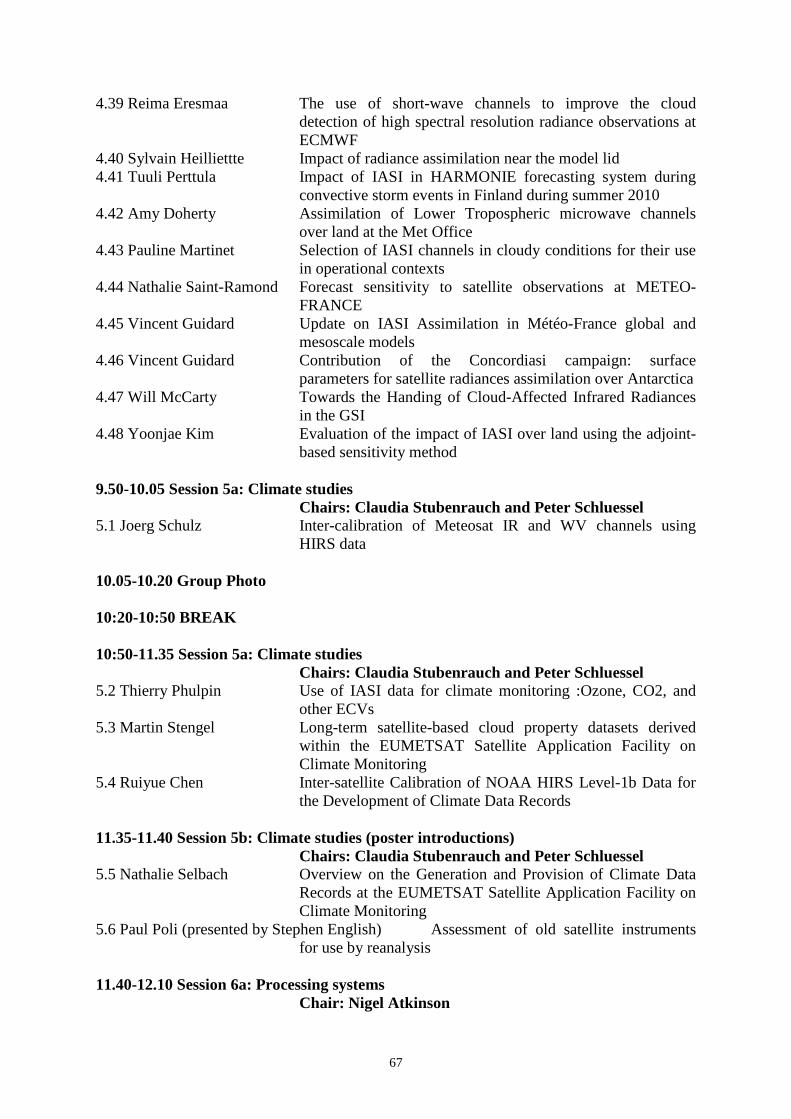
67
4.39 Reima Eresmaa The use of short-wave channels to improve the cloud detection of high spectral resolution radiance observations at ECMWF
4.40 Sylvain Heilliettte Impact of radiance assimilation near the model lid 4.41 Tuuli Perttula Impact of IASI in HARMONIE forecasting system during
convective storm events in Finland during summer 2010 4.42 Amy Doherty Assimilation of Lower Tropospheric microwave channels
over land at the Met Office 4.43 Pauline Martinet Selection of IASI channels in cloudy conditions for their use
in operational contexts 4.44 Nathalie Saint-Ramond Forecast sensitivity to satellite observations at METEO-
FRANCE 4.45 Vincent Guidard Update on IASI Assimilation in Météo-France global and
mesoscale models 4.46 Vincent Guidard Contribution of the Concordiasi campaign: surface
parameters for satellite radiances assimilation over Antarctica 4.47 Will McCarty Towards the Handing of Cloud-Affected Infrared Radiances
in the GSI 4.48 Yoonjae Kim Evaluation of the impact of IASI over land using the adjoint-
based sensitivity method 9.50-10.05 Session 5a: Climate studies Chairs: Claudia Stubenrauch and Peter Schluessel 5.1 Joerg Schulz Inter-calibration of Meteosat IR and WV channels using
HIRS data 10.05-10.20 Group Photo 10:20-10:50 BREAK 10:50-11.35 Session 5a: Climate studies Chairs: Claudia Stubenrauch and Peter Schluessel 5.2 Thierry Phulpin Use of IASI data for climate monitoring :Ozone, CO2, and
other ECVs 5.3 Martin Stengel Long-term satellite-based cloud property datasets derived
within the EUMETSAT Satellite Application Facility on Climate Monitoring
5.4 Ruiyue Chen Inter-satellite Calibration of NOAA HIRS Level-1b Data for the Development of Climate Data Records
11.35-11.40 Session 5b: Climate studies (poster introductions) Chairs: Claudia Stubenrauch and Peter Schluessel 5.5 Nathalie Selbach Overview on the Generation and Provision of Climate Data
Records at the EUMETSAT Satellite Application Facility on Climate Monitoring
5.6 Paul Poli (presented by Stephen English) Assessment of old satellite instruments for use by reanalysis
11.40-12.10 Session 6a: Processing systems Chair: Nigel Atkinson

68
6.1 Liam Gumley Community Satellite Processing Package (CSPP) - A Critical Infrastructure in Support of NOAA's NPP/JPSS Real Time Regional Users
6.2 Anders Meier Sorensen EARS-ATMS, EARS-CrIS and EARS-VIIRS: Three new regional services
12.10-12.20 Session 6b: Processing systems (poster introductions) Chairs: Nigel Atkinson 6.3 Kathleen Strabala 10+ Years of IMAPP Software for Direct Broadcast: IMAPP
Lessons Learned 6.4 Christelle Ponsard Status of the EUMETSAT Advanced Retransmission Service
(EARS) 6.5 Ray Garcia Open-Source Tools for the Community Satellite Processing
Package 6.6 Thomas Achtor (presented by Bob Knuteson) McIDAS-V: A Data Analysis and
Visualization Tool for Global Satellite Data 12.20-12.50 Session 7a: Advanced Infrared Sounders Chairs: Carmine Serio and Paolo Antonelli 7.1 John Eyre Information content of radiance climatologies for advanced
infra-red sounders 7.2 Laura Stewart Derivation of AMVs from single-level retrieved MTG-IRS
moisture fields 12.45-14.15 LUNCH 14.15-15.00 Session 7a: Advanced Infrared Sounders Chairs: Carmine Serio and Paolo Antonelli 7.3 Brian Kahn New AIRS cloud top microphysical properties and their
comparison with updated NCAR CAM5 simulations 7.4 Paolo Antonelli Monitoring of pre-convective situation from hyperspectral
observations by AIRS and lASI 7.5 Bill Smith Observations of Atmospheric Dynamics From Consecutive
CrIS and AIRS Measurements 15.00-15.10 Session 7b: Advanced Infrared Sounders (poster introductions) Chairs: Carmine Serio and Paolo Antonelli 7.6 Bob Knuteson Hyperspectral Infrared Sounding within 3-Dimensional Cloud
Structures 7.8 Jordi Chinaud IASI Technical Expertise Centre 7.9 Denis Jouglet Long-term radiometric inter-comparison of IASI-A / AIRS
and preparation for IASI-A / IASI-B. 7.10 Thomas August Status of the operational IASI L2 products at EUMETSAT 7.11 Tim Hultberg Hyperspectral retrieval and subspaces 7.12 Allen Larar Geophysical Information Content Variation with Advanced
Sounder Characteristics 15:10-15:30 Session 8a: Radiative transfer (poster introductions) Chairs: Marco Matricardi and Stuart Newman

69
8.1 Nicole Jacquinet-Husson A tool for IASI hyperspectral remote sensing: The GEISA Database in its latest edition
8.2 Noelle Scott The ARSA (Analyzed RadioSoundings Archive) database to assess the accuracy of forward and inverse radiative models
8.3 Laure Chaumat 4A/OP: A fast & accurate operational forward radiative transfer model
8.4 Peter Wang A Thematic Climate Data Record (TCDR) of Atmospheric Temperature Derived from Satellite Microwave Sounding Instruments Using 1D-Var MIRS
8.5 Rasmus Tonboe Simulations of the snow covered sea ice surface temperature and microwave effective temperature
8.6 Rasmus Tonboe The EUMETSAT OSI SAF near 50 GHz sea ice emissivity model
8.7 Niels Bormann Evaluation and comparisons of FASTEM versions 2 to 5 in the ECMWF system
8.8 Jerome Vidot Developing a VIS and NIR surface reflectance model for RTTOV
8.9 Paul van Delst CRTM Development Status 8.10 Eva Borbas The recent update of the UW/CIMSS high spectral resolution
global IR land surface emissivity database: the satellite viewing angle dependence
15.30-17.00 Session 4f, 5b, 6b, 7b, 8a Poster Viewing including tea break 17.00-18.00 Session 8b: Radiative transfer Chairs: Marco Matricardi and Stuart Newman 8.11 Raymond Armante Assessing the accuracy of the line-by-line 4A/OP model
through comparisons with IASI and AIRS observations 8.12 Gerrit Holl Simulating cloudy thermal infrared radiances with an
optimised frequency grid in the radiative transfer model ARTS
8.13 James Hocking Update on RTTOV developments 8.14 Fatima Karbou Modelling the surface emissivity to assimilate SSMI/S
observations over land Saturday 24 March 2012 9.00-12.00 Working Groups (with break 10:15-10:45) Monday 26 March 2012 09.00-10.00 Session 9a: Atmospheric composition, clouds and chemistry Chairs: Jean-Francois Mahfouf and Dirceu Herdies 9.1 Anton Kaifel Towards a NNORSY Synergistic GOME-2/IASI Ozone
Profile ECV 9.2 Thibaud Thonat Study of biomass burning emissions with Aqua/AIRS and
MetOp-A/IASI 9.3 Stuart Newman Case study of airborne and satellite observations of volcanic
ash from the Eyjafjallajokull eruption 9.4 Claudia Stubenrauch Cloud properties and bulk microphysical properties of semi-
transparent cirrus

70
10.00-10.15 Session 9b: Atmospheric composition, clouds and chemistry (poster introductions) Chairs: Jean-Francois Mahfouf and Dirceu Herdies 9.5 Giuseppe Grieco Retrieval of minor gases on the Mediterranean area by means
of the FTS*PSI technique 9.6 Victoria Galligani Snowfall characterization over land using active and passive
microwave satellite observations 9.7 Marc Schröder GEWEX water vapour and temperature profile assessment 9.8 Virginie Capelle Towards the daily observation of dust aerosols infrared
optical depth and altitude from IASI and AIRS with one spot resolution: comparison with MODIS and CALIPSO
9.9 Zhiquan Liu Relative merit of MODIS AOD and surface PM2.5 for aerosol analysis and forecast
9.10 Hyo-Jin Han Asian dust AOT and height retrieval from AIRS measurements using an ANN approach
10.15-10.45 BREAK 10:45-12:00 Session 10a: Retrieval science Chairs: Sid Boukabara and Mitch Goldberg 10.1 Eric Pequignot New approach in atmospheric sounding 10.2 Carmine Serio New IASI stand alone cloud detection scheme based on
correlation interferometry 10.3 Guido Masiello IASI retrieval of geophysical parameters over land surfaces
with phi-IASI package 10.4 Maxime Paul A physical scheme to retrieve simultaneously surface
temperature and emissivities using high spectral infrared observations from IASI
10.5 Virginie Capelle Infrared continental surface emissivity spectra and skin temperature retrieved from IASI observations
12.00-12.30 Session 10b: Retrieval science (poster introductions) Chairs: Sid Boukabara and Mitch Goldberg 10.6 Michele Feltz Validation of IR Sounder Temperature Profiles Using GPS
Radio Occultation 10.7 Xavier Calbet Assessment of adequate quality and co-location of sondes
with space borne hyperspectral infrared instruments to validate retrievals of temperature and water vapour
10.8 Stephen Tjemkes Intercomparison of retrieval codes for hyperspectral infrared sounding observations
10.9 Aralova Didlora The relationship between land surface temperature (LST) and perpendicular vegetation index (PVI) values for desert vegetation of Kyzylkum zones, Uzbekistan
10.10 Jean-Luc Moncet Land Surface Temperatures from AMSR-E with an Emissivity Database
10.11 Christopher Down Use of multi-spectral imagery in the Bureau of Meteorology 10.12 Stuart Newman Airborne and satellite remote sensing of the mid-infrared
water vapour continuum

71
10.13 Jon Taylor (presented by Stuart Newman) Comparing different cloud representations in variational retrievals using the HT-FRTC code on IASI data
10.15 Lydie Lavanant A cloud detection scheme for the O&SI SAF NPP/VIIRS SST product
10.16 Alexander Uspensky Analysis of land air temperature mapping capabilities with IR and microwave satellite data
10.17 Sergey Uspensky Derivation of land air temperatures using measurements from geostationary meteorological satellites
10.18 Eun-Han Kwon Examining effect of TPW-classified a priori error and quality control on atmospheric temperature and water vapor sounding retrieval
10.19 Bomin Sun An Evaluation of NOAA IASI Temperature and Water Vapor Sounding Retrievals Using NPROVS Collocation Data
10.20 Eva Borbas The MODIS MOD07 Collection 6 products: The impact of the H2O/CO2/O3 channel spectral shifts
12.30-13.00 Working groups and technical sub-groups finalise reports 13.00-14.15 LUNCH 14.15-15.45 Session 9b and 10b poster viewing including tea break 15.45-16.30 Session 10c: Retrieval science Chairs: Ben Ruston and Eva Borbas 10.21 Daniel Zhou Error Consistency Analysis Scheme for Retrieval Error
Budget Estimation 10.22 Yin Yang Diagnosis and Tuning of observation error in 1DVAR(MIRS)
in all sky conditions 10.23 Harald Schyberg Validation of the EUMETSAT OSI SAF 50 GHz sea ice
emissivity product 16.30-18.30 Working groups finalise reports Tuesday 27 March 2012 09.00-10.15 Session 11: Working Group Reports Co-chairs: Allen Huang and Stephen English RT (Marco Matricardi, Paul van Delst) Climate (Thierry Phulpin, Joerg Schulz) NWP (Andrew Collard, Niels Bormann) 10.15-10.45 BREAK 10.45-12.00 Session 11: Working Group Reports Co-chairs: Allen Huang and Stephen English Advanced IR Sounders (Peter Schluessel, Bill Smith) International and Future Systems (John Eyre, Jerome Lafeuille)

72
Satellite Sounder Science and Products (Nigel Atkinson, Liam Gumley, Nathalie Selbach) 12.00-12.30 Session 12: Technical Sub-Group Reports Co-chairs: Allen Huang and Stephen English ATOVS direct broadcast packages (Liam Gumley) RTTOV (James Hocking) RARS (Jerome Lafeuille) CRTM (Paul van Delst) Remote Sensing and Modeling of Surface Properties (Fatima Karbou) 12.30-12.45 Closing Session Co-chairs: Allen Huang and Stephen English Future meetings, other events relevant to ITWG Nominations for election of new co-chairs Closing remarks
73
ITSC-XVI ABSTRACTS 1.1 Suomi NPP Program Status and Instrument Performance Authors: Mitchell D. Goldberg, J.F. Gleason, H. Kilcoyne, F. Weng. I. Csiszar, L. Zhou and L. Rokke Presenter: Mitch Goldberg In 1994, the United States merged its two polar-orbiting environmental satellite programs operated separately by the Department of Commerce and the Department of Defense into a single system which was called the National Polar-orbiting Operational Environmental Satellite System (NPOESS). NPOESS was sponsored by the Department of Defense, the Department of Commerce and the National Aeronautics and Space Administration and was managed by an Integrated Program Office (IPO) that was populated by personnel from the three sponsoring agencies. A risk reduction mission named the NPOESS Preparatory Project (NPP) preceded the first NPOESS satellite, planned for early 2013. On February 1, 2010, the Office of Science, Technology and Policy announced a major restructuring of the NPOESS program to resolve conflicting perspectives and priorities among the three agencies and minimize potential lapses in capability resulting from NPOESS delays. The restructure terminated the NPOESS program on 30 September 2010 and assigned primary responsibility for the 1330 and 1730 Local Time Ascending Node (LTAN) orbits to the National Oceanic and Atmospheric Administration (NOAA) and the Department of Defense (DoD) respectively. The NOAA program is called the Joint Polar Satellite System (JPSS) and the DoD program is called the Defense Weather Satellite System (DWSS). The two programs are expected to use the Command, Control, Communications and ground processing systems that were developed for NPOESS. The follow-on programs are also expected to use the advanced sensors that were developed for NPOESS. The United States need for data from the 2130 LTAN orbit will be fulfilled through a partnership with the European Organisation for the Exploitation of Meteorological Satellites (EUMETSAT). The NPP satellite was successfully launched on October 28, 2011 and carries the following five sensors:
• Visible/Infrared Imager Radiometer Suite (VIIRS) that will provide advanced imaging and radiometric capabilities.
• Cross-track Infrared Sounder (CrIS) that will provide improved atmospheric moisture and temperature profiles in clear conditions.
• Advanced Technology Microwave Sounder (ATMS) that will provide improved atmospheric moisture and temperature profiles in cloudy conditions. - Ozone Mapping and Profiler Suite (OMPS) that will provide improved vertical and horizontal measurements of the distribution of ozone in the Earth's atmosphere.
• Clouds and the Earth's Radiant Energy System (CERES) sensor that will continue precise, calibrated global measurements of the earth's radiation budget
NPP will provide on-orbit testing and validation of sensors, algorithms, ground-based operations, and data processing systems that will be used in the operational JPSS mission. By the middle of the decade the first JPSS spacecraft will be launched into the afternoon orbit to provide significantly improved operational capabilities and benefits to satisfy critical civil and national security requirements for space-based, remotely sensed environmental data. The last satellite in the JPSS mission constellation is expected to continue operations until about 2037. The European Organisation for the Exploitation of Meteorological Satellites (EUMETSAT) Meteorological Operational (MetOp) spacecraft will occupy the mid-morning orbit. The joint constellation of JPSS, DWSS and MetOp satellites will provide the international community global coverage from advanced atmospheric imaging and sounding instruments with a data refresh rate of approximately four to six hours. At the conference, an overview of the JPSS program will be provided, including discussions on calibration and validation activities and active user engagement. Some early results will also be presented.
74
1.2 AAPP status report and initial experiences with processing NPP data Authors: Nigel Atkinson and Anna Booton Presenter: Nigel Atkinson Version 7 of the ATOVS and AVHRR Pre-processing Package (AAPP) was released in early 2012. The main enhancement in this release is to provide support for the ATMS and CrIS sounders on the NPP satellite (launched October 2011). VIIRS imager support will be added later in 2012 (based on the MAIA utility developed by Meteo-France). The package has been used in the cal/val phase of NPP to provide feedback to NOAA on the status of the instruments and to facilitate the ingestion of the data into NWP systems. AAPP provides the following functionality for processing ATMS and CrIS data:
• Ingests the Sensor Data Records (SDR) in HDF5 format
• Ingests the BUFR data distributed by NOAA and EUMETSAT
• Spatial filtering for ATMS (to reduce noise and improve footprint matching)
• Channel selection and spatial thinning for CrIS
• Map ATMS to CrIS grid • Generate derived products (e.g. cloud
liquid and ice indicators) • BUFR encoding capability
The package is designed for use with both Direct Readout data (i.e. SDR products from a package such as University of Wisconsin’s Community Satellite Processing Package), and with near-real-time or archived global SDR data. A Fourier transform based filtering technique has been developed for ATMS (as described at ITSC-17). This presentation shows (using real ATMS data) that the technique is successful in improving the matching of the broad footprint channels 1 and 2 with the much narrower sounding channels 3 to 15. This improved matching allows channels 1 and 2 to be used more effectively in NWP quality control processes. Examples of AAPP output products will be shown. 1.3 The NOAA Unique CrIS/ATMS Processing System (NUCAPS): First Light Retrieval Results Authors: A.Gambacorta, C. Barnet, W.Wolf, T. King, E. Maddy, M.Divakarla, N. Nalli Presenter: Antonia Gambacorta
Launched on board the National Polar-orbiting Operational Environmental Satellite System Preparatory Project (NPOESS/NPP) platform on October 28th 2011, the Cross-track Infrared Sounder (CrIS) and the Advanced Technology Microwave Sounder (ATMS) represent the US next generation of polar-orbiting operational hyper spectral sounders. CrIS is a Fourier transform spectrometer with a total of 1305 infrared sounding channels covering the longwave (655-1095 cm^-1), midwave (1210-1750 cm^-1), and shortwave (2155-2550 cm^-1) spectral regions. The ATMS sounder is a cross-track scanner with 22 channels in spectral bands from 23 GHz through 183 GHz. These two instruments together represent the latest addition to a long series of atmospheric satellite sounders that originated in the late 1970's. CrIS has been designed to continue the advances in atmospheric observations and research that started with the Atmospheric Infrared Sounder (AIRS) launched by NASA in 2002 and followed by the Infrared Atmospheric Sounding Interferometer (IASI) launched by CNES in 2006. ATMS will similarly continue the series of observations that started with the Advanced Microwave Sounding Unit (AMSU) first launched by NOAA in 1998. NOAA/NESDIS/STAR has processed AIRS data in near real-time since AIRS became operational in October 2002 by employing the NASA Science Team retrieval algorithm. Using this same retrieval algorithm (including spectroscopy), STAR has also processed IASI data since IASI became operational in August 2008. STAR is currently developing the NOAA-Unique CrIS/ATMS Product System (NUCAPS) which will employ the AIRS/IASI heritage retrieval algorithm to operationally process the CrIS/ATMS data to produce cloud cleared radiances and trace gas products. NUCAPS is an iterative least squares minimization of cleared column radiances following the approach of Susskind, Barnet, Blaisdell (2003) and Maddy et al. (2011). To summarize, the NUCAPS retrieval scheme will include: 1) A microwave retrieval module which derives cloud liquid water flags and microwave surface emissivity uncertainty; 2) A cloud clearing module that combines visible observations (provided by the onboard VIIRS instrument) and uses a set of microwave and IR channels to produce the cloud-cleared IR radiance product and reject those cases violating the cloud-clearing requirements; 3) A fast eigenvector regression retrieval for temperature and moisture that is trained using the ECMWF analysis and CrIS cloud cleared radiances; 4) This regression retrieval is used as an initial solution for
75
the final physical retrieval; 5) The final IR retrieval module is an iterated regularized least squared minimization performed on a selected subset of infrared channels, following the methodology of Gambacorta and Barnet (2011). The retrieval output consists of cloud cleared radiances, surface emissivity and temperature, vertical profiles of temperature, water vapor and trace gases, along with OLR, cloud fraction and pressure. Status of the retrieval algorithm and first light results will be presented at the conference. 1.4 New Results from the Cross-track Infrared Sounder (CrIS) on NPP, Part 1 Authors: Hank Revercomb, Dave Tobin, Bob Knuteson, Dan Deslover, Lori Borg, Joe Taylor, Graeme Martin, Greg Quinn Presenter: Hank Revercomb Recent analysis characterizing the spectral and radiometric performance of CrIS will be presented. 1.5 EDR Retrievals from CrIS and ATMS using CrIMSS operational algorithm Authors: X Liu, S. Kizer, C. Barnet, M. Goldberg, M. Divakarla, G. Guo, X. Xong, L. Zhou, D. Gu, W. Blackwell, V. Leslie, A. Larar, D. Zhou, W. Smith Presenter: Xu Liu As a part of the Joint Polar Satellite System (JPSS) and the NPOESS Preparatory Project (NPP), the instruments Cross-track Infrared Sounder (CrIS) and Advanced Technology Microwave Sounder (ATMS) make up the Cross-track Infrared and Microwave Sounder Suite (CrIMSS). CrIMSS will primarily provide global temperature, moisture, and pressure profiles and calibrated radiances. The CrIMSS operational code has been ported to LINUX system and retrievals are performed using both proxy data and real ATMS data. CrIS data will be analyzed when it becomes available. 1.6 Retrieval algorithm development for the Cross-track Infrared Sounder (CrIS) Authors: Elisabeth Weisz, William L. Smith Sr., Nadia Smith, Kathy Strabala, Liam Gumley, Hung-Lung Huang Presenter: Elisabeth Weisz
The dual-regression retrieval algorithm has been adapted to process NPP/CrIS radiance measurements. The retrieval method, which has been previously applied to AIRS and IASI measurements, provides accurate sounding and cloud parameter retrievals regardless of surface or cloud condition at single field-of-view resolution. The algorithm will be part of a software package to be released under CSPP (Community Satellite Processing Package). A detailed description of the algorithm, a summary of the products, and their evaluation are presented. 1.7 CrIS on NPP: Instrument status and first glance on the instrument in-flight performance Authors: Vladimir Zavyalov, Mark Esplin, Mark Greenman, Deron Scott, Brandon Graham, Charles Major, and Kavin Grant Presenter: Vladimir Zavyalov The Joint Polar Satellite System (JPSS) mission is a joint effort involving the National Aeronautics and Space Administration (NASA) and National Oceanographic and Atmospheric Administration (NOAA). This satellite system developed earlier as the U.S. National Polar-orbiting Operational Environmental Satellite System (NPOESS) is being developed to monitor global environmental conditions and collect and disseminate data related to weather, atmosphere, oceans, land and near-space environment. The Cross-track Infrared Sounder (CrIS) is part of the Cross-track Infrared and Microwave Sounding Suite (CrIMSS) instrument suite that will be used to produce accurate temperature, water vapor, and pressure profiles on the NPOESS Preparatory Project (NPP) mission and upcoming Joint Polar Satellite System (JPSS) operational missions. The NPP satellite has been launched on the October 28, 2011. This presentation will review current status of the CrIS instrument and present first assessment of the CrIS in-flight performance. We will provide a comparison to the AIRS and IASI heritage sensors that it builds upon. On-orbit calibration and validation (CAL/VAL) activities will be also outlined in this presentation. On-orbit sensor performance will be compared with sensor qualification, characterization, and calibration data obtained during ground thermal-vacuum tests.

76
1.8 New Results from the Cross-track Infrared Sounder (CrIS) on NPP, Part 2 Authors: Dave Tobin, Hank Revercomb, Bob Knuteson, Dan Deslover, Lori Borg, Joe Taylor, Graeme Martin, Greg Quinn Presenter: Dave Tobin Recent analysis characterizing the spectral and radiometric performance of CrIS will be presented. 1.9 VIIRS Atmospheric Products in the Community Satellite Processing Package (CSPP) Authors: Geoff P. Cureton and Liam E. Gumley Presenter: Geoff Cureton The Cooperative Institute for Meteorological Satellite Studies (CIMSS) has a long history of supporting the Direct Broadcast (DB) community for various sensors, recently with the International MODIS/AIRS Processing Package (IMAPP) for the NASA EOS polar orbiters Terra and Aqua. CIMSS has continued this effort into the NPP/JPSS (previously NPOESS) era with the development of the Community Satellite Processing Package (CSPP), supporting the NPP VIIRS, CrIS and ATMS sensors. In time it is intended that CSPP will support GOES-R, JPSS and other geostationary and polar orbiting platforms. In this poster we will focus on the development, implementation and usage of the VIIRS atmospheric product sub-packages within CSPP, which are based on the Interface Data Processing Segment (IDPS) code as implemented by Raytheon in the Algorithm Development Library (ADL). VIIRS Scientific Data Record (SDR) files are ingested in HDF5 format and converted to the internal Binary Large Object (BLOB) files with matching text file metadata. The manipulation and handling of these BLOB files, the acquisition and conversion of the various ancillary data formats into the internal BLOB format, and the various output products are described. 1.10 Early results from the ATMS on NPP Authors: Evan Fishbein, Sung-Yung Lee, Bjorn Lambrigtsen Presenter: Evan Fishbein Calculated radiance comparisons between ATMS and ECMWF analyses are examined to characterize
system performance. Also we peform EOF analysis on the water vapor sounding channels to characterize information provided by the additional water vapor sounding channel. 1.11 The NOAA Unique CrIS/ATMS Product Processing System (NUCAPS) Authors: Thomas King, Antonia Gambacorta, Eric Maddy, Haibing Sun, Kexin Zhang, Yi Song, Walter Wolf, Chris Barnet, and Mitch Goldberg Presenter: Thomas King The NOAA Unique Cross-track Infrared Sounder (CrIS) and Advanced Technology Microwave Sounder (ATMS) Product System (NUCAPS) was developed at NOAA/NESDIS/STAR. When declared operational, the system will produce thinned apodized CrIS radiances, principal components of CrIS radiances, cloud-cleared CrIS radiances, and trace gas profile products for NOAA customers in near real-time. The radiance products will be available in two formats: Binary Universal Form for the Representation of meteorological data (BUFR) and network Common Data Form version 4 (netCDF4). The principal components and trace gas profile products will be available in netCDF4 format. Development began in 2008 and the system was developed and tested using simulated CrIS and ATMS data. The first CrIS test BUFR data files were made available to the user community in February 2009. Currently, the system is being refined and tested using actual pre-operational data. NUCAPS will be run operationally within the National Polar-orbiting Operational Environmental Satellite System (NPOESS) Data Exploitation (NDE) Data Handling System (DHS). The thinned apodized radiances will be available once the NPP data are released approximately 6 months after launch; the remaining products will be released approximately 15 months after launch. The details of the system and its products will be discussed. 1.12 A BUFR and GRIB Tailoring System for NPP/JPSS Products Authors: Yi Song, Thomas King, and Walter Wolf Presenter: Yi Song A tailoring software system that will convert network Common Data Form version 4 (NetCDF4) formatted files to Binary Universal Form for the Representation of meteorological data (BUFR) and GRIdded Binary Edition 2 (GRIB2) formatted files is under development at NOAA/NESDIS/STAR.

77
This NetCDF4 Reformatting Toolkit will produce the tailored BUFR and GRIB2 products for the NPOESS Preparatory Project (NPP) Data Exploitation (NDE). NDE will make these data available to Numerical Weather Prediction (NWP) customers in near real-time. The Cross-track Infrared Sounder (CrIS) Radiances, Advanced Technology Microwave Sounder (ATMS) Radiances, Visible/Infrared Imager Radiometer Suite (VIIRS) Radiances, Aerosol Optical Thickness (AOT), Ozone Mapping and Profiler Suite (OMPS) Nadir Profile and Total Column data, Sea Surface Temperature (SST) and Polar Winds will be distributed in BUFR format. The Green Vegetation Fraction will be distributed in GRIB2 format. Currently, the BUFR tables of CrIS, ATMS and VIIRS radiances are completed and BUFR formatted files are available containing simulated data. The BUFR tables of SST, AOT and OMPS Nadir Profile are under review and the Polar Winds BUFR table and OMPS Total Column BUFR table are under development. Since November 8, 2011, NDE has been running ATMS data through this toolkit for internal testing purposes. The operational radiance products in BUFR format will be made available once the NPP data are released approximately 6 months after launch. The details of the tool and its products will be discussed. 1.13 CSPP - NPP VIIRS RDR 2 SDR For the Direct Broadcast Community Authors: Scott Mindock, R.Garcia, G Martin, K Strabala Presenter: Scott Mindock The Community Satellite Processing Package (CSPP) is a software system available for use by the Direct Broadcast Community. CSPP is distributed by the Cooperative Institute for Meteorological Satellite Studies (CIMSS) of the Space Science and Engineering Center (SSEC) at the University of Wisconsin, Madison. CSPP allows Direct Broadcast (DB) users to benefit from data produced by the NPP VIIRS instrument by providing software to support real-time processing of VIIRS data. CSPP allows DB users to transform VIIRS RDRs (Raw Data Records) into Sensor Data Records (SDRs). The poster details the aspects of the CSPP software as it relates to VIIRS SDR processing. This includes a detailed description of the hardware and software requirements. Also included is a walk through of the simple software installation, setup and operation. Ancillary data requirements are described including methods used to obtain and distribute the data to your site. Finally we finish
with the details of the software components and the VIIRS SDR products produced. 1.14 The CrIS SDR Algorithm in the Community Satellite Processing Package Authors: G. Martin, R. Garcia, S. Mindock Presenter: Graeme Martin The Community Satellite Processing Package (CSPP) project provides a suite of processing algorithms for NPP/JPSS instrument data tailored to direct broadcast (DB) users. The software is designed to be easy to use and to run on relatively modest hardware. The Cooperative Institute for Meteorological Satellite Studies (CIMSS) at the University of Wisconsin–Madison draws on its experience providing MODIS, AIRS, AMSU, and AMSR-E data processing support to the DB community through the IMAPP project. This poster describes the CSPP algorithm to generate Cross-track Infrared Sounder (CrIS) Sensor Data Records (SDR), which is based on the Algorithm Development Library (ADL) developed at Raytheon, and the related Interface Data Processing Segment (IDPS). Here we discuss the user interface, data flow, hardware requirements, project status and current use in calibration / validation efforts. 1.15 Use of NPP data in the US Navy's Global Assimilation System Authors: Benjamin Ruston, Steve Swadley, Nancy Baker, Rolf Langland, and Tim Hogan Presenter: Ben Ruston The Navy's 4-Dimensional Variational (4D-Var) assimilation system NAVDAS-AR recently has added the capability to assimilate the ATMS and CrIS sensors from the NPP satellite. The core of the Navy's global forecast system is the NOGAPS model which uses 42 levels with a model top of 0.01 hPa along with the 4D-Var system NAVDAS-AR. The system currently assimilates radiances from microwave and infrared satellite sounders as well was bending angle from GSNN sensors. The monitoring of how these sensors are processed by the assimilation system is accomplished using a suite of tools which include mean and standard deviation of the innovations (observation minus background), the atmospheric increments applied to wind, temperature and moisture fields and the observation impact metric. This observation impact metric has been shown to weight the troposphere strongly and shouldn't be considered

78
an overall metric, but can be used to determine whether a channel is beneficial or non-beneficial on 24-hour forecast error as formulated by Langland and Baker. The study will include both these monitoring plots of the assimilation system and an examination of NPP's impact on the forecast skill. Thereby showing the impact of these sensors on the current assimilation system and their subsequent impact on medium-range, 1-5 day, forecasts. 1.16 Early analysis of ATMS data at the Met Office Authors: Amy Doherty Presenter: Amy Doherty First results from assimilation of ATMS data into the Met Office global NWP system are presented. As a member of the calibration and validation team the Met Office is in early receipt of the data from NPP. ATMS has initially been processed following the treatment of ATOVS. Preprocessing by the AAPP provides the ATMS data with ATOVS-like resolution and noise characteristics. ATOVS quality control tests must be retuned for use with ATMS due to slight differences in frequency, changes in polarisation, scan pattern variation and to make use of the additional ATMS channels. This is discussed and results of updating the AAPP surface and liquid water test are shown. 1.17 Initial results from using ATMS and CrIS data at ECMWF Authors: Niels Bormann, William Bell, Tony McNally, Reima Eresmaa, Anne Fouilloux and Stephen English Presenter: Niels Bormann Following the successful launch of NPP on 28 October 2011, data from this new American polar orbiting satellite is being evaluated in the ECMWF assimilation system as part of the international calibration/validation exercise. The instruments most interesting to NWP onboard NPP are the new Advanced Technology Microwave Sounder (ATMS), building on the AMSU-A/B/MHS heritage, as well as the Crosstrack Infrared Sounder (CrIS), a hyperspectral infrared sounder with AIRS/IASI heritage. The performance of ATMS and CrIS is assessed through comparisons between observations and model equivalents, in terms of biases, noise levels, stability and other characteristics. Results are compared to those from heritage instruments,
putting the new data in a wider perspective. In the case of ATMS, footprint averaging of the raw data is required for a fair comparison to AMSU-A in the case of the temperature sounding channels, offering new opportunities and challenges. Initial results from early assimilation experiments will also be discussed, with particular focus on the assessment of quality control procedures and bias corrections. 1.18 Toward assimilation of CrIS and ATMS in the NCEP Global Model Authors: Andrew Collard, John Derber, Russ Treadon, Nigel Atkinson, Jim Jung, Kevin Garrett and Sean Casey Presenter: Andrew Collard The launch of the NPOESS Preparatory Project marks the beginning of the next phase of the NOAA polar orbiting meteorological satellite program. The ATMS microwave sounder provides operational continuity to the AMSU instruments. The CrIS advanced infrared sounder follows on from the experimental AIRS sounder and complements EUMETSAT's IASI. Although these instruments have many similarities with those already assimilated operationally, there are still significant differences that need to be address. In particular strategies to allow for the different field of view sizes for the various ATMS channels and the higher noise on the ATMS sounding channels need to be developed. In this talk, we will discuss the quality of the data sets, the additional processing required and will give initial indications as to the forecast impact of assimilating these data. 2.1 WMO plans Presenter: Jerome Lafeuille No abstract. 2.2 EUMETSAT Plans Author: Dieter Klaes Presenter: Dieter Klaes This Poster is the "traditional" summary presentation of EUMETSAT's programmes and their current status, relevant to the conference. It
79
will cover the current and future relevant programmes, i.e. EPS, MSG, MTG, EPS-SG, Jason and GMES Sentinel-3. 2.3 CNES Programmes For Meteorology, Climate And Atmospheric Composition Presenter: Thierry Phulpin No abstract. 2.4 JMA and JAXA plans Presenter: Kozo Okamoto No abstract. 2.5 NOAA Plans Presenter: Mitch Goldberg No abstract. 2.6 China’s Plans Presenter: Jun Li No abstract. 2.7 Russia’s Plans Presenter: Alexander Uspensky No abstract. 2.8 Radio Frequency Interference in Earth Exploration Satellite Service (passive) bands Presenter: Jean Pla No abstract. 2.9 EUMETSAT Polar System - Second Generation Author: Peter Schluessel Presenter: Peter Schluessel Preparations for the EUMETSAT Polar System Second Generation (EPS-SG) which is needed from 2020 onwards have progressed with the consolidation of mission requirements and
industrial feasibility studies. Initial concepts have been elaborated for the system and instruments. Enhancements with respect to EPS predecessor instruments will provide for potential breakthrough in various target applications. The presentation will give an update on the EPS-SG development status and an overview of the payload complement under study. 2.10 Future degradation of the polar orbiting satellite network - how will it affect Numerical Weather Prediction? Authors: Tony McNally Presenter: Tony McNally It is likely that the provision of polar orbiting satellites launched to support operational Numerical Weather Prediction will be less in the future compared to today. Using a state of the art 4DVAR data assimilation system at ECMWF, the impact of satellite reduction scenarios on the accuracy of numerical weather forecasts has been quantified. Results will be presented suggesting that a future baseline system of just two polar orbiting spacecraft could achieve a large proportion of the performance of the current polar observing network. Furthermore, it appears that modern data assimilation systems can even allow the loss of one of these two satellites without a significant loss in forecast skill. Some indication is also given as to how different sensors carried by polar orbiting spacecraft contribute to forecast accuracy. 2.11 IASI-New Generation onboard EPS-SG: Expected impact on accuracy and vertical resolution for atmospheric variables Authors: Cyril Crevoisier, Cathy Clerbaux, Vincent Guidard, Thierry Phulpin, Raymond Armante, Brice Barret, Claude Camy-Peyret, Jean-Pierre Chaboureau, Gaelle Dufour, Lydie Lavanant, Juliette Hadji-Lazaro, Herve Herbin Presenter: Cyril Crevoisier Thermal infrared sounders onboard polar-orbiting platforms are now playing a key role for monitoring the atmospheric composition change. The IASI instrument developed by CNES and launched by Eumetsat onboard the MetOp satellite series is providing essential inputs for weather forecasting and pollution/climate monitoring owing to its smart combination of large horizontal swath, good spectral resolution and high radiometric performance.

80
EUMETSAT is currently preparing the next polar-orbiting program for satellites that will be launched onboard the EPS-SG satellite series around 2019. In this framework, CNES is studying the concept of an improved IASI instrument, IASI-NG (IASI-New Generation), now in Phase-A, with a factor of 2 gain in terms of spectral resolution and radiometric noise. IASI-NG main objectives are: (i) continuity of the MetOp series; (ii) improvement of vertical coverage, especially in the lower troposphere; (iii) improvement of the precision and detection threshold of atmospheric and surface components. In this talk, we will discuss the expected impact that IASI-NG characteristics will have on the accuracy and vertical resolution of several atmospheric variables such as temperature, water vapour, and several trace gases (CO2, CH4, CO and other chemical species). In particular, we will show that the better spectral resolution together with the improved radiometric noise will enable: (1) a better coverage of the vertical, especially in the lower part of the troposphere; (2) an improvement of the accuracy of the retrieved variables because of less interferences between the species in the channels and a better signal to noise ratio. IASI-NG has the potential for strongly benefiting the NWP, chemistry and climate communities now connected through the GMES initiative (Sentinel 5, MACC project). 2.12 GeoMetWatch-STORM: Towards Building an Optimal Scale Coupled Next-Generation Geostationary Ultra-spectral Measurements for Improving Regional Weather and Environmental Forecast Authors: Hung-Lung Allen Huang, W. L. Smith, D. Crain, E. Pache, and J. Elwell Presenter: David Crain GeoMetWatch (GMW) is the first, and currently only, commercial, fee-for-service company licensed by the US Government to operate a global geostationary ultra-spectral imaging/sounding system. GMW leverages the state-of-the-art technology developed by NASA and NOAA to provide an affordable and innovative solution to deliver a constellation of next-generation ultra-spectral sensors that will provide frequent, global infrared/visible measurements for weather forecast, climate study, environmental use, and most of all, for time critical high-resolution regional numerical weather prediction models, but at a fraction of the cost of conventional, dedicated systems. GMW's license allows for a method to deliver these advanced data with limited export control restriction.
GMW is partnering with the key science and technology developers in the NASA GIFTS and NOAA HES programs, namely Space Dynamic Laboratory (SDL), the developer of GIFTS sensor, and Space Science and Engineering Center (SSEC), the developer of GIFTS/HES science, algorithms and ground processing system. By leveraging these capabilities, GMW and its partners are developing an advanced sensor dubbed, “Sounding & Tracking Observatory for Regional Meteorology (STORM).” STORM is a derivative of GIFTS which has more than 1000 hours of comprehensive testing. GMW is licensed to observe and deliver simultaneous imaging and sounding products. Each STORM sensor package is designed to make measurements in: 1) Pan Imaging band at 300m ground sample distance (GSD), 2) Visible/Near IR bands (0.5 - 3.5 micron) at 500m GSD, and 3) Ultra-spectral IR Data (4.3-15.2 micron) with 0.6-2.5 cm-1 spectral resolution at 2km GSD, depending upon customer requirements. GMW will provide a minimum of Level 1b data (calibrated and navigated radiances) from each band/channel for both global and regional weather prediction applications. GMW can also provide derived sounder weather products (Levels 2 and 3) such as high vertical resolution profiles of temperature and water vapor, altitude resolved water vapor winds, and highly accurate sea surface temperature, land surface emissivity, and other customer-specified multi-dimensional atmospheric and surface products. Most of all, the critical regional weather and environmental forecast related high-temporal (a few minutes to one hour), high-spatial (2-4 km IR), high-spectral (i.e. higher vertical resolving power) resolution infrared radiances can be available that covering most of the global with the calibrated measurements made by the same sensor system in real-time. GMW first launch is slated for 2015/2016, with the full complement GMW global constellation, comprised of the Six-Satellite-STORM-System (S4), to be fully deployed by 2019-2020. Each GMW STORM sensor makes full-disk observations in all bands every 20 minutes to 1 hour. Regional observation (~1000km x ~1000km) modes allow faster observation of severe weather events, such as hurricanes/typhoons, every 1-2 minutes. Larger regions, or customer-specified observation areas of special interest, are possible with various high temporal resolutions ranging from 5 to 15 minutes. In this ITSC-18 conference paper, we'll unveil the exciting and challenging GeoMetWatch-STORM project, and discuss the realization of the first of
81
the next-generation optimal time/horizontal/vertical scale coupled four dimensional infrared radiances for the improvement of the regional weather and environmental forecast. 2.13 Future benefits of high-density radiance data from MTG in the AROME fine-scale weather forecast model Authors: Stephanie Guedj, Florence Rabier, Vincent Guidard and Gerald Desroziers Presenter: Stephanie Guedj Satellite radiances currently provide the largest input to data-assimilation systems for Numerical Weather prediction, in terms of both numbers and forecast impact. The assumed observation-error covariances, together with background-error covariances play an important role in determining the weight of a given observation in a data assimilation system. For future high-resolution satellite observation systems such as MTG-IRS, the assumption of spatial and spectral uncorrelated errors is questionable and can lead to sub-optimal analyses if the observations are used at full resolution. The common methods to counteract error correlation are spatial thinning, channel selection or empirical error inflation, but they might lead to a sub-optimal use of MTG-IRS. There are also ways to quantify these correlations, and to include them in the assimilation process. It is not clear yet, based on initial experimental evidence, that taking into account all the observations with the full error covariance matrix is beneficial compared to an adequate thinning. Since observations from MTG-IRS are not yet available, a preliminary study is based on the use of available information from the SEVIRI radiometer (onboard MSG) and from IASI hyperspectral sounder (onboard MetOp). Three preliminary assimilation experiments have been run using SEVIRI data in summer 2011. One is representative of the operational version of AROME (CTL).In the two others experiments, the density of assimilated SEVIRI data is increased progressively. Neither spatial nor spectral observation error correlations are prescribed in these experiments. This leads to a poorer forecast performance, and the amplitude of the degradation has been characterized in term of forecast scores against radiosondes and synoptic measurements. Following this initial trial, most of the work will be performed in the context of OSSEs (Observing System Simulated Experiments). MTG-IRS
radiances will be simulated using the radiative transfer model RTTOV in clear-sky conditions and RTTOV-Cloud in cloudy conditions over sea surfaces in the framework of an AROME-WMED reference run (also called Nature Run). In parallel, spatial and spectral error correlations will be approximated using standard methods (the Desroziers method, Hollingsworth-Lönnberg method, etc.) from SEVIRI and IASI observations. SEVIRI data will allow us to provide relevant estimates of spatial error correlations, and IASI data to provide approximations of inter-channel (or, alternatively principal component amplitude) error correlations. The estimation of the correlations will be evaluated over many scenarios which correspond to various hypotheses on error correlations (resolution, cloud type, surface type, etc.). These scenarios will be helpful to construct specific observation error matrix that correspond better to meteorological transitions. Finally, simulations from MTG-IRS radiances together with observations from other data sources will be assimilated. The impact over analyses/forecasts will be investigated following pre-defined scenarios. Improvements will be investigated with respect to standard measures, mainly with respect to heavy precipitation fields and moisture convergence over the Mediterranean sea. The period of October 2011 should be ideal. 3.1 IASI on MetOp-A & B: Performance Status Authors: E. Pequignot, L. Buffet , E. Jacquette, C. Larigauderie, V. Lonjou, J. Chinaud, B. Tournier, J. Donnadille, C. Baque Presenter: Eric Pequignot The Infrared Atmospheric Sounding Interferometer (IASI), is a key element of the MetOp payload. It has been designed to provide very accurate data about the atmosphere, land and oceans for application to weather predictions, climate studies and atmospheric chemistry. IASI measurements allow to retrieve temperature and humidity profiles at a 1 km vertical resolution with an accuracy of respectively 1K and 10 %. Trace gases column amount (CO, CH4, N2O) are retrieved with an accuracy better than 10 % and 5 % for Ozone. The IASI program is led by the French National Space Agency CNES in cooperation with the European Meteorological Satellite Organization EUMETSAT. Under this cooperation agreement, CNES leads the development of the instruments, is in charge of the level 1 processing and operates the IASI Technical Expertise Center (TEC). EUMETSAT is responsible for development of

82
level 2 processing, operations and data distribution. The instrument development was carried out by THALES ALENIA SPACE as industrial Prime Contractor. Three IASI flight models have been manufactured and delivered. The first flight model was launched on board the MetOp-A satellite from Baikonour on October 19, 2006. Following a successful in-orbit commissioning phase, which included in-orbit functional validation (2 months) and calibration/validation (6 months), the first IASI instrument was declared operational in July 2007 and is in routine operation phase since then. IASI measurements were assimilated operationally as early as June 2007 by some Numerical Weather Prediction centers. This paper gives a status of IASI radiometric, spectral and geometric performances after four years in orbit. As the first European infrared sounder, the IASI instrument has demonstrated its operational capability and its adequacy to user needs, with highly meaningful contributions to meteorology, climate and atmospheric chemistry. The in-flight performance of IASI is fully satisfactory (instrument and processing). In particular, the system shows a very stable behavior. In addition, IASI PFM-R performance assessment has been done at ESTEC in July 2010 during MetOp-B TV test. Launch is planned for May 2012. Cal/Val plan has been defined and pre-launch activities were carried out. 3.2 Assessing the Stability of Jason/TOPEX Microwave Radiometers Using AMSU and AMSR-E Authors: Ruiyue Chen, Changyong Cao, Laury Miller, Yong Chen Presenter: Ruiyue Chen The microwave radiometers aboard the Jason/TOPEX satellites for altimetry missions are a key component of the Jason/TOPEX system, providing important measurements for water vapor correction, which is the most variable path delay correction in the altimeter measurement system. Unfortunately, these radiometers have exhibited on-orbit calibration drifts, step jumps, and other types of irregularities that can result in height rate errors. This study developed a method to assess the stability of Jason/TOPEX microwave radiometers relative to the Advanced Microwave Sounding Unit (AMSU) on the MetOp-A/NOAA satellites and the Advanced Microwave Scanning Radiometer (AMSR-E) on the Aqua satellite using the
Simultaneous Nadir Overpass (SNO) time series method. NOAA's CRTM radiative transfer model is used to simulate the impacts of the frequency difference and the view-angle differences between the instruments. After the frequency and view-angle corrections, the uncertainties for the instrument cross-comparisons are generally less than 2 degrees. The long-term stabilities of Jason/TOPEX microwave radiometers are also discussed based on the results of the instrument cross-comparisons. 3.3 An assessment of the characteristics of SSMIS from F-16 to F-18 Authors: Anna Booton Presenter: Anna Booton During 2010 the data from the latest SSMIS instrument onboard the DMSP F-18 satellite was made available to Numerical Weather Prediction (NWP) centres. Assimilating these new data into the Met Office's global NWP model is expected to improve the current data coverage, as well enhance the NWP system's future robustness. However, the SSMIS instrument has been found to suffer from a distinct ascending and descending systematic bias. In order to correct this bias, it has been characterised in this study with respect to the Met Office's global forecast NWP model with the objective of deriving a new ascending/descending bias predictor. The characteristics of the SSMIS data streams from the F-16, F-17 and F-18 satellites are presented. Similarities between the F-16 data processed using the Unified Pre-Processor (UPP) at the Naval Research Laboratory, and that of our currently assimilated F-16 data pre-processed using our original in house Met Office pre processor, are also considered. In addition, the influence of the new ascending/descending bias predictor (being developed in order to mitigate the strong bias present in the F-18 data) is also presented. 3.4 Evaluation of FY-3 instruments in the ECMWF system Authors: Qifeng Lu, William Bell, Niels Bormann, Carole Peubey and Alan Geer Presenter: Niels Bormann Several instruments onboard China's FY-3A and FY-3B platforms have been evaluated over the last three years using ECMWF's analysis and forecasting system. The FY-3A and -3B platforms

83
carry four instruments of particular interest for NWP: microwave temperature and humidity sounders (MWTS and MWHS); a HIRS/3-like infrared sounder (IRAS); and a microwave imager (MWRI) - similar in specification to AMSR-E. We review our analysis of the data quality for the FY-3A instruments, including departure statistics and results from observing system experiments, which shows the data to be of good quality overall. Analysis of data from the FY-3B instruments has shown the data quality to be improved relative to that from FY-3A. An analysis of data from the MWTS instruments, in particular, has again illustrated the power of NWP in diagnosing and correcting a range of instrument biases. Detailed investigations on the FY-3A MWTS has uncovered, and corrected, biases related to passband uncertainties as well as radiometer non-linearities. These issues appear to have been solved for the FY-3B MWTS. 3.5 Results and discussion of the LMD coupled LEO/LEO intercalibration and stand-alone validation approaches for IASI and HIRS on board MetopA Authors: N.A Scott, L. Crepeau, R. Armante, J. Pernin, A. Chedin Presenter: Noelle Scott To be fully useful for climate and environmental applications, satellite observations require quality control during the instruments lifetime: any systematic error not identified in the level1 radiances may induce errors in the retrieved variables. At LMD, the technique for inter-calibration has been initially developed for the calibration of Meteosat, based on space and time collocations with instruments on the NOAA series (J. Appl. Meteor., vol 21, 1982) Based on work with TOVS (NOAA/NASA Pathfinder Programme), ATOVS, AIRS, IASI and IIR two complementary approaches: (i) an intercalibration approach and (ii) a \"stand alone\" approach have been developed which aim at identifying deviations or trends (natural, spurious) between pairs of channels of different instruments (in LEO/LEO or GEO/LEO modes). To identify deviations or trends between pairs of channels, companion channels are selected based on the coherence of their radiative transfer properties as well as on the characteristics of their space, time, spatial resolution, viewing geometry. Concerning IASI, such similar channels exist in
both AIRS/Aqua, HIRS4/Metop, Tanso/Gosat, CrIS/NPP. Selection of companion channels is made through sensitivity studies to various observation conditions, based upon the TIGR databases accordingly computed for each instrument involved. The inter-calibration approach is based on channel-by-channel comparisons between observations and observations made by other instruments: this presentation will mainly be devoted to the LEO/LEO IASI/HIRS4 intercomparison. The stand alone approach is based on comparisons between observed and simulated radiances. Simulated radiances result from the 4A/OP radiative transfer model fed with ARSA profiles in collocation (time and space) with clear sky satellite observations. For that purpose, a validated cloud detection algorithm is used for various scene types. The two approaches are complementary: the inter-calibration approach - not restricted to clear scenes - allows wide ranges of brightness temperatures being compared. and studies the behaviour of one channel relative to its companion channel. The 'stand alone' screens each channel of each instrument, individually, allowing e.g. the detection of viewing angle dependence of the brightness temperatures. When combined with the use of two companion instruments this contributes identifying which instrument deviates from the other(s). Results for biases, standard deviations, trends, anomalies are reported in tables and/or plots. They are presented for 20K wide bins of temperatures ranging from 200 to 320K and for several observations conditions - e.g., latitude, day, night, viewing angles, etc. Presentation and interpretaion of the results will be devoted to the most recent applications within the frame of the validation of level1 of IASI/AMSU/HIRS4/MetopA from July 2007 onwards. These actions are supported by CNES. 4.1 Recent development of satellite data assimilation at JMA Author: Akira Okagaki Presenter: Akira Okagaki Recent developments in satellite data assimilation (DA) at Japan Meteorological Agency (JMA) are presented. JMA introduced various satellite data into the global DA system after the last TOVS
84
conference in April 2010; SSMIS on DMSP-F18, AMSU-A channel 6-8 at coastal area, COSMIC refractivity, clear sky radiance and atmospheric motion vectors of GOES-13,-15 and MTSAT2. In the meso-scale DA system, radiance assimilation was started instead of the retrieval assimilation in December 2011. There are several developments which are in experimental stage. A global DA experiment was conducted enhancing assimilation of lower tropospheric radiances combined with the RTTOV v10, while JMA uses RTTOV v9.3 in operation. The result showed reduction of biases in lower tropospheric temperature and total column water content. It leads to improvement of short range forecast not only in the troposphere but also in the stratosphere. These results may be derived from new features of RTTOV-10, which are improved surface emissivity and increased number of vertical levels in stratosphere. The result of data quality assessment and the first DA experiment of MWTS of FY-3A will also be presented. Hyper spectral infrared sounders are not assimilated operationally in JMA because the DA experiment showed degradation of forecast in some elements. To avoid any erroneous interaction between cloud contamination and VarBC, a simple cloud screening scheme using the long-wave window channels is implemented. And also, ozone density used for RTTOV is changed from climatological values to daily product of JMA's chemical transport model. AIRS DA experiment with those changes showed positive impact on the forecast. However, IASI DA experiment applying almost same configuration as AIRS degrades the forecast performance. The causes are being investigated. 4.2 Developments in Satellite Data Assimilation at ECMWF Authors: Tony McNally et al. Presenter: Tony McNally An overview of the main developments in operational satellite data assimilation at ECMWF will be shown. The poster will also describe important research topics and a view towards future development.
4.3 Status of operational satellite data assimilation at Environment Canada Authors: Gilles Verner, Godelieve Deblonde, Mark Buehner, Louis Garand, Sylvain Heilliette, Réal Sarrazin, Alain Beaulne and Stephen Macpherson Presenter: Gilles Verner An important upgrade to the operational Global Deterministic Prediction System of Environment Canada was implemented on 16th November 2011. New data include 62 IASI channels, humidity from aircrafts, SSMI/S (F16) imaging channels, and 6.7 micron water vapor radiances from GOES-W, METEOSAT (2 satellites) and MTSAT. Another significant change is the reduced thinning of radiances from 250 km to 150 km. The total number of observations assimilated has increased by a factor of two to reach slightly more than 4 M per day. AMV quality control was revised. A unified radiance bias correction scheme was implemented with coefficients dynamically updated from 7-day statistics (with the exception of fixed parameters for AMSUA 11-14). Validation results show a very clear positive impact against the previous assimilation system for all variables. The data monitoring system was also improved substantially. A summary of assimilated data volumes will be presented. 4.4 The use of satellite radiances at the Hungarian Meteorological Service Authors: Gergely Bölöni, Máté Mile, Alena Trojáková, and Roger Randriamampianina Presenter: Roger Randriamampianina The microwave radiances (AMSU-A and AMSU-B/MHS) measured by most of the NOAA satellites are used operationally at the Hungarian Meteorological Service (OMSZ). The use of the radiances in the analysis system, which is based on a 3D-Var assimilation technique is under revision. The revision became important due to the extended developments in the IFS/ARPEGE/ALADIN radiance assimilation system. We are also upgrading the assimilation system to use all the available microwave information from the NOAA and the Metop satellites and also the IASI radiances. Our presentation discuses the tuning and implementation of the above mentioned instruments in both the hydrostatic ALADIN and non-hydrostatic AROME assimilation systems.
85
4.5 Recent developments on satellite data assimilation at Meteo-France Authors: J.-F. Mahfouf, N. Fourrie, E. Gerard, S. Guedj, F. Karbou, P. Martinet, F. Rabier, A. Vincensini Presenter: Jean-Francois Mahfouf A summary of recent developments undertaken at Meteo-France in order to increase the usage of satellite radiances in regional and global data assimilation systems is provided. The main focus has been on the use of additional channels from infra-red and micro-wave sounders (IASI and SSMIS) and on an enhanced assimilation over continental surfaces and in cloudy conditions (SEVIRI and IASI). Results are presented in terms of numerical weather forecast scores and ongoing activities for the preparation of new instruments are also presented. 4.6 Developments on assimilation of IASI in the Norwegian HARMONIE regional NWP model Authors: Trygve Aspelien, Jelena Bojarova, Roger Randriamampianina, Harald Schyberg, Frank T. Tveter and Ole Vignes Presenter: Harald Schyberg Assimilation of IASI temperature channels has already been implemented in a Norwegian version of the HARMONIE regional model. In a new setup of the model and assimilation system the channel selection and characteristics has been further monitored to optimize the system. Present developments focus on adding moisture channels. A first impact trial using moisture channels has been performed and first results along with plans for further developments are presented. 4.7 AMSU-A Assimilation in COAMPS/NAVDAS Authors: William F. Campbell, William T. Thompson and Keith Sashegyi Presenter: Bill Campbell AMSU-A radiance assimilation using 3dVar (the NRL Atmospheric Variational Data Assimilation System (NAVDAS)) has shown a significant positive impact in the Coupled Ocean/Atmosphere Mesoscale Prediction System (COAMPS) compared to the Fleet Numerical Meteorology and Oceanography Center (FNMOC) operational version of COAMPS/NAVDAS that assimilates
ATOVS retrievals. FNMOC utilizes a suite of statistical comparisons (scorecard) to evaluate any future capability before transition to operations. In our tests, three weeks of 2-day and 3-day forecasts were compared with various surface and raob observations, and given a weighted grade for each ranging from -4 to 4. FNMOC accepts a total grade as low as -2 for operational transition; the best experiment scored +17. Two factors were crucial for positive impact: the height of the (effective) model top, and the radiance bias correction (data thinning and quality control are also important). The standard 30-level COAMPS configuration with a model top of 35 km (and effective model top of only 15 km due to the sponge layer) was found to be inadequate for radiance assimilation, even using a restricted low-peaking channel set, whereas a 45-level COAMPS configuration with a lower model top but a higher effective model top (21 km) including four levels above 15 km showed positive results. Bias correction coefficients from NRL's 4DVAR global data assimilation system (NAVDAS Accelerated Representer or NAVDAS-AR) were found to work surprisingly well, perhaps because the underlying radiative transfer model (the Community Radiative Transfer Model (CRTM)) was the same for both our mesoscale and global data assimilation systems. If global bias correction coefficients are as effective in general as they were in this study, the problem of spinning up regional bias corrections for each area of interest would be eliminated. 4.8 NCEP status report Presenter: Andrew Collard No abstract. 4.9 Recent progresses of the use of satellite observation in the CPTEC/INPE data assimilation systems Presenter: Luis Gustavo de Goncalves No abstract.
86
4.10 An Update on the Operational Use of Satellite Sounding Data at the Met Office Authors: Ed Pavelin, Nigel Atkinson, Anna Booton, Chris Burrows, James Cameron, Brett Candy, Amy Doherty, Fiona Hilton, Katie Lean, Michael Rennie, T. R. Sreerekha & Michael Thurlow Presenter: Ed Pavelin No abstract. 4.11 The NWP system at NCMRWF and the use of satellite data Authors: Indira Rani S, Munmun Das Gupta and V. S. Prasad Presenter: Indira Rani National Centre for Medium Range Weather Forecasting (NCWRWF) is running T574L64 Global Forecasting System (GFS), an adopted version of NCEP GFS, in real-time. The Global Data Assimilation System (GDAS) of NCMRWF is a six hourly intermittent three dimensional scheme. Meteorological observations from all over the globe and from various conventional and remote sensing platforms are received at Regional Telecommunication Hub (RTH), New Delhi through GTS and the same is made available to NCMRWF in real-time. The data are assimilated four times a day at 0000, 0600, 1200, and 1800 UTC to the global analysis system. A six hour prediction from model with a previous initial condition valid for current analysis time is used as the background field or first guess field for subsequent analysis. The global analysis scheme used is the Grid point Statistical Interpolation (GSI). The key aspect of GSI is that it formulates the analysis in model grid space, which allows for more flexibility in the application of the background error covariance and makes it straight forward for a single analysis system to be used across a broad range of applications, including both global and regional modeling systems and domains. Meteorological observations from various types of observing platforms assimilated in T574L64 (~ 23 km horizontal resolution) global analysis scheme at NCMRWF are SYNOP, BUOY, METAR, TEMP, PILOT, AIREP, AMDAR, ACARS, Atmospheric Motion Vectors (AMVs) from geostationary satellites, viz. GOES, METEOSAT and GMS, Scatterometer winds from ASCAT, and Oceansat-II, NOAA and METOP satellite radiances, Global Positioning System Radio Occultation (GPSRO) observation, etc. The radiance data assimilated to the NCMRWF GDAS includes, satellite radiance (Level 1b) from AMSU-A, AMSU-B/MHS and
HIRS on board NOAA-15, 16, 18 and 19, Metop-A and SBUV ozone profiles from NOAA-16 and -17, GPSRO, AIRS, and AMSRE. The use of Level 1b data requires the application of quality control, bias correction and the appropriate radiative transfer model. The radiative transfer model used is the Community Raditive Transfer Model (CRTM), which uses the OPTRAN transmittance model to calculate instrument radiance and brightness temperature and their jacobians. 4.12 Assimilation of advanced sounder cloudy radiances in global NWP model and retrieval of cloud parameters from IASI over Antarctica Authors: N. Fourrie, V. Guidard, F. Rabier, T. Perttula and T. Pangaud Presenter: Nadia Fourrie The Atmospheric Infrared Sounder (AIRS) onboard Aqua and the Infrared Atmospheric Sounding Interferometer (IASI) onboard METOP belong to a new generation of advanced satellite sounding instruments. They provide information with spectral resolution far exceeding that of previous sounders (HIRS). The aim of this presentation is to describe the developments performed at Meteo-France to assimilate the IASI and AIRS radiances for clear and cloudy observation conditions. Indeed, cloud affected radiances used to be rejected from the ARPEGE model (90% of total observations). The under-exploitation of these sounding instruments and the fact that sensitive regions (where forecast error can rapidly grow) are often cloudy, motivated our research efforts to assimilate AIRS and IASI cloudy radiances. The approach is based on the use of cloud parameters, the cloud-top pressure and the net emissivity calculated offline by the cloud-characterization algorithm CO2-Slicing (Pangaud et al, 2010). These cloud parameters are then provided to the radiative transfer model RTTOV to simulate cloudy radiances from the background into the observation operator. The CO2-slicing approach used to assimilate AIRS cloudy radiances has been extended and adapted to IASI data. The assimilation of AIRS radiances affected by low clouds inside the 4D-Var assimilation scheme has been implemented in the operational configuration in February 2009. After the evaluation of the cloud parameters retrieved directly from the IASI observations, the impact of the additional cloudy IASI radiances in the data assimilation has been studied with global forecast scores. In research mode, a special attention has been paid to the retrieval of cloud parameter in the
87
framework of CONCORDIASI experiment over Antarctica continent and sea ice. The cloud detection and characterization have been studied over sea ice and the plateau over Antarctica with Caliop and CPR data of the A-Train. 4.13 Wind tracing from SEVIRI clear and overcast radiance assimilation Authors: Cristina Lupu and Tony McNally Presenter: Cristina Lupu The ECMWF 4D-Var analysis system has been successfully extended to directly assimilate cloud-affected geostationary radiances in overcast conditions, in addition to the clear-sky data from Meteosat-9. Experimentation with the assimilation of cloud-affected SEVIRI radiances in the context of no-satellite baseline experiments have revealed the potential of overcast images for improving the wind tracing capability of SEVIRI radiances in 4D-Var. We will summarise recent research results to characterise how these radiances affect the wind analysis, and compare the impact to that of the assimilation of clear-sky radiances and cloudy AMVs from SEVIRI. The assessment of the impact of all-sky SEVIRI observations in the operational assimilation and forecast system will be also presented in terms of DFS diagnostics and forecast error contribution. 4.14 The direct assimilation in the ECMWF 4D-Var system of principal component scores derived from shortwave IASI spectra Authors: Marco Matricardi, Tony McNally Presenter: Marco Matricardi A principal component based version of the RTTOV fast radiative transfer model has been implemented into the ECMWF assimilation system to study the direct assimilation of principal component scores derived from IASI spectra. We have carried out extensive trials by conveying to the analysis system information in the form of principal component scores obtained from a subset of radiances in IASI band 3. We have performed a detailed study of the analysis increments in temperature for this system and have assessed the relative impact on forecast scores. Results have been compared to those obtained either from the assimilation of the corresponding short-wave radiances or from the assimilation of long-wave radiances used in the operational system. Our study show that information from the IASI spectrum can be successfully communicated to the analysis in a
highly efficient way by the direct assimilation of principal component scores. We also discuss the possibility that the assimilation of IASI principal component scores can replace (or at least augment) the current use of IASI radiances in the ECMWF operations. 4.15 New developments for the use of microphysical variables for the assimilation of IASI radiances in convective scale models Authors: Pauline Martinet, Nadia Fourrie, Vincent Guidard, Florence Rabier, Thibaut Montmerle, Pascal Brunel Presenter: Pauline Martinet This presentation focuses on new developments for the assimilation of cloud-affected radiances from the Infrared Sounding Interferometer (IASI) into the convective scale model AROME for the improvement of heavy rainfall forecasts over the Mediterranean region. The radiative transfer model currently used (RTTOV) to simulate cloudy radiances assumes single layer clouds with an emissivity equal to one and requires the estimation of cloud parameters (cloud top pressure and effective cloud fraction). This method has shown its limitations to detect low or thin high clouds and limits the retrieval process to temperature and humidity. In this study, we propose to take advantage of the advanced interface RTTOV-CLD included in RTTOV to directly use cloud profiles (liquid and ice water contents, cloud fraction) from the model forecast. The use of such radiative transfer model is necessary with the view to add the cloud variables into the state vector of the variational assimilation system. Firstly, a screening procedure to select homogeneous field of view in both observation and model spaces and reject worthless cloud affected radiances is presented. The process based on the radiance analysis of the co-located imager AVHRR (Advanced Very High Resolution Radiometer) inside each IASI field of view is presented. Secondly, the feasibility of using cloud profiles from AROME to simulate cloud-affected radiances is evaluated both in terms of bias and standard deviation of the observation minus simulation innovations. Finally, this work presents the first results of one dimensional variational assimilation (1D-Var) retrievals. To that end, the cloud variables are added to the state vector and analysed

88
simultaneously with temperature and humidity. Forecast errors for cloud variables that consider multivariate relationships involving errors of temperature and specific humidity have been specifically computed for AROME. The gain in information brought by the cloud-affected radiances is evaluated with the degrees of freedom for signals (DFS). In future, retrievals of temperature, humidity, liquid and ice water contents will be evaluated using observing system simulation experiments and a new channel selection in cloudy conditions. 4.16 IASI radiances assimilation over land Authors: Anais Vincensini, Nadia Fourrie, Florence Rabier, Vincent Guidard Presenter: Anais Vincensini Observations from satellite infrared measurements have large atmospheric and surface information contents and are known to improve Numerical Weather Prediction (NWP). However, the use of these observations is still not optimal over land because of uncertainties about land emissivity and skin temperature. Indeed, only radiances that are not affected by the surface are currently assimilated. Previous studies, on microwave observations from AMSU-A and AMSU-B or on infrared observations from SEVIRI, have shown that the use of land emissivity climatologies together with land surface temperature retrievals improves the assimilation system. The aim of this study is the improvement of the brightness temperature simulation and the assimilation of the Infrared Atmospheric Sounding Interferometer (IASI) data over land in the ARPEGE NWP of Meteo-France within the French 4D-Var system. The provision of spatial and temporal variations in emissivity is studied. The impacts on simulation of a constant emissivity, emissivity climatologies from the IASI Level-2 products from EUMETSAT and atlases computed from MODIS (Moderate Resolution Imaging Spectroradiometer) emissivity products are compared. These land surface emissivities are used as input parameters in the radiative transfer model to retrieve the land surface temperature. Assimilation experiments are then run using a better representation of emissivity and surface temperature.
4.17 The assimilation of hyperspectral infrared radiances over land Author: Ed Pavelin Presenter: Ed Pavelin Lower-tropospheric sounding radiances from infrared instruments are highly sensitive to surface emission. In order to safely assimilate such radiances, it is necessary to have good information on the temperature and emissivity of the surface. Over the sea, the surface temperature is predicted with a high degree of accuracy by NWP models, whilst the sea surface emissivity can be modelled well as a function of viewing angle. The land surface temperature, however, is generally less well represented in NWP models, whilst the land surface emissivity is highly variable with location and season. Thus, until recently, surface-sensitive infrared radiances have not been assimilated over land. The Met Office has recently implemented an improved representation of the land surface emissivity in its operational 1D-Var pre-processor for IASI, allowing the effective land surface emissivity to be estimated. The IASI spectral emissivity is represented by 12 principal components derived from a laboratory training dataset, and these principal component weights are allowed to vary in 1D-Var to fit the observations. The emissivity spectrum retrieved in this way is then used as a fixed radiative transfer parameter in 4D-Var, allowing the assimilation of surface-sensing channels. As well as describing the technical implementation of the new emissivity retrieval scheme, this presentation will discuss the results of NWP impact trials and a number of scientific issues that they raise. 4.18 Towards the use of cloud microphysical and optical properties to simulate IASI spectra in an operational context Authors: Francois Faijan, Lydie Lavanant, Florence Rabier Presenter: Francois Faijan The Infrared Atmospheric Sounding Interferometer (IASI) onboard the MetOp satellite is a spectrometer with 8461 spectral channels ranging from 3.7 to 15.5 micrometers. The instrument was designed to retrieve temperature and humidity, these highly informative observations are now assimilated mainly in clear conditions at many

89
operational meteorological centres, providing significant positive impact on forecast skill. However, more than 80% on the whole globe is covered by clouds. All the centres have begun to handle cloudy data in recent years, starting with the assimilation of cloud-affected radiances with simple assumptions on the cloud and consequently for very restricted conditions as overcast opaque single layers. Indeed, in most RTMs, the cloud is considered as an opaque or semi-transparent single layer at a defined pressure level with a constant effective emissivity over the range of selected wavelengths. This presentation investigates the capabilities and limitations of two fast radiative transfer models for simulating cloudy spectra in the footprint of IASI. These models include a better modeling of the clouds than current operational fast forward models, such as scattering effects of the radiation in the cloud layer. These two models are RTTOV and HISCRTM. Through collocation of IASI observations with independent data from the Lindenberg ground-base campaign and from the AQUA-Train space-borne active instruments, we will demonstrate the positive contribution of the scattering modeling to simulate cloudy spectra when input accurate cloud profiles are available. Some typical examples will be presented. Finally, an operational context was simulated with the use of the cloud variables profiles from the ECMWF forecast to compute the radiances during a one month period over the North-Atlantic area. 4.19 Use of Radiances in the CNMCA (Italian National Meteorological Center) Operational Ensemble Data Assimilation System Authors: Lucio Torrisi, Francesca Marcucci, Antonio Vocino, Alexandre Lanciani Presenter: Lucio Torrisi The Italian National Meteorological Center has recently tested and implemented an ensemble data assimilation algorithm based on the LETKF approach (Hunt et al., 2007). The CNMCA-LETKF data assimilation system (Bonavita, Torrisi and Marcucci, Q.J.R.M.S. 2008, 2010) is used to initialize the deterministic COSMO-ME model (7km) and it is operational since 1 June 2011. The observational dataset operationally ingested comprises radiosonde ascents (RAOB, surface pressure observations from land and sea stations (SYNOP, SHIP, BUOY), manual and automatic aircraft observations, atmospheric motion vectors
from Meteosat 9, European wind profilers, scatterometer winds from ERS-2 and METOP satellites. The use of nonlocal observations (i.e. radiances), which is not straightforward to implement in a local algorithm such as LETKF, has been investigated. For radiances, in contrast to the case of conventional observations, the observation operator depends on the entire atmospheric column of the model atmosphere, thus an ad-hoc vertical localization strategy must be used. In this work the assimilation of AMSU-A observation has been tested using different methods: the \"maximum based method\" and the \"cut-off based selection\" (Fertig et al. 2007). Results of the impact of the AMSU-A assimilation on the CNMCA operational NWP system will be shown. 4.20 Infrared radiance simulation in an OSSE context Authors: Sylvain Heilliette, Yves Rochon, Louis Garand, Environment Canada Presenter: Sylvain Heilliette Observing System Simulation Experiments (OSSEs) are an important tool to evaluate the impact of existing and future observations in a data assimilation system in atmospheric and oceanic sciences. The OSSE capability developed at Environment Canada allows simulating all observation types currently used operationally as well as new data types. This capability was recently enhanced for conducting data assimilation experiments for the proposed PRocess Exploration through Measurements of Infrared and Millimetre-wave Emitted Radiation (PREMIER) mission headed by the European Space Agency and the Polar Communications and Weather (PCW) mission led by the Canadian Space Agency. This presentation describes the component of that system associated with the simulation of multispectral infrared radiances such as those provided by the Atmospheric Infra-Red Sounder (AIRS) and the Infrared Atmospheric Sounding Interferometer (IASI). A prerequisite is to define an appropriate level of random perturbation leading to realistic statistical characteristics in terms of departures from the short-term forecasts and analyses. Another issue is the simulation of all-sky radiances allowing to mimic the operational quality control procedures. Knowing the truth atmospheric state allows assessing the level of cloud contamination potentially affecting the assimilation of real radiances. A comparison of the impact of simulated and observed AIRS and IASI radiances is also conducted.

90
4.21 Use of SEVIRI data in Met Office convective-scale models Author: Robert Tubbs Presenter: Robert Tubbs The SEVIRI instrument on the Meteosat Second Generation satellites provides infrared radiances operationally every 5 to 15 minutes with a pixel scale of 3km at the sub-satellite point. These observations are well-matched to high-resolution short-range forecasts models, such as those provided by the Met Office's operational 1.5km-resolution UKV 36-hour NWP forecast system and also its 1.5km nowcasting system currently under development. This presentation will discuss recent developments in the Met Office variational data assimilation system used for assimilating SEVIRI radiances and SEVIRI cloud information into the 1.5km models. Also discussed will be assimilation experiments using cloudy SEVIRI observations, and monitoring results comparing simulated and real SEVIRI observations. 4.22 Accounting for correlated observation error in the assimilation of high resolution sounders Author: Peter Weston Presenter: Peter Weston Currently data from high resolution sounders, such as AIRS and IASI, are used with diagonal observation error covariance matrices (R) within the Met Office 4D-Var assimilation scheme, assuming no correlation between channels. This is inadequate due to the presence of errors of representativeness, forward model error and errors associated with the pre-processing of the data. Previous work both at the Met Office and ECMWF has demonstrated that correlations exist in IASI data particularly for channels sensitive to water vapour. It is likely that a better description of the error correlations in 4D-Var will allow for improved use of the water vapour channels. This presentation will show the results of performing a diagnostic technique described by Desroziers [2005] on AIRS and IASI data to estimate the true structure of the R matrices. Initial tests using the full matrices resulted in the 4D-Var minimisation becoming unstable leading to non-convergence and increased computational cost. To counter this, the raw matrices have been reconditioned. Results from trialling these matrices
in the Met Office assimilation scheme will also be shown. 4.23 Recent developments on inclusion of radiances in the CPTEC/INPE data assimilation systems Authors: Presenter: Bruna Silveira No abstract. 4.24 Improving high impact weather forecasts with advanced IR soundings Authors: Jun Li, Tim Schmit, Mitch Goldberg, Lihang Zhou, Chris Barnet, Jinlong Li, Hui Liu, and Jing Zheng Presenter: Jun Li Atmospheric temperature and water vapor information are the key parameters needed in the regional numerical weather prediction (NWP) model for convective storm forecasting. Radar measurements provide useful information mostly after the storm has initiated. In the earlier stage of the storm, the clear sky atmosphere is dynamically unstable, the spatial, temporal and vertical distributions of the atmospheric temperature and moisture information in pre-convection environment are important for NWP. Tropical storms form over oceans in areas of high humidity, light winds, and warm sea surface temperatures, but poorly observed by conventional observations. The understanding and predictability of hurricane genesis and rapid intensification (and de-intensification) remains one of the most challenging aspects of atmospheric science. Atmospheric temperature and moisture information in the environment is very important to the understanding and prediction of the genesis, rapid intensification, motion, rainfall potential, and landfall impacts of tropical cloud systems. The AIRS (Atmospheric InfraRed Sounder) onboard EOS (Earth Observing System) Aqua, IASI (Infrared Atmospheric Sounding Interferometer) onboard the Metop-A and CrIS (Cross-track Infrared Sounder) onboard NPP (NPOESS Preparatory Project) and JPSS (Joint Polar Satellite System) provide atmospheric temperature and moisture profiles with high vertical resolution and accuracy. Both AIRS single field-of-view (SFOV) soundings and science team sounding product are used in the regional WRF (Weather Research and Forecasting) model with 3DVAR, Ensemble Kalman Filter (EnKF), and 4DVAR assimilation
91
techniques. The AIRS soundings are applied to severe storms such as convective precipitation and hurricanes. Results show that assimilation of AIRS soundings with both WRF/3DVAR and WRF/DART (data assimilation research testbed) improve the hurricane track and intensity forecasts, AIRS soundings also improve the precipitation forecasts with 4DVAR assimilation technique. IASI and CrIS soundings will be used together with AIRS to investigate the impact of integrated advanced IR sounding systems on high impact weather forecasts. 4.25 An Observation Impact Tool for CPTECLETKF: Preliminary Results in South America Region Authors: D. L. Herdies, F. L. R. Diniz, L. G. G. Goncalves, and R. Todling Presenter: Dirceu Herdies The Center for Weather Forecast and Climate Studies from the National Institute for Space Research (CPTEC/INPE; that is, a Brazilian National Weather Center) has been using a Physical-Space Statistical Analysis (PSAS) in its operational data assimilation system since 2004. Efforts are presently on the way to complete development and testing of a Local Ensemble Transform Kalman Filter (LETKF) as a replacement for PSAS. One feature of interest, to be added to the CPTEC implementation of the LETKF, is the capability to evaluation observation impacts. The present work outlines the effort under way to implement and test an observation impact capability tool for CPTEC's new system following the approach of Liu and Kalnay (2008; QJRMS). This presentation will discuss a qualitative comparison with the observation impacts derived from other centers using a set of conventional observations currently available in the CPTEC LETKF. Furthermore, the presentation will show preliminary results for the observations located in the South America Region. 4.26 Humidity observing system experiments within the ECMWF assimilation system Authors: Fabrizio Baordo Presenter: Fabrizio Baordo The global analysis and forecast of observed humidity has been studied by means of observing system experiments with the ECMWF 4DVar data assimilation scheme.
Data from Microwave Imagers (SSMIS, TMI, AMSRE), Microwave Sounders (MHS) and Infrared Sounders (HIRS, AISI, AIRS, GEOS) instruments have been used in order to evaluate the impact of each observing system on the humidity and total column water vapour analysis and forecast. The results show that each tested data type contributes to the humidity analysis, but significant impact has been observed by the assimilation of microwave imagers observations in the all-sky approach over ocean. All-sky assimilation brings additional information on water vapour, cloud and precipitation into the system constraining the humidity analysis more than the other two observing systems. These results encourage additional studies in the all-sky framework and a potential further step is to test the assimilation of cloudy-precipitation observations from microwave imagers over land. 4.27 Experimentation with inter-channel error correlations with AIRS and IASI at ECMWF Authors: Niels Bormann and Andrew Collard Presenter: Niels Bormann The contribution will describe assimilation experiments which explicitly take estimates of observation error correlations into account for AIRS and IASI in the ECMWF system. The error correlations are estimated using the Desroziers diagnostic for data in clear conditions. Single-spectra experiments highlight how the filtering properties of the assimilation system are altered when inter-channel error correlations are taken into account. Depending on the structure of the departures, increments can be larger as well as smaller when inter-channel error correlations are included and observation error variances are left unchanged. Longer assimilation trials with taking error correlations into account give mixed results. They indicate that it is nevertheless required to scale the observation error variances compared to the Desroziers-based estimates. An optimal scaling factor has been estimated on the basis of departure statistics for other observations, for the case of assuming diagonal observation errors, as well as for the case of using the Desrozier-based error correlation estimates. The results for the scaling factors for the two situations are surprisingly similar, and the benefits of accounting for inter-channel error correlations in terms of forecast impact are not clear. A possible explanation is the neglected situation-dependence of the error

92
correlations, especially in cases of partly cloudy spectra. 4.28 The use 1D-VAR as pre-processor of the radiances: CPTEC Pre-operational results Authors: Presenter: Simone Costa No abstract. 4.29 Assimilation of cloudy infrared radiances of MTSAT-1R imager Author: Kozo Okamoto Presenter: Kozo Okamoto Infrared radiances from MTSAT-1R are assimilated in cloudy conditions with effective cloud amount greater than 0.8. The radiance data are created by averaging original pixels and include clear rate and brightness temperature variance, which are used as quality information in a pre-processing scheme of assimilation, derived from radiances of all pixels. The larger radius increases inner-variance or inhomogeneity of individual super-ob but decreases inter-variance of super-obs due to a growing number of bins of typical range of 275 to 290 K. The cloudy super-ob radiances are simulated by using a simple radiative transfer model with cloud parameters of cloud top pressure (Pc) and effective cloud amount (Ne), assuming a homogeneous and single layer cloud. Pc and Ne are estimated based on a minimum residual method with IR-1 (11um) and -2 (12um) channels that nearly satisfy the assumption of no wavelength dependence of cloud emissivity. To further ensure these assumptions, inhomogeneous, transparent (Ne<0.8), low or high clouds (Pc >650hPa or Pc <160hPa) are removed. The overcast super-ob radiances (OSRs) are expected to have the advantage of (1) availability of temperature and humidity information in overcast regions where other data are not, (2) highly vertical temperature information around cloud top, and (3) high frequency of measurement. However no clear impact by high frequency can be seen probably because of a very small number of data assimilated. Cycle assimilation experiment using a low resolution version of the global operational data assimilation at JMA reveals generally small impact but slightly positive impacts on forecasts of temperature in the mid- to upper troposphere and wind in the low troposphere.
4.30 Assimilation of surface-sensitive SEVIRI radiances over land in meso-scale models Authors: Stephanie Guedj, Fatima Karbou, Florence Rabier Presenter: Stephanie Guedj This work aims to improve the assimilation of low-level SEVIRI (Spinning Enhanced Visible and Infra Red Imager) IR (Infra-red) observations over land to better constrain atmospheric analyses in meso scale models operating at Meteo-France. To date, only high-peaking Water Vapour channels are operationally assimilated over land and IR channels are entirely rejected over land surfaces. The assimilation of IR observations over land is possible only if several limitations are accounted for: a reliable description of the surface emissivity, a more accurate estimation of the surface temperature and an effective bias correction scheme. Some feasibility studies have been undertaken in order to assimilate high density IR SEVIRI observations in the ALADIN French system and also into the operational AROME system. The land surface emissivity was described using climatologies from the EUMETSAT Land-SAF (Satellite Application Facilities). The use of these climatologies was found very helpful in improving the RTTOV performances when simulating SEVIRI brightness temperatures (Tb) over Europe. The land surface emissivity and SEVIRI Tb were also used as input parameter in the radiative transfer model to retrieve the surface temperature (Ts) over Europe. The retrieved Ts was compared with independent Ts estimates (MODIS, Land-SAF products, T2m) and was then used within the assimilation process to constrain the analysis of surface temperature. A description of the methods for emissivity/temperature retrievals will be given. An evaluation of the retrieved Ts against independent measurements will be also presented. Finally, we will give further results of assimilation and forecast experiment when surface-sensitive SEVIRI IR observations are assimilated.

93
4.31 Impact of assimilating AMSU-A radiances on 2008 Atlantic tropical cyclones initialized with a limited-area ensemble Kalman filter Authors: Zhiquan Liu, Craig S. Schwartz, Chris Snyder, and So-Young Ha Presenter: Zhiquan Liu The impact of assimilating AMSU-A radiance data from the NOAA-18 and METOP-2 satellites on forecasts of several tropical cyclones (TCs) over the Atlantic Ocean during the summer of 2008 was studied using the Weather Research and Forecasting (WRF) model and a limited-area ensemble Kalman filter (EnKF). The analysis/forecast cycling experiments with and without AMSU-A radiances were performed from 11 August to 13 September 2008, when five TCs formed. In the AMSU-A assimilation experiments, radiance prior ensembles were computed externally using the Community Radiative Transfer Model (CRTM) built in a variational data assimilation system, and radiance bias correction coefficients were obtained from a 3-month offline statistics and fixed during the EnKF analysis cycles. The peaks of AMSU-A channels' weighting functions were used for vertical covariance localization. The deterministic 72-hr WRF forecasts initialized from the ensemble mean analyses were evaluated for the TC prediction. The results indicated that assimilating AMSU-A radiances produced better depiction of the environment fields when comparing to the dropwindsonde observations and ERA-Interim reanalysis, with the error reduction larger for wind fields than for temperature and moisture. This resulted in substantial improvement of the TC track and intensity forecasts with the track error reduction up to 16% for the forecast ranges beyond 36-hr. Another important finding is that AMSU-A radiances apparently have to be assimilated together with satellite winds to maximize the benefit on the TC track forecast. 4.32 Data Assimilation and Retrievals of Microwave Measurements Impacted by Atmospheric Hydrometeors (Cloud, Rain, Ice) Authors: Sid Ahmed Boukabara and Kevin Garrett Presenter: Sid Boukabara The use of microwave cloud and rain-impacted radiances in data assimilation and retrieval systems is both a desirable and challenging application for many reasons including the fact that these radiances have the potential to inform us on the state of the atmosphere and the surface in meteorologically active situations. We introduce in
this study a methodology that aims at performing cloud- and rain-impacted data assimilation that relies on the radiometric signal itself (remote sensing approach) and not so much on the explicit inclusion of cloud microphysics. This approach is demonstrated using a 1-D variational system capable of assimilating microwave brightness temperature observations to produce multiple atmospheric and surface parameters, including temperature, humidity and hydrometeor profiles, as well as skin temperature and surface emissivity. During the assimilation, all parameters are part of a single state vector to ensure that the final solution, including that of the hydrometeors, is consistent with observations and their intrinsic signal. The assimilation/retrieval itself, as mentioned above, relies solely on the observation radiometric signal and the corresponding Jacobians, therefore ensuring that the state vector obtained responds to actual signal at the time and space of the measurement, reducing therefore the sensitivity to misplaced features and rain/cloud estimates from forecast models. It also reduces the dependence on an accurate estimation and geolocation of the parameters in forecast fields and the linearity of the cloud microphysics. Traditional approaches incorporate cloud resolving model physics in the assimilation system with the objective of ensuring consistency between dry parameters and moist parameters. This consistency is indirectly ensured in the present approach, by means of a strong covariance matrix, the reliance on a physically based radiative transfer and Jacobian operator and the constraint to fit the measurements within noise levels. The Community Radiative Transfer Model (CRTM) forward and adjoint operators are utilized in this system. The non-reliance on the cloud microphysics also removes the complication of establishing an adjoint of the cloud model with all the uncertainty associated to it and its linearization (necessary for inclusion in variational assimilation systems). This study will attempt to demonstrate that this approach would produce reasonable performances. Results presented demonstrate the capability to retrieve temperature profiles in all weather conditions using cloudy/rainy radiances. It also shows the capability to perform humidity profiling and surface emissivity in most cases including some light precipitating events. An assessment of the hydrometeor profiles is also provided through deriving instantaneous rainfall rate and comparing to rain radar and gauge data. The approach suggests the feasibility to include hydrometeors as part of the state vector in current data assimilation systems.
94
4.33 Implementation of AMSU-A Cloudy Radiance Data Assimilation in NCEP NWP Models Authors: Min-Jeong Kim, Emily Liu, Yanqiu Zhu, Will McCarty, Andrew Collard, John Derber Presenter: Min-Jeong Kim The majority of satellite data affected by clouds are discarded in the NCEP operational data assimilation system which has been geared towards utilization of observations in clear sky conditions. However, as clouds and precipitation often occur in regions with high forecast sensitivity, improvements in the analysis of this region are likely to contribute to significant gains in NWP accuracy. Efforts to assimilate cloud affected radiance data in the NCEP NWP models has been progressing continuously and NCEP aims at implementing cloud affected AMSU-A microwave radiance data assimilation in Global Data Assimilation System (GDAS) in operational mode by early 2013. This presentation gives updates on progress made to date and the technical details on observation operator, observation error model, new quality control processes, and tangent linear and adjoint moisture physics schemes incorporated in GDAS to add the capability to assimilate AMSU-A cloudy radiance data in NCEP NWP models. In addition, experiments coordinated to study the impact of various choices of control variable for cloudy radiance assimilation are performed to learn about pros and cons of each and to find most appropriate one for cloudy radiance assimilation in NCEP GSI. Finally, preliminary impacts of cloudy radiance data assimilation on NCEP global NWP forecasts and the Hurricane Weather Research and Forecasting (HWRF) model forecasts are discussed. 4.34 A Variational Approach to NWP Preprocessing and Quality Control Authors: Kevin Garrett, Sid Boukabara, and Quanhua Liu Presenter: Kevin Garrett Current Numerical Weather Prediction (NWP) data assimilation systems use a variety of quality control metrics applied to satellite observations to include only those qualified as most beneficial to the analysis and forecasts. Specifically for microwave radiances, techniques have been established to remove cloud or rain contaminated radiances first through observation-based cloud detection
schemes. Radiances are also filtered through observation minus simulation (O-B) calculations and these may include radiances impacted by clouds and precipitation as well. However, due to possible spatial differences between first-guess fields and satellite observations along with other potential inconsistencies, good quality scenes including clear-sky may be inadvertently screened. To improve upon current data assimilation systems, a 1-D variational assimilation/retrieval algorithm has been developed which could serve as a preprocessor and provide a number of radiance quality control metrics along with other potential information to improve the analyses. The algorithm inverts microwave radiances into multiple atmospheric and surface parameters, including temperature, humidity and hydrometeor parameters, as well as skin temperature and surface emissivity simultaneously, with the requirement that the retrieved state, when input to a forward model, fits the radiometric observations. Derived products from the retrieved fields provide more information in regards to precipitation rate and surface type. The algorithm along with a comprehensive description of quality control metrics output from the variational preprocessing algorithm will be described, including the chi-squared measure (how well the retrieval fits the observation), clouds and precipitation screening, along with retrieval quality assessment through the uncertainty matrix, averaging kernel, and contribution functions. An assessment on the use of these metrics to calculate O-B biases will be given, along with the impact on the analysis quality and forecast. Other potential uses to improve the analysis, such as providing a dynamic surface emissivity or surface type classification will also be presented. 4.35 Study and Comparison of Simulation of Satellite Microwave Observations in Cloudy and Rainy Area using RTTOV and CRTM Authors: Wei Han and Peiming Dong Presenter: Wei Han Presently, a variety of satellite observations have being assimilated in most NWP centers. However, it is the satellite measurement on the clear atmosphere that has been focused on. More and more studies are being carried out to explore how to use the satellite observation in cloudy and rainy area. The rapid radiative transfer model is the observation operator in radiance data assimilation system. The simulation of satellite observations in cloudy and rainy area in the rapid radiative transfer model is a basic, also the key issue to assimilate the satellite data affected by cloud and precipitation.

95
Study and comparison of simulation of satellite microwave observations in cloudy and rainy area are carried out in this paper by using both RTTOV and CRTM, two rapid radiative transfer models being developed in US NOAA/NESDIS and UK Meteor Office, respectively. At the same time, the water content from both WRF forecast and Cloudsat observation are taken as the input of the rapid radiative transfer model to verify the performance under numerical forecast background and true observation condition. Preliminary results from numerical forecast background show that the response function and the simulation of satellite brightness temperature for RTTOV and CRTM presents almost the same characteristics, but with difference in magnitude. The response function of water content obtained from Jacobin corresponds well with the distribution of water content. The magnitude of CRTM is larger than that of RTTOV. For AMSUA, the radiative effect of cloud and rain water increases the simulated brightness temperature, especially on those window channels with low frequency. The ice and snow decreases the brightness temperature simulation of satellite observations. For AMSUB, water content mainly decreases the simulated brightness temperature. It is the most obvious in the channel 2. The result of CRTM is also larger than that of RTTOV. In addition, graupel has great effect on the simulation of AMSUB satellite observation. The result from Cloudsat observation is also expected to be presented on the conference. 4.36 Observing system experiments on ATOVS orbit constellation Authors: Enza Di Tomaso, Niels Bormann Presenter: Enza Di Tomaso Data from the ATOVS family contribute substantially to the correct assessment of the state of the atmosphere and, in turn, to the accuracy of numerical weather prediction forecasts. A large number of ATOVS instruments are currently assimilated into NWP systems as six polar-orbiting satellites are carrying at least some of these sensors. Future changes in the constellation of ATOVS (or equivalent) instruments might affect the skill of numerical weather prediction forecasts; therefore, studying the impact of different orbit constellations can provide valuable references for planning future observing systems which involve ATOVS-like sensors. Here we report on observing system experiments which evaluate the benefit for NWP of having
microwave sounding data from three evenly-spaced orbits compared to having data from three unevenly spaced orbits. We also investigate the benefit of having data from more than three satellites. Results show some benefit from having an evenly-spaced orbit constellation of AMSU-A sensors and a clear advantage from assimilating all available ATOVS data. 4.37 Correction of errors in the simulation of AMSU-A observations Authors: Enza Di Tomaso, Niels Bormann Presenter: Enza Di Tomaso The radiative transfer model plays a crucial role in radiance assimilation as it is used in the estimation of the optimal state of the atmosphere to fit the analysis to the measured radiances. The radiative transfer absorption coefficients for AMSU-A channels 5 to 8 on NOAA-15, NOAA-18 and AQUA are currently scaled at ECMWF by a factor, termed gamma, of the order of a few percentages, while the radiative transfer calculations for the same instrument on NOAA-18 and on METOP-A do not have such a correction factor applied. To harmonise the treatment of radiance data over the different platforms, we have estimated the value of an absorption coefficient correction for all the AMSU-A instruments currently assimilated, following a previous work done in 2004 by P. Watts and A. McNally. The new values of gamma compare well with the old ones for the AMSU-A sensors that had already a correction applied, suggesting that they are modelling radiative transfer errors or errors in the instrument characterisation rather than model errors. Assimilation experiments show that scaling the absorption coefficient by a factor smaller than 1.05 reduces significantly the air-mass dependent component of the bias in AMSU-A channel 5 to 8 departures from model estimates. The adaptive bias correction scheme (VarBC) implemented at ECMWF is however able to compensate for the absence of the above correction and efficiently correct the air-mass dependent component of the bias in the variational analysis. Correcting systematic errors off-line prior to the application of VarBC is however preferable as the gamma correction is less likely to correct effects which are not radiative transfer biases.
96
4.38 The assimilation of surface-sensitive microwave sounder radiances at ECMWF Authors: Enza Di Tomaso, Niels Bormann Presenter: Enza Di Tomaso This paper gives an overview of recent work towards enhancing the use of microwave sounder data in the ECMWF system with a focus on the assimilation of surface-sensitive radiances. ECMWF is currently assimilating microwave sounder data from six polar orbiting satellites (NOAA-15, NOAA-17, NOAA-18, NOAA-19, MetOp-A, and Aqua) for a total of five AMSU-A and three MHS. The assimilation of the above observations is currently limited to measurements with no or weak contribution from the surface because of uncertainties in the estimated surface emission, and because cloud screening over land is more difficult. These uncertainties are particularly relevant over land and sea-ice surfaces. The recent implementation of a dynamic retrieval of surface emissivities has led to a better representation of model-estimated brightness temperatures over land, providing a good ground for the exploitation of additional surface-sensitive measurements. Here we discuss the impact in NWP of enhancing the use of observations which are sensitive to the low part of the atmosphere and provide valuable information on low-level temperature and humidity. The assimilation of additional MHS observations over land (from the lowest-peaking channel in the water vapour band) has in fact a relevant impact on the mean humidity analysis which is consistent with independent GPS observations. 4.39 The use of short-wave channels to improve the cloud detection of high spectral resolution radiance observations at ECMWF Authors: R. Eresmaa and A. McNally Presenter: Reima Eresmaa A weak sensitivity to water vapour absorption makes short-wave (SW) channels measured by high-spectral-resolution infrared sounders potentially very useful for identification of cloud contamination. However, this capability is limited to night time due to the difficulty of accurately modeling scattered solar radiation and non-LTE in the radiance observations. While the interfering effect of water vapour is less for SW (reducing the potential to confuse cloud
signals with those due to water vapour errors), the cloud detection becomes more vulnerable to prior errors in the surface emission. Furthermore it is found that SW channels sensitive to the upper troposphere and lower stratosphere demonstrate non-LTE effects even at night. As a result, only a relatively modest number of additional SW channels are selected to assist the cloud detection scheme. Despite these limitations, results from initial experiments adding SW radiance data to the cloud detection suggest improved performance. 4.40 Impact of radiance assimilation near the model lid Authors: Sylvain Heilliette, Louis Garand, Alain Beaulne, Environment Canada Presenter: Sylvain Heilliette Recently Environment Canada updated its data assimilation system by adding 62 IASI channels to the 82 AIRS channels already used operationally. As well, all radiances were assimilated with thinning reduced from 250 km to 150 km. In the test period, long cycles showed that the temperature at model lid was drifting, suffering from anomalous warming. A practical fix consisted in reducing the background error below 3 hPa, dropping gradually to zero at the model top (0.1 hPa). The problem was possibly the result of inconsistency between infrared and microwave radiance assimilation, with consequences more evident in polar regions. It was hypothesized that using different bias correction predictors for these two types of radiances created the inconsistency. Tests were conducted where the same bias predictors were used for all radiances. This eliminated the temperature drift (without change to background error), confirming the hypothesis. This also improved significantly the assimilation impact even in the lower troposphere in some regions, notably the Tropics. A remaining imperfection is that long term mean temperature increments resulting from radiance assimilation are not zero in the lower stratosphere (30-60 km), displaying broad positive and negative regions in the vertical. The region 0.1 hPa to 1 hPa should be in principle largely insensitive to radiance assimilation (region of Jacobian tails). The impact of setting the contribution to outgoing radiance from levels near the model top to zero is under evaluation, corresponding to a minor vertical localization of the radiance forcing.
97
4.41 Impact of IASI in HARMONIE forecasting system during convective storm events in Finland during summer 2010 Authors: Tuuli Perttula, Pauli Jokinen, and Kalle Eerola Presenter: Tuuli Perttula HARMONIE (Hirlam Aladin Regional/Meso-scale Operational NWP in Europe) is a limited area non-hydrostatic NWP system for meso-scale weather events. At the Finnish Meteorological Institute it is used in its AROME (Applications of Research to Operations at MEsoscale) configuration with 2.5 km resolution. The data assimilation system in HARMONIE is 3D-Var. The first operational version of HARMONIE with 3D-Var was implemented in 2011. Work to assimilate hyperspectral observations is still going on. This study is part of the preparatory work before extensive case studies with several hyperspectral observation types. IASI (Infrared Atmospheric Sounding Interferometer) has been shown to have a clear positive impact in global and regional models alike. In this work its impact was studied in a large Finnish domain during July and August 2010. During that period Finland was struck by several heavy convective storms causing considerable damage. The general impact of IASI is analyzed during a one month period. As a case study one of the storms is studied in detail. The IASI channels used in assimilation were chosen by looking at bias time series for each channel separately. Variational bias correction scheme (VAR-BC) was applied and only channels showing reduced bias were selected. Efficiency of VAR-BC depends on the amount of observations on the model domain at the particular cycle. Since the satellite passage is almost the same every day at the same time it was possible to blacklist channels separately for each cycle. The passages with too little observations on certain channel were blacklisted. Most of the selected channels peak in stratosphere but some tropospheric channels are selected as well. The tropospheric channels are all peaking above 400 hPa to avoid contamination by surface.
4.42 Assimilation of Lower Tropospheric microwave channels over land at the Met Office Author: TR Sreerekha Presenter: Amy Doherty At the Met Office microwave sounding channels that are sensitive to the lower troposphere are not currently assimilated over land because these channels have comparable sensitivity to surface properties. The assimilation of sounding channel radiances is very sensitive to the accuracy of the skin temperature estimate and the specification of skin temperature errors in 1D-Var. NWP model skin temperature estimates have errors of at least 2-5 K errors which will seriously degrade the use of sounding information. Hence we need to analyse skin temperature prior to assimilation and this also needs an accurate knowledge of surface emissivity. In this work, the monthly mean emissivity atlases derived from Advanced Microwave Sounding Unit (AMSU)- A and B are used as background to analyse skin temperature and surface emissivity. The result of our 1D-Var experiments shows that combined with a good cloud screening method there is an improvement in the fit for all the lower tropospheric channels. Results of forecast impact trials assimilating lower tropospheric channels over land are shown. 4.43 Selection of IASI channels in cloudy conditions for their use in operational contexts Authors: Pauline Martinet, Francois Faijan, Lydie Lavanant, Nadia Fourrie, Florence Rabier Presenter: Pauline Martinet Our works focus on the assimilation of cloud-affected radiances from the Infrared Atmospheric Sounding Interferometer (IASI). IASI is a passive infrared Fourier-Transform Spectrometer measuring the radiance emitted from the Earth in 8461 channels covering the spectral range from 645 cm-1 to 2760 cm-1 at a resolution of 0.25 cm-1. In an operational context, it is impossible to process all the data. One of the simplest methods for reducing the data volume is the channel selection. Currently, a subset of about 300 channels is processed by numerical weather prediction (NWP) centres based on clear profiles of temperature, humidity, ozone, carbon dioxide and surface temperature. This selection is satisfactory for the assimilation of clear IASI channels. However, in the context of the processing of cloud-affected data with the addition of cloud variables (liquid and ice water contents)

98
into the state vector of variational assimilation systems, another channel selection must be investigated with the aim of improving the cloud description. This presentation focuses on a new channel selection for the assimilation of cloud-affected radiances in an operational context or in a stand alone 1D-Var retrieval. To that end, two subsets of profiles, a global one and a local one over the Mediterranean Sea, representative of different cloud types (liquid clouds, ice clouds and mixed phase) were selected from NWP forecasts. An advanced interface of the radiative transfer model RTTOV that includes profiles of liquid water content, ice water content and cloud fraction was used for the calculation of the Jacobian matrix. The Degrees of Freedom for Signal (DFS) is used as the figure of merit of the Rodgers Selection. The selection dedicated to the cloud retrieval will be compared to the already existing ones. 4.44 Forecast sensitivity to satellite observations at METEO-FRANCE Authors: N. Saint-Ramond, A. Doerenbecher,F. Rabier, V. Guidard Presenter: Nathalie Saint-Ramond In order to improve weather forecasts and assimilations, the capability to compute the forecast sensitivity to observations has been implemented at METEO-FRANCE. This technique (Langland and Baker, 2004) is now commonly used as a complement to data denial experiments. The linear estimate of each observation contribution to the forecast improvement is computed using the adjoint model. The code implemented in our global model ARPEGE has been developed at ECMWF by C. Cardinali and M. Fisher. Emphasis will be placed on the relative contributions of various satellite sounding observations (AMSUA, MHS, IASI, AIRS, HIRS, SSMIS, SEVIRI) with respect to other data assimilated in the system. 4.45 Update on IASI Assimilation in Météo-France global and mesoscale models Authors: Vincent Guidard, Nadia Fourrie, Fanny Duffourg Presenter: Vincent Guidard IASI is in flight since October 2006 on board the European polar-orbiting satellite MetOp-A. It has been assimilated in operations since mid-2008 in Météo-France global model ARPEGE. This poster
will display the most recent updates (channel selection, tuning of the observation error variances, etc.). The assimilation in the mesoscale model AROME (with as mesh of 2.5 km) was put in operations in 2009. Among the main challenges: the resolution at which IASI is assimilated, an innovative observation operator, etc. They will be addressed in the poster. 4.46 Contribution of the Concordiasi campaign: surface parameters for satellite radiances assimilation over Antarctica Authors: Vincent Guidard, Florence Rabier, Eric Bazile, Eric Brun, Nadia Fourrie, Stéphanie Guedj, Fatima Karbou, Anaïs Vincensini Presenter: Vincent Guidard A field campaign took place over Antarctica in Fall 2010, in the framework of the international project Concordiasi. This poster will display the quantification of model errors both over the Plateau and over the sea ice surrounding this continent thanks to the dropsondes deployed during the campaign. Moreover, some surface processes have been tuned in Météo-France global model ARPEGE to improve the surface temperature over the Plateau; consequences on the simulations of satellite radiances from the model fields will be described. Then, retrievals of surface parameters from various sensors will be addressed. 4.47 Towards the Handing of Cloud-Affected Infrared Radiances in the GSI Author: Will McCarty Presenter: Will McCarty In the gridpoint statistical interpolation (GSI) data assimilation algorithm, only thermal infrared measurements determined to be uncontaminated by clouds are assimilated. Using this approach, typically only 10-20% of footprints are deemed to have no cloud affects through the measured spectra. This study will discuss the efforts underway at the Global Modeling and Assimilation Office (GMAO) at NASA Goddard Space Flight Center, in conjunction with the Joint Center for Satellite Data Assimilation (JCSDA), to actively assimilate these more-complicated observations by using a graybody assumption. In the GSI, cloud top pressure and effective cloud amount are retrieved concurrently using a minimum residual method. This study will address the limitations and advantages of the technique and the modifications underway to the assimilation system to incorporate
99
those two parameters into the radiative transfer forward operators and TL/AD calculations. Furthermore, it will explain the efforts underway to incorporate these parameters into the control vector so that they can be altered variationally as part of the minimization. 4.48 Evaluation of the impact of IASI over land using the adjoint-based sensitivity method Presenter: Yoonjae Kim The assimilation of IASI radiance data has improved the operational NWP forecast accuracy with the help of better data assimilation methods. However it is still a challenge to use IASI data over land due to the difficulties in specifying the surface properties accurately, such as surface emissivity and temperature. Therefore, until recently, only channels which are not sensitive to the surface properties have been assimilated over land with confidence. In order to use the surface-sensitive channels of IASI data over land at the Met Office, surface emissivity is retrieved by 1D-Var with a priori emissivity from the CIMSS/University of Wisconsin infrared emissivity data base. In this presentation, the observation impact of IASI data over land using the new surface emissivity scheme is evaluated in the context of the UK Met Office NWP system using an adjoint-based sensitivity method. With the capability of the method to produce observation impacts that can be easily aggregated by various subsets such as observation time, location, channels and so on, the benefits of the assimilation of surface-sensitive channels of IASI data over land are assessed in detail. 5.1 Inter-calibration of Meteosat IR and WV channels using HIRS data Authors: Joerg Schulz, Tim Hewison, Rob Roebeling, Bertrand Theodore Presenter: Joerg Schulz The detection of climate change and analysis of climate variability at inter-annual scales requires well calibrated observations and long-term homogeneity of time series of data. Observations from EUMETSAT's series of Meteosat First and Second Generation geostationary satellites spans a period from 1982 to today for the zero degree longitude sub-satellite position and from 1997 to today over the Indian Ocean providing data for climate analysis at multi-decadal scale. However, heterogeneities in the time series are introduced
due to successive radiometers having different filter functions and due to changes in calibration methodology over time. To improve the quality of the Meteosat radiance time series an activity has been introduced in the framework of GSICS that targets the inter-calibration of this climate-relevant series of weather satellite observations. This paper presents the strategy to inter-calibrate the complete time series of the Meteosat First and Second Generation radiometers MVIRI and SEVIRI IR channels (6.3 and 11.8 µm). Basically, two different methods are considered (1) inter-calibrate to an inter-calibrated time series of HIRS observations and (2) inter-calibration using the so called double differencing methodology that compares for instance two different Meteosat instruments to the same HIRS instrument. The double difference then provides the difference between the two Meteosat instruments. This approach can also be used with two HIRS and one Meteosat instrument that provides the relative difference between the two HIRS instruments. Both approaches need a reference for which the IASI instrument is the most appropriate. Direct collocation with all SEVIRI instruments and MVIRI on Meteosat-7 can be achieved that provide the anchor point for the time-series. From Metop IASI and Metop HIRS observations also the stability of the HIRS on Metop is investigated. In both approaches uncertainties are introduced by the different filter functions of MVIRI/SEVIRI and HIRS, different filter functions within both the MVIRI/SEVIRI and HIRS instrument series, noise in the collocation of instrument pixels due to spatial and temporal variability in imperfectly matched scenes, radiometric noise as well as potential orbital and instrumental drift. A systematic review of spectral conversion functions indicates that the best set up is to use collocations under all conditions, i.e., all latitudes covered by the collocated observations, all atmospheric situations including cloudy scenes and all observation conditions such as viewing angles. First estimates for spectral conversion uncertainties among the different types of HIRS instruments and the HIRS vs. MVIRI and SEVIRI and among the Meteosat instruments have been computed. The spectral conversion uncertainty for the WV channel 6.3 µm is much larger (almost one order of magnitude) compared to the uncertainty in the infrared window channel (11.8 µm). For the WV channel conversions from the HIRS/2 to the HIRS/3 and HIRS/4 instruments have an uncertainty of approximately 1 K, conversions between MVIRI and SEVIRI have uncertainties around 0.5 K and conversions among the same type of instruments such as HIRS/3 to HIRS/4 and MVIRIs and SEVIRIs among themselves have
100
uncertainties of less than 0.1 K with some exceptions that are up to 0.2 K. 5.2 Use of IASI data for climate monitoring :Ozone, CO2, and other ECVs Authors: T. Phulpin, C. Bellisario, C. Camy-Peyret and A. Klonecki. Presenter: Thierry Phulpin Thanks to the 3 Flight models of MetOp and the continuity with EPS-SG, IASI data are expected to be available for 30 years or longer. As IASI is a very well calibrated and stable instrument, it is expected to deliver very good observations for Climate data records (CDRs) (fundamental (at level1) or Thematic (at level 2). Among the ECVs listed by the GCOS many are relevant for IASI. The ESA CCI programme (Climate change initiative), has for objectives to provide climate data records for 13 ECVs. To foster the use of satellite observations ESA set up a Climate modelling users group (CMUG) who defined the requirements for the CDRs to meet the needs of the modelling community. Satellite data can either be used in reanalysis, model initialisation, for assessment of the models, to improve understanding and description of the processes, or build-up long term data series. At Meteo-France, IASI data products are proposed to be used to assess the ozone total or partial columns predicted by the models. A study was performed to evaluate the uncertainties on the L2 Eumetsat Ozone products, study the adequate spatial or temporal sampling, and compare the products with MIPAS or with model results run for CMIP5. Regarding, the carbon dioxide (another ECV), it is quite to important to evaluate sources and sinks and one unknown is the fluxes at level of the sea surface. A method using IASI radiances in weak absorption CO2 absorption band over regions with strong SST gradients is proposed by CNES and has been evaluated. All the results are quite encouraging. There is still much to do with IASI to derive other ECVs like Clouds, SST, Methane, aerosols, in addition to temperature, humidity etc.
5.3 Long-term satellite-based cloud property datasets derived within the EUMETSAT Satellite Application Facility on Climate Monitoring Authors: Martin Stengel, Frank Kaspar, Maarit Lockhoff, Karl-Goran Karlsson, Jan Fokke Meirink, Rainer Hollmann Presenter: Martin Stengel The EUMETSAT Satellite Application Facility on Climate Monitoring (CM SAF) uses space-based observations from both geostationary satellites (Meteosat Second Generation, MSG) and polar orbiting satellites (NOAA, MetOp, DMSP) to provide data sets of geophysical parameters suitable for climate analysis and monitoring. A substantial part of this initiative is related to clouds and corresponding satellite-derived parameters, such as cloud fractional coverage, cloud top, cloud optical depth, effective radius, cloud phase, and cloud water path. Due to recurring efforts of incorporating revised retrieval schemes and new information about radiance inter-calibration and homogenization, the processing system is periodically maintained and updated. Recently, the CM SAF cloud datasets were re-processed using the latest retrieval developments and homogenized radiances. They span time periods of 28 years for AVHRR GAC, and 6 years for SEVIRI, respectively. The latter with very high temporal resolution. Besides other existing datasets, e.g. Patmos-X, ISCCP, and MODIS-, microwave- and IR-sounder-based cloud climatologies, the CM SAF datasets of cloud properties complement the international effort of satellite-based observations to improve the analysis and understanding of clouds, their spatiotemporal variations and long-term variability. The CM SAF datasets allow for investigations of process studies and the general long-term cloud analysis with respect to the time period covered. The reprocessed and homogenized data will support the assessment of possible occurring global or regional trends, and of cyclic variations of cloud parameters at different time scales. Among other applications, these data sets are therefore a proper reference to assess the quality of global climate simulations. This presentation will give an overview over the cloud products and corresponding datasets, as processed by the CM SAF. Validation results and examples of applications will be shown. Further, we will give an outlook on future CM SAF activities which will additionally focus on the
101
generation of cloud properties derived from TOVS and ATOVS, and derived from multiple generations of geostationary instruments. 5.4 Inter-satellite Calibration of NOAA HIRS Level-1b Data for the Development of Climate Data Records Authors: Ruiyue Chen, Changyong Cao, W. Paul Menzel Presenter: Ruiyue Chen The 30 years of observations from High-Resolution Infrared Radiation Sounder (HIRS) aboard NOAA series of satellites have been widely used in numerical weather prediction and climate studies. However, there are significant discrepancies in the HIRS radiance measurements between different satellites. To ensure the consistency and reduce the uncertainties for the climate studies of clouds using HIRS data, this study analyzes the inter-satellite radiance comparisons at Simultaneous-Nadir-Overpass (SNO) locations for HIRS longwave CO2 channels on board of NOAA series of satellite. It is found that the inter-satellite radiance biases can be as large as 5% for these channels and the spectral differences are shown to be the main reason for the inter-satellite biases. The hyper-spectral measurements from the Infrared Atmospheric Sounding Interferometer (IASI) on MetOp-A are used to simulate the impact of spectral differences. The inter-satellite radiance biases are generally less than 1% if the spectral differences are taken into account. Using the on-board spectral response function of MetOp HIRS as a reference, corrections are provided for the spectral response functions (SRF) for every NOAA HIRS by minimizing the inter-satellite biases. It is shown that the differences between the pre-launch measured SRF and the effective on-orbit SRF can be as large as 2.5 cm-1. 5.5 Overview on the Generation and Provision of Climate Data Records at the EUMETSAT Satellite Application Facility on Climate Monitoring Authors: Nathalie Selbach, Petra Fuchs, Frank Kaspar, Christian Koziar, Diana Stein, Britta Thies, Jinghong Tan Presenter: Nathalie Selbach The EUMETSAT Satellite Application Facility on Climate Monitoring (CM SAF) generates, archives and distributes widely recognized high-quality satellite-derived products and services relevant for
climate monitoring. First data sets have already been released. Users have access to several surface radiation parameters based on MVIRI and a set of SSM/I based parameters ranging from vertically integrated water vapour to latent heat fluxes based on more than 20 years of satellite data. Further climate data records will be released until the end of the Continuous Development and Operations Phase CDOP-1 (2007-2012) covering several cloud parameters, surface albedo, radiation fluxes at top of the atmosphere and at the surface, atmospheric temperature and water vapour profiles as well as vertically integrated water vapour (total, layered integrated). These will be derived from different sensors onboard operational geostationary and polar orbiting satellites including instruments such as (A)TOVS, AVHRR (in GAC resolution), GERB and SEVIRI. The data sets cover different areas of the globe. While products based on geostationary sensors will cover the expanse of the respective sensor, a global coverage is envisaged for products based on polar orbiting sensors. During the following Continuous Development and Operations Phase 2 (2012-2017) already released data sets will be extended and re-processed. Additionally, new parameters will be added to the product portfolio of the CM SAF. This presentation will give an overview on the current and planned re-processing activities at the CM SAF. It will cover the processing approach as well as the user access to all CM SAF products and services. 5.6 Assessment of old satellite instruments for use by reanalysis Authors: Presenter: Stephen English (on behalf of Paul Poli) No abstract available. 6.1 Community Satellite Processing Package (CSPP) - A Critical Infrastructure in Support of NOAA's NPP/JPSS Real Time Regional Users Authors: Hunglung Allen Huang, Liam Gumley and Kathy Strabala Presenter: Liam Gumley Cooperative Institute for Meteorological Satellite Studies (CIMSS) of the Space Science and Engineering Center (SSEC) has supported the global Direct Broadcast (DB) community since 1985 via the International TOVS and ATOVS Processing Packages (ITPP, IAPP) for NOAA
102
POES and since 2000 via the International MODIS/AIRS Processing Package (IMAPP) for NASA Terra and Aqua. Since 2007, CIMSS/SSEC has also participated in the development of DB versions of CrIS and ATMS SDR software, and VIIRS atmosphere and cloud EDR software. In cooperation with the NASA/NOAA NPP/JPSS program, CIMSS/SSEC continues to facilitate the use of polar orbiter satellite data through the initial development of a newly conceived Community Satellite Processing Package (CSPP) that will support the NPP/JPSS, and subsequently build up over time, to support GOES-R and other international polar orbiting and geostationary meteorological and environmental satellites for the global Real Time Regional (RTR) user community. CSPP follows the successful Community Radiative Transfer Model (CRTM) software model conceived by NOAA to develop a cross cutting processing software system that can support global RTR users in both polar orbiting and geostationary satellite data processing and applications. CSPP is supported by JPSS and GOES-R and expanded to include all satellite data from international meteorological and environmental satellite agencies that provide real time direct broadcast data down link to all users who are capable of receiving such data stream through either X-band or L-band receiving systems. This paper highlights more than 10 years of success of IMAPP as a pathway to the development of a freely available software package to transform VIIRS, CrIS, and ATMS (Raw Data Records) RDRs (i.e. Level 0) to Sensor Data Records (SDRs) (i.e. Level 1), and SDRs to Environmental Data Records (EDRs) (i.e. Level 2) in support of NPP and subsequently the JPSS missions under the CSPP framework. In addition, this paper outlines ways in leveraging the JPSS Algorithm Development Library (ADL) effort to develop a processing software package suitable for global users in real time product generation and for their unique regional applications. Furthermore, this paper is to summarize the CSPP-NPP/JPSS effort in achieving the following goals: - Continue to support the US and international community of POES, Terra, and Aqua direct broadcast users through the transition to NPP and JPSS; - Engage US and international RTR users in the calibration and validation of JPSS SDR and EDR products; - Enable users to blend and integrate data for product fusion and applications; - Facilitate the adoption of NPP and JPSS real time products into regional applications such as NWS
forecasts, air quality monitoring, aviation safety, and wildfire detection; - Allow accelerated development of improved and alternative algorithms for deriving products from NPP and JPSS observations, such as collocated VIIRS/CrIS/ATMS retrievals of temperature, moisture, and cloud products; - Conduct proving ground activities in support of US agencies (in particular the National Weather Service) for early and optimal uses of NPP/JPSS data and products; - Facilitate training workshops to promote the use of NPP/JPSS RTR products and applications and foster the next generation of remote sensing students and scientists; - Foster collaboration with NOAA, NASA, and other government agencies, universities, and industry partners to facilitate broad and efficient uses of NPP/JPSS data. 6.2 EARS-ATMS, EARS-CrIS and EARS-VIIRS: Three new regional services Authors: Christelle Ponsard and Anders Meier Soerensen Presenter: Anders Meier Soerensen In Summer 2011, the EUMETSAT Council approved the creation of three new regional services based on NPP data: EARS-ATMS, EARS-CrIS and EARS-VIIRS. The services are planned to start in 2012 and will involve initially five EARS Direct Broadcast stations to provide European and North Atlantic coverage - namely Athens, Kangerlussuaq, Lannion, Maspalomas and Svalbard. This presentation will detail the specification for these three new services, including product format and target end-to-end timeliness. It will also describe the processing steps involved to create the Level-1 products and the compression scheme used to optimise the transfer time between the EARS stations and Users. 6.3 10+ Years of IMAPP Software for Direct Broadcast: IMAPP Lessons Learned Authors: Kathleen Strabala, Liam Gumley, Allen Huang, James Davies, Elisabeth Weisz Presenter: Kathleen Strabala Starting with the launch of Terra in 1999, NASA’s International MODIS/AIRS Processing Package (IMAPP) has been supporting the Earth Observing
103
System (EOS) Aqua and Terra missions through the distribution of free software packages for local Direct Broadcast (DB) applications. Since that time, 45 different packages have been released in support of MODIS, AIRS and AMSR-E environmental applications from users in 65 different countries. In addition, 10 IMAPP direct broadcast application workshops have been held on 5 continents as a means of fostering interest, knowledge and use of Aqua and Terra data and products from students and decision makers. Factors involved in the success of the project, including scientific quality of the data and products, portability and robustness of the products and a good working relationship with the user community will be described. 6.4 Status of the EUMETSAT Advanced Retransmission Service (EARS) Authors: Christelle Ponsard and Anders Meier Soerensen Presenter: Christelle Ponsard In this poster presentation we will describe the status and latest developments on the EARS services, including EARS-ATOVS and EARS-IASI, in terms of products, satellites and geographical coverage. 6.5 Open-Source Tools for the Community Satellite Processing Package Authors: Ray Garcia, Kathy Strabala, Eva Schiffer, Geoff Cureton Presenter: Ray Garcia The Community Satellite Processing Package (CSPP) provides worldwide users an easy-to-install, easy-to-use data processing capability for NPP satellite observations. In this technical presentation we illustrate open-source tools, techniques and work-flows for bringing NPP product data to end-users quickly and easily. This includes generation of quick-look imagery and reports, forming interactive visualizations, and creating bridges to third-party services capable of manipulating direct-broadcast (DB) meteorological data. Also included is discussion of techniques and software used in the construction of the CSPP software package.
6.6 McIDAS-V: A Data Analysis and Visualization Tool for Global Satellite Data Authors: Thomas Achtor, Thomas Rink, Tommy Jasmin, Thomas Whittaker Presenter: Bob Knuteson (on behalf of Tom Achtor) The Man-computer Interactive Data Access System (McIDAS-V) is a java-based, open-source, freely available system for scientists, researchers and algorithm developers working with atmospheric data. The McIDAS-V software tools provide powerful new data manipulation and visualization capabilities, including 4-dimensional displays, an abstract data model with integrated metadata, user defined computation, and a powerful scripting capability. As such, McIDAS-V is a valuable tool for scientists and researchers within the global environmental satellite data. The advancing polar and geostationary orbit environmental satellite missions conducted by several countries will carry advanced instrumentation and systems that will collect and distribute land, ocean, and atmosphere data. These systems provide atmospheric and sea surface temperatures, humidity sounding, cloud and aerosol properties, and numerous other environmental products. This presentation will display and demonstrate some of the capabilities of McIDAS-V to analyze and display high temporal and spectral resolution data using examples from international environmental satellites. 7.1 Information content of radiance climatologies for advanced infra-red sounders Authors: John Eyre and Nigel Atkinson Presenter: John Eyre When assimilating observations into numerical weather prediction (NWP) models, it is usually assumed that there are two sources of information: the observations and the NWP background field. Current research to improve the exploitation of advanced infra-red sounder data is making use of "radiance climatologies", i.e. large ensembles of "historical" radiances from the same instruments. The leading principal components (PCs) of the covariances of such ensembles are being used to make the processing and assimilation of these data more efficient - in both the forward (radiative transfer) computation and the inverse (retrieval/assimilation) component - and to reduce the noise in the measured spectra. These radiance climatologies therefore constitute a potential third source of information for retrieval/assimilation processes.

104
In this presentation we consider from a theoretical perspective the status of this third source of information and its implications for retrieval/analysis accuracy. We compare two methods of applying PCs to the processing of IASI spectra: simple PC truncation and optimal radiance estimation. We show why it is possible to reduce the noise in IASI Level 1c data considerably (by a factor ~3), yet this does not lead to comparable reductions in retrieval/analysis error. We also consider whether it is possible, with information from the radiance climatology, to reduce the retrieval error at all. Results of linearised error analyses for IASI data will be presented. 7.2 Derivation of AMVs from single-level retrieved MTG-IRS moisture fields Authors: Laura Stewart, John Eyre Presenter: Laura Stewart The proposed infrared sounder for Meteosat Third Generation (MTG-IRS) is expected to provide unprecedented information on three-dimensional temperature and humidity fields at a very high spatial and temporal resolution. Dynamical information from these fields can potentially be used for improved forecasting in a pre-convective environment; for example, through the provision of Atmospheric Motion Vectors (AMVs). The current assimilation of AMVs derived in radiance space is hindered by an inability to accurately assign the wind vectors to a specific pressure level. This has motivated a move towards feature tracking in retrieval space, where winds can be derived at the model retrieval levels, negating the need for a separate wind height assignment. The work presented investigates the potential to derive AMVs from single level retrieved MTG-IRS moisture fields. Using case studies with predominantly cloud free conditions, we use high-resolution Met Office UKV 1.5km model fields to simulate hyper-spectral observations representative of MTG-IRS at 30 minute intervals. These are assimilated in a 1DVar algorithm to generate three-dimensional humidity retrievals. Using triplets of water vapour imagery, we use a modified feature tracking software to derive wind vectors from strong fine-scale features in the single level moisture fields. AMVs are generated from tracking in (a) single-level model fields, (b) single-level retrieval fields, and (c) horizontally smoothed retrieval fields. Using the true model winds, we evaluate the horizontal and vertical error structures of the derived wind fields under different pixel grid box
sizes and noise specifications. We also consider the impact of treating specific humidity as a passive tracer on the derived wind fields. 7.3 New AIRS cloud top microphysical properties and their comparison with updated NCAR CAM5 simulations Authors: B. H. Kahn, F. W. Irion, M. M. Schreier, Q. Yue, B. P. Medeiros, and S. L. Nasiri Presenter: Brian Kahn A new set of cloud products from the upcoming Version 6 release of the Atmospheric Infrared Sounder (AIRS) algorithm is described and initial results are presented. The three new cloud retrieval products include (1) cloud thermodynamic phase, (2) cirrus cloud optical thickness, and (3) cirrus cloud effective diameter. The retrieval methodology of the cirrus cloud parameters is based on an optimal estimation approach that uses Level 1B observed radiances and Level 2 cloud clearing-derived atmospheric profiles that define the atmospheric state, surface temperature and emissivity, and cloud top temperature. The Stand Alone AIRS Radiative Transfer Algorithm (SARTA) is coupled to a delta-4-stream (D4S) approximation (SARTA+D4S) to simulate single-layered cloudy spectra. The error characterization and averaging kernels associated with the retrieved fields, and various challenges to operational implementation, will be highlighted. Statistical comparisons are made to pixel-scale collocated Aqua Moderate Resolution Imaging Spectroradiometer (MODIS) retrievals, with similarities and differences sorted into distinct cloud regimes. Lastly, comparisons are made to the NCAR CAM5 climate model, which now includes a relatively sophisticated two-moment cloud microphysics parameterization, among many other improvements. We will show that the new suite of AIRS cloud products offer useful and tangible constraints for climate model development. 7.4 Monitoring of pre-convective situation from hyperspectral observations by AIRS and IASI Authors: Paolo Antonelli, Agostino Manzato, Stephen Tjemkes, Rolf Stuhlmann Presenter: Paolo Antonelli Following the development and the testing of a nowcasting system for atmospheric instability, it was previously shown that nowcasting of convection by IASI data over individual areas is feasible and promising. However no conclusive
105
results on the generalization capabilities of the system developed were found because of the limited size of the IASI database. The work presented aims to extend the study by using, along with IASI data, also AIRS observations obtained from the NASA-EOS AQUA polar platform. The results are expected to consolidate conclusions drawn in the previous study and to have direct impact in the area of operational near-casting. 7.5 Observations of Atmospheric Dynamics From Consecutive CrIS and AIRS Measurements Authors: William L. Smith Sr., Elisabeth Weisz, Robert Holz, and Liam Gumley Presenter: Bill Smith The NPP and the Aqua satellites share the same orbital plane. However, since the two satellites are at slightly different altitudes (i.e., 825 km for NPP and 705 km for Aqua), the same point on the Earth is observed with time differences varying between zero and fifty minutes during a period of ~1.5 days. Since the CrIS on NPP and the AIRS on Aqua are ultraspectral resolution sounding instruments, atmospheric temperature and water vapor profile tendency measurements are being achieved. These tendency observations provide a measure of vertically resolved water vapor convergence and divergence and atmospheric stability change, both of which are important predictors of convective weather. It may also be possible to extract wind velocity profiles from the motion of vertically resolved moisture features observed from consecutive satellite soundings. It is demonstrated that a useful measure of atmospheric temperature and moisture dynamics is being achieved from consecutive NPP and Aqua spectral radiance observations. 7.6 Hyperspectral Infrared Sounding within 3-Dimensional Cloud Structures Authors: Robert O. Knuteson, Youri Plokhenko, Paul Menzel, Elise Garms, William L. Smith, Elisabeth Weisz, Paolo Antonelli, and Henry E. Revercomb Presenter: Bob Knuteson On 28 October 2011, the NPP satellite with the CrIS/ATMS sensors was launched as part of the Joint Polar Satellite System (JPSS) to complement the METOP IASI/ASMU sounding suite. These advanced infrared and microwave sounders are anticipated to provide essential improvements to
medium range weather forecasting as well as open new research opportunities not possible with filter radiometers. This paper presents recent advances in the use of hyperspectral infrared sensors to provide temperature and moisture sounding within three dimensional cloud structures. This will be illustrated using a method developed at the UW-Madison's Cooperative Institute for Meteorological Satellite Studies (CIMSS) for the estimation of 3-D cloud volume using high spectral resolution channels of the AIRS sounder on the NASA Aqua satellite. The 3-D cloud "mask" will be visualized using the McIDAS-V visualization package developed at UW-Madison's Space Science and Engineering Center (SSEC). Retrieval results within this cloud volume are compared with two retrieval packages also developed at UW-SSEC/CIMSS; the Dual-Regression Retrieval package, and the UWPHYSRET retrieval package. Particular attention is given to retrievals through cirrus cloud and retrievals above middle to lower tropospheric opaque cloud tops. Validation of cloud boundaries is provided by satellite and airborne lidar/radar measurements while temperature and moisture profiles are validated using aircraft dropsondes and radisondes. Application of these methods to tropical cyclone life cycle analysis is the focus of future work. 7.8 IASI Technical Expertise Centre Authors: Jordi Chinaud, Vincent Lonjou Presenter: Jordi Chinaud The IASI technical expertise centre (IASI-TEC, located in CNES, Toulouse) is in charge of IASI instrument performance monitoring and tuning as well as the maintenance of the IASI level 1 processing software. The generic architecture of IASI-TEC will be presented in the context of the IASI system. Then the main analysis/visualization tools to be used during the upcoming commissioning of the METOP-B/IASI instrument will be detailed. Finally, the main outcome of the technical expertise centre over the last 5 years will be detailed.

106
7.9 Long-term radiometric inter-comparison of IASI-A / AIRS and preparation for IASI-A / IASI-B Authors: D. Jouglet, J. Chinaud, X. Lenot, D. Blumstein, E. Pequignot Presenter: Denis Jouglet The Infrared Atmospheric Sounding Interferometer (IASI) is a key element of the MetOp payload. It was designed to provide very accurate data about the atmosphere, land and oceans for application to weather predictions, climate studies and atmospheric chemistry. CNES lead the development of three IASI instruments, and is now in charge of the level 1 processing and of the operation of the IASI Technical Expertise Center. IASI is a Fourier Transform Spectrometer delivering radiance spectra (1C level) covering the [645 cm-1, 2762 cm-1] wave number range with a spectral resolution of 0.5 cm-1, a radiometric resolution of 0.2 to 0.4K and a spatial resolution of 12 km (pixel diameter). The IASI first flight model, named IASI-A, was launched on October 19, 2006, and has been in routine operation phase since July 2007. This paper reports our long-term radiometric inter-comparison of IASI-A with the AIRS spectra. The AIRS instrument aboard Aqua has been in routine operations since September 2002. AIRS is a grating spectrometer delivering partial radiance spectra in the [650 cm-1, 2670 cm-1] range, with a spectral resolution close to IASI. The goal of this inter-comparison is to provide an external reference for the IASI radiometric calibration and to deliver the high radiometric accuracy needed by climate data records. We have developed industrial software based on the use of Simultaneous Nadir Observations (SNO) with a simultaneity constraint released to 20 minutes. This configuration provides a large data set of similar scenes for both sounders (~10 events / day), on which we compare the IASI-A and AIRS radiance spectra. We handle the differences in spatial resolution by averaging the spectra in the geographic area, and the differences in spectral resolution by constructing large channels with similar response functions for IASI and AIRS. Our main result is that the radiometric bias between IASI and AIRS is lower than 0.1K for all wavelengths and that no drift has been observed for 4.5 years. We also present a feed-back on the quality of our methods. In addition, IASI-B on board MetOp-B is scheduled for launch in May 2012. We present the new methods we developed for a radiometric inter-
comparison between IASI-A and IASI-B. MetOp-B is on the same orbit as MetOp-A but with a shift of 180°. In this configuration, common observations are available on the entire orbits but with a temporal shift of ~50 minutes and in off-nadir geometrical configuration. 7.10 Status of the operational IASI L2 products at EUMETSAT Authors: Thomas August, Marc Crapeau, Tim Hultberg, Dorothée Coppens, Dieter Klaes, François Montagner, Rose Munro Presenter: Thomas August The EUMETSAT Polar System's IASI Level 2 (L2) Product Processing Facility (PPF) retrieves various atmospheric and surface parameters from the Infrared Atmospheric Sounding Interferometer (IASI) measurements. This includes the vertical temperature profile with vertical resolution of 1 km as well as humidity profiles, the surface skin temperatures and emissivities, the detection of clouds along with their effective coverage characterisation, height assignment and phase determination. Moreover this facility can also retrieve a collection of atmospheric composition products with O3, CO, N2O, CH4 and CO2 total columns and three partial O3 columns (0-6 km, 0-12 km and 0-16 km). We present here the recent and on-going algorithms development as well as the validation status of the operational products generated at EUMETSAT since the introduction of the version 5 (v5) of the PPF on the 14/09/2010. The retrieved temperature profiles, for instance, are seen to have departures rms lower than 1K in the mid and upper troposphere as compared to ECMWF analyses. The on-going validation of the retrieved temperature and humidity profiles with sonde data, e.g. from the ConcordIasi project, will be discussed as well. The surface parameter products were further improved and characterised in the scope of the upgrade to the IASI L2 v5. The sea surface temperature (SST) validation and monitoring against buoys and other satellite products shows typical errors of the order of 0.3K in bias and standard deviation, which motivated the creation of a IASI L2P SST product as a contribution to the GHRSST (Group for High Resolution SST). Also, answering to user needs, the retrieval of geophysical parameters from partially cloudy IFOVs was introduced. Recent developments in the area of cloud detection lead to the introduction of a new cloud test, based on artificial neural networks, which jointly uses IASI and AVHRR measurements as inputs.
107
Essentially four cloud tests are currently implemented, involving IASI measurements alone and/or different ancillary data such as NWP forecasts or the AVHRR cloud information integrated within IASI IFOVs. Systematic agreement and disagreement between the classifications resulting from those tests were analysed over focus periods. It showed that clear IFOVs as seen by all methods are rare, with some specific regions of systematic disagreement like deserts and snow/ice covers. Conversely, some methods showed higher skills with particular cloud types like mineral dust clouds. The identification of clear-sky IFOVs is essential as the current retrieval modules are nominally tailored for cloud-free scenes. The impact on the retrieved geophysical parameters of potentially remaining cloud contamination in the IASI fields of view is systematically studied for temperature profiles, for humidity profiles, for skin surface temperature and for atmospheric composition products separately with the aim to determine the cloud test combination balancing the best the yield and the quality of each parameter of the IASI L2 product. Preliminary results as to the respective limitations of these cloud tests and their optimal combined use for the generation of IASI L2 products will be discussed. 7.11 Hyperspectral retrieval and subspaces Authors: Tim Hultberg, Thomas August Presenter: Tim Hultberg The high compression rate of IASI principal component (PC) compression, relies on the ability to suppress most of the random instrument noise from the measurements. This is achieved by removing the component of the measurements, which is orthogonal to the signal space defined by a truncated set of PCs. Due to the high spectral correlation of IASI radiances, the number of retained PCs (the dimension of the signal space) can be chosen to be much smaller than the number of channels, without introducing any significant atmospheric loss when suppressing the orthogonal complement of the signal space. Similarly, it is possible to determine a small dimensional subspace within which simulated spectra originating from a given forward model are contained. In the case of a PC forward model the vectors spanning this subspace are readily available. Following the characterization of the signal and forward model subspaces, each individual spectrum can be uniquely written as a sum of four components: 1) a component which belongs to both the signal and forward model space, 2) a component which belongs to signal space but is orthogonal to the
forward model space, 3) a component which belongs to the forward model space but is orthogonal to the signal space and 4) the rest component, orthogonal to both signal and forward model space. For a simulated spectrum, the third component represents features, which are not observed in any measurements and must therefore be classified as forward model error, which might be caused, for example, by spectroscopy errors, instrument and processing artefacts or unrealistic shape of the surface emissivity spectrum in the input state vector. This component can be suppressed from simulated spectra simply by projecting them onto the signal space and in this case we see that the optimal estimation cost function using a subset of reconstructed radiances equals the one where radiances are represented by PC scores. The size of the subset of reconstructed radiances is equal to the number of PC scores and must be selected such that the sub-matrix corresponding to the selected rows of the eigenvectors has a small condition number. A simple channel selection method for reconstructed radiances is presented and retrievals using the resulting subset are performed and analysed in order to characterize the effect of the suppression of the part of the forward model error mentioned above. 7.12 Geophysical Information Content Variation with Advanced Sounder Characteristics Authors: Allen Larar, D. Zhou, X. Liu, and W. Smith Presenter: Allen Larar Advanced satellite sensors are tasked with improving global observations of the Earth's atmosphere, clouds, and surface to enable enhancements in weather prediction, climate monitoring capability, and environmental change detection. Achieving this type of improvement in inferred geophysical information from these observations requires optimal usage of data from current systems as well as system enhancements for future instruments. This presentation addresses tradeoff studies performed to evaluate the impact of spectral resolution, spectral coverage, instrument noise, and a priori knowledge on remote sensing system information content, with a specific emphasis on thermodynamic state and trace species information obtainable from advanced atmospheric sounders. A focus is placed on information achievable from the Atmospheric InfraRed Sounder (AIRS) on the NASA EOS Aqua satellite in orbit since 2002, the Infrared Atmospheric Sounding Interferometer (IASI) aboard MetOp-A since 2006, and the Cross-track Infrared Sounder (CrIS)

108
instrument aboard the NPP and JPSS series of satellites which began 28 October 2011. 8.1 A tool for IASI hyperspectral remote sensing: The GEISA Database in its latest edition Authors: Nicole Jacquinet-Husson, Laurent Crepeau, Raymond Armante, Cherif Boutammine, Alain Chedin, Noelle Scott, Cyril Crevoisier, Virginie Capelle Presenter: Nicole Jaquinet-Husson Numerous physical phenomena that influence the radiative transfer of a planet can be discerned and often measured from the variation of specific spectral features remotely recorded. The role of molecular spectroscopy in modern atmospheric research has entered a new promising perspectives phase for remote sensing applications with the advent of highly sophisticated spectroscopic instruments, such as, for Earth's atmosphere observation: high spectral resolution vertical infrared sounders like AIRS (http://www-airs.jpl.nasa.gov/) on board EOS-Aqua since May 2002, and IASI (http://smsc.cnes.fr/IASI/index.htm) on board the European polar satellite Metop-A (http://www.eumetsat.int/Home/Main/Satellites/Metop/index.htm?l=en; http://www.esa.int/export/esaLP/LPMetop.html) since October 2006. The January 2009 launch of the GOSAT satellite (http://www.gosat.nies.go.jp/index_e.html) is another noteworthy event. As a consequence, spectroscopy is at the root of modern meteorology, especially in the investigation of climate change, providing an improved understanding of the different phenomena driving an atmospheric system in order to predict its past and future evolution. For the remote sensing of planetary atmospheres from satellite spectra measurements, an essential prerequisite is the availability of a high accuracy forward radiative transfer modeling. Related to the strong impact of the quality of the reference spectroscopic information on the research in direct and inverse planetary radiative transfer, there is an acute and constant demand for validated, operational and interactive public spectroscopic databases. In this context, the ARA/ABC(t) group at LMD (http://ara.abct.lmd.polytechnique.fr) develops and maintains, for over three decades, GEISA (Gestion et Etude des Informations Spectroscopiques Atmospheriques: Management and Study of Atmospheric Spectroscopic Information), a computer accessible database
system. GEISA, in its latest edition (1), comprises three independent sub-databases devoted respectively to: line parameters (50 molecules involved, including 111 isotopes, for a total of 3,807,997 entries, in the spectral range from 10-6 to 35,877.031 cm-1), infrared and ultraviolet absorption cross-sections, microphysical and optical properties of atmospheric aerosols. It is used on-line by more than 300 laboratories working in the domains of atmospheric physics, astronomy and astrophysics, and planetology. Since the launch of MetOp-A, GEISA is the reference basis for the validation of the level-1 IASI data, using the 4A radiative transfer model (2) (4A/LMD; 4A/OP co-developed by LMD and Noveltis- http://www.noveltis.fr/, with the support of CNES). The contents of each of the three sections of the GEISA, edition will be presented; emphasis will be placed on the IASI sounding spectral range; recommendations on the quality of spectroscopic line parameters required (from the conclusions of experts involved in Atmospheric Science) will be specified in the context of comparisons between observed or simulated Earth atmosphere spectra. GEISA is freely accessible from the CNRS/CNES/IPSL expertise center website Ether (http://ether.ipsl.jussieu.fr/). Refs: (1) Jacquinet-Husson N., L. Crepeau, R. Armante, C. Boutammine, A. Chedin, N.A. Scott, C. Crevoisier, V. Capelle, C. Boone, N. Poulet-Crovisier, A. Barbe, A. Campargue, D. Chris Benner, Y. Benilan, B. Bezard, V. Boudon, L.R. Brown, L.H. Coudert, A. Coustenis, V. Dana, V.M. Devi, S. Fally, A. Fayt, J.-M Flaud, A. Goldman, M. Herman, G.J. Harris, D. Jacquemart, A. Jolly, I. Kleiner, A. Kleinboehl, F. Kwabia-Tchana, N. Lavrentieva, N. Lacome, Li-Hong Xu, O.M. Lyulin, J.-Y. Mandin, A. Maki, S. Mikhailenko, C.E. Miller, T. Mishina, N. Moazzen-Ahmadi, H.S.P. Mueller, A. Nikitin, J. Orphal, V. Perevalov, A. Perrin, D.T. Petkie, A. Predoi-Cross, C.P. Rinsland, J.J. Remedios, M. Rotger, M.A.H. Smith, K. Sung, S. Tashkun, J. Tennyson, R.A. Toth, A.-C. Vandaele, J. Vander Auwera, 2011. The 2009 edition of the GEISA spectroscopic database. JQSRT,112,2395-2445. (2) Scott, N.A. and A. Chedin, 1981: A fast line-by-line method for atmospheric absorption computations: The Automatized Atmospheric Absorption Atlas. J. Appl. Meteor., 20,556-564.
109
8.2 The ARSA (Analyzed RadioSoundings Archive) database to assess the accuracy of forward and inverse radiative models Authors: N.A Scott, L. Crepeau, J. Pernin, R. Armante, V. Capelle, A. Chedin Presenter: Noelle Scott For many years, LMD has been involved in the processing and validation of level1 and level2 satellite data. Such processing or validation tasks require auxiliary datasets, a key one being radiosonde measurements. Radiosonde reports are critical for a wide range of applications as forward and inverse models validation, verification of satellite measurements, etc. In order to be fully useful for the above mentioned applications, and mainly for the one involving forward radiative transfer simulations, LMD has elaborated the ARSA database, starting from observations by worldwide distributed radiosonde stations (from the ECMWF Data Server) and combining them with surface and other auxiliary observations. Several tasks are performed to answer the questions of quality and completeness of the radiosonde reports from the surface to the upper levels of the atmosphere: - to develop and apply physically coherent quality control tests: besides the obvious elimination of gross errors, unrealistic jumps and redundant measurements (redundant reports, redundant levels), it is required that temperature measurements be available at least up to 30 hPa, that water vapor measurements be available at least up to 300 hPa, and that surface pressure be not smaller than a given value (currently: 800 hPa over land, 950hPa over sea). Also, the TIGR dataset helps removing values that deviate by more than a certain number of standard deviation from their respective air-mass (tropical, mid-lat, polar) mean values. - to combine existing radiosonde measurements with other reliable data sources(e.g. the ERA-interim outputs, ACE/Scisat level2 outputs) in order to complete the description of the atmospheric and surface state, whenever and wherever required information is missing: eventually, most of the radiosonde reports have to be extrapolated to the upper levels of the atmosphere; also, most of them have to be completed with ozone profiles. - temperature, water vapour, ozone profiles profiles are interpolated to interface the forward radiative transfer model to be used:for us, the 4A/OP model with, nominally, 43 levels between sea level pressure and 0.0026hPa.
Validation of ARSA data is interactively performed using numerous comparisons between 4A/OP simulated and observed brightness temperatures of IASI/Metop. So far, ARSA covers the 1979-2011 period and is extended onwards, on a monthly basis (http://ara.abct.lmd.polytechnique.fr). ARSA contains more than 4,000,000 profiles covering most areas of the globe. Detailed characteristics of the ARSA database will be given at the time of the Conference and some applications to validations of level1b and level2 IASI related products, based on its use will be presented. 8.3 4A/OP: A fast & accurate operational forward radiative transfer model Authors: L. Chaumat (1), C. Standfuss (1), B. Tournier (1), R. Armante (2), V. Capelle (2), N.A. Scott (2), A. Chedin (2), C. Pierangelo (3) ; (1) NOVELTIS, Ramonville-Saint-Agne, France - (2) LMD, Palaiseau, France - (3) CNES, Toulouse, France Presenter: Laure Chaumat 4A/OP is the operational user-friendly software - developed by NOVELTIS with the support of CNES (the French Space Agency) - of the LMD 4A (Automatized Atmospheric Absorption Atlas) forward radiative transfer model. Within this frame, NOVELTIS is in charge of the industrialization and the distribution of this operational 4A/OP software. The 4A/OP package is regularly updated and improved. It also contains a graphical user interface and a reference documentation. The associated Website http://www.noveltis.fr/4AOP/ includes an on-line registration form. 4A/OP is distributed to registered users. 4A/OP has the official support of CNES for radiative transfer applications in the infrared; in particular, 4A/OP has been chosen by CNES as the official radiative transfer model for IASI level 1 Cal/Val and level 1 operational processing. This operational software is used by several research groups and can be integrated in operational processing chains including inverse problems processing. Additional and strengthened capabilities (based on updated spectroscopic parameters of the GEISA database, line mixing, scattering effects ...) of the

110
new version - to be used by CNES in the Cal/Val of IASI/MetOp-B in 2012 - will be presented. An outlook on ongoing developments, in particular the extension to the Short Wave InfraRed domain (reference code for Microcarb mission), will be given. 8.4 A Thematic Climate Data Record (TCDR) of Atmospheric Temperature Derived from Satellite Microwave Sounding Instruments Using 1D-Var MIRS Authors: Kunghwa. Wang, Fuzhong Weng and Xiaolei Zou Presenter: Peter Wang Since 1978, Microwave Sounding Units(MSUs) and the Advanced Microwave Sounding Unit (AMSU) on National Oceanic and Atmospheric Administration (NOAA) polar orbiting satellites have measured the upwelling microwave radiation emitted from atmospheric oxygen and provided a long-term monitoring of atmospheric temperature. The AMSU instruments are similar to the MSUs, but they make measurements using a larger number of channels, thus sampling the atmosphere in a larger number of layers. By using the AMSU channels that most closely match the channels in the MSU instruments, a long-term climate data record of atmospheric temperature can be constructed at a period of 30 years and can extended beyond the next decade. Both MSU and AMSU instruments were intended for day-to-day operational use in weather forecasting and thus are not calibrated to the precision needed for climate studies. A climate quality dataset can be extracted from their measurements only by careful inter-calibration of the distinct MSU and AMSU instruments. When microwave measurements are obtained from the conditions of clouds and precipitation, coastal areas and surface snow and ice, the retrieval can become non-linear and often requires an initial guess and a background profile for an optimal solution. Since MSU only have 4 channels and provide limited details on atmospheric temperature profiles, the background information from climatological profiles can help bring more constrain on the final solution. With one-dimension variation (1D-Var) called microwave integrated retrieval system (MIRS), the solution in the retrieval starts from a first guess and converges to the final estimate based on a forward model and its Jacobian. The final atmospheric profile solution found fits the brightness temperatures measurements closest. In addition to the retrieval,
the degree of fitting (or convergence) is also an excellent metric for assessing the quality of the retrieval. The final atmospheric profile solution found fits the brightness temperatures measurements closest. In addition to the retrieval, the degree of fitting (or convergence) is also an excellent metric for assessing the quality of the temperature retrieval. 8.5 Simulations of the snow covered sea ice surface temperature and microwave effective temperature Authors: Rasmus T. Tonboe, Gorm Dybkjaer, Jacob L. Hoyer Presenter: Rasmus Tonboe The snow surface on thick multiyear sea ice in winter is on average colder than the air because of the negative radiation balance. Beneath the snow surface there is a strong temperature gradient in winter with increasing temperatures towards the ice-water interface temperature at the freezing point around -1.8C. The sea ice surface temperature and the thermal microwave brightness temperature were simulated using a combination of thermodynamic and microwave emission models. The simulations indicate that the physical snow-ice interface temperature or alternatively the 6 GHz effective temperature have a good correlation with the effective temperature at the temperature sounding channels near 50 GHz. The complete correlation matrix based on the simulations for physical and effective temperatures is given. The physical snow-ice interface temperature is related to the brightness temperature at 6 GHz vertical polarisation as expected. However, the emissivity factor normally used when converting brightness temperature to the ice temperature is dependent on the ice temperature. The simulations indicate that a simple model may be used to derive the snow-ice interface temperature from satellite AMSR 6 GHz measurements. 8.6 The EUMETSAT OSI SAF near 50 GHz sea ice emissivity model Authors: Rasmus T. Tonboe, Harald Schyberg, Frank T. Tveter Presenter: Rasmus Tonboe With the large potential impact of microwave temperature sounding from Advanced Microwave

111
Sounding Unit (AMSU) in Numerical Weather Prediction (NWP) modelling, there is an interest in describing surface emissivities using of the tropospheric microwave channels in data assimilation. Several weather centres have done efforts towards using the surface sensitive channels. The EUMETSAT OSI SAF sea ice emissivity product supports such developments increasing the data usage over sea ice. This is the motivation for the new EUMETSAT's Ocean and Sea Ice Satellite Application Facility (OSI SAF) sea ice emissivity model. The OSISAF emissivity model is based on simulated correlations between the surface brightness temperature at 19 and 37 GHz and at 50 GHz. The model coefficients are tuned with simulated data from a combined thermodynamic and emission model. The intension with the model is to provide a first guess sea ice surface emissivity estimate for atmospheric temperature sounding applications in the troposphere in numerical weather prediction models assimilating both AMSU and Special Sensor Microwave Imager/ Sounder (SSMI/S) data. The spectral gradient ratio defined as the difference over the sum of the 18 and 36 GHz window channels at vertical polarisation is related to the emissivity at the atmospheric temperature sounding channels at around 50 GHz. Further, the brightness temperatures and the polarisation ratio at neighbouring channels are highly correlated. Both the gradient ratio and the polarisation ratio measured by conically scanning radiometers currently in orbit are input to the model predicting the 50 GHz emissivity for horizontal and vertical linear polarisations and incidence angles between 0 and 60º. This model can attain solutions in between: 1) perfectly diffuse emission where there is no angular dependence and no polarisation difference, and 2) the specular reflection with angular dependence and the polarisation determined by Fresnel reflection coefficients and a surface permittivity of 3.5 which is typical for sea ice. The sea ice surface brightness temperature measured by the satellite, Tb, is the product of the effective temperature, Teff, and the emissivity, e, i.e. Tb=Teff*e. The effective temperature is the integrated emitting layer thermometric temperature. The effective temperature is equally important as the emissivity for atmospheric sounding applications. Recommendations for measuring the effective temperature over sea ice are given at the conference.
8.7 Evaluation and comparisons of FASTEM versions 2 to 5 in the ECMWF system Authors: Niels Bormann and Alan Geer Presenter: Niels Bormann The poster presents an evaluation of the latest upgrade of the fast microwave ocean surface emissivity model FASTEM in the ECMWF system, as implemented in RTTOV-10, and compares results with findings for earlier versions of FASTEM (ranging from version 2 to version 4). Intercomparisons will be shown in terms of differences between simulated and observed brightness temperatures for a range of sensors. FASTEM-5 includes a range of modifications, such as a new permittivity parameterisation, new regression coefficients for roughness effects (derived based on a new rigorous two-scale emissivity model and a full surface roughness spectrum model), and a new angular-dependent foam reflectivity parameterisation. Also, the user has the option to provide the roughness parameterisation through look-up-tables or through regressions. FASTEM-5 is a small revision of FASTEM-4 which uses a different parameterisation of foam coverage and different regression coefficients compared to FASTEM-5. The different versions of FASTEM lead to considerably different situation-dependent biases, whereas standard deviations of differences between observations and simulations are largely unaffected. For microwave imagers, inter-sensor biases mean that it depends on the instrument which version of FASTEM produces the smallest biases in absolute terms: FASTEM-4 produces overall the best results for SSMIS, whereas FASTEM-5 performs best for TMI. FASTEM-4 shows a different wind speed dependence of the biases than the other versions, especially in high wind speed regions, a result primarily of the change in the foam coverage parameterisation. For the window channels of AMSU-A, FASTEM-5 shows a clear benefit compared to earlier versions with reduced biases and a better windspeed dependence of the biases. 8.8 Developing a VIS and NIR surface reflectance model for RTTOV Authors: Jerome Vidot and Eva Borbas Presenter: Jerome Vidot The objective of this study is to investigate the possibility to apply the RTTOV IR land surface

112
emissivity module to provide VIS and NIR reflectance as an input for the RTTOV surface reflectance model. The RTTOV IR emissivity module provides high spectral resolution (HSR) IR emissivity spectra between 3.6 and 14.3 microns. The HSR IR emissivity spectrum is derived by using an eigenfunction representation of high spectral resolution laboratory measurements of selected materials applied to the UW/CIMSS Baseline Fit (BF) global infrared land surface emissivity database, which is a MODIS-based, global, gridded, monthly database. The methodology would follow the algorithm of the RTTOV IR emissivity module but using a newly selected set of laboratory (reflectance) spectra measurements within the spectral range of 0.4-2.5 microns. The laboratory spectra were selected from the USGS library version 6. During this study the big challenge is how to handle and take into account the bidirectional feature of the VIS-NIR part of the laboratory reflectance spectra. For that, the MODIS BRDF Albedo model parameters product (MCD34C1) at 7 spectral bands is used. Preliminary results of this study will be presented. 8.9 CRTM Development Status Authors: Paul van Delst, Quanhua Liu, Yong Chen, David Groff Presenter: Paul van Delst Development of the Community Radiative Transfer Model (CRTM) has continued along a number of fronts with focus on surface emissivity and scattering radiative transfer updates. Chief among the updates being implemented are: - surface emissivity models changes, including the updated FASTEM5 microwave sea surface emissivity model - a series of updates to the way that cloudy and aerosol-laden atmospheres can be handled. Users will be able to select scattering radiative transfer algorithms (ADA or SOI), forego scattering calculations and simply compute cloud and aerosol absorption, and use different aerosol optical property databases, - the introduction of a new tool to perform only aerosol optical depth calculations, - the capability to run the CRTM for instruments at aircraft altitudes, - introduction of a non-LTE capability.
8.10 The recent update of the UW/CIMSS high spectral resolution global IR land surface emissivity database: the satellite viewing angle dependence Authors: E. E Borbas and R. O. Knuteson Presenter: Eva Borbas The monthly, UW/CIMSS Baseline Fit (BF) global infrared land surface emissivity database has been available for distribution since 2006 at the http://cimss.ssec.wisc.edu/iremis/ website and includes data from October 2002 at ten wavelengths (3.6, 4.3, 5.0, 5.8, 7.6, 8.3, 9.3, 10.8, 12.1, and 14.3 microns) with 0.05 degree spatial resolution. To derive high spectral resolution emissivity spectra, the UW High Spectral Resolution (HSR) IR Emissivity Algorithm was also developed. This algorithm uses a principal component analysis (PCA) regression from a combination of high spectral resolution laboratory measurements of selected materials, and the above-mentioned UW/CIMSS Baseline Fit (BF) Global Infrared Land Surface Emissivity Database to provide a 5 wavenumber resolution emissivity database at 416 wavenumbers. Applying the UW HSR Emissivity Algorithm to the UW BF emissivity data makes it possible to create a monthly instrument specific emissivity spectrum for any application involving forward model calculations such as retrieval methods and NWP assimilation or for use in studies of surface energy and water balance. This poster introduces new updates and results focusing on the satellite viewing angle dependence of the IR emissivity over land. 8.11 Assessing the accuracy of the line-by-line 4A/OP model through comparisons with IASI and AIRS observations Authors: R. Armante (1), V. Capelle (1), N.A. Scott (1) A. Chedin (1), L. Chaumat (2), B. Tournier (2), C. Pierangelo (3), (1) LMD / IPSL, Ecole Polytechnique, Palaiseau, France, (2) NOVELTIS, Ramonville-Saint-Agne, France, (3) CNES, Toulouse, France Presenter: Raymond Armante The method is based on comparisons between simulated and observed radiances. Here, simulated radiances result from the forward radiative transfer model 4A/OP fed with atmospheric profiles from the ARSA (Analyzed RadioSounding Archive) database in collocation (time and space) with the satellite observations.

113
With the second generation of instruments (spectrometers like AIRS/Aqua or interferometers like IASI/MetopA), owing to their high spectral resolution, their wide spectral coverage, their good performances in terms of noise level, it becomes possible to identify the different sources of error between simulated and observed radiances: those emanating from the forward model e.g. due to the spectroscopy (line mixing, spectral shift, continua and their temperature dependences, spectroscopic parameters ...) from other sources (e.g. noise, instrument spectral response function, spatio-temporal distribution of the atmospheric state measurements collocated with observations ...) . Studying the spectral residuals between simulated and clear sky observed radiances together with their behaviour and consistency all along the spectral interval (645 to 2760 cm-1 continuously for IASI) helps i) to assess the accuracy of the forward model ii) to orientate corrections or improvements in the description of spectroscopic characteristics. For this presentation, besides a brief description of the current status of the 4A/OP radiative transfer model - based on the latest version of the GEISA spectroscopic database (2009) -, we describe and analyze how carefully have been selected the cases involved in the comparisons, the coherence of the atmospheric profiles with the observations, the quality of the clear sky detection, the impact of the spatio temporal collocations, ... . We then present results based on more than 4 years of IASI observations (from July 2007 onwards) over the full spectral range (645-2760 cm-1). We present improvements already performed or planned, focusing on the bands of absorption of CO2 (15 and 4.3 microns), H2O (continuum and 6.3 microns), CH4 and N2O continuum (around 7.6 microns). 8.12 Simulating cloudy thermal infrared radiances with an optimised frequency grid in the radiative transfer model ARTS Authors: G. Holl, S. A. Buehler, J. Mendrok, A. Kottayil Presenter: Gerrit Holl We show that cloudy infrared instrument radiances can be simulated with an optimised frequency grid derived under clear-sky conditions. For HIRS/4 channel 11 (7.33 µm), cloudy Monte Carlo simulations using a previously clear-sky derived optimised frequency grid with 19 monochromatic pencil-beam simulations (MPBS) were compared with reference simulations using 4611 MPBS. For
AVHRR/3 channel 5 (10.8 µm), a new optimised frequency grid was derived using clear-sky simulations, representing the channel with only 5 frequencies. Subsequently, cloudy simulations with the new optimised frequency grid were compared against simulations using a reference grid with 5461 MPBS. The root mean square error between the fast and the reference simulation was found to be less than 0.5 K for both comparisons, with the magnitude of the bias less than 0.03 K. The fast simulation is still more than 20 times faster than the reference simulation, even if the total number of photons to simulate a channel is the same. Simulations were carried out using the Atmospheric Radiative Transfer Simulator (ARTS) version 2.The findings are used to statistically study the cloud signal in infrared radiances using the output of different GCMs. Those are compared against collocations between AVHRR on-board NOAA-18 and -19 and CPR on-board CloudSat. The same will be carried out for microwave radiances from MHS near the 183 GHz water vapour absorption line. Finally, the aim is to derive an improved Ice Water Path (IWP) retrieval by combining infrared and microwave radiances. 8.13 Update on RTTOV developments Authors: Roger Saunders, Peter Rayer, James Hocking, David Rundle, Pascal Brunel, Jerome Vidot, Marco Matricardi, Alan Geer, Niels Bormann Presenter: James Hocking RTTOV (Radiative Transfer for TOVS) is a fast radiative transfer model developed within the context of the NWP SAF (Numerical Weather Prediction Satellite Applications Facility) and designed for use in operational NWP environments. The model allows rapid simulations of radiances for satellite infrared or microwave nadir-scanning radiometers given an atmospheric profile of temperature, variable gas concentrations, cloud and surface properties. Version 10.1 of RTTOV was released in January 2011 with an update (v10.2) in January 2012. RTTOV v10 introduces a number of new features including: explicit treatment of Zeeman splitting for AMSU-A and SSMI/S; principal component calculations for IASI and AIRS spectra; an improved microwave sea surface emissivity model (FASTEM-4/5); and new land surface emissivity atlases for use with infrared and microwave sensors. An overview of these developments will be presented along with a summary of the work in progress for RTTOV v11 which will include the capability to simulate channels at near-infrared and visible wavelengths, and the ability to account for the effects of non-

114
local thermodynamic equilibrium on short-wave infrared channels. 8.14 Modelling the surface emissivity to assimilate SSMI/S observations over land Authors: Fatima Karbou, Jean-François Mahfouf Presenter: Fatima Karbou The use of remote sensing observations over land surfaces is one of most challenging scientific issues in data assimilation. Some progress has been made in this area in recent years but much effort is needed to extract useful information from observations to feed Numerical Weather Prediction (NWP) models. The SSMI/S (Special Sensor Microwave Imager / Sounder ) microwave sensor on board the latest generations of the Defense Meteorological Satellite Program (DMSP) provides unprecedented observations of the air temperature and humidity using a conical scanning technique. However, only low-frequency observations of this instrument are assimilated operationally in NWP models and that over the seas only. Over land, data rejection prevents observations sensitive to air temperature and humidity from being assimilated. The surface emissivity being highly variable (in space and time), the forward model can have large biases if such variability is not accurately described. This study is devoted to improve the surface emissivity modelling over land for SSMI/S frequencies and polarizations. . Then, assimilation experiments of SSMI/S channels sensitive to low level atmospheric layers over sea and over land are undertaken with the Meteo-France global 4D-Var system. will show how to better describe land emissivity at SSMI/S frequencies. We will give details on the proposed methodology and on its impact on the performance of the radiative transfer model. We will also examine the impact of the assimilation of SSMI/S observations sensitive to low level temperature and humidity in terms of global forecast skill scores for the Meteo-France ARPEGE model. 9.1 Towards a NNORSY Synergistic GOME-2/IASI Ozone Profile ECV Authors: Anton Kaifel, Martin Felder, Frank Sehnke Presenter: Anton Kaifel Within the framework of a EUMETSAT funded study ZSW developed an advanced Neural
Network Ozone Retrieval System (NNORSY) version for synergistic ozone profile retrieval using GOME-2 and IASI spectral measurement data. Both instruments onboard the METOP satellite are measuring simultaneously, which gives an unique opportunity for a combined ozone profile retrieval. Furthermore, the AVHRR instrument delivers high resolution cloud information at the same time for GOME-2 and IASI FOVs, which was used for the retrieval as well. NNORSY uses machine learning techniques for data mining satellite FOVs collocated with ground (ozone sonde) and satellite based (ACE-FTS, AURA-MLS) ozone profile measurements. For combining spectral data from GOME-2 and IASI we developed a hierarchical neural network scheme by splitting up the training task into several smaller networks with shorter input vectors and combining the output of these networks together with further input parameters to the final ozone profile retrieval. For the application to the synergistic GOME-2/IASI ozone profile retrieval task this means that we condense spectral information from GOME-2 and IASI into separate intermediate ozone profiles, which are then used in conjunction with temperature profile data in a second neural network to retrieve the final ozone profile product. The additional use of IASI spectral information reduces RMSE for ozone profile retrieval up to 10% in the troposphere and ~5% in the stratosphere. Furthermore we were able to reduce random errors by another 5%-15% through averaging of several slightly different neural networks. For the processing of all GOME-2 data we collocated IASI data with GOME-2 FOVs. We also collocated high resolution AVHRR data with these two sensors, in order to obtain accurate cloud cover information. With this scheme we processed global METOP data in the time range June 2007 to Dec. 2011. This new advanced NNORSY ozone profile retrieval approach will be presented together with comparisons and validation of the resulting ozone profile data set, as well as different sensitivity studies showing the dependence of retrieval accuracy from latitude, solar zenith angle, GOME-2 scan angle and cloud cover. The resulting long-term ozone profile data record met the APOC/GCOS "break through" requirement for ozone profile ECV in terms of accuracy in the stratosphere and at least the "minimun accuracy" within the troposphere. The spatial and temporal resolution corresponds to the full resolution of the GOME-2 instrument.

115
9.2 Study of biomass burning emissions with Aqua/AIRS and MetOp-A/IASI Authors: Thibaud Thonat, Cyril Crevoisier, Alain Chedin, Raymond Armante, Laurent Crepeau and Noelle Scott Presenter: Thibaud Thonat Biomass burning is an important source of CO2, CO and CH4 to the atmosphere, and plays a key part in the global carbon budget. However, there are still large discrepancies between existing emission inventories, stressing the need of diverse approaches to improve our knowledge of biomass burning emissions. Hyperspectral infrared sounders such as AIRS and IASI provide information on several gases emitted by fires, with the spatial and temporal coverage needed to improve our knowledge of the biomass burning issue. From IASI, we derive monthly mid-tropospheric integrated content of CO2, CO and CH4 by night and day in clear sky conditions, for the period July 2007-present (4.5 years will be available in March 2012). Retrieving simultaneously the three gases from the same instrument allows studying the correlations between their atmospheric distributions and provides important information on the role of fires on the evolution of these gases. We also derive mid-tropospheric integrated content of CO from AIRS at 01:30/13:30 LT. Focusing our analysis on Africa and Amazonia, where most of fire emissions are located, and following Chedin et al. (2005) who revealed the existence of a daily tropospheric excess of CO2 (DTE) quantitatively related to fire emissions in the tropics, we will show that both daily CO and CO2 are in good agreement with the location and seasonal variations of fires, and that fires can play a key role in the interannual variations of these gases. We will also show that combining AIRS (01:30/13:30 LT) and IASI (09:30/21:30 LT) improves the characterisation of the diurnal cycle of CO and related fire emissions. 9.3 Case study of airborne and satellite observations of volcanic ash from the Eyjafjallajokull eruption Authors: Stuart Newman, Lieven Clarisse, Daniel Hurtmans, Franco Marenco, Ben Johnson, Kate Turnbull, Stephan Havemann, Anthony Baran, Debbie O'Sullivan and Jim Haywood Presenter: Stuart Newman
An extensive set of airborne and satellite observations of volcanic ash from the Eyjafjallajokull Icelandic eruption are analyzed for a case study on 17 May 2010. Data collected from particle scattering probes and backscatter lidar on the Facility for Airborne Atmospheric Measurements (FAAM) BAe 146 aircraft allow estimates of ash concentration to be derived. Using radiative transfer simulations we show that airborne and satellite infrared radiances can be accurately modeled based on the in situ measured size distribution and a mineral dust refractive index. Furthermore, airborne irradiance measurements in the 0.3-1.7 micron range are well modeled with these properties. Retrievals of ash mass column loading using Infrared Atmospheric Sounding Interferometer (IASI) observations are shown to be in accord with lidar-derived mass estimates, giving for the first time an independent verification of a hyperspectral ash variational retrieval method. The agreement of the observed and modeled solar and terrestrial irradiances suggests a reasonable degree of radiative closure implying that the physical and optical properties of volcanic ash can be relatively well constrained using data from state-of-the-science airborne platforms such as the FAAM BAe 146 aircraft. Comparisons with IASI measurements during recent Grimsvotn and Puyehue volcanic eruptions demonstrate the importance of accurately specifying the refractive index when modeling the observed spectra. 9.4 Cloud properties and bulk microphysical properties of semi-transparent cirrus Authors: C. J. Stubenrauch, A. Guignard, R. Armante, A. Feofilov Presenter: Claudia Stubenrauch Satellite observations provide a continuous survey of the state of the atmosphere over the whole globe. IR sounders have continuously observed our planet since 1979, with improvements in spectral resolution: the TIROS-N Operational Vertical Sounders (TOVS) onboard the NOAA polar satellites, the Atmospheric InfraRed Sounder (AIRS) onboard Aqua (since 2002) and the InfraRed Atmospheric Sounding Interferometer (IASI) on board METOP (since 2006). The spectral resolution of IR sounders along the CO2 absorption band makes them the passive instruments most sensitive to cirrus, day and night. Semi-transparent cirrus constitute about 30% of all clouds. The LMD IR sounder cloud property retrievals for TOVS, AIRS and IASI are based on a weighted chi2 method using different channels along the 15
116
micron CO2 absorption band. Once the cloud physical properties (cloud pressure and IR emissivity) are retrieved, cirrus bulk microphysical properties (De and IWP) are determined by investigating their spectral emissivity difference between 8 and 12 micron. The latter are obtained by using the retrieved cloud pressure and are then compared to those simulated by the radiative transfer model 4A - DISORT, using single scattering properties of column-like or aggregate-like ice crystals provided by MetOffice (Baran et al. (2001); Baran and Francis (2004)). The TOVS Path-B and AIRS-LMD cloud climatologies (1987-1994 and 2003-2009) participated in the GEWEX cloud assessment (http://climserv.ipsl.polytechnique.fr/gewexca). AIRS presents the significant advantage to be part of the A-Train, including two active instruments since 2006: the lidar CALIOP of the Cloud-Aerosol Lidar and Infrared Pathfinder Satellite Observations (CALIPSO) mission and the Cloud Profiling Radar (CPR) of the CloudSat mission. The synergy with these active instruments, which provide accurate information on geometrical cloud height and thickness as well as on the number of vertical cloud layers, allowed the evaluation of cloud properties retrieved from the AIRS observations. Thus the A-Train provides a unique tool to develop a reliable cloud property retrieval and error estimation as well as more detailed studies on the vertical extent of different types of cirrus. The LMD cloud retrieval method was also adapted to IASI measurements, and results will be presented. References: Baran, A.J. and Francis, P.N. and Havemann, S. and Yang, P: A study of the absorption and extinction properties of hexagonal ice columns and plates in random and preferred orientation, using exact T-matrix theory and aircraft observations of cirrus, J. Quant. Spectrosc. Ra., 70, 505-518, 2001. Baran, A. J. and Francis, P. N.: On the radiative properties of cirrus cloud at solar and thermal wavelengths:A test of model consistency using high-resolution airborne radiance measurements,Q. J. Roy. Meteor. Soc.,130, 763-778, 2004.
9.5 Retrieval of minor gases on the Mediterranean area by means of the FTS*PSI technique Authors: G. Grieco, G. Masiello, C. Serio, M. Matricardi Presenter: Giuseppe Grieco We present an application of the Fourier Transform Spectroscopy with Partially Scanned Interferograms (FTS*PSI) to retrieve the tropospheric content of minor gases (CO2, CO, CH4 and N2O) over the area of the Mediterranean Sea. FTS*PSI is a technique to obtain the difference between spectra of atmospheric radiance at two diverse spectral resolutions. The difference spectrum has an improved signal-to-noise ratio and can isolate emission features of atmospheric gases from, e.g., the strong surface emission. In this respect the technique is mostly suited for nadir looking radiometers/spectrometers. We have applied this method using the hyperspectral radiance spectra collected by the Infrared Advanced Sounding Interferometer (IASI) which is currently flying on board the Metop-A (Meteorological Operational Satellite) platform, launched by the European Organization for the Exploitation of Meteorological Satellite (EUMETSAT). The accuracy of the retrieval per single IASI Field Of View (FOV) is around 7 ppmv for the CO2, 16 ppbv for the CO, 0.1 ppmv for the CH4 and 40 ppbv for the N2O. The period object of this study is the month of July 2010. We have compared the results with the ground measurements of the Mediterranean stations of the network World Data Centre for Greenhouse Gases owned by the World Meteorological Organization and with AIRS retrieved data. 9.6 Snowfall characterization over land using active and passive microwave satellite observations Authors: Victoria Galligani, Catherine Prigent, Carlos Jimenez, Eric Defer Presenter: Victoria Galligani The quantification of falling snow on a global basis is important to capture the full atmospheric water cycle and to completely characterize the Earth's energy and radiation budget. Microwave frequencies are sensitive to scattering from frozen hydrometeors, with the sensitivity depending to a large degree on the size and shape of the hydrometeors with respect to the observing
117
wavelength. For this reason, sensors such as the Microwave Humidity Sounder (MHS) on board MetOp providing observations at 89 GHz, 157 GHz, 183 ± 1 GHz, 183 ± 3 GHz and 190 GHz, have the potential to be used for snowfall characterization. Active microwave measurements responding to cloud particles, light rain, and snow events are also available through the CPR radar (94 GHz) aboard CloudSat. In reality, the estimation of snowfall from the present suite of observations is still at a very early stage. The main difficulties encountered in characterizing snowfall from space are (a) the weak signal from snowfall with respect to the background emission from the snow covered land, (b) separating the signal related to the emission/scattering from other cloud hydrometeors from the snowfall signal; and (c) the complex variability and lack of parameterizations of the microphysical properties, and thus radiative properties, of snow particles (e.g. shape, size, density, wetness, and the related dielectric properties). This study seeks to improve the understanding of the relationship between the physical properties of snowfall and the radiative properties measured by radar reflectivities and sounder radiances. In contrast to other studies based on analyzing only one type of observation we exploit here the synergy of active and passive observations from a database of (a) collocated real observations from CloudSat and MHS, and (b) simulated observations for the same sensors from atmospheric scenes generated by a cloud resolving model (MESO-NH) capable of calculating complete hydrometeor profiles, including snow. Present work is going in two directions. First, the Advanced Radiative Transfer Simulator (ARTS) is used to simulate both the active and passive observations corresponding to snowfall situations reproduced by Meso-NH. Simulations are also calculated for frequencies for future planned sensors (118 GHz - 874 GHz) to further explore the potential of the submillimeter/millimeter range in the context of snowfall characterization. Special attention is paid to the sensitivity of the simulations to snow physical properties, especially those variables affecting the scattering properties of the snowfall particles. Secondly, the hydrometeors profiles from selected relevant CPR inversions are used to simulate the coincident MHS observations from the collocation database. The difference between the MHS simulations and that of the observations is helping us constraining the physical properties of snow in the radiative transfer model.
Finally, we expect to develop a snow retrieval scheme for the passive microwave band on a data base of simulations derived from realistic meteorological situations. Coupling of passive and active observations will possibly be examined. 9.7 GEWEX water vapour and temperature profile assessment Authors: M. Schröder, L. Shi, C. Kummerow, J. Schulz, B. Bojkov Presenter: Marc Schröder The GEWEX Data Assessment Panel (GDAP) has initiated a water vapour assessment project intended to both quantify the state of the art in water vapour products as well as to eventually select a product for use by GDAP in its production of globally consistent water and energy cycle products. The activity started with a dedicated workshop on long-term water vapour data sets and their quality assessment that was strongly supported by the European Space Agency’s (ESA) GlobVapour Project. Currently a dedicated assessment plan is drafted which will be distributed to the community in early 2012 to gather feedback and refine the plan. On 14-16 May 2012 a second water vapour assessment workshop will be carried out at DWD in Offenbach, Germany with the main objective to finalise the assessment plan and to bring together various experts to identify the status and critical gaps in the existing and planned water vapour data sets for climate applications. At the core of the assessment is GEWEX’s need to gain insight into a number of water vapour products now being constructed for climate applications. Because each product can have slightly different users and objectives, it is important to clearly describe the data set objectives in a dedicated requirements section of the assessment in order to place each product in the proper perspective relative to climate needs. The assessment focuses not only on the quality of each product, but on overall characteristics of each product as determined from comparisons against various in-situ observations, comparisons with other products, analyses of other properties such as the representation of the diurnal cycle and dependence on a priori information. The assessment will include water vapour and temperature profile products as well as total column water vapour and upper tropospheric humidity products from all willing participants in the current activity, that is, products from passive
118
individuals or groups if the product is generally used, fully published, and freely available without restrictions. Besides single sensor products combined or merged satellite products are of interest if meeting the above requirement. Such products, in particular combined infrared and microwave observations, are of high interest to the assessment and well suited to provide global atmospheric sounding climatologies. The above requirements also apply to existing data records coming from various NWP model-based reanalysis activities. At present, more than 15 different institutes expressed their interest to participate. An important service provided by the assessment activity is building and maintaining of a total column water vapour and a water vapour profile validation database that includes data of sufficient quality and long-term stability to be of use to the assessment and future producers. A large variety of validation data sets which can be made available to the validation effort in a coherent fashion will be considered. At present approximately 10 institutes offered their data sets to the assessment. A validation group was initiated with the main objective to guide utilisation and interpretation of validation data and their uncertainties. The assessment covers with Level 1, Level 2 and Level 3 data sets used to produce water vapour products. The focus will be on Level 2 products which will be compared to the validation data using a common metric comprising of standard parameters. This basic validation will be extended by a series of analysis to assess various uncertainty sources such as radiometric bias, sampling bias or structural bias. These comparisons allow for the characterization of product uncertainties as well as a product’s strengths and weaknesses. Level 3 monthly global and regional intercomparisons are useful to elucidate differences among products and focus on parameters such as probability density functions (PDFs) in addition to means and will further be used to assess suitability for climate change analysis. The assessment will be performed in two phases. Phase I begins with 1-3 years of recent data, when more satellite data sets and more validation data sets are available. This should also shed some light on the properties of the longer term data sets that will be useful when longer time series with less validation data are assessed in Phase II.
9.8 Towards the daily observation of dust aerosols infrared optical depth and altitude from IASI and AIRS with one spot resolution: comparison with MODIS and CALIPSO Authors: C. Tsamalis, A. Chedin, S. Peyridieu, V. Capelle and C. Pierangelo Presenter: Virginie Capelle Dust aerosols affect the earth's radiative budget via the direct, the indirect and the semi-direct effects, they also influence the hydrological cycle by acting as cloud condensation and ice nuclei, furthermore they modify the oxidizing capacity of the atmosphere and thus the concentration of some tropospheric trace gases, likewise they participate in the fertilization with nutrients of the ocean, in addition they degrade the restitution of atmospheric and surface parameters from satellite measurements and finally they deteriorate the air quality. Observation from space, being global and quasi-continuous, is a first importance tool for aerosol studies. Remote sensing in the visible domain has been widely used to obtain better characterization of these particles and their effect on solar radiation. On the opposite, remote sensing of aerosols in the infrared domain still remains marginal. Yet, not only the knowledge of the effect of aerosols on terrestrial radiation is needed for the evaluation of their total radiative forcing, but also infrared remote sensing provides a way to retrieve other aerosol characteristics, including their mean altitude. Moreover, observations are possible at night and day, over sea and land and especially deserts, where the solar remote sensing is challenging. At LMD, a method has been specifically designed to retrieve simultaneously dust aerosols optical depth at 10 µm and their mean altitude from high spectral resolution infrared sounders and applied to more than 8.5 years of AIRS observations and 4 years of IASI observations with results being obtained at a space-time resolution of 1 degree-1 month above ocean. recently been upgraded to a time-space resolution of one day / one spot opening the way to (i) a more acute view of dust aerosols variability in time and space, something very important due to their spatial heterogeneity and relatively small lifetime of about one week in the troposphere; in turn this should permit a better study of dust aerosols implication in the atmospheric processes, (ii) a validation against daily products from either MODIS or CALIPSO, allowing a better and more direct comparison between the products leading to a better estimate of their accuracy and (iii) the use of dust infrared

119
optical depth and altitude in data assimilation into numerical models, in order to further improve their performances. It should be noted that, especially for the altitude, this is important, as, although CALIPSO is certainly more adequate to provide this information, its space coverage remains quite limited on a daily basis. First comparisons between optical depth retrieved from AIRS or IASI and MODIS show good correlations on a daily basis. Also, comparison of the dust altitude from AIRS and CALIOP, both of them part of the A-Train constellation, confirm the capability of our method to retrieve the dust altitude, although with a general tendency to underestimate it. 9.9 Relative merit of MODIS AOD and surface PM2.5 for aerosol analysis and forecast Authors: Zhiquan Liu, Craig S. Schwartz, Hui-Chuan Lin, and Stuart A. McKeen Presenter: Zhiquan Liu Total 550 nm aerosol optical depth (AOD) retrievals from Moderate Resolution Imaging Spectroradiometer (MODIS) sensors and surface fine particulate matter (PM2.5) observations were assimilated with the National Centers for Environmental Prediction (NCEP) Gridpoint Statistical Interpolation (GSI) three-dimensional variational (3DVAR) data assimilation (DA) system. Parallel experiments assimilated AOD and surface PM2.5 observations both individually and simultaneously. New 3DVAR aerosol analyses were produced every 6-hrs between 0000 UTC 01 June and 1800 UTC 14 July 2010 over a domain encompassing the continental United States. The analyses initialized Weather Research and Forecasting-Chemistry (WRF-Chem) model forecasts. Assimilating AOD, either alone or in conjunction with PM2.5 observations, produced substantially better AOD forecasts than a control experiment that did not perform DA. Additionally, individual assimilation of both AOD and PM2.5 improved surface PM2.5 forecasts compared to when no DA occurred. However, the best PM2.5 forecasts were produced when both AOD and PM2.5 were assimilated. Considering both AOD and PM2.5 forecasts, the results unequivocally show that concurrent DA of both PM2.5 and AOD observations produced the best overall forecasts, illustrating how simultaneous DA of different aerosol observations can work synergistically to improve aerosol forecasts.
9.10 Asian dust AOT and height retrieval from AIRS measurements using an ANN approach Authors: Hyo-Jin Han, Byung-Ju Sohn and Hung-Lung Huang Presenter: Hyo-Jin Han The aerosol optical thickness (AOT) and height of Asian dust are retrieved from Advanced Infrared Radiation Sounder (AIRS) measurements by applying a statistical method, an Artificial Neural Network (ANN) approach. Inputs of the ANN models are AIRS brightness temperatures for 20 channels and geometrical information such as sensor viewing angle and surface elevation. For training the model, target data are obtained from the Moderate Resolution Imaging Spectroradiometer (MODIS) and the Cloud-Aerosol Lidar and Infrared Pathfinder Satellite Observations (CALIPSO) aerosol data which are collocated with AIRS measurements over the East Asian domain (15N - 55N, 70E - 15E). The model for AOT retrieval is trained during four months (Feb - Apr) of 2007 using MODIS visible AOT and AIRS measurements, and two-year (2008 - 2009) collocated CALIPSO and AIRS data are used for training the model for dust height retrieval. Results show that the retrieved AOT from AIRS are comparable to MODIS-driven AOT with correlation coefficient of 0.79. Case studies suggest that the model is possible to provide dust transportation information during the nighttime. The retrieved dust heights agree reasonably with CALIPSO dust heights, but it has a correlation coefficient of 0.56 which is slightly lower than that of AOT. AIRS dust retrieval method developed in this study can give Asian dust information during day and night, over land and ocean, and then it can contribute to dust forecast by aerosol data assimilation. 10.1 New approach in atmospheric sounding Authors: E. Pequignot, J-L Bertaux, A. Hauchecorne, S. Ferron, F. Montmessin, J-L Vergely Presenter: Eric Pequignot Actual space infrared hyperspectral sounders like IASI on MetOp, AIRS on Aqua and more recently CrIS on NPP measure infrared atmospheric spectra at very high spectral resolution typically between 0.5 and 2 cm-1 and poor spatial resolution typically 10-12 km. These infrared measurements allow constraining vertically atmospheric profiles of temperature, water vapour and in a lesser extent other atmospheric gases.

120
The design philosophy of current infrared sounders has always been to decrease the spectral resolution in order to increase the vertical resolution of temperature, water vapour and other atmospheric gas profiles. However, the improvement of the vertical resolution is not linear with respect to the improvement of the spectral resolution. There is a physical limit imposed by spectroscopy and line-shape dependency with temperature and pressure. IASI and future IASI-NG are already very close to the limit imposed by physics. It means that the improvement in terms of vertical resolution of a single channel averaging kernels or jacobians could not be very much better. The energy entering the instrument is directly proportional to its "etendue"(pixel solid angle x entrance pupil surface) and therefore to its size, mass and power need. These parameters are constrained by the launcher, the payload, the telemetry and the overall cost of the mission. Then for a constant energy flux entering the instrument, a trade-off between instrument noise, spectral resolution and spatial resolution is needed. That is the reason why actual infrared hyperspectral sounders have a limited spatial resolution, typically 10-12 km. Spectra are directly assimilated by NWP mid-term forecast models in order to constrain atmospheric parameter as temperature, pressure and specific humidity. In the future, they also hope to be able to constrain concentration of other atmospheric gases. The results provided by forecast models also depend on the model itself and more precisely on how the small scale convective phenomenon are solved. For now, spatial scales of about 1-2 kilometres are not explicitly solved. Assimilation of heterogeneous scenes is still also a challenge. At that time, there are no instruments that can provide measurements in order to validate atmospheric model at a kilometric scale vertically or horizontally. We have studied the potential of a new observation scheme based on atmospheric tomography. It allows to get both a vertical and horizontal resolution of about 1-2 km. In the final paper we will present the approach in detail. First we will defined the instrument characteristics. Then the inversion scheme based on Bayesian optimal estimation. We will finally validate the concept through its ability in retrieving temperature and water vapour profiles in some representative simulated atmospheric conditions.
10.2 New IASI stand alone cloud detection scheme based on correlation interferometry Authors: Carmine Serio, Guido Masiello, Giuseppe Grieco Presenter: Carmine Serio Correlation interferometry is based on the concept of partial interferogram and is particularly suited for Fourier Transform Spectrometers (FTS) such as IASI. Basically Fourier transform spectroscopy with partially scanned interferograms is a technique to obtain the difference between spectra of atmospheric radiance at two diverse spectral resolutions. The methodology may have many applications, but that we are interested in this work is concerning with its capability to separate in a given spectrum the surface emission from that of the atmosphere. In other word, we can obtain a difference spectrum (i.e., the Fourier transform of a partial interferogram), which is largely insensitive to surface emissivity. This difference spectrum is the ingredients of the cloud detection scheme we will discuss in the present analysis. In clear sky the difference spectrum depends only on the emission of atmospheric gases and therefore, because of the line structure of gas emission, it is expected to have a shape, which markedly differs from that expected when the atmosphere also contains a large amount of broad band emitters, such as cloud and aerosols. Once we have defined a proper reference difference spectrum for clear sky, a given observed spectrum can be checked or tested for clear sky in a two steps procedure: 1) transform the spectrum into a difference spectrum, 2) compare the shape to the reference difference spectrum. The similarity in shape can be quantitatively defined and computed on the basis of a suitable index, the so called hs-index, which was first introduced by one of the authors in 2000. The performance of the new approach will be demonstrated for three IASI orbits, which have been co-located with SEVIRI imagery. A SEVIRI-based cloud mask has been derived at the scale of the IASI pixel, which can be compared with that derived directly through the new approach in this work. The three orbits cover a large part of the Mediterranean, Europe, Sahara desert, Arabian peninsula, rain forest, Atlantic and Indian oceans and, therefore, encompass the large variety of land surface types. Particularly interesting for the
121
analysis is the inclusion of the whole African and Arabian deserts. Satellite data covering these lands are still now difficult to analyze because of the strong fingerprint of quartz-rich soils, which makes it difficult to develop a suitable emissivity function. Desert areas along with other type of bare soils have a global yearly coverage of about 20%, and they show the most variable emissivity. 10.3 IASI retrieval of geophysical parameters over land surfaces with phi-IASI package Authors: Guido Masiello, Carmine Serio, Giuseppe Grieco Presenter: Guido Masiello The tool phi-IASI is a package intended for the generation of IASI (Infrared Atmospheric Sounding Interferometer) synthetic spectra and for the inversion of geophysical parameters: temperature and water vapour profiles, low vertical resolution profiles of ozone, carbon monoxide, methane and nitrous oxide. The generation of synthetic radiance is carried out by the forward model sigma-IASI. It is a monochromatic radiative transfer model designed for fast computation of spectral radiance and its derivatives (Jacobian) with respect to a given set of geophysical parameters. It represents a compromise between the accuracy of the exact line-by-line radiative model and the fastness of the hyper-fast radiative transfer model. This compromise is achieved by means of a look-up table of pre-computed pressure dependent monochromatic optical depths and an interpolation procedure. The optical depth look-up-table takes into account also effects depending on the gas concentration, such as the line self-broadening of the water vapour. The module delta-IASI is the inverse module. It has been designed to retrieve: skin temperature, atmospheric profiles of temperature, water vapour and ozone by inverting highly resolved infrared radiance. The algorithm is mostly intended for the IASI, but the code is well suited for any nadir (or zenith) viewing satellite airborne and ground based infrared sensor with a sampling rate in the range of 0.1-2 cm-1. The inversion scheme is based on a Netwon-Raphson scheme in which the Radiative Transfer Equation is step-linearized by Taylor expansion. In this paper we show the application of phi-IASI to IASI data recorded over the land during the COPS (Convective and Orographically-induced
Precipitation Study) observation campaign in the period between June and August 2007 over the region at boundaries among France Germany and Switzerland. Temperature, water vapor and surface emissivity have been simultaneously derived and compared with co-located GPS tomography, lidar and radiosonde profiles. For the emissivity three difference case studies have been addressed: constant emissivity, inverted emissivity with constant and global atlas first guess. The atlas we have used is the University of Wisconsin emissivity database (http://cimss.ssec.wisc.edu/iremis/). 10.4 A physical scheme to retrieve simultaneously surface temperature and emissivities using high spectral infrared observations from IASI Authors: M. Paul, F. Aires, C. Prigent Presenter: Maxime Paul Retrieving key atmospheric parameters such as water vapor or temperature close to the surface is difficult over land areas. Indeed, the spatial and temporal variability of the surface, in terms of temperature and composition is higher over land than over seas. In the infrared domain, the surface emissivity has a high variability over desert areas due to the Restrahlen band of the quartz. Thus, a precise knowledge of the state of the surface is needed in order to characterize the influence of the surface on the top-of-atmosphere measured radiance. The objective of this study is to create a retrieval algorithm based on IASI measurements that gives real time access to the surface emissivity and temperature. This algorithm uses as inputs IASI measurements and a first guess in emissivity and surface temperature. In order to get the first guess emissivity spectrum, a spectral interpolator has been built. It uses MODIS retrieved emissivities and laboratory measurements at IASI spectral resolution. A non-linear method using a neural network is preferred to better represent the fine spectral features. In order to optimize computation time the algorithm, a principal component analysis is performed over the high spectral emissivity spectra. This dataset provides an emissivity first guess compatible with the principal component analysis used in the retrieval. The retrieval scheme is based on a Taylor expansion of the radiative transfer equation. The

122
first guess emissivities are coupled with ECMWF analysis and are used to perform a radiative transfer calculation to get a first guess IASI spectrum. The algorithm returns the effective infrared emissivity and surface temperature as outputs. In order to measure the precision of the retrieved products, radiative transfer calculations using different inputs are compared. These comparisons show that using monthly mean datasets of emissivity reduces the quality of the surface characterization (differences up to 5K in the 100 to 1100cm-1) than when using the real time retrieval. The retrieved surface temperature is compared with the LSA SAF temperature retrieval. These two independent datasets show a very high correlation (0.94). A triple collocation method has been used to compare these two datasets and the ECMWF surface temperature. It showed an error of 1.5K for the retrieved surface temperature which is less than what is obtained with the other datasets. These surface characteristics will be used as a first step before an atmospheric parameters retrieval. A better knowledge of the surface will help the retrieval of the satellite measurements, especially in the spectral domain sensitive to the low atmospheric layers. If the quality of the surface retrieval is not good enough, mischaracterizations of the surface will imply errors in the atmospheric state. 10.5 Infrared continental surface emissivity spectra and skin temperature retrieved from IASI observations Authors: Virginie Capelle, Alain Chedin , Eric Pequignot, Peter Schlussel, Stuart M Newman, Noelle A Scott Presenter: Virginie Capelle Land surface temperature and emissivity spectra are essential variables for improving models of the earth surface-atmosphere interaction or retrievals of atmospheric variables such as thermodynamic profiles, chemical composition, cloud and aerosol characteristics, etc. However, in most cases, emissivity spectral variations are not correctly taken into account in climate models, leading to potentially significant errors in the estimation of surface energy fluxes and temperature. Satellite infrared observations offer the dual opportunity of accurately estimating these properties of land surfaces, as well as allowing a global coverage in space and time. Here, high spectral resolution observations from the Infrared Atmospheric Sounder Interferometer
(IASI) over the tropics (30N-30S) are interpreted from July 2007 up to now, in terms of 1X1 degree monthly mean surface skin temperature and emissivity spectra from 3.7 to 14 microns at a resolution of 0.05 microns. The precision estimated for the surface temperature is of about 1.3 K. For the surface emissivity, it varies from about 1-1.5% for the 10.5-14 microns and 5.5-8 microns windows to about 4% around 4 microns. Results from comparisons with products such as MODIS low resolution emissivity and surface temperature, or ECMWF forecast data (temperature only) are presented and discussed. Finally, comparisons with emissivity derived from the Airborne Research Interferometer Evaluation System (ARIES) radiances collected during an aircraft campaign over Oman and made at the scale of the IASI field of view, offer valuable data for the validation of the IASI retrievals. 10.6 Validation of IR Sounder Temperature Profiles Using GPS Radio Occultation Authors: Michelle L. Feltz, Robert O. Knuteson, Steven A. Ackerman, Eva E. Borbas, David C. Tobin, and Henry E. Revercomb, Cooperative Institute for Meteorological Satellite Studies Presenter: Michelle Feltz Atmospheric temperature is an important input to numerical weather prediction (NWP) models used to provide daily global weather forecasts. Traditionally the temperature profile used in NWP data assimilation has come from the global WMO network of radiosonde launch sites. The distribution of these sites is biased toward land areas and concentrated mainly in developed countries like the continental United States and Europe. Since the 1970's the use of satellites to provide temperature information on the atmosphere has taken on increasing importance. Microwave sounders in particular have been successfully integrated into operational weather forecast data assimilation system. The infrared sensors on the NOAA series of satellites, ATOVS, have also been assimilated with an emphasis on observed channels that peak high above the surface and clouds. In recent years, GPS Radio Occultation (GPS RO) measured atmospheric temperature profiles have been assimilated directly into NWP models, e.g. ECWMF and NCEP. On 28 October 2011, the NPP satellite with the CrIS/ATMS sensors was launched as part of the Joint Polar Satellite System (JPSS) to complement the METOP IASI/ASMU sounding suite. These advanced infrared and microwave sounders are anticipated to provide additional improvements to medium range weather forecasting.

123
This paper presents a validation of the temperature profile retrievals from the advanced infrared and microwave sounders through inter-comparison with GPS RO profiles matched in time and space. We will discuss the unique issues related to matchups in time and space between GPS RO and polar oribiting satellites. In particular we show the impact of including the horizontal averaging inherent in the radio occultation measurements on the statistical validation. In particular, an analysis of the NASA AIRS Level 2 products (v5) will be presented compared to measurements made by the COSMIC program. Systematic bias and RMS vertical profiles have been created for 1 km vertical layers in several latitude zones (Arctic, NH Mid-Lat, Tropical, SH Mid-Lat, and Antarctic). Results from the METOP GRAS and IASI/AMSU sounders will also be discussed. Preliminary results from the Cross-Track Infrared Microwave Sounding Suite (CrIMSS) on the NPP satellite matched to COSMIC profiles will be evaluated in comparison to the performance of the AIRS Level 2 products similarly matched to COSMIC data. 10.7 Assessment of adequate quality and co-location of sondes with space borne hyperspectral infrared instruments to validate retrievals of temperature and water vapour Author: Xavier Calbet Presenter: Xavier Calbet A method to assess whether a given reference ground based point observation, typically sonde measurements, is of sufficient quality and adequately co-located to hyperspectral infrared instruments is shown. Once this assessment is made, the ground based data can be used to validate, with a high degree of accuracy and precision, the hyperspectral retrievals of temperature and water vapour. This comparison of reference ground based data and hyperspectral retrievals can also be used to fine tune the hyperspectral retrieval methodology.
10.8 Intercomparison of retrieval codes for hyperspectral infrared sounding observations Authors: Stephen Tjemkes, P. Antonelli, X. Calbet, G. Grieco, S. Havemann, R. Knuteson, L. Lavanant, G. Masiello, J.L Moncet, C. Serio, B. Smith, R. Stuhlmann, J. Taylor, G. Uymin, E. Weisz, D. Zhou Presenter: Stephen Tjemkes Proposed is a presentation on initial results of an intercomparison of retrieval methodologies which are used to infer atmospheric state from hyperspectral sounder observations. Presented will be results of a wide range of retrieval methods ranging from statistical to non-linear iterative physical in normal space or in principal component space applied to IASI observations. 10.9 The relationship between land surface temperature (LST) and perpendicular vegetation index (PVI) values for desert vegetation of Kyzylkum zones, Uzbekistan Authors: Aralova Dildora Presenter: Aralova Didlora The images based with application MSS, TM and ETM+ images of Central Kyzylkum, Uzbekistan acquired on September 21, 1992 and August 21, 2001 and September 28, 2009.The main goal of the article is found interaction between Land Surface Temperature (LST) and Normalized Difference Vegetation Index (NDVI) in desert zone, especially in sparse and densely covered vegetation. LST is a main factor for analyzing the surface soil temperature and predicting what kind of desertification is going on in Uzbekistan. The current paper mentioned the generally of the relationship between LST-NDVI in the overtime period (1992-2009) in the Kyzylkum desert (long.43 and lat. 64) in the following path/row: 157/31. LST-NDVI was obtained between 20 years period and focused to apply Landsat images. Also, analyzed correlation between LST-NDVI in two decades, the correlation between them shown r2=0.96 (1992) , r2=0.87 (2001) and r2=0.92 (2009). The main Land surface temperature (LST) is better performance over sparse vegetation in the desert. The results shown that maximum LST was - 312.010K (1992), 313.660K (2009). The performance is given to apply digital numbers to emissivity.
124
10.10 Land Surface Temperatures from AMSR-E with an Emissivity Database Authors: Jean-Luc Moncet, Pan Liang, Gennady Uymin, John Galantowicz, Alan Lipton, Catherine Prigent Presenter: Jean-Luc Moncet Land surface temperature (LST) has been retrieved from AMSR-E microwave data. A monthly emissivity database built from clear-sky AMSR-E brightness temperature and MODIS LST measurements provides the background surface emissivity, and NCEP atmospheric profiles are used in the RT retrieval. Over vegetated areas where sub-surface penetration at low microwave frequencies can be considered negligible, LST is derived from AMSR-E 10.65-GHz V-polarization data. Over arid or sub-arid areas, LST is derived from 89-GHz channels and water vapor is retrieved simultaneously, since 89-GHz channels are the least penetrating and the effective emitting temperature is closest (among the AMSR-E channels) to the surface skin temperature. We retrieve day and night LST (at about 13:30 and 01:30 local time) daily on a fixed 28-km sinusoidal earth grid, and monthly-averaged LST database is computed from the days where the surface emissive properties are considered stable and representable by the emissivity database. MODIS produces monthly infrared (IR) LST estimates, but IR-derived LST data are produced in clear conditions only and are sometimes contaminated by undetected clouds or aerosols. We compared monthly-averaged day and night LST, as well as mean day-night temperature difference produced by AMSR-E and MODIS. In particular, we are interested in quantifying the impact of various sources of bias in IR estimates on spatially/temporally averaged product and providing some estimates of the accuracy of the MW and IR products compared to in-situ air temperature measurements. The emissivity database was generated with MODIS V4 LST product, the latest V5 algorithm incorporating in particular improved cloud flags was available afterward, in this study, we also compare MODIS V4 and V5 LST. The comparison of global database shows the MODIS V5 LST quality flagging is much less conservative than the V4 flagging, however, their differences from AMSR-E LST have roughly the same monthly statistics, which indicates the samples flagged as high quality in V5 may contain significant cloud contamination. The temporal averaged (i.e., monthly) IR LST is often biased toward the clearest part of that time period, and the
bias is the largest in regions that are often cloudy. Over cloud-persistent regions such as the Amazon, where MODIS LST is unavailable, AMSR-E provides continuous accurate day and night measurements, as verified against the in-situ measurements. Microwave observations, although they are inherently limited by the low spatial resolution (of the order of a few tens of km) have the advantage over the IR that they are much less sensitive to clouds. Therefore they provide almost seamless time coverage at any given location, providing estimates under both clear and cloudy phases (outside of precipitation), and are immune to errors in cloud/aerosol detection schemes used to identify clear areas. The latter characteristics make the microwave observations potentially useful for quality control of the IR estimates. 10.11 Use of multi-spectral imagery in the Bureau of Meteorology Authors: Christopher Down, Bodo Zeschke, Kevin Su, Denis Margetic Presenter: Christopher Down The next generation of Japanese geostationary satellites (Himawari 8/9) will carry an improved imager supporting the effective use of multi-spectral red-green-blue (RGB) enhanced imagery. In preparation, the Bureau of Meteorology (Bureau) is working on adopting EUMETSAT (European Organisation for the Exploitation of Meteorological Satellites) multi-spectral image enhancement algorithms, developed for Meteosat Second Generation (MSG) satellite data. The necessary data for the Australian region is sourced from the Moderate-Resolution Imaging Spectroradiometer (MODIS) instrument on NASA's AQUA and TERRA polar orbiting platforms, which provides a superset of the planned Himawari 8/9 spectral bands. Development work includes extending the Bureau's satellite data processing systems to produce multi-spectral images, as well as making use of the increased spatial resolution of MODIS data to improve forecasting and “nowcasting†� capabilities. To evaluate progress, the multi-spectral enhancements are assessed against complementary data sets, such as Numerical Weather Prediction (NWP) model data, surface-based observations, radar observations and current single band imagery and associated products. The new multi-spectral enhancements provide an effective training opportunity for forecasters in preparation for Himawari 8/9 data. This results in the added challenge of making the new products
125
easily accessible, which has lead to the development of an innovative web-based data viewer, which provides geographic and temporal browsing capabilities of the various satellite data products. The aim of this presentation is to describe the Bureau's efforts in adapting the MSG multi-spectral enhancement algorithms to the Australian region by presenting the outcomes of a number of case studies, as well as the demonstration of the web-based satellite data viewer. 10.12 Airborne and satellite remote sensing of the mid-infrared water vapour continuum Author: Stuart Newman Presenter: Stuart Newman Field campaigns involving the Facility for Airborne Atmospheric Measurements (FAAM) research aircraft have collected a wide-ranging data set, comprising remotely-sensed infrared radiance spectra co-located with accurate measurements of the temperature and humidity structure of the atmosphere and Infrared Atmospheric Sounding Interferometer (IASI) observations. These field measurements have been used to validate the strength of the infrared water vapour continuum in comparison with the latest laboratory measurements. The recent substantial changes to self-continuum coefficients in the widely used MT_CKD model between 2400-3200 cm-1 are shown to be appropriate and in agreement with field measurements. Results for the foreign continuum in the 1300-2000 cm-1 band suggest a weak temperature dependence which is not currently included in atmospheric models. The implications for assimilation of IASI water vapour channels in numerical weather prediction (NWP) are discussed. 10.13 Comparing different cloud representations in variational retrievals using the HT-FRTC code on IASI data Authors: Stephan Havemann, Anthony Baran, Jean-Claude Thelen, Jonathan P Taylor Presenter: Stuart Newman (on behalf of Jon Taylor) The Havemann-Taylor Fast Radiative Transfer Code allows fast and exact radiance calculation for the simulation of hyperspectral instruments across the electromagnetic spectrum. The radiance spectra are represented by one hundred principal
components. For the training of the HT-FRTC with a diverse set of atmosphere and surface conditions the recent spectroscopy of LBLRTM 11.7 is used. The HT-FRTC does now incorporate various cloud and aerosol properties. The scattering problem is treated exactly with a spherical harmonics code very similar to the Edwards-Slingo radiation code, which has been included into the HT-FRTC. The HT-FRTC serves as the fast forward model within a 1D-Var code, which also represents the radiance observations in principal components. This reduces the size of the inverse problem considerably whilst conserving the information content of the measurements. Vertical profiles of temperature, humidity and ozone as well as surface temperature and surface emissivity can be retrieved. Ice and water cloud parameters can be retrieved. The new description of the cirrus optical properties (volume extinction coefficient, single-scattering albedo and the moments of the phase functions) parameterizes these in terms ice water content and ice cloud temperature. In addition to the ice water content, the ice cloud retrieval parameters include cloud fraction, cloud height and thickness. The list of water cloud parameters is similar, but only cloud fraction and height tend to be relevant in this case. The retrievals with these cloud representations are compared with retrievals obtained with a simple grey cloud approximation, where the emission is spectrally uniform and the only parameters are a cloud height and an effective cloud fraction. The performance of the different cloud models and their effect on the retrieval of temperature and humidity are investigated. 10.15 A cloud detection scheme for the O&SI SAF NPP/VIIRS SST product Authors: L. Lavanant, P. Roquet Presenter: Lydie Lavanant The NASA's newest Earth-observing satellite, NPP, carries a Visible Infrared Imager Radiometer Suite (VIIRS) that enables the detection and the characterization of the clouds over all areas. The Ocean and Sea Ice Satellite Application Facility (OSISAF) of EUMETSAT is developing an operational processing chain aiming to produce NPP derived SST fields over the Europe and North Atlantic area in near real time. The cloud masking step which is a crucial part of the SST production will be operationally assured by the MAIA version4 cloud mask developed at Meteo-France (MF). This poster will review the successive steps of the OSISAF MAIA cloud mask production chain,
126
show some examples of the products from the HRPT acquisition if available on the date of the conference and analyse the preliminary results before NPP launch on proxy data based on MODIS. 10.16 Analysis of land air temperature mapping capabilities with IR and microwave satellite data Authors: A. B. Uspensky, S. A. Uspensky, E. K. Kramchaninova Presenter: Alexander Uspensky Methods of land air temperature retrieval from IR and microwave (MW) satellite measurements are discussed. IR measurements used were SEVIRI/Meteosat-9 and for MW it was Meteor-M N1 imager-sounder MTVZA. This instrument is in some ways similar to the well-known SSMIS/DMSP. The synergy of IR – MW soundings was caused by cloud contamination of single IR-data approach. In cloud free conditions the IR temperature estimates were generated, while for the cloudy situation a MW data were used. It is important to mention that the resulting spatial resolution for the MW data is much worse comparing to the IR estimates. The land air temperatures are estimated using multiple linear regression algorithm. Predictor variables in this algorithm are satellite based land surface temperature, elevation and solar zenith angle. Land surface temperature estimates are derived from consequent cloud-free SEVIRI/Meteosat-9 measurements in IR split-window channels (IR10.8, IR 12.0). A regression was built on the base on a training sample comprising of synchronous collocated pairs of satellite estimates and in situ measurements over central Russia for 2009-2010 vegetation periods (48 stations). A validation of regression model and land air estimates has been performed using the independent subset of stations for the same region. The accuracy of retrieved land air temperatures is usually less then 2.5K for the standard synoptic hours. As for MW based land air temperature retrievals a multiple linear regression algorithm was used with brightness temperatures in MTVZA channels 18.7H, 23.8V, 36.7V, 91.65V as predictors. The regression coefficients were produced for different surface types. Land surface types were determined according to ISLSCP II MODIS (Collection 4) IGPB Land Cover, 2000-2001 database.
MTVZA data covering most of the Europe was analyzed for some dates of April 2010 and April-September 2011. The estimates were validated by comparison with in situ station network measurements and with gridded model datasets. The accuracy of the proposed approach is as follows: RMS errors are less then 2.9K and biases are about 0.4K while comparing to in situ data; RMS errors 3.8K and biases of 0.2K for gridded model datasets. These data relate to the surface types excluding forests. 10.17 Derivation of land air temperatures using measurements from geostationary meteorological satellites Authors: S. A. Uspensky, V. I. Solovjev, A. B. Uspensky Presenter: Sergey Uspensky Land air temperature is an important geophysical parameter and its knowledge at a variety of spatial and temporal scales is of considerable interest for many applications, such as hydrology, agrometeorology, and climate studies. Since the conventional air temperature measurements on in situ station network are rather sparse, the remotely sensed temperature observations are required. Together with land surface temperature this parameter could also be used for comparison with values derived from hyperspectral sounders data. The new methodology of land air temperature derivation has been developed and tested based on measurements in SEVIRI/Meteosat-9 IR split-window channels. The proposed approach is as follows: at first we are deriving land surface temperatures and spectral emissivities from consequent measurements (using split-window technique combined with so called two-temperatures method). Then land air temperatures are estimated using multiple linear regression algorithm. Predictor variables in this algorithm are satellite based land surface temperature, elevation and solar zenith angle. A regression was built on the base on a training sample comprising of synchronous collocated pairs of satellite estimates and in situ measurements over central Russia for 2009-2010 vegetation periods (48 stations). A validation of regression model and land air estimates has been performed using the independent subset of stations for the same region. The accuracy of retrieved land air temperatures is usually less then 2.5K for the standard synoptic hours.
127
10.18 Examining effect of TPW-classified a priori error and quality control on atmospheric temperature and water vapor sounding retrieval Authors: Eun-Han Kwon, Jun Li, Jinlong Li, B. J. Sohn, and Elisabeth Weisz Presenter: Eun-Han Kwon This study examines the use of dynamic a priori error information according to atmospheric moistness and the use of quality controls in temperature and water vapor profile retrievals from hyperspectral infrared (IR) sounders. Temperature and water vapor profiles are retrieved from Atmospheric InfraRed Sounder (AIRS) radiance measurements by applying a physical iterative method using regression retrieval as the first-guess. For the evaluation of the retrieved profiles, European Centre for Medium-Range Weather Forecasting (ECMWF) analysis data is used as a reference. Based on the dependency of the first-guess errors on the degree of atmospheric moistness, the a priori first-guess errors classified by total precipitable water (TPW) are applied in the AIRS physical retrieval procedure. Compared to the retrieval results from a fixed a priori error, boundary layer moisture retrievals appear to be improved via TPW classification of a priori first-guess errors. Six quality control (QC) tests, which check non-converged or bad retrievals, large residuals, high terrain and desert areas, and large temperature and moisture deviations from the first-guess, are also examined in the AIRS retrievals to proved insights on QC which should be considered in the application of the retrievals. Significantly large errors are found for the retrievals rejected by these six QCs and the retrieval errors are substantially reduced via QC over land, which suggest the usefulness and high impact of the QCs, especially over land. These results suggest the use of dynamic a priori error information according to atmospheric moistness, and the use of appropriate QCs dealing with the geographical information and the deviation from the first-guess as well as the conventional inverse performance to improve temperature and moisture retrievals and their applications. 10.19 An Evaluation of NOAA IASI Temperature and Water Vapor Sounding Retrievals Using NPROVS Collocation Data Authors: Bomin Sun and Tony Reale Presenter: Bomin Sun The National Oceanic and Atmospheric Administration/National Environmental Satellite
Data and Information Service (NOAA/NESDIS) produces global temperature and water vapor sounding products from operational polar-orbiting and geostationary satellites. Within the NESDIS Office of SaTellite Applications and Research (STAR), the NOAA PROducts Validation System (NPROVS) has provided a centralized, integrated real-time monitoring and validation function for inter-comparing derived satellite weather products against collocated radiosonde, dropsonde and numerical weather prediction (NWP) forecast data since April, 2008. The satellite product systems compared include Advanced-TOVS (ATOVS), Atmospheric Infrared Sounder (AIRS), Microwave integrated Retrieval System (MiRS), GOES, Infrared Atmospheric Sounding Interferometer (IASI) from NOAA and EUMETSAT and Constellation Observing System for Meteorology Ionosphere and Climate (COSMIC) Global Positioning System Radio Occultation (GPSRO) derived sounding products from the University Corporation for Atmospheric Research (UCAR). This study aims to provide detailed accuracy characterization of NOAA IASI temperature and water vapor retrievals by analyzing ~3 years of NPROVS collocation data. We investigate how the accuracy characteristics of NOAA IASI retrievals vary with a) correlative reference datasets, including radiosondes, NWP, and GPSRO all of which have their own bias and noise uncertainties, and b) atmospheric variability arising from the spatial-temporal mismatch of satellite data with the references. The IASI retrievals performance is further assessed for different climate regimes and surface types, such as cold & dry vs. warm & humid air masses, land (snow/ice) vs. sea, for different cloud fractions and for different time-scales including day vs. night and seasonal cycle. Results from the analysis underscore the importance of compiling datasets carefully in order to provide a representative validation of satellite EDRs and identify target areas for improvement within the hyper-spectral IR sounding retrieval approach. The above work is supported by the NOAA Joint Polar Satellite System (JPSS) in conjunction with CrIS/ATMS Cal/Val team activities in preparation for NPOESS Preparatory Project (NPP) products in October 2011. NPROVS is a pivotal component of the JPSS Cal/Val program for Cross-track Infrared/Microwave Sounding Suite (CrIMSS) Environmental Data Records (EDR) weather products validation.
128
10.20 The MODIS MOD07 Collection 6 products: The impact of the H2O/CO2/O3 channel spectral shifts Authors: E. E. Borbas, S. W. Seemann, N. Smith and W. P. Menzel Presenter: Eva Borbas The operational algorithm for retrieving temperature and moisture profiles and total column ozone and water vapor from infrared (IR) radiances observed by the NASA/EOS Moderate Resolution Imaging Spectroradiometer (MODIS) instrument is a clear sky synthetic regression retrieval algorithm called MOD07. The MOD07 retrieval algorithm uses clear-sky radiances over land and ocean for both day and night from eleven MODIS infrared channels (25, 27-36). A new version of this algorithm (Collection 6) will be promulgated soon. This poster introduces the new updates - focusing on the impact of the H2O/CO2/O3 channel spectral shifts - and offers local and global comparisons between the collection 5 and 6 products, using Southern Great Plains cart site measurements and the Atmospheric Infrared Sounder (AIRS) retrievals and Total Ozone Mapping Spectrometer (TOMS) products. 10.21 Error Consistency Analysis Scheme for Retrieval Error Budget Estimation Authors: Daniel Zhou, Allen Larar, Xu Liu, William Smith, and Larrabee Strow Presenter: Daniel Zhou Ultraspectral infrared radiances obtained from satellite observations provide atmospheric, surface, and/or cloud information. Great effort has been devoted toward retrieving and validating these atmospheric, surface, and cloud properties. An error Consistency Analysis Scheme (ECAS), utilizing fast radiative transfer model (RTM) forward and inverse calculations, has been developed to estimate the error budget in terms of mean difference and standard deviation of difference in both spectral radiance and retrieved geophysical parameter domains. The retrieval error is assessed through ECAS without dependence upon other independent measurements such as radiosonde data. ECAS evaluates instrument random noise and establishes a link between radiometric accuracy and retrieved geophysical parameter accuracy. ECAS can be applied to measurements from any ultraspectral instrument and any retrieval scheme with its associated RTM. In this paper, ECAS is described and demonstrated with measurements from the MetOp-A satellite
Infrared Atmospheric Sounding Interferometer (IASI). This scheme can be used together with other validation methodologies to give a more definitive characterization of the error and/or uncertainty of geophysical parameters retrieved from ultraspectral radiances observed from current and future satellite instruments, such as IASI, the Atmospheric InfraRed Sounder (AIRS), and the Cross-track Infrared Sounder (CrIS). 10.22 Diagnosis and Tuning of observation error in 1DVAR(MIRS) in all sky conditions Author: Yin Yang Presenter: Yin Yang Retrieval of satellite microwave sounding data under clear sky is much accurate now, but the accuracy in unclear sky such as cloudy and rain is not so well. Besides of observation operator’s simulation error enlarged under unclear sky, the reason of such is that in cloud and rain the observation error can not represent observation suitably. The observation error could be re-estimated by analysis error according to the hypothesis that the relationship between background error and observation error are unrelated in data assimilation. In this paper, observation error re-estimation is used in retrieval of temperature and water material from AMSU sounding data in different weather conditions by CRTM. The result shows that error re-estimation could get observation error of more accuracy and improve retrieval effect. In details, the retrieved temperature profiles are close to DOTSRAT’s sounding result, water material variations such as ice water path are accord with CloudSat also. 10.23 Validation of the EUMETSAT OSI SAF 50 GHz sea ice emissivity product Authors: Harald Schyberg, Frank T. Tveter and Rasmus T. Tonboe Presenter: Harald Schyberg Trial runs with the regional numerical weather prediction model HIRLAM where satellite microwave radiometer data from sea ice covered regions were assimilated, has indicated that atmospheric temperature sounding of the troposphere over sea ice is useful. The test showed that the assimilation of Advanced Microwave Sounding Unit (AMSU) near 50 GHz temperature sounding channels with some surface sensitivity over sea ice improved model skill in the near-Arctic area. The possibility of increasing use of
129
microwave sounding data from AMSU and SSMI/S covering the lower troposphere has been a motivation for developing a sea ice emissivity product as part of EUMETSAT Ocean and Sea Ice Satellite Application Facility. This product is expected to become operational and available to users from beginning of 2012. It will be a gridded product based on SSMI(S) data of quantities describing the surface, and is based on an emissivity model derived by simulating correlations between the surface brightness temperature at 19 and 37 GHz and at 50 GHz. This provides an estimate of sea ice surface emissivity for atmospheric temperature sounding applications in the troposphere in numerical weather prediction models. The product has been validated by studying the fit to real AMSU-A observations when using it together with RTTOV-8 and NWP profiles. It has been compared to other ways of estimating the emissivity such as applying the multi-year fraction of sea ice as a predictor, or using a "dynamical" method deriving emissivity from an AMSU window channel. Within the frame of the analyses undertakes, the method compares favorably to these other approaches.

International TOVS Study Conference-XVII Working Group Report
- 1 -