A Drone’s Eye View on Public Works...
50
A Drone’s Eye View on Public Works Applications A Drone’s Eye View on Public Works Applications APWA Construction Inspection Conference Parker, CO Jason Caldwell, VP of Business Development and Sales ©2013, The Sanborn Map Company, Inc.
Transcript of A Drone’s Eye View on Public Works...

A Drone’s Eye View on Public Works ApplicationsA Drone’s Eye View on Public Works ApplicationsAPWA Construction Inspection ConferenceParker, CO Jason Caldwell, VP of Business Development and Sales
©2013, The Sanborn Map Company, Inc.

Agenda• Sanborn Overview and Why UAS?• Non‐Airborne Drones• UAS/UAV Technology• Sensor Technology• Communications Technology• Mapping, Remote Sensing • Testing• Use Cases• Current Business Models• Regulation Issues• Questions
2/24/2015 ©2015, The Sanborn Map Company, Inc. 2

Company Overview• Sanborn is an industry leader in terms of acquisition
resources and data processing throughput, assets included:– Aircraft (12)– UltraCam Eagle Digital (3)– UltraCamD (2)– Integraph Z/I (4)– 5‐way oblique system (4)– Airborne GPS systems (7)– Inertial Navigation Systems (6)– Trimble GPS survey equipment– IT Infrastructure (over a Petabyte of storage)– Over 1,200 distributive processing CPUs

4
DecisionSupport
VisualizationSystems
Software Applications
Value Added Services
(Base Map Analysis)
Data and Map Production
Comprehensive Solutions• Decision Support Systems
– Wildfire Management– Forestry and Ecosystem Management– Emergency Response
• Visualization Systems– 2D– 3D– Prism 4D, Common Operating Picture
• Software Applications– GIS Software Development
(Enterprise/Desktop/Web)– Portals and Distribution Tools
• Value‐Added Services– Land use and land cover analyses– Change detection– Other imagery analysis services
• Mapping & Remote‐Sensed Services– LiDAR, Digital Orthoimagery,
Photogrammetric, Topographical Maps

Airborne LiDARUSGS QL1 SAMPLE
Mobile Mapping100 points per Sq. Meter Sample

Sanborn Mobile Mapping
High Resolution Street View
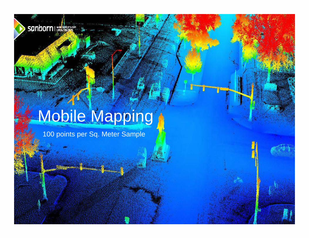
Orthoimagery3” SAMPLE

Planimetrics

10
Storm Water Utility and Fee Management Using Impervious Data
Cities can revamp their Storm Water Utility Rate Structure using Google Imagery and Sanborn’s Premium Impervious Data
Stormwater Needs Assessment & Rate Structure Development
Ordinance forNew RateStructure
Public InfoReview &
Adjustment
Billing&
Collection
Update &
Maintenance
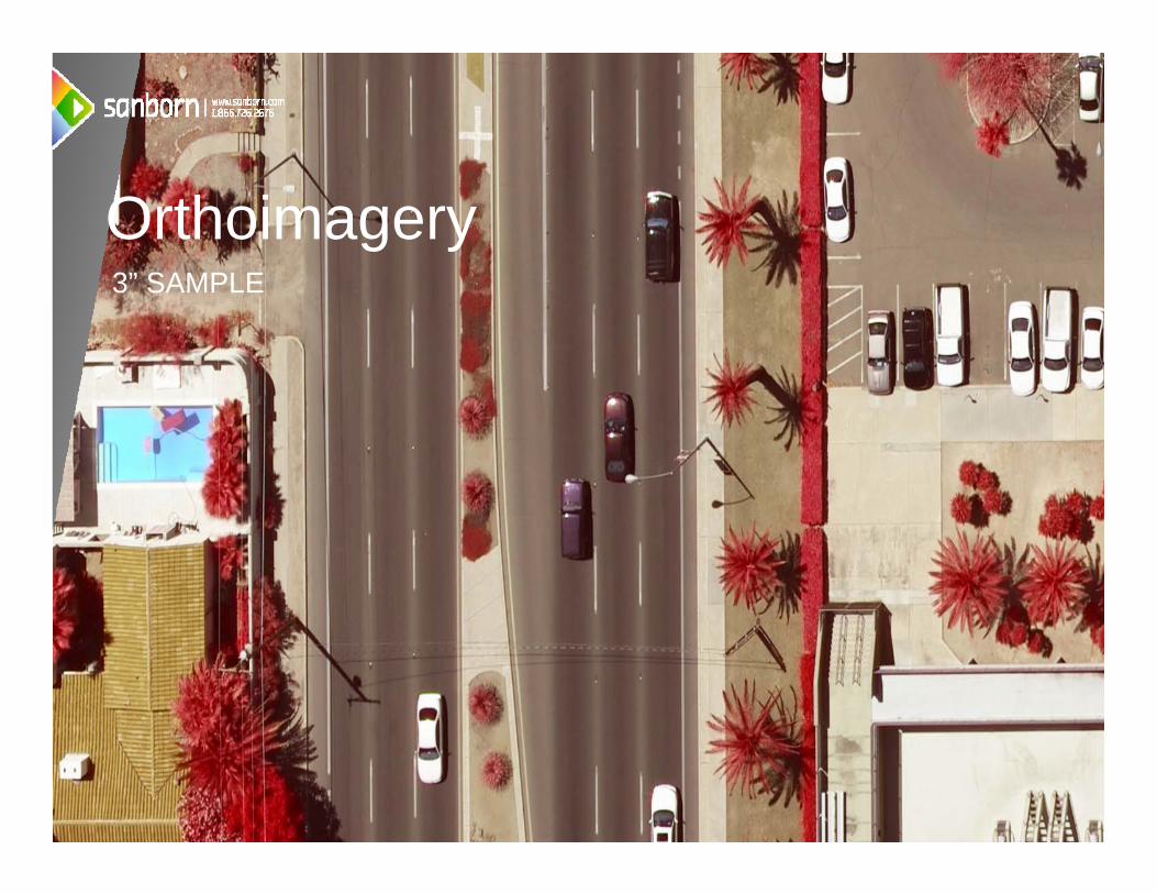
Oblique Imagery2.5” SAMPLE

3D Data

7/12/2014 13
2D map of the scanned environment3D LiDAR intensity point cloud of the scanned areaA topological map of the areaDerivative products:
i. 3D LiDAR intensity point cloud can be vectorized to extract objects in the sceneii. Create photo‐realistic 3D model of the building interiorsiii. Building inventory of the quantity, locations and dimensions of all scanned objects
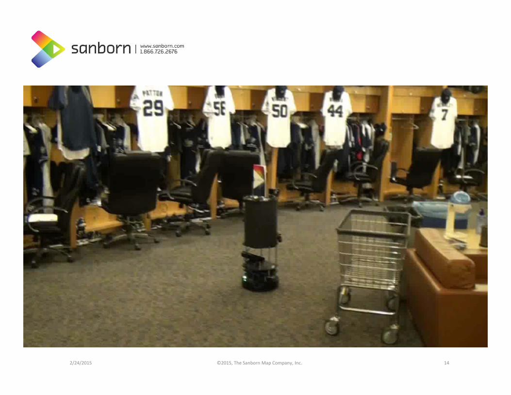
2/24/2015 ©2015, The Sanborn Map Company, Inc. 14

Unmanned Aerial Vehicles
2/24/2015 ©2014, The Sanborn Map Company, Inc. 15
In the US alone, approximately 50 companies, universities, and government organizations are developing and producing over 155 unmanned aircraft designs.
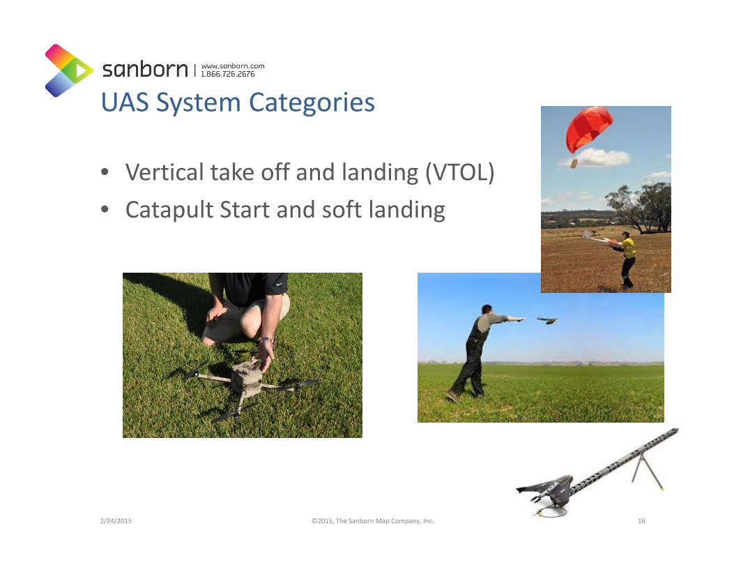
UAS System Categories
• Vertical take off and landing (VTOL)• Catapult Start and soft landing
2/24/2015 ©2015, The Sanborn Map Company, Inc. 16

Unmanned Aerial Systems
UAS
UAV
Communications
Sensors

18
UAS and Sanborn
Expand value propositions
within existing set of target
verticals
Develop new offerings for
existing target verticals
Expand offerings into
new verticals
Develop new offerings for new verticals and expand geographies
Current Verticals
NewVerticals
Current Value Propositions New Value Propositions
• Integrate technology into existing products and services
• Allows for expansion into new Markets
• Allows for expansion into new Services

2/24/2015 ©2013, The Sanborn Map Company, Inc. 19
http://www.birdseyeimaging.net/

Avenger E: Electric UAS• Operational Altitude: 5,000 ‐ 12,000 Ft WGS, no Lift Loss• System that is sensor agnostic• Full Autopilot : Autonomous flying, terrain following, target tracking, real
time GPS waypoints, simultaneous helicopters, etc. Dual Mode – Wireless and Laptop
• Automated return home, max/min altitude setting • Payload max of 10‐15lbs• Can fly in 50+ MPH cross winds, can land and take off in a small area• Manufacture with build, training and maintenance programs• Full Turn Key systems: Maintenance, Training and Helicopters, Ground
Stations, Wireless communications, etc.
http://www.youtube.com/watch_popup?v=c0gvbN5uxEs&vq=large

Flight Management Integration• Auto Take‐Off, flight and Landing• Waypoints – 10 CM Accuracy • Terrain Following• Remote camera settings and GPS integration• Real Time Vehicle Data during flight

There is a Sensor for the Job
2/24/2015 ©2013, The Sanborn Map Company, Inc. 22

Live Down Link Communication
2/24/2015 ©2013, The Sanborn Map Company, Inc. 23
Video : Digital/Analog ‐ Frequency : L, S and C ‐ Power: .25, 1, 2 and 5 Watt Power ‐ Range: .5 – 2 Mile Video : IP ‐ Frequency : 5.8 GHz ‐ Power: 1, 2 and 5 Watt Power ‐ Range: 1 – 10 Mile
Control : Analog ‐ Frequency : 900 MHz and 2.4 GHz‐ Power: 1, 2 Watt Power‐ Range: 1 Mile HH, 2 Mile GSControl : IP ‐ Frequency : 5.8 GHz‐ Power: 1, 2 and 5 Watt Power‐ Range: 1 – 10 Mile Control : Satellite ‐ Frequency : Iridium ‐ Range: 10 Mile

Property UHWP
Digital Orthoimagery • Sub centimeter resolution• Horizontal accuracy within 2 pixels

Property UHWP
3D Color Photos DSM
Digital Surface Models and 3D
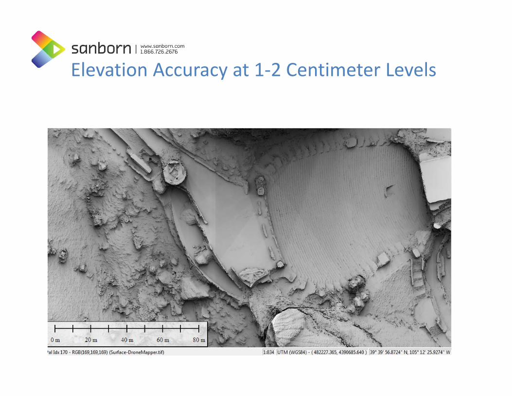
Elevation Accuracy at 1‐2 Centimeter Levels
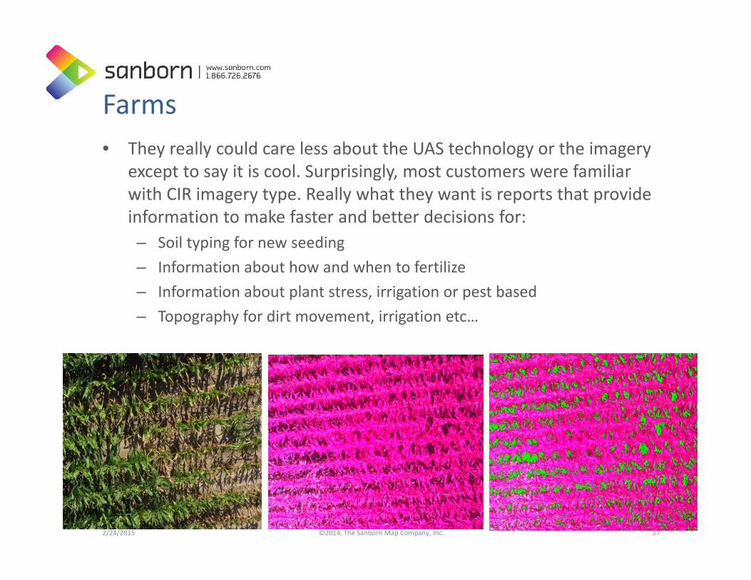
Farms• They really could care less about the UAS technology or the imagery
except to say it is cool. Surprisingly, most customers were familiar with CIR imagery type. Really what they want is reports that provide information to make faster and better decisions for:– Soil typing for new seeding– Information about how and when to fertilize– Information about plant stress, irrigation or pest based– Topography for dirt movement, irrigation etc…
2/24/2015 ©2014, The Sanborn Map Company, Inc. 27
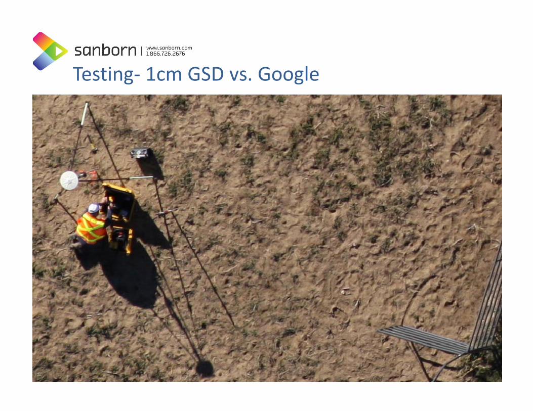
Testing‐ 1cm GSD vs. Google
2/24/2015 ©2013, The Sanborn Map Company, Inc. 28
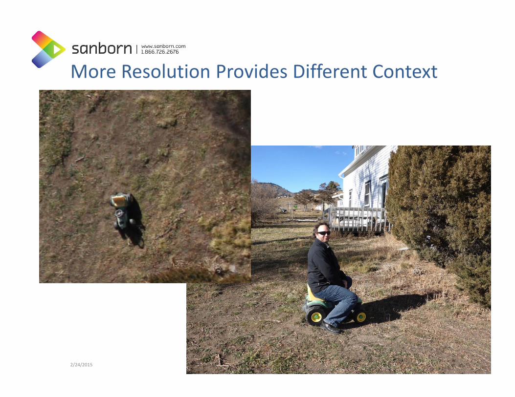
More Resolution Provides Different Context
2/24/2015 ©2013, The Sanborn Map Company, Inc. 29

2/24/2015 ©2013, The Sanborn Map Company, Inc. 30
Crop Health Index
DSM
3cm Multi Spectral Ortho Imagery
Web Viewer built on open source and other technology:
• Leaflet • MapQuest • Stamen • GDAL
Information to be processed automatically within 24 hours of flight.
Results: better beer

2/24/2015 ©2013, The Sanborn Map Company, Inc. 31
3cm Resolution Imagery

2/24/2015 ©2014, The Sanborn Map Company, Inc. 32
3‐5cm vertical accuracy

Thermal

Video Application• Inspection: Active of Hazardous areas and explosives• EPA : Avoid Fines and Stack ‘Shutdown’ that can be up to
$1M in cost

Ranchers• Almost all ranchers have interest in the smaller RDAS UAS system.
These applications don’t require significant remote sensing processing; essentially all applications are video camera surveillance type of work. Applications included:– Livestock locations and issues– Grazing patterns– Fencing issues– Well/Water tanks status– Overall surveillance of property
• I had one rancher tell me he spends four hours every day driving to his water tanks to confirm they have water for his cattle. He wanted to use the RDASS for doing the work instead of driving.
2/24/2015 ©2013, The Sanborn Map Company, Inc. 35
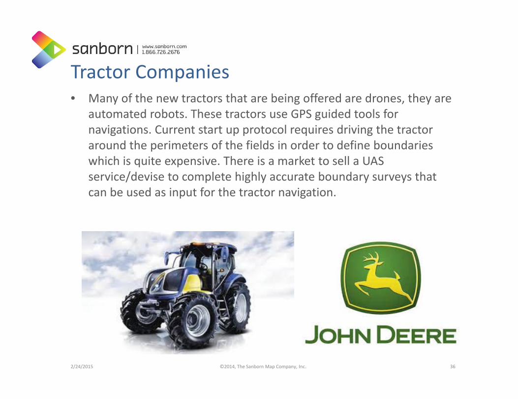
Tractor Companies• Many of the new tractors that are being offered are drones, they are
automated robots. These tractors use GPS guided tools for navigations. Current start up protocol requires driving the tractor around the perimeters of the fields in order to define boundaries which is quite expensive. There is a market to sell a UAS service/devise to complete highly accurate boundary surveys that can be used as input for the tractor navigation.
2/24/2015 ©2014, The Sanborn Map Company, Inc. 36
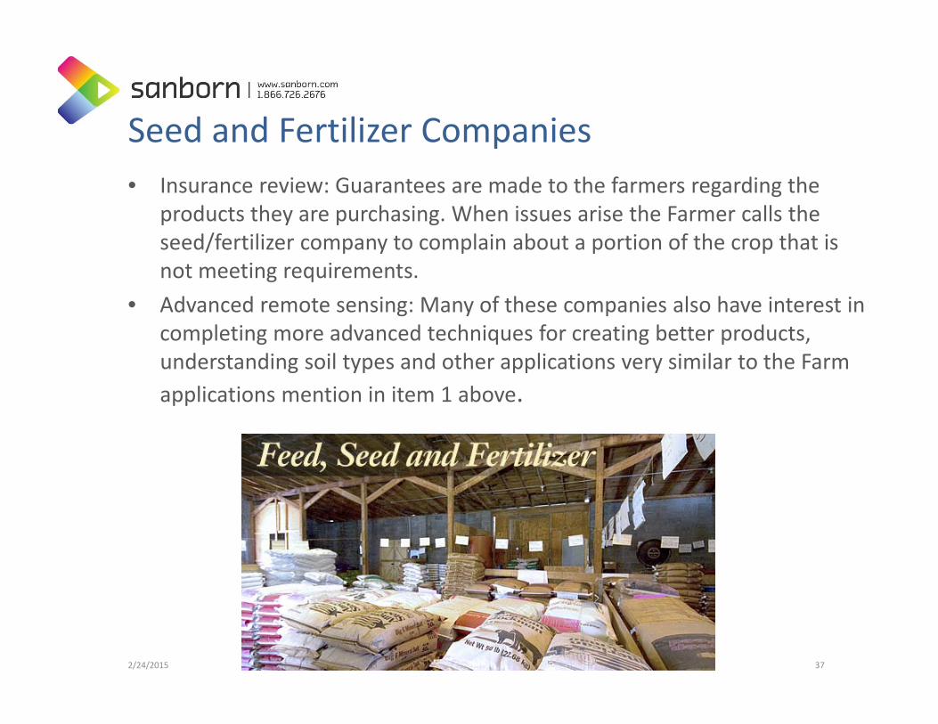
Seed and Fertilizer Companies • Insurance review: Guarantees are made to the farmers regarding the
products they are purchasing. When issues arise the Farmer calls the seed/fertilizer company to complain about a portion of the crop that is not meeting requirements.
• Advanced remote sensing: Many of these companies also have interest in completing more advanced techniques for creating better products, understanding soil types and other applications very similar to the Farm applications mention in item 1 above.
2/24/2015 ©2013, The Sanborn Map Company, Inc. 37

Fire and Streets• Emergency Management/Fire: Stopped by the booth and want share
the system throughout the City for different EM requirements. Fire, Police and other for surveillance type of work.
• Non‐Ag. City of Greeley Streets Division: Has sensor that measures road surface during ice and snow storms to determine salt and gravel requirements. Sensor is currently used on truck; client thought the UAS platform would be faster and less costly.
2/24/2015 ©2013, The Sanborn Map Company, Inc. 38

Police ‐ Surveillance/Search • Ability to launch in less than 5 minutes • Search large areas quickly, HD Video, Night and Infra‐red• Ability to zoom with HD Video or photos of subjects• Quiet: At 100 – 300 Ft minimal sight and sound recognition • Remote live communications feed with cloud broadcast
capabilities
2/24/2015 ©2014, The Sanborn Map Company, Inc. 39
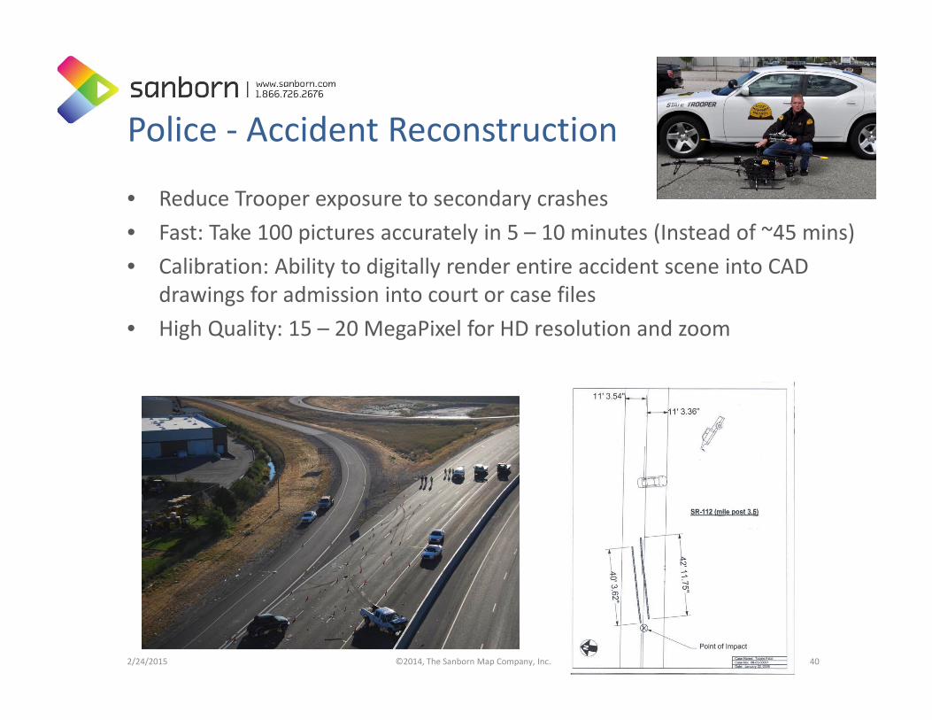
Police ‐ Accident Reconstruction
• Reduce Trooper exposure to secondary crashes • Fast: Take 100 pictures accurately in 5 – 10 minutes (Instead of ~45 mins) • Calibration: Ability to digitally render entire accident scene into CAD
drawings for admission into court or case files • High Quality: 15 – 20 MegaPixel for HD resolution and zoom
2/24/2015 ©2014, The Sanborn Map Company, Inc. 40

Prism 4D ‐ Common Operating Picture

FAA Issues: Current Ways to “Legally” use UASUnmanned Aerial Systems UAS) integration into the National Airspace System (NAS):• The FAA continues efforts to develop the regulatory
framework for safely integrating small UAS into routine NAS operations. This will primarily be accomplished by the small UAS (sUAS) rule, which is scheduled to be released for public comment later this year.
Current legal ways to fly sUAS in the United States include:• Model Aircraft• Experimental Aircraft• Certificate of Authorization (COA)• Section 333 Exemption
2/24/2015 ©2015, The Sanborn Map Company, Inc. 42
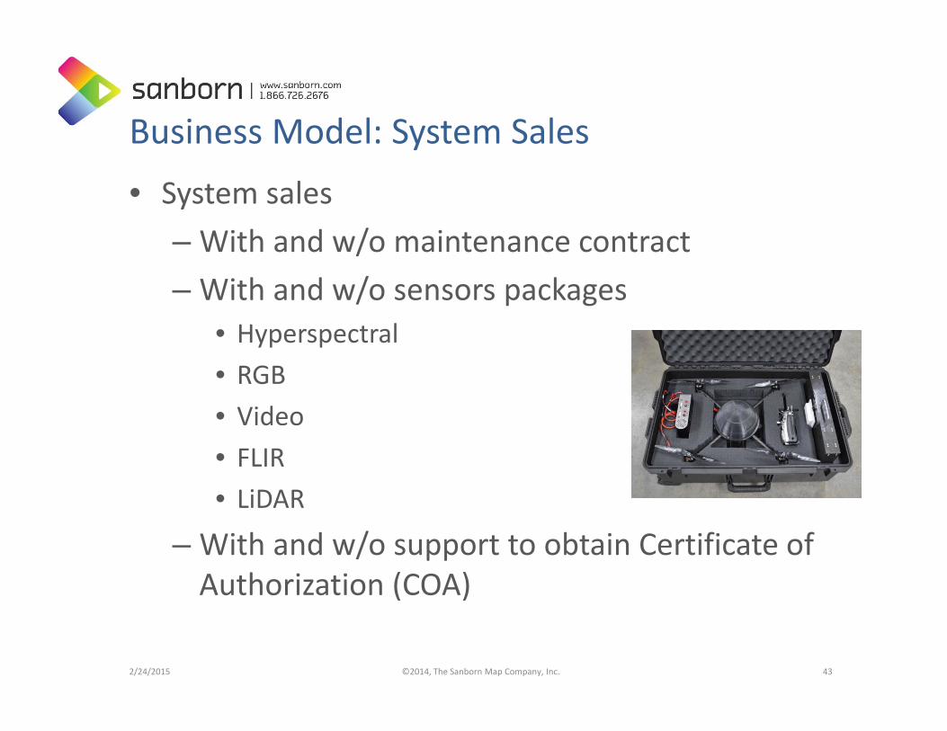
Business Model: System Sales
• System sales– With and w/o maintenance contract– With and w/o sensors packages
• Hyperspectral• RGB• Video• FLIR• LiDAR
– With and w/o support to obtain Certificate of Authorization (COA)
2/24/2015 ©2014, The Sanborn Map Company, Inc. 43

Business Model: Pilot and Processing Services
• Trained Pilots to provide service to fly client owned Systems• Large scale mapping (1”=20’ map scale or better) • Small AOI updates/maintenance
– Landfills– DOT Survey and Mapping– Video monitoring
2/24/2015 ©2015, The Sanborn Map Company, Inc. 44
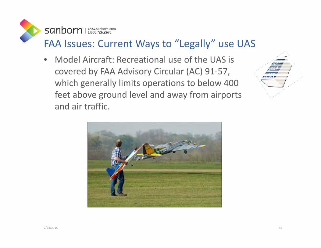
FAA Issues: Current Ways to “Legally” use UAS• Model Aircraft: Recreational use of the UAS is
covered by FAA Advisory Circular (AC) 91‐57, which generally limits operations to below 400 feet above ground level and away from airports and air traffic.
2/24/2015 45

FAA Issues: Current Ways to “Legally” use UAS• Experimental UAS: An SAC‐EC is the only
certification means available to civil operators for UAS. Since July 2005, the FAA has issued 94 SAC‐EC, to 13 civil operators covering 20 unique UAS types. The FAA works with these operators to collect technical and operational data to improve the UAS airworthiness certification process.
2/24/2015 46

FAA Issues: Current Ways to “Legally” use UAS• Certificate of Authorization (COA)
– The process is available to public entities, including military, law enforcement, and other governmental agencies who want to fly a UAS in civil airspace. Applicants apply online and the FAA evaluates the request.
• The COA authorizes an operator to use defined airspace and includes special provisions unique to the proposed operation.
• Most COAs are issued for a specified time period (up to one year, in most cases).
• Most COAs require coordination with an appropriate air traffic control facility • The FAA issued 146 COAs in 2009 and 298 in 2010, more than doubling in
one year. As of June 28, 2011, there were 251 active COAs, 90 different proponents, and 77 different aircraft types.
2/24/2015 47
FAA Issues: Current Ways to “Legally” use UAS• Section 333 Exemption
– Section 333, "Special Rules for Certain Unmanned Aircraft Systems," provides flexibility for authorizing safe civil operations in the NAS by granting the Secretary of Transportation the authority to determine whether airworthiness certification is required for a UAS to operate in the NAS. Specifically, Section 333 authorizes the Secretary to determine:
– This framework will provide operators who wish to pursue safe and legal entry into the NAS a competitive advantage in the UAS marketplace, thus discouraging illegal operations and improving safety. It is anticipated that this activity will result in significant economic benefits, and the FAA Administrator has identified this as a high priority project to address demand for civil operation of UAS for commercial purposes.
• Astraeus Aerial, Aerial MOB, LLC., Pictorvision Inc., HeliVideo Productions LLC, Snaproll Media LLC , RC Pro Productions Consulting LLC dba Vortex Aerial, Flying Cam, Clayco, Inc., Trimble Navigation, Limited, VDOS Global LLC , Woolpert, Inc., Tierra Antigua Realty , Advanced Aviation Solutions
2/24/2015 ©2015, The Sanborn Map Company, Inc. 48

Legislation• Congressional Bills Being Introduced for Regulations– State – Federal– Some good, some bad– There needs to be a balance between the use of technology and privacy
2/24/2015 49

Questions
Jason CaldwellVice President of Business Development and Sales719‐264‐[email protected]
2/24/2015 ©2015, The Sanborn Map Company, Inc. 50


![€¦ · “Q4 2015” through “Q2 2016” .31 pu disclosed that Karma’s launch “would be delayed until [the 2016] holiday season,” the drone’s “revolutionary features.”32,](https://static.fdocuments.in/doc/165x107/5f9539136175d36f3055504d/aoeq4-2015a-through-aoeq2-2016a-31-pu-disclosed-that-karmaas-launch-aoewould.jpg)